NE12 6TG - 3 bedroom terraced house for sale in Dove Close, Killingwor…
View on Property Piper
3 bedroom terraced house for sale in Dove Close, Killingworth, North Tyneside, NE12
Property Details
- Price: £120000
- Bedrooms: 3
- Bathrooms: 2
- Property Type: undefined
- Property SubType: undefined
Brochure Descriptions
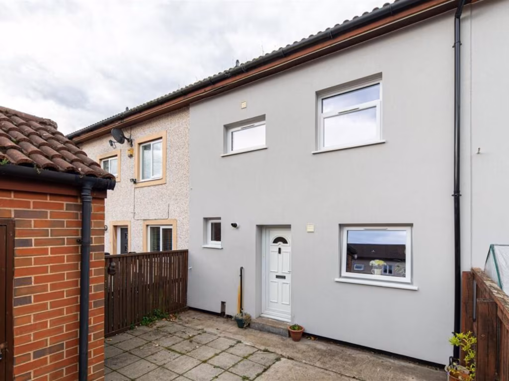
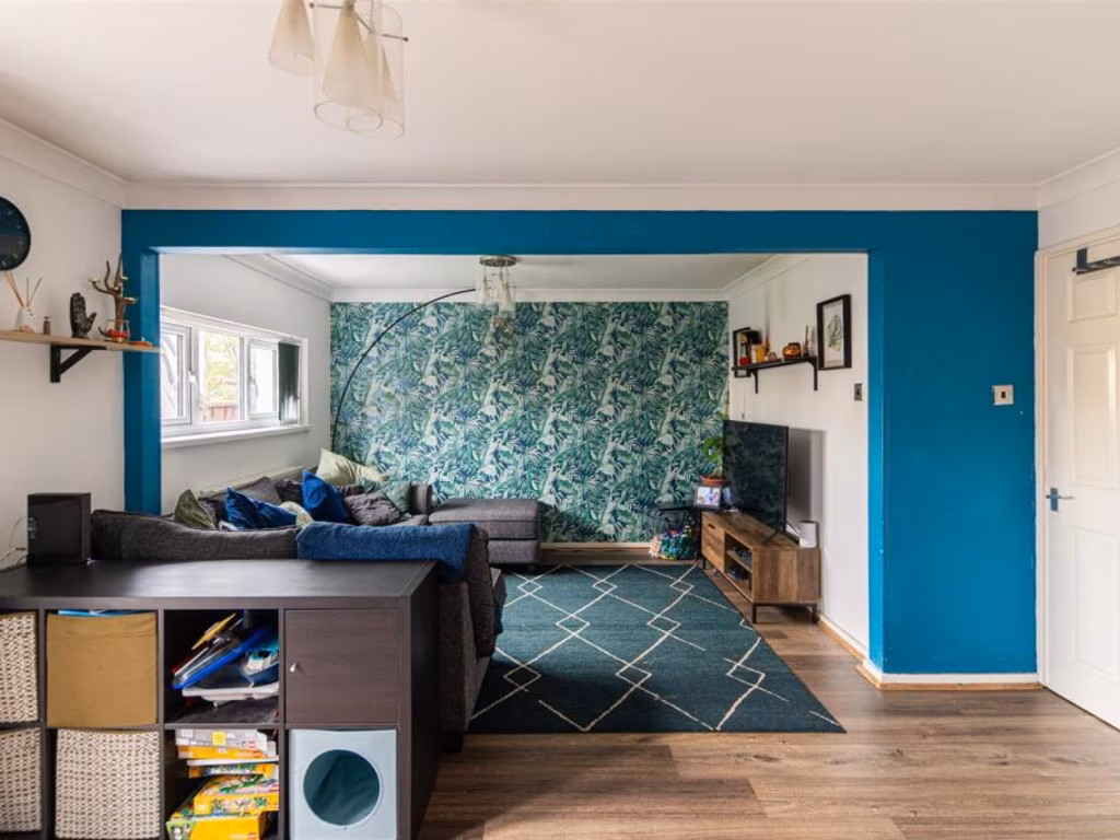
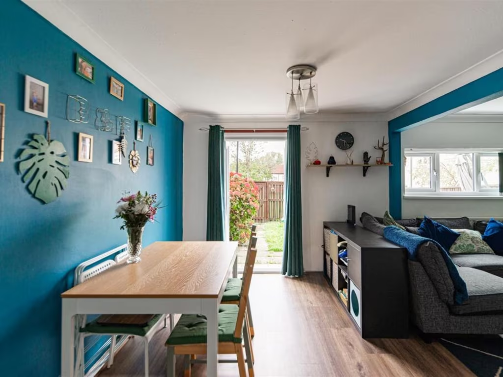
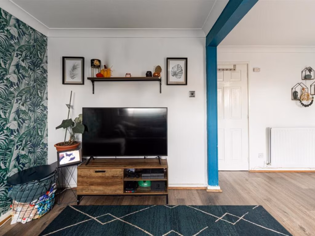
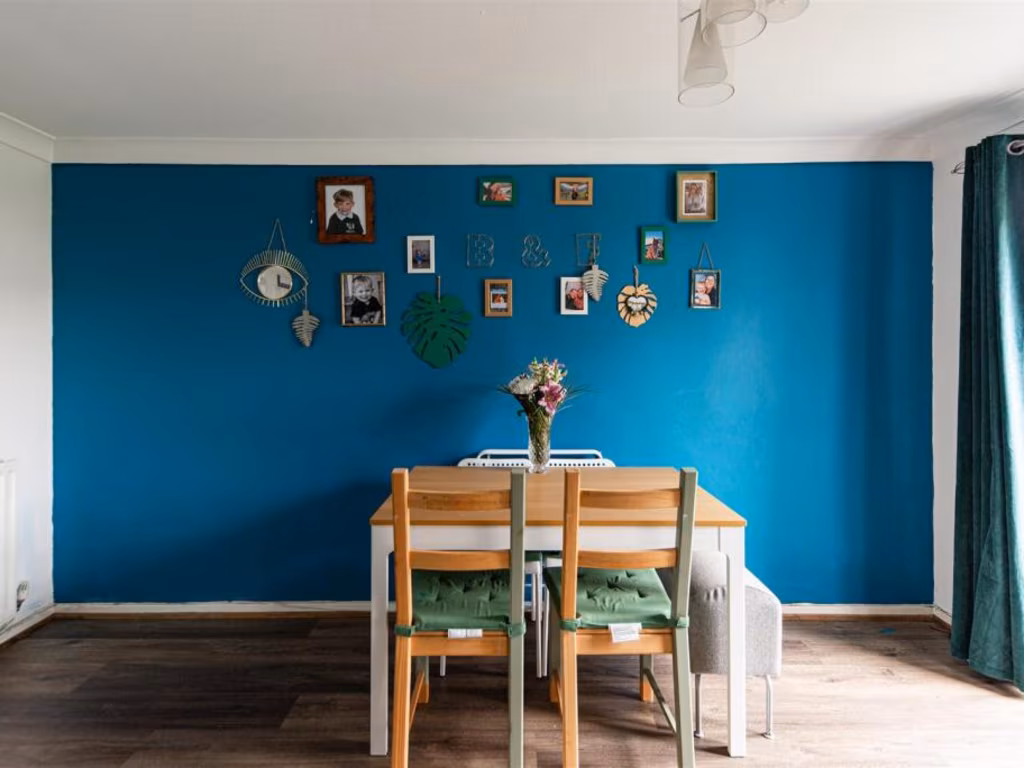
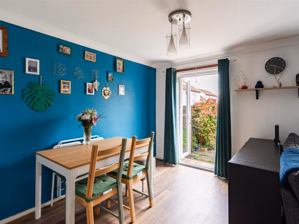
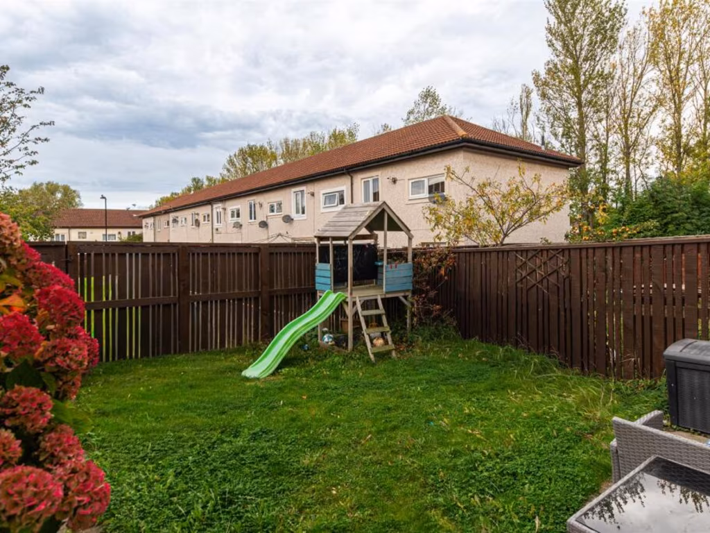
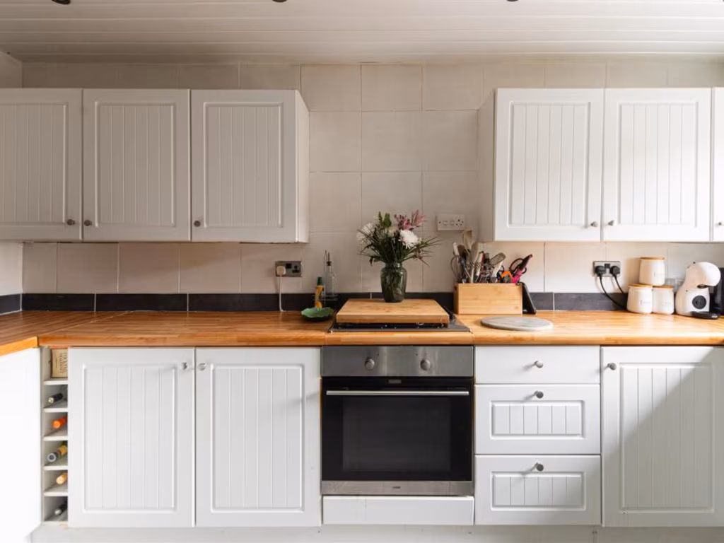
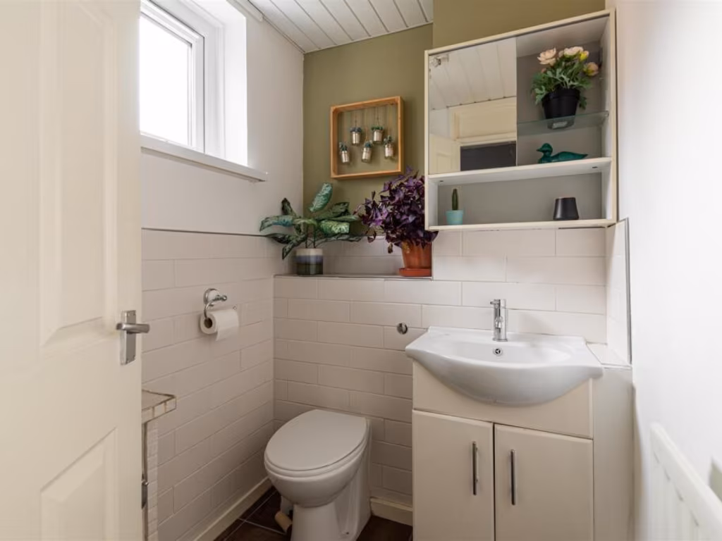
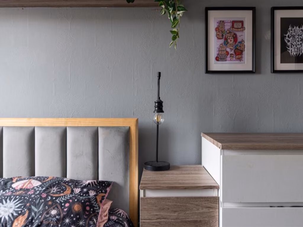
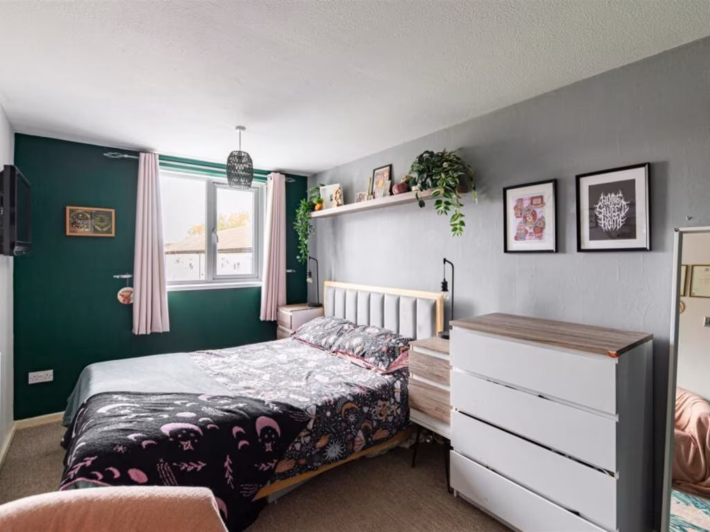
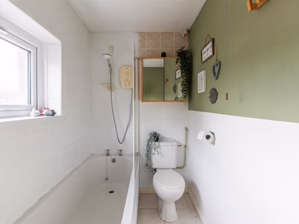
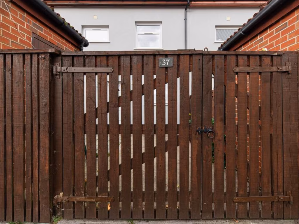
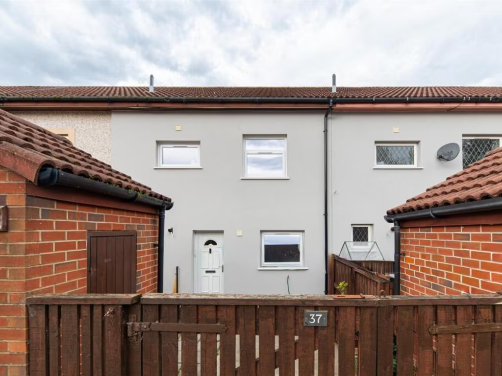
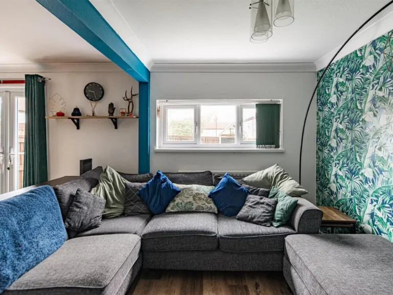
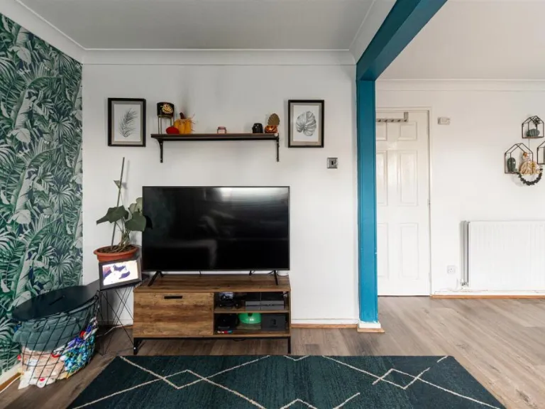
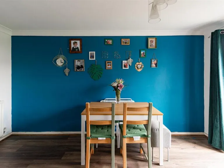
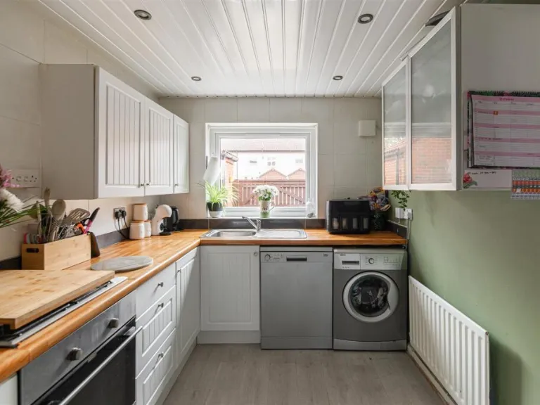
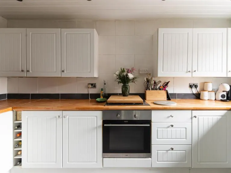
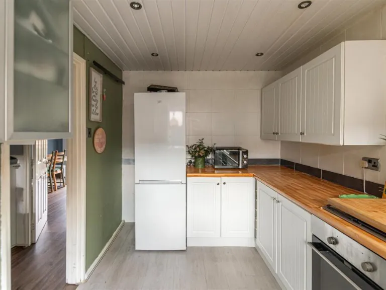
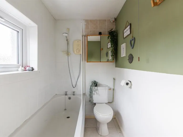
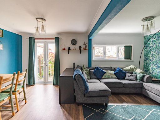
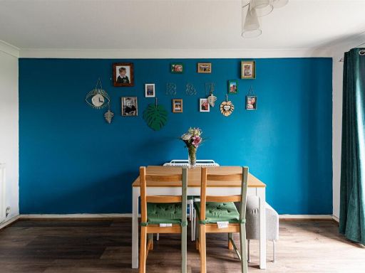
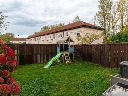
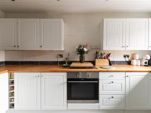
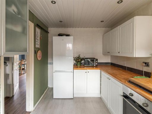
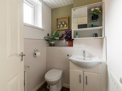
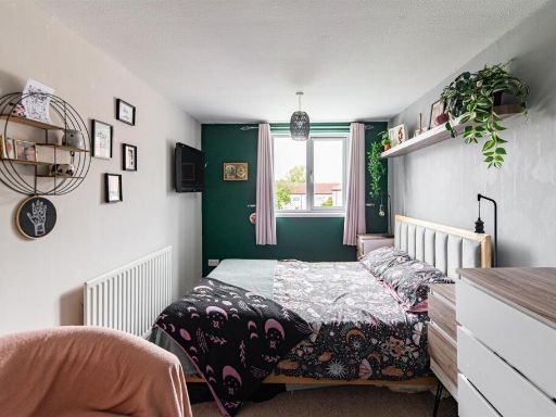
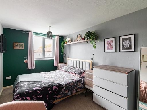
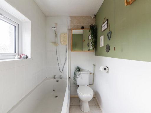
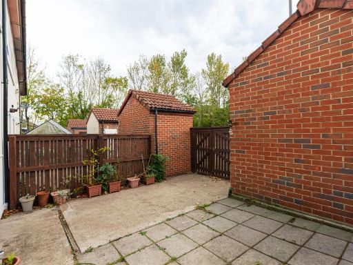
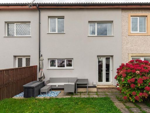
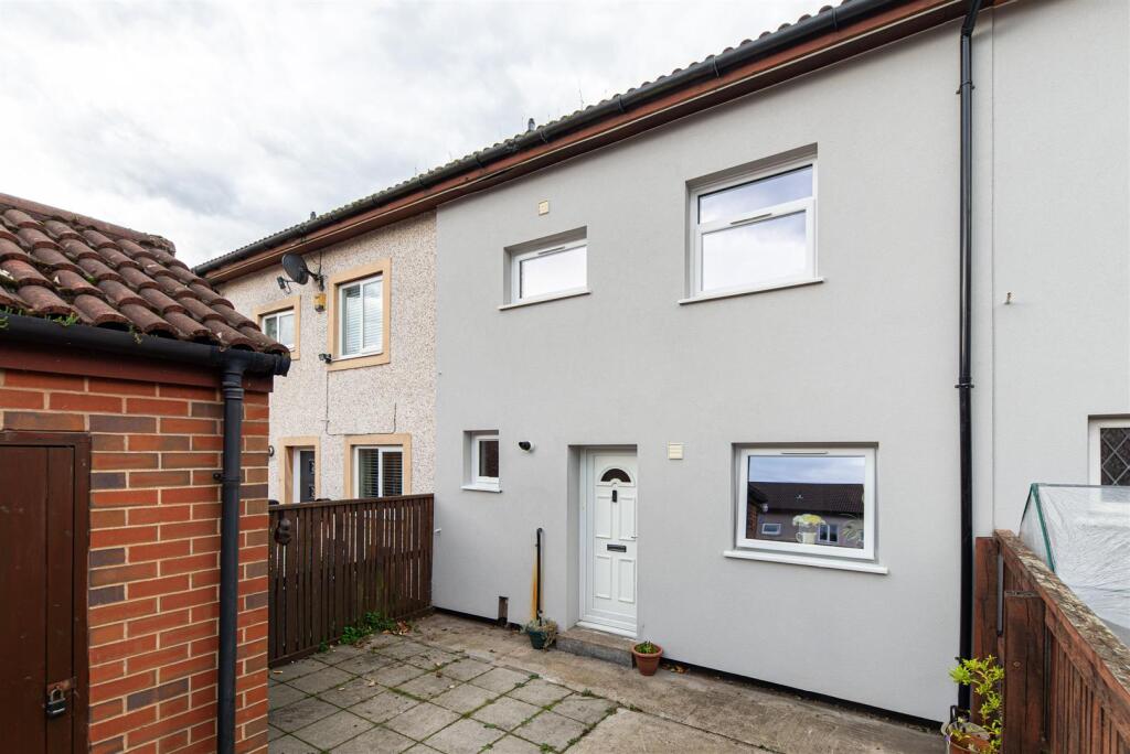
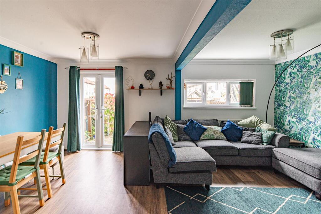
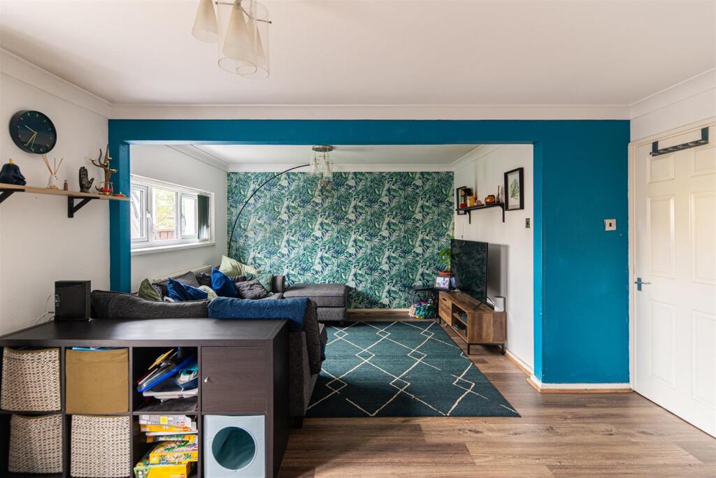
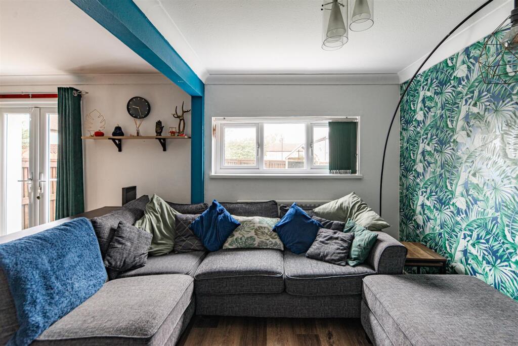
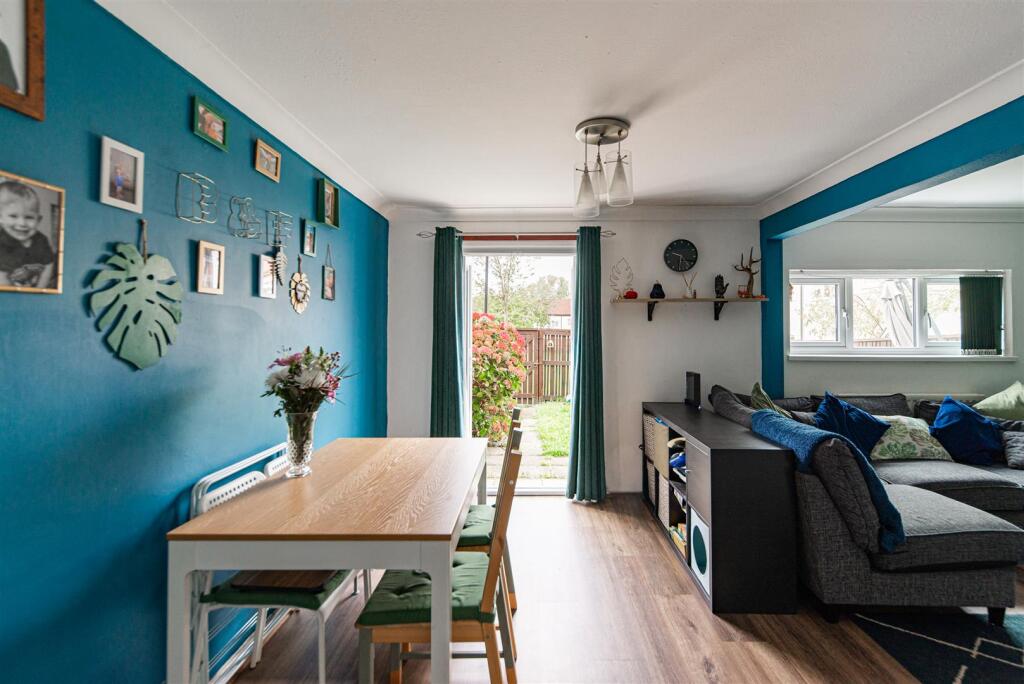
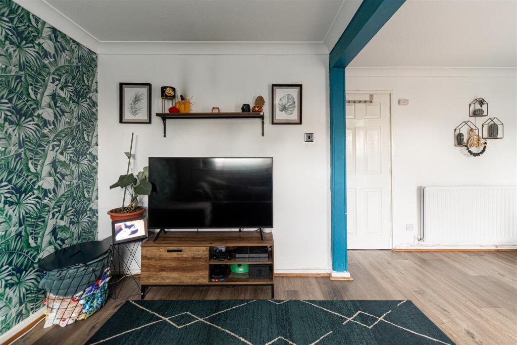
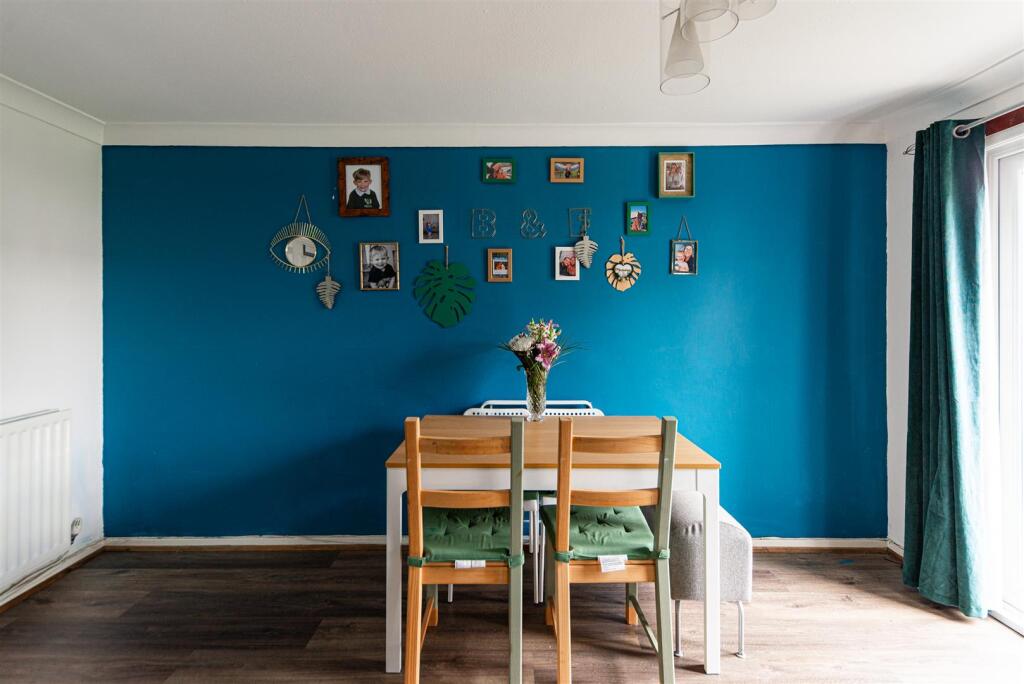
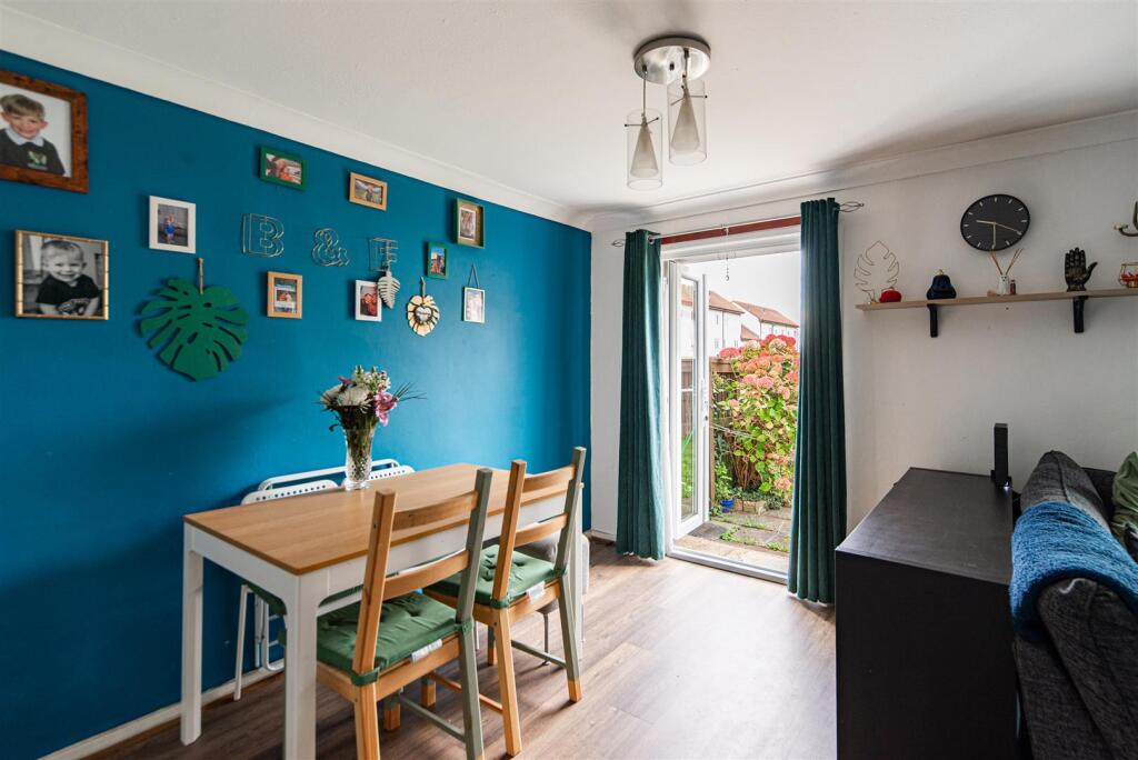
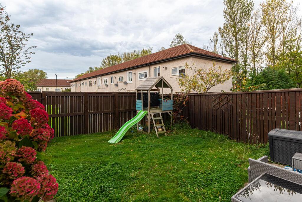
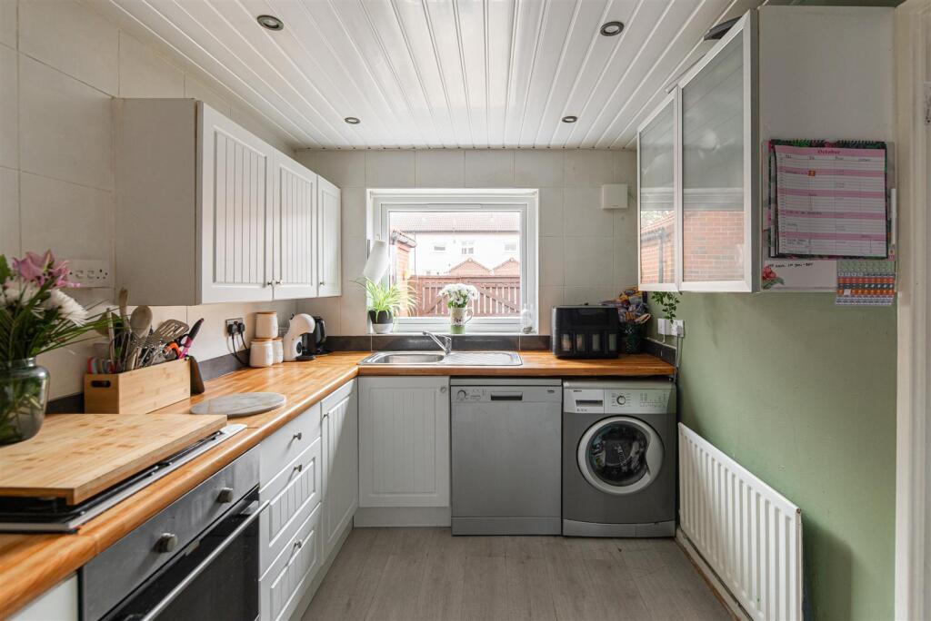
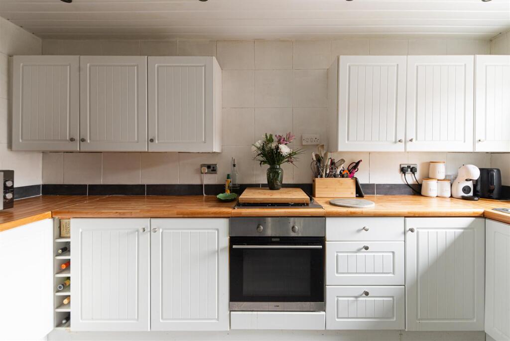
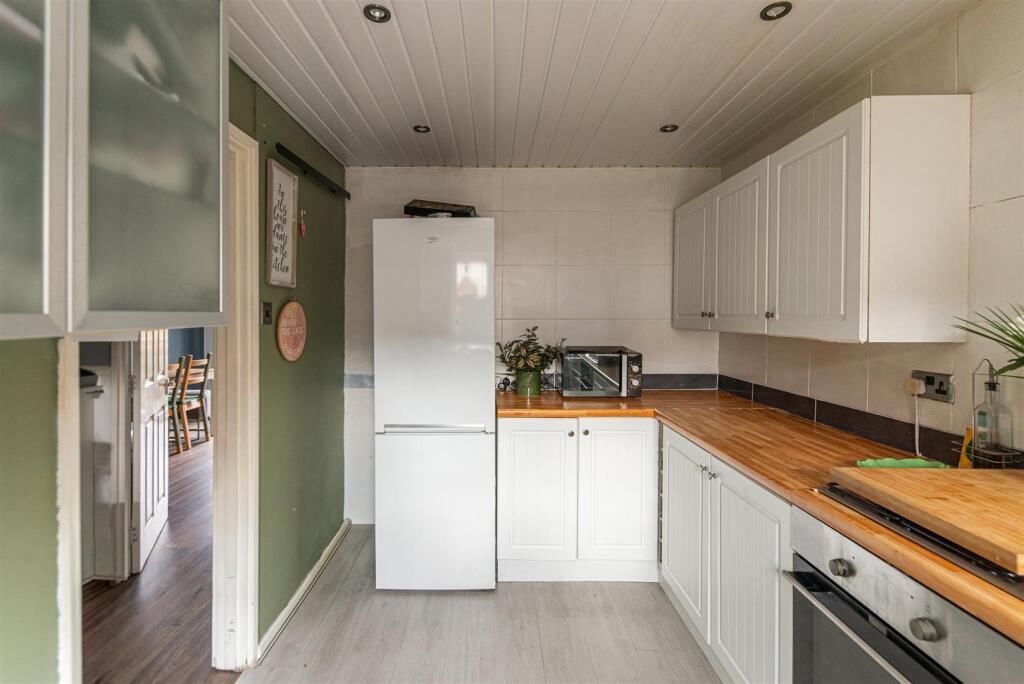
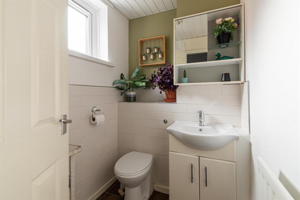
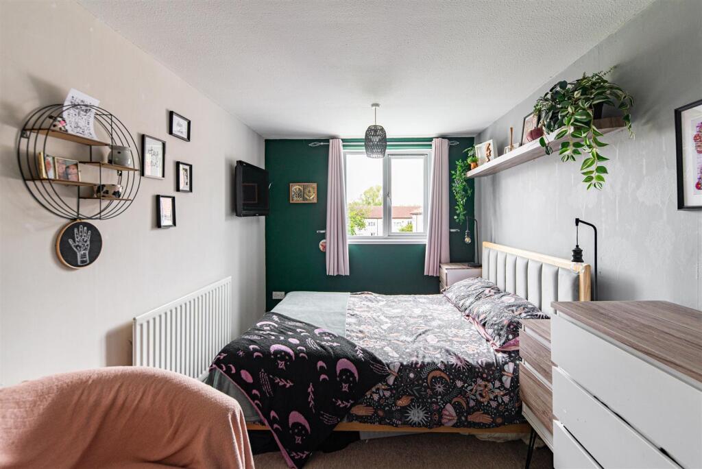
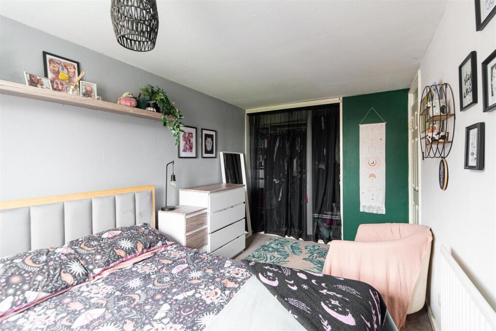
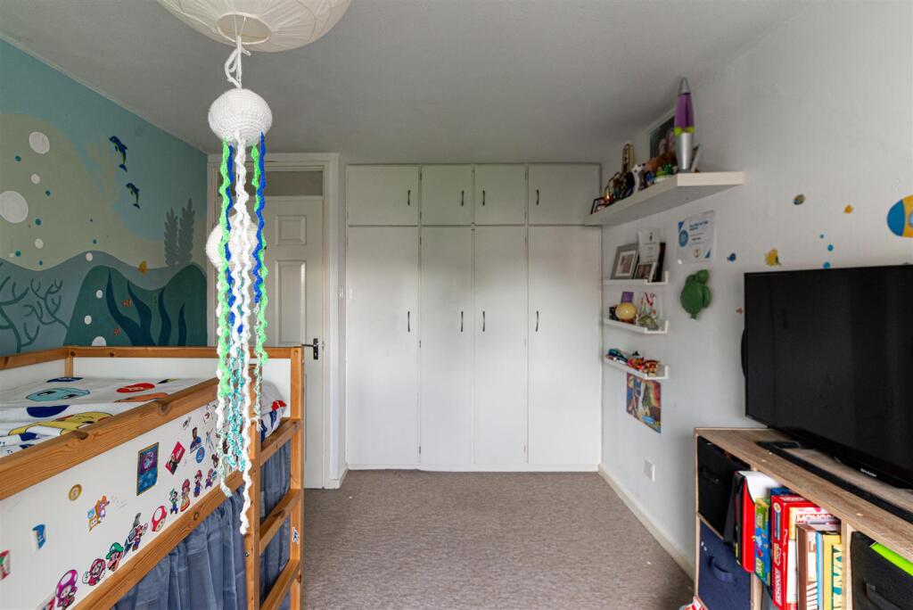
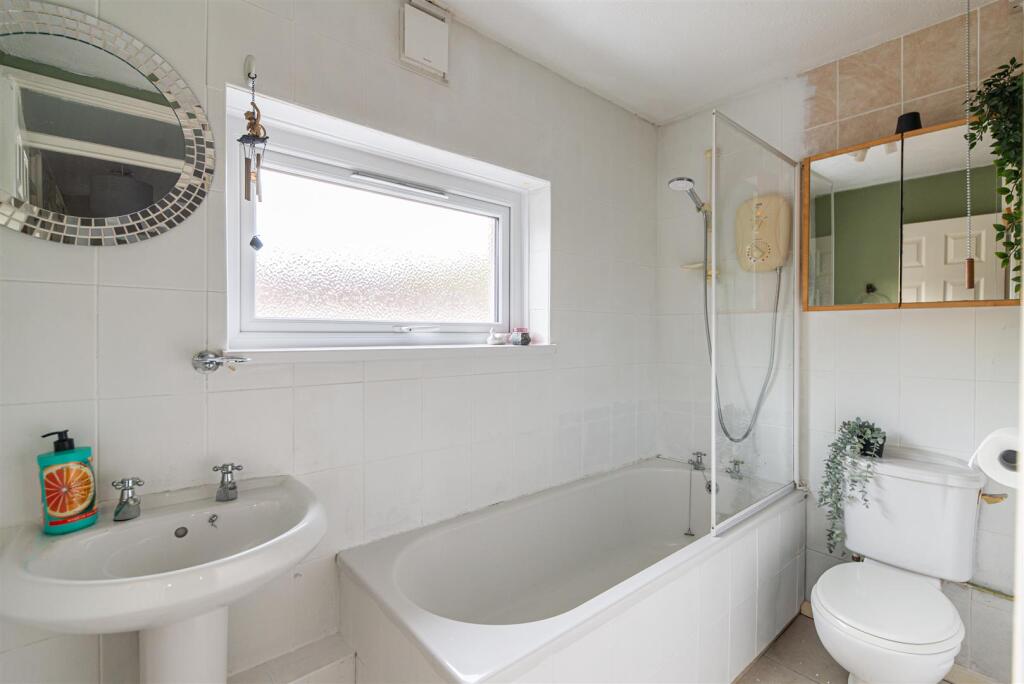
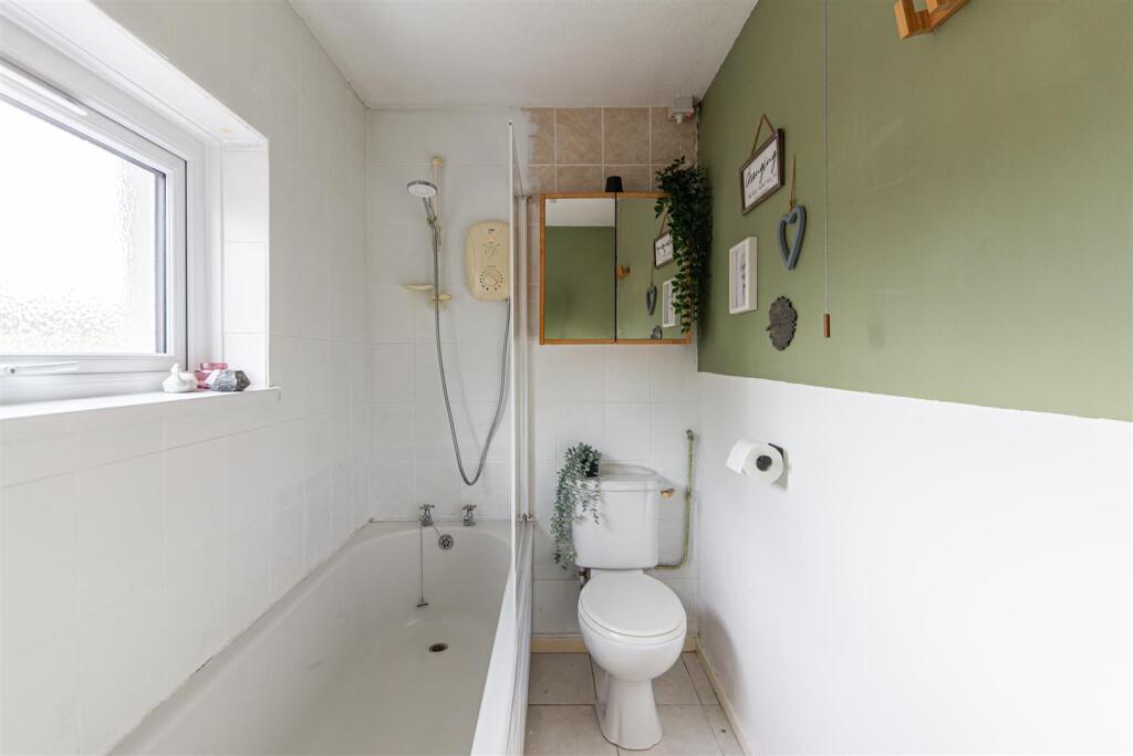
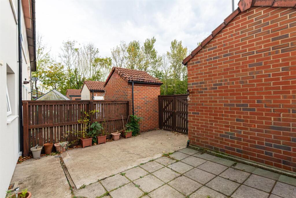
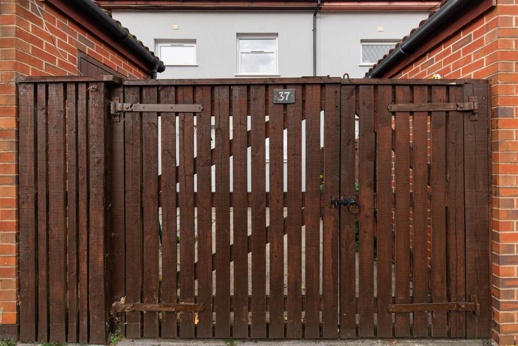
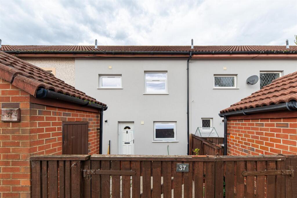
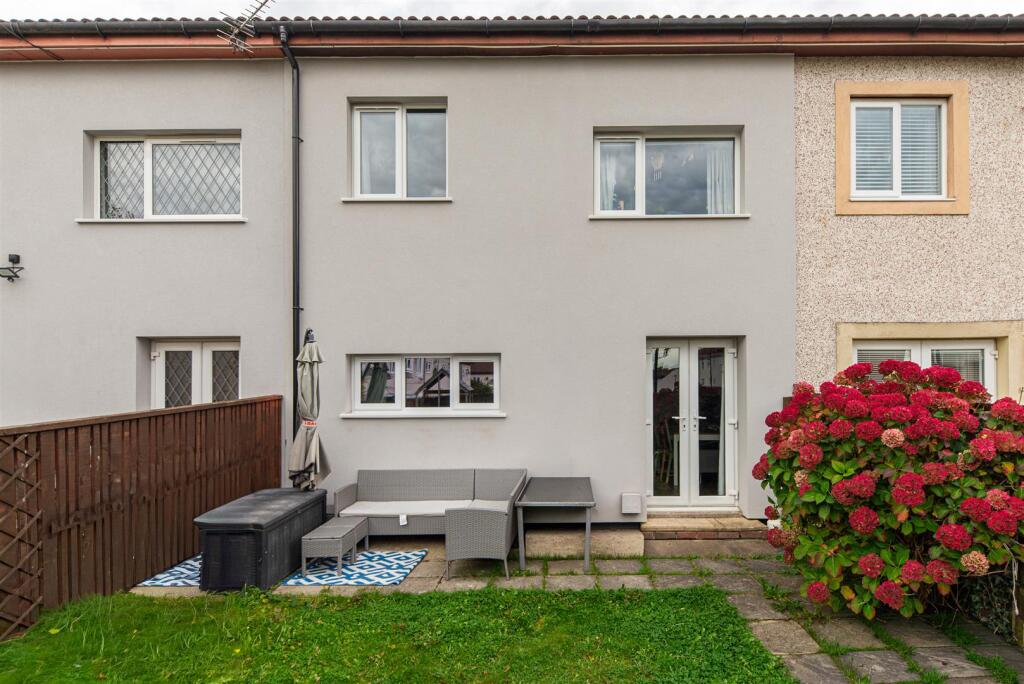
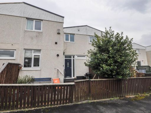
- Mid-terraced three-bedroom residential property presented to a modern standard. The ground floor offers an open-plan living and dining area with wood-effect flooring and patio doors leading to the private rear garden. The kitchen is contemporary with white cabinetry and integrated oven and gas hob. A convenient downstairs WC with wash basin completes the ground floor. Upstairs there are three carpeted bedrooms, two with fitted wardrobes, and a family bathroom with bath and shower over, WC and wash basin. Externally the property benefits from a paved forecourt/front patio and a modest private rear garden incorporating a patio and a mix of lawn and hardstanding with a handy storage shed. Overall plot and garden sizes are small-to-average for a terraced house; the internal footprint appears modest and well-suited to first-time buyers, families or buy-to-let investors. No notable views (urban/residential setting).
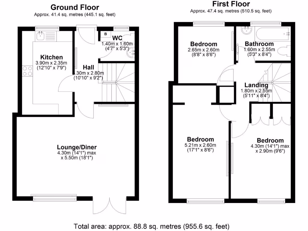
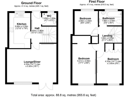
- Mid-sized two-storey residential dwelling (approx. 88.8 sq. metres / 955.6 sq. ft) shown on the floorplan. Ground floor comprises kitchen (approx. 3.90 x 2.35 m) to the front, entrance hall with WC, and a large open plan lounge/diner to the rear (approx. 4.30 x 5.50 m max) with double doors to the garden. First floor comprises three bedrooms (one larger main bedroom approx. 5.21 x 2.60 m, two smaller bedrooms approx. 4.30 x 2.90 m max and 2.65 x 2.60 m) and a family bathroom. Overall property footprint and internal layout indicate a typical 3-bedroom family house with an average-sized rear garden (not dimensioned) and suburban outlook — map places it in the Killingworth / Camperdown residential area. Condition/fixtures not shown; excludes furniture and removable items.
- Document shows internal room dimensions for a 3-bedroom property with separate lounge/diner and kitchen plus bathroom and separate WC. Layout and sizes (approx): lounge/diner large (14'1" x 18'0" / 4.30 x 5.50m), kitchen medium (12'9" x 7'8" / 3.90 x 2.35m), Bedroom 1 long and narrow (17'1" x 8'6" / 5.21 x 2.60m), Bedroom 2 medium (14'1" x 9'6" / 4.30 x 2.90m), Bedroom 3 small (8'8" x 8'6" / 2.65 x 2.60m), bathroom small (5'2" x 8'4" / 1.60 x 2.55m) and separate WC (4'7" x 5'2" / 1.40 x 1.60m). Based on these dimensions the property is likely a modest to average-sized three-bedroom house or flat with a generous lounge/dining space and one larger principal bedroom plus two smaller bedrooms. No external/garden or view information is present. Overall internal accommodation suggests medium overall property footprint suitable for family occupation; condition, floor level and fittings cannot be determined from the image.
Image Descriptions
- exterior of a modern townhouse modern
- living room modern
Floorplan Description
- Two-storey residential property with kitchen, lounge/diner, WC on ground floor and three bedrooms plus bathroom on first floor.
Rooms
- Kitchen:
- Hall:
- WC:
- Lounge/Diner:
- Bedroom:
- Bathroom:
- Landing:
- Bedroom:
- Bedroom:
Textual Property Features
Detected Visual Features
- modern townhouse
- two-story
- updated facade
- terraced house
- concrete exterior
- small front yard
- no garage
- modern style
- living room
- french doors
- wood flooring
- open plan
- natural light
- accent color
- shelving
- ceramic lighting fixtures
EPC Details
- Fully double glazed
- System built, with external insulation
- Boiler and radiators, mains gas
- Low energy lighting in 38% of fixed outlets
- Solid, no insulation (assumed)
Nearby Schools
- Cragside Primary School
- Benton Park Primary School
- Hopespring Newcastle
- Benton Dene Primary School
- Amberley Primary School
- Burradon Community Primary School
- Cragside CofE Controlled Primary School
- Redesdale Primary School
- St Mary's Catholic School
- Balliol Primary School
- St Stephen's Catholic Primary School, Newcastle
- Longbenton High School
- Forest Hall Primary School
- Westmoor Primary School
- Fordley Primary School
- Jesmond Park Academy
- St Bartholomew's Church of England Primary School (Aided)
- Ivy Road Primary School
- St Marys Catholic Primary School, Forest Hall
- Grasmere Academy
- Backworth Park Primary School
- Ss Peter and Paul's Catholic Primary Academy
- George Stephenson High School
- Bailey Green Primary School
- Seghill First School
- Cramlington Learning Village
- Hareside Primary School
Nearest General Shops
- Id: 10056940
- Tags:
- Contact:
- Website: https://killingworthcentre.com/
- Name: The Killingworth Centre
- Opening_hours: Mo-Fr 07:00-22:00; Sa 07:00-22:00; Su 10:00-16:00
- Shop: mall
- Type: site
- TagsNormalized:
- Lat: 55.0360268
- Lon: -1.567296
- FullGeoHash: gcych748p6gr
- PartitionGeoHash: gcyc
- Images:
- FoodStandards: null
- Distance: 575.4
,- Id: 653257873
- Tags:
- Brand: Matalan
- Brand:wikidata: Q12061509
- Brand:wikipedia: en:Matalan
- Building: retail
- Name: Matalan
- Shop: clothes
- TagsNormalized:
- Lat: 55.0355297
- Lon: -1.5680704
- FullGeoHash: gcych6fjjq3f
- PartitionGeoHash: gcyc
- Images:
- FoodStandards: null
- Distance: 553.8
,- Id: 653257874
- Tags:
- Addr:
- City: Newcastle upon Tyne
- Country: GB
- Housename: The Killingworth Centre
- Postcode: NE12 6YT
- Suburb: Killingworth
- Unit: 1
- Brand: Home Bargains
- Brand:wikidata: Q5888229
- Brand:wikipedia: en:Home Bargains
- Building: retail
- Fhrs:
- Name: Home Bargains
- Phone: +44 191 328 0565
- Shop: variety_store
- Website: https://storelocator.homebargains.co.uk/store/A688/Killingworth+Centre,+Killingworth,+Newcastle+Upon+Tyne
- TagsNormalized:
- home bargains
- retail
- variety store
- shop
- Lat: 55.0356923
- Lon: -1.5686279
- FullGeoHash: gcych6cy0kdk
- PartitionGeoHash: gcyc
- Images:
- FoodStandards:
- Id: 1108634
- FHRSID: 1108634
- LocalAuthorityBusinessID: 18/00341/FOOD
- BusinessName: Home Bargains
- BusinessType: Retailers - other
- BusinessTypeID: 4613
- AddressLine1: Unit 1
- AddressLine2: Citadel West
- AddressLine3: Killingworth
- AddressLine4: NEWCASTLE UPON TYNE
- PostCode: NE12 6YT
- RatingValue: 5
- RatingKey: fhrs_5_en-GB
- RatingDate: 2019-02-26
- LocalAuthorityCode: 417
- LocalAuthorityName: North Tyneside
- LocalAuthorityWebSite: http://www.northtyneside.gov.uk/
- LocalAuthorityEmailAddress: environmental.health@northtyneside.gov.uk
- Scores:
- Hygiene: 0
- Structural: 0
- ConfidenceInManagement: 0
- NewRatingPending: false
- Geocode:
- Longitude: -1.56692695617676
- Latitude: 55.03628540039060
- Distance: 513.9
}
Nearest Religious buildings
- Id: 450641322
- Tags:
- Addr:
- Postcode: NE12 6BL
- Street: West Lane
- Amenity: community_centre
- Building: yes
- Name: St John's Church Hall
- Source: ESRI World
- TagsNormalized:
- community centre
- church
- church hall
- Lat: 55.0322633
- Lon: -1.5646524
- FullGeoHash: gcych6kdhvqt
- PartitionGeoHash: gcyc
- Images:
- FoodStandards: null
- Distance: 943.1
,- Id: 440104830
- Tags:
- Amenity: place_of_worship
- Building: church
- Denomination: anglican
- Name: Church of the Good Shepherd
- Religion: christian
- Source: Bing
- Wikidata: Q105101462
- TagsNormalized:
- place of worship
- church
- anglican
- christian
- Lat: 55.0461446
- Lon: -1.577218
- FullGeoHash: gcychhge01j4
- PartitionGeoHash: gcyc
- Images:
- FoodStandards: null
- Distance: 922.1
,- Id: 438212930
- Tags:
- Amenity: place_of_worship
- Building: chapel
- Denomination: anglican
- Name: St John the Evangelist
- Religion: christian
- Source: Bing
- Wikidata: Q26479550
- TagsNormalized:
- place of worship
- chapel
- anglican
- evangelist
- christian
- church
- Lat: 55.0326812
- Lon: -1.5645929
- FullGeoHash: gcych6ksw76f
- PartitionGeoHash: gcyc
- Images:
- FoodStandards: null
- Distance: 915.8
}
Nearest Medical buildings
- Id: 746656890
- Tags:
- Amenity: doctors
- Name: Burradon Wellbeing Centre
- TagsNormalized:
- Lat: 55.044426
- Lon: -1.5775461
- FullGeoHash: gcychhe3088q
- PartitionGeoHash: gcyc
- Images:
- FoodStandards: null
- Distance: 735.3
,- Id: 796508798
- Tags:
- Addr:
- City: Newcastle upon Tyne
- Country: GB
- Postcode: NE12 6HS
- Street: Citadel East
- Suburb: Killingworth
- Amenity: pharmacy
- Brand: Boots
- Brand:wikidata: Q6123139
- Brand:wikipedia: en:Boots UK
- Dispensing: yes
- Fhrs:
- Healthcare: pharmacy
- Name: Boots
- Opening_hours: Mo-Fr 08:30-18:00; Sa 09:00-12:00
- Phone: +44 191 268 3124
- TagsNormalized:
- pharmacy
- boots
- health
- healthcare
- Lat: 55.0372287
- Lon: -1.5644344
- FullGeoHash: gcych7hz4511
- PartitionGeoHash: gcyc
- Images:
- FoodStandards:
- Id: 258098
- FHRSID: 258098
- LocalAuthorityBusinessID: 08/00304/MIXED
- BusinessName: Boots
- BusinessType: Retailers - other
- BusinessTypeID: 4613
- AddressLine1: Moss Chemist
- AddressLine2: Killingworth Health Centre
- AddressLine3: Citadel
- AddressLine4: Killingworth
- PostCode: NE12 6HS
- RatingValue: Exempt
- RatingKey: fhrs_exempt_en-GB
- RatingDate: 2022-12-15
- LocalAuthorityCode: 417
- LocalAuthorityName: North Tyneside
- LocalAuthorityWebSite: http://www.northtyneside.gov.uk/
- LocalAuthorityEmailAddress: environmental.health@northtyneside.gov.uk
- Scores:
- Hygiene: null
- Structural: null
- ConfidenceInManagement: null
- NewRatingPending: false
- Geocode:
- Longitude: -1.56436600000000
- Latitude: 55.03719100000000
- Distance: 722.7
,- Id: 7143036545
- Tags:
- Amenity: pharmacy
- Dispensing: yes
- Name: Burradon Pharmacy
- TagsNormalized:
- Lat: 55.0434345
- Lon: -1.5786066
- FullGeoHash: gcychh67pzcs
- PartitionGeoHash: gcyc
- Images:
- FoodStandards: null
- Distance: 642.7
,- Id: 6192925525
- Tags:
- Amenity: pharmacy
- Dispensing: yes
- Drive_through: no
- Healthcare: pharmacy
- TagsNormalized:
- Lat: 55.0366747
- Lon: -1.5672147
- FullGeoHash: gcych74gc7b0
- PartitionGeoHash: gcyc
- Images:
- FoodStandards: null
- Distance: 558.5
}
Nearest Airports
- Id: 51496177
- Tags:
- Addr:
- City: Newcastle upon Tyne
- Housename: Newcastle International Airport
- Postcode: NE13 8BZ
- Street: Woolsington
- Aerodrome: international
- Aerodrome:type: public
- Aeroway: aerodrome
- Contact:
- Website: http://www.newcastleairport.com
- Ele: 81
- Iata: NCL
- Icao: EGNT
- Ifr: yes
- Name: Newcastle International Airport
- Old_name: Woolsington Aerodrome
- Operator: Newcastle International Airport Ltd
- Operator:type: private
- Phone: +44 871 882 1121
- Ref: NCL
- Size: 4500000
- Source: Bing
- Vfr: yes
- Website: https://www.newcastleairport.com/
- Wheelchair: yes
- Wikidata: Q8975
- Wikipedia: en:Newcastle International Airport
- TagsNormalized:
- airport
- international airport
- Lat: 55.0385826
- Lon: -1.6925163
- FullGeoHash: gcyc17rwcx2m
- PartitionGeoHash: gcyc
- Images:
- FoodStandards: null
- Distance: 7442.6
,- Id: 224091164
- Tags:
- Addr:
- City: Newcastle upon Tyne
- Postcode: NE13 8BZ
- Street: Woolsington
- Building: hotel
- Contact:
- Facebook: https://www.facebook.com/doubletree.newcastle
- Google_plus: https://plus.google.com/115643701064921491168/about
- Twitter: https://twitter.com/dtnewcastle_int
- Email: info@doubletree-newcastle.co.uk
- Fhrs:
- Name: DoubleTree by Hilton Hotel Newcastle International Airport
- Operator: Hilton Worldwide
- Phone: +44 1661 824266
- Rooms: 179
- Smoking: no
- Stars: 4
- Tourism: hotel
- Website: https://doubletree3.hilton.com/en/hotels/united-kingdom/doubletree-by-hilton-hotel-newcastle-international-airport-NCLNADI/index.html?WT.mc_id=zELWAKN0EMEA1DT2DMH3LocalSearch4DGGenericx6NCLNADI
- Wheelchair: yes
- TagsNormalized:
- hotel
- airport
- international airport
- tourism
- major airport
- Lat: 55.0364476
- Lon: -1.7124358
- FullGeoHash: gcyc1514937m
- PartitionGeoHash: gcyc
- Images:
- FoodStandards:
- Id: 236731
- FHRSID: 236731
- LocalAuthorityBusinessID: 11/00246/MIXED
- BusinessName: Doubletree By Hilton Hotel
- BusinessType: Hotel/bed & breakfast/guest house
- BusinessTypeID: 7842
- AddressLine1: Doubletree By Hilton Newcastle Airport
- AddressLine2: Woolsington
- AddressLine3: Newcastle Upon Tyne
- AddressLine4: null
- PostCode: NE13 8BZ
- RatingValue: 5
- RatingKey: fhrs_5_en-GB
- RatingDate: 2019-08-13
- LocalAuthorityCode: 416
- LocalAuthorityName: Newcastle Upon Tyne
- LocalAuthorityWebSite: http://www.newcastle.gov.uk/
- LocalAuthorityEmailAddress: psr@newcastle.gov.uk
- Scores:
- Hygiene: 0
- Structural: 5
- ConfidenceInManagement: 0
- NewRatingPending: false
- Geocode:
- Longitude: -1.71254240000000
- Latitude: 55.03664040000000
- Distance: 8713.2
}
Nearest Leisure Facilities
- Id: 7208868279
- Tags:
- Addr:
- City: Killingworth
- Country: GB
- Housename: The Killingworth Centre
- Postcode: NE12 6YT
- Unit: 34
- Email: fun@aceplayce.co.uk
- Fhrs:
- Leisure: indoor_play
- Name: Ace Playce
- Opening_hours: Mo-Fr 09:30-18:30; Sa 10:00-18:30; Su 10:00-16:00
- Phone: +44 191 268 2388
- Website: http://www.aceplayce.co.uk/s/
- TagsNormalized:
- Lat: 55.0364062
- Lon: -1.5658521
- FullGeoHash: gcych75f318n
- PartitionGeoHash: gcyc
- Images:
- FoodStandards:
- Id: 658697
- FHRSID: 658697
- LocalAuthorityBusinessID: 14/00022/FOOD
- BusinessName: Ace Playce
- BusinessType: Restaurant/Cafe/Canteen
- BusinessTypeID: 1
- AddressLine1: Unit 34
- AddressLine2: The Killingworth Centre
- AddressLine3: Citadel East
- AddressLine4: Killingworth
- PostCode: NE12 6YT
- RatingValue: 5
- RatingKey: fhrs_5_en-GB
- RatingDate: 2022-03-17
- LocalAuthorityCode: 417
- LocalAuthorityName: North Tyneside
- LocalAuthorityWebSite: http://www.northtyneside.gov.uk/
- LocalAuthorityEmailAddress: environmental.health@northtyneside.gov.uk
- Scores:
- Hygiene: 0
- Structural: 0
- ConfidenceInManagement: 5
- NewRatingPending: false
- Geocode:
- Longitude: -1.56692700000000
- Latitude: 55.03628400000000
- Distance: 650
,- Id: 1074242521
- Tags:
- TagsNormalized:
- Lat: 55.0333449
- Lon: -1.5786383
- FullGeoHash: gcych4d2rp1c
- PartitionGeoHash: gcyc
- Images:
- FoodStandards: null
- Distance: 539.3
,- Id: 796552239
- Tags:
- Leisure: playground
- Name: Killingworth Lakeside Park
- Ref:
- TagsNormalized:
- Lat: 55.0336527
- Lon: -1.5786618
- FullGeoHash: gcych4d6q82m
- PartitionGeoHash: gcyc
- Images:
- FoodStandards: null
- Distance: 507.9
,- Id: 439551749
- Tags:
- Leisure: pitch
- Source: Bing
- Sport: soccer
- TagsNormalized:
- Lat: 55.0342754
- Lon: -1.5789844
- FullGeoHash: gcych4djyuxb
- PartitionGeoHash: gcyc
- Images:
- FoodStandards: null
- Distance: 453.3
,- Id: 71381076
- Tags:
- Leisure: pitch
- Sport: soccer
- Surface: asphalt
- TagsNormalized:
- Lat: 55.0374281
- Lon: -1.5738248
- FullGeoHash: gcych5mbr0pn
- PartitionGeoHash: gcyc
- Images:
- FoodStandards: null
- Distance: 131.3
}
Nearest Tourist attractions
- Id: 778170895
- Tags:
- Name: Big Waters Country Park
- Tourism: picnic_site
- TagsNormalized:
- Lat: 55.0534252
- Lon: -1.6417979
- FullGeoHash: gcyc4whmrq6c
- PartitionGeoHash: gcyc
- Images:
- FoodStandards: null
- Distance: 4550.1
,- Id: 840300950
- Tags:
- TagsNormalized:
- Lat: 55.0447684
- Lon: -1.5948759
- FullGeoHash: gcyc5sweh8w3
- PartitionGeoHash: gcyc
- Images:
- FoodStandards: null
- Distance: 1440.1
,- Id: 33038296
- Tags:
- Boat: yes
- Motorboat: no
- Name: Killingworth Lake
- Name:en: Killingworth Lake
- Natural: water
- Ref:
- Source: Bing
- Tourism: attraction
- Water: lake
- TagsNormalized:
- lake
- water
- attraction
- tourism
- Lat: 55.0328
- Lon: -1.5741763
- FullGeoHash: gcych4mtr13p
- PartitionGeoHash: gcyc
- Images:
- FoodStandards: null
- Distance: 575.2
}
Nearest Train stations
- Id: 4524061408
- Tags:
- Light_rail: yes
- Name: Northumberland Park
- Naptan:
- Network: Tyne and Wear Metro
- Operator: Nexus
- Public_transport: station
- Railway: station
- Station: light_rail
- Wikidata: Q7059817
- Wikipedia: en:Northumberland Park Metro station
- TagsNormalized:
- Lat: 55.0330969
- Lon: -1.5198326
- FullGeoHash: gcycj6mr12fd
- PartitionGeoHash: gcyc
- Images:
- FoodStandards: null
- Distance: 3600.8
,- Id: 4524066897
- Tags:
- Name: Longbenton
- Naptan:
- Network: Tyne and Wear Metro
- Operator: Nexus
- Public_transport: station
- Railway: station
- Station: light_rail
- Wikipedia: en:Longbenton Metro station
- TagsNormalized:
- Lat: 55.0089239
- Lon: -1.5916006
- FullGeoHash: gcybgy141n8s
- PartitionGeoHash: gcyb
- Images:
- FoodStandards: null
- Distance: 3377
,- Id: 4523982246
- Tags:
- Light_rail: yes
- Name: Four Lane Ends
- Naptan:
- Network: Tyne and Wear Metro
- Operator: Nexus
- Public_transport: station
- Railway: station
- Station: light_rail
- Wikipedia: en:Four Lane Ends Interchange
- TagsNormalized:
- Lat: 55.010164
- Lon: -1.5785049
- FullGeoHash: gcybun696jv6
- PartitionGeoHash: gcyb
- Images:
- FoodStandards: null
- Distance: 3088.9
,- Id: 4523974774
- Tags:
- Light_rail: yes
- Name: Benton
- Naptan:
- Network: Tyne and Wear Metro
- Operator: Nexus
- Public_transport: station
- Railway: station
- Station: light_rail
- Wikidata: Q4890591
- Wikipedia: en:Benton Metro station
- TagsNormalized:
- Lat: 55.0139029
- Lon: -1.5676297
- FullGeoHash: gcybuqfrpwf9
- PartitionGeoHash: gcyb
- Images:
- FoodStandards: null
- Distance: 2717.3
,- Id: 4524643130
- Tags:
- Internet_access: no
- Light_rail: yes
- Name: Palmersville
- Naptan:
- Network: Tyne and Wear Metro
- Operator: Nexus
- Public_transport: station
- Railway: station
- Station: light_rail
- Wikidata: Q7128339
- Wikipedia: en:Palmersville Metro station
- TagsNormalized:
- Lat: 55.0236937
- Lon: -1.5411852
- FullGeoHash: gcychbv8pzcj
- PartitionGeoHash: gcyc
- Images:
- FoodStandards: null
- Distance: 2708.7
}
Nearest Hotels
- Id: 99791961
- Tags:
- Addr:
- City: Cramlington
- County: Northumberland
- Postcode: NE23 7QA
- Brand: Premier Inn
- Brand:wikidata: Q2108626
- Brand:wikipedia: en:Premier Inn
- Building: yes
- Name: Premier Inn
- Source: Bing
- Tourism: hotel
- TagsNormalized:
- Lat: 55.0648506
- Lon: -1.5816126
- FullGeoHash: gcyck0221b0h
- PartitionGeoHash: gcyc
- Images:
- FoodStandards: null
- Distance: 3020.6
,- Id: 286799228
- Tags:
- Addr:
- City: Newcastle upon Tyne
- Country: GB
- Postcode: NE3 5HN
- Suburb: Gosforth
- Building: hotel
- Fhrs:
- Internet_access: yes
- Name: Grand Hotel Gosforth Park Newcastle
- Operator: Britannia
- Postal_code: NE3 5HN
- Source: Bing
- Tourism: hotel
- Website: https://www.britanniahotels.com/hotels/grand-hotel-gosforth-park-newcastle
- TagsNormalized:
- Lat: 55.0354293
- Lon: -1.6221371
- FullGeoHash: gcyc54fu97wg
- PartitionGeoHash: gcyc
- Images:
- FoodStandards: null
- Distance: 2970.6
,- Id: 743051080
- Tags:
- Amenity: pub
- Name: The Dudley Hotel
- Wikidata: Q79683807
- TagsNormalized:
- Lat: 55.0556054
- Lon: -1.594902
- FullGeoHash: gcyc5wwdhhdy
- PartitionGeoHash: gcyc
- Images:
- FoodStandards: null
- Distance: 2317.6
}
Tags
- modern townhouse
- two-story
- updated facade
- terraced house
- concrete exterior
- small front yard
- no garage
- modern style
- living room
- french doors
- wood flooring
- open plan
- natural light
- accent color
- shelving
- ceramic lighting fixtures
Local Market Stats
- Average Price/sqft: £204
- Avg Income: £39200
- Rental Yield: 4.8%
- Social Housing: 15%
- Planning Success Rate: 97%
Similar Properties
 3 bedroom terraced house for sale in Angus Close, Killingworth, NE12 — £135,000 • 3 bed • 1 bath • 755 ft²
 2 bedroom terraced house for sale in George Court, Killingworth, NE12 — £175,000 • 2 bed • 1 bath • 625 ft²
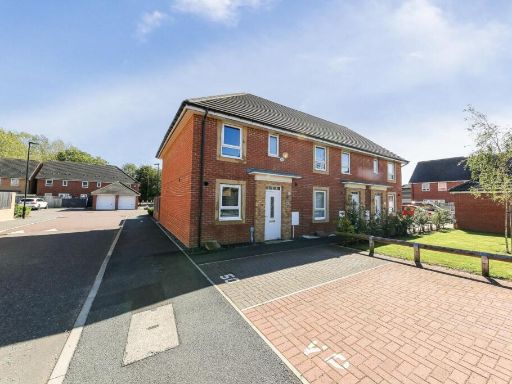 3 bedroom semi-detached house for sale in Ryder Court, Killingworth, NE12 — £210,000 • 3 bed • 2 bath • 829 ft²
 3 bedroom semi-detached house for sale in Bolam Road, Killingworth NE12 — £190,000 • 3 bed • 1 bath • 902 ft²
 3 bedroom terraced house for sale in Angus Close, Killingworth, NE12 — £90,500 • 3 bed • 1 bath • 755 ft²
 2 bedroom semi-detached house for sale in Yates Close, Killingworth, NE12 — £160,000 • 2 bed • 2 bath • 636 ft²
Meta
- {
"@context": "https://schema.org",
"@type": "Residence",
"name": "3 bedroom terraced house for sale in Dove Close, Killingwor…",
"description": "",
"url": "https://propertypiper.co.uk/property/0d8110fc-9f5d-4427-9551-7dfcf1e1ab66",
"image": "https://image-a.propertypiper.co.uk/61953e6c-61d8-4185-a277-2bf709150b99-1024.jpeg",
"address": {
"@type": "PostalAddress",
"streetAddress": "37 DOVE CLOSE KILLINGWORTH NEWCASTLE UPON TYNE",
"postalCode": "NE12 6TG",
"addressLocality": "North Tyneside",
"addressRegion": "North Tyneside",
"addressCountry": "England"
},
"geo": {
"@type": "GeoCoordinates",
"latitude": 55.037896762816146,
"longitude": -1.575716583323639
},
"numberOfRooms": 3,
"numberOfBathroomsTotal": 2,
"floorSize": {
"@type": "QuantitativeValue",
"value": 956,
"unitCode": "FTK"
},
"offers": {
"@type": "Offer",
"price": 120000,
"priceCurrency": "GBP",
"availability": "https://schema.org/InStock"
},
"additionalProperty": [
{
"@type": "PropertyValue",
"name": "Feature",
"value": "modern townhouse"
},
{
"@type": "PropertyValue",
"name": "Feature",
"value": "two-story"
},
{
"@type": "PropertyValue",
"name": "Feature",
"value": "updated facade"
},
{
"@type": "PropertyValue",
"name": "Feature",
"value": "terraced house"
},
{
"@type": "PropertyValue",
"name": "Feature",
"value": "concrete exterior"
},
{
"@type": "PropertyValue",
"name": "Feature",
"value": "small front yard"
},
{
"@type": "PropertyValue",
"name": "Feature",
"value": "no garage"
},
{
"@type": "PropertyValue",
"name": "Feature",
"value": "modern style"
},
{
"@type": "PropertyValue",
"name": "Feature",
"value": "living room"
},
{
"@type": "PropertyValue",
"name": "Feature",
"value": "french doors"
},
{
"@type": "PropertyValue",
"name": "Feature",
"value": "wood flooring"
},
{
"@type": "PropertyValue",
"name": "Feature",
"value": "open plan"
},
{
"@type": "PropertyValue",
"name": "Feature",
"value": "natural light"
},
{
"@type": "PropertyValue",
"name": "Feature",
"value": "accent color"
},
{
"@type": "PropertyValue",
"name": "Feature",
"value": "shelving"
},
{
"@type": "PropertyValue",
"name": "Feature",
"value": "ceramic lighting fixtures"
}
]
}
High Res Floorplan Images
Compatible Floorplan Images
FloorplanImages Thumbnail