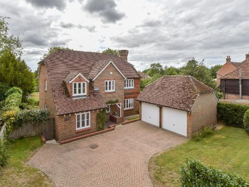
TN30 6QP - 4 bedroom detached house for sale in Forson Close, Tenterde…
View on Property Piper
4 bedroom detached house for sale in Forson Close, Tenterden, Kent, TN30
Property Details
- Price: £750000
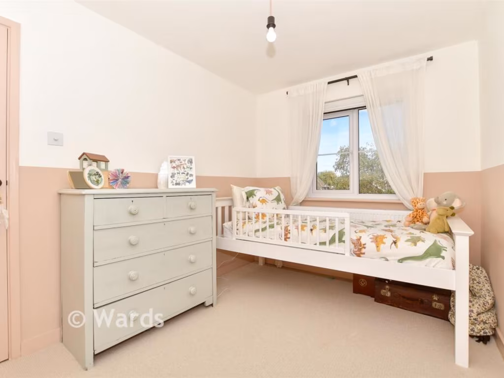
- Bedrooms: 4
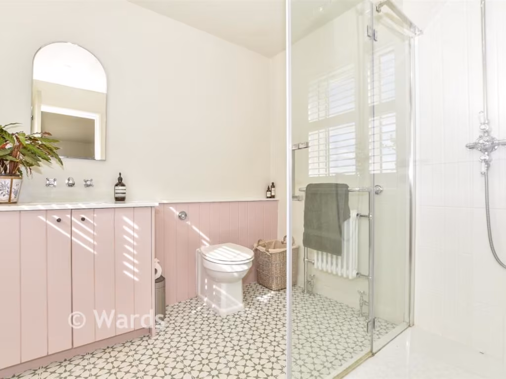
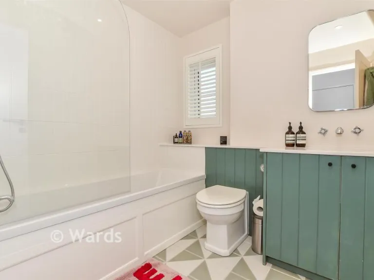
- Bathrooms: 2
- Property Type: undefined
- Property SubType: undefined
Image Descriptions
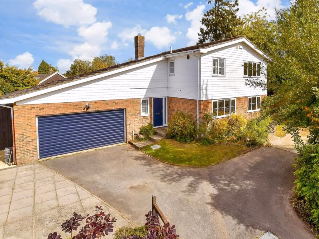
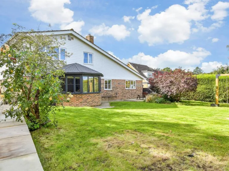
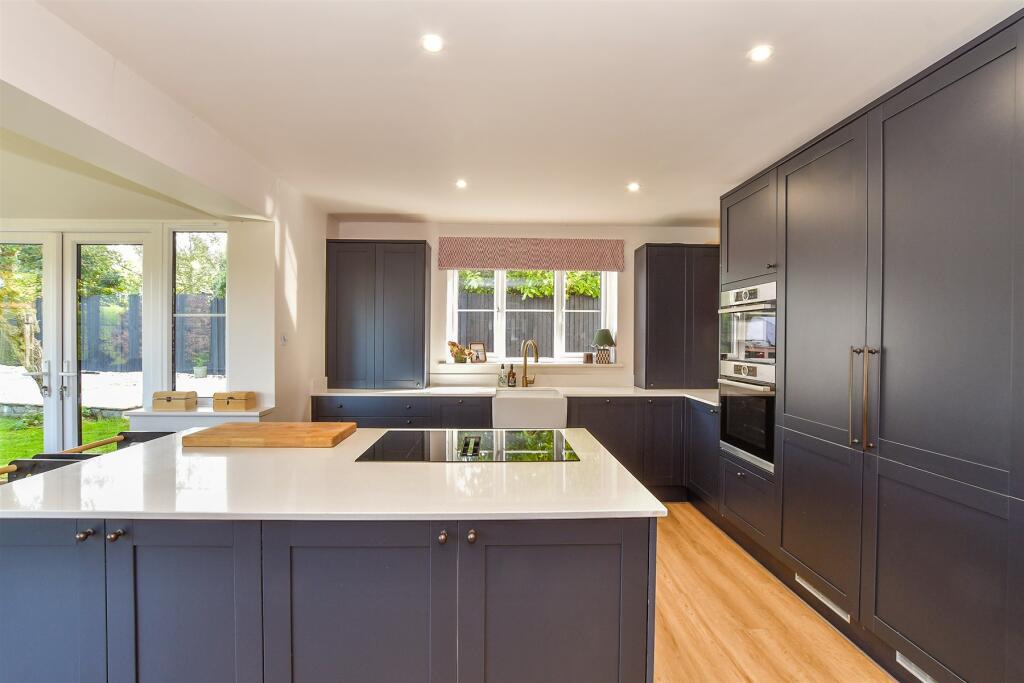
- detached house mid-20th century
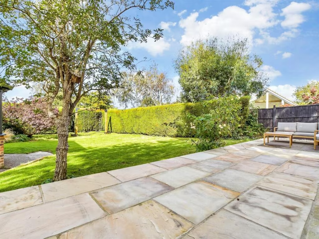
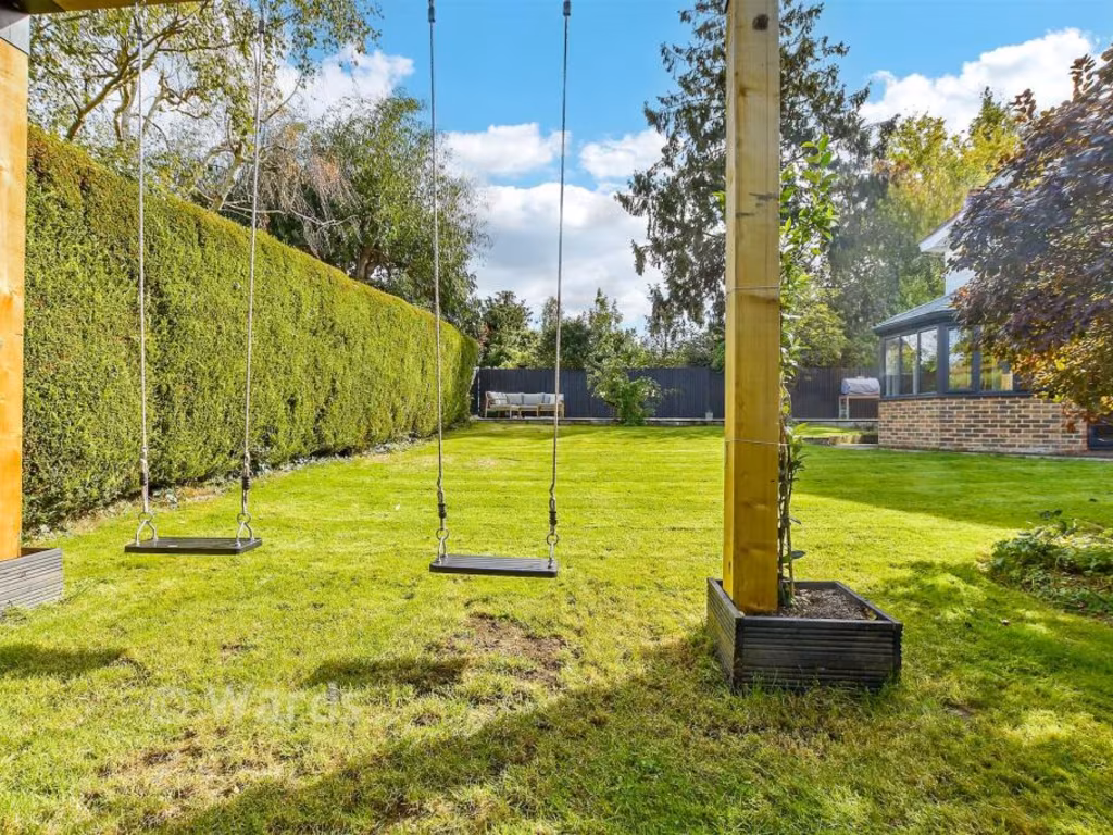
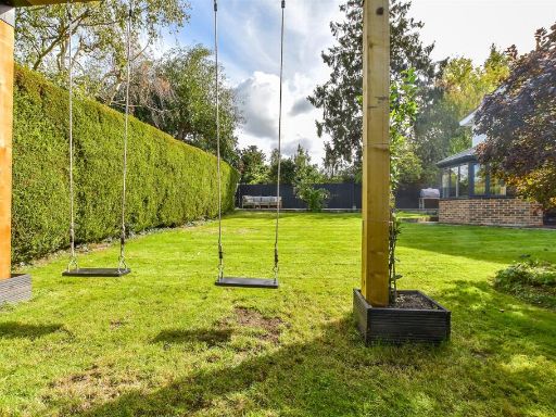
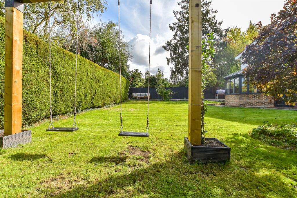
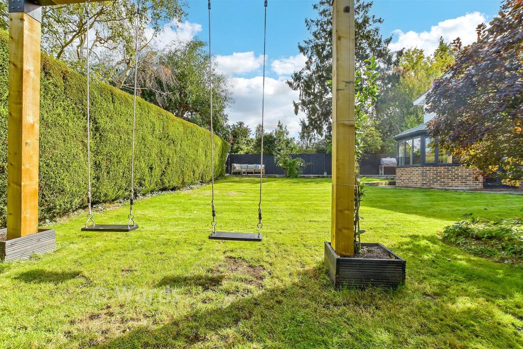
- back exterior of house and garden suburban
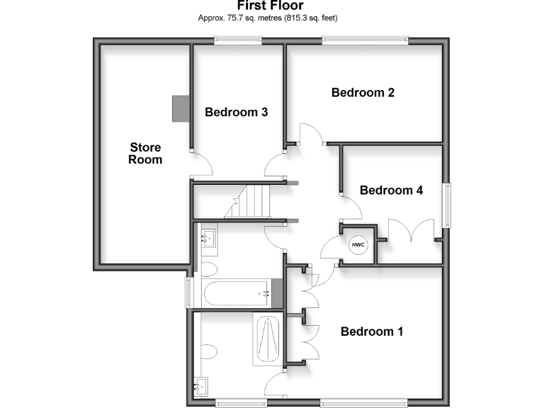
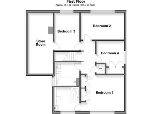
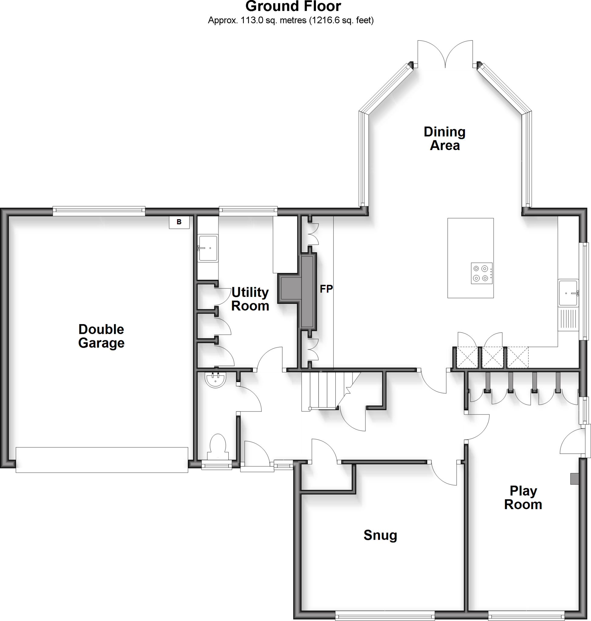
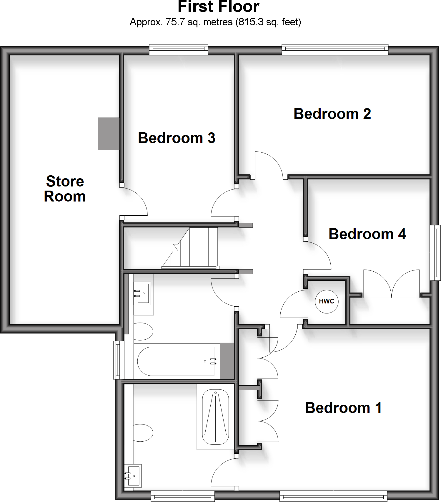
Rooms
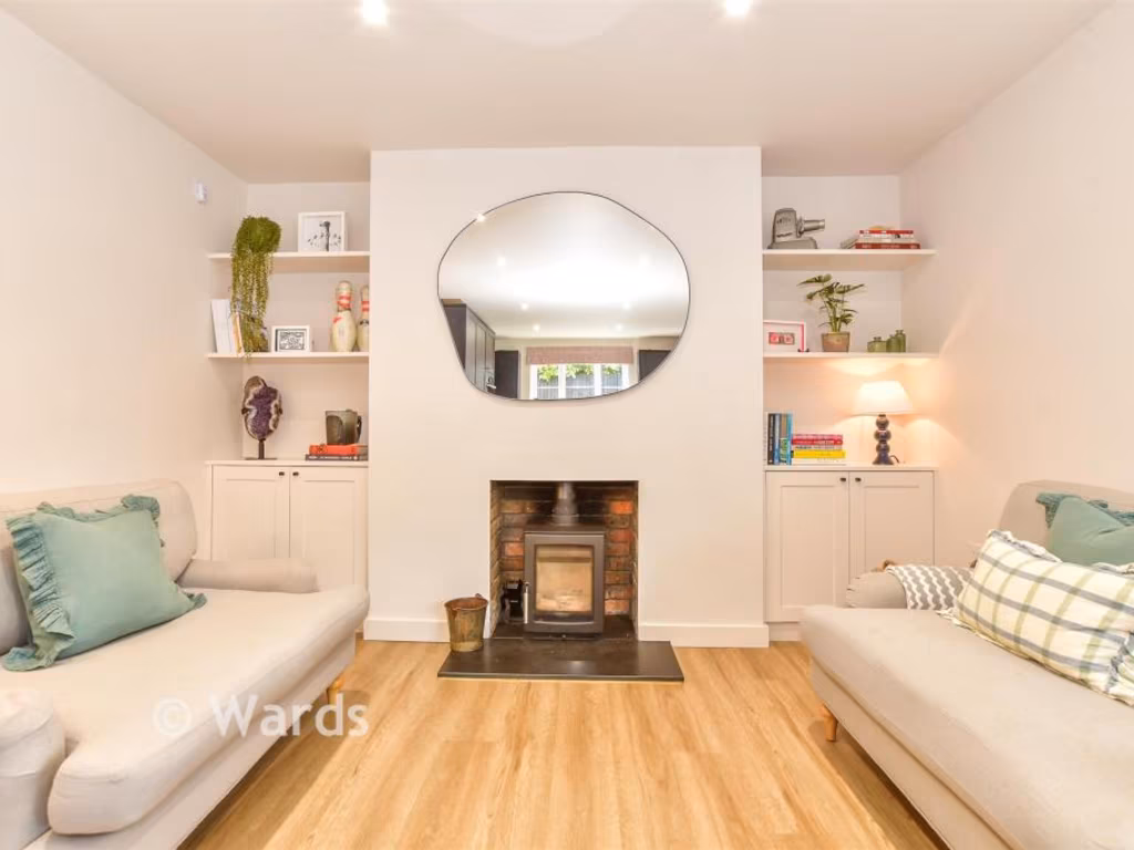
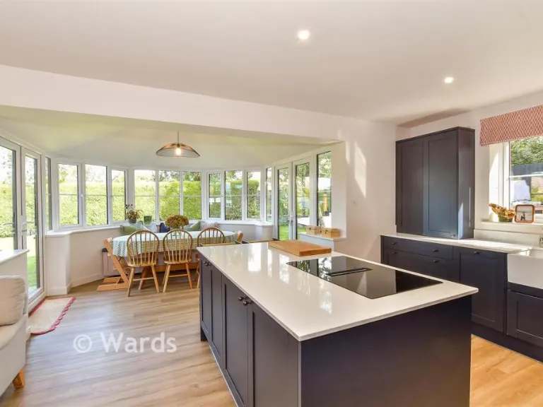
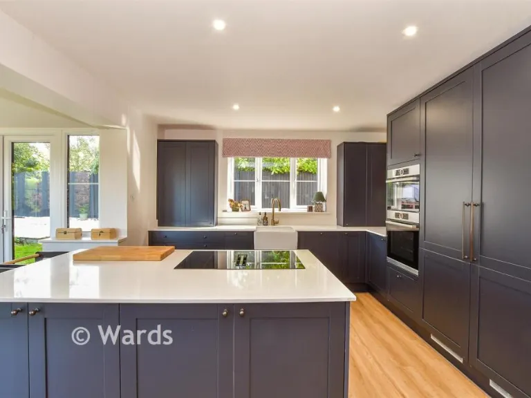
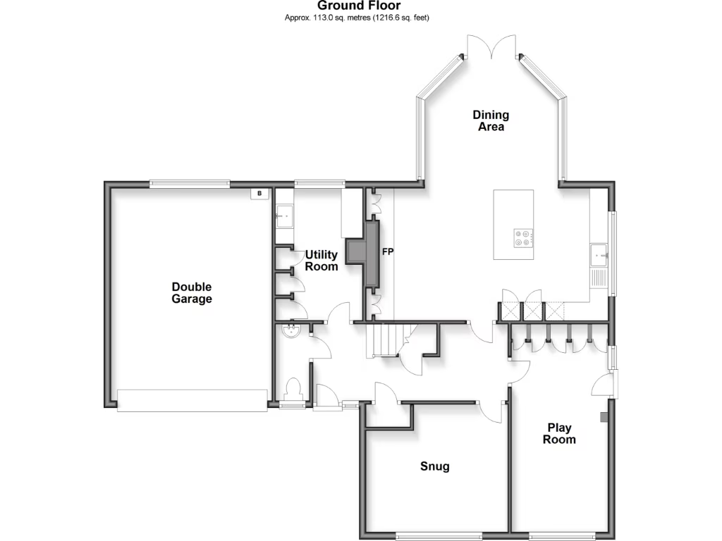
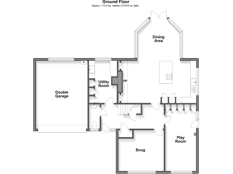
- Double Garage:
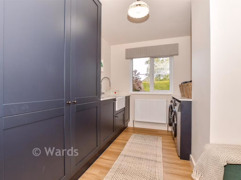
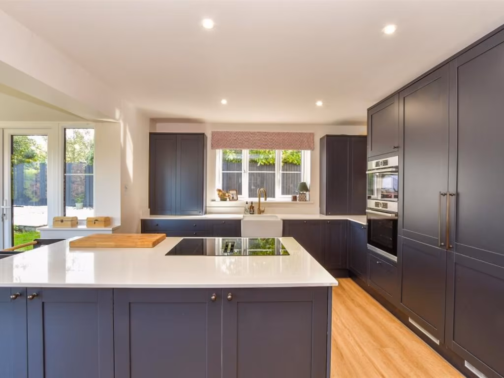
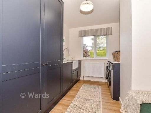
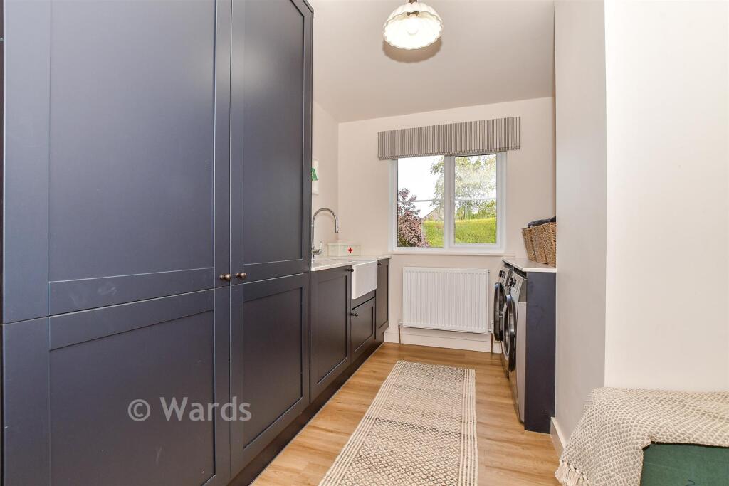
- Utility Room:
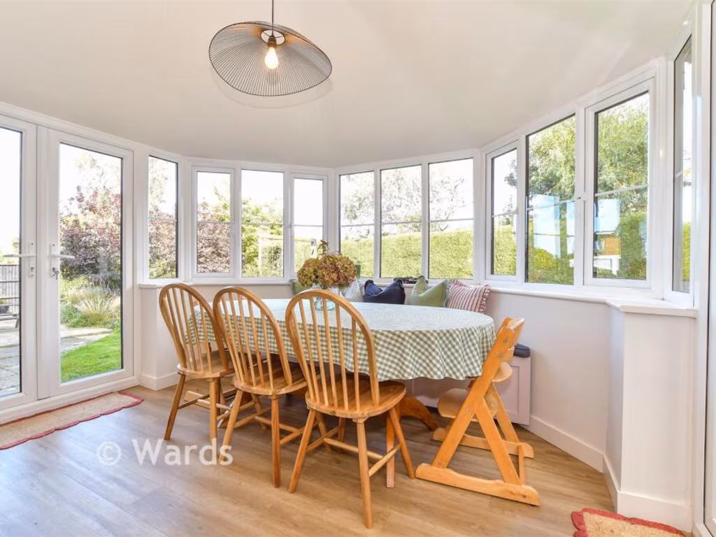
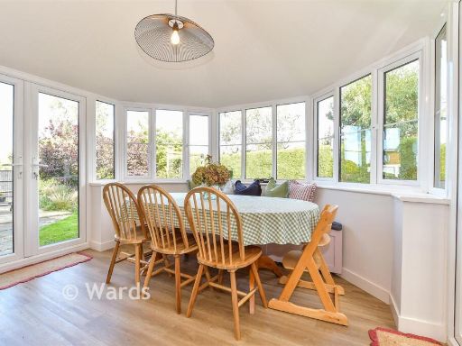
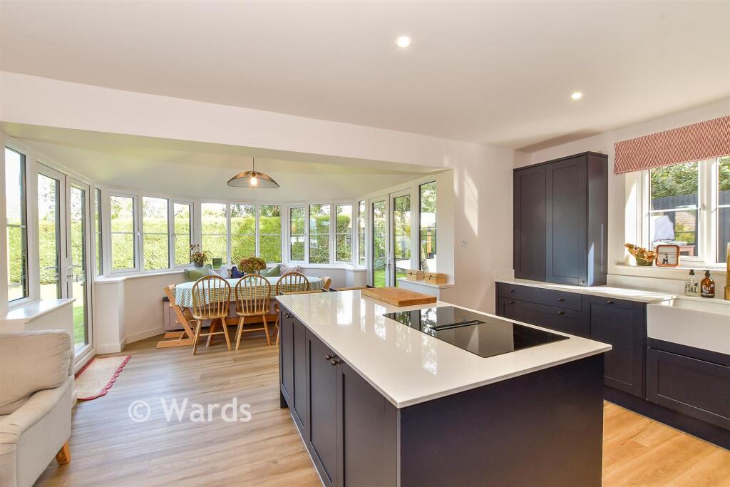
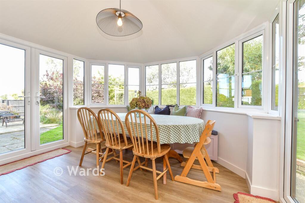
- Dining Area:
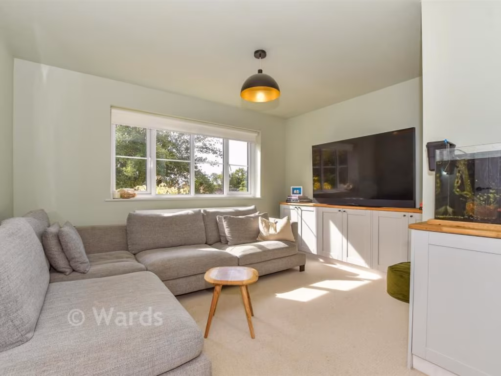
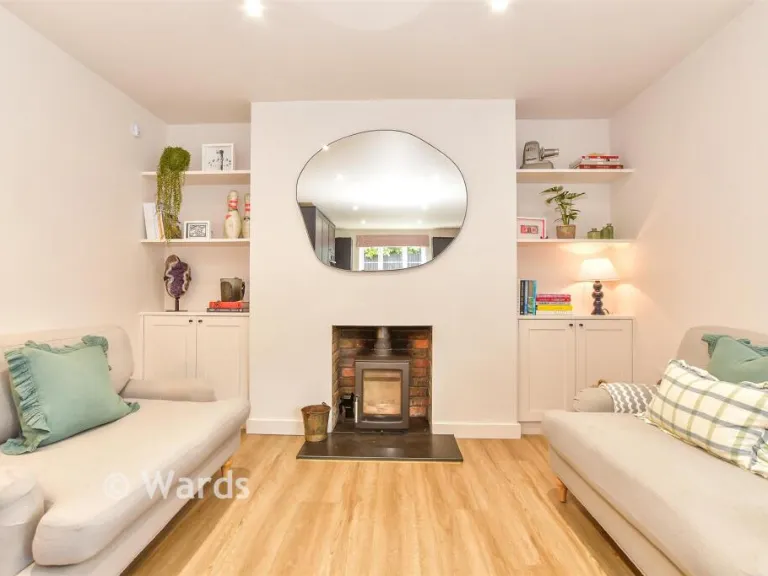
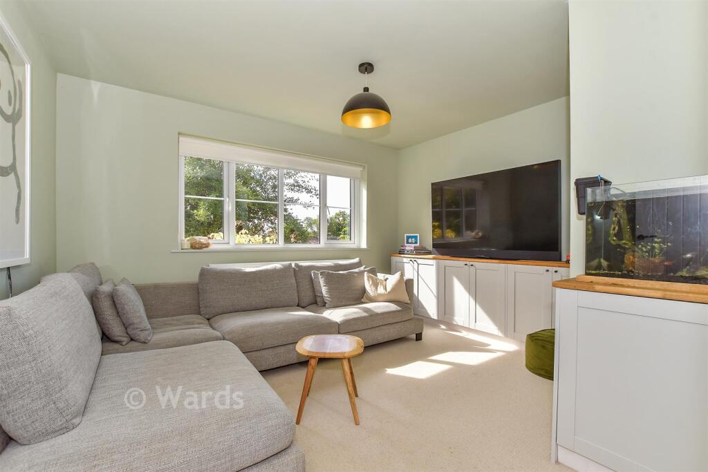
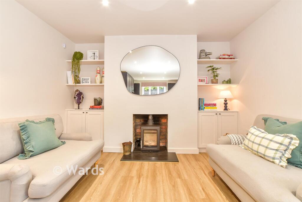
- Snug:
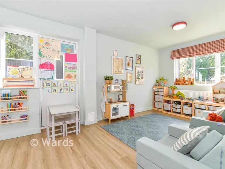
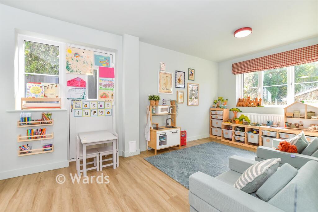
- Play Room:
- Store Room:
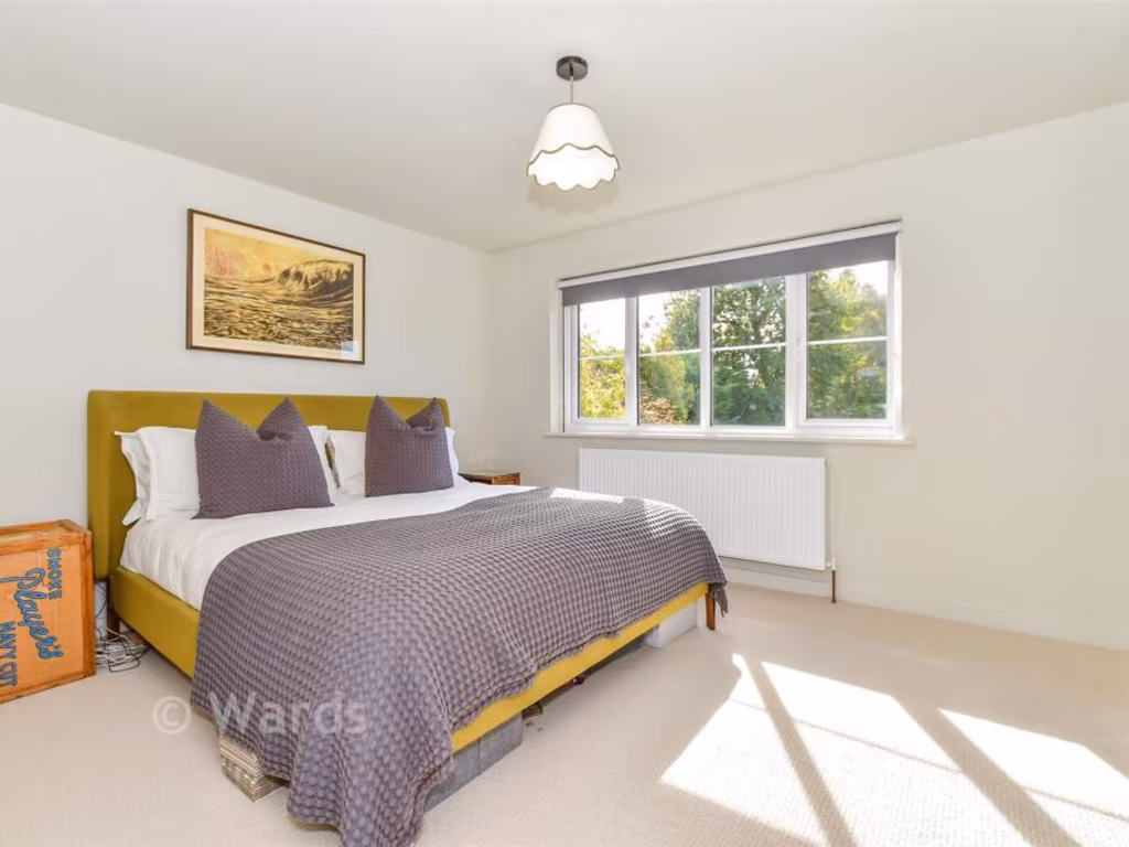
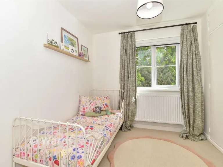
- Bedroom 3:
- Bedroom 2:
- Bedroom 4:
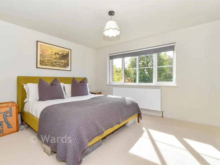
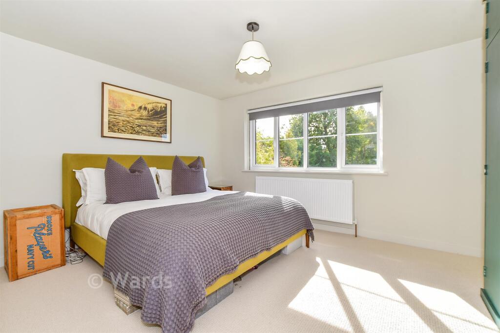
- Bedroom 1:
Textual Property Features
Detected Visual Features
- detached house
- mid-20th century
- two-story
- garage
- driveway
- garden
- lawn
- brick construction
- white siding
- residential
- suburban house
- large garden
- brickwork
- wooden siding
- patio
- detached
EPC Details
- Fully double glazed
- Cavity wall, filled cavity
- Boiler and radiators, mains gas
- Low energy lighting in 41% of fixed outlets
- Solid, no insulation (assumed)
Nearby Schools
- Benenden Church of England Primary School
- Homewood School and Sixth Form Centre
- St Michael's Church of England Primary School
- Rolvenden Primary School
- Tenterden Church of England Junior School
- Woodchurch Church of England Primary School
- Wittersham Church of England Primary School
- High Halden Church of England Primary School
- Bethersden Primary School
- Tenterden Infant School
- John Mayne Church of England Primary School
Nearest Bars And Restaurants
- Id: 488105610
- Tags:
- Addr:
- City: Tenterden
- Housename: 13-15
- Postcode: TN30 6BN
- Street: High Street
- Amenity: cafe
- Brand: Costa
- Brand:wikidata: Q608845
- Brand:wikipedia: en:Costa Coffee
- Building: yes
- Cuisine: coffee_shop
- Internet_access: wlan
- Name: Costa
- Takeaway: yes
- TagsNormalized:
- Lat: 51.0685578
- Lon: 0.6887389
- FullGeoHash: u106x8txbv0v
- PartitionGeoHash: u106
- Images:
- FoodStandards: null
- Distance: 486
,- Id: 902585886
- Tags:
- Amenity: cafe
- Name: The Savannah cafe
- TagsNormalized:
- Lat: 51.0688314
- Lon: 0.6891389
- FullGeoHash: u106x8vcd05j
- PartitionGeoHash: u106
- Images:
- FoodStandards: null
- Distance: 450
,- Id: 4783694060
- Tags:
- Amenity: cafe
- Brand: Caffè Nero
- Brand:wikidata: Q675808
- Brand:wikipedia: en:Caffè Nero
- Contact:
- Website: https://caffenero.com/uk/store/tenterden-333/
- Cuisine: coffee_shop
- Name: Caffè Nero
- Takeaway: yes
- TagsNormalized:
- cafe
- caffè nero
- coffee
- takeaway
- Lat: 51.069004
- Lon: 0.6896255
- FullGeoHash: u106x8y4t2q5
- PartitionGeoHash: u106
- Images:
- FoodStandards: null
- Distance: 425.3
,- Id: 7079391612
- Tags:
- Amenity: restaurant
- Cuisine: tapas
- Name: This Ancient Boro'
- TagsNormalized:
- Lat: 51.0694326
- Lon: 0.6894659
- FullGeoHash: u106x8yj18pp
- PartitionGeoHash: u106
- Images:
- FoodStandards: null
- Distance: 380
,- Id: 7079391611
- Tags:
- Amenity: restaurant
- Name: Amy's Pantry
- TagsNormalized:
- Lat: 51.0695067
- Lon: 0.6895269
- FullGeoHash: u106x8yj7nh9
- PartitionGeoHash: u106
- Images:
- FoodStandards: null
- Distance: 371.1
}
Nearest General Shops
- Id: 7079391614
- Tags:
- Addr:
- City: Tenterden
- Housenumber: 2
- Postcode: TN30 6AD
- Street: East Cross
- Name: County Clothes
- Shop: clothes
- Wheelchair: limited
- TagsNormalized:
- Lat: 51.0694001
- Lon: 0.6895316
- FullGeoHash: u106x8yhg60j
- PartitionGeoHash: u106
- Images:
- FoodStandards: null
- Distance: 382.8
,- Id: 7079391610
- Tags:
- Name: Potters
- Shop: hifi
- Wheelchair: limited
- TagsNormalized:
- Lat: 51.0696765
- Lon: 0.6896596
- FullGeoHash: u106x8ynqjxq
- PartitionGeoHash: u106
- Images:
- FoodStandards: null
- Distance: 351
,- Id: 673982783
- Tags:
- Addr:
- City: Tenterden
- Housenumber: 7
- Postcode: TN30 6AB
- Street: Ashford Road
- Name: RM Cycles
- Phone: +44 1580 765612
- Shop: bicycle
- Website: http://www.rmcycles.co.uk/
- TagsNormalized:
- Lat: 51.0707439
- Lon: 0.6902141
- FullGeoHash: u106x9nsehsv
- PartitionGeoHash: u106
- Images:
- FoodStandards: null
- Distance: 228.4
}
Nearest Grocery shops
- Id: 871994443
- Tags:
- Brand: Costcutter
- Brand:wikidata: Q5175072
- Brand:wikipedia: en:Costcutter
- Name: Costcutter
- Shop: convenience
- TagsNormalized:
- costcutter
- convenience
- shop
- Lat: 51.052737
- Lon: 0.6296732
- FullGeoHash: u106qmfe8ryq
- PartitionGeoHash: u106
- Images:
- FoodStandards: null
- Distance: 4798.2
,- Id: 886306602
- Tags:
- Brand: Tiger Mart
- Brand:wikidata: Q57643977
- Building: yes
- Name: Tiger Mart
- Shop: convenience
- Source: Bing
- TagsNormalized:
- Lat: 51.0658561
- Lon: 0.6658707
- FullGeoHash: u106x0kb5vt1
- PartitionGeoHash: u106
- Images:
- FoodStandards: null
- Distance: 1883.8
,- Id: 5110967828
- Tags:
- Brand: Holland & Barrett
- Brand:wikidata: Q5880870
- Brand:wikipedia: en:Holland & Barrett
- Name: Holland & Barrett
- Shop: health_food
- TagsNormalized:
- holland & barrett
- health
- health food
- food
- shop
- Lat: 51.0689541
- Lon: 0.6885482
- FullGeoHash: u106x8v6hr4c
- PartitionGeoHash: u106
- Images:
- FoodStandards: null
- Distance: 447.3
}
Nearest Supermarkets
- Id: 456411153
- Tags:
- Addr:
- City: Cranbrook
- County: Kent
- Postcode: TN18 4HG
- Street: Rye Road
- Village: Hawkhurst
- Brand: Tesco
- Brand:wikidata: Q487494
- Building: yes
- Fhrs:
- Name: Tesco
- Opening_hours: Mo-Sa 08:00-22:00 Su 10:00-16:00
- Operator: Tesco
- Shop: supermarket
- Source:
- TagsNormalized:
- Lat: 51.0476747
- Lon: 0.5147404
- FullGeoHash: u1067syy6262
- PartitionGeoHash: u106
- Images:
- FoodStandards:
- Id: 510915
- FHRSID: 510915
- LocalAuthorityBusinessID: 13/00014/MIXED
- BusinessName: Tesco
- BusinessType: Retailers - supermarkets/hypermarkets
- BusinessTypeID: 7840
- AddressLine1: Rye Road
- AddressLine2: Hawkhurst
- AddressLine3: Cranbrook
- AddressLine4: Kent
- PostCode: TN18 4HG
- RatingValue: 5
- RatingKey: fhrs_5_en-GB
- RatingDate: 2022-05-03
- LocalAuthorityCode: 192
- LocalAuthorityName: Tunbridge Wells
- LocalAuthorityWebSite: http://www.tunbridgewells.gov.uk
- LocalAuthorityEmailAddress: EHAdmin@Midkent.gov.uk
- Scores:
- Hygiene: 0
- Structural: 0
- ConfidenceInManagement: 0
- NewRatingPending: false
- Geocode:
- Longitude: 0.51401300000000
- Latitude: 51.04769900000000
- Distance: 12594.6
,- Id: 199625561
- Tags:
- Addr:
- Housename: Highbury Works
- Postcode: TN30 7LN
- Street: Tenterden Road
- Alt_name: Tesco Tenderden Superstore
- Brand: Tesco
- Brand:wikidata: Q487494
- Brand:wikipedia: en:Tesco
- Building: yes
- Contact:
- Website: https://www.tesco.com/store-locator/tenterden/highbury-works
- Name: Tesco
- Shop: supermarket
- TagsNormalized:
- Lat: 51.0658909
- Lon: 0.6856035
- FullGeoHash: u106x870rsp0
- PartitionGeoHash: u106
- Images:
- FoodStandards: null
- Distance: 839.2
,- Id: 199625562
- Tags:
- Addr:
- Housenumber: 10
- Postcode: TN30 6BW
- Street: Sayers Lane
- Alt_name: Waitrose Tenterden
- Brand: Waitrose
- Brand:wikidata: Q771734
- Brand:wikipedia: en:Waitrose
- Building: yes
- Name: Waitrose
- Official_name: Waitrose & Partners
- Operator: Waitrose & Partners
- Shop: supermarket
- Source: survey
- TagsNormalized:
- Lat: 51.0680209
- Lon: 0.6887594
- FullGeoHash: u106x8tsc304
- PartitionGeoHash: u106
- Images:
- FoodStandards: null
- Distance: 543.7
}
Nearest Religious buildings
- Id: 58680499
- Tags:
- Amenity: place_of_worship
- Building: yes
- Denomination: anglican
- Heritage: yes
- Name: St Mildreds C of E church
- Religion: christian
- Wikidata: Q17529438
- TagsNormalized:
- place of worship
- anglican
- church
- christian
- Lat: 51.0687475
- Lon: 0.6871729
- FullGeoHash: u106x8u3h292
- PartitionGeoHash: u106
- Images:
- FoodStandards: null
- Distance: 505.2
,- Id: 217489922
- Tags:
- Amenity: place_of_worship
- Denomination: baptist
- Name: Trinity Baptist Church
- Religion: christian
- TagsNormalized:
- place of worship
- baptist
- church
- christian
- Lat: 51.0735473
- Lon: 0.6921839
- FullGeoHash: u106xc8hcp38
- PartitionGeoHash: u106
- Images:
- FoodStandards: null
- Distance: 146.4
,- Id: 217489916
- Tags:
- Amenity: place_of_worship
- Building: church
- Denomination: catholic
- Name: Saint Andrew's Catholic Church
- Religion: christian
- Source: Bing
- TagsNormalized:
- place of worship
- church
- catholic
- christian
- Lat: 51.0731495
- Lon: 0.6917809
- FullGeoHash: u106x9xdxtj5
- PartitionGeoHash: u106
- Images:
- FoodStandards: null
- Distance: 100
}
Nearest Medical buildings
- Id: 165813912
- Tags:
- Amenity: hospital
- Healthcare: hospital
- Name: West View Hospital
- Note: Care home
- TagsNormalized:
- Lat: 51.0641373
- Lon: 0.6749555
- FullGeoHash: u106rrgqpt5k
- PartitionGeoHash: u106
- Images:
- FoodStandards: null
- Distance: 1449.5
,- Id: 2269449268
- Tags:
- Addr:
- City: Tenterden
- Postcode: TN30 6RB
- Street: Recreation Ground Road
- Amenity: hospital
- Emergency: no
- Healthcare: hospital
- Name: Ivy Court Surgery (temporary location)
- TagsNormalized:
- hospital
- health
- healthcare
- surgery
- Lat: 51.0678935
- Lon: 0.6909309
- FullGeoHash: u106x8xh5c76
- PartitionGeoHash: u106
- Images:
- FoodStandards: null
- Distance: 545.6
,- Id: 4090180429
- Tags:
- Addr:
- City: Tenterden
- Housenumber: 4
- Postcode: TN30 6BN
- Street: High Street
- Amenity: dentist
- Description: Dental clinic providing Private Dental Healthcare
- Healthcare: dentist
- Name: EasySmile Dental Practice
- Phone: +44 1580763686
- Website: https://myeasysmile.co.uk/
- TagsNormalized:
- dentist
- health
- healthcare
- dental
- Lat: 51.0687403
- Lon: 0.6893067
- FullGeoHash: u106x8vbyp0m
- PartitionGeoHash: u106
- Images:
- FoodStandards: null
- Distance: 457.7
,- Id: 7079391617
- Tags:
- Amenity: pharmacy
- Brand: Boots
- Brand:wikidata: Q6123139
- Brand:wikipedia: en:Boots (company)
- Healthcare: pharmacy
- Name: Boots
- Website: https://www.boots.com/stores/982-tenterden-high-street-tn30-6ah
- Wheelchair: yes
- TagsNormalized:
- pharmacy
- boots
- health
- healthcare
- Lat: 51.0692964
- Lon: 0.6894095
- FullGeoHash: u106x8yh0qug
- PartitionGeoHash: u106
- Images:
- FoodStandards: null
- Distance: 395.6
}
Nearest Leisure Facilities
- Id: 889320649
- Tags:
- TagsNormalized:
- swimming
- swimming pool
- pool
- leisure
- Lat: 51.0692386
- Lon: 0.6940403
- FullGeoHash: u106xbc7uk1f
- PartitionGeoHash: u106
- Images:
- FoodStandards: null
- Distance: 467.3
,- Id: 761450073
- Tags:
- Leisure: fitness_station
- Sport: fitness
- TagsNormalized:
- fitness
- fitness station
- station
- leisure
- sports
- Lat: 51.0687018
- Lon: 0.6913208
- FullGeoHash: u106x8z2ubn0
- PartitionGeoHash: u106
- Images:
- FoodStandards: null
- Distance: 458.6
,- Id: 106899503
- Tags:
- Leisure: playground
- Source: Bing
- TagsNormalized:
- Lat: 51.0688643
- Lon: 0.6909817
- FullGeoHash: u106x8z1tn33
- PartitionGeoHash: u106
- Images:
- FoodStandards: null
- Distance: 438.2
,- Id: 693761477
- Tags:
- TagsNormalized:
- Lat: 51.0699056
- Lon: 0.690418
- FullGeoHash: u106x8yxzbkv
- PartitionGeoHash: u106
- Images:
- FoodStandards: null
- Distance: 320.9
,- Id: 887988242
- Tags:
- TagsNormalized:
- swimming
- swimming pool
- pool
- leisure
- Lat: 51.0720683
- Lon: 0.6919756
- FullGeoHash: u106x9ruk5w6
- PartitionGeoHash: u106
- Images:
- FoodStandards: null
- Distance: 132.5
}
Nearest Tourist attractions
- Id: 972923746
- Tags:
- Building: yes
- Name: Exhibition and Model Railway
- Tourism: museum
- TagsNormalized:
- Lat: 51.0702592
- Lon: 0.6856972
- FullGeoHash: u106x953cfkf
- PartitionGeoHash: u106
- Images:
- FoodStandards: null
- Distance: 436.4
,- Id: 827397889
- Tags:
- Landuse: grass
- Tourism: picnic_site
- TagsNormalized:
- grass
- picnic
- picnic site
- tourism
- Lat: 51.0702306
- Lon: 0.686058
- FullGeoHash: u106x959dkcz
- PartitionGeoHash: u106
- Images:
- FoodStandards: null
- Distance: 419.6
,- Id: 9073480727
- Tags:
- Addr:
- Country: GB
- Housename: Little Dane Court
- Housenumber: 1
- Postcode: TN30 6AB
- Street: Ashford Road
- Fhrs:
- Guest_house: bed_and_breakfast
- Name: Little Dane Court B & B
- Tourism: guest_house
- TagsNormalized:
- Lat: 51.0704375
- Lon: 0.6901672
- FullGeoHash: u106x9ndf59f
- PartitionGeoHash: u106
- Images:
- FoodStandards:
- Id: 415434
- FHRSID: 415434
- LocalAuthorityBusinessID: PI/000046633
- BusinessName: Little Dane Court B & B
- BusinessType: Hotel/bed & breakfast/guest house
- BusinessTypeID: 7842
- AddressLine1: Little Dane Court
- AddressLine2: 1 Ashford Road
- AddressLine3: Tenterden
- AddressLine4: Kent
- PostCode: TN30 6AB
- RatingValue: 5
- RatingKey: fhrs_5_en-GB
- RatingDate: 2016-09-20
- LocalAuthorityCode: 179
- LocalAuthorityName: Ashford
- LocalAuthorityWebSite: http://www.ashford.gov.uk
- LocalAuthorityEmailAddress: envhealth@ashford.gov.uk
- Scores:
- Hygiene: 0
- Structural: 5
- ConfidenceInManagement: 0
- NewRatingPending: false
- Geocode:
- Longitude: 0.69019200000000
- Latitude: 51.07068600000000
- Distance: 262.6
}
Nearest Train stations
- Id: 6688385724
- Tags:
- Name: Headcorn
- Naptan:
- Network: National Rail
- Public_transport: station
- Railway: station
- Ref:
- Wikidata: Q2482799
- Wikipedia: en:Headcorn railway station
- TagsNormalized:
- Lat: 51.1656292
- Lon: 0.6273669
- FullGeoHash: u107n62v6swd
- PartitionGeoHash: u107
- Images:
- FoodStandards: null
- Distance: 11223.4
,- Id: 29647645
- Tags:
- Name: Northiam
- Naptan:
- Note: Explicitly named on NPE
- Public_transport: station
- Railway: station
- Source: survey
- Tourism: preserved_railway
- Usage: tourism
- Wikidata: Q7059479
- TagsNormalized:
- Lat: 51.0094167
- Lon: 0.6138687
- FullGeoHash: u106jvzp2hmw
- PartitionGeoHash: u106
- Images:
- FoodStandards: null
- Distance: 8851
,- Id: 29647593
- Tags:
- Name: Wittersham Road
- Naptan:
- Note: Explictly named on NPE
- Public_transport: station
- Railway: station
- Tourism: preserved_railway
- Usage: tourism
- Wikidata: Q8028586
- Wikipedia: en:Wittersham Road railway station
- TagsNormalized:
- Lat: 51.0279011
- Lon: 0.6611109
- FullGeoHash: u106r137j40n
- PartitionGeoHash: u106
- Images:
- FoodStandards: null
- Distance: 5397
,- Id: 29647549
- Tags:
- Name: Rolvenden
- Naptan:
- Public_transport: station
- Railway: station
- Tourism: preserved_railway
- Usage: tourism
- Wikidata: Q7361435
- Wikipedia: en:Rolvenden railway station
- TagsNormalized:
- Lat: 51.0639927
- Lon: 0.6600068
- FullGeoHash: u106rpbt760t
- PartitionGeoHash: u106
- Images:
- FoodStandards: null
- Distance: 2342.6
,- Id: 29647467
- Tags:
- Name: Tenterden Town
- Naptan:
- Public_transport: station
- Railway: station
- Tourism: preserved_railway
- Usage: tourism
- Wikidata: Q7700834
- Wikipedia: en:Tenterden Town railway station
- TagsNormalized:
- Lat: 51.0703263
- Lon: 0.6852189
- FullGeoHash: u106x94fnyb4
- PartitionGeoHash: u106
- Images:
- FoodStandards: null
- Distance: 457.9
}
Nearest Hotels
- Id: 298257640
- Tags:
- Addr:
- Country: GB
- Postcode: TN30 6HX
- Street: Ashford Road
- Fhrs:
- Name: London Beach Golf Club
- Tourism: hotel
- TagsNormalized:
- beach
- golf
- club
- hotel
- tourism
- Lat: 51.0907645
- Lon: 0.6885522
- FullGeoHash: u106xsv3k2v9
- PartitionGeoHash: u106
- Images:
- FoodStandards: null
- Distance: 2003
,- Id: 487835997
- Tags:
- Addr:
- Country: GB
- Housenumber: 57
- Postcode: TN30 6BD
- Street: High Street
- Amenity: restaurant
- Building: yes
- Fhrs:
- Heritage: yes
- Name: The White Lion
- Tourism: hotel
- Wikidata: Q26324200
- TagsNormalized:
- Lat: 51.0678127
- Lon: 0.6867348
- FullGeoHash: u106x8s5d468
- PartitionGeoHash: u106
- Images:
- FoodStandards: null
- Distance: 612
,- Id: 298257644
- Tags:
- Amenity: pub
- Name: Woolpack Hotel
- Source: TMJ-Mobile_0.6.2
- TagsNormalized:
- Lat: 51.0687153
- Lon: 0.687716
- FullGeoHash: u106x8ubbfw0
- PartitionGeoHash: u106
- Images:
- FoodStandards: null
- Distance: 492.4
}
Tags
- detached house
- mid-20th century
- two-story
- garage
- driveway
- garden
- lawn
- brick construction
- white siding
- residential
- suburban house
- two-story
- large garden
- brickwork
- wooden siding
- patio
- detached
Local Market Stats
- Average Price/sqft: £407
- Avg Income: £43300
- Social Housing: 8%
- Planning Success Rate: 86%
AirBnB Data
- 1km average: £115/night
- Listings in 1km: 3
Similar Properties
 5 bedroom detached house for sale in Woodchurch Road, Tenterden, Kent, TN30 — £900,000 • 5 bed • 3 bath • 1819 ft²
 4 bedroom detached house for sale in Forson Close, Tenterden, Kent, TN30 — £495,500 • 4 bed • 2 bath • 1626 ft²
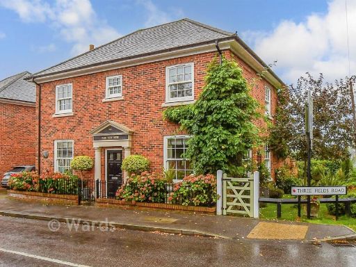 4 bedroom detached house for sale in Three Fields Road, Tenterden, Kent, TN30 — £725,000 • 4 bed • 1 bath • 1050 ft²
 5 bedroom detached house for sale in Homewood Road, Tenterden, Kent, TN30 — £650,000 • 5 bed • 2 bath • 2046 ft²
 3 bedroom link detached house for sale in Beacon Walk, Tenterden, Kent, TN30 — £600,000 • 3 bed • 2 bath • 1176 ft²
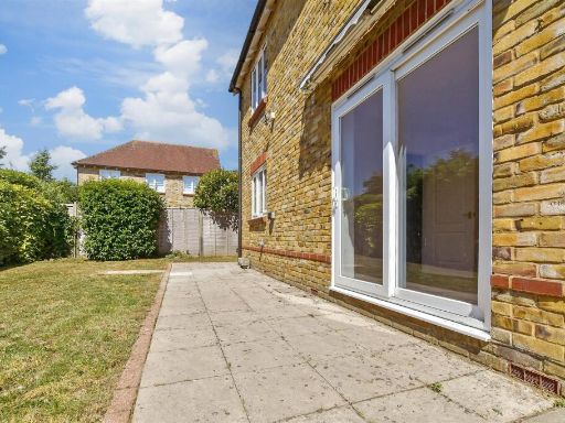 4 bedroom detached house for sale in William Judge Close, Tenterden, Kent, TN30 — £550,000 • 4 bed • 2 bath • 1378 ft²
Meta
- {
"@context": "https://schema.org",
"@type": "Residence",
"name": "4 bedroom detached house for sale in Forson Close, Tenterde…",
"description": "",
"url": "https://propertypiper.co.uk/property/09700917-8865-43ad-bada-a94120dc8fab",
"image": "https://image-a.propertypiper.co.uk/46a80228-7e6d-4858-bfb9-bf5fcd5d8d7b-1024.jpeg",
"address": {
"@type": "PostalAddress",
"streetAddress": "Mallia, Forson Close",
"postalCode": "TN30 6QP",
"addressLocality": "Ashford",
"addressRegion": "Ashford",
"addressCountry": "England"
},
"geo": {
"@type": "GeoCoordinates",
"latitude": 51.07279154700928,
"longitude": 0.6904684615792926
},
"numberOfRooms": 4,
"numberOfBathroomsTotal": 2,
"floorSize": {
"@type": "QuantitativeValue",
"value": 1626,
"unitCode": "FTK"
},
"offers": {
"@type": "Offer",
"price": 750000,
"priceCurrency": "GBP",
"availability": "https://schema.org/InStock"
},
"additionalProperty": [
{
"@type": "PropertyValue",
"name": "Feature",
"value": "detached house"
},
{
"@type": "PropertyValue",
"name": "Feature",
"value": "mid-20th century"
},
{
"@type": "PropertyValue",
"name": "Feature",
"value": "two-story"
},
{
"@type": "PropertyValue",
"name": "Feature",
"value": "garage"
},
{
"@type": "PropertyValue",
"name": "Feature",
"value": "driveway"
},
{
"@type": "PropertyValue",
"name": "Feature",
"value": "garden"
},
{
"@type": "PropertyValue",
"name": "Feature",
"value": "lawn"
},
{
"@type": "PropertyValue",
"name": "Feature",
"value": "brick construction"
},
{
"@type": "PropertyValue",
"name": "Feature",
"value": "white siding"
},
{
"@type": "PropertyValue",
"name": "Feature",
"value": "residential"
},
{
"@type": "PropertyValue",
"name": "Feature",
"value": "suburban house"
},
{
"@type": "PropertyValue",
"name": "Feature",
"value": "two-story"
},
{
"@type": "PropertyValue",
"name": "Feature",
"value": "large garden"
},
{
"@type": "PropertyValue",
"name": "Feature",
"value": "brickwork"
},
{
"@type": "PropertyValue",
"name": "Feature",
"value": "wooden siding"
},
{
"@type": "PropertyValue",
"name": "Feature",
"value": "patio"
},
{
"@type": "PropertyValue",
"name": "Feature",
"value": "detached"
}
]
}
High Res Floorplan Images
Compatible Floorplan Images
FloorplanImages Thumbnail