BS22 9QU - 2 bedroom detached bungalow for sale in Ashbury Drive, Milt…
View on Property Piper
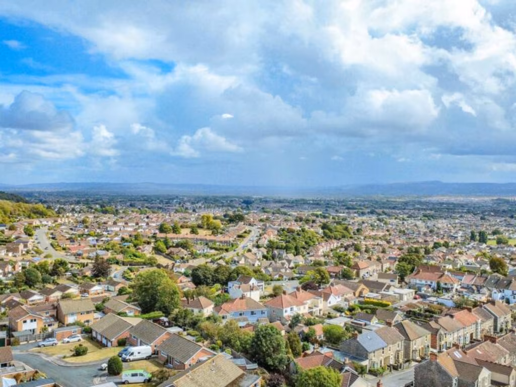
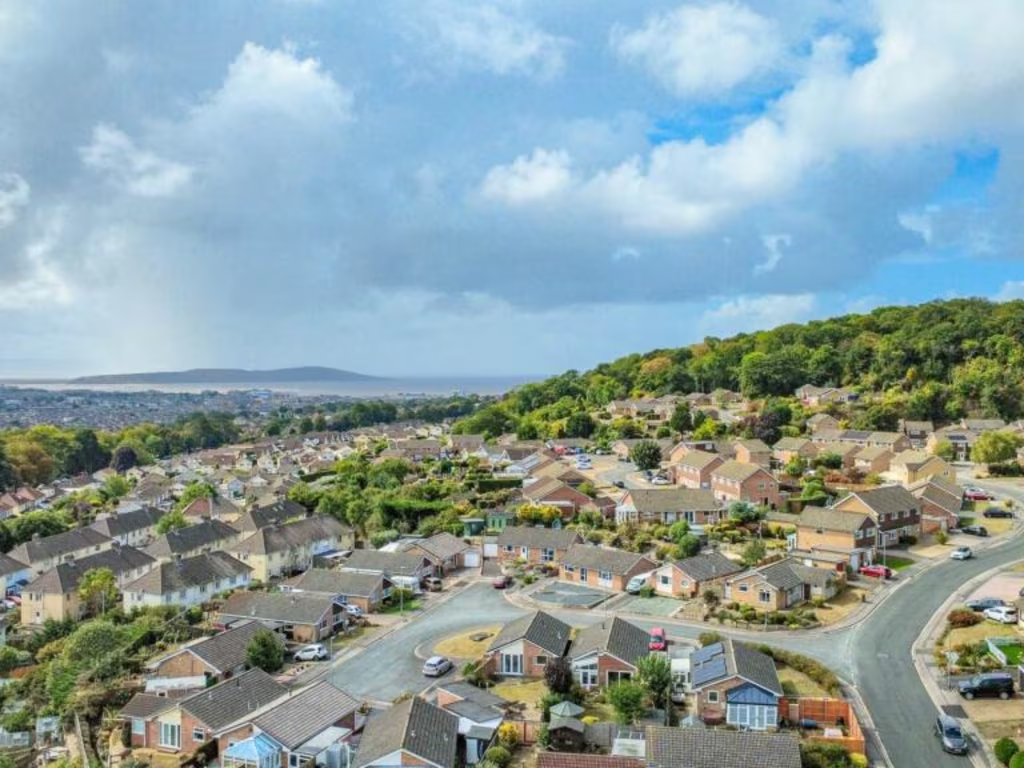
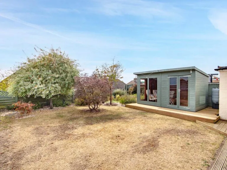
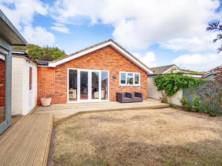
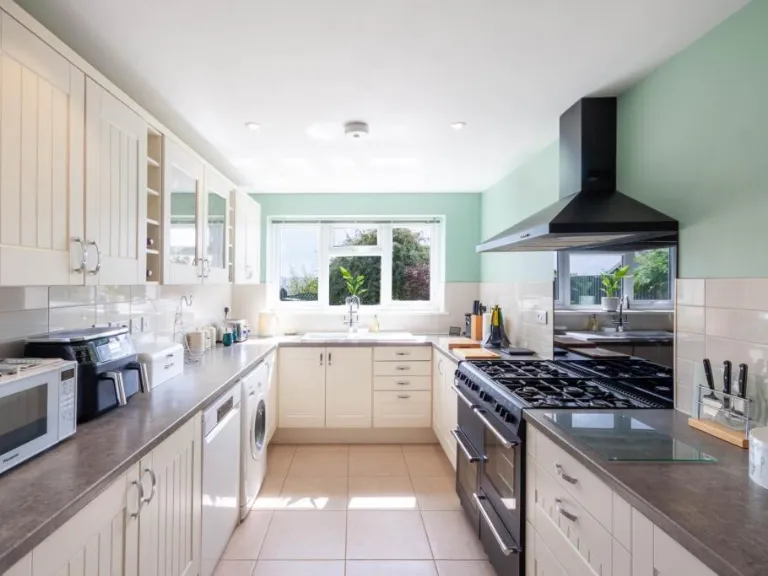
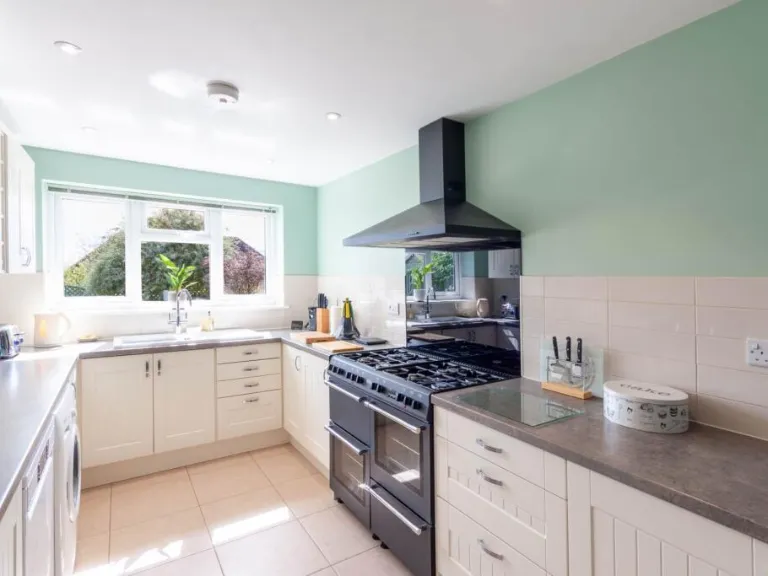
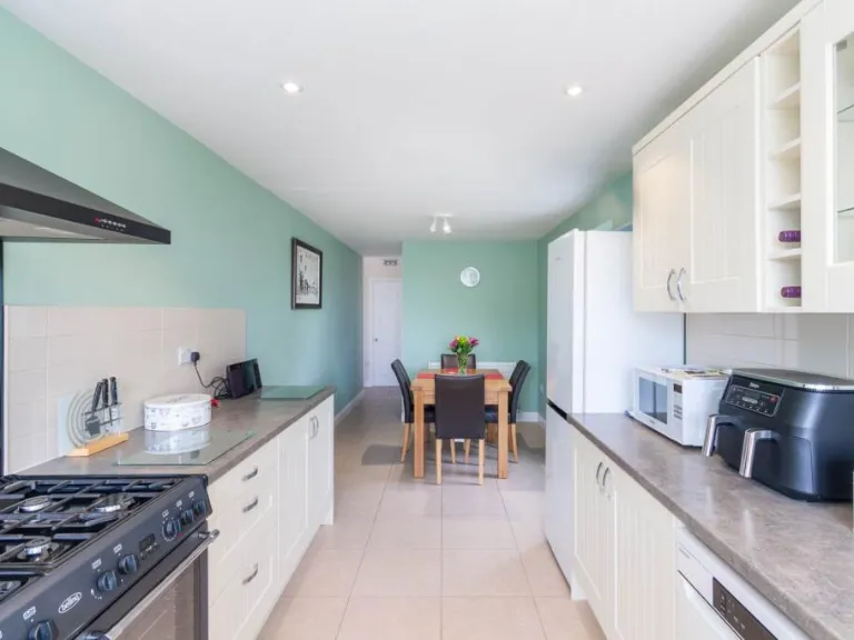
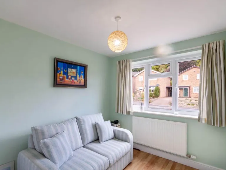
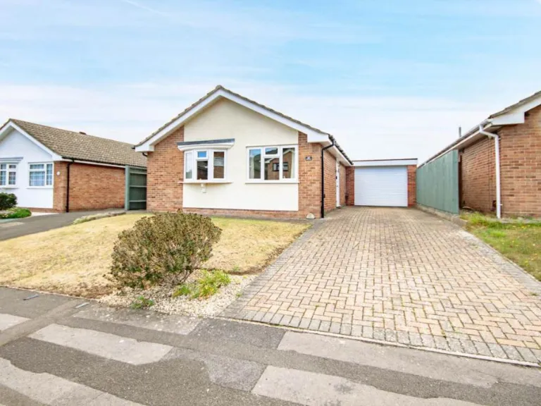
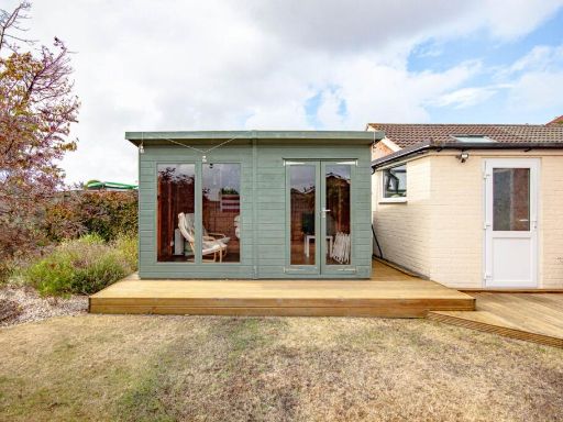
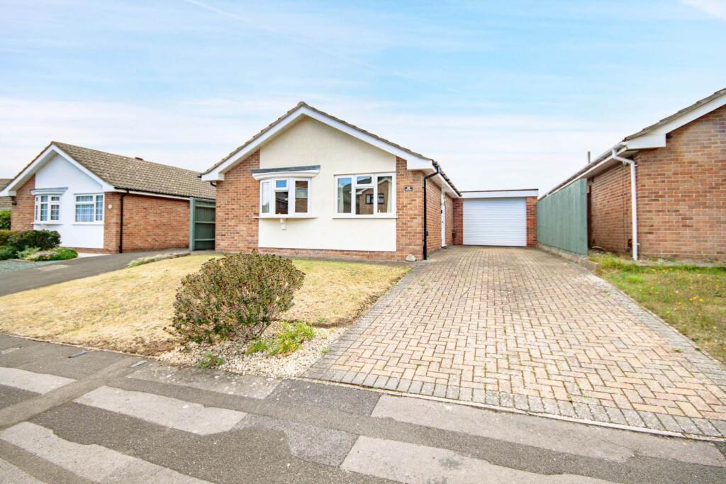
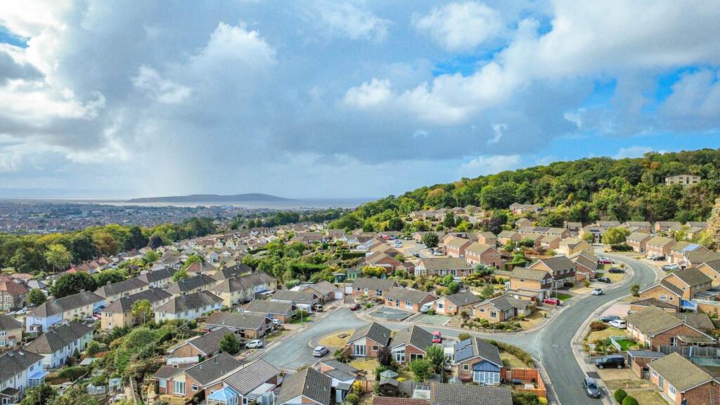
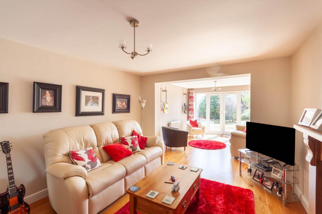
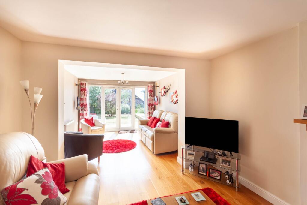
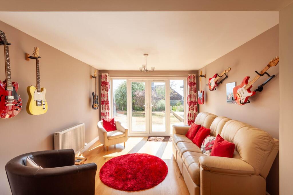
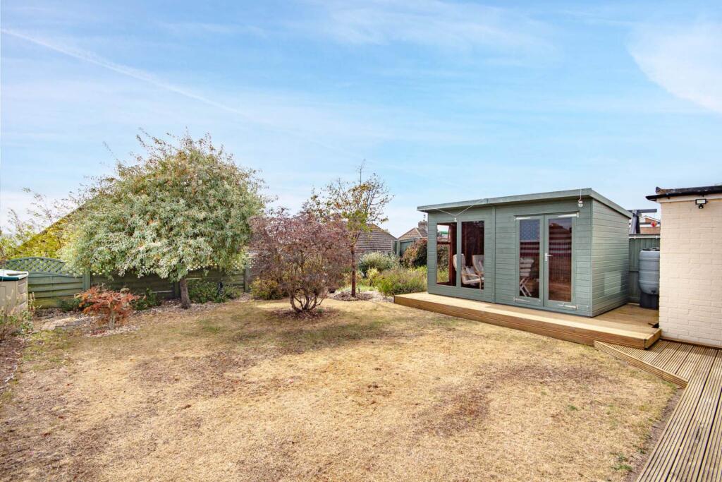
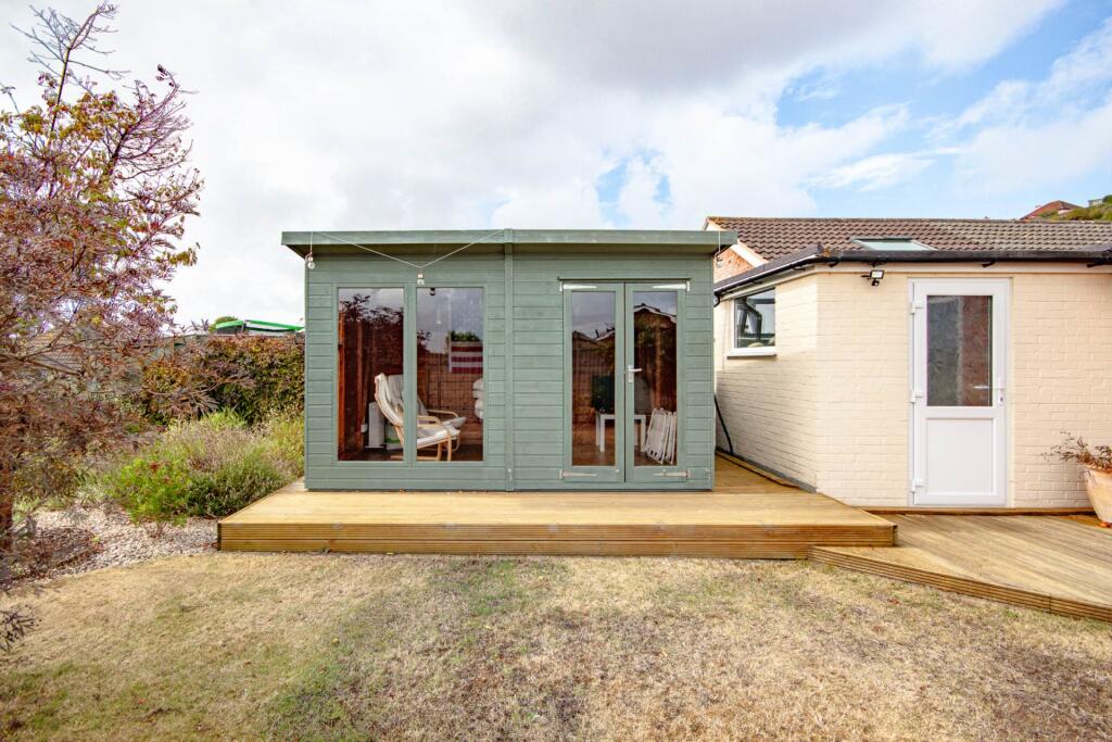
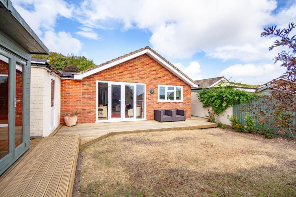
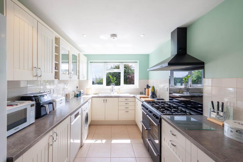
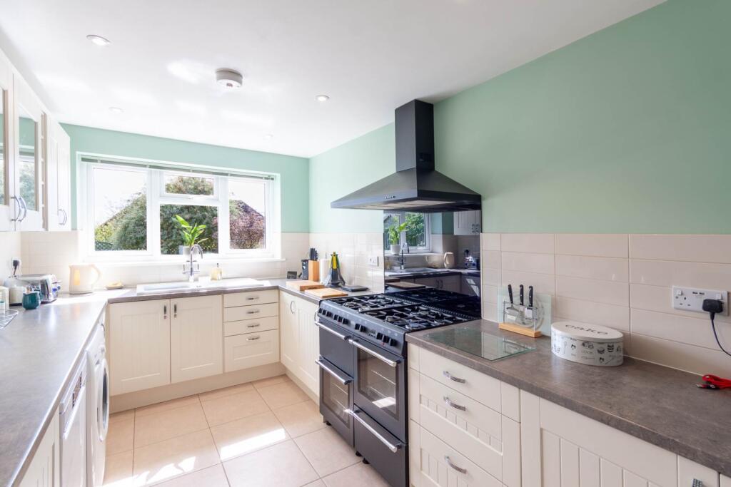
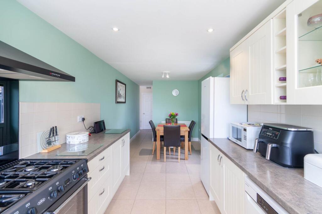
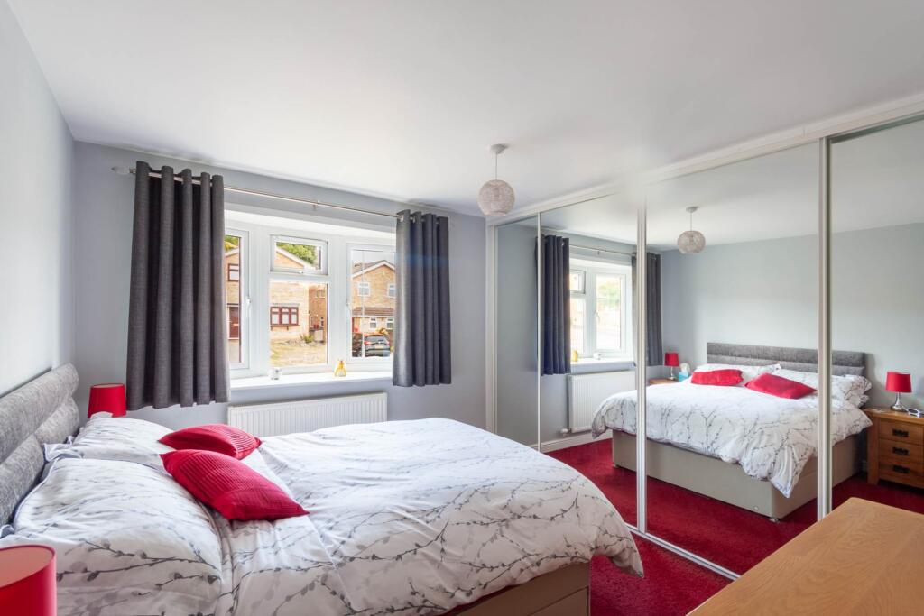
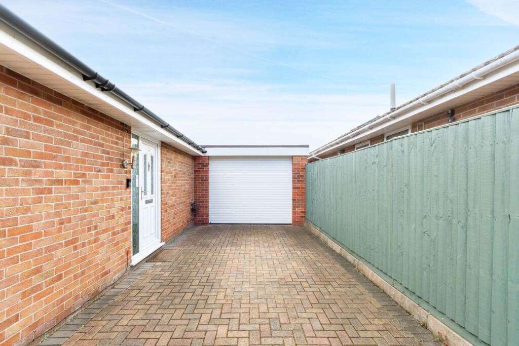
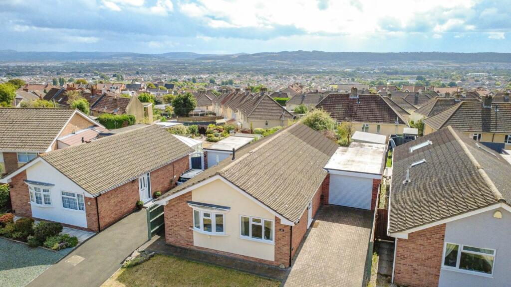
2 bedroom detached bungalow for sale in Ashbury Drive, Milton Hillside - Extended & Stunningly Presented, BS22
Property Details
- Price: £362500
- Bedrooms: 2
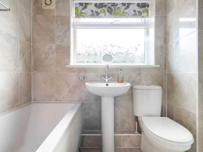
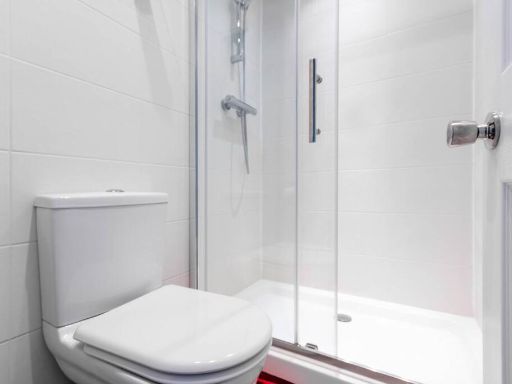
- Bathrooms: 2
- Property Type: undefined
- Property SubType: undefined
Image Descriptions
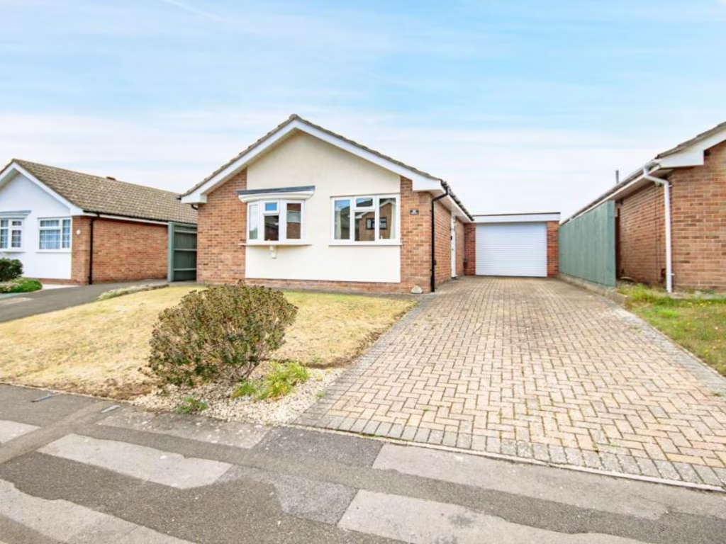
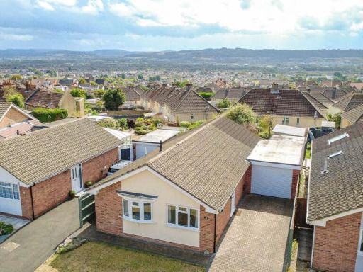
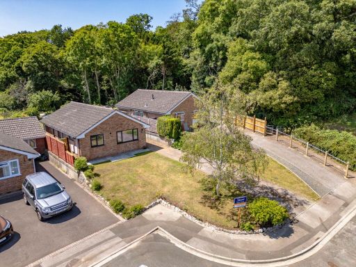
- detached house 1970s bungalow
- bungalow post-war
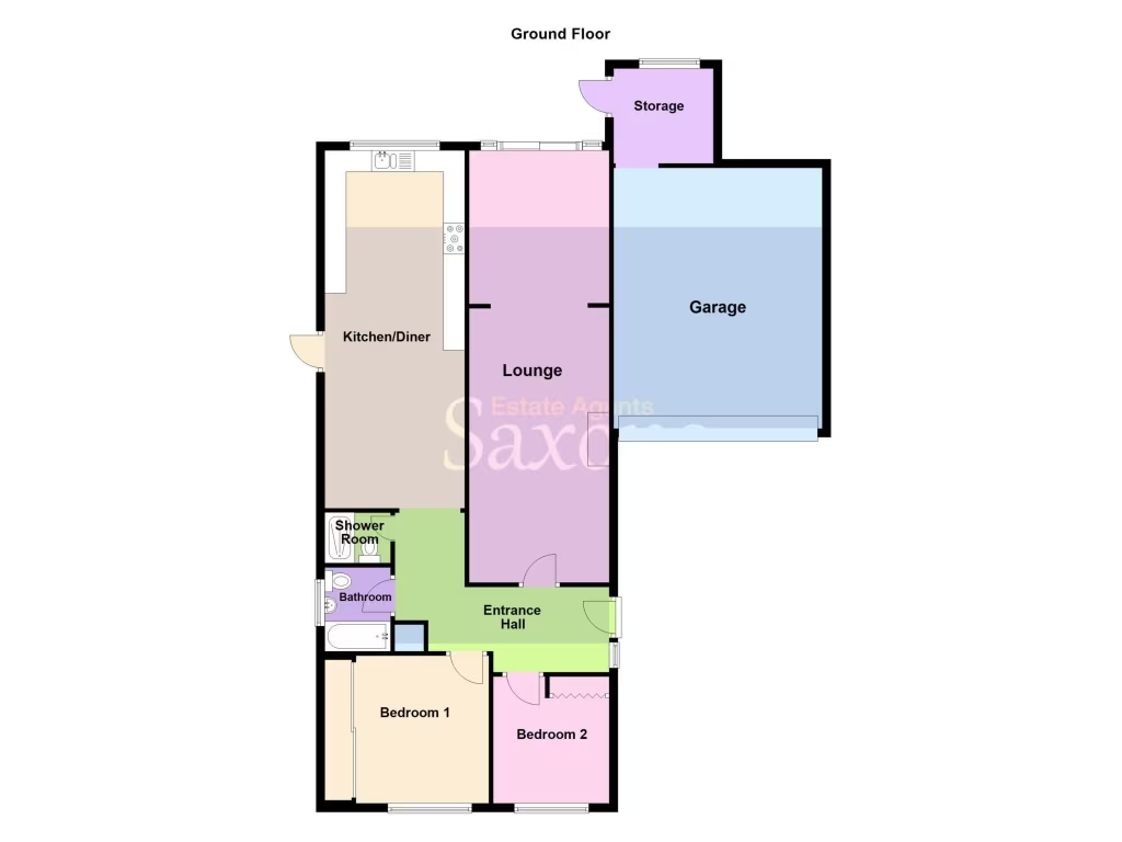
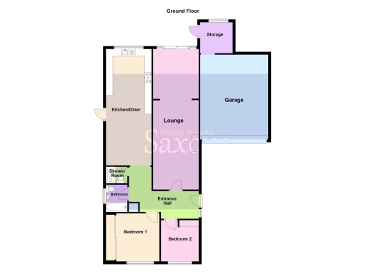
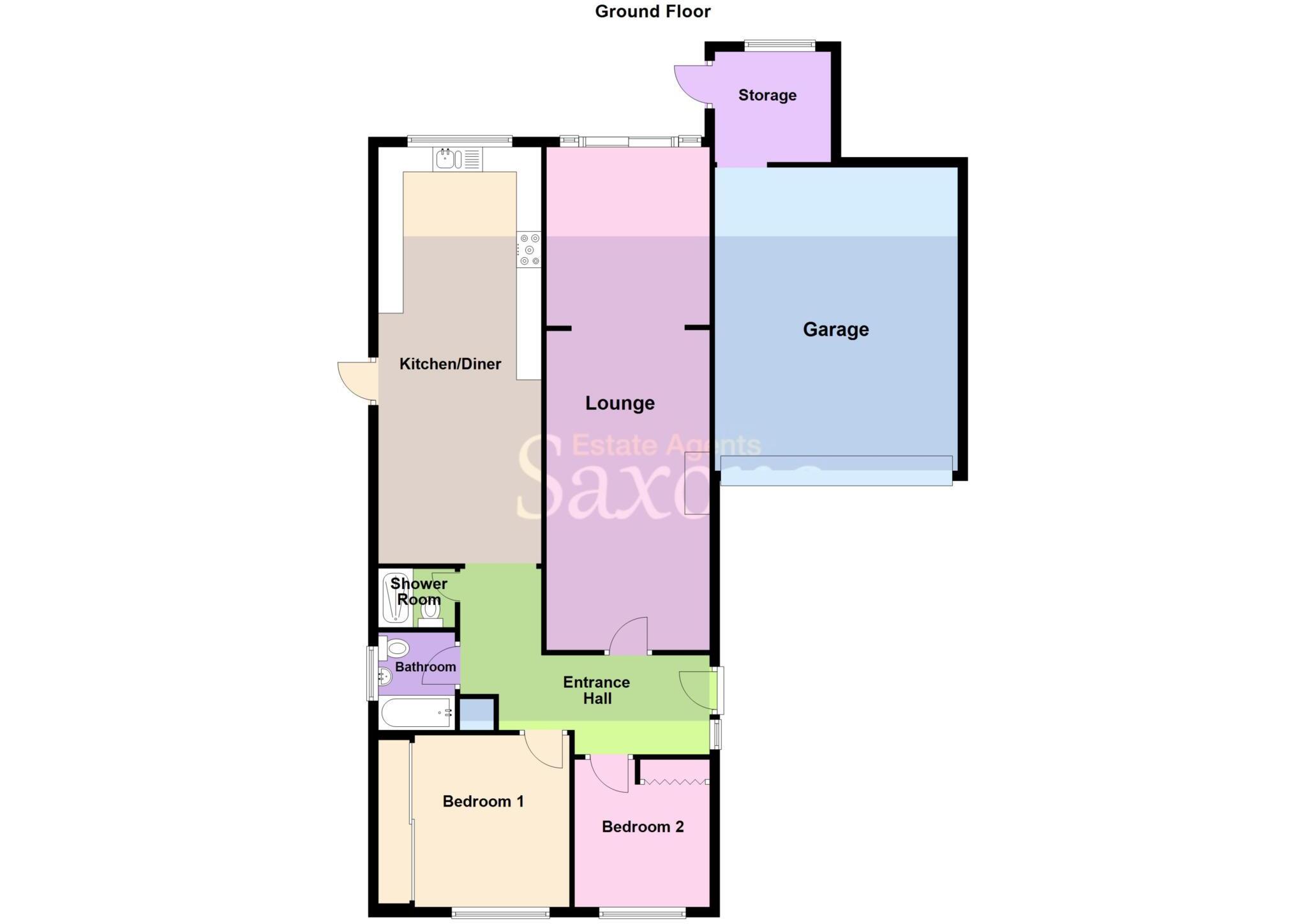
Rooms
- Storage:
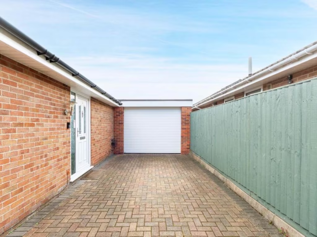
- Garage:
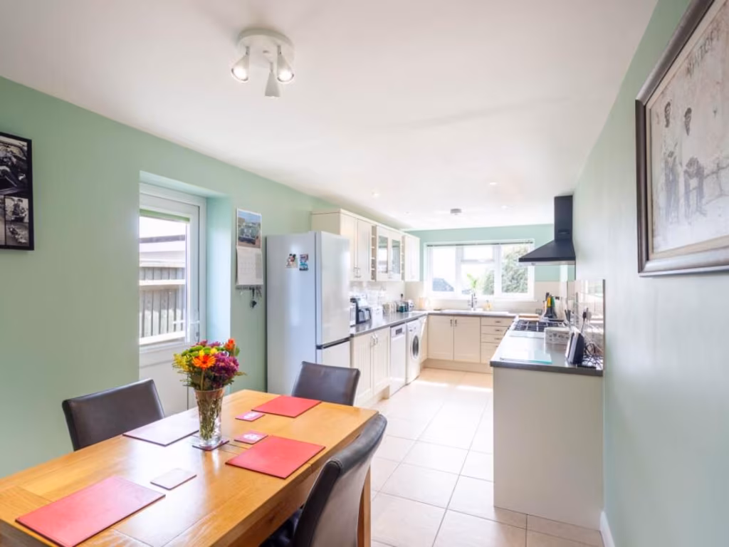
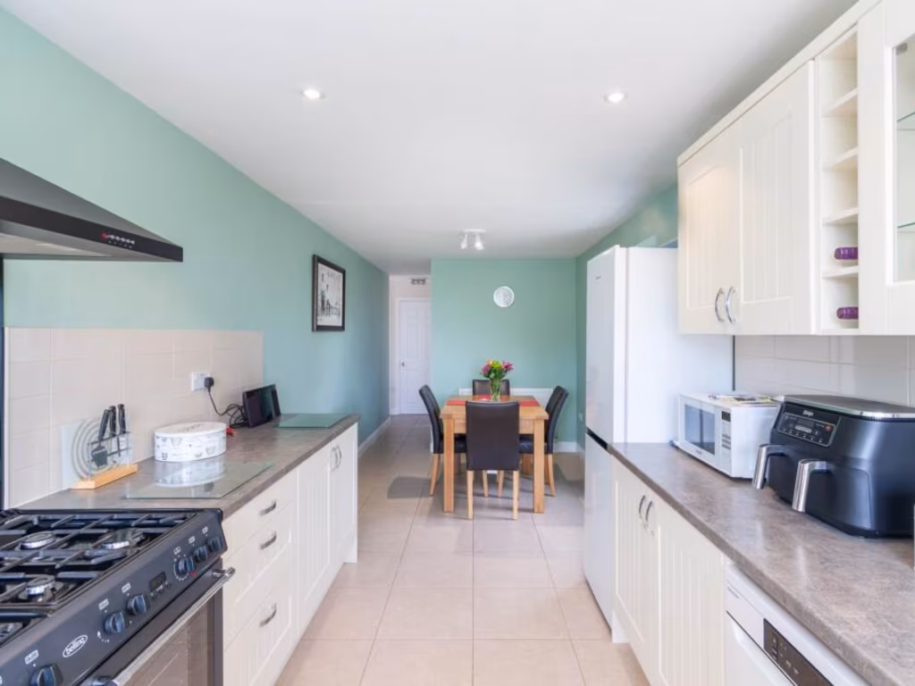
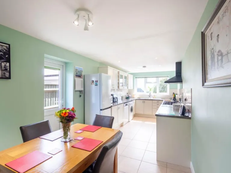
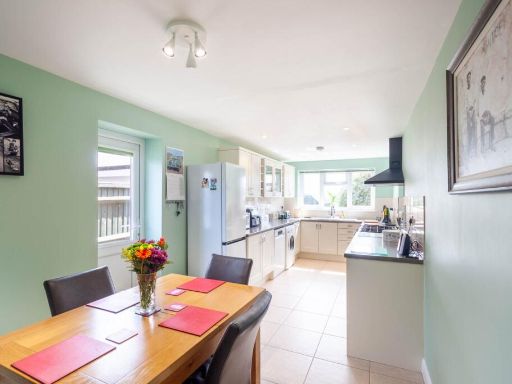
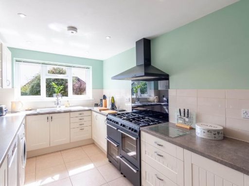
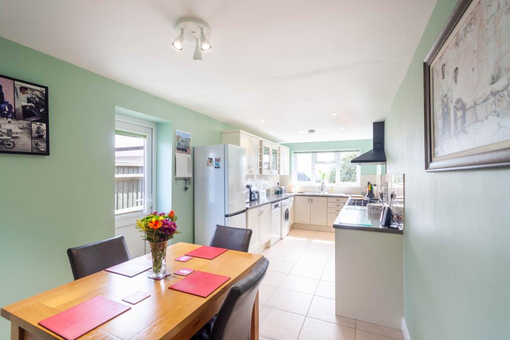
- Kitchen/Diner:
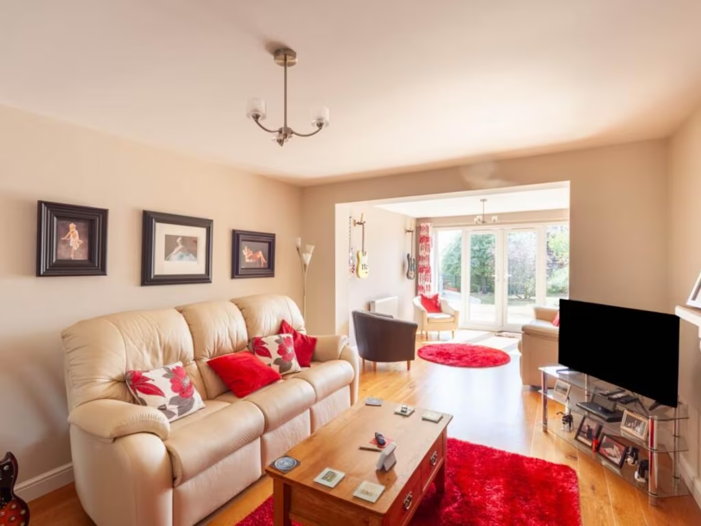
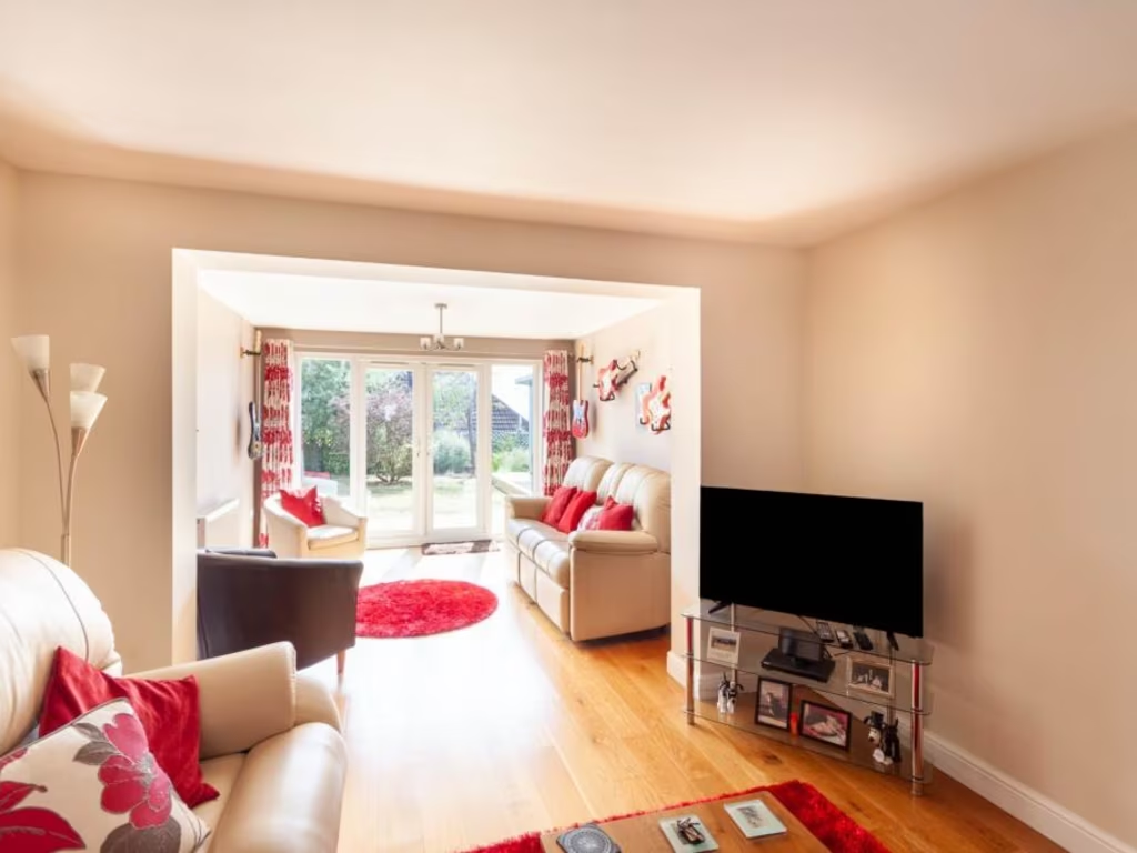
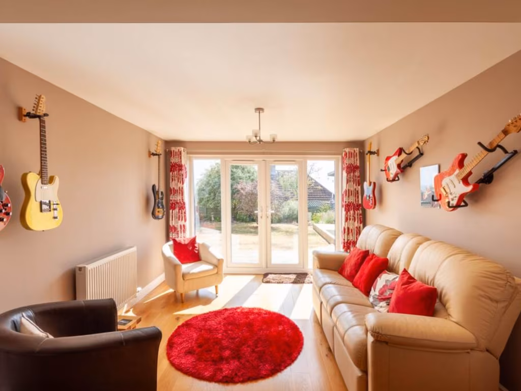
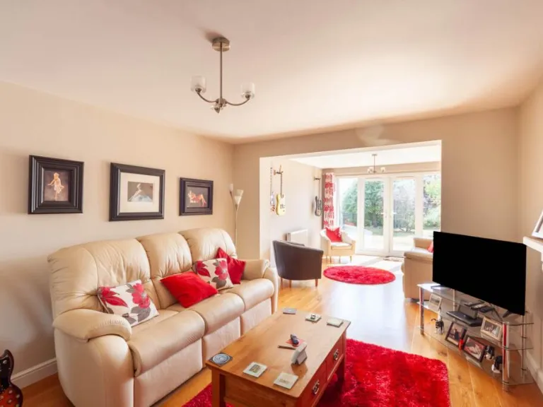
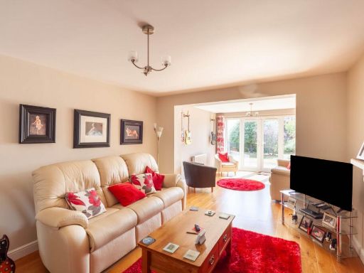
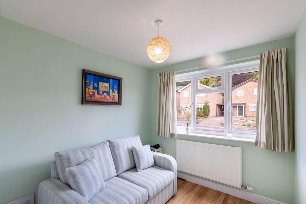
- Lounge:
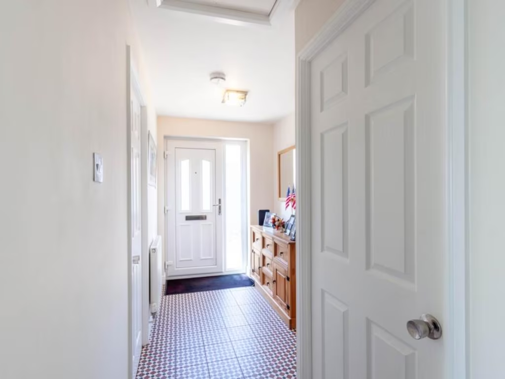
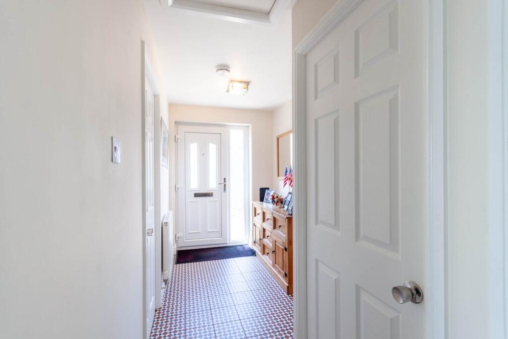
- Entrance Hall:
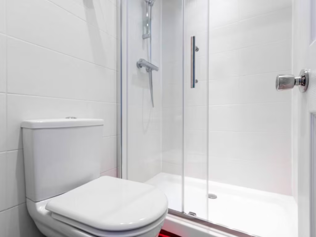
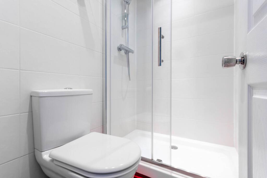
- Shower Room:
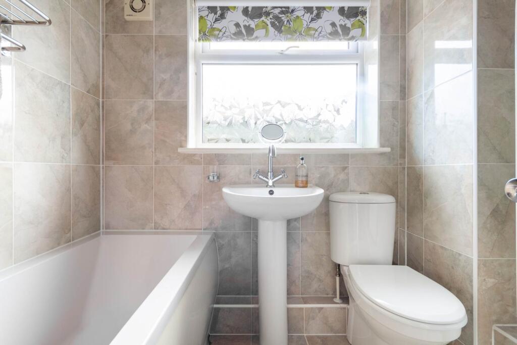
- Bathroom:
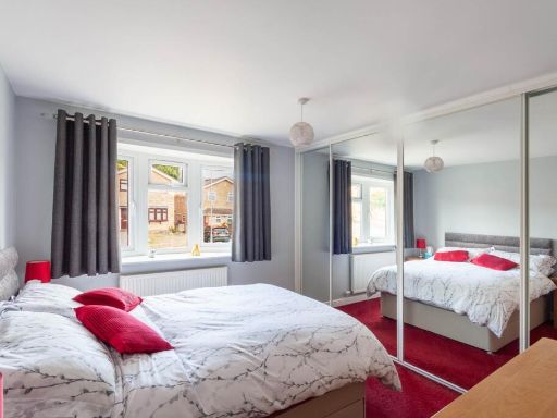
- Bedroom 1:
- Bedroom 2:
Textual Property Features
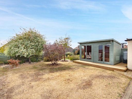
- Has Garden
- Chain Free
- Success
Detected Visual Features
- detached
- bungalow
- 1970s
- garage
- garden
- driveway
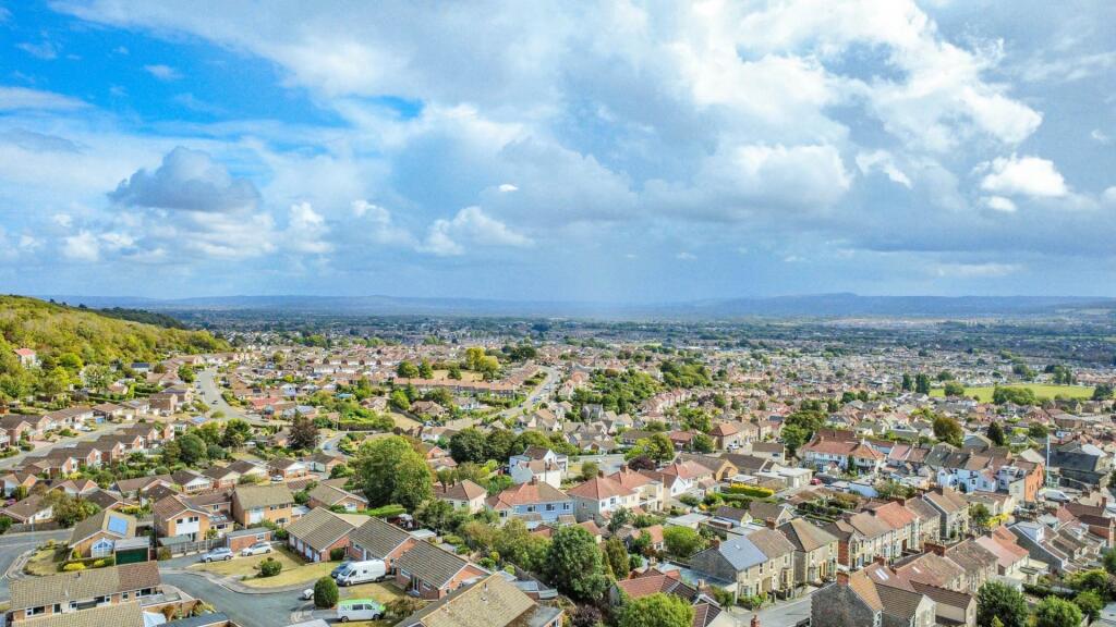
- suburban
- single-story
- post-war
- standard ceiling height
- attached garage
- paved driveway
- low maintenance garden
- roof tiles
- solar panels potential
- residential neighborhood
- Bay window
EPC Details
- Fully double glazed
- Cavity wall, filled cavity
- Boiler and radiators, mains gas
- Low energy lighting in all fixed outlets
- Solid, no insulation (assumed)
Nearby Schools
- Hutton Church of England Primary School
- Walliscote Primary School
- Worle Community School
- Mendip Green Primary School
- St Martin's Church of England Primary School
- Becket Primary School
- Priory Community School
- Oldmixon Primary School
- Uphill Village Academy
- Broadoak Academy
- Windwhistle Primary School
- Bournville Primary School
- Winterstoke Hundred Academy
- Ashcombe Primary School
- Christ Church Church of England Primary School
- Mead Vale Community Primary School
- Milton Park Primary School
- Worle Village Primary School
- Kewstoke Primary School
- Castle Batch Primary School Academy
- Parklands Educate Together Primary
- Haywood Village Academy
- Hans Price Academy
- Corpus Christi Catholic Primary School
- Herons' Moor Academy
- Worlebury St Pauls Church School
- St Mark's Ecumenical Anglican/Methodist Primary School
Nearest General Shops
- Id: 325946483
- Tags:
- Addr:
- Housenumber: 109
- Street: Upper Bristol Road
- Building: retail
- Name: Flair
- Shop: hairdresser
- Source: Bing
- TagsNormalized:
- Lat: 51.3576924
- Lon: -2.9471841
- FullGeoHash: gcjuhvmujxu2
- PartitionGeoHash: gcju
- Images:
- FoodStandards: null
- Distance: 256.7
,- Id: 325742956
- Tags:
- Addr:
- Housenumber: 1
- Street: Furland Road
- Building: retail
- Name: Salon Indigo
- Shop: beauty
- Source: Bing
- TagsNormalized:
- Lat: 51.3572936
- Lon: -2.9478397
- FullGeoHash: gcjuhvm3ym7m
- PartitionGeoHash: gcju
- Images:
- FoodStandards: null
- Distance: 240.4
,- Id: 325741881
- Tags:
- Addr:
- Housenumber: 89
- Street: Upper Bristol Road
- Building: retail
- Name: Hairs & Graces
- Shop: hairdresser
- Source: Bing
- TagsNormalized:
- Lat: 51.3572966
- Lon: -2.9482691
- FullGeoHash: gcjuhvm1umgp
- PartitionGeoHash: gcju
- Images:
- FoodStandards: null
- Distance: 217.5
}
Nearest Grocery shops
- Id: 316743591
- Tags:
- Addr:
- Housenumber: 375
- Street: Locking Road
- Brand: Spar
- Brand:wikidata: Q610492
- Brand:wikipedia: en:SPAR (retailer)
- Building: yes
- Name: Spar
- Shop: convenience
- Source: Bing
- TagsNormalized:
- Lat: 51.3493007
- Lon: -2.9487963
- FullGeoHash: gcjuhgug256j
- PartitionGeoHash: gcju
- Images:
- FoodStandards: null
- Distance: 1044.2
,- Id: 10213855699
- Tags:
- Addr:
- Housenumber: 141
- Postcode: BS22 8AA
- Street: Milton Road
- Brand: The Co-operative Food
- Brand:wikidata: Q107617274
- Name: The Co-operative Food
- Opening_hours: Mo-Su 07:00-22:00
- Phone: +44 1934 631172
- Shop: convenience
- TagsNormalized:
- the co-operative food
- food
- convenience
- shop
- Lat: 51.3524273
- Lon: -2.9537844
- FullGeoHash: gcjuhu3jef68
- PartitionGeoHash: gcju
- Images:
- FoodStandards: null
- Distance: 724.7
,- Id: 325946478
- Tags:
- Addr:
- Housenumber: 93-95
- Place: Milton
- Postcode: BS22 8DN
- Street: Upper Bristol Road
- Building: yes
- Fhrs:
- Name: Premiere
- Shop: convenience
- Source: Bing
- TagsNormalized:
- Lat: 51.3574255
- Lon: -2.9475884
- FullGeoHash: gcjuhvmdsnnb
- PartitionGeoHash: gcju
- Images:
- FoodStandards:
- Id: 151420
- FHRSID: 151420
- LocalAuthorityBusinessID: A06KWM93-9/1
- BusinessName: Sunshine Stores (Premier Stores)
- BusinessType: Retailers - other
- BusinessTypeID: 4613
- AddressLine1: null
- AddressLine2: 93-95 Upper Bristol Road
- AddressLine3: Milton
- AddressLine4: Weston-Super-Mare, North Somer
- PostCode: BS22 8DN
- RatingValue: 5
- RatingKey: fhrs_5_en-GB
- RatingDate: 2022-03-11
- LocalAuthorityCode: 858
- LocalAuthorityName: North Somerset
- LocalAuthorityWebSite: http://www.n-somerset.gov.uk
- LocalAuthorityEmailAddress: foodandsafety@n-somerset.gov.uk
- Scores:
- Hygiene: 5
- Structural: 5
- ConfidenceInManagement: 5
- NewRatingPending: false
- Geocode:
- Longitude: -2.94765100000000
- Latitude: 51.35740900000000
- Distance: 246.1
}
Nearest Religious buildings
- Id: 960077960
- Tags:
- Addr:
- Housenumber: 89
- Postcode: BS23 2YE
- Street: Ashcombe Park Road
- Amenity: place_of_worship
- Building: yes
- Name: Bethany Gospel Hall
- Religion: christian
- TagsNormalized:
- place of worship
- christian
- church
- Lat: 51.3546428
- Lon: -2.9584693
- FullGeoHash: gcjuhsvdqxm2
- PartitionGeoHash: gcju
- Images:
- FoodStandards: null
- Distance: 705.3
,- Id: 95737592
- Tags:
- Addr:
- Place: Milton
- Postcode: BS22 8HJ
- Street: Baytree Road
- Amenity: place_of_worship
- Building: church
- Denomination: baptist
- Fhrs:
- Name: Milton Baptist Church
- Religion: christian
- TagsNormalized:
- place of worship
- church
- baptist
- christian
- Lat: 51.355125
- Lon: -2.9427555
- FullGeoHash: gcjujhcjkc4m
- PartitionGeoHash: gcju
- Images:
- FoodStandards: null
- Distance: 667.6
,- Id: 1131410044
- Tags:
- Amenity: place_of_worship
- Denomination: greek_orthodox
- Name: St Andrew's Church
- Religion: christian
- TagsNormalized:
- place of worship
- orthodox
- church
- christian
- Lat: 51.3566682
- Lon: -2.946983
- FullGeoHash: gcjuhvnn62f4
- PartitionGeoHash: gcju
- Images:
- FoodStandards: null
- Distance: 330.6
}
Nearest Medical buildings
- Id: 325224849
- Tags:
- Addr:
- Housenumber: 131
- Street: High Street
- Amenity: dentist
- Building: yes
- Healthcare: dentist
- Name: S Watkins
- Source: Bing
- TagsNormalized:
- Lat: 51.3600809
- Lon: -2.928826
- FullGeoHash: gcjujmg61mj0
- PartitionGeoHash: gcju
- Images:
- FoodStandards: null
- Distance: 1518.1
,- Id: 187873324
- Tags:
- Amenity: doctors
- Building: yes
- Healthcare: doctor
- Name: Worle Health Centre
- Source: bing
- TagsNormalized:
- doctor
- doctors
- health
- healthcare
- health centre
- Lat: 51.3601397
- Lon: -2.9294889
- FullGeoHash: gcjujmff3zyz
- PartitionGeoHash: gcju
- Images:
- FoodStandards: null
- Distance: 1473.1
,- Id: 900762920
- Tags:
- Addr:
- City: Weston-super-Mare
- Postcode: BS22 9UZ
- Street: Beach Road
- Amenity: hospital
- Healthcare: hospital
- Healthcare:speciality: psychiatry
- Name: Cygnet Hospital Kewstoke
- TagsNormalized:
- hospital
- health
- healthcare
- psychiatry
- Lat: 51.3648286
- Lon: -2.9606089
- FullGeoHash: gcjuhwsjuf1c
- PartitionGeoHash: gcju
- Images:
- FoodStandards: null
- Distance: 980.7
,- Id: 10213855697
- Tags:
- Addr:
- Housenumber: 141
- Postcode: BS22 8AA
- Street: Milton Road
- Amenity: dentist
- Healthcare: dentist
- Healthcare:speciality: orthodontics
- Name: Weston Orthodontic Centre
- Website: https://www.westonortho.co.uk/
- TagsNormalized:
- dentist
- health
- healthcare
- orthodontics
- Lat: 51.3524678
- Lon: -2.9541451
- FullGeoHash: gcjuhu2vg3vf
- PartitionGeoHash: gcju
- Images:
- FoodStandards: null
- Distance: 728.5
}
Nearest Airports
- Id: 319112968
- Tags:
- Aerodrome: international
- Aerodrome:type: public
- Aeroway: aerodrome
- Iata: CWL
- Icao: EGFF
- Internet_access: yes
- Internet_access:fee: no
- Is_in: Cardiff,Wales,UK
- Name: Cardiff Airport
- Operator: Cardiff International Airport Limited
- Source: Gagravarr_Airports
- Type: civil
- Wikidata: Q8994
- Wikipedia: en:Cardiff Airport
- TagsNormalized:
- airport
- international airport
- Lat: 51.3978554
- Lon: -3.3438203
- FullGeoHash: gcjs7utn5qdy
- PartitionGeoHash: gcjs
- Images:
- FoodStandards: null
- Distance: 27640.3
,- Id: 47483196
- Tags:
- Aerodrome: international
- Aeroway: aerodrome
- Iata: BRS
- Icao: EGGD
- Internet_access: wlan
- Internet_access:fee: no
- Name: Bristol Airport
- Type: public
- Website: https://www.bristolairport.co.uk/
- Wikidata: Q8725
- Wikipedia: en:Bristol Airport
- TagsNormalized:
- airport
- international airport
- Lat: 51.3830799
- Lon: -2.7186615
- FullGeoHash: gcnh64h24s74
- PartitionGeoHash: gcnh
- Images:
- FoodStandards: null
- Distance: 16326
}
Nearest Leisure Facilities
- Id: 188283745
- Tags:
- Leisure: pitch
- Source: Bing
- Sport: tennis
- TagsNormalized:
- Lat: 51.3545274
- Lon: -2.9542823
- FullGeoHash: gcjuhubcb1z2
- PartitionGeoHash: gcju
- Images:
- FoodStandards: null
- Distance: 523.8
,- Id: 188283748
- Tags:
- Leisure: pitch
- Source: Bing
- Sport: tennis
- TagsNormalized:
- Lat: 51.3547542
- Lon: -2.954444
- FullGeoHash: gcjuhubehknc
- PartitionGeoHash: gcju
- Images:
- FoodStandards: null
- Distance: 507.9
,- Id: 186389701
- Tags:
- Leisure: playground
- Source: Bing
- TagsNormalized:
- Lat: 51.3552662
- Lon: -2.9530551
- FullGeoHash: gcjuhucwhg6x
- PartitionGeoHash: gcju
- Images:
- FoodStandards: null
- Distance: 411.7
,- Id: 954541466
- Tags:
- Access: private
- Leisure: swimming_pool
- TagsNormalized:
- swimming
- swimming pool
- pool
- leisure
- Lat: 51.3595189
- Lon: -2.9559396
- FullGeoHash: gcjuhtxwcs5x
- PartitionGeoHash: gcju
- Images:
- FoodStandards: null
- Distance: 386.1
,- Id: 243168706
- Tags:
- Leisure: swimming_pool
- Source: Bing
- TagsNormalized:
- swimming
- swimming pool
- pool
- leisure
- Lat: 51.358558
- Lon: -2.9464858
- FullGeoHash: gcjuhvw3mchg
- PartitionGeoHash: gcju
- Images:
- FoodStandards: null
- Distance: 283.4
}
Nearest Tourist attractions
- Id: 951938564
- Tags:
- Addr:
- Housenumber: 14
- Postcode: BS22 9UZ
- Street: Beach Road
- Name: Quex Caravan Park
- Tourism: caravan_site
- TagsNormalized:
- Lat: 51.3667666
- Lon: -2.9631043
- FullGeoHash: gcjuhx434em6
- PartitionGeoHash: gcju
- Images:
- FoodStandards: null
- Distance: 1255.8
,- Id: 171196691
- Tags:
- Addr:
- Housenumber: 12
- Postcode: BS22 9UZ
- Street: Beach Road
- Name: Carefree Holiday Park
- Tourism: caravan_site
- TagsNormalized:
- Lat: 51.3664225
- Lon: -2.963112
- FullGeoHash: gcjuhwfr47pt
- PartitionGeoHash: gcju
- Images:
- FoodStandards: null
- Distance: 1228.9
,- Id: 952286356
- Tags:
- Name: Meadow Lee Caravan Park
- Tourism: caravan_site
- TagsNormalized:
- Lat: 51.3672171
- Lon: -2.95871
- FullGeoHash: gcjuhxje9p3c
- PartitionGeoHash: gcju
- Images:
- FoodStandards: null
- Distance: 1110
}
Nearest Train stations
- Id: 492098581
- Tags:
- Internet_access: no
- Name: Nailsea and Backwell
- Naptan:
- Network: National Rail
- Operator: GWR
- Public_transport: station
- Railway: station
- Ref:
- Source: GPX + NPE
- Wikidata: Q6959642
- Wikipedia: en:Nailsea and Backwell railway station
- TagsNormalized:
- Lat: 51.4196718
- Lon: -2.7496898
- FullGeoHash: gcnh92ttr9d9
- PartitionGeoHash: gcnh
- Images:
- FoodStandards: null
- Distance: 15503.5
,- Id: 21277558
- Tags:
- Name: Yatton
- Naptan:
- Network: National Rail
- Operator: GWR
- Platforms: 2
- Public_transport: station
- Railway: station
- Ref:
- Source: NPE + GPX
- Wikidata: Q1957149
- Wikipedia: en:Yatton railway station
- TagsNormalized:
- Lat: 51.3908826
- Lon: -2.8277046
- FullGeoHash: gcjurekvtdye
- PartitionGeoHash: gcju
- Images:
- FoodStandards: null
- Distance: 9251.4
,- Id: 253893851
- Tags:
- Name: Worle
- Naptan:
- Network: National Rail
- Public_transport: station
- Railway: station
- Ref:
- Wikidata: Q2416797
- Wikipedia: en:Worle railway station
- TagsNormalized:
- Lat: 51.3578502
- Lon: -2.9093225
- FullGeoHash: gcjujv3mpv5v
- PartitionGeoHash: gcju
- Images:
- FoodStandards: null
- Distance: 2865
,- Id: 21277582
- Tags:
- Name: Weston-super-Mare
- Naptan:
- Network: National Rail
- Public_transport: station
- Railway: station
- Ref:
- Source: NPE
- Wikidata: Q2335883
- Wikipedia: en:Weston-super-Mare railway station
- TagsNormalized:
- Lat: 51.344496
- Lon: -2.9718305
- FullGeoHash: gcjuh6gzr7f8
- PartitionGeoHash: gcju
- Images:
- FoodStandards: null
- Distance: 2156.3
,- Id: 21277557
- Tags:
- Name: Weston Milton
- Naptan:
- Network: National Rail
- Operator: GWR
- Public_transport: station
- Railway: station
- Ref:
- Source: NPE + GPX
- Wikidata: Q2432877
- Wikipedia: en:Weston Milton railway station
- TagsNormalized:
- Lat: 51.3485177
- Lon: -2.9422803
- FullGeoHash: gcjuj59qzckz
- PartitionGeoHash: gcju
- Images:
- FoodStandards: null
- Distance: 1262.7
}
Nearest Hotels
- Id: 13040476
- Tags:
- Brand: Premier Inn
- Brand:wikidata: Q2108626
- Brand:wikipedia: en:Premier Inn
- Building: yes
- Internet_access: wlan
- Internet_access:fee: customers
- Internet_access:operator: Virgin Media
- Internet_access:ssid: Premier Inn Free Wi-Fi
- Name: Premier Inn
- Source: OS_OpenData_StreetView
- Tourism: hotel
- Type: multipolygon
- TagsNormalized:
- Lat: 51.3440481
- Lon: -2.9488394
- FullGeoHash: gcjuhfusz03b
- PartitionGeoHash: gcju
- Images:
- FoodStandards: null
- Distance: 1625.5
,- Id: 685921221
- Tags:
- Addr:
- City: Weston-Super-Mare
- Housename: The Commodore Hotel
- Housenumber: 1-2
- Postcode: BS22 9UZ
- Street: Beach Road
- Suburb: Kewstoke
- Fhrs:
- Name: Commodore Hotel
- Source:
- Tourism: hotel
- TagsNormalized:
- Lat: 51.3650078
- Lon: -2.9647632
- FullGeoHash: gcjuhw9nu52q
- PartitionGeoHash: gcju
- Images:
- FoodStandards: null
- Distance: 1214.6
,- Id: 8817914283
- Tags:
- Addr:
- Housename: The Owls Crest House
- Postcode: BS22 9YE
- Street: Kewstoke Road
- Name: Owls Crest House
- Tourism: hotel
- TagsNormalized:
- Lat: 51.365785
- Lon: -2.9552764
- FullGeoHash: gcjuhyb53h64
- PartitionGeoHash: gcju
- Images:
- FoodStandards: null
- Distance: 860.6
}
Tags
- detached
- bungalow
- 1970s
- garage
- garden
- driveway
- suburban
- single-story
- bungalow
- detached
- post-war
- standard ceiling height
- driveway
- attached garage
- paved driveway
- low maintenance garden
- roof tiles
- solar panels potential
- residential neighborhood
- suburban
- Bay window
Local Market Stats
- Average Price/sqft: £305
- Avg Income: £45100
- Rental Yield: 4.8%
- Social Housing: 10%
- Planning Success Rate: 92%
AirBnB Data
- 1km average: £70/night
- Listings in 1km: 1
Similar Properties
 3 bedroom detached bungalow for sale in Prescot Close, Milton Hillside - Fully Refurbished Bungalow, BS22 — £425,000 • 3 bed • 2 bath • 850 ft²
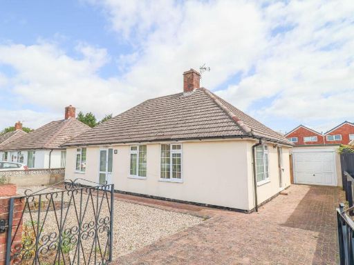 2 bedroom detached bungalow for sale in Corondale Road, Milton - Well Presented Detached Bungalow, BS22 — £325,000 • 2 bed • 1 bath • 955 ft²
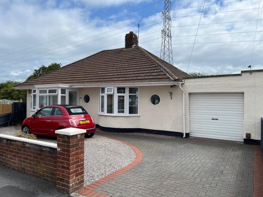 2 bedroom detached bungalow for sale in Newbourne Road, BS22 — £385,000 • 2 bed • 1 bath • 1094 ft²
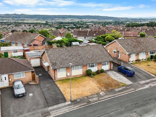 3 bedroom bungalow for sale in Ashbury Drive, Weston-super-Mare - NO CHAIN, BS22 — £340,000 • 3 bed • 1 bath • 1171 ft²
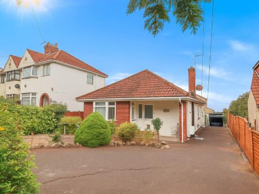 3 bedroom detached bungalow for sale in Oldmixon Road, Southern Outskirts - Deceptively Spacious Detached Bungalow, BS24 — £310,000 • 3 bed • 1 bath • 775 ft²
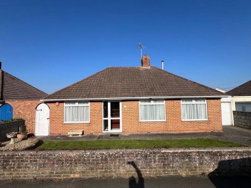 2 bedroom detached bungalow for sale in Corondale Road, BS22 — £320,000 • 2 bed • 1 bath • 2450 ft²
Meta
- {
"@context": "https://schema.org",
"@type": "Residence",
"name": "2 bedroom detached bungalow for sale in Ashbury Drive, Milt…",
"description": "",
"url": "https://propertypiper.co.uk/property/0954cdb9-a066-48b7-bb4f-eecfb524d290",
"image": "https://image-a.propertypiper.co.uk/efc69923-1df3-43ca-9845-578116f542fb-1024.jpeg",
"address": {
"@type": "PostalAddress",
"streetAddress": "23 ASHBURY DRIVE WESTON-SUPER-MARE",
"postalCode": "BS22 9QU",
"addressLocality": "North Somerset",
"addressRegion": "Weston-Super-Mare",
"addressCountry": "England"
},
"geo": {
"@type": "GeoCoordinates",
"latitude": 51.35862656795884,
"longitude": -2.950565559725763
},
"numberOfRooms": 2,
"numberOfBathroomsTotal": 2,
"floorSize": {
"@type": "QuantitativeValue",
"value": 872,
"unitCode": "FTK"
},
"offers": {
"@type": "Offer",
"price": 362500,
"priceCurrency": "GBP",
"availability": "https://schema.org/InStock"
},
"additionalProperty": [
{
"@type": "PropertyValue",
"name": "Feature",
"value": "detached"
},
{
"@type": "PropertyValue",
"name": "Feature",
"value": "bungalow"
},
{
"@type": "PropertyValue",
"name": "Feature",
"value": "1970s"
},
{
"@type": "PropertyValue",
"name": "Feature",
"value": "garage"
},
{
"@type": "PropertyValue",
"name": "Feature",
"value": "garden"
},
{
"@type": "PropertyValue",
"name": "Feature",
"value": "driveway"
},
{
"@type": "PropertyValue",
"name": "Feature",
"value": "suburban"
},
{
"@type": "PropertyValue",
"name": "Feature",
"value": "single-story"
},
{
"@type": "PropertyValue",
"name": "Feature",
"value": "bungalow"
},
{
"@type": "PropertyValue",
"name": "Feature",
"value": "detached"
},
{
"@type": "PropertyValue",
"name": "Feature",
"value": "post-war"
},
{
"@type": "PropertyValue",
"name": "Feature",
"value": "standard ceiling height"
},
{
"@type": "PropertyValue",
"name": "Feature",
"value": "driveway"
},
{
"@type": "PropertyValue",
"name": "Feature",
"value": "attached garage"
},
{
"@type": "PropertyValue",
"name": "Feature",
"value": "paved driveway"
},
{
"@type": "PropertyValue",
"name": "Feature",
"value": "low maintenance garden"
},
{
"@type": "PropertyValue",
"name": "Feature",
"value": "roof tiles"
},
{
"@type": "PropertyValue",
"name": "Feature",
"value": "solar panels potential"
},
{
"@type": "PropertyValue",
"name": "Feature",
"value": "residential neighborhood"
},
{
"@type": "PropertyValue",
"name": "Feature",
"value": "suburban"
},
{
"@type": "PropertyValue",
"name": "Feature",
"value": "Bay window"
}
]
}
High Res Floorplan Images
Compatible Floorplan Images
FloorplanImages Thumbnail