DE14 2LP - 3 bedroom terraced house for sale in Victoria Street, Burto…
View on Property Piper
3 bedroom terraced house for sale in Victoria Street, Burton-On-Trent, DE14
Property Details
- Price: £140000
- Bedrooms: 3
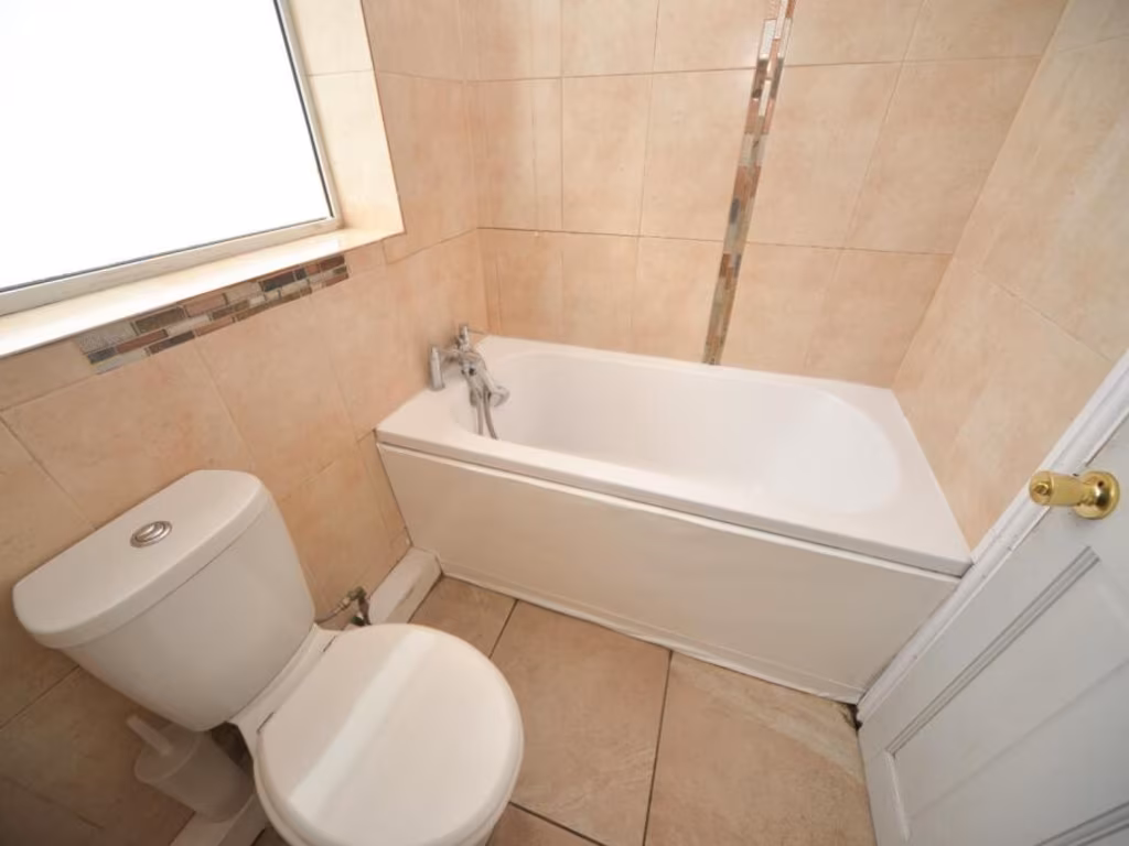
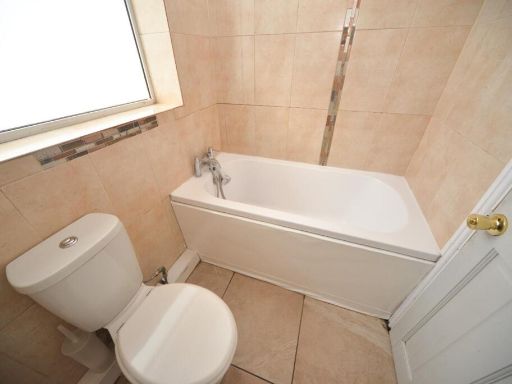
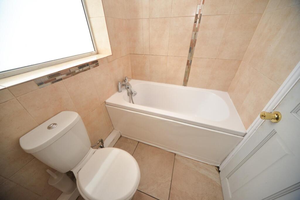
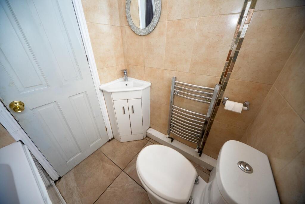
- Bathrooms: 1
- Property Type: undefined
- Property SubType: undefined
Brochure Descriptions
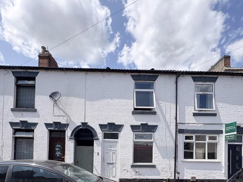
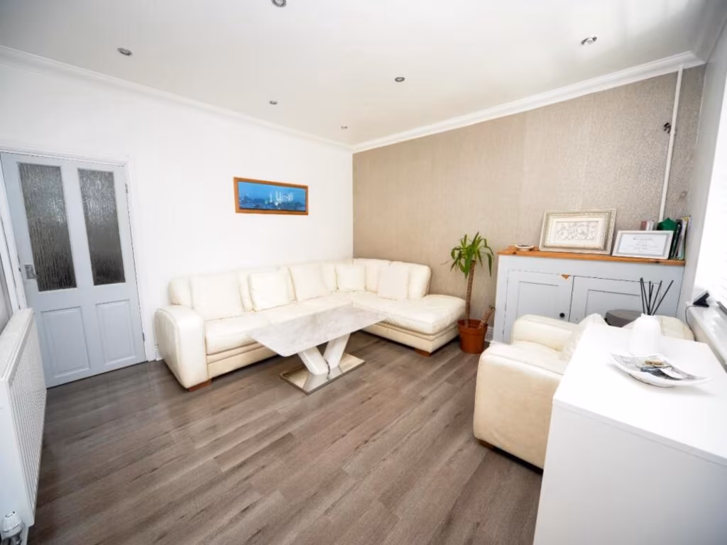
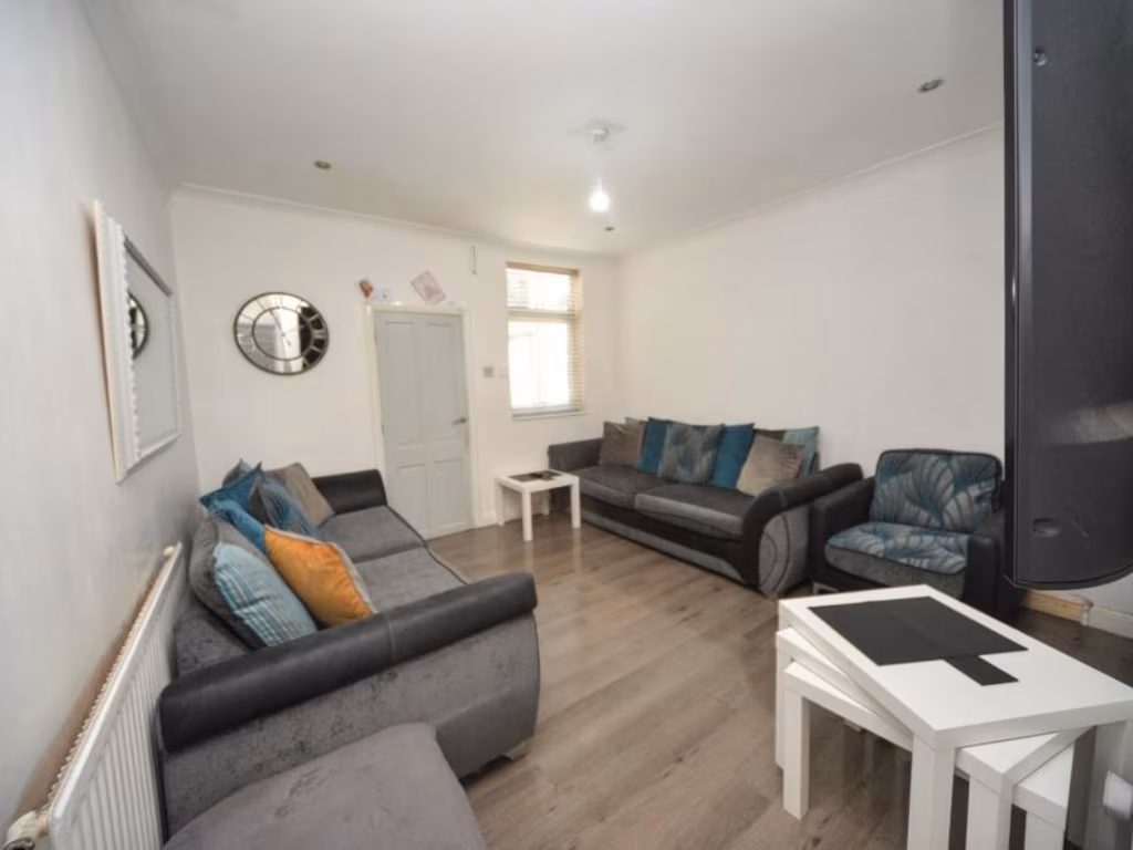
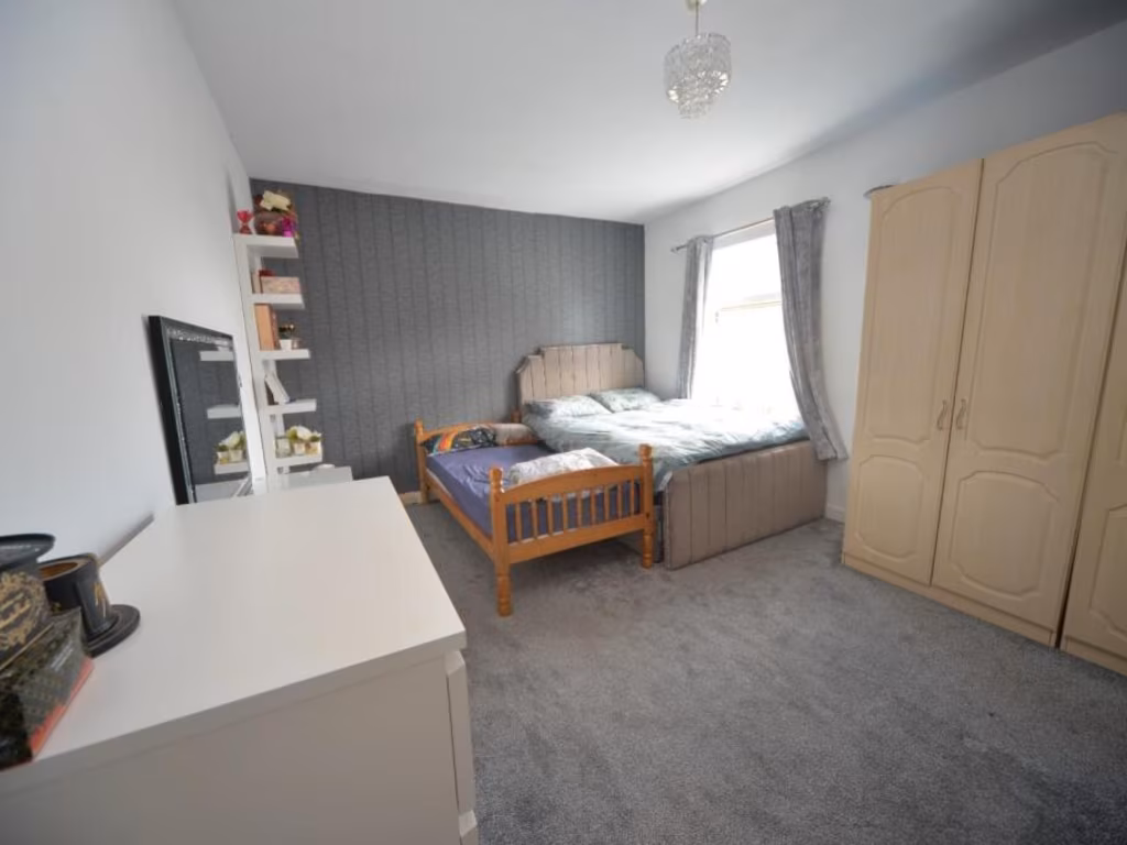
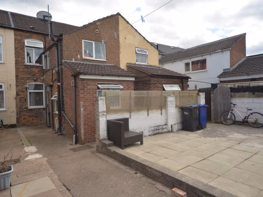
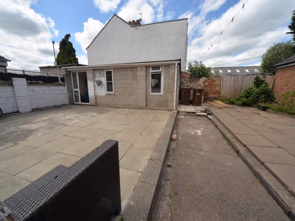
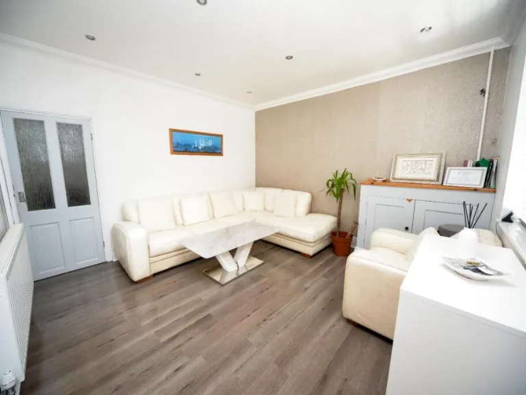
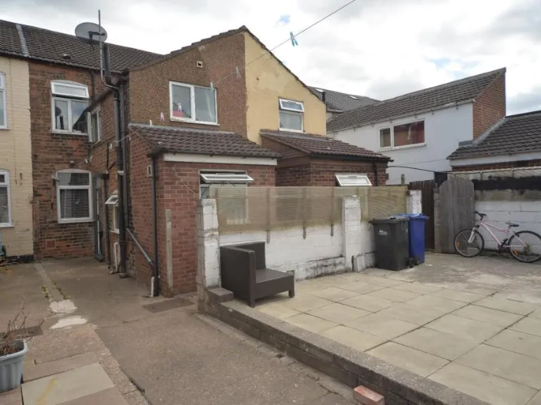
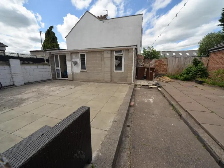
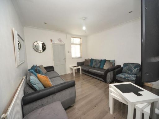
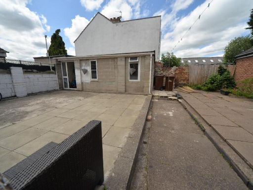
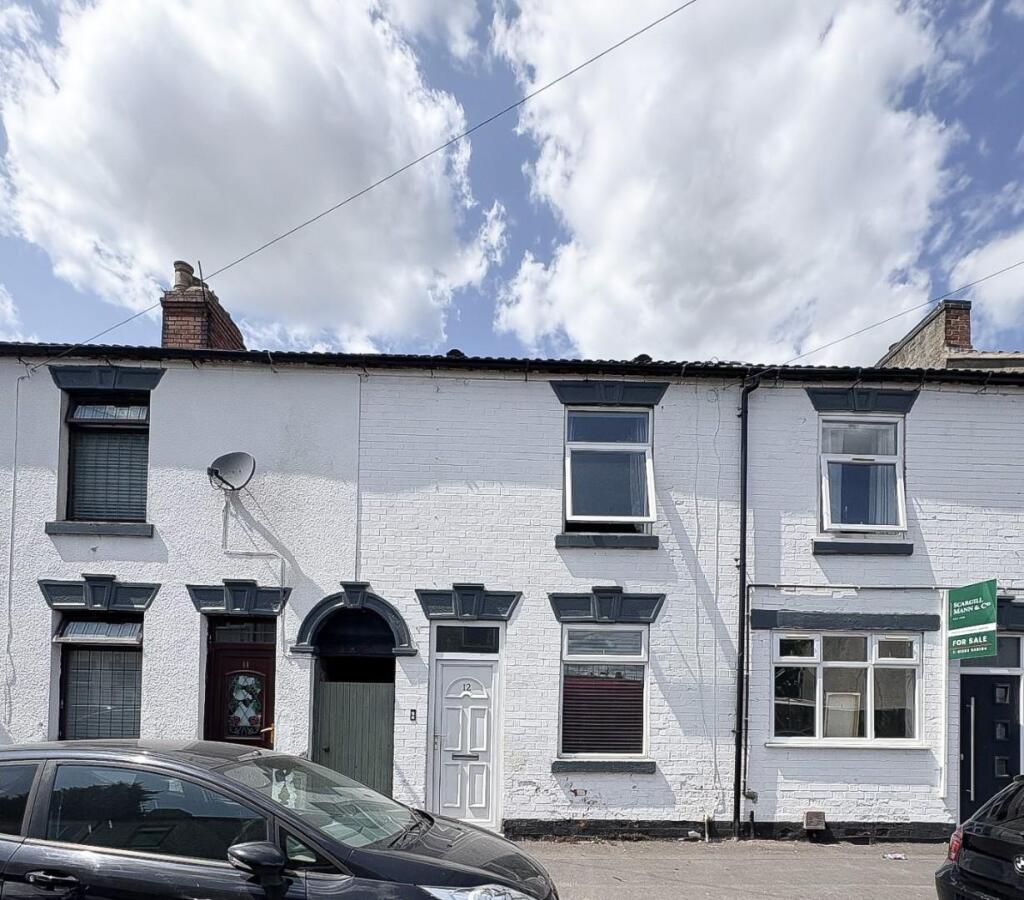
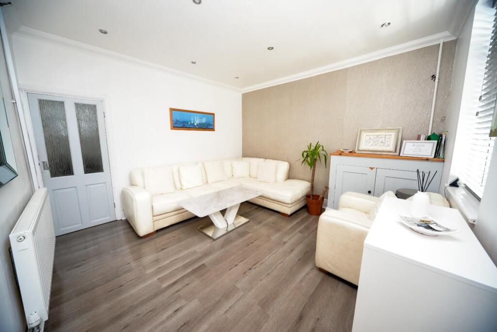
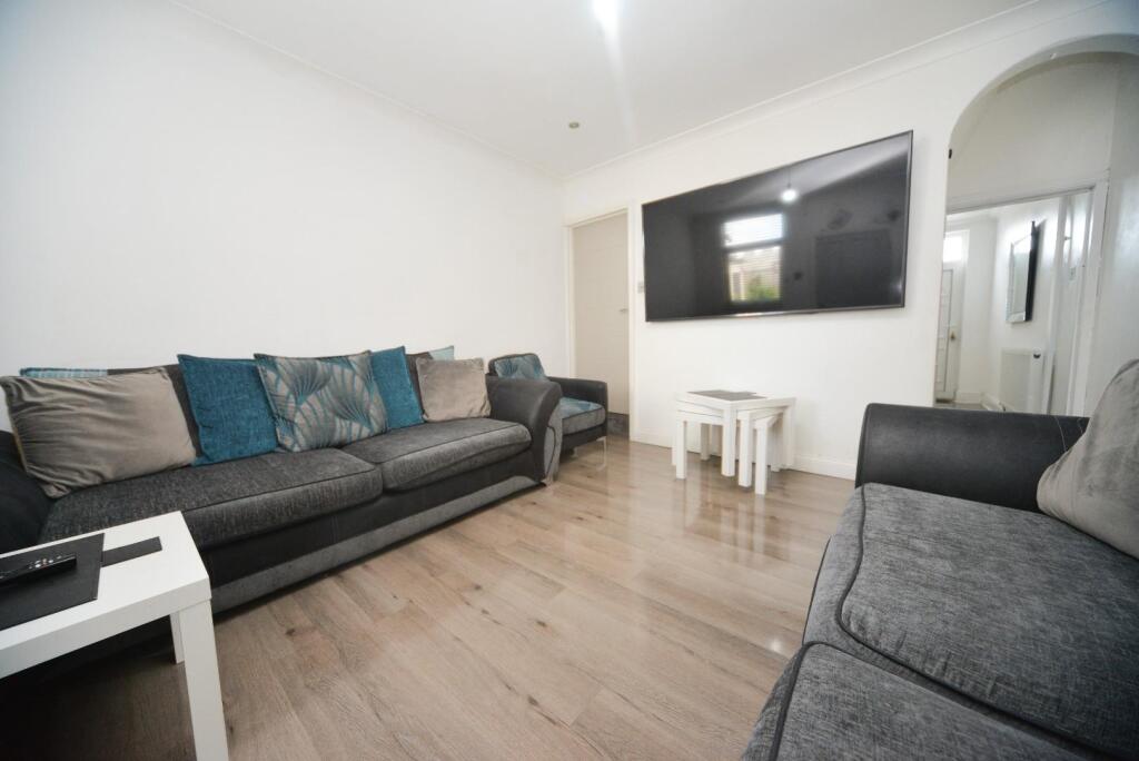
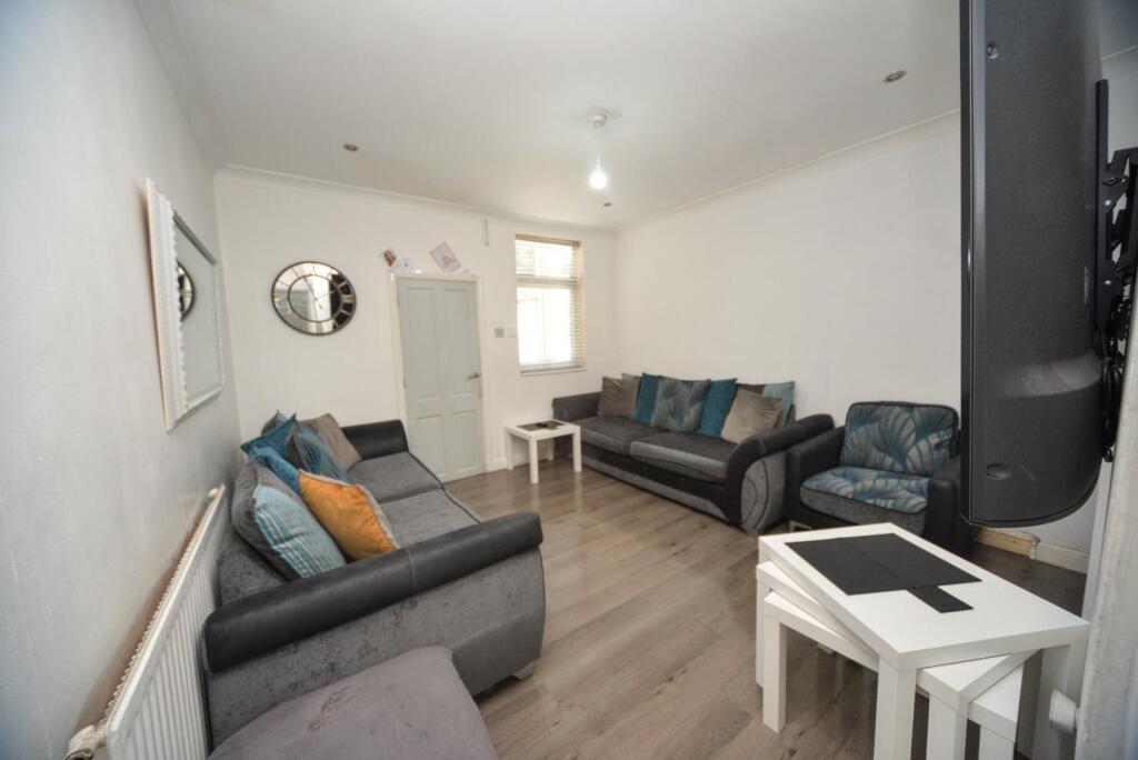
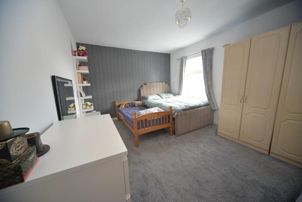
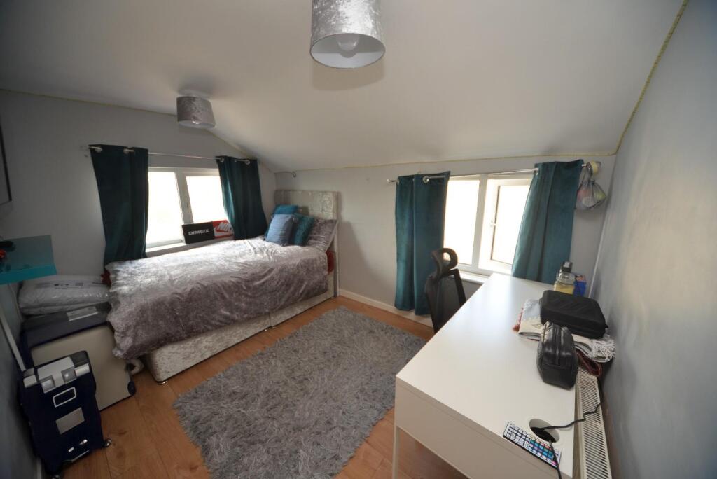
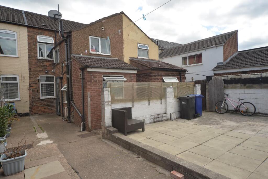
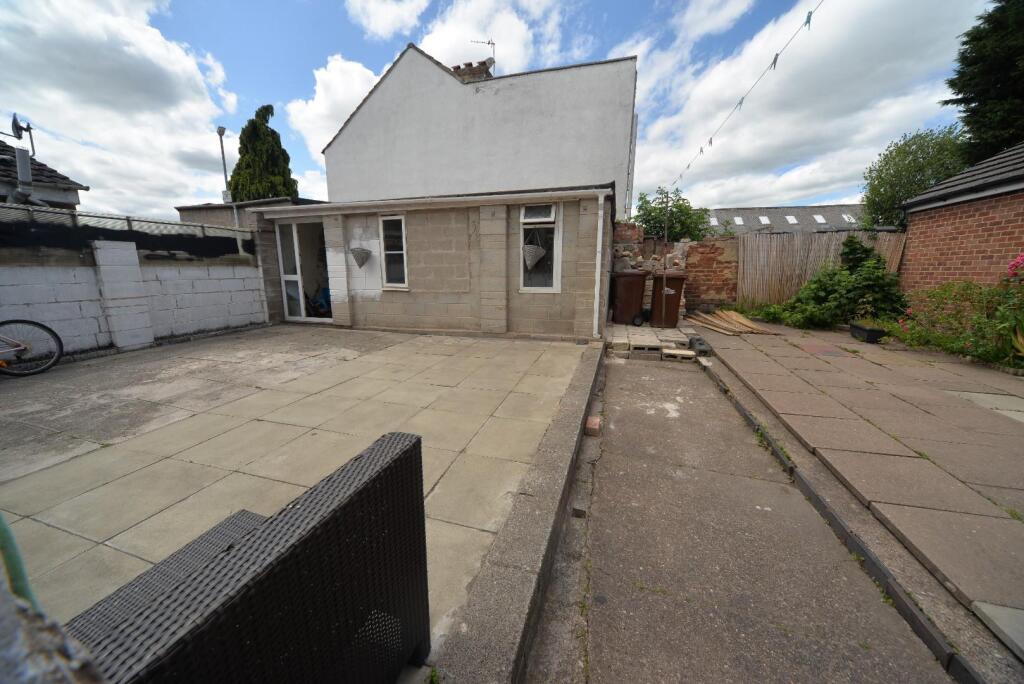
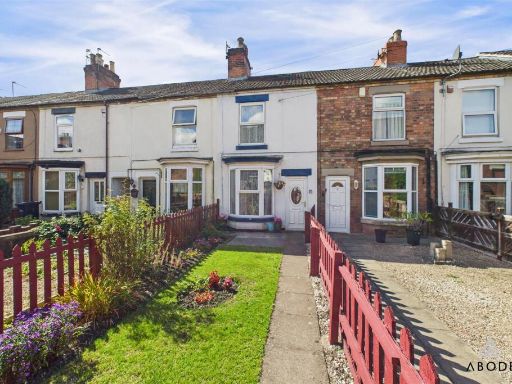
- The property is a charming terrace house with a classic brick façade featuring large windows that allow ample natural light into the interiors. The living spaces are tastefully decorated with a modern aesthetic that complements the traditional architecture. The rooms, including the lounge and bedrooms, appear to provide an average spaciousness suitable for a typical family. There is no visible garden or external area in the images, suggesting a focus on indoor living rather than outdoor space. The area seems residential with a peaceful setting, and the property is likely designed to provide convenience and comfort with a functional layout.
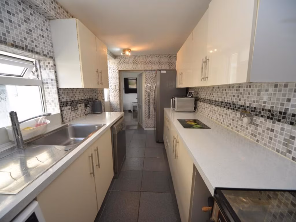
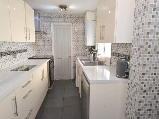
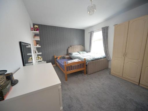
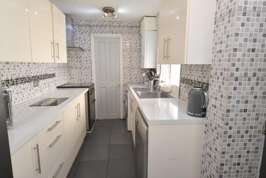
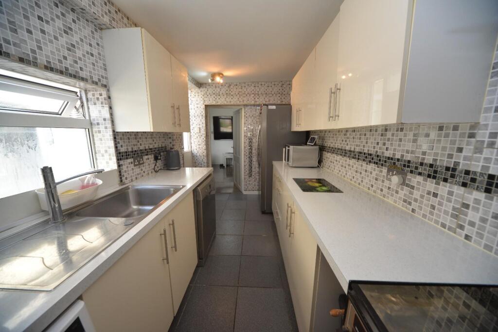
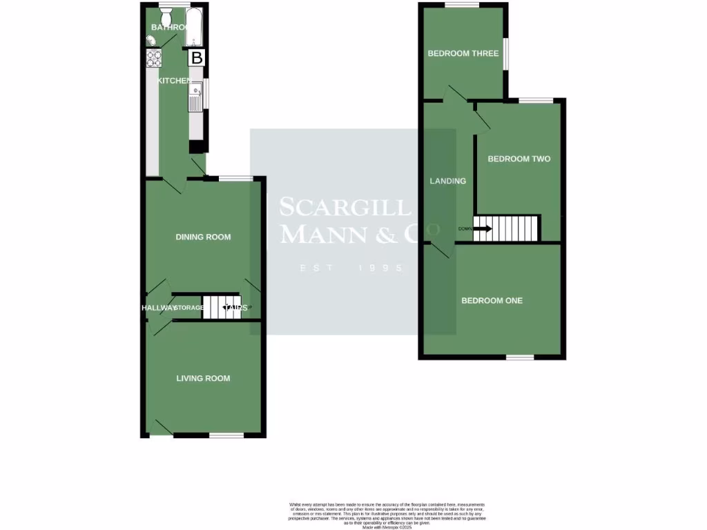
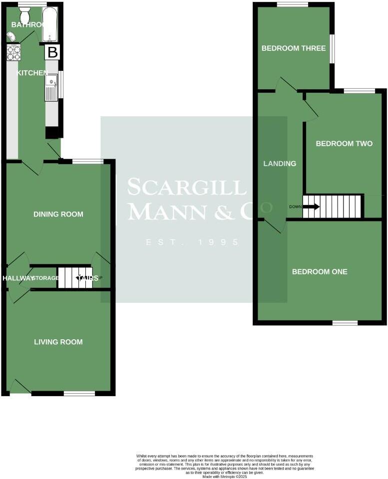
- The property boasts a well-organized layout across two floors, offering generous room sizes suitable for a medium-sized family home. The ground floor includes a living room and dining room that could be combined for an open-plan feel. A compact kitchen adjacent to a bathroom provides practicality. The upstairs encompasses three bedrooms of varying dimensions. Given the layout from the floor plan, the rooms appear to be of average size, conducive for a comfortable living environment with necessary amenities. The overall footprint, judging purely from the floor plan, suggests an average-sized property without visible external garden areas or notable external views.
Image Descriptions
- terraced house Victorian
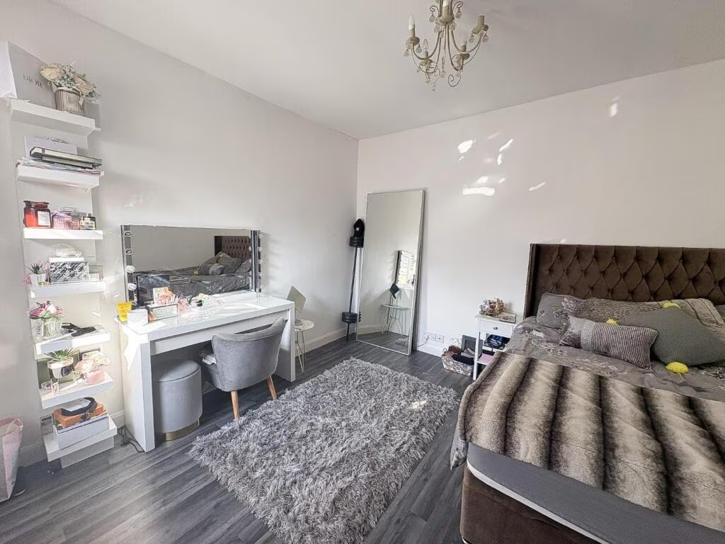
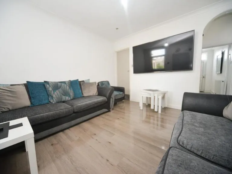
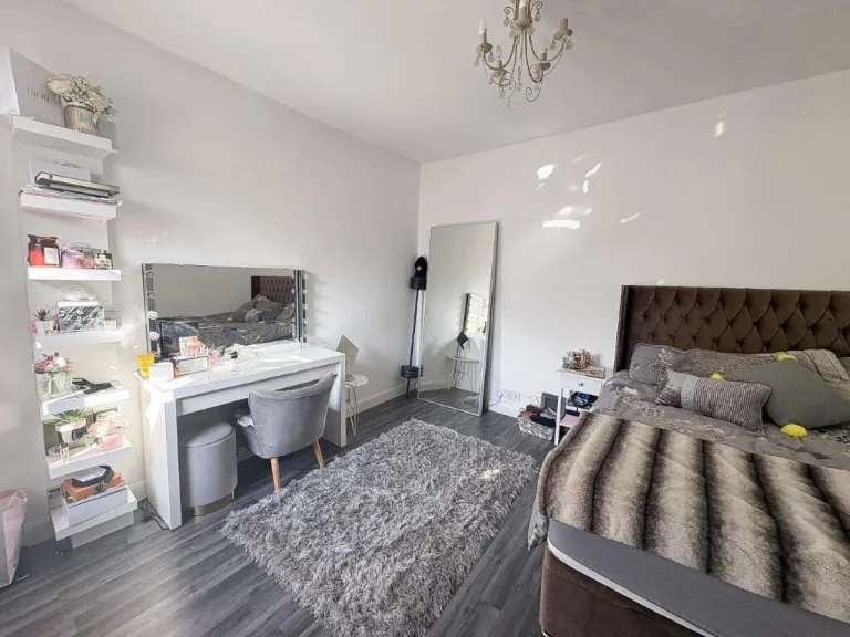
- living room modern
Floorplan Description
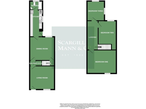
- A two-story house with a typical layout including three bedrooms, a kitchen, living and dining rooms, and a bathroom.
Rooms
- Living Room: average
- Dining Room: average
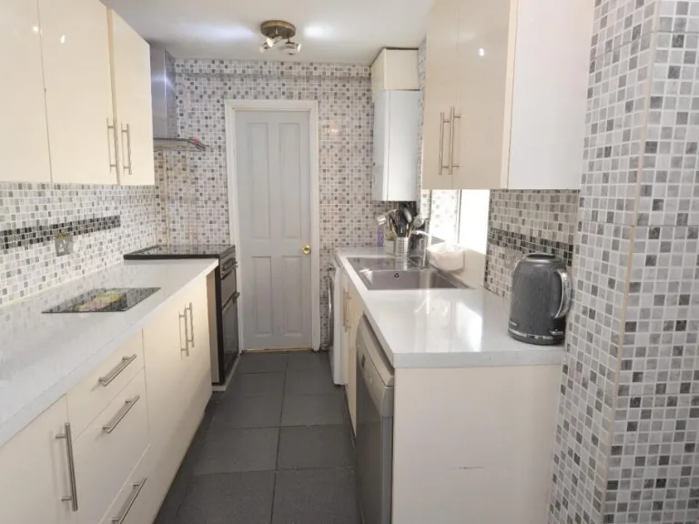
- Kitchen: small
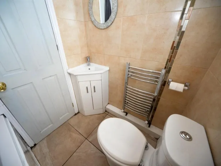
- Bathroom: small
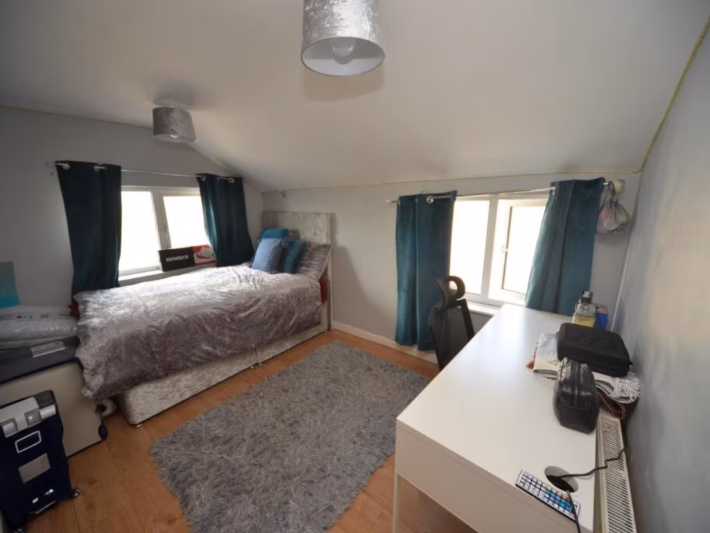
- Bedroom One: average
- Bedroom Two: average
- Bedroom Three: average
Textual Property Features
Detected Visual Features
- Victorian
- terraced house
- brick exterior
- two-story
- street parking
- starter home
- investment potential
- renovation project
- living room
- modern style
- laminate flooring
- neutral colors
- standard ceiling
EPC Details
- Fully double glazed
- Solid brick, as built, no insulation (assumed)
- Boiler and radiators, mains gas
- Low energy lighting in all fixed outlets
- Solid, no insulation (assumed)
Nearby Schools
- River View Primary and Nursery School
- Shobnall Primary & Nursery School
- Victoria Community School
- Outwoods Primary School
- William Shrewsbury Primary School
- Edge Hill Academy
- The Violet Way Academy
- Tower View Primary School
- Abbot Beyne School
- Holy Trinity CofE (C) Primary School
- Scientia Academy
- The de Ferrers Academy
- John of Rolleston Primary School
- Paget High School
- Anglesey Primary Academy
- Holy Rosary Catholic Voluntary Academy
- Horninglow Primary: A de Ferrers Trust Academy
- St Modwen's Catholic Primary School
- Blessed Robert Sutton Catholic Voluntary Academy
- Rykneld Primary School
- Paulet High School
- Christ Church Primary School
- Grange School
- Lansdowne: A de Ferrers Trust Academy
- Eton Park Junior: A de Ferrers Trust Academy
- Burton Fields School
Nearest General Shops
- Id: 7119613787
- Tags:
- TagsNormalized:
- Lat: 52.8094853
- Lon: -1.6433692
- FullGeoHash: gcqu6temd9x4
- PartitionGeoHash: gcqu
- Images:
- FoodStandards: null
- Distance: 234.6
,- Id: 7119611786
- Tags:
- Brand: Coral
- Brand:wikidata: Q54621344
- Brand:wikipedia: en:Coral (bookmaker)
- Name: Coral
- Shop: bookmaker
- TagsNormalized:
- Lat: 52.8124055
- Lon: -1.6430269
- FullGeoHash: gcqu6w5wd9yq
- PartitionGeoHash: gcqu
- Images:
- FoodStandards: null
- Distance: 198.9
,- Id: 3400767574
- Tags:
- Name: Wellings
- Shop: funeral_directors
- TagsNormalized:
- funeral
- funeral directors
- shop
- Lat: 52.8096924
- Lon: -1.6408598
- FullGeoHash: gcqu6ttnv0nm
- PartitionGeoHash: gcqu
- Images:
- FoodStandards: null
- Distance: 153.6
}
Nearest Religious buildings
- Id: 320933129
- Tags:
- Amenity: place_of_worship
- Denomination: methodist
- Name: St. Thomas's
- Religion: christian
- TagsNormalized:
- place of worship
- methodist
- christian
- church
- Lat: 52.8171426
- Lon: -1.6505345
- FullGeoHash: gcqu6rn45ubr
- PartitionGeoHash: gcqu
- Images:
- FoodStandards: null
- Distance: 928.2
,- Id: 506312075
- Tags:
- Addr:
- City: Burton-on-Trent
- Postcode: DE14 2SS
- Street: Hunter Street
- Amenity: place_of_worship
- Building: yes
- Denomination: anglican
- Name: St Chad
- Religion: christian
- Source: OS-OpenData_StreetView
- Wikidata: Q7587484
- Wikipedia: en:St Chad's, Burton upon Trent
- TagsNormalized:
- place of worship
- anglican
- christian
- church
- Lat: 52.8172893
- Lon: -1.6361956
- FullGeoHash: gcqu6z0e1bk5
- PartitionGeoHash: gcqu
- Images:
- FoodStandards: null
- Distance: 765.2
,- Id: 274447043
- Tags:
- Addr:
- City: Burton-on-Trent
- Postcode: DE14 2EZ
- Street: St Paul's Square
- Amenity: place_of_worship
- Building: church
- Denomination: anglican
- Fhrs:
- Name: St Paul's
- Religion: christian
- Source: Bing
- Website: https://www.achurchnearyou.com/church/4195/
- Wikidata: Q7595100
- Wikipedia: en:St Paul's, Burton upon Trent
- TagsNormalized:
- place of worship
- church
- anglican
- christian
- Lat: 52.808164
- Lon: -1.6468356
- FullGeoHash: gcqu6t2vcgq2
- PartitionGeoHash: gcqu
- Images:
- FoodStandards:
- Id: 1247838
- FHRSID: 1247838
- LocalAuthorityBusinessID: 5278c521-c7be-e211-8a33-00215ad1c18a
- BusinessName: St Pauls Church
- BusinessType: Other catering premises
- BusinessTypeID: 7841
- AddressLine1: St Pauls Church
- AddressLine2: St Pauls Square
- AddressLine3: Burton upon Trent
- AddressLine4: null
- PostCode: DE14 2EZ
- RatingValue: Exempt
- RatingKey: fhrs_exempt_en-GB
- RatingDate: 2021-03-12
- LocalAuthorityCode: 288
- LocalAuthorityName: East Staffordshire
- LocalAuthorityWebSite: http://www.eaststaffsbc.gov.uk
- LocalAuthorityEmailAddress: foodteam@eaststaffsbc.gov.uk
- Scores:
- Hygiene: null
- Structural: null
- ConfidenceInManagement: null
- NewRatingPending: false
- Geocode:
- Longitude: -1.64813399314880
- Latitude: 52.80800628662110
- Distance: 504.9
}
Nearest Medical buildings
- Id: 29198110
- Tags:
- Leisure: pitch
- Name: Belvedere Park/Burton Hospitals Bp Crown Green Bowls Club
- Source: BING
- Sport: bowls
- TagsNormalized:
- pitch
- leisure
- bowls
- hospital
- club
- sports
- Lat: 52.8172498
- Lon: -1.6478508
- FullGeoHash: gcqu6x04f2cr
- PartitionGeoHash: gcqu
- Images:
- FoodStandards: null
- Distance: 825
,- Id: 29198111
- Tags:
- Highlight: yes
- Leisure: pitch
- Name: Belvedere Park/Burton Hospitals Bp Crown Green Bowls Club
- Source: approx
- Sport: bowls
- TagsNormalized:
- pitch
- leisure
- bowls
- hospital
- club
- sports
- Lat: 52.8169287
- Lon: -1.6482579
- FullGeoHash: gcqu6rpbbv1u
- PartitionGeoHash: gcqu
- Images:
- FoodStandards: null
- Distance: 811.5
,- Id: 320649377
- Tags:
- Amenity: clinic
- Healthcare: clinic
- TagsNormalized:
- Lat: 52.804004
- Lon: -1.6384476
- FullGeoHash: gcqu6swvt7uc
- PartitionGeoHash: gcqu
- Images:
- FoodStandards: null
- Distance: 804.9
,- Id: 7119613785
- Tags:
- Addr:
- City: Burton-on-Trent
- Postcode: DE14 2NQ
- Street: Waterloo Street
- Amenity: pharmacy
- Healthcare: pharmacy
- Name: Waterloo Pharmacy
- TagsNormalized:
- Lat: 52.8122361
- Lon: -1.6430783
- FullGeoHash: gcqu6w5t9d25
- PartitionGeoHash: gcqu
- Images:
- FoodStandards: null
- Distance: 187.7
}
Nearest Airports
- Id: 11359528
- Tags:
- Aerodrome: international
- Aerodrome:type: public
- Aeroway: aerodrome
- Iata: EMA
- Icao: EGNX
- Is_in: Castle Donington,England,UK
- Name: East Midlands Airport
- Old_name: RAF Castle Donington
- Operator: Manchester Airports Holdings Limited
- Operator:type: private
- Ref: EMA
- Type: multipolygon
- Website: https://www.eastmidlandsairport.com/
- Wikidata: Q8977
- Wikipedia: en:East Midlands Airport
- TagsNormalized:
- airport
- international airport
- Lat: 52.8281122
- Lon: -1.3322143
- FullGeoHash: gcrh99jfj1vh
- PartitionGeoHash: gcrh
- Images:
- FoodStandards: null
- Distance: 20840.3
}
Nearest Leisure Facilities
- Id: 467270488
- Tags:
- Leisure: pitch
- Sport: tennis
- TagsNormalized:
- Lat: 52.8075628
- Lon: -1.6486839
- FullGeoHash: gcqu6mr6qghn
- PartitionGeoHash: gcqu
- Images:
- FoodStandards: null
- Distance: 643.7
,- Id: 7120616160
- Tags:
- TagsNormalized:
- Lat: 52.8127333
- Lon: -1.6488647
- FullGeoHash: gcqu6qr26xj3
- PartitionGeoHash: gcqu
- Images:
- FoodStandards: null
- Distance: 556.1
,- Id: 29146125
- Tags:
- Leisure: park
- Note: nursery school frontage
- Source: approx
- TagsNormalized:
- Lat: 52.8106468
- Lon: -1.6476149
- FullGeoHash: gcqu6tbhrf17
- PartitionGeoHash: gcqu
- Images:
- FoodStandards: null
- Distance: 442.9
,- Id: 29146114
- Tags:
- TagsNormalized:
- Lat: 52.8135661
- Lon: -1.639299
- FullGeoHash: gcqu6wqm3d61
- PartitionGeoHash: gcqu
- Images:
- FoodStandards: null
- Distance: 302
,- Id: 717472594
- Tags:
- TagsNormalized:
- Lat: 52.8135219
- Lon: -1.6392726
- FullGeoHash: gcqu6wqm44jc
- PartitionGeoHash: gcqu
- Images:
- FoodStandards: null
- Distance: 298.2
}
Nearest Tourist attractions
- Id: 696756403
- Tags:
- Camp_site: basic
- Description: No Children
- Name: Cross Farm
- Tourism: camp_site
- TagsNormalized:
- Lat: 52.8380224
- Lon: -1.6422442
- FullGeoHash: gcquddu5ucmb
- PartitionGeoHash: gcqu
- Images:
- FoodStandards: null
- Distance: 2998.2
,- Id: 9008554456
- Tags:
- Addr:
- City: Burton-on-Trent
- Postcode: DE13 0QJ
- Street: Shobnall Road
- Museum: history
- Name: Sinai Park House
- Operator: Sinai Park House Trust
- Tourism: museum
- Website: http://www.sinaiparkhouse.co.uk/
- Wikidata: Q17557238
- Wikipedia: en:Sinai Park House
- TagsNormalized:
- Lat: 52.8049137
- Lon: -1.6717438
- FullGeoHash: gcqu3uydvt37
- PartitionGeoHash: gcqu
- Images:
- FoodStandards: null
- Distance: 2172.9
,- Id: 29197633
- Tags:
- Name: National Brewery Centre
- Old_name: Coors Visitor Centre;Bass Museum
- Tourism: museum
- Wikidata: Q6971121
- TagsNormalized:
- Lat: 52.8076847
- Lon: -1.6324482
- FullGeoHash: gcqu6v7711ym
- PartitionGeoHash: gcqu
- Images:
- FoodStandards: null
- Distance: 690.5
}
Nearest Train stations
- Id: 8829329092
- Tags:
- Name: Waterside Station
- Public_transport: station
- Railway: station
- Usage: tourism
- TagsNormalized:
- Lat: 52.7388088
- Lon: -1.5432862
- FullGeoHash: gcquhbu1yfd2
- PartitionGeoHash: gcqu
- Images:
- FoodStandards: null
- Distance: 10383.5
,- Id: 5364278857
- Tags:
- Name: Discovery Station
- Public_transport: station
- Railway: station
- Usage: tourism
- TagsNormalized:
- Lat: 52.7409495
- Lon: -1.5432771
- FullGeoHash: gcquhchnr194
- PartitionGeoHash: gcqu
- Images:
- FoodStandards: null
- Distance: 10200.7
,- Id: 6646199703
- Tags:
- Layer: 1
- Name: Willington
- Naptan:
- Network: National Rail
- Public_transport: station
- Railway: station
- Ref:
- Source: memory
- Wikidata: Q746608
- Wikipedia: en:Willington railway station
- TagsNormalized:
- Lat: 52.8533792
- Lon: -1.5641036
- FullGeoHash: gcqusmtj1xzz
- PartitionGeoHash: gcqu
- Images:
- FoodStandards: null
- Distance: 6990.2
,- Id: 100878319
- Tags:
- Name: Tutbury and Hatton
- Naptan:
- Network: National Rail
- Public_transport: station
- Railway: station
- Ref:
- Wikidata: Q2564949
- Wikipedia: en:Tutbury and Hatton railway station
- TagsNormalized:
- Lat: 52.864141
- Lon: -1.6823404
- FullGeoHash: gcqu9xwgywhh
- PartitionGeoHash: gcqu
- Images:
- FoodStandards: null
- Distance: 6520.3
,- Id: 6646199708
- Tags:
- Layer: 2
- Level: 0
- Name: Burton-on-Trent
- Name:lt: Bertonas prie Trento
- Naptan:
- Network: National Rail
- Public_transport: station
- Railway: station
- Ref:
- Train: yes
- Wikidata: Q2011595
- Wikipedia: en:Burton-on-Trent railway station
- TagsNormalized:
- Lat: 52.8058728
- Lon: -1.6424988
- FullGeoHash: gcqu6t5bx00h
- PartitionGeoHash: gcqu
- Images:
- FoodStandards: null
- Distance: 585.7
}
Nearest Bus stations and stops
- Id: 6633336670
- Tags:
- Bus: yes
- Highway: bus_stop
- Name: Victoria Road
- Public_transport: platform
- TagsNormalized:
- Lat: 52.8115348
- Lon: -1.6382048
- FullGeoHash: gcqu6wp17p9u
- PartitionGeoHash: gcqu
- Images:
- FoodStandards: null
- Distance: 198.9
,- Id: 6635094358
- Tags:
- Bus: yes
- Highway: bus_stop
- Name: Albert Street
- Public_transport: platform
- TagsNormalized:
- Lat: 52.8107598
- Lon: -1.6431561
- FullGeoHash: gcqu6tgkzxnj
- PartitionGeoHash: gcqu
- Images:
- FoodStandards: null
- Distance: 144.9
,- Id: 6633336673
- Tags:
- Bus: yes
- Highway: bus_stop
- Name: Derby Street East
- Public_transport: platform
- TagsNormalized:
- Lat: 52.8099459
- Lon: -1.6401976
- FullGeoHash: gcqu6tv8hxkj
- PartitionGeoHash: gcqu
- Images:
- FoodStandards: null
- Distance: 137.7
,- Id: 6635094357
- Tags:
- Bus: yes
- Highway: bus_stop
- Name: Albert Street
- Public_transport: platform
- TagsNormalized:
- Lat: 52.8110427
- Lon: -1.6430086
- FullGeoHash: gcqu6tgwe5gu
- PartitionGeoHash: gcqu
- Images:
- FoodStandards: null
- Distance: 130.9
,- Id: 6633336672
- Tags:
- Bus: yes
- Highway: bus_stop
- Name: Derby Street East
- Public_transport: platform
- TagsNormalized:
- Lat: 52.8103156
- Lon: -1.6399911
- FullGeoHash: gcqu6tvf3kq5
- PartitionGeoHash: gcqu
- Images:
- FoodStandards: null
- Distance: 110.4
}
Nearest Hotels
- Id: 262421605
- Tags:
- Addr:
- City: Burton-on-Trent
- Postcode: DE14 1BN
- Street: Station Street
- Amenity: pub
- Name: Grail Court Hotel
- Old_fhrs:
- Old_fhrs:id:2: 1248197
- Wheelchair: no
- TagsNormalized:
- Lat: 52.8043555
- Lon: -1.6339509
- FullGeoHash: gcqu6udpwjmc
- PartitionGeoHash: gcqu
- Images:
- FoodStandards: null
- Distance: 886.4
,- Id: 262574341
- Tags:
- Addr:
- City: Burton-on-Trent
- Housenumber: 90
- Postcode: DE14 2PT
- Street: Horninglow Road
- Amenity: pub
- Name: Crescent Hotel
- Old_fhrs:
- TagsNormalized:
- Lat: 52.8167206
- Lon: -1.6392118
- FullGeoHash: gcqu6wyrew74
- PartitionGeoHash: gcqu
- Images:
- FoodStandards: null
- Distance: 640.7
,- Id: 29101097
- Tags:
- Addr:
- City: Burton-on-Trent
- Housename: Midland Grain Warehouse
- Postcode: DE14 2JJ
- Street: Derby Street
- Air_conditioning: no
- Alt_name: Midland Grain Warehouse No.2
- Bar: yes
- Brand: Ibis Budget
- Brand:wikidata: Q1458135
- Brand:wikipedia: en:Ibis Budget
- Building: yes
- Email: hb8f5@accor.com
- Fhrs:
- Internet_access: wlan
- Internet_access:fee: no
- Name: Ibis Budget Burton Upon Trent
- Old_fhrs:
- Old_name: Travelodge Burton upon Trent Central
- Pets_allowed: yes
- Phone: +44 1283 387 394
- Rooms: 68
- Smoking: no
- Source: survey;Bing
- Stars: 2
- Tourism: hotel
- Website: https://all.accor.com/hotel/B8F5/index.en.shtml
- Wheelchair: yes
- TagsNormalized:
- Lat: 52.8070161
- Lon: -1.6422787
- FullGeoHash: gcqu6thphjk1
- PartitionGeoHash: gcqu
- Images:
- FoodStandards: null
- Distance: 457.9
}
Tags
- Victorian
- terraced house
- brick exterior
- two-story
- street parking
- starter home
- investment potential
- renovation project
- living room
- modern style
- laminate flooring
- neutral colors
- standard ceiling
Local Market Stats
- Average Price/sqft: £201
- Avg Income: £42500
- Rental Yield: 4.5%
- Social Housing: 14%
- Planning Success Rate: 90%
AirBnB Data
- 1km average: £61/night
- Listings in 1km: 7
Similar Properties
 3 bedroom terraced house for sale in Lansdowne Terrace, Burton Upon Trent, DE14 — £120,000 • 3 bed • 1 bath • 641 ft²
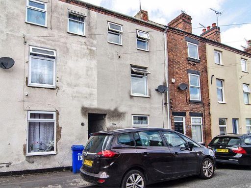 3 bedroom terraced house for sale in Stafford Street, Burton-On-Trent, DE14 — £155,000 • 3 bed • 1 bath • 1235 ft²
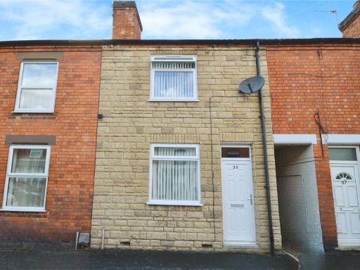 3 bedroom terraced house for sale in Carlton Street, Burton Upon Trent, Staffordshire, DE13 — £145,000 • 3 bed • 1 bath • 876 ft²
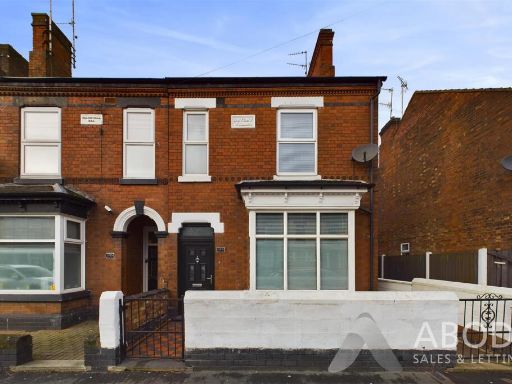 3 bedroom semi-detached house for sale in Shobnall Street, Burton On Trent, DE14 — £205,000 • 3 bed • 2 bath • 1346 ft²
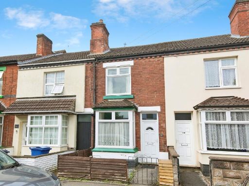 3 bedroom terraced house for sale in Anglesey Road, BURTON-ON-TRENT, DE14 — £160,000 • 3 bed • 1 bath • 704 ft²
 3 bedroom terraced house for sale in Grange Close, Burton Upon Trent, DE14 — £180,000 • 3 bed • 1 bath • 857 ft²
Meta
- {
"@context": "https://schema.org",
"@type": "Residence",
"name": "3 bedroom terraced house for sale in Victoria Street, Burto…",
"description": "",
"url": "https://propertypiper.co.uk/property/091977ec-afae-44d2-b65c-c96645eb1123",
"image": "https://image-a.propertypiper.co.uk/7a3fae2e-a4b3-4140-a28e-23e54393186a-1024.jpeg",
"address": {
"@type": "PostalAddress",
"streetAddress": "12, VICTORIA STREET, BURTON-ON-TRENT",
"postalCode": "DE14 2LP",
"addressLocality": "East Staffordshire",
"addressRegion": "Burton",
"addressCountry": "England"
},
"geo": {
"@type": "GeoCoordinates",
"latitude": 52.8110683,
"longitude": -1.6410619
},
"numberOfRooms": 3,
"numberOfBathroomsTotal": 1,
"floorSize": {
"@type": "QuantitativeValue",
"value": 828,
"unitCode": "FTK"
},
"offers": {
"@type": "Offer",
"price": 140000,
"priceCurrency": "GBP",
"availability": "https://schema.org/InStock"
},
"additionalProperty": [
{
"@type": "PropertyValue",
"name": "Feature",
"value": "Victorian"
},
{
"@type": "PropertyValue",
"name": "Feature",
"value": "terraced house"
},
{
"@type": "PropertyValue",
"name": "Feature",
"value": "brick exterior"
},
{
"@type": "PropertyValue",
"name": "Feature",
"value": "two-story"
},
{
"@type": "PropertyValue",
"name": "Feature",
"value": "street parking"
},
{
"@type": "PropertyValue",
"name": "Feature",
"value": "starter home"
},
{
"@type": "PropertyValue",
"name": "Feature",
"value": "investment potential"
},
{
"@type": "PropertyValue",
"name": "Feature",
"value": "renovation project"
},
{
"@type": "PropertyValue",
"name": "Feature",
"value": "living room"
},
{
"@type": "PropertyValue",
"name": "Feature",
"value": "modern style"
},
{
"@type": "PropertyValue",
"name": "Feature",
"value": "laminate flooring"
},
{
"@type": "PropertyValue",
"name": "Feature",
"value": "neutral colors"
},
{
"@type": "PropertyValue",
"name": "Feature",
"value": "standard ceiling"
}
]
}
High Res Floorplan Images
Compatible Floorplan Images
FloorplanImages Thumbnail