SP10 4NZ - 3 bedroom end of terrace house for sale in St Alphege Garde…
View on Property Piper
3 bedroom end of terrace house for sale in St Alphege Gardens, Andover, SP10
Property Details
- Price: £340000
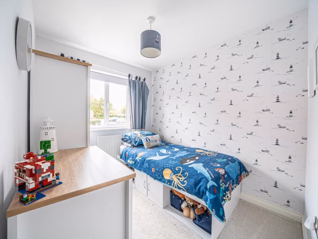
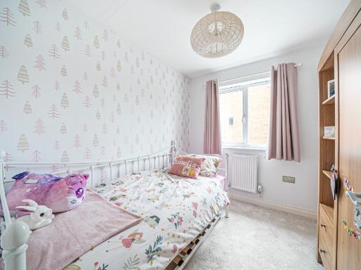
- Bedrooms: 3
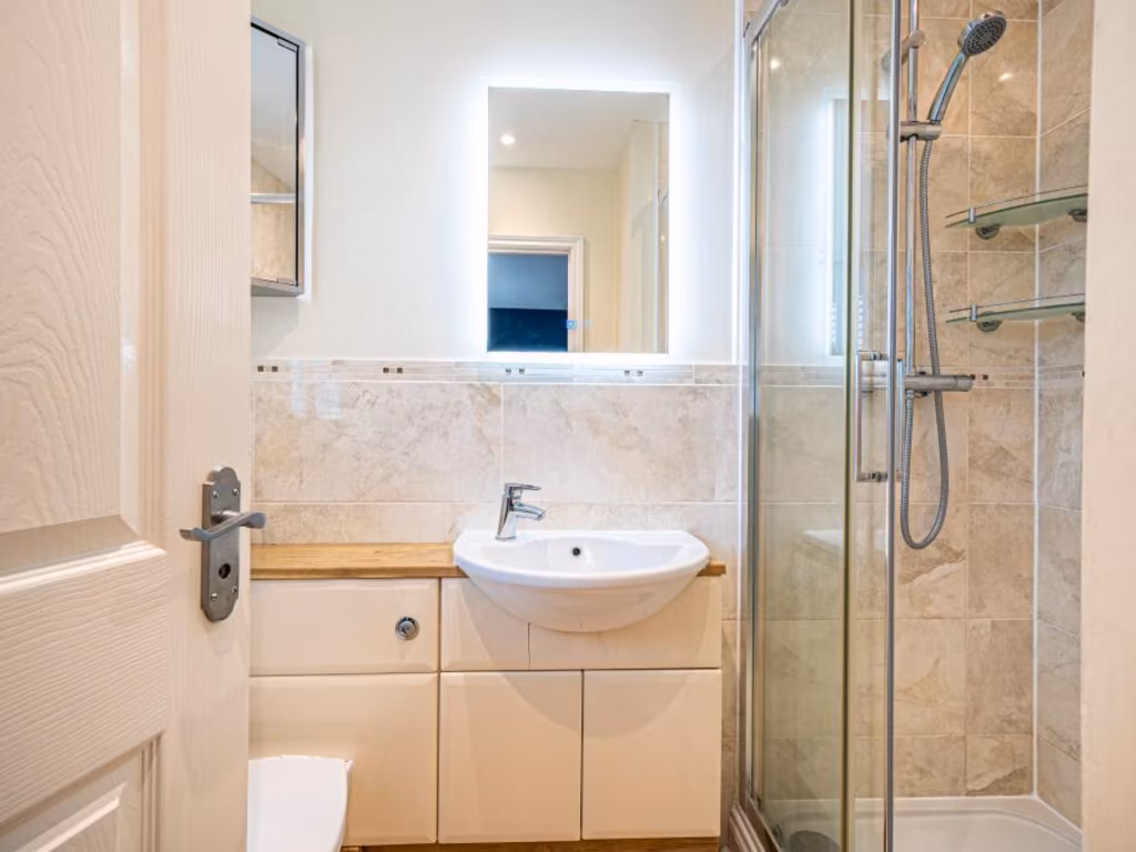
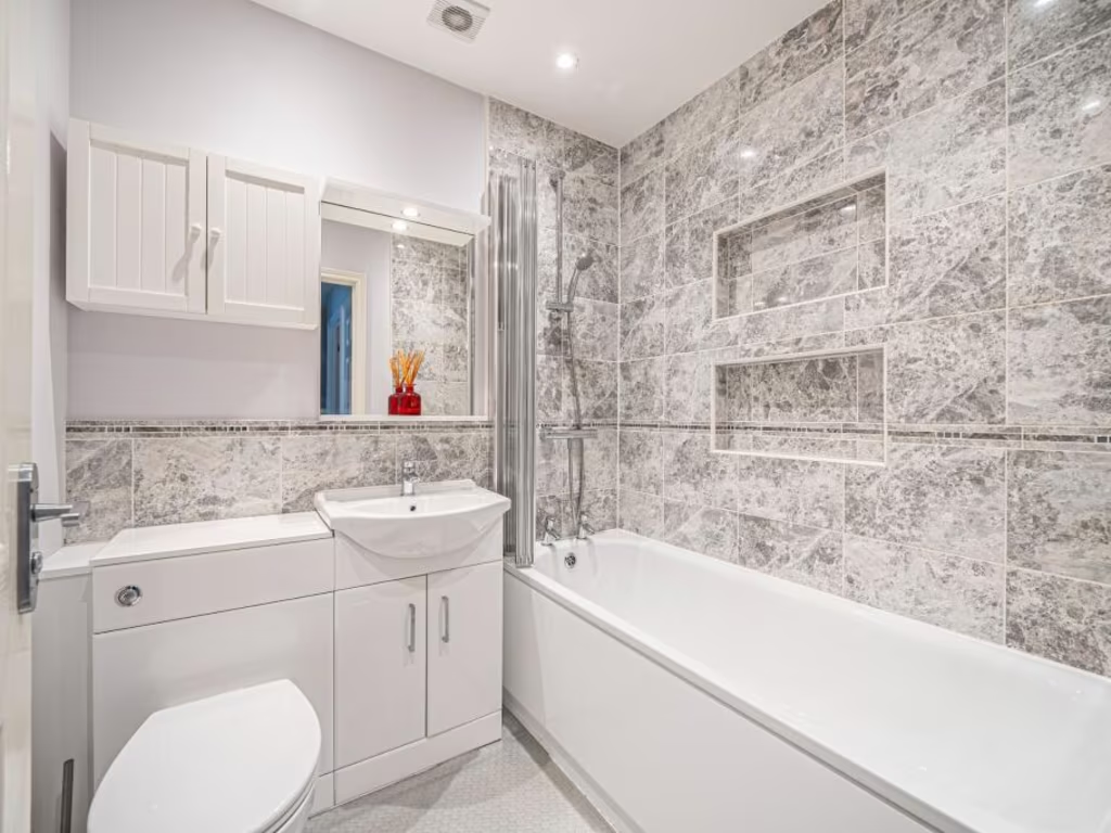
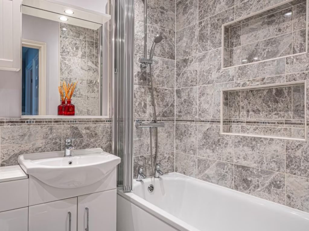
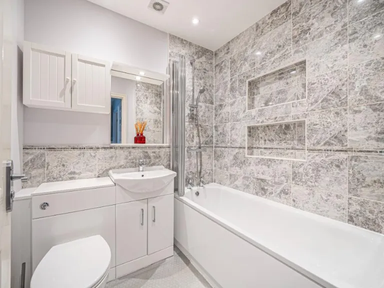
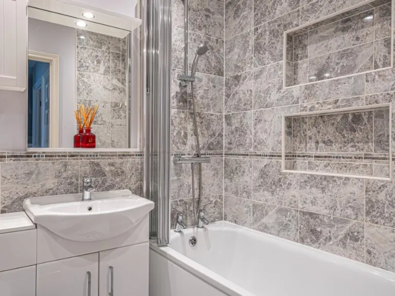
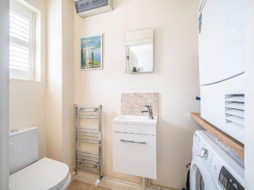
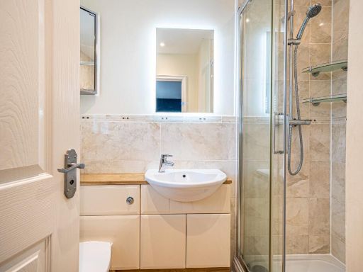
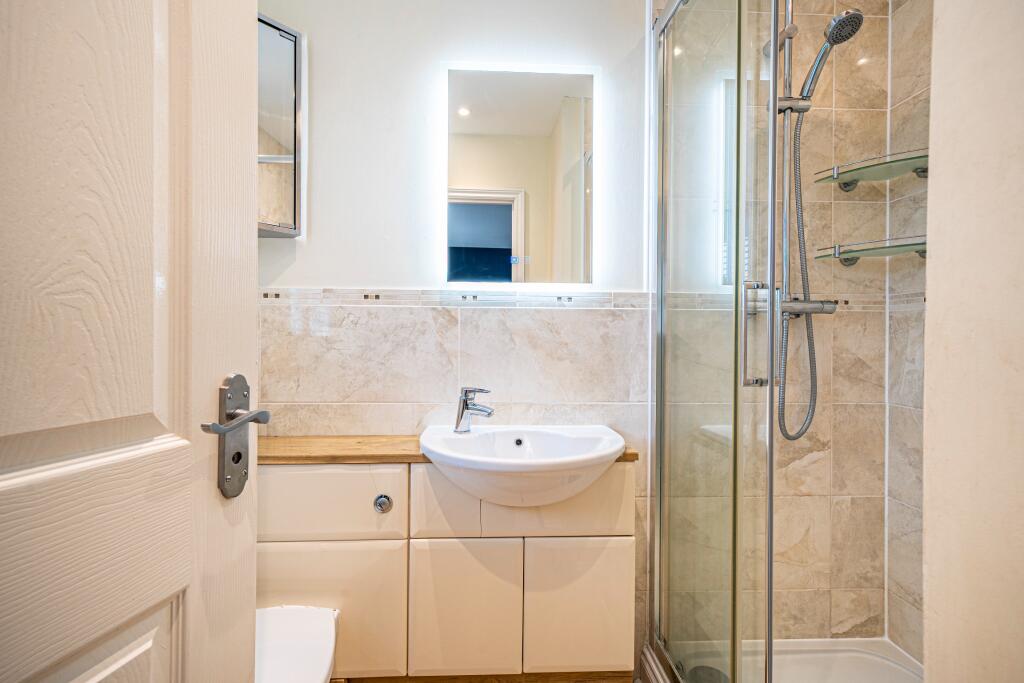
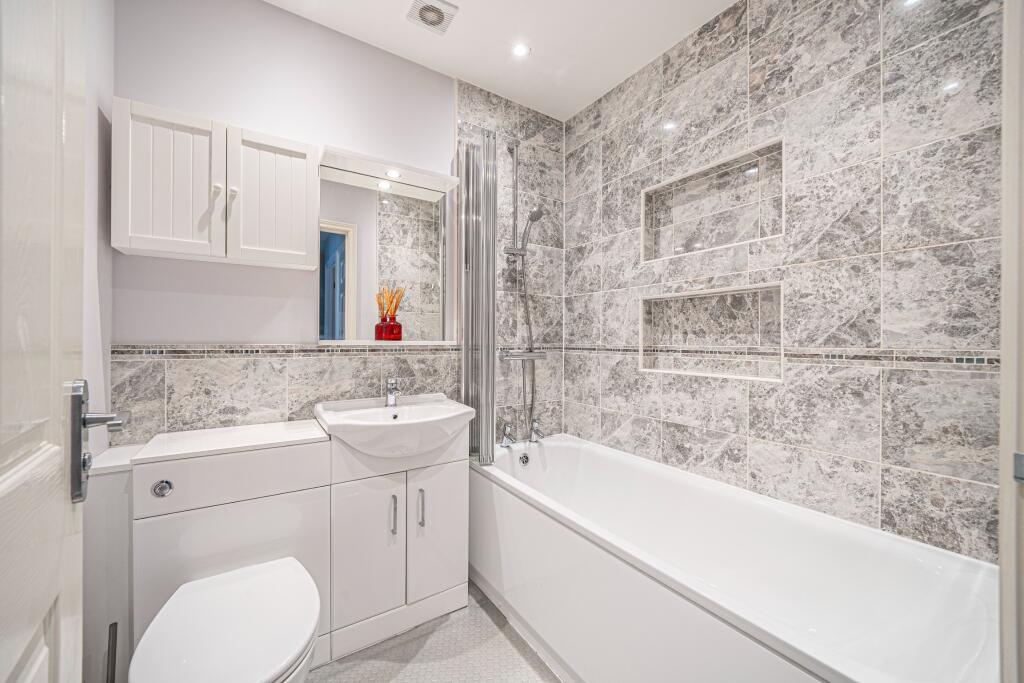
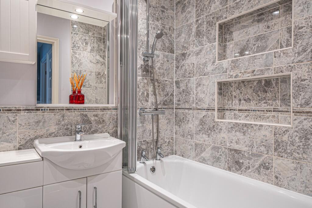
- Bathrooms: 2
- Property Type: undefined
- Property SubType: undefined
Brochure Descriptions
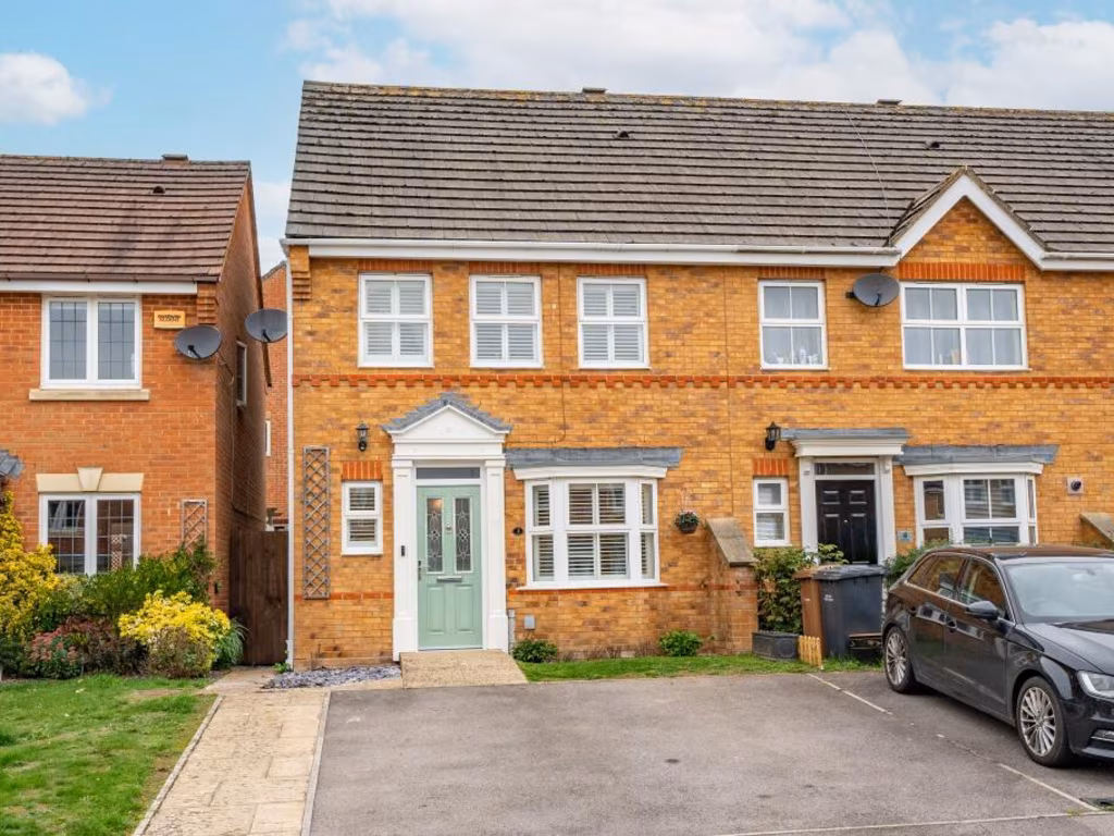
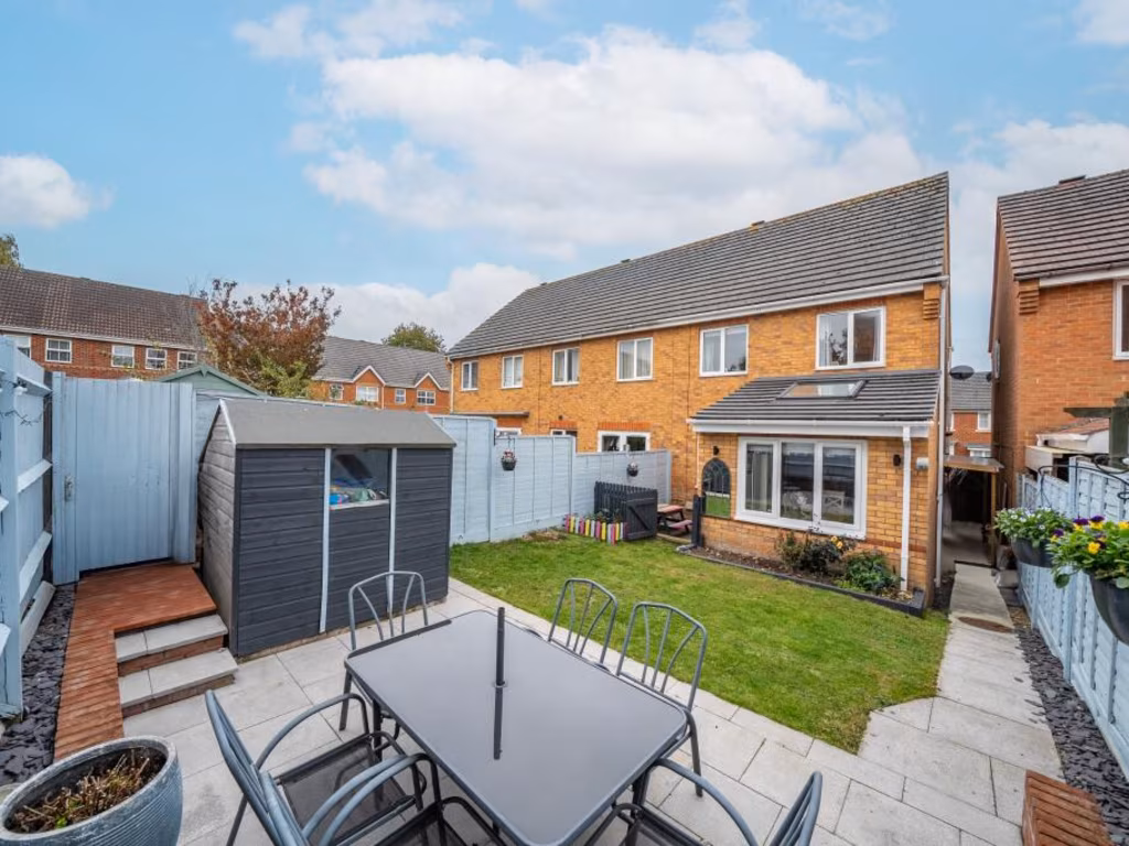
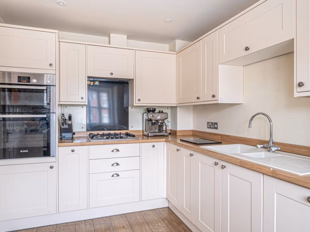
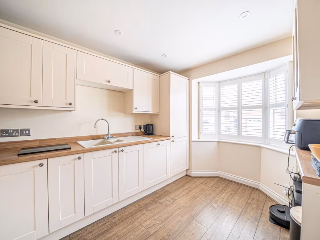
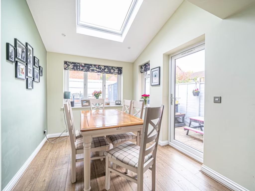
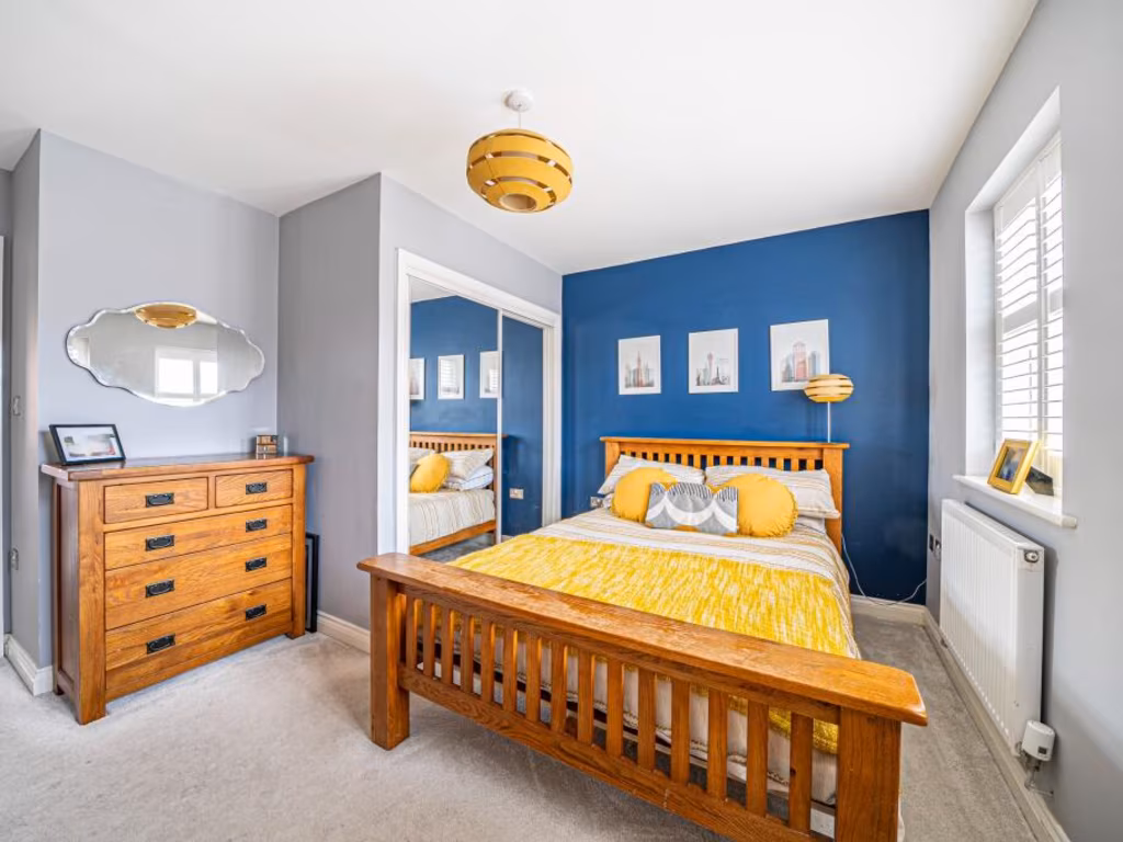
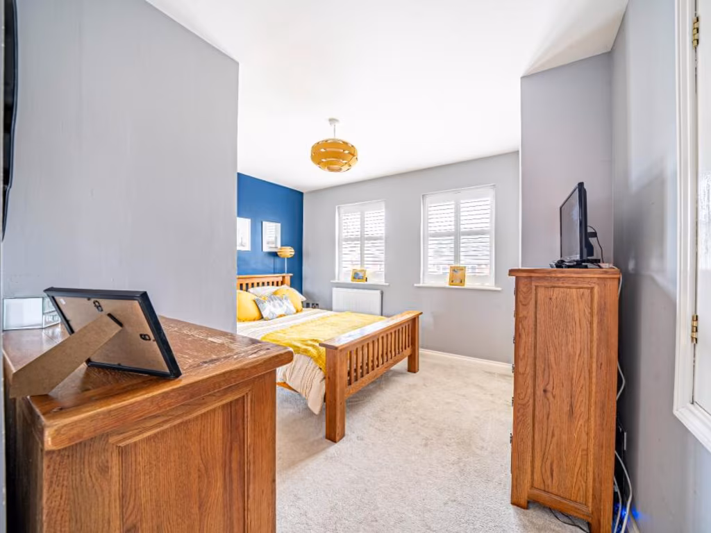
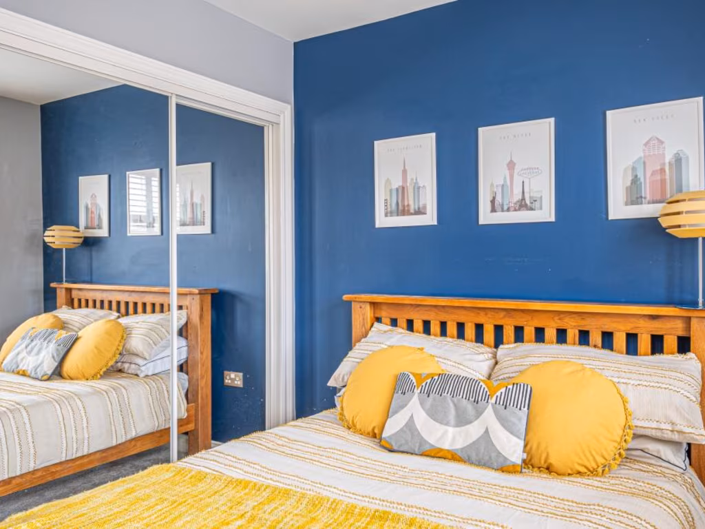
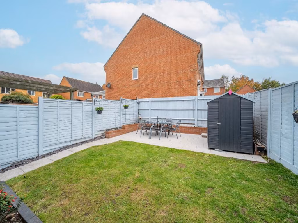
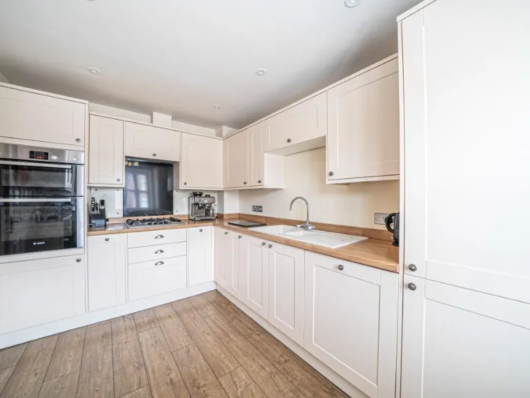
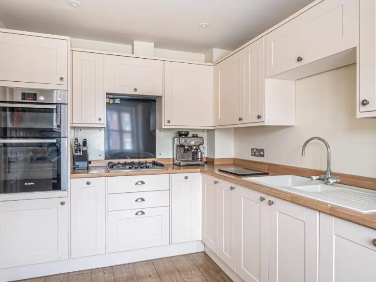
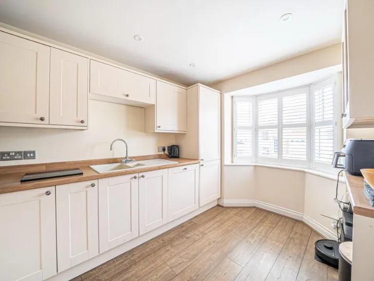
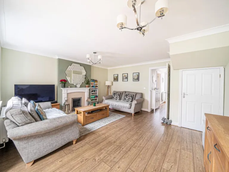
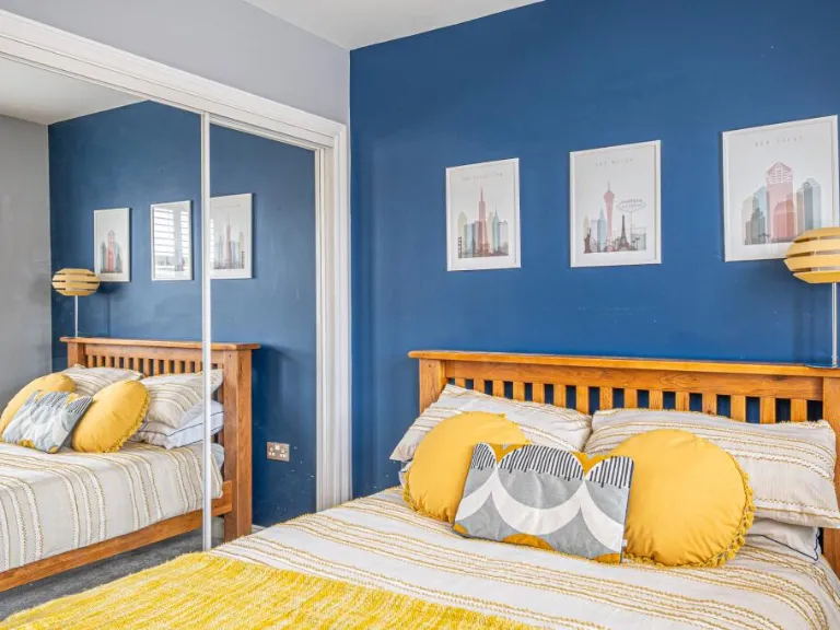
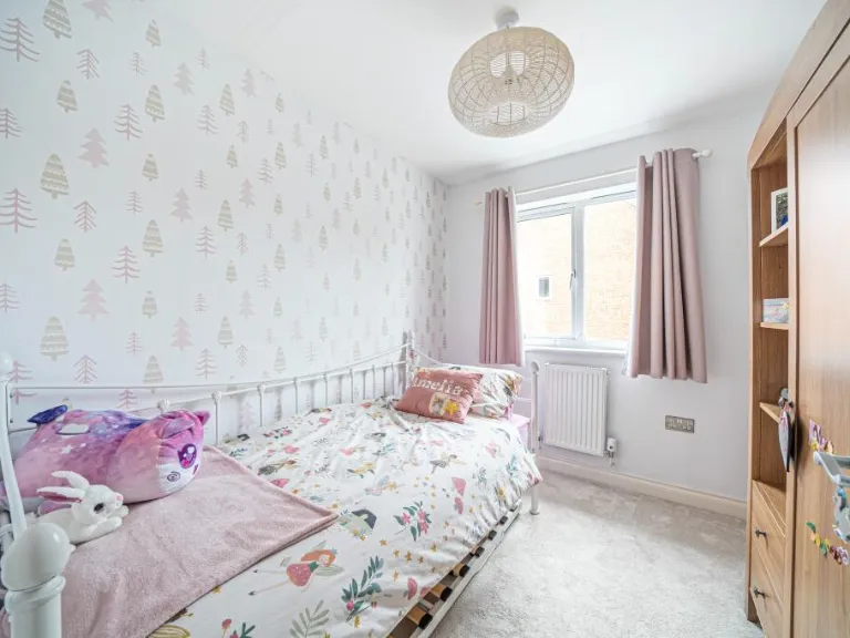
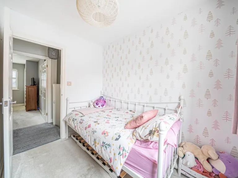
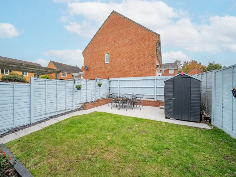
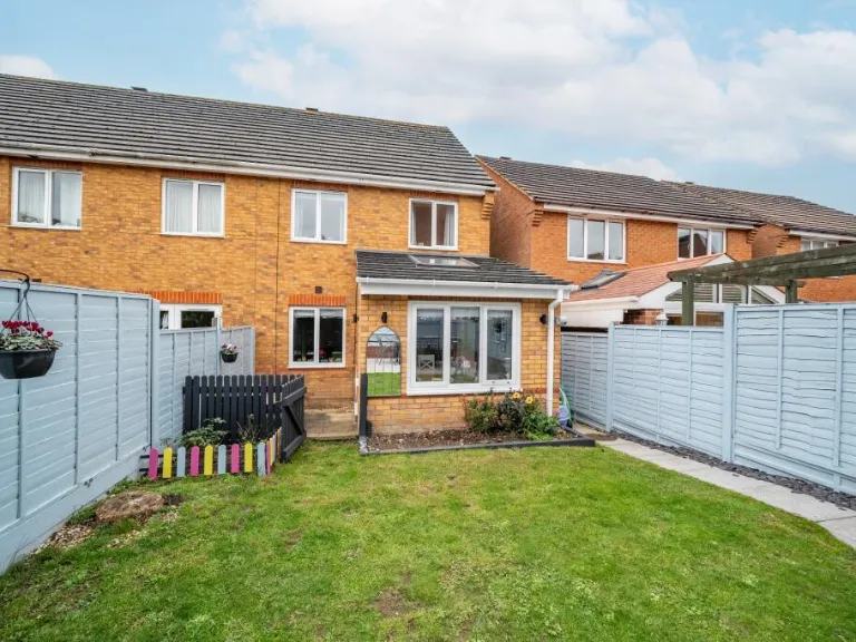
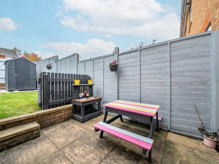
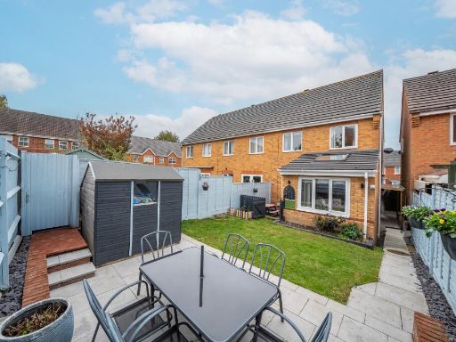
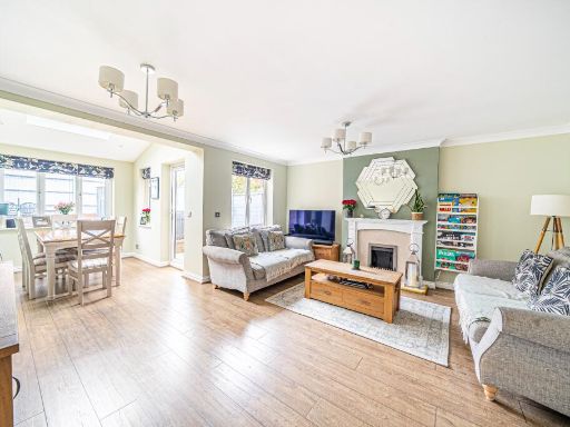
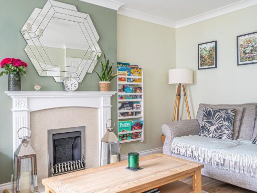
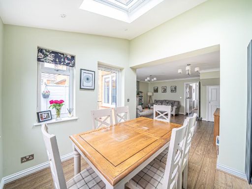
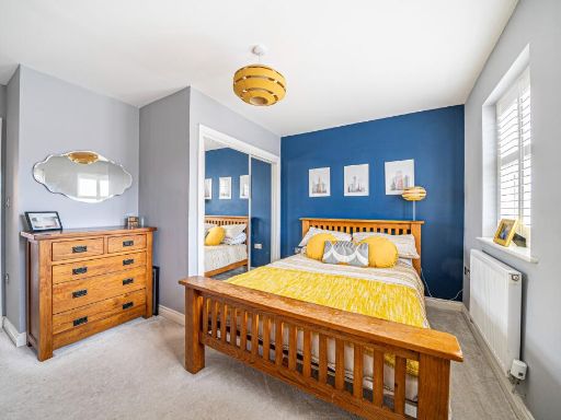
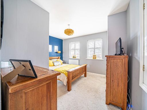
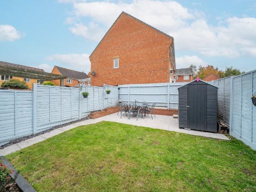
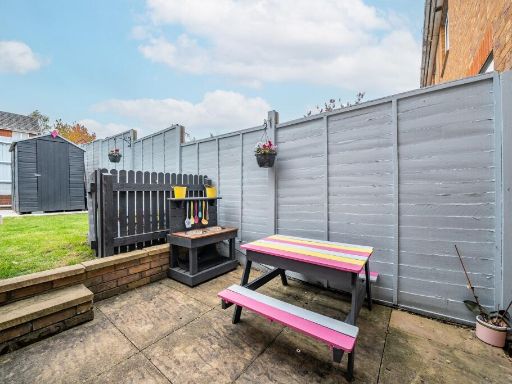
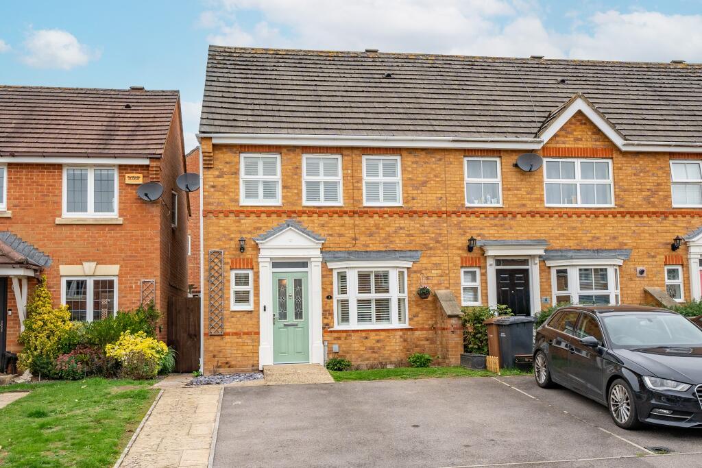
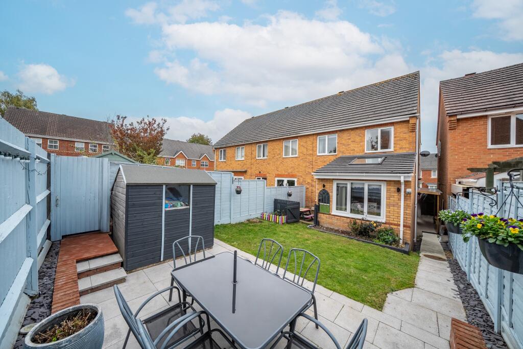
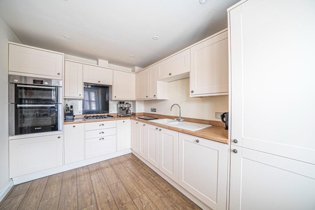
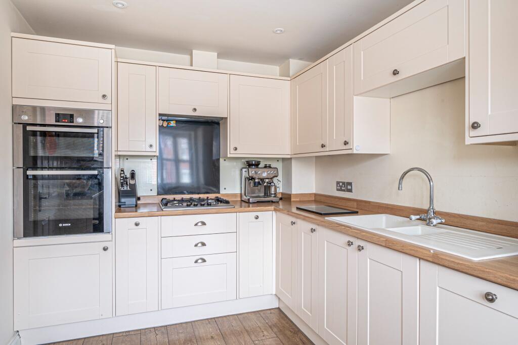
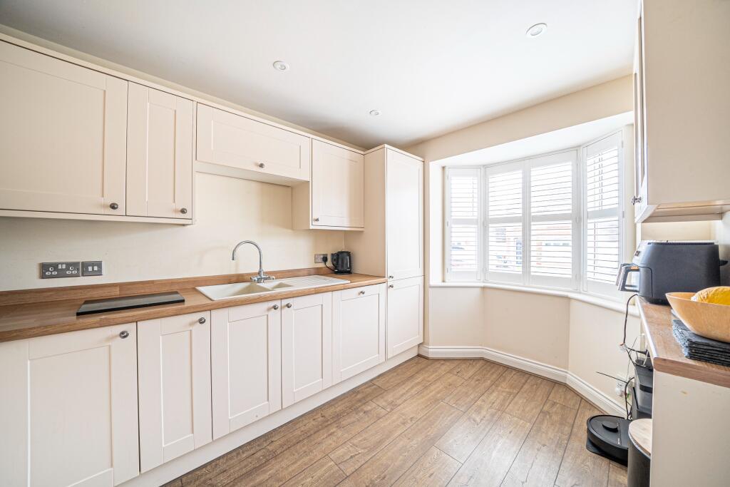
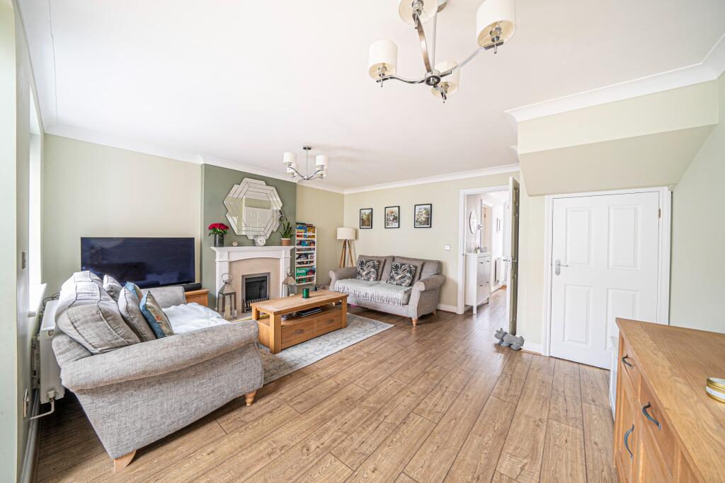
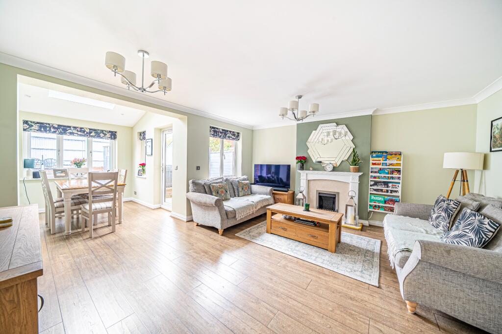
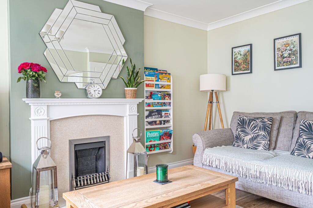
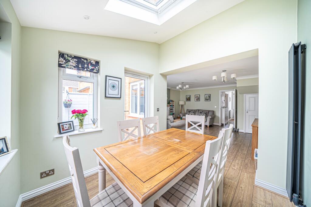
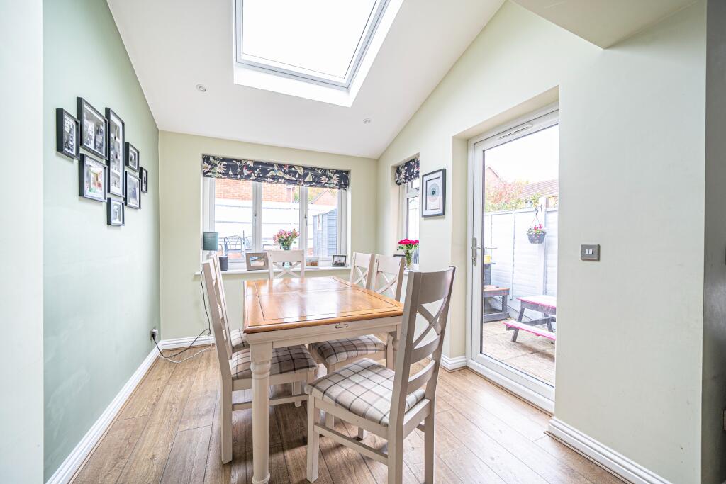
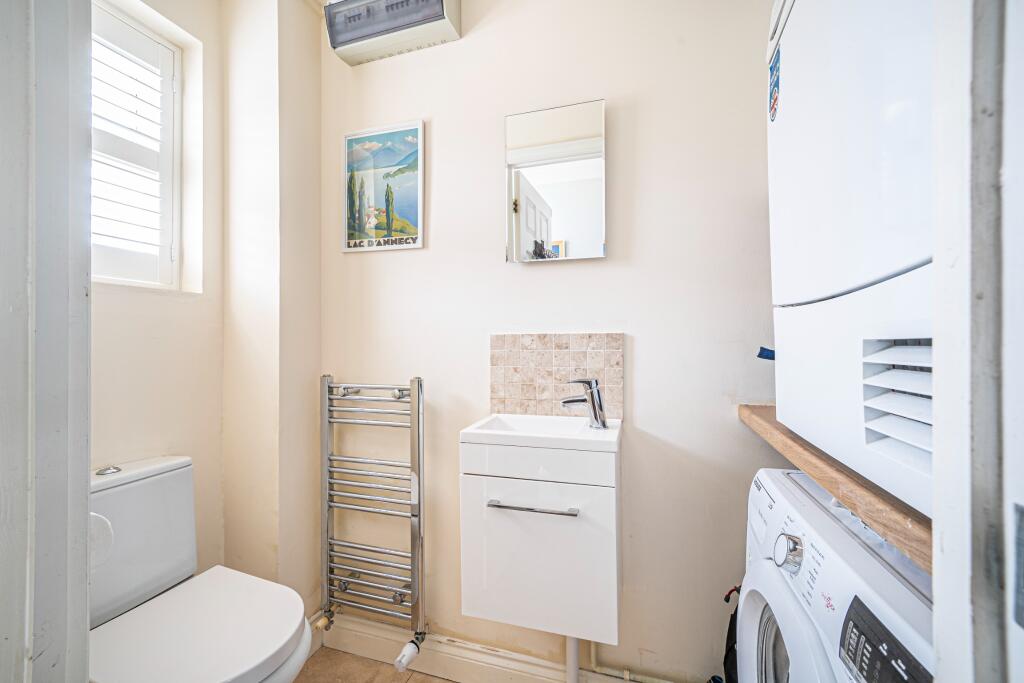
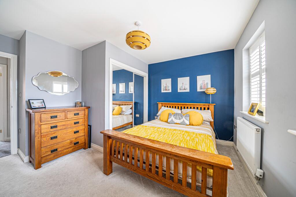
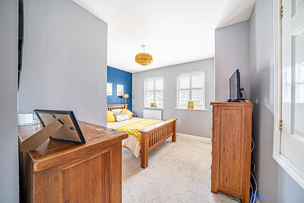
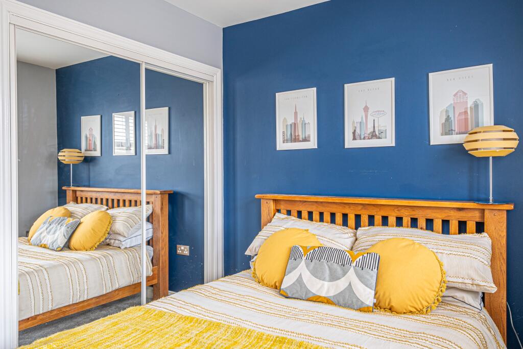
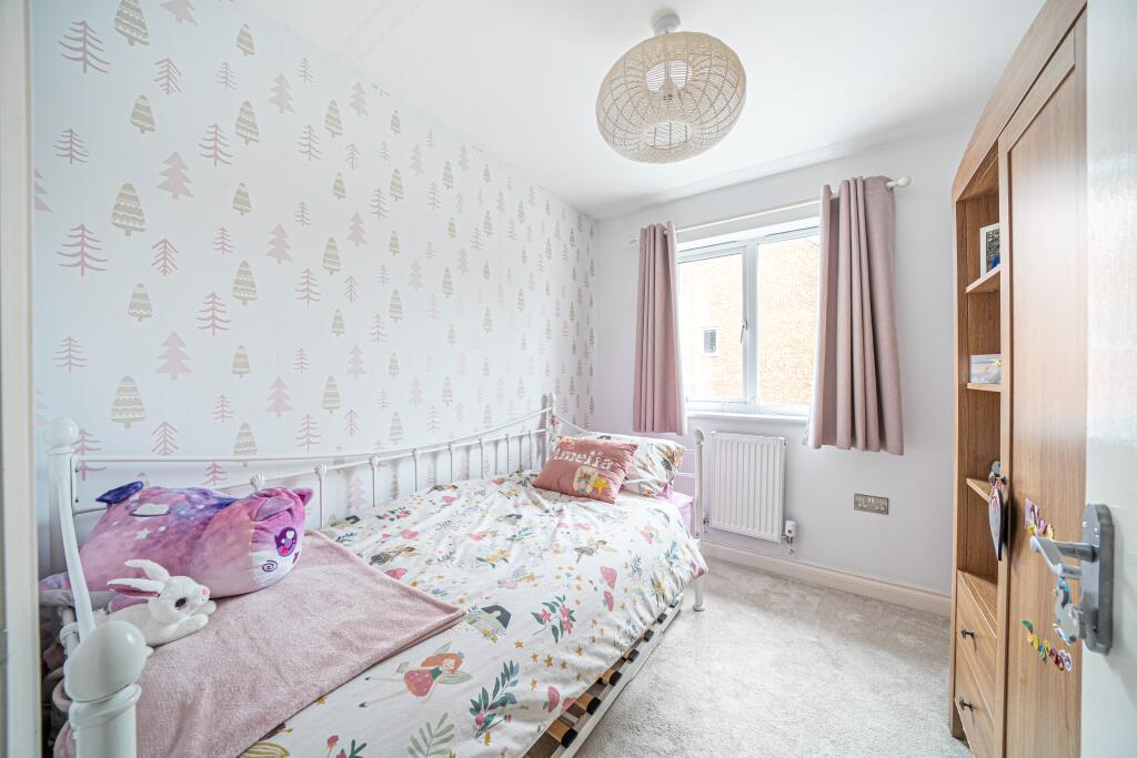
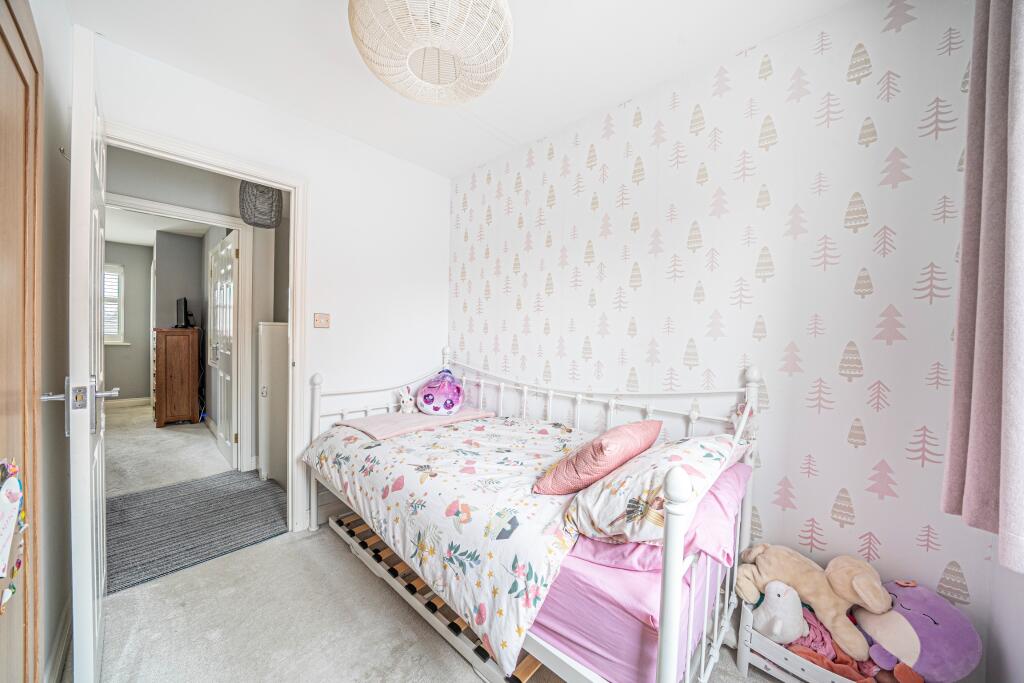
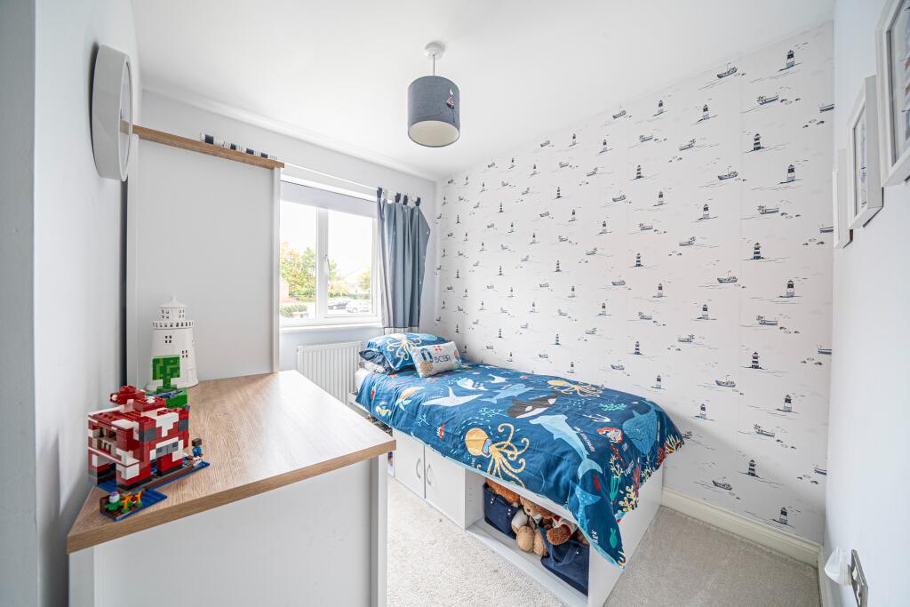
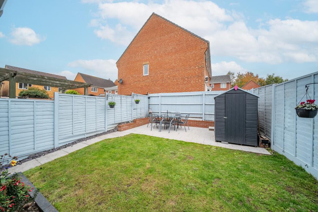
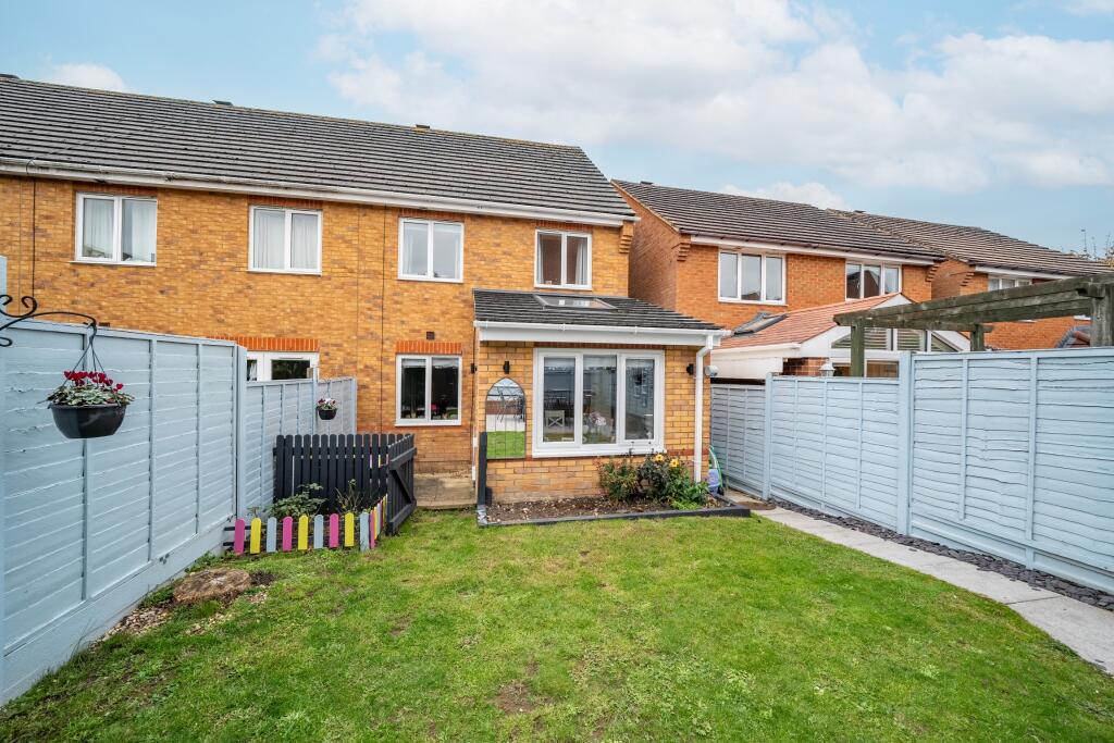
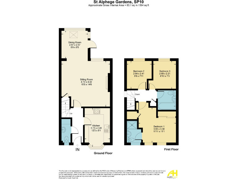
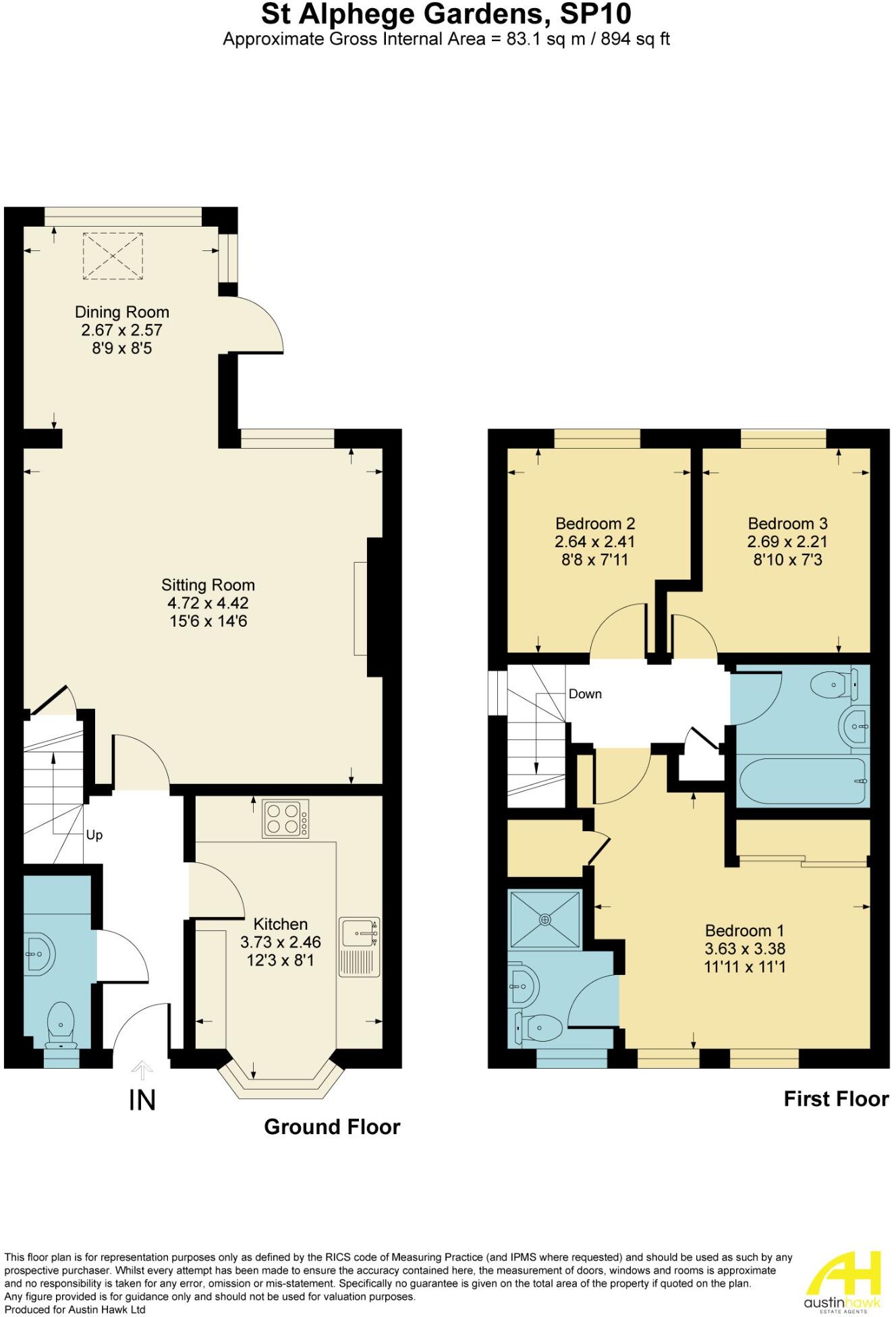
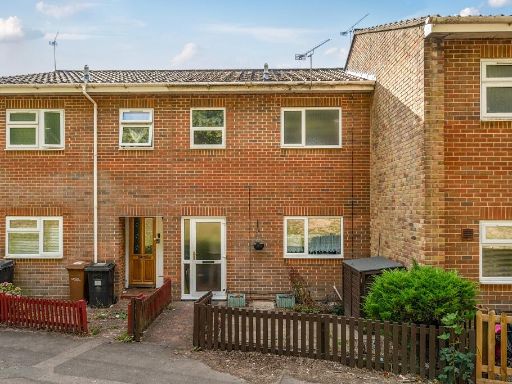
- Mid-terraced modern townhouse-style residence arranged over two storeys. Internal layout (from floorplan) comprises entrance hall, cloakroom/WC, kitchen/breakfast room, separate dining room and a sitting room at ground floor; first floor offers a master bedroom with en-suite (master bedroom suite), two further bedrooms and a family bathroom. Externally there is an attractive rear garden of average size and off-street parking for two cars to the front. Construction appears to be brick with tiled roof; the property sits within a residential cul-de-sac/estate setting. Suitable for owner-occupation or buy-to-let; overall accommodation and outdoor space are typical of a mid-range family home. Energy efficiency shown on brochure indicates a current band around C and potential to improve.
Image Descriptions
- semi-detached house modern
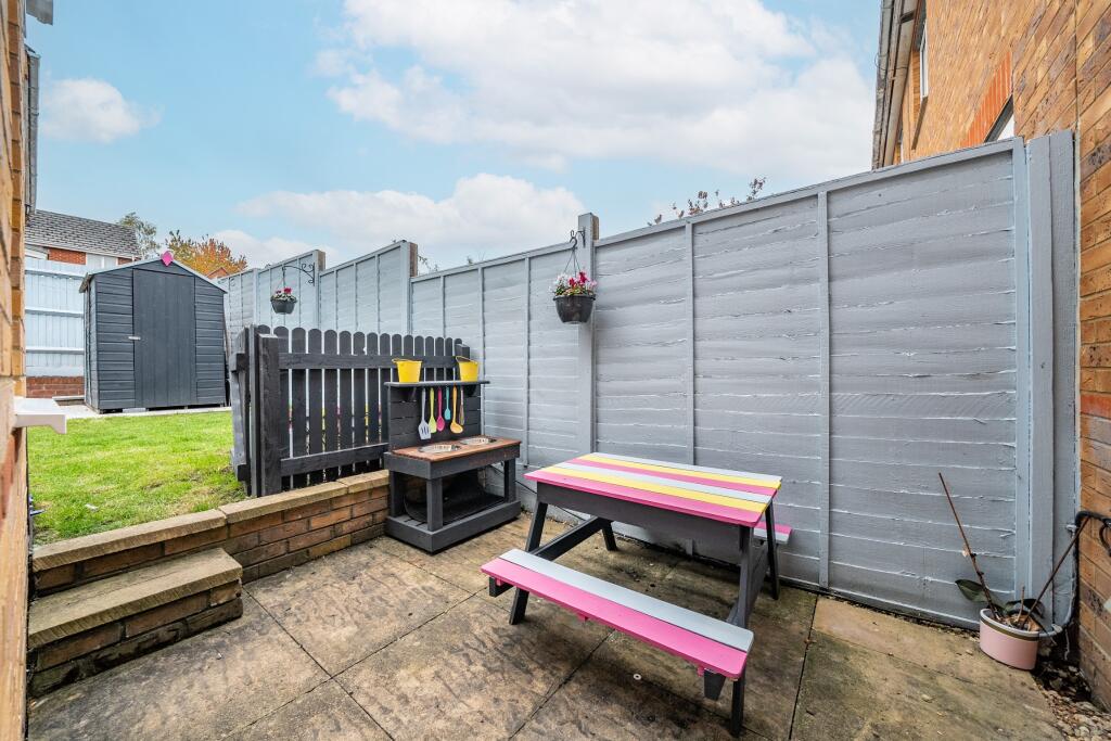
- yard and house exterior Modern Suburban
Floorplan Description
- Two-storey residential property with three bedrooms and open sitting/dining area.
Rooms
- Dining Room:
- Sitting Room:
- Kitchen:
- Bedroom 2:
- Bedroom 3:
- Bedroom 1:
Textual Property Features
Detected Visual Features
- semi-detached
- modern
- driveway
- brick exterior
- two-story
- double glazed windows
- well-maintained
- suburban
- family home
- brick
- backyard
- patio
- garden
- shed
- landscaped
EPC Details
- Fully double glazed
- Cavity wall, as built, insulated (assumed)
- Boiler and radiators, mains gas
- Low energy lighting in 67% of fixed outlets
- Solid, limited insulation (assumed)
Nearby Schools
- Wherwell Primary School
- Anton Junior School
- Balksbury Junior School
- Vigo Primary School
- Knights Enham Nursery and Infant School
- Knight's Enham Junior School
- Farleigh School
- John Hanson Community School
- Rookwood School
- Andover Church of England Primary School
- Portway Junior School
- Harrow Way Community School
- Clatford Church of England Primary School
- Anton Infant School
- Balksbury Infant School
- Pilgrims' Cross CofE Aided Primary School
- Roman Way Primary School
- Appleshaw St Peter's CofE Primary School
- Hurstbourne Tarrant Church of England Primary School
- Abbotts Ann Church of England Primary School
- St John the Baptist Catholic Primary School, Andover
- Winton Community Academy
- Portway Infant School
- Endeavour Primary School
- Smannell and Enham Church of England (Aided) Primary School
Nearest Bars And Restaurants
- Id: 6934673261
- Tags:
- Addr:
- City: Andover
- Housenumber: 1b
- Postcode: SP10 3HJ
- Street: Mylen Road
- Amenity: restaurant
- Brand: Pizza Hut
- Brand:wikidata: Q191615
- Brand:wikipedia: en:Pizza Hut
- Cuisine: pizza
- Name: Pizza Hut
- TagsNormalized:
- restaurant
- pizza
- pizza hut
- hut
- Lat: 51.2138184
- Lon: -1.4945083
- FullGeoHash: gcngmgpwp7ty
- PartitionGeoHash: gcng
- Images:
- FoodStandards: null
- Distance: 812.4
,- Id: 4368489194
- Tags:
- Amenity: fast_food
- Cuisine: chinese
- Name: Tip-Top Fish & Chips and Chinese Takeaway
- Takeaway: only
- TagsNormalized:
- fast food
- food
- chinese
- fish
- takeaway
- Lat: 51.2222259
- Lon: -1.4799737
- FullGeoHash: gcngqkdr44gx
- PartitionGeoHash: gcng
- Images:
- FoodStandards: null
- Distance: 753.9
,- Id: 4368489193
- Tags:
- Amenity: restaurant
- Cuisine: indian
- Name: Andover Tandoori take-away
- Takeaway: only
- TagsNormalized:
- restaurant
- indian
- tandoori
- takeaway
- Lat: 51.2222304
- Lon: -1.4803311
- FullGeoHash: gcngqkdp1gc4
- PartitionGeoHash: gcng
- Images:
- FoodStandards: null
- Distance: 729.8
,- Id: 735962468
- Tags:
- Amenity: pub
- Name: The Merlin
- Note: Previously "The Entertainer"
- TagsNormalized:
- Lat: 51.2221907
- Lon: -1.4806057
- FullGeoHash: gcngqk9ygkkm
- PartitionGeoHash: gcng
- Images:
- FoodStandards: null
- Distance: 710.2
,- Id: 813856845
- Tags:
- Amenity: pub
- Name: The Royal Oak
- TagsNormalized:
- Lat: 51.2202575
- Lon: -1.4985074
- FullGeoHash: gcngmukgdhpc
- PartitionGeoHash: gcng
- Images:
- FoodStandards: null
- Distance: 558.7
}
Nearest General Shops
- Id: 8265678994
- Tags:
- Brand: B&M
- Brand:wikidata: Q4836931
- Brand:wikipedia: en:B&M
- Contact:
- Website: https://www.bmstores.co.uk/stores/andover-689
- Name: B&M
- Operator: B&M
- Shop: variety_store
- TagsNormalized:
- Lat: 51.2170734
- Lon: -1.4781861
- FullGeoHash: gcngq7g95f2x
- PartitionGeoHash: gcng
- Images:
- FoodStandards: null
- Distance: 947.8
,- Id: 2043051220
- Tags:
- TagsNormalized:
- Lat: 51.2122383
- Lon: -1.4900555
- FullGeoHash: gcngq4fuzjnh
- PartitionGeoHash: gcng
- Images:
- FoodStandards: null
- Distance: 939.5
,- Id: 6934673260
- Tags:
- Addr:
- City: Andover
- Housenumber: 63c
- Postcode: SP10 3JY
- Street: Charlton Road
- Name: Raggos Barbering Studio
- Payment:
- Shop: hairdresser
- TagsNormalized:
- barber
- studio
- hairdresser
- shop
- Lat: 51.213922
- Lon: -1.4942402
- FullGeoHash: gcngmgpytxjb
- PartitionGeoHash: gcng
- Images:
- FoodStandards: null
- Distance: 795.3
}
Nearest Grocery shops
- Id: 7129361119
- Tags:
- Shop: convenience
- Source: seen from road
- TagsNormalized:
- Lat: 51.22045
- Lon: -1.498569
- FullGeoHash: gcngmuku8zcv
- PartitionGeoHash: gcng
- Images:
- FoodStandards: null
- Distance: 561.5
,- Id: 9392748479
- Tags:
- Addr:
- Housenumber: 26
- Postcode: SP10 4AJ
- Street: Charlton Road
- Brand: Tesco Express
- Brand:wikidata: Q98456772
- Contact:
- Website: https://www.tesco.com/store-locator/andover/26-charlton-rd
- Fhrs:
- Name: Tesco Express
- Shop: convenience
- TagsNormalized:
- tesco
- tesco express
- convenience
- shop
- Lat: 51.2194479
- Lon: -1.4977281
- FullGeoHash: gcngmujqumhg
- PartitionGeoHash: gcng
- Images:
- FoodStandards:
- Id: 23064
- FHRSID: 23064
- LocalAuthorityBusinessID: 07/00478/FOOD
- BusinessName: Tesco Express
- BusinessType: Retailers - supermarkets/hypermarkets
- BusinessTypeID: 7840
- AddressLine1: Tesco
- AddressLine2: 26 Charlton
- AddressLine3: Andover
- AddressLine4: Hampshire
- PostCode: SP10 4AJ
- RatingValue: 5
- RatingKey: fhrs_5_en-GB
- RatingDate: 2022-11-18
- LocalAuthorityCode: 142
- LocalAuthorityName: Test Valley
- LocalAuthorityWebSite: http://www.testvalley.gov.uk/
- LocalAuthorityEmailAddress: envhealth@testvalley.gov.uk
- Scores:
- Hygiene: 0
- Structural: 0
- ConfidenceInManagement: 0
- NewRatingPending: false
- Geocode:
- Longitude: -1.49779900000000
- Latitude: 51.21947300000000
- Distance: 520.8
,- Id: 735957541
- Tags:
- Name: Saxon Fields Stores
- Odbl: clean
- Shop: convenience
- TagsNormalized:
- Lat: 51.2246438
- Lon: -1.4895852
- FullGeoHash: gcngqj5m4jsy
- PartitionGeoHash: gcng
- Images:
- FoodStandards: null
- Distance: 445.2
}
Nearest Religious buildings
- Id: 152932817
- Tags:
- Addr:
- City: Andover
- Housename: Kingdom Hall
- Postcode: SP10 1DX
- Street: River Way
- Amenity: place_of_worship
- Building: yes
- Contact:
- Denomination: jehovahs_witness
- Name: Kingdom Hall of Jehovah's Witnesses
- Religion: christian
- TagsNormalized:
- place of worship
- jehovah
- jehovahs witness
- christian
- church
- Lat: 51.2179278
- Lon: -1.4753855
- FullGeoHash: gcngq7vwj1bb
- PartitionGeoHash: gcng
- Images:
- FoodStandards: null
- Distance: 1097.3
,- Id: 153078599
- Tags:
- Amenity: place_of_worship
- Building: church
- Denomination: baptist
- Name: Andover Baptist Church
- Religion: christian
- Source: Bing
- TagsNormalized:
- place of worship
- church
- baptist
- christian
- Lat: 51.2123995
- Lon: -1.4865373
- FullGeoHash: gcngq4vtc5jq
- PartitionGeoHash: gcng
- Images:
- FoodStandards: null
- Distance: 961.8
,- Id: 255975490
- Tags:
- Amenity: place_of_worship
- Building: church
- Denomination: anglican
- Name: St Thomas
- Religion: christian
- Wikidata: Q105104405
- TagsNormalized:
- place of worship
- church
- anglican
- christian
- Lat: 51.22144
- Lon: -1.4988933
- FullGeoHash: gcngmusd922p
- PartitionGeoHash: gcng
- Images:
- FoodStandards: null
- Distance: 589.6
}
Nearest Medical buildings
- Id: 264443678
- Tags:
- Amenity: doctors
- Building: hospital
- Name: Andover Health Centre
- Opening_hours: Mo 7:30-19:00; Tu-Fr 7:30-18:15
- Wheelchair: yes
- TagsNormalized:
- doctor
- doctors
- hospital
- health
- health centre
- Lat: 51.2150841
- Lon: -1.4954622
- FullGeoHash: gcngmgrj3pws
- PartitionGeoHash: gcng
- Images:
- FoodStandards: null
- Distance: 711.5
,- Id: 106869277
- Tags:
- Amenity: doctors
- Building: yes
- Name: Charlton Hill Surgery
- TagsNormalized:
- Lat: 51.21604
- Lon: -1.4961691
- FullGeoHash: gcngmgwe09z6
- PartitionGeoHash: gcng
- Images:
- FoodStandards: null
- Distance: 649.3
,- Id: 688156267
- Tags:
- Addr:
- City: Andover
- Postcode: SP10 3LB
- Street: Charlton Road
- Amenity: hospital
- Emergency: no
- Name: Andover War Memorial Hospital
- Operator: Hampshire Hospitals NHS Foundation Trust
- Phone: +44 1264 358 811
- Wikidata: Q23926537
- TagsNormalized:
- Lat: 51.2155631
- Lon: -1.494556
- FullGeoHash: gcngmgx8q2fq
- PartitionGeoHash: gcng
- Images:
- FoodStandards: null
- Distance: 635
,- Id: 176331601
- Tags:
- Amenity: hospital
- Emergency: no
- Name: Andover Hospital (Grounds)
- Source: Bing
- TagsNormalized:
- Lat: 51.2155051
- Lon: -1.4943192
- FullGeoHash: gcngmgrzgy4u
- PartitionGeoHash: gcng
- Images:
- FoodStandards: null
- Distance: 633.8
}
Nearest Leisure Facilities
- Id: 723125593
- Tags:
- Hoops: 2
- Leisure: pitch
- Sport: basketball
- TagsNormalized:
- pitch
- leisure
- basketball
- sports
- Lat: 51.2220617
- Lon: -1.4847821
- FullGeoHash: gcngqhwy4h65
- PartitionGeoHash: gcng
- Images:
- FoodStandards: null
- Distance: 427.7
,- Id: 732676084
- Tags:
- TagsNormalized:
- Lat: 51.2186581
- Lon: -1.486127
- FullGeoHash: gcngqhjf69zk
- PartitionGeoHash: gcng
- Images:
- FoodStandards: null
- Distance: 379.5
,- Id: 723138241
- Tags:
- TagsNormalized:
- Lat: 51.2187465
- Lon: -1.4862243
- FullGeoHash: gcngqhjfb6qg
- PartitionGeoHash: gcng
- Images:
- FoodStandards: null
- Distance: 368.3
,- Id: 194116475
- Tags:
- TagsNormalized:
- Lat: 51.2237557
- Lon: -1.4897915
- FullGeoHash: gcngqj50j24u
- PartitionGeoHash: gcng
- Images:
- FoodStandards: null
- Distance: 345.4
,- Id: 723140286
- Tags:
- TagsNormalized:
- Lat: 51.2228348
- Lon: -1.4872883
- FullGeoHash: gcngqhufxsmr
- PartitionGeoHash: gcng
- Images:
- FoodStandards: null
- Distance: 328.3
}
Nearest Tourist attractions
- Id: 727693368
- Tags:
- Name: Andover Museum of the Iron Age
- Tourism: museum
- Wikidata: Q85741612
- TagsNormalized:
- Lat: 51.2101259
- Lon: -1.4772992
- FullGeoHash: gcngq6s287mg
- PartitionGeoHash: gcng
- Images:
- FoodStandards: null
- Distance: 1491.7
,- Id: 971624238
- Tags:
- TagsNormalized:
- Lat: 51.2201758
- Lon: -1.5052809
- FullGeoHash: gcngmsrghkv1
- PartitionGeoHash: gcng
- Images:
- FoodStandards: null
- Distance: 1029.9
,- Id: 971613151
- Tags:
- TagsNormalized:
- Lat: 51.2199933
- Lon: -1.5051872
- FullGeoHash: gcngmsrfndg1
- PartitionGeoHash: gcng
- Images:
- FoodStandards: null
- Distance: 1024.7
}
Nearest Hotels
- Id: 597396026
- Tags:
- Brand: Premier Inn
- Brand:wikidata: Q2108626
- Internet_access: wlan
- Internet_access:fee: customers
- Internet_access:operator: Virgin Media
- Internet_access:ssid: Premier Inn Free Wi-Fi
- Name: Premier Inn
- Operator: Premier Inn
- Toilets:
- Tourism: hotel
- Wheelchair: yes
- TagsNormalized:
- Lat: 51.212195
- Lon: -1.5169449
- FullGeoHash: gcngm6zkst5f
- PartitionGeoHash: gcng
- Images:
- FoodStandards: null
- Distance: 2068.7
,- Id: 101377153
- Tags:
- Amenity: parking
- Name: Star and Garter Hotel Car Park
- Parking: surface
- TagsNormalized:
- Lat: 51.2066032
- Lon: -1.4783777
- FullGeoHash: gcngq3gkp69w
- PartitionGeoHash: gcng
- Images:
- FoodStandards: null
- Distance: 1779.2
,- Id: 492400037
- Tags:
- Addr:
- City: Andover
- Postcode: SP10 1PD
- Street: High Street
- Name: Star and Garter Hotel
- Operator: citylodge
- Toilets:
- Tourism: hotel
- Url: http://citylodge.co.uk/andover/contact/
- Wheelchair: yes
- Wikidata: Q17535455
- TagsNormalized:
- Lat: 51.2065235
- Lon: -1.4787371
- FullGeoHash: gcngq3g5wgvd
- PartitionGeoHash: gcng
- Images:
- FoodStandards: null
- Distance: 1775.3
}
Tags
- semi-detached
- modern
- driveway
- brick exterior
- two-story
- double glazed windows
- well-maintained
- suburban
- family home
- modern
- suburban
- semi-detached
- brick
- backyard
- patio
- garden
- shed
- landscaped
- family home
Local Market Stats
- Average Price/sqft: £312
- Avg Income: £54400
- Rental Yield: 4.7%
- Social Housing: 16%
- Planning Success Rate: 83%
AirBnB Data
- 1km average: £81/night
- Listings in 1km: 1
Similar Properties
 3 bedroom terraced house for sale in Launcelot Close, Andover, SP10 4BY, SP10 — £235,000 • 3 bed • 1 bath • 861 ft²
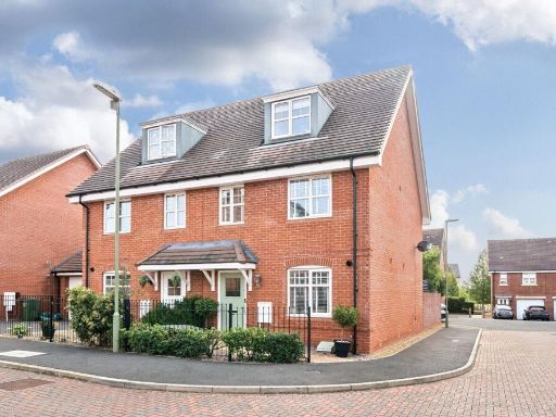 3 bedroom semi-detached house for sale in Arena Close, Andover, SP11 6YD, SP11 — £390,000 • 3 bed • 2 bath • 1150 ft²
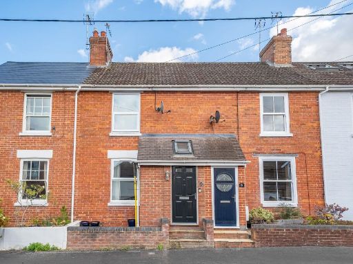 3 bedroom terraced house for sale in Leigh Road, Andover, SP10 2AS, SP10 — £315,000 • 3 bed • 1 bath • 1000 ft²
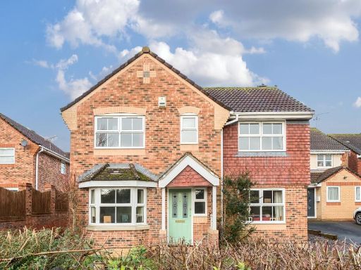 3 bedroom detached house for sale in Andeferas Road, Andover, SP10 — £385,000 • 3 bed • 2 bath • 969 ft²
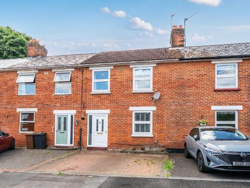 3 bedroom terraced house for sale in Leicester Place, Andover, SP10 — £270,000 • 3 bed • 1 bath • 832 ft²
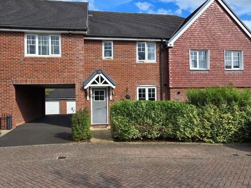 3 bedroom terraced house for sale in Hampton Road, Andover, SP11 — £325,000 • 3 bed • 2 bath • 788 ft²
Meta
- {
"@context": "https://schema.org",
"@type": "Residence",
"name": "3 bedroom end of terrace house for sale in St Alphege Garde…",
"description": "",
"url": "https://propertypiper.co.uk/property/064af8ac-19e1-4de5-93be-5d923b97a37b",
"image": "https://image-a.propertypiper.co.uk/f7e3f8e6-51c6-436a-b930-f09ce070d19b-1024.jpeg",
"address": {
"@type": "PostalAddress",
"streetAddress": "3 ST ALPHEGE GARDENS ANDOVER",
"postalCode": "SP10 4NZ",
"addressLocality": "Test Valley",
"addressRegion": "North West Hampshire",
"addressCountry": "England"
},
"geo": {
"@type": "GeoCoordinates",
"latitude": 51.220682544450625,
"longitude": -1.4905144329499835
},
"numberOfRooms": 3,
"numberOfBathroomsTotal": 2,
"floorSize": {
"@type": "QuantitativeValue",
"value": 894,
"unitCode": "FTK"
},
"offers": {
"@type": "Offer",
"price": 340000,
"priceCurrency": "GBP",
"availability": "https://schema.org/InStock"
},
"additionalProperty": [
{
"@type": "PropertyValue",
"name": "Feature",
"value": "semi-detached"
},
{
"@type": "PropertyValue",
"name": "Feature",
"value": "modern"
},
{
"@type": "PropertyValue",
"name": "Feature",
"value": "driveway"
},
{
"@type": "PropertyValue",
"name": "Feature",
"value": "brick exterior"
},
{
"@type": "PropertyValue",
"name": "Feature",
"value": "two-story"
},
{
"@type": "PropertyValue",
"name": "Feature",
"value": "double glazed windows"
},
{
"@type": "PropertyValue",
"name": "Feature",
"value": "well-maintained"
},
{
"@type": "PropertyValue",
"name": "Feature",
"value": "suburban"
},
{
"@type": "PropertyValue",
"name": "Feature",
"value": "family home"
},
{
"@type": "PropertyValue",
"name": "Feature",
"value": "modern"
},
{
"@type": "PropertyValue",
"name": "Feature",
"value": "suburban"
},
{
"@type": "PropertyValue",
"name": "Feature",
"value": "semi-detached"
},
{
"@type": "PropertyValue",
"name": "Feature",
"value": "brick"
},
{
"@type": "PropertyValue",
"name": "Feature",
"value": "backyard"
},
{
"@type": "PropertyValue",
"name": "Feature",
"value": "patio"
},
{
"@type": "PropertyValue",
"name": "Feature",
"value": "garden"
},
{
"@type": "PropertyValue",
"name": "Feature",
"value": "shed"
},
{
"@type": "PropertyValue",
"name": "Feature",
"value": "landscaped"
},
{
"@type": "PropertyValue",
"name": "Feature",
"value": "family home"
}
]
}
High Res Floorplan Images
Compatible Floorplan Images
FloorplanImages Thumbnail