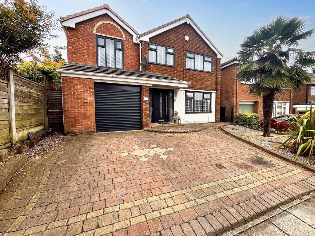
BL9 8BL - 4 bedroom detached house for sale in Gawthorpe Close, Bury,…
View on Property Piper
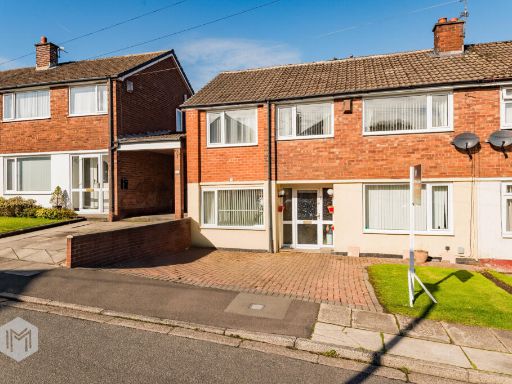
4 bedroom detached house for sale in Gawthorpe Close, Bury, BL9
Property Details
- Price: £485000
- Bedrooms: 4
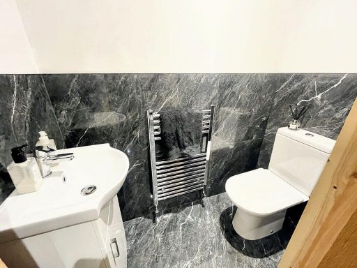
- Bathrooms: 3
- Property Type: undefined
- Property SubType: undefined
Image Descriptions
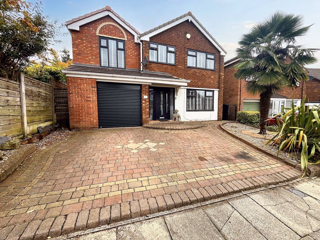
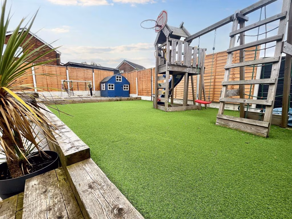
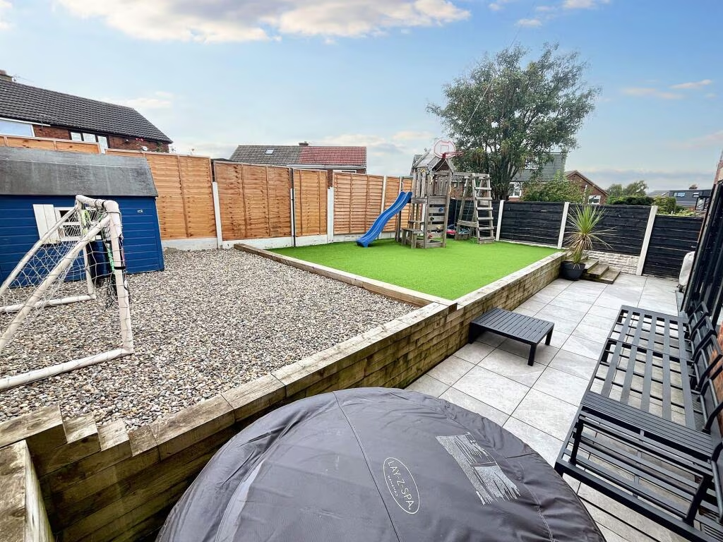
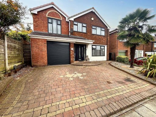
- residential property modern
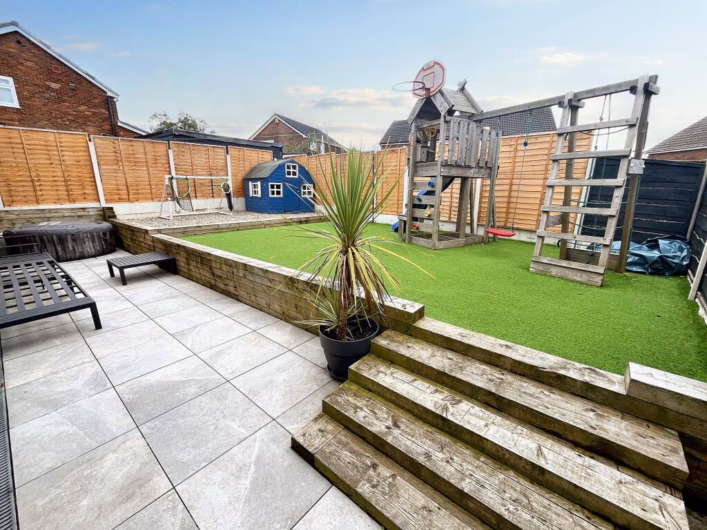
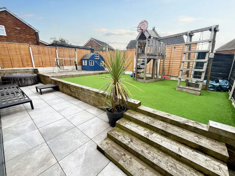
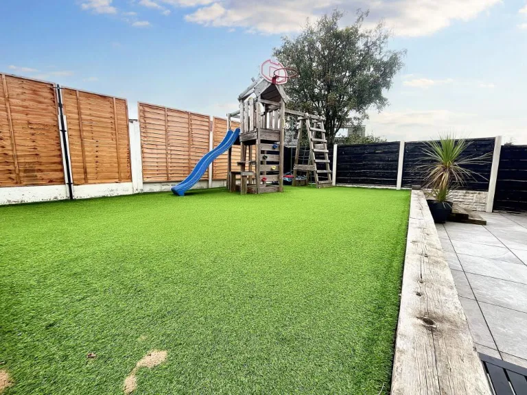
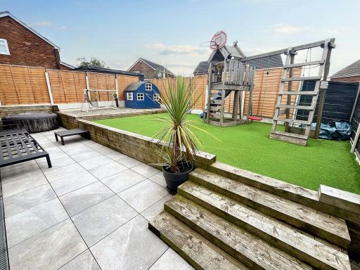
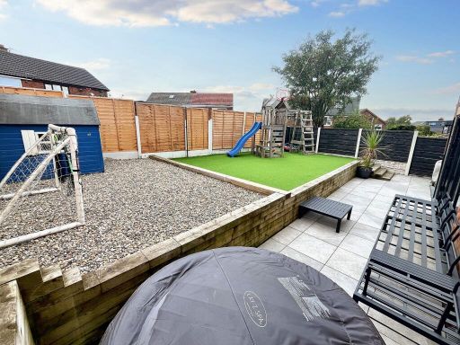
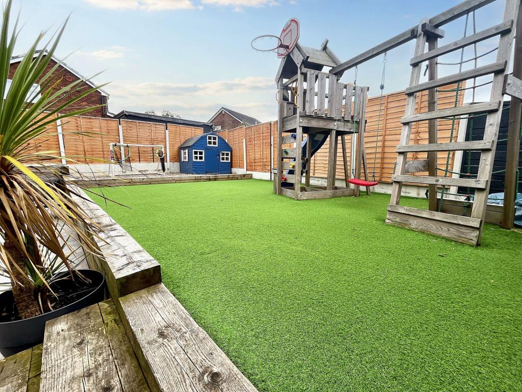
- backyard modern residential
Floorplan Description
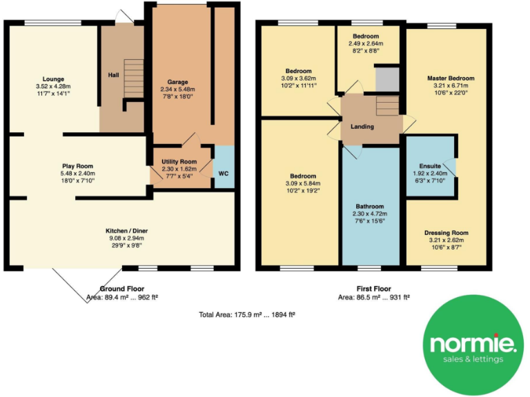
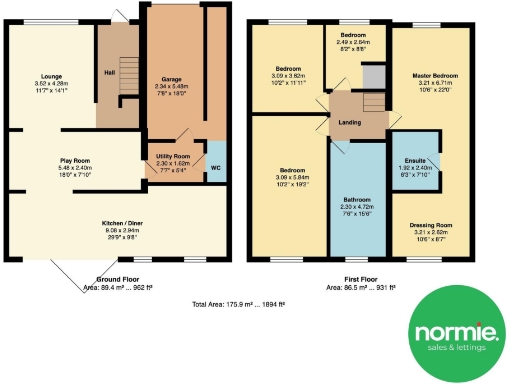
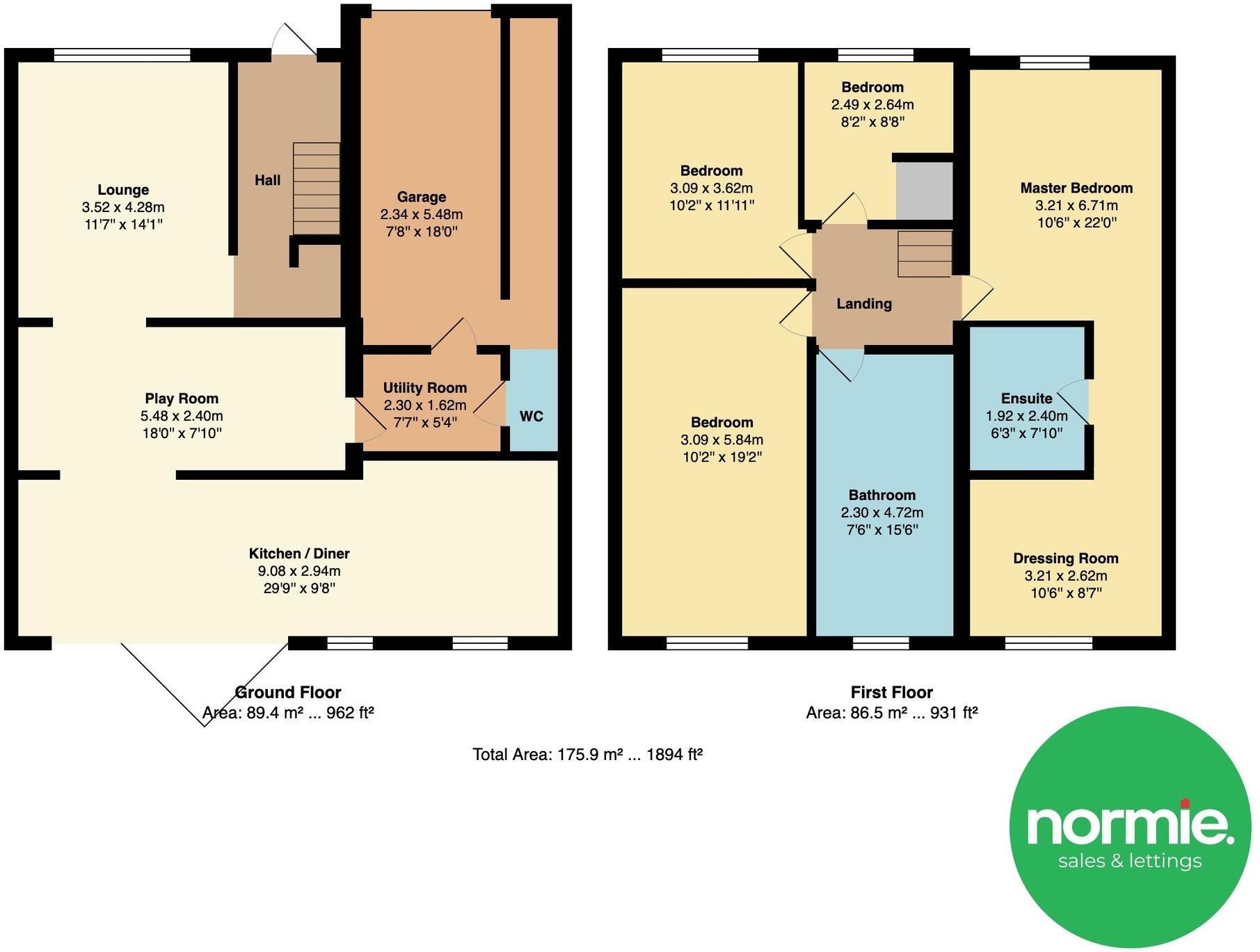
- Floor plan showing ground and first floor rooms with dimensions.
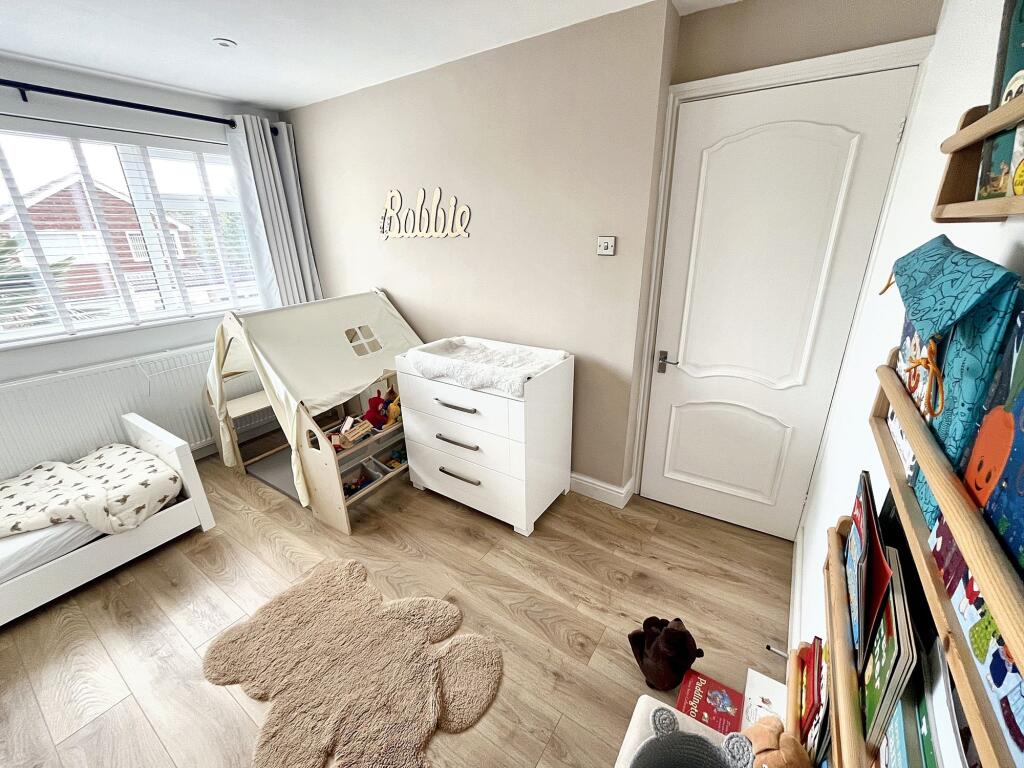
Rooms
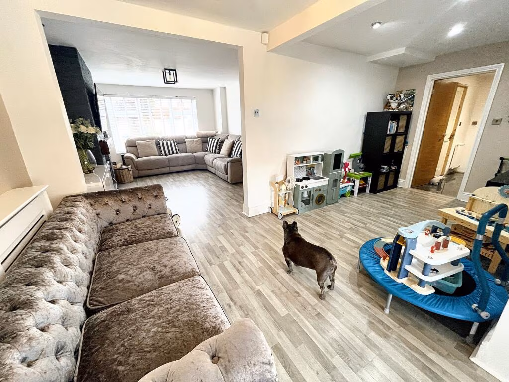
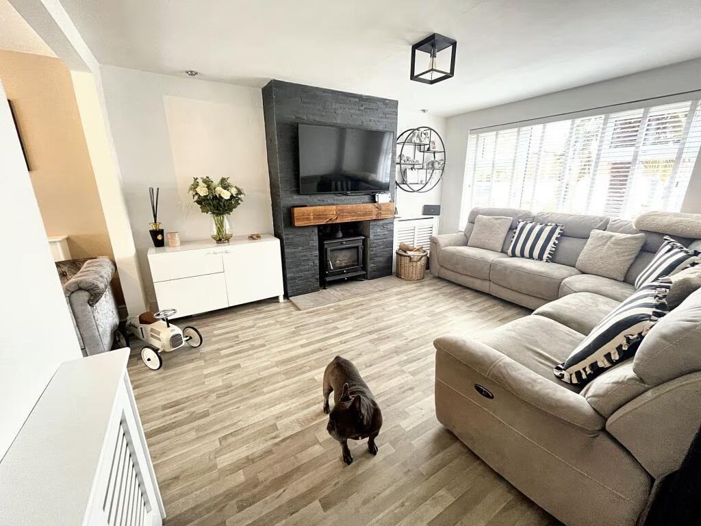
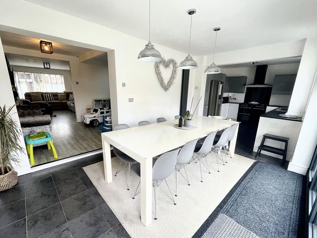
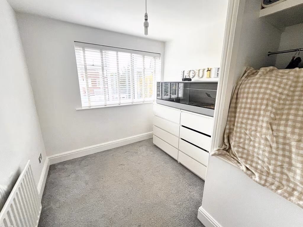
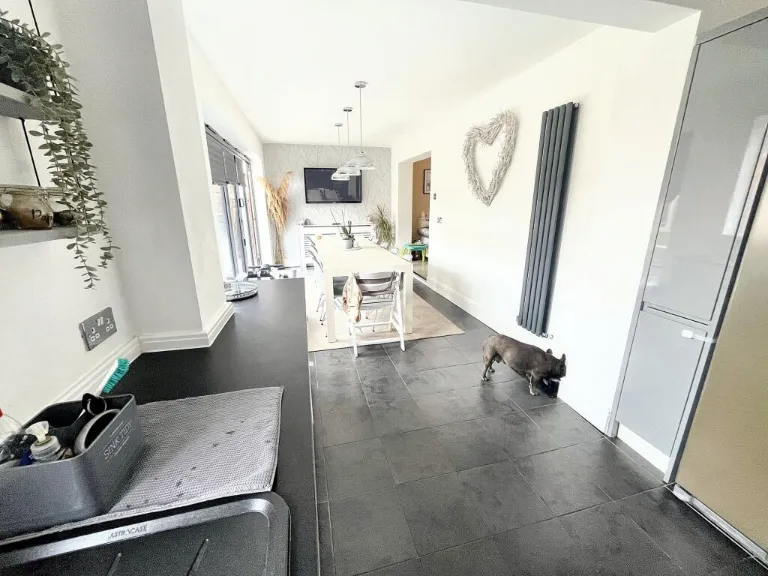
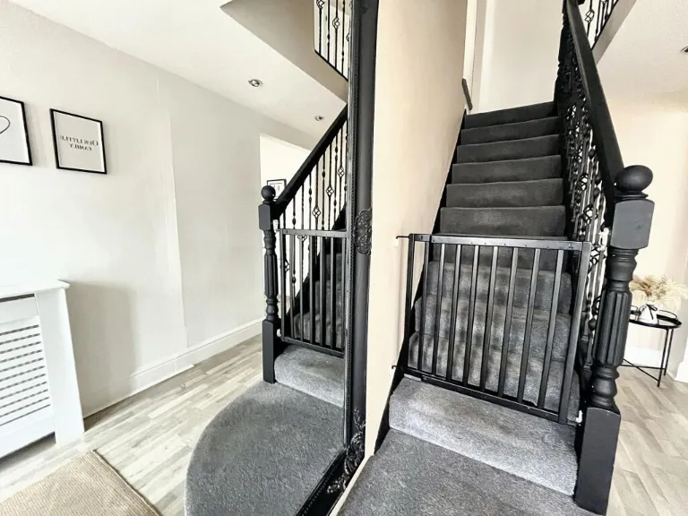
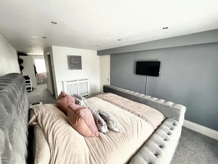
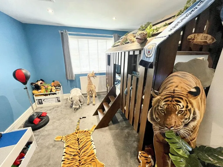
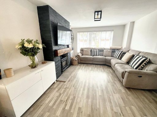
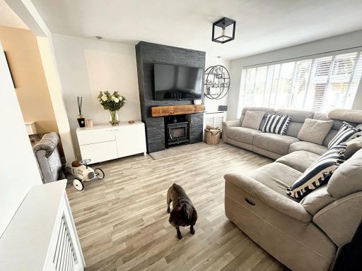
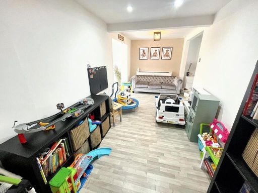
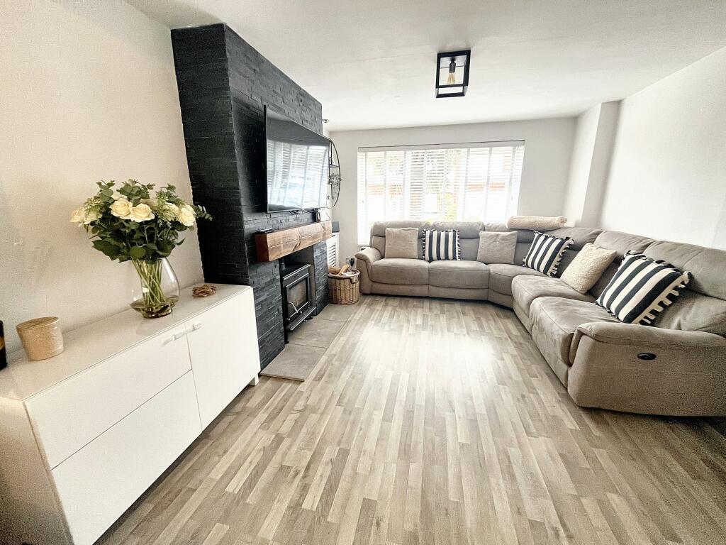
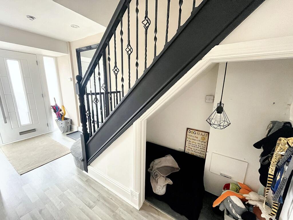
- Lounge:
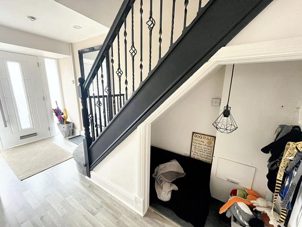
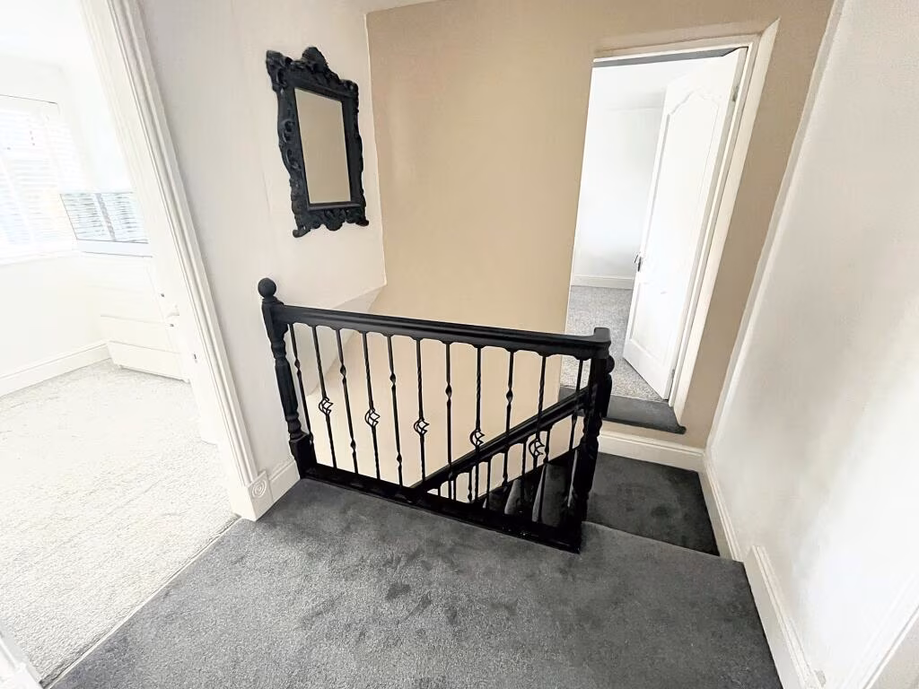
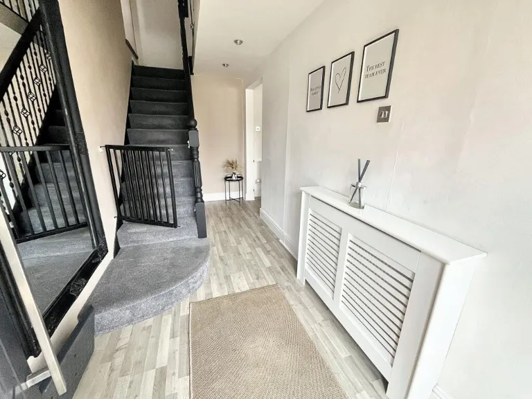
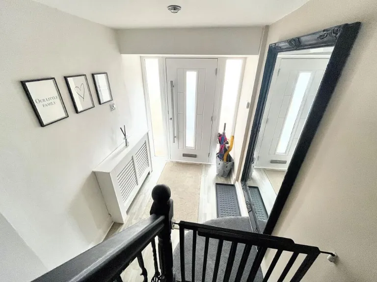
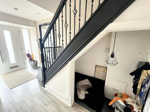
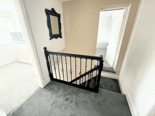
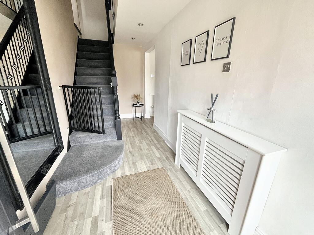
- Hall:
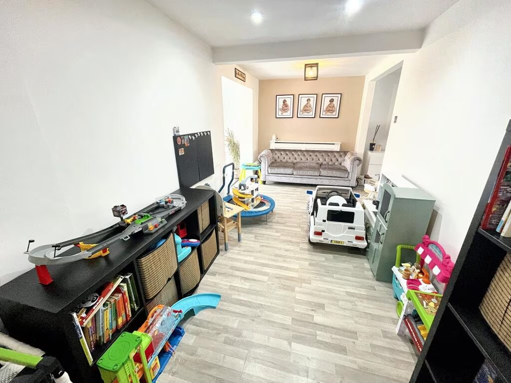
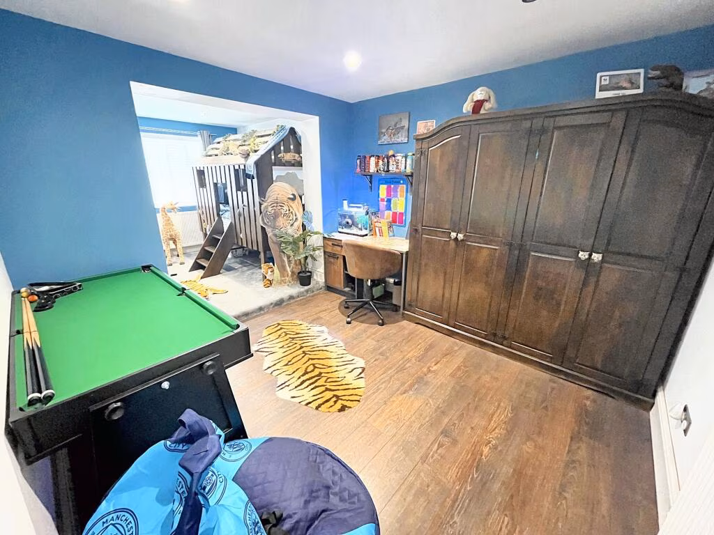
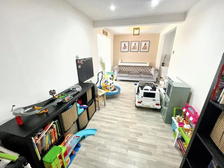
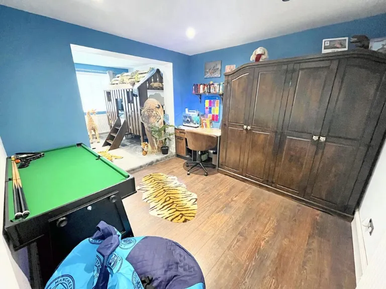
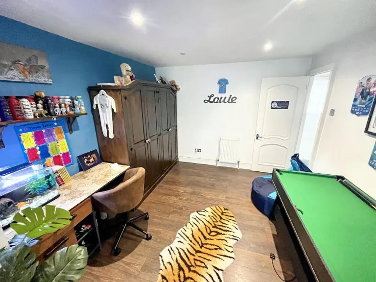
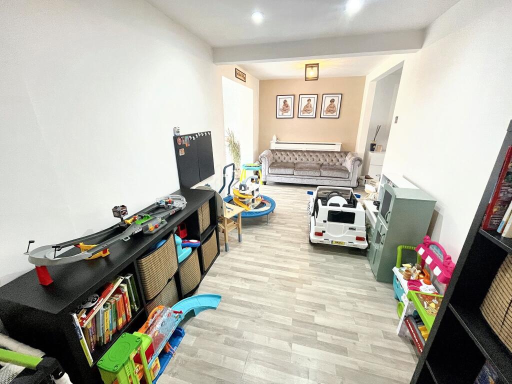
- Play Room:
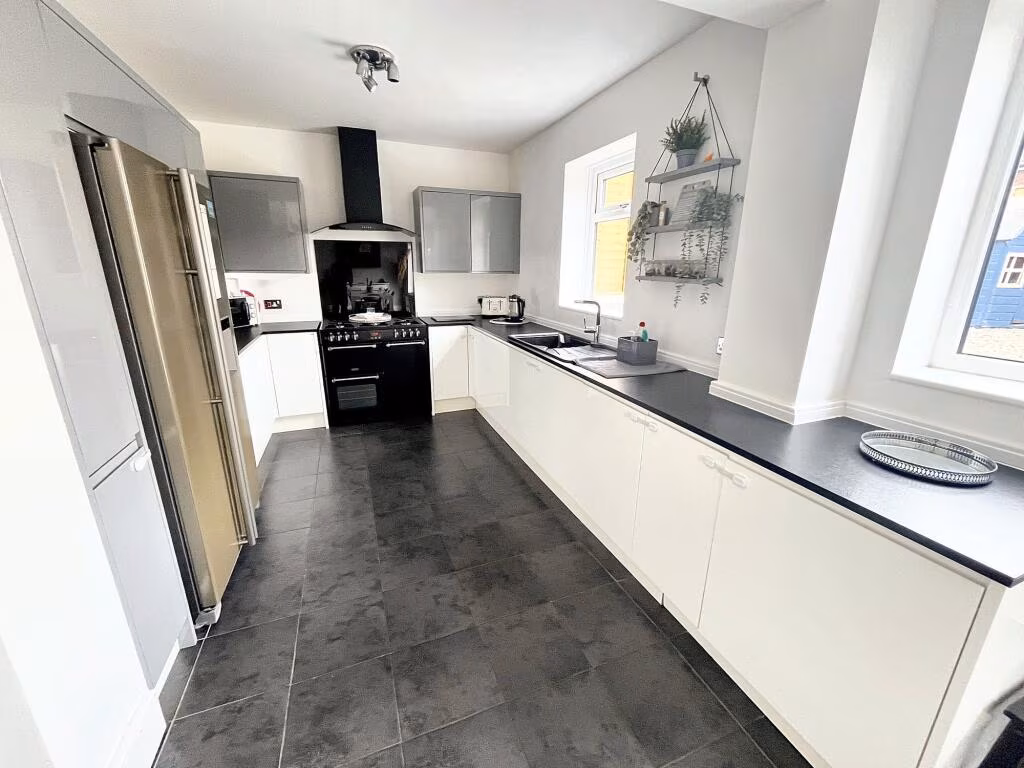
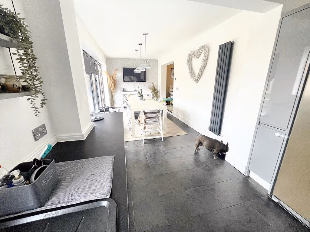
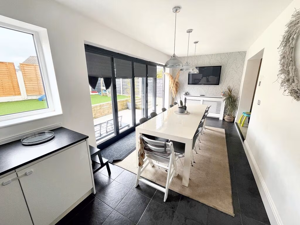
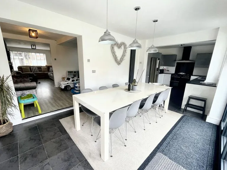
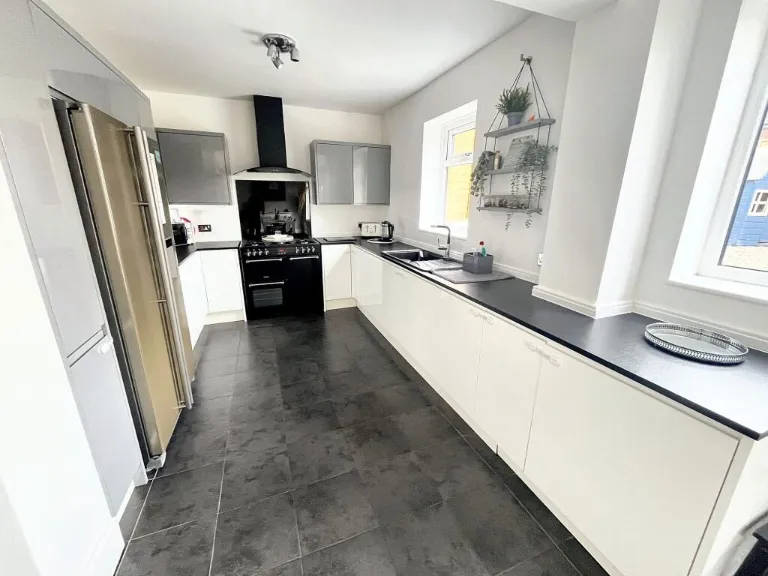
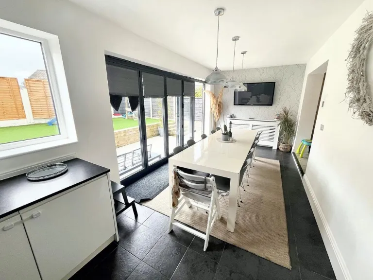
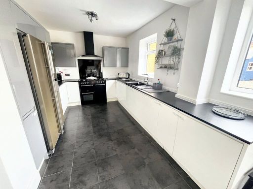
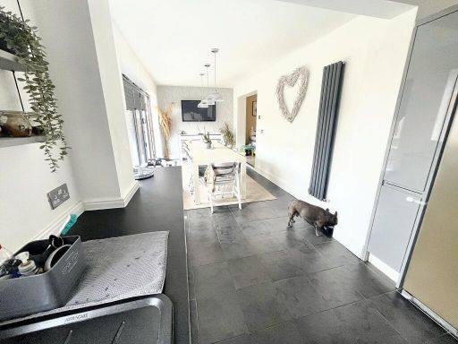
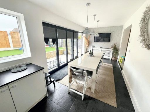
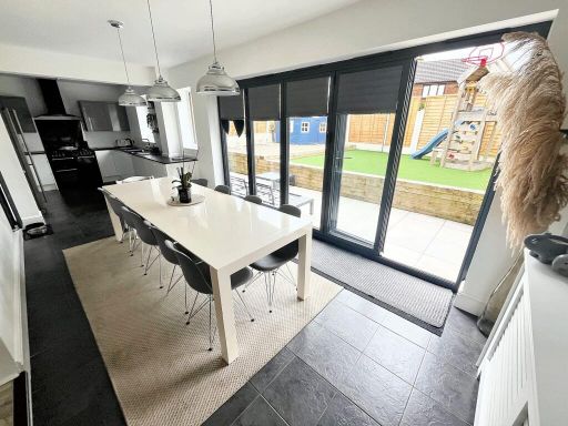
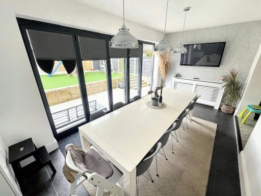
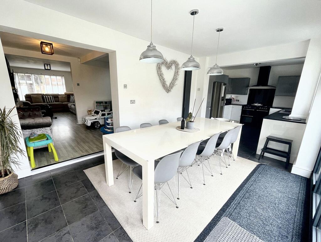
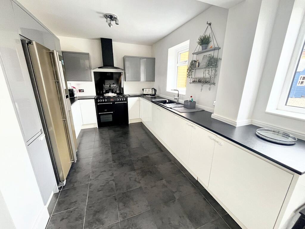
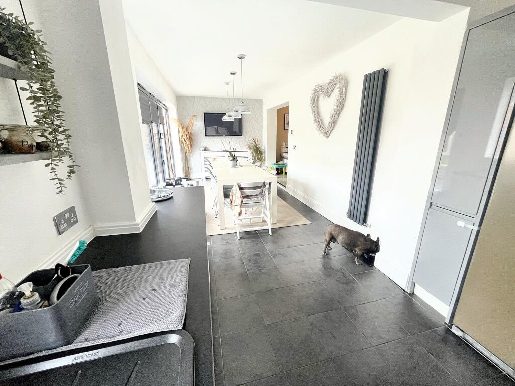
- Kitchen / Diner:
- Garage:
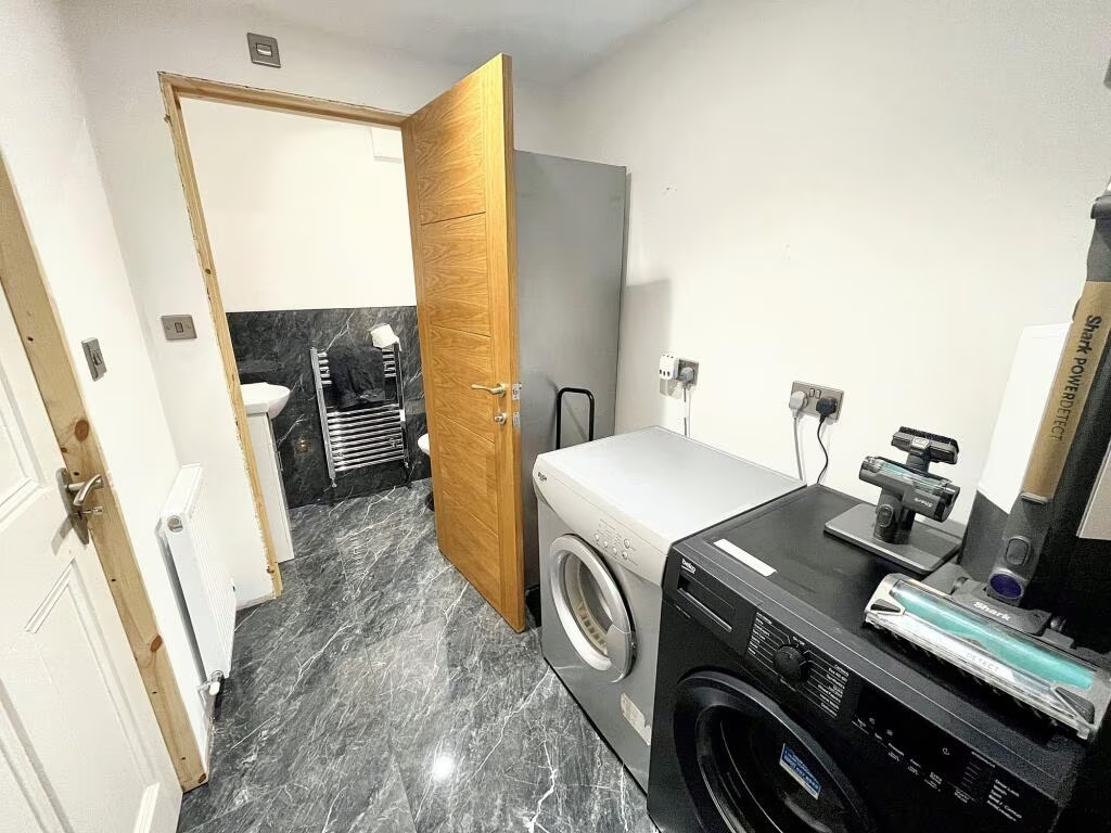
- Utility Room:
- WC:
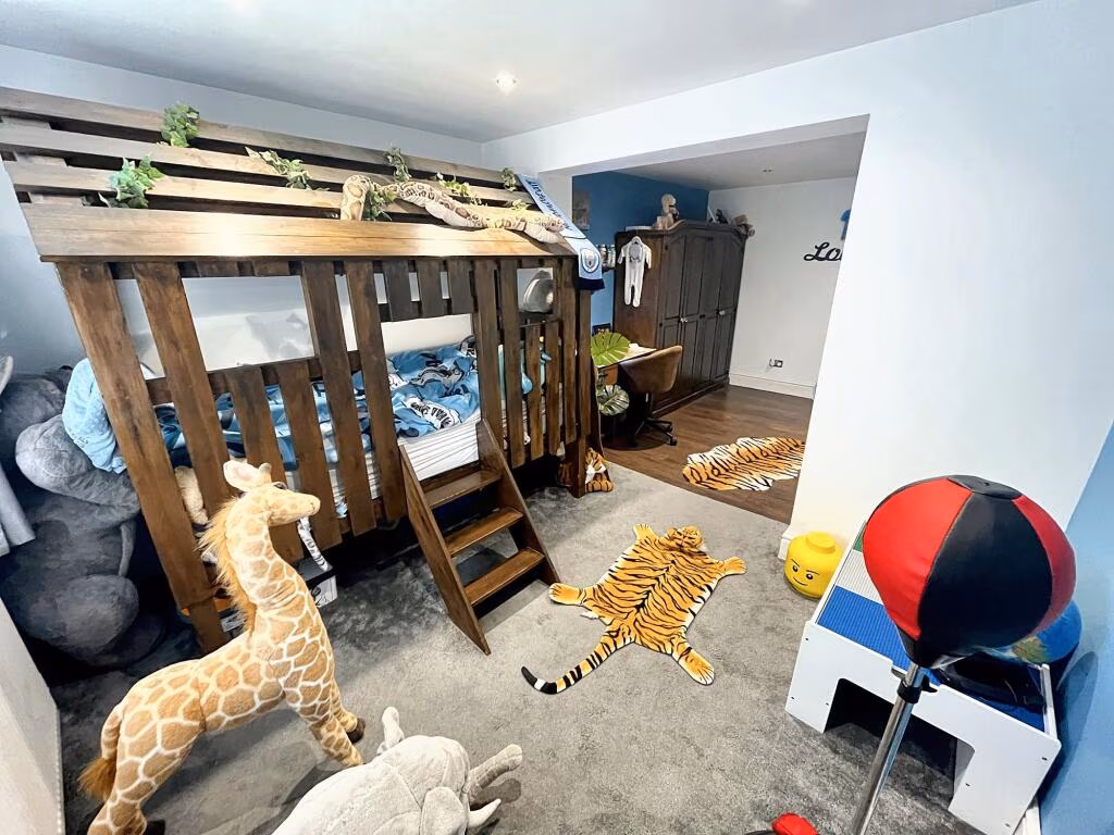
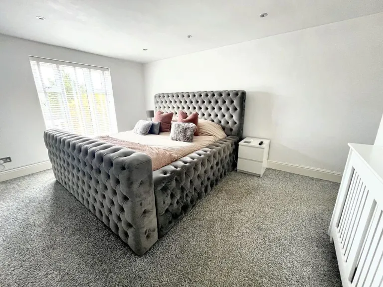
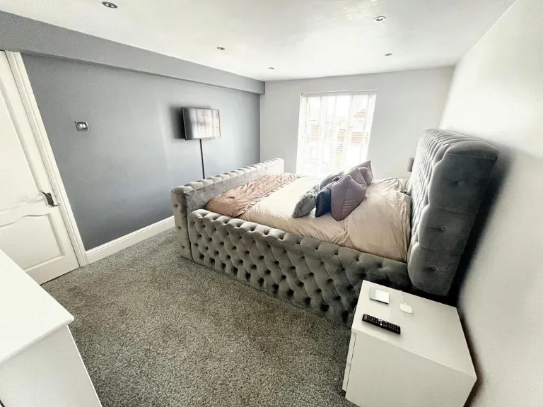
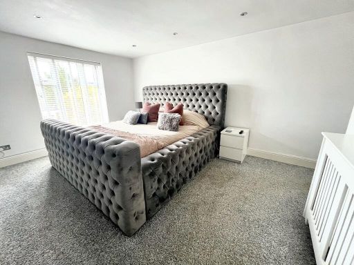
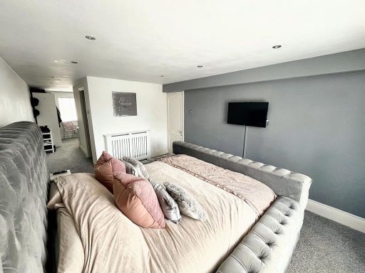
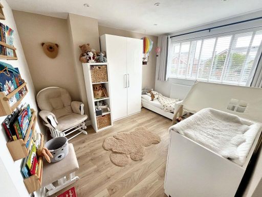
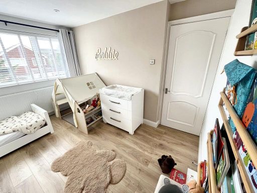
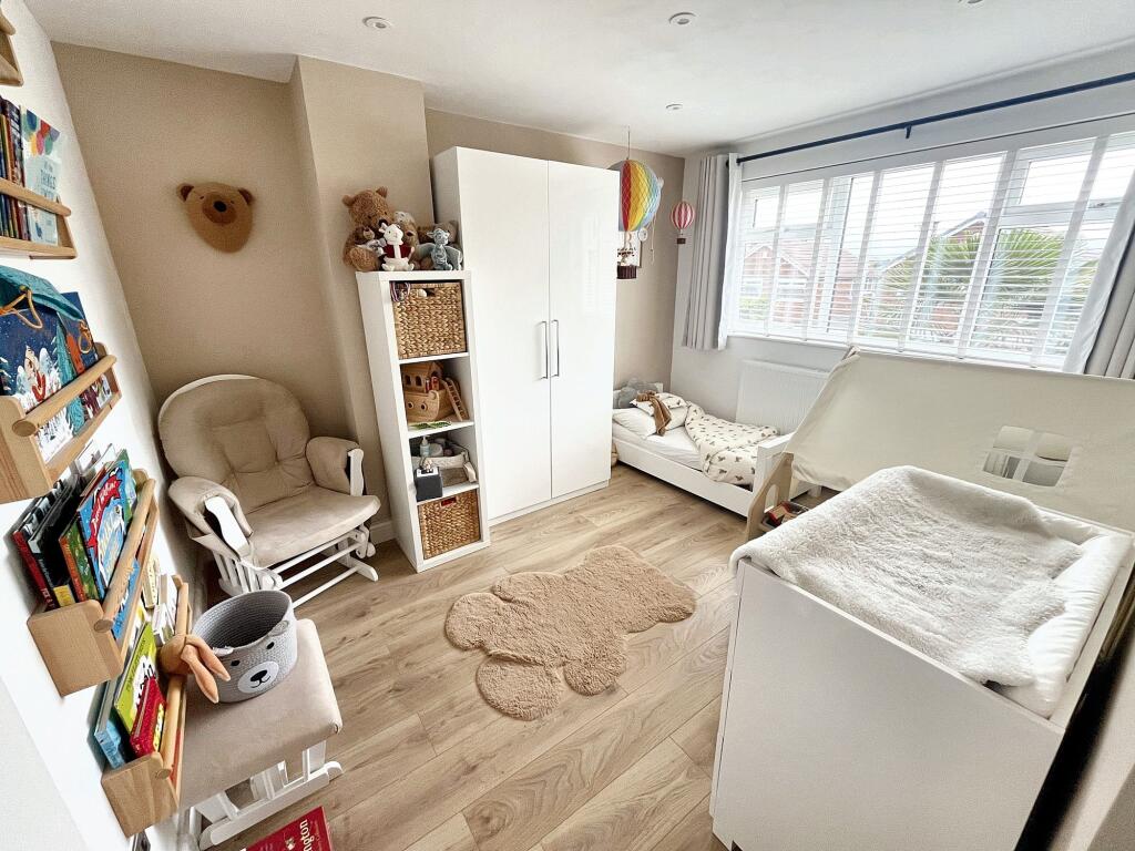
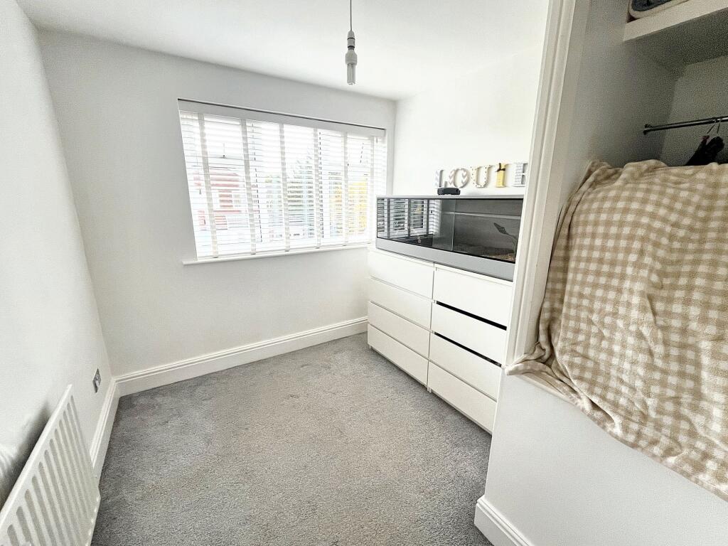
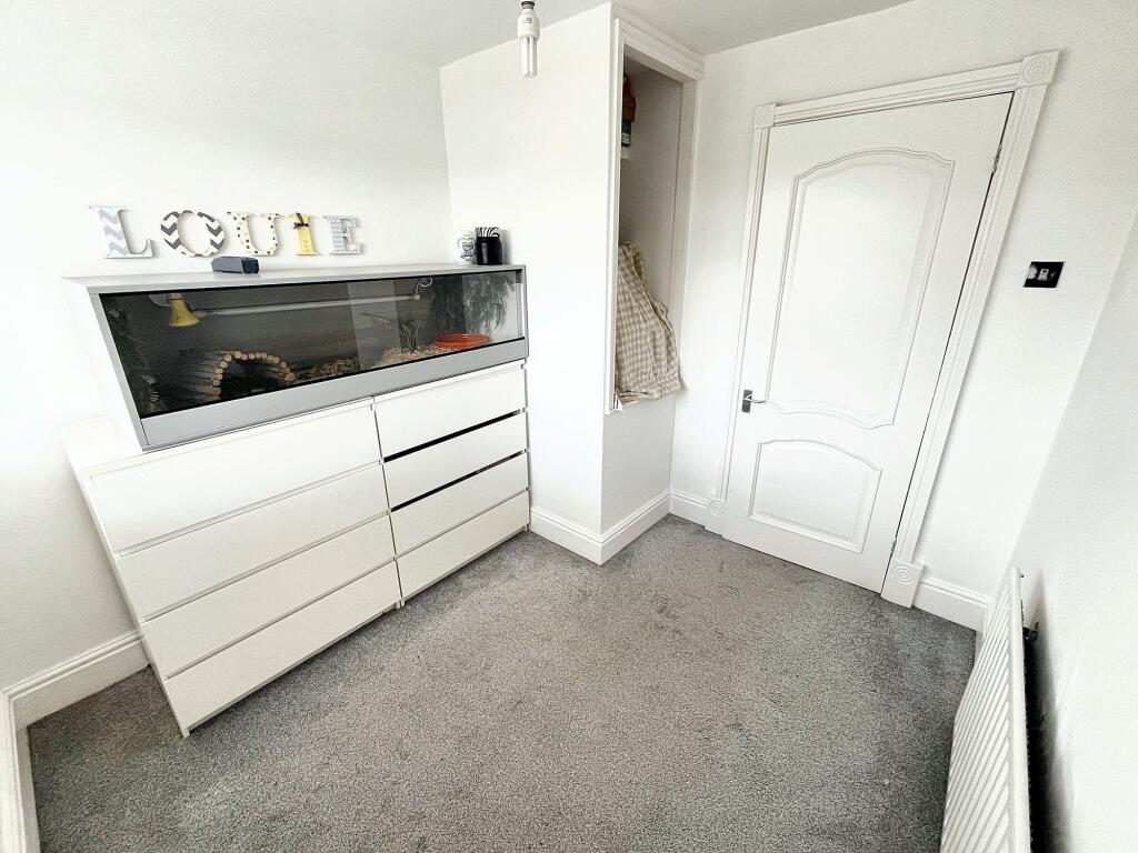
- Bedroom:
- Bedroom:
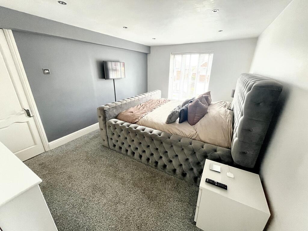
- Master Bedroom:
- Bedroom:
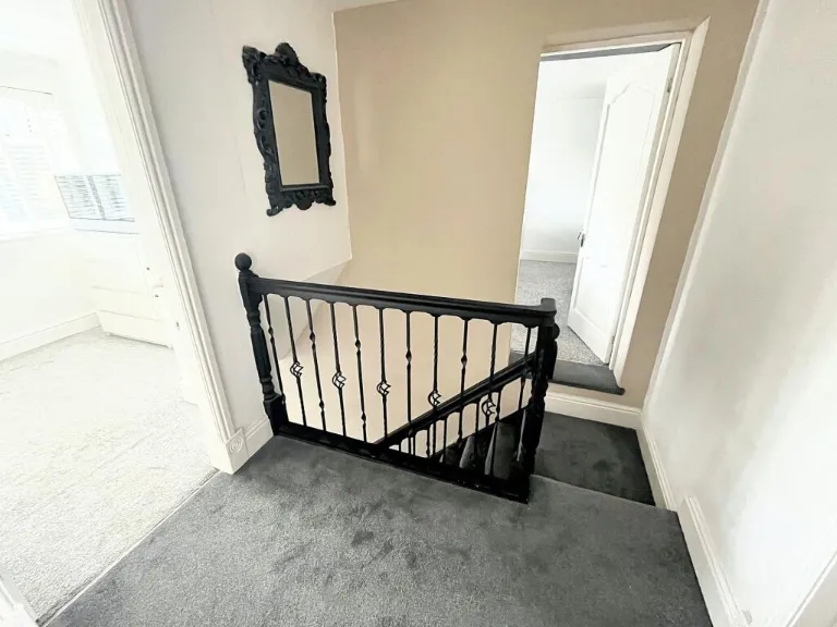
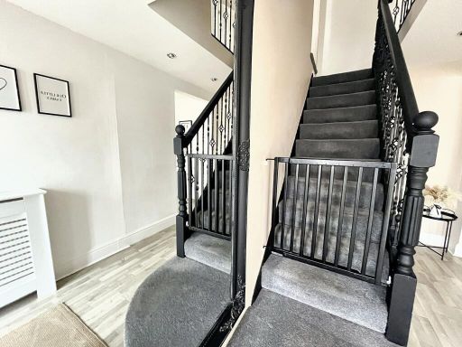
- Landing:
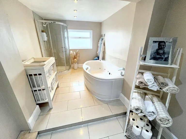
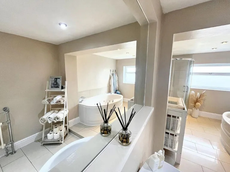
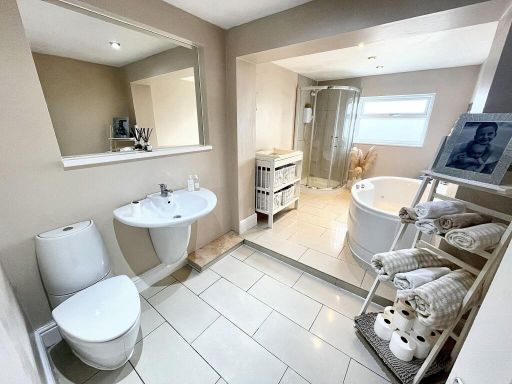
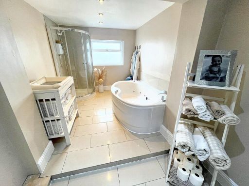
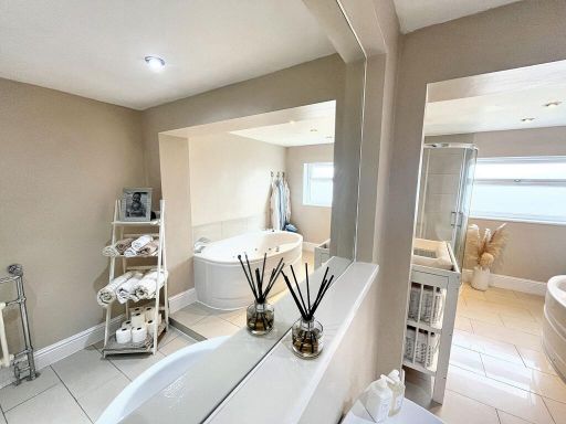
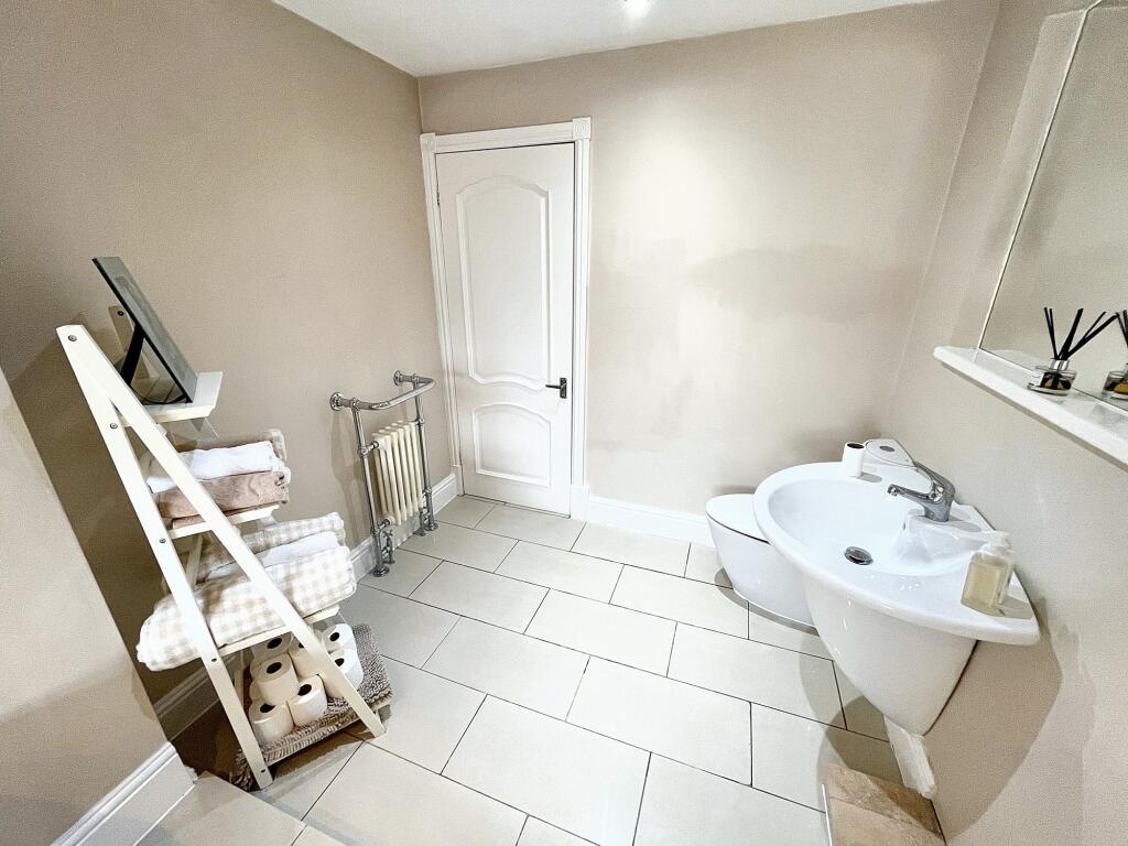
- Ensuite:
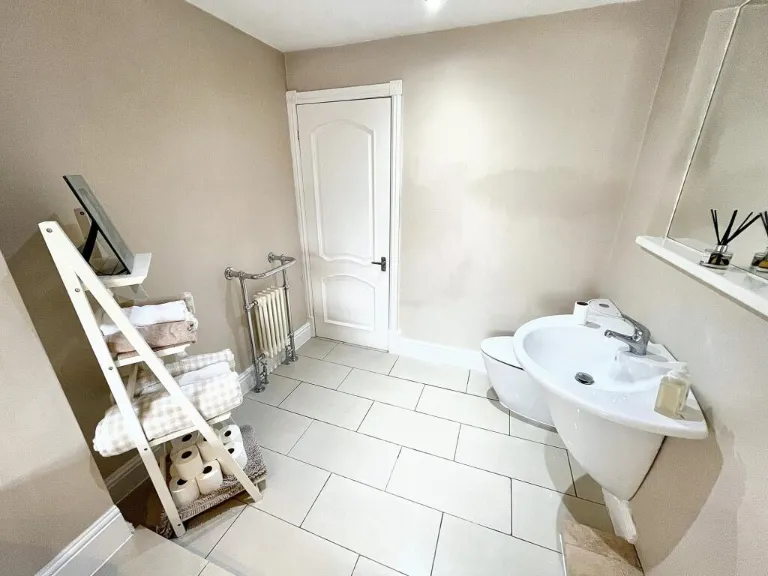
- Bathroom:
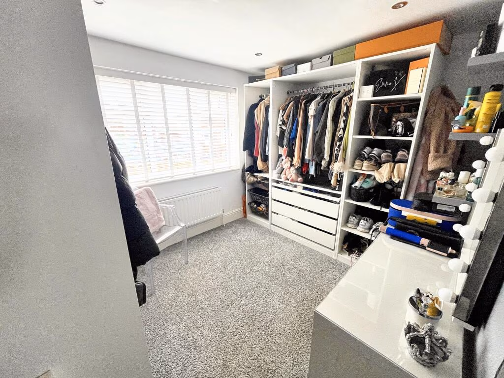
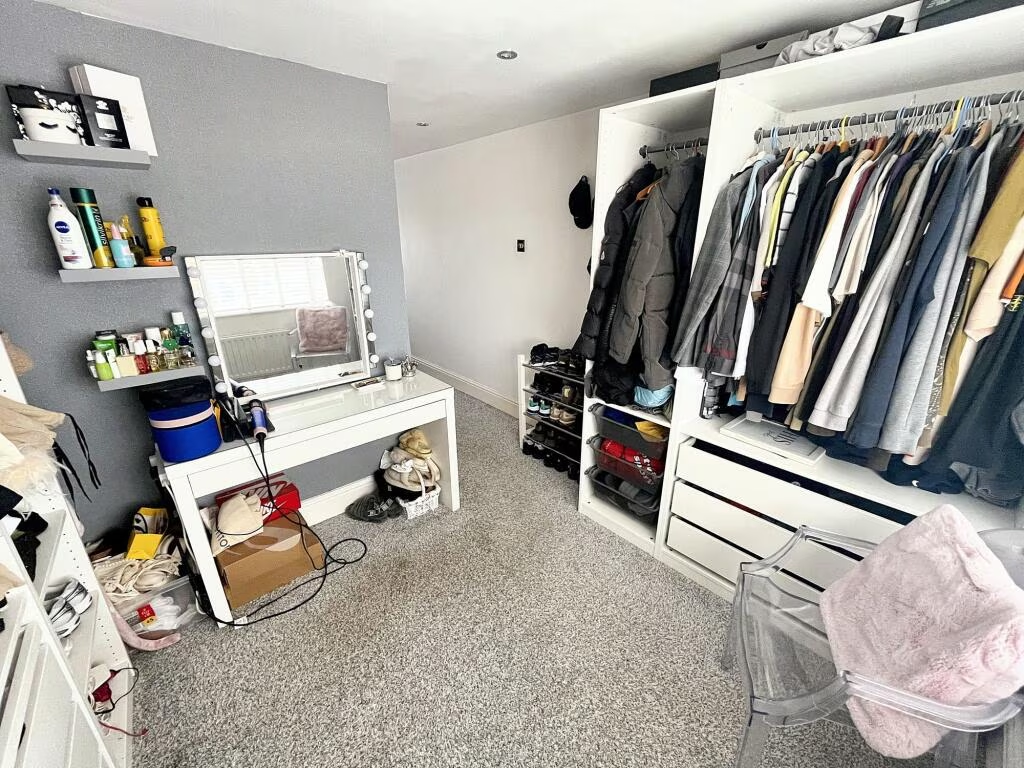
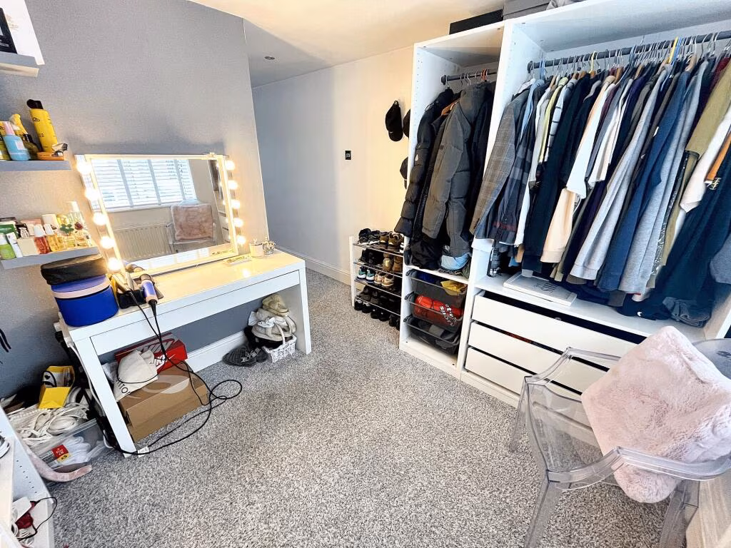
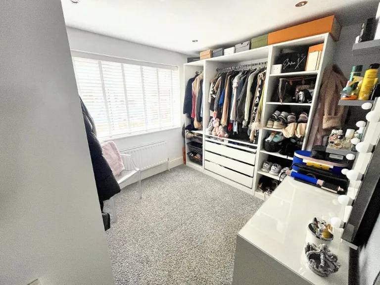
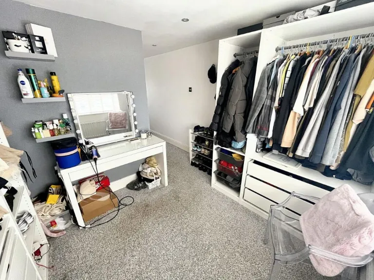
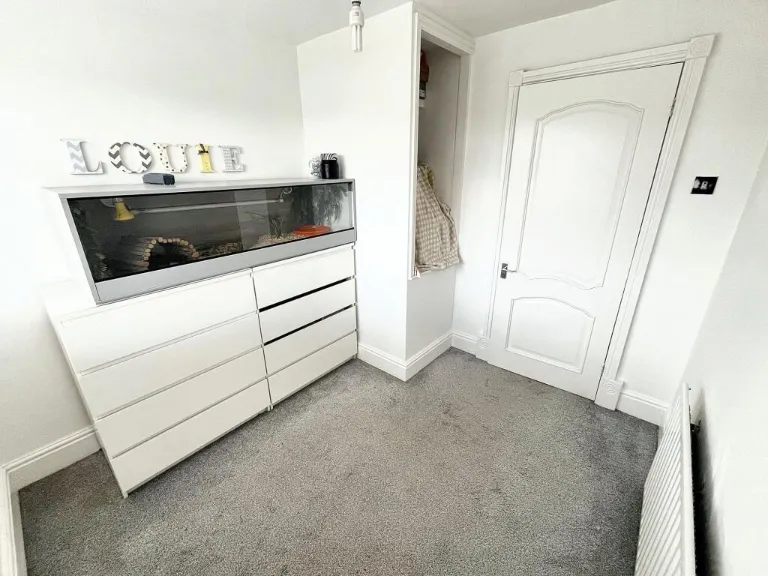
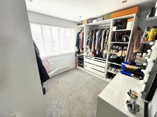
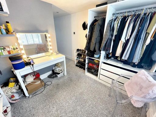
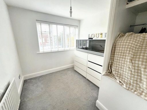
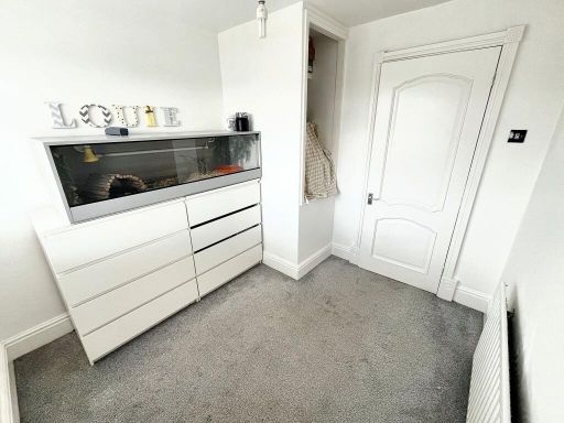
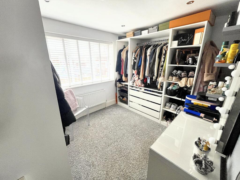
- Dressing Room:
Textual Property Features
Detected Visual Features
- modern
- detached
- two-story
- garage
- paved driveway
- brick exterior
- palm tree
- landscaping
- residential
- family home
- backyard
- garden
- play area
- modular flooring
- family-friendly
- low maintenance
- outdoor space
EPC Details
- Fully double glazed
- Cavity wall, as built, no insulation (assumed)
- Boiler and radiators, mains gas
- Low energy lighting in 8% of fixed outlets
- Suspended, no insulation (assumed)
Nearby Schools
- All Saints Church of England Primary School, Stand
- Unsworth Primary School
- St Gabriel's RC High School, a Voluntary Academy
- Bury Grammar Schools
- St Thomas Church of England Primary School
- Sunny Bank Primary School
- Hollins Grundy Primary School
- St Luke's CofE Primary School
- Bury Church of England High School
- St Marie's Roman Catholic Primary School, Bury
- East Ward Community Primary School
- St Michael's Roman Catholic Primary School, a Voluntary Academy
- Bury and Whitefield Jewish Primary School
- Unsworth Academy
- The Derby High School
- Holy Trinity Primary School
- Higher Lane Primary School
- Mersey Drive Community Primary School
- Radcliffe Hall Church of England Methodist Primary School
- St Peter's Church of England Primary School
- Hazel Wood High School
Nearest General Shops
- Id: 6581999084
- Tags:
- Addr:
- Postcode: BL9 8RS
- Street: Pilsworth Road
- Brand: Home Bargains
- Brand:wikidata: Q5888229
- Brand:wikipedia: en:Home Bargains
- Contact:
- Website: https://storelocator.homebargains.co.uk/store/A681/Park+66+-+Pilsworth
- Fhrs:
- Name: Home Bargains
- Shop: variety_store
- Source:
- TagsNormalized:
- home bargains
- variety store
- shop
- Lat: 53.5762654
- Lon: -2.2765304
- FullGeoHash: gcw2u1q22gxz
- PartitionGeoHash: gcw2
- Images:
- FoodStandards:
- Id: 1176843
- FHRSID: 1176843
- LocalAuthorityBusinessID: 31363
- BusinessName: Home Bargains
- BusinessType: Retailers - supermarkets/hypermarkets
- BusinessTypeID: 7840
- AddressLine1: null
- AddressLine2: Pilsworth Road
- AddressLine3: Bury
- AddressLine4: null
- PostCode: BL9 8RS
- RatingValue: 5
- RatingKey: fhrs_5_en-GB
- RatingDate: 2020-03-14
- LocalAuthorityCode: 405
- LocalAuthorityName: Bury
- LocalAuthorityWebSite: http://www.bury.gov.uk
- LocalAuthorityEmailAddress: Commercial@bury.gov.uk
- Scores:
- Hygiene: 5
- Structural: 0
- ConfidenceInManagement: 0
- NewRatingPending: false
- Geocode:
- Longitude: -2.27373099327087
- Latitude: 53.57779693603520
- Distance: 905
,- Id: 967202703
- Tags:
- Addr:
- Housenumber: 845
- Postcode: BL9 9TP
- Street: Manchester Road
- Brand: Mercedes-Benz
- Brand:wikidata: Q36008
- Brand:wikipedia: en:Mercedes-Benz
- Building: yes
- Layer: -1
- Name: Mercedes-Benz
- Phone: +44 1618 853 912
- Shop: car
- TagsNormalized:
- Lat: 53.563874
- Lon: -2.2901789
- FullGeoHash: gcw2ezh24vyf
- PartitionGeoHash: gcw2
- Images:
- FoodStandards: null
- Distance: 749
,- Id: 8733909380
- Tags:
- Name: Cohen's Chemist
- Shop: chemist
- TagsNormalized:
- chemist
- cohens chemist
- shop
- Lat: 53.5741481
- Lon: -2.2835219
- FullGeoHash: gcw2u0chn149
- PartitionGeoHash: gcw2
- Images:
- FoodStandards: null
- Distance: 485.8
}
Nearest Grocery shops
- Id: 8948115167
- Tags:
- Addr:
- Housenumber: 103
- Street: Parr Lane
- Brand: Nisa Local
- Brand:wikidata: Q16999069
- Brand:wikipedia: en:Nisa (retailer)
- Name: Nisa Local
- Shop: convenience
- TagsNormalized:
- nisa
- nisa local
- convenience
- shop
- Lat: 53.5600909
- Lon: -2.2736075
- FullGeoHash: gcw2sq26jhe7
- PartitionGeoHash: gcw2
- Images:
- FoodStandards: null
- Distance: 1322.3
,- Id: 6582037585
- Tags:
- Brand:
- Name: The Food Warehouse
- Shop: supermarket
- TagsNormalized:
- food
- the food warehouse
- warehouse
- shop
- Lat: 53.5760843
- Lon: -2.2761842
- FullGeoHash: gcw2u1nx31fp
- PartitionGeoHash: gcw2
- Images:
- FoodStandards: null
- Distance: 903.8
,- Id: 298449154
- Tags:
- Brand: Spar
- Brand:wikidata: Q610492
- Brand:wikipedia: en:Spar (retailer)
- Building: retail
- Name: Spar
- Operator: EuroGarages
- Shop: convenience
- TagsNormalized:
- spar
- retail
- convenience
- shop
- Lat: 53.5707877
- Lon: -2.2938845
- FullGeoHash: gcw2gb38kwes
- PartitionGeoHash: gcw2
- Images:
- FoodStandards: null
- Distance: 595.2
}
Nearest Religious buildings
- Id: 837534624
- Tags:
- Addr:
- Postcode: BL9 8JJ
- Street: Hollins Lane
- Amenity: place_of_worship
- Building: church
- Denomination: anglican
- Fhrs:
- Name: St George
- Religion: christian
- Source:
- Wikidata: Q105100893
- TagsNormalized:
- place of worship
- church
- anglican
- christian
- Lat: 53.5629323
- Lon: -2.2719584
- FullGeoHash: gcw2sqcdew30
- PartitionGeoHash: gcw2
- Images:
- FoodStandards:
- Id: 528663
- FHRSID: 528663
- LocalAuthorityBusinessID: 25773
- BusinessName: St Georges Church
- BusinessType: Restaurant/Cafe/Canteen
- BusinessTypeID: 1
- AddressLine1: null
- AddressLine2: Hollins Lane Unsworth
- AddressLine3: null
- AddressLine4: null
- PostCode: BL9 8JJ
- RatingValue: 5
- RatingKey: fhrs_5_en-GB
- RatingDate: 2020-02-03
- LocalAuthorityCode: 405
- LocalAuthorityName: Bury
- LocalAuthorityWebSite: http://www.bury.gov.uk
- LocalAuthorityEmailAddress: Commercial@bury.gov.uk
- Scores:
- Hygiene: 0
- Structural: 0
- ConfidenceInManagement: 0
- NewRatingPending: false
- Geocode:
- Longitude: -2.27281900000000
- Latitude: 53.56289500000000
- Distance: 1156.3
,- Id: 464450749
- Tags:
- Amenity: place_of_worship
- Building: yes
- Denomination: anglican
- Name: St Peter's Church
- Religion: christian
- Wikidata: Q105107231
- TagsNormalized:
- place of worship
- anglican
- church
- christian
- Lat: 53.5765847
- Lon: -2.2954184
- FullGeoHash: gcw2gc2d0z7b
- PartitionGeoHash: gcw2
- Images:
- FoodStandards: null
- Distance: 1015.2
,- Id: 619165554
- Tags:
- Amenity: place_of_worship
- Building: yes
- Religion: christian
- TagsNormalized:
- place of worship
- christian
- church
- Lat: 53.5668654
- Lon: -2.2929572
- FullGeoHash: gcw2ezd3d5rn
- PartitionGeoHash: gcw2
- Images:
- FoodStandards: null
- Distance: 622.4
}
Nearest Medical buildings
- Id: 8853918422
- Tags:
- Amenity: clinic
- Healthcare: clinic
- Name: The Elms Medical Centre
- TagsNormalized:
- Lat: 53.5532689
- Lon: -2.2952016
- FullGeoHash: gcw2ev0dmuvs
- PartitionGeoHash: gcw2
- Images:
- FoodStandards: null
- Distance: 1964.8
,- Id: 8948115165
- Tags:
- Amenity: dentist
- Building:
- Healthcare: dentist
- Name: Unsworth Smile Clinic
- TagsNormalized:
- dentist
- health
- healthcare
- clinic
- Lat: 53.5607976
- Lon: -2.273072
- FullGeoHash: gcw2sq2y386d
- PartitionGeoHash: gcw2
- Images:
- FoodStandards: null
- Distance: 1279.9
,- Id: 614749465
- Tags:
- Amenity: clinic
- Building: yes
- Healthcare: clinic
- TagsNormalized:
- Lat: 53.5609548
- Lon: -2.2730908
- FullGeoHash: gcw2sq2z1jss
- PartitionGeoHash: gcw2
- Images:
- FoodStandards: null
- Distance: 1265.4
,- Id: 7497229117
- Tags:
- Amenity: pharmacy
- Brand: Asda
- Brand:wikidata: Q297410
- Brand:wikipedia: en:Asda
- Contact:
- Phone: +44 161 351 2510
- Website: https://storelocator.asda.com/north-west/bury/pilsworth-road/pharmacy
- Fixme: Location not accurate
- Operator: Asda Stores Ltd
- TagsNormalized:
- Lat: 53.5775909
- Lon: -2.2733436
- FullGeoHash: gcw2u38856b4
- PartitionGeoHash: gcw2
- Images:
- FoodStandards: null
- Distance: 1153.3
}
Nearest Airports
- Id: 1224469
- Tags:
- Addr:
- City: Manchester
- Country: GB
- Postcode: M90 1QX
- Aerodrome: international
- Aeroway: aerodrome
- Arp: yes
- Atis: 128.175
- Iata: MAN
- Icao: EGCC
- Name: Manchester Airport
- Note: rough sketched outline referring to Yahoo imagery - true boundary is where?
- Old_name: Ringway
- Operator: Manchester Airport PLC
- Size: 18720000
- Source:
- Tower_frequency: 118.625,119.400
- Type: multipolygon
- Website: https://www.manchesterairport.co.uk/
- Wikidata: Q8694
- Wikipedia: en:Manchester Airport
- TagsNormalized:
- airport
- international airport
- Lat: 53.3503197
- Lon: -2.2798822
- FullGeoHash: gcqrs05u4ukt
- PartitionGeoHash: gcqr
- Images:
- FoodStandards: null
- Distance: 24415.1
}
Nearest Leisure Facilities
- Id: 264389892
- Tags:
- Leisure: nature_reserve
- Name: Hollins Vale
- TagsNormalized:
- Lat: 53.5708789
- Lon: -2.2768336
- FullGeoHash: gcw2u0q0cztu
- PartitionGeoHash: gcw2
- Images:
- FoodStandards: null
- Distance: 551.1
,- Id: 182511367
- Tags:
- Leisure: park
- Surface: grass
- TagsNormalized:
- Lat: 53.5696111
- Lon: -2.2910932
- FullGeoHash: gcw2gb59tem1
- PartitionGeoHash: gcw2
- Images:
- FoodStandards: null
- Distance: 403.1
,- Id: 264389900
- Tags:
- Leisure: pitch
- Wheelchair: limited
- TagsNormalized:
- Lat: 53.5706767
- Lon: -2.2824128
- FullGeoHash: gcw2u01zzcvt
- PartitionGeoHash: gcw2
- Images:
- FoodStandards: null
- Distance: 193.3
,- Id: 264389899
- Tags:
- Leisure: pitch
- Sport: bowls
- Wheelchair: no
- TagsNormalized:
- Lat: 53.5695233
- Lon: -2.282865
- FullGeoHash: gcw2u019j6um
- PartitionGeoHash: gcw2
- Images:
- FoodStandards: null
- Distance: 146.4
,- Id: 264389901
- Tags:
- Leisure: playground
- Wheelchair: limited
- TagsNormalized:
- Lat: 53.5700998
- Lon: -2.2828807
- FullGeoHash: gcw2u01smn2u
- PartitionGeoHash: gcw2
- Images:
- FoodStandards: null
- Distance: 142.5
}
Nearest Tourist attractions
- Id: 510707138
- Tags:
- Addr:
- City: Bury
- Housenumber: 7
- Postcode: BL8 2AL
- Street: Wellington Street
- Building: yes
- Name: Castle Guest House
- Phone: +44 161 797 3396
- Tourism: guest_house
- TagsNormalized:
- Lat: 53.592117
- Lon: -2.3107506
- FullGeoHash: gcw2gkjkeweq
- PartitionGeoHash: gcw2
- Images:
- FoodStandards: null
- Distance: 3001.5
,- Id: 103989468
- Tags:
- Building: yes
- Name: Bury Transport Museum
- Tourism: museum
- Wikidata: Q26670146
- Wikipedia: en:Bury Transport Museum
- TagsNormalized:
- Lat: 53.5945646
- Lon: -2.3006588
- FullGeoHash: gcw2gssdyybq
- PartitionGeoHash: gcw2
- Images:
- FoodStandards: null
- Distance: 2934.1
,- Id: 405208907
- Tags:
- Tourism: museum
- Wheelchair: no
- TagsNormalized:
- Lat: 53.5944888
- Lon: -2.3003755
- FullGeoHash: gcw2gssft2gd
- PartitionGeoHash: gcw2
- Images:
- FoodStandards: null
- Distance: 2919.7
}
Nearest Train stations
- Id: 9776991777
- Tags:
- Name: Kearsley
- Naptan:
- Network: National Rail
- Public_transport: station
- Railway: station
- Ref:
- Source: npe
- Train: yes
- Wikidata: Q3464698
- Wikipedia: en:Kearsley railway station
- TagsNormalized:
- Lat: 53.5443635
- Lon: -2.3751628
- FullGeoHash: gcw29gqqw8y3
- PartitionGeoHash: gcw2
- Images:
- FoodStandards: null
- Distance: 6596
,- Id: 21668347
- Tags:
- Name: Clifton
- Naptan:
- Network: National Rail
- Operator: Northern
- Public_transport: station
- Railway: station
- Ref:
- Train: yes
- Wikidata: Q2708119
- Wikipedia: en:Clifton railway station (Greater Manchester)
- TagsNormalized:
- Lat: 53.5223155
- Lon: -2.3141164
- FullGeoHash: gcw27r6yj4v8
- PartitionGeoHash: gcw2
- Images:
- FoodStandards: null
- Distance: 5626.6
,- Id: 1765708615
- Tags:
- Name: Heywood
- Naptan:
- Operator: East Lancashire Railway Preservation Society
- Owner: East Lancashire Railway
- Public_transport: station
- Railway: station
- Source: npe
- Train: yes
- Usage: tourism
- Wikidata: Q12060004
- TagsNormalized:
- Lat: 53.589009
- Lon: -2.2070104
- FullGeoHash: gcw2vg8fsgmf
- PartitionGeoHash: gcw2
- Images:
- FoodStandards: null
- Distance: 5571.5
,- Id: 27016832
- Tags:
- Name: Burrs Country Park Halt
- Network: East Lancashire Railway
- Note: Opened to the public on Jan 1st 2017
- Operator: East Lancashire Railway
- Public_transport: station
- Railway: station
- Train: yes
- Usage: tourism
- Wheelchair: yes
- Wikidata: Q28197680
- TagsNormalized:
- Lat: 53.6113055
- Lon: -2.3032556
- FullGeoHash: gcw2gxdu6r8n
- PartitionGeoHash: gcw2
- Images:
- FoodStandards: null
- Distance: 4762.5
,- Id: 27016927
- Tags:
- Name: Bury, Bolton Street
- Naptan:
- Public_transport: station
- Railway: station
- Train: yes
- Usage: tourism
- Wheelchair: yes
- Wikidata: Q5001073
- TagsNormalized:
- Lat: 53.5929094
- Lon: -2.3003018
- FullGeoHash: gcw2gskcr46t
- PartitionGeoHash: gcw2
- Images:
- FoodStandards: null
- Distance: 2753.9
}
Nearest Hotels
- Id: 28818063
- Tags:
- Building: hotel
- Name: The Village Hotel
- Tourism: hotel
- Wifi: free
- TagsNormalized:
- Lat: 53.5907023
- Lon: -2.2761597
- FullGeoHash: gcw2u5ys3wur
- PartitionGeoHash: gcw2
- Images:
- FoodStandards: null
- Distance: 2389.1
,- Id: 4893244122
- Tags:
- Addr:
- Amenity: pub
- Name: Old cross hotel
- Name:en: Old cross hotel
- TagsNormalized:
- Lat: 53.5665182
- Lon: -2.3125086
- FullGeoHash: gcw2erkpddsx
- PartitionGeoHash: gcw2
- Images:
- FoodStandards: null
- Distance: 1854.1
,- Id: 297036582
- Tags:
- Addr:
- City: Bury
- Postcode: BL9 8RN
- Street: Little 66
- Brand: Travelodge
- Brand:wikidata: Q9361374
- Brand:wikipedia: en:Travelodge UK
- Building: hotel
- Internet_access: wlan
- Internet_access:fee: customers
- Internet_access:ssid: Travelodge WiFi
- Name: Travelodge
- Source:
- Addr:
- Postcode: code-point_open
- Tourism: hotel
- TagsNormalized:
- Lat: 53.5783594
- Lon: -2.2748503
- FullGeoHash: gcw2u1xs84he
- PartitionGeoHash: gcw2
- Images:
- FoodStandards: null
- Distance: 1158
}
Tags
- modern
- detached
- two-story
- garage
- paved driveway
- brick exterior
- palm tree
- landscaping
- residential
- family home
- backyard
- garden
- play area
- modular flooring
- modern
- family-friendly
- low maintenance
- outdoor space
Local Market Stats
- Average Price/sqft: £204
- Avg Income: £38800
- Rental Yield: 4.6%
- Social Housing: 15%
- Planning Success Rate: 90%
Similar Properties
 4 bedroom semi-detached house for sale in Alton Close, Bury, Greater Manchester, BL9 8BN, BL9 — £315,000 • 4 bed • 2 bath • 1110 ft²
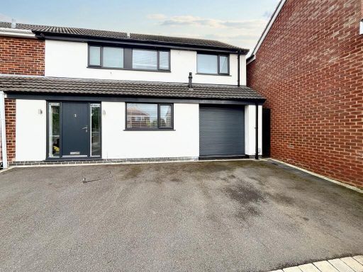 4 bedroom semi-detached house for sale in Alkrington Close, Bury, BL9 — £395,000 • 4 bed • 2 bath • 1397 ft²
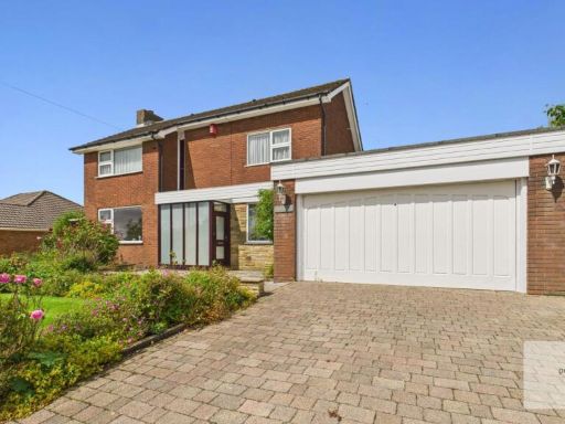 4 bedroom detached house for sale in Falshaw Drive, Walmersley, Bury, BL9 — £535,000 • 4 bed • 1 bath • 1669 ft²
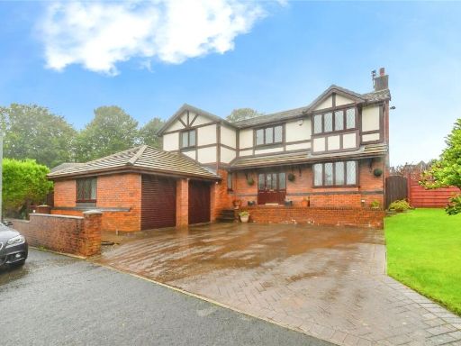 4 bedroom detached house for sale in Bridgefield Drive, Bury, Greater Manchester, BL9 — £550,000 • 4 bed • 2 bath • 2109 ft²
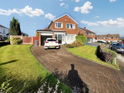 3 bedroom detached house for sale in Felton Close, Bury, BL9 — £340,000 • 3 bed • 1 bath • 1197 ft²
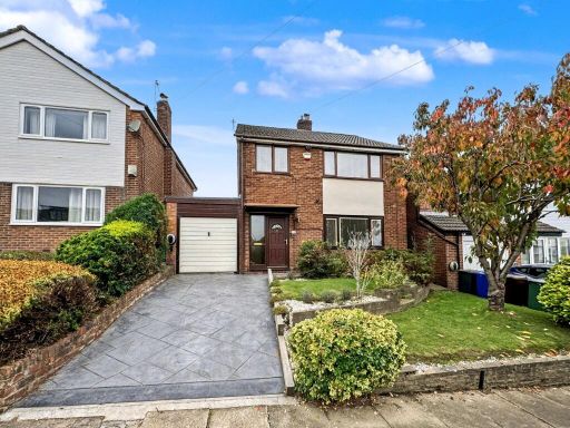 3 bedroom detached house for sale in Burndale Drive, Bury, BL9 — £435,000 • 3 bed • 2 bath • 1238 ft²
Meta
- {
"@context": "https://schema.org",
"@type": "Residence",
"name": "4 bedroom detached house for sale in Gawthorpe Close, Bury,…",
"description": "",
"url": "https://propertypiper.co.uk/property/059a845e-5e93-4753-a6b4-54f0215807a0",
"image": "https://image-a.propertypiper.co.uk/a55ea811-cf97-4a3f-8f2d-aaf6ef8f06ea-1024.jpeg",
"address": {
"@type": "PostalAddress",
"streetAddress": "1 GAWTHORPE CLOSE BURY ",
"postalCode": "BL9 8BL",
"addressLocality": "Bury",
"addressRegion": "Bury South",
"addressCountry": "England"
},
"geo": {
"@type": "GeoCoordinates",
"latitude": 53.56986839074798,
"longitude": -2.2850039944739686
},
"numberOfRooms": 4,
"numberOfBathroomsTotal": 3,
"floorSize": {
"@type": "QuantitativeValue",
"value": 1421,
"unitCode": "FTK"
},
"offers": {
"@type": "Offer",
"price": 485000,
"priceCurrency": "GBP",
"availability": "https://schema.org/InStock"
},
"additionalProperty": [
{
"@type": "PropertyValue",
"name": "Feature",
"value": "modern"
},
{
"@type": "PropertyValue",
"name": "Feature",
"value": "detached"
},
{
"@type": "PropertyValue",
"name": "Feature",
"value": "two-story"
},
{
"@type": "PropertyValue",
"name": "Feature",
"value": "garage"
},
{
"@type": "PropertyValue",
"name": "Feature",
"value": "paved driveway"
},
{
"@type": "PropertyValue",
"name": "Feature",
"value": "brick exterior"
},
{
"@type": "PropertyValue",
"name": "Feature",
"value": "palm tree"
},
{
"@type": "PropertyValue",
"name": "Feature",
"value": "landscaping"
},
{
"@type": "PropertyValue",
"name": "Feature",
"value": "residential"
},
{
"@type": "PropertyValue",
"name": "Feature",
"value": "family home"
},
{
"@type": "PropertyValue",
"name": "Feature",
"value": "backyard"
},
{
"@type": "PropertyValue",
"name": "Feature",
"value": "garden"
},
{
"@type": "PropertyValue",
"name": "Feature",
"value": "play area"
},
{
"@type": "PropertyValue",
"name": "Feature",
"value": "modular flooring"
},
{
"@type": "PropertyValue",
"name": "Feature",
"value": "modern"
},
{
"@type": "PropertyValue",
"name": "Feature",
"value": "family-friendly"
},
{
"@type": "PropertyValue",
"name": "Feature",
"value": "low maintenance"
},
{
"@type": "PropertyValue",
"name": "Feature",
"value": "outdoor space"
}
]
}
High Res Floorplan Images
Compatible Floorplan Images
FloorplanImages Thumbnail