NE28 9UA - 2 bedroom bungalow for sale in Alder Road, Wallsend, Tyne a…
View on Property Piper
2 bedroom bungalow for sale in Alder Road, Wallsend, Tyne and Wear, NE28
Property Details
- Price: £195000
- Bedrooms: 2
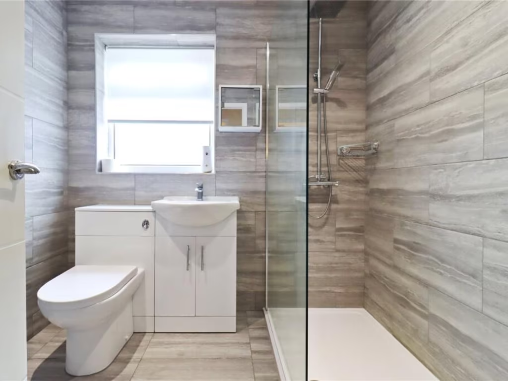
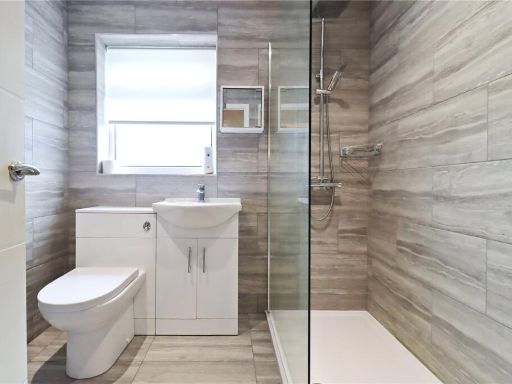
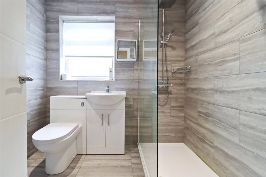
- Bathrooms: 1
- Property Type: undefined
- Property SubType: undefined
Image Descriptions
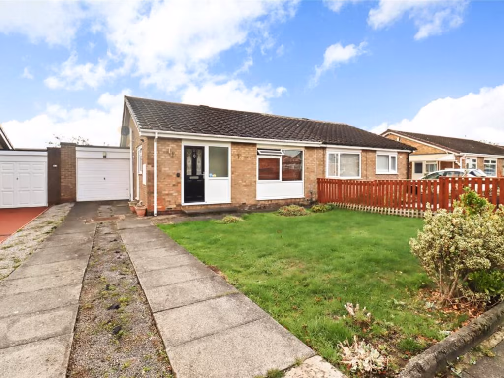
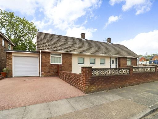
- semi-detached bungalow post-war
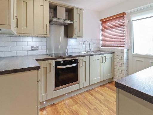
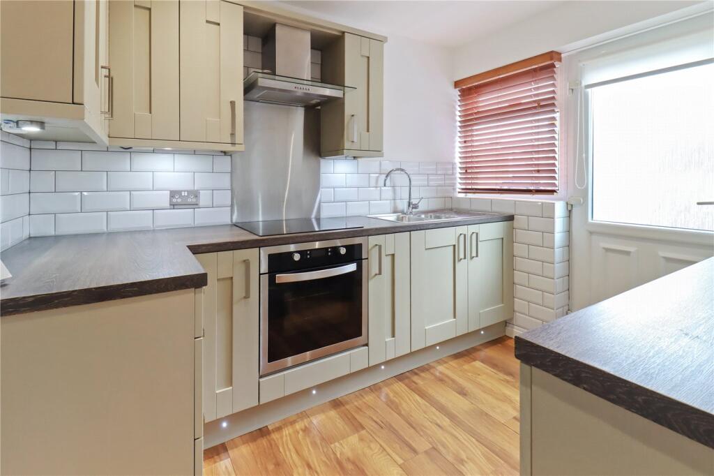
- kitchen modern
Floorplan Description
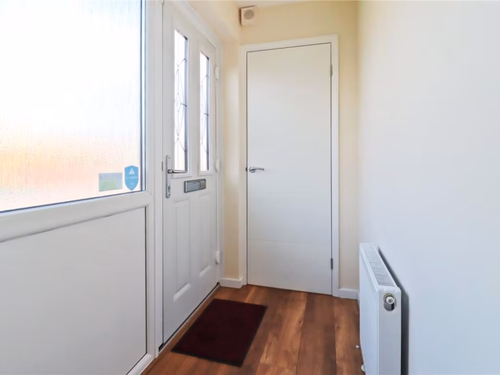
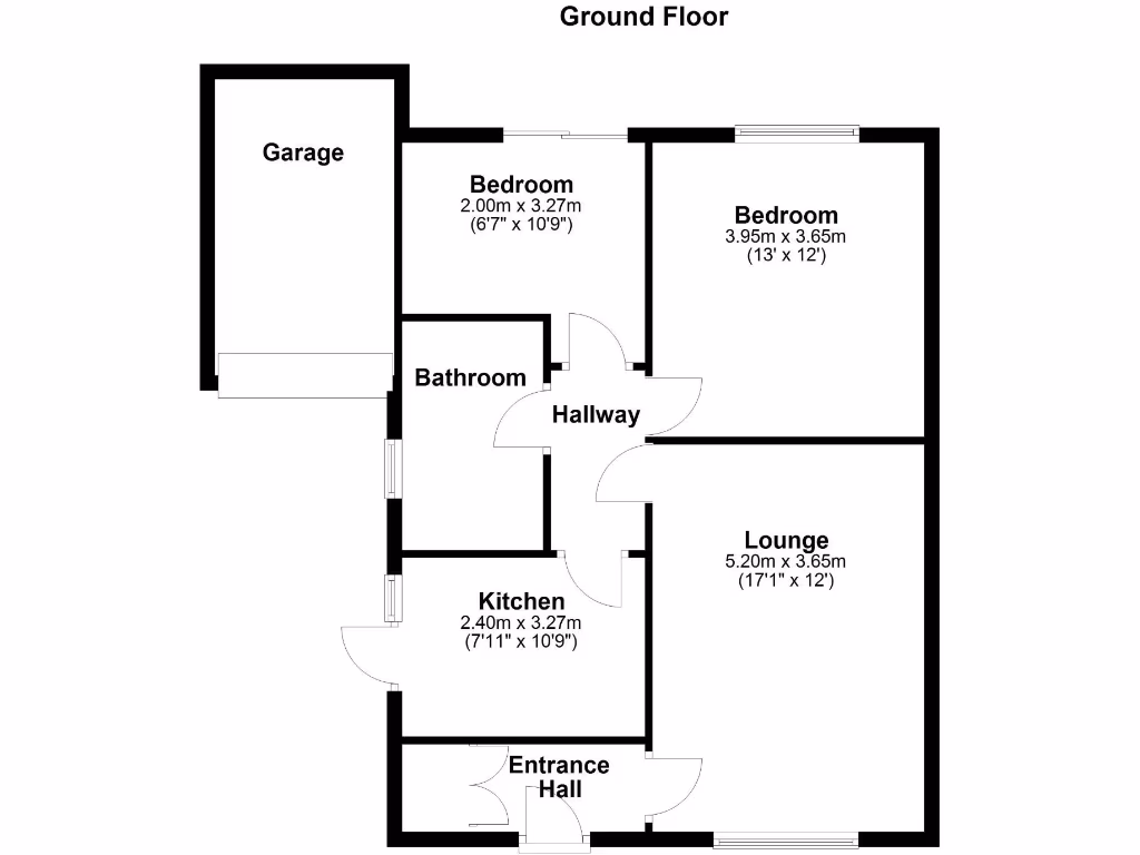
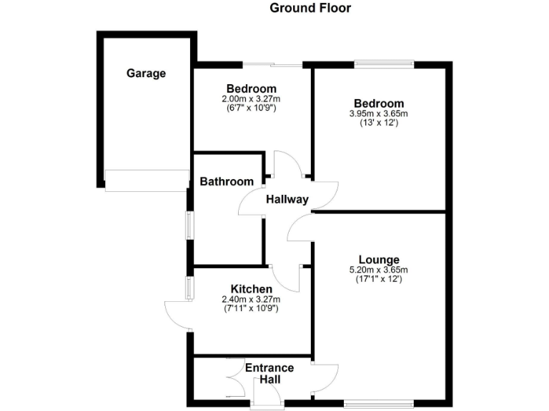
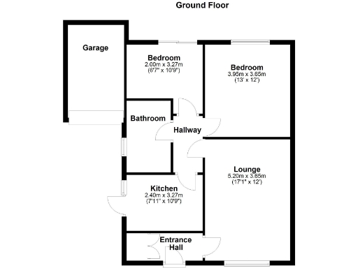
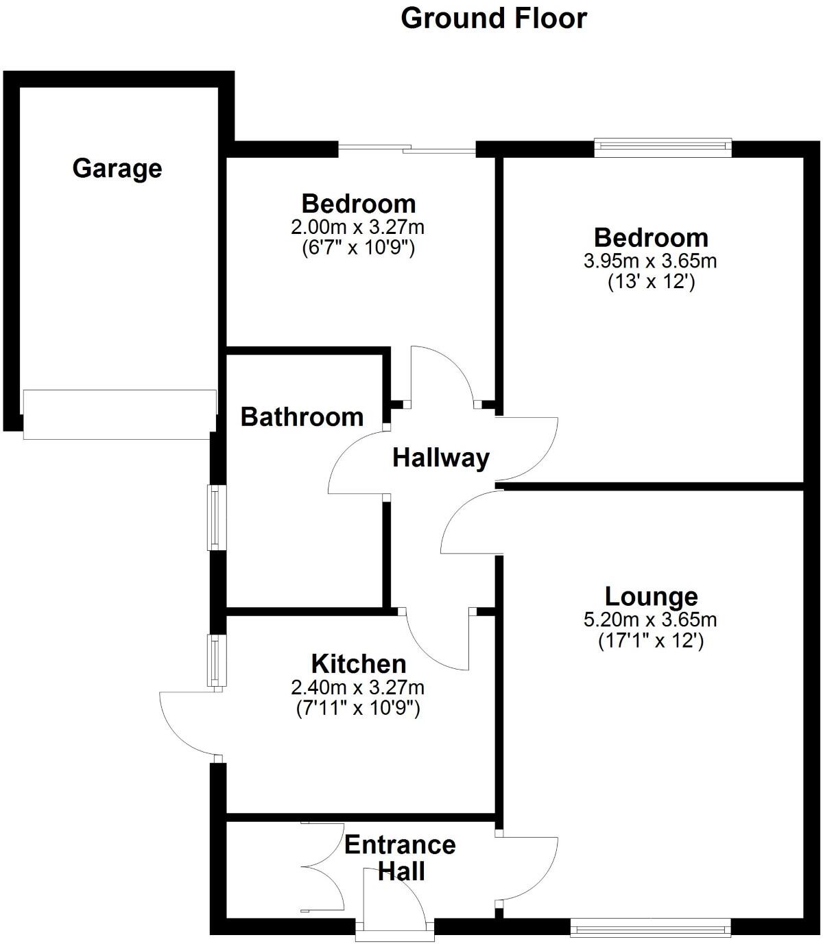
- Ground floor plan showing lounge, kitchen, two bedrooms, bathroom, hallway, entrance hall and garage.
Rooms
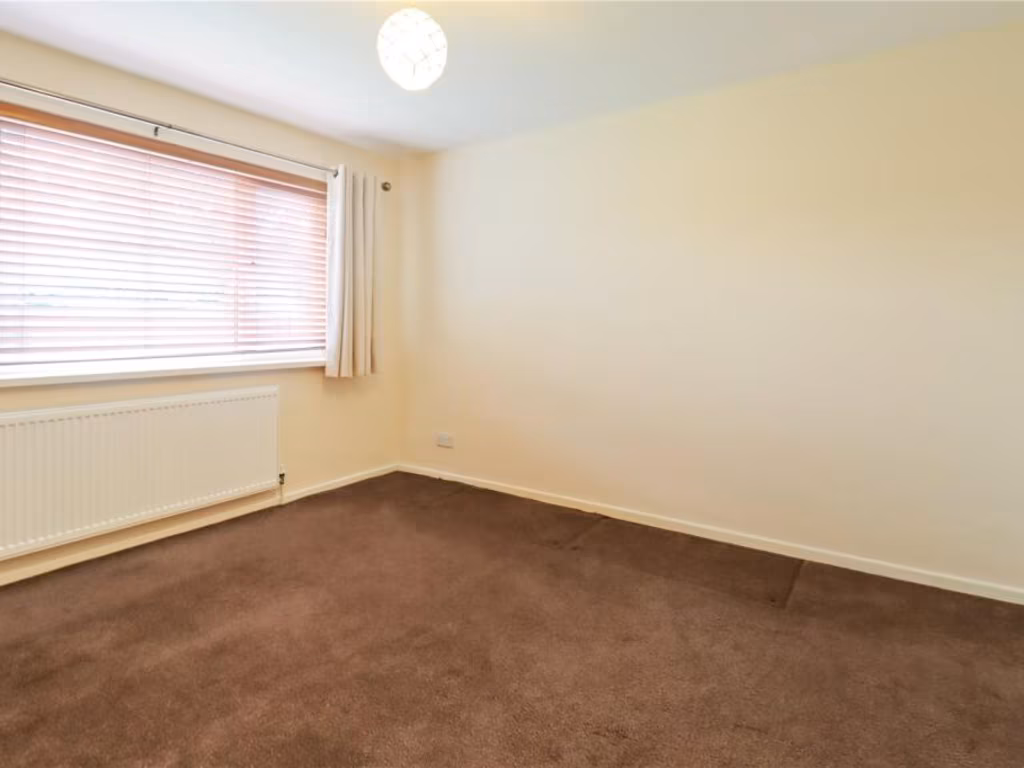
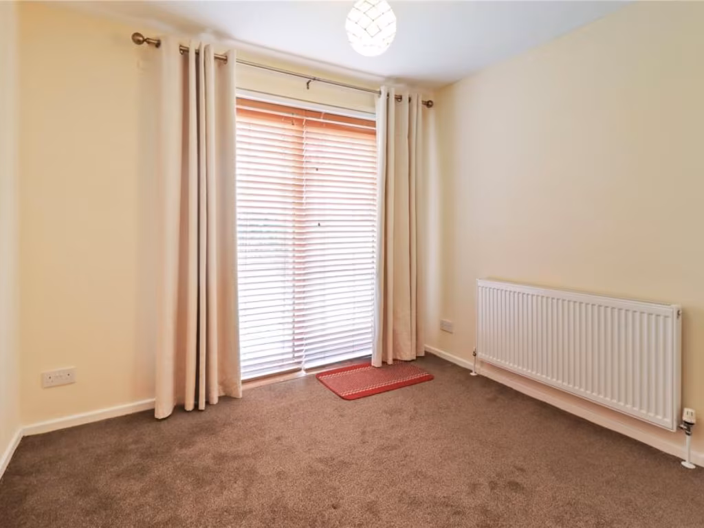
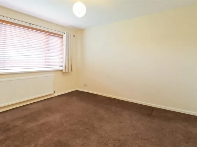
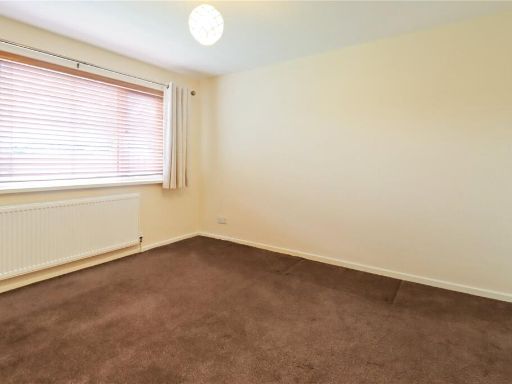
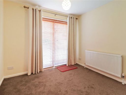
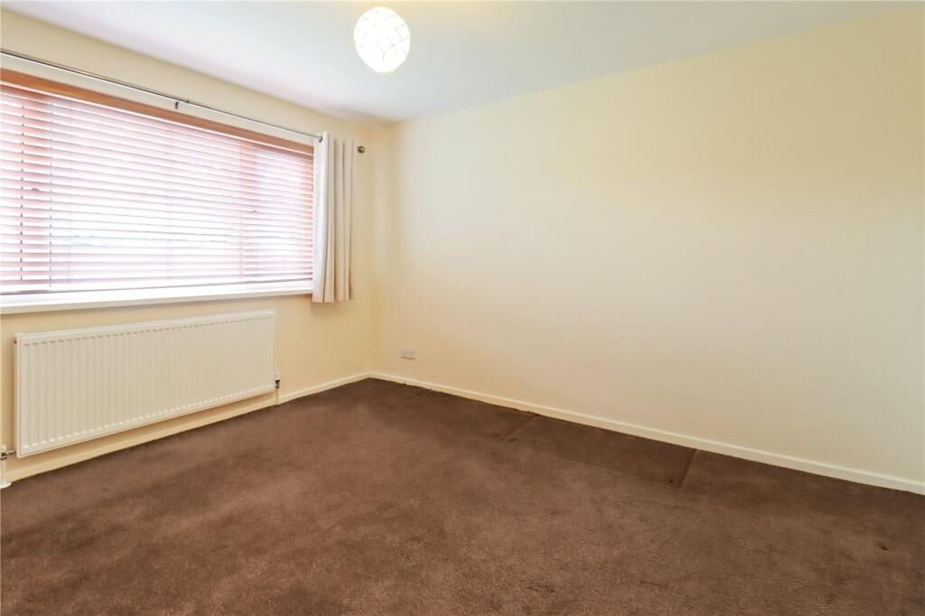
- Bedroom:
- Bedroom:
- Kitchen:
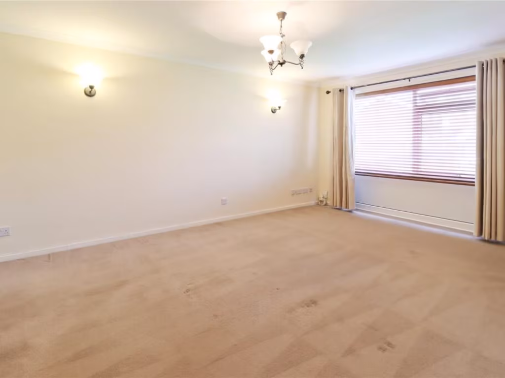
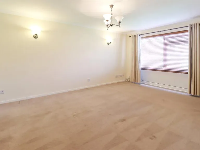
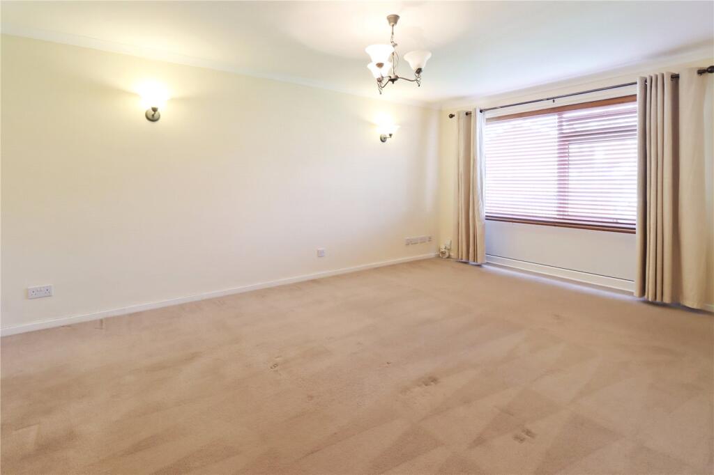
- Lounge:
Textual Property Features
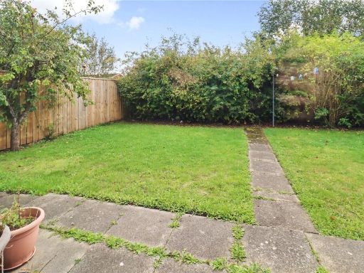
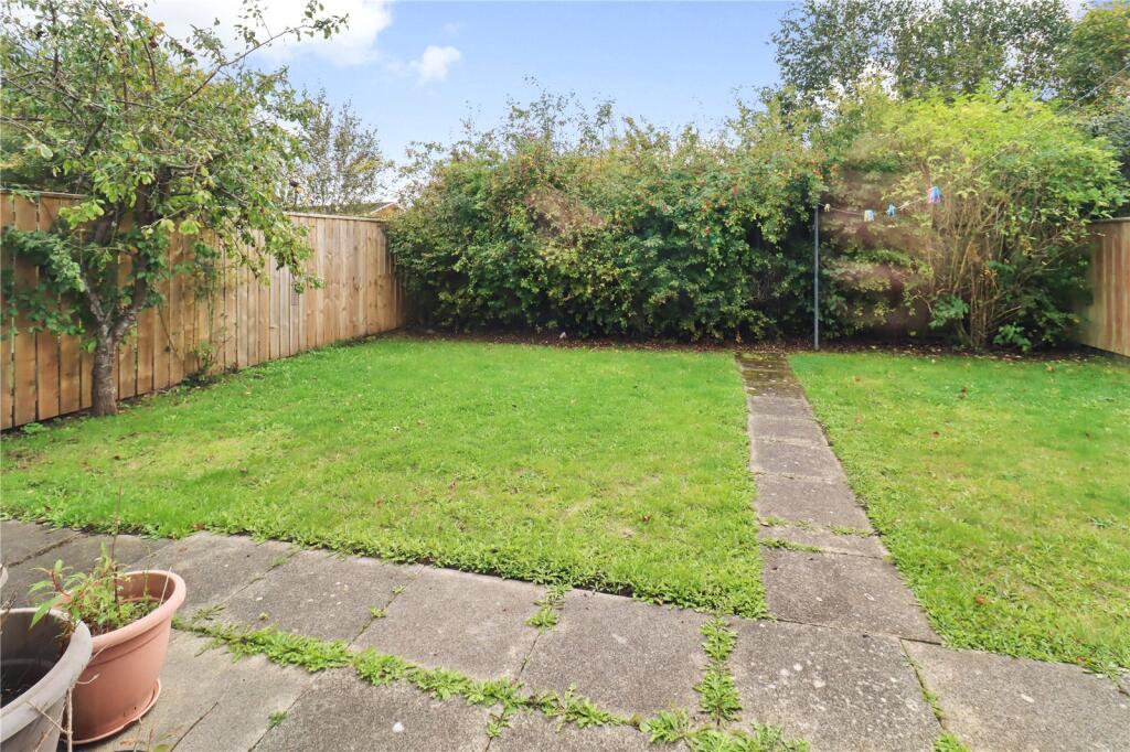
- Has Garden
- Chain Free
- Success
Detected Visual Features
- bungalow
- semi-detached
- garage
- garden
- driveway
- post-war
- one-story
- brick property
- modern
- kitchen
- gloss cabinets
- subway tiles
- wood flooring
- integrated oven
- stainless steel
- clean
EPC Details
- Fully double glazed
- Cavity wall, filled cavity
- Boiler and radiators, mains gas
- Low energy lighting in all fixed outlets
- Suspended, no insulation (assumed)
Nearby Schools
- New York Primary School
- Holystone Primary School
- Shiremoor Primary School
- St Aloysius Catholic Infant School, Hebburn
- Richardson Dees Primary School
- Wallsend St Peter's CofE Aided Primary School
- Burnside College
- St Thomas More Catholic High School
- St Columba's Catholic Primary School, Wallsend
- Denbigh Community Primary School
- Wallsend Jubilee Primary School
- St Aidan's Catholic Primary School, Wallsend
- Battle Hill Primary School
- Wellfield Middle School
- Backworth Park Primary School
- St Oswald's CofE Aided Primary School
- Carville Primary School
- Churchill Community College
- St Bernadettes Catholic Primary, Wallsend
- Hadrian Park Primary School
- St Aloysius Catholic Junior School Academy
- Western Community Primary School
Nearest General Shops
- Id: 4674446349
- Tags:
- Addr:
- City: Wallsend
- Street: Addington Drive
- Name: Hadrian News
- Shop: newsagent
- TagsNormalized:
- Lat: 55.0160424
- Lon: -1.5118326
- FullGeoHash: gcybvx75etxu
- PartitionGeoHash: gcyb
- Images:
- FoodStandards: null
- Distance: 556.2
,- Id: 132648854
- Tags:
- Addr:
- City: Wallsend
- Street: Middle Engine Lane
- Brand: Wickes
- Brand:wikidata: Q7998350
- Brand:wikipedia: en:Wickes
- Building: yes
- Contact:
- Website: https://www.wickes.co.uk/store/8229
- Name: Wickes
- Opening_hours: Mo-Sa 07:00-20:00; Su 10:00-16:00
- Shop: doityourself
- TagsNormalized:
- Lat: 55.0080694
- Lon: -1.5061741
- FullGeoHash: gcybvtzjpx75
- PartitionGeoHash: gcyb
- Images:
- FoodStandards: null
- Distance: 493.4
,- Id: 132648900
- Tags:
- Addr:
- City: Wallsend
- Housename: Unit 12
- Place: Silverlink Retail Park
- Postcode: NE28 9NT
- Street: Middle Engine Lane
- Brand: Smyths
- Brand:wikidata: Q7546779
- Brand:wikipedia: en:Smyths
- Building: yes
- Name: Smyths Toys Superstores
- Shop: toys
- Website: https://www.smythstoys.com/
- TagsNormalized:
- Lat: 55.0079458
- Lon: -1.5074873
- FullGeoHash: gcybvtyk8brf
- PartitionGeoHash: gcyb
- Images:
- FoodStandards: null
- Distance: 445.4
}
Nearest Religious buildings
- Id: 105807349
- Tags:
- Addr:
- City: Wallsend
- Postcode: NE28 7TN
- Street: Churchill Street
- Amenity: school
- Building: school
- Isced:
- Name: Churchill Community College
- Phone: +44 191 234 7200
- Ref:
- Source: inng and local knowledge
- Website: https://www.churchillcommunitycollege.org/
- Wikidata: Q19654556
- TagsNormalized:
- Lat: 55.0051187
- Lon: -1.5070065
- FullGeoHash: gcybvtqsh1q9
- PartitionGeoHash: gcyb
- Images:
- FoodStandards: null
- Distance: 729.2
,- Id: 753245263
- Tags:
- Leisure: sports_centre
- Name: Churchilll LTA tennis centre
- TagsNormalized:
- sports
- sports centre
- leisure
- church
- tennis
- Lat: 55.0060998
- Lon: -1.5075564
- FullGeoHash: gcybvtw1z2hq
- PartitionGeoHash: gcyb
- Images:
- FoodStandards: null
- Distance: 615.9
,- Id: 449940315
- Tags:
- Amenity: place_of_worship
- Building: church
- Denomination: anglican
- Name: Good Shepherd
- Religion: christian
- Source: Bing
- Wikidata: Q105101687
- TagsNormalized:
- place of worship
- church
- anglican
- christian
- Lat: 55.008016
- Lon: -1.5179573
- FullGeoHash: gcybvmysvj2u
- PartitionGeoHash: gcyb
- Images:
- FoodStandards: null
- Distance: 511.1
}
Nearest Airports
- Id: 51496177
- Tags:
- Addr:
- City: Newcastle upon Tyne
- Housename: Newcastle International Airport
- Postcode: NE13 8BZ
- Street: Woolsington
- Aerodrome: international
- Aerodrome:type: public
- Aeroway: aerodrome
- Contact:
- Website: http://www.newcastleairport.com
- Ele: 81
- Iata: NCL
- Icao: EGNT
- Ifr: yes
- Name: Newcastle International Airport
- Old_name: Woolsington Aerodrome
- Operator: Newcastle International Airport Ltd
- Operator:type: private
- Phone: +44 871 882 1121
- Ref: NCL
- Size: 4500000
- Source: Bing
- Vfr: yes
- Website: https://www.newcastleairport.com/
- Wheelchair: yes
- Wikidata: Q8975
- Wikipedia: en:Newcastle International Airport
- TagsNormalized:
- airport
- international airport
- Lat: 55.0385826
- Lon: -1.6925163
- FullGeoHash: gcyc17rwcx2m
- PartitionGeoHash: gcyc
- Images:
- FoodStandards: null
- Distance: 11911.5
,- Id: 224091164
- Tags:
- Addr:
- City: Newcastle upon Tyne
- Postcode: NE13 8BZ
- Street: Woolsington
- Building: hotel
- Contact:
- Facebook: https://www.facebook.com/doubletree.newcastle
- Google_plus: https://plus.google.com/115643701064921491168/about
- Twitter: https://twitter.com/dtnewcastle_int
- Email: info@doubletree-newcastle.co.uk
- Fhrs:
- Name: DoubleTree by Hilton Hotel Newcastle International Airport
- Operator: Hilton Worldwide
- Phone: +44 1661 824266
- Rooms: 179
- Smoking: no
- Stars: 4
- Tourism: hotel
- Website: https://doubletree3.hilton.com/en/hotels/united-kingdom/doubletree-by-hilton-hotel-newcastle-international-airport-NCLNADI/index.html?WT.mc_id=zELWAKN0EMEA1DT2DMH3LocalSearch4DGGenericx6NCLNADI
- Wheelchair: yes
- TagsNormalized:
- hotel
- airport
- international airport
- tourism
- major airport
- Lat: 55.0364476
- Lon: -1.7124358
- FullGeoHash: gcyc1514937m
- PartitionGeoHash: gcyc
- Images:
- FoodStandards:
- Id: 236731
- FHRSID: 236731
- LocalAuthorityBusinessID: 11/00246/MIXED
- BusinessName: Doubletree By Hilton Hotel
- BusinessType: Hotel/bed & breakfast/guest house
- BusinessTypeID: 7842
- AddressLine1: Doubletree By Hilton Newcastle Airport
- AddressLine2: Woolsington
- AddressLine3: Newcastle Upon Tyne
- AddressLine4: null
- PostCode: NE13 8BZ
- RatingValue: 5
- RatingKey: fhrs_5_en-GB
- RatingDate: 2019-08-13
- LocalAuthorityCode: 416
- LocalAuthorityName: Newcastle Upon Tyne
- LocalAuthorityWebSite: http://www.newcastle.gov.uk/
- LocalAuthorityEmailAddress: psr@newcastle.gov.uk
- Scores:
- Hygiene: 0
- Structural: 5
- ConfidenceInManagement: 0
- NewRatingPending: false
- Geocode:
- Longitude: -1.71254240000000
- Latitude: 55.03664040000000
- Distance: 13089.5
}
Nearest Leisure Facilities
- Id: 473303911
- Tags:
- TagsNormalized:
- Lat: 55.0153933
- Lon: -1.4989438
- FullGeoHash: gcybvzhxbhdk
- PartitionGeoHash: gcyb
- Images:
- FoodStandards: null
- Distance: 958.6
,- Id: 473303927
- Tags:
- TagsNormalized:
- Lat: 55.0159285
- Lon: -1.5006921
- FullGeoHash: gcybvz75p26u
- PartitionGeoHash: gcyb
- Images:
- FoodStandards: null
- Distance: 898.9
,- Id: 449939253
- Tags:
- Leisure: park
- Source: Bing
- TagsNormalized:
- Lat: 55.0074896
- Lon: -1.5219664
- FullGeoHash: gcybvmg9ze78
- PartitionGeoHash: gcyb
- Images:
- FoodStandards: null
- Distance: 752.5
,- Id: 105807345
- Tags:
- Building: yes
- Building:roof:shape: gabled
- Leisure: sports_centre
- Source: Bing and local knowledge
- Sport: tennis
- TagsNormalized:
- sports
- sports centre
- leisure
- tennis
- Lat: 55.0061022
- Lon: -1.507546
- FullGeoHash: gcybvtw1z8sh
- PartitionGeoHash: gcyb
- Images:
- FoodStandards: null
- Distance: 615.9
,- Id: 399300267
- Tags:
- Leisure: pitch
- Surface: grass
- TagsNormalized:
- Lat: 55.0095155
- Lon: -1.5184987
- FullGeoHash: gcybvqnm8kvm
- PartitionGeoHash: gcyb
- Images:
- FoodStandards: null
- Distance: 452.4
}
Nearest Tourist attractions
- Id: 468078225
- Tags:
- Addr:
- City: Wallsend
- Postcode: NE28 6HR
- Street: Buddle Street
- Building: yes
- Fee: yes
- Name: Segedunum
- Opening_hours: 10:00-15:00 (winter); 10:00-17:00 (summer)
- Phone: +44 191 278 4217
- Source: Bing
- Tourism: museum
- Website: https://www.segedunumromanfort.org.uk/
- Wikidata: Q68044879
- TagsNormalized:
- Lat: 54.9882514
- Lon: -1.5308108
- FullGeoHash: gcybv4m3c908
- PartitionGeoHash: gcyb
- Images:
- FoodStandards: null
- Distance: 2805.9
,- Id: 1117349898
- Tags:
- Amenity: clock
- Display: sundial
- Support: ground
- Tourism: viewpoint
- TagsNormalized:
- Lat: 55.0242237
- Lon: -1.5073841
- FullGeoHash: gcycj8y776sz
- PartitionGeoHash: gcyc
- Images:
- FoodStandards: null
- Distance: 1494.2
,- Id: 93884394
- Tags:
- Addr:
- City: North Shields
- Housename: Stephenson Railway Museum
- Postcode: NE29 8DX
- Street: Middle Engine Lane
- Building: yes
- Name: Stephenson Railway Museum
- Operator: Stephens Railway Volunteers
- Phone: +44 191 200 7146
- Source: Bing
- Tourism: museum
- Url: https://stephensonrailwaymuseum.org.uk/
- Wikidata: Q7610998
- TagsNormalized:
- Lat: 55.0165258
- Lon: -1.4973451
- FullGeoHash: gcybvzmwmrdx
- PartitionGeoHash: gcyb
- Images:
- FoodStandards: null
- Distance: 1111.6
}
Nearest Train stations
- Id: 5995338521
- Tags:
- Internet_access: no
- Internet_access:fee: no
- Name: Percy Main
- Operator: NTSR
- Public_transport: station
- Railway: station
- Train: yes
- Usage: tourism
- TagsNormalized:
- Lat: 54.9977941
- Lon: -1.4780506
- FullGeoHash: gcybyk59qgvs
- PartitionGeoHash: gcyb
- Images:
- FoodStandards: null
- Distance: 2614.4
,- Id: 4524061408
- Tags:
- Light_rail: yes
- Name: Northumberland Park
- Naptan:
- Network: Tyne and Wear Metro
- Operator: Nexus
- Public_transport: station
- Railway: station
- Station: light_rail
- Wikidata: Q7059817
- Wikipedia: en:Northumberland Park Metro station
- TagsNormalized:
- Lat: 55.0330969
- Lon: -1.5198326
- FullGeoHash: gcycj6mr12fd
- PartitionGeoHash: gcyc
- Images:
- FoodStandards: null
- Distance: 2503.9
,- Id: 4524643130
- Tags:
- Internet_access: no
- Light_rail: yes
- Name: Palmersville
- Naptan:
- Network: Tyne and Wear Metro
- Operator: Nexus
- Public_transport: station
- Railway: station
- Station: light_rail
- Wikidata: Q7128339
- Wikipedia: en:Palmersville Metro station
- TagsNormalized:
- Lat: 55.0236937
- Lon: -1.5411852
- FullGeoHash: gcychbv8pzcj
- PartitionGeoHash: gcyc
- Images:
- FoodStandards: null
- Distance: 2336.7
,- Id: 4524045380
- Tags:
- Name: Hadrian Road
- Naptan:
- Network: Tyne and Wear Metro
- Operator: Nexus
- Public_transport: station
- Railway: station
- Station: light_rail
- Wheelchair: yes
- Wikidata: Q5638057
- Wikipedia: en:Hadrian Road Metro station
- TagsNormalized:
- Lat: 54.9922694
- Lon: -1.5159676
- FullGeoHash: gcybve015qh8
- PartitionGeoHash: gcyb
- Images:
- FoodStandards: null
- Distance: 2103.2
,- Id: 4524046458
- Tags:
- Light_rail: yes
- Name: Howdon
- Naptan:
- Network: Tyne and Wear Metro
- Operator: Nexus
- Public_transport: station
- Railway: station
- Station: light_rail
- Wikidata: Q5921466
- Wikipedia: en:Howdon Metro station
- TagsNormalized:
- Lat: 54.9959066
- Lon: -1.4941598
- FullGeoHash: gcybvgxyrs19
- PartitionGeoHash: gcyb
- Images:
- FoodStandards: null
- Distance: 2028.5
}
Nearest Hotels
- Id: 96428982
- Tags:
- Addr:
- City: Holystone
- Postcode: NE27 0UN
- Street: Edmund Road
- Brand: Premier Inn
- Brand:wikidata: Q2108626
- Brand:wikipedia: en:Premier Inn
- Building: yes
- Internet_access: wlan
- Internet_access:fee: no
- Name: Premier Inn
- Tourism: hotel
- TagsNormalized:
- Lat: 55.0268521
- Lon: -1.5232246
- FullGeoHash: gcycj36fdk9q
- PartitionGeoHash: gcyc
- Images:
- FoodStandards: null
- Distance: 1900.1
,- Id: 96429035
- Tags:
- Addr:
- City: Newcastle upon Tyne
- Housenumber: 10
- Postcode: NE27 0BY
- Street: The Silverlink North
- Building: yes
- Fhrs:
- Internet_access: wlan
- Internet_access:fee: no
- Name: The Village Newcastle
- Phone: +44 191 338 5245
- Source: Bing
- Tourism: hotel
- Website: https://www.village-hotels.co.uk/hotels/newcastle/
- TagsNormalized:
- Lat: 55.0255855
- Lon: -1.5114504
- FullGeoHash: gcycj957k8sg
- PartitionGeoHash: gcyc
- Images:
- FoodStandards: null
- Distance: 1617.6
,- Id: 96417359
- Tags:
- Addr:
- Place: Cobalt Business Park
- Postcode: NE27 0QJ
- Street: Silver Fox Way
- Brand: Travelodge
- Brand:wikidata: Q9361374
- Building: yes
- Internet_access: wlan
- Internet_access:fee: customers
- Internet_access:ssid: Travelodge WiFi
- Name: Travelodge
- Office: yes
- Source: Bing
- Tourism: hotel
- TagsNormalized:
- Lat: 55.0212336
- Lon: -1.5030375
- FullGeoHash: gcycjb39btq4
- PartitionGeoHash: gcyc
- Images:
- FoodStandards: null
- Distance: 1267
}
Tags
- bungalow
- semi-detached
- garage
- garden
- driveway
- post-war
- one-story
- brick property
- modern
- kitchen
- gloss cabinets
- subway tiles
- wood flooring
- integrated oven
- stainless steel
- clean
Local Market Stats
- Average Price/sqft: £160
- Avg Income: £34400
- Rental Yield: 4.4%
- Social Housing: 20%
- Planning Success Rate: 94%
Similar Properties
 2 bedroom bungalow for sale in Jasmine Close, Newcastle upon Tyne, Tyne and Wear, NE6 — £220,000 • 2 bed • 1 bath • 915 ft²
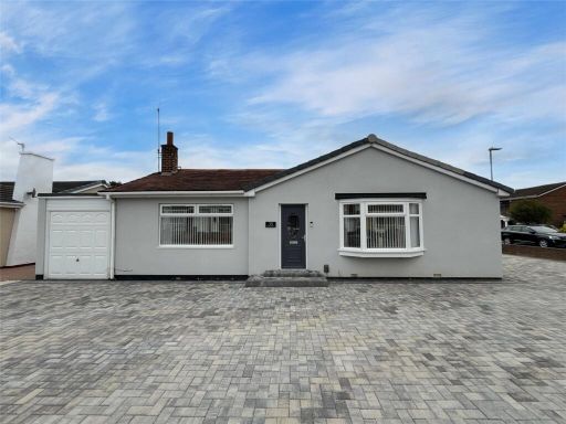 2 bedroom bungalow for sale in Briardene Drive, Wardley, NE10 — £240,000 • 2 bed • 1 bath • 754 ft²
 3 bedroom semi-detached bungalow for sale in High View North, Wallsend, NE28 — £150,000 • 3 bed • 1 bath • 808 ft²
 2 bedroom semi-detached bungalow for sale in Trafford Walk, Hillheads Estate, Newcastle Upon Tyne, NE5 — £178,500 • 2 bed • 1 bath • 782 ft²
 2 bedroom semi-detached bungalow for sale in Priory Way, Whorlton Grange, NE5 — £190,000 • 2 bed • 1 bath • 657 ft²
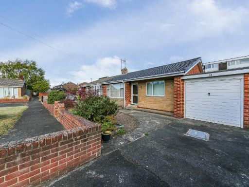 2 bedroom bungalow for sale in Meadway, Forest Hall, NE12 — £180,000 • 2 bed • 1 bath • 862 ft²
Meta
- {
"@context": "https://schema.org",
"@type": "Residence",
"name": "2 bedroom bungalow for sale in Alder Road, Wallsend, Tyne a…",
"description": "",
"url": "https://propertypiper.co.uk/property/053d56f3-1df8-4447-a359-8dcd9a020968",
"image": "https://image-a.propertypiper.co.uk/3cd6fba1-ffb3-4369-8612-decbb318b383-1024.jpeg",
"address": {
"@type": "PostalAddress",
"streetAddress": "12 ALDER ROAD WALLSEND",
"postalCode": "NE28 9UA",
"addressLocality": "North Tyneside",
"addressRegion": "North Tyneside",
"addressCountry": "England"
},
"geo": {
"@type": "GeoCoordinates",
"latitude": 55.011040619922944,
"longitude": -1.5119208342722559
},
"numberOfRooms": 2,
"numberOfBathroomsTotal": 1,
"floorSize": {
"@type": "QuantitativeValue",
"value": 514,
"unitCode": "FTK"
},
"offers": {
"@type": "Offer",
"price": 195000,
"priceCurrency": "GBP",
"availability": "https://schema.org/InStock"
},
"additionalProperty": [
{
"@type": "PropertyValue",
"name": "Feature",
"value": "bungalow"
},
{
"@type": "PropertyValue",
"name": "Feature",
"value": "semi-detached"
},
{
"@type": "PropertyValue",
"name": "Feature",
"value": "garage"
},
{
"@type": "PropertyValue",
"name": "Feature",
"value": "garden"
},
{
"@type": "PropertyValue",
"name": "Feature",
"value": "driveway"
},
{
"@type": "PropertyValue",
"name": "Feature",
"value": "post-war"
},
{
"@type": "PropertyValue",
"name": "Feature",
"value": "one-story"
},
{
"@type": "PropertyValue",
"name": "Feature",
"value": "brick property"
},
{
"@type": "PropertyValue",
"name": "Feature",
"value": "modern"
},
{
"@type": "PropertyValue",
"name": "Feature",
"value": "kitchen"
},
{
"@type": "PropertyValue",
"name": "Feature",
"value": "gloss cabinets"
},
{
"@type": "PropertyValue",
"name": "Feature",
"value": "subway tiles"
},
{
"@type": "PropertyValue",
"name": "Feature",
"value": "wood flooring"
},
{
"@type": "PropertyValue",
"name": "Feature",
"value": "integrated oven"
},
{
"@type": "PropertyValue",
"name": "Feature",
"value": "stainless steel"
},
{
"@type": "PropertyValue",
"name": "Feature",
"value": "clean"
}
]
}
High Res Floorplan Images
Compatible Floorplan Images
FloorplanImages Thumbnail