WF6 2DL - 3 bedroom detached house for sale in Redruth Drive, Normant…
View on Property Piper
3 bedroom detached house for sale in Redruth Drive, Normanton, West Yorkshire, WF6
Property Details
- Price: £220000
- Bedrooms: 3
- Bathrooms: 1
- Property Type: undefined
- Property SubType: undefined
Brochure Descriptions
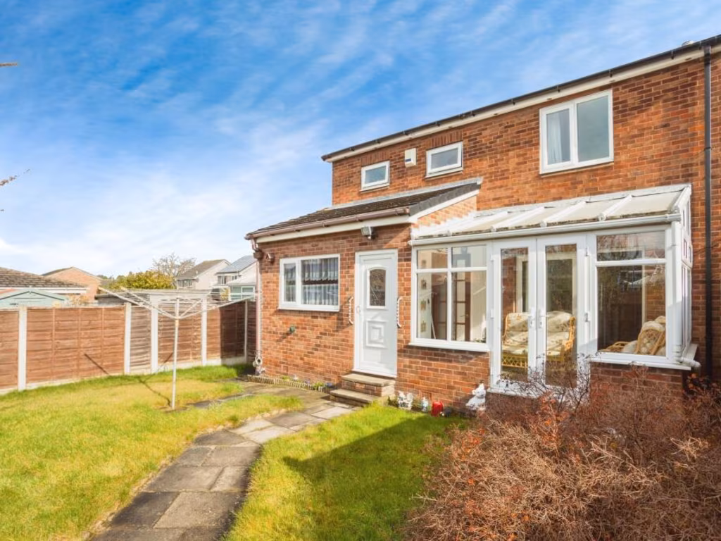
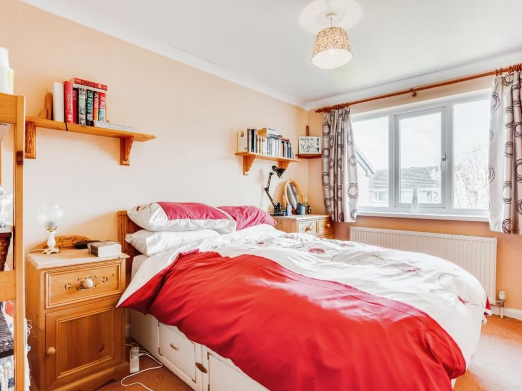
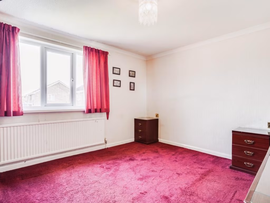
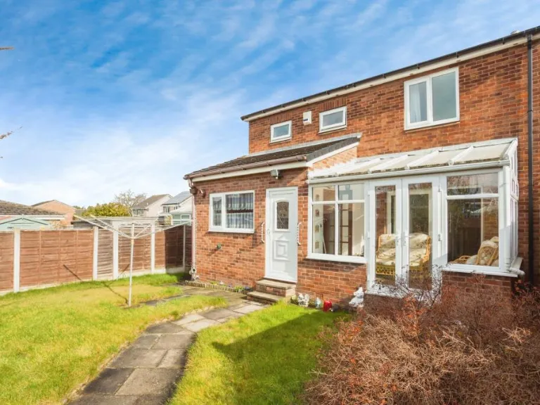
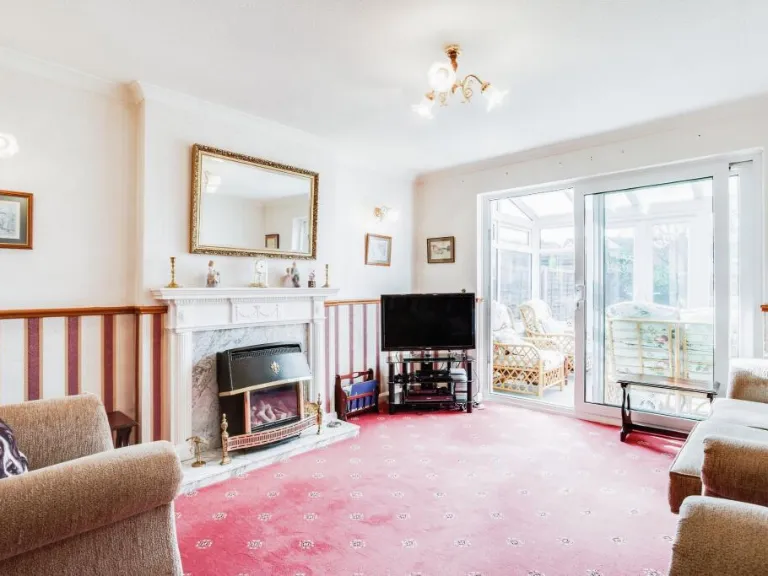
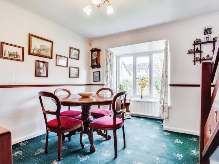
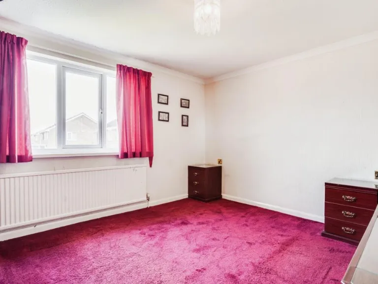
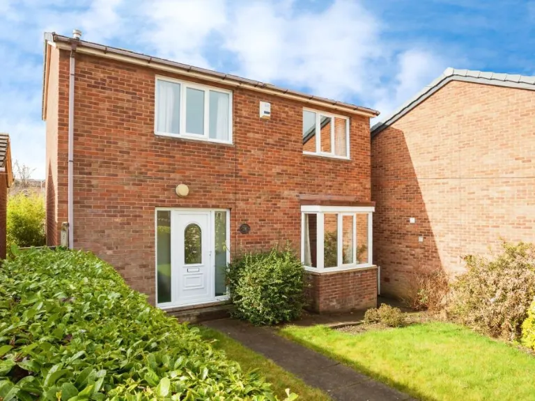
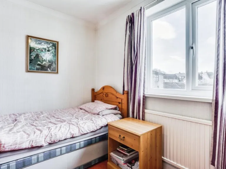
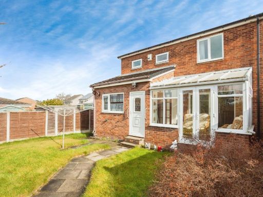
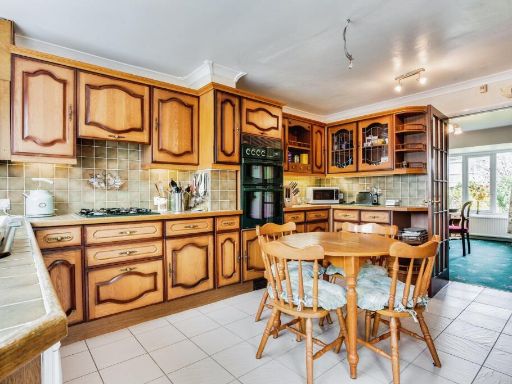
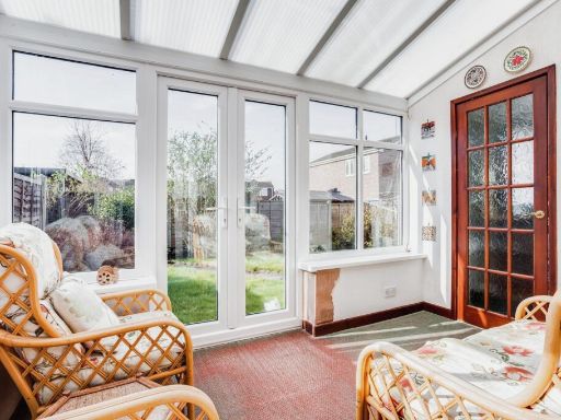
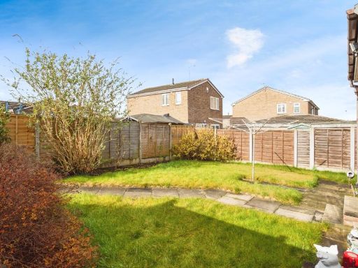
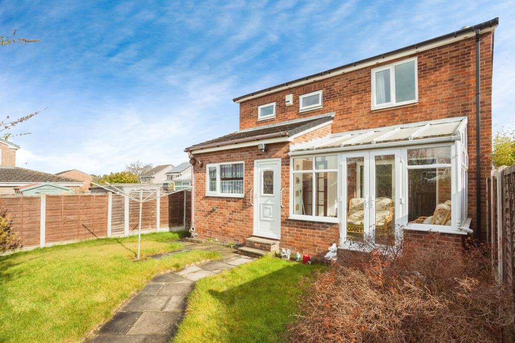
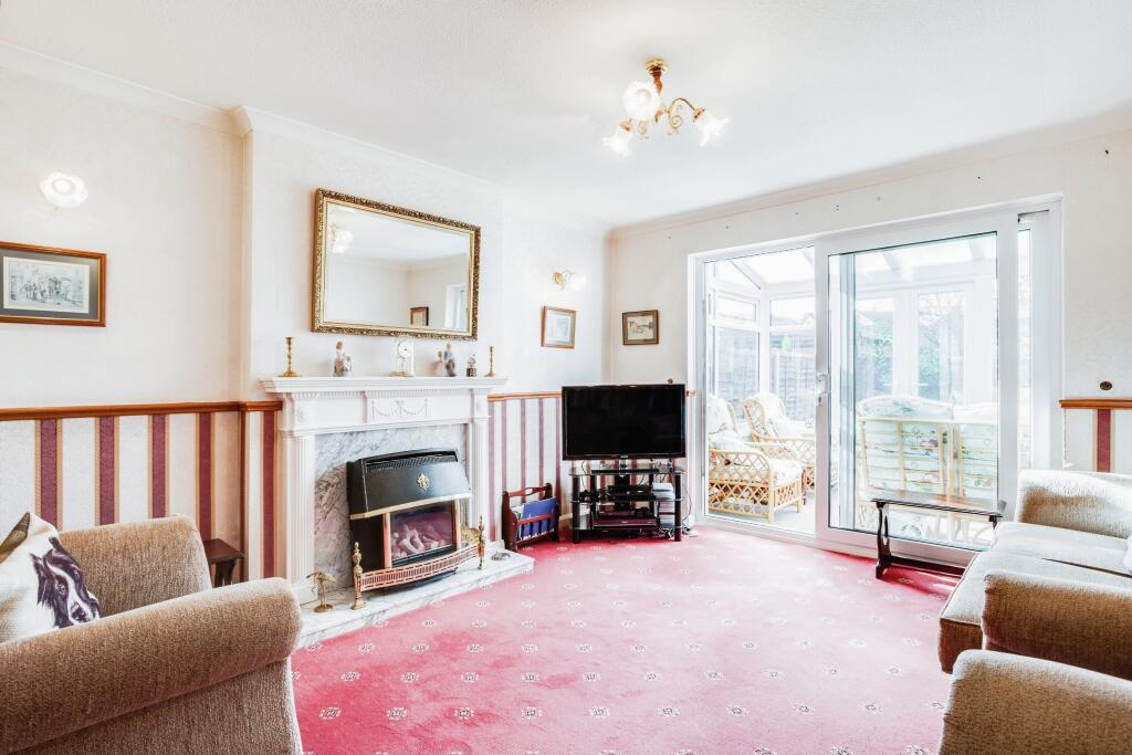
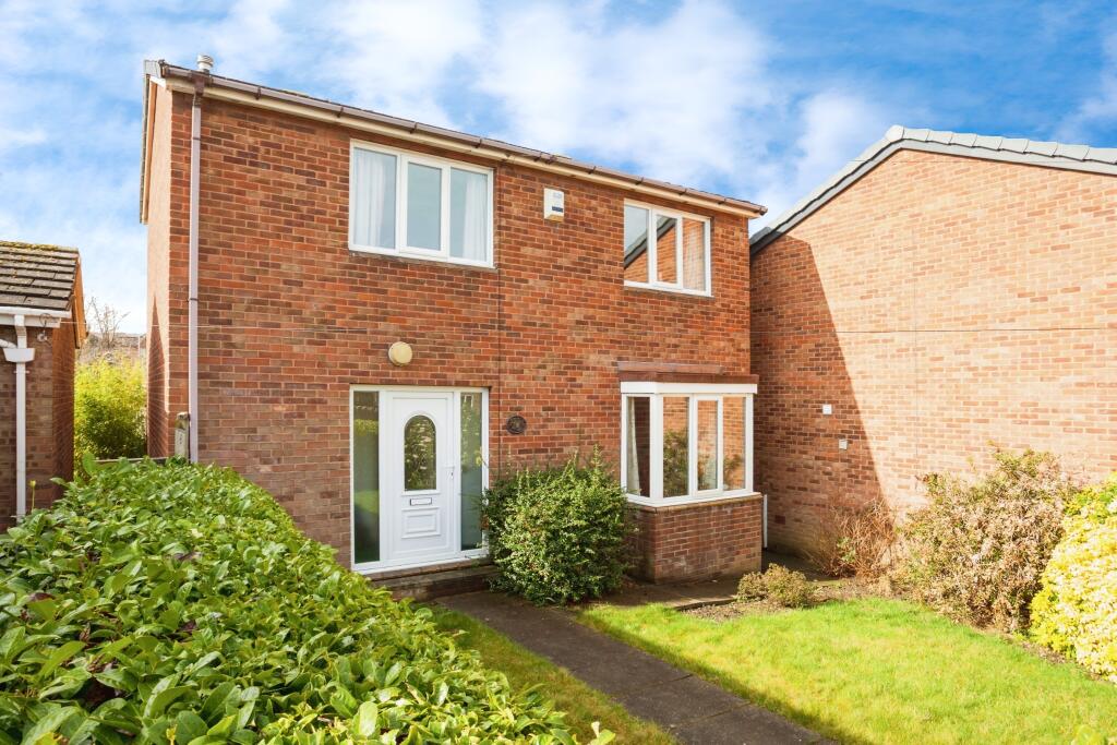
- This property is a detached house offering a spacious and welcoming living environment. The exterior features a well-maintained brick facade with an enclosed conservatory that adds both charm and functional living space, allowing for enjoyment of the outdoors from within the home. The garden is average in size, well-kept with a mixture of lawn and paved areas, suitable for family activities and light gardening. Inside, the property boasts bright and airy rooms with large windows that provide ample natural light. The kitchen is spacious, featuring wooden cabinetry and a dining area ideal for family meals. The living room includes a fireplace and provides a cozy atmosphere for relaxation. The bedrooms are well-proportioned, offering comfortable space for furnishings. Overall, this property presents a reasonable size, showing good potential as a family home.
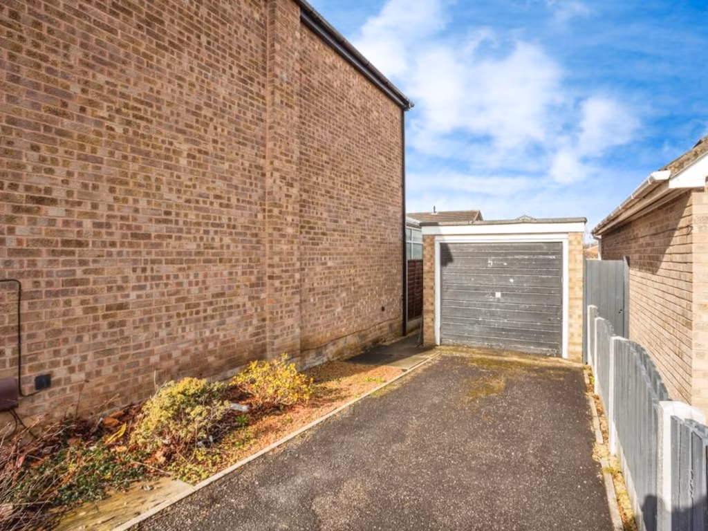
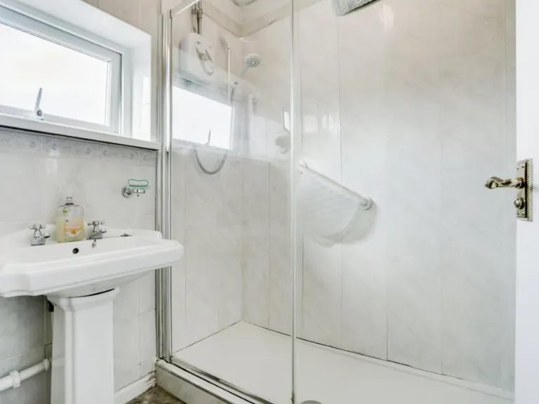
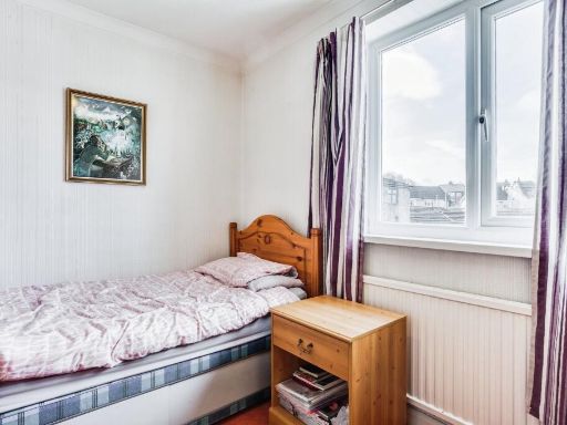
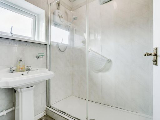
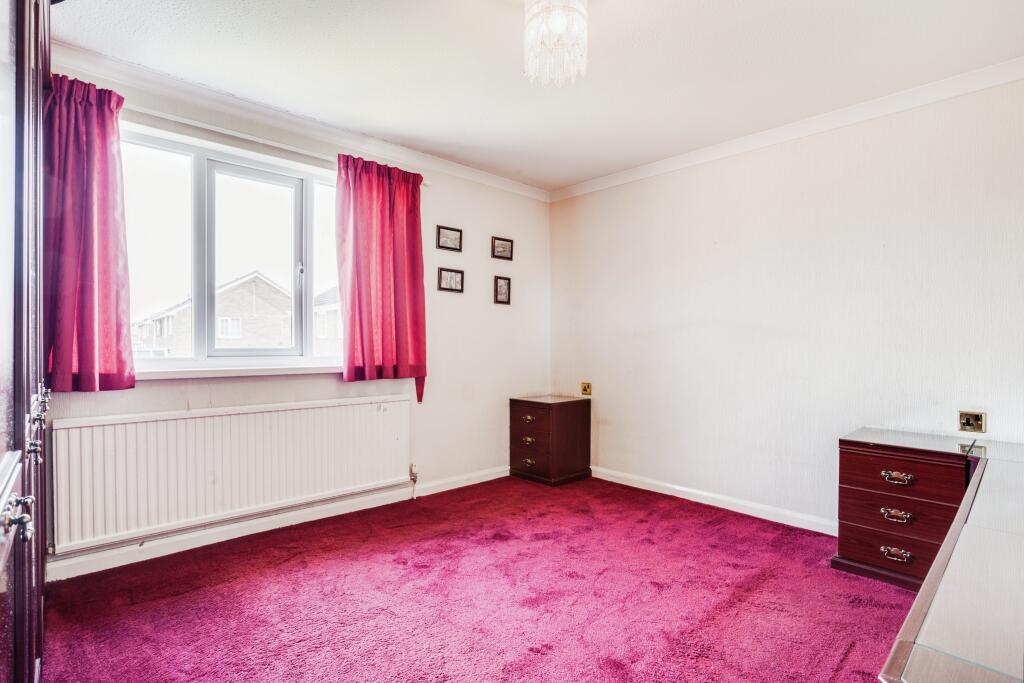
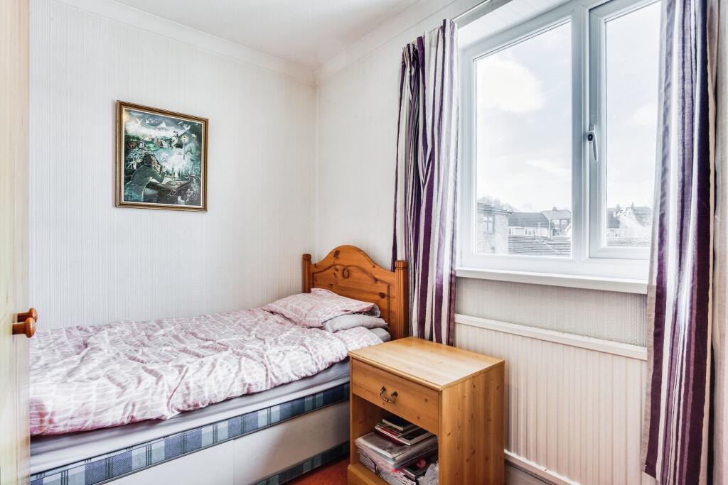
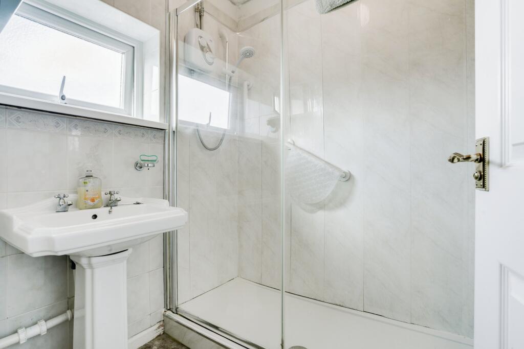
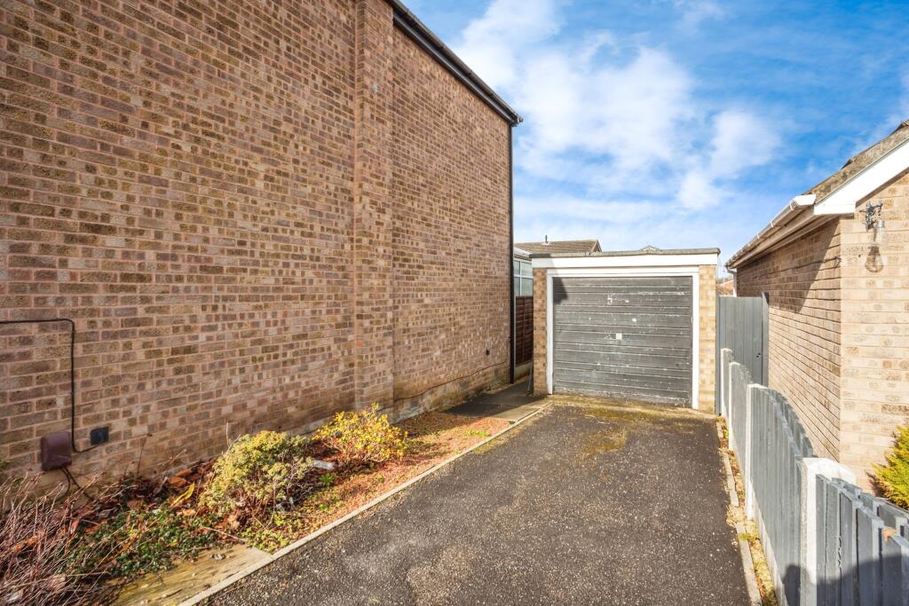
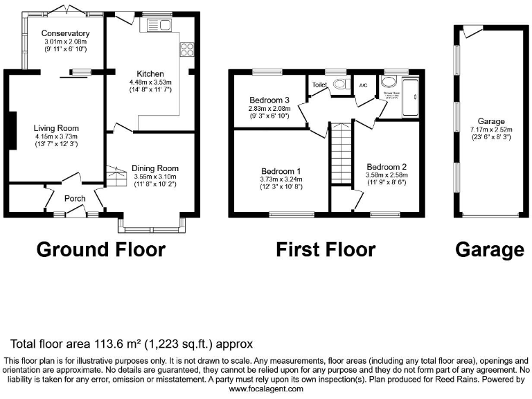
- The property is a detached house located on Redruth Drive in Normanton, West Yorkshire. It features generous garden space and multiple reception rooms, emphasizing views and the spaciousness essential for family living. The ground floor includes a porch leading to a dining room, a spacious living room, and a kitchen fitted with a range of units and modern appliances. There's also a conservatory offering additional leisure space with pleasant garden views, indicative of a well-sized garden area with potential for various landscaping features. The first floor hosts three bedrooms and a shower room. Bedroom sizes vary from average to small, suitable for standard furnishings, while the garage is a detached unit with up-and-over door access enhancing the usability for parking or storage. Exterior includes driveway access with garden areas and fenced boundaries, suggesting privacy and potential for outdoor activities.
Image Descriptions
- rear exterior of a 1980s detached suburban house modern suburban
- living room traditional
Floorplan Description
- A two-story house with a separate garage featuring a conservatory, three bedrooms, and multiple living spaces.
Rooms
- Conservatory: Small
- Living Room: Large
- Kitchen: Average
- Dining Room: Average
- Porch:
- Bedroom 1: Average
- Bedroom 2: Average
- Bedroom 3: Small
- Toilet:
- Garage: Large
Textual Property Features
Detected Visual Features
- 1980s
- detached house
- suburban
- rear garden
- conservatory
- uPVC windows
- modern suburban style
- brick facade
- traditional style
- living room
- fireplace
- French doors
- medium room
- standard ceiling
EPC Details
- Fully double glazed
- Cavity wall, filled cavity
- Boiler and radiators, mains gas
- Low energy lighting in all fixed outlets
- Suspended, no insulation (assumed)
Nearby Schools
- Shay Lane Primary (J and I) School
- Featherstone Girnhill Infant School
- Newlands Primary School
- Half Acres Primary Academy
- Oulton Academy
- Wakefield independent sch
- Crofton Academy
- Sharlston Community School
- Outwood Academy Freeston
- Normanton All Saints CofE Infant School
- Normanton Common Primary Academy
- Methley Primary School
- Crofton Infant School
- Crofton Junior School
- Featherstone Purston St Thomas Church of England Voluntary Controlled Junior School
- Lee Brigg Infant and Nursery School
- Ackton Pastures Primary Academy
- Great Preston VC CofE Primary School
- Streethouse, Junior, Infant and Nursery
- Featherstone All Saints CofE Academy
- St Wilfrid's Catholic High School & Sixth Form College: A Voluntary Academy
- Normanton Junior Academy
- St. John the Baptist Catholic Primary School
- Normanton Altofts Junior School
- Martin Frobisher Infant School
- Castleford Three Lane Ends Academy
- Allerton Bywater Primary School
- Brigshaw High School
Nearest General Shops
- Id: 458711705
- Tags:
- Addr:
- City: Wakefield
- Housenumber: 65
- Postcode: WF6 2AF
- Street: High Street
- Town: Normanton
- Building: yes
- Name: Special Occasions
- Shop: gift
- TagsNormalized:
- Lat: 53.7002102
- Lon: -1.418174
- FullGeoHash: gcwcrxz66hsz
- PartitionGeoHash: gcwc
- Images:
- FoodStandards: null
- Distance: 582.9
,- Id: 458711678
- Tags:
- Addr:
- City: Wakefield
- Housenumber: 52
- Postcode: WF6 2AQ
- Street: High Street
- Town: Normanton
- Building: yes
- Name: The Studio
- Shop: hairdresser
- TagsNormalized:
- Lat: 53.7000647
- Lon: -1.4177644
- FullGeoHash: gcwcrxz9e9w5
- PartitionGeoHash: gcwc
- Images:
- FoodStandards: null
- Distance: 579.4
,- Id: 458711704
- Tags:
- Addr:
- City: Wakefield
- Housenumber: 67
- Postcode: WF6 2AF
- Street: High Street
- Town: Normanton
- Building: yes
- Name: The Curtain Shop
- Shop: curtain
- TagsNormalized:
- Lat: 53.7002463
- Lon: -1.4180967
- FullGeoHash: gcwcrxz6egqq
- PartitionGeoHash: gcwc
- Images:
- FoodStandards: null
- Distance: 576.5
}
Nearest Religious buildings
- Id: 460574123
- Tags:
- Amenity: place_of_worship
- Building: church
- Denomination: anglican
- Name: Normanton All Saints Church
- Religion: christian
- Wikidata: Q4729507
- Wikipedia: en:All Saints' Church, Normanton
- TagsNormalized:
- place of worship
- church
- anglican
- christian
- Lat: 53.6978609
- Lon: -1.4147905
- FullGeoHash: gcwcrz3u8yz9
- PartitionGeoHash: gcwc
- Images:
- FoodStandards: null
- Distance: 729.4
,- Id: 458711844
- Tags:
- Addr:
- City: Wakefield
- Postcode: WF6 2AF
- Street: High Street
- Amenity: place_of_worship
- Building: church
- Denomination: baptist
- Name: Normanton Baptist Church
- Religion: christian
- TagsNormalized:
- place of worship
- church
- baptist
- christian
- Lat: 53.7005356
- Lon: -1.4171565
- FullGeoHash: gcwcrzbh3c7s
- PartitionGeoHash: gcwc
- Images:
- FoodStandards: null
- Distance: 513.5
,- Id: 423342211
- Tags:
- Amenity: place_of_worship
- Name: Normanton National Spiritualist Church
- Religion: spiritualist
- TagsNormalized:
- place of worship
- church
- spiritualist
- Lat: 53.7030813
- Lon: -1.4069117
- FullGeoHash: gcwcxbre0efw
- PartitionGeoHash: gcwc
- Images:
- FoodStandards: null
- Distance: 399.3
}
Nearest Medical buildings
- Id: 4550748785
- Tags:
- Addr:
- City: Wakefield
- Postcode: WF6 2AZ
- Amenity: pharmacy
- Dispensing: yes
- Healthcare: pharmacy
- Name: The Pharmacy Group
- Old_name: Lloyds Pharmacy
- TagsNormalized:
- Lat: 53.70046
- Lon: -1.4175469
- FullGeoHash: gcwcrxzgbg23
- PartitionGeoHash: gcwc
- Images:
- FoodStandards: null
- Distance: 535.5
,- Id: 458711843
- Tags:
- Addr:
- City: Wakefield
- Postcode: WF6 2AZ
- Street: King Edward Street
- Amenity: doctors
- Building: yes
- Healthcare: doctor
- Name: Kings Medical Centre
- Opening_hours: Mo-Su 08:00-20:00
- TagsNormalized:
- doctor
- doctors
- health
- healthcare
- Lat: 53.7006645
- Lon: -1.417898
- FullGeoHash: gcwcrxzt096t
- PartitionGeoHash: gcwc
- Images:
- FoodStandards: null
- Distance: 532.4
,- Id: 465225296
- Tags:
- Addr:
- City: Wakefield
- Housenumber: 148
- Postcode: WF6 2EP
- Street: Castleford Road
- Amenity: doctors
- Building: house
- Healthcare: doctor
- Name: Bridge Street Surgery
- Ref:
- TagsNormalized:
- doctor
- doctors
- health
- healthcare
- surgery
- Lat: 53.702187
- Lon: -1.408885
- FullGeoHash: gcwcxbnjft5p
- PartitionGeoHash: gcwc
- Images:
- FoodStandards: null
- Distance: 339.7
,- Id: 465224678
- Tags:
- Addr:
- City: Wakefield
- Housenumber: 146
- Postcode: WF6 2EP
- Street: Castleford Road
- Amenity: pharmacy
- Building: yes
- Healthcare: pharmacy
- Name: M & A Pharmacy
- TagsNormalized:
- Lat: 53.7020988
- Lon: -1.4092288
- FullGeoHash: gcwcxbjv6sfc
- PartitionGeoHash: gcwc
- Images:
- FoodStandards: null
- Distance: 330.8
}
Nearest Airports
- Id: 11519546
- Tags:
- Addr:
- City: Leeds
- Postcode: LS19 7TU
- Aerodrome: international
- Aerodrome:type: public
- Aeroway: aerodrome
- Iata: LBA
- Icao: EGNM
- Name: Leeds Bradford Airport
- Operator: Leeds Bradford Airport Limited
- Operator:type: private
- Ref: LBA
- Type: multipolygon
- Website: https://www.leedsbradfordairport.co.uk/
- Wikidata: Q8699
- Wikipedia: en:Leeds Bradford Airport
- TagsNormalized:
- airport
- international airport
- Lat: 53.8667047
- Lon: -1.660138
- FullGeoHash: gcwf6nph7cx3
- PartitionGeoHash: gcwf
- Images:
- Q8699-1
- Q8699-2
- Q8699-3
- Q8699-4
- FoodStandards: null
- Distance: 24301.1
}
Nearest Leisure Facilities
- Id: 900734253
- Tags:
- TagsNormalized:
- Lat: 53.7023595
- Lon: -1.4104906
- FullGeoHash: gcwcxbhyvjmu
- PartitionGeoHash: gcwc
- Images:
- FoodStandards: null
- Distance: 256.8
,- Id: 1123067214
- Tags:
- Leisure: park
- Name: Haw Hill Park
- Operator: Wakefield Council
- TagsNormalized:
- Lat: 53.7022691
- Lon: -1.4120087
- FullGeoHash: gcwcxb5y3ud1
- PartitionGeoHash: gcwc
- Images:
- FoodStandards: null
- Distance: 228.7
,- Id: 900735923
- Tags:
- TagsNormalized:
- Lat: 53.7038994
- Lon: -1.4154946
- FullGeoHash: gcwcxb3rbs6w
- PartitionGeoHash: gcwc
- Images:
- FoodStandards: null
- Distance: 194.1
,- Id: 471038093
- Tags:
- Leisure: pitch
- Sport: multi
- TagsNormalized:
- Lat: 53.7030178
- Lon: -1.4111236
- FullGeoHash: gcwcxbk6y2jg
- PartitionGeoHash: gcwc
- Images:
- FoodStandards: null
- Distance: 172.8
,- Id: 471037428
- Tags:
- Leisure: pitch
- Sport: tennis
- TagsNormalized:
- Lat: 53.7028069
- Lon: -1.4126825
- FullGeoHash: gcwcxb73d0g9
- PartitionGeoHash: gcwc
- Images:
- FoodStandards: null
- Distance: 165.4
}
Nearest Tourist attractions
- Id: 981922508
- Tags:
- Addr:
- City: Pontefract
- Postcode: WF7 6AW
- Street: Featherstone Lane
- Suburb: Featherstone
- Town: Pontefract
- Building: yes
- Fhrs:
- Guest_house: guest_house
- Name: Rolands Croft Guest House
- Stars: 3
- Tourism: guest_house
- Website: https://www.rolandscroft.co.uk/
- TagsNormalized:
- Lat: 53.6925382
- Lon: -1.3589514
- FullGeoHash: gcx13n6mwns6
- PartitionGeoHash: gcx1
- Images:
- FoodStandards:
- Id: 811979
- FHRSID: 811979
- LocalAuthorityBusinessID: PI/000084096
- BusinessName: Rolands Croft
- BusinessType: Hotel/bed & breakfast/guest house
- BusinessTypeID: 7842
- AddressLine1: Featherstone Lane
- AddressLine2: Featherstone
- AddressLine3: Pontefract
- AddressLine4: null
- PostCode: WF7 6AW
- RatingValue: 5
- RatingKey: fhrs_5_en-GB
- RatingDate: 2015-11-10
- LocalAuthorityCode: 432
- LocalAuthorityName: Wakefield
- LocalAuthorityWebSite: http://www.wakefield.gov.uk
- LocalAuthorityEmailAddress: food@wakefield.gov.uk
- Scores:
- Hygiene: 5
- Structural: 5
- ConfidenceInManagement: 5
- NewRatingPending: false
- Geocode:
- Longitude: -1.35836195945740
- Latitude: 53.69247436523440
- Distance: 3767.2
,- Id: 157875245
- Tags:
- Addr:
- City: Wakefield
- Postcode: WF10 5NW
- Street: Willowbridge Way
- Name: Diggerland Yorkshire
- Tourism: theme_park
- Wikidata: Q5275638
- Wikipedia: en:Diggerland
- TagsNormalized:
- Lat: 53.7184959
- Lon: -1.3840867
- FullGeoHash: gcx18e0humqj
- PartitionGeoHash: gcx1
- Images:
- FoodStandards: null
- Distance: 2453.7
,- Id: 458711921
- Tags:
- Addr:
- City: Wakefield
- Housenumber: 21-27
- Postcode: WF6 2BE
- Street: Lower Station Road
- Building: house
- Name: Station Lodge
- Tourism: guest_house
- TagsNormalized:
- Lat: 53.7003774
- Lon: -1.4222456
- FullGeoHash: gcwcrxu777bu
- PartitionGeoHash: gcwc
- Images:
- FoodStandards: null
- Distance: 768.7
}
Nearest Hotels
- Id: 643201477
- Tags:
- Addr:
- City: Wakefield
- Postcode: WF10 5JU
- Street: High Street
- Suburb: Castleford
- Amenity: pub
- Building: yes
- Name: The Commercial Hotel
- TagsNormalized:
- Lat: 53.7228994
- Lon: -1.3630632
- FullGeoHash: gcx18gzqw663
- PartitionGeoHash: gcx1
- Images:
- FoodStandards: null
- Distance: 3862.2
,- Id: 863261389
- Tags:
- Addr:
- City: Castleford
- Postcode: WF10 5TG
- Street: Pioneer Way
- Brand: Ibis
- Brand:wikidata: Q920166
- Building: yes
- Fhrs:
- Internet_access: wlan
- Name: Ibis
- Old_name: Premier Inn
- Tourism: hotel
- TagsNormalized:
- Lat: 53.7123762
- Lon: -1.3870442
- FullGeoHash: gcx186jcr88u
- PartitionGeoHash: gcx1
- Images:
- FoodStandards: null
- Distance: 1908.3
,- Id: 458711910
- Tags:
- Addr:
- City: Wakefield
- Postcode: WF6 2AR
- Street: Market Street
- Amenity: pub
- Building: yes
- Fhrs:
- Name: The Midland Hotel
- TagsNormalized:
- Lat: 53.6994873
- Lon: -1.4208454
- FullGeoHash: gcwcrxtq5vuz
- PartitionGeoHash: gcwc
- Images:
- FoodStandards: null
- Distance: 760.7
}
Tags
- 1980s
- detached house
- suburban
- rear garden
- conservatory
- uPVC windows
- modern suburban style
- brick facade
- traditional style
- living room
- fireplace
- French doors
- conservatory
- medium room
- standard ceiling
Local Market Stats
- Average Price/sqft: £190
- Avg Income: £41200
- Rental Yield: 5%
- Social Housing: 16%
- Planning Success Rate: 94%
Similar Properties
 3 bedroom detached house for sale in Dalefield Road, Normanton, WF6 — £294,000 • 3 bed • 2 bath • 1012 ft²
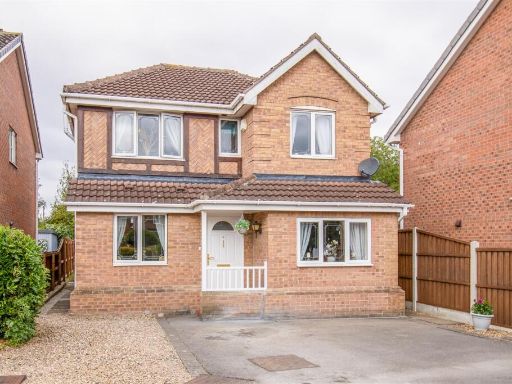 4 bedroom detached house for sale in Queensbury Court, Normanton, WF6 — £335,000 • 4 bed • 2 bath • 899 ft²
 5 bedroom detached house for sale in Troon Close, Normanton, West Yorkshire WF6 — £400,000 • 5 bed • 3 bath • 1144 ft²
 4 bedroom detached house for sale in Beverley Close, Normanton, WF6 — £335,000 • 4 bed • 2 bath • 1538 ft²
 4 bedroom detached house for sale in Whinbeck Avenue, Normanton, WF6 — £320,000 • 4 bed • 3 bath • 1185 ft²
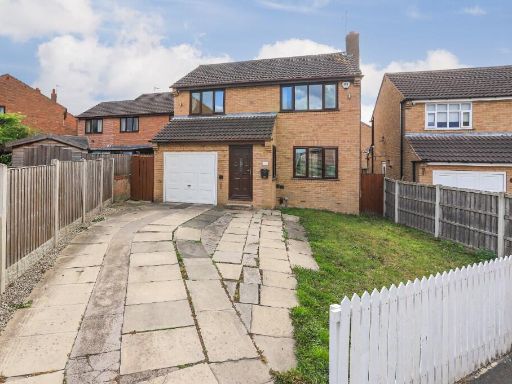 4 bedroom detached house for sale in Bodmin Drive, Normanton, West Yorkshire, WF6 — £330,000 • 4 bed • 2 bath • 1062 ft²
Meta
- {
"@context": "https://schema.org",
"@type": "Residence",
"name": "3 bedroom detached house for sale in Redruth Drive, Normant…",
"description": "",
"url": "https://propertypiper.co.uk/property/03928008-9a84-4ec9-b20f-ce6db29b4484",
"image": "https://image-a.propertypiper.co.uk/0f17d326-5a51-4629-ad1b-b85cf83104a4-1024.jpeg",
"address": {
"@type": "PostalAddress",
"streetAddress": "Redruth Drive, Normanton, West Yorkshire, WF6",
"postalCode": "WF6 2DL",
"addressLocality": "Wakefield",
"addressRegion": "Normanton, Pontefract and Castleford",
"addressCountry": "England"
},
"geo": {
"@type": "GeoCoordinates",
"latitude": 53.7042935,
"longitude": -1.412622
},
"numberOfRooms": 3,
"numberOfBathroomsTotal": 1,
"floorSize": {
"@type": "QuantitativeValue",
"value": 1223,
"unitCode": "FTK"
},
"offers": {
"@type": "Offer",
"price": 220000,
"priceCurrency": "GBP",
"availability": "https://schema.org/InStock"
},
"additionalProperty": [
{
"@type": "PropertyValue",
"name": "Feature",
"value": "1980s"
},
{
"@type": "PropertyValue",
"name": "Feature",
"value": "detached house"
},
{
"@type": "PropertyValue",
"name": "Feature",
"value": "suburban"
},
{
"@type": "PropertyValue",
"name": "Feature",
"value": "rear garden"
},
{
"@type": "PropertyValue",
"name": "Feature",
"value": "conservatory"
},
{
"@type": "PropertyValue",
"name": "Feature",
"value": "uPVC windows"
},
{
"@type": "PropertyValue",
"name": "Feature",
"value": "modern suburban style"
},
{
"@type": "PropertyValue",
"name": "Feature",
"value": "brick facade"
},
{
"@type": "PropertyValue",
"name": "Feature",
"value": "traditional style"
},
{
"@type": "PropertyValue",
"name": "Feature",
"value": "living room"
},
{
"@type": "PropertyValue",
"name": "Feature",
"value": "fireplace"
},
{
"@type": "PropertyValue",
"name": "Feature",
"value": "French doors"
},
{
"@type": "PropertyValue",
"name": "Feature",
"value": "conservatory"
},
{
"@type": "PropertyValue",
"name": "Feature",
"value": "medium room"
},
{
"@type": "PropertyValue",
"name": "Feature",
"value": "standard ceiling"
}
]
}
High Res Floorplan Images
Compatible Floorplan Images
FloorplanImages Thumbnail