DN9 2EY - 4 bedroom detached house for sale in Holm Road, Westwoodsid…
View on Property Piper
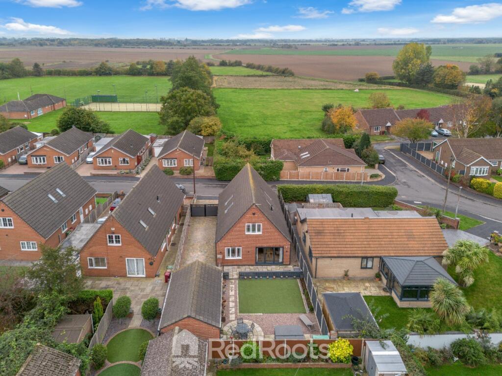
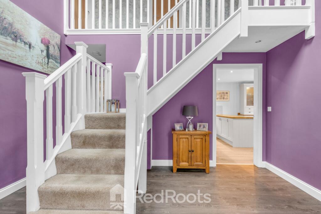
4 bedroom detached house for sale in Holm Road, Westwoodside, Doncaster, Lincolnshire, DN9 2EY, DN9
Property Details
- Price: £350000
- Bedrooms: 4
- Bathrooms: 2
- Property Type: undefined
- Property SubType: undefined
Image Descriptions
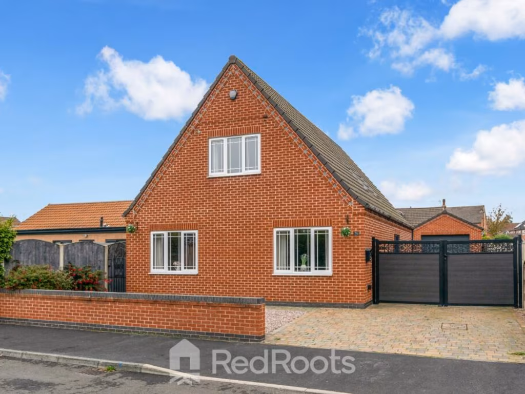
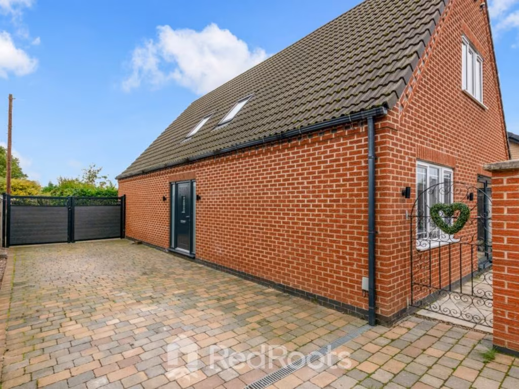
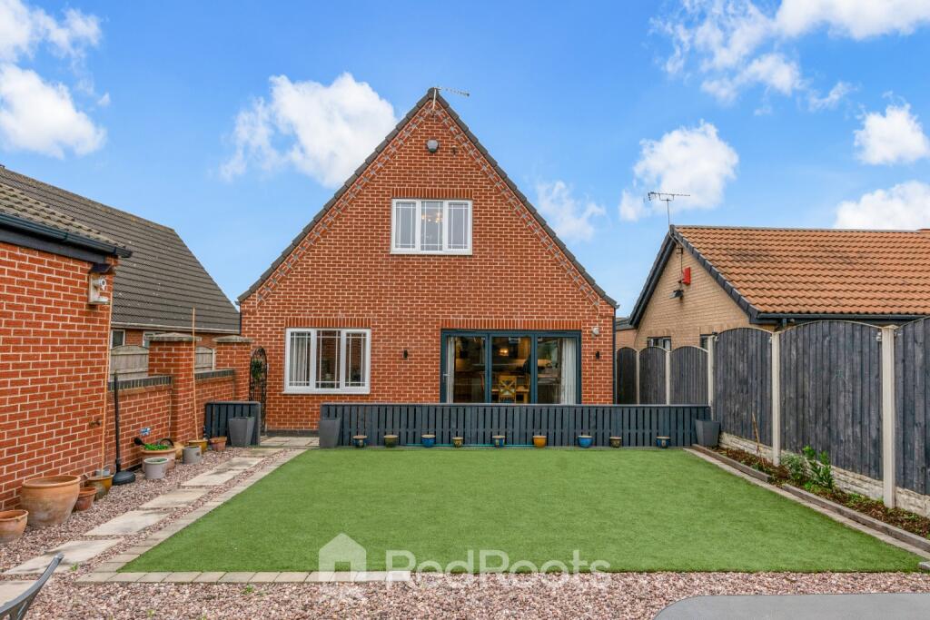
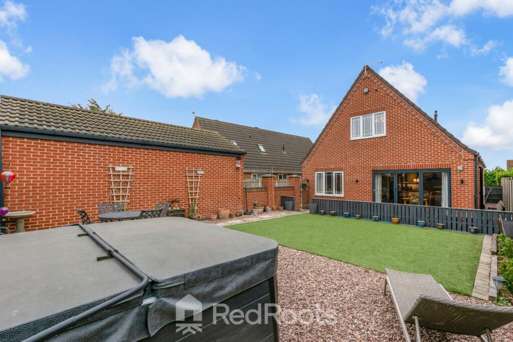
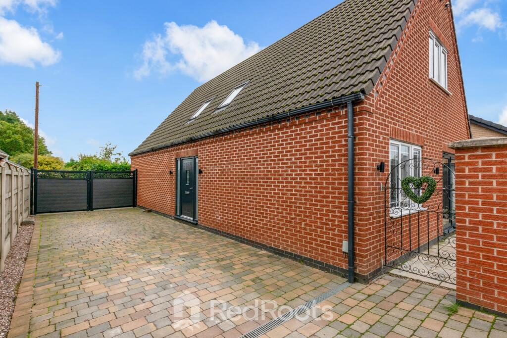
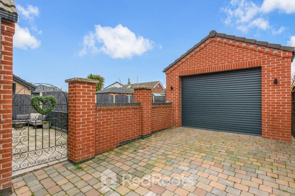
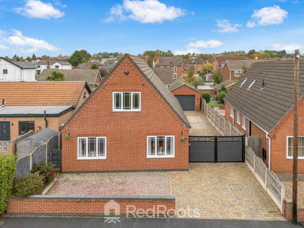
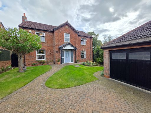
- detached house modern
- detached house modern
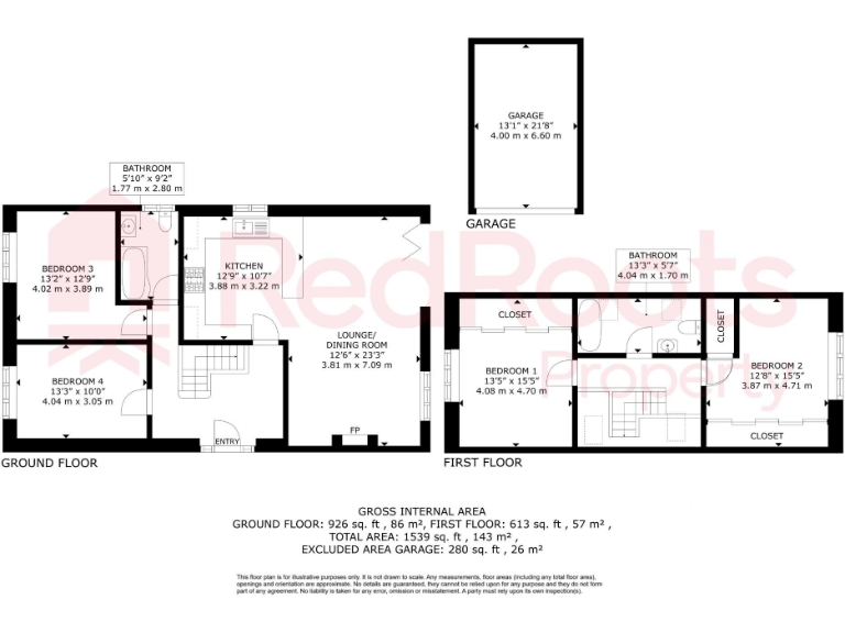
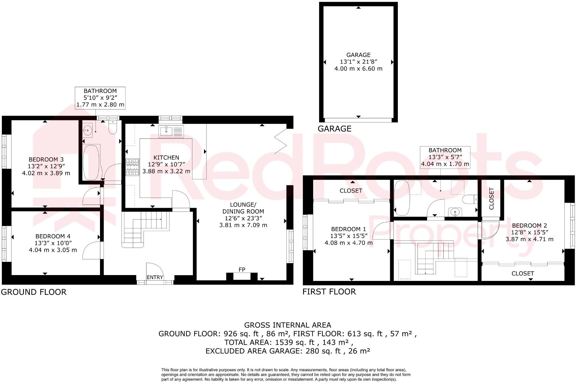
Rooms
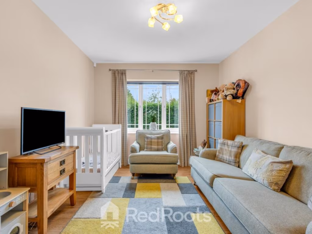
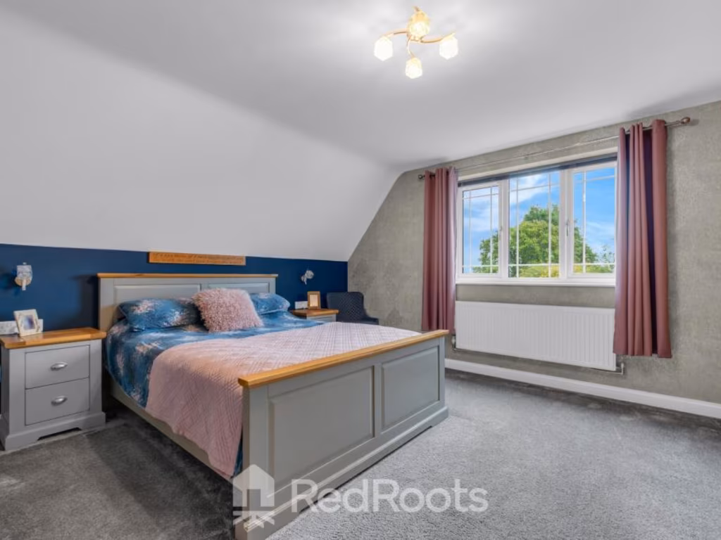
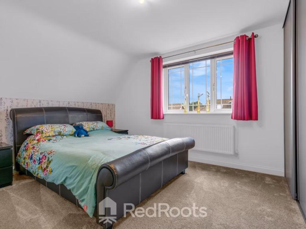
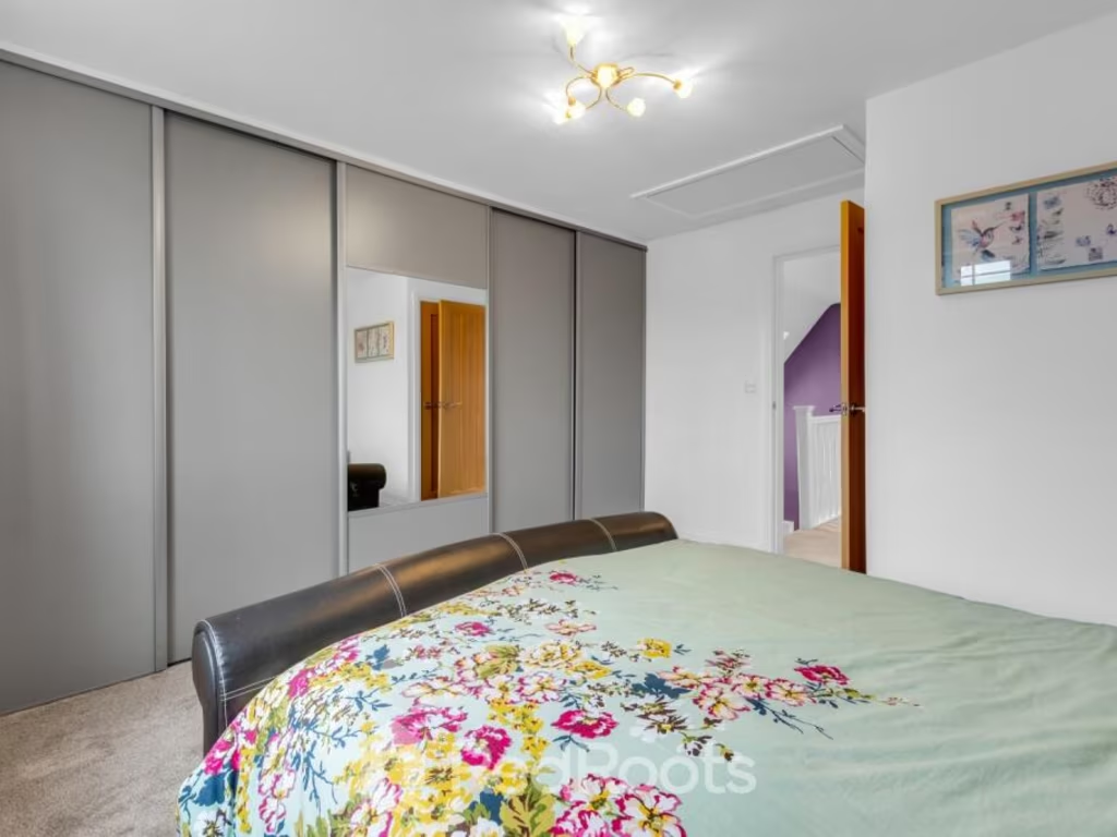
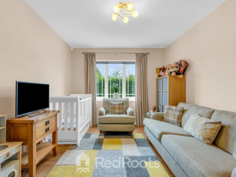
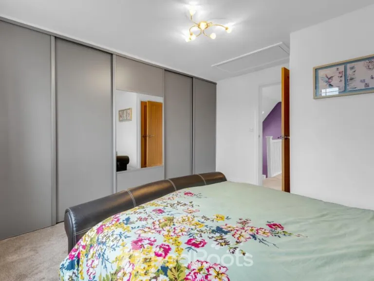
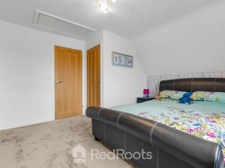
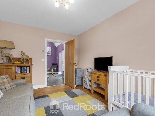
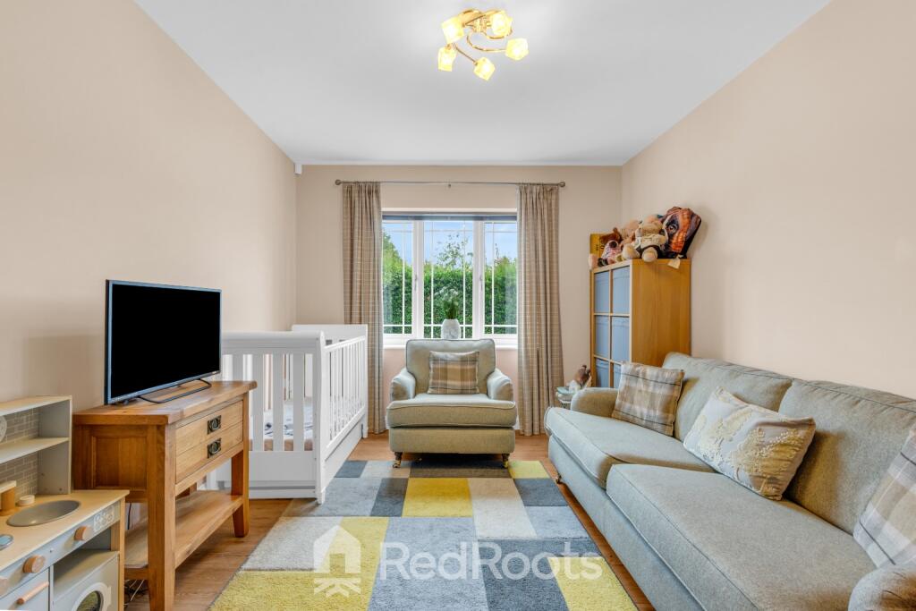
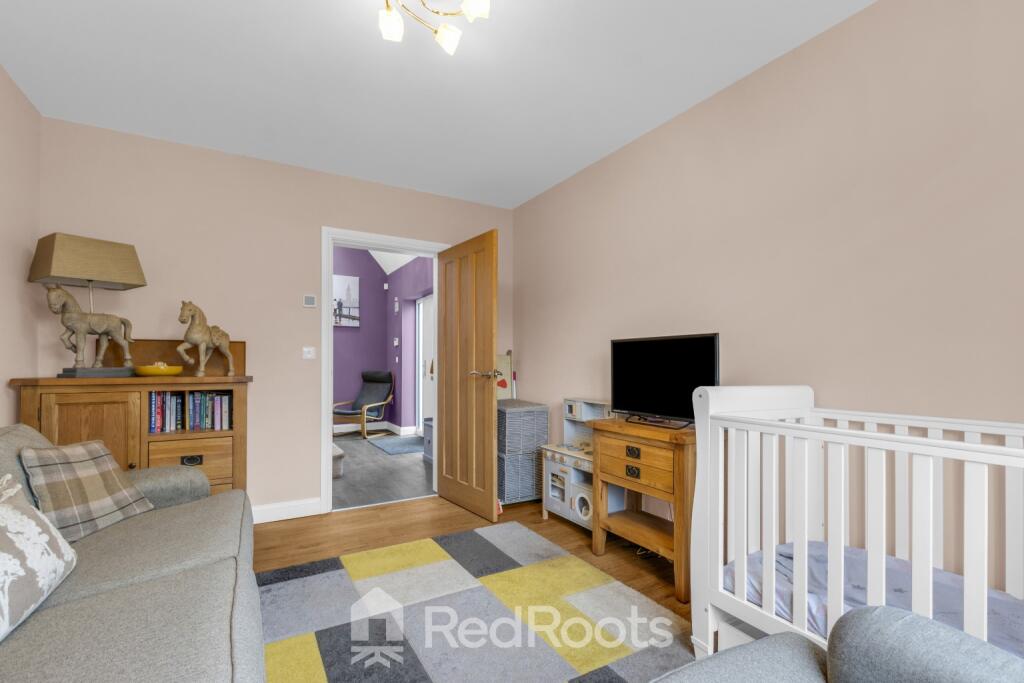
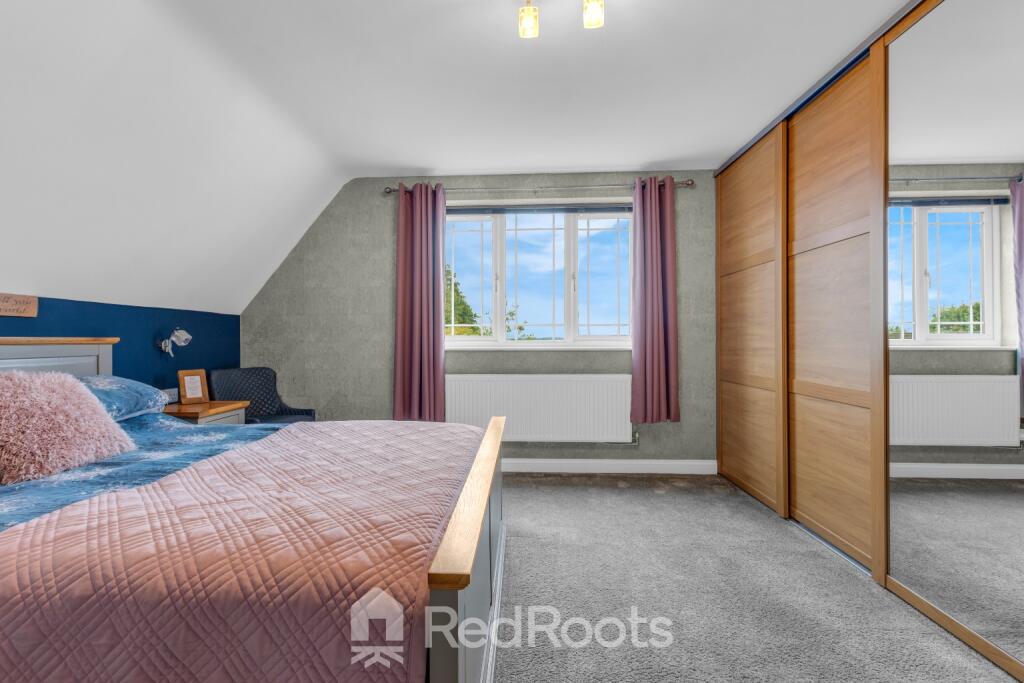
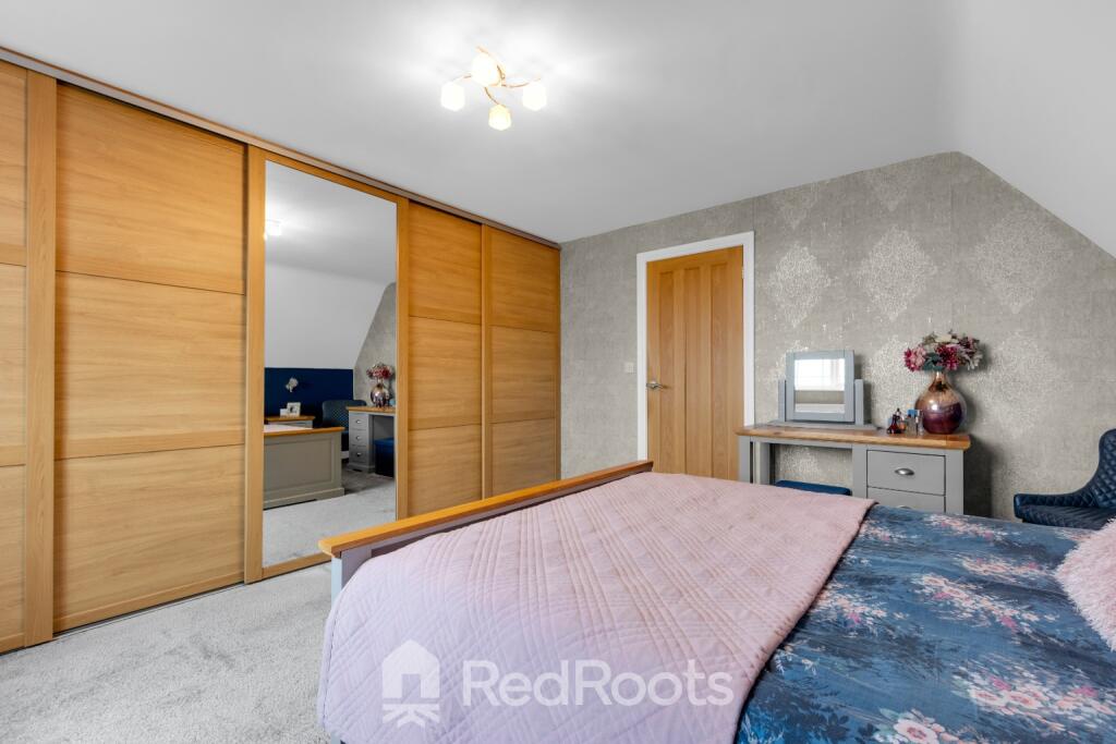
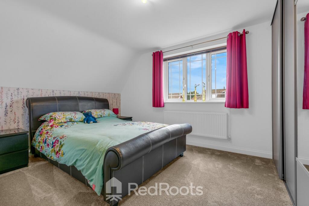
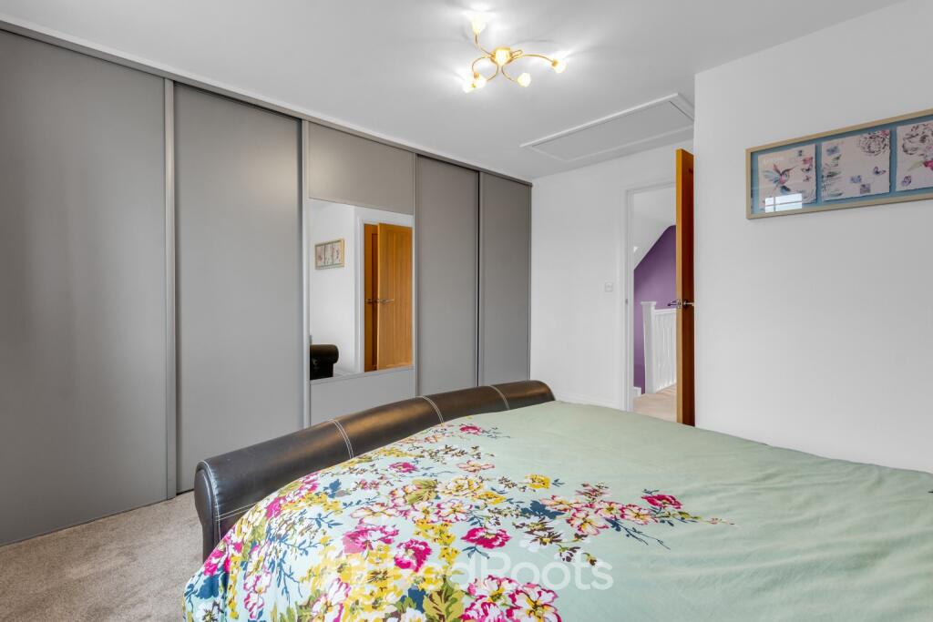
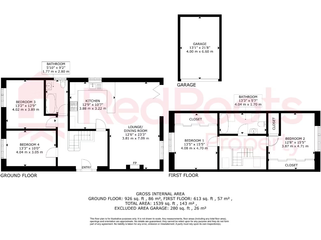
- BEDROOM 3:
- BEDROOM 4:
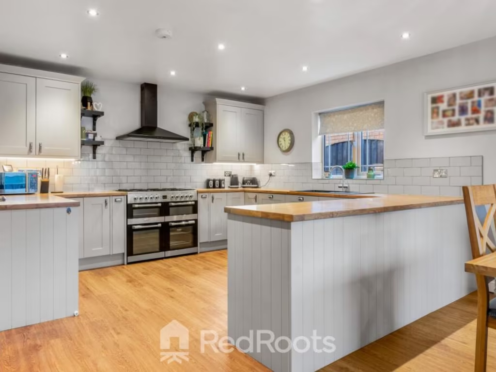
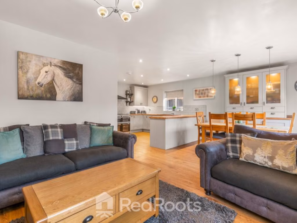
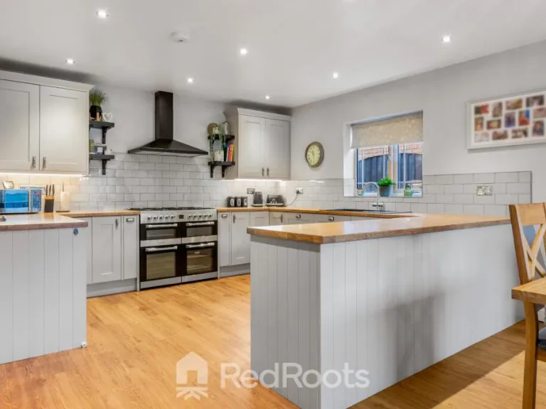
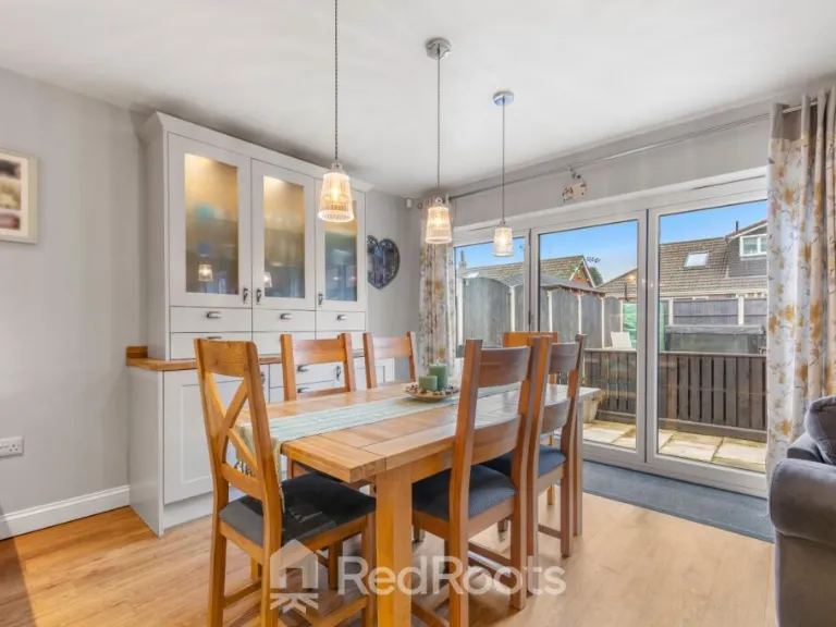
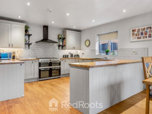
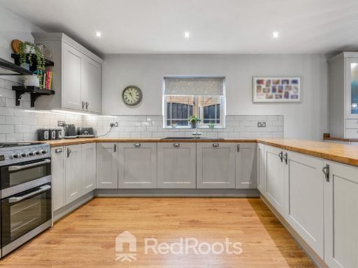
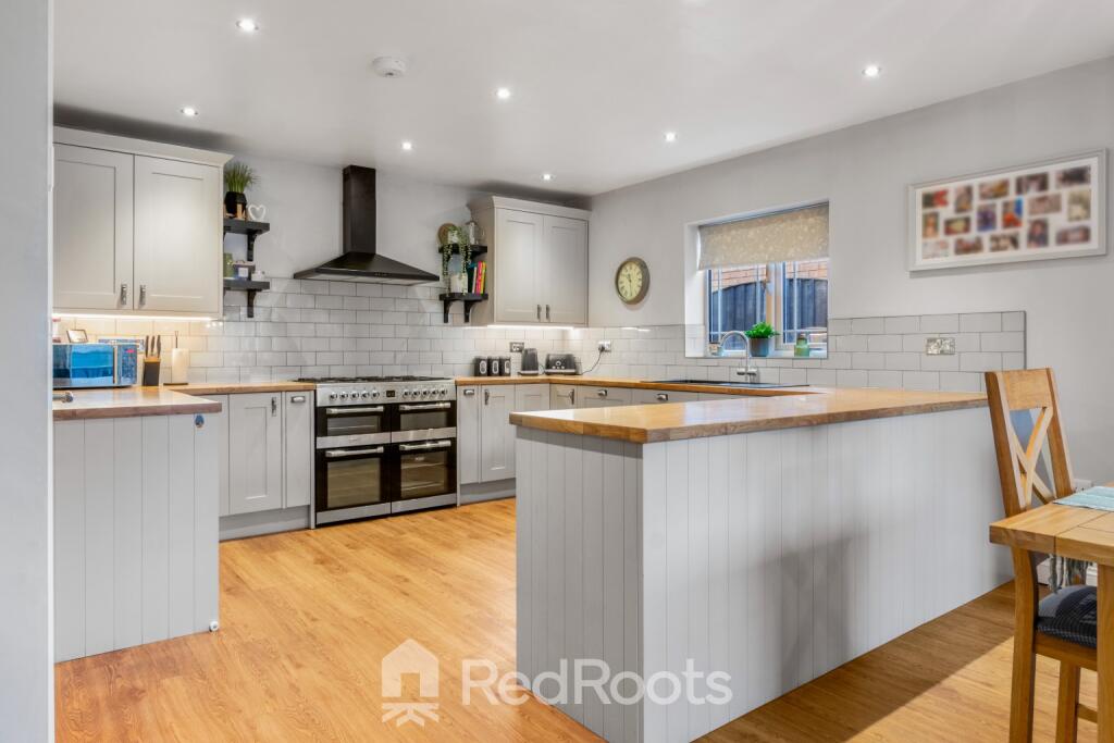
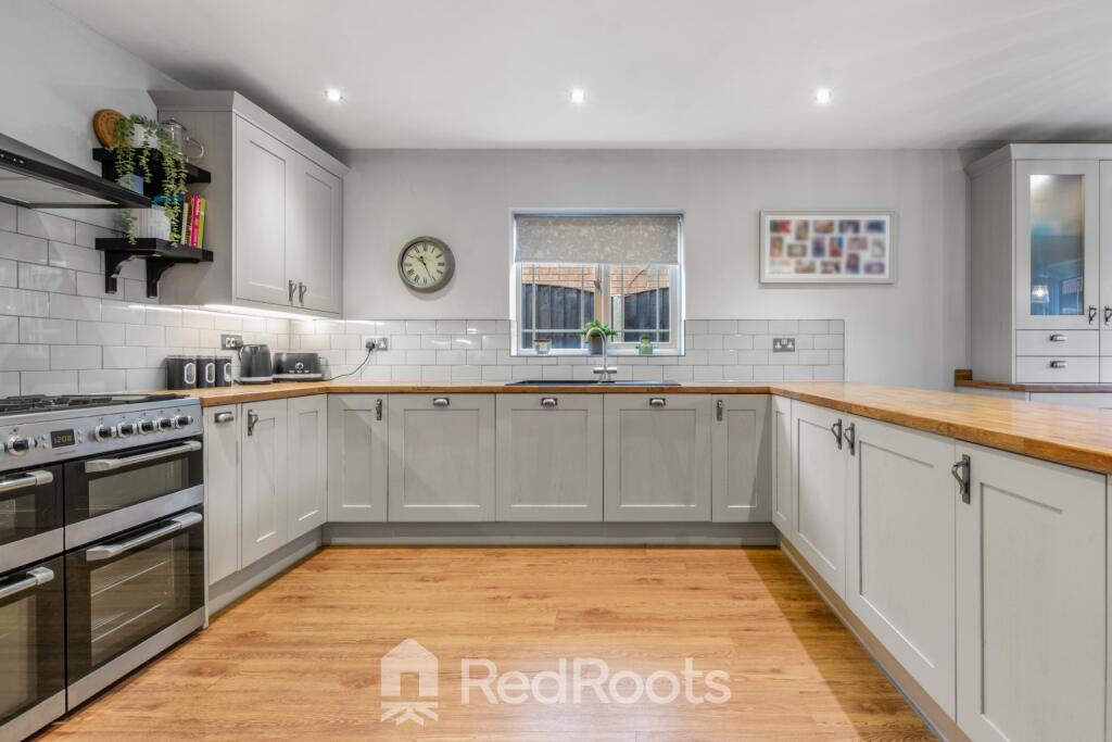
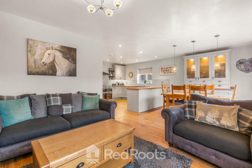
- KITCHEN:
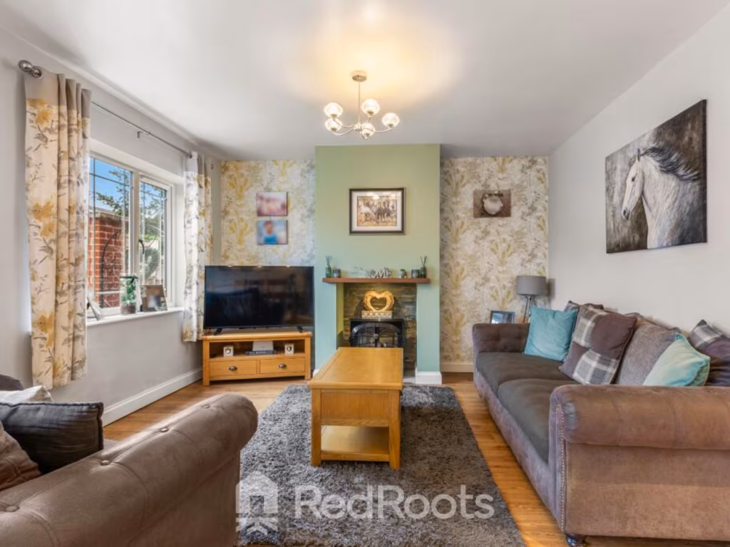
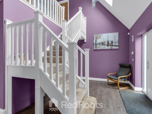
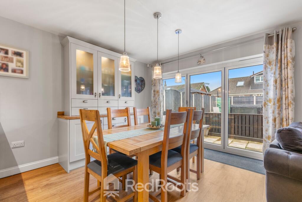
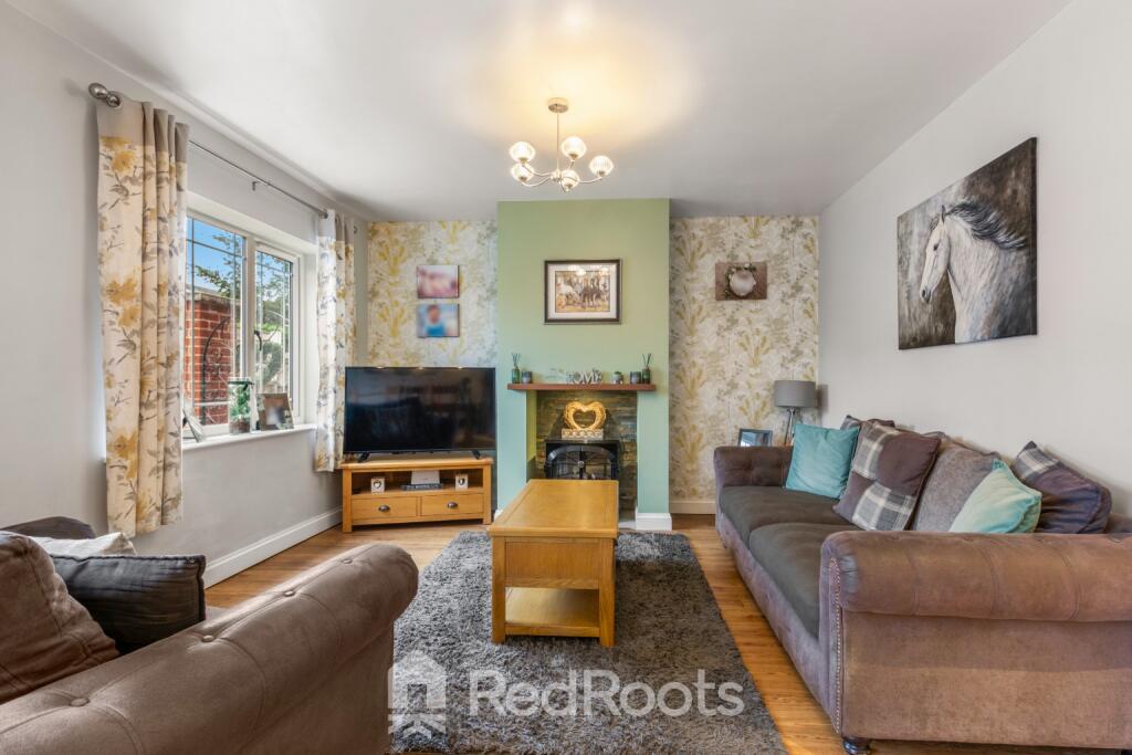
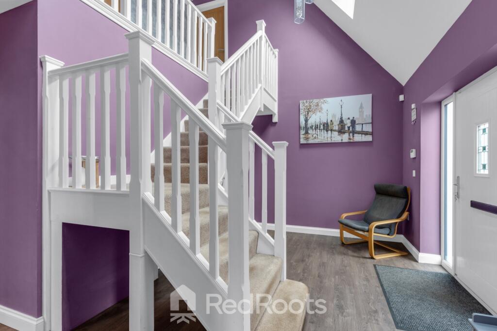
- LOUNGE/ DINING ROOM:
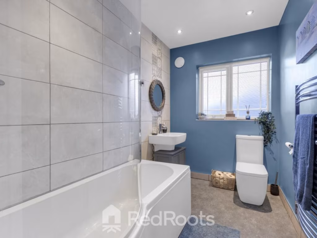
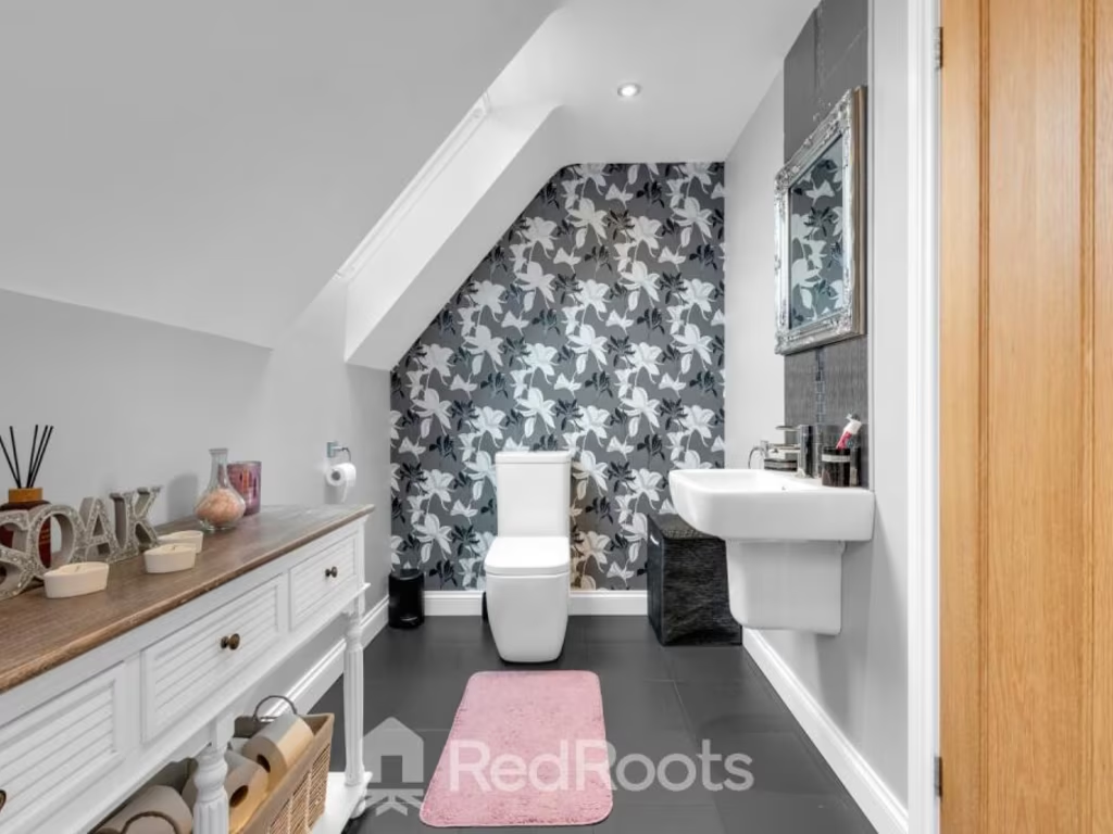
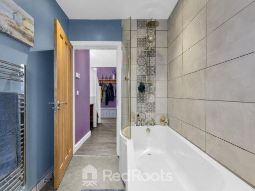
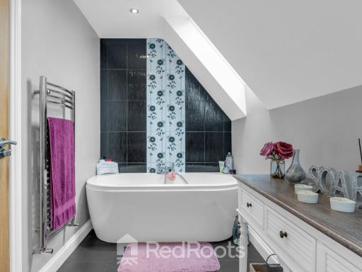
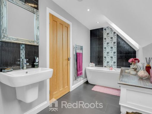
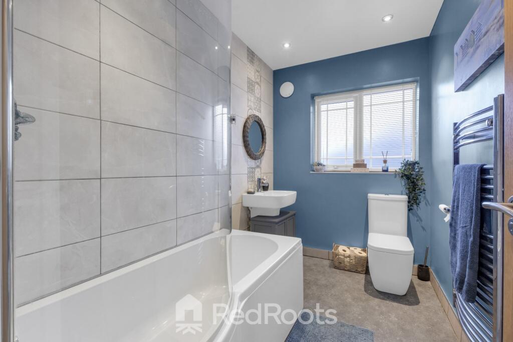
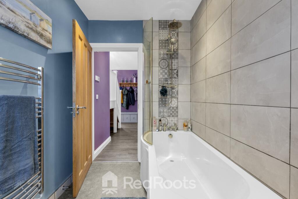
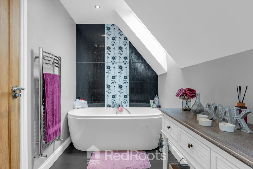
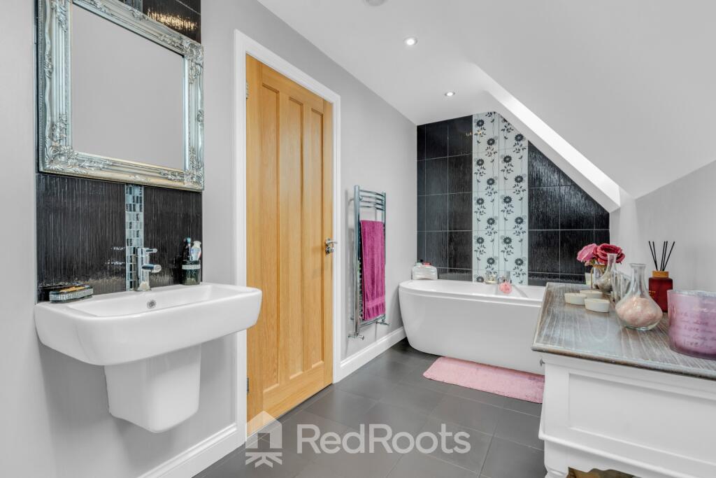
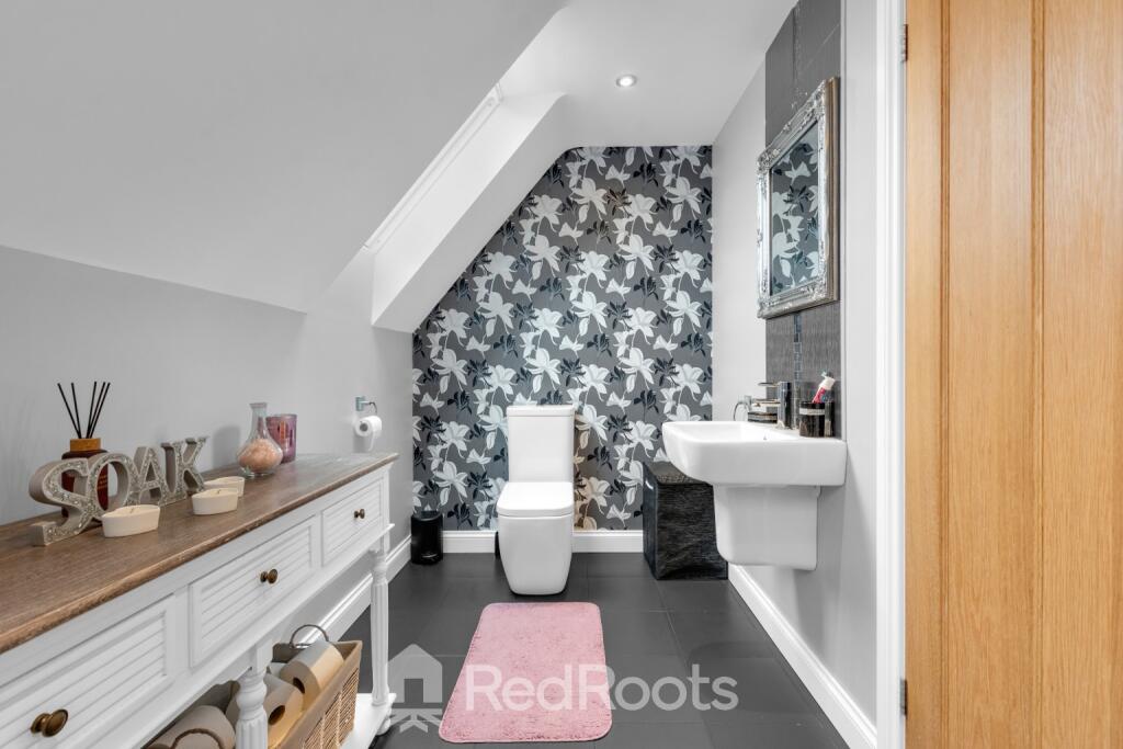
- BATHROOM:
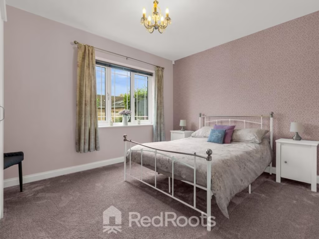
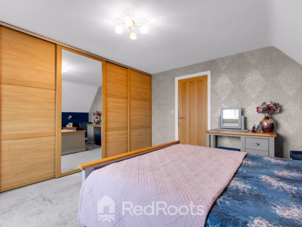
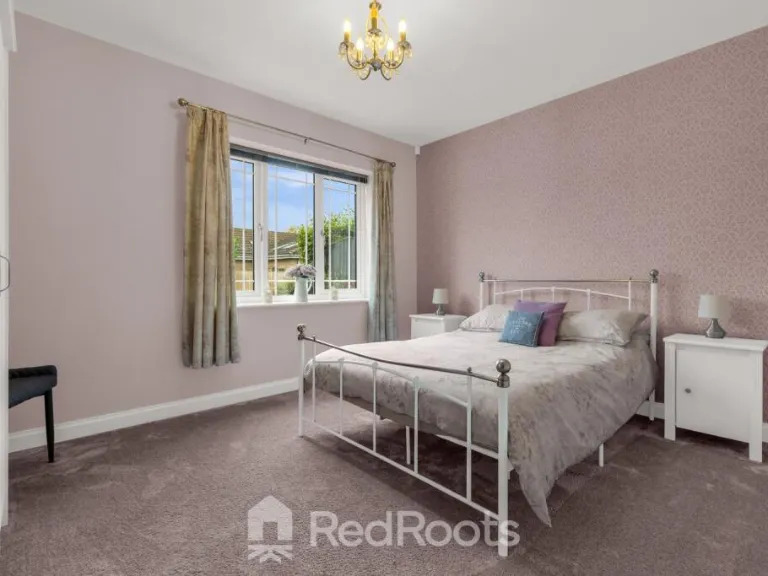
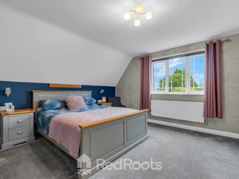
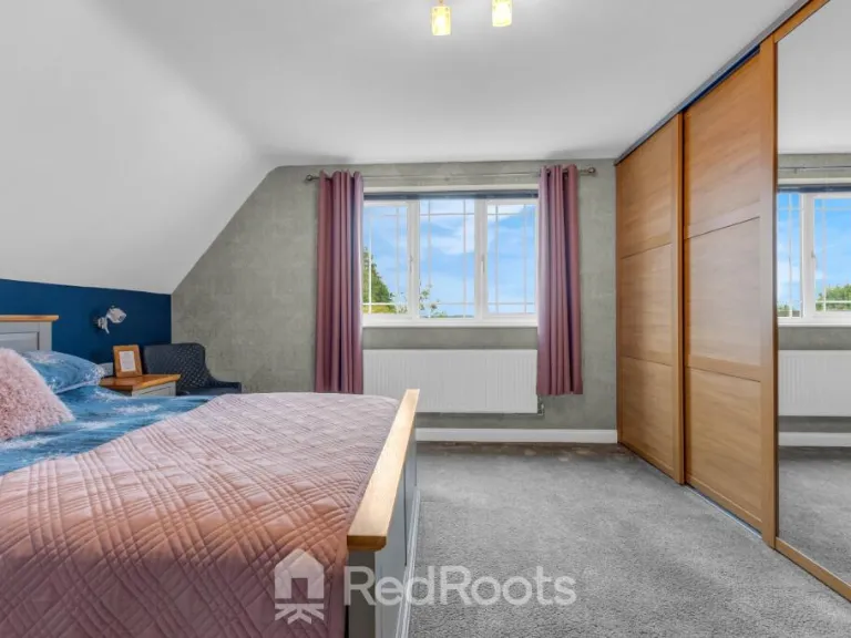
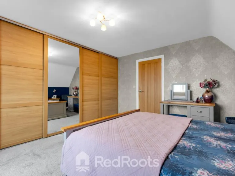
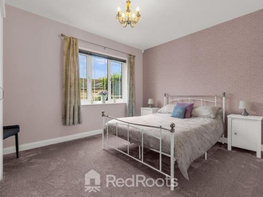
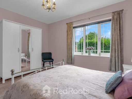
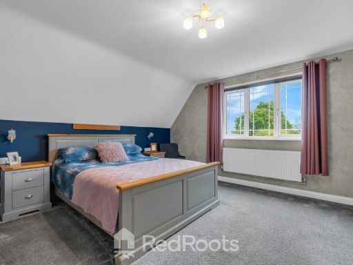
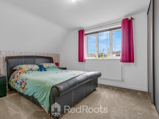
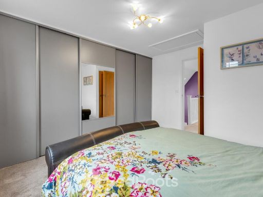
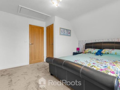
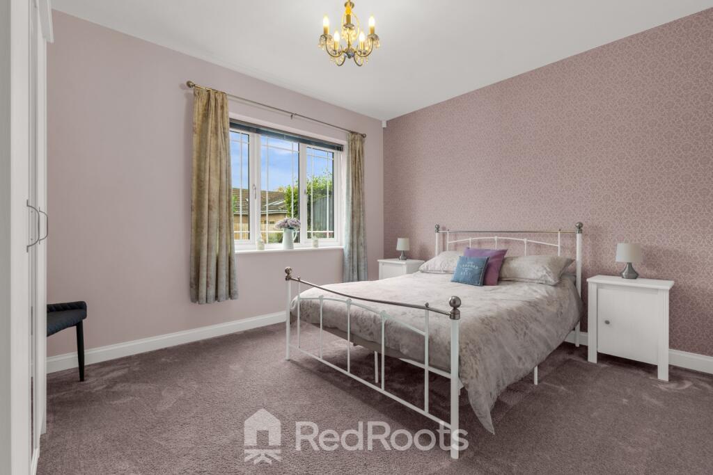
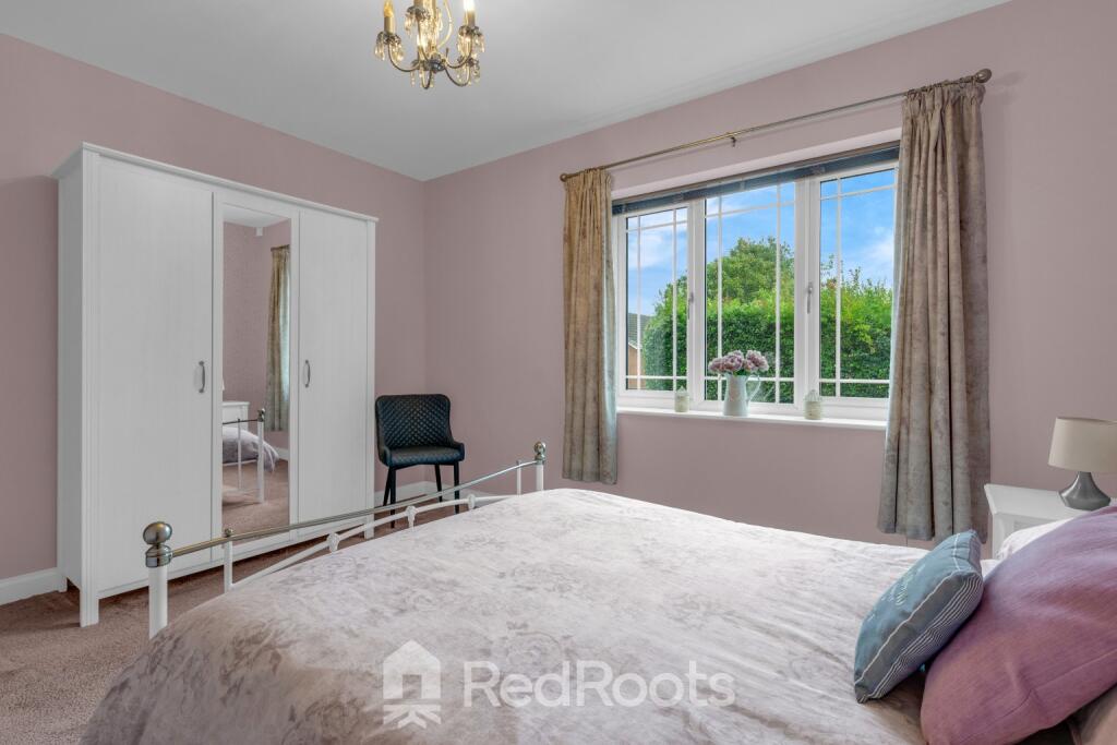
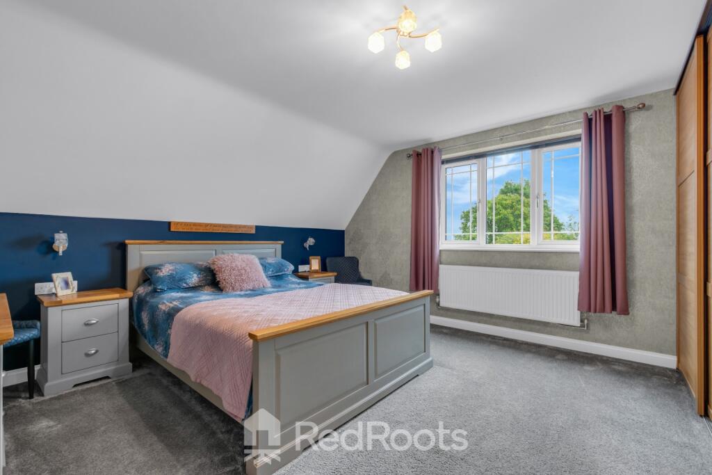
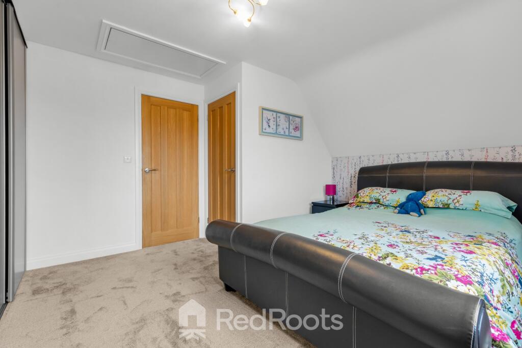
- BEDROOM 1:
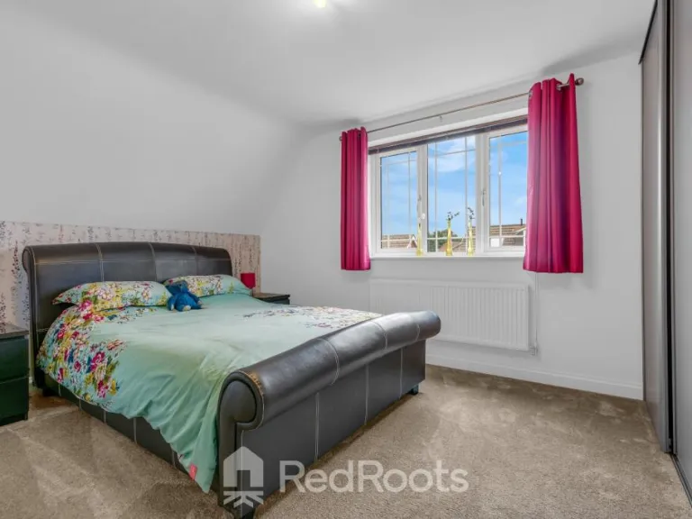
- BEDROOM 2:
- BATHROOM:
Textual Property Features
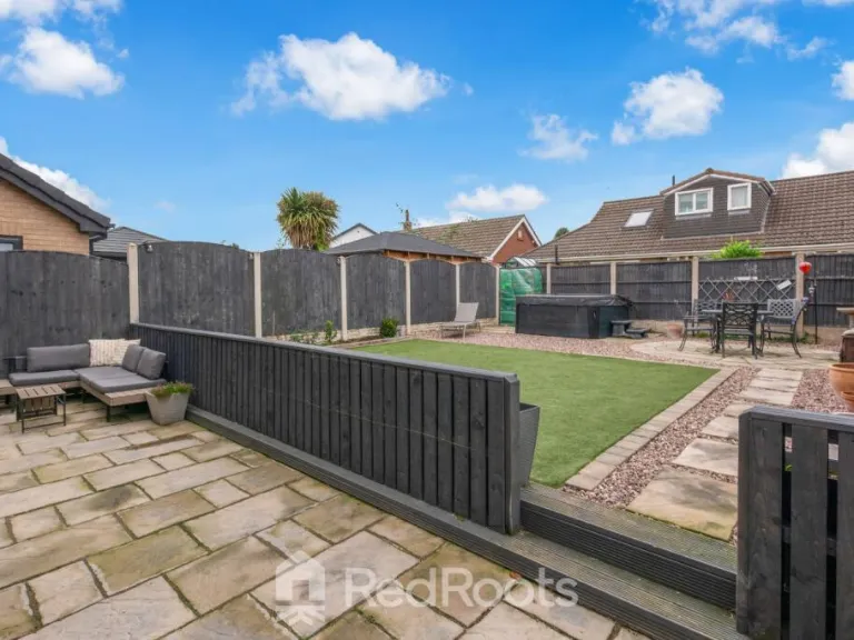
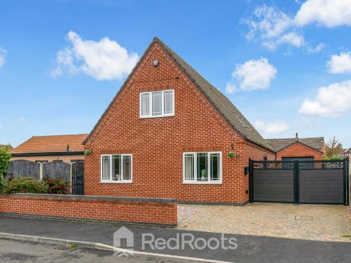
Detected Visual Features
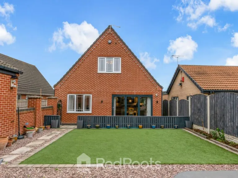
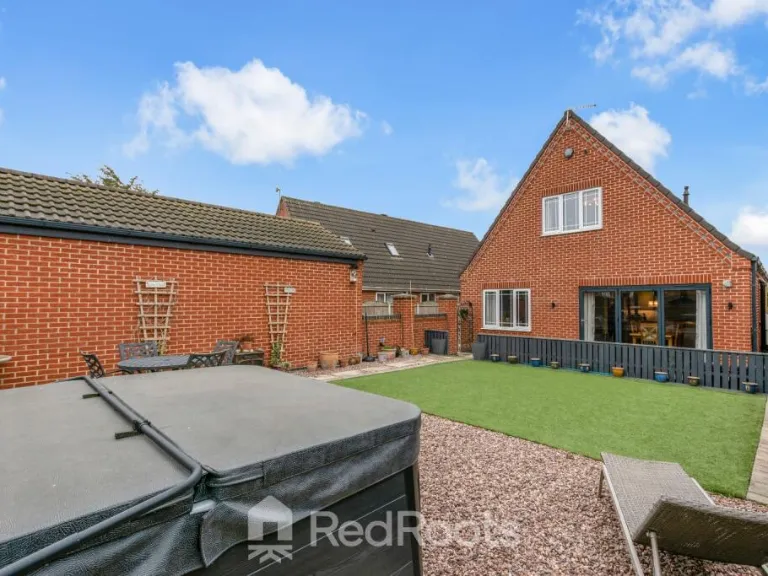
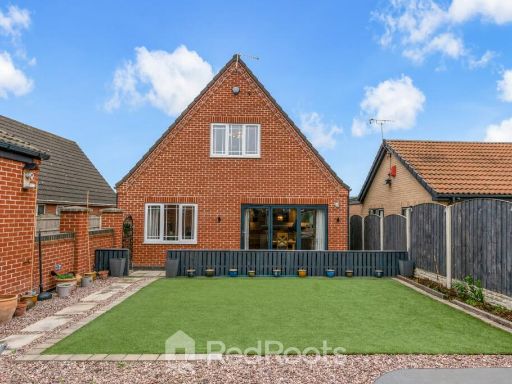
- detached
- modern
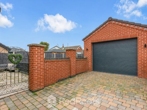
- brick
- gable roof
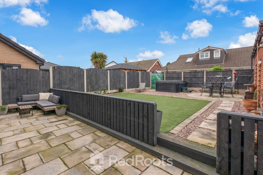
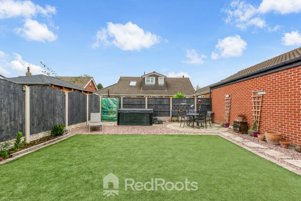
- driveway
- fenced
- double glazing
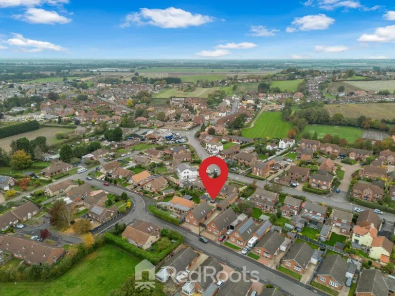
- residential area
- garage
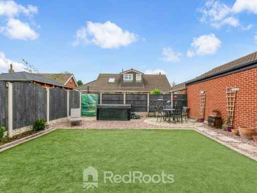
- garden
- suburban
- family home
- country view
- brick exterior
EPC Details
- High performance glazing
- Average thermal transmittance 0.22 W/m-¦K
- Boiler & underfloor, mains gas
- Low energy lighting in all fixed outlets
- Average thermal transmittance 0.11 W/m-¦K
Nearby Schools
- South Axholme Academy
- Walkeringham Primary School
- Misson Primary School
- Wroot Travis Charity Church of England Primary School
- Epworth Primary Academy
- St Oswald's CofE Academy
- Westwoodside Church of England Academy
- Belton All Saints CofE Primary School
- Morton Trentside Primary School
- Misterton Primary and Nursery School
Nearest General Shops
- Id: 4029417567
- Tags:
- Name: Wroot Newsagents & Store
- Shop: newsagent
- TagsNormalized:
- Lat: 53.5200509
- Lon: -0.9246155
- FullGeoHash: gcx26zn8yuse
- PartitionGeoHash: gcx2
- Images:
- FoodStandards: null
- Distance: 5318.7
,- Id: 249631745
- Tags:
- Addr:
- City: Mission
- Housename: The Rocket Site
- Postcode: DN10 6ET
- Building: yes
- Fax: +44 (0)1302 770050
- Name: L Jackson & Co
- Phone: +44 1302 770485
- Shop: car
- Website: https://www.ljacksonandco.com/
- TagsNormalized:
- Lat: 53.469251
- Lon: -0.9429448
- FullGeoHash: gcx24tc2gyc6
- PartitionGeoHash: gcx2
- Images:
- FoodStandards: null
- Distance: 5228.1
,- Id: 5733696221
- Tags:
- Name: Haxey Hounds Dog Training
- Shop: pet
- TagsNormalized:
- Lat: 53.5083358
- Lon: -0.8693393
- FullGeoHash: gcx2khyuwuv8
- PartitionGeoHash: gcx2
- Images:
- FoodStandards: null
- Distance: 2530.4
}
Nearest Grocery shops
- Id: 941055340
- Tags:
- Brand: Nisa
- Brand:wikidata: Q16999069
- Brand:wikipedia: en:Nisa (retailer)
- Building: yes
- Name: Nisa
- Shop: convenience
- TagsNormalized:
- Lat: 53.4905422
- Lon: -1.018642
- FullGeoHash: gcx22cdhzzv3
- PartitionGeoHash: gcx2
- Images:
- FoodStandards: null
- Distance: 9924.9
,- Id: 318192136
- Tags:
- Area: yes
- Building: yes
- Name: The Co-operative Food
- Operator: The Co-operative Group
- Shop: supermarket
- TagsNormalized:
- the co-operative food
- food
- shop
- Lat: 53.5247615
- Lon: -0.8199874
- FullGeoHash: gcx2mrfukftp
- PartitionGeoHash: gcx2
- Images:
- FoodStandards: null
- Distance: 5424.7
,- Id: 482053675
- Tags:
- Addr:
- City: Misterton
- Housenumber: 31
- Postcode: DN10 4BU
- Street: High Street
- Building: yes
- Name: The Co-operative Food
- Opening_hours: Mo-Su 07:00-22:00
- Operator: Lincolnshire Co-operative Society
- Shop: supermarket
- TagsNormalized:
- the co-operative food
- food
- shop
- Lat: 53.4431052
- Lon: -0.8444177
- FullGeoHash: gcx2hc10esus
- PartitionGeoHash: gcx2
- Images:
- FoodStandards: null
- Distance: 4992.6
}
Nearest Religious buildings
- Id: 884692304
- Tags:
- Amenity: place_of_worship
- Building: church
- Denomination: anglican
- Name: St Pancras
- Religion: christian
- Wikidata: Q105098201
- TagsNormalized:
- place of worship
- church
- anglican
- christian
- Lat: 53.5158186
- Lon: -0.9196375
- FullGeoHash: gcx27n624zss
- PartitionGeoHash: gcx2
- Images:
- FoodStandards: null
- Distance: 4752.2
,- Id: 782373798
- Tags:
- Amenity: place_of_worship
- Building: church
- Denomination: anglican
- Name: St Nicholas
- Religion: christian
- Wikidata: Q17537957
- TagsNormalized:
- place of worship
- church
- anglican
- christian
- Lat: 53.4896923
- Lon: -0.8488836
- FullGeoHash: gcx2k9tb596e
- PartitionGeoHash: gcx2
- Images:
- FoodStandards: null
- Distance: 1398.5
,- Id: 400530696
- Tags:
- Amenity: place_of_worship
- Building: chapel
- Denomination: methodist
- Name: Primitive Methodist Chapel
- Religion: christian
- TagsNormalized:
- place of worship
- chapel
- methodist
- christian
- church
- Lat: 53.4866208
- Lon: -0.8642178
- FullGeoHash: gcx2k2fwnkb8
- PartitionGeoHash: gcx2
- Images:
- FoodStandards: null
- Distance: 328.2
}
Nearest Medical buildings
- Id: 941436242
- Tags:
- Addr:
- City: Doncaster
- Housenumber: 30
- Postcode: DN9 3HY
- Street: Ellers Lane
- Suburb: Auckley
- Amenity: pharmacy
- Building: yes
- Dispensing: yes
- Healthcare: pharmacy
- Name: Auckley Pharmacy
- Opening_hours: Mo-Fr 08:00-18:00, Sa 09:00-13:00
- TagsNormalized:
- Lat: 53.5017722
- Lon: -1.0187006
- FullGeoHash: gcx22gdnqt1y
- PartitionGeoHash: gcx2
- Images:
- FoodStandards: null
- Distance: 10074.2
,- Id: 941436245
- Tags:
- Addr:
- City: Doncaster
- Housenumber: 41
- Postcode: DN9 3HY
- Street: Ellers Lane
- Suburb: Auckley
- Amenity: clinic
- Building: yes
- Group: Part of the Village Surgery group
- Healthcare: clinic
- Name: Auckley Surgery
- Opening_hours: Mo-We 07:30-18:00, Th-Fr 08:00-18:00
- Operator: NHS
- Operator:type: public
- Operator:wikidata: Q918396
- Telephone: 01302 770327
- TagsNormalized:
- clinic
- health
- healthcare
- surgery
- Lat: 53.5021686
- Lon: -1.0179561
- FullGeoHash: gcx22gf8xzhg
- PartitionGeoHash: gcx2
- Images:
- FoodStandards: null
- Distance: 10033.8
,- Id: 507088411
- Tags:
- Amenity: hospital
- Emergency: no
- Healthcare: hospital
- Name: John Coupland Hospital
- Operator: United Lincolnshire Hospitals NHS Trust
- Operator:type: public
- Source: Bing
- Source:name: Naptan
- Wikidata: Q30293238
- TagsNormalized:
- Lat: 53.4115992
- Lon: -0.7849152
- FullGeoHash: gcrry5k3n5sz
- PartitionGeoHash: gcrr
- Images:
- FoodStandards: null
- Distance: 9928.6
,- Id: 1000458075
- Tags:
- Addr:
- Amenity: doctors
- Building: yes
- Healthcare: doctor
- Name: Belton Surgery
- TagsNormalized:
- doctor
- doctors
- health
- healthcare
- surgery
- Lat: 53.5544086
- Lon: -0.8164379
- FullGeoHash: gcx2tmm3p97f
- PartitionGeoHash: gcx2
- Images:
- FoodStandards: null
- Distance: 8401.4
}
Nearest Airports
- Id: 100889514
- Tags:
- Addr:
- Aerodrome: international
- Aerodrome:type: public
- Area: yes
- Cities_served: Doncaster, Sheffield
- Closest_town: Doncaster
- Disused:
- Ele: 17
- Iata: DSA
- Icao: EGCN
- Ifr: yes
- Is_in: Finningley
- Name: Doncaster Sheffield Airport
- Old_iata: FNY
- Old_icao: EGXI
- Old_name: RAF Finningley
- Old_operator: Royal Air Force
- Old_type: military
- Operator: Doncaster Sheffield Airport Limited/Peel Airports
- Source: wikipedia
- Tower_frequency: 128.775
- Vfr: yes
- Website: https://www.robinhoodairport.com/
- Wikidata: Q8996
- Wikipedia: en:Robin Hood Airport Doncaster Sheffield
- TagsNormalized:
- airport
- international airport
- Lat: 53.4761577
- Lon: -1.0054086
- FullGeoHash: gcx21p5chq34
- PartitionGeoHash: gcx2
- Images:
- FoodStandards: null
- Distance: 9096.1
}
Nearest Leisure Facilities
- Id: 345618448
- Tags:
- TagsNormalized:
- Lat: 53.4854564
- Lon: -0.8642677
- FullGeoHash: gcx2k2dxm5er
- PartitionGeoHash: gcx2
- Images:
- FoodStandards: null
- Distance: 304.2
,- Id: 345312625
- Tags:
- TagsNormalized:
- Lat: 53.4842952
- Lon: -0.8669123
- FullGeoHash: gcx2k288x7r2
- PartitionGeoHash: gcx2
- Images:
- FoodStandards: null
- Distance: 192.5
,- Id: 345245465
- Tags:
- TagsNormalized:
- Lat: 53.4849188
- Lon: -0.8715134
- FullGeoHash: gcx2k0tkhr88
- PartitionGeoHash: gcx2
- Images:
- FoodStandards: null
- Distance: 190.3
,- Id: 118397948
- Tags:
- Leisure: playground
- Source: bing
- TagsNormalized:
- Lat: 53.4846496
- Lon: -0.868258
- FullGeoHash: gcx2k0xf8j7f
- PartitionGeoHash: gcx2
- Images:
- FoodStandards: null
- Distance: 111
,- Id: 400530841
- Tags:
- TagsNormalized:
- Lat: 53.4846359
- Lon: -0.8691563
- FullGeoHash: gcx2k0x4e4y0
- PartitionGeoHash: gcx2
- Images:
- FoodStandards: null
- Distance: 106.9
}
Nearest Tourist attractions
- Id: 329230448
- Tags:
- Name: Waterfront Country Park
- Tourism: camp_site
- TagsNormalized:
- Lat: 53.4437668
- Lon: -0.820916
- FullGeoHash: gcx2j34hx20w
- PartitionGeoHash: gcx2
- Images:
- FoodStandards: null
- Distance: 5629.5
,- Id: 324456890
- Tags:
- Name: White House Farm Camping and Caravanning
- Tourism: camp_site
- TagsNormalized:
- Lat: 53.448718
- Lon: -0.8507276
- FullGeoHash: gcx2hdh92e5t
- PartitionGeoHash: gcx2
- Images:
- FoodStandards: null
- Distance: 4271.1
,- Id: 428920942
- Tags:
- Name: Haxey Quays
- Tourism: camp_site
- TagsNormalized:
- Lat: 53.4540936
- Lon: -0.8435045
- FullGeoHash: gcx2hg1b8vm2
- PartitionGeoHash: gcx2
- Images:
- FoodStandards: null
- Distance: 3882.7
}
Nearest Hotels
- Id: 4692516135
- Tags:
- Addr:
- City: Gainsborough
- Country: GB
- County: Lincolnshire
- Housenumber: 49
- Postcode: DN21 2DD
- Street: Lord Street
- Email: info.whiteharthotel@gmail.com
- Fhrs:
- Name: The Gainsborough Hotel
- Old_name: The White Hart Hotel
- Outdoor_seating: no
- Tourism: hotel
- TagsNormalized:
- Lat: 53.3999437
- Lon: -0.7760683
- FullGeoHash: gcrry34vhqcx
- PartitionGeoHash: gcrr
- Images:
- FoodStandards: null
- Distance: 11333.4
,- Id: 3214075123
- Tags:
- Addr:
- City: Doncaster
- Country: GB
- Postcode: DN11 0HW
- Street: Great North Road
- Village: Rossington
- Brand: Best Western
- Fhrs:
- Name: Mount Pleasant Hotel
- Tourism: hotel
- TagsNormalized:
- Lat: 53.4712379
- Lon: -1.0373847
- FullGeoHash: gcx20qhse1jy
- PartitionGeoHash: gcx2
- Images:
- FoodStandards: null
- Distance: 11265.5
,- Id: 216204243
- Tags:
- Addr:
- City: Doncaster
- Housename: Ramada Encore Doncaster Sheffield Airport
- Postcode: DN9 3GP
- Street: First Avenue
- Village: Auckley
- Brand: Ramada
- Brand:wikidata: Q1502859
- Brand:wikipedia: en:Ramada
- Building: yes
- Fhrs:
- Name: Ramada
- Operator: Ramada
- Tourism: hotel
- TagsNormalized:
- Lat: 53.4841139
- Lon: -1.014089
- FullGeoHash: gcx22bmxd12q
- PartitionGeoHash: gcx2
- Images:
- FoodStandards: null
- Distance: 9610.4
}
Tags
- detached
- modern
- brick
- gable roof
- driveway
- fenced
- double glazing
- residential area
- detached
- modern
- garage
- garden
- suburban
- family home
- country view
- brick exterior
Local Market Stats
- Average Price/sqft: £218
- Avg Income: £43700
- Social Housing: 5%
- Planning Success Rate: 86%
Similar Properties
 4 bedroom detached house for sale in Crackle Hill, Westwoodside, DN9 — £460,000 • 4 bed • 2 bath • 2024 ft²
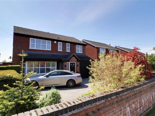 4 bedroom detached house for sale in Akeferry Road, Westwoodside, Lincolnshire, DN9 — £397,500 • 4 bed • 2 bath • 1667 ft²
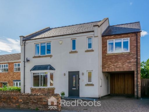 5 bedroom detached house for sale in Newbigg, Westwoodside, Doncaster, Lincolnshire, DN9 2AT, DN9 — £370,000 • 5 bed • 3 bath • 1910 ft²
 4 bedroom detached house for sale in Craycroft Road, Westwoodside, DN9 — £310,000 • 4 bed • 1 bath • 804 ft²
 4 bedroom detached house for sale in Upperthorpe Road, Westwoodside, Lincolnshire, DN9 — £320,000 • 4 bed • 1 bath • 1094 ft²
 4 bedroom detached house for sale in The Rein, Westwoodside, Doncaster, DN9 — £360,000 • 4 bed • 2 bath • 1249 ft²
Meta
- {
"@context": "https://schema.org",
"@type": "Residence",
"name": "4 bedroom detached house for sale in Holm Road, Westwoodsid…",
"description": "",
"url": "https://propertypiper.co.uk/property/0180269b-eb99-4a19-9e95-e0a2a02a25e7",
"image": "https://image-a.propertypiper.co.uk/32b08054-5f9c-4633-b34e-4beeaff76f18-1024.jpeg",
"address": {
"@type": "PostalAddress",
"streetAddress": "9a, Holm Road, Westwoodside",
"postalCode": "DN9 2EY",
"addressLocality": "North Lincolnshire",
"addressRegion": "Brigg and Goole",
"addressCountry": "England"
},
"geo": {
"@type": "GeoCoordinates",
"latitude": 53.48558110322317,
"longitude": -0.8688607820610157
},
"numberOfRooms": 4,
"numberOfBathroomsTotal": 2,
"floorSize": {
"@type": "QuantitativeValue",
"value": 1539,
"unitCode": "FTK"
},
"offers": {
"@type": "Offer",
"price": 350000,
"priceCurrency": "GBP",
"availability": "https://schema.org/InStock"
},
"additionalProperty": [
{
"@type": "PropertyValue",
"name": "Feature",
"value": "detached"
},
{
"@type": "PropertyValue",
"name": "Feature",
"value": "modern"
},
{
"@type": "PropertyValue",
"name": "Feature",
"value": "brick"
},
{
"@type": "PropertyValue",
"name": "Feature",
"value": "gable roof"
},
{
"@type": "PropertyValue",
"name": "Feature",
"value": "driveway"
},
{
"@type": "PropertyValue",
"name": "Feature",
"value": "fenced"
},
{
"@type": "PropertyValue",
"name": "Feature",
"value": "double glazing"
},
{
"@type": "PropertyValue",
"name": "Feature",
"value": "residential area"
},
{
"@type": "PropertyValue",
"name": "Feature",
"value": "detached"
},
{
"@type": "PropertyValue",
"name": "Feature",
"value": "modern"
},
{
"@type": "PropertyValue",
"name": "Feature",
"value": "garage"
},
{
"@type": "PropertyValue",
"name": "Feature",
"value": "garden"
},
{
"@type": "PropertyValue",
"name": "Feature",
"value": "suburban"
},
{
"@type": "PropertyValue",
"name": "Feature",
"value": "family home"
},
{
"@type": "PropertyValue",
"name": "Feature",
"value": "country view"
},
{
"@type": "PropertyValue",
"name": "Feature",
"value": "brick exterior"
}
]
}
High Res Floorplan Images
Compatible Floorplan Images
FloorplanImages Thumbnail