AL10 8BZ - 3 bedroom terraced house for sale in St. Etheldredas Drive,…
View on Property Piper
3 bedroom terraced house for sale in St. Etheldredas Drive, Hatfield, AL10
Property Details
- Price: £415000
- Bedrooms: 3
- Bathrooms: 1
- Property Type: undefined
- Property SubType: undefined
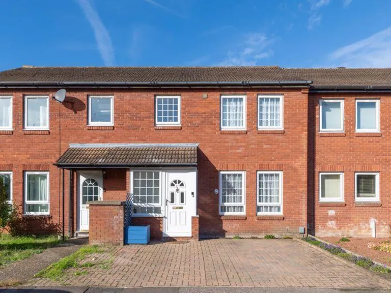
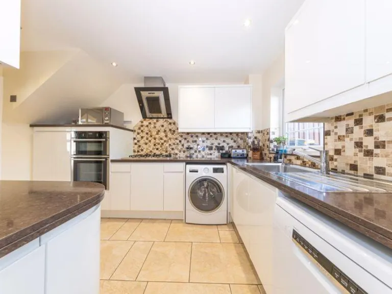
Image Descriptions
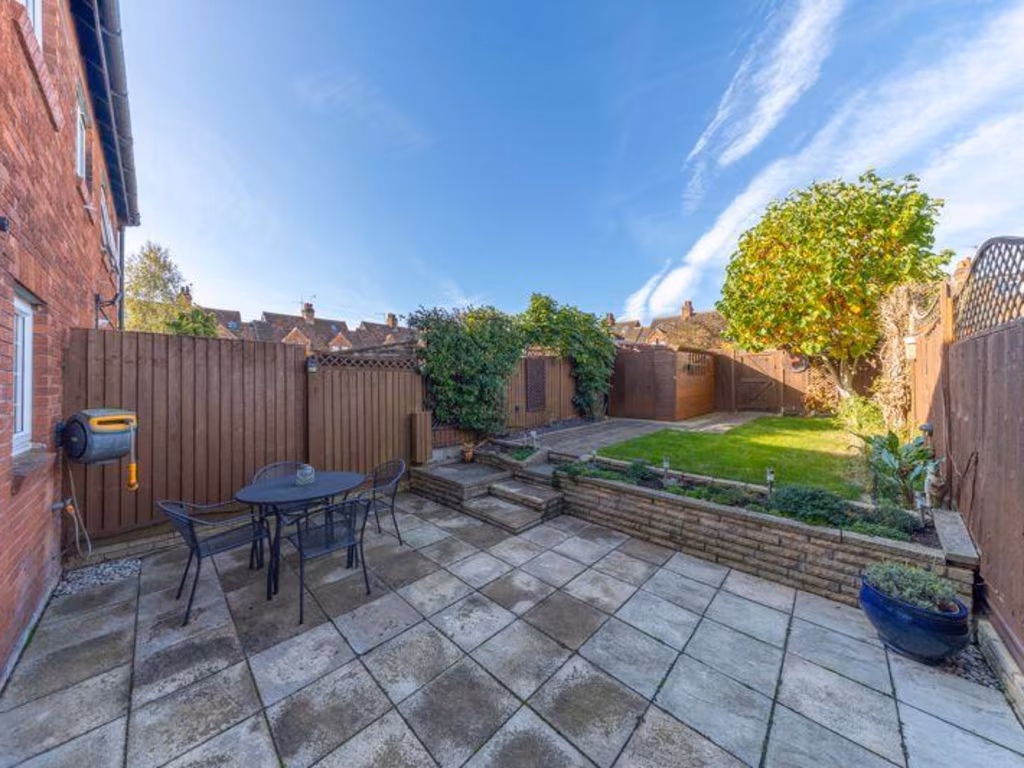
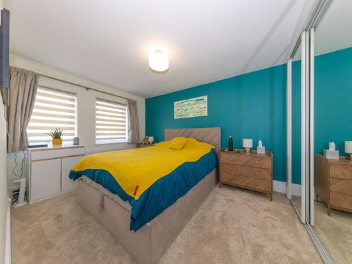
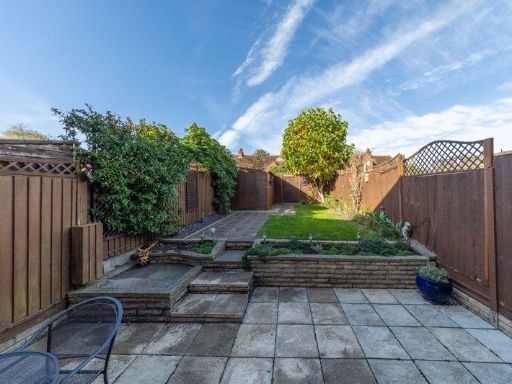
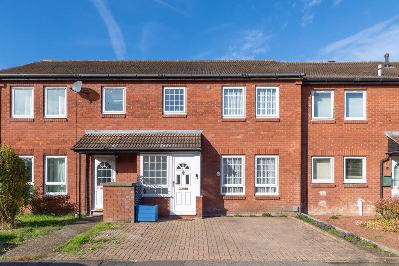
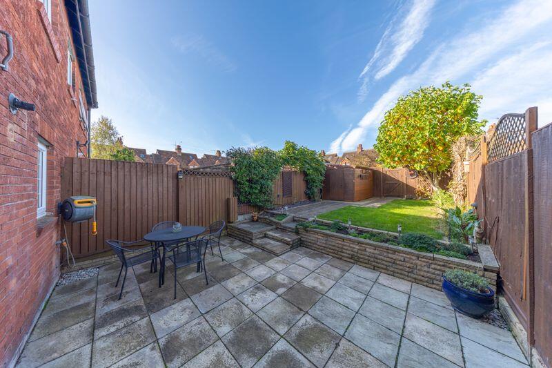
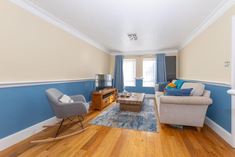
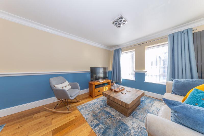
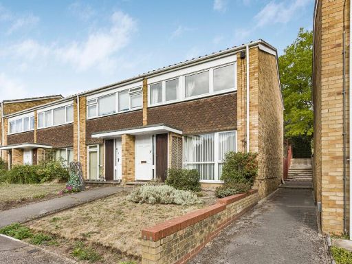
- Terraced house Modern
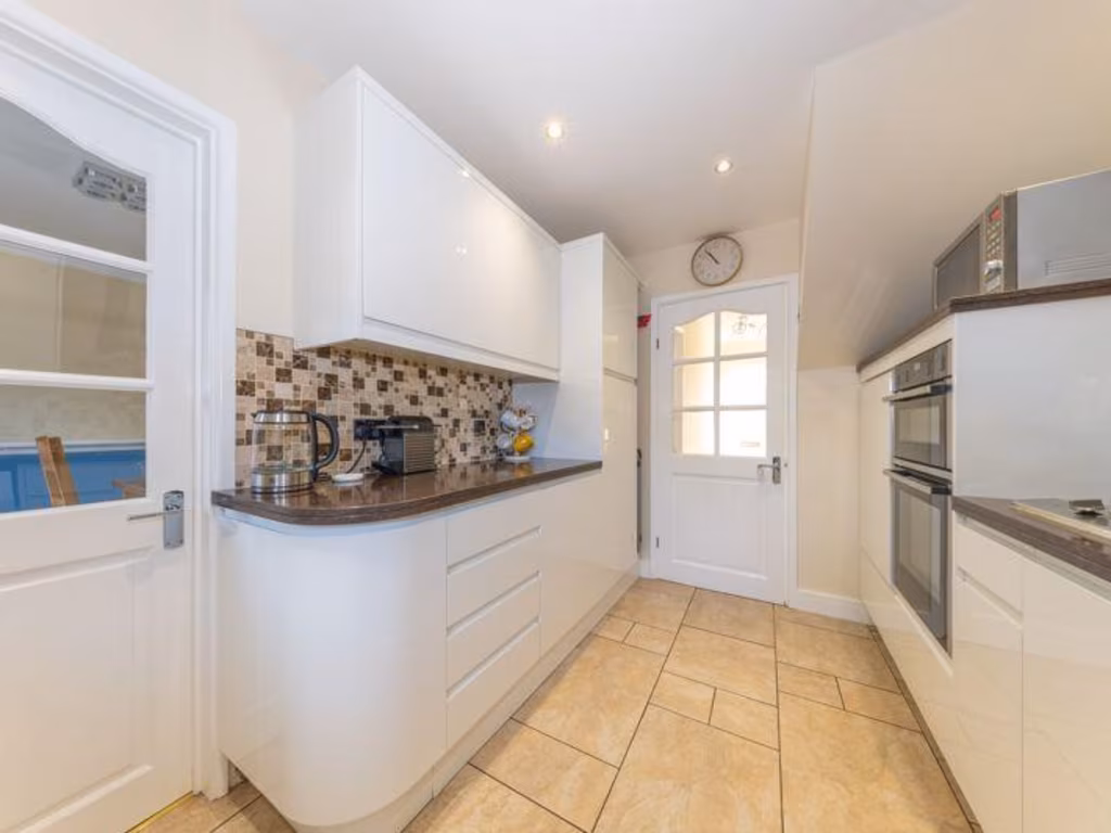
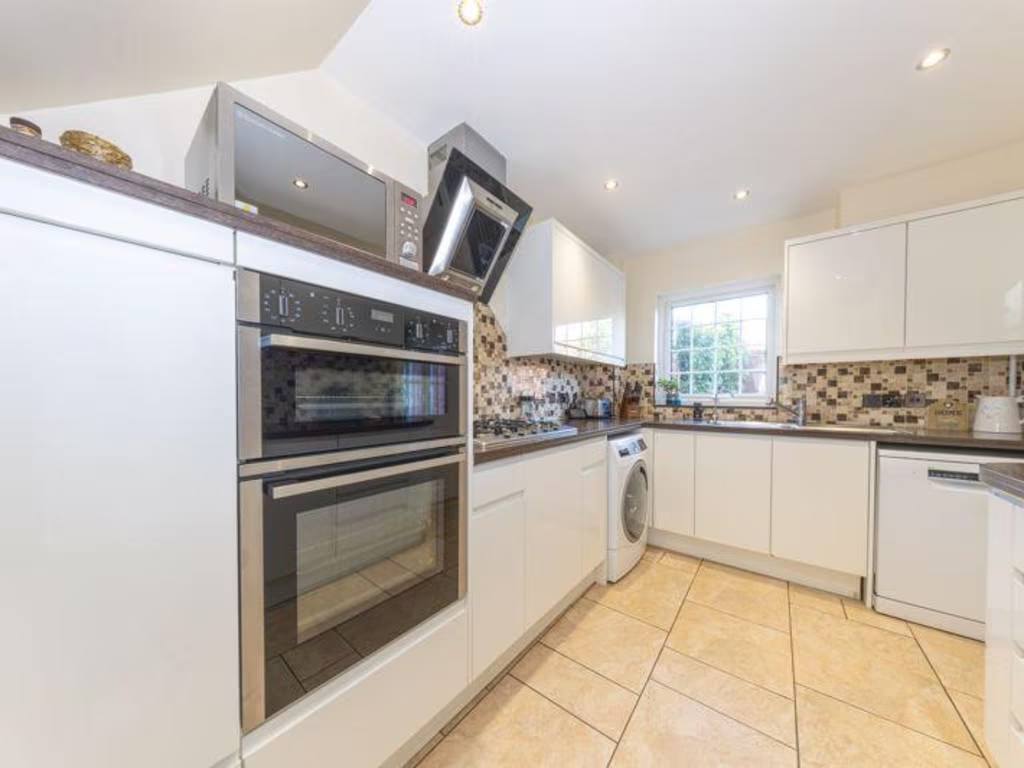
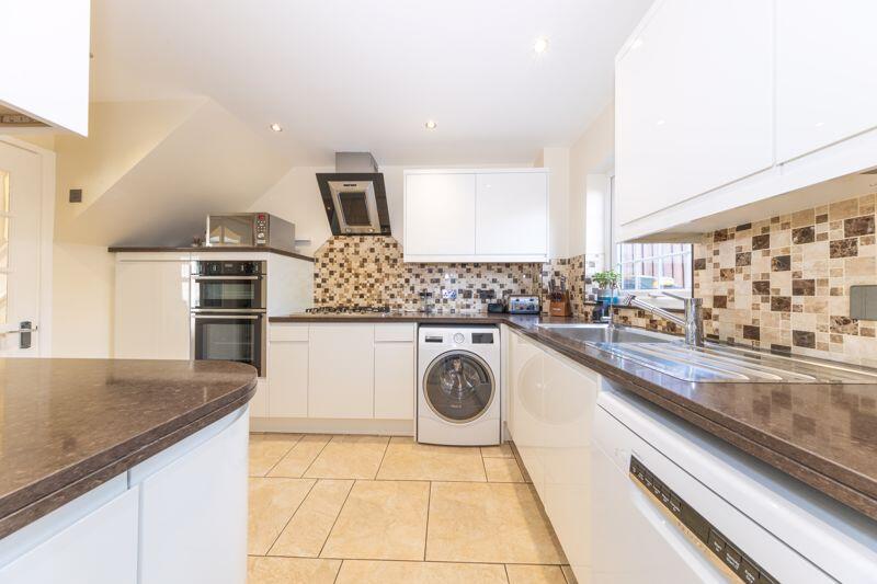
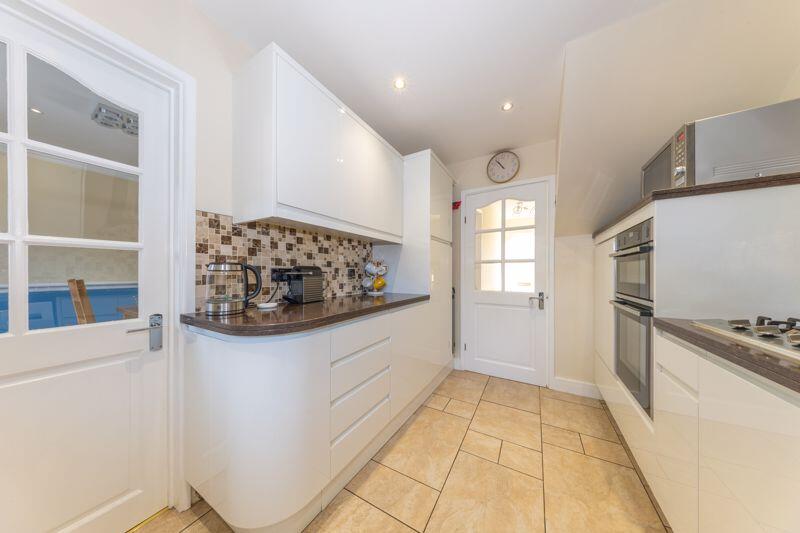
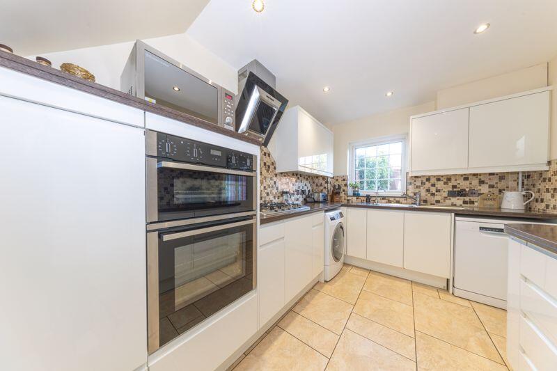
- kitchen modern
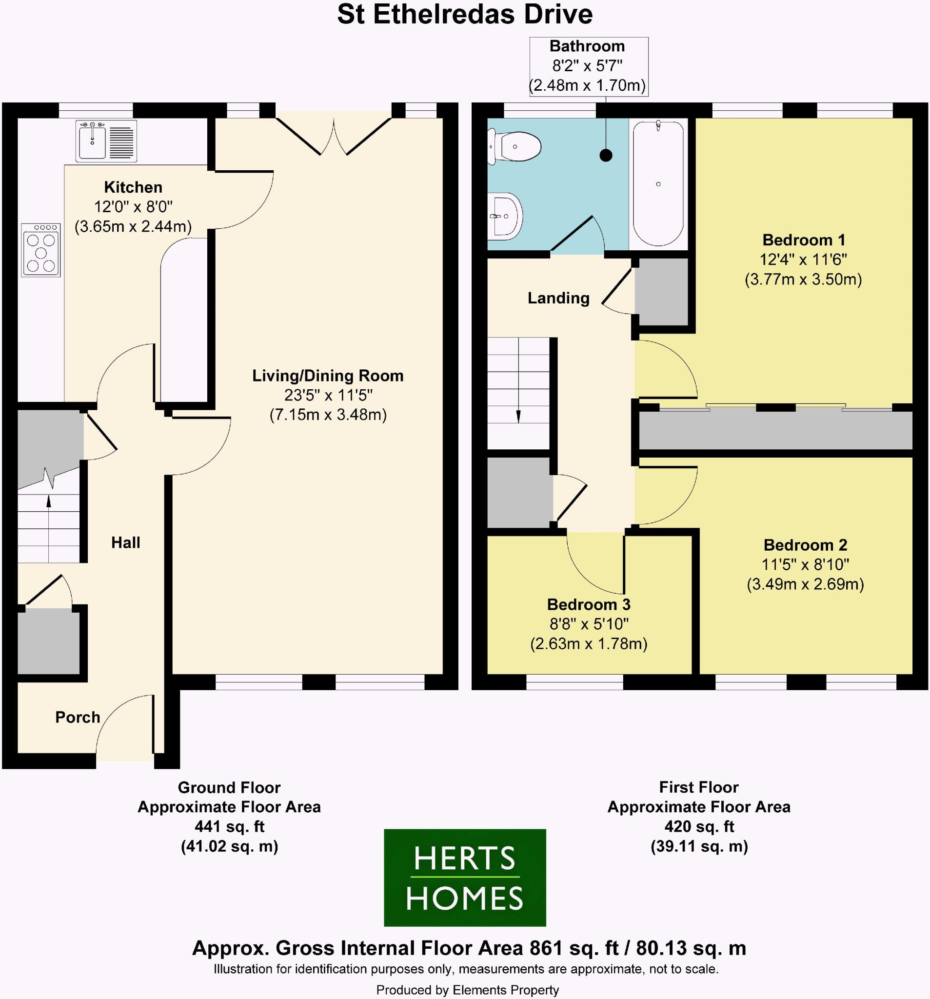
Floorplan Description
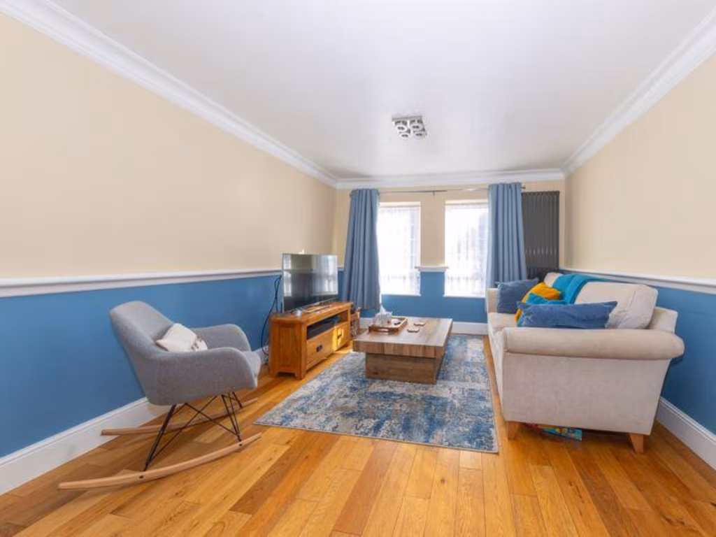
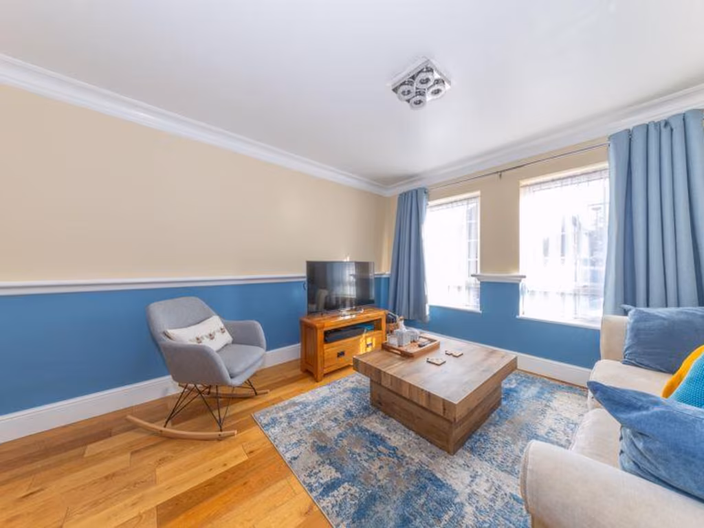
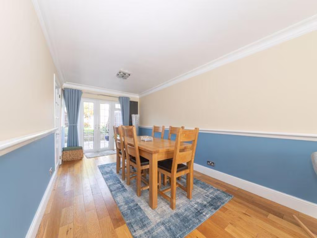
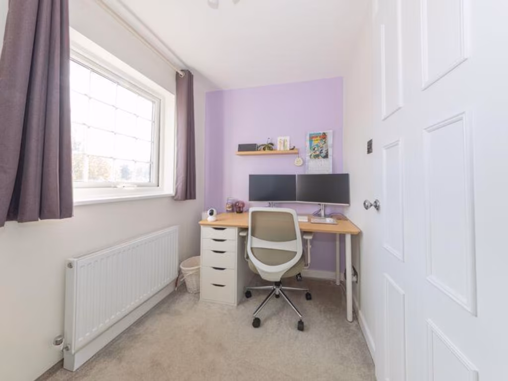
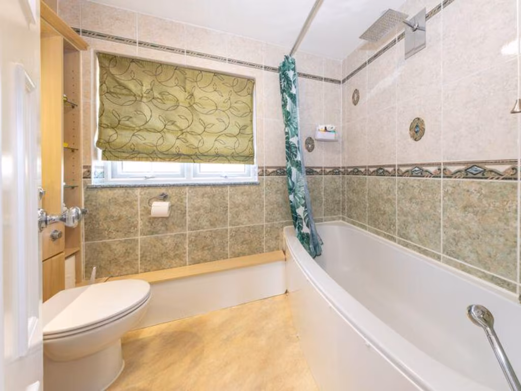
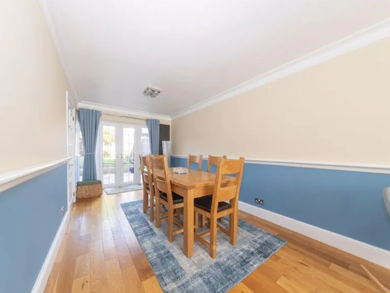
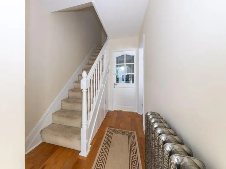
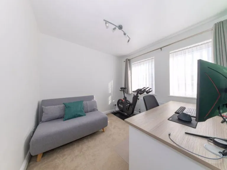
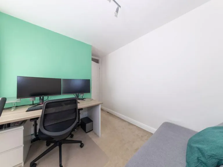
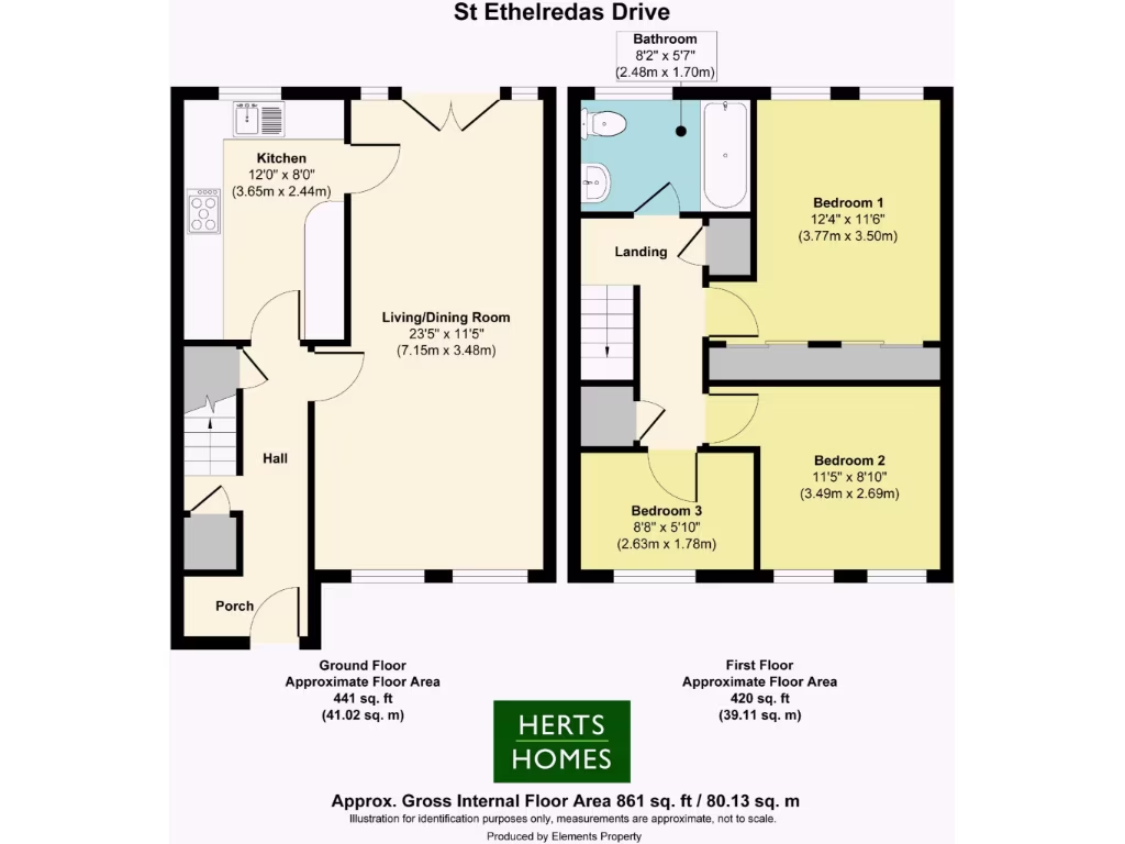
- Two-storey residential property with kitchen, living/dining room and three bedrooms
Rooms
- Kitchen:
- Living/Dining Room:
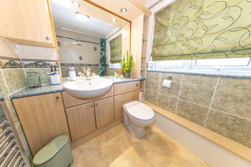
- Bathroom:
- Bedroom 1:
- Bedroom 2:
- Bedroom 3:
Textual Property Features
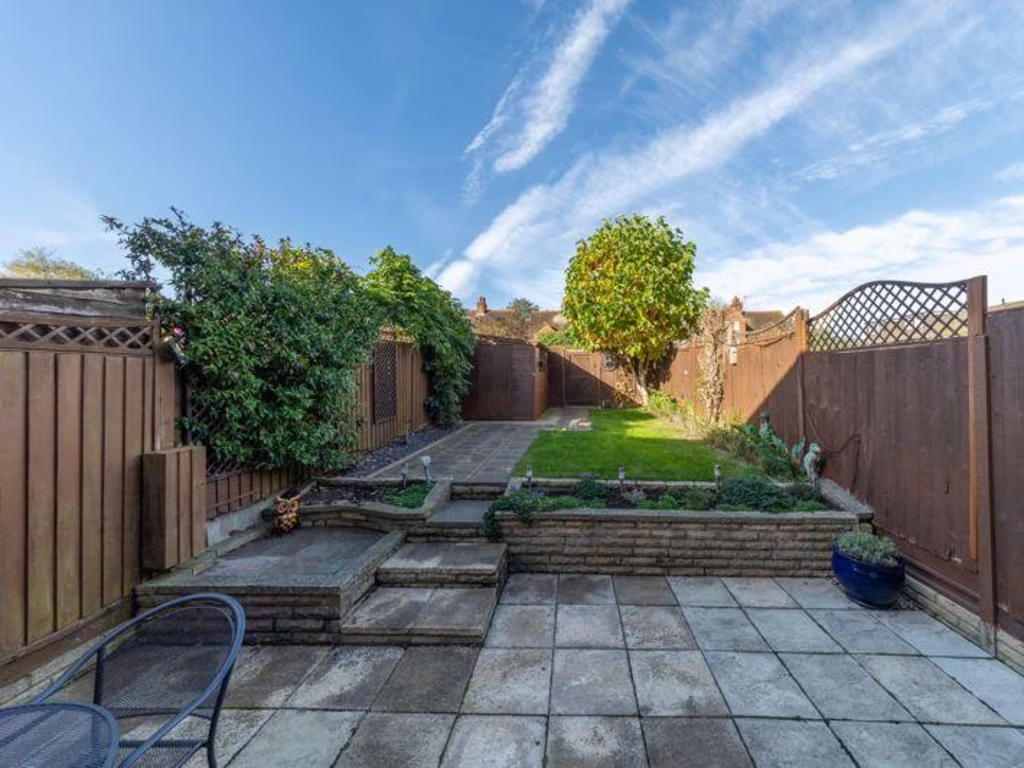
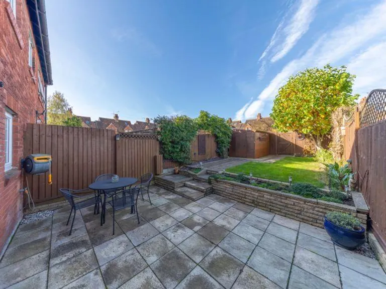
Detected Visual Features
- modern
- terraced
- brick
- 2-story
- small windows
- driveway
- residential
- compact
- kitchen
- tiled floor
- integrated appliances
- white cabinets
- mosaic backsplash
- wash machine
Nearby Schools
- St Philip Howard Catholic Primary School
- Our Lady Catholic Primary School
- Holwell Primary School
- St John's Voluntary Aided Church of England Primary School, Lemsford
- Panshanger Primary School
- Templewood Primary School
- Chancellor's School
- St Mary's Church of England VA Primary School, Welham Green
- Countess Anne Church of England School
- Birchwood Avenue Primary School
- Green Lanes Primary School
- Applecroft School
- De Havilland Primary School
- Links Hatfield Academy
- Hatfield Community Free School
- Commonswood Primary & Nursery School
- Stanborough School
- Swallow Dell Primary and Nursery School
- Peartree Primary School
- Ridgeway Academy
- Brookmans Park Primary School
- Colney Heath Junior Mixed Infant and Nursery School
- Oak View Primary and Nursery School
- Bishop's Hatfield Girls' School
- Onslow St Audrey's School
- Howe Dell Primary School
- The Ryde School
Nearest Bars And Restaurants
- Id: 740030266
- Tags:
- Addr:
- City: Hatfield
- Housenumber: 2
- Postcode: AL9 5AX
- Street: Park Street
- Amenity: pub
- Building: yes
- Building:levels: 2
- Name: The Eight Bells
- Source: Local knowledge, pub website
- Website: http://theeightbells.com/
- Wikidata: Q28406126
- TagsNormalized:
- Lat: 51.7624989
- Lon: -0.2134803
- FullGeoHash: gcpy7phd3t1t
- PartitionGeoHash: gcpy
- Images:
- FoodStandards: null
- Distance: 340.4
,- Id: 6920261793
- Tags:
- Addr:
- City: Hatfield
- Housenumber: 3
- Postcode: AL9 5BG
- Street: The Broadway
- Amenity: cafe
- Name: Angie's Deli
- TagsNormalized:
- Lat: 51.7622136
- Lon: -0.2136415
- FullGeoHash: gcpy7ph2tzcr
- PartitionGeoHash: gcpy
- Images:
- FoodStandards: null
- Distance: 317
,- Id: 8743899690
- Tags:
- Amenity: restaurant
- Cuisine: chinese
- Name: The New Dynasty
- TagsNormalized:
- Lat: 51.7624667
- Lon: -0.214463
- FullGeoHash: gcpy7p5f4xhv
- PartitionGeoHash: gcpy
- Images:
- FoodStandards: null
- Distance: 279.9
,- Id: 8743899689
- Tags:
- Amenity: fast_food
- Cuisine: pizza
- Name: Pizza Palace
- TagsNormalized:
- Lat: 51.762545
- Lon: -0.2145579
- FullGeoHash: gcpy7p5f8my0
- PartitionGeoHash: gcpy
- Images:
- FoodStandards: null
- Distance: 279.2
,- Id: 738970540
- Tags:
- Addr:
- City: Hatfield
- Housenumber: 33-34
- Postcode: AL9 5AF
- Street: Salisbury Square
- Amenity: restaurant
- Building: yes
- Building:levels: 3
- Cuisine: indian
- Name: Taste Of India
- Source: OS VectorMap District
- TagsNormalized:
- Lat: 51.7628048
- Lon: -0.2149819
- FullGeoHash: gcpy7p5knw1y
- PartitionGeoHash: gcpy
- Images:
- FoodStandards: null
- Distance: 274.7
}
Nearest General Shops
- Id: 692597738
- Tags:
- Addr:
- City: Hatfield
- Housenumber: 6-8
- Postcode: AL10 8BE
- Street: Beaconsfield Road
- Building: industrial
- Building:levels: 1
- Name: Datum
- Shop: copyshop
- Source:
- Addr:
- Postcode: code-point_open
- TagsNormalized:
- Lat: 51.7633498
- Lon: -0.2168143
- FullGeoHash: gcpy7p4p7gg9
- PartitionGeoHash: gcpy
- Images:
- FoodStandards: null
- Distance: 259.5
,- Id: 52091219
- Tags:
- Addr:
- City: Hatfield
- Housenumber: 1
- Postcode: AL10 8BJ
- Street: Bury Road
- Building: yes
- Name: Fairway Tyre & Auto Services
- Shop: car_repair
- TagsNormalized:
- fairway
- service
- car repair
- repair
- shop
- Lat: 51.7628967
- Lon: -0.2169556
- FullGeoHash: gcpy7p4h8x64
- PartitionGeoHash: gcpy
- Images:
- FoodStandards: null
- Distance: 208.5
,- Id: 596420243
- Tags:
- Addr:
- City: Hatfield
- Housenumber: 1
- Postcode: AL9 5JA
- Street: Great North Road
- Brand: Peugot;Citroën
- Name: Robins & Day
- Shop: car
- TagsNormalized:
- Lat: 51.7603778
- Lon: -0.2165394
- FullGeoHash: gcpy7ndq43b8
- PartitionGeoHash: gcpy
- Images:
- FoodStandards: null
- Distance: 123.9
}
Nearest Grocery shops
- Id: 678788541
- Tags:
- Building: yes
- Building:levels: 3
- Cuisine: romanian
- Name: RO FOOD UK
- Shop: convenience
- TagsNormalized:
- Lat: 51.7634065
- Lon: -0.225936
- FullGeoHash: gcpy6z5rxq3g
- PartitionGeoHash: gcpy
- Images:
- FoodStandards: null
- Distance: 609.6
,- Id: 6357350865
- Tags:
- Level: 0
- Name: Hatfield Fresh Meat, Groceries & Fresh Fish
- Shop: convenience
- TagsNormalized:
- meat
- grocer
- fish
- convenience
- shop
- Lat: 51.7627703
- Lon: -0.2256322
- FullGeoHash: gcpy6z5eyru2
- PartitionGeoHash: gcpy
- Images:
- FoodStandards: null
- Distance: 563.7
,- Id: 6855004129
- Tags:
- Name: SimplyFresh
- Shop: convenience
- TagsNormalized:
- Lat: 51.7638937
- Lon: -0.2153115
- FullGeoHash: gcpy7p74wchj
- PartitionGeoHash: gcpy
- Images:
- FoodStandards: null
- Distance: 356.5
}
Nearest Religious buildings
- Id: 217348984
- Tags:
- Addr:
- City: Hatfield
- Housenumber: 1
- Postcode: AL9 5AN
- Street: Fore Street
- Amenity: place_of_worship
- Building: church
- Denomination: anglican
- Name: St Etheldreda's Church
- Religion: christian
- Source: http://www.achurchnearyou.com/hatfield-st-etheldreda/
- Website: https://stetheldreda.org/
- Wikidata: Q17529175
- Wikipedia: en:St Etheldreda's Church, Hatfield
- TagsNormalized:
- place of worship
- church
- anglican
- christian
- Lat: 51.7614532
- Lon: -0.2119643
- FullGeoHash: gcpy7nvskf5z
- PartitionGeoHash: gcpy
- Images:
- FoodStandards: null
- Distance: 409.7
,- Id: 495459935
- Tags:
- Addr:
- Amenity: community_centre
- Building: yes
- Building:levels: 1
- Name: St Etheldreda’s Church Hall
- Operator: Hatfield House
- Source: OS VectorMap District
- Wikidata: Q26394032
- TagsNormalized:
- community centre
- church
- church hall
- Lat: 51.7608453
- Lon: -0.2125223
- FullGeoHash: gcpy7nv0zbgv
- PartitionGeoHash: gcpy
- Images:
- FoodStandards: null
- Distance: 370.7
,- Id: 159056681
- Tags:
- Addr:
- City: Hatfield
- Housenumber: 26
- Postcode: AL9 5JD
- Street: Salisbury Square
- Amenity: place_of_worship
- Building: church
- Denomination: roman_catholic
- Name: Roman Catholic Church of Marychurch
- Religion: christian
- Website: https://parish.rcdow.org.uk/hatfield/
- Wikidata: Q26676143
- TagsNormalized:
- place of worship
- church
- catholic
- roman catholic
- christian
- Lat: 51.7621238
- Lon: -0.2145384
- FullGeoHash: gcpy7p5b0zhx
- PartitionGeoHash: gcpy
- Images:
- FoodStandards: null
- Distance: 256.7
}
Nearest Medical buildings
- Id: 51744441
- Tags:
- Addr:
- City: Hatfield
- Housenumber: 52;54
- Postcode: AL10 8HP
- Street: Dellfield Road
- Amenity: doctors
- Building: yes
- Healthcare: doctor
- Healthcare:speciality: general
- Name: Burvill House Surgery
- Opening_hours: Mo-Fr 08:30-18:30
- TagsNormalized:
- doctor
- doctors
- health
- healthcare
- general
- surgery
- Lat: 51.7612397
- Lon: -0.2271577
- FullGeoHash: gcpy6yfe4f6v
- PartitionGeoHash: gcpy
- Images:
- FoodStandards: null
- Distance: 637.9
,- Id: 678788534
- Tags:
- Amenity: pharmacy
- Building: yes
- Building:levels: 3
- Dispensing: yes
- Healthcare: pharmacy
- Name: Jade Pharmacy
- TagsNormalized:
- Lat: 51.7632665
- Lon: -0.2263309
- FullGeoHash: gcpy6z5nyh72
- PartitionGeoHash: gcpy
- Images:
- FoodStandards: null
- Distance: 628.2
,- Id: 653961291
- Tags:
- Amenity: dentist
- Healthcare: dentist
- Level: 1
- Name: Hatfield Dental Care
- Source: local_knowledge
- TagsNormalized:
- dentist
- health
- healthcare
- dental
- Lat: 51.7624396
- Lon: -0.2265505
- FullGeoHash: gcpy6z540fpe
- PartitionGeoHash: gcpy
- Images:
- FoodStandards: null
- Distance: 613.9
,- Id: 53151498
- Tags:
- Addr:
- City: Hatfield
- Postcode: AL10 0LF
- Street: Queensway
- Amenity: doctors
- Building: yes
- Building:levels: 2
- Healthcare: doctor
- Name: Queensway Health Clinic
- Phone: +44 1707 264577
- Source: local_knowledge
- TagsNormalized:
- doctor
- doctors
- health
- healthcare
- clinic
- Lat: 51.7631027
- Lon: -0.2246335
- FullGeoHash: gcpy6zhmvttp
- PartitionGeoHash: gcpy
- Images:
- FoodStandards: null
- Distance: 514.1
}
Nearest Airports
- Id: 110273499
- Tags:
- Addr:
- Country: GB
- Postcode: LU2 9LY
- Aerodrome: international
- Aerodrome:type: public
- Aeroway: aerodrome
- Alt_name: London Luton
- Iata: LTN
- Icao: EGGW
- Name: London Luton Airport
- Website: https://www.london-luton.co.uk/
- Wikidata: Q8712
- Wikipedia: en:Luton Airport
- TagsNormalized:
- airport
- international airport
- Lat: 51.8780363
- Lon: -0.3701408
- FullGeoHash: gcpxps47rngh
- PartitionGeoHash: gcpx
- Images:
- FoodStandards: null
- Distance: 16689.6
,- Id: 495488524
- Tags:
- Aerodrome: international
- Aerodrome:type: public
- Aeroway: aerodrome
- Alt_name: Stansted
- Iata: STN
- Icao: EGSS
- Is_in: Essex,England,UK
- Name: London Stansted Airport
- Ref: STN
- Source: Gagravarr_Airports
- Website: https://www.stanstedairport.com/
- Wikidata: Q8709
- Wikipedia: en:London Stansted Airport
- TagsNormalized:
- airport
- international airport
- Lat: 51.8869677
- Lon: 0.2429264
- FullGeoHash: u10pjt8zkxg4
- PartitionGeoHash: u10p
- Images:
- FoodStandards: null
- Distance: 34624.7
,- Id: 121158889
- Tags:
- Aerodrome: continental
- Aeroway: aerodrome
- Fhrs:
- Authority: City of London Corporation
- Iata: LCY
- Icao: EGLC
- Name: London City Airport
- Operator: London City Airport Limited
- Ref: LCY
- Website: https://www.londoncityairport.com/
- Wikidata: Q8982
- Wikipedia: en:London City Airport
- TagsNormalized:
- airport
- continental airport
- Lat: 51.5042658
- Lon: 0.0539987
- FullGeoHash: u10j10p64702
- PartitionGeoHash: u10j
- Images:
- FoodStandards: null
- Distance: 34173.4
}
Nearest Leisure Facilities
- Id: 741644643
- Tags:
- Leisure: pitch
- Sport: soccer
- TagsNormalized:
- Lat: 51.7595565
- Lon: -0.2200719
- FullGeoHash: gcpy6yx9rbwm
- PartitionGeoHash: gcpy
- Images:
- FoodStandards: null
- Distance: 229.1
,- Id: 169349543
- Tags:
- Leisure: pitch
- Sport: tennis
- TagsNormalized:
- Lat: 51.7609726
- Lon: -0.220897
- FullGeoHash: gcpy6yz1s8xk
- PartitionGeoHash: gcpy
- Images:
- FoodStandards: null
- Distance: 207.5
,- Id: 169349530
- Tags:
- Leisure: pitch
- Sport: tennis
- TagsNormalized:
- Lat: 51.7612338
- Lon: -0.220521
- FullGeoHash: gcpy6yz7j3rd
- PartitionGeoHash: gcpy
- Images:
- FoodStandards: null
- Distance: 181.5
,- Id: 737424871
- Tags:
- TagsNormalized:
- Lat: 51.7612563
- Lon: -0.2155967
- FullGeoHash: gcpy7ng50jx2
- PartitionGeoHash: gcpy
- Images:
- FoodStandards: null
- Distance: 158.7
,- Id: 740842323
- Tags:
- TagsNormalized:
- Lat: 51.7605808
- Lon: -0.2173876
- FullGeoHash: gcpy7n9xnx85
- PartitionGeoHash: gcpy
- Images:
- FoodStandards: null
- Distance: 68.6
}
Nearest Tourist attractions
- Id: 139267271
- Tags:
- Addr:
- City: Hatfield
- Country: GB
- Postcode: AL10 9NG
- Street: Comet Way
- Building: yes
- Building:levels: 2
- Name: Hatfield Hostel
- Operator: One YMCA
- Stars: 4
- Tourism: hostel
- TagsNormalized:
- Lat: 51.7625662
- Lon: -0.2413571
- FullGeoHash: gcpy6x04zcxn
- PartitionGeoHash: gcpy
- Images:
- FoodStandards: null
- Distance: 1623
,- Id: 9287553130
- Tags:
- Fixme: needs proper mapping
- Museum: history
- Name: Mill Green Museum & Working Mill
- Tourism: museum
- Website: https://www.millgreenmuseum.co.uk/
- Wikidata: Q6858324
- Wikipedia: en:Mill Green Museum
- TagsNormalized:
- Lat: 51.7728202
- Lon: -0.2040372
- FullGeoHash: gcpye2gqt94y
- PartitionGeoHash: gcpy
- Images:
- FoodStandards: null
- Distance: 1613.5
,- Id: 813714407
- Tags:
- Addr:
- City: Hatfield
- Postcode: AL9 5NG
- Street: Hatfield Park
- Building: yes
- Building:levels: 2
- Name: Lawn House
- Tourism: guest_house
- Website: https://www.lawn-house.com/
- TagsNormalized:
- Lat: 51.7584817
- Lon: -0.211952
- FullGeoHash: gcpy7nmej0m1
- PartitionGeoHash: gcpy
- Images:
- FoodStandards: null
- Distance: 502.7
}
Nearest Train stations
- Id: 7140227886
- Tags:
- Name: Potters Bar
- Naptan:
- Network: National Rail
- Operator: Great Northern
- Public_transport: station
- Railway: station
- Ref:
- Train: yes
- Wheelchair: yes
- Wikidata: Q19960
- Wikipedia: en:Potters Bar railway station
- TagsNormalized:
- Lat: 51.6975545
- Lon: -0.193118
- FullGeoHash: gcpy5e72h48u
- PartitionGeoHash: gcpy
- Images:
- FoodStandards: null
- Distance: 7270.4
,- Id: 6751829050
- Tags:
- Name: Welwyn North
- Naptan:
- Network: National Rail
- Public_transport: station
- Railway: station
- Ref:
- Train: yes
- Wikidata: Q2345556
- Wikipedia: en:Welwyn North railway station
- TagsNormalized:
- Lat: 51.8237723
- Lon: -0.192134
- FullGeoHash: gcpygdhp6gqe
- PartitionGeoHash: gcpy
- Images:
- FoodStandards: null
- Distance: 7189
,- Id: 2137118353
- Tags:
- Name: Welwyn Garden City
- Naptan:
- Network: National Rail
- Public_transport: station
- Railway: station
- Ref:
- Source: NPE
- Wheelchair: yes
- Wikidata: Q2723798
- Wikipedia: en:Welwyn Garden City railway station
- TagsNormalized:
- Lat: 51.8008507
- Lon: -0.2038429
- FullGeoHash: gcpyeq59f47w
- PartitionGeoHash: gcpy
- Images:
- FoodStandards: null
- Distance: 4523.1
,- Id: 5520232756
- Tags:
- Name: Welham Green
- Naptan:
- Network: National Rail
- Operator: Great Northern
- Public_transport: station
- Railway: station
- Ref:
- Wikidata: Q2509071
- Wikipedia: en:Welham Green railway station
- TagsNormalized:
- Lat: 51.736419
- Lon: -0.2105454
- FullGeoHash: gcpy74qdmztb
- PartitionGeoHash: gcpy
- Images:
- FoodStandards: null
- Distance: 2792
,- Id: 1641343847
- Tags:
- Name: Hatfield
- Naptan:
- Network: National Rail
- Operator: Great Northern
- Public_transport: station
- Railway: station
- Ref:
- Source:
- Wheelchair: yes
- Wikidata: Q19956
- Wikipedia: en:Hatfield railway station
- TagsNormalized:
- Lat: 51.7651554
- Lon: -0.2158
- FullGeoHash: gcpy7pdcgkrg
- PartitionGeoHash: gcpy
- Images:
- FoodStandards: null
- Distance: 472
}
Nearest Hotels
- Id: 702117663
- Tags:
- Addr:
- City: Hatfield
- Postcode: AL10 9RH
- Street: St. Albans Road West
- Building: yes
- Building:levels: 2
- Name: The Comet
- Tourism: hotel
- Wikidata: Q26394020
- TagsNormalized:
- Lat: 51.760254
- Lon: -0.2441142
- FullGeoHash: gcpy6qwjrdxm
- PartitionGeoHash: gcpy
- Images:
- FoodStandards: null
- Distance: 1807.3
,- Id: 423685408
- Tags:
- Brand: Travelodge
- Brand:wikidata: Q9361374
- Brand:wikipedia: en:Travelodge UK
- Building: yes
- Building:levels: 4
- Name: Travelodge Hatfield Central
- Tourism: hotel
- Website: https://www.travelodge.co.uk/hotels/info?hotelId=321
- TagsNormalized:
- Lat: 51.763687
- Lon: -0.2397914
- FullGeoHash: gcpy6x33k6ws
- PartitionGeoHash: gcpy
- Images:
- FoodStandards: null
- Distance: 1534.1
,- Id: 677183831
- Tags:
- Brand: Premier Inn
- Brand:wikidata: Q2108626
- Brand:wikipedia: en:Premier Inn
- Building: yes
- Building:levels: 2
- Contact:
- Website: https://www.premierinn.com/gb/en/hotels/england/hertfordshire/hatfield/hatfield.html
- Name: Premier Inn
- Tourism: hotel
- TagsNormalized:
- Lat: 51.7684839
- Lon: -0.2333757
- FullGeoHash: gcpyd8nj3by7
- PartitionGeoHash: gcpy
- Images:
- FoodStandards: null
- Distance: 1344.3
}
Tags
- modern
- terraced
- brick
- 2-story
- small windows
- driveway
- residential
- compact
- kitchen
- modern
- tiled floor
- integrated appliances
- white cabinets
- mosaic backsplash
- wash machine
Local Market Stats
- Average Price/sqft: £405
- Avg Income: £47800
- Rental Yield: 5.2%
- Social Housing: 27%
- Planning Success Rate: 73%
AirBnB Data
- 1km average: £90/night
- Listings in 1km: 2
Similar Properties
 3 bedroom end of terrace house for sale in Old Hertford Road, Hatfield, AL9 — £475,000 • 3 bed • 1 bath • 995 ft²
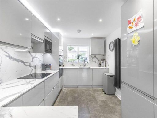 3 bedroom semi-detached house for sale in Clarkes Road, Hatfield, AL10 — £575,000 • 3 bed • 3 bath • 1196 ft²
 2 bedroom terraced house for sale in Heyford Way, Hatfield, AL10 — £375,000 • 2 bed • 1 bath • 594 ft²
 3 bedroom end of terrace house for sale in Glebeland, Hatfield, AL10 — £460,000 • 3 bed • 1 bath • 956 ft²
 3 bedroom detached house for sale in Burleigh Mead, Hatfield, AL9 — £600,000 • 3 bed • 2 bath • 1238 ft²
 3 bedroom terraced house for sale in Glebeland, Hatfield, AL10 — £400,000 • 3 bed • 1 bath • 1030 ft²
Meta
- {
"@context": "https://schema.org",
"@type": "Residence",
"name": "3 bedroom terraced house for sale in St. Etheldredas Drive,…",
"description": "",
"url": "https://propertypiper.co.uk/property/00ec003f-bffd-4b1b-b72c-04e61aae697b",
"image": "https://image-a.propertypiper.co.uk/c7be38ba-1b34-4817-9a1b-747a402527f0-1024.jpeg",
"address": {
"@type": "PostalAddress",
"streetAddress": "41 ST ETHELDREDA'S DRIVE HATFIELD",
"postalCode": "AL10 8BZ",
"addressLocality": "Welwyn Hatfield",
"addressRegion": "Welwyn Hatfield",
"addressCountry": "England"
},
"geo": {
"@type": "GeoCoordinates",
"latitude": 51.7611132,
"longitude": -0.2178912
},
"numberOfRooms": 3,
"numberOfBathroomsTotal": 1,
"floorSize": {
"@type": "QuantitativeValue",
"value": 861,
"unitCode": "FTK"
},
"offers": {
"@type": "Offer",
"price": 415000,
"priceCurrency": "GBP",
"availability": "https://schema.org/InStock"
},
"additionalProperty": [
{
"@type": "PropertyValue",
"name": "Feature",
"value": "modern"
},
{
"@type": "PropertyValue",
"name": "Feature",
"value": "terraced"
},
{
"@type": "PropertyValue",
"name": "Feature",
"value": "brick"
},
{
"@type": "PropertyValue",
"name": "Feature",
"value": "2-story"
},
{
"@type": "PropertyValue",
"name": "Feature",
"value": "small windows"
},
{
"@type": "PropertyValue",
"name": "Feature",
"value": "driveway"
},
{
"@type": "PropertyValue",
"name": "Feature",
"value": "residential"
},
{
"@type": "PropertyValue",
"name": "Feature",
"value": "compact"
},
{
"@type": "PropertyValue",
"name": "Feature",
"value": "kitchen"
},
{
"@type": "PropertyValue",
"name": "Feature",
"value": "modern"
},
{
"@type": "PropertyValue",
"name": "Feature",
"value": "tiled floor"
},
{
"@type": "PropertyValue",
"name": "Feature",
"value": "integrated appliances"
},
{
"@type": "PropertyValue",
"name": "Feature",
"value": "white cabinets"
},
{
"@type": "PropertyValue",
"name": "Feature",
"value": "mosaic backsplash"
},
{
"@type": "PropertyValue",
"name": "Feature",
"value": "wash machine"
}
]
}
High Res Floorplan Images
Compatible Floorplan Images
FloorplanImages Thumbnail