IG10 4QU - 4 bedroom detached house for sale in High Road, Loughton, I…
View on Property Piper
4 bedroom detached house for sale in High Road, Loughton, IG10
Property Details
- Price: £1050000
- Bedrooms: 4
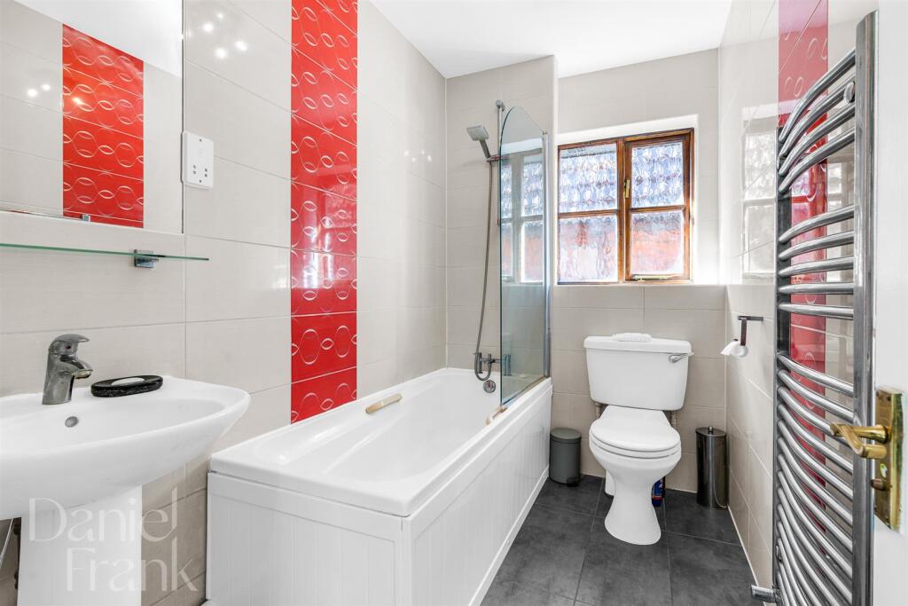
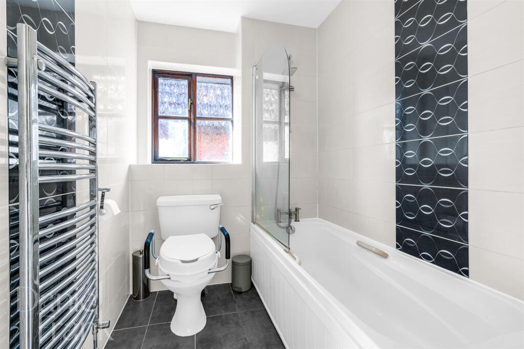
- Bathrooms: 2
- Property Type: undefined
- Property SubType: undefined
Brochure Descriptions
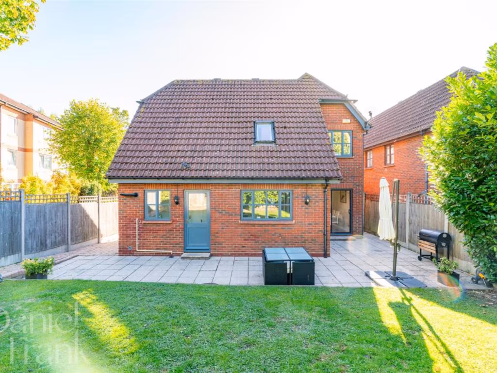
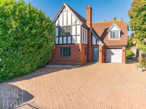
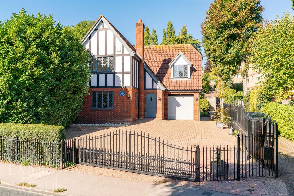
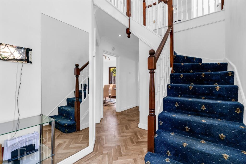
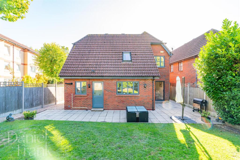
- Substantial detached two-storey residence of mock-Tudor appearance with red brick lower elevation and white timber-framed upper gable. The property sits behind a secure metal boundary gate with a large paved forecourt/drive providing off-street parking for multiple vehicles and an integral single garage to the right. Primary frontage faces a quiet tree-lined residential street and is flanked by mature hedging and specimen trees, offering a degree of privacy. Ground floor likely includes a formal reception and entrance hall (traditional window proportions and leaded glazing visible), with further accommodation above in the gabled roof space. Plot size: front hardstanding is large/very generous for parking; front garden/landscaping is small. Overall property/plot appears medium in size for a suburban detached house. Setting: established residential area with mature planting; no significant long-distance views visible from the frontage. Excludes any assumptions about internal layout beyond external cues and excludes movable items.
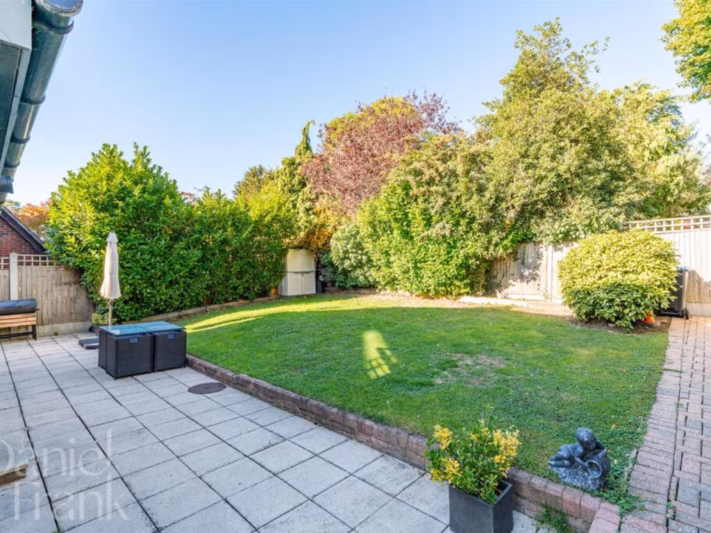
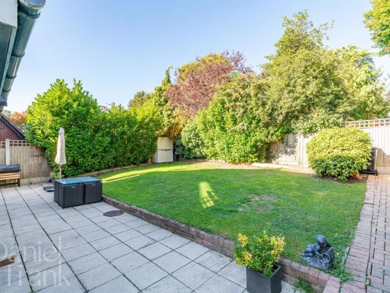
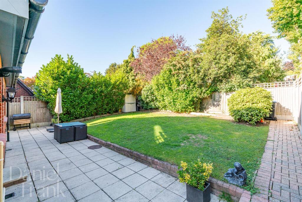
- A well-presented, modern two-storey detached family house with a pitched tiled roof and red-brick exterior. The rear garden is private and of medium-to-large size with a paved patio area directly off the house and a level lawn framed by mature shrubs and boundary fencing. The property benefits from a paved terrace suitable for outdoor dining and entertaining and appears to have good natural light from multiple rear-facing windows and a glazed door. The plot is suburban in character with neighbouring houses visible; no sea, river or exceptional long-distance views are apparent. Overall the dwelling and garden suggest a medium-sized family property with outdoor space suited to family use and low-maintenance landscaping.
Image Descriptions
- Tudor-style property Tudor
- exterior of a detached house Mock Tudor
Floorplan Description
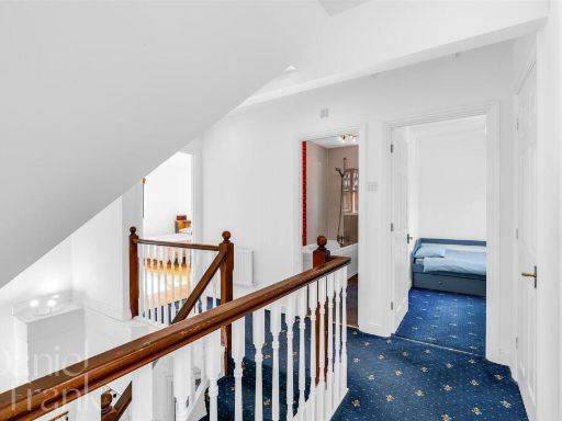
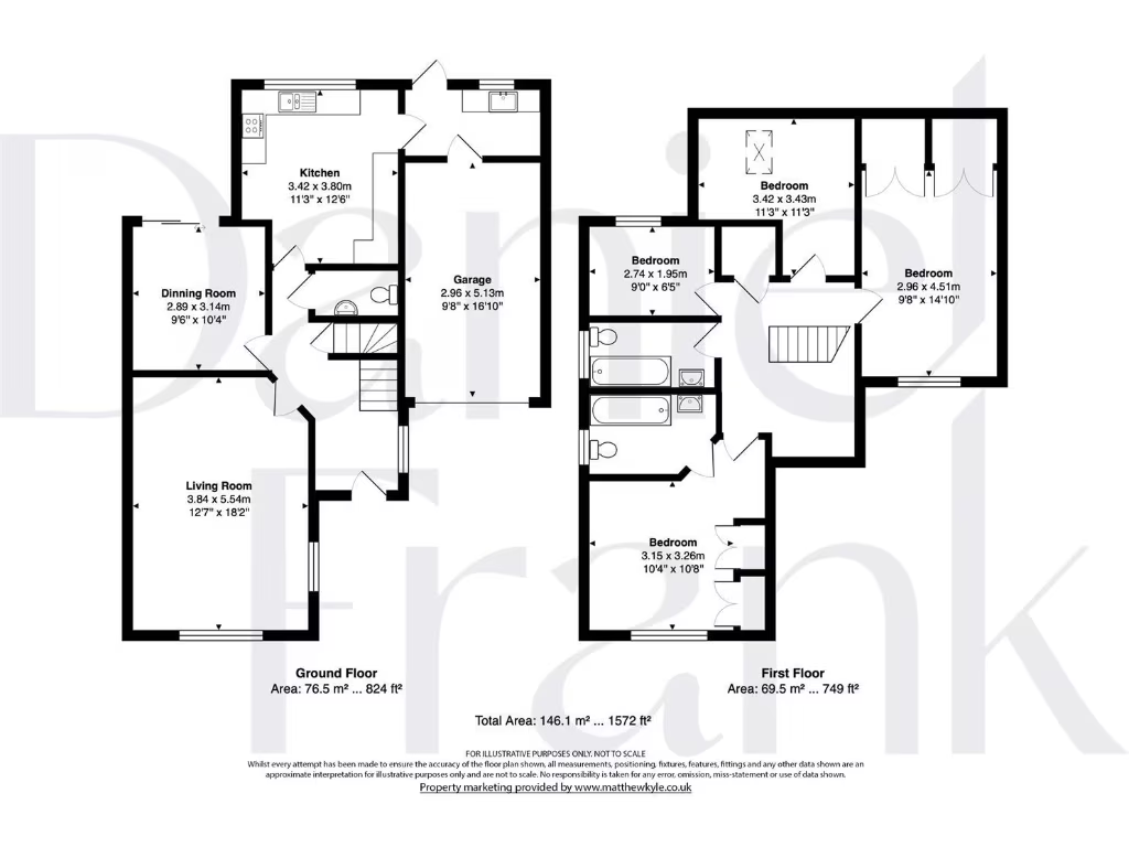
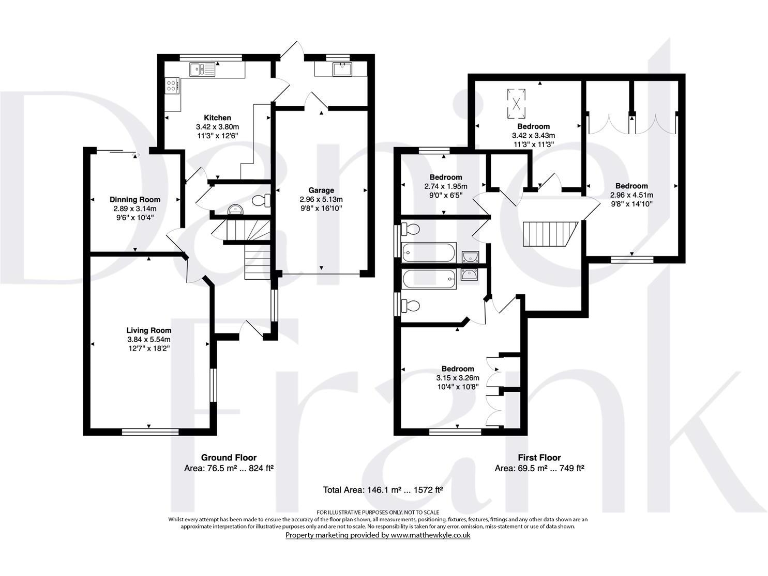
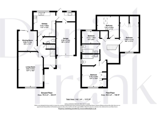
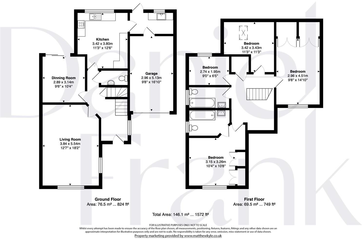
- Two-storey house with garage (garage area excluded from total).
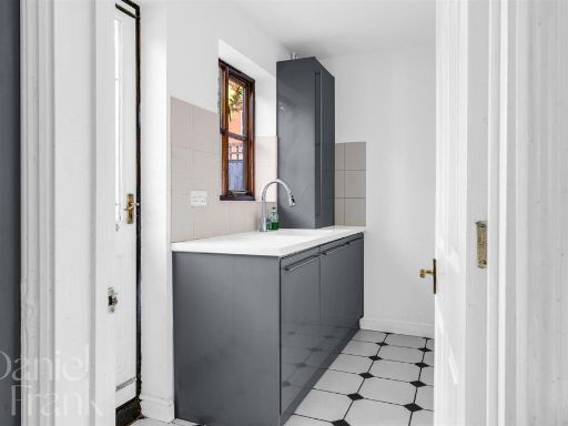
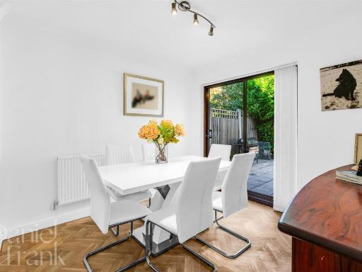
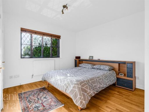
Rooms
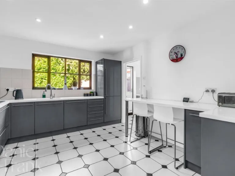
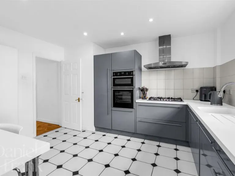
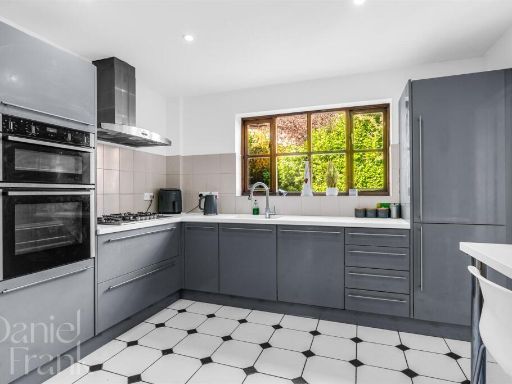
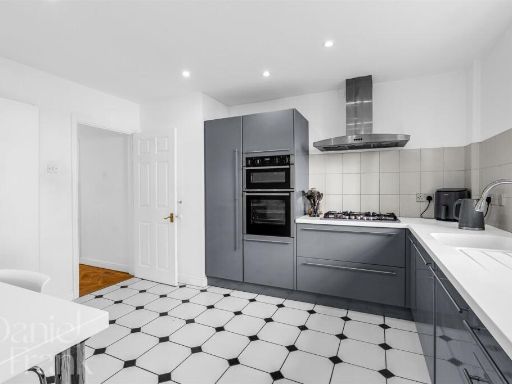
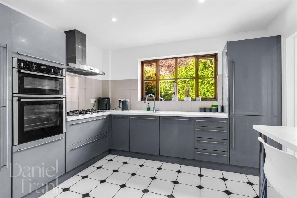
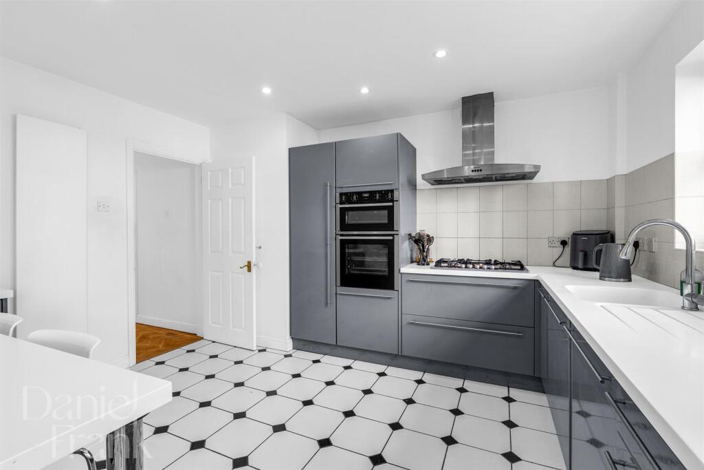
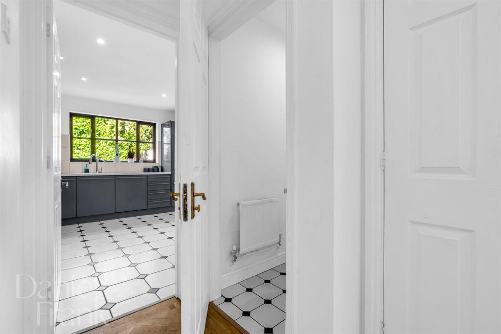
- Kitchen:
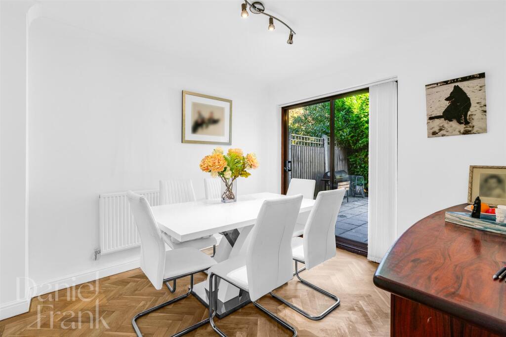
- Dinning Room:
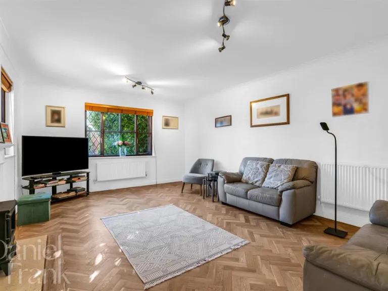
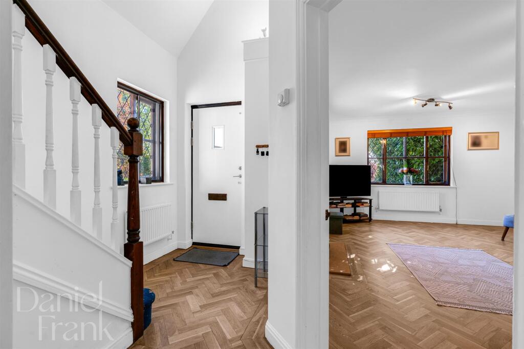
- Living Room:
- Garage:
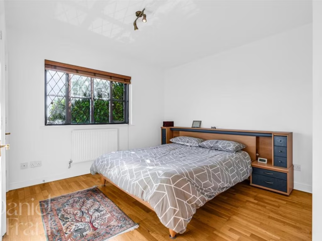
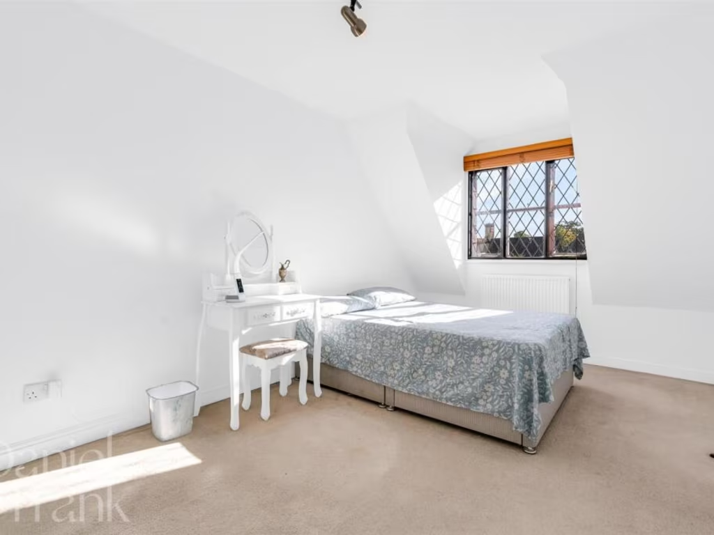
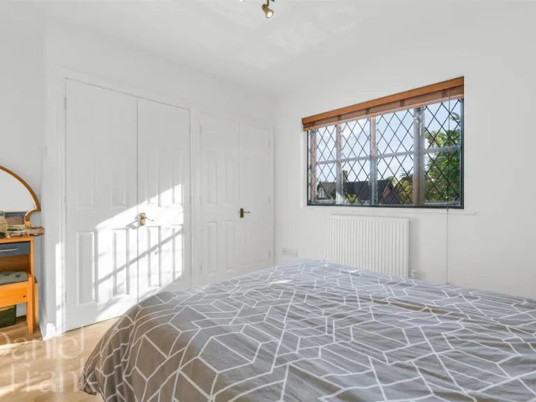
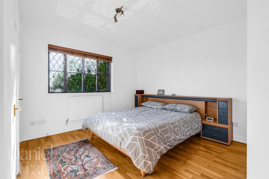
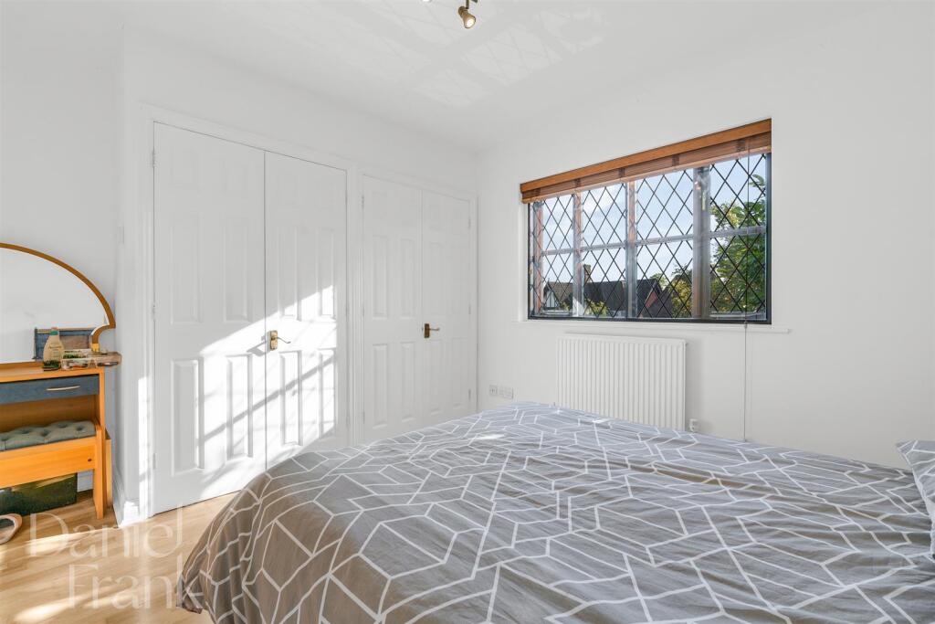
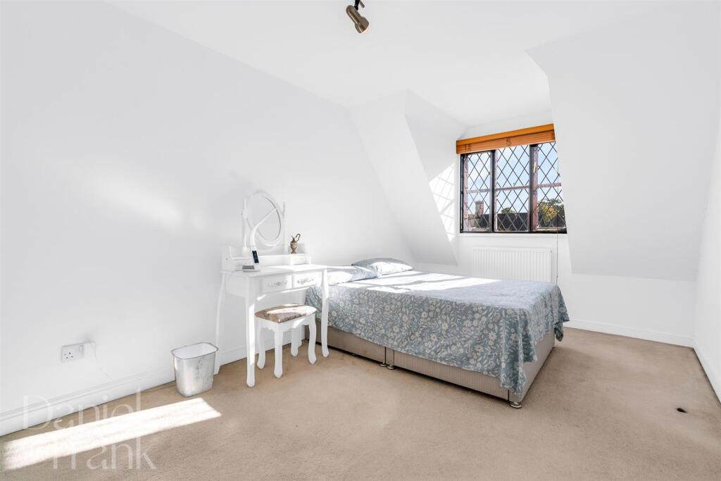
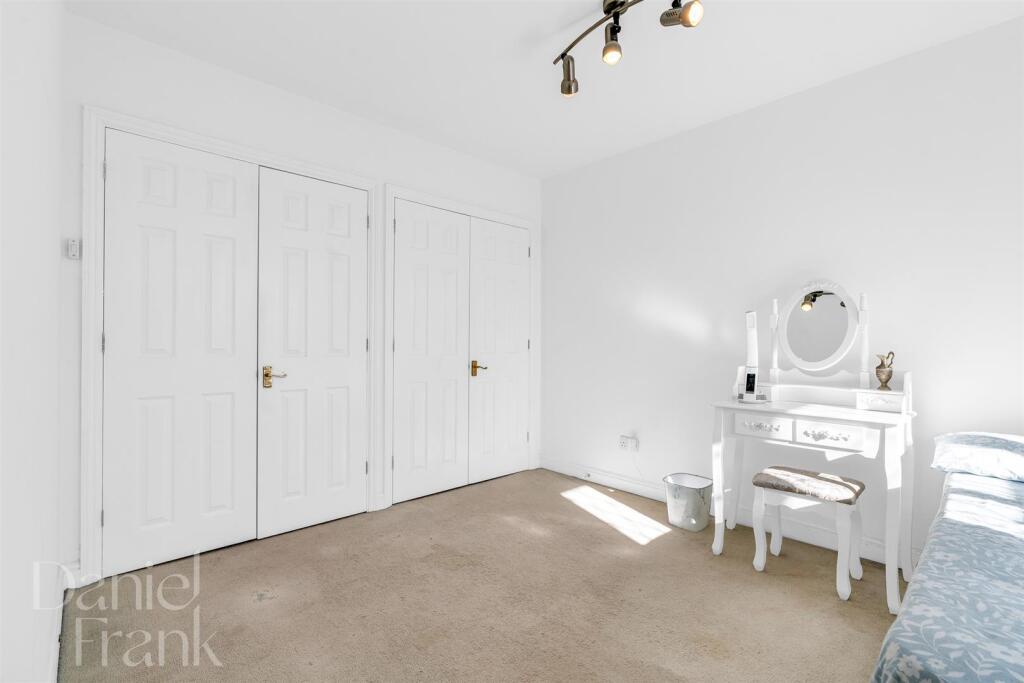
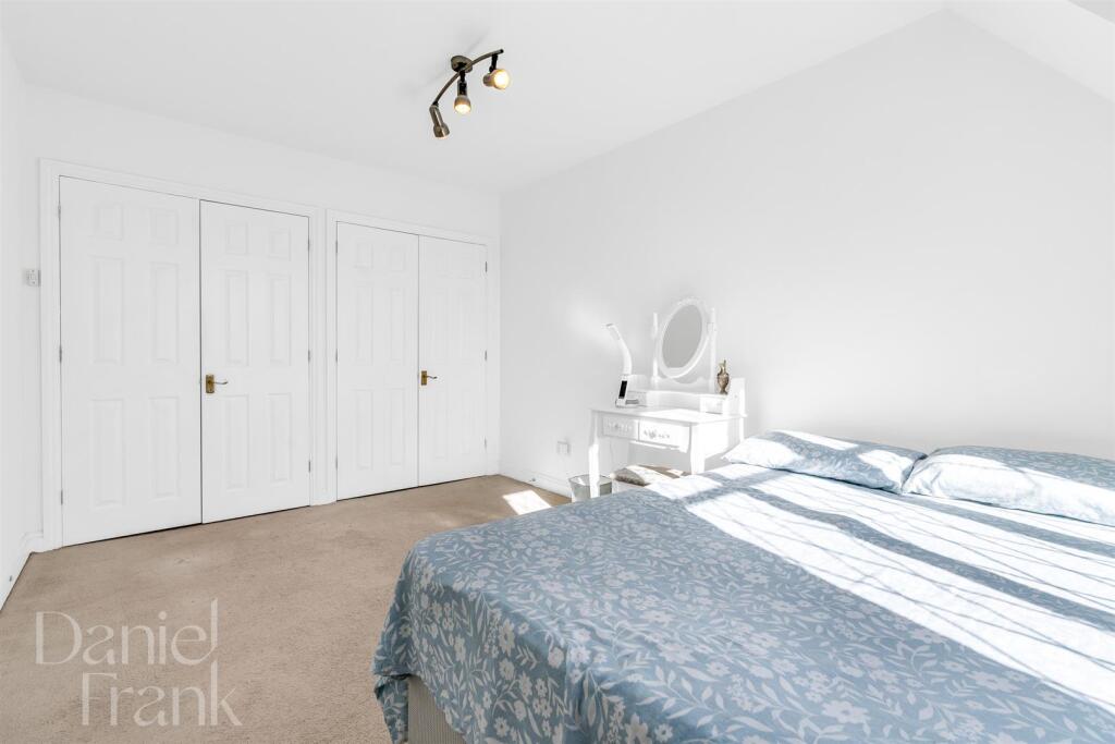
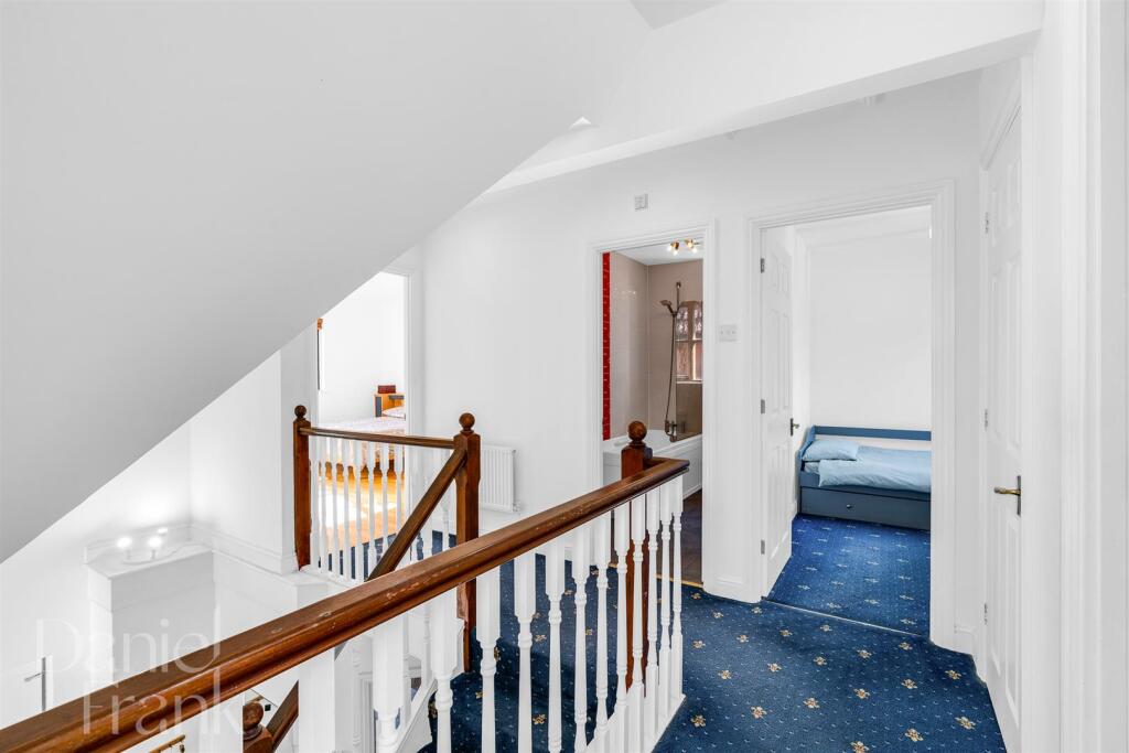
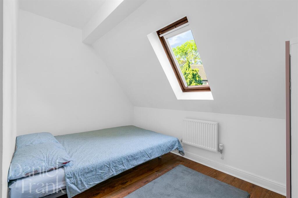
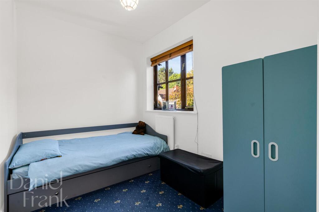
- Bedroom:
- Bedroom:
- Bedroom:
- Bedroom:
Textual Property Features
Detected Visual Features
- Tudor style
- detached house
- gable roof
- brickwork
- half timbering
- garage
- driveway
- garden
- residential
- well-maintained
- period architecture
- Mock Tudor
- timber framing
EPC Details
- Fully double glazed
- Cavity wall, as built, insulated (assumed)
- Boiler and radiators, mains gas
- Low energy lighting in 83% of fixed outlets
- Solid, no insulation (assumed)
Nearby Schools
- Bancrofts Preparatory School
- Chigwell School
- Chigwell Primary Academy
- Loyola Preparatory School
- St John Fisher Catholic Primary School
- West Hatch High School
- St John's Church of England Voluntary Controlled Primary School, Buckhurst Hill
- Braeside School
- The Alderton Junior School
- Thomas Willingale Primary School and Nursery
- High Beech CofE Primary School
- Ray Lodge Primary School
- Avon House School
- Wells Primary School
- Bancrofts School
- Daiglen School
- The Alderton Infant School
- Hereward Primary School
- St Antony's Catholic Primary School
- Buckhurst Hill Community Primary School
- White Bridge Primary School
- Oaklands School
- Roding Valley High School
- Staples Road Primary School
- Debden Park High School
- Davenant Foundation School
Nearest Bars And Restaurants
- Id: 4770819622
- Tags:
- Amenity: fast_food
- Cuisine: fish_and_chips
- Name: Palace Fish Bar
- Name:en: Palace Fish Bar
- TagsNormalized:
- Lat: 51.644915
- Lon: 0.0524172
- FullGeoHash: u10jc1wjmmvj
- PartitionGeoHash: u10j
- Images:
- FoodStandards: null
- Distance: 198.7
,- Id: 2018958185
- Tags:
- Amenity: restaurant
- Cuisine: indian
- Name: India Grill
- Source: survey
- TagsNormalized:
- Lat: 51.6445697
- Lon: 0.0526915
- FullGeoHash: u10jc1w77v9d
- PartitionGeoHash: u10j
- Images:
- FoodStandards: null
- Distance: 187.8
,- Id: 7168835277
- Tags:
- Amenity: restaurant
- Name: Gem of Essex
- TagsNormalized:
- Lat: 51.6447154
- Lon: 0.0522627
- FullGeoHash: u10jc1wh3b9z
- PartitionGeoHash: u10j
- Images:
- FoodStandards: null
- Distance: 175.3
,- Id: 6601971205
- Tags:
- Amenity: restaurant
- Cuisine: pizza
- Name: God's Own Pizza
- Old_name: Rhino
- Website: https://www.godsownpizza.com/
- TagsNormalized:
- Lat: 51.6443738
- Lon: 0.0524497
- FullGeoHash: u10jc1w4q1j3
- PartitionGeoHash: u10j
- Images:
- FoodStandards: null
- Distance: 161.8
,- Id: 6603967027
- Tags:
- Amenity: restaurant
- Name: Tom, Dick and Harry's
- TagsNormalized:
- Lat: 51.6442806
- Lon: 0.0525289
- FullGeoHash: u10jc1w38p8m
- PartitionGeoHash: u10j
- Images:
- FoodStandards: null
- Distance: 161.4
}
Nearest General Shops
- Id: 6603967024
- Tags:
- Name: Robert Green
- Shop: hairdresser
- TagsNormalized:
- Lat: 51.6441116
- Lon: 0.0520122
- FullGeoHash: u10jc1tbgbpj
- PartitionGeoHash: u10j
- Images:
- FoodStandards: null
- Distance: 121.1
,- Id: 6603967012
- Tags:
- Name: Repro @ 96
- Shop: printing
- TagsNormalized:
- Lat: 51.6442322
- Lon: 0.051663
- FullGeoHash: u10jc1t97yds
- PartitionGeoHash: u10j
- Images:
- FoodStandards: null
- Distance: 108.5
,- Id: 6603967022
- Tags:
- TagsNormalized:
- Lat: 51.6439773
- Lon: 0.0518021
- FullGeoHash: u10jc1mxzp4k
- PartitionGeoHash: u10j
- Images:
- FoodStandards: null
- Distance: 101.6
}
Nearest Grocery shops
- Id: 6627988964
- Tags:
- Name: Roding Food & Wine
- Shop: convenience
- TagsNormalized:
- Lat: 51.6388625
- Lon: 0.0611294
- FullGeoHash: u10jc2sd0mtm
- PartitionGeoHash: u10j
- Images:
- FoodStandards: null
- Distance: 905.9
,- Id: 6606335954
- Tags:
- Brand: Holland & Barrett
- Brand:wikidata: Q5880870
- Brand:wikipedia: en:Holland & Barrett
- Name: Holland & Barrett
- Shop: health_food
- TagsNormalized:
- holland & barrett
- health
- health food
- food
- shop
- Lat: 51.6478595
- Lon: 0.0553596
- FullGeoHash: u10jc60q9fz4
- PartitionGeoHash: u10j
- Images:
- FoodStandards: null
- Distance: 581.5
,- Id: 6604554032
- Tags:
- Name: Wood Stock
- Shop: health_food
- Wikidata: Q1457144
- Wikipedia: en:Team Halfords (men's team)
- TagsNormalized:
- wood
- health
- health food
- food
- shop
- Lat: 51.6474168
- Lon: 0.0554416
- FullGeoHash: u10jc60k5bk3
- PartitionGeoHash: u10j
- Images:
- FoodStandards: null
- Distance: 545.7
}
Nearest Supermarkets
- Id: 172447802
- Tags:
- Addr:
- City: Loughton
- Country: GB
- Housenumber: 246-250
- Postcode: IG10 1HW
- Street: High Road
- Brand: Morrisons
- Brand:wikidata: Q922344
- Brand:wikipedia: en:Morrisons
- Building: yes
- Contact:
- Website: https://my.morrisons.com/storefinder/314
- Name: Morrisons
- Shop: supermarket
- Source: bing
- Wheelchair: yes
- TagsNormalized:
- Lat: 51.6490857
- Lon: 0.0558835
- FullGeoHash: u10jc62twpmv
- PartitionGeoHash: u10j
- Images:
- FoodStandards: null
- Distance: 715.1
,- Id: 191306926
- Tags:
- Brand: M&S Foodhall
- Brand:wikidata: Q714491
- Brand:wikipedia: en:Marks & Spencer
- Building: yes
- Contact:
- Website: https://www.marksandspencer.com/stores/loughton-simply-food-9124
- Name: M&S Foodhall
- Operator: Marks & Spencer
- Shop: supermarket
- Source: bing
- TagsNormalized:
- m&s foodhall
- supermarket
- shop
- Lat: 51.6446398
- Lon: 0.0530438
- FullGeoHash: u10jc1weu48k
- PartitionGeoHash: u10j
- Images:
- FoodStandards: null
- Distance: 212.3
,- Id: 105608385
- Tags:
- Brand: Sainsbury's
- Brand:wikidata: Q152096
- Brand:wikipedia: en:Sainsbury's
- Building: yes
- Name: Sainsbury's
- Shop: supermarket
- Source: survey
- Wheelchair: yes
- TagsNormalized:
- sainsburys
- supermarket
- shop
- Lat: 51.6433861
- Lon: 0.0525311
- FullGeoHash: u10jc1qk80fj
- PartitionGeoHash: u10j
- Images:
- FoodStandards: null
- Distance: 145.2
}
Nearest Religious buildings
- Id: 148893503
- Tags:
- Amenity: place_of_worship
- Building: church
- Denomination: anglican
- Name: St Mary the Virgin
- Religion: christian
- Wikidata: Q26404903
- TagsNormalized:
- place of worship
- church
- anglican
- christian
- Lat: 51.6464428
- Lon: 0.0547734
- FullGeoHash: u10jc1zyk6dp
- PartitionGeoHash: u10j
- Images:
- FoodStandards: null
- Distance: 433.8
,- Id: 449922619
- Tags:
- Addr:
- Housenumber: 2
- Street: High Beech Road
- Amenity: place_of_worship
- Building: yes
- Denomination: evangelical
- Name: Forest Hall
- Religion: christian
- TagsNormalized:
- place of worship
- evangelical
- forest
- christian
- church
- Lat: 51.6450974
- Lon: 0.0521898
- FullGeoHash: u10jc1wn2pgw
- PartitionGeoHash: u10j
- Images:
- FoodStandards: null
- Distance: 204.4
,- Id: 172449085
- Tags:
- Addr:
- Housenumber: 92
- Postcode: IG10 4QU
- Street: high road
- Amenity: place_of_worship
- Name: Loughton Baptist Church
- Religion: christian
- Source: OS OpenData StreetView
- Website: https://loughtonbaptistchurch.co.uk/
- TagsNormalized:
- place of worship
- baptist
- church
- christian
- Lat: 51.644247
- Lon: 0.0505314
- FullGeoHash: u10jc1sc93qv
- PartitionGeoHash: u10j
- Images:
- FoodStandards: null
- Distance: 71.4
}
Nearest Medical buildings
- Id: 6606335930
- Tags:
- Amenity: pharmacy
- Brand: Boots
- Brand:wikidata: Q6123139
- Brand:wikipedia: en:Boots (company)
- Dispensing: yes
- Healthcare: pharmacy
- Name: Boots
- TagsNormalized:
- pharmacy
- boots
- health
- healthcare
- Lat: 51.6482359
- Lon: 0.0557851
- FullGeoHash: u10jc628gbur
- PartitionGeoHash: u10j
- Images:
- FoodStandards: null
- Distance: 632.6
,- Id: 6601953668
- Tags:
- Addr:
- City: Loughton
- Country: GB
- Housenumber: 21
- Postcode: IG10 4NZ
- Street: Station Road
- Amenity: dentist
- Healthcare: dentist
- Name: Station Road Dental Practice
- TagsNormalized:
- Lat: 51.6438526
- Lon: 0.0539007
- FullGeoHash: u10jc1rppzzk
- PartitionGeoHash: u10j
- Images:
- FoodStandards: null
- Distance: 239.2
,- Id: 105608387
- Tags:
- Amenity: medical_centre
- Building: yes
- Healthcare: centre
- Name: Forest Medical Centre
- Source: survey
- TagsNormalized:
- Lat: 51.6437399
- Lon: 0.0534267
- FullGeoHash: u10jc1qysfvu
- PartitionGeoHash: u10j
- Images:
- FoodStandards: null
- Distance: 205.5
,- Id: 6603966999
- Tags:
- Amenity: dentist
- Healthcare: dentist
- Name: Loughton Dental Centre
- TagsNormalized:
- dentist
- health
- healthcare
- dental
- Lat: 51.6442681
- Lon: 0.0517286
- FullGeoHash: u10jc1t9tm7e
- PartitionGeoHash: u10j
- Images:
- FoodStandards: null
- Distance: 114.5
}
Nearest Airports
- Id: 103894219
- Tags:
- Aerodrome: international
- Aeroway: aerodrome
- Iata: SEN
- Icao: EGMC
- Name: London Southend Airport
- Old_name: Southend Municipal Airport
- Ref: SEN
- Wikidata: Q1415441
- TagsNormalized:
- airport
- international airport
- Lat: 51.5701749
- Lon: 0.6924624
- FullGeoHash: u10mru04p937
- PartitionGeoHash: u10m
- Images:
- FoodStandards: null
- Distance: 45081.1
,- Id: 121158889
- Tags:
- Aerodrome: continental
- Aeroway: aerodrome
- Fhrs:
- Authority: City of London Corporation
- Iata: LCY
- Icao: EGLC
- Name: London City Airport
- Operator: London City Airport Limited
- Ref: LCY
- Website: https://www.londoncityairport.com/
- Wikidata: Q8982
- Wikipedia: en:London City Airport
- TagsNormalized:
- airport
- continental airport
- Lat: 51.5042658
- Lon: 0.0539987
- FullGeoHash: u10j10p64702
- PartitionGeoHash: u10j
- Images:
- FoodStandards: null
- Distance: 15495.9
}
Nearest Leisure Facilities
- Id: 448230115
- Tags:
- Leisure: pitch
- Sport: tennis
- TagsNormalized:
- Lat: 51.6457297
- Lon: 0.0449961
- FullGeoHash: u10jc1bf0mz9
- PartitionGeoHash: u10j
- Images:
- FoodStandards: null
- Distance: 444.7
,- Id: 703208913
- Tags:
- TagsNormalized:
- Lat: 51.6439597
- Lon: 0.0568054
- FullGeoHash: u10jc33rgev5
- PartitionGeoHash: u10j
- Images:
- FoodStandards: null
- Distance: 439.8
,- Id: 951476226
- Tags:
- Access: private
- Leisure: swimming_pool
- Location: outdoor
- Swimming: private
- TagsNormalized:
- swimming
- swimming pool
- pool
- leisure
- Lat: 51.6459667
- Lon: 0.0459335
- FullGeoHash: u10jc1c7w3fx
- PartitionGeoHash: u10j
- Images:
- FoodStandards: null
- Distance: 407.8
,- Id: 43032873
- Tags:
- TagsNormalized:
- Lat: 51.6422167
- Lon: 0.055557
- FullGeoHash: u10jc30mwwfm
- PartitionGeoHash: u10j
- Images:
- FoodStandards: null
- Distance: 384.4
,- Id: 951476225
- Tags:
- Access: private
- Leisure: swimming_pool
- Location: outdoor
- Swimming: private
- TagsNormalized:
- swimming
- swimming pool
- pool
- leisure
- Lat: 51.6456148
- Lon: 0.0462672
- FullGeoHash: u10jc1c9w07k
- PartitionGeoHash: u10j
- Images:
- FoodStandards: null
- Distance: 365.3
}
Nearest Tourist attractions
- Id: 43171287
- Tags:
- Building: yes
- Building:levels: 3
- Colour: white
- Description: hunting lodge
- Historic: yes
- Name: Queen Elizabeth's Hunting Lodge
- Roof:
- Colour: brown
- Shape: gabled
- Tourism: attraction
- Wikidata: Q17531911
- Wikipedia: en:Queen Elizabeth's Hunting Lodge
- TagsNormalized:
- Lat: 51.6344471
- Lon: 0.0175514
- FullGeoHash: u10j8rub2yx6
- PartitionGeoHash: u10j
- Images:
- FoodStandards: null
- Distance: 2488.7
,- Id: 3086185544
- Tags:
- TagsNormalized:
- Lat: 51.6346722
- Lon: 0.0187401
- FullGeoHash: u10j8rv9u8t9
- PartitionGeoHash: u10j
- Images:
- FoodStandards: null
- Distance: 2403.6
,- Id: 6601829154
- Tags:
- Name: Lopping Hall Gallery
- Tourism: gallery
- TagsNormalized:
- Lat: 51.6455026
- Lon: 0.0534229
- FullGeoHash: u10jc1ybug7p
- PartitionGeoHash: u10j
- Images:
- FoodStandards: null
- Distance: 293.8
}
Nearest Hotels
- Id: 1151938312
- Tags:
- Addr:
- Housenumber: 735
- Locality: Woodford Green
- Postcode: IG8 8AS
- Street: Chigwell Road
- Brand: Travelodge
- Brand:wikidata: Q9361374
- Building: yes
- Internet_access: wlan
- Internet_access:fee: customers
- Internet_access:ssid: Travelodge WiFi
- Name: Travelodge
- Tourism: hotel
- Website: https://www.travelodge.co.uk/hotels/454/London-Chigwell-hotel
- TagsNormalized:
- Lat: 51.6090711
- Lon: 0.0595564
- FullGeoHash: u10j975keu0k
- PartitionGeoHash: u10j
- Images:
- FoodStandards: null
- Distance: 3891.2
,- Id: 200111
- Tags:
- Name: Royal Forest Hotel
- Naptan:
- StopAreaCode: 490G00011759
- StopAreaType: GPBS
- Verified: no
- Public_transport: stop_area
- Type: public_transport
- TagsNormalized:
- Lat: 51.6335355
- Lon: 0.0146005
- FullGeoHash: u10j8rdehhwu
- PartitionGeoHash: u10j
- Images:
- FoodStandards: null
- Distance: 2716
,- Id: 303395715
- Tags:
- Addr:
- City: London
- Housenumber: 4
- Postcode: E4 7QH
- Street: Ranger's Road
- Suburb: Chingford
- Brand: Premier Inn
- Brand:wikidata: Q2108626
- Brand:wikipedia: en:Premier Inn
- Building: hotel
- Internet_access: wlan
- Internet_access:fee: customers
- Internet_access:operator: Virgin Media
- Internet_access:ssid: Premier Inn Free Wi-Fi
- Name: Premier Inn
- Tourism: hotel
- TagsNormalized:
- Lat: 51.6343102
- Lon: 0.0168239
- FullGeoHash: u10j8rsr8j0c
- PartitionGeoHash: u10j
- Images:
- FoodStandards: null
- Distance: 2540.8
}
Tags
- Tudor style
- detached house
- gable roof
- brickwork
- half timbering
- garage
- driveway
- garden
- residential
- well-maintained
- period architecture
- Mock Tudor
- detached house
- garage
- driveway
- brickwork
- timber framing
Local Market Stats
- Average Price/sqft: £548
- Avg Income: £57100
- Rental Yield: 4%
- Social Housing: 10%
- Planning Success Rate: 79%
Similar Properties
 4 bedroom detached house for sale in Woodbury Hill, Loughton, IG10 — £1,925,000 • 4 bed • 3 bath • 3206 ft²
 4 bedroom detached house for sale in Churchfields, Loughton, IG10 — £1,250,000 • 4 bed • 2 bath • 2066 ft²
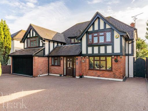 4 bedroom detached house for sale in The Beacons, Loughton, IG10 — £1,650,000 • 4 bed • 3 bath • 2681 ft²
 4 bedroom detached house for sale in Church Hill, Loughton, IG10 — £1,150,000 • 4 bed • 3 bath • 2003 ft²
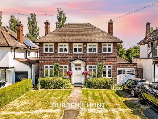 4 bedroom detached house for sale in Hilltop Close, Loughton, IG10 — £1,450,000 • 4 bed • 1 bath • 2442 ft²
 4 bedroom detached house for sale in Tycehurst Hill, Loughton, IG10 — £1,500,000 • 4 bed • 2 bath • 2072 ft²
Meta
- {
"@context": "https://schema.org",
"@type": "Residence",
"name": "4 bedroom detached house for sale in High Road, Loughton, I…",
"description": "",
"url": "https://propertypiper.co.uk/property/0062a25b-307b-4a4c-ba2e-b6edbc510603",
"image": "https://image-a.propertypiper.co.uk/25d63f9d-b44e-4fd8-8ea4-6018388e7b2c-1024.jpeg",
"address": {
"@type": "PostalAddress",
"streetAddress": "70, High Road",
"postalCode": "IG10 4QU",
"addressLocality": "Epping Forest",
"addressRegion": "Epping Forest",
"addressCountry": "England"
},
"geo": {
"@type": "GeoCoordinates",
"latitude": 51.64360627622514,
"longitude": 0.05045687438648724
},
"numberOfRooms": 4,
"numberOfBathroomsTotal": 2,
"floorSize": {
"@type": "QuantitativeValue",
"value": 1572,
"unitCode": "FTK"
},
"offers": {
"@type": "Offer",
"price": 1050000,
"priceCurrency": "GBP",
"availability": "https://schema.org/InStock"
},
"additionalProperty": [
{
"@type": "PropertyValue",
"name": "Feature",
"value": "Tudor style"
},
{
"@type": "PropertyValue",
"name": "Feature",
"value": "detached house"
},
{
"@type": "PropertyValue",
"name": "Feature",
"value": "gable roof"
},
{
"@type": "PropertyValue",
"name": "Feature",
"value": "brickwork"
},
{
"@type": "PropertyValue",
"name": "Feature",
"value": "half timbering"
},
{
"@type": "PropertyValue",
"name": "Feature",
"value": "garage"
},
{
"@type": "PropertyValue",
"name": "Feature",
"value": "driveway"
},
{
"@type": "PropertyValue",
"name": "Feature",
"value": "garden"
},
{
"@type": "PropertyValue",
"name": "Feature",
"value": "residential"
},
{
"@type": "PropertyValue",
"name": "Feature",
"value": "well-maintained"
},
{
"@type": "PropertyValue",
"name": "Feature",
"value": "period architecture"
},
{
"@type": "PropertyValue",
"name": "Feature",
"value": "Mock Tudor"
},
{
"@type": "PropertyValue",
"name": "Feature",
"value": "detached house"
},
{
"@type": "PropertyValue",
"name": "Feature",
"value": "garage"
},
{
"@type": "PropertyValue",
"name": "Feature",
"value": "driveway"
},
{
"@type": "PropertyValue",
"name": "Feature",
"value": "brickwork"
},
{
"@type": "PropertyValue",
"name": "Feature",
"value": "timber framing"
}
]
}
High Res Floorplan Images
Compatible Floorplan Images
FloorplanImages Thumbnail