OL1 4NL - 2 bedroom semidetached house for sale in Higher Fullwood, O…
View on Property Piper
2 bedroom semi-detached house for sale in Higher Fullwood, Oldham, OL1
Property Details
- Price: £170000
- Bedrooms: 2
- Bathrooms: 1
- Property Type: undefined
- Property SubType: undefined
Image Descriptions
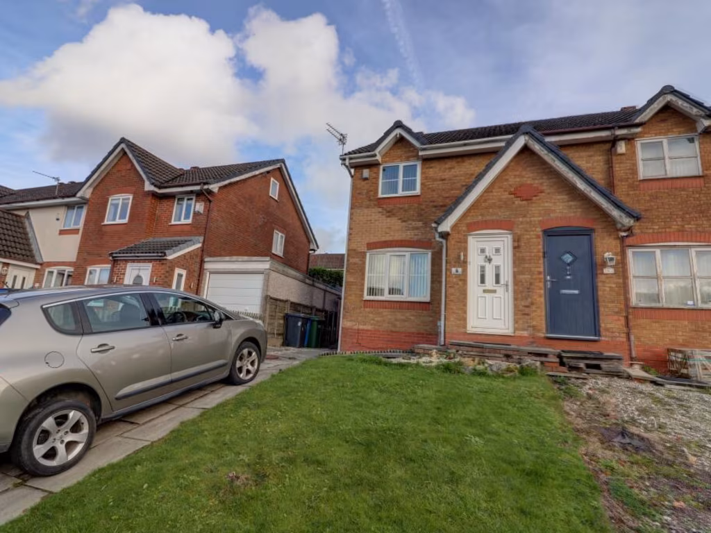
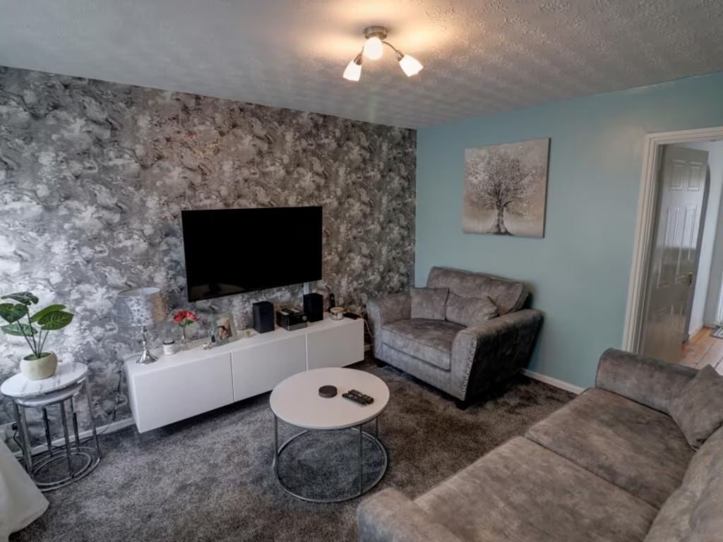
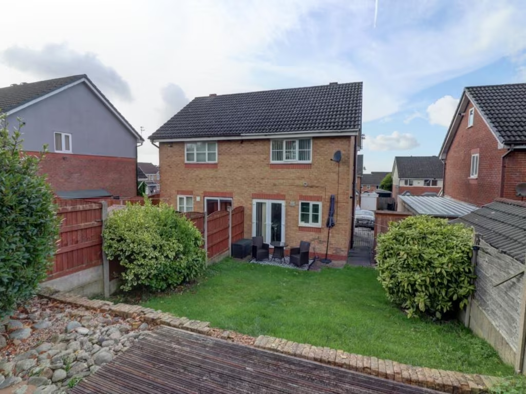
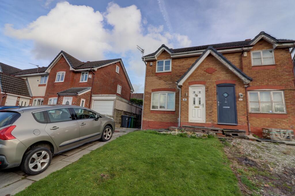
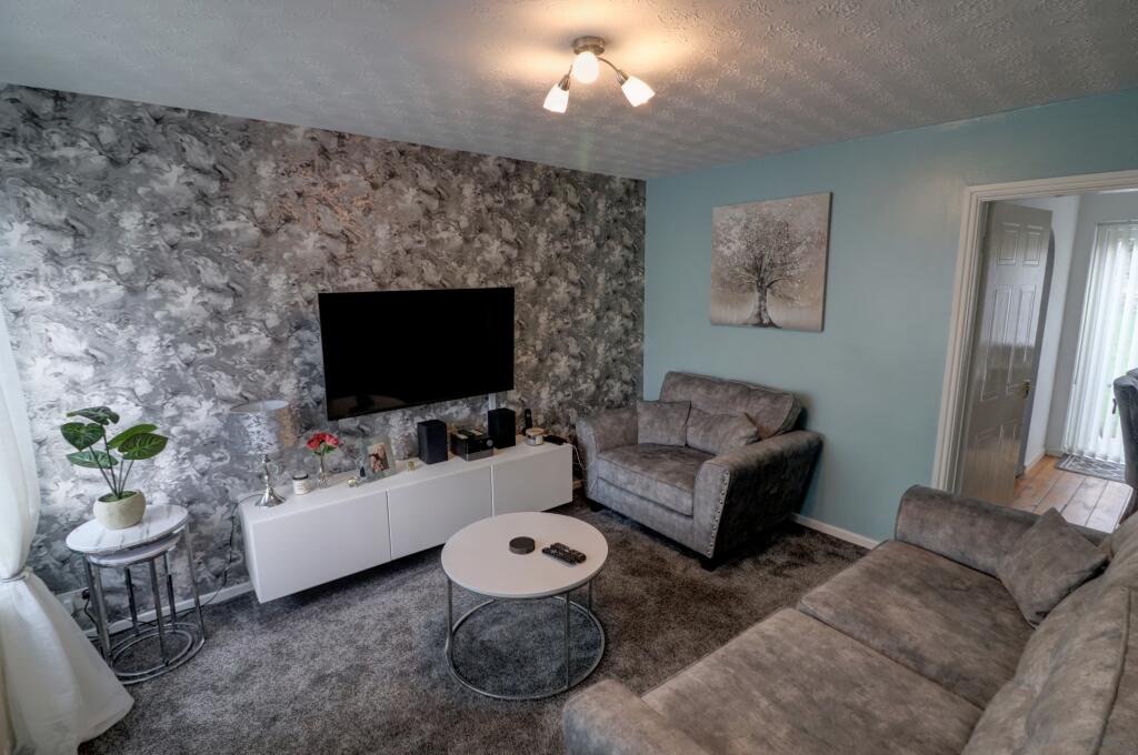
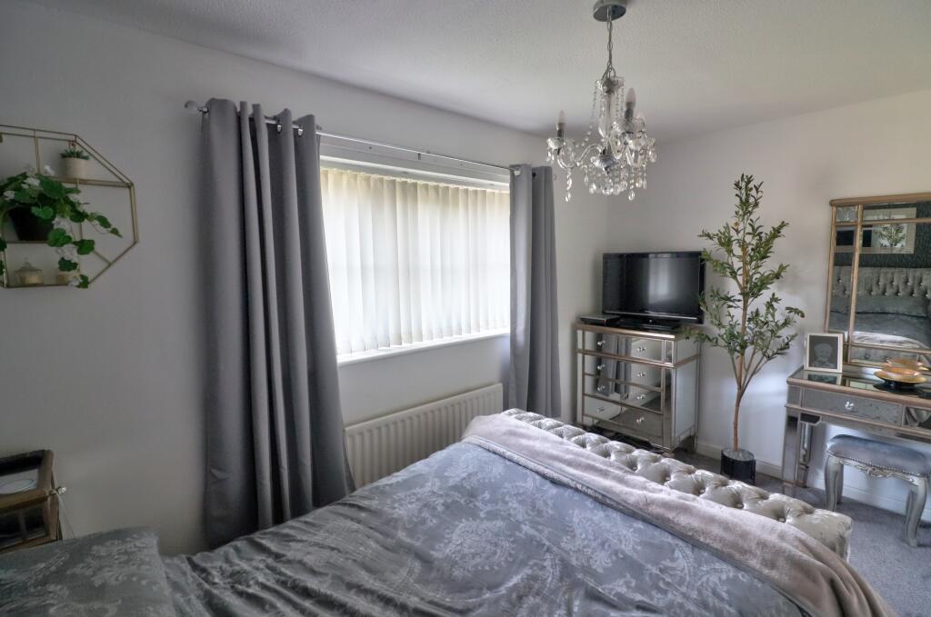
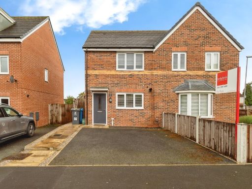
- residential property contemporary
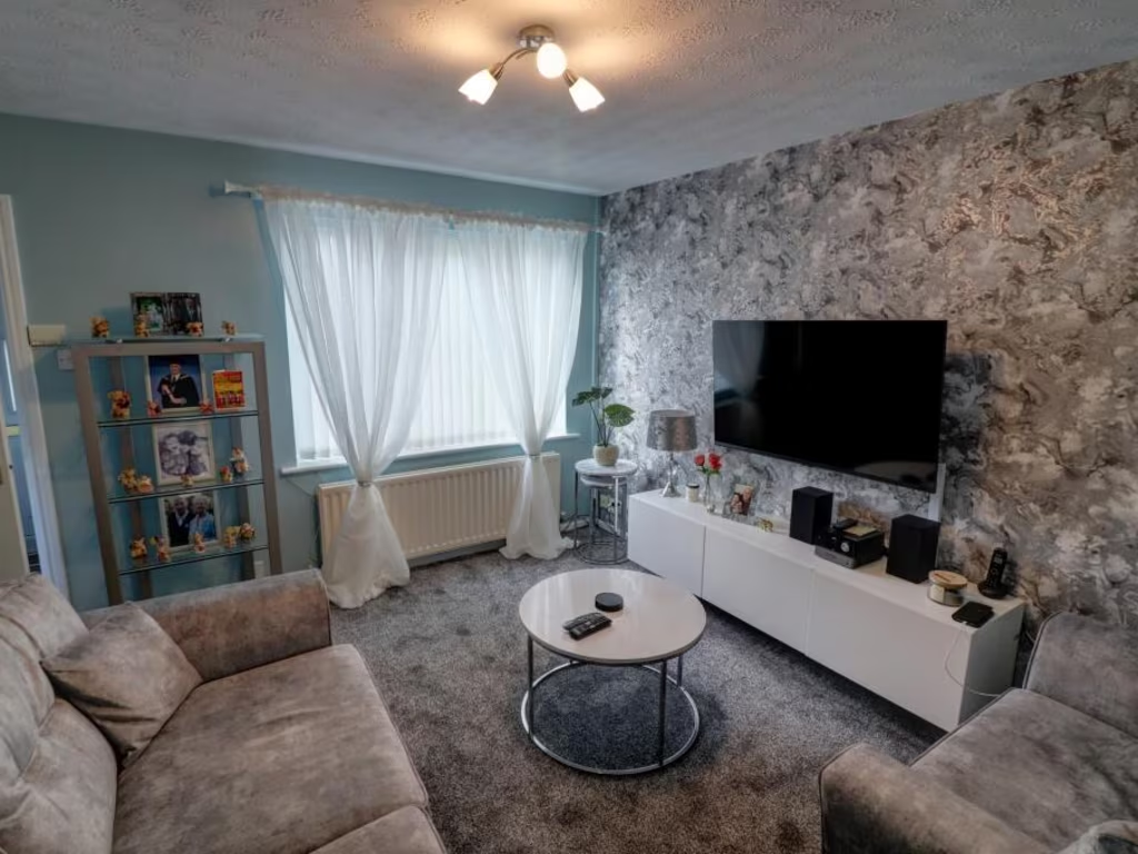
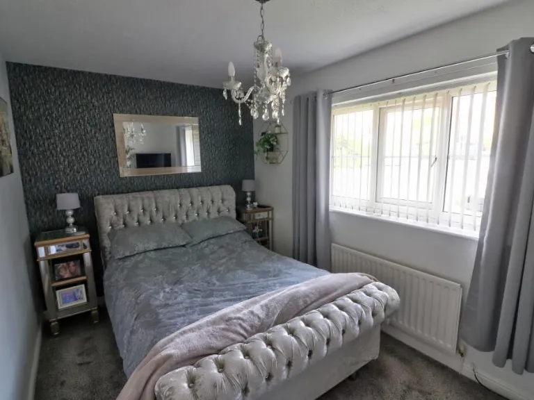
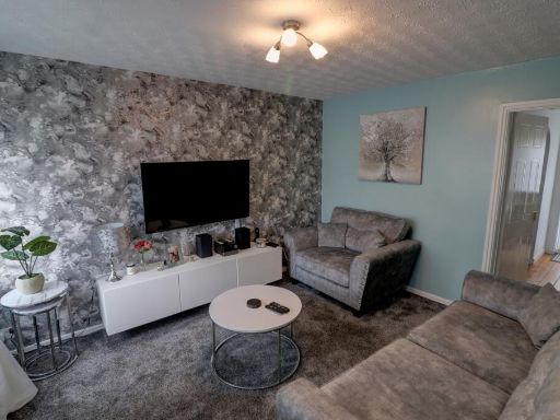
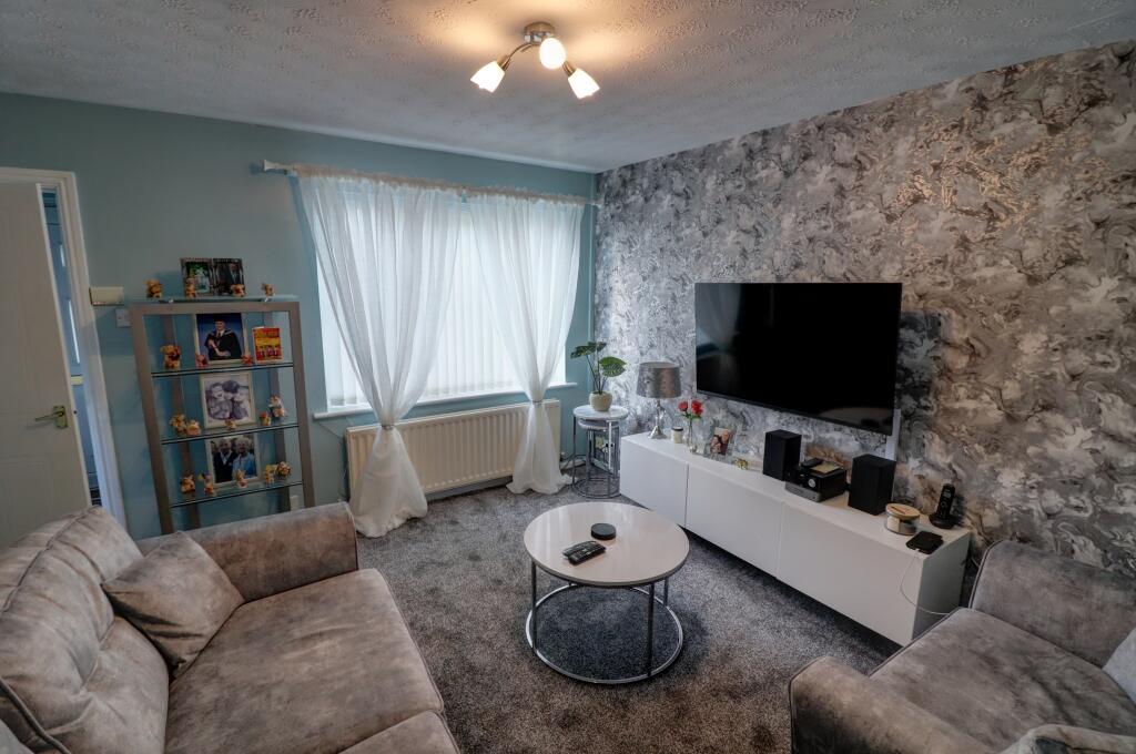
- living room contemporary
Floorplan Description
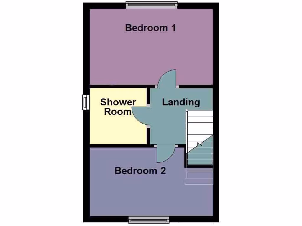
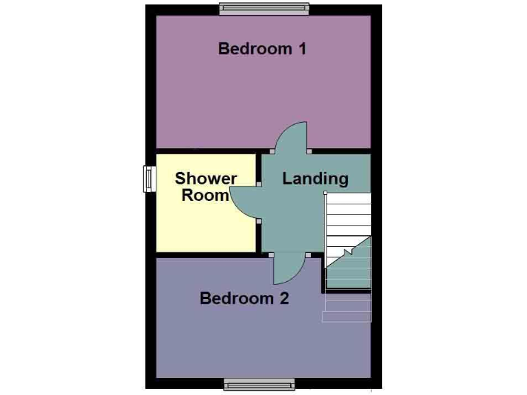
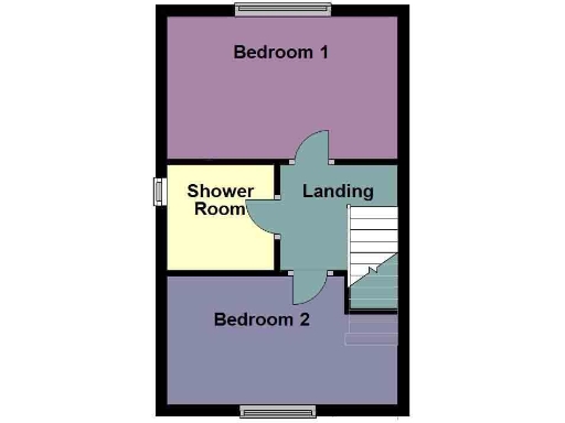
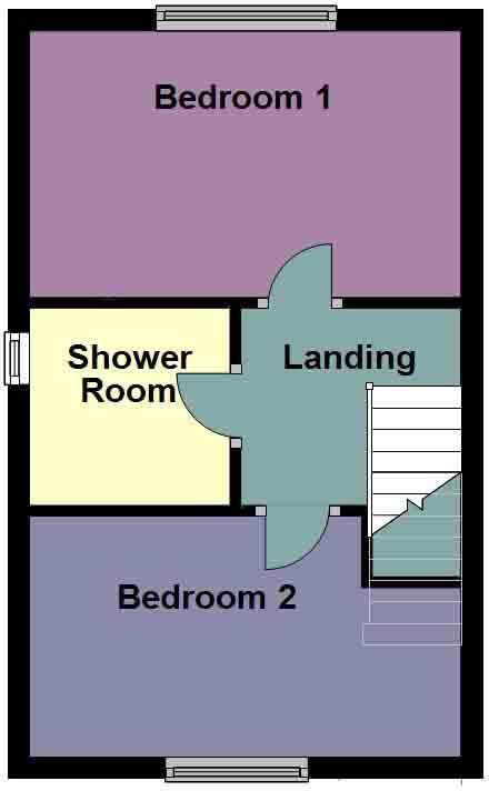
- Floor plan showing Bedroom 1, Bedroom 2, Shower Room and Landing.
Rooms
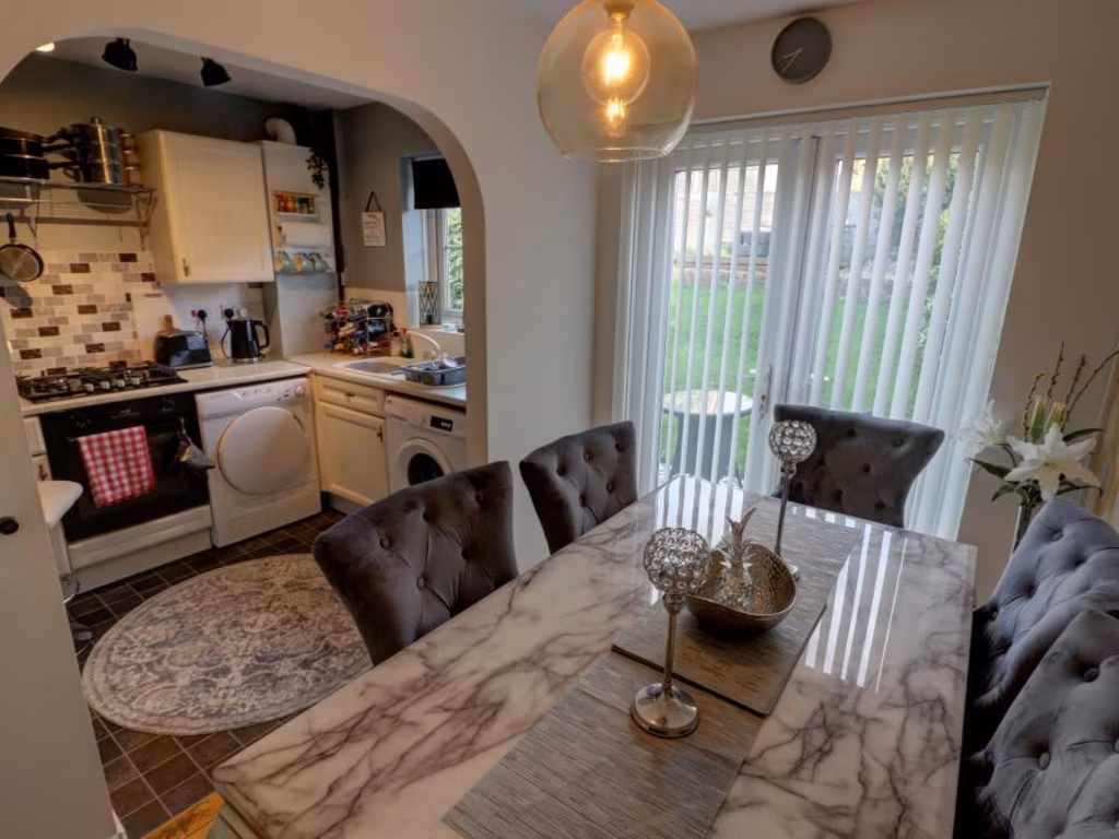
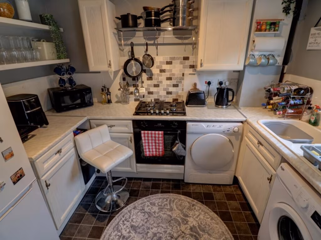
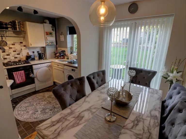
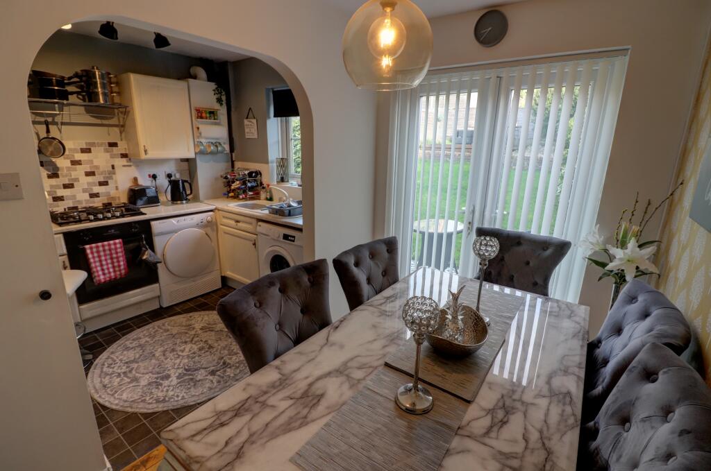
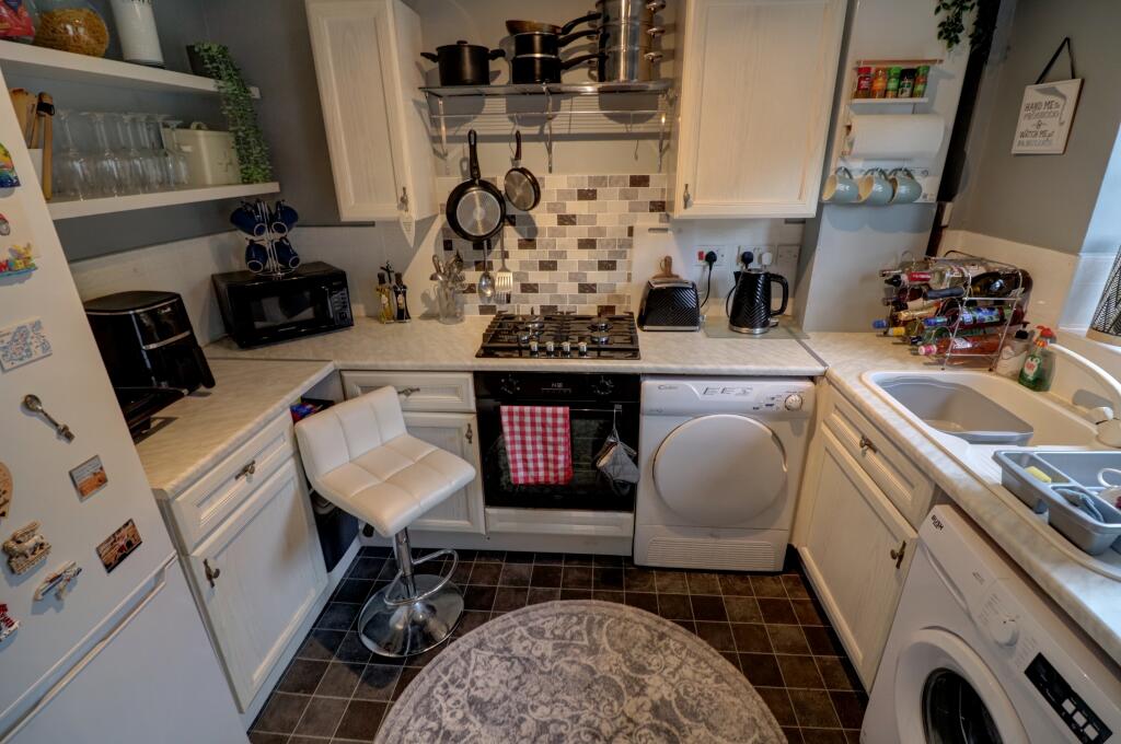
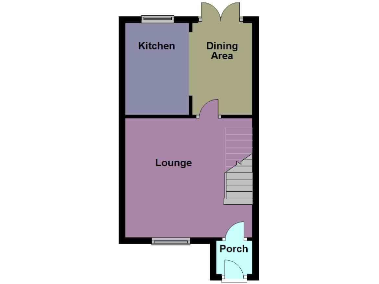
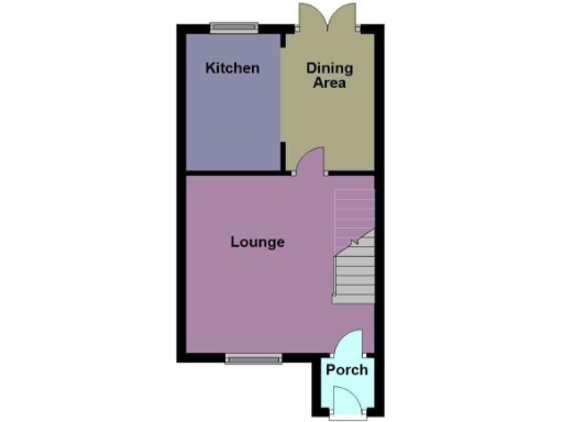
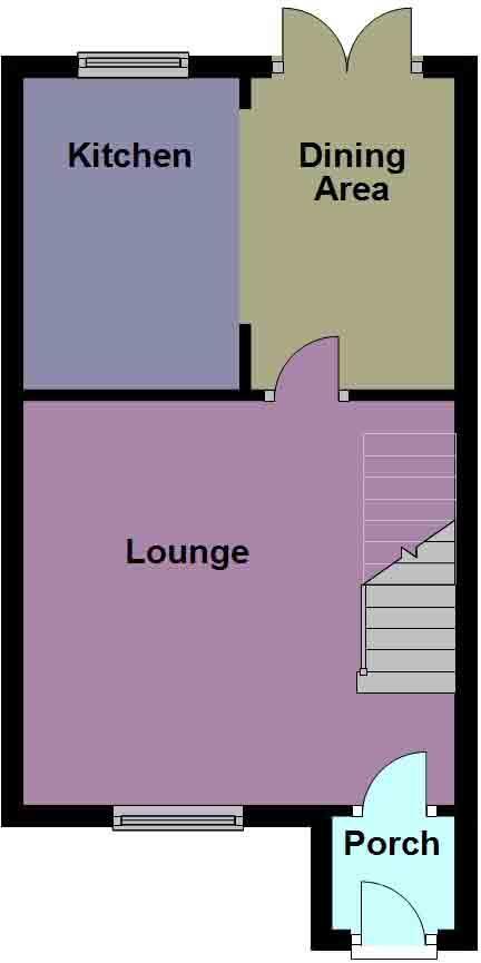
- Kitchen:
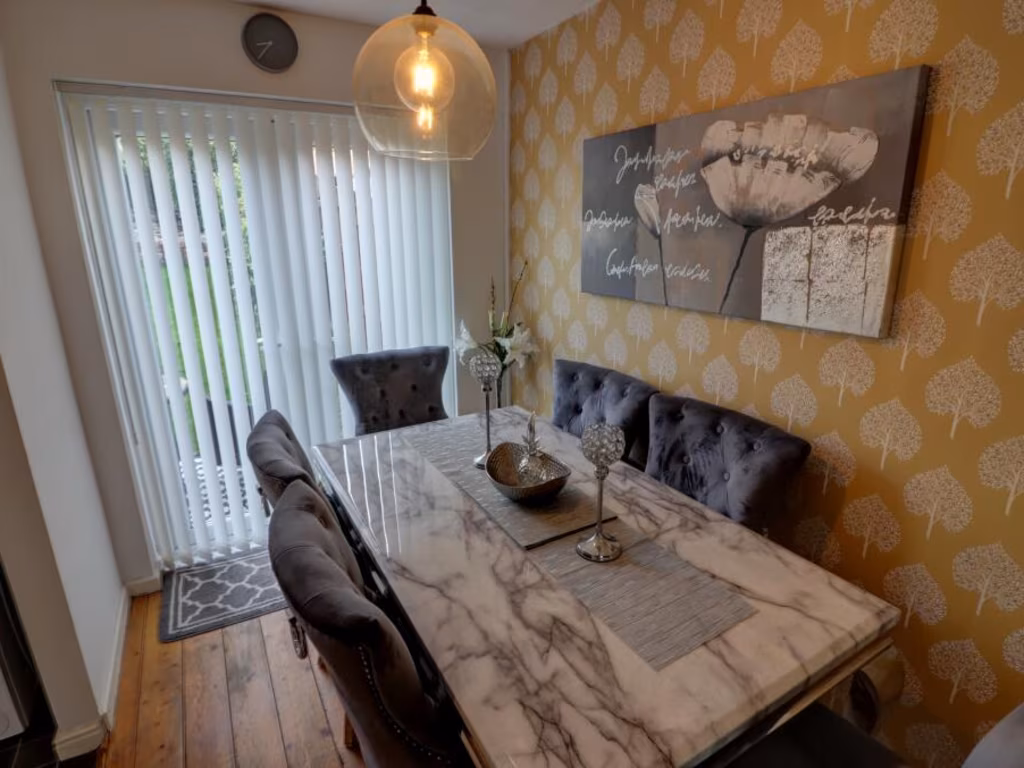
- Dining Area:
- Lounge:
- Porch:
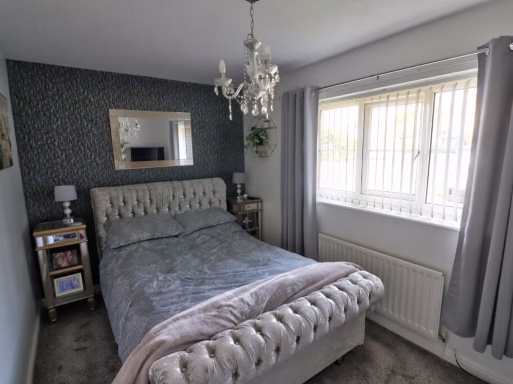
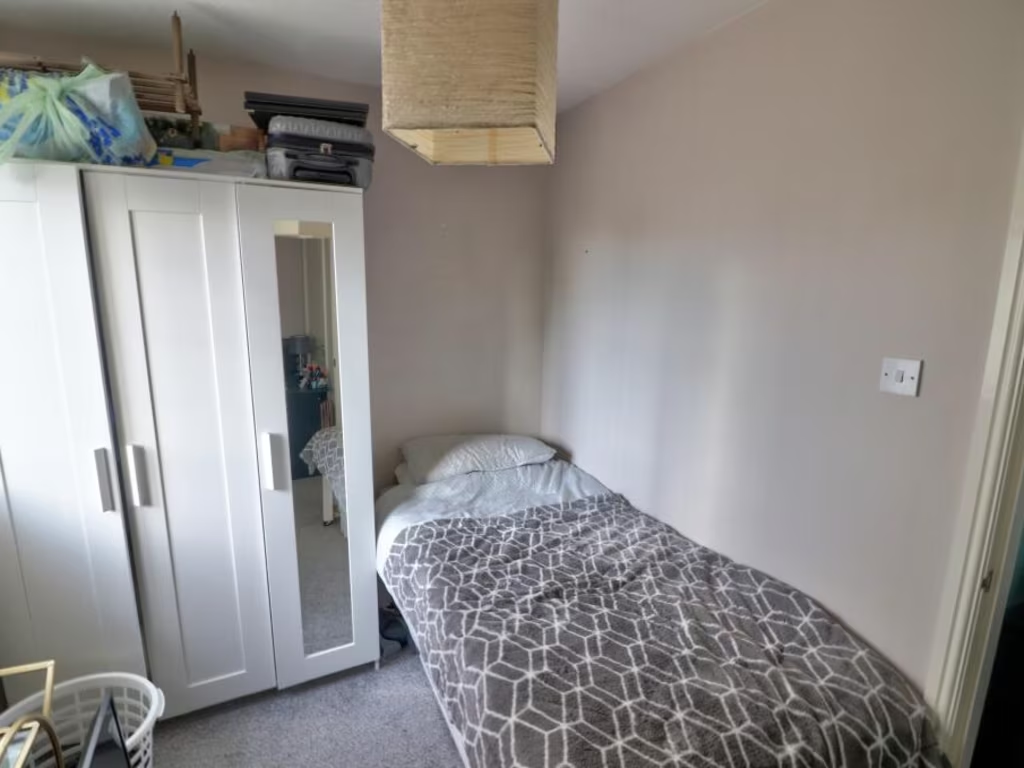
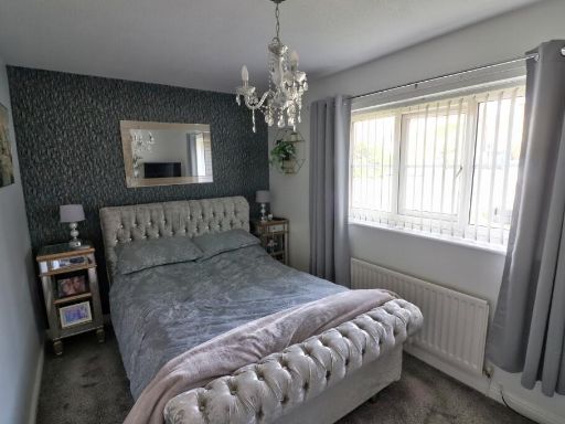
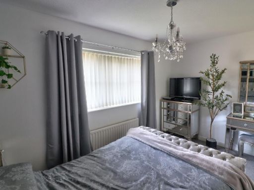
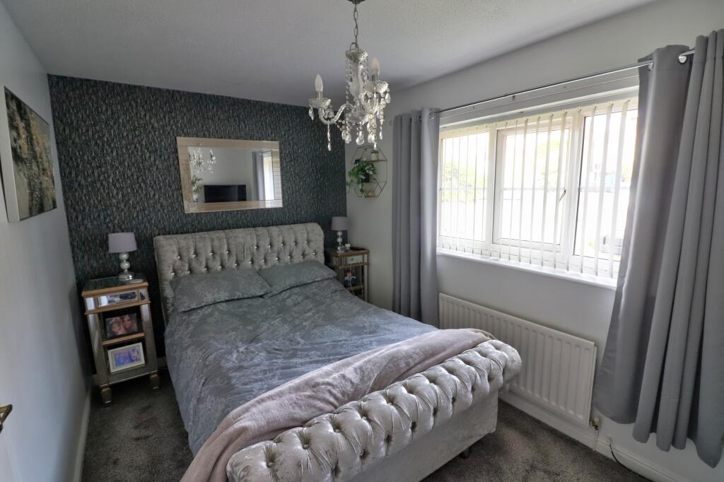
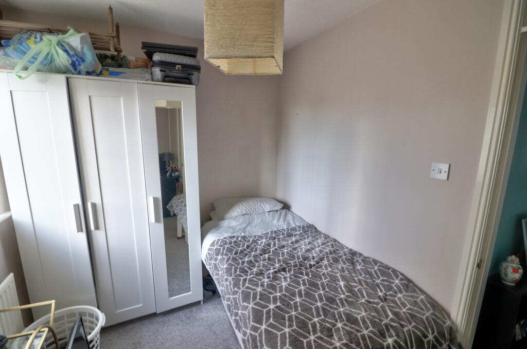
- Bedroom 1:
- Bedroom 2:
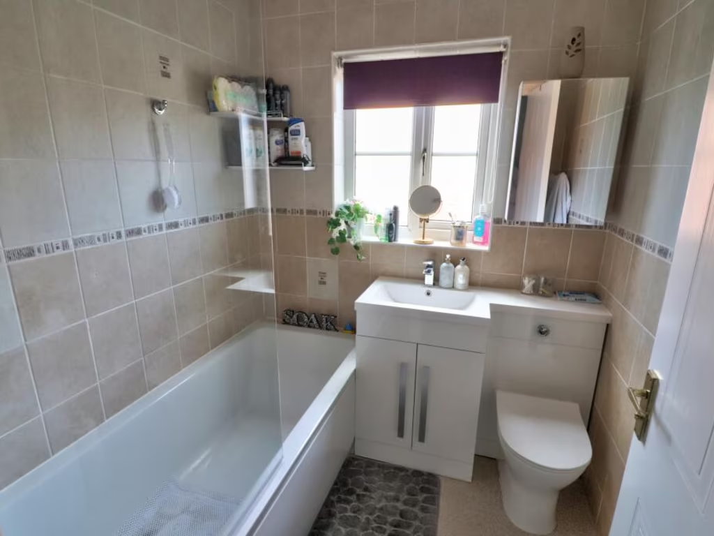
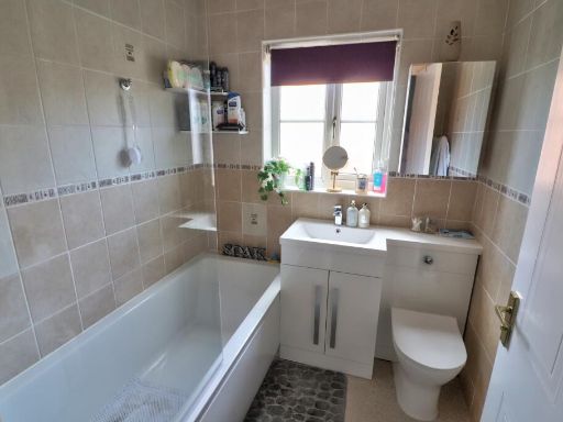
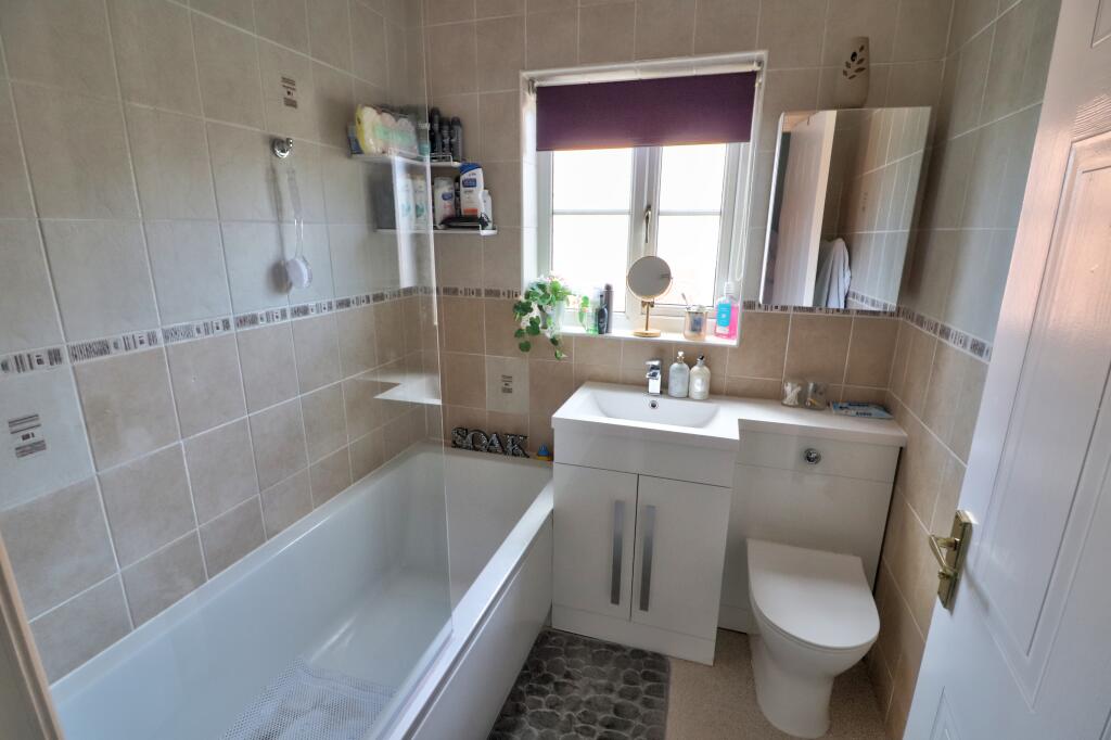
- Shower Room:
- Landing:
Textual Property Features
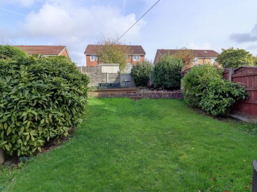
Detected Visual Features
- contemporary
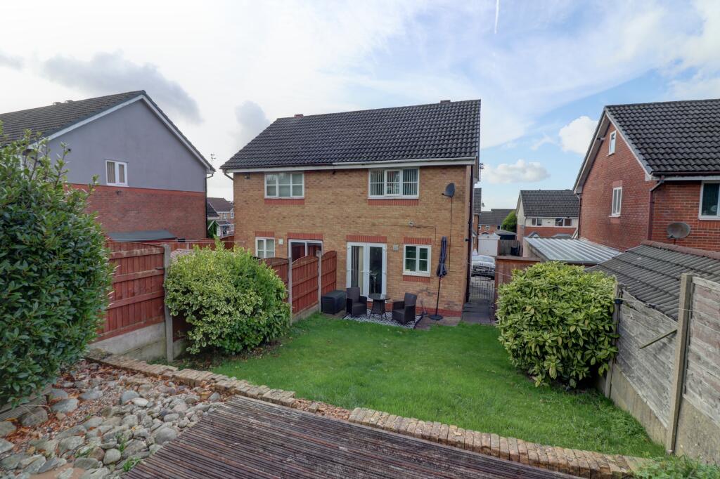
- semi-detached
- red brick
- modern
- garage
- well-maintained
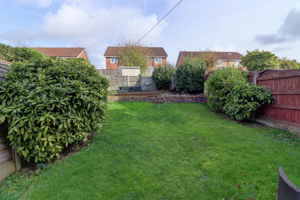
- garden
- family home
- residential area
- living room
- accent wall
- modern lighting
- textured ceiling
- window treatment
- central heating
EPC Details
- Fully double glazed
- Cavity wall, as built, insulated (assumed)
- Boiler and radiators, mains gas
- No low energy lighting
- Solid, no insulation (assumed)
Nearby Schools
- St Anne's RC Primary School
- Greenacres Primary Academy
- Beever Primary School
- Littlemoor Primary School
- Mayfield Primary School
- Blackshaw Lane Primary & Nursery School
- Woodlands Primary Academy
- St. Theresa's RC Primary School
- Hodge Clough Primary School
- St Thomas Moorside CofE (VA) Primary School
- St Joseph's RC Junior Infant and Nursery School
- Crompton Primary School
- East Crompton St James CofE Primary School
- St Thomas' Leesfield CofE Primary School
- Oasis Academy Clarksfield
- Willowpark Primary Academy
- Beal Vale Primary School
- The Crompton House Church of England Academy
- Oasis Academy Leesbrook
- Horton Mill Community Primary School
- St Edward's Roman Catholic School, a Voluntary Academy
- Waterhead Academy
- E-ACT Royton and Crompton Academy
- Farrowdale House School
- East Crompton St George's CofE School
- Buckstones Primary School
- Rushcroft Primary School
Nearest Bars And Restaurants
- Id: 479613948
- Tags:
- Amenity: pub
- Building: yes
- Name: The Highfield
- TagsNormalized:
- Lat: 53.5597007
- Lon: -2.0784388
- FullGeoHash: gcw88wnxbgge
- PartitionGeoHash: gcw8
- Images:
- FoodStandards: null
- Distance: 750.9
,- Id: 533642961
- Tags:
- Amenity: pub
- Building: yes
- Name: The Moorside
- TagsNormalized:
- Lat: 53.5632767
- Lon: -2.074617
- FullGeoHash: gcw88yck9ymr
- PartitionGeoHash: gcw8
- Images:
- FoodStandards: null
- Distance: 622.5
,- Id: 303814550
- Tags:
- Amenity: pub
- Name: Village Inn
- TagsNormalized:
- Lat: 53.5623174
- Lon: -2.0760076
- FullGeoHash: gcw88y8r1e8s
- PartitionGeoHash: gcw8
- Images:
- FoodStandards: null
- Distance: 607.1
,- Id: 479613590
- Tags:
- Amenity: pub
- Building: yes
- Name: The Northgate
- TagsNormalized:
- Lat: 53.5657243
- Lon: -2.0803422
- FullGeoHash: gcw88xm4uw8r
- PartitionGeoHash: gcw8
- Images:
- FoodStandards: null
- Distance: 172.9
,- Id: 1659136989
- Tags:
- TagsNormalized:
- Lat: 53.5657276
- Lon: -2.0803618
- FullGeoHash: gcw88xm4up3g
- PartitionGeoHash: gcw8
- Images:
- FoodStandards: null
- Distance: 171.6
}
Nearest General Shops
- Id: 954872273
- Tags:
- TagsNormalized:
- Lat: 53.5678004
- Lon: -2.0746923
- FullGeoHash: gcw88z9r01v2
- PartitionGeoHash: gcw8
- Images:
- FoodStandards: null
- Distance: 584.4
,- Id: 954872274
- Tags:
- TagsNormalized:
- Lat: 53.56778
- Lon: -2.0747639
- FullGeoHash: gcw88z9nymzy
- PartitionGeoHash: gcw8
- Images:
- FoodStandards: null
- Distance: 579.1
,- Id: 954872275
- Tags:
- TagsNormalized:
- Lat: 53.5678329
- Lon: -2.0748994
- FullGeoHash: gcw88z9p5rff
- PartitionGeoHash: gcw8
- Images:
- FoodStandards: null
- Distance: 573
}
Nearest Supermarkets
- Id: 1965795124
- Tags:
- Addr:
- City: Shaw
- Country: GB
- Postcode: OL2 8QP
- Street: Greenfield Lane
- Brand: Asda
- Brand:wikidata: Q297410
- Brand:wikipedia: en:Asda
- Contact:
- Website: https://storelocator.asda.com/north-west/shaw-oldham/greenfield-lane
- Fhrs:
- Name: Asda
- Operator: Asda Stores Ltd
- Shop: supermarket
- Toilets:
- Wheelchair: yes
- TagsNormalized:
- Lat: 53.576024
- Lon: -2.0916309
- FullGeoHash: gcw8b3hyvqwz
- PartitionGeoHash: gcw8
- Images:
- FoodStandards:
- Id: 117796
- FHRSID: 117796
- LocalAuthorityBusinessID: 47047
- BusinessName: Asda Stores Ltd
- BusinessType: Retailers - supermarkets/hypermarkets
- BusinessTypeID: 7840
- AddressLine1: Asda Supermarket
- AddressLine2: Greenfield Lane
- AddressLine3: Shaw
- AddressLine4: Oldham
- PostCode: OL2 8QP
- RatingValue: 3
- RatingKey: fhrs_3_en-GB
- RatingDate: 2022-10-27
- LocalAuthorityCode: 418
- LocalAuthorityName: Oldham
- LocalAuthorityWebSite: https://www.oldham.gov.uk
- LocalAuthorityEmailAddress: FHRS@oldham.gov.uk
- Scores:
- Hygiene: 10
- Structural: 5
- ConfidenceInManagement: 10
- NewRatingPending: false
- Geocode:
- Longitude: -2.09286900000000
- Latitude: 53.57540300000000
- Distance: 1263.4
,- Id: 1965796430
- Tags:
- Brand: ALDI
- Brand:wikidata: Q41171672
- Brand:wikipedia: en:Aldi
- Contact:
- Website: https://stores.aldi.co.uk/shaw/1-refuge-street
- Name: ALDI
- Shop: supermarket
- Wheelchair: yes
- TagsNormalized:
- Lat: 53.57525
- Lon: -2.0936211
- FullGeoHash: gcw8b356rn6y
- PartitionGeoHash: gcw8
- Images:
- FoodStandards: null
- Distance: 1256.1
,- Id: 533641554
- Tags:
- Building: yes
- Name: Moorside Co-op
- Shop: supermarket
- TagsNormalized:
- Lat: 53.5619027
- Lon: -2.0756567
- FullGeoHash: gcw88y8s9wq5
- PartitionGeoHash: gcw8
- Images:
- FoodStandards: null
- Distance: 655.2
}
Nearest Religious buildings
- Id: 403914659
- Tags:
- Amenity: place_of_worship
- Building: church
- Note: probably St Joseph's (RC) because of school
- Religion: christian
- Source: Bing
- TagsNormalized:
- place of worship
- church
- christian
- Lat: 53.5689406
- Lon: -2.0990278
- FullGeoHash: gcw88pzt9n73
- PartitionGeoHash: gcw8
- Images:
- FoodStandards: null
- Distance: 1114.6
,- Id: 532780339
- Tags:
- Amenity: place_of_worship
- Building: yes
- Name: Fresh Church
- Religion: christian
- TagsNormalized:
- place of worship
- church
- christian
- Lat: 53.5679601
- Lon: -2.0741492
- FullGeoHash: gcw88z9xuzd2
- PartitionGeoHash: gcw8
- Images:
- FoodStandards: null
- Distance: 624.2
,- Id: 153269705
- Tags:
- Amenity: place_of_worship
- Building: church
- Denomination: anglican
- Name: St Thomas Church, Moorside
- Religion: christian
- Wikidata: Q26497386
- TagsNormalized:
- place of worship
- church
- anglican
- christian
- Lat: 53.564473
- Lon: -2.0760102
- FullGeoHash: gcw88z079mqx
- PartitionGeoHash: gcw8
- Images:
- FoodStandards: null
- Distance: 484.6
}
Nearest Medical buildings
- Id: 10676927989
- Tags:
- Addr:
- City: Oldham
- Housenumber: 25
- Postcode: OL2 6QN
- Street: Park Street
- Suburb: Royton
- Amenity: pharmacy
- Brand: Well Pharmacy
- Brand:wikidata: Q7726524
- Healthcare: pharmacy
- Name: Well Pharmacy
- TagsNormalized:
- pharmacy
- well pharmacy
- health
- healthcare
- Lat: 53.5667046
- Lon: -2.1221324
- FullGeoHash: gcw2xxw8wtrr
- PartitionGeoHash: gcw2
- Images:
- FoodStandards: null
- Distance: 2589.5
,- Id: 10616343007
- Tags:
- Addr:
- City: Oldham
- Housenumber: 16A
- Postcode: OL2 6QJ
- Street: Rochdale Road
- Suburb: Royton
- Amenity: dentist
- Healthcare: dentist
- Name: Harewood Dental Lab
- TagsNormalized:
- dentist
- health
- healthcare
- dental
- Lat: 53.5658001
- Lon: -2.1219441
- FullGeoHash: gcw2xxqg7hgg
- PartitionGeoHash: gcw2
- Images:
- FoodStandards: null
- Distance: 2575.6
,- Id: 10622219179
- Tags:
- Addr:
- City: Oldham
- Housename: Royton Health & Wellbeing Centre
- Postcode: OL2 6QW
- Street: Park Street
- Suburb: Royton
- Amenity: clinic
- Healthcare: clinic
- Name: Royton Health & Wellbeing Centre
- Operator: NHS
- Operator:type: public
- Operator:wikidata: Q918396
- TagsNormalized:
- Lat: 53.5663433
- Lon: -2.1213613
- FullGeoHash: gcw2xxrq8dnk
- PartitionGeoHash: gcw2
- Images:
- FoodStandards: null
- Distance: 2537.5
,- Id: 7499470937
- Tags:
- Amenity: pharmacy
- Brand: Asda
- Brand:wikidata: Q297410
- Brand:wikipedia: en:Asda
- Contact:
- Phone: +44 1706 883510
- Website: https://storelocator.asda.com/north-west/shaw-oldham/greenfield-lane/pharmacy
- Fixme: Location not accurate
- Healthcare: pharmacy
- Name: Asda
- Operator: Asda Stores Ltd
- TagsNormalized:
- pharmacy
- asda
- health
- healthcare
- Lat: 53.5761539
- Lon: -2.0907551
- FullGeoHash: gcw8b3jx9yun
- PartitionGeoHash: gcw8
- Images:
- FoodStandards: null
- Distance: 1251.3
}
Nearest Airports
- Id: 1224469
- Tags:
- Addr:
- City: Manchester
- Country: GB
- Postcode: M90 1QX
- Aerodrome: international
- Aeroway: aerodrome
- Arp: yes
- Atis: 128.175
- Iata: MAN
- Icao: EGCC
- Name: Manchester Airport
- Note: rough sketched outline referring to Yahoo imagery - true boundary is where?
- Old_name: Ringway
- Operator: Manchester Airport PLC
- Size: 18720000
- Source:
- Tower_frequency: 118.625,119.400
- Type: multipolygon
- Website: https://www.manchesterairport.co.uk/
- Wikidata: Q8694
- Wikipedia: en:Manchester Airport
- TagsNormalized:
- airport
- international airport
- Lat: 53.3503197
- Lon: -2.2798822
- FullGeoHash: gcqrs05u4ukt
- PartitionGeoHash: gcqr
- Images:
- FoodStandards: null
- Distance: 27288.1
}
Nearest Leisure Facilities
- Id: 552215731
- Tags:
- TagsNormalized:
- Lat: 53.5673984
- Lon: -2.08075
- FullGeoHash: gcw88xsuenb6
- PartitionGeoHash: gcw8
- Images:
- FoodStandards: null
- Distance: 220.7
,- Id: 552651818
- Tags:
- TagsNormalized:
- Lat: 53.5672882
- Lon: -2.0806404
- FullGeoHash: gcw88xsujd60
- PartitionGeoHash: gcw8
- Images:
- FoodStandards: null
- Distance: 216.6
,- Id: 552217334
- Tags:
- TagsNormalized:
- Lat: 53.5645951
- Lon: -2.0842687
- FullGeoHash: gcw88x4k3h0x
- PartitionGeoHash: gcw8
- Images:
- FoodStandards: null
- Distance: 169.6
,- Id: 552217336
- Tags:
- TagsNormalized:
- Lat: 53.5646084
- Lon: -2.0839172
- FullGeoHash: gcw88x4s3nwx
- PartitionGeoHash: gcw8
- Images:
- FoodStandards: null
- Distance: 157.5
,- Id: 552450031
- Tags:
- TagsNormalized:
- Lat: 53.5647504
- Lon: -2.0841608
- FullGeoHash: gcw88x4m791n
- PartitionGeoHash: gcw8
- Images:
- FoodStandards: null
- Distance: 151.1
}
Nearest Tourist attractions
- Id: 2631058167
- Tags:
- Source: Bing
- Tourism: picnic_site
- TagsNormalized:
- Lat: 53.5747261
- Lon: -2.1433401
- FullGeoHash: gcw2z0zr2scc
- PartitionGeoHash: gcw2
- Images:
- FoodStandards: null
- Distance: 4107
,- Id: 10022209197
- Tags:
- Addr:
- City: Oldham
- Housename: Oldham Council Gallery
- Housenumber: 35
- Postcode: OL1 1AL
- Street: Greaves Street
- Name: Gallery Oldham
- Tourism: gallery
- Website: galleryoldham.org.uk
- Wikidata: Q5518996
- Wikipedia: en:Gallery Oldham
- TagsNormalized:
- Lat: 53.5402163
- Lon: -2.1092273
- FullGeoHash: gcw8848n77wn
- PartitionGeoHash: gcw8
- Images:
- FoodStandards: null
- Distance: 3342.4
,- Id: 10541978101
- Tags:
- Addr:
- City: Oldham
- Housenumber: 63
- Postcode: OL4 3BN
- Street: High Street
- Suburb: Lees
- Name: Sub Space
- Tourism: gallery
- TagsNormalized:
- Lat: 53.5381024
- Lon: -2.073447
- FullGeoHash: gcw88f64j1tu
- PartitionGeoHash: gcw8
- Images:
- FoodStandards: null
- Distance: 3154.1
}
Nearest Hotels
- Id: 407207770
- Tags:
- Building: yes
- Name: Clough Manor
- Tourism: hotel
- TagsNormalized:
- Lat: 53.597612
- Lon: -2.0503712
- FullGeoHash: gcw8cm4uwzh3
- PartitionGeoHash: gcw8
- Images:
- FoodStandards: null
- Distance: 4130
,- Id: 2706325755
- Tags:
- Name: Travelodge
- Tourism: hotel
- TagsNormalized:
- Lat: 53.5550609
- Lon: -2.1411225
- FullGeoHash: gcw2xm2uu4zq
- PartitionGeoHash: gcw2
- Images:
- FoodStandards: null
- Distance: 4027.2
,- Id: 267813103
- Tags:
- Brand: Premier Inn
- Brand:wikidata: Q2108626
- Brand:wikipedia: en:Premier Inn
- Building: hotel
- Name: Premier Inn
- Tourism: hotel
- TagsNormalized:
- Lat: 53.5544342
- Lon: -2.1320963
- FullGeoHash: gcw2xmr3nw1g
- PartitionGeoHash: gcw2
- Images:
- FoodStandards: null
- Distance: 3487.8
}
Tags
- contemporary
- semi-detached
- red brick
- modern
- garage
- well-maintained
- garden
- family home
- residential area
- contemporary
- living room
- accent wall
- modern lighting
- textured ceiling
- window treatment
- central heating
Local Market Stats
- Average Price/sqft: £169
- Avg Income: £33100
- Rental Yield: 4.7%
- Social Housing: 21%
- Planning Success Rate: 86%
Similar Properties
 2 bedroom semi-detached house for sale in Whitebank Road, OLDHAM, Lancashire, OL8 — £210,000 • 2 bed • 2 bath • 590 ft²
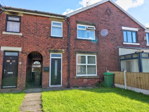 3 bedroom semi-detached house for sale in Scowcroft Lane, Oldham, OL2 — £180,000 • 3 bed • 2 bath • 718 ft²
 2 bedroom terraced house for sale in Bardsley Vale Avenue, Bardsley, Oldham, OL8 — £190,000 • 2 bed • 1 bath • 794 ft²
 3 bedroom semi-detached house for sale in Eastcote Avenue, Oldham, OL1 — £240,000 • 3 bed • 1 bath • 855 ft²
 2 bedroom semi-detached house for sale in Bottomfield Close, Oldham, OL1 — £175,000 • 2 bed • 1 bath • 646 ft²
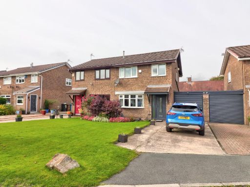 3 bedroom semi-detached house for sale in Bullcote Green, Oldham, OL2 — £240,000 • 3 bed • 1 bath
Meta
- {
"@context": "https://schema.org",
"@type": "Residence",
"name": "2 bedroom semidetached house for sale in Higher Fullwood, O…",
"description": "",
"url": "https://propertypiper.co.uk/property/00178a65-0383-47f7-ba18-fa7f1e95b91e",
"image": "https://image-a.propertypiper.co.uk/697c16d0-2760-4cce-bb9e-fa6d3f64f459-1024.jpeg",
"address": {
"@type": "PostalAddress",
"streetAddress": "8 HIGHER FULLWOOD OLDHAM",
"postalCode": "OL1 4NL",
"addressLocality": "Oldham",
"addressRegion": "Oldham East and Saddleworth",
"addressCountry": "England"
},
"geo": {
"@type": "GeoCoordinates",
"latitude": 53.565901133752845,
"longitude": -2.082943386673366
},
"numberOfRooms": 2,
"numberOfBathroomsTotal": 1,
"floorSize": {
"@type": "QuantitativeValue",
"value": 625,
"unitCode": "FTK"
},
"offers": {
"@type": "Offer",
"price": 170000,
"priceCurrency": "GBP",
"availability": "https://schema.org/InStock"
},
"additionalProperty": [
{
"@type": "PropertyValue",
"name": "Feature",
"value": "contemporary"
},
{
"@type": "PropertyValue",
"name": "Feature",
"value": "semi-detached"
},
{
"@type": "PropertyValue",
"name": "Feature",
"value": "red brick"
},
{
"@type": "PropertyValue",
"name": "Feature",
"value": "modern"
},
{
"@type": "PropertyValue",
"name": "Feature",
"value": "garage"
},
{
"@type": "PropertyValue",
"name": "Feature",
"value": "well-maintained"
},
{
"@type": "PropertyValue",
"name": "Feature",
"value": "garden"
},
{
"@type": "PropertyValue",
"name": "Feature",
"value": "family home"
},
{
"@type": "PropertyValue",
"name": "Feature",
"value": "residential area"
},
{
"@type": "PropertyValue",
"name": "Feature",
"value": "contemporary"
},
{
"@type": "PropertyValue",
"name": "Feature",
"value": "living room"
},
{
"@type": "PropertyValue",
"name": "Feature",
"value": "accent wall"
},
{
"@type": "PropertyValue",
"name": "Feature",
"value": "modern lighting"
},
{
"@type": "PropertyValue",
"name": "Feature",
"value": "textured ceiling"
},
{
"@type": "PropertyValue",
"name": "Feature",
"value": "window treatment"
},
{
"@type": "PropertyValue",
"name": "Feature",
"value": "central heating"
}
]
}
High Res Floorplan Images
Compatible Floorplan Images
FloorplanImages Thumbnail