S70 3RS - 2 bedroom apartment for sale in Barberry Court, Barnsley, S…
View on Property Piper
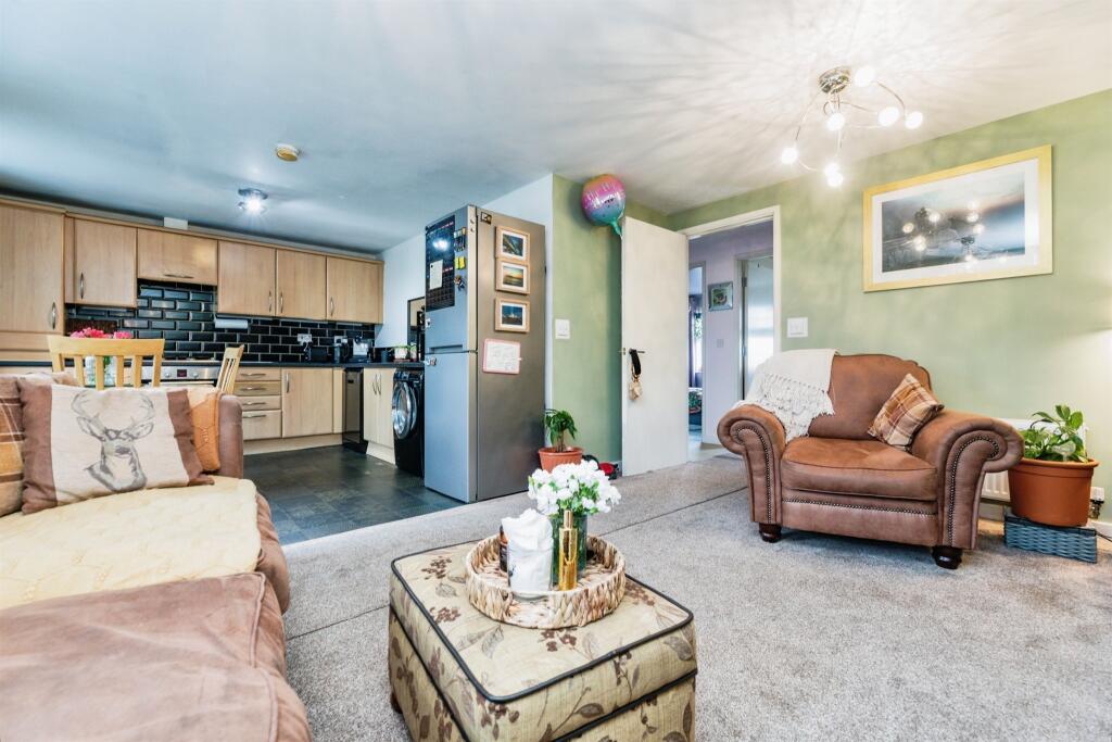
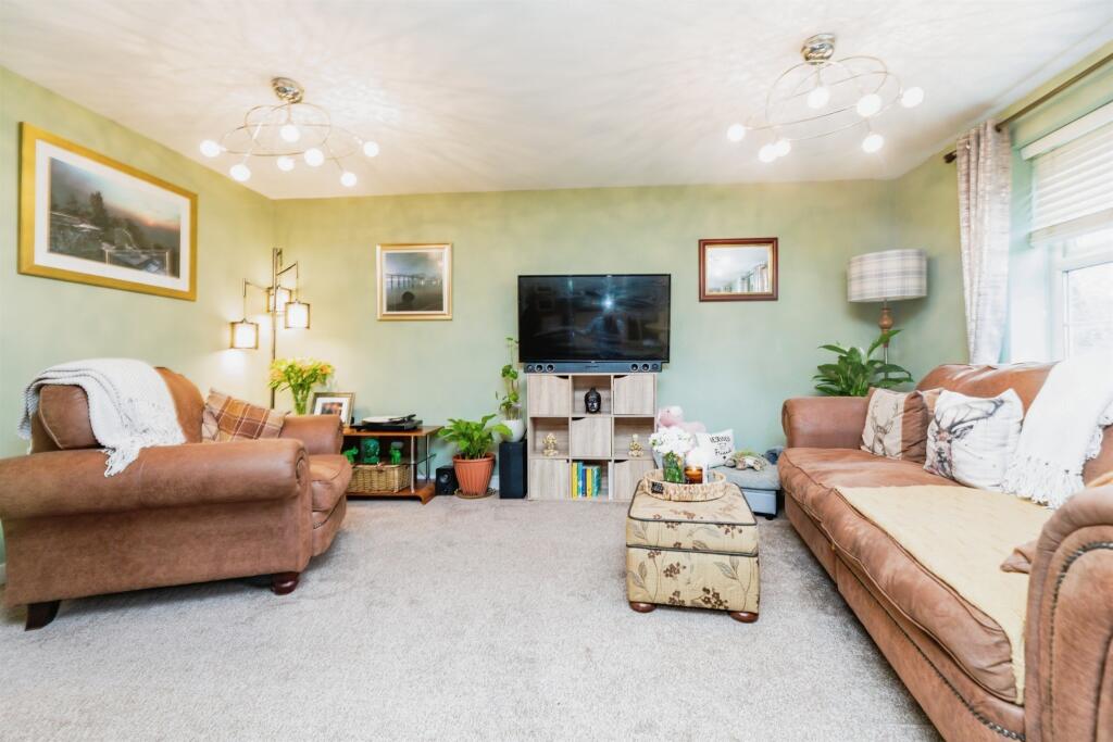
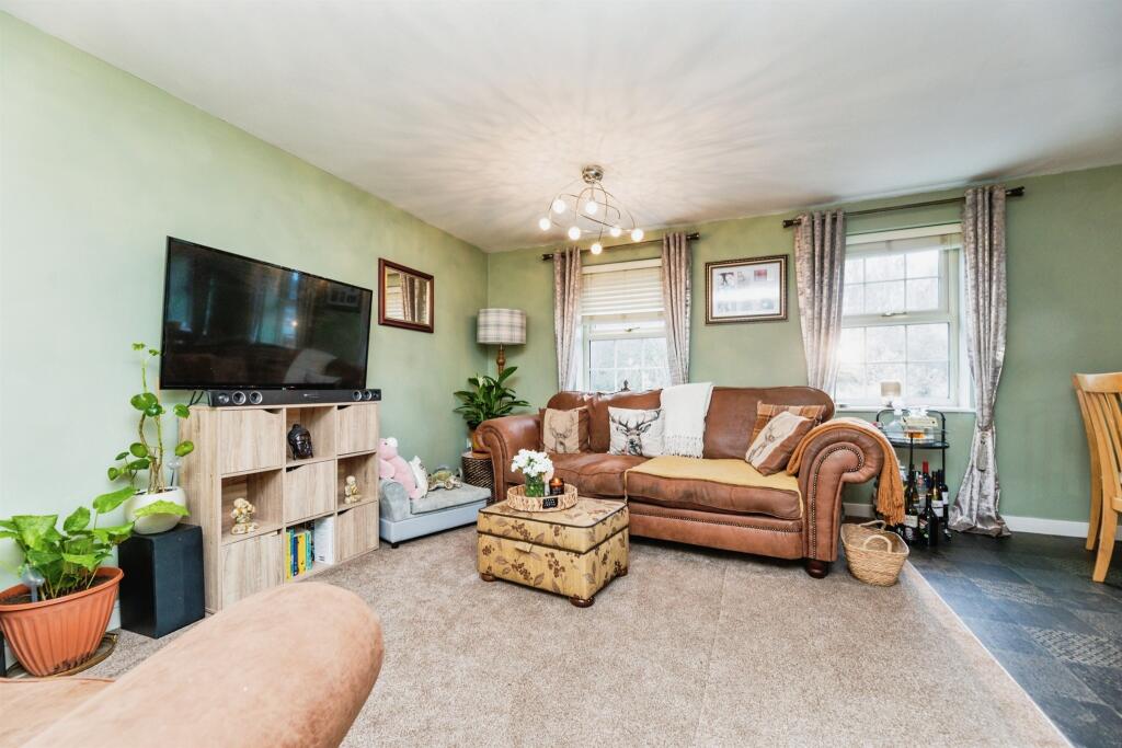
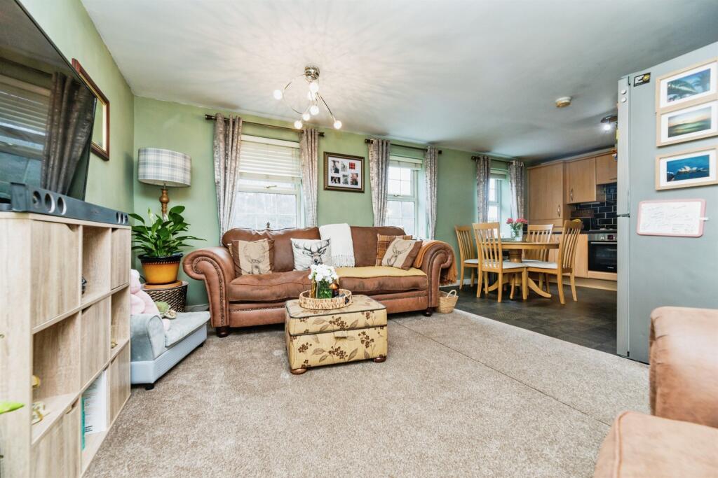
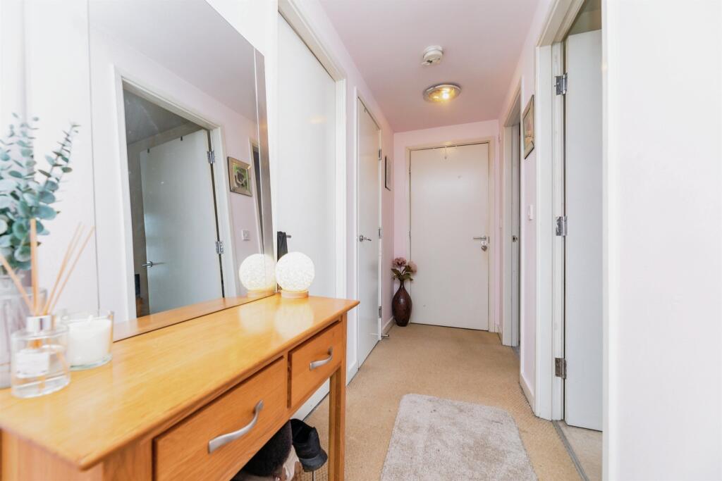
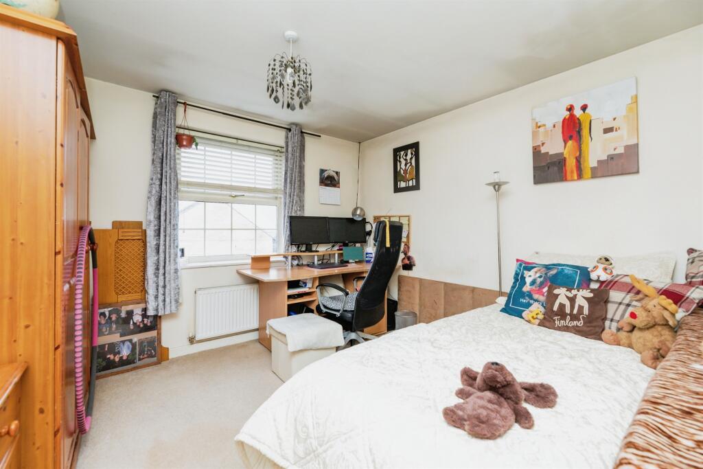
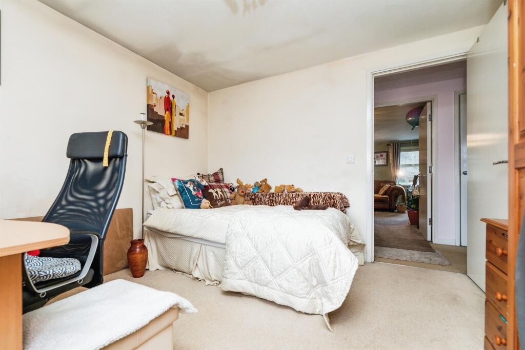
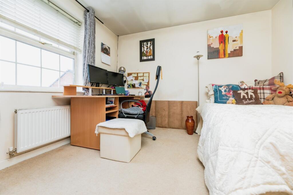
2 bedroom apartment for sale in Barberry Court, Barnsley, S70
Property Details
- Price: £80000
- Bedrooms: 2
- Bathrooms: 1
- Property Type: undefined
- Property SubType: undefined
Image Descriptions
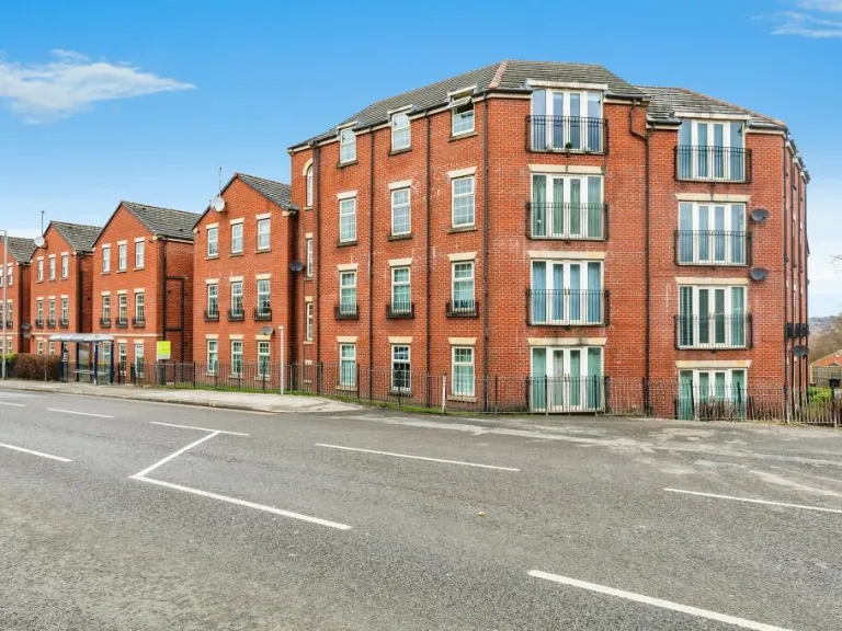
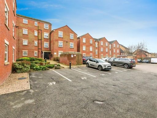
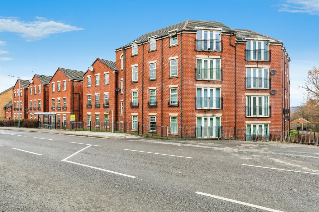
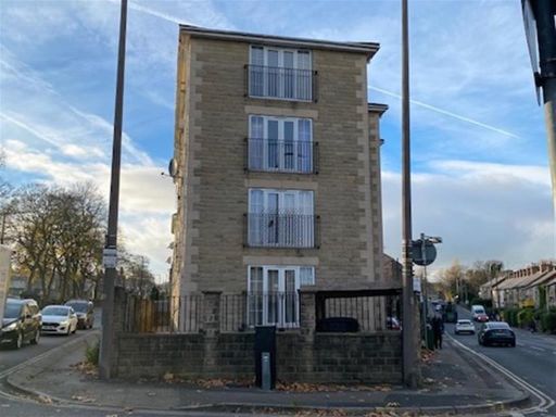
- modern apartment complex contemporary
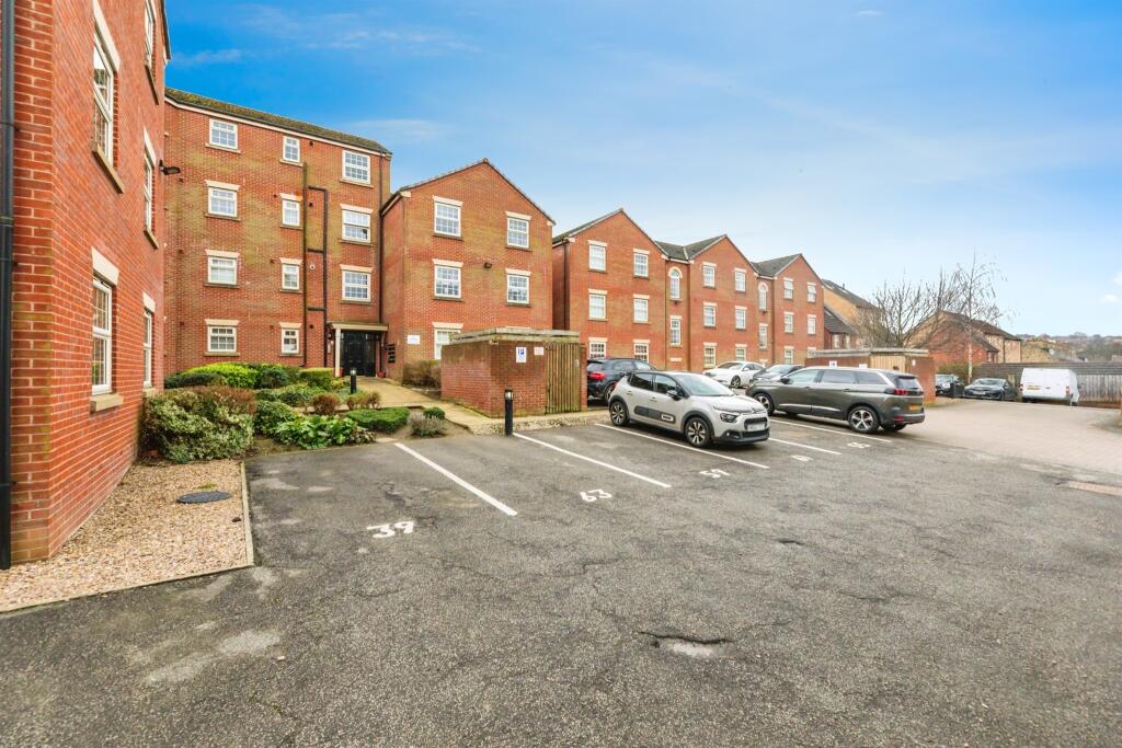
- apartment building Contemporary
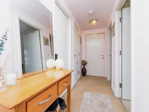
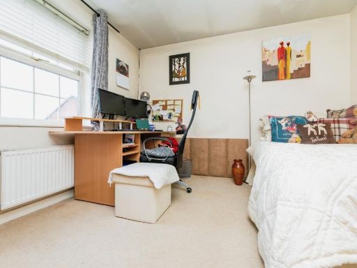
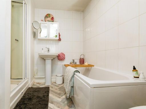
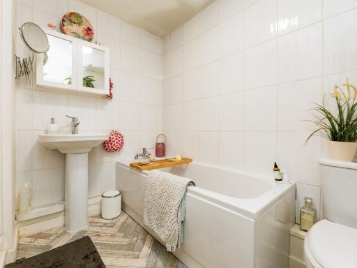
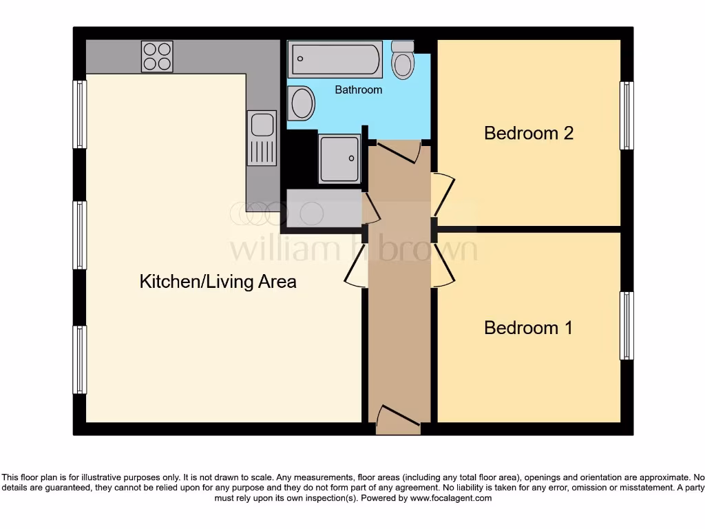
Rooms
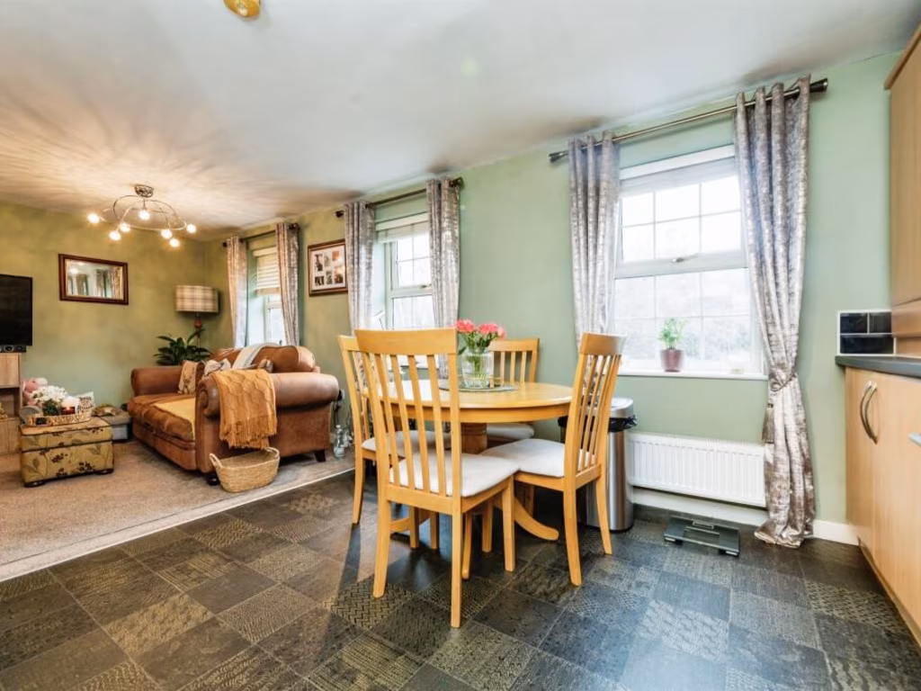
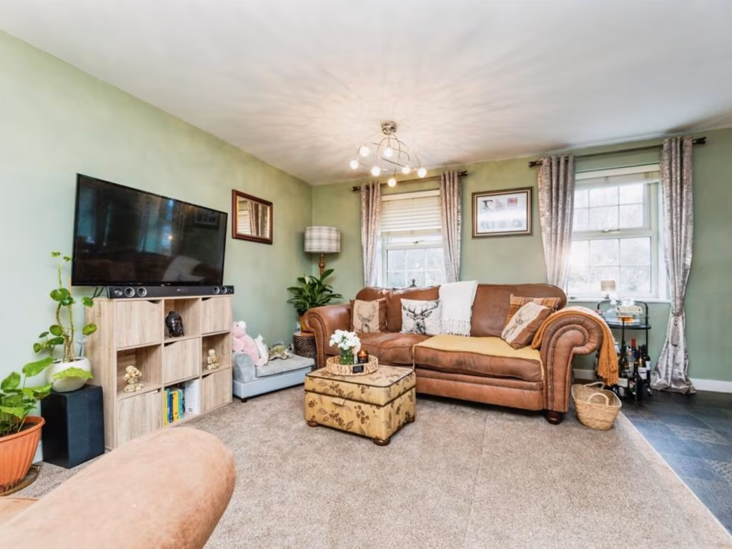
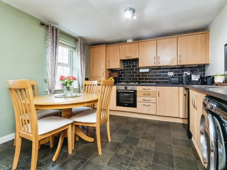
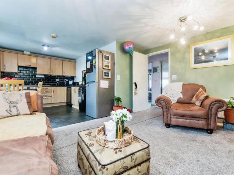
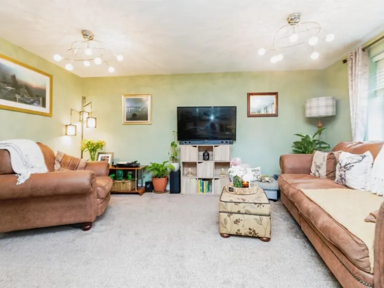
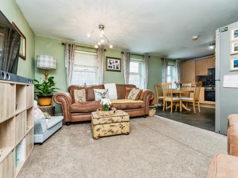
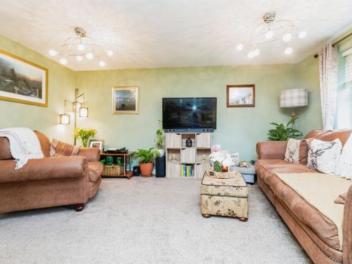
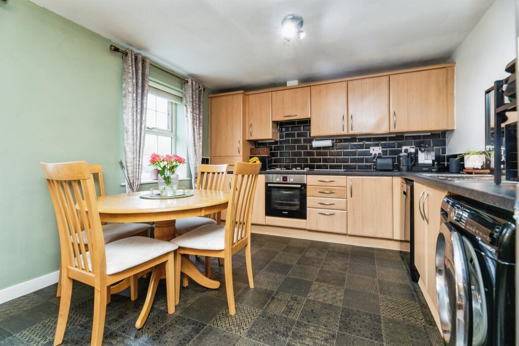
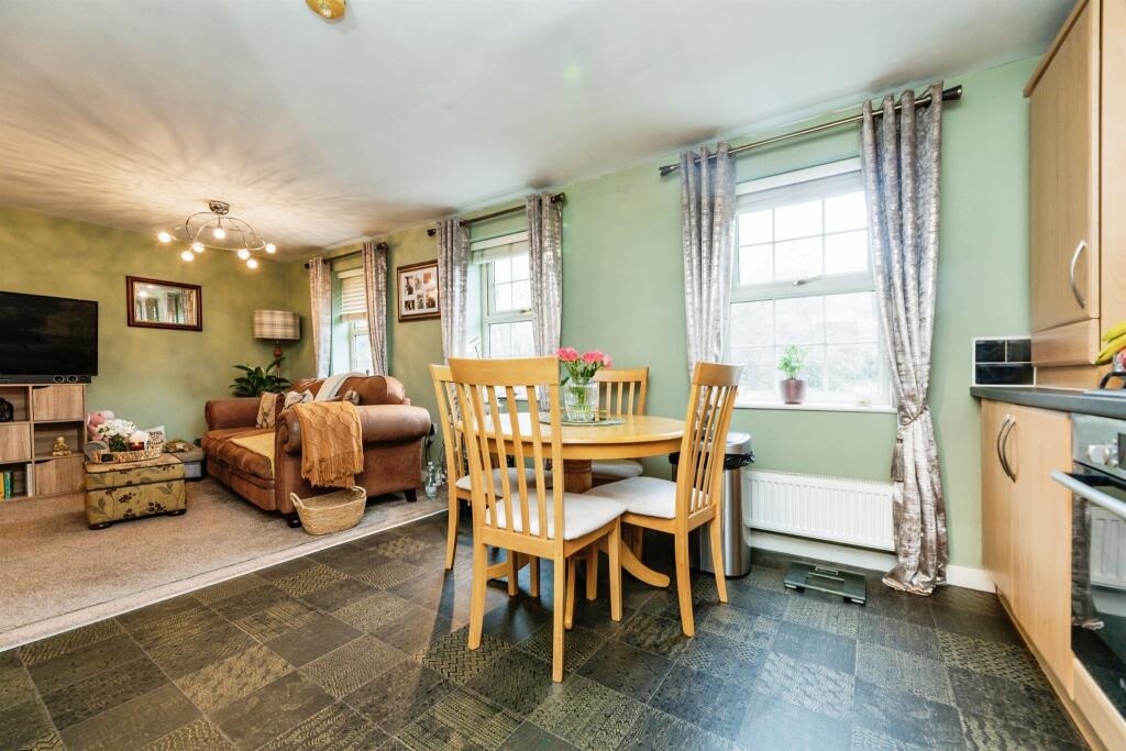
- Kitchen/Living Area:
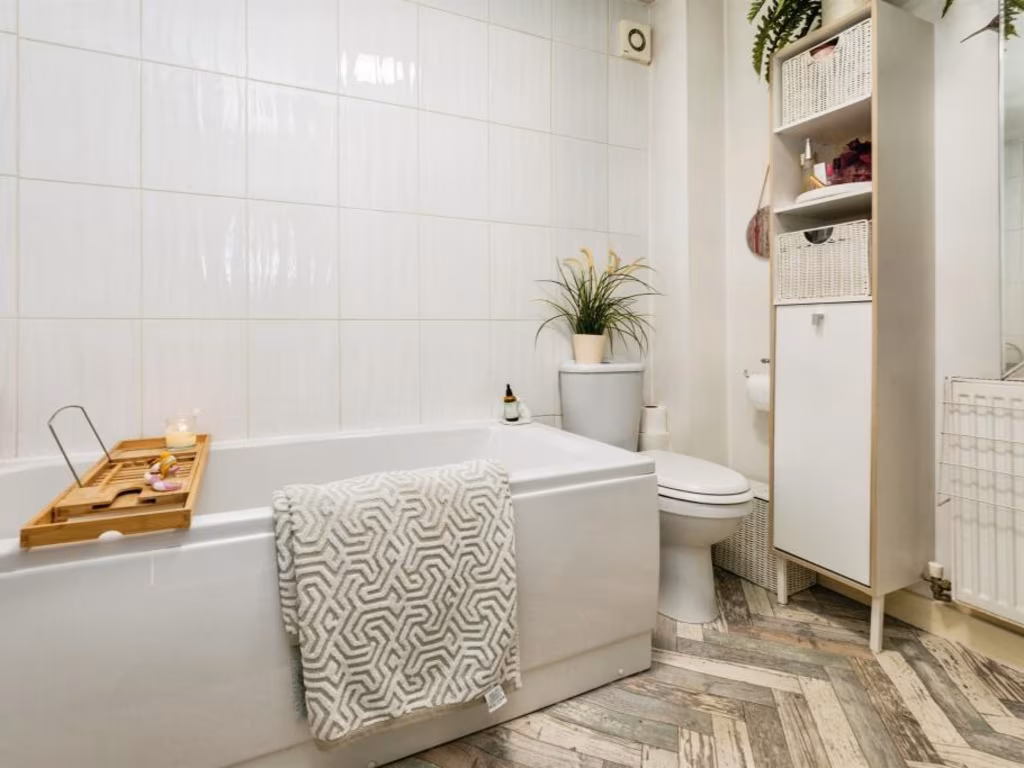
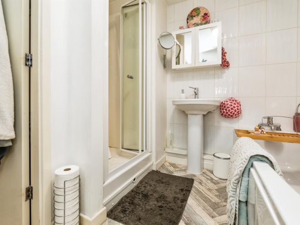
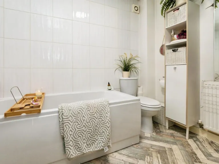
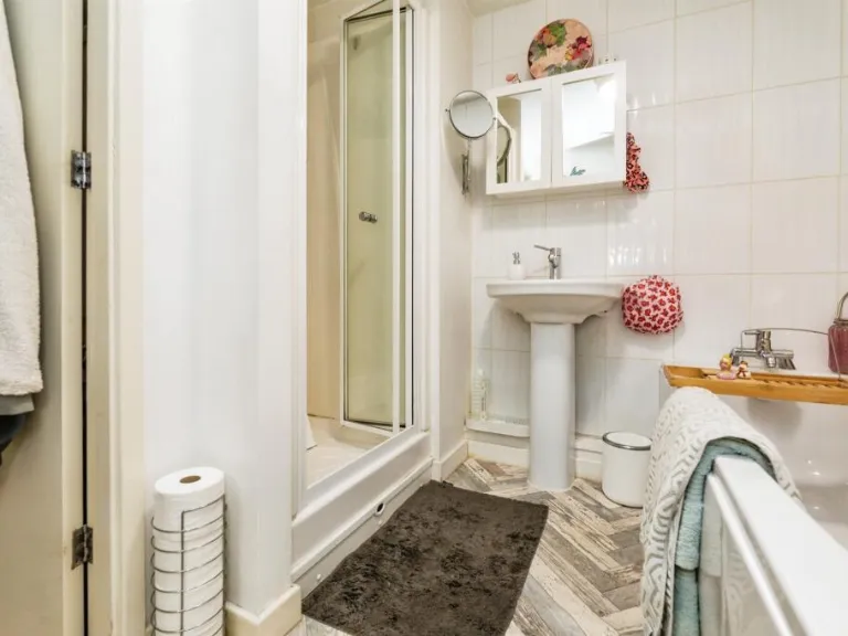
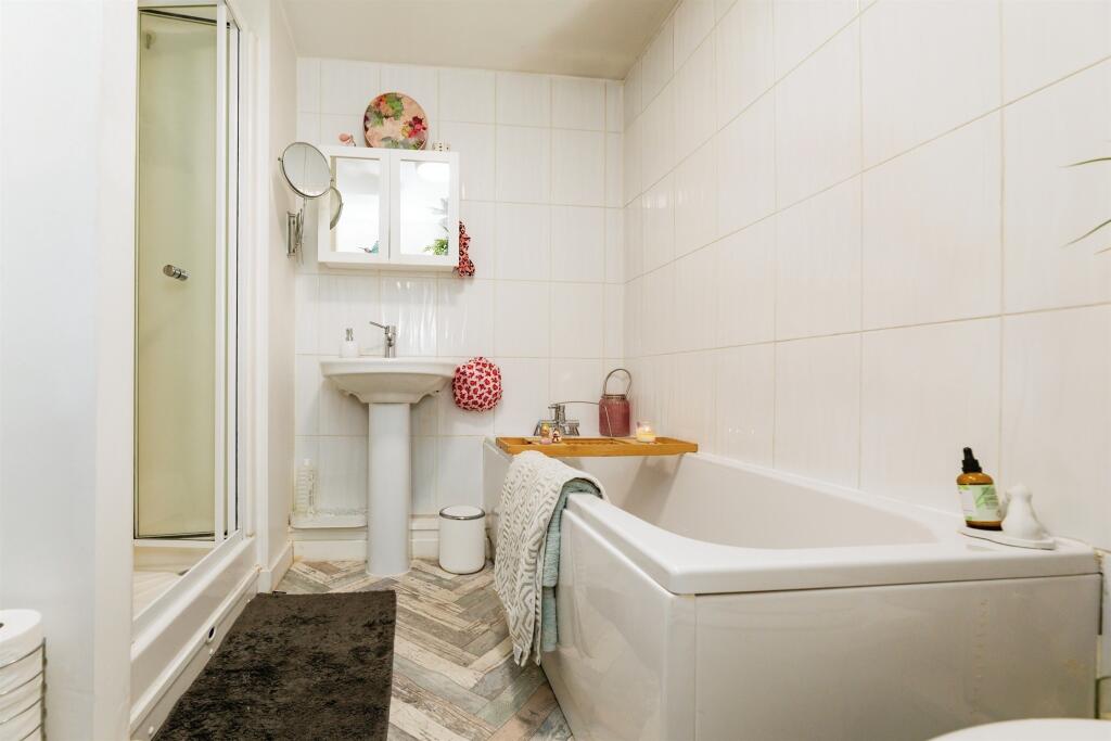
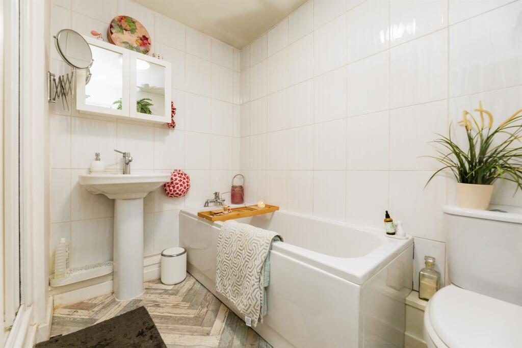
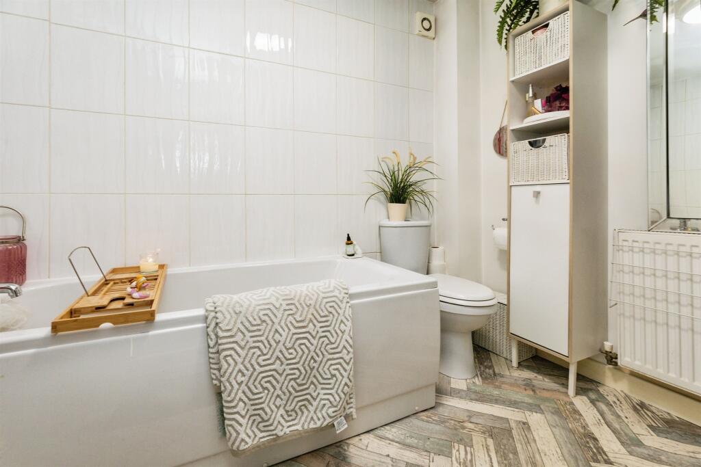
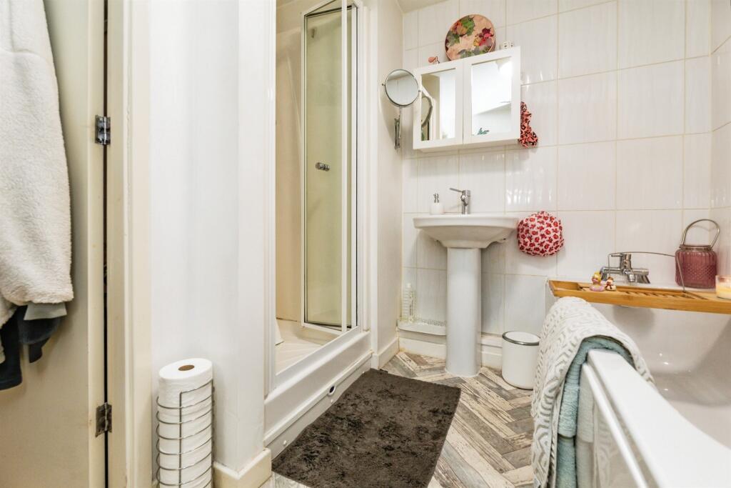
- Bathroom:
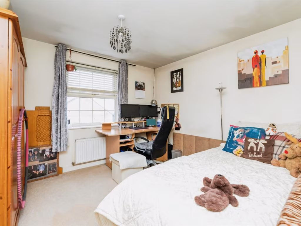
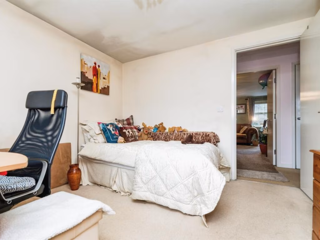
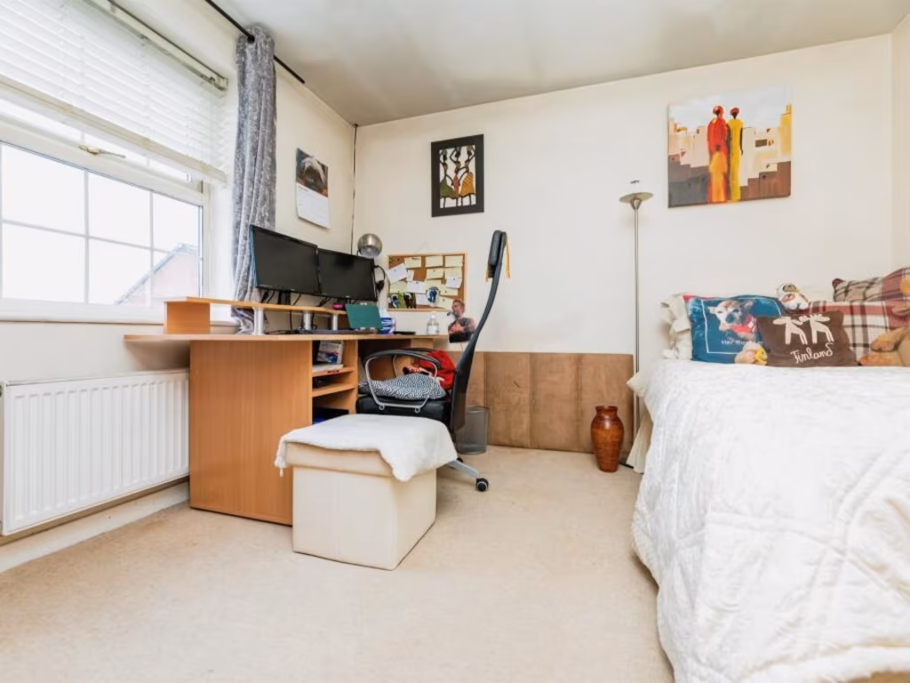
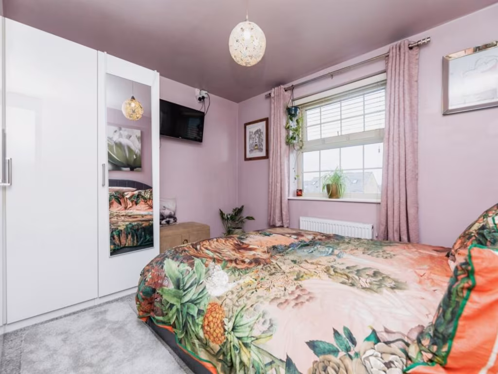
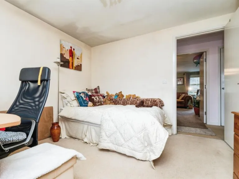
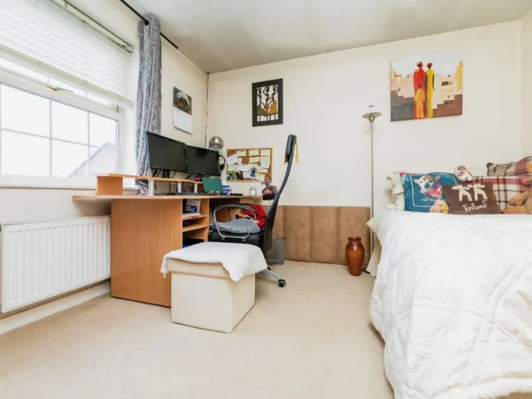
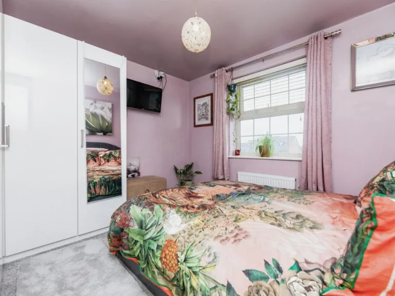
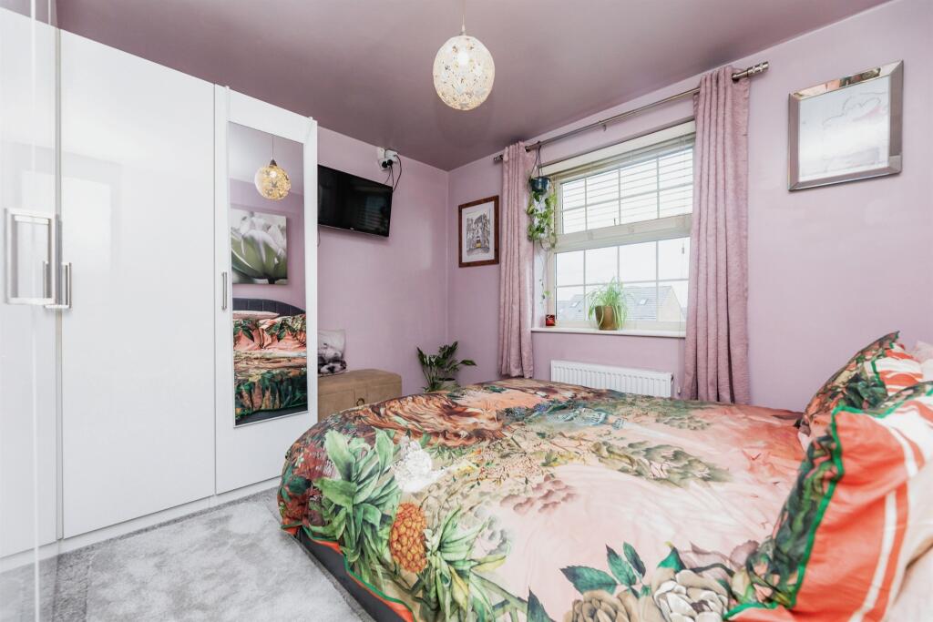
- Bedroom 1:
- Bedroom 2:
Textual Property Features
Detected Visual Features
- modern
- apartment
- complex
- flat
- contemporary
- three-story
- brick
- balconies
- French windows
- car parking
- red brick
- low-rise building
- well-maintained exterior
- landscaped area
EPC Details
- Fully double glazed
- Cavity wall, as built, insulated (assumed)
- Boiler and radiators, mains gas
- Low energy lighting in 83% of fixed outlets
- (another dwelling below)
Nearby Schools
- Bank End Primary Academy
- Barnsley Academy
- Worsbrough Common Primary School
- Oakwell Rise Primary Academy
- Shawlands Primary School
- Athersley South Primary School
- The Mill Academy
- The Forest Academy
- Trinity Academy St. Edwards
- Carlton Primary Academy
- Ward Green Primary School
- Joseph Locke Primary School
- Holy Rood Catholic Primary School
- Queens Road Academy
- Burton Road Primary School
- Laithes Primary School
- Hunningley Primary Academy
- Oakhill Primary Academy
- St Mary's Church of England Primary School, Barnsley
- Summer Lane Primary
- Outwood Primary Academy Littleworth Grange
- St Helen's Primary Academy
- Holy Trinity Catholic and Church of England School
- Outwood Academy Carlton
Nearest Bars And Restaurants
- Id: 331325686
- Tags:
- Amenity: cafe
- Building: yes
- TagsNormalized:
- Lat: 53.5487226
- Lon: -1.4713536
- FullGeoHash: gcwbws0xfvrh
- PartitionGeoHash: gcwb
- Images:
- FoodStandards: null
- Distance: 894.7
,- Id: 1080923056
- Tags:
- Amenity: fast_food
- Building: yes
- Cuisine: sandwich
- TagsNormalized:
- Lat: 53.5500815
- Lon: -1.4699012
- FullGeoHash: gcwbws3xufdn
- PartitionGeoHash: gcwb
- Images:
- FoodStandards: null
- Distance: 845.5
,- Id: 331326026
- Tags:
- Amenity: pub
- Building: yes
- Name: East Dene WMC
- TagsNormalized:
- Lat: 53.5476211
- Lon: -1.4697485
- FullGeoHash: gcwbws1c82h1
- PartitionGeoHash: gcwb
- Images:
- FoodStandards: null
- Distance: 774
,- Id: 331312274
- Tags:
- Amenity: pub
- Building: yes
- TagsNormalized:
- Lat: 53.5540575
- Lon: -1.4562809
- FullGeoHash: gcwbwv5wfpyk
- PartitionGeoHash: gcwb
- Images:
- FoodStandards: null
- Distance: 771.1
,- Id: 331312284
- Tags:
- Addr:
- City: Barnsley
- Postcode: S71 1HR
- Street: Elm Row
- Amenity: pub
- Building: yes
- Name: Corner Pocket
- TagsNormalized:
- Lat: 53.5524778
- Lon: -1.4579571
- FullGeoHash: gcwbwufmg1km
- PartitionGeoHash: gcwb
- Images:
- FoodStandards: null
- Distance: 586.5
}
Nearest General Shops
- Id: 331325689
- Tags:
- Building: yes
- Name: Belle
- Shop: beauty
- TagsNormalized:
- Lat: 53.5486452
- Lon: -1.471099
- FullGeoHash: gcwbws0z2yvn
- PartitionGeoHash: gcwb
- Images:
- FoodStandards: null
- Distance: 876.6
,- Id: 331325691
- Tags:
- Building: yes
- Name: First Impressions
- Shop: hairdresser
- TagsNormalized:
- Lat: 53.5485879
- Lon: -1.4709216
- FullGeoHash: gcwbws0zjh33
- PartitionGeoHash: gcwb
- Images:
- FoodStandards: null
- Distance: 863.9
,- Id: 331310318
- Tags:
- Building: yes
- Name: Oakwell Motorhomes
- Shop: car
- TagsNormalized:
- Lat: 53.5498607
- Lon: -1.4703174
- FullGeoHash: gcwbws3qe1ec
- PartitionGeoHash: gcwb
- Images:
- FoodStandards: null
- Distance: 862.3
}
Nearest Grocery shops
- Id: 9285891260
- Tags:
- Brand: Iceland
- Brand:wikidata: Q721810
- Brand:wikipedia: en:Iceland (supermarket)
- Contact:
- Website: https://www.iceland.co.uk/store-finder/store?StoreID=1256&StoreName=BARNSLEY%202
- Name: Iceland
- Shop: frozen_food
- TagsNormalized:
- iceland
- frozen food
- food
- shop
- Lat: 53.5504483
- Lon: -1.4787961
- FullGeoHash: gcwbwke1vx1d
- PartitionGeoHash: gcwb
- Images:
- FoodStandards: null
- Distance: 1417
,- Id: 478993012
- Tags:
- Brand: The Food Warehouse
- Brand:wikidata: Q87263899
- Building: yes
- Name: The Food Warehouse
- Shop: supermarket
- TagsNormalized:
- food
- the food warehouse
- warehouse
- shop
- Lat: 53.5573561
- Lon: -1.4691688
- FullGeoHash: gcwbwtf4jyu3
- PartitionGeoHash: gcwb
- Images:
- FoodStandards: null
- Distance: 1346.7
,- Id: 211486449
- Tags:
- Addr:
- Postcode: S70 4PJ
- Street: Upper Sheffield Road
- Brand: Co-op Food
- Brand:wikidata: Q3277439
- Brand:wikipedia: en:Co-op Food
- Building: yes
- Name: Co-op Food
- Operator: The Co-operative Group
- Shop: convenience
- TagsNormalized:
- co-op
- co-op food
- food
- convenience
- shop
- Lat: 53.5437355
- Lon: -1.4714045
- FullGeoHash: gcwbwe2dcg9r
- PartitionGeoHash: gcwb
- Images:
- FoodStandards: null
- Distance: 962.6
}
Nearest Supermarkets
- Id: 1936891006
- Tags:
- Brand: Iceland
- Brand:wikidata: Q721810
- Contact:
- Website: https://www.iceland.co.uk/store-finder/store?StoreID=1356&StoreName=MONK%20BRETTON
- Name: Iceland
- Operator: Iceland
- Shop: supermarket
- TagsNormalized:
- Lat: 53.5618002
- Lon: -1.4583413
- FullGeoHash: gcwbwydh45jz
- PartitionGeoHash: gcwb
- Images:
- FoodStandards: null
- Distance: 1623.2
,- Id: 211485185
- Tags:
- Addr:
- Postcode: S70 3NS
- Street: Wombwell Lane
- Brand: Tesco Extra
- Brand:wikidata: Q25172225
- Brand:wikipedia: en:Tesco Extra
- Building: yes
- Contact:
- Website: https://www.tesco.com/store-locator/barnsley/wombwell-lane
- Name: Tesco Extra
- Shop: supermarket
- TagsNormalized:
- tesco
- tesco extra
- supermarket
- shop
- Lat: 53.5409509
- Lon: -1.4359174
- FullGeoHash: gcwbx6f6sswk
- PartitionGeoHash: gcwb
- Images:
- FoodStandards: null
- Distance: 1619.5
,- Id: 211487276
- Tags:
- Addr:
- Postcode: S70 3PE
- Street: Doncaster Road
- Brand: ALDI
- Brand:wikidata: Q41171672
- Brand:wikipedia: en:Aldi
- Building: yes
- Contact:
- Website: https://stores.aldi.co.uk/barnsley/doncaster-road
- Name: Aldi
- Shop: supermarket
- TagsNormalized:
- Lat: 53.5449444
- Lon: -1.4401564
- FullGeoHash: gcwbx5x3cvjd
- PartitionGeoHash: gcwb
- Images:
- FoodStandards: null
- Distance: 1208.9
}
Nearest Religious buildings
- Id: 331325904
- Tags:
- Amenity: place_of_worship
- Building: church
- Denomination: anglican
- Name: St Peter the Apostle & St John the Baptist
- Religion: christian
- Source:
- Wikidata: Q17530992
- TagsNormalized:
- place of worship
- church
- anglican
- baptist
- christian
- Lat: 53.5484126
- Lon: -1.4717185
- FullGeoHash: gcwbws0q47x5
- PartitionGeoHash: gcwb
- Images:
- FoodStandards: null
- Distance: 912.7
,- Id: 331311811
- Tags:
- Amenity: place_of_worship
- Building: yes
- Name: Bethel Chapel
- Religion: christian
- TagsNormalized:
- place of worship
- chapel
- christian
- church
- Lat: 53.5531347
- Lon: -1.4588615
- FullGeoHash: gcwbwv19w5f5
- PartitionGeoHash: gcwb
- Images:
- FoodStandards: null
- Distance: 661.7
,- Id: 332682580
- Tags:
- Amenity: place_of_worship
- Building: church
- Denomination: anglican
- Name: St Andrew
- Religion: christian
- Wikidata: Q105103374
- TagsNormalized:
- place of worship
- church
- anglican
- christian
- Lat: 53.5431485
- Lon: -1.4521323
- FullGeoHash: gcwbwgnx6y79
- PartitionGeoHash: gcwb
- Images:
- FoodStandards: null
- Distance: 597
}
Nearest Medical buildings
- Id: 294765193
- Tags:
- Amenity: hospital
- Healthcare: hospital
- Name: Cambian Oaks Hospital
- TagsNormalized:
- Lat: 53.5426382
- Lon: -1.4685565
- FullGeoHash: gcwbwe4skphv
- PartitionGeoHash: gcwb
- Images:
- FoodStandards: null
- Distance: 859.7
,- Id: 332566272
- Tags:
- Amenity: doctors
- Building: yes
- TagsNormalized:
- Lat: 53.5429308
- Lon: -1.4580841
- FullGeoHash: gcwbwg4q0jtx
- PartitionGeoHash: gcwb
- Images:
- FoodStandards: null
- Distance: 475.1
,- Id: 332566266
- Tags:
- Amenity: hospital
- Name: Ashville Medical Practice
- TagsNormalized:
- Lat: 53.542988
- Lon: -1.4580235
- FullGeoHash: gcwbwg4q986u
- PartitionGeoHash: gcwb
- Images:
- FoodStandards: null
- Distance: 468.7
,- Id: 294761907
- Tags:
- Amenity: hospital
- Name: Kendray Hospital
- TagsNormalized:
- Lat: 53.545478
- Lon: -1.45622
- FullGeoHash: gcwbwget58e9
- PartitionGeoHash: gcwb
- Images:
- FoodStandards: null
- Distance: 226.9
}
Nearest Leisure Facilities
- Id: 924849248
- Tags:
- TagsNormalized:
- Lat: 53.5427315
- Lon: -1.4554986
- FullGeoHash: gcwbwghjh2td
- PartitionGeoHash: gcwb
- Images:
- FoodStandards: null
- Distance: 525.1
,- Id: 326957165
- Tags:
- Leisure: park
- Name: Hen Pen
- TagsNormalized:
- Lat: 53.5474852
- Lon: -1.4659076
- FullGeoHash: gcwbwsh89ysp
- PartitionGeoHash: gcwb
- Images:
- FoodStandards: null
- Distance: 519.7
,- Id: 294835000
- Tags:
- Leisure: common
- Natural: scrub
- TagsNormalized:
- Lat: 53.5514804
- Lon: -1.456821
- FullGeoHash: gcwbwuepvx7x
- PartitionGeoHash: gcwb
- Images:
- FoodStandards: null
- Distance: 482.5
,- Id: 331365668
- Tags:
- TagsNormalized:
- Lat: 53.5473095
- Lon: -1.4611295
- FullGeoHash: gcwbwgbp9jyz
- PartitionGeoHash: gcwb
- Images:
- FoodStandards: null
- Distance: 203.5
,- Id: 331365670
- Tags:
- TagsNormalized:
- Lat: 53.5476121
- Lon: -1.4610274
- FullGeoHash: gcwbwu017w7h
- PartitionGeoHash: gcwb
- Images:
- FoodStandards: null
- Distance: 201.6
}
Nearest Tourist attractions
- Id: 2550156426
- Tags:
- Name: Experience Barnsley Museum and Discovery Centre
- Tourism: museum
- Website: https://www.experience-barnsley.com/
- TagsNormalized:
- Lat: 53.5540665
- Lon: -1.4828164
- FullGeoHash: gcwbwm0ppcef
- PartitionGeoHash: gcwb
- Images:
- FoodStandards: null
- Distance: 1805.1
,- Id: 320715501
- Tags:
- Building: yes
- Name: Keel Inn and Motel
- Tourism: motel
- TagsNormalized:
- Lat: 53.5595971
- Lon: -1.4756727
- FullGeoHash: gcwbwqjrq2d9
- PartitionGeoHash: gcwb
- Images:
- FoodStandards: null
- Distance: 1803.8
,- Id: 968462884
- Tags:
- Area: yes
- Name: Monk Bretton Priory
- Operator: English Heritage
- Tourism: attraction
- Website: https://www.english-heritage.org.uk/visit/places/monk-bretton-priory/
- TagsNormalized:
- Lat: 53.553979
- Lon: -1.4379091
- FullGeoHash: gcwbxm0yw332
- PartitionGeoHash: gcwb
- Images:
- FoodStandards: null
- Distance: 1529.4
}
Nearest Train stations
- Id: 21625873
- Tags:
- Name: Silkstone Common
- Naptan:
- Network: National Rail
- Public_transport: station
- Railway: station
- Ref:
- Wikidata: Q1882359
- Wikipedia: en:Silkstone Common railway station
- TagsNormalized:
- Lat: 53.5353509
- Lon: -1.5630289
- FullGeoHash: gcwbs3vf4b9p
- PartitionGeoHash: gcwb
- Images:
- FoodStandards: null
- Distance: 7060.4
,- Id: 3680549066
- Tags:
- Name: Darton
- Naptan:
- Network: National Rail
- Public_transport: station
- Railway: station
- Ref:
- Source: NPE
- Wheelchair: limited
- Wikidata: Q1894541
- Wikipedia: en:Darton railway station
- TagsNormalized:
- Lat: 53.5880035
- Lon: -1.5307942
- FullGeoHash: gcwbv5mk9zvh
- PartitionGeoHash: gcwb
- Images:
- FoodStandards: null
- Distance: 6607.2
,- Id: 1477345762
- Tags:
- Heritage: 2
- Heritage:operator: Elsecar Heritage Railway Ltd
- Name: Rockingham
- Public_transport: station
- Railway: station
- Usage: tourism
- Wikidata: Q7355379
- Wikipedia: en:Rockingham railway station (South Yorkshire)
- TagsNormalized:
- Lat: 53.4937958
- Lon: -1.4192072
- FullGeoHash: gcwbrdnxfn63
- PartitionGeoHash: gcwb
- Images:
- FoodStandards: null
- Distance: 6470.2
,- Id: 419936
- Tags:
- Name: Dodworth
- Naptan:
- Network: National Rail
- Public_transport: station
- Railway: station
- Ref:
- Source: NPE
- Wikidata: Q1996156
- Wikipedia: en:Dodworth railway station
- TagsNormalized:
- Lat: 53.5442059
- Lon: -1.5320346
- FullGeoHash: gcwbt5kmt52j
- PartitionGeoHash: gcwb
- Images:
- FoodStandards: null
- Distance: 4899.2
,- Id: 254510740
- Tags:
- Name: Barnsley Interchange
- Naptan:
- Network: National Rail
- Platforms: 2
- Public_transport: station
- Railway: station
- Ref:
- Wikidata: Q2711384
- Wikipedia: en:Barnsley Interchange
- TagsNormalized:
- Lat: 53.5544108
- Lon: -1.4772984
- FullGeoHash: gcwbwmk303y2
- PartitionGeoHash: gcwb
- Images:
- FoodStandards: null
- Distance: 1502.8
}
Nearest Hotels
- Id: 320419201
- Tags:
- Amenity: pub
- Building: yes
- Name: Warren Quarry Hotel
- TagsNormalized:
- Lat: 53.5455778
- Lon: -1.4784219
- FullGeoHash: gcwbw7emw70t
- PartitionGeoHash: gcwb
- Images:
- FoodStandards: null
- Distance: 1357.7
,- Id: 323911178
- Tags:
- Amenity: pub
- Building: yes
- Demolished: building
- Name: Black Bull Hotel
- Pub: disused
- Source: survey
- Survey:
- TagsNormalized:
- Lat: 53.5456946
- Lon: -1.4390957
- FullGeoHash: gcwbx78n68um
- PartitionGeoHash: gcwb
- Images:
- FoodStandards: null
- Distance: 1263.8
,- Id: 231760688
- Tags:
- Brand: Travelodge
- Brand:wikidata: Q9361374
- Brand:wikipedia: en:Travelodge
- Building: yes
- Internet_access: wlan
- Internet_access:fee: customers
- Internet_access:ssid: Travelodge WiFi
- Name: Travelodge Barnsley
- Tourism: hotel
- TagsNormalized:
- Lat: 53.5461906
- Lon: -1.4404519
- FullGeoHash: gcwbx5z15j3h
- PartitionGeoHash: gcwb
- Images:
- FoodStandards: null
- Distance: 1168.4
}
Tags
- modern
- apartment
- complex
- flat
- contemporary
- three-story
- brick
- balconies
- French windows
- apartment
- contemporary
- car parking
- red brick
- low-rise building
- well-maintained exterior
- landscaped area
Local Market Stats
- Average Price/sqft: £144
- Avg Income: £32800
- Rental Yield: 5.4%
- Social Housing: 14%
- Planning Success Rate: 85%
Similar Properties
 2 bedroom apartment for sale in Doncaster Road, Barnsley, S70 — £70,000 • 2 bed • 1 bath • 560 ft²
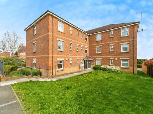 2 bedroom apartment for sale in Birchin Bank, Barnsley, S74 — £100,000 • 2 bed • 2 bath • 754 ft²
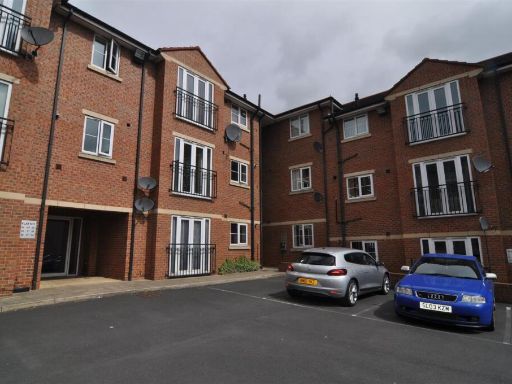 2 bedroom apartment for sale in Langdale Court, Barnsley, S71 — £90,000 • 2 bed • 2 bath • 664 ft²
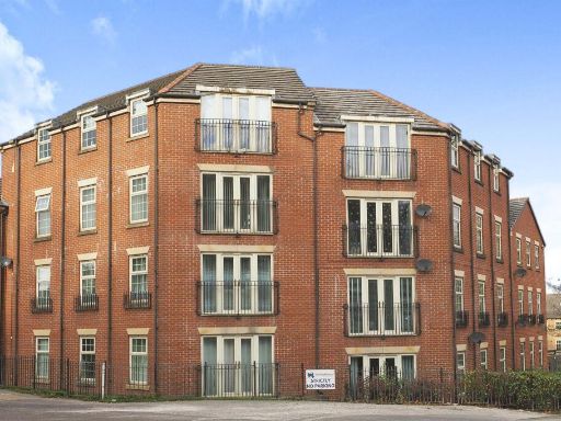 2 bedroom apartment for sale in Barberry Court, Barnsley, S70 — £70,000 • 2 bed • 1 bath • 829 ft²
 2 bedroom apartment for sale in Old Oaks View, BARNSLEY, S70 — £99,950 • 2 bed • 1 bath • 602 ft²
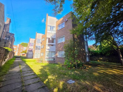 2 bedroom flat for sale in Westwood Court, Huddersfield Road, Barnsley, S70 2LT, S70 — £75,000 • 2 bed • 1 bath • 506 ft²
Meta
- {
"@context": "https://schema.org",
"@type": "Residence",
"name": "2 bedroom apartment for sale in Barberry Court, Barnsley, S…",
"description": "",
"url": "https://propertypiper.co.uk/property/fdeac912-0c3a-452f-a896-9682683c07e2",
"image": "https://image-a.propertypiper.co.uk/e83f6be0-983d-4377-8a16-0eb634738488-1024.jpeg",
"address": {
"@type": "PostalAddress",
"streetAddress": "Barberry Court, Barnsley",
"postalCode": "S70 3RS",
"addressLocality": "Barnsley",
"addressRegion": "Barnsley Central",
"addressCountry": "England"
},
"geo": {
"@type": "GeoCoordinates",
"latitude": 53.54720317391396,
"longitude": -1.4580550010041868
},
"numberOfRooms": 2,
"numberOfBathroomsTotal": 1,
"floorSize": {
"@type": "QuantitativeValue",
"value": 592,
"unitCode": "FTK"
},
"offers": {
"@type": "Offer",
"price": 80000,
"priceCurrency": "GBP",
"availability": "https://schema.org/InStock"
},
"additionalProperty": [
{
"@type": "PropertyValue",
"name": "Feature",
"value": "modern"
},
{
"@type": "PropertyValue",
"name": "Feature",
"value": "apartment"
},
{
"@type": "PropertyValue",
"name": "Feature",
"value": "complex"
},
{
"@type": "PropertyValue",
"name": "Feature",
"value": "flat"
},
{
"@type": "PropertyValue",
"name": "Feature",
"value": "contemporary"
},
{
"@type": "PropertyValue",
"name": "Feature",
"value": "three-story"
},
{
"@type": "PropertyValue",
"name": "Feature",
"value": "brick"
},
{
"@type": "PropertyValue",
"name": "Feature",
"value": "balconies"
},
{
"@type": "PropertyValue",
"name": "Feature",
"value": "French windows"
},
{
"@type": "PropertyValue",
"name": "Feature",
"value": "apartment"
},
{
"@type": "PropertyValue",
"name": "Feature",
"value": "contemporary"
},
{
"@type": "PropertyValue",
"name": "Feature",
"value": "car parking"
},
{
"@type": "PropertyValue",
"name": "Feature",
"value": "red brick"
},
{
"@type": "PropertyValue",
"name": "Feature",
"value": "low-rise building"
},
{
"@type": "PropertyValue",
"name": "Feature",
"value": "well-maintained exterior"
},
{
"@type": "PropertyValue",
"name": "Feature",
"value": "landscaped area"
}
]
}
High Res Floorplan Images
Compatible Floorplan Images
FloorplanImages Thumbnail