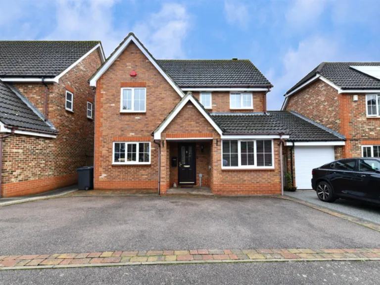
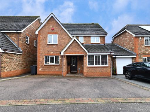
SG1 6AG - 5 bedroom detached house for sale in Windermere Close, Stev…
View on Property Piper
5 bedroom detached house for sale in Windermere Close, Stevenage, SG1
Property Details
- Price: £575000
- Bedrooms: 5
- Bathrooms: 2
- Property Type: undefined
- Property SubType: undefined
Image Descriptions
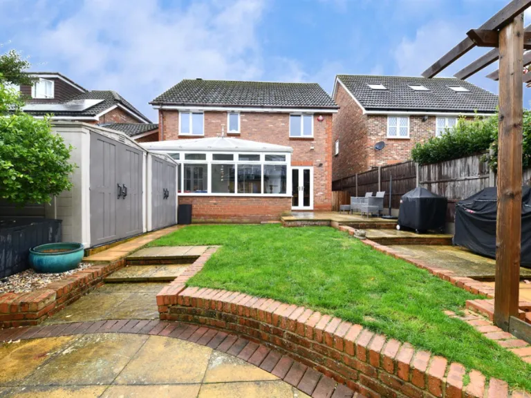
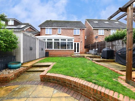
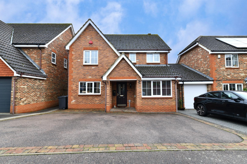
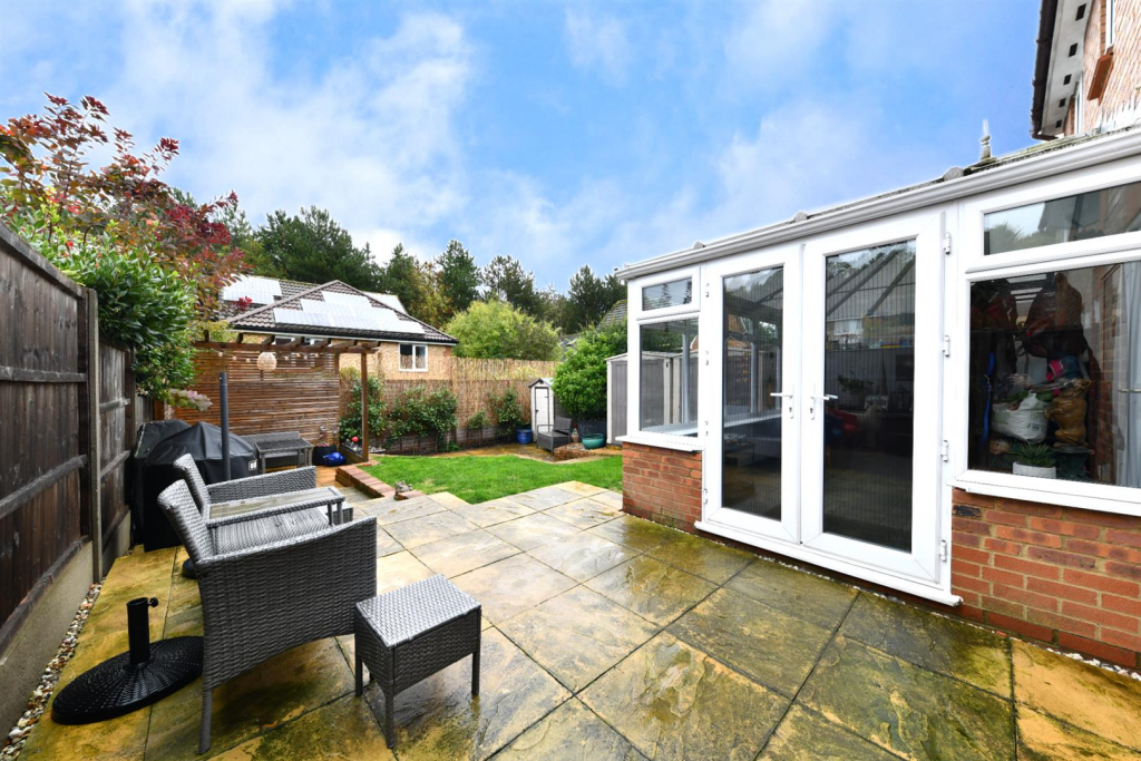
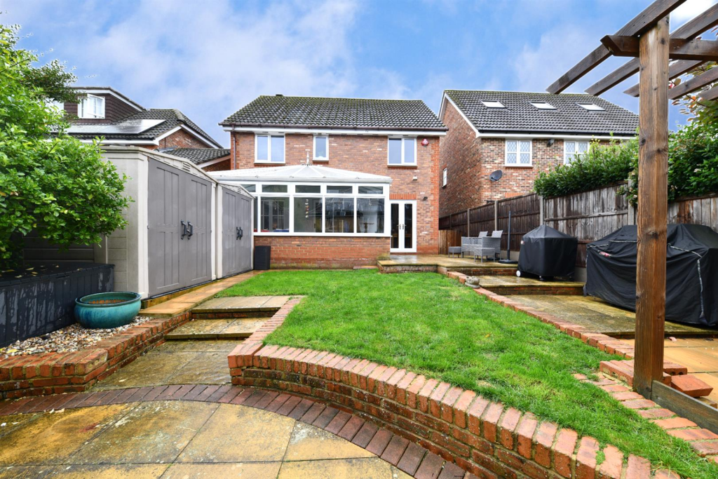
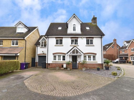
- detached house modern suburban
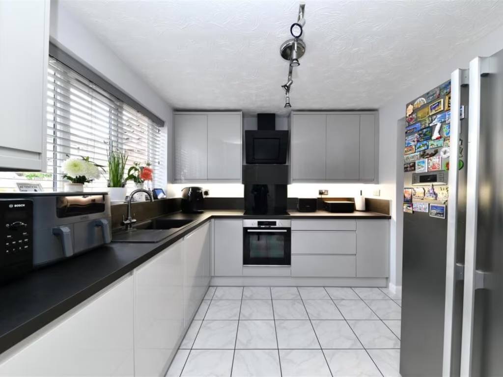
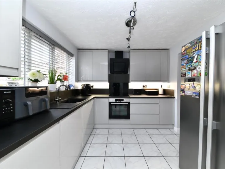
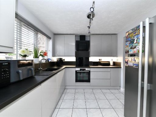
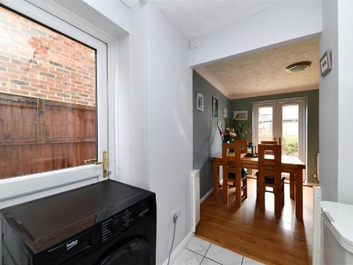
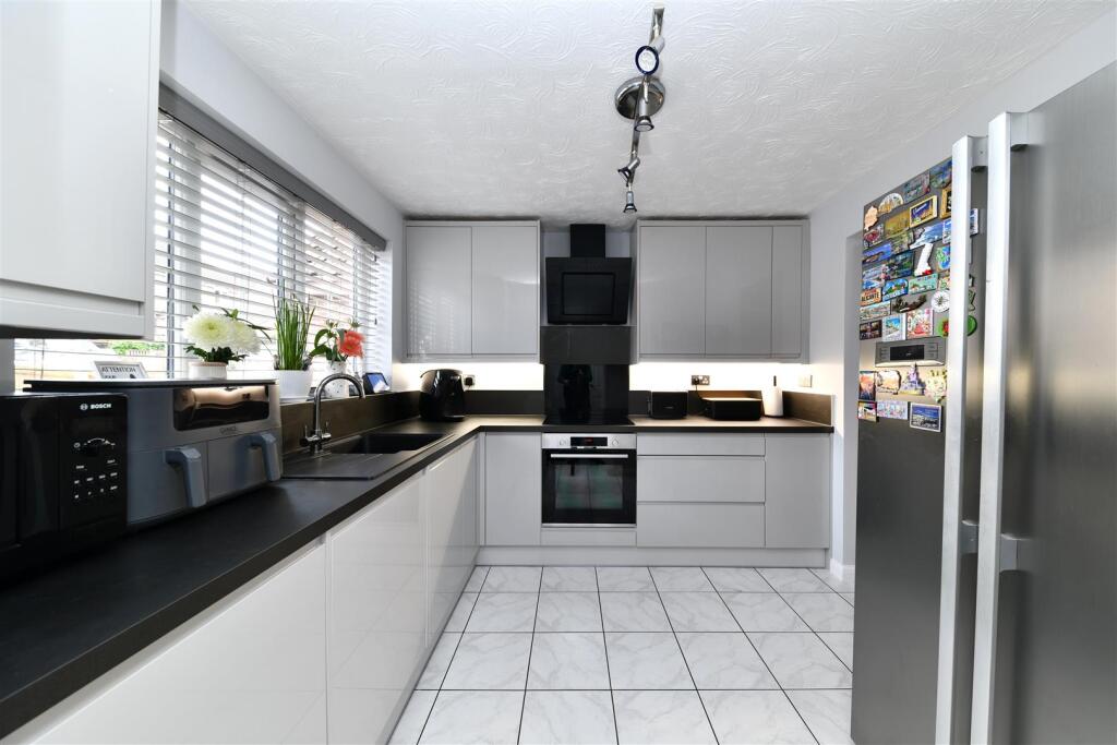
- kitchen Modern
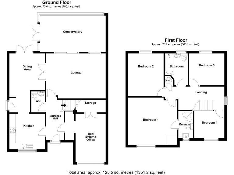
Floorplan Description
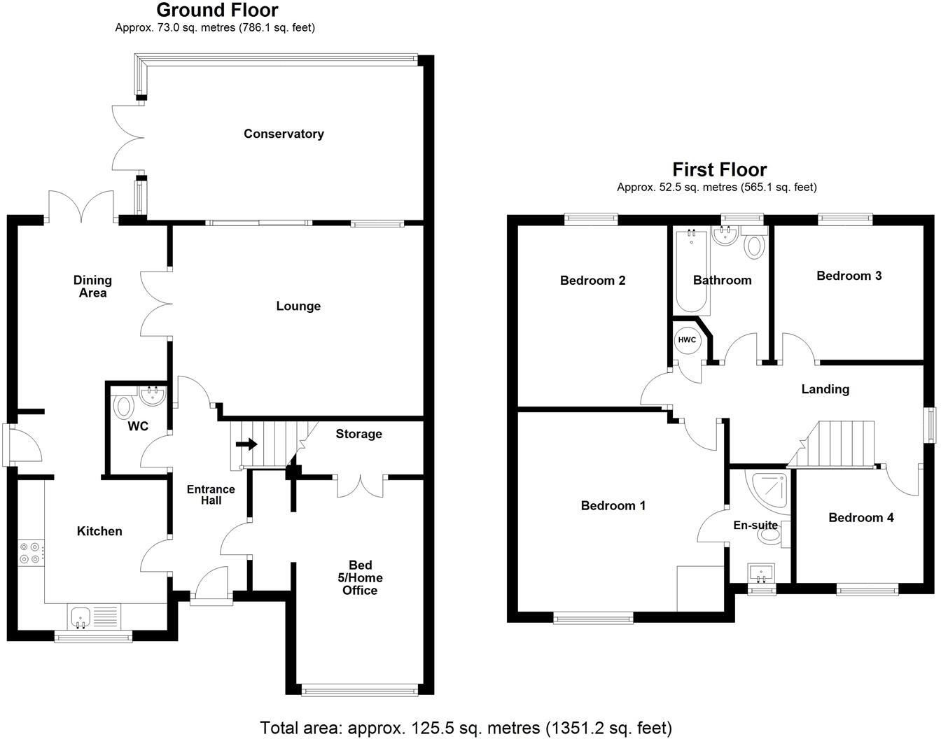
- Two-storey house with conservatory
Rooms
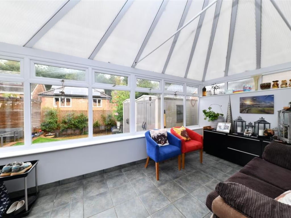
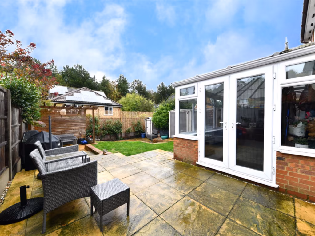
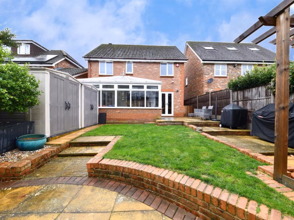
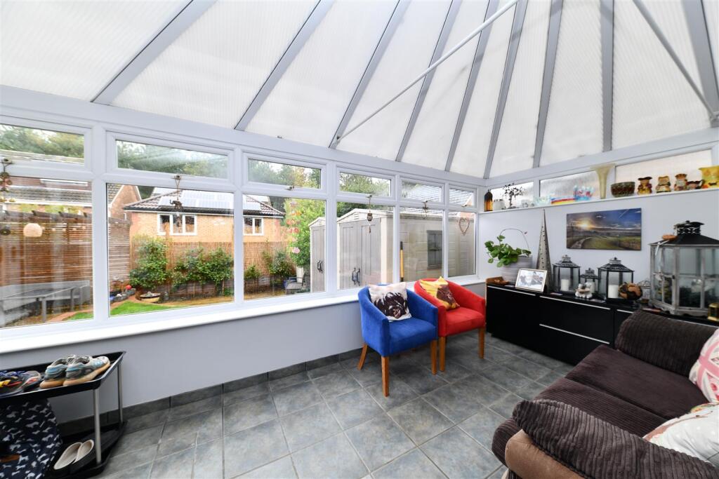
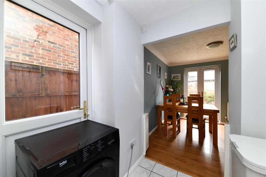
- Conservatory:
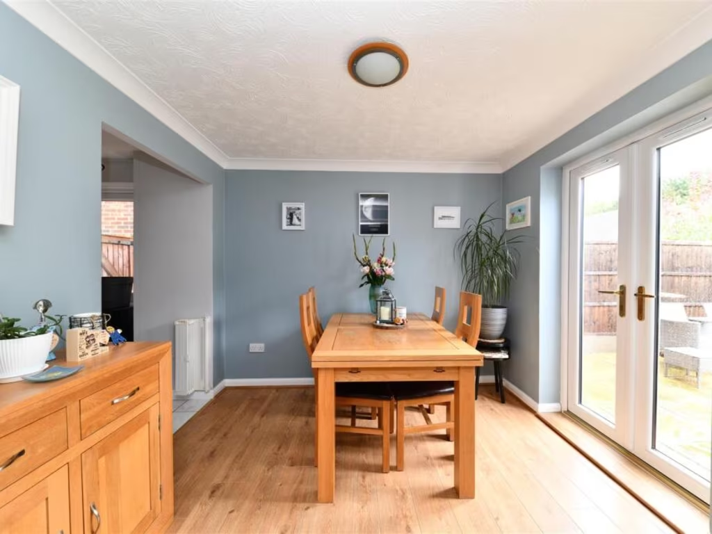
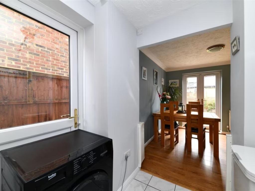
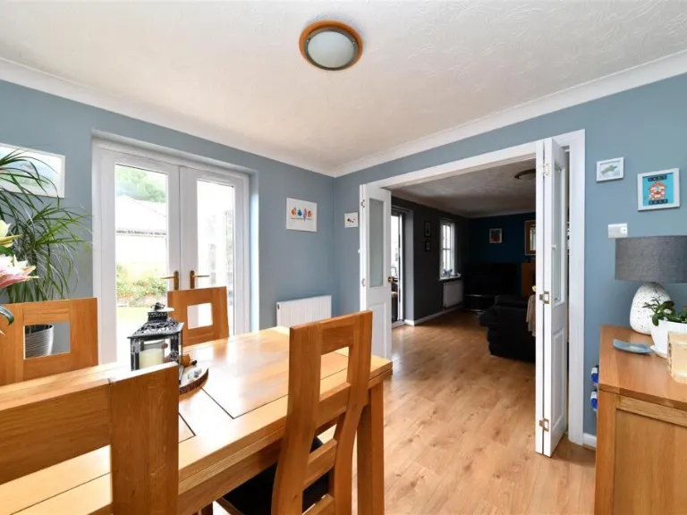
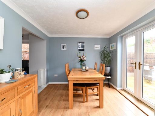
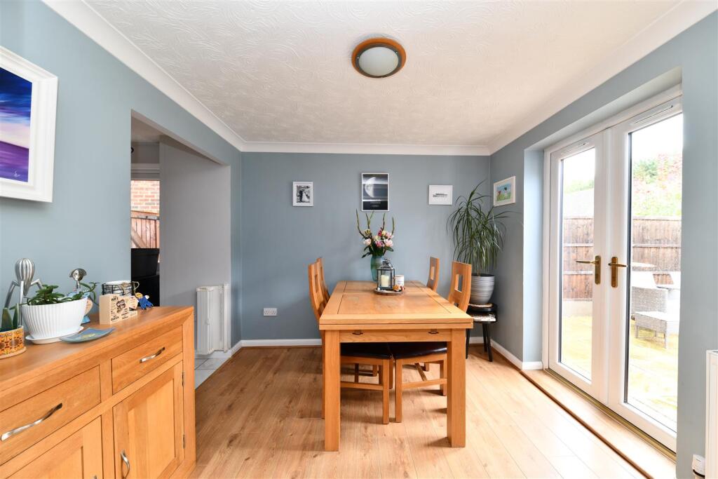
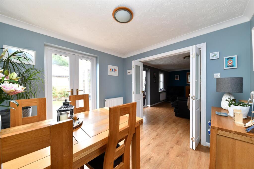
- Dining Area:
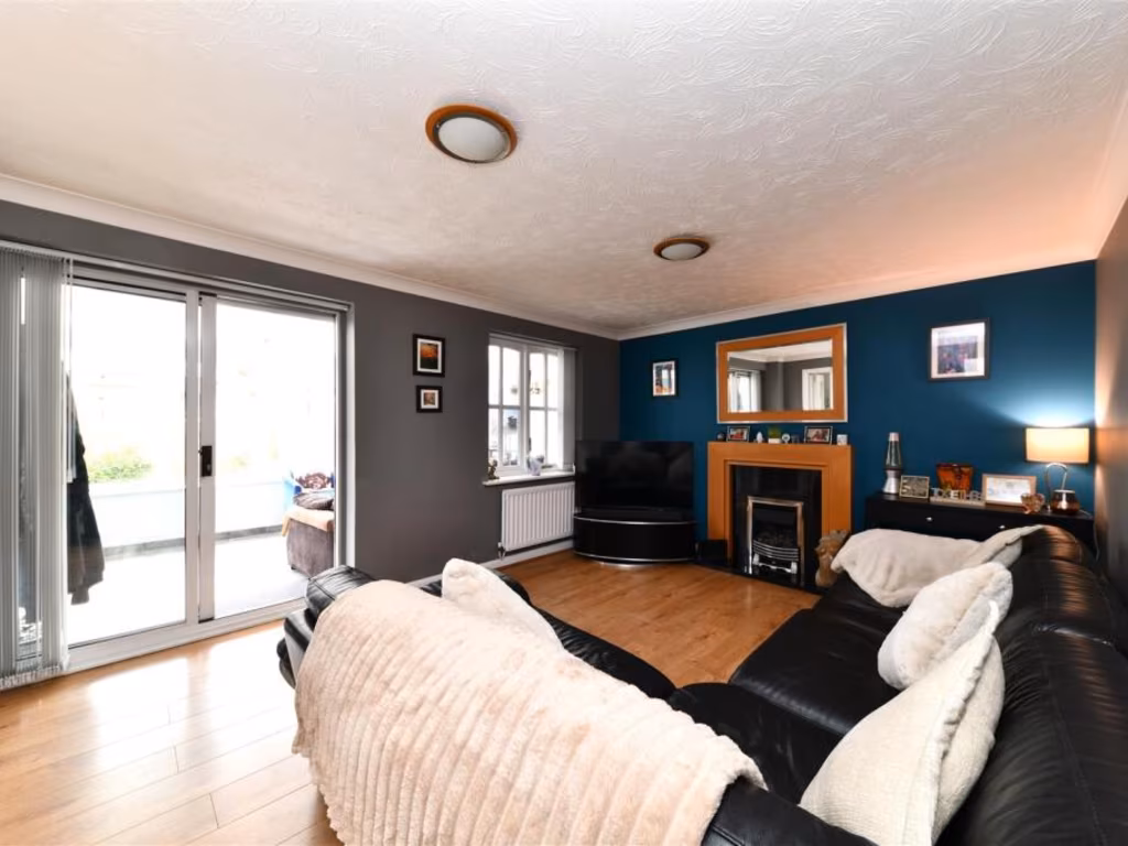
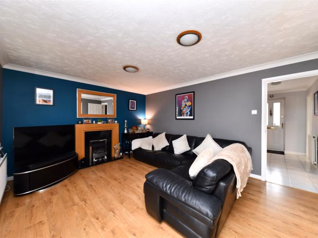
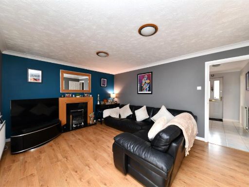
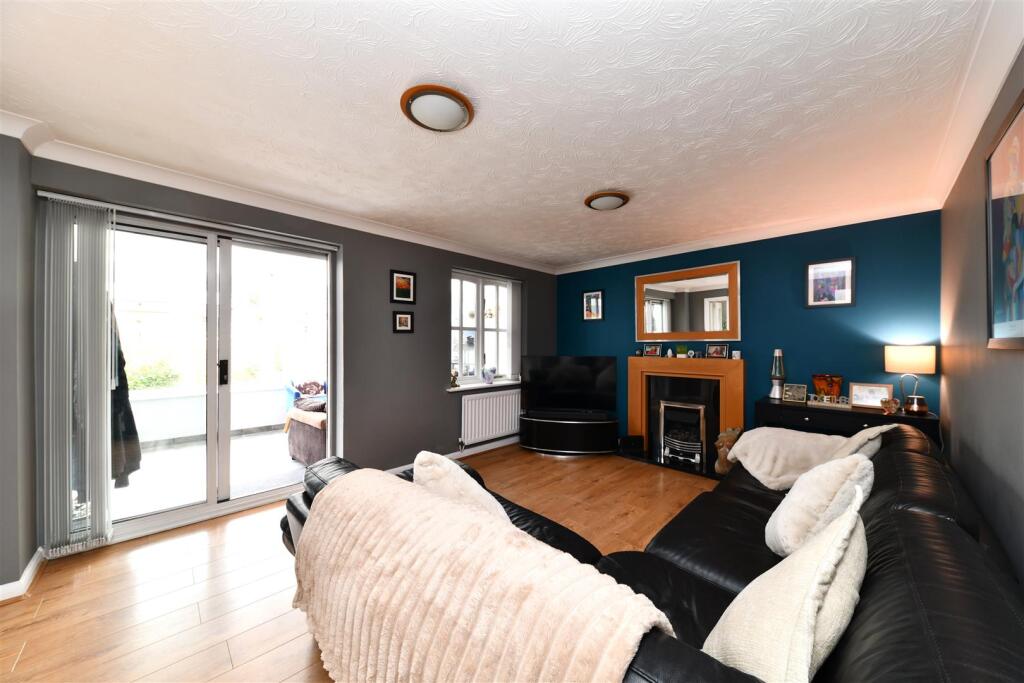
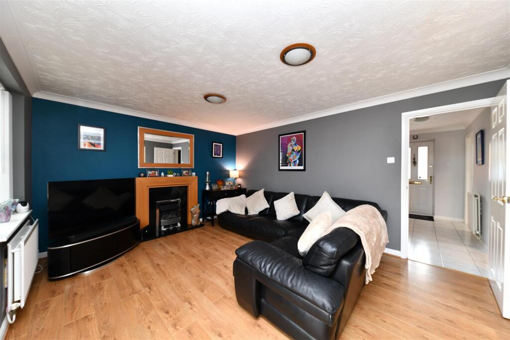
- Lounge:
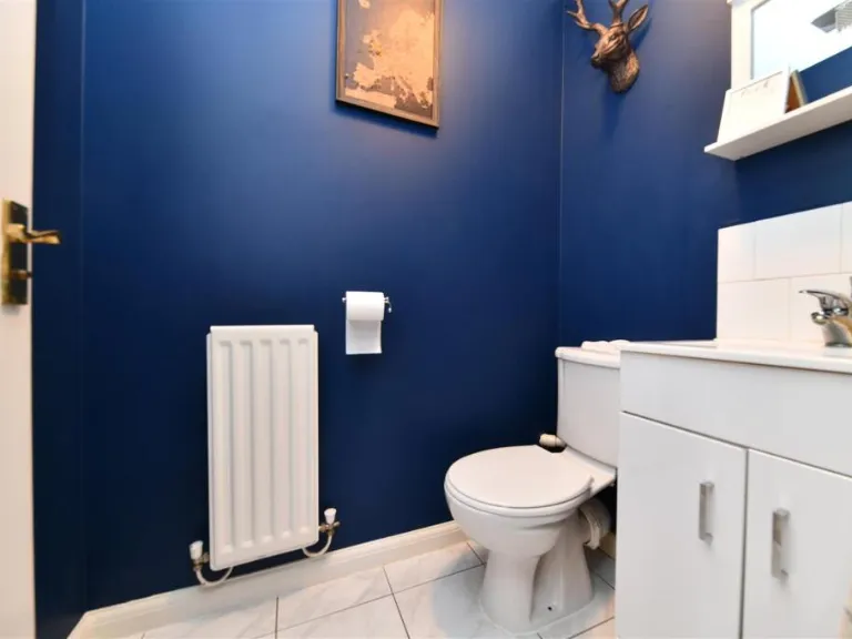
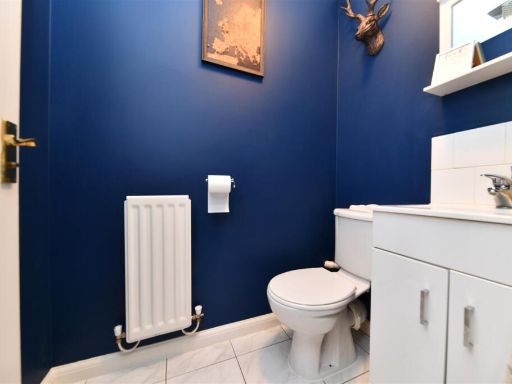
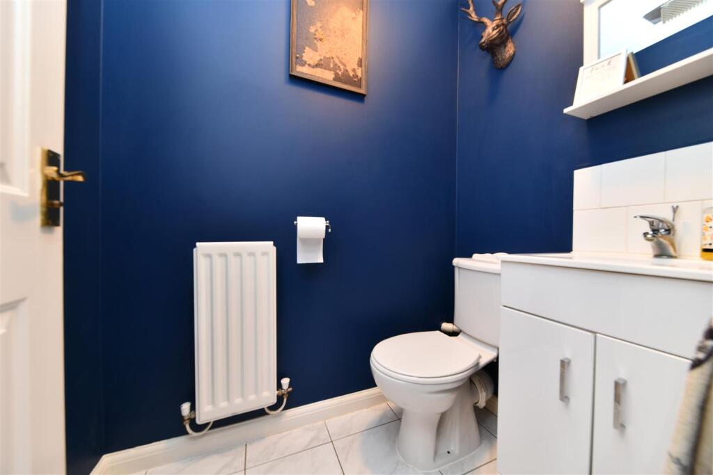
- WC:
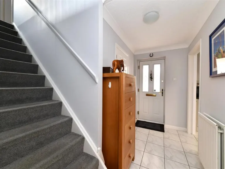
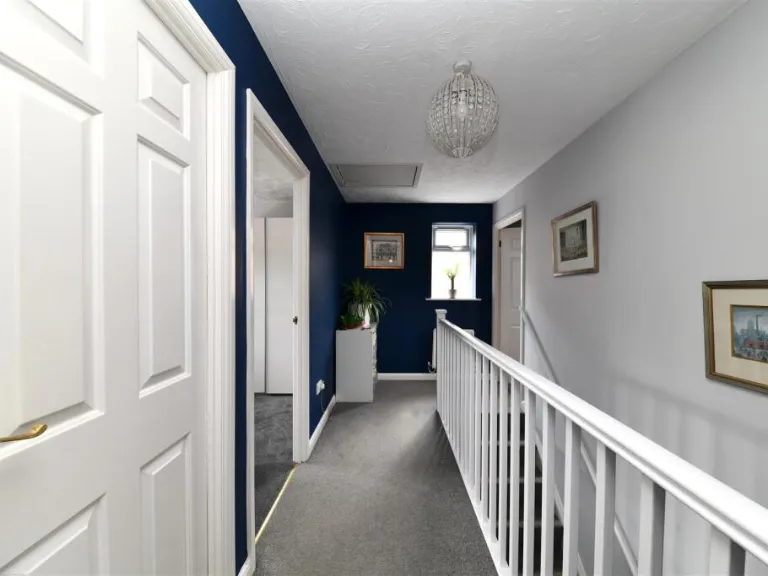
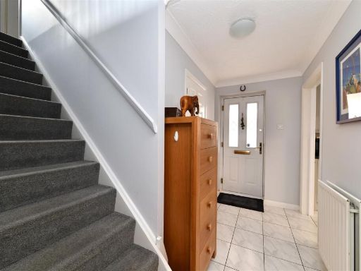
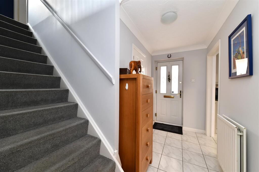
- Entrance Hall:
- Storage:
- Kitchen:
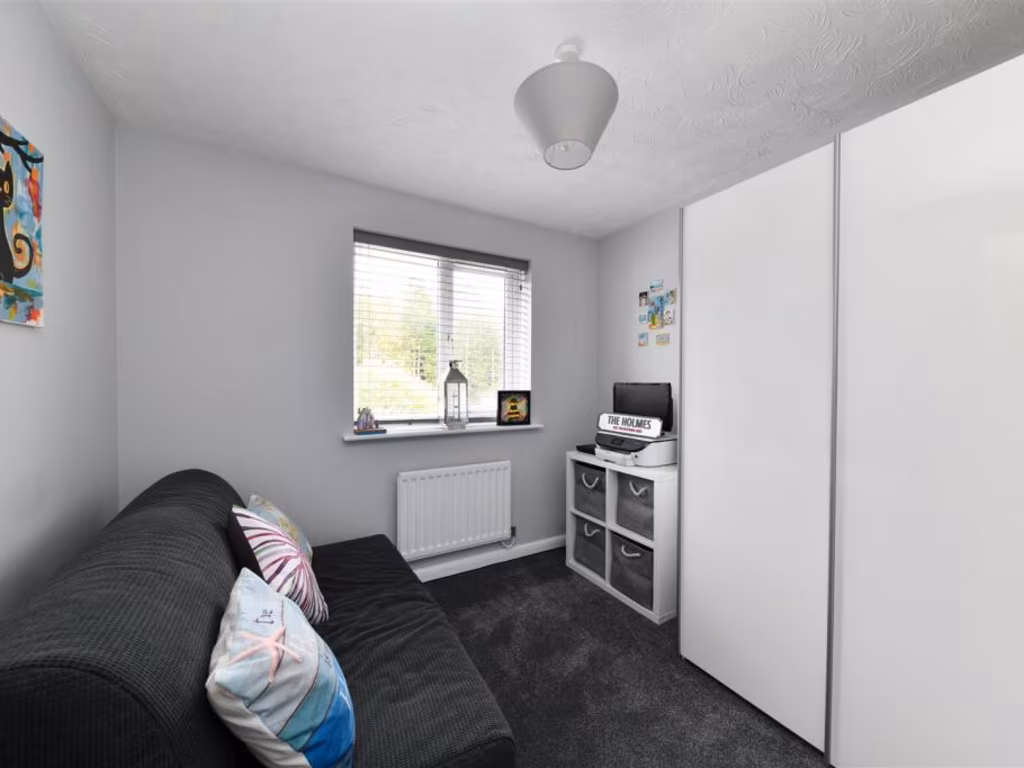
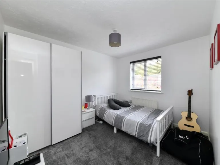
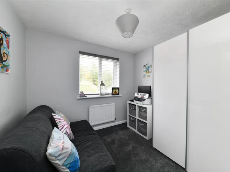
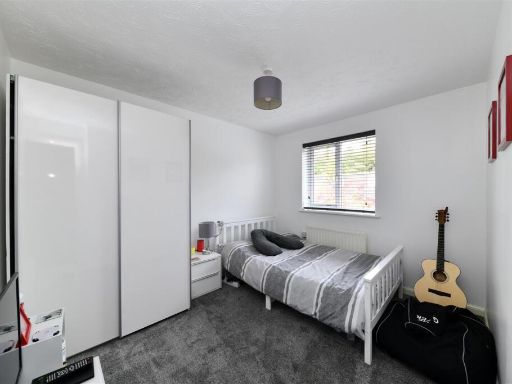
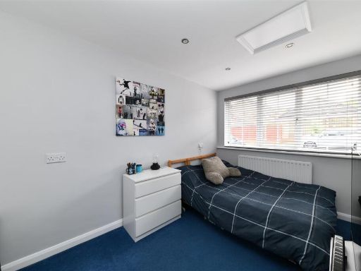
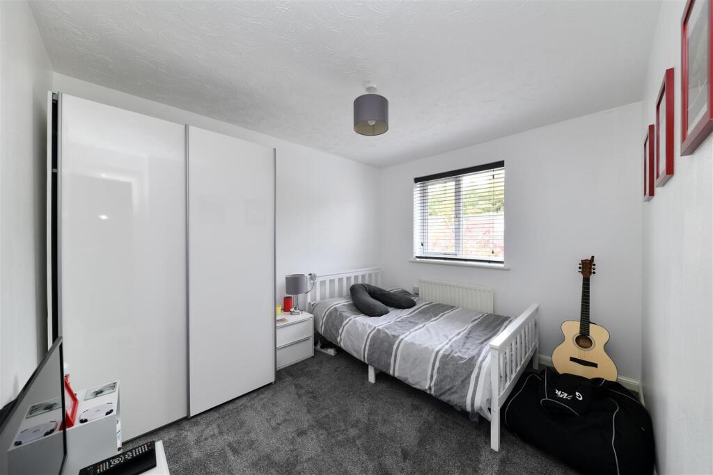
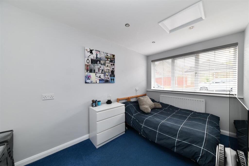
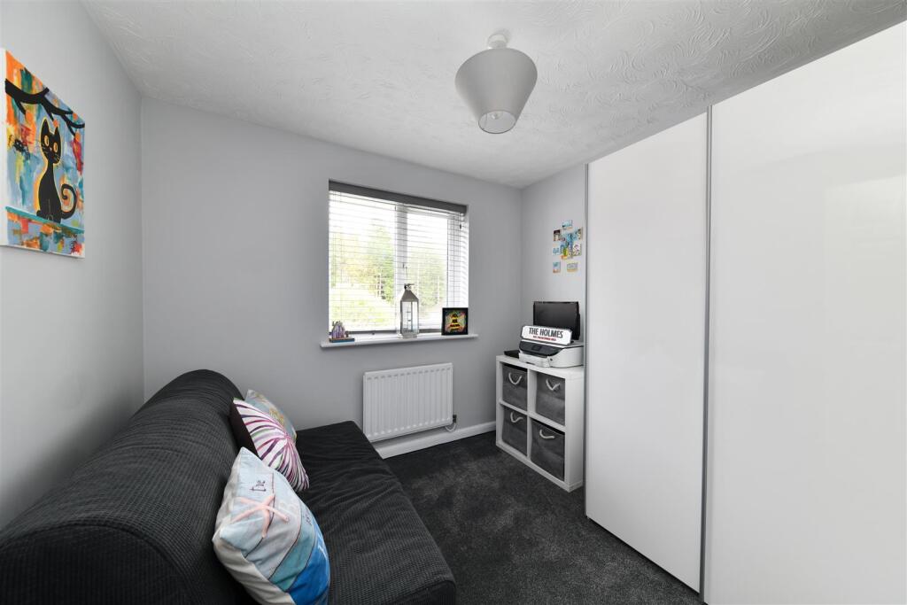
- Bed 5/Home Office:
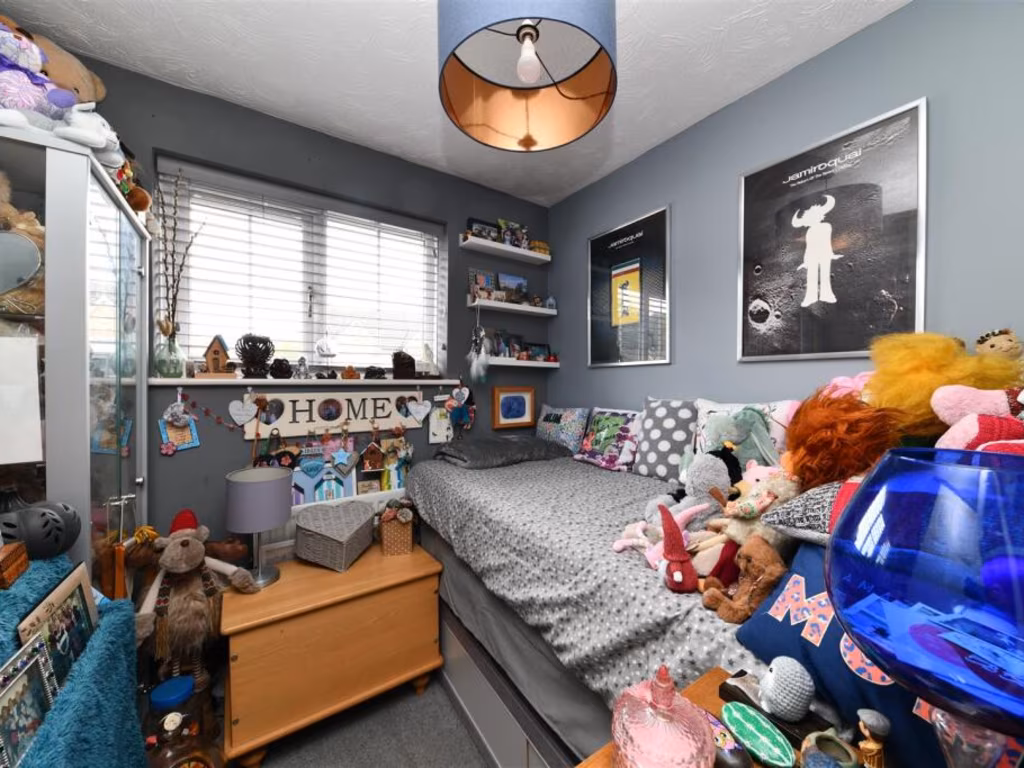
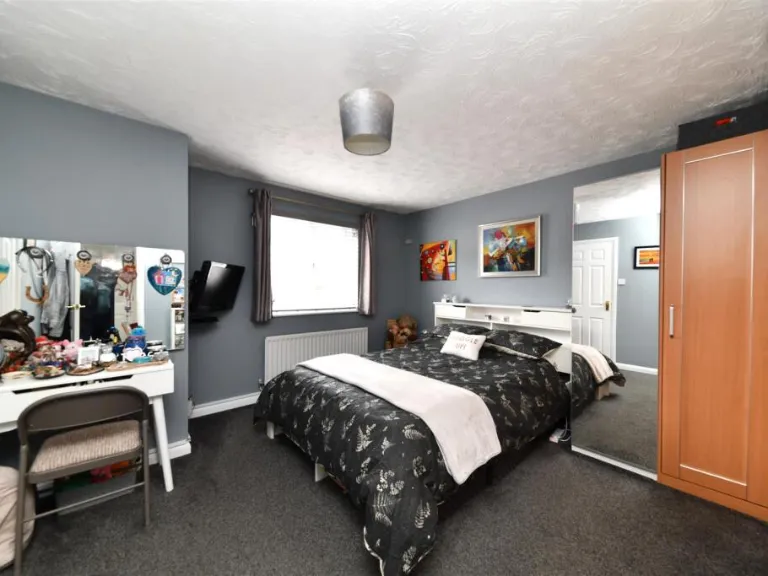
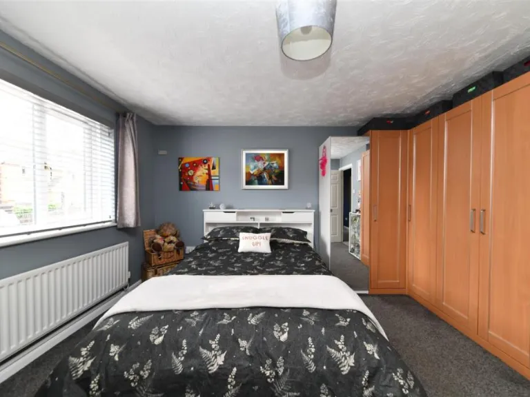
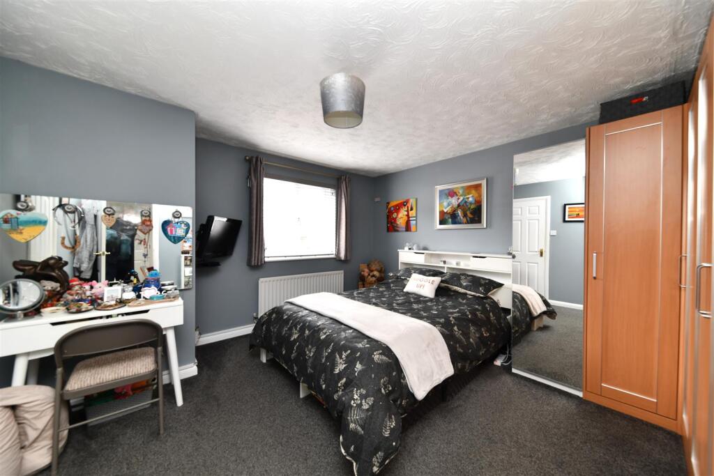
- Bedroom 2:
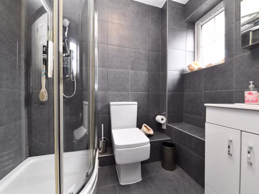
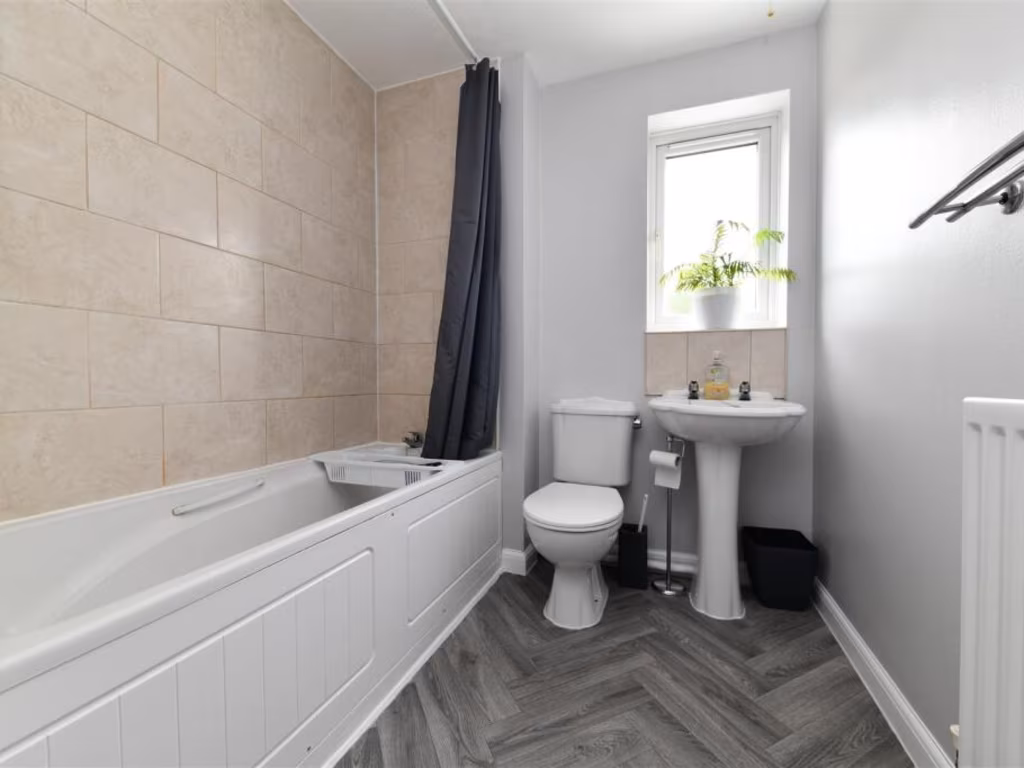
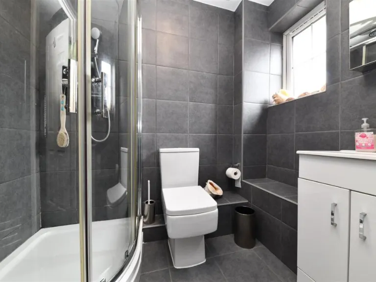
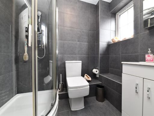
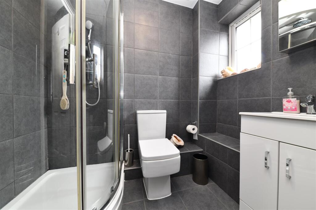
- Bathroom:
- Bedroom 3:
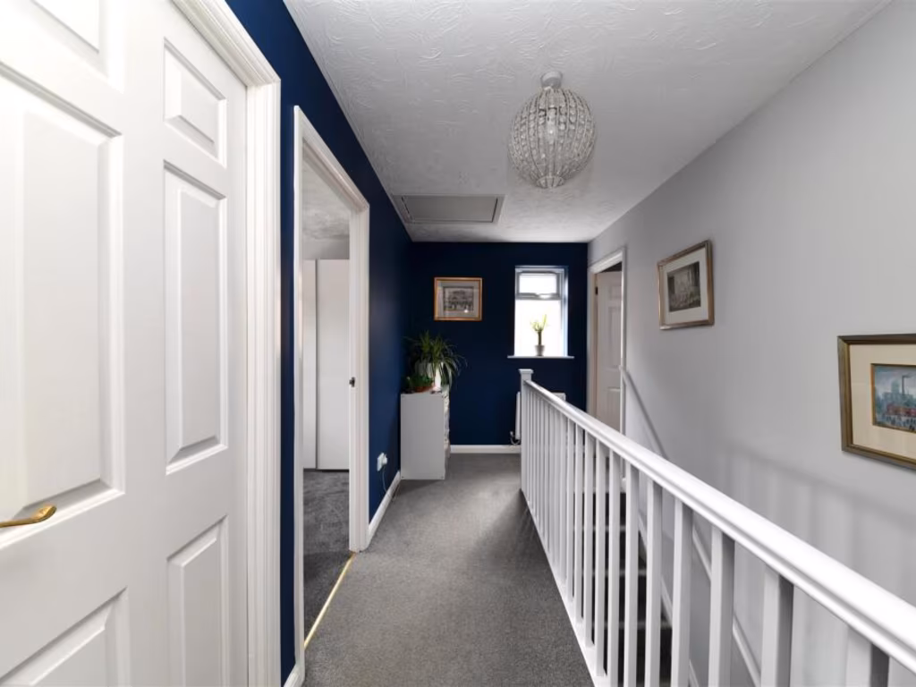
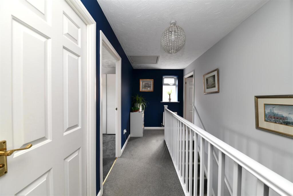
- Landing:
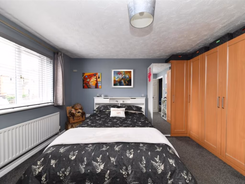
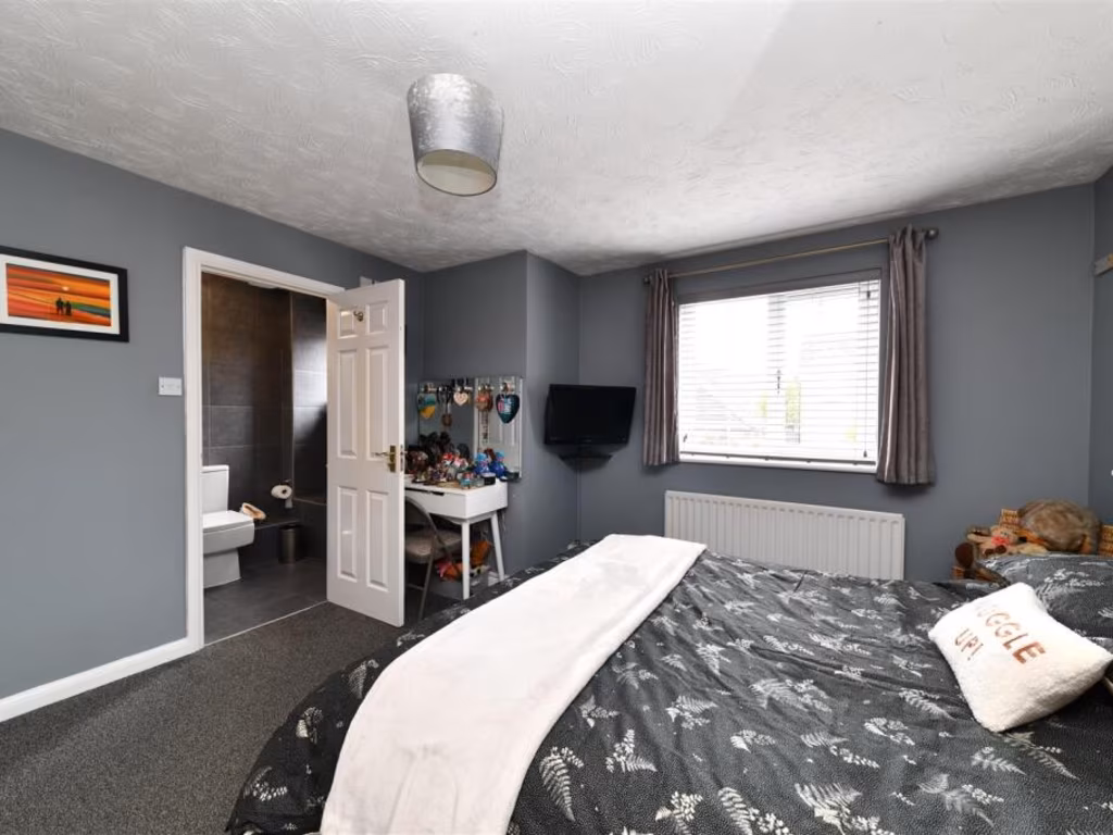
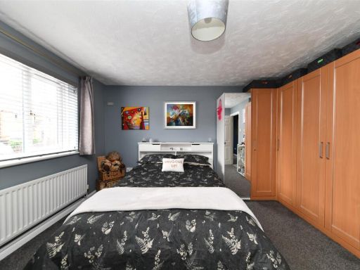
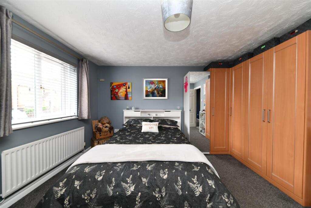
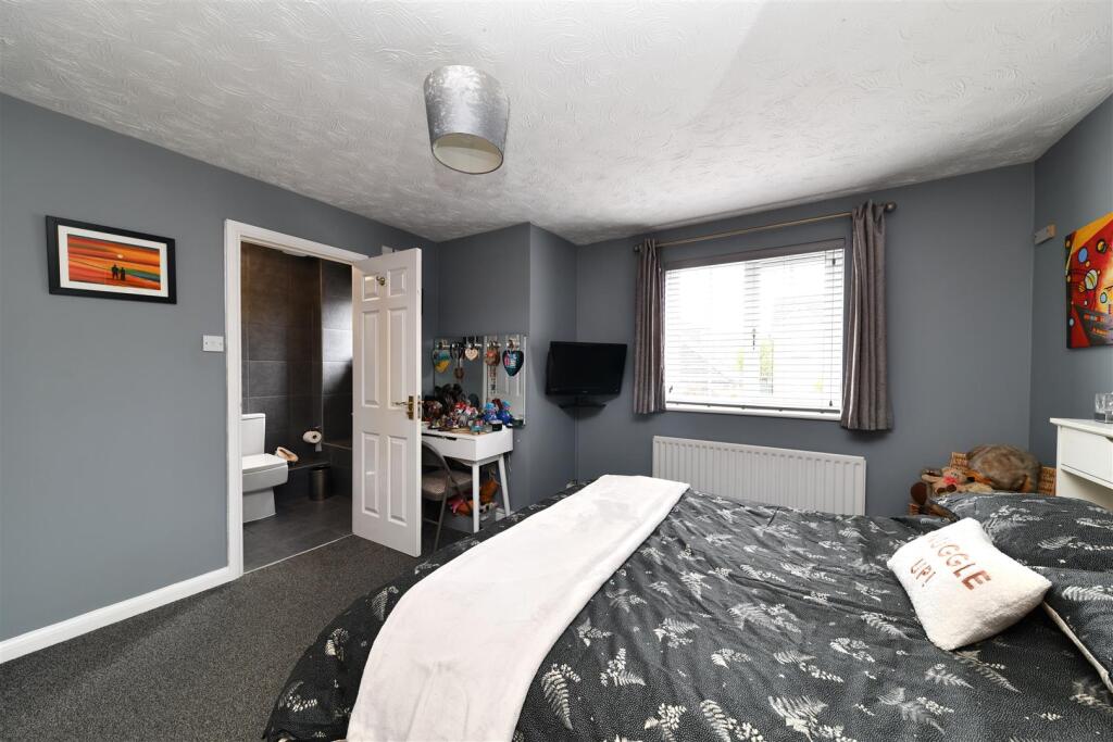
- Bedroom 1:
- En-suite:
- Bedroom 4:
Textual Property Features
Detected Visual Features
- modern
- suburban
- detached
- brick
- two-story
- garage
- driveway
- family home
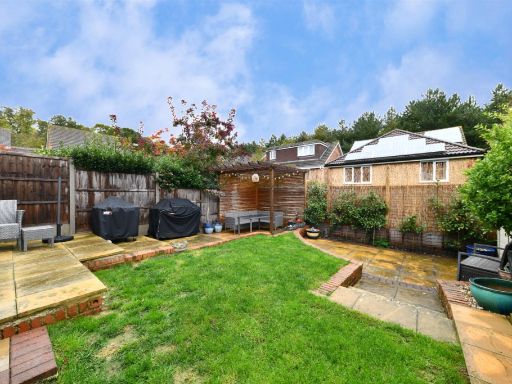
- low maintenance garden
- kitchen
- integrated appliances
- high gloss cabinets
- white tile flooring
- electric oven
- grey countertops
- spotlights
- blinds
EPC Details
- Fully double glazed
- Cavity wall, filled cavity
- Boiler and radiators, mains gas
- No low energy lighting
- Solid, limited insulation (assumed)
Nearby Schools
- Aston St Mary's Church of England Aided Primary School
- Marriotts School
- Moss Bury Primary School and Nursery
- The Leys Primary and Nursery School
- Barnwell School
- Ashtree Primary School and Nursery
- Saint Vincent de Paul Catholic Primary School
- The Nobel School
- Barclay Academy
- Martins Wood Primary School
- The Giles Infant and Nursery School
- Round Diamond Primary School
- Weston Primary & Nursery School
- Peartree Spring Primary School
- Featherstone Wood Primary School
- Broom Barns Primary School
- Fairlands Primary School
- Lodge Farm Primary School
- St Nicholas CofE (VA) Primary School and Nursery
- Bedwell Primary School
- Camps Hill Primary School
- Walkern Primary School
- Almond Hill Junior School
- Trotts Hill Primary and Nursery School
- Giles Junior School
Nearest General Shops
- Id: 8354941046
- Tags:
- Fixme: Not sure what this is (can't read name on dashcam footage)
- Shop: yes
- TagsNormalized:
- Lat: 51.9297433
- Lon: -0.1708567
- FullGeoHash: gcpzkje8dvb0
- PartitionGeoHash: gcpz
- Images:
- FoodStandards: null
- Distance: 926.7
,- Id: 8354941043
- Tags:
- Beauty: tanning
- Fixme: Not sure what this is (shutters over front)
- Name: Sun Booth
- Shop: beauty
- TagsNormalized:
- Lat: 51.9296102
- Lon: -0.1707588
- FullGeoHash: gcpzkj7xvhcn
- PartitionGeoHash: gcpz
- Images:
- FoodStandards: null
- Distance: 912.4
,- Id: 290519215
- Tags:
- Addr:
- City: Stevenage
- District: Great Ashby
- Housename: Unit 6
- Place: The Neighbourhood Centre
- Postcode: SG1 6DQ
- Street: Whitehorse Lane
- Brand: Budgens
- Brand:wikidata: Q4985016
- Brand:wikipedia: en:Budgens
- Building: retail
- Building:levels: 2
- Fhrs:
- Name: Budgens
- Opening_hours: Mo-Sa 08:00-22:00; Su 10:00-16:00
- Roof:
- Shop: supermarket
- Source:
- TagsNormalized:
- Lat: 51.9293742
- Lon: -0.1706168
- FullGeoHash: gcpzkj7y82fz
- PartitionGeoHash: gcpz
- Images:
- FoodStandards:
- Id: 961430
- FHRSID: 961430
- LocalAuthorityBusinessID: 710863
- BusinessName: Budgens
- BusinessType: Retailers - supermarkets/hypermarkets
- BusinessTypeID: 7840
- AddressLine1: Unit 6, The Neighbourhood Centre Whitehorse Lane
- AddressLine2: Great Ashby
- AddressLine3: Stevenage
- AddressLine4: Hertfordshire
- PostCode: SG1 6NH
- RatingValue: 5
- RatingKey: fhrs_5_en-GB
- RatingDate: 2021-11-04
- LocalAuthorityCode: 159
- LocalAuthorityName: North Hertfordshire
- LocalAuthorityWebSite: http://www.north-herts.gov.uk
- LocalAuthorityEmailAddress: env.health@north-herts.gov.uk
- Scores:
- Hygiene: 0
- Structural: 5
- ConfidenceInManagement: 0
- NewRatingPending: false
- Geocode:
- Longitude: -0.17084800000000
- Latitude: 51.92976700000000
- Distance: 888.9
}
Nearest Grocery shops
- Id: 1494141948
- Tags:
- Name: Gill's Stores
- Shop: convenience
- Wheelchair: yes
- TagsNormalized:
- Lat: 51.9140098
- Lon: -0.1711882
- FullGeoHash: gcpzk4em50bf
- PartitionGeoHash: gcpz
- Images:
- FoodStandards: null
- Distance: 1403.7
,- Id: 632717183
- Tags:
- Brand: Budgens
- Brand:wikidata: Q4985016
- Name: Budgens
- Operator: Spar
- Shop: convenience
- TagsNormalized:
- Lat: 51.9202761
- Lon: -0.1784622
- FullGeoHash: gcpz7gy198by
- PartitionGeoHash: gcpz
- Images:
- FoodStandards: null
- Distance: 1345.6
,- Id: 10203720140
- Tags:
- Addr:
- City: Stevenage
- Housenumber: 6
- Postcode: SG2 7QX
- Street: Emperors Gate
- Brand: Costcutter
- Brand:wikidata: Q5175072
- Fhrs:
- Name: Costcutter
- Opening_hours:
- Shop: convenience
- Source:
- TagsNormalized:
- costcutter
- convenience
- shop
- Lat: 51.9160823
- Lon: -0.1611619
- FullGeoHash: gcpzk749hehv
- PartitionGeoHash: gcpz
- Images:
- FoodStandards:
- Id: 349405
- FHRSID: 349405
- LocalAuthorityBusinessID: 12360/0006/0/000
- BusinessName: Costcutter
- BusinessType: Retailers - other
- BusinessTypeID: 4613
- AddressLine1: 6 Emperors Gate
- AddressLine2: Stevenage
- AddressLine3: Herts
- AddressLine4: null
- PostCode: SG2 7QX
- RatingValue: 5
- RatingKey: fhrs_5_en-GB
- RatingDate: 2019-09-03
- LocalAuthorityCode: 161
- LocalAuthorityName: Stevenage
- LocalAuthorityWebSite: http://www.stevenage.gov.uk
- LocalAuthorityEmailAddress: env.health@stevenage.gov.uk
- Scores:
- Hygiene: 5
- Structural: 5
- ConfidenceInManagement: 5
- NewRatingPending: false
- Geocode:
- Longitude: -0.16124000000000
- Latitude: 51.91609400000000
- Distance: 954.7
}
Nearest Religious buildings
- Id: 660277181
- Tags:
- Amenity: place_of_worship
- Name: Stevenage Muslim Community Centre and Mosque
- Religion: muslim
- Source: observation
- TagsNormalized:
- place of worship
- community centre
- mosque
- muslim
- Lat: 51.9159649
- Lon: -0.1817705
- FullGeoHash: gcpz7g58kmq1
- PartitionGeoHash: gcpz
- Images:
- FoodStandards: null
- Distance: 1768.4
,- Id: 765354902
- Tags:
- Addr:
- Amenity: place_of_worship
- Building: church
- Denomination: anglican
- Name: All Saints Church
- Religion: christian
- Wikidata: Q105085371
- TagsNormalized:
- place of worship
- church
- anglican
- christian
- Lat: 51.9187977
- Lon: -0.1786067
- FullGeoHash: gcpz7gtbyjm5
- PartitionGeoHash: gcpz
- Images:
- FoodStandards: null
- Distance: 1422.1
,- Id: 765354903
- Tags:
- Amenity: place_of_worship
- Building: yes
- Denomination: jehovahs_witness
- Name: Kingdom Hall of Jehovahs Witnesses
- Religion: christian
- TagsNormalized:
- place of worship
- jehovah
- jehovahs witness
- christian
- church
- Lat: 51.9191193
- Lon: -0.178373
- FullGeoHash: gcpz7gw4g976
- PartitionGeoHash: gcpz
- Images:
- FoodStandards: null
- Distance: 1391.7
}
Nearest Medical buildings
- Id: 8457073661
- Tags:
- Amenity: pharmacy
- Dispensing: yes
- Name: Stevenage Pharmacy
- Opening_hours: Mo-Fr 09:00-18:00;Sa 09:00-13:00
- TagsNormalized:
- Lat: 51.9161051
- Lon: -0.1605466
- FullGeoHash: gcpzk7514zrv
- PartitionGeoHash: gcpz
- Images:
- FoodStandards: null
- Distance: 950.1
,- Id: 290519213
- Tags:
- Addr:
- City: Stevenage
- Housename: St Francis House
- Postcode: SG1 6DU
- Street: Whitehorse Lane
- Amenity: veterinary
- Name: Great Ashby Veterinary Hospital
- Opening_hours: Mo-Fr 08:00-20:00; Sa 08:00-17:00
- TagsNormalized:
- Lat: 51.9294596
- Lon: -0.1714345
- FullGeoHash: gcpzkj7pj2ch
- PartitionGeoHash: gcpz
- Images:
- FoodStandards: null
- Distance: 940
,- Id: 4496417241
- Tags:
- Addr:
- City: Stevenage
- Postcode: SG2 7QX
- Street: Emperors Gate
- Amenity: doctors
- Description: Local Surgery - No emergency service
- Name: Manor House Surgery
- Opening_hours: Mo-Fr 08:30-18:00
- Opening_hours:signed: no
- TagsNormalized:
- Lat: 51.9163861
- Lon: -0.1609321
- FullGeoHash: gcpzk74ff5b6
- PartitionGeoHash: gcpz
- Images:
- FoodStandards: null
- Distance: 920
,- Id: 8354941044
- Tags:
- Amenity: pharmacy
- Name: Jhoots Pharmacy
- TagsNormalized:
- Lat: 51.9296366
- Lon: -0.1707776
- FullGeoHash: gcpzkje8h9fu
- PartitionGeoHash: gcpz
- Images:
- FoodStandards: null
- Distance: 915.2
}
Nearest Airports
- Id: 495488524
- Tags:
- Aerodrome: international
- Aerodrome:type: public
- Aeroway: aerodrome
- Alt_name: Stansted
- Iata: STN
- Icao: EGSS
- Is_in: Essex,England,UK
- Name: London Stansted Airport
- Ref: STN
- Source: Gagravarr_Airports
- Website: https://www.stanstedairport.com/
- Wikidata: Q8709
- Wikipedia: en:London Stansted Airport
- TagsNormalized:
- airport
- international airport
- Lat: 51.8869677
- Lon: 0.2429264
- FullGeoHash: u10pjt8zkxg4
- PartitionGeoHash: u10p
- Images:
- FoodStandards: null
- Distance: 27968.6
,- Id: 110273499
- Tags:
- Addr:
- Country: GB
- Postcode: LU2 9LY
- Aerodrome: international
- Aerodrome:type: public
- Aeroway: aerodrome
- Alt_name: London Luton
- Iata: LTN
- Icao: EGGW
- Name: London Luton Airport
- Website: https://www.london-luton.co.uk/
- Wikidata: Q8712
- Wikipedia: en:Luton Airport
- TagsNormalized:
- airport
- international airport
- Lat: 51.8780363
- Lon: -0.3701408
- FullGeoHash: gcpxps47rngh
- PartitionGeoHash: gcpx
- Images:
- FoodStandards: null
- Distance: 15310.2
}
Nearest Leisure Facilities
- Id: 6798397473
- Tags:
- Covered: no
- Leisure: picnic_table
- TagsNormalized:
- picnic
- picnic table
- leisure
- Lat: 51.925217
- Lon: -0.1582422
- FullGeoHash: gcpzkksy2dn0
- PartitionGeoHash: gcpz
- Images:
- FoodStandards: null
- Distance: 146.3
,- Id: 23292506
- Tags:
- Access: yes
- Barrier: fence
- Leisure: playground
- TagsNormalized:
- Lat: 51.9256784
- Lon: -0.1592738
- FullGeoHash: gcpzkku108hb
- PartitionGeoHash: gcpz
- Images:
- FoodStandards: null
- Distance: 130
,- Id: 6482271565
- Tags:
- Leisure: fitness_station
- Sport: fitness
- TagsNormalized:
- fitness
- fitness station
- station
- leisure
- sports
- Lat: 51.9253115
- Lon: -0.1589818
- FullGeoHash: gcpzkksnz7ws
- PartitionGeoHash: gcpz
- Images:
- FoodStandards: null
- Distance: 109.8
,- Id: 23292509
- Tags:
- Leisure: park
- Name: Great Ashby District Park
- Source: estimation from footpaths
- TagsNormalized:
- Lat: 51.9244816
- Lon: -0.1587208
- FullGeoHash: gcpzkks6j8cj
- PartitionGeoHash: gcpz
- Images:
- FoodStandards: null
- Distance: 100.7
,- Id: 6482271564
- Tags:
- Fitness_station: yes
- Leisure: fitness_station
- Sport: fitness
- TagsNormalized:
- fitness
- fitness station
- station
- leisure
- sports
- Lat: 51.9244911
- Lon: -0.1590033
- FullGeoHash: gcpzkks4nfww
- PartitionGeoHash: gcpz
- Images:
- FoodStandards: null
- Distance: 81.5
}
Nearest Tourist attractions
- Id: 193437485
- Tags:
- Area: yes
- Cabins: yes
- Landuse: forest
- Name: Pits Wood
- Note: Forest planted 2003
- Operator: Church Farm
- Tents: yes
- Tourism: camp_site
- TagsNormalized:
- Lat: 51.9244507
- Lon: -0.0985933
- FullGeoHash: gcpzmu81ye5t
- PartitionGeoHash: gcpz
- Images:
- FoodStandards: null
- Distance: 4222.2
,- Id: 559969108
- Tags:
- Addr:
- City: Stevenage
- Postcode: SG1 1XX
- Name: Stevenage Museum
- Tourism: museum
- Website: https://www.stevenage.gov.uk/stevenage-museum
- Wikidata: Q29570928
- TagsNormalized:
- Lat: 51.9014446
- Lon: -0.1986286
- FullGeoHash: gcpz72r7gdeb
- PartitionGeoHash: gcpz
- Images:
- FoodStandards: null
- Distance: 3690
,- Id: 7663623716
- Tags:
- Name: Forster Country
- Operator: Stevenage Borough Council and Hertfordshire County Council.
- Tourism: attraction
- TagsNormalized:
- Lat: 51.9262929
- Lon: -0.1976725
- FullGeoHash: gcpz7sbh9fsd
- PartitionGeoHash: gcpz
- Images:
- FoodStandards: null
- Distance: 2578.5
}
Nearest Train stations
- Id: 21264536
- Tags:
- Name: Arlesey
- Naptan:
- Network: National Rail
- Public_transport: station
- Railway: station
- Ref:
- Source:
- Wikidata: Q4567224
- Wikipedia: en:Arlesey railway station
- TagsNormalized:
- Lat: 52.0258212
- Lon: -0.266464
- FullGeoHash: gcpzczjbqgyp
- PartitionGeoHash: gcpz
- Images:
- FoodStandards: null
- Distance: 13400.8
,- Id: 6751829050
- Tags:
- Name: Welwyn North
- Naptan:
- Network: National Rail
- Public_transport: station
- Railway: station
- Ref:
- Train: yes
- Wikidata: Q2345556
- Wikipedia: en:Welwyn North railway station
- TagsNormalized:
- Lat: 51.8237723
- Lon: -0.192134
- FullGeoHash: gcpygdhp6gqe
- PartitionGeoHash: gcpy
- Images:
- FoodStandards: null
- Distance: 11429.3
,- Id: 20981580
- Tags:
- Name: Baldock
- Naptan:
- Network: National Rail
- Public_transport: station
- Railway: station
- Ref:
- Wheelchair: no
- Wikidata: Q19953
- Wikipedia: en:Baldock railway station
- TagsNormalized:
- Lat: 51.9929714
- Lon: -0.1875624
- FullGeoHash: gcpzg9p3j2r7
- PartitionGeoHash: gcpz
- Images:
- FoodStandards: null
- Distance: 7825.9
,- Id: 2089152132
- Tags:
- Name: Letchworth Garden City
- Naptan:
- Network: National Rail
- Old_name: Letchworth
- Operator: First Capital Connect
- Platforms: 2
- Public_transport: station
- Railway: station
- Ref:
- Wikidata: Q2582397
- Wikipedia: en:Letchworth Garden City railway station
- TagsNormalized:
- Lat: 51.9803536
- Lon: -0.2289056
- FullGeoHash: gcpzdy9rd05x
- PartitionGeoHash: gcpz
- Images:
- FoodStandards: null
- Distance: 7782.2
,- Id: 7140195250
- Tags:
- Name: Stevenage
- Naptan:
- Network: National Rail
- Public_transport: station
- Railway: station
- Ref:
- Wheelchair: yes
- Wikidata: Q19970
- Wikipedia: en:Stevenage railway station
- TagsNormalized:
- Lat: 51.9018356
- Lon: -0.207144
- FullGeoHash: gcpz723nj5qj
- PartitionGeoHash: gcpz
- Images:
- FoodStandards: null
- Distance: 4100.8
}
Nearest Hotels
- Id: 452515957
- Tags:
- Addr:
- City: Stevenage
- Postcode: SG1 1HS
- Street: St. Georges Way
- Brand: Holiday Inn
- Brand:wikidata: Q2717882
- Building: yes
- Fhrs:
- Name: Holiday Inn
- Source:
- Tourism: hotel
- TagsNormalized:
- Lat: 51.9010113
- Lon: -0.1985233
- FullGeoHash: gcpz72r3q1dr
- PartitionGeoHash: gcpz
- Images:
- FoodStandards: null
- Distance: 3718.8
,- Id: 236466723
- Tags:
- Addr:
- City: Stevenage
- Housenumber: 23
- Postcode: SG1 3BJ
- Street: Hitchin Road
- Building: yes
- Fhrs:
- Internet_access: wlan
- Internet_access:fee: no
- Name: Abbington
- Phone: +44 1438 315241
- Tourism: hotel
- Website: https://www.abbingtonhotel.co.uk/
- TagsNormalized:
- Lat: 51.9168791
- Lon: -0.2118858
- FullGeoHash: gcpz75jtwxwr
- PartitionGeoHash: gcpz
- Images:
- FoodStandards: null
- Distance: 3650.6
,- Id: 301824745
- Tags:
- Addr:
- City: Stevenage
- Housenumber: 25-27
- Postcode: SG1 3AR
- Street: High Street
- Fhrs:
- Name: The Cromwell
- Source: observation, estimation and local knowledge
- Source:addr: FHRS Open Data
- Tourism: hotel
- Wikidata: Q26394284
- TagsNormalized:
- Lat: 51.9127962
- Lon: -0.2077948
- FullGeoHash: gcpz762tyn8g
- PartitionGeoHash: gcpz
- Images:
- FoodStandards: null
- Distance: 3522.3
}
Tags
- modern
- suburban
- detached
- brick
- two-story
- garage
- driveway
- family home
- low maintenance garden
- modern
- kitchen
- integrated appliances
- high gloss cabinets
- white tile flooring
- electric oven
- grey countertops
- spotlights
- blinds
Local Market Stats
- Average Price/sqft: £360
- Avg Income: £48200
- Rental Yield: 4.2%
- Social Housing: 20%
- Planning Success Rate: 95%
Similar Properties
 5 bedroom detached house for sale in Cleveland Way, Great Ashby, Stevenage, SG1 — £685,000 • 5 bed • 3 bath • 2029 ft²
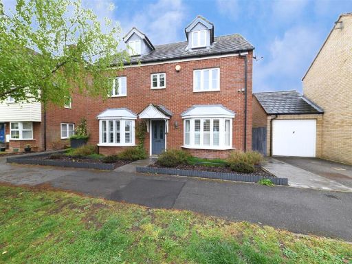 5 bedroom detached house for sale in Haybluff Drive, Stevenage, SG1 — £615,000 • 5 bed • 3 bath • 2087 ft²
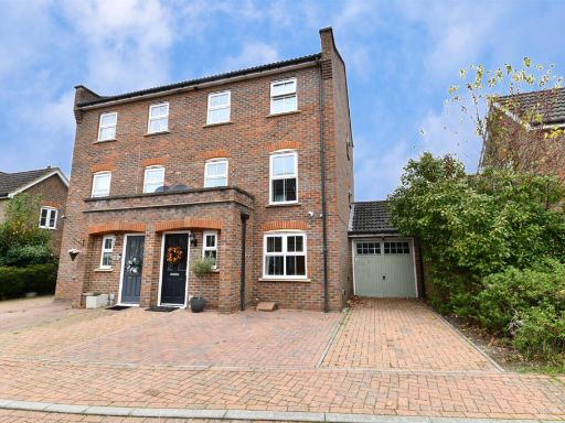 4 bedroom semi-detached house for sale in Haycock Round, Stevenage, SG1 — £450,000 • 4 bed • 2 bath • 1416 ft²
 6 bedroom detached house for sale in Thirlmere, Stevenage, Hertfordshire, SG1 — £600,000 • 6 bed • 4 bath • 1858 ft²
 6 bedroom detached house for sale in Lomond Way, Stevenage, Hertfordshire, SG1 — £650,000 • 6 bed • 4 bath • 1968 ft²
 5 bedroom detached house for sale in Mount Keen, Stevenage, Hertfordshire, SG1 — £600,000 • 5 bed • 3 bath • 1673 ft²
Meta
- {
"@context": "https://schema.org",
"@type": "Residence",
"name": "5 bedroom detached house for sale in Windermere Close, Stev…",
"description": "",
"url": "https://propertypiper.co.uk/property/f98df10b-ac46-4abc-ae1d-ceb24a5b537b",
"image": "https://image-a.propertypiper.co.uk/41b70d67-36fa-4453-8803-5925d9723885-1024.jpeg",
"address": {
"@type": "PostalAddress",
"streetAddress": "33 WINDERMERE CLOSE STEVENAGE ",
"postalCode": "SG1 6AG",
"addressLocality": "North Hertfordshire",
"addressRegion": "Hitchin and Harpenden",
"addressCountry": "England"
},
"geo": {
"@type": "GeoCoordinates",
"latitude": 51.924645987327835,
"longitude": -0.16016470390528154
},
"numberOfRooms": 5,
"numberOfBathroomsTotal": 2,
"floorSize": {
"@type": "QuantitativeValue",
"value": 1351,
"unitCode": "FTK"
},
"offers": {
"@type": "Offer",
"price": 575000,
"priceCurrency": "GBP",
"availability": "https://schema.org/InStock"
},
"additionalProperty": [
{
"@type": "PropertyValue",
"name": "Feature",
"value": "modern"
},
{
"@type": "PropertyValue",
"name": "Feature",
"value": "suburban"
},
{
"@type": "PropertyValue",
"name": "Feature",
"value": "detached"
},
{
"@type": "PropertyValue",
"name": "Feature",
"value": "brick"
},
{
"@type": "PropertyValue",
"name": "Feature",
"value": "two-story"
},
{
"@type": "PropertyValue",
"name": "Feature",
"value": "garage"
},
{
"@type": "PropertyValue",
"name": "Feature",
"value": "driveway"
},
{
"@type": "PropertyValue",
"name": "Feature",
"value": "family home"
},
{
"@type": "PropertyValue",
"name": "Feature",
"value": "low maintenance garden"
},
{
"@type": "PropertyValue",
"name": "Feature",
"value": "modern"
},
{
"@type": "PropertyValue",
"name": "Feature",
"value": "kitchen"
},
{
"@type": "PropertyValue",
"name": "Feature",
"value": "integrated appliances"
},
{
"@type": "PropertyValue",
"name": "Feature",
"value": "high gloss cabinets"
},
{
"@type": "PropertyValue",
"name": "Feature",
"value": "white tile flooring"
},
{
"@type": "PropertyValue",
"name": "Feature",
"value": "electric oven"
},
{
"@type": "PropertyValue",
"name": "Feature",
"value": "grey countertops"
},
{
"@type": "PropertyValue",
"name": "Feature",
"value": "spotlights"
},
{
"@type": "PropertyValue",
"name": "Feature",
"value": "blinds"
}
]
}
High Res Floorplan Images
Compatible Floorplan Images
FloorplanImages Thumbnail