TN4 8TP - 3 bedroom house for sale in Westwood Road, Tunbridge Wells,…
View on Property Piper
3 bedroom house for sale in Westwood Road, Tunbridge Wells, TN4
Property Details
- Price: £545000
- Bedrooms: 3
- Bathrooms: 2
- Property Type: undefined
- Property SubType: undefined
Brochure Descriptions
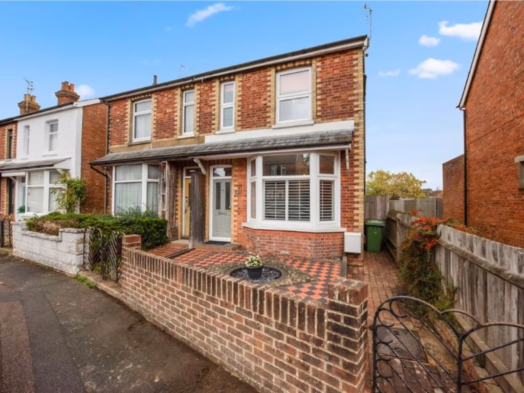
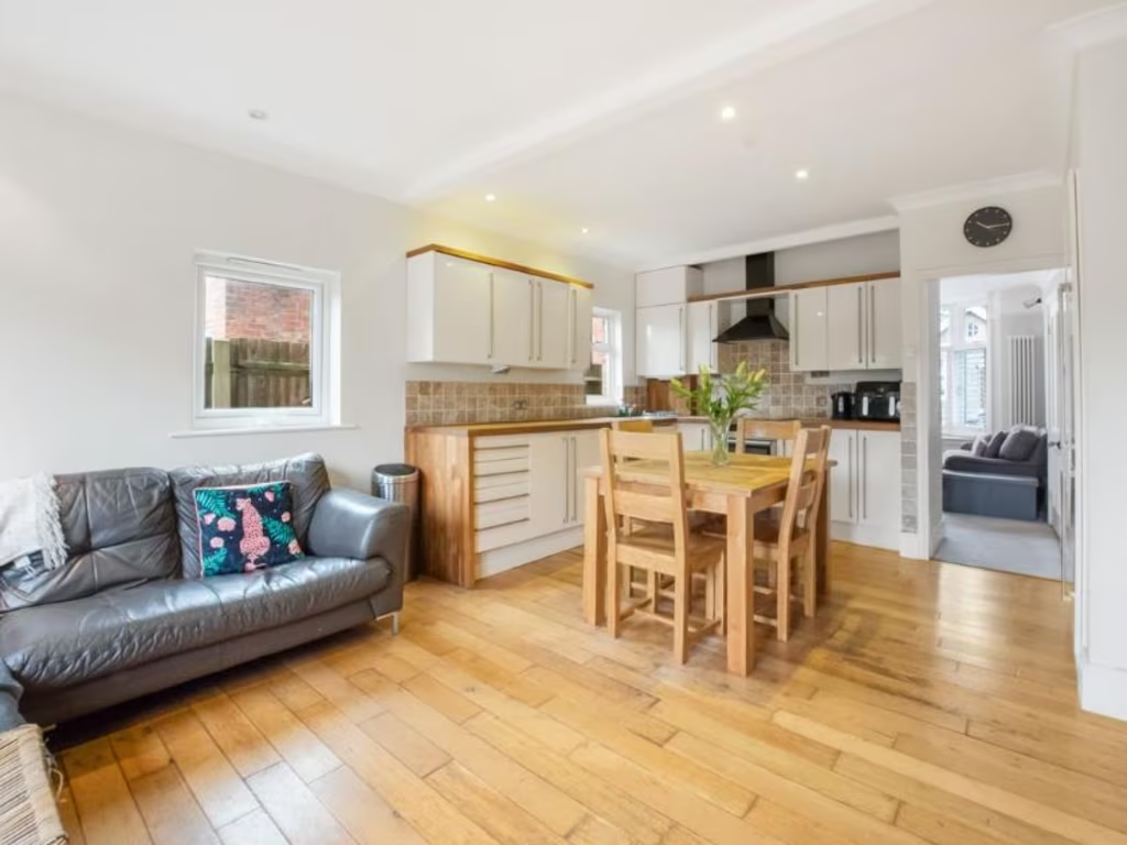
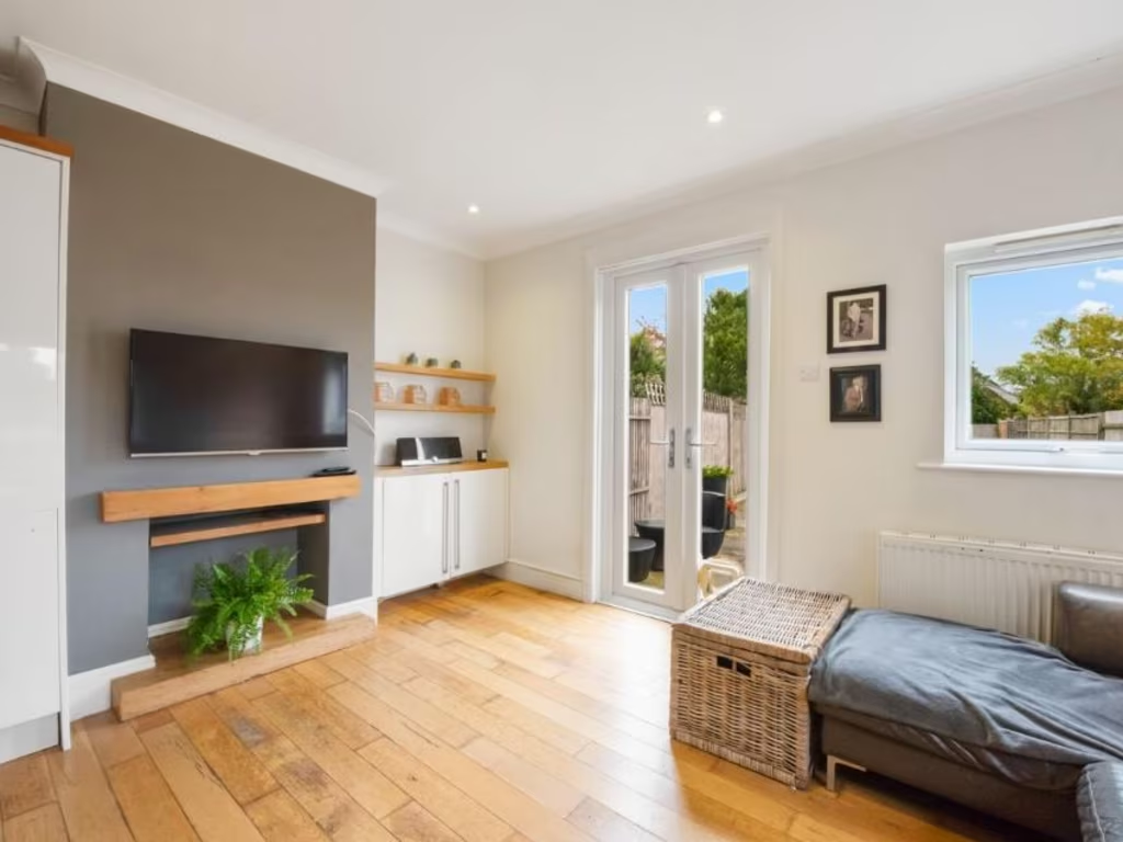
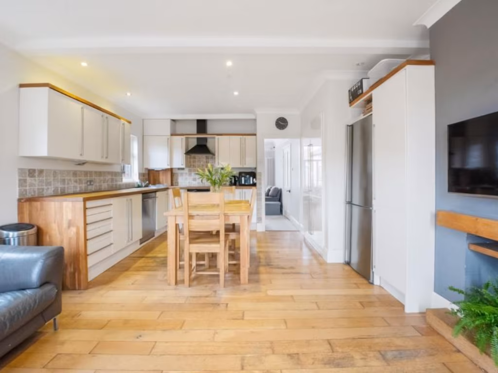
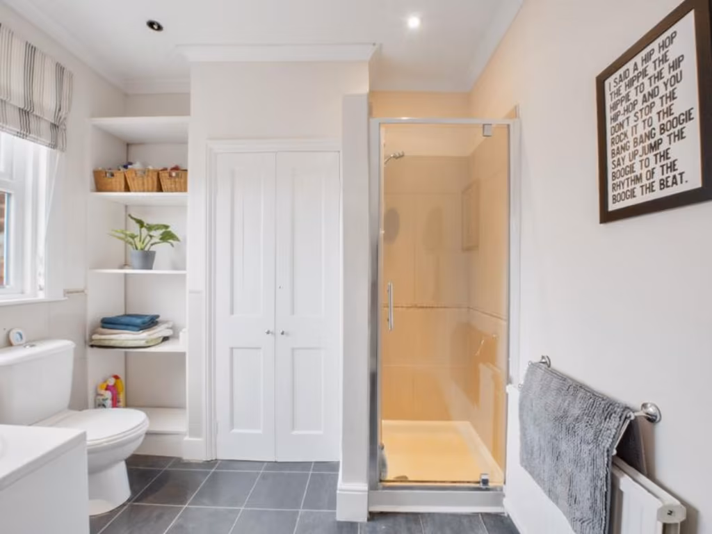
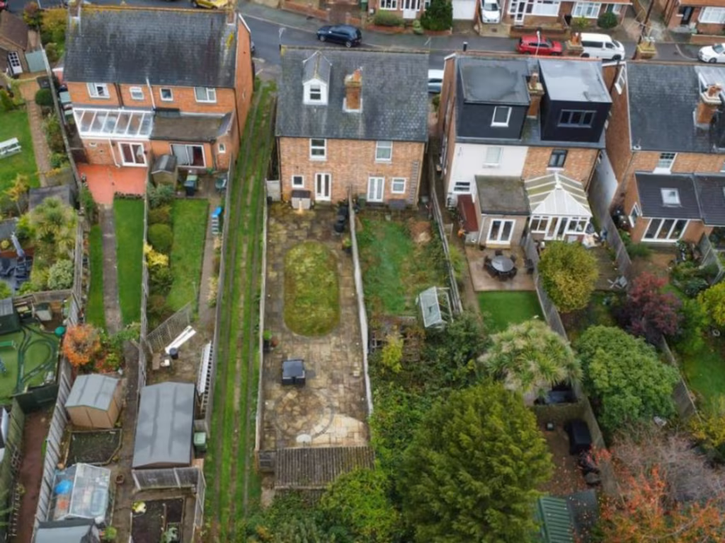
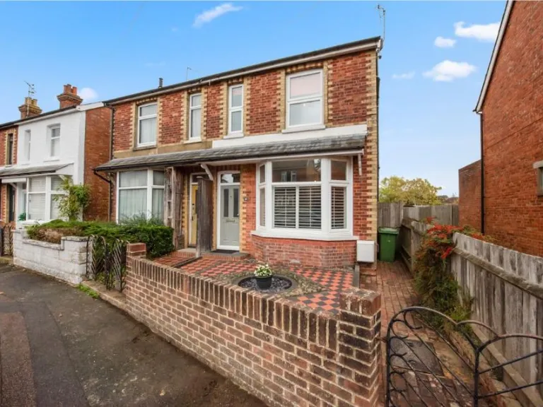
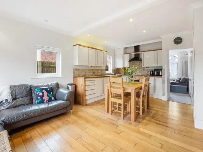
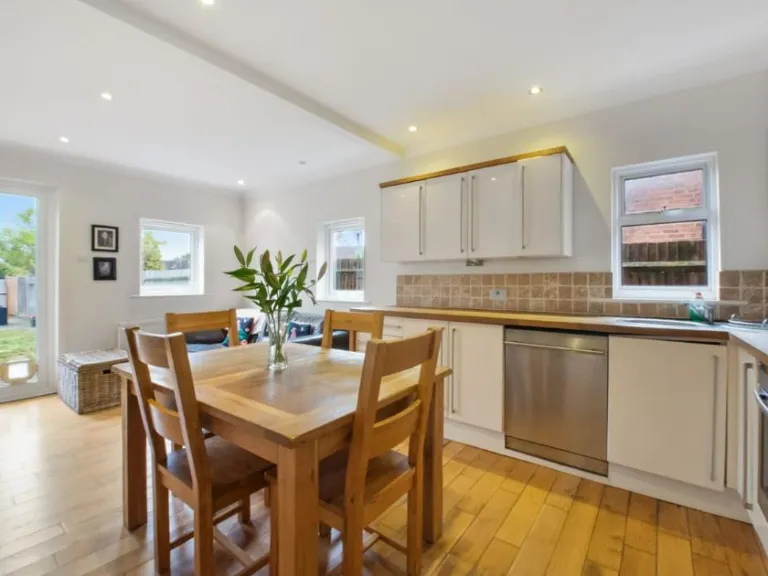
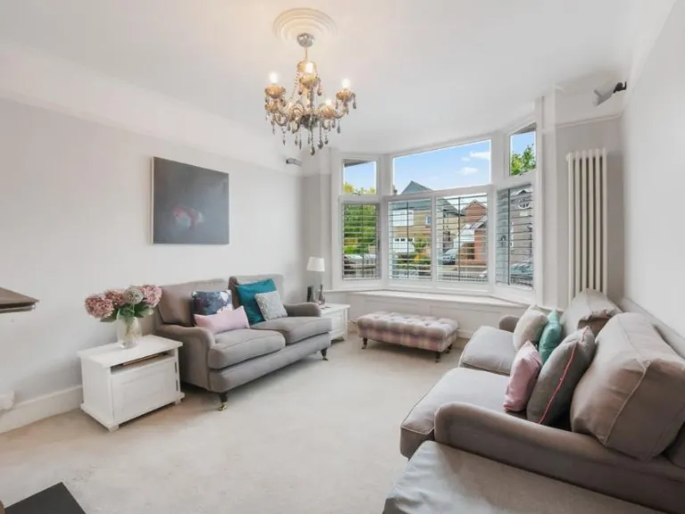
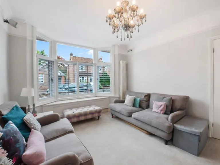
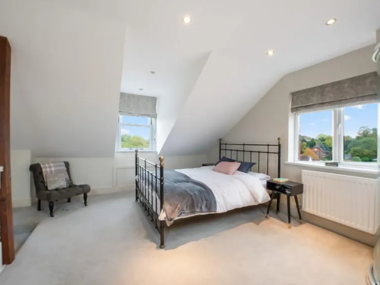
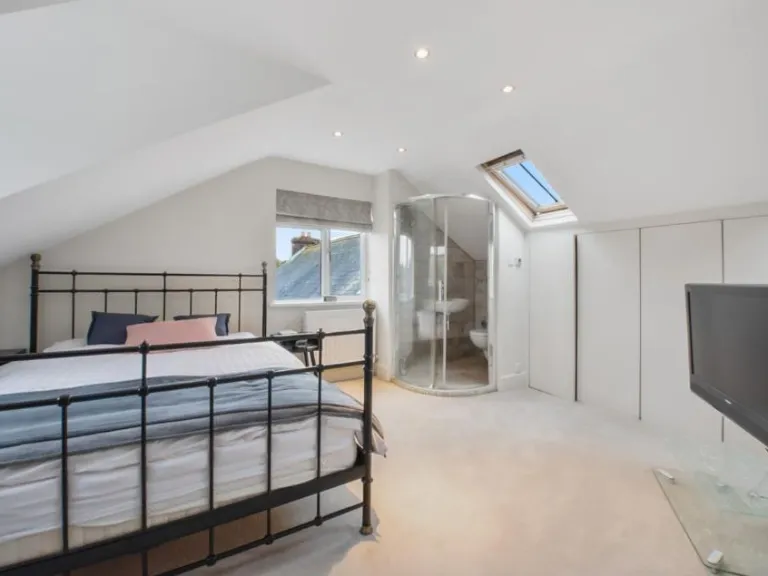
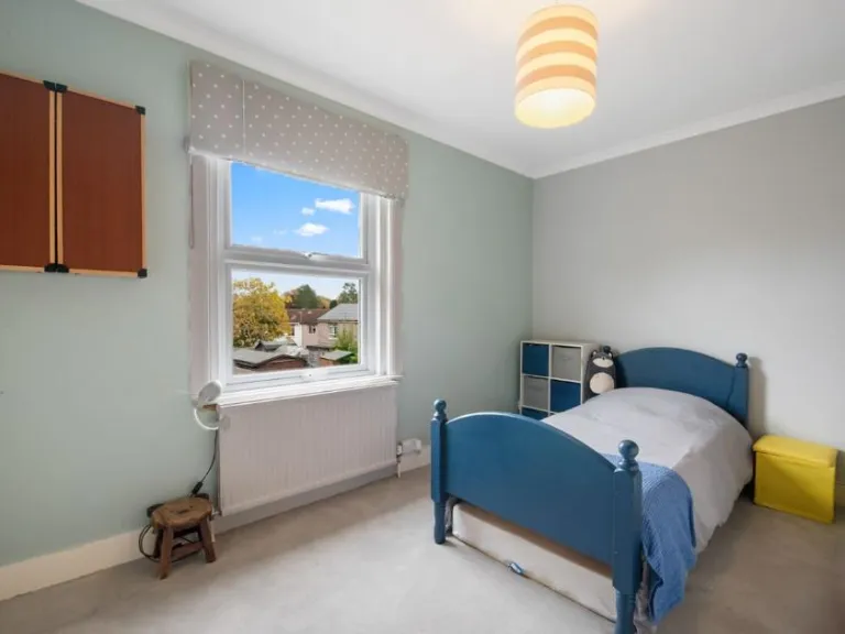
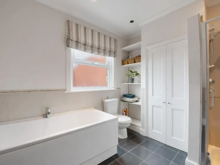
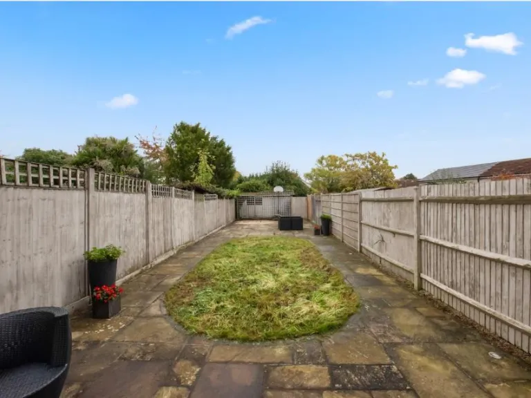
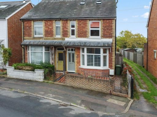
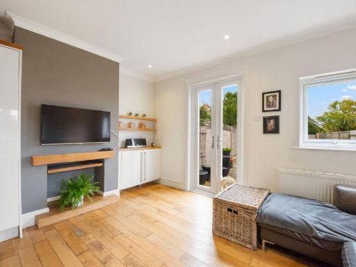
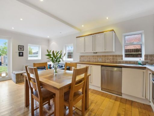
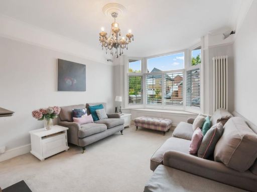
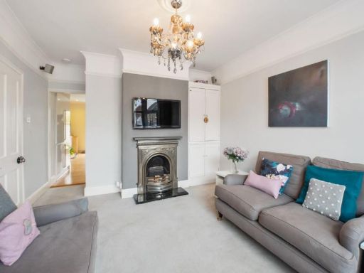
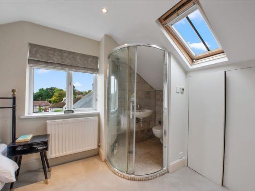
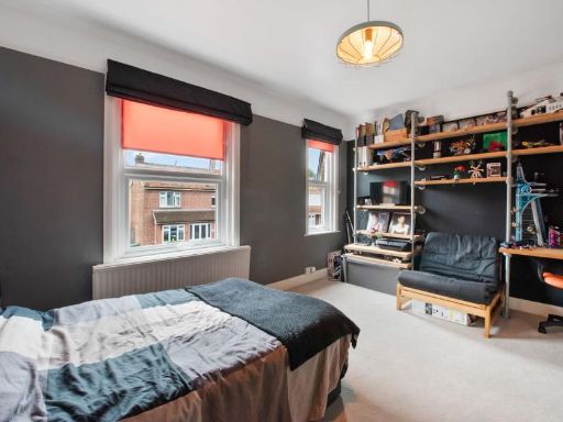
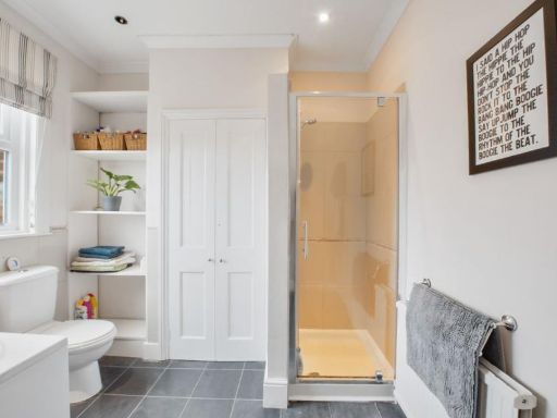
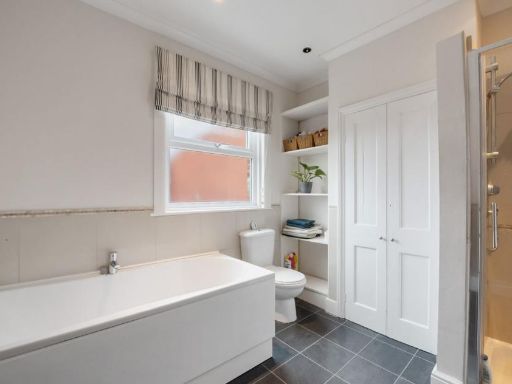
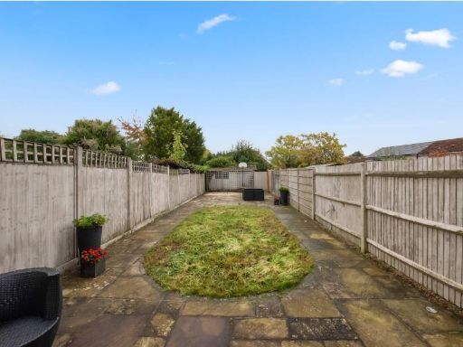
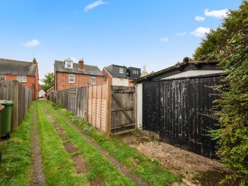
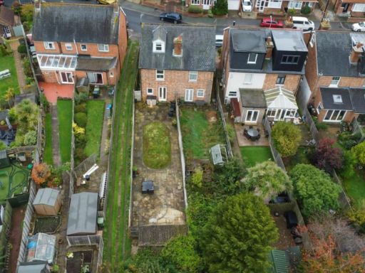
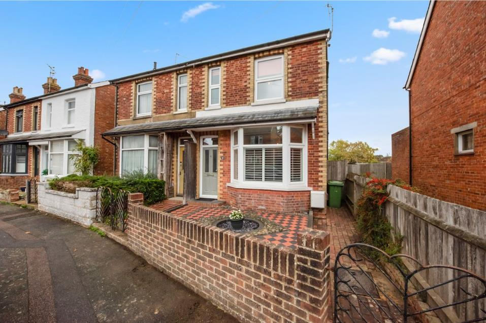
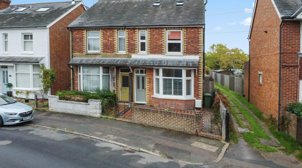
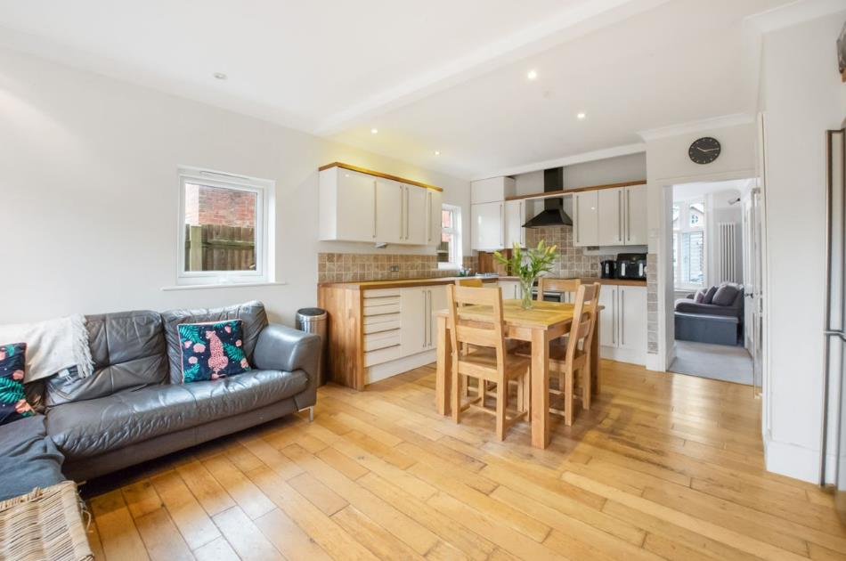
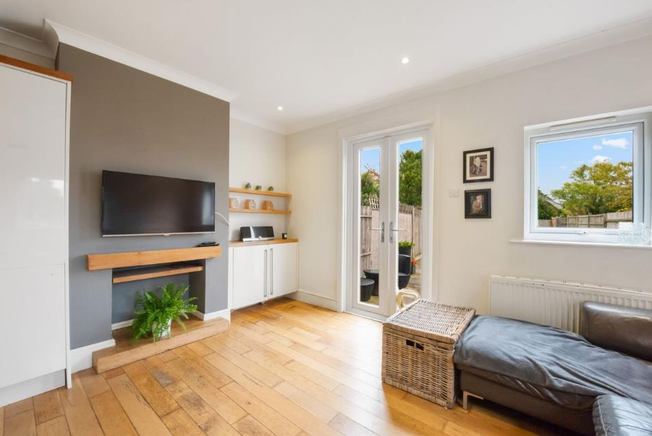
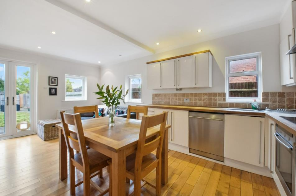
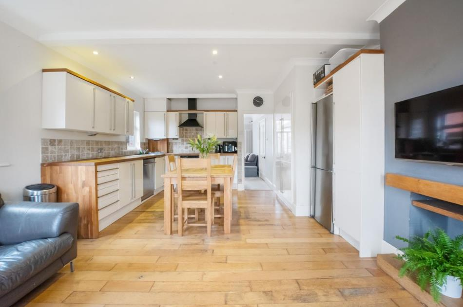
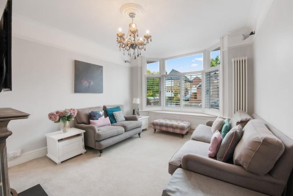
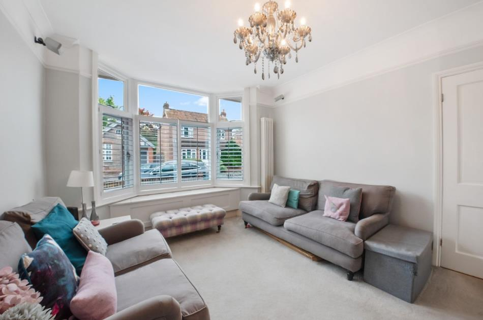
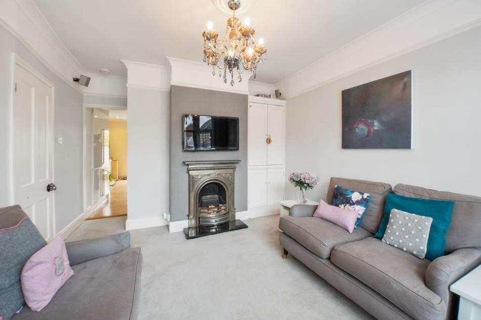
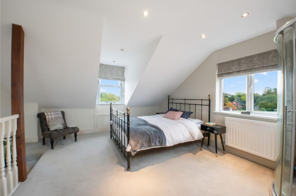
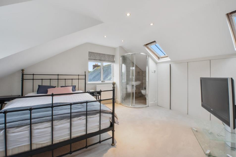
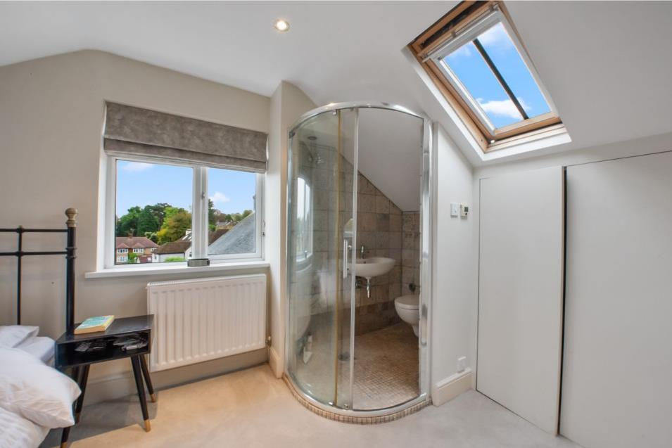
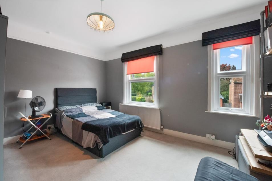
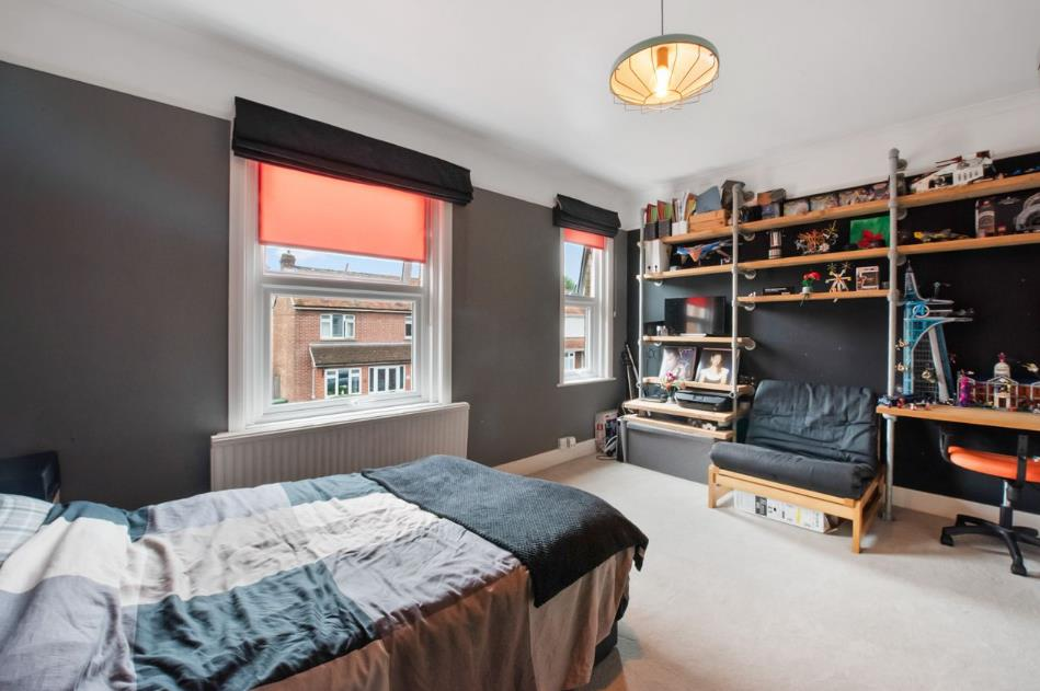
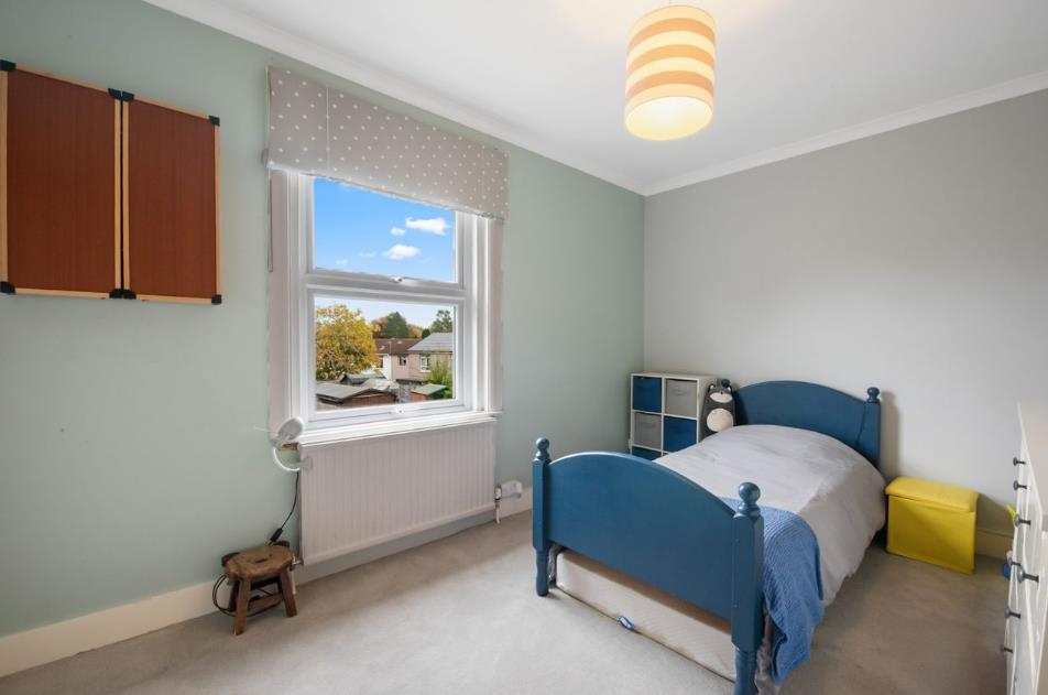
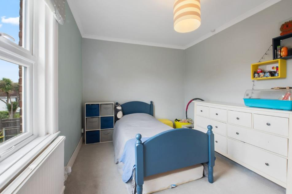
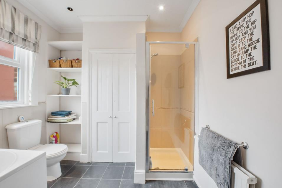
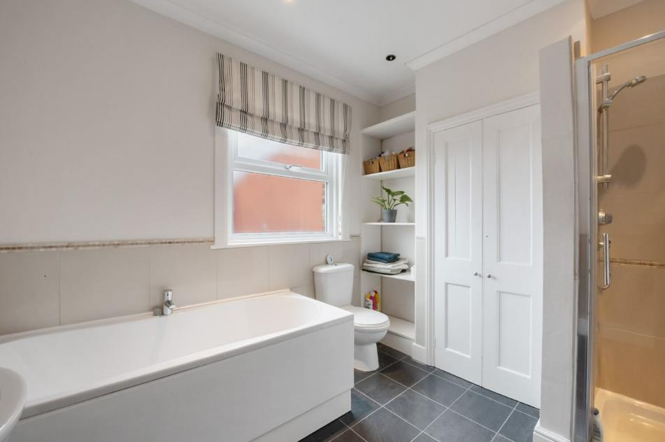
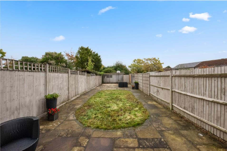
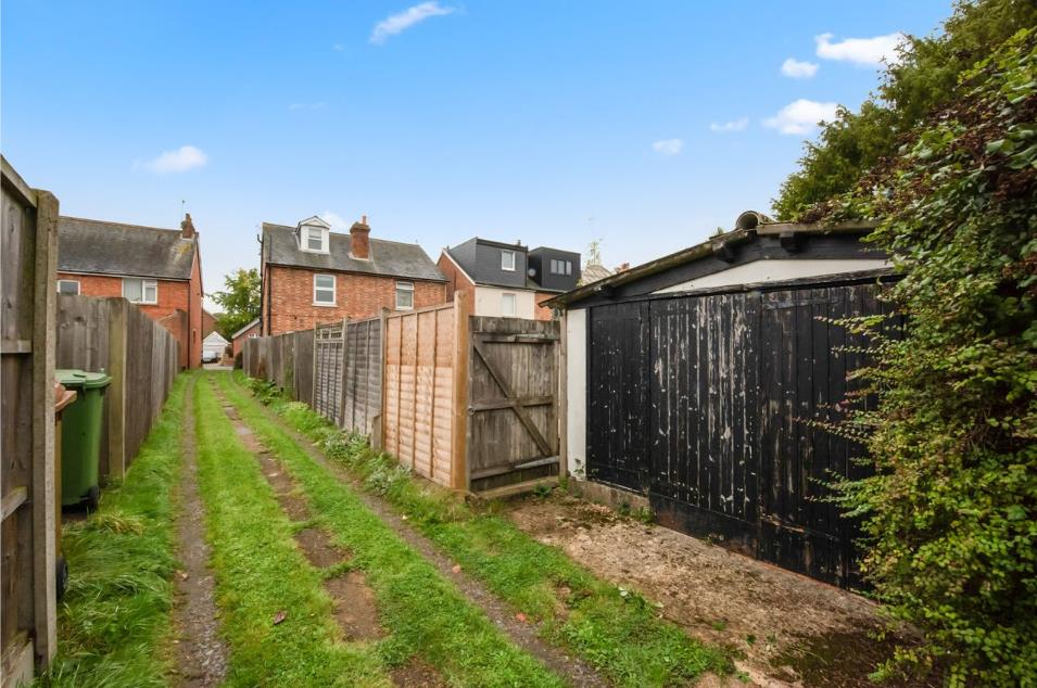
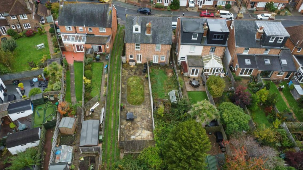
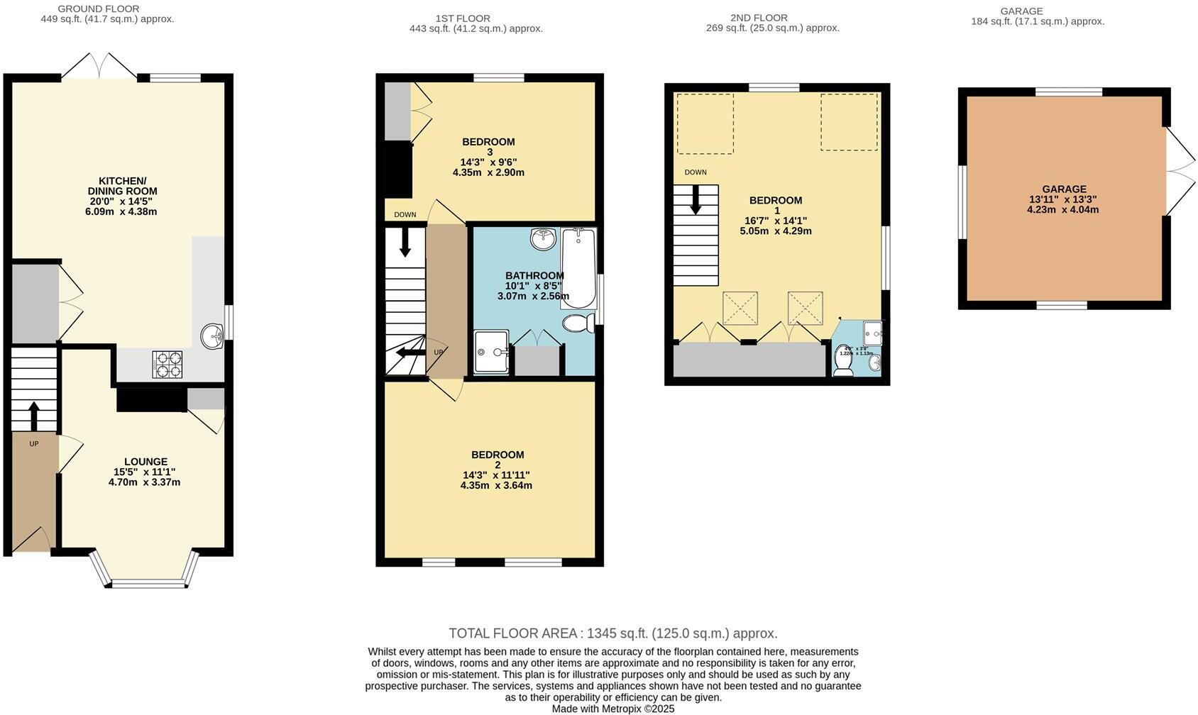
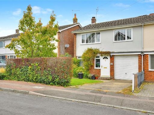
- A well-presented, period semi-detached house arranged over three floors offering approximately 1,300 sq ft of living space. The property comprises three double bedrooms, two bathrooms, a bright front lounge with large bay window and fireplace, and an open-plan kitchen/diner with timber flooring and fitted units. Benefits include double glazing, gas central heating, garage and a large rear garden with direct access from the dining room — suitable for informal family living and outdoor dining. The front of the property has a manageable paved forecourt. Overall the home combines traditional period features with practical family accommodation and a sizable rear garden, making it appropriate for a growing family or buyers seeking a period home with scope for updating.
Image Descriptions
- exterior facade of a semi-detached house Victorian
- semi-detached house Victorian
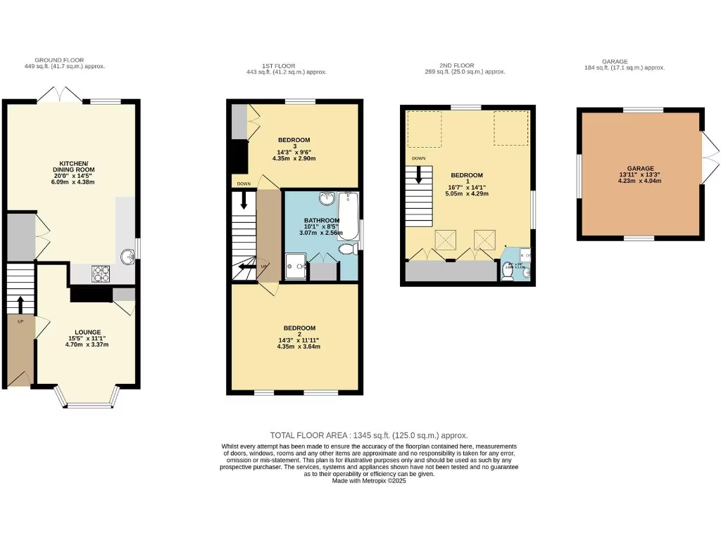
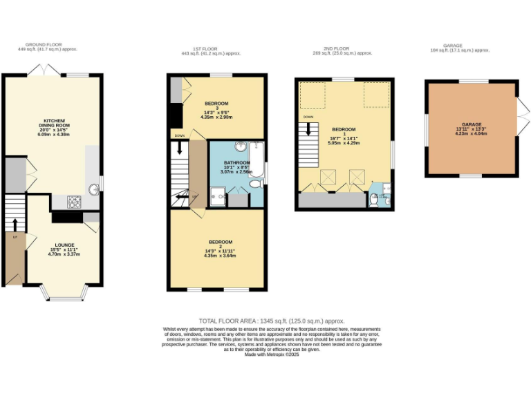
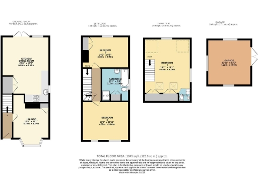
Floorplan Description
- Three-storey house with separate garage
Rooms
- KITCHEN/ DINING ROOM:
- LOUNGE:
- BEDROOM 3:
- BATHROOM:
- BEDROOM 2:
- BEDROOM 1:
- GARAGE:
Textual Property Features
Detected Visual Features
- Victorian
- semi-detached
- brick facade
- bay window
- small garden
- red brick
- period property
- brick
- pitched roof
- tile roof
- front garden
- urban
- two-storey
- traditional architecture
EPC Details
- Fully double glazed
- Cavity wall, as built, insulated (assumed)
- Boiler and radiators, mains gas
- Low energy lighting in all fixed outlets
- Solid, no insulation (assumed)
Nearby Schools
- The Wells Free School
- Rose Hill School
- Fordcombe Church of England Primary School
- Bennett Memorial Diocesan School
- Tunbridge Wells Girls' Grammar School
- St Gregory's Catholic School
- Southborough CofE Primary School
- Groombridge St Thomas' Church of England Primary School
- Holmewood House School
- Claremont Primary School
- St James' Church of England Voluntary Aided Primary School
- The Skinners' School
- Speldhurst Church of England Voluntary Aided Primary School
- St Matthew's High Brooms Church of England Voluntary Controlled Primary School
- Bidborough Church of England Voluntary Controlled Primary School
- The Mead School
- Langton Green Primary School
- Bishops Down Primary and Nursery School
- St Augustine's Catholic Primary School
- St John's Church of England Primary School
- St Mark's Church of England Primary School
- Broadwater Down Primary School
- St Barnabas CofE VA Primary School
- Tunbridge Wells Grammar School for Boys
Nearest General Shops
- Id: 138233425
- Tags:
- Building: yes
- Name: Whitehouse Renault
- Shop: car
- TagsNormalized:
- Lat: 51.130401
- Lon: 0.2452749
- FullGeoHash: u104vs485md4
- PartitionGeoHash: u104
- Images:
- FoodStandards: null
- Distance: 1453.5
,- Id: 551259073
- Tags:
- Addr:
- City: Rusthall
- Housenumber: 14
- Postcode: TN4 8RW
- Street: Rusthall High Street
- Building: yes
- Fhrs:
- Name: Oliver Greens
- Shop: yes
- Source:
- TagsNormalized:
- Lat: 51.1353725
- Lon: 0.2301822
- FullGeoHash: u104vhzt5sk6
- PartitionGeoHash: u104
- Images:
- FoodStandards: null
- Distance: 435.7
,- Id: 5323523066
- Tags:
- Addr:
- City: Rusthall
- Housenumber: 38
- Postcode: TN4 8RY
- Street: Rusthall High Street
- Fhrs:
- Name: Quarrintons
- Shop: butcher
- Source:
- TagsNormalized:
- Lat: 51.1356364
- Lon: 0.2289916
- FullGeoHash: u104vhywxvs8
- PartitionGeoHash: u104
- Images:
- FoodStandards:
- Id: 24136
- FHRSID: 24136
- LocalAuthorityBusinessID: 07420/0038/0/000
- BusinessName: The Butchery Rusthall Ltd
- BusinessType: Retailers - other
- BusinessTypeID: 4613
- AddressLine1: 38 Rusthall High Street
- AddressLine2: Rusthall
- AddressLine3: Tunbridge Wells
- AddressLine4: Kent
- PostCode: TN4 8RY
- RatingValue: 5
- RatingKey: fhrs_5_en-GB
- RatingDate: 2021-08-03
- LocalAuthorityCode: 192
- LocalAuthorityName: Tunbridge Wells
- LocalAuthorityWebSite: http://www.tunbridgewells.gov.uk
- LocalAuthorityEmailAddress: EHAdmin@Midkent.gov.uk
- Scores:
- Hygiene: 0
- Structural: 0
- ConfidenceInManagement: 0
- NewRatingPending: false
- Geocode:
- Longitude: 0.22908340000000
- Latitude: 51.13570780000000
- Distance: 412.3
}
Nearest Religious buildings
- Id: 360743100
- Tags:
- Amenity: place_of_worship
- Building: church
- Denomination: anglican
- Name: St Paul's Church Centre
- Religion: christian
- Wikidata: Q105102841
- TagsNormalized:
- place of worship
- church
- anglican
- christian
- Lat: 51.135269
- Lon: 0.2313327
- FullGeoHash: u104vkbkw3n1
- PartitionGeoHash: u104
- Images:
- FoodStandards: null
- Distance: 456.6
,- Id: 551259072
- Tags:
- Addr:
- Street: Rusthall High Street
- Amenity: place_of_worship
- Building: yes
- Name: Rusthall URC Church
- TagsNormalized:
- Lat: 51.1353861
- Lon: 0.2304382
- FullGeoHash: u104vhzv1wg5
- PartitionGeoHash: u104
- Images:
- FoodStandards: null
- Distance: 435.1
,- Id: 751991866
- Tags:
- Amenity: place_of_worship
- Name: Rusthall Evangelical Church
- Religion: christian
- TagsNormalized:
- place of worship
- church
- evangelical
- christian
- Lat: 51.1390174
- Lon: 0.2297125
- FullGeoHash: u104vjx62ey1
- PartitionGeoHash: u104
- Images:
- FoodStandards: null
- Distance: 36.3
}
Nearest Medical buildings
- Id: 833163884
- Tags:
- Addr:
- City: Speldhurst
- Housename: The Old Bakery
- Postcode: TN3 0PQ
- Street: Penshurst Road
- Amenity: doctors
- Building: yes
- Fax: +44 1892 861 462
- Healthcare: doctor
- Name: The Old Bakery Surgery
- Operator: Doctor Sawyer and Partners
- Phone: +44 1892 863 040
- TagsNormalized:
- doctor
- doctors
- health
- healthcare
- bakery
- surgery
- Lat: 51.1520239
- Lon: 0.2165547
- FullGeoHash: u104uzvwnh6u
- PartitionGeoHash: u104
- Images:
- FoodStandards: null
- Distance: 1698.5
,- Id: 138244830
- Tags:
- Amenity: doctors
- Building: yes
- Name: Rusthall Medical Centre
- Source: bing
- TagsNormalized:
- Lat: 51.1359522
- Lon: 0.2246725
- FullGeoHash: u104vj58e0ru
- PartitionGeoHash: u104
- Images:
- FoodStandards: null
- Distance: 525.3
,- Id: 551259070
- Tags:
- Addr:
- Street: Rusthall High Street
- Amenity: pharmacy
- Building: yes
- Name: Rusthall Chemists
- TagsNormalized:
- Lat: 51.1352232
- Lon: 0.2311094
- FullGeoHash: u104vkbk30rx
- PartitionGeoHash: u104
- Images:
- FoodStandards: null
- Distance: 458.7
,- Id: 5323523068
- Tags:
- Amenity: veterinary
- Name: Rusthall Veterinary Surgery
- Phone: +44 1892 511715
- TagsNormalized:
- Lat: 51.1385168
- Lon: 0.2307778
- FullGeoHash: u104vm2p3w2r
- PartitionGeoHash: u104
- Images:
- FoodStandards: null
- Distance: 101.6
}
Nearest Airports
- Id: 260720166
- Tags:
- Aerodrome: international
- Aeroway: aerodrome
- Alt_name: Gatwick Airport
- Ele: 62
- Iata: LGW
- Icao: EGKK
- Internet_access: wlan
- Internet_access:fee: no
- Internet_access:ssid: Gatwick FREE Wi-Fi
- Name: London Gatwick Airport
- Operator: Gatwick Airport Limited
- Ref: LGW
- Website: https://www.gatwickairport.com/
- Wikidata: Q8703
- Wikipedia: en:Gatwick Airport
- TagsNormalized:
- airport
- international airport
- Lat: 51.1540917
- Lon: -0.1883773
- FullGeoHash: gcpg58qf4mzd
- PartitionGeoHash: gcpg
- Images:
- FoodStandards: null
- Distance: 29230.6
}
Nearest Leisure Facilities
- Id: 162777243
- Tags:
- Leisure: pitch
- Sport: soccer
- TagsNormalized:
- Lat: 51.1413164
- Lon: 0.2261625
- FullGeoHash: u104vjuxvbqg
- PartitionGeoHash: u104
- Images:
- FoodStandards: null
- Distance: 350
,- Id: 162777235
- Tags:
- TagsNormalized:
- Lat: 51.1413979
- Lon: 0.227022
- FullGeoHash: u104vnj21zxc
- PartitionGeoHash: u104
- Images:
- FoodStandards: null
- Distance: 313.3
,- Id: 162778249
- Tags:
- Leisure: pitch
- Sport: basketball
- TagsNormalized:
- pitch
- leisure
- basketball
- sports
- Lat: 51.1404872
- Lon: 0.2262495
- FullGeoHash: u104vjudzvzb
- PartitionGeoHash: u104
- Images:
- FoodStandards: null
- Distance: 293.7
,- Id: 138170687
- Tags:
- TagsNormalized:
- Lat: 51.1408172
- Lon: 0.2274055
- FullGeoHash: u104vjvsfgmc
- PartitionGeoHash: u104
- Images:
- FoodStandards: null
- Distance: 248.3
,- Id: 60414631
- Tags:
- TagsNormalized:
- Lat: 51.1385969
- Lon: 0.230001
- FullGeoHash: u104vjrrzmmh
- PartitionGeoHash: u104
- Images:
- FoodStandards: null
- Distance: 77
}
Nearest Tourist attractions
- Id: 2187783865
- Tags:
- Name: The Amelia Scott
- Opening_hours: Tu-Sa 09:30-17:00
- Tourism: museum
- TagsNormalized:
- Lat: 51.1332844
- Lon: 0.2640556
- FullGeoHash: u104yh82bzn4
- PartitionGeoHash: u104
- Images:
- FoodStandards: null
- Distance: 2468.1
,- Id: 680448673
- Tags:
- Access: permissive
- Addr:
- Name: Adamswell Scout Camp
- Operator: Scout Association
- Tourism: camp_site
- TagsNormalized:
- Lat: 51.1203578
- Lon: 0.2117285
- FullGeoHash: u104uf4jttkh
- PartitionGeoHash: u104
- Images:
- FoodStandards: null
- Distance: 2461.2
,- Id: 434453694
- Tags:
- TagsNormalized:
- Lat: 51.1363678
- Lon: 0.2489702
- FullGeoHash: u104vtj6cmve
- PartitionGeoHash: u104
- Images:
- FoodStandards: null
- Distance: 1362.8
}
Nearest Hotels
- Id: 547749663
- Tags:
- Addr:
- City: Frant
- Place: Broadwater Forest
- Postcode: TN3 9JJ
- Street: High Rocks Lane
- Amenity: pub
- Building: yes
- Fhrs:
- Name: High Rocks
- Source:
- Tourism: hotel
- Wikidata: Q26279422
- TagsNormalized:
- Lat: 51.12277
- Lon: 0.2255161
- FullGeoHash: u104v4s5wzhc
- PartitionGeoHash: u104
- Images:
- FoodStandards: null
- Distance: 1863.4
,- Id: 5109069458
- Tags:
- Addr:
- Housenumber: 84
- Postcode: TN4 8BU
- Street: Mount Ephraim
- Brand: Travelodge
- Brand:wikidata: Q9361374
- Brand:wikipedia: en:Travelodge UK
- Fhrs:
- Authority: Tunbridge Wells
- Id: 22837
- Local_authority_id: 07/00338/MIXED
- Internet_access: wlan
- Internet_access:fee: customers
- Internet_access:ssid: Travelodge WiFi
- Name: Travelodge
- Tourism: hotel
- TagsNormalized:
- Lat: 51.1312319
- Lon: 0.253081
- FullGeoHash: u104vu0m10qy
- PartitionGeoHash: u104
- Images:
- FoodStandards: null
- Distance: 1842.8
,- Id: 138226898
- Tags:
- Addr:
- City: Royal Tunbridge Wells
- Postcode: TN4 8XJ
- Street: Langton Road
- Building: yes
- Fhrs:
- Name: The Spa Hotel
- Source: survey
- Source:addr: FHRS Open Data
- Source:geometry: Bing
- Stars: 4
- Tourism: hotel
- Website: https://www.spahotel.co.uk
- TagsNormalized:
- Lat: 51.1308018
- Lon: 0.2462218
- FullGeoHash: u104vs5692k3
- PartitionGeoHash: u104
- Images:
- FoodStandards: null
- Distance: 1473.7
}
Tags
- Victorian
- semi-detached
- brick facade
- bay window
- small garden
- red brick
- period property
- Victorian
- semi-detached
- brick
- bay window
- pitched roof
- tile roof
- front garden
- urban
- two-storey
- traditional architecture
Local Market Stats
- Average Price/sqft: £448
- Avg Income: £58000
- Rental Yield: 4.3%
- Social Housing: 13%
- Planning Success Rate: 95%
AirBnB Data
- 1km average: £161/night
- Listings in 1km: 2
Similar Properties
 4 bedroom semi-detached house for sale in Westwood Road, Tunbridge Wells, Kent, TN4 — £550,000 • 4 bed • 2 bath • 819 ft²
 3 bedroom semi-detached house for sale in Southwood Road, Tunbridge Wells, TN4 — £410,000 • 3 bed • 2 bath • 540 ft²
 3 bedroom semi-detached house for sale in Manor Road, Rusthall, Tunbridge Wells, TN4 — £475,000 • 3 bed • 1 bath • 929 ft²
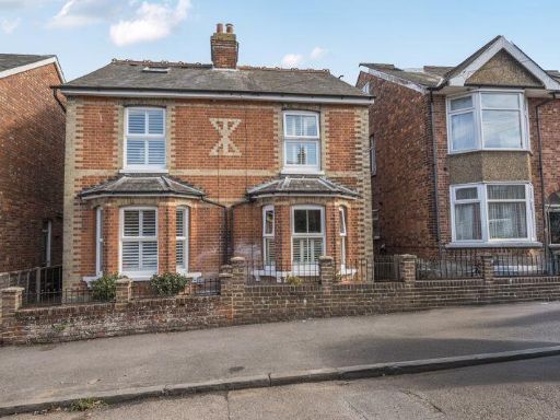 3 bedroom semi-detached house for sale in Erskine Park Road, Tunbridge Wells, TN4 8UR, TN4 — £475,000 • 3 bed • 1 bath • 1165 ft²
 3 bedroom semi-detached house for sale in Erskine Park Road, Tunbridge Wells, TN4 — £375,000 • 3 bed • 1 bath • 1050 ft²
 5 bedroom semi-detached house for sale in Lower Green Road, Tunbridge Wells, TN4 — £1,175,000 • 5 bed • 2 bath • 2481 ft²
Meta
- {
"@context": "https://schema.org",
"@type": "Residence",
"name": "3 bedroom house for sale in Westwood Road, Tunbridge Wells,…",
"description": "",
"url": "https://propertypiper.co.uk/property/f574f7fb-fea2-45ce-8aae-a2a4c2966c90",
"image": "https://image-a.propertypiper.co.uk/a730e648-eaaf-4a0e-a811-bccea6552ec3-1024.jpeg",
"address": {
"@type": "PostalAddress",
"streetAddress": "12 WESTWOOD ROAD RUSTHALL TUNBRIDGE WELLS",
"postalCode": "TN4 8TP",
"addressLocality": "Tunbridge Wells",
"addressRegion": "Tunbridge Wells",
"addressCountry": "England"
},
"geo": {
"@type": "GeoCoordinates",
"latitude": 51.13928952938345,
"longitude": 0.2300008636137264
},
"numberOfRooms": 3,
"numberOfBathroomsTotal": 2,
"floorSize": {
"@type": "QuantitativeValue",
"value": 1300,
"unitCode": "FTK"
},
"offers": {
"@type": "Offer",
"price": 545000,
"priceCurrency": "GBP",
"availability": "https://schema.org/InStock"
},
"additionalProperty": [
{
"@type": "PropertyValue",
"name": "Feature",
"value": "Victorian"
},
{
"@type": "PropertyValue",
"name": "Feature",
"value": "semi-detached"
},
{
"@type": "PropertyValue",
"name": "Feature",
"value": "brick facade"
},
{
"@type": "PropertyValue",
"name": "Feature",
"value": "bay window"
},
{
"@type": "PropertyValue",
"name": "Feature",
"value": "small garden"
},
{
"@type": "PropertyValue",
"name": "Feature",
"value": "red brick"
},
{
"@type": "PropertyValue",
"name": "Feature",
"value": "period property"
},
{
"@type": "PropertyValue",
"name": "Feature",
"value": "Victorian"
},
{
"@type": "PropertyValue",
"name": "Feature",
"value": "semi-detached"
},
{
"@type": "PropertyValue",
"name": "Feature",
"value": "brick"
},
{
"@type": "PropertyValue",
"name": "Feature",
"value": "bay window"
},
{
"@type": "PropertyValue",
"name": "Feature",
"value": "pitched roof"
},
{
"@type": "PropertyValue",
"name": "Feature",
"value": "tile roof"
},
{
"@type": "PropertyValue",
"name": "Feature",
"value": "front garden"
},
{
"@type": "PropertyValue",
"name": "Feature",
"value": "urban"
},
{
"@type": "PropertyValue",
"name": "Feature",
"value": "two-storey"
},
{
"@type": "PropertyValue",
"name": "Feature",
"value": "traditional architecture"
}
]
}
High Res Floorplan Images
Compatible Floorplan Images
FloorplanImages Thumbnail