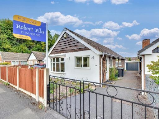
NG3 7FX - 3 bedroom detached bungalow for sale in Greenwood Avenue, N…
View on Property Piper
3 bedroom detached bungalow for sale in Greenwood Avenue, Nottingham, NG3
Property Details
- Price: £280000
- Bedrooms: 3
- Bathrooms: 1
- Property Type: undefined
- Property SubType: undefined
Image Descriptions
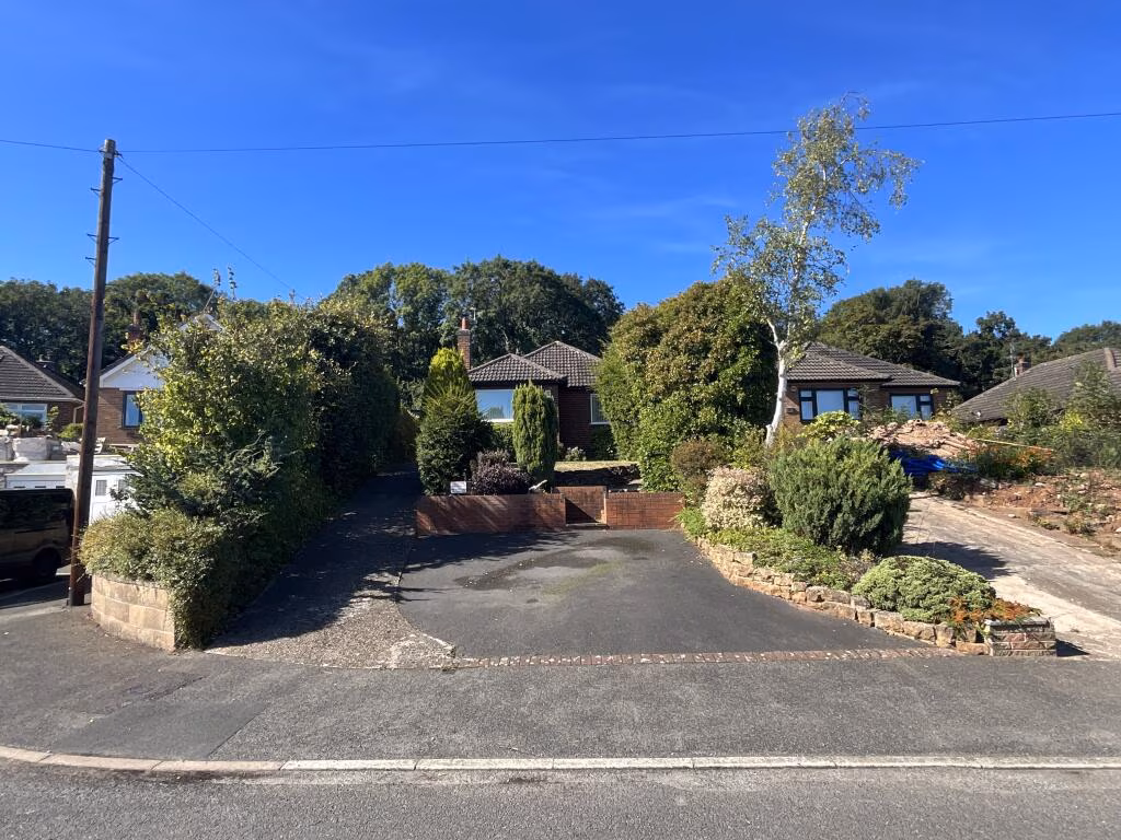
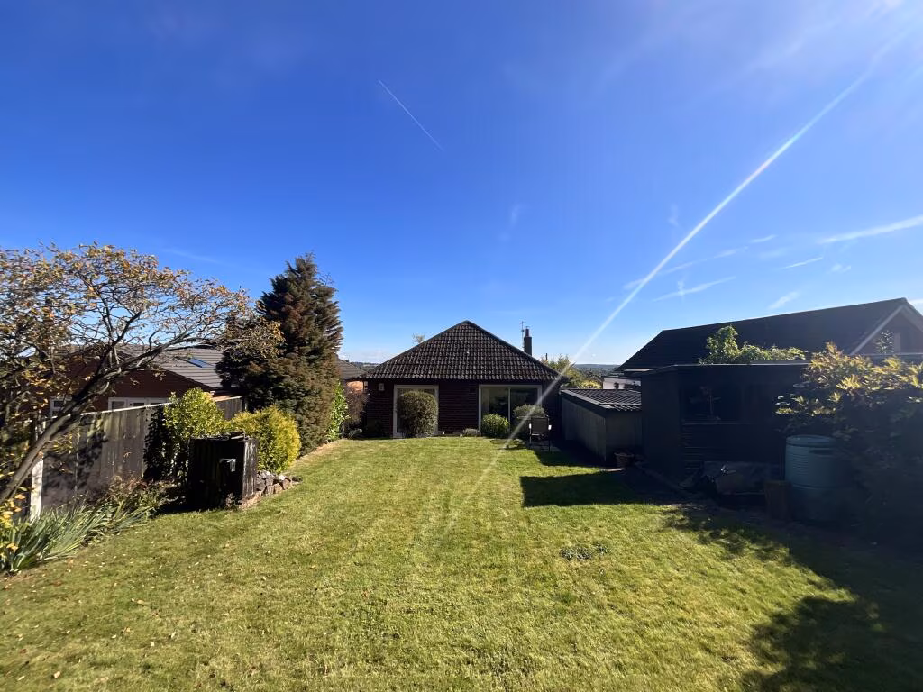
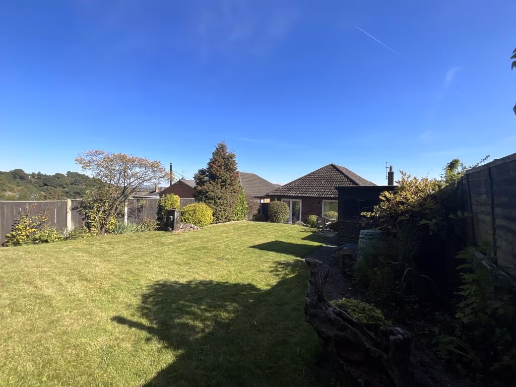
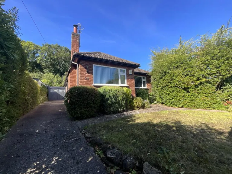
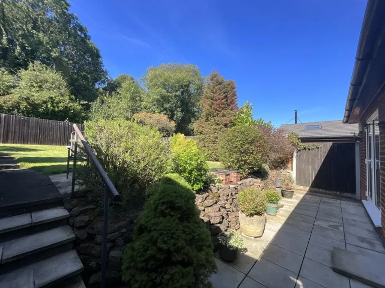
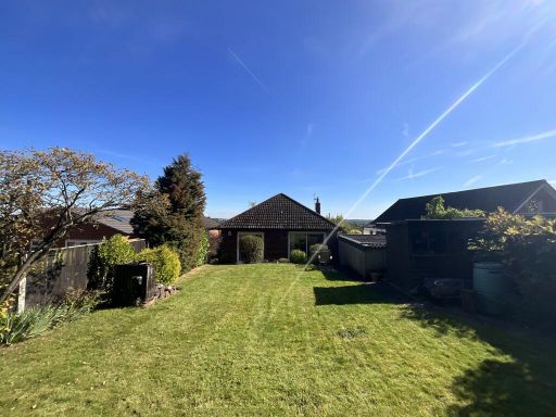
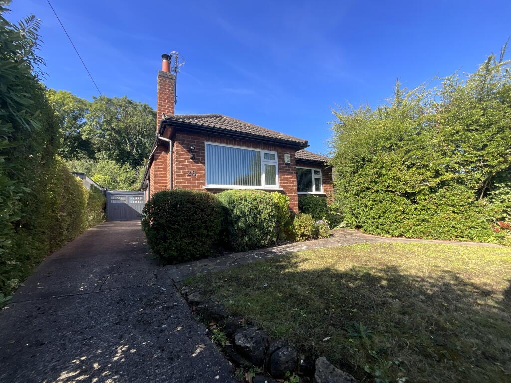
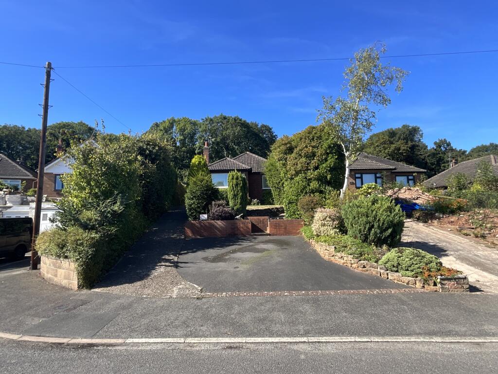
- detached bungalow mid-20th century
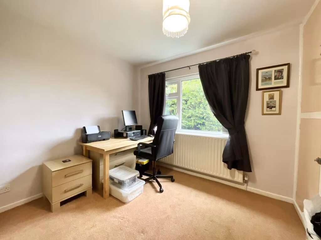
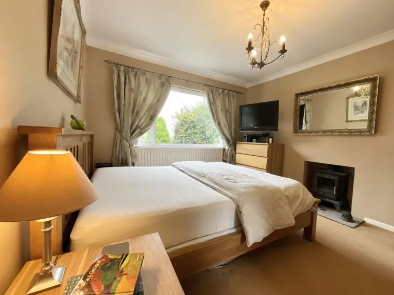
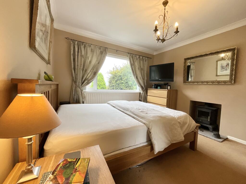
- bedroom modern
Floorplan Description
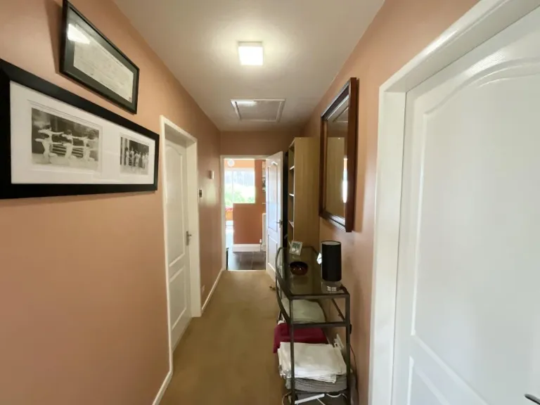
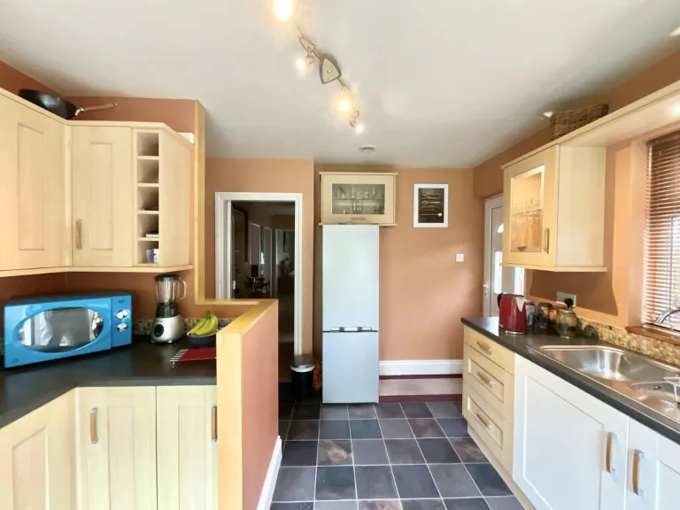
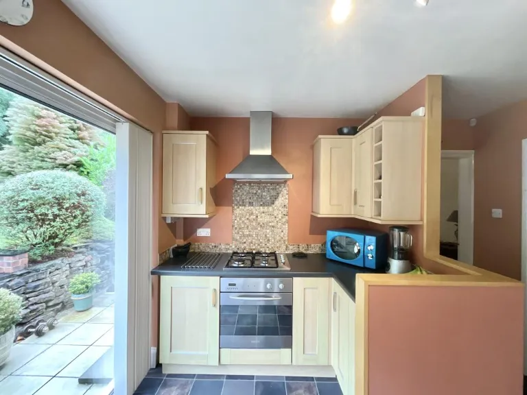
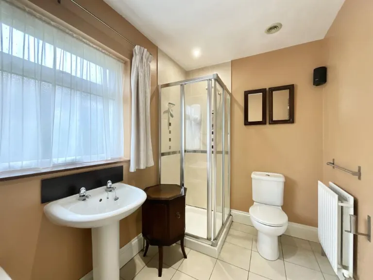
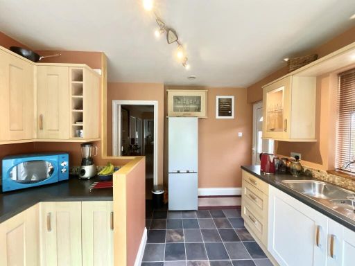
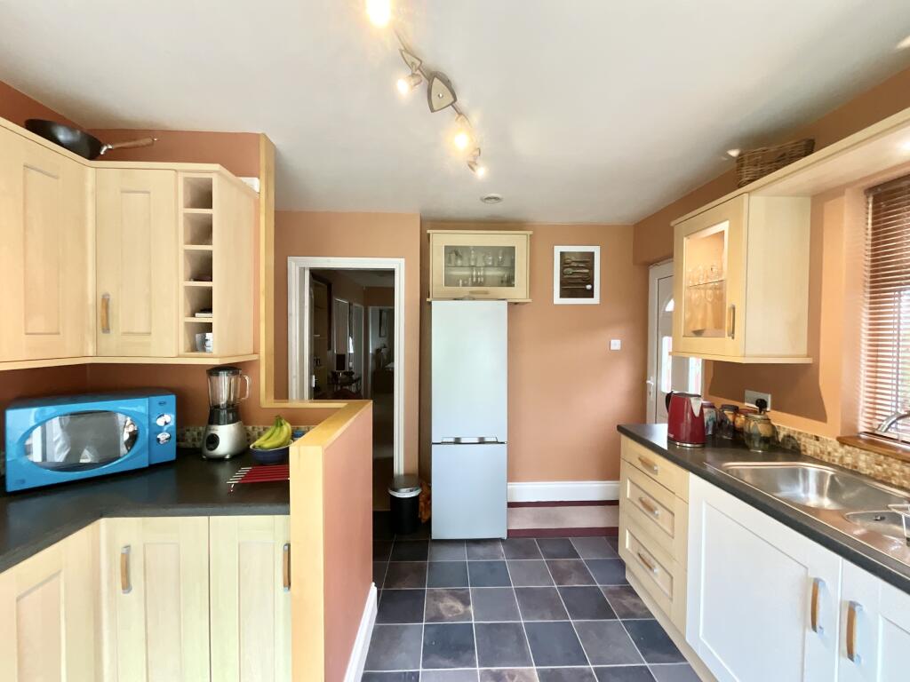
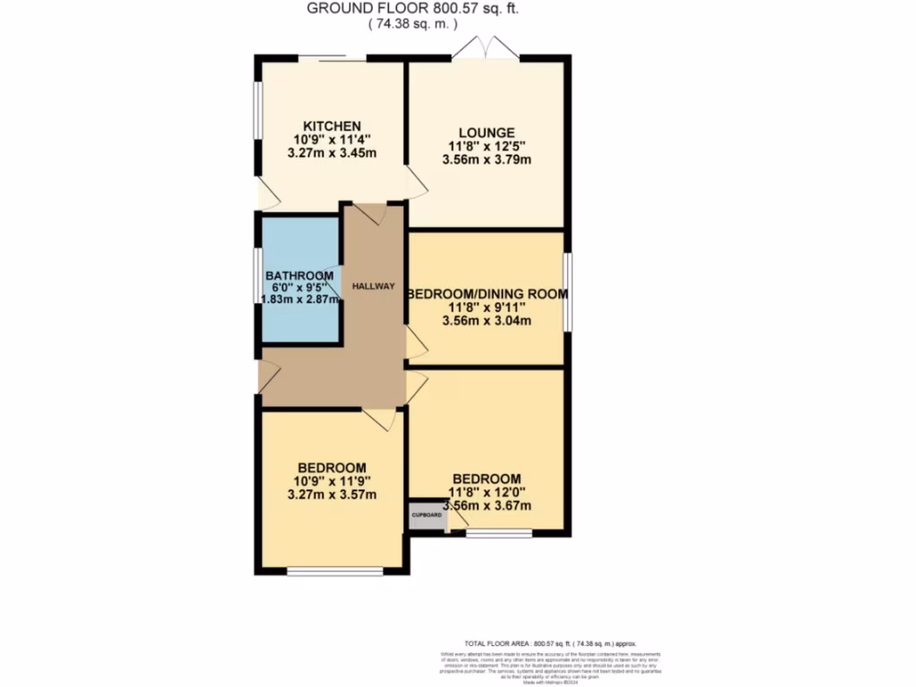
- Ground floor flat with kitchen, lounge, bathroom and three bedrooms (one used as dining).
Rooms
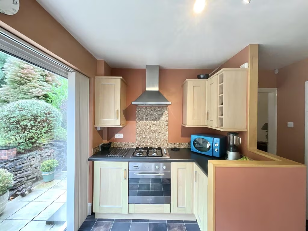
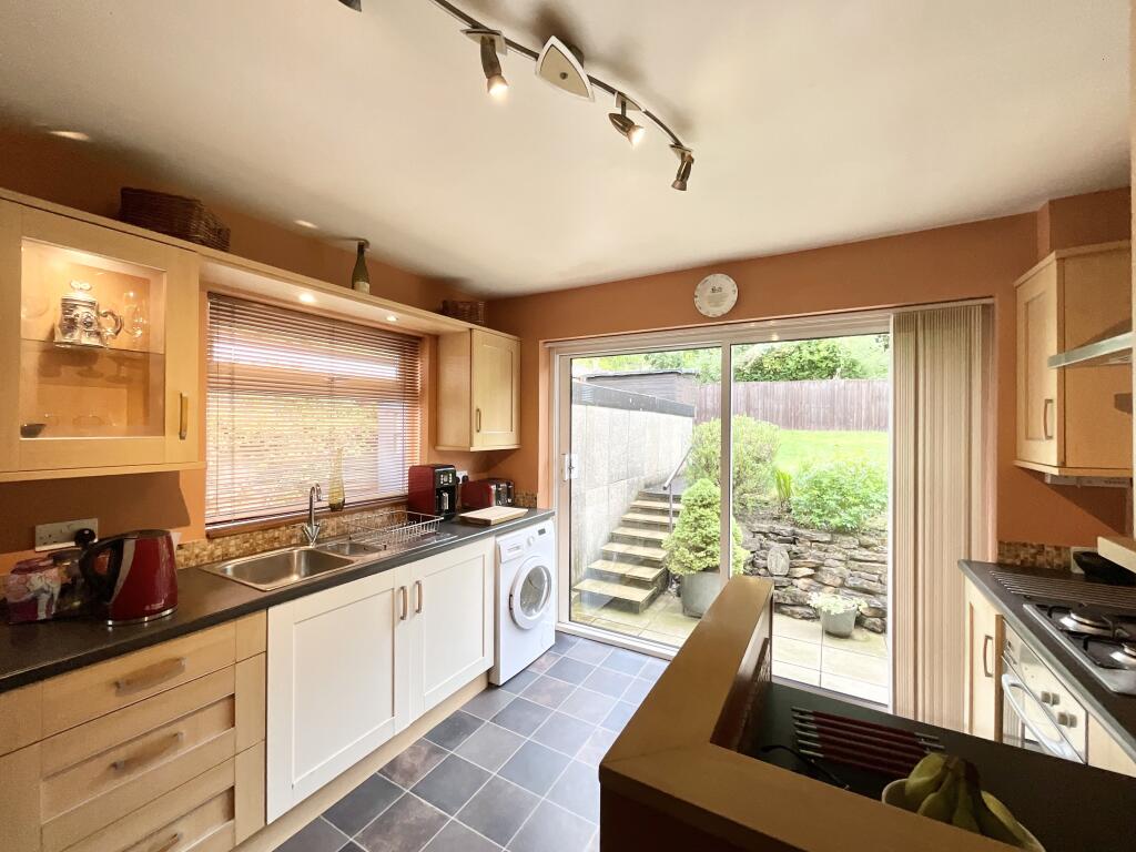
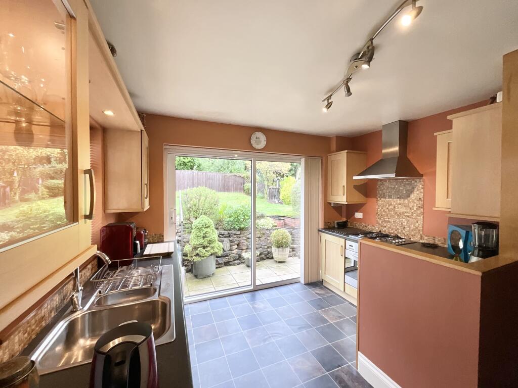
- KITCHEN:
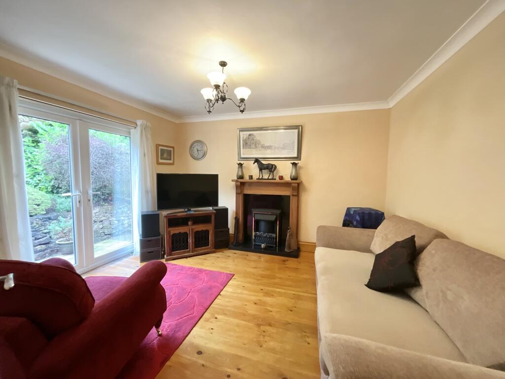
- LOUNGE:
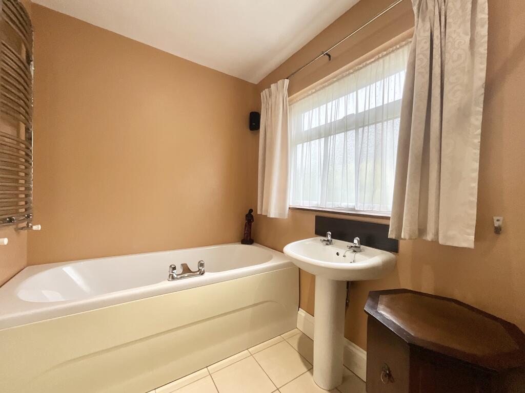
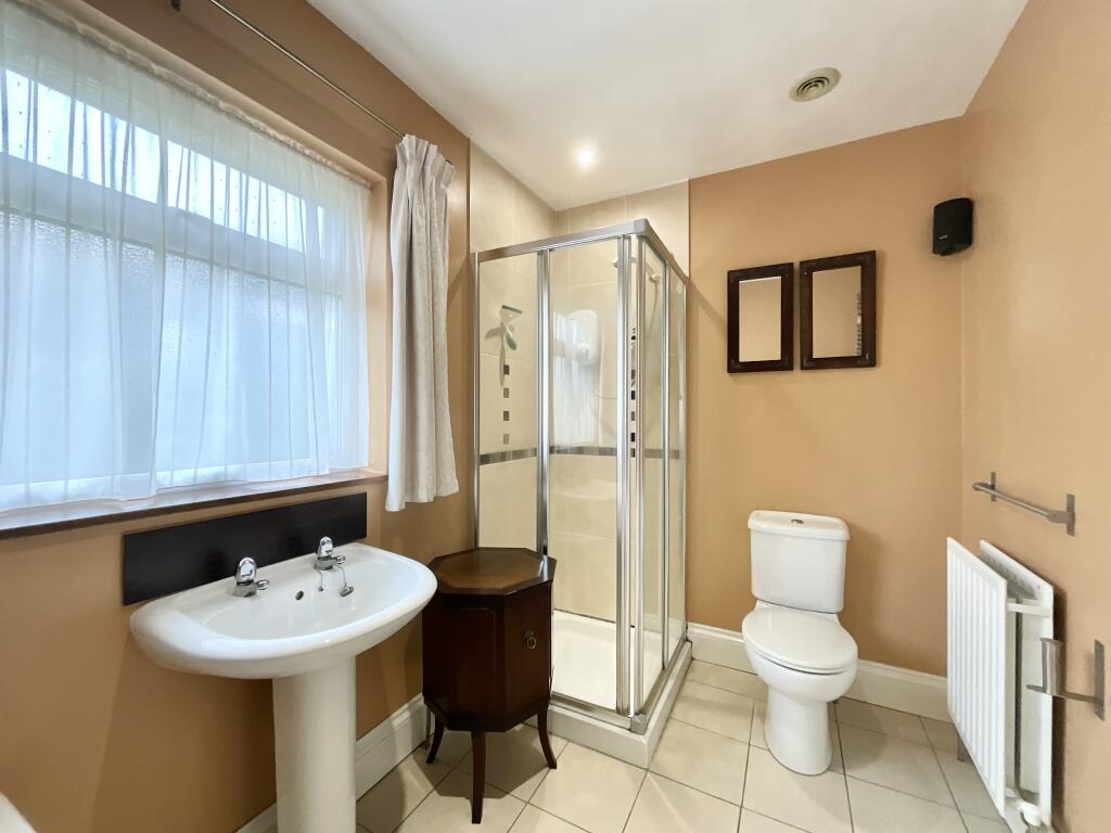
- BATHROOM:
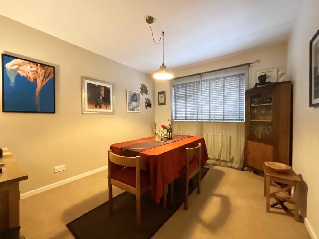
- BEDROOM/DINING ROOM:
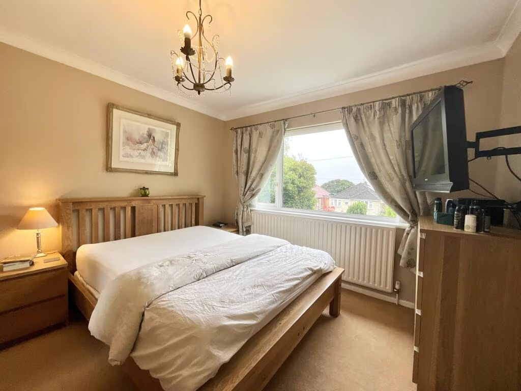
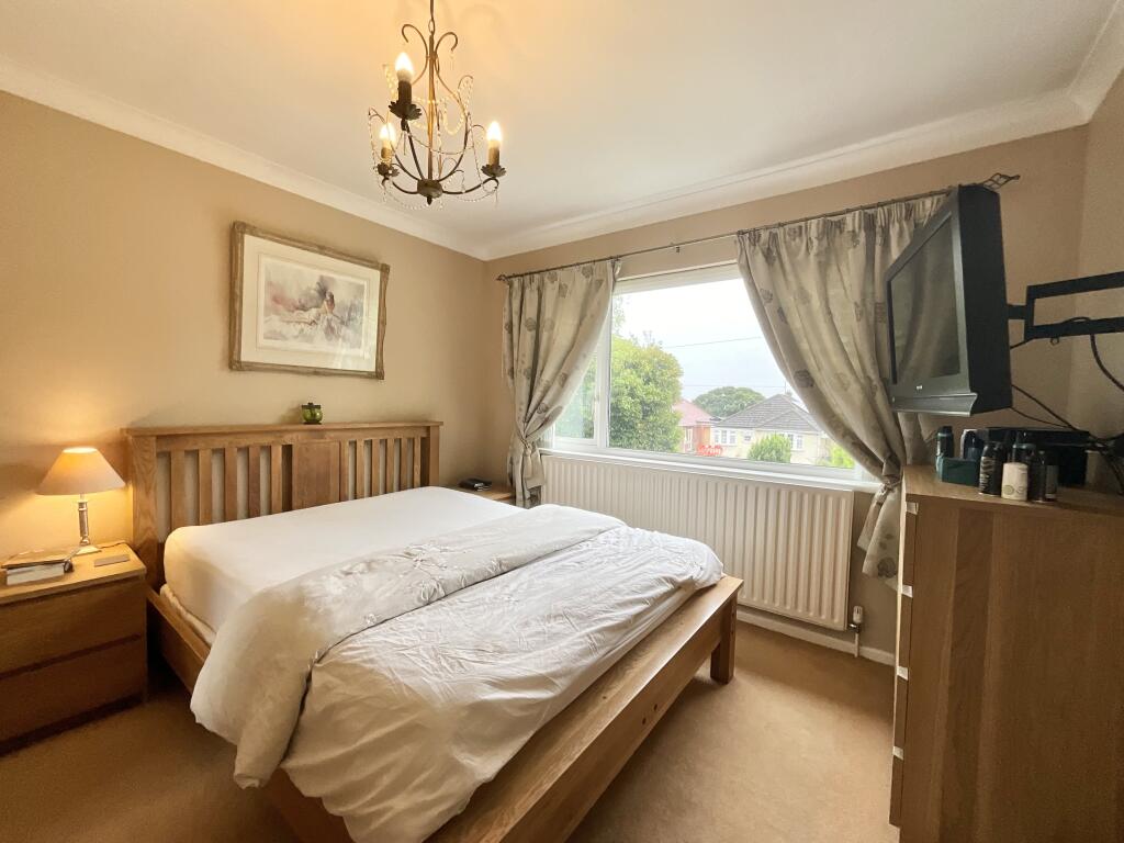
- BEDROOM:
- BEDROOM:
Textual Property Features
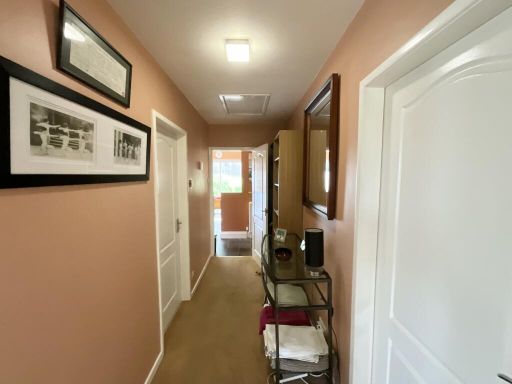
Detected Visual Features
- detached
- bungalow
- brick
- garage
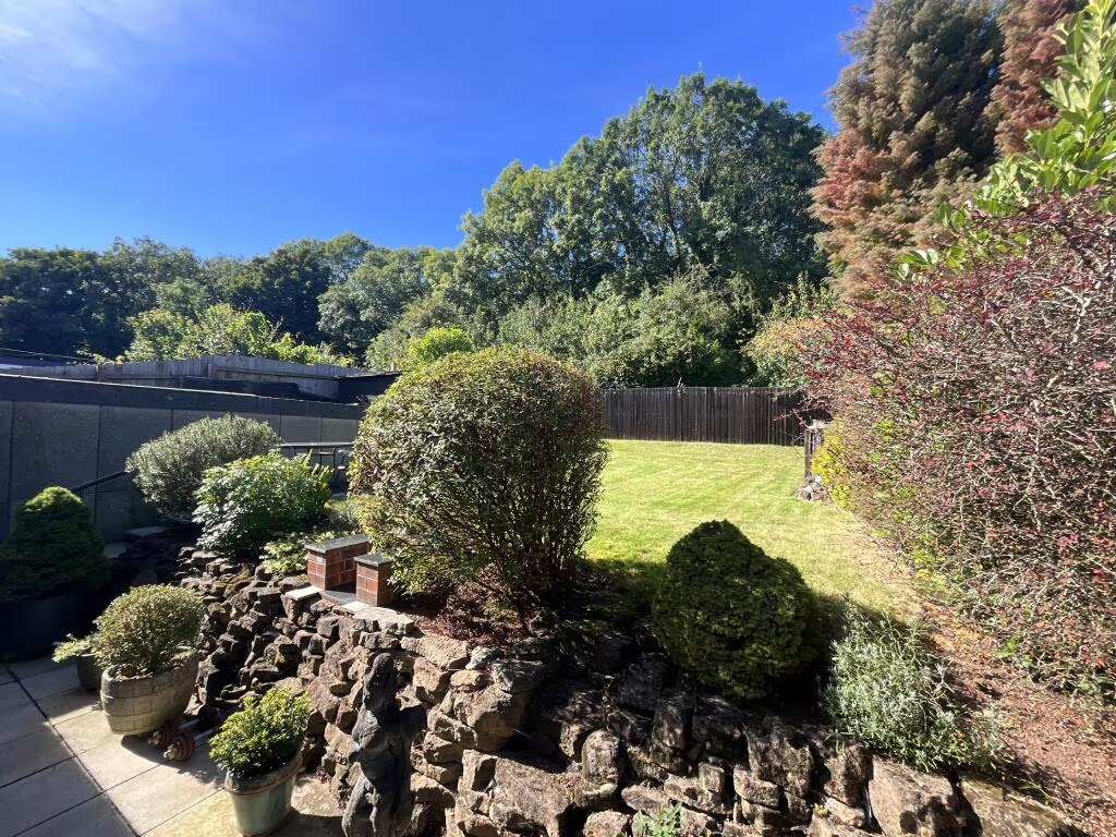
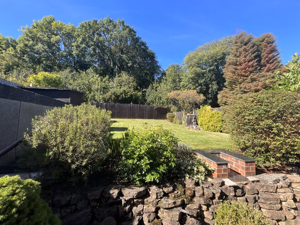
- garden
- mid-20th century
- single-story
- driveway
- residential
- greenery
- hedges
- modern
- bedroom
- standard ceiling
- ceiling moldings
- chandelier
- neutral decor
- neutral color
- window
- ample natural light
- fireplace
- double bed
EPC Details
- Mostly double glazing
- Solid brick, as built, no insulation (assumed)
- Boiler and radiators, mains gas
- Low energy lighting in all fixed outlets
- Suspended, no insulation (assumed)
Nearby Schools
- Blue Bell Hill Primary and Nursery School
- Parkdale Primary School
- Our Lady & St Edward Primary & Nursery Catholic Voluntary Academy
- Netherfield Primary School
- The Carlton Infant Academy
- Carlton Academy
- Willow Farm Primary School
- Westdale Infant School
- Priory Junior School
- All Hallows CofE Primary School
- Haddon Primary and Nursery School
- Lady Bay Primary School
- Windmill L.E.A.D. Academy
- Edale Rise Primary & Nursery School
- The Sacred Heart Primary Catholic Voluntary Academy
- The Carlton Junior Academy
- Porchester Junior School
- Phoenix Infant and Nursery School
- Pierrepont Gamston Primary School
- Sneinton St Stephen's CofE Primary School
- Nottingham Academy
- St John's CofE Primary School
- Hogarth Academy
- Standhill Infants' School
- Westdale Junior School
Nearest General Shops
- Id: 330832794
- Tags:
- Addr:
- Building: yes
- Name: Lindleys Garage
- Shop: car_repair
- TagsNormalized:
- garage
- car repair
- repair
- shop
- Lat: 52.9618025
- Lon: -1.094879
- FullGeoHash: gcrjr16sz7x1
- PartitionGeoHash: gcrj
- Images:
- FoodStandards: null
- Distance: 717.8
,- Id: 381853861
- Tags:
- Addr:
- Housenumber: 98
- Street: Oakdale Road
- Building: house
- Note: No name sign
- Shop: hairdresser
- Source: survey
- Source:building: Bing
- TagsNormalized:
- Lat: 52.9597758
- Lon: -1.1065744
- FullGeoHash: gcrjqc41ncy2
- PartitionGeoHash: gcrj
- Images:
- FoodStandards: null
- Distance: 681.5
,- Id: 369591291
- Tags:
- Addr:
- City: Nottingham
- Housenumber: 241
- Postcode: NG4 2EB
- Street: Vale Road
- Building: yes
- Name: Archers of Colwick
- Shop: car_repair
- Source: survey
- Source:addr: Companies House Registered Companies
- TagsNormalized:
- Lat: 52.9551534
- Lon: -1.0931919
- FullGeoHash: gcrjr05ynu14
- PartitionGeoHash: gcrj
- Images:
- FoodStandards: null
- Distance: 384.4
}
Nearest Grocery shops
- Id: 224790380
- Tags:
- Addr:
- City: Nottingham
- Housenumber: 7
- Postcode: NG3 7EF
- Street: Oakdale Road
- Building: cinema
- Name: Oakdale Stores
- Old_amenity: cinema
- Old_fhrs:
- Shop: convenience
- Source: survey
- Source:addr: NCC Open Data Licensed Premises
- Source:building: Bing
- Wheelchair: no
- TagsNormalized:
- Lat: 52.9597815
- Lon: -1.1131331
- FullGeoHash: gcrjq9j3n4gf
- PartitionGeoHash: gcrj
- Images:
- FoodStandards: null
- Distance: 1055.4
,- Id: 369521647
- Tags:
- Addr:
- City: Nottingham
- Housenumber: 248
- Postcode: NG4 1BQ
- Street: Oakdale Road
- Name: Jazz's Little Oak Convenience Store
- Shop: convenience
- Source: survey
- Source:addr: FHRS Open Data
- TagsNormalized:
- Lat: 52.9621142
- Lon: -1.0933021
- FullGeoHash: gcrjr17ysjwv
- PartitionGeoHash: gcrj
- Images:
- FoodStandards: null
- Distance: 793.6
,- Id: 2329502017
- Tags:
- Addr:
- City: Nottingham
- Housenumber: 81-83
- Postcode: NG3 7EJ
- Street: Oakdale Road
- Name: Booze Corner
- Old_fhrs:
- Shop: convenience
- Source: survey
- Source:addr: NCC Open Data Licensed Premises
- TagsNormalized:
- Lat: 52.9600584
- Lon: -1.1069996
- FullGeoHash: gcrjqc1ftn3m
- PartitionGeoHash: gcrj
- Images:
- FoodStandards: null
- Distance: 723.6
}
Nearest Religious buildings
- Id: 340992622
- Tags:
- Addr:
- City: Nottingham
- Housename: Dales United Reformed Church Hall
- Housenumber: 1
- Postcode: NG3 7GL
- Street: Parkdale Road
- Suburb: Bakersfield
- Amenity: church_hall
- Building: yes
- Name: Dales United Reformed Church Hall
- Polling_station: 20190308
- Ref:
- Polling_district: DALE
- Polling_station: 87
- Source: NCC_OpenData (OGL - Open Government Licence)
- TagsNormalized:
- church
- church hall
- united reformed
- Lat: 52.9616641
- Lon: -1.1071603
- FullGeoHash: gcrjqc3u13c2
- PartitionGeoHash: gcrj
- Images:
- FoodStandards: null
- Distance: 858.2
,- Id: 340992619
- Tags:
- Addr:
- City: Nottingham
- Postcode: NG3 7GN
- Street: Parkdale Road
- Alt_name: The Dales United Reformed Church
- Amenity: place_of_worship
- Building: church
- Denomination: united_reformed
- Name: Dales Church
- Religion: christian
- Source: survey
- Wikidata: Q5210791
- TagsNormalized:
- place of worship
- church
- united reformed
- christian
- Lat: 52.961653
- Lon: -1.1069569
- FullGeoHash: gcrjqc3gyp9n
- PartitionGeoHash: gcrj
- Images:
- FoodStandards: null
- Distance: 848.4
,- Id: 334213951
- Tags:
- Amenity: place_of_worship
- Building: church
- Denomination: anglican
- Name: St John the Baptist
- Religion: christian
- Source: survey
- Wikidata: Q105079011
- TagsNormalized:
- place of worship
- church
- anglican
- baptist
- christian
- Lat: 52.955607
- Lon: -1.0917629
- FullGeoHash: gcrjr0m0b0ds
- PartitionGeoHash: gcrj
- Images:
- FoodStandards: null
- Distance: 473.8
}
Nearest Airports
- Id: 11359528
- Tags:
- Aerodrome: international
- Aerodrome:type: public
- Aeroway: aerodrome
- Iata: EMA
- Icao: EGNX
- Is_in: Castle Donington,England,UK
- Name: East Midlands Airport
- Old_name: RAF Castle Donington
- Operator: Manchester Airports Holdings Limited
- Operator:type: private
- Ref: EMA
- Type: multipolygon
- Website: https://www.eastmidlandsairport.com/
- Wikidata: Q8977
- Wikipedia: en:East Midlands Airport
- TagsNormalized:
- airport
- international airport
- Lat: 52.8281122
- Lon: -1.3322143
- FullGeoHash: gcrh99jfj1vh
- PartitionGeoHash: gcrh
- Images:
- FoodStandards: null
- Distance: 21136
}
Nearest Leisure Facilities
- Id: 338483522
- Tags:
- Leisure: pitch
- Source: Bing
- Source:geometry: Bing
- Sport: bowls
- TagsNormalized:
- Lat: 52.9555605
- Lon: -1.1087658
- FullGeoHash: gcrjqb287zuq
- PartitionGeoHash: gcrj
- Images:
- FoodStandards: null
- Distance: 666.2
,- Id: 6283504634
- Tags:
- Covered: no
- Leisure: picnic_table
- TagsNormalized:
- picnic
- picnic table
- leisure
- Lat: 52.9500076
- Lon: -1.0974098
- FullGeoHash: gcrjpp2bhkzf
- PartitionGeoHash: gcrj
- Images:
- FoodStandards: null
- Distance: 651.2
,- Id: 340992601
- Tags:
- TagsNormalized:
- Lat: 52.9608863
- Lon: -1.1035219
- FullGeoHash: gcrjqchrw0f2
- PartitionGeoHash: gcrj
- Images:
- FoodStandards: null
- Distance: 646.9
,- Id: 166856912
- Tags:
- Designation: local_nature_reserve
- Leisure: nature_reserve
- Name: Colwick Woods Local Nature Reserve
- Operator: Nottingham City Council
- Operator:type: government
- Operator:wikidata: Q7063612
- Website: http://www.friendsofcolwickwoods.co.uk
- TagsNormalized:
- Lat: 52.9542649
- Lon: -1.1076538
- FullGeoHash: gcrjqb12vy3q
- PartitionGeoHash: gcrj
- Images:
- FoodStandards: null
- Distance: 615.4
,- Id: 338483523
- Tags:
- Leisure: playground
- Name: Colwick Woods PLayground
- Operator: Nottingham City Council
- Source:
- Geometry: Bing
- Name: survey
- TagsNormalized:
- Lat: 52.9557641
- Lon: -1.1078542
- FullGeoHash: gcrjqb339juj
- PartitionGeoHash: gcrj
- Images:
- FoodStandards: null
- Distance: 604.6
}
Nearest Tourist attractions
- Id: 370759029
- Tags:
- Addr:
- City: Nottingham
- Postcode: NG2 4LF
- Street: Belvoir Hill
- Name: Green's Windmill & Science Centre
- Operator: Nottingham City Council; The Green’s Windmill Trust
- Source:
- Addr: NCC Open Data planning
- Tourism: museum
- Website: https://www.greensmill.org.uk/
- TagsNormalized:
- Lat: 52.9521809
- Lon: -1.1293547
- FullGeoHash: gcrjnr9su1un
- PartitionGeoHash: gcrj
- Images:
- FoodStandards: null
- Distance: 2084.2
,- Id: 39606868
- Tags:
- Addr:
- Place: Holme Pierrepont
- Postcode: NG12 2LU
- Street: Adbolton Lane
- Caravans: yes
- Contact:
- Facebook: HPWhiteWater
- Twitter: nwscnotts
- Email: info.nwsc@serco.com
- Name: Holme Pierrepont Country Park
- Old_name: National Water Sports Centre Campsite
- Phone: +44 115 9821212
- Tents: yes
- Tourism: camp_site
- Website: https://www.nwscnotts.com/
- Wheelchair: yes
- TagsNormalized:
- Lat: 52.9393433
- Lon: -1.1002118
- FullGeoHash: gcrjnvqf50ye
- PartitionGeoHash: gcrj
- Images:
- FoodStandards: null
- Distance: 1832.4
,- Id: 80947607
- Tags:
- Alt_name: Elms House
- Building: yes
- Name: The Elms
- Source: Auto_OS_OpenData_StreetView
- Tourism: chalet
- TagsNormalized:
- Lat: 52.9418611
- Lon: -1.0895807
- FullGeoHash: gcrjpjy8dyjw
- PartitionGeoHash: gcrj
- Images:
- FoodStandards: null
- Distance: 1669.3
}
Nearest Hotels
- Id: 71223887
- Tags:
- Addr:
- Locality: Holme Pierrepont
- Postcode: NG12 2LU
- Street: Adbolton Lane
- Amenity: events_venue
- Name: Blotts Country Club
- Not:
- Old_fhrs:
- Source:
- Addr: Food hygiene opendata
- Tourism: hotel
- Website: https://www.blotts.com/
- TagsNormalized:
- events venue
- club
- hotel
- tourism
- Lat: 52.9452244
- Lon: -1.0734832
- FullGeoHash: gcrjpw6k610v
- PartitionGeoHash: gcrj
- Images:
- FoodStandards: null
- Distance: 2065.6
,- Id: 3688270261
- Tags:
- Addr:
- Name: Lakeside
- Tourism: hotel
- Website: https://www.nwscnotts.com/nwsc/ACCOMMODATION_Rooms
- TagsNormalized:
- Lat: 52.9410645
- Lon: -1.0914558
- FullGeoHash: gcrjpjthp1xw
- PartitionGeoHash: gcrj
- Images:
- FoodStandards: null
- Distance: 1711.5
,- Id: 55517057
- Tags:
- HE_ref: 1254981
- Addr:
- City: Nottingham
- Postcode: NG2 4BH
- Street: Racecourse Road
- Building: yes
- Fhrs:
- Listed_status: Grade II*
- Name: Colwick Hall
- Source:
- Addr: FHRS Open Data
- Listed_status: English Heritage
- Tourism: hotel
- Wikidata: Q5150328
- Wikipedia: en:Colwick Hall
- TagsNormalized:
- Lat: 52.9453132
- Lon: -1.1057917
- FullGeoHash: gcrjny6uc1tz
- PartitionGeoHash: gcrj
- Images:
- FoodStandards: null
- Distance: 1256
}
Tags
- detached
- bungalow
- brick
- garage
- garden
- mid-20th century
- single-story
- driveway
- residential
- greenery
- hedges
- modern
- bedroom
- standard ceiling
- ceiling moldings
- chandelier
- neutral decor
- neutral color
- window
- ample natural light
- fireplace
- double bed
Local Market Stats
- Average Price/sqft: £227
- Avg Income: £38800
- Rental Yield: 4.7%
- Social Housing: 15%
- Planning Success Rate: 91%
Similar Properties
 2 bedroom detached bungalow for sale in Galena Drive, Nottingham, NG3 — £250,000 • 2 bed • 1 bath • 722 ft²
 3 bedroom detached bungalow for sale in Imperial Avenue, Gedling, NG4 — £320,000 • 3 bed • 1 bath • 765 ft²
 3 bedroom bungalow for sale in Quantock Close, Arnold, Nottingham, NG5 — £250,000 • 3 bed • 1 bath • 1226 ft²
 3 bedroom detached bungalow for sale in Perlethorpe Avenue, Gedling, Nottingham, NG4 — £240,000 • 3 bed • 1 bath • 670 ft²
 3 bedroom detached bungalow for sale in Revesby Road, Woodthorpe, Nottingham, NG5 — £325,000 • 3 bed • 1 bath • 902 ft²
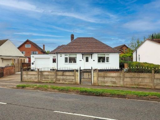 3 bedroom bungalow for sale in Linby Road, Hucknall, Nottingham, Nottinghamshire, NG15 — £350,000 • 3 bed • 1 bath • 942 ft²
Meta
- {
"@context": "https://schema.org",
"@type": "Residence",
"name": "3 bedroom detached bungalow for sale in Greenwood Avenue, N…",
"description": "",
"url": "https://propertypiper.co.uk/property/f0cfd43c-5387-407a-966f-b7195689b784",
"image": "https://image-a.propertypiper.co.uk/a00bc03d-0a95-42af-ac1a-7ee7ced96378-1024.jpeg",
"address": {
"@type": "PostalAddress",
"streetAddress": "28 GREENWOOD AVENUE NOTTINGHAM ",
"postalCode": "NG3 7FX",
"addressLocality": "Nottingham",
"addressRegion": "Nottingham East",
"addressCountry": "England"
},
"geo": {
"@type": "GeoCoordinates",
"latitude": 52.95580123185098,
"longitude": -1.0988288669266044
},
"numberOfRooms": 3,
"numberOfBathroomsTotal": 1,
"floorSize": {
"@type": "QuantitativeValue",
"value": 800,
"unitCode": "FTK"
},
"offers": {
"@type": "Offer",
"price": 280000,
"priceCurrency": "GBP",
"availability": "https://schema.org/InStock"
},
"additionalProperty": [
{
"@type": "PropertyValue",
"name": "Feature",
"value": "detached"
},
{
"@type": "PropertyValue",
"name": "Feature",
"value": "bungalow"
},
{
"@type": "PropertyValue",
"name": "Feature",
"value": "brick"
},
{
"@type": "PropertyValue",
"name": "Feature",
"value": "garage"
},
{
"@type": "PropertyValue",
"name": "Feature",
"value": "garden"
},
{
"@type": "PropertyValue",
"name": "Feature",
"value": "mid-20th century"
},
{
"@type": "PropertyValue",
"name": "Feature",
"value": "single-story"
},
{
"@type": "PropertyValue",
"name": "Feature",
"value": "driveway"
},
{
"@type": "PropertyValue",
"name": "Feature",
"value": "residential"
},
{
"@type": "PropertyValue",
"name": "Feature",
"value": "greenery"
},
{
"@type": "PropertyValue",
"name": "Feature",
"value": "hedges"
},
{
"@type": "PropertyValue",
"name": "Feature",
"value": "modern"
},
{
"@type": "PropertyValue",
"name": "Feature",
"value": "bedroom"
},
{
"@type": "PropertyValue",
"name": "Feature",
"value": "standard ceiling"
},
{
"@type": "PropertyValue",
"name": "Feature",
"value": "ceiling moldings"
},
{
"@type": "PropertyValue",
"name": "Feature",
"value": "chandelier"
},
{
"@type": "PropertyValue",
"name": "Feature",
"value": "neutral decor"
},
{
"@type": "PropertyValue",
"name": "Feature",
"value": "neutral color"
},
{
"@type": "PropertyValue",
"name": "Feature",
"value": "window"
},
{
"@type": "PropertyValue",
"name": "Feature",
"value": "ample natural light"
},
{
"@type": "PropertyValue",
"name": "Feature",
"value": "fireplace"
},
{
"@type": "PropertyValue",
"name": "Feature",
"value": "double bed"
}
]
}
High Res Floorplan Images
Compatible Floorplan Images
FloorplanImages Thumbnail