CV12 0LA - 3 bedroom detached house for sale in Hospital Lane, Bedwort…
View on Property Piper
3 bedroom detached house for sale in Hospital Lane,
Bedworth,
CV12 0LA
, CV12
Property Details
- Price: £367000
- Bedrooms: 3
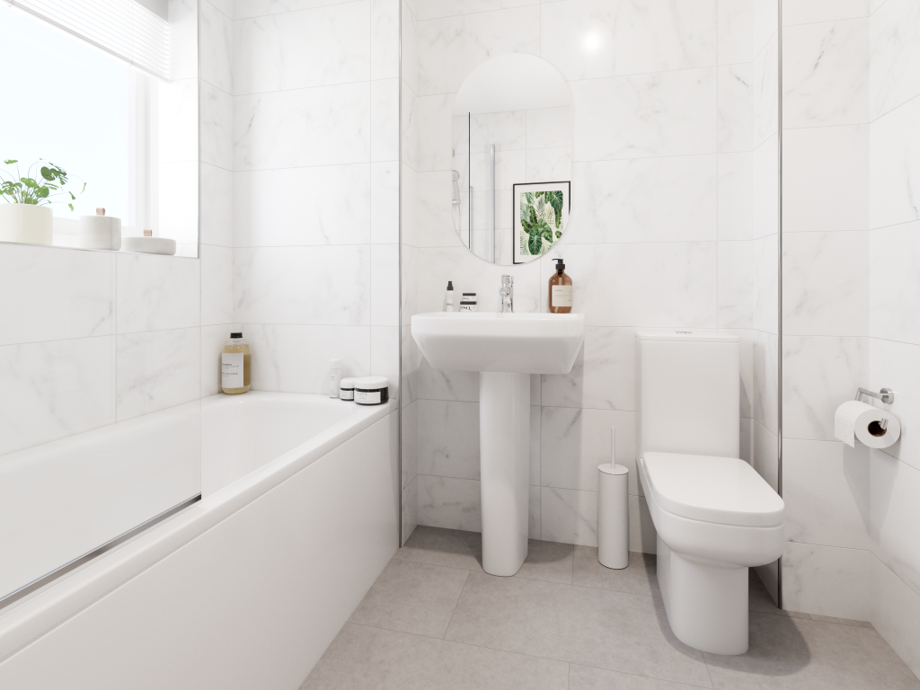
- Bathrooms: 1
- Property Type: undefined
- Property SubType: undefined
Image Descriptions
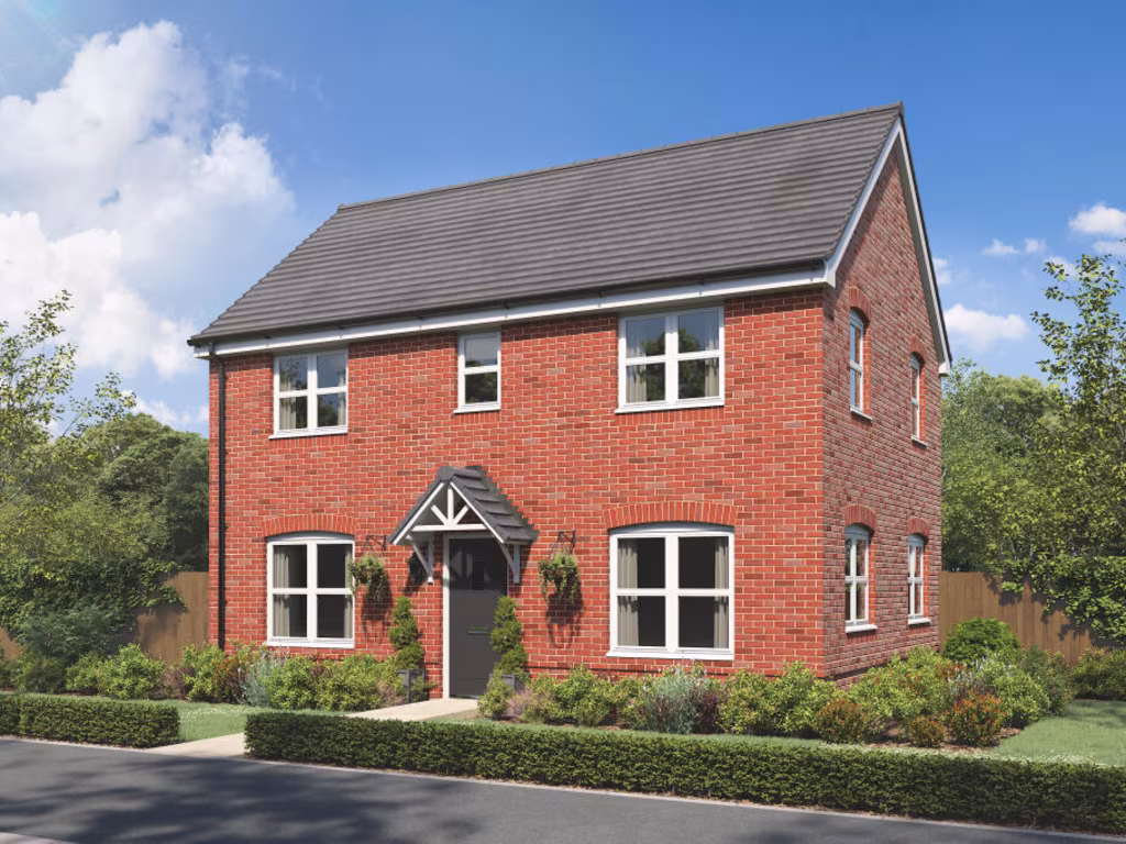
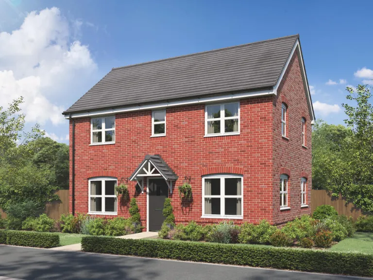
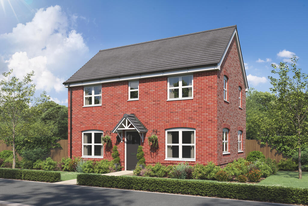
- House exterior Modern detached
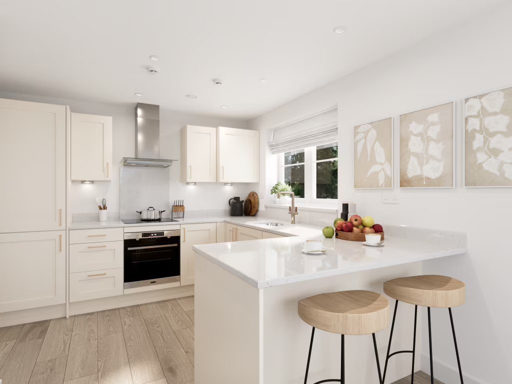
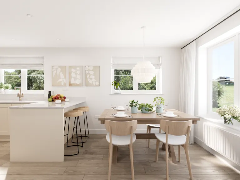
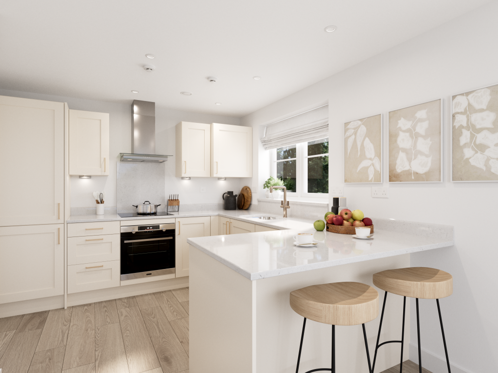
- modern-style kitchen modern
Floorplan Description
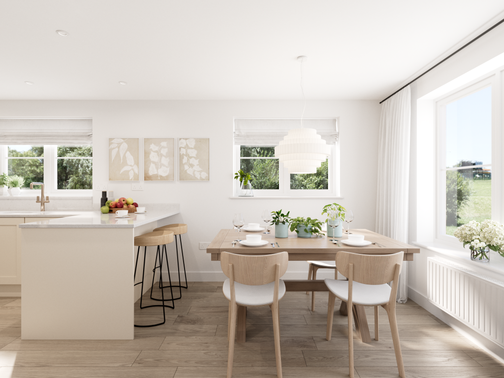
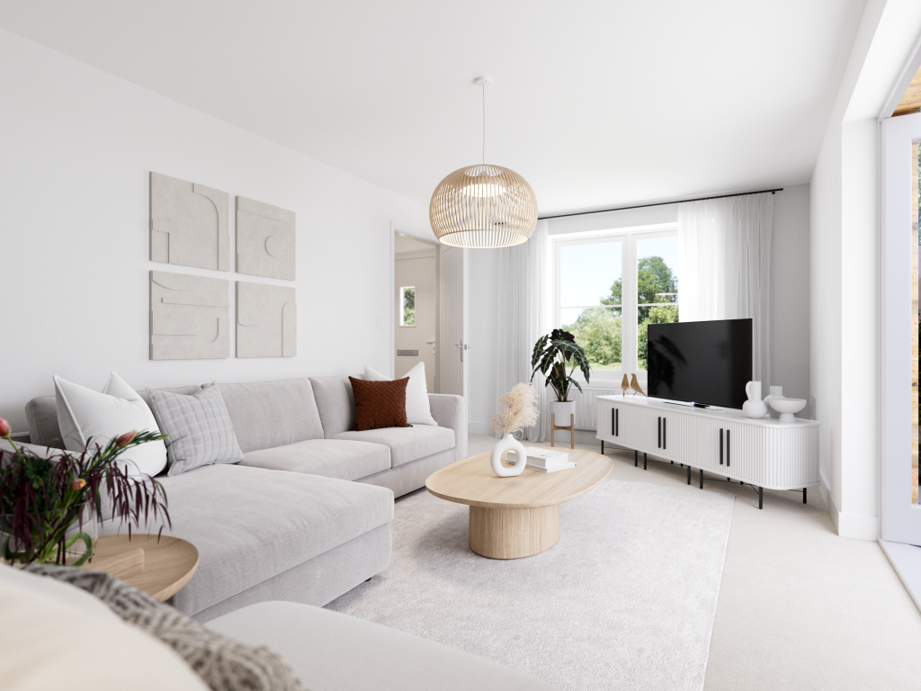
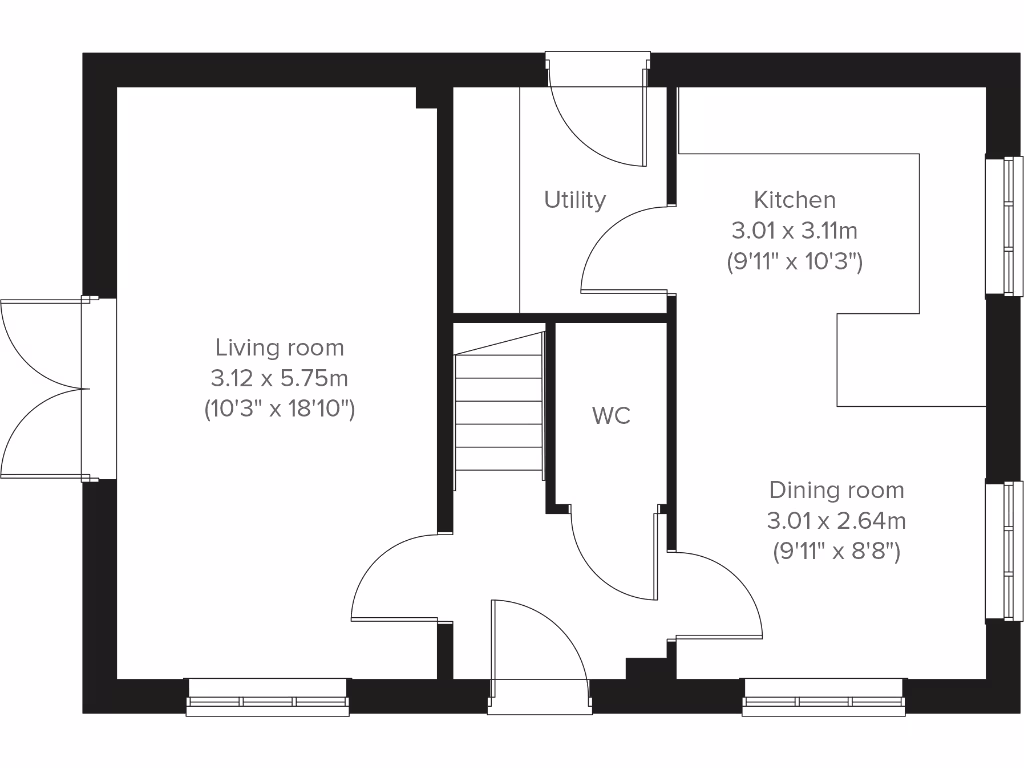
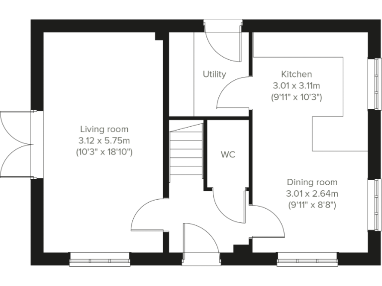
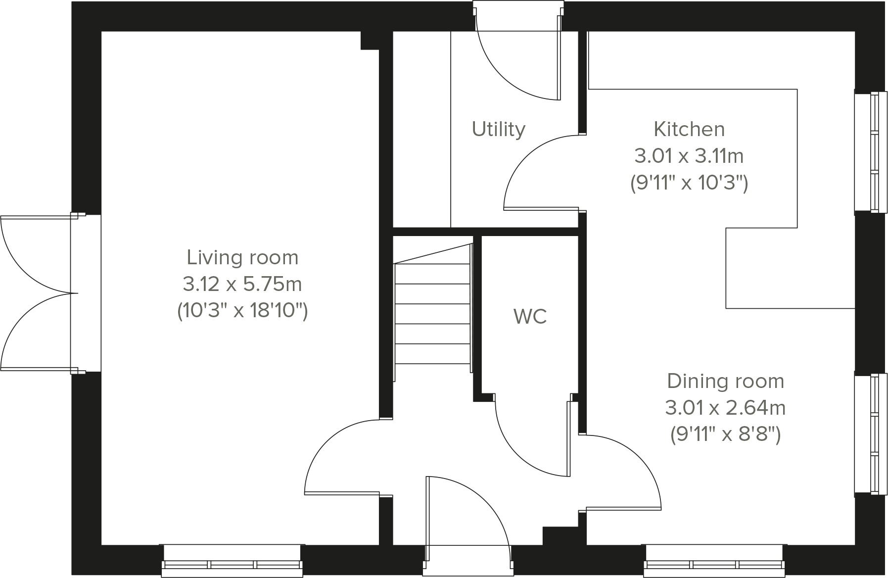
- A single floor layout with a living room, kitchen, dining room, utility, and WC.
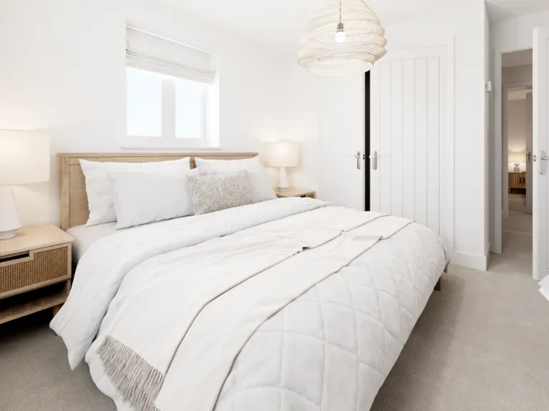
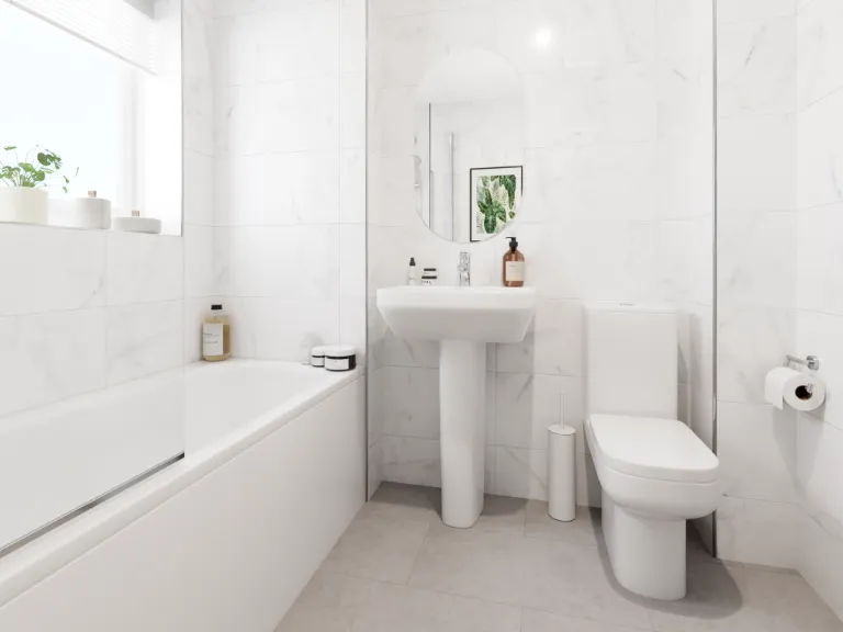
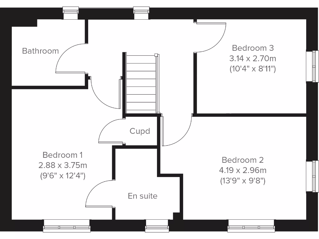
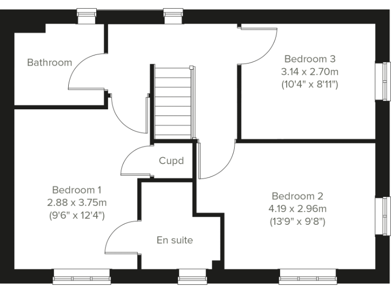
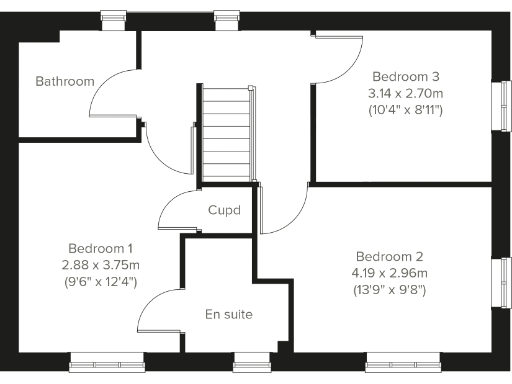
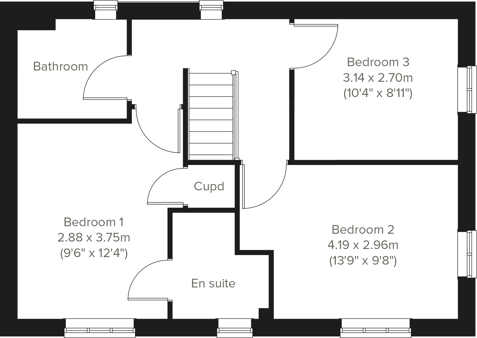
- A floor with 3 bedrooms, a bathroom, an ensuite, and a cupboard.
Rooms
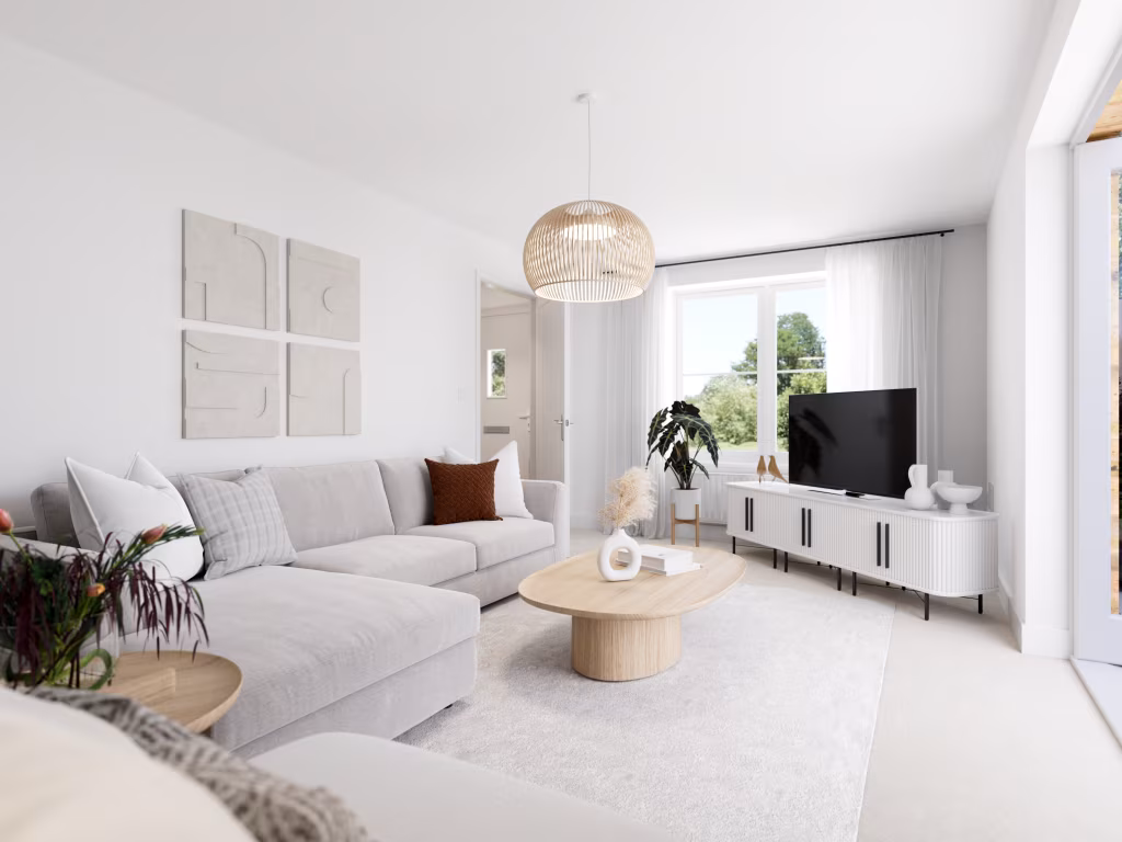
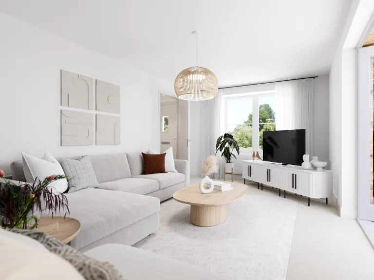
- Living room: large
- Kitchen: average
- Dining room: average
- Utility:
- WC:
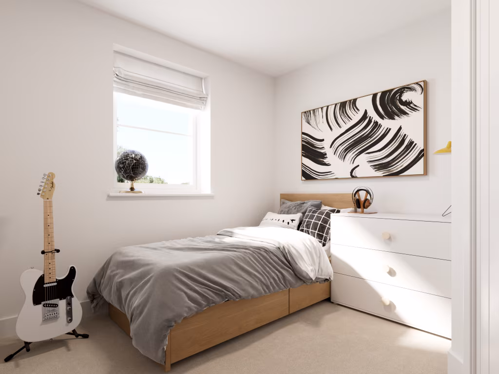
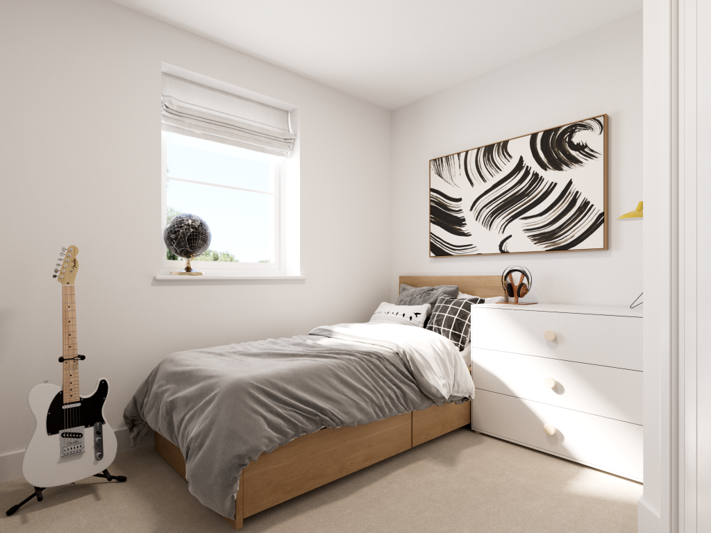
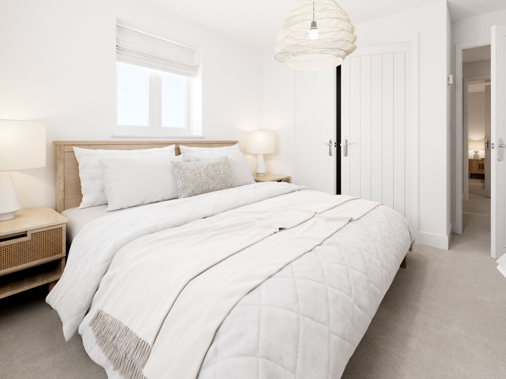
- Bedroom 3:
- Bathroom:
- Bedroom 1:
- Bedroom 2:
Textual Property Features
Detected Visual Features
- modern
- detached
- brick facade
- two-story
- pitched roof
- new build
- energy efficient
- family home
- kitchen
- bright
- contemporary
- minimalist
- clean
- white
- wooden floor
- countertops
- breakfast bar
Nearby Schools
- Little Heath Primary School
- Race Leys Infant School
- Race Leys Junior School
- Joseph Cash Primary School
- Exhall Junior School
- Goodyers End Primary School
- Parkgate Primary School
- Holy Family Catholic Primary School
- John Shelton Community Primary School
- President Kennedy School Academy
- Ash Green School
- Newdigate Primary and Nursery School
- Good Shepherd Catholic School
- Grangehurst Primary School
- Exhall Cedars Infant School
- The Canons C of E Primary School
- Cardinal Newman Catholic School
- Wheelwright Lane Primary School
- Edgewick Community Primary School
- Lote Tree Primary School
- Holbrook Primary School
- Longford Park Primary School
- Foxford Community School
- Keresley Grange Primary School
- Whitmore Park Primary School
- Keresley Newland Primary Academy
Nearest General Shops
- Id: 66715604
- Tags:
- Building: yes
- Name: Bayton Vehicle Services
- Shop: car_repair
- Source: visual survey;OS_OpenData_StreetView
- TagsNormalized:
- service
- car repair
- repair
- shop
- Lat: 52.4631727
- Lon: -1.4791488
- FullGeoHash: gcqfqqdujk4x
- PartitionGeoHash: gcqf
- Images:
- FoodStandards: null
- Distance: 2285.4
,- Id: 157997826
- Tags:
- Addr:
- City: Coventry
- Housenumber: 47
- Postcode: CV7 9FU
- Street: Coventry Road Exhall
- Brand: Škoda
- Building: yes
- Name: Listers Škoda Coventry
- Opening_hours: Mo-Fr 08:30-18:30; Sa 09:00-18:00; Su 10:00-16:00
- Operator: Listers Group
- Shop: car
- Website: https://listers.co.uk/Skoda/Coventry
- TagsNormalized:
- Lat: 52.4619014
- Lon: -1.4829009
- FullGeoHash: gcqfqq2htzhz
- PartitionGeoHash: gcqf
- Images:
- FoodStandards: null
- Distance: 2109.7
,- Id: 256208221
- Tags:
- Building: yes
- Name: The Trade Centre UK
- Shop: car
- TagsNormalized:
- Lat: 52.4544691
- Lon: -1.4984564
- FullGeoHash: gcqfmvhc7mvb
- PartitionGeoHash: gcqf
- Images:
- FoodStandards: null
- Distance: 1962.3
}
Nearest Grocery shops
- Id: 7589884814
- Tags:
- Brand: One Stop
- Brand:wikidata: Q65954217
- Name: One Stop
- Shop: convenience
- TagsNormalized:
- Lat: 52.4617342
- Lon: -1.5368263
- FullGeoHash: gcqfmn2gv256
- PartitionGeoHash: gcqf
- Images:
- FoodStandards: null
- Distance: 2019.2
,- Id: 6297816688
- Tags:
- Addr:
- City: Bedworth
- Housenumber: 2
- Postcode: CV12 0AA
- Street: Woodlands Road
- Fhrs:
- Name: B&P Convenience
- Operator: Premier
- Shop: convenience
- TagsNormalized:
- Lat: 52.4797784
- Lon: -1.4896422
- FullGeoHash: gcqfw1ekbgf2
- PartitionGeoHash: gcqf
- Images:
- FoodStandards:
- Id: 718046
- FHRSID: 718046
- LocalAuthorityBusinessID: 47612
- BusinessName: B & P Drinks
- BusinessType: Retailers - other
- BusinessTypeID: 4613
- AddressLine1: null
- AddressLine2: 2 Woodlands Road
- AddressLine3: null
- AddressLine4: Bedworth
- PostCode: CV12 0AA
- RatingValue: 5
- RatingKey: fhrs_5_en-GB
- RatingDate: 2020-01-30
- LocalAuthorityCode: 318
- LocalAuthorityName: Nuneaton and Bedworth
- LocalAuthorityWebSite: http://www.nuneatonandbedworth.gov.uk
- LocalAuthorityEmailAddress: food.team@nuneatonandbedworth.gov.uk
- Scores:
- Hygiene: 0
- Structural: 5
- ConfidenceInManagement: 0
- NewRatingPending: false
- Geocode:
- Longitude: -1.48957200000000
- Latitude: 52.48000400000000
- Distance: 1762
,- Id: 4021719933
- Tags:
- Name: One Stop Shop
- Shop: convenience
- TagsNormalized:
- Lat: 52.4738289
- Lon: -1.4929211
- FullGeoHash: gcqfw08fhqtm
- PartitionGeoHash: gcqf
- Images:
- FoodStandards: null
- Distance: 1260.4
}
Nearest Supermarkets
- Id: 150634352
- Tags:
- Brand: Tesco Extra
- Brand:wikidata: Q25172225
- Brand:wikipedia: en:Tesco Extra
- Building: yes
- Contact:
- Website: https://www.tesco.com/store-locator/bedworth/leicester-street
- Name: Tesco Extra
- Shop: supermarket
- TagsNormalized:
- tesco
- tesco extra
- supermarket
- shop
- Lat: 52.4813005
- Lon: -1.474303
- FullGeoHash: gcqfw3ymwr2p
- PartitionGeoHash: gcqf
- Images:
- FoodStandards: null
- Distance: 2743.2
,- Id: 65767213
- Tags:
- Brand: ALDI
- Brand:wikidata: Q41171672
- Brand:wikipedia: en:Aldi
- Building: yes
- Contact:
- Website: https://stores.aldi.co.uk/bedworth/mill-street
- Name: Aldi
- Shop: supermarket
- Source: visual survey;OS_OpenData_StreetView
- TagsNormalized:
- Lat: 52.4795876
- Lon: -1.4757596
- FullGeoHash: gcqfw3t7u21v
- PartitionGeoHash: gcqf
- Images:
- FoodStandards: null
- Distance: 2574.1
,- Id: 66767078
- Tags:
- Brand: Co-op Food
- Brand:wikidata: Q3277439
- Brand:wikipedia: en:Co-op Food
- Building: retail
- Name: Co-op Food
- Shop: supermarket
- Source: visual survey;OS_OpenData_StreetView; survey
- TagsNormalized:
- co-op
- co-op food
- food
- retail
- supermarket
- shop
- Lat: 52.4638939
- Lon: -1.4827037
- FullGeoHash: gcqfqqb266xv
- PartitionGeoHash: gcqf
- Images:
- FoodStandards: null
- Distance: 2031.8
}
Nearest Religious buildings
- Id: 807160603
- Tags:
- Amenity: place_of_worship
- Name: Gurdwara Dukh Nirwaran Sahib
- Religion: sikh
- Source: survey
- TagsNormalized:
- place of worship
- gurdwara
- sikh
- Lat: 52.463924
- Lon: -1.4818418
- FullGeoHash: gcqfqqbbw868
- PartitionGeoHash: gcqf
- Images:
- FoodStandards: null
- Distance: 2085.2
,- Id: 198066472
- Tags:
- Amenity: place_of_worship
- Building: yes
- Denomination: anglican
- Heritage: 2
- Heritage:operator: Historic England
- Listed_status: Grade II*
- Name: St Giles
- Religion: christian
- Wikidata: Q17550734
- TagsNormalized:
- place of worship
- anglican
- christian
- church
- Lat: 52.4623952
- Lon: -1.5003312
- FullGeoHash: gcqfmy7rxerc
- PartitionGeoHash: gcqf
- Images:
- FoodStandards: null
- Distance: 1139.1
,- Id: 154331716
- Tags:
- Amenity: place_of_worship
- Building: yes
- Denomination: anglican
- Name: St Andrews' Church
- Religion: christian
- Wikidata: Q105094276
- TagsNormalized:
- place of worship
- anglican
- church
- christian
- Lat: 52.4743564
- Lon: -1.5023699
- FullGeoHash: gcqftbdj21pb
- PartitionGeoHash: gcqf
- Images:
- FoodStandards: null
- Distance: 710.5
}
Nearest Medical buildings
- Id: 150623462
- Tags:
- Amenity: doctors
- Building: yes
- Healthcare: doctor
- Name: Bedworth Health Centre
- Source: visual survey;bing
- Wheelchair: yes
- TagsNormalized:
- doctor
- doctors
- health
- healthcare
- health centre
- Lat: 52.4786629
- Lon: -1.4724957
- FullGeoHash: gcqfw3ry27g9
- PartitionGeoHash: gcqf
- Images:
- FoodStandards: null
- Distance: 2742.8
,- Id: 394448357
- Tags:
- Amenity: doctors
- Building: yes
- Healthcare: doctor
- Name: Park Leys Medical Practice
- Source: Warwicks CC Aerial Imagery 2013
- TagsNormalized:
- doctor
- doctors
- health
- healthcare
- Lat: 52.4604066
- Lon: -1.5355905
- FullGeoHash: gcqfmn1u40sd
- PartitionGeoHash: gcqf
- Images:
- FoodStandards: null
- Distance: 2023.9
,- Id: 4021731172
- Tags:
- Amenity: parking
- Name: Woodlands Surgery Car Park
- TagsNormalized:
- Lat: 52.4795566
- Lon: -1.4898124
- FullGeoHash: gcqfw1e5sf7m
- PartitionGeoHash: gcqf
- Images:
- FoodStandards: null
- Distance: 1738.3
,- Id: 508728725
- Tags:
- Addr:
- City: Bedworth
- Housename: Woodlands Surgery
- Housenumber: 301
- Postcode: CV12 0AJ
- Street: Newtown Road
- Amenity: doctors
- Building: yes
- Designation: Medical Surgery
- Healthcare: doctor
- Name: Woodlands Doctors Surgery
- TagsNormalized:
- doctor
- doctors
- health
- healthcare
- surgery
- Lat: 52.4794809
- Lon: -1.4899584
- FullGeoHash: gcqfw1e51kq3
- PartitionGeoHash: gcqf
- Images:
- FoodStandards: null
- Distance: 1725.3
}
Nearest Airports
- Id: 2437117
- Tags:
- Aerodrome: international
- Aerodrome:type: public
- Aeroway: aerodrome
- Ele: 104
- Iata: BHX
- Icao: EGBB
- Internet_access: wlan
- Is_in: Birmingham,England,UK
- Name: Birmingham Airport
- Ref: BHX
- Type: multipolygon
- Website: https://www.birminghamairport.co.uk/
- Wikidata: Q8719
- Wikipedia: en:Birmingham Airport
- TagsNormalized:
- airport
- international airport
- Lat: 52.4543817
- Lon: -1.7468974
- FullGeoHash: gcqf2jpbym6y
- PartitionGeoHash: gcqf
- Images:
- FoodStandards: null
- Distance: 16102.4
}
Nearest Leisure Facilities
- Id: 562767647
- Tags:
- Leisure: pitch
- Source: Warwicks CC Aerial Imagery 2013
- Sport: cricket
- TagsNormalized:
- pitch
- leisure
- cricket
- sports
- Lat: 52.473056
- Lon: -1.5007496
- FullGeoHash: gcqftb7jtyxg
- PartitionGeoHash: gcqf
- Images:
- FoodStandards: null
- Distance: 732.4
,- Id: 567077177
- Tags:
- Leisure: playground
- Source: Warwicks CC Aerial Imagery 2013
- TagsNormalized:
- Lat: 52.4736111
- Lon: -1.5018252
- FullGeoHash: gcqftbd2uyjf
- PartitionGeoHash: gcqf
- Images:
- FoodStandards: null
- Distance: 694.9
,- Id: 698883339
- Tags:
- TagsNormalized:
- Lat: 52.4740555
- Lon: -1.5023522
- FullGeoHash: gcqftbd588vj
- PartitionGeoHash: gcqf
- Images:
- FoodStandards: null
- Distance: 691.6
,- Id: 230040397
- Tags:
- Landuse: meadow
- Source: bing
- Sport: equestrian
- TagsNormalized:
- Lat: 52.4645743
- Lon: -1.5076214
- FullGeoHash: gcqfmwyhmcs0
- PartitionGeoHash: gcqf
- Images:
- FoodStandards: null
- Distance: 687.2
,- Id: 230015842
- Tags:
- Leisure: park
- Source: bing
- TagsNormalized:
- Lat: 52.4738454
- Lon: -1.5135675
- FullGeoHash: gcqft89f73f2
- PartitionGeoHash: gcqf
- Images:
- FoodStandards: null
- Distance: 423.4
}
Nearest Tourist attractions
- Id: 73689706
- Tags:
- Addr:
- City: Nuneaton
- Housenumber: 1
- Place: Astley
- Postcode: CV10 7QN
- Street: Church Lane
- Building: yes
- Castle_type: manor
- Heritage: 2
- Heritage:operator: Historic England
- Historic: castle
- Listed_status: Grade II*
- Name: Astley Castle
- Number_of_apartments: 1
- Operator: Landmark Trust
- Tourism: apartment
- Wikidata: Q4810907
- Wikipedia: en:Astley Castle
- TagsNormalized:
- Lat: 52.502349
- Lon: -1.542348
- FullGeoHash: gcqfsvubkejy
- PartitionGeoHash: gcqf
- Images:
- FoodStandards: null
- Distance: 4143
,- Id: 1024688180
- Tags:
- Area: yes
- Fixme: this is the holding pen for football fans awaiting a train. Not sure of the markup for it .
- Tourism: attraction
- TagsNormalized:
- Lat: 52.4465967
- Lon: -1.494799
- FullGeoHash: gcqfmgxe8djp
- PartitionGeoHash: gcqf
- Images:
- FoodStandards: null
- Distance: 2864.1
,- Id: 10139459517
- Tags:
- Name: Bedworth Water Tower
- Tourism: apartment
- TagsNormalized:
- Lat: 52.4759533
- Lon: -1.4793702
- FullGeoHash: gcqfw2fy84tw
- PartitionGeoHash: gcqf
- Images:
- FoodStandards: null
- Distance: 2207.4
}
Nearest Hotels
- Id: 33686368
- Tags:
- Brand: Days Inn
- Brand:wikidata: Q1047239
- Brand:wikipedia: en:Days Inn
- Building: yes
- Name: Days Inn
- Operator: Welcome Break
- Tourism: hotel
- TagsNormalized:
- Lat: 52.4703267
- Lon: -1.5462757
- FullGeoHash: gcqfkzfjc1v6
- PartitionGeoHash: gcqf
- Images:
- FoodStandards: null
- Distance: 2410.5
,- Id: 4749485661
- Tags:
- TagsNormalized:
- Lat: 52.4644682
- Lon: -1.5400194
- FullGeoHash: gcqfkyyedvwr
- PartitionGeoHash: gcqf
- Images:
- FoodStandards: null
- Distance: 2095.7
,- Id: 175066006
- Tags:
- Brand: Novotel
- Brand:wikidata: Q420545
- Brand:wikipedia: en:Novotel
- Designation: 3*
- Name: Novotel
- Source: bing
- Tourism: hotel
- TagsNormalized:
- Lat: 52.4577234
- Lon: -1.4880099
- FullGeoHash: gcqfqjskqu7k
- PartitionGeoHash: gcqf
- Images:
- FoodStandards: null
- Distance: 2090
}
Tags
- modern
- detached
- brick facade
- two-story
- pitched roof
- new build
- energy efficient
- family home
- modern
- kitchen
- bright
- contemporary
- minimalist
- clean
- white
- wooden floor
- countertops
- breakfast bar
Local Market Stats
- Average Price/sqft: £241
- Avg Income: £39600
- Social Housing: 7%
- Planning Success Rate: 90%
Similar Properties
 3 bedroom detached house for sale in Hospital Lane,
Bedworth,
CV12 0LA
, CV12 — £365,000 • 3 bed • 1 bath • 1446 ft²
3 bedroom detached house for sale in Hospital Lane,
Bedworth,
CV12 0LA
, CV12 — £365,000 • 3 bed • 1 bath • 1446 ft² 3 bedroom detached house for sale in Hospital Lane,
Bedworth,
CV12 0LA
, CV12 — £380,000 • 3 bed • 1 bath • 380 ft²
3 bedroom detached house for sale in Hospital Lane,
Bedworth,
CV12 0LA
, CV12 — £380,000 • 3 bed • 1 bath • 380 ft² 3 bedroom semi-detached house for sale in Hospital Lane,
Bedworth,
CV12 0LA
, CV12 — £330,000 • 3 bed • 1 bath • 376 ft²
3 bedroom semi-detached house for sale in Hospital Lane,
Bedworth,
CV12 0LA
, CV12 — £330,000 • 3 bed • 1 bath • 376 ft²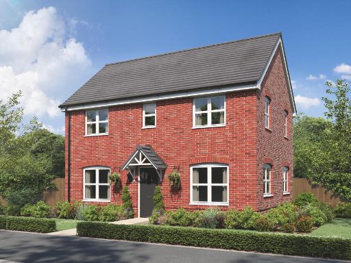 3 bedroom detached house for sale in Whitmore Place,
Holbrook Lane,
Coventry,
West Midlands,
CV6 4QY, CV6 — £349,995 • 3 bed • 1 bath • 379 ft²
3 bedroom detached house for sale in Whitmore Place,
Holbrook Lane,
Coventry,
West Midlands,
CV6 4QY, CV6 — £349,995 • 3 bed • 1 bath • 379 ft² 3 bedroom semi-detached house for sale in Hospital Lane,
Bedworth,
CV12 0LA
, CV12 — £330,000 • 3 bed • 1 bath • 341 ft²
3 bedroom semi-detached house for sale in Hospital Lane,
Bedworth,
CV12 0LA
, CV12 — £330,000 • 3 bed • 1 bath • 341 ft²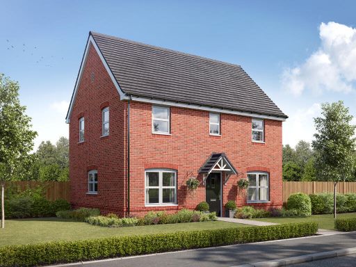 3 bedroom semi-detached house for sale in Hospital Lane,
Bedworth,
CV12 0LA
, CV12 — £365,000 • 3 bed • 1 bath • 375 ft²
3 bedroom semi-detached house for sale in Hospital Lane,
Bedworth,
CV12 0LA
, CV12 — £365,000 • 3 bed • 1 bath • 375 ft²
Meta
- {
"@context": "https://schema.org",
"@type": "Residence",
"name": "3 bedroom detached house for sale in Hospital Lane, Bedwort…",
"description": "",
"url": "https://propertypiper.co.uk/property/df28c787-905b-4620-9e99-5a6993e2c84e",
"image": "https://image-a.propertypiper.co.uk/1dc1d598-b6ee-4a2f-9ba5-0dcbfa4bf3d4-1024.jpeg",
"address": {
"@type": "PostalAddress",
"streetAddress": "Hospital Lane,\r\nBedworth,\r\nCV12 0LA\r\n",
"postalCode": "CV12 0LA",
"addressLocality": "Nuneaton and Bedworth",
"addressRegion": "North Warwickshire",
"addressCountry": "England"
},
"geo": {
"@type": "GeoCoordinates",
"latitude": 52.47046491584822,
"longitude": -1.5106902604388588
},
"numberOfRooms": 3,
"numberOfBathroomsTotal": 1,
"floorSize": {
"@type": "QuantitativeValue",
"value": 380,
"unitCode": "FTK"
},
"offers": {
"@type": "Offer",
"price": 367000,
"priceCurrency": "GBP",
"availability": "https://schema.org/InStock"
},
"additionalProperty": [
{
"@type": "PropertyValue",
"name": "Feature",
"value": "modern"
},
{
"@type": "PropertyValue",
"name": "Feature",
"value": "detached"
},
{
"@type": "PropertyValue",
"name": "Feature",
"value": "brick facade"
},
{
"@type": "PropertyValue",
"name": "Feature",
"value": "two-story"
},
{
"@type": "PropertyValue",
"name": "Feature",
"value": "pitched roof"
},
{
"@type": "PropertyValue",
"name": "Feature",
"value": "new build"
},
{
"@type": "PropertyValue",
"name": "Feature",
"value": "energy efficient"
},
{
"@type": "PropertyValue",
"name": "Feature",
"value": "family home"
},
{
"@type": "PropertyValue",
"name": "Feature",
"value": "modern"
},
{
"@type": "PropertyValue",
"name": "Feature",
"value": "kitchen"
},
{
"@type": "PropertyValue",
"name": "Feature",
"value": "bright"
},
{
"@type": "PropertyValue",
"name": "Feature",
"value": "contemporary"
},
{
"@type": "PropertyValue",
"name": "Feature",
"value": "minimalist"
},
{
"@type": "PropertyValue",
"name": "Feature",
"value": "clean"
},
{
"@type": "PropertyValue",
"name": "Feature",
"value": "white"
},
{
"@type": "PropertyValue",
"name": "Feature",
"value": "wooden floor"
},
{
"@type": "PropertyValue",
"name": "Feature",
"value": "countertops"
},
{
"@type": "PropertyValue",
"name": "Feature",
"value": "breakfast bar"
}
]
}
High Res Floorplan Images
Compatible Floorplan Images
FloorplanImages Thumbnail