DA12 4NS - 3 bedroom semidetached house for sale in Windhover Way, Gra…
View on Property Piper
3 bedroom semi-detached house for sale in Windhover Way, Gravesend, DA12
Property Details
- Price: £400000
- Bedrooms: 3
- Bathrooms: 1
- Property Type: undefined
- Property SubType: undefined
Image Descriptions
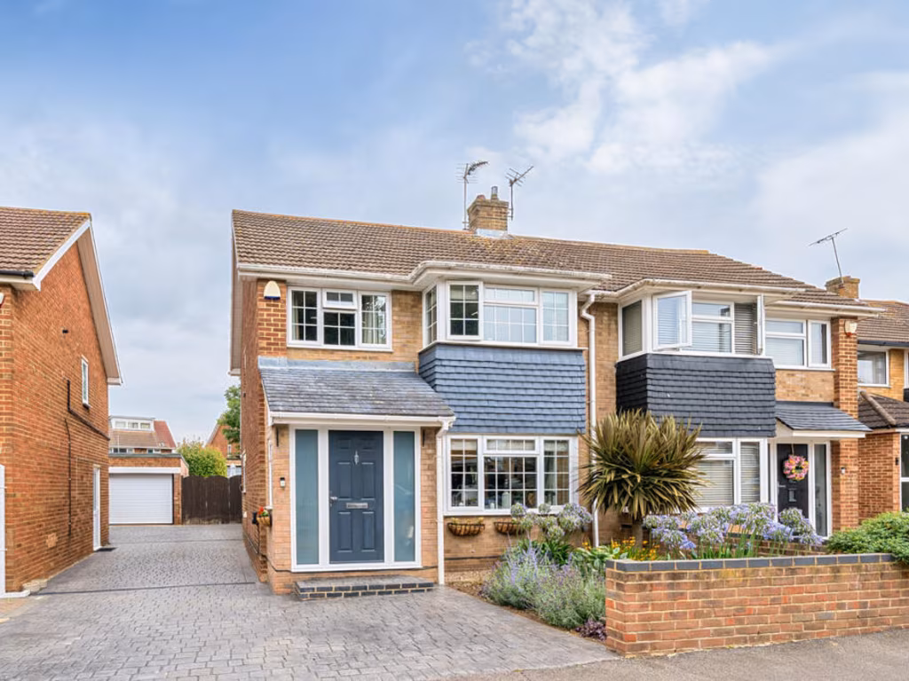
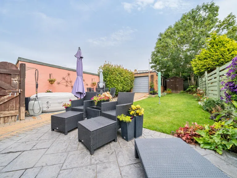
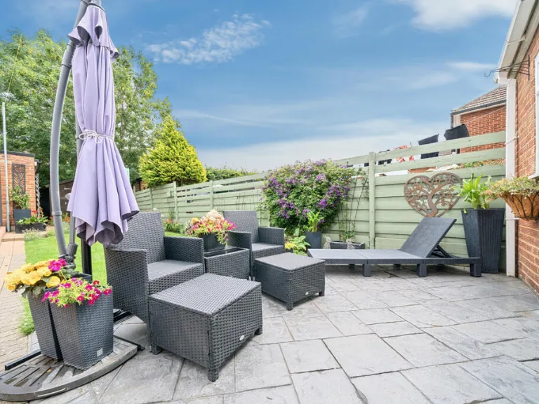
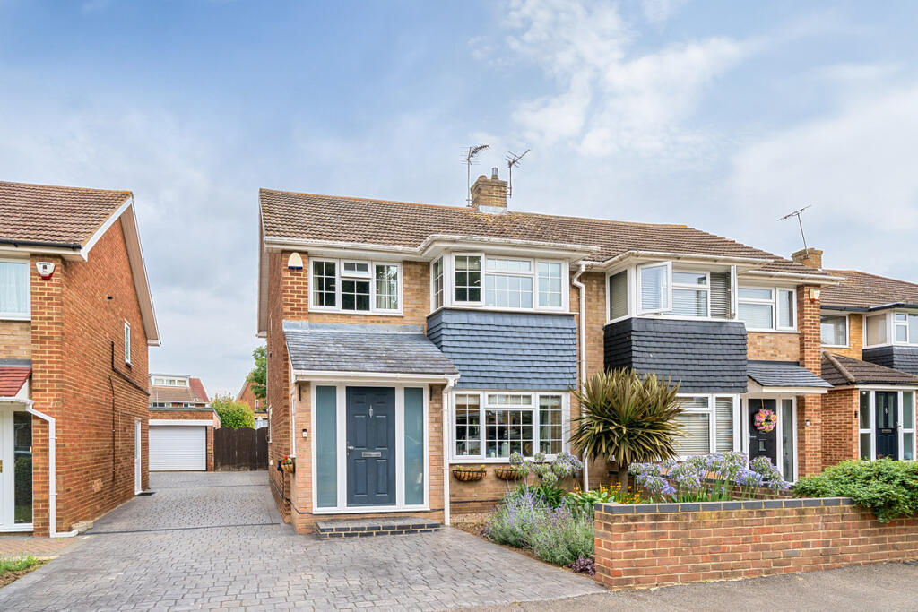
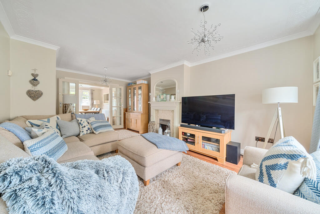
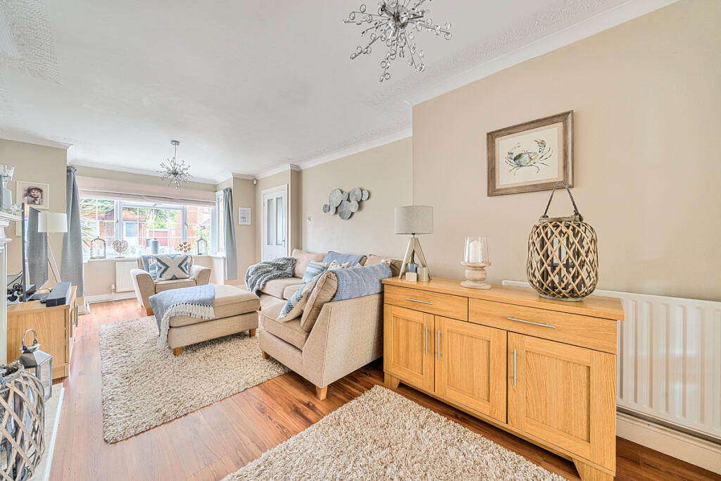
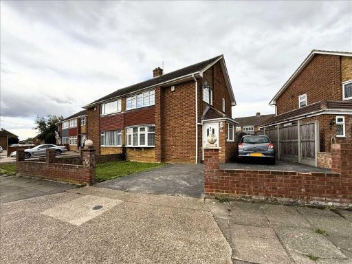
- semi-detached house mid-20th-century
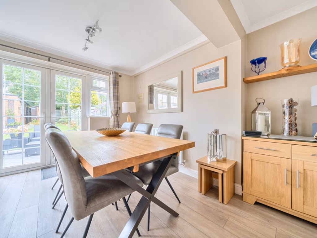
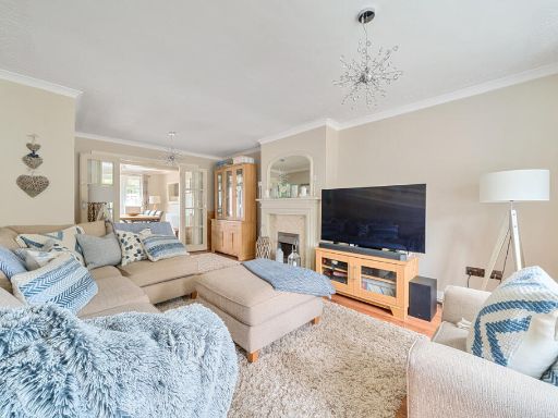
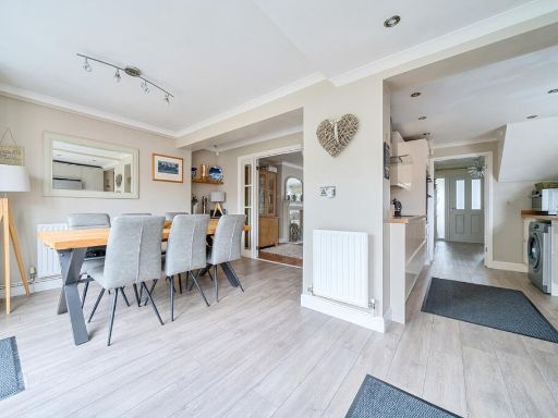
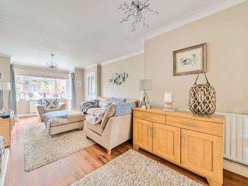
- living room contemporary
Floorplan Description
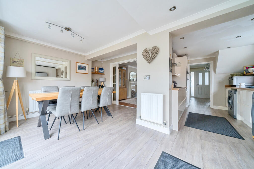
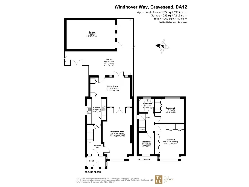
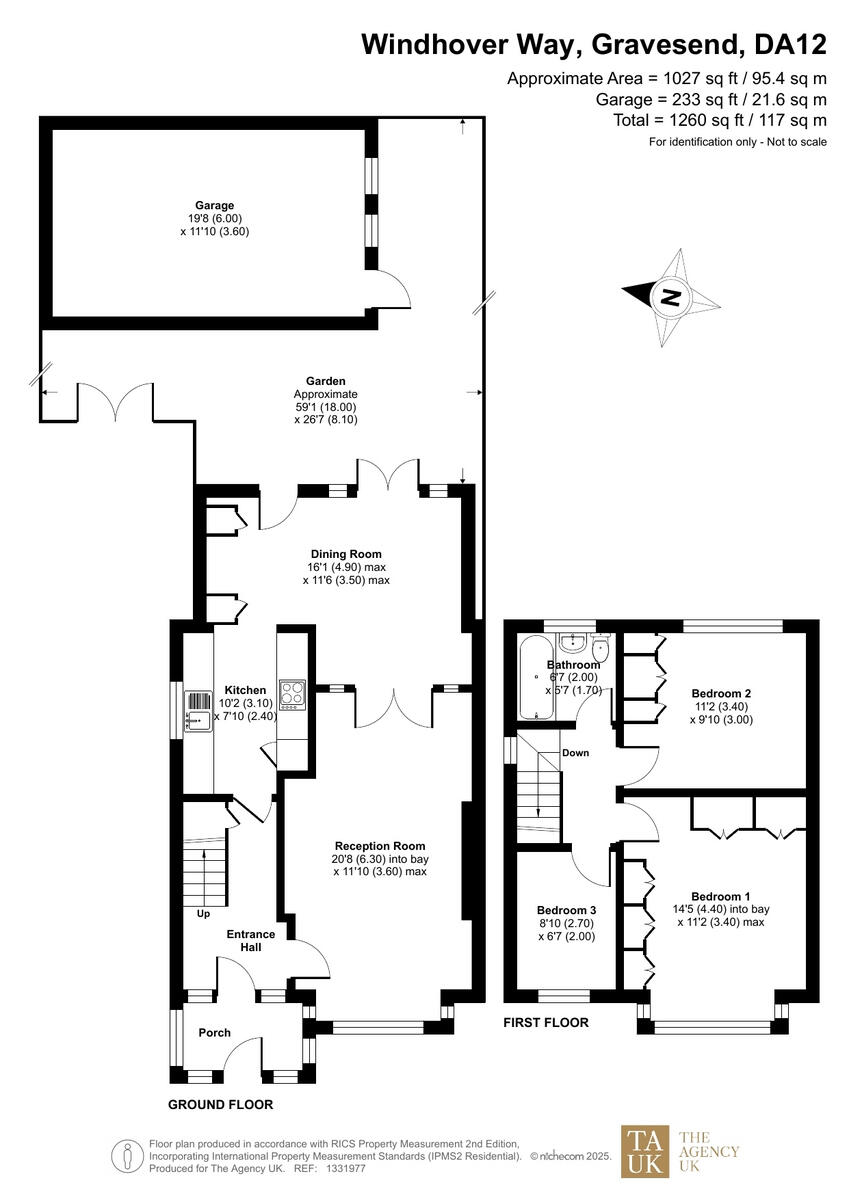
- Two-storey residential property with reception, dining room, kitchen and three bedrooms.
Rooms
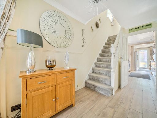
- Porch:
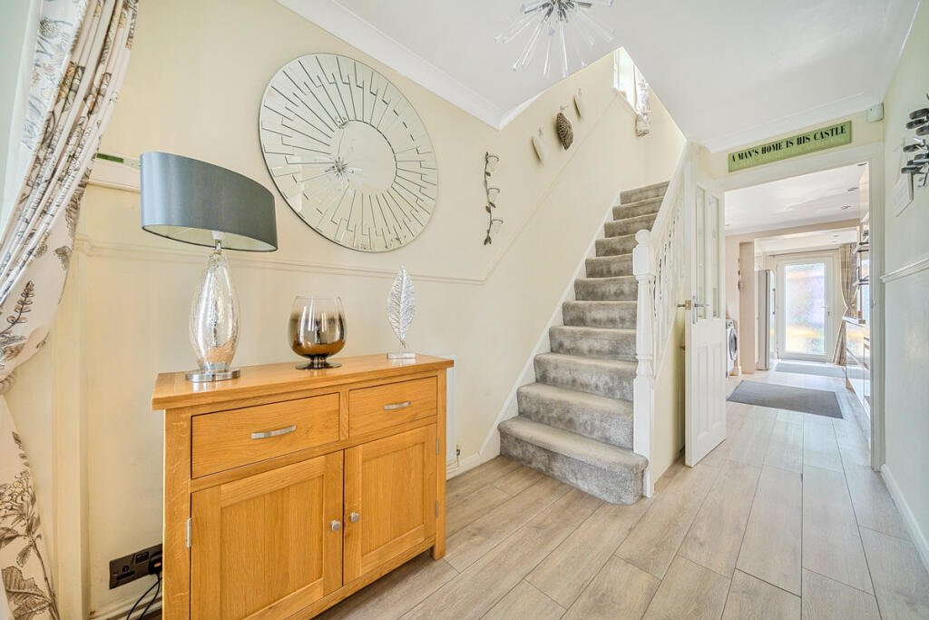
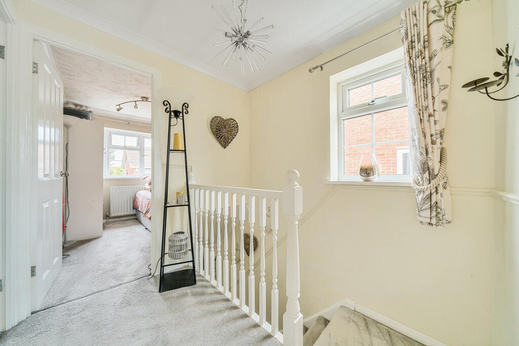
- Entrance Hall:
- Reception Room: large
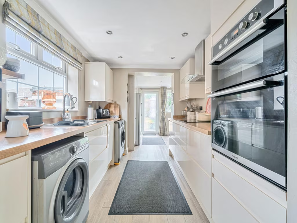
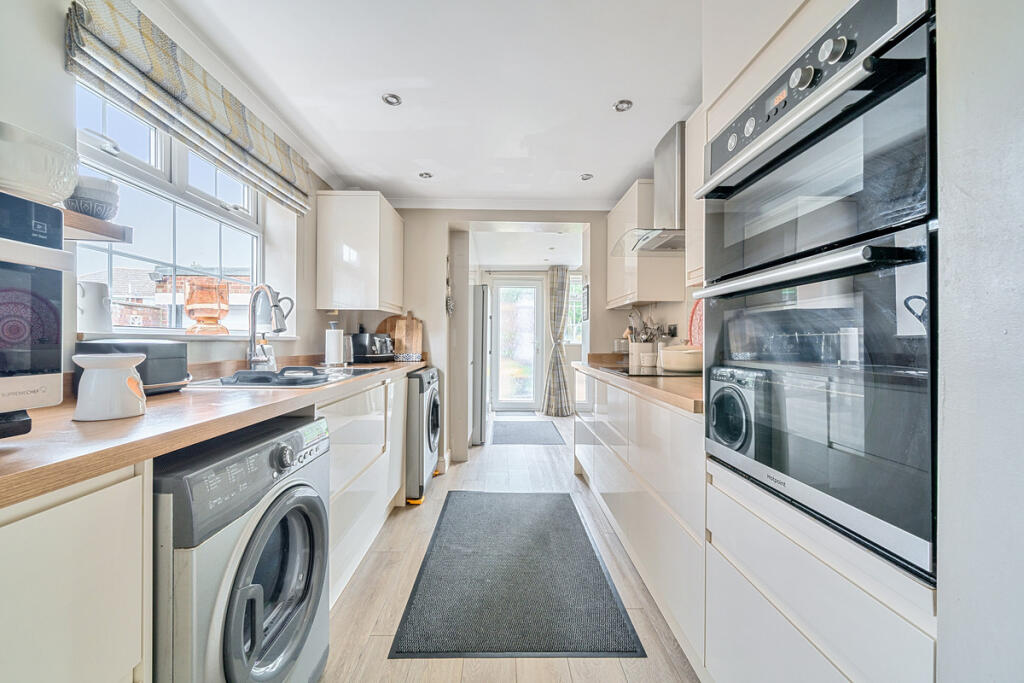
- Kitchen: average
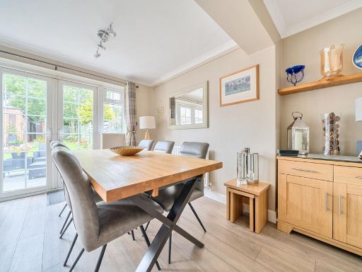
- Dining Room: large
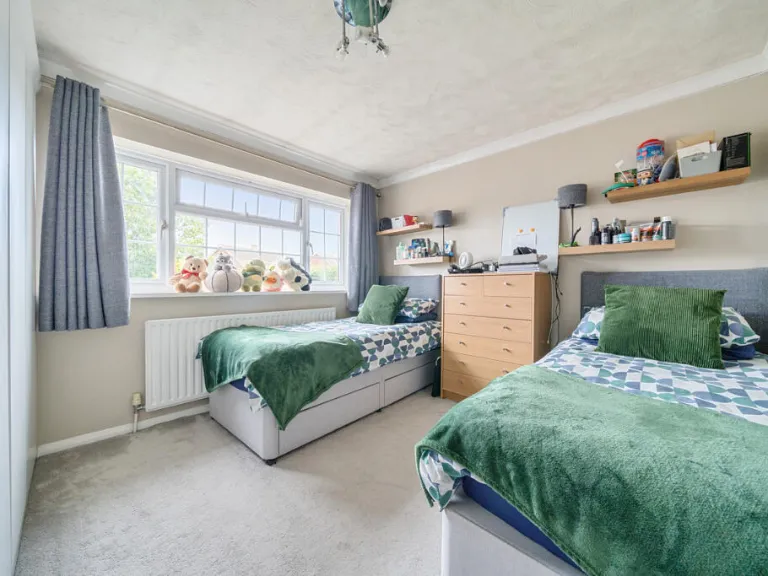
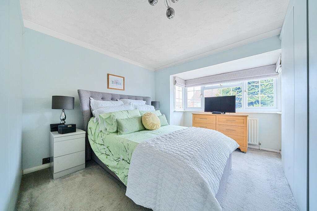
- Bedroom 1: large
- Bedroom 2: average
- Bedroom 3: small
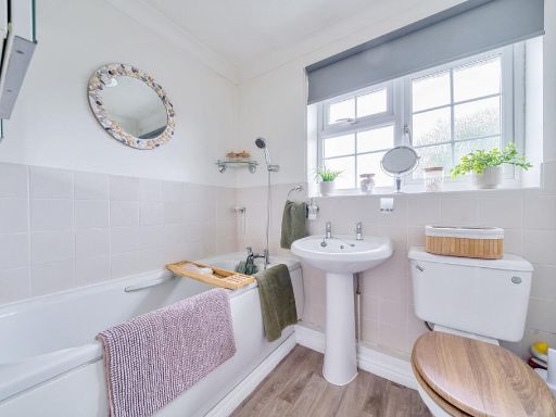
- Bathroom: small
Textual Property Features
Detected Visual Features
- semi-detached
- mid-20th-century
- brick exterior
- attached garage
- paved driveway
- bay windows
- residential area
- family home
- contemporary
- living room
- neutral colors
- standard ceiling
- fireplace
- glass doors
- modern lighting
EPC Details
- Fully double glazed
- Cavity wall, filled cavity
- Boiler and radiators, mains gas
- Low energy lighting in 10% of fixed outlets
- Solid, no insulation (assumed)
Nearby Schools
- Thamesview School
- Tymberwood Academy
- Whitehill Primary School
- Saint George's Church of England School
- Northfleet Technology College
- Holy Trinity Church of England Primary School
- Cobham Primary School
- Istead Rise Primary School
- Riverview Junior School
- North West Kent Alternative Provision Service
- Westcourt Primary School
- Bronte School
- Cobham Hall
- Shears Green Infant School
- Shears Green Junior School
- Cecil Road Primary and Nursery School
- St John's Catholic Comprehensive
- Mayfield Grammar School, Gravesend
- Gravesend Grammar School
- Wrotham Road Primary School
- Tilbury Pioneer Academy
- Singlewell Primary School
- Shorne Church of England Primary School
- King's Farm Primary School
- Riverview Infant School
- St John's Catholic Primary School, Gravesend
- Copperfield Academy
- Chantry Community Academy
Nearest General Shops
- Id: 4575869384
- Tags:
- Addr:
- City: Gravesend
- Postcode: DA12 4NQ
- Street: Leander Drive
- Fhrs:
- Name: JD's Seafood
- Shop: fishmonger
- Source: ratings.food.gov.uk
- TagsNormalized:
- Lat: 51.4180728
- Lon: 0.3932599
- FullGeoHash: u10k8bq7gx7z
- PartitionGeoHash: u10k
- Images:
- FoodStandards: null
- Distance: 396.7
,- Id: 532699245
- Tags:
- TagsNormalized:
- Lat: 51.4183477
- Lon: 0.3956155
- FullGeoHash: u10k902jdd8r
- PartitionGeoHash: u10k
- Images:
- FoodStandards: null
- Distance: 396.1
,- Id: 532699241
- Tags:
- Name: S&H Hair & Beauty
- Shop: hairdresser
- TagsNormalized:
- Lat: 51.4183526
- Lon: 0.3955432
- FullGeoHash: u10k902j8gdk
- PartitionGeoHash: u10k
- Images:
- FoodStandards: null
- Distance: 393.7
}
Nearest Religious buildings
- Id: 376801621
- Tags:
- Amenity: community_centre
- Building: yes
- Name: St Aidan's Church Hall
- Source: bing
- TagsNormalized:
- community centre
- church
- church hall
- Lat: 51.4278869
- Lon: 0.3879843
- FullGeoHash: u10k8f4t0syn
- PartitionGeoHash: u10k
- Images:
- FoodStandards: null
- Distance: 790.7
,- Id: 376800977
- Tags:
- Amenity: place_of_worship
- Denomination: anglican
- Name: St. Aidan's Church
- Religion: christian
- Source: bing
- Wikidata: Q105089612
- TagsNormalized:
- place of worship
- anglican
- church
- christian
- Lat: 51.4275792
- Lon: 0.3882595
- FullGeoHash: u10k8f4er5e7
- PartitionGeoHash: u10k
- Images:
- FoodStandards: null
- Distance: 751.6
,- Id: 528510599
- Tags:
- Addr:
- City: Gravesend
- Postcode: DA12 4AZ
- Street: St Hilda's Way
- Amenity: place_of_worship
- Historic:
- Amenity: pub
- Name: Westcourt Inn
- Name: Gravesend Shahjalal Masjid
- Phone: +441474332237
- Religion: muslim
- Source:
- TagsNormalized:
- place of worship
- muslim
- mosque
- Lat: 51.4265328
- Lon: 0.3894214
- FullGeoHash: u10k8cgt60t9
- PartitionGeoHash: u10k
- Images:
- FoodStandards: null
- Distance: 611.1
}
Nearest Medical buildings
- Id: 3916714758
- Tags:
- Addr:
- City: Gravesend
- Housenumber: 1
- Parentstreet: Valley Drive
- Postcode: DA12 5RT
- Street: The Parade
- Amenity: pharmacy
- Dispensing: yes
- Name: Nicholson & Keep
- TagsNormalized:
- Lat: 51.4288441
- Lon: 0.3852687
- FullGeoHash: u10k8f2d9rmh
- PartitionGeoHash: u10k
- Images:
- FoodStandards: null
- Distance: 980.9
,- Id: 3916709960
- Tags:
- Addr:
- City: Gravesend
- Housenumber: 2
- Postcode: DA12 5DZ
- Street: Livingstone Road
- Amenity: pharmacy
- Dispensing: yes
- Healthcare: pharmacy
- Name: R.S. Bains
- Source: survey
- Wheelchair: yes
- TagsNormalized:
- Lat: 51.4186224
- Lon: 0.383033
- FullGeoHash: u10k88qzjmfn
- PartitionGeoHash: u10k
- Images:
- FoodStandards: null
- Distance: 795.1
,- Id: 3485052308
- Tags:
- Amenity: pharmacy
- Name: Lloyds Pharmacy
- TagsNormalized:
- Lat: 51.4181168
- Lon: 0.393763
- FullGeoHash: u10k8bqsprdv
- PartitionGeoHash: u10k
- Images:
- FoodStandards: null
- Distance: 392.3
,- Id: 4328179501
- Tags:
- Amenity: dentist
- Name: Gravesend Dental Surgery
- Wheelchair: yes
- TagsNormalized:
- Lat: 51.4188813
- Lon: 0.393745
- FullGeoHash: u10k8bw8wyjw
- PartitionGeoHash: u10k
- Images:
- FoodStandards: null
- Distance: 307.4
}
Nearest Airports
- Id: 103894219
- Tags:
- Aerodrome: international
- Aeroway: aerodrome
- Iata: SEN
- Icao: EGMC
- Name: London Southend Airport
- Old_name: Southend Municipal Airport
- Ref: SEN
- Wikidata: Q1415441
- TagsNormalized:
- airport
- international airport
- Lat: 51.5701749
- Lon: 0.6924624
- FullGeoHash: u10mru04p937
- PartitionGeoHash: u10m
- Images:
- FoodStandards: null
- Distance: 26482.5
,- Id: 121158889
- Tags:
- Aerodrome: continental
- Aeroway: aerodrome
- Fhrs:
- Authority: City of London Corporation
- Iata: LCY
- Icao: EGLC
- Name: London City Airport
- Operator: London City Airport Limited
- Ref: LCY
- Website: https://www.londoncityairport.com/
- Wikidata: Q8982
- Wikipedia: en:London City Airport
- TagsNormalized:
- airport
- continental airport
- Lat: 51.5042658
- Lon: 0.0539987
- FullGeoHash: u10j10p64702
- PartitionGeoHash: u10j
- Images:
- FoodStandards: null
- Distance: 25245.8
}
Nearest Leisure Facilities
- Id: 151170605
- Tags:
- Leisure: pitch
- Source: Bing
- Sport: soccer
- Surface: grass
- TagsNormalized:
- Lat: 51.4191902
- Lon: 0.3887649
- FullGeoHash: u10k8be46zu1
- PartitionGeoHash: u10k
- Images:
- FoodStandards: null
- Distance: 422.8
,- Id: 544706625
- Tags:
- TagsNormalized:
- Lat: 51.4182866
- Lon: 0.3961567
- FullGeoHash: u10k902mpp7f
- PartitionGeoHash: u10k
- Images:
- FoodStandards: null
- Distance: 417.9
,- Id: 151170613
- Tags:
- Leisure: pitch
- Source: Bing
- Sport: netball
- Surface: gravel
- TagsNormalized:
- pitch
- leisure
- netball
- sports
- Lat: 51.4190768
- Lon: 0.3895013
- FullGeoHash: u10k8be9u49h
- PartitionGeoHash: u10k
- Images:
- FoodStandards: null
- Distance: 394.1
,- Id: 390674813
- Tags:
- Leisure: pitch
- Source: Bing
- Sport: netball
- TagsNormalized:
- pitch
- leisure
- netball
- sports
- Lat: 51.4243249
- Lon: 0.3961145
- FullGeoHash: u10k9182qhuq
- PartitionGeoHash: u10k
- Images:
- FoodStandards: null
- Distance: 352
,- Id: 390674797
- Tags:
- Leisure: pitch
- Source: Bing
- Sport: hockey
- TagsNormalized:
- Lat: 51.4235484
- Lon: 0.3953983
- FullGeoHash: u10k8crgvknq
- PartitionGeoHash: u10k
- Images:
- FoodStandards: null
- Distance: 252.4
}
Nearest Tourist attractions
- Id: 1832087538
- Tags:
- Building: bunker
- Bunker_type: civil_defence
- Location: underground
- Military: bunker
- Name: Cold War Bunker
- Tourism: museum
- Website: https://www.gravesham.gov.uk/home/community-and-leisure/arts-and-heritage/cold-war-bunker
- TagsNormalized:
- Lat: 51.4311498
- Lon: 0.3643172
- FullGeoHash: u10k86c21jnw
- PartitionGeoHash: u10k
- Images:
- FoodStandards: null
- Distance: 2278.7
,- Id: 4507358514
- Tags:
- Addr:
- City: Gravesend
- Housenumber: 90
- Postcode: DA12 1LH
- Street: Windmill Street
- Fhrs:
- Name: Briars Court B & B
- Source: ratings.food.gov.uk
- Tourism: guest_house
- TagsNormalized:
- Lat: 51.4341073
- Lon: 0.3690176
- FullGeoHash: u10k87k9qsx3
- PartitionGeoHash: u10k
- Images:
- FoodStandards: null
- Distance: 2187.9
,- Id: 4507357678
- Tags:
- Addr:
- City: Gravesend
- Housenumber: 3
- Postcode: DA12 1LG
- Street: Sunnyside, Windmill Street
- Fhrs:
- Name: Sunnyside Guest House
- Source: ratings.food.gov.uk
- Tourism: guest_house
- TagsNormalized:
- Lat: 51.4342712
- Lon: 0.3698866
- FullGeoHash: u10k87m66gp6
- PartitionGeoHash: u10k
- Images:
- FoodStandards:
- Id: 83708
- FHRSID: 83708
- LocalAuthorityBusinessID: 205809209
- BusinessName: Sunnyside Guest House
- BusinessType: Hotel/bed & breakfast/guest house
- BusinessTypeID: 7842
- AddressLine1: 3 Sunnyside
- AddressLine2: Windmill Street
- AddressLine3: Gravesend
- AddressLine4: Kent
- PostCode: DA12 1LG
- RatingValue: 5
- RatingKey: fhrs_5_en-GB
- RatingDate: 2022-01-04
- LocalAuthorityCode: 184
- LocalAuthorityName: Gravesham
- LocalAuthorityWebSite: http://www.gravesham.gov.uk/
- LocalAuthorityEmailAddress: hygiene.ratingscheme@gravesham.gov.uk
- Scores:
- Hygiene: 0
- Structural: 0
- ConfidenceInManagement: 0
- NewRatingPending: false
- Geocode:
- Longitude: 0.36981300000000
- Latitude: 51.43444800000000
- Distance: 2153.4
}
Nearest Train stations
- Id: 294925033
- Tags:
- Building: train_station
- Public_transport: station
- TagsNormalized:
- station
- train
- train station
- Lat: 51.4265473
- Lon: 0.4663702
- FullGeoHash: u10kd9gt75nz
- PartitionGeoHash: u10k
- Images:
- FoodStandards: null
- Distance: 5086.7
,- Id: 30091651
- Tags:
- Name: Higham
- Naptan:
- Network: National Rail
- Public_transport: station
- Railway: station
- Ref:
- Source: survey
- Wikidata: Q1883622
- Wikipedia: en:Higham railway station (Kent)
- TagsNormalized:
- Lat: 51.426953
- Lon: 0.4660183
- FullGeoHash: u10kd9grenb7
- PartitionGeoHash: u10k
- Images:
- FoodStandards: null
- Distance: 5067.5
,- Id: 6689773484
- Tags:
- Name: Meopham
- Naptan:
- Network: National Rail
- Public_transport: station
- Railway: station
- Ref:
- Source: NPE
- Wikidata: Q2119853
- Wikipedia: en:Meopham railway station
- TagsNormalized:
- Lat: 51.3864534
- Lon: 0.3566218
- FullGeoHash: u10k24eevchq
- PartitionGeoHash: u10k
- Images:
- FoodStandards: null
- Distance: 4671.8
,- Id: 6689773483
- Tags:
- Name: Sole Street
- Naptan:
- Network: National Rail
- Public_transport: station
- Railway: station
- Ref:
- Source: NPE
- Wikidata: Q2434718
- Wikipedia: en:Sole Street railway station
- TagsNormalized:
- Lat: 51.383247
- Lon: 0.3781687
- FullGeoHash: u10k2d535grp
- PartitionGeoHash: u10k
- Images:
- FoodStandards: null
- Distance: 4398.3
,- Id: 6691194325
- Tags:
- Name: Gravesend
- Naptan:
- Network: National Rail
- Public_transport: station
- Railway: station
- Ref:
- Wikidata: Q2615632
- Wikipedia: en:Gravesend railway station
- TagsNormalized:
- Lat: 51.4413627
- Lon: 0.3668306
- FullGeoHash: u10k8ke5ev09
- PartitionGeoHash: u10k
- Images:
- FoodStandards: null
- Distance: 2865.4
}
Nearest Hotels
- Id: 999048439
- Tags:
- Brand: Premier Inn
- Brand:wikidata: Q2108626
- Brand:wikipedia: en:Premier Inn
- Building: yes
- Internet_access: wlan
- Internet_access:fee: customers
- Internet_access:operator: Virgin Media
- Internet_access:ssid: Premier Inn Free Wi-Fi
- Name: Premier Inn
- Tourism: hotel
- TagsNormalized:
- Lat: 51.4108607
- Lon: 0.3776062
- FullGeoHash: u10k2x4cyz59
- PartitionGeoHash: u10k
- Images:
- FoodStandards: null
- Distance: 1624.9
,- Id: 999048441
- Tags:
- Addr:
- City: Gravesend
- Postcode: DA12 5UQ
- Street: Hever Court Road
- Brand: Best Western
- Brand:wikidata: Q830334
- Brand:wikipedia: en:Best Western
- Building: yes
- Fhrs:
- Name: Best Western
- Source:
- Addr: ratings.food.gov.uk
- Tourism: hotel
- TagsNormalized:
- Lat: 51.410776
- Lon: 0.3786743
- FullGeoHash: u10k2x59rz20
- PartitionGeoHash: u10k
- Images:
- FoodStandards: null
- Distance: 1583
,- Id: 9734707
- Tags:
- Name: Manor Hotel
- Public_transport: stop_area
- Type: public_transport
- TagsNormalized:
- Lat: 51.4108875
- Lon: 0.3791315
- FullGeoHash: u10k2xh44khc
- PartitionGeoHash: u10k
- Images:
- FoodStandards: null
- Distance: 1553.2
}
Tags
- semi-detached
- mid-20th-century
- brick exterior
- attached garage
- paved driveway
- bay windows
- residential area
- family home
- contemporary
- living room
- neutral colors
- standard ceiling
- fireplace
- glass doors
- modern lighting
Local Market Stats
- Average Price/sqft: £361
- Avg Income: £51400
- Rental Yield: 4.6%
- Social Housing: 9%
- Planning Success Rate: 70%
Similar Properties
 3 bedroom semi-detached house for sale in Frobisher Way, Riverview Park, Gravesend, DA12 — £425,000 • 3 bed • 1 bath • 983 ft²
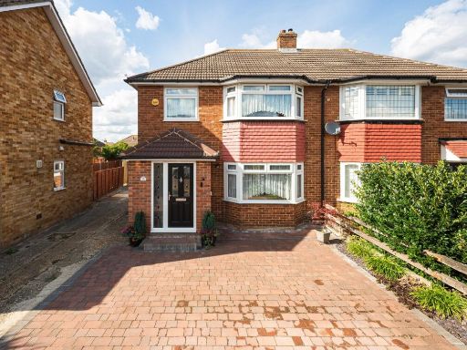 3 bedroom semi-detached house for sale in Leander Drive, Gravesend, Kent, DA12 — £425,000 • 3 bed • 2 bath • 1362 ft²
 3 bedroom detached house for sale in Cambria Crescent, Gravesend, Kent, DA12 — £475,000 • 3 bed • 2 bath • 1451 ft²
 3 bedroom semi-detached house for sale in Imperial Drive, Gravesend, DA12 — £430,000 • 3 bed • 2 bath • 1253 ft²
 3 bedroom semi-detached house for sale in St Francis Avenue, Gravesend, Kent, DA12 — £450,000 • 3 bed • 2 bath • 1185 ft²
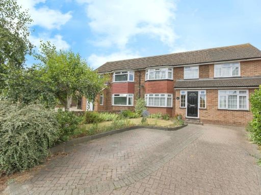 4 bedroom semi-detached house for sale in Thong Lane, GRAVESEND, Kent, DA12 — £525,000 • 4 bed • 2 bath • 1513 ft²
Meta
- {
"@context": "https://schema.org",
"@type": "Residence",
"name": "3 bedroom semidetached house for sale in Windhover Way, Gra…",
"description": "",
"url": "https://propertypiper.co.uk/property/daa3de09-76d7-4b87-9ae8-c47601eb8ca9",
"image": "https://image-a.propertypiper.co.uk/439dfa44-f2a4-4790-89b3-a868176b744f-1024.jpeg",
"address": {
"@type": "PostalAddress",
"streetAddress": "32 WINDHOVER WAY GRAVESEND ",
"postalCode": "DA12 4NS",
"addressLocality": "Gravesham",
"addressRegion": "Gravesham",
"addressCountry": "England"
},
"geo": {
"@type": "GeoCoordinates",
"latitude": 51.4216386,
"longitude": 0.3934297
},
"numberOfRooms": 3,
"numberOfBathroomsTotal": 1,
"floorSize": {
"@type": "QuantitativeValue",
"value": 1027,
"unitCode": "FTK"
},
"offers": {
"@type": "Offer",
"price": 400000,
"priceCurrency": "GBP",
"availability": "https://schema.org/InStock"
},
"additionalProperty": [
{
"@type": "PropertyValue",
"name": "Feature",
"value": "semi-detached"
},
{
"@type": "PropertyValue",
"name": "Feature",
"value": "mid-20th-century"
},
{
"@type": "PropertyValue",
"name": "Feature",
"value": "brick exterior"
},
{
"@type": "PropertyValue",
"name": "Feature",
"value": "attached garage"
},
{
"@type": "PropertyValue",
"name": "Feature",
"value": "paved driveway"
},
{
"@type": "PropertyValue",
"name": "Feature",
"value": "bay windows"
},
{
"@type": "PropertyValue",
"name": "Feature",
"value": "residential area"
},
{
"@type": "PropertyValue",
"name": "Feature",
"value": "family home"
},
{
"@type": "PropertyValue",
"name": "Feature",
"value": "contemporary"
},
{
"@type": "PropertyValue",
"name": "Feature",
"value": "living room"
},
{
"@type": "PropertyValue",
"name": "Feature",
"value": "neutral colors"
},
{
"@type": "PropertyValue",
"name": "Feature",
"value": "standard ceiling"
},
{
"@type": "PropertyValue",
"name": "Feature",
"value": "fireplace"
},
{
"@type": "PropertyValue",
"name": "Feature",
"value": "glass doors"
},
{
"@type": "PropertyValue",
"name": "Feature",
"value": "modern lighting"
}
]
}
High Res Floorplan Images
Compatible Floorplan Images
FloorplanImages Thumbnail