NG17 9HA - 4 bedroom detached house for sale in Forest Road, KirkbyInA…
View on Property Piper
4 bedroom detached house for sale in Forest Road, Kirkby-In-Ashfield, NG17
Property Details
- Price: £430000
- Bedrooms: 4
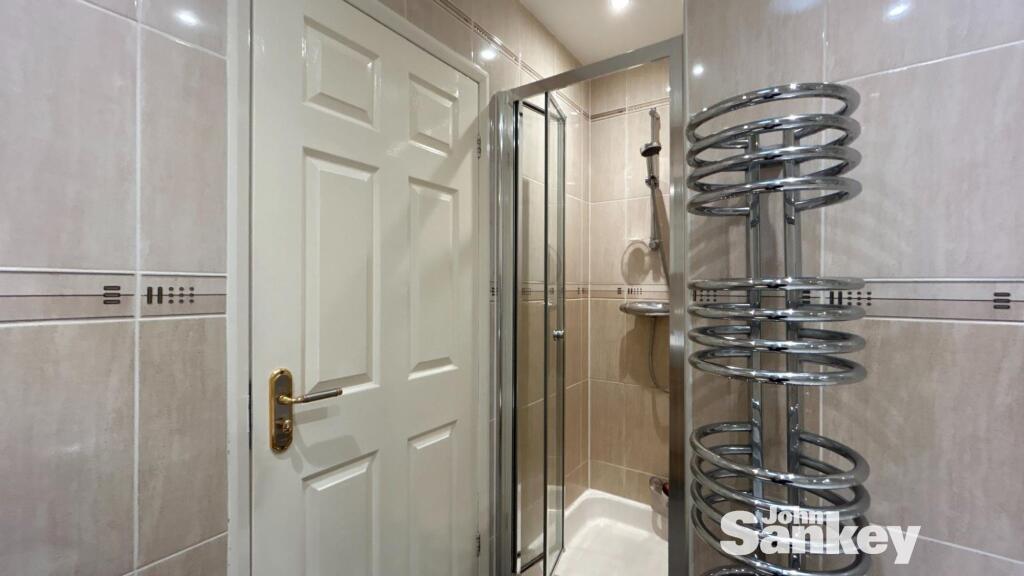
- Bathrooms: 1
- Property Type: undefined
- Property SubType: undefined
Brochure Descriptions
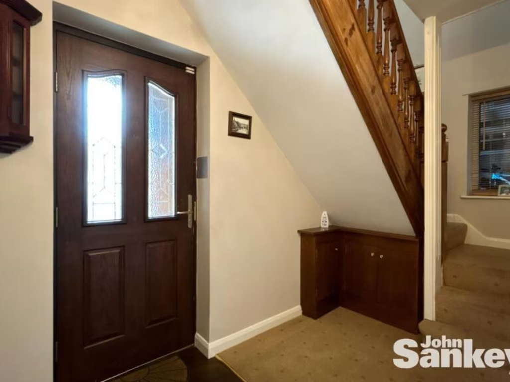
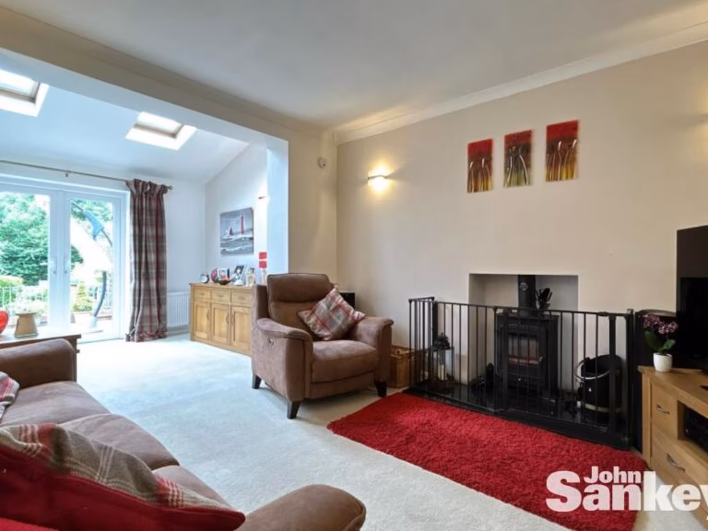
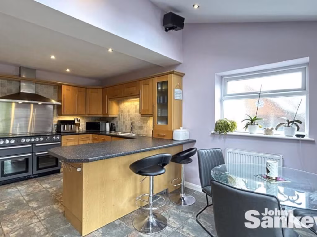
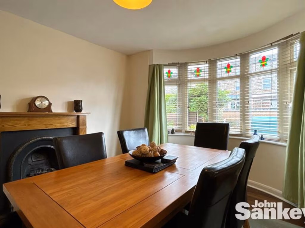
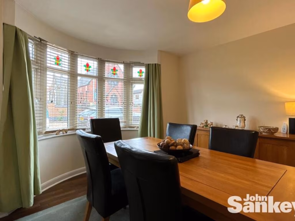
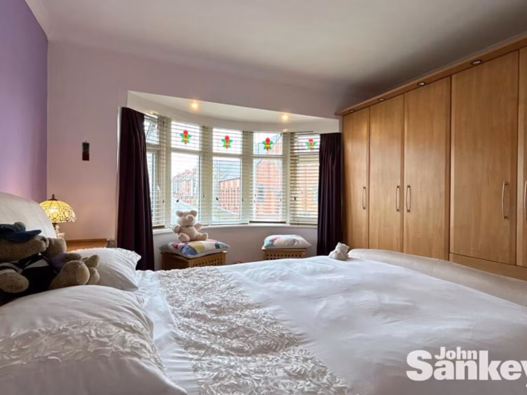
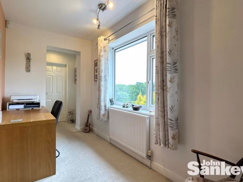
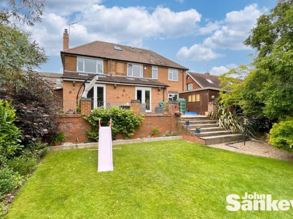
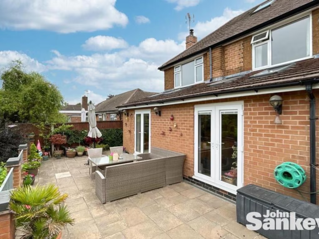
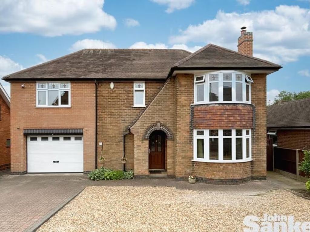
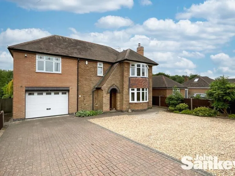
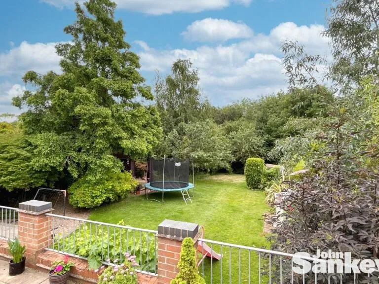
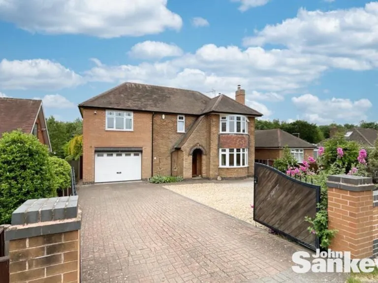
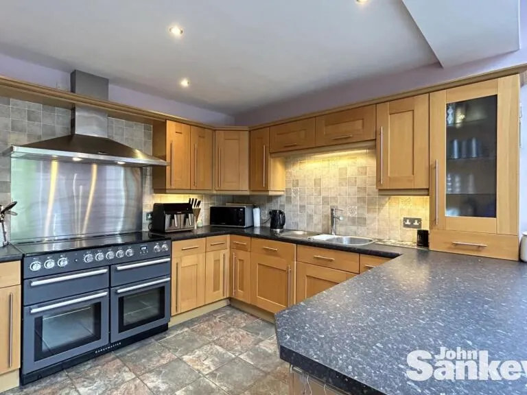
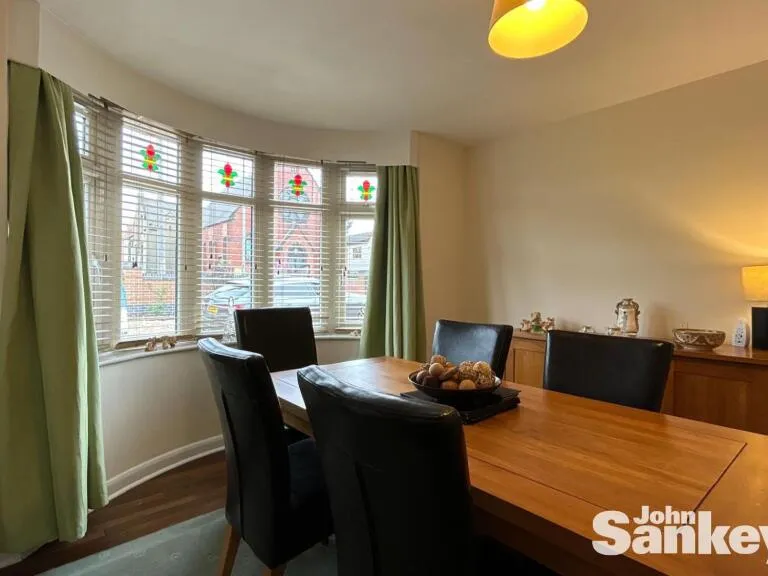
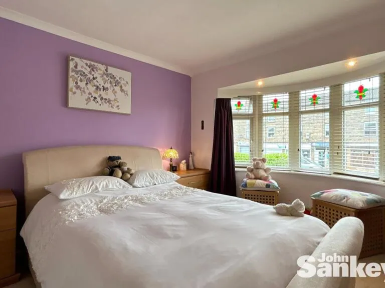
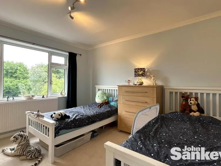
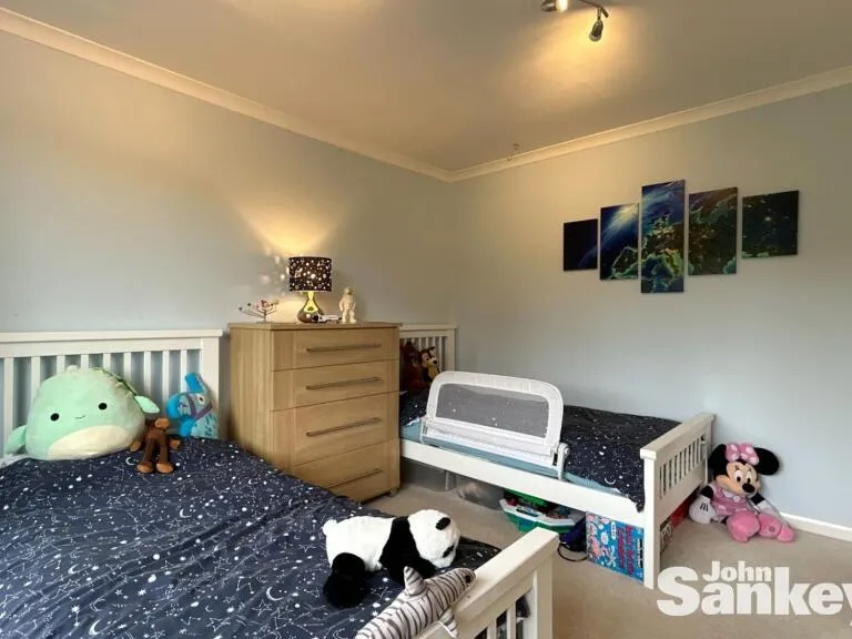
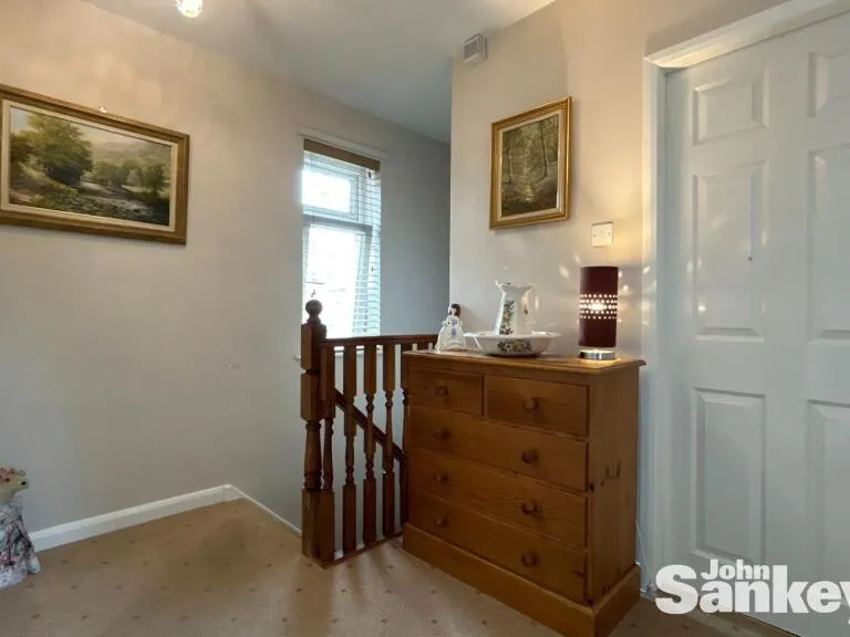
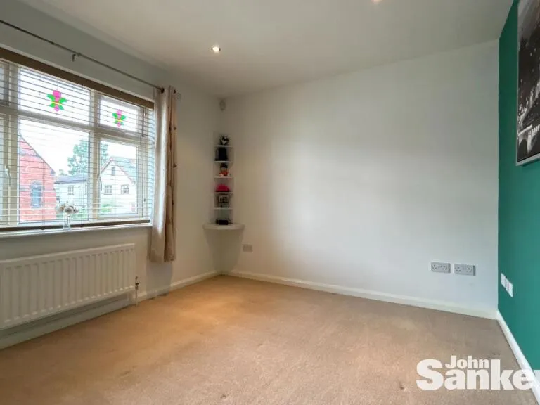
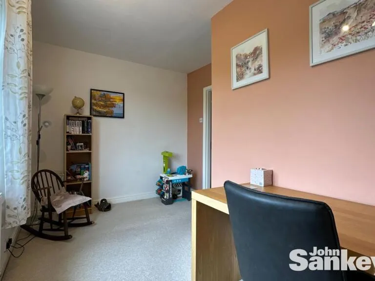
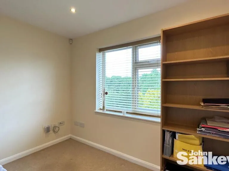
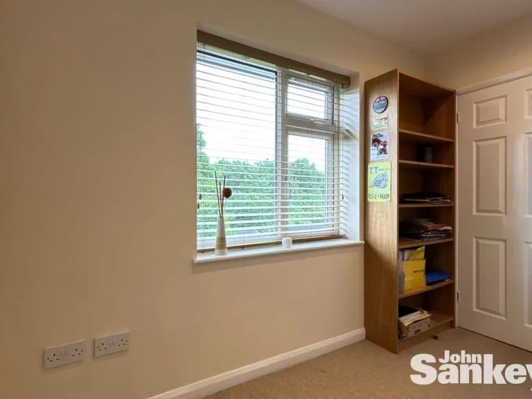
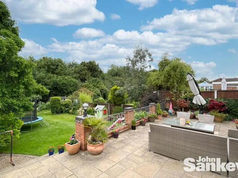
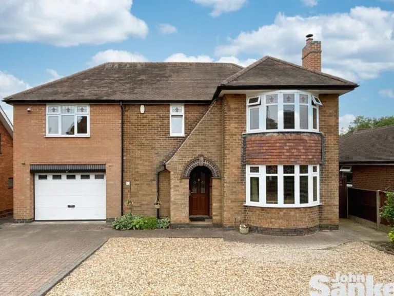
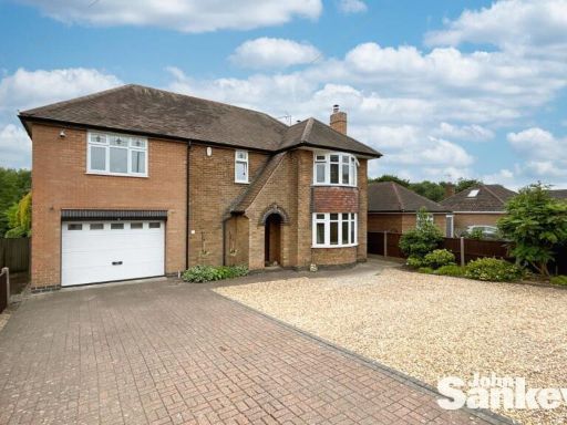
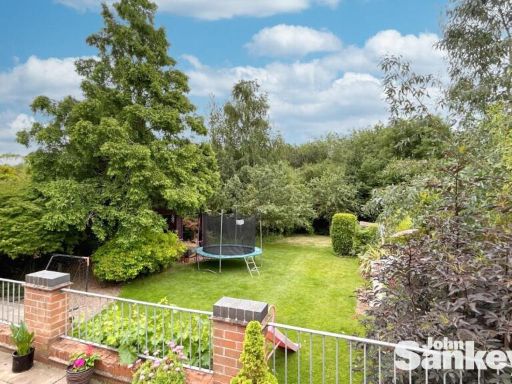
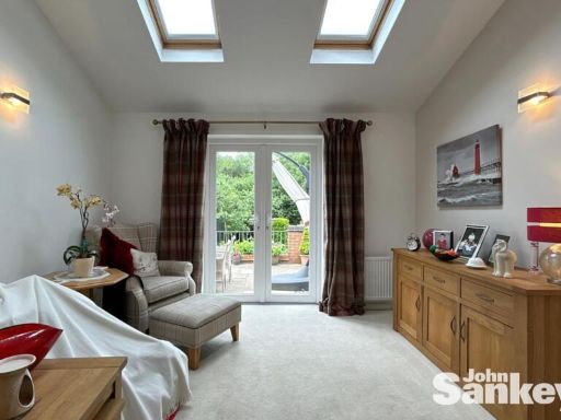
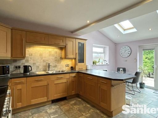
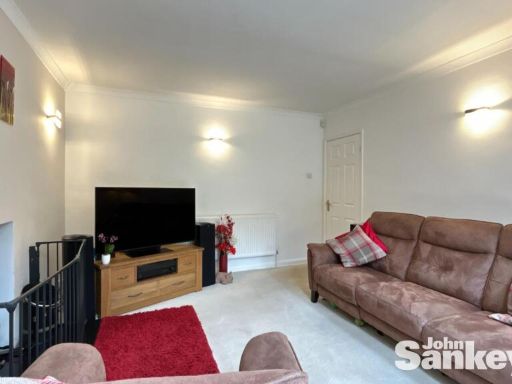
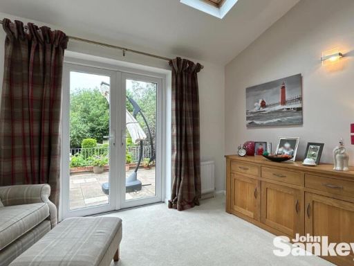
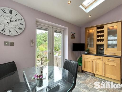
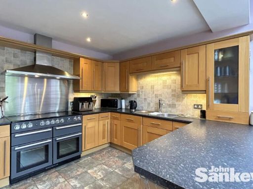
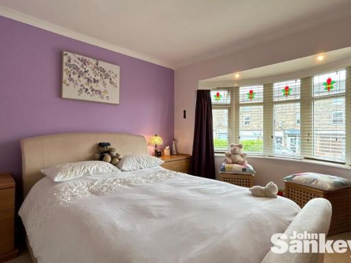
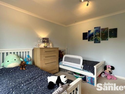
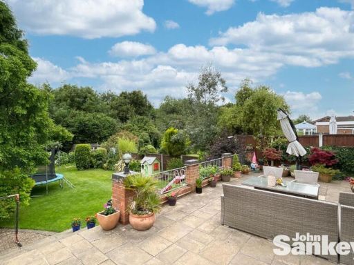
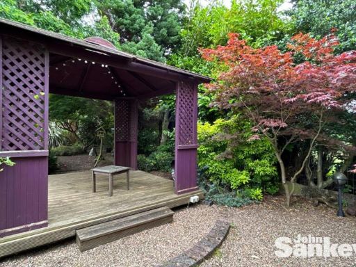
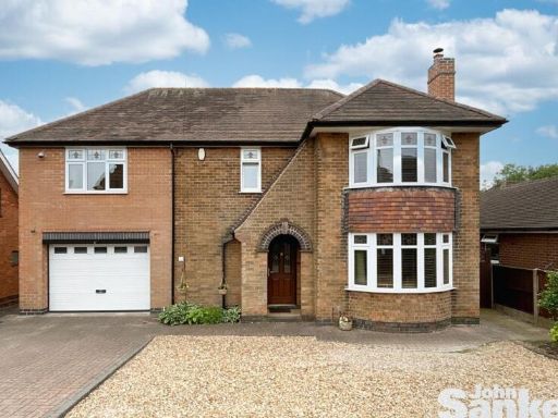
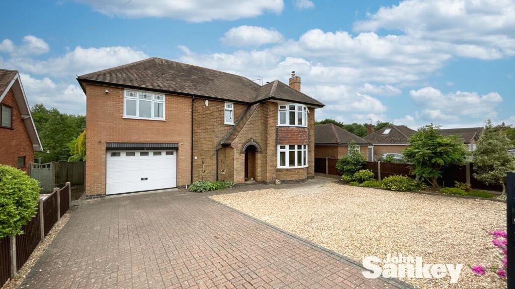
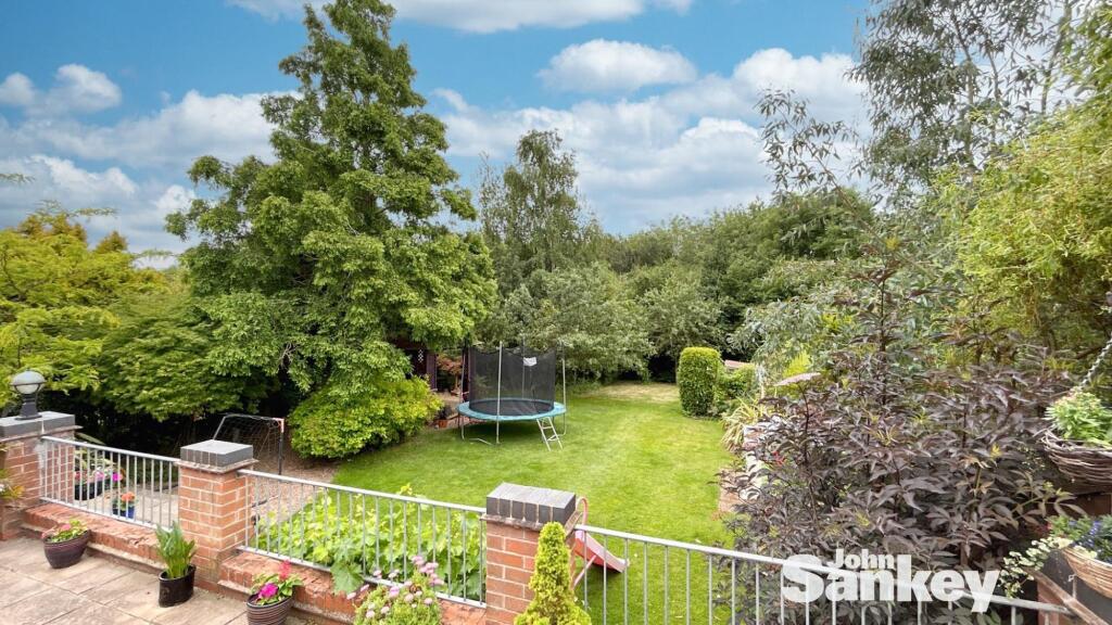
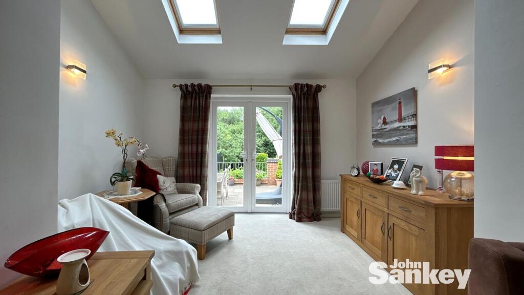
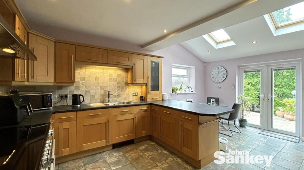
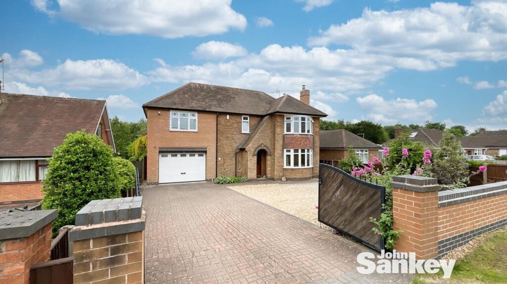
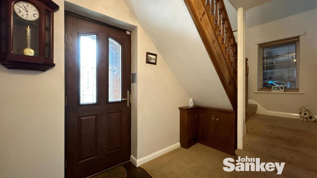
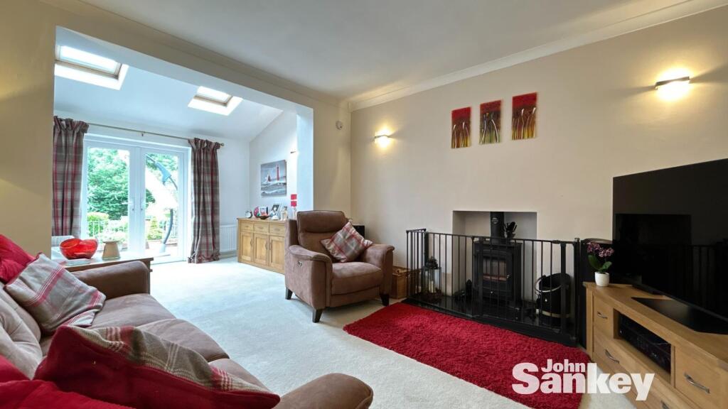
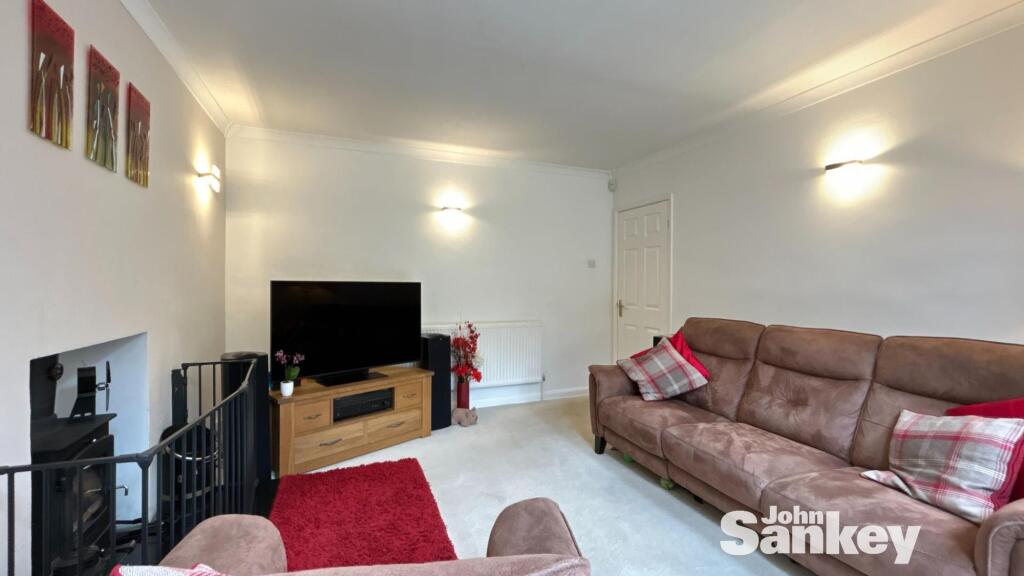
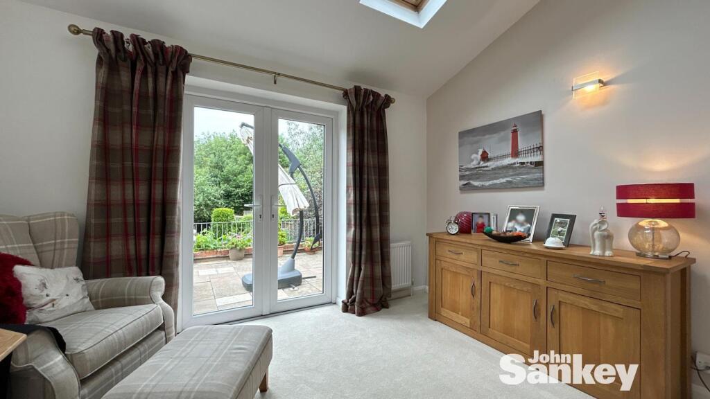
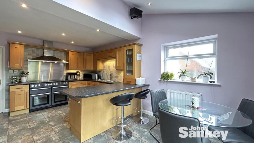
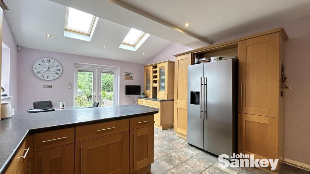
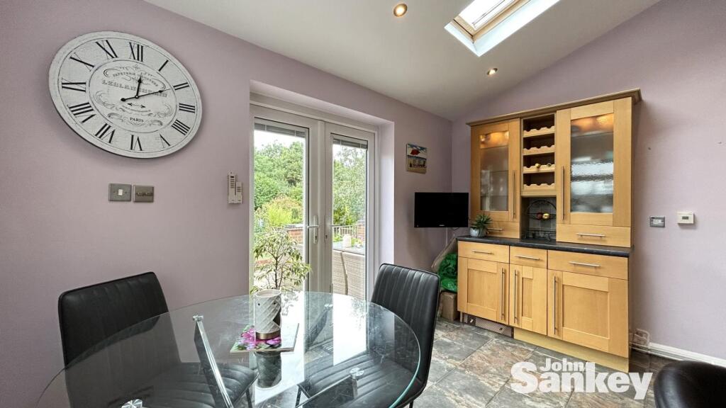
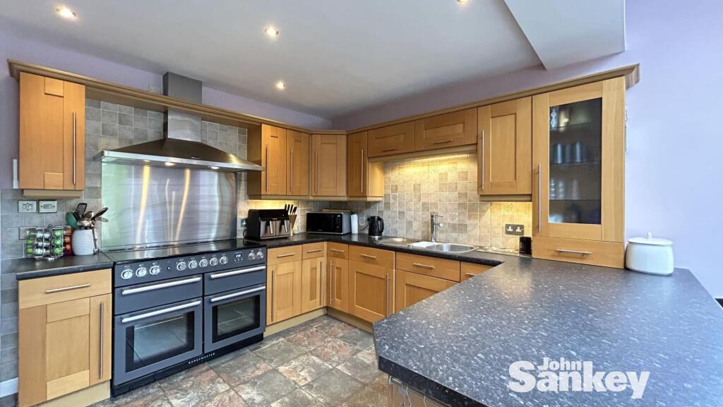
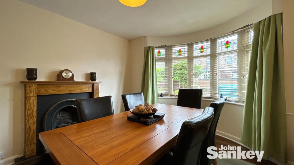
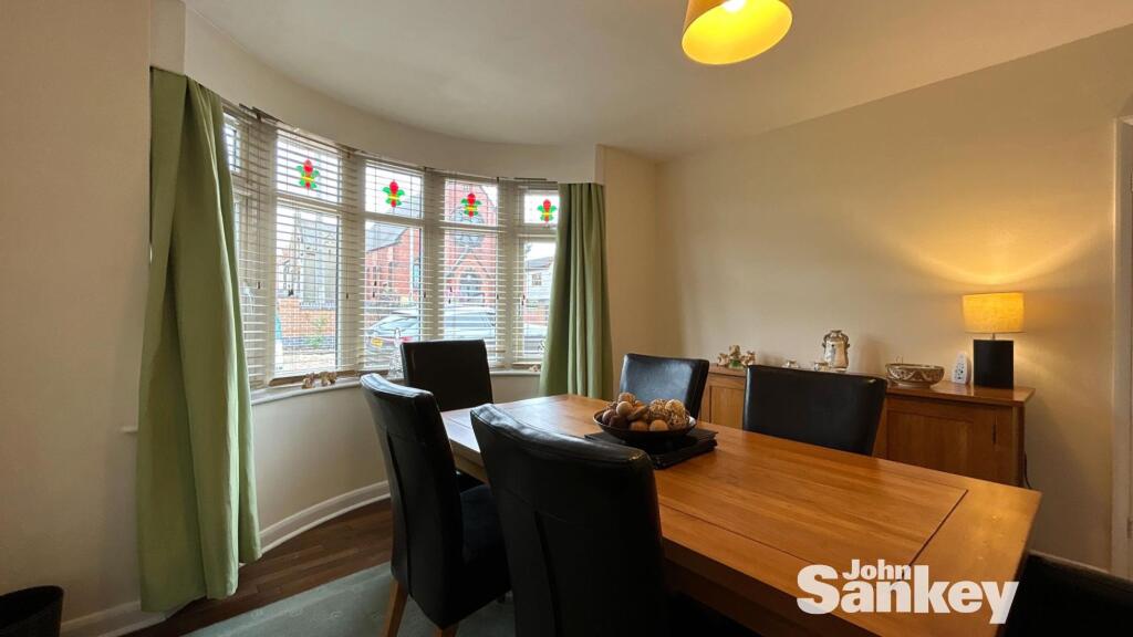
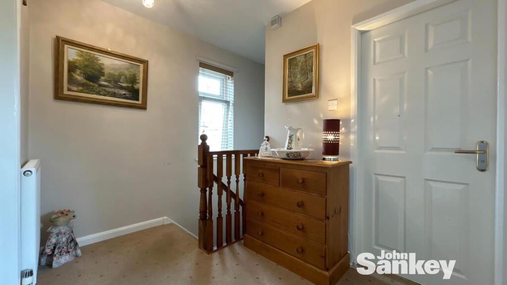
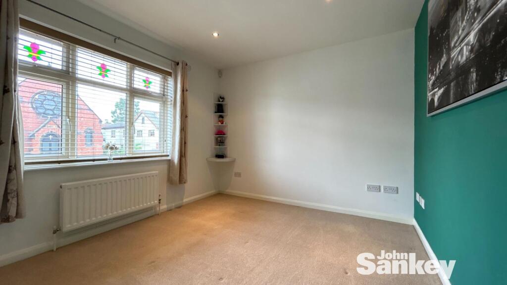
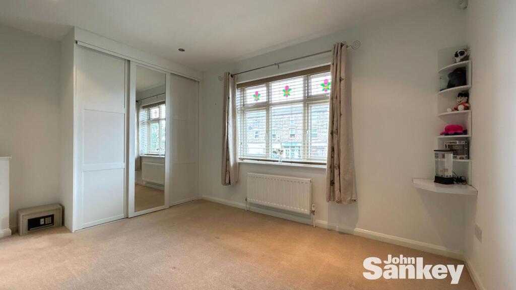
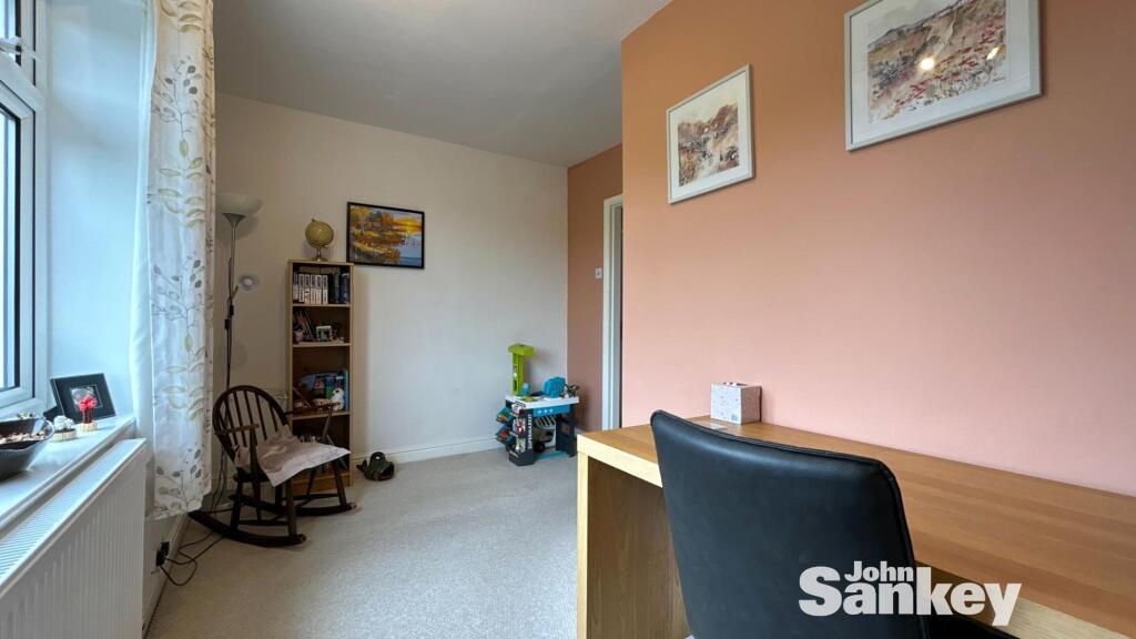
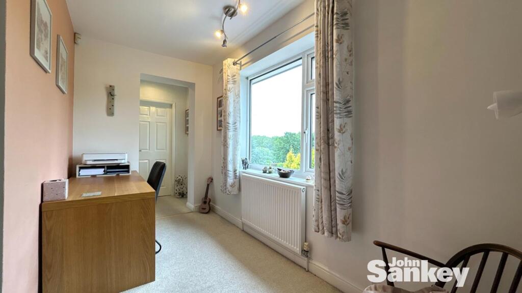
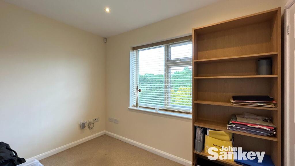
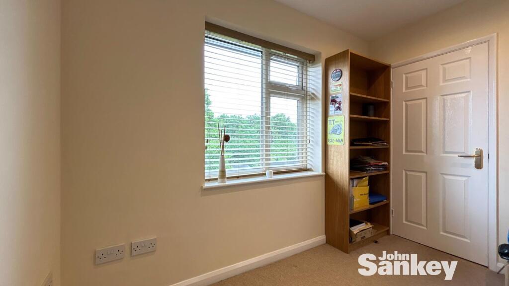
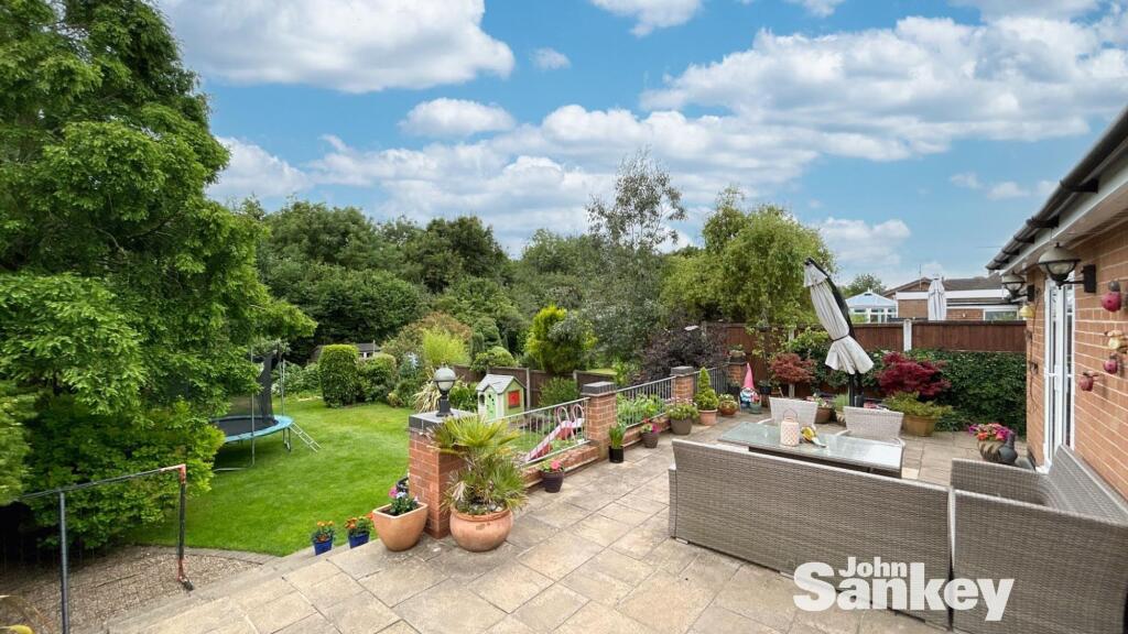
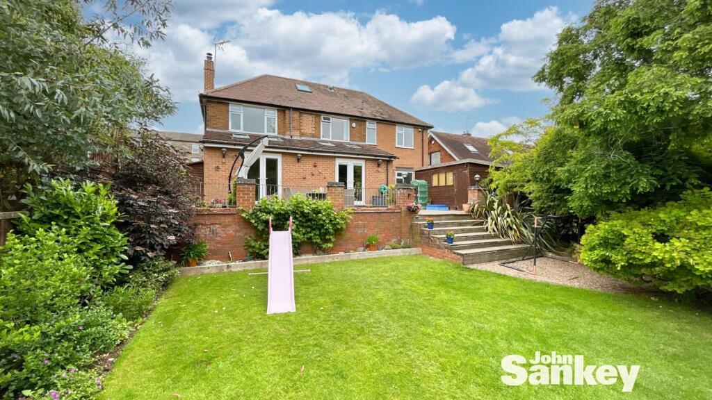
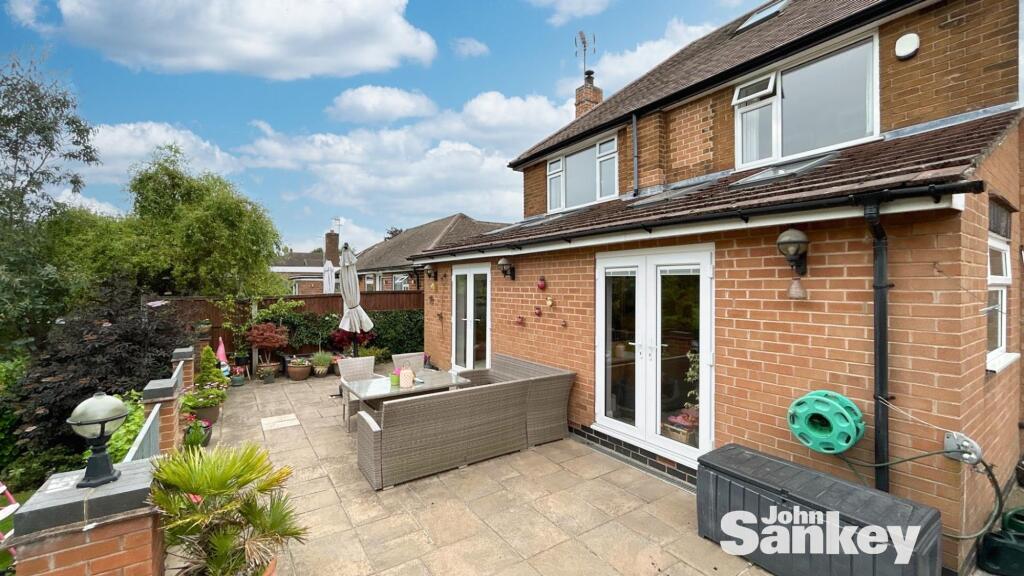
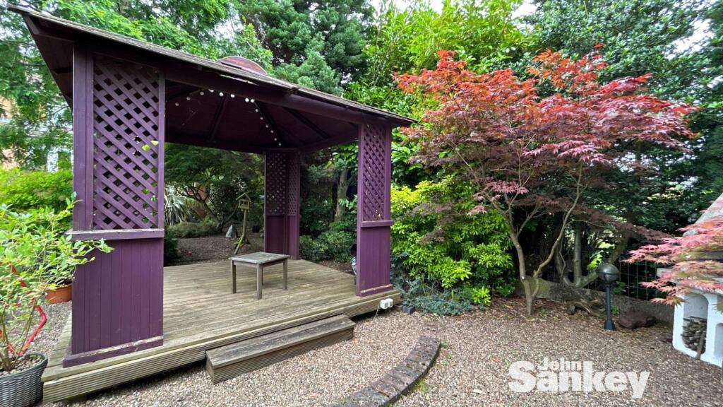
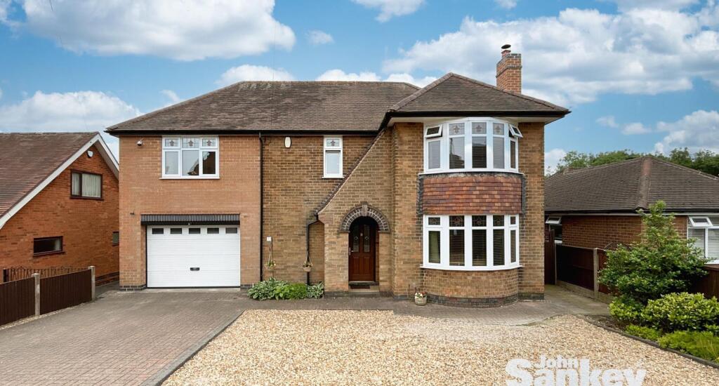
- Well-presented, substantial detached two-storey family home on a large, private plot. The property appears to offer four bedrooms plus an additional office area and extended living accommodation (extended lounge and dining kitchen noted), with a single integral garage and substantial off-street parking provided by a wide block‑paved driveway and large gravel forecourt. Mature, enclosed rear garden of large size with established trees and shrubbery, offering good privacy and family amenity. Constructed in traditional brick with bay windows to the front, pitched roof and a covered arched entrance. Convenient location for motorway access (advertised as near M1 Junction 27). EPC rating shown as D. Overall this is a sizeable family home with strong external curb appeal and a generous plot, suitable for buyers seeking extended living space and garden privacy.
Image Descriptions
- detached house Post-war traditional
- garden
Floorplan Description
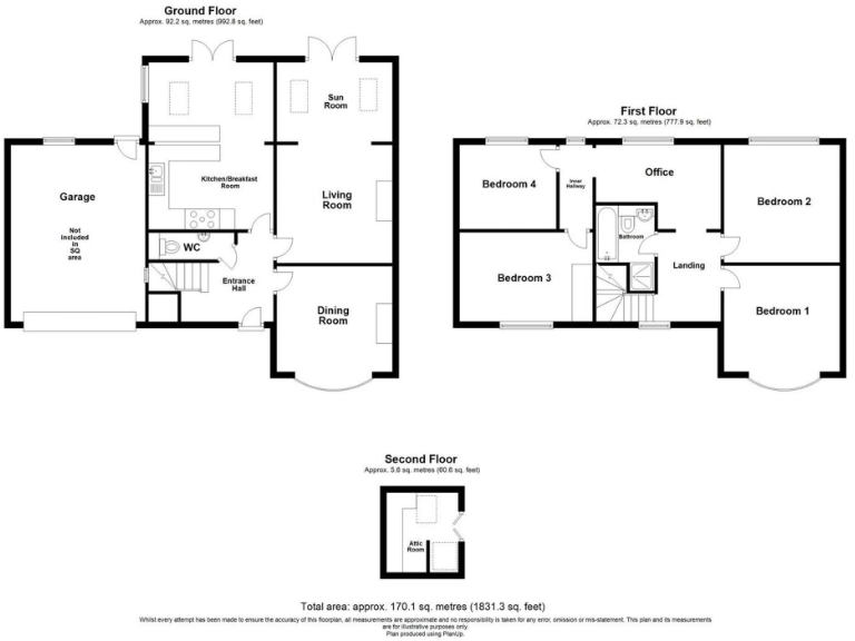
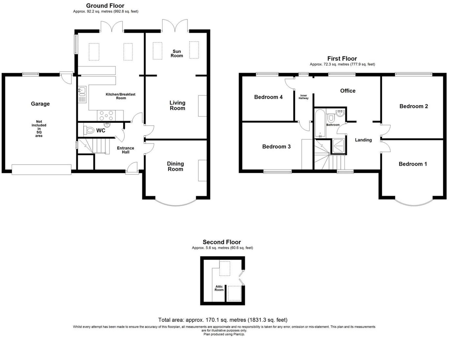
- Multi-storey house floorplan with garage (garage area not included in totals).
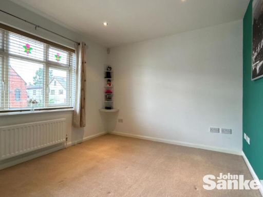
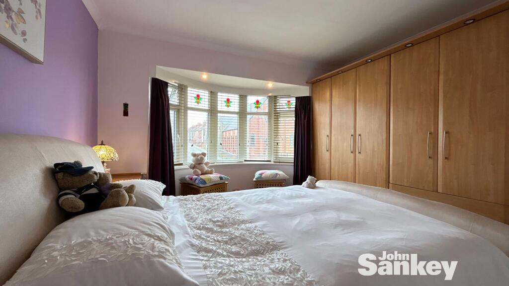
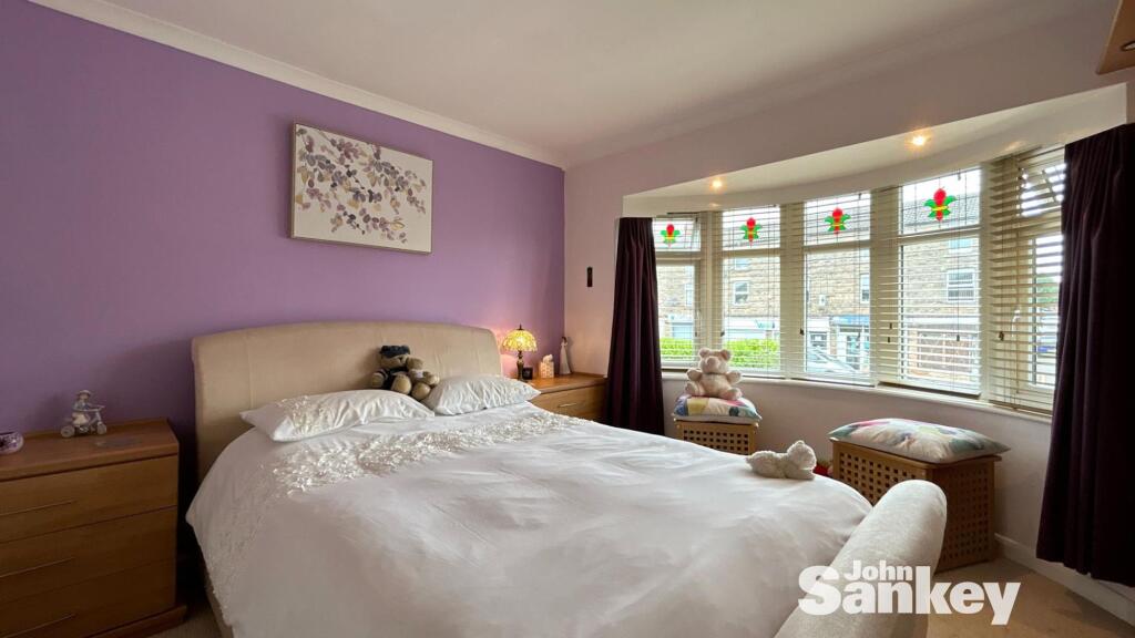
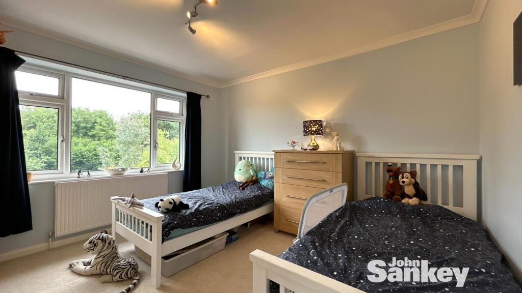
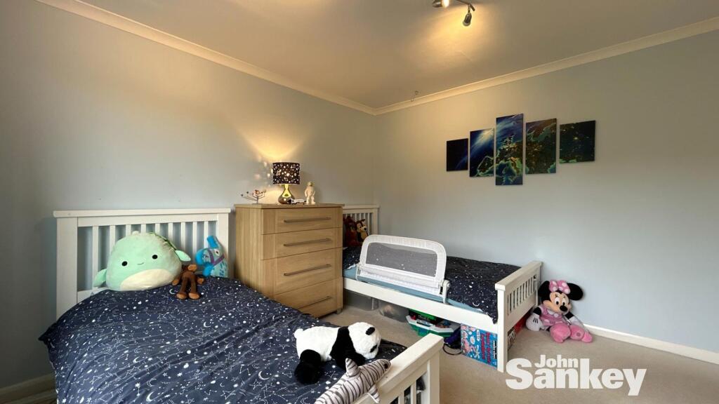
Rooms
- Kitchen/Breakfast Room:
- Sun Room:
- Living Room:
- Dining Room:
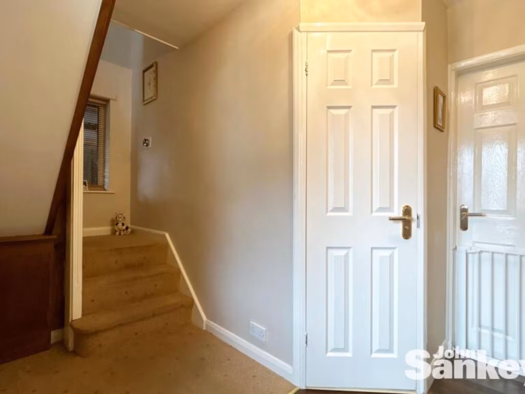
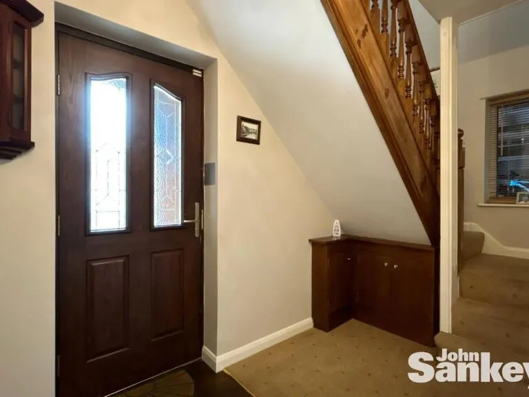
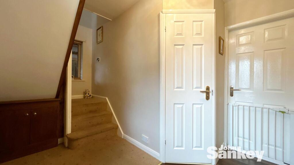
- Entrance Hall:
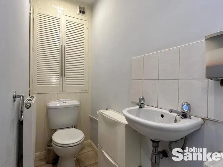
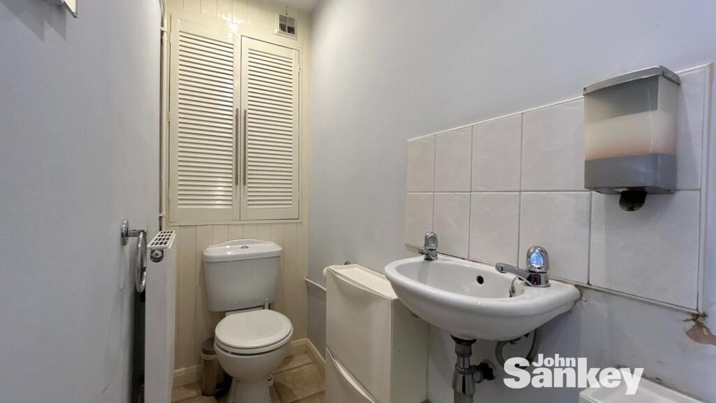
- WC:
- Garage:
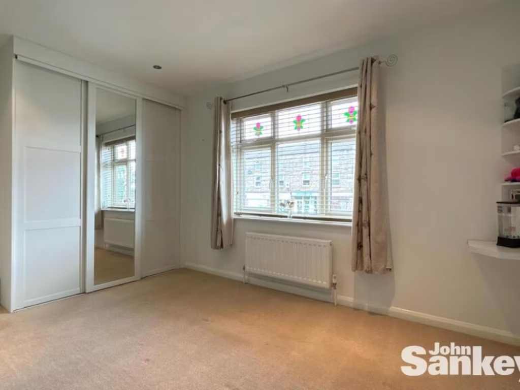
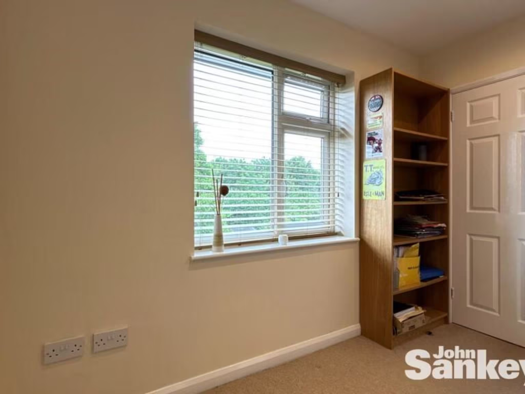
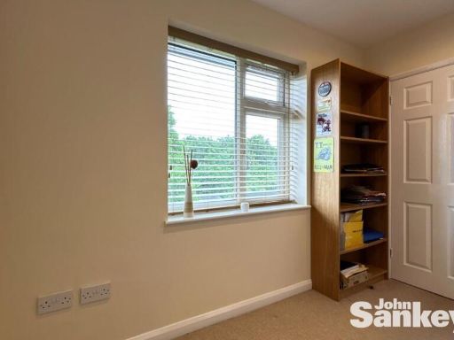
- Bedroom 4:
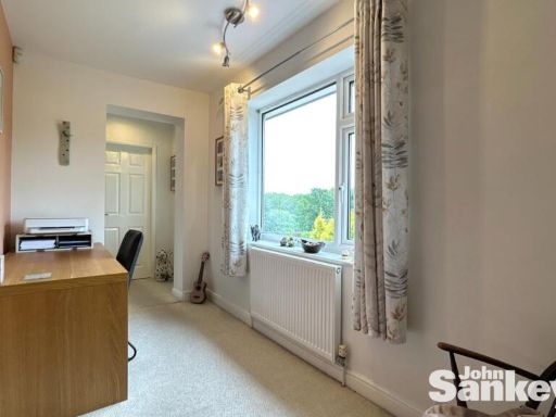
- Bedroom 3:
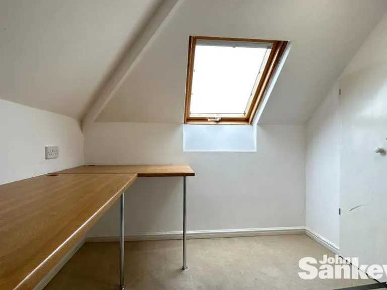
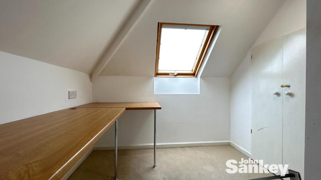
- Office:
- Bedroom 2:
- Bedroom 1:
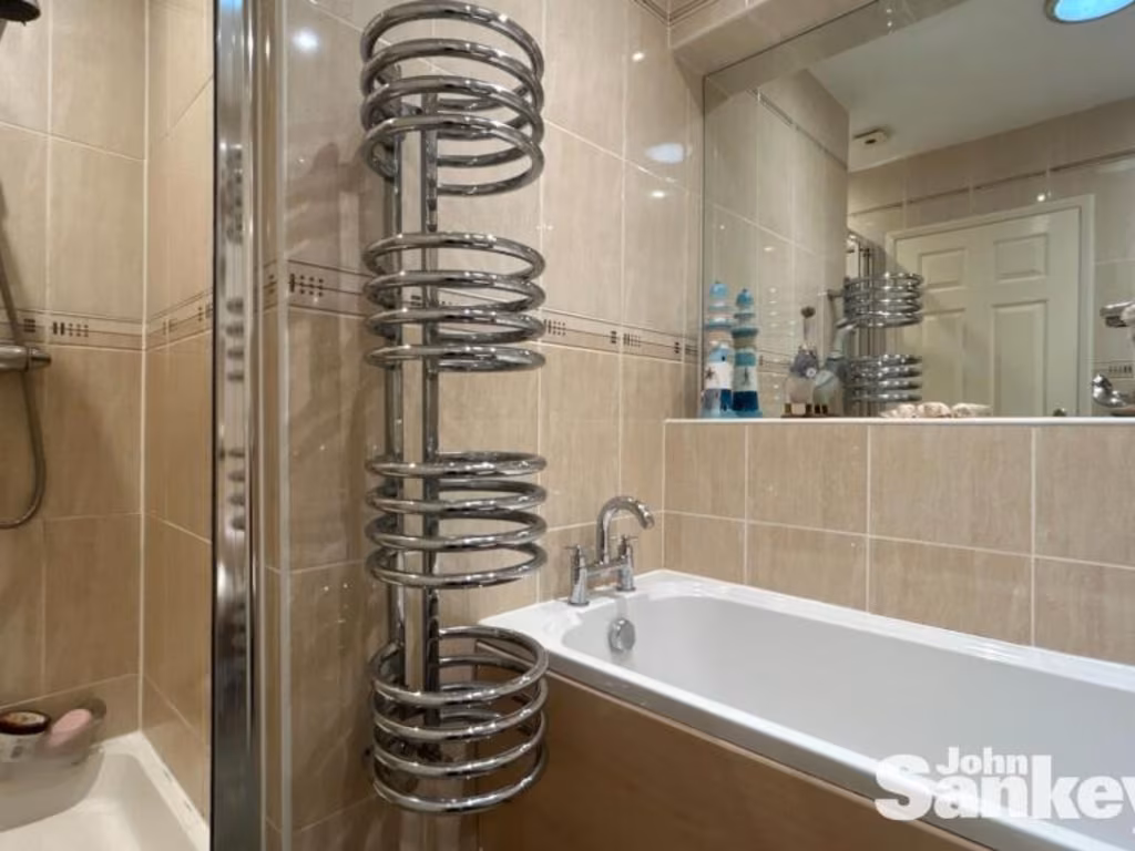
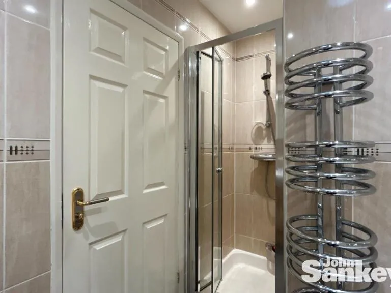
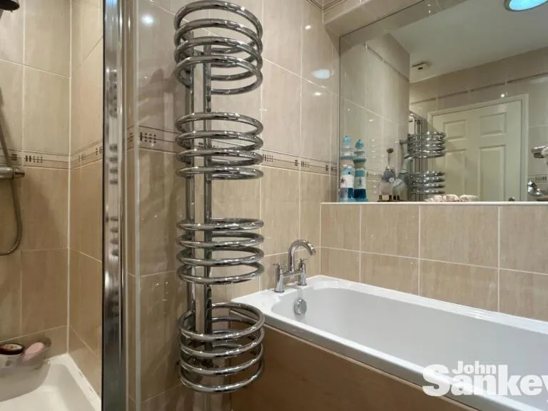
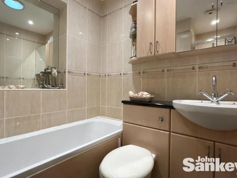
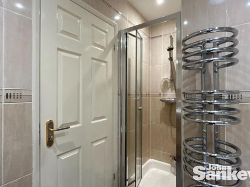
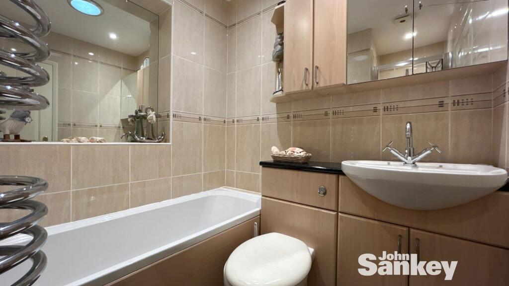
- Bathroom:
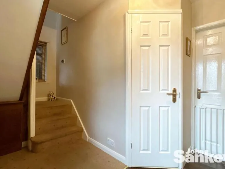
- Landing:
- Inner Hallway:
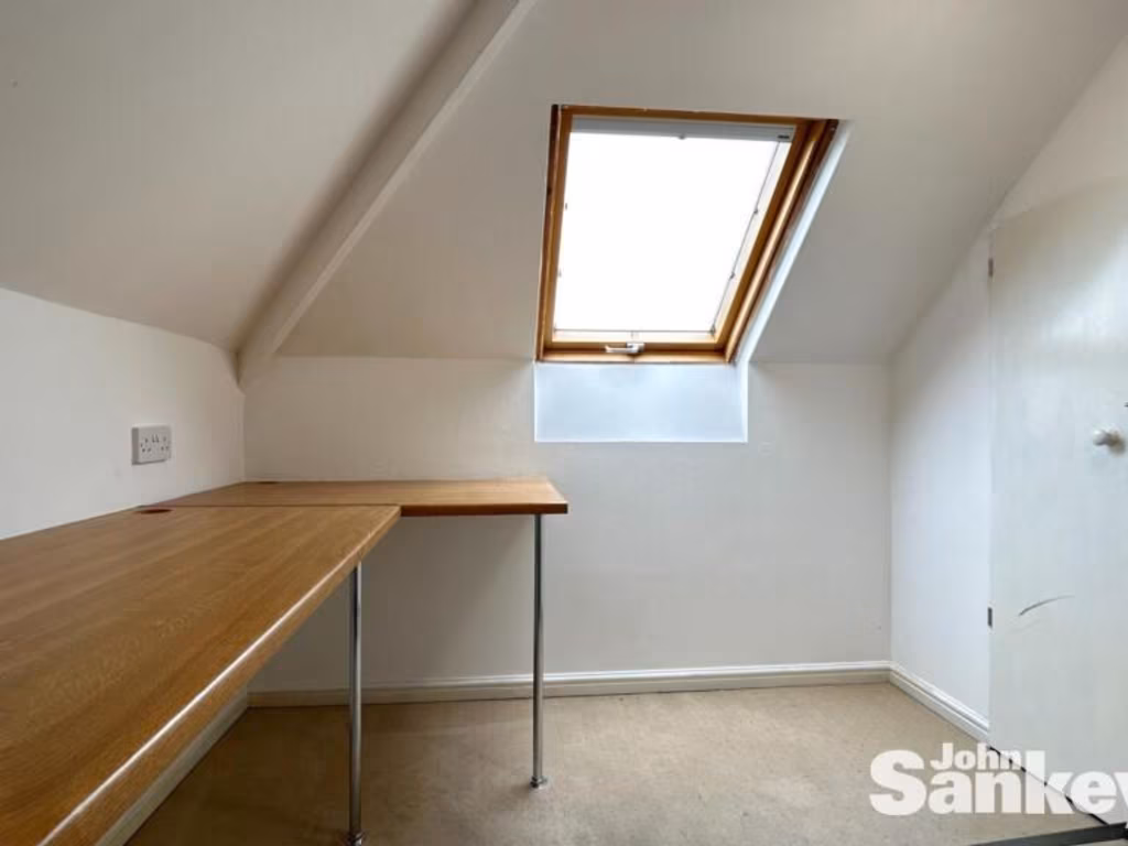
- Attic Room:
Textual Property Features
Detected Visual Features
- detached house
- Post-war
- brick construction
- two-story
- garage
- driveway
- garden
- mature trees
- landscaped
- outdoor space
- private
- vegetable patch
- lawn
- play area
EPC Details
- Fully double glazed
- Cavity wall, as built, no insulation (assumed)
- Boiler and radiators, mains gas
- Low energy lighting in all fixed outlets
- Suspended, no insulation (assumed)
Nearby Schools
- Edgewood Primary and Nursery School
- The National CofE Academy
- Bagthorpe Primary School
- Selston High School
- Annesley Primary and Nursery School
- Croft Primary School
- Holly Hill Primary and Nursery School
- Kirkby Woodhouse School
- Kingsway Primary School
- Morven Park Primary and Nursery School
- The West Park Academy
- Ashfield Comprehensive School
- Priestsic Primary and Nursery School
- Forest Glade Primary School
- Hillside Primary and Nursery School
- Newstead Primary and Nursery School
- Orchard Primary School and Nursery
- Greenwood Primary and Nursery School
- Mapplewells Primary and Nursery School
- Hillocks Primary Academy
- Brierley Forest Primary and Nursery School
- The Holgate Academy
- Underwood Church of England Primary School
- Outwood Academy Kirkby
- Leamington Primary and Nursery Academy
- Sutton Community Academy
Nearest General Shops
- Id: 905985628
- Tags:
- Addr:
- Housenumber: 146
- Street: Forest Road
- Building: yes
- Name: Gigi's Fashion
- Shop: yes
- TagsNormalized:
- Lat: 53.0768624
- Lon: -1.2542143
- FullGeoHash: gcrjgqqensq0
- PartitionGeoHash: gcrj
- Images:
- FoodStandards: null
- Distance: 76.2
,- Id: 905985627
- Tags:
- TagsNormalized:
- Lat: 53.076864
- Lon: -1.2541105
- FullGeoHash: gcrjgqqg1he6
- PartitionGeoHash: gcrj
- Images:
- FoodStandards: null
- Distance: 69.5
,- Id: 905985624
- Tags:
- Addr:
- Housenumber: 138
- Street: Forest Road
- Building: yes
- Name: Sauce & Brown Menswear
- Shop: yes
- TagsNormalized:
- Lat: 53.0769292
- Lon: -1.2538126
- FullGeoHash: gcrjgqr5809x
- PartitionGeoHash: gcrj
- Images:
- FoodStandards: null
- Distance: 53.4
}
Nearest Grocery shops
- Id: 5248705966
- Tags:
- Brand: Shell
- Brand:wikidata: Q154950
- Brand:wikipedia: en:Royal Dutch Shell
- Name: Shell
- Shop: convenience
- TagsNormalized:
- Lat: 53.0796093
- Lon: -1.2428703
- FullGeoHash: gcrjgwygph2d
- PartitionGeoHash: gcrj
- Images:
- FoodStandards: null
- Distance: 755.9
,- Id: 544632227
- Tags:
- Addr:
- Building: retail
- Name: Co-operative Food
- Shop: supermarket
- TagsNormalized:
- Lat: 53.0771959
- Lon: -1.2578139
- FullGeoHash: gcrjgqkj4f3y
- PartitionGeoHash: gcrj
- Images:
- FoodStandards: null
- Distance: 319.3
,- Id: 5248693105
- Tags:
- Name: Ian White's
- Shop: convenience
- TagsNormalized:
- Lat: 53.0771007
- Lon: -1.2527893
- FullGeoHash: gcrjgqrsxbsw
- PartitionGeoHash: gcrj
- Images:
- FoodStandards: null
- Distance: 48.5
}
Nearest Supermarkets
- Id: 1223157839
- Tags:
- Addr:
- City: Pinxton
- Housenumber: 146
- Postcode: NG16 6LQ
- Street: Wharf Road
- Ele: 98.1796875
- Fhrs:
- Name: Co-op
- Operator: The Co-operative Group
- Shop: supermarket
- TagsNormalized:
- Lat: 53.0893171
- Lon: -1.3176712
- FullGeoHash: gcrn408e8n10
- PartitionGeoHash: gcrn
- Images:
- FoodStandards:
- Id: 60884
- FHRSID: 60884
- LocalAuthorityBusinessID: 13320/0146/0/000
- BusinessName: The Co Operative Food
- BusinessType: Retailers - supermarkets/hypermarkets
- BusinessTypeID: 7840
- AddressLine1: 146 Wharf Road
- AddressLine2: Pinxton
- AddressLine3: Nottingham
- AddressLine4: null
- PostCode: NG16 6LQ
- RatingValue: 4
- RatingKey: fhrs_4_en-GB
- RatingDate: 2022-07-04
- LocalAuthorityCode: 063
- LocalAuthorityName: Bolsover
- LocalAuthorityWebSite: http://www.bolsover.gov.uk/
- LocalAuthorityEmailAddress: enquiries@bolsover.gov.uk
- Scores:
- Hygiene: 5
- Structural: 10
- ConfidenceInManagement: 5
- NewRatingPending: false
- Geocode:
- Longitude: -1.31611100000000
- Latitude: 53.08986800000000
- Distance: 4534.7
,- Id: 236370576
- Tags:
- Brand: Morrisons
- Brand:wikidata: Q922344
- Brand:wikipedia: en:Morrisons
- Building: retail
- Contact:
- Website: https://my.morrisons.com/storefinder/512
- Name: Morrisons
- Shop: supermarket
- TagsNormalized:
- morrisons
- retail
- supermarket
- shop
- Lat: 53.100083
- Lon: -1.2427885
- FullGeoHash: gcrn5dx42uvt
- PartitionGeoHash: gcrn
- Images:
- FoodStandards: null
- Distance: 2689
,- Id: 261166173
- Tags:
- Addr:
- Brand: ALDI
- Brand:wikidata: Q41171672
- Brand:wikipedia: en:Aldi
- Building: retail
- Building:levels: 1
- Contact:
- Website: https://stores.aldi.co.uk/kirkby-in-ashfield/urban-road
- Name: Aldi
- Opening_hours: Mo-Sa 08:00-22:00; Su 10:00-16:00
- Shop: supermarket
- TagsNormalized:
- aldi
- retail
- supermarket
- shop
- Lat: 53.1002523
- Lon: -1.2516204
- FullGeoHash: gcrn5d8e7hkp
- PartitionGeoHash: gcrn
- Images:
- FoodStandards: null
- Distance: 2619.9
}
Nearest Religious buildings
- Id: 544629972
- Tags:
- Amenity: place_of_worship
- Building: yes
- Denomination: jehovahs_witness
- Religion: christian
- TagsNormalized:
- place of worship
- jehovah
- jehovahs witness
- christian
- church
- Lat: 53.0820901
- Lon: -1.2528336
- FullGeoHash: gcrjgrr9wfg9
- PartitionGeoHash: gcrj
- Images:
- FoodStandards: null
- Distance: 598.8
,- Id: 544632230
- Tags:
- Addr:
- City: Kirkby Woodhouse
- Country: GB
- Postcode: NG17 9JE
- Street: Skegby Road
- Amenity: place_of_worship
- Building: church
- Denomination: anglican
- Name: St John the Evangelist
- Operator: Church of England
- Religion: christian
- Website: https://www.achurchnearyou.com/church/17834/
- Wikidata: Q7588995
- TagsNormalized:
- place of worship
- church
- anglican
- evangelist
- christian
- Lat: 53.07807
- Lon: -1.2591284
- FullGeoHash: gcrjgqe4hjmu
- PartitionGeoHash: gcrj
- Images:
- FoodStandards: null
- Distance: 430.1
,- Id: 544632229
- Tags:
- Amenity: community_centre
- Building: hall
- Community_centre: parish_hall
- Denomination: anglican
- Name: St. John's Church Hall
- Religion: christian
- TagsNormalized:
- community centre
- anglican
- church
- church hall
- christian
- Lat: 53.0778753
- Lon: -1.2587944
- FullGeoHash: gcrjgqe35cng
- PartitionGeoHash: gcrj
- Images:
- FoodStandards: null
- Distance: 401.7
}
Nearest Medical buildings
- Id: 6816261129
- Tags:
- Amenity: clinic
- Healthcare: clinic
- Name: Your Feet First Foot Health clinic
- TagsNormalized:
- Lat: 53.098859
- Lon: -1.2452608
- FullGeoHash: gcrn5dm5r2dp
- PartitionGeoHash: gcrn
- Images:
- FoodStandards: null
- Distance: 2518.2
,- Id: 357347831
- Tags:
- Amenity: pharmacy
- Healthcare: pharmacy
- Name: Briscos
- TagsNormalized:
- Lat: 53.0985131
- Lon: -1.2440862
- FullGeoHash: gcrn5dq168q0
- PartitionGeoHash: gcrn
- Images:
- FoodStandards: null
- Distance: 2498.3
,- Id: 976664829
- Tags:
- Amenity: doctors
- Building: yes
- Healthcare: doctor
- Name: Ashfield House
- TagsNormalized:
- doctor
- doctors
- health
- healthcare
- Lat: 53.076419
- Lon: -1.2570744
- FullGeoHash: gcrjgqk8s197
- PartitionGeoHash: gcrj
- Images:
- FoodStandards: null
- Distance: 267.2
,- Id: 5248693109
- Tags:
- Amenity: pharmacy
- Brand: Well Pharmacy
- Brand:wikidata: Q7726524
- Brand:wikipedia: en:Well Pharmacy
- Healthcare: pharmacy
- Name: Well Pharmacy
- TagsNormalized:
- pharmacy
- well pharmacy
- health
- healthcare
- Lat: 53.076962
- Lon: -1.2533902
- FullGeoHash: gcrjgqr79yue
- PartitionGeoHash: gcrj
- Images:
- FoodStandards: null
- Distance: 34.2
}
Nearest Airports
- Id: 11359528
- Tags:
- Aerodrome: international
- Aerodrome:type: public
- Aeroway: aerodrome
- Iata: EMA
- Icao: EGNX
- Is_in: Castle Donington,England,UK
- Name: East Midlands Airport
- Old_name: RAF Castle Donington
- Operator: Manchester Airports Holdings Limited
- Operator:type: private
- Ref: EMA
- Type: multipolygon
- Website: https://www.eastmidlandsairport.com/
- Wikidata: Q8977
- Wikipedia: en:East Midlands Airport
- TagsNormalized:
- airport
- international airport
- Lat: 52.8281122
- Lon: -1.3322143
- FullGeoHash: gcrh99jfj1vh
- PartitionGeoHash: gcrh
- Images:
- FoodStandards: null
- Distance: 28146
}
Nearest Leisure Facilities
- Id: 8410193487
- Tags:
- TagsNormalized:
- picnic
- picnic table
- leisure
- Lat: 53.0793842
- Lon: -1.2499787
- FullGeoHash: gcrjgwccc6kk
- PartitionGeoHash: gcrj
- Images:
- FoodStandards: null
- Distance: 363.5
,- Id: 461449632
- Tags:
- Leisure: pitch
- Sport: skateboard
- TagsNormalized:
- pitch
- leisure
- skateboard
- sports
- Lat: 53.0795716
- Lon: -1.2504843
- FullGeoHash: gcrjgwc6vt73
- PartitionGeoHash: gcrj
- Images:
- FoodStandards: null
- Distance: 363.4
,- Id: 8410193475
- Tags:
- TagsNormalized:
- picnic
- picnic table
- leisure
- Lat: 53.0793305
- Lon: -1.2501655
- FullGeoHash: gcrjgwc9t035
- PartitionGeoHash: gcrj
- Images:
- FoodStandards: null
- Distance: 351.5
,- Id: 461449563
- Tags:
- Leisure: pitch
- Sport: basketball
- TagsNormalized:
- pitch
- leisure
- basketball
- sports
- Lat: 53.0793799
- Lon: -1.2503446
- FullGeoHash: gcrjgwc9bce6
- PartitionGeoHash: gcrj
- Images:
- FoodStandards: null
- Distance: 349.7
,- Id: 8410193476
- Tags:
- TagsNormalized:
- picnic
- picnic table
- leisure
- Lat: 53.0792862
- Lon: -1.2501387
- FullGeoHash: gcrjgwc9m8j5
- PartitionGeoHash: gcrj
- Images:
- FoodStandards: null
- Distance: 348.5
}
Nearest Tourist attractions
- Id: 4867673690
- Tags:
- Guest_house: bed_and_breakfast
- Name: Sherwood Cottage
- Tourism: guest_house
- TagsNormalized:
- Lat: 53.0992291
- Lon: -1.2707802
- FullGeoHash: gcrn546tkttx
- PartitionGeoHash: gcrn
- Images:
- FoodStandards: null
- Distance: 2768.6
,- Id: 2672390965
- Tags:
- Source: Sign at main road
- Tourism: caravan_site
- TagsNormalized:
- Lat: 53.0902841
- Lon: -1.2315473
- FullGeoHash: gcrn5bz1qf7b
- PartitionGeoHash: gcrn
- Images:
- FoodStandards: null
- Distance: 2086.1
,- Id: 9090298864
- Tags:
- Addr:
- Country: GB
- Housenumber: 9
- Postcode: NG17 9BE
- Street: Forest Road
- Fhrs:
- Guest_house: bed_and_breakfast
- Name: Woodhouse Bed & Breakfast
- Tourism: guest_house
- TagsNormalized:
- Lat: 53.078193
- Lon: -1.2456782
- FullGeoHash: gcrjgwsfvs74
- PartitionGeoHash: gcrj
- Images:
- FoodStandards:
- Id: 1150530
- FHRSID: 1150530
- LocalAuthorityBusinessID: 18945
- BusinessName: Woodhouse Bed & Breakfast
- BusinessType: Hotel/bed & breakfast/guest house
- BusinessTypeID: 7842
- AddressLine1: null
- AddressLine2: 9 Forest Road
- AddressLine3: null
- AddressLine4: null
- PostCode: NG17 9BE
- RatingValue: Exempt
- RatingKey: fhrs_exempt_en-GB
- RatingDate: 2019-12-13
- LocalAuthorityCode: 259
- LocalAuthorityName: Ashfield
- LocalAuthorityWebSite: http://www.ashfield.gov.uk
- LocalAuthorityEmailAddress: info@ashfield.gov.uk
- Scores:
- Hygiene: null
- Structural: null
- ConfidenceInManagement: null
- NewRatingPending: false
- Geocode:
- Longitude: -1.24570090000000
- Latitude: 53.07819840000000
- Distance: 522.8
}
Nearest Train stations
- Id: 7147298084
- Tags:
- Name: Mansfield
- Naptan:
- Network: National Rail
- Public_transport: station
- Railway: station
- Ref:
- Train: yes
- Wikidata: Q13528239
- Wikipedia: en:Mansfield railway station, Nottinghamshire
- TagsNormalized:
- Lat: 53.142079
- Lon: -1.1985012
- FullGeoHash: gcrnkdpr0cs9
- PartitionGeoHash: gcrn
- Images:
- FoodStandards: null
- Distance: 8131.5
,- Id: 135459446
- Tags:
- Name: Hucknall
- Naptan:
- Network: National Rail
- Public_transport: station
- Railway: station
- Ref:
- Source: knowledge
- Train: yes
- Wikidata: Q2393008
- Wikipedia: en:Hucknall station
- TagsNormalized:
- Lat: 53.0384983
- Lon: -1.1959496
- FullGeoHash: gcrjsz35skeq
- PartitionGeoHash: gcrj
- Images:
- FoodStandards: null
- Distance: 5713.1
,- Id: 3170173970
- Tags:
- Name: Sutton Parkway
- Naptan:
- Network: National Rail
- Note: immediately after rejoining the old alignment; it's between two bridges, it's also miles away from its namesake
- Public_transport: station
- Railway: station
- Ref:
- Train: yes
- Wikidata: Q1984369
- Wikipedia: en:Sutton Parkway railway station
- TagsNormalized:
- Lat: 53.1141408
- Lon: -1.2455485
- FullGeoHash: gcrn5tjh297x
- PartitionGeoHash: gcrn
- Images:
- FoodStandards: null
- Distance: 4192.9
,- Id: 3170172465
- Tags:
- Name: Kirkby-in-Ashfield
- Naptan:
- Network: National Rail
- Note: Note the realignment after the Robin Hood line extension re-opened
- Public_transport: station
- Railway: station
- Ref:
- Train: yes
- Wikidata: Q6415580
- Wikipedia: en:Kirkby-in-Ashfield railway station
- TagsNormalized:
- Lat: 53.1000196
- Lon: -1.2532679
- FullGeoHash: gcrn56x6h9pd
- PartitionGeoHash: gcrn
- Images:
- FoodStandards: null
- Distance: 2592.2
,- Id: 49183356
- Tags:
- Name: Newstead
- Naptan:
- Network: National Rail
- Public_transport: station
- Railway: station
- Ref:
- Source: NPE
- Train: yes
- Wikidata: Q2700960
- Wikipedia: en:Newstead railway station
- TagsNormalized:
- Lat: 53.069977
- Lon: -1.2218222
- FullGeoHash: gcrjujn712xr
- PartitionGeoHash: gcrj
- Images:
- FoodStandards: null
- Distance: 2219.7
}
Nearest Hotels
- Id: 822692810
- Tags:
- Addr:
- Country: GB
- Housenumber: 1
- Postcode: NG17 5FF
- Street: Station Road
- Ele: 166.1923828
- Fhrs:
- Name: Central Hotel
- Tourism: hotel
- TagsNormalized:
- Lat: 53.1241747
- Lon: -1.2582074
- FullGeoHash: gcrn5qgy9xut
- PartitionGeoHash: gcrn
- Images:
- FoodStandards: null
- Distance: 5289.1
,- Id: 526106508
- Tags:
- Building: yes
- Source: Mapbox
- Tourism: hotel
- TagsNormalized:
- Lat: 53.0688887
- Lon: -1.294111
- FullGeoHash: gcrjfscstjbg
- PartitionGeoHash: gcrj
- Images:
- FoodStandards: null
- Distance: 2874.2
,- Id: 561222196
- Tags:
- Addr:
- Country: GB
- Postcode: NG15 0EA
- Street: Lake View Drive
- Building: yes
- Fhrs:
- Name: Mour
- Old_name: Dakota
- Tourism: hotel
- TagsNormalized:
- Lat: 53.0687766
- Lon: -1.2518586
- FullGeoHash: gcrjgsbkj8fx
- PartitionGeoHash: gcrj
- Images:
- FoodStandards: null
- Distance: 885.8
}
Tags
- detached house
- Post-war
- brick construction
- two-story
- garage
- driveway
- garden
- garden
- mature trees
- landscaped
- outdoor space
- private
- vegetable patch
- lawn
- play area
Local Market Stats
- Average Price/sqft: £181
- Avg Income: £36200
- Rental Yield: 4.5%
- Social Housing: 10%
- Planning Success Rate: 85%
Similar Properties
 4 bedroom detached house for sale in Forest Road, Sutton-in-Ashfield, NG17 — £270,000 • 4 bed • 2 bath
 4 bedroom detached house for sale in Eyres Close, Skegby, Sutton-in-Ashfield, Nottinghamshire, NG17 — £525,000 • 4 bed • 3 bath • 2896 ft²
 4 bedroom detached house for sale in Caspian Close, Mansfield, NG19 — £350,000 • 4 bed • 2 bath • 1537 ft²
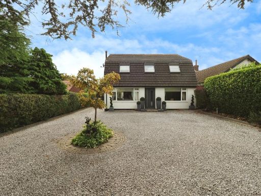 4 bedroom detached house for sale in Poplar Grove, Mansfield, NG19 — £600,000 • 4 bed • 2 bath • 1645 ft²
 3 bedroom detached house for sale in Alder Close, Forest Town, Mansfield, NG19 — £200,000 • 3 bed • 1 bath • 823 ft²
 4 bedroom detached house for sale in Kirkby Lane, Pinxton, Nottingham, Nottinghamshire, NG16 — £375,000 • 4 bed • 3 bath • 2201 ft²
Meta
- {
"@context": "https://schema.org",
"@type": "Residence",
"name": "4 bedroom detached house for sale in Forest Road, KirkbyInA…",
"description": "",
"url": "https://propertypiper.co.uk/property/d84f598c-8e14-46c3-be0c-6939f894b675",
"image": "https://image-a.propertypiper.co.uk/86a708ed-bec7-482a-ac80-d6c9d26ff471-1024.jpeg",
"address": {
"@type": "PostalAddress",
"streetAddress": "75 FOREST ROAD ANNESLEY WOODHOUSE NOTTINGHAM",
"postalCode": "NG17 9HA",
"addressLocality": "Ashfield",
"addressRegion": "Ashfield",
"addressCountry": "England"
},
"geo": {
"@type": "GeoCoordinates",
"latitude": 53.076707461641945,
"longitude": -1.2531031446361205
},
"numberOfRooms": 4,
"numberOfBathroomsTotal": 1,
"floorSize": {
"@type": "QuantitativeValue",
"value": 1831,
"unitCode": "FTK"
},
"offers": {
"@type": "Offer",
"price": 430000,
"priceCurrency": "GBP",
"availability": "https://schema.org/InStock"
},
"additionalProperty": [
{
"@type": "PropertyValue",
"name": "Feature",
"value": "detached house"
},
{
"@type": "PropertyValue",
"name": "Feature",
"value": "Post-war"
},
{
"@type": "PropertyValue",
"name": "Feature",
"value": "brick construction"
},
{
"@type": "PropertyValue",
"name": "Feature",
"value": "two-story"
},
{
"@type": "PropertyValue",
"name": "Feature",
"value": "garage"
},
{
"@type": "PropertyValue",
"name": "Feature",
"value": "driveway"
},
{
"@type": "PropertyValue",
"name": "Feature",
"value": "garden"
},
{
"@type": "PropertyValue",
"name": "Feature",
"value": "garden"
},
{
"@type": "PropertyValue",
"name": "Feature",
"value": "mature trees"
},
{
"@type": "PropertyValue",
"name": "Feature",
"value": "landscaped"
},
{
"@type": "PropertyValue",
"name": "Feature",
"value": "outdoor space"
},
{
"@type": "PropertyValue",
"name": "Feature",
"value": "private"
},
{
"@type": "PropertyValue",
"name": "Feature",
"value": "vegetable patch"
},
{
"@type": "PropertyValue",
"name": "Feature",
"value": "lawn"
},
{
"@type": "PropertyValue",
"name": "Feature",
"value": "play area"
}
]
}
High Res Floorplan Images
Compatible Floorplan Images
FloorplanImages Thumbnail