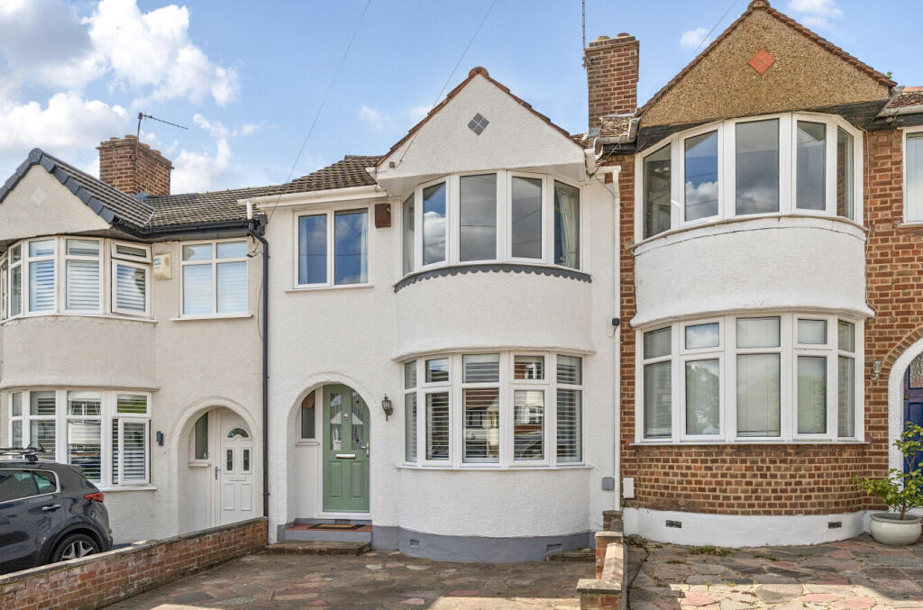
BR7 6JB - 3 bedroom terraced house for sale in Meadow Close, Chislehu…
View on Property Piper
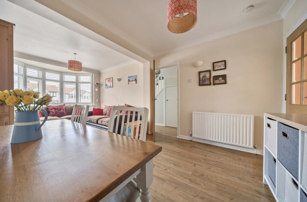
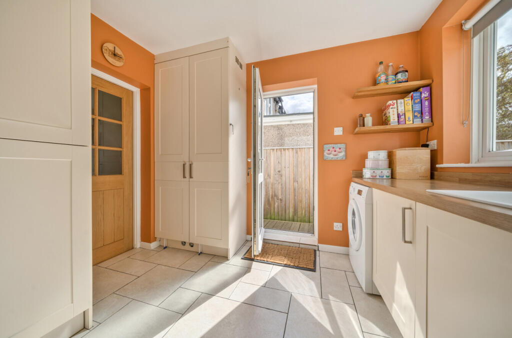
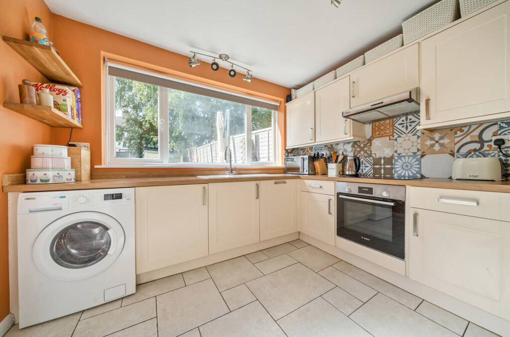
3 bedroom terraced house for sale in Meadow Close, Chislehurst, Kent, BR7
Property Details
- Price: £500000
- Bedrooms: 3
- Bathrooms: 1
- Property Type: undefined
- Property SubType: undefined
Image Descriptions
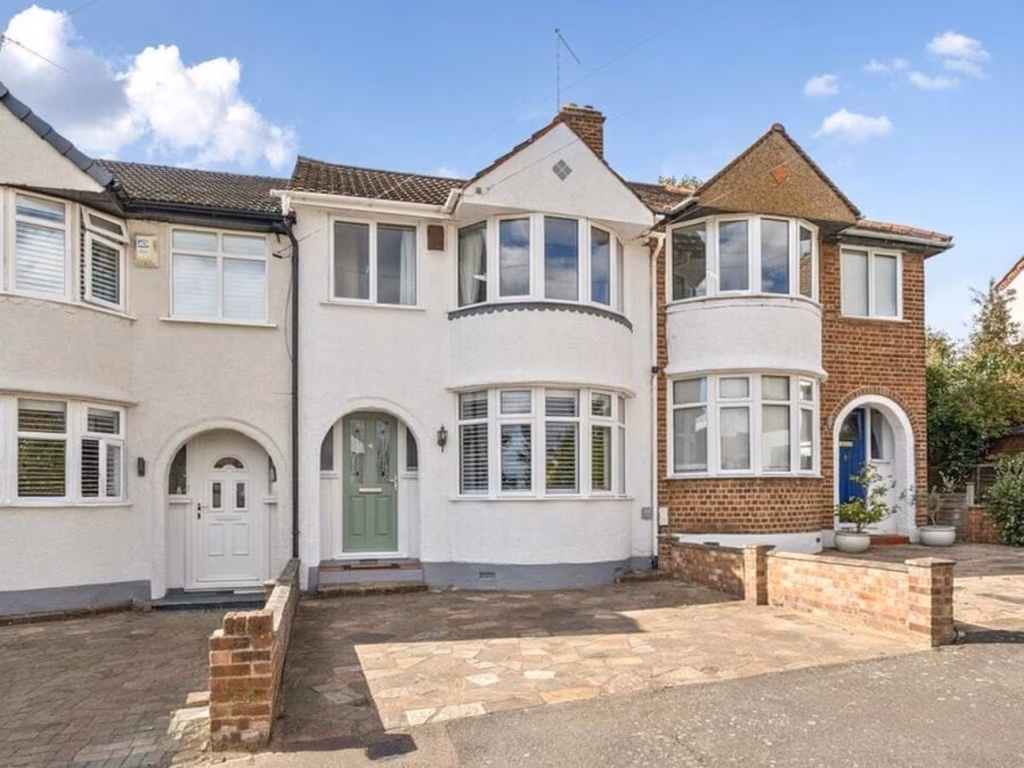
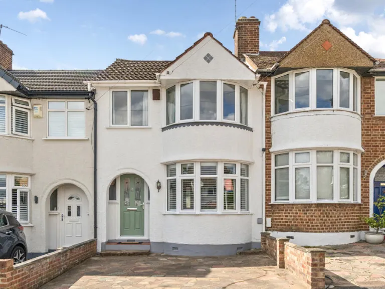
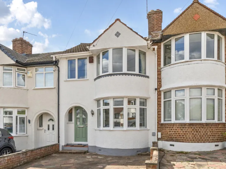
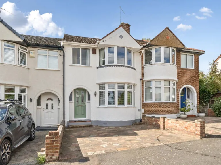
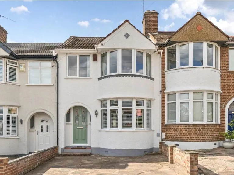
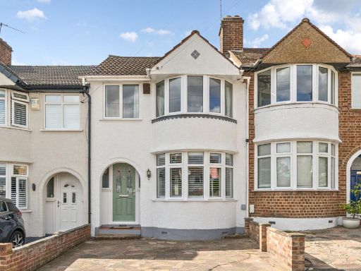
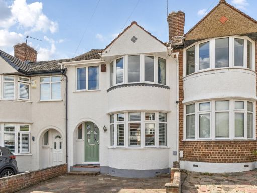
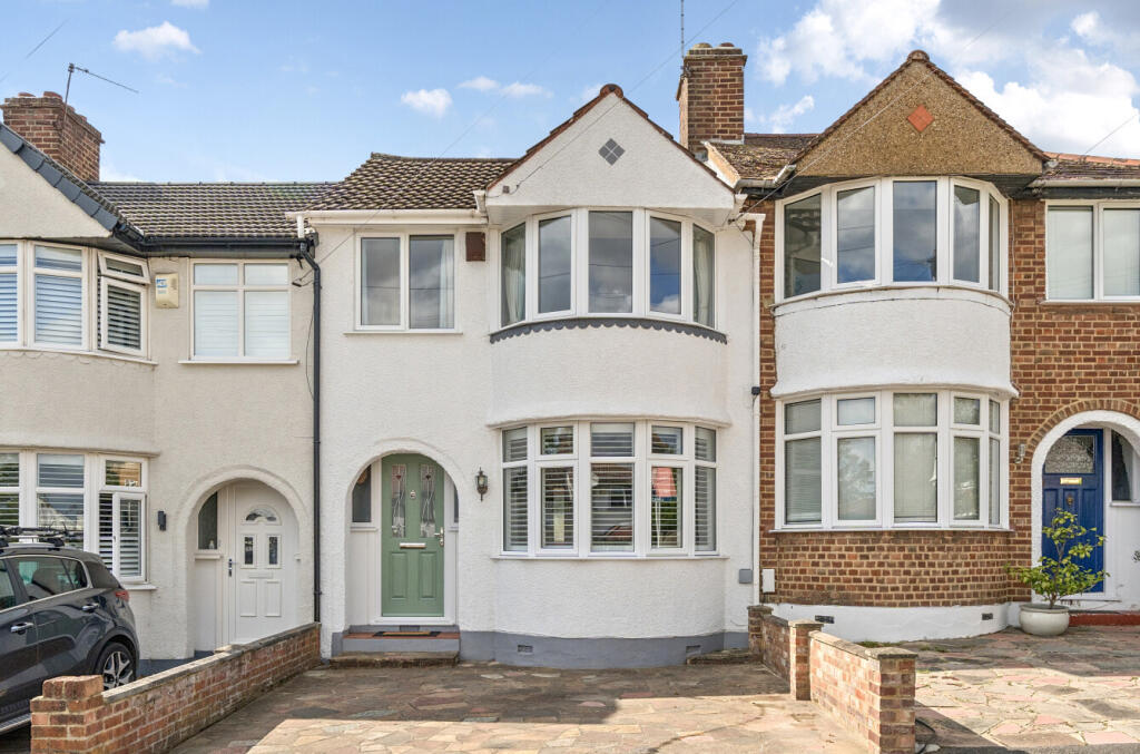
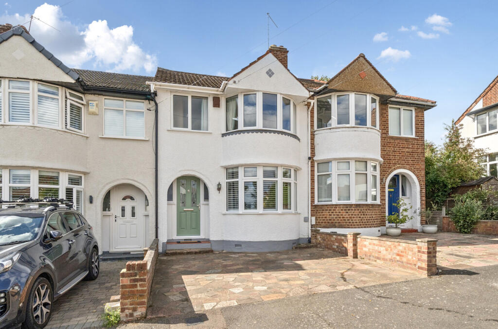
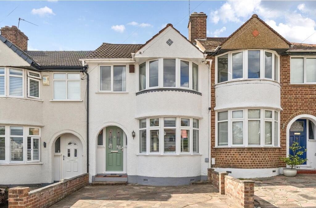
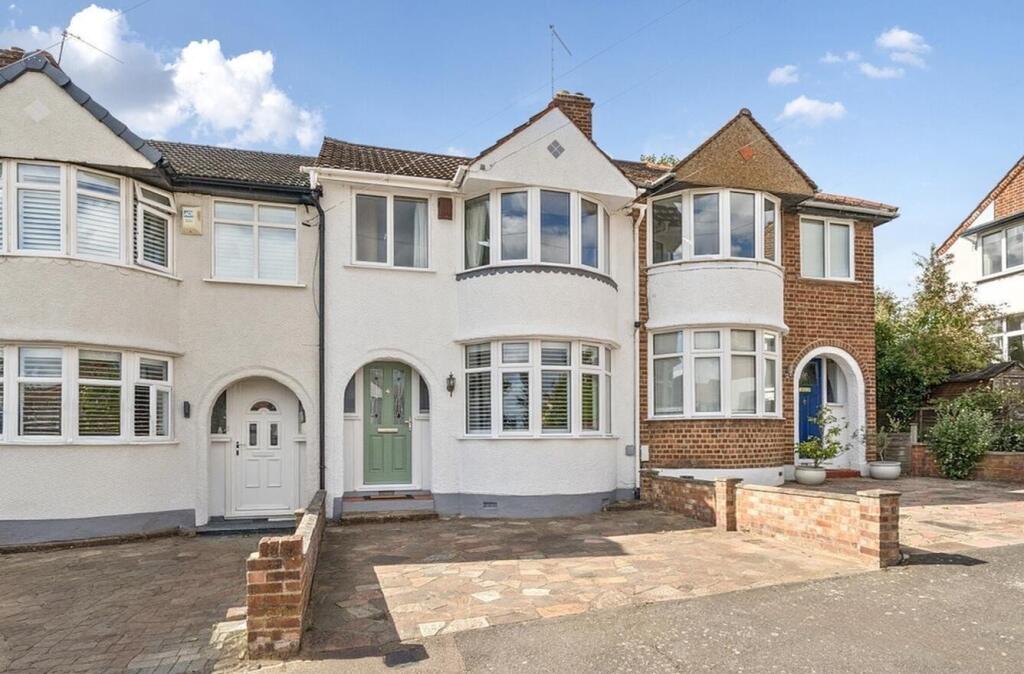
- house exterior 1930s semi-detached
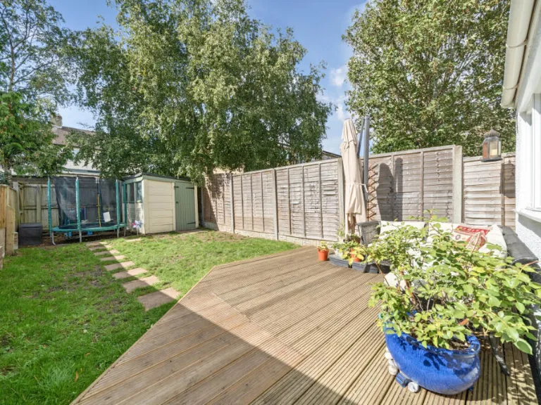
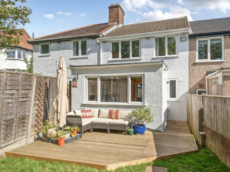
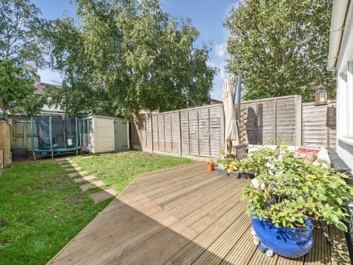
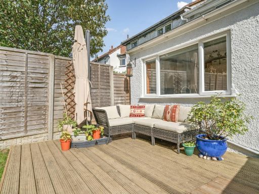
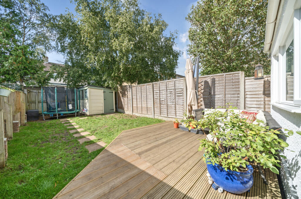
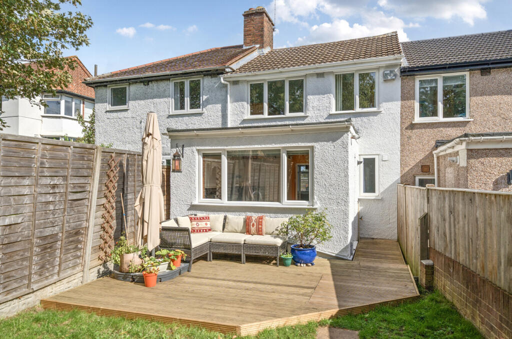
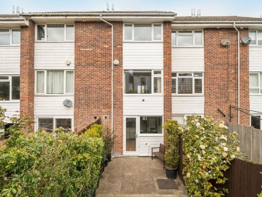
- backyard contemporary
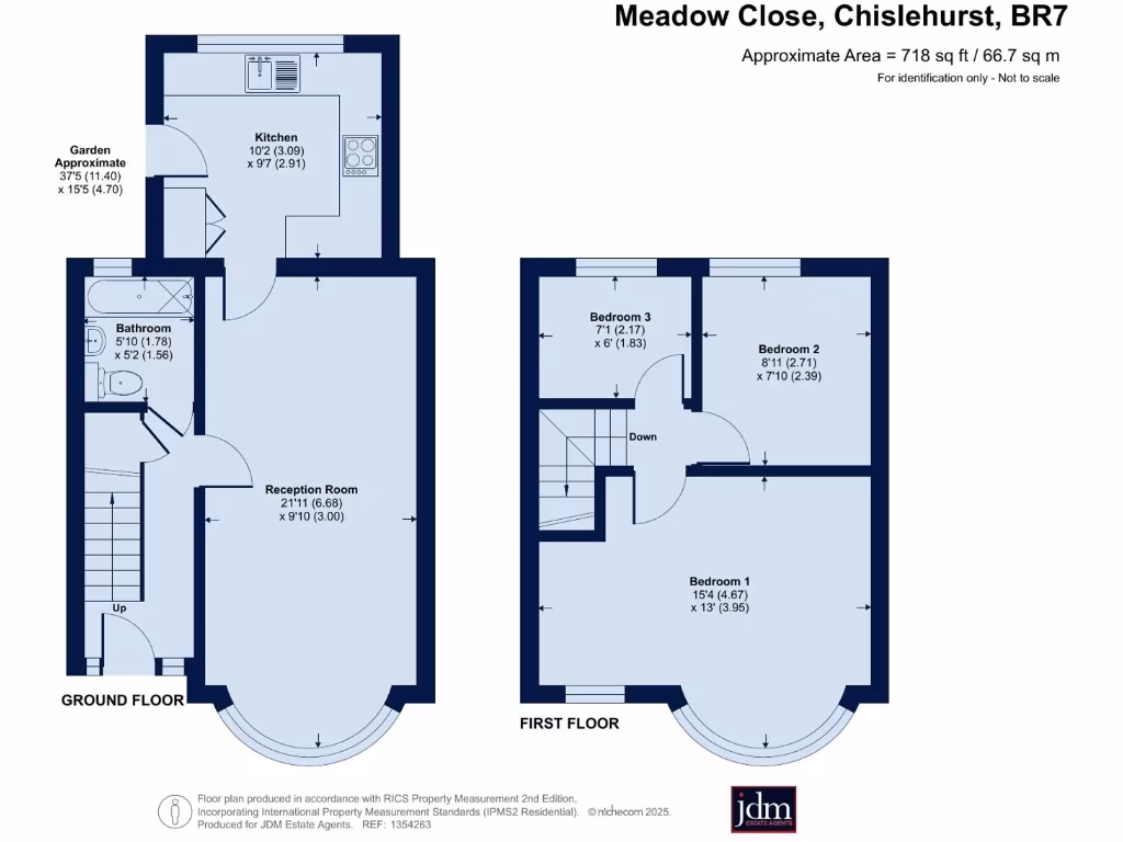
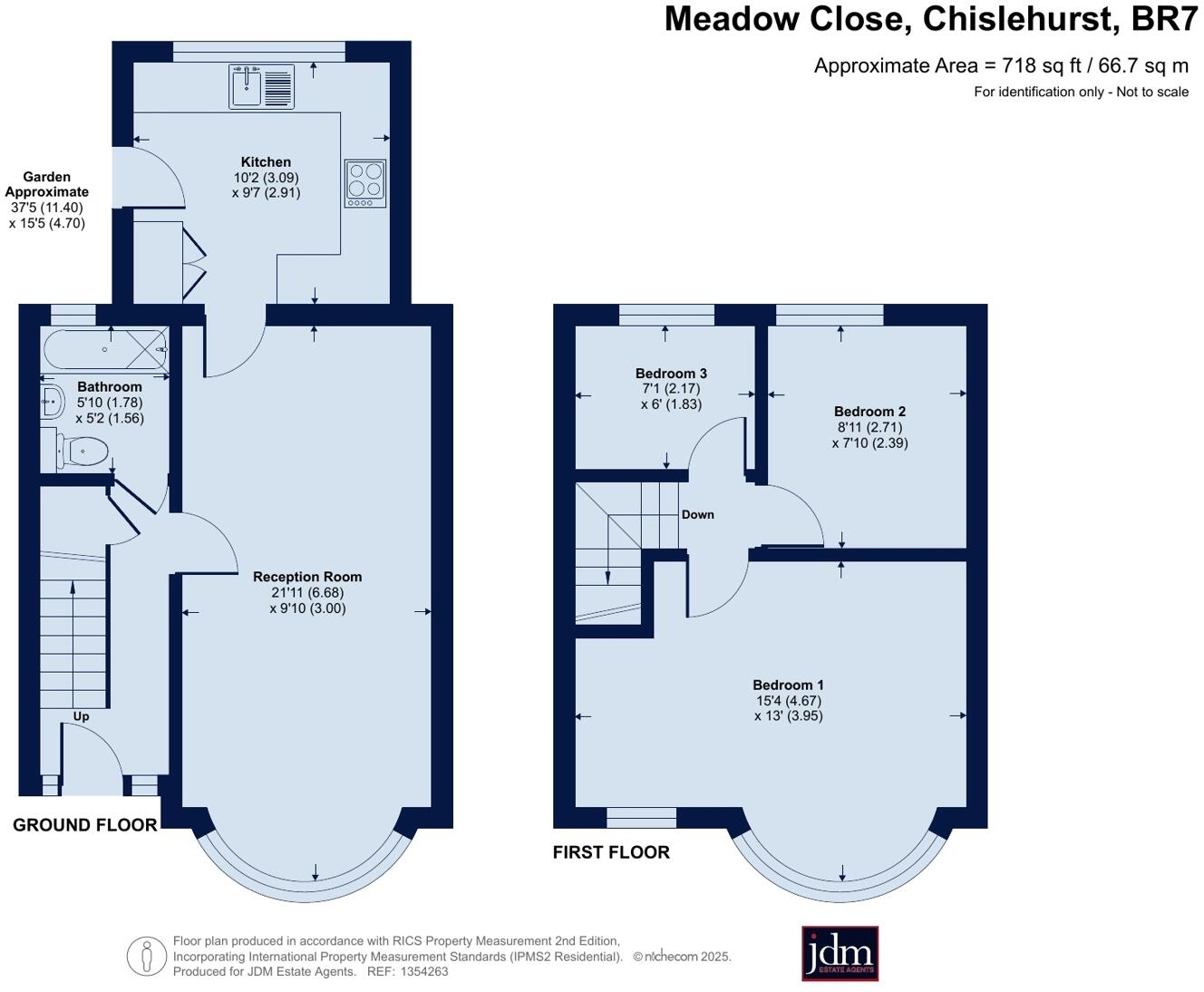
Floorplan Description
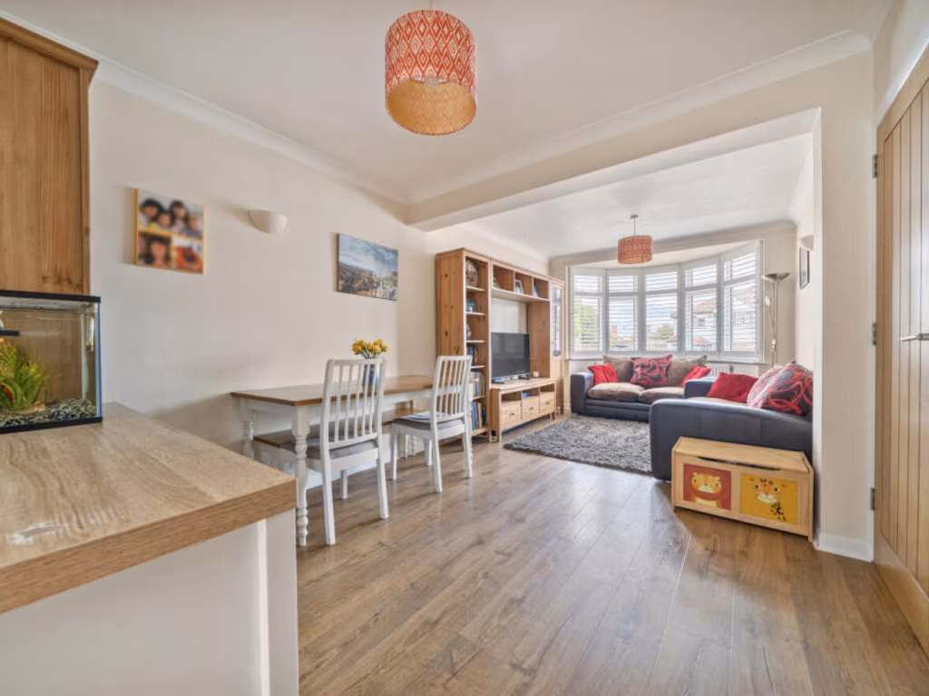
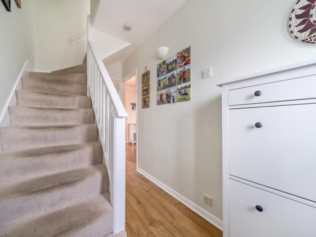
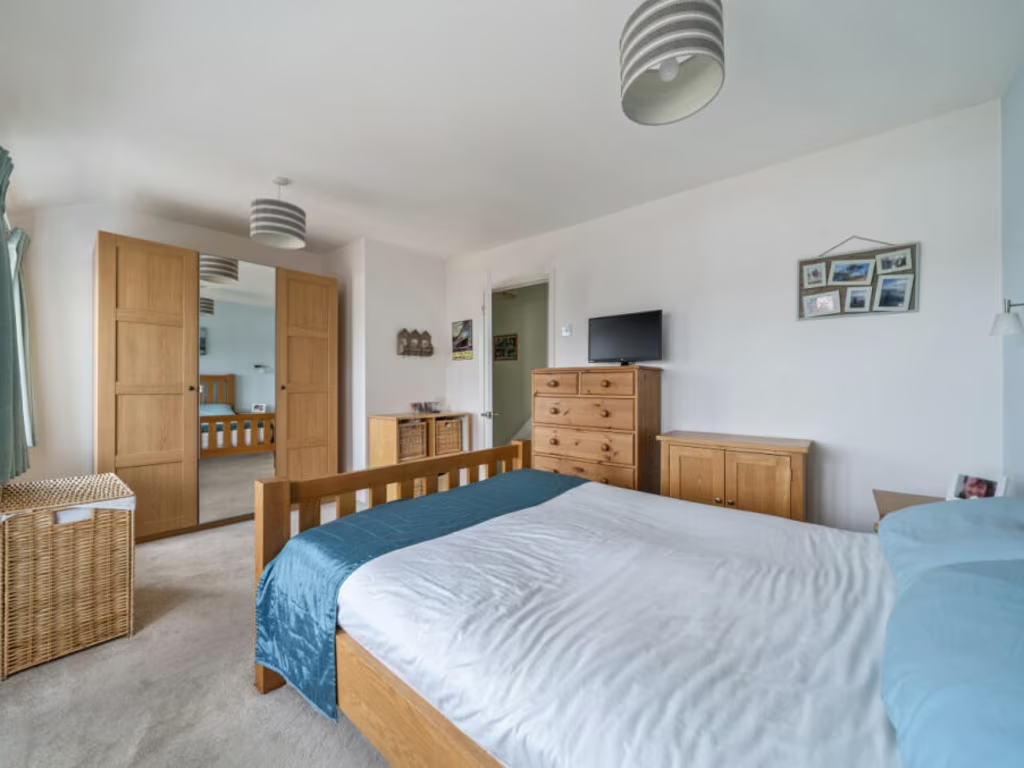
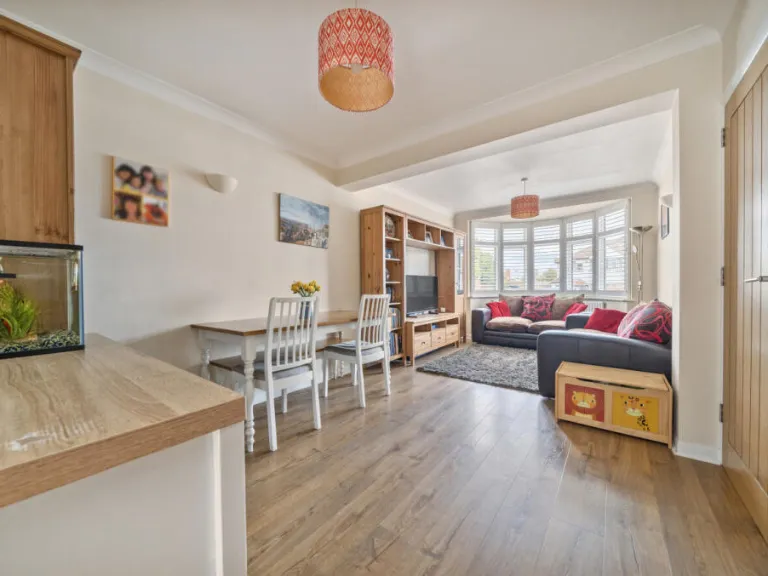
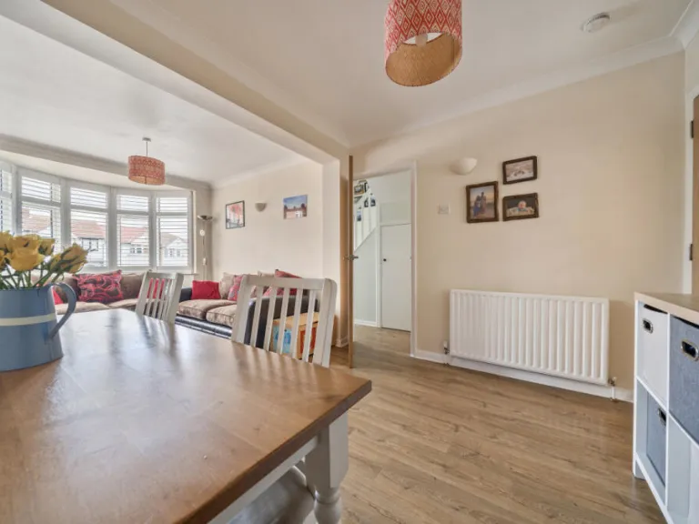
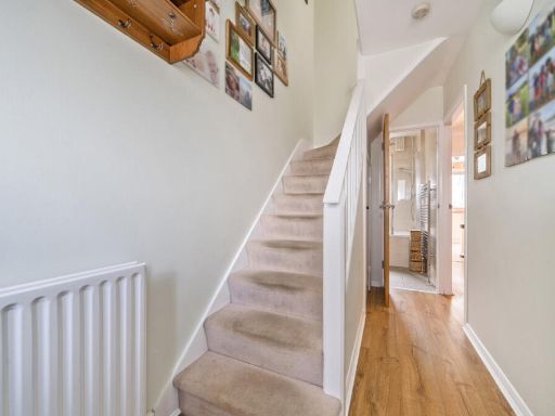
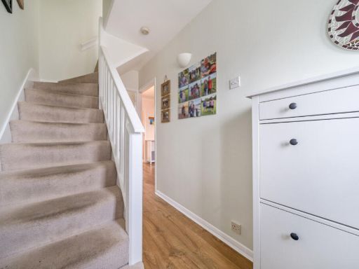
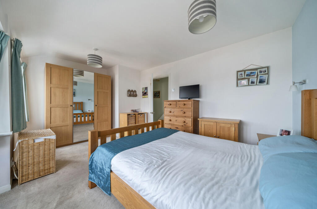
- Three-bedroom house with reception, kitchen and bathroom
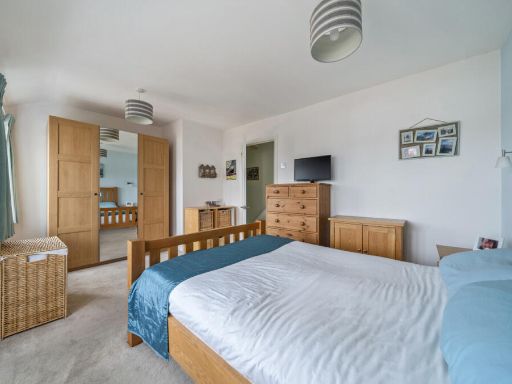
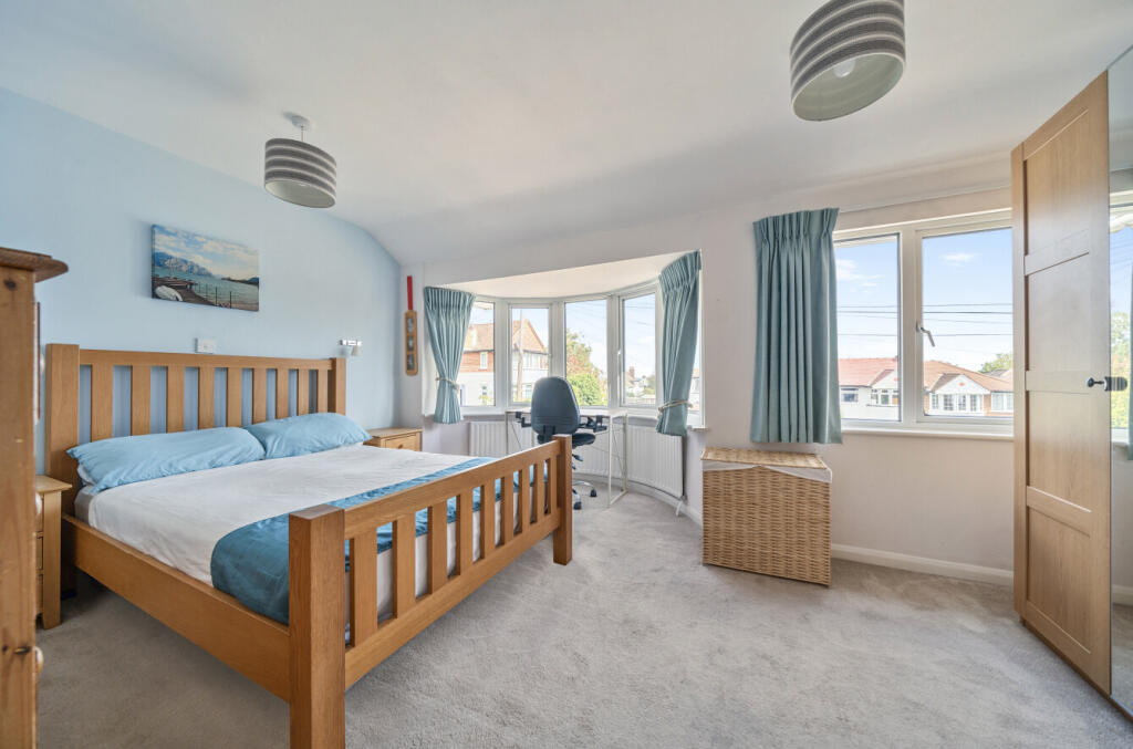
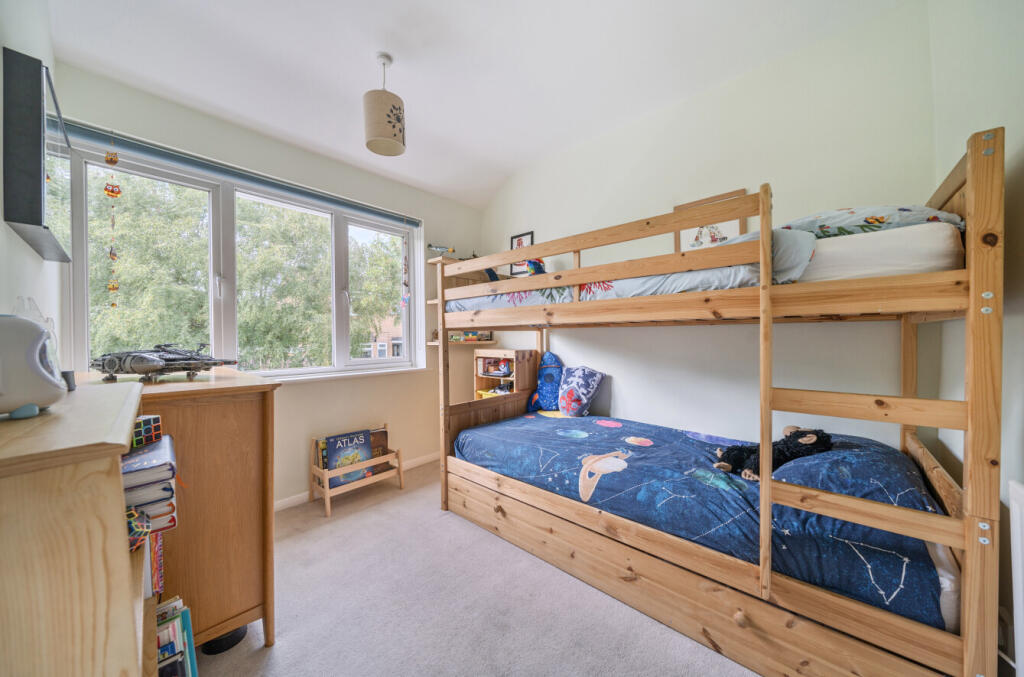
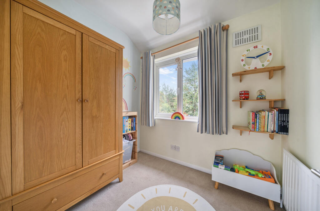
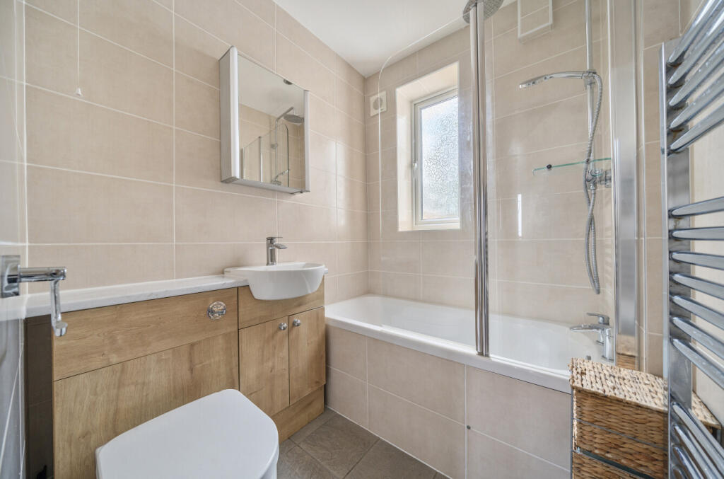
Rooms
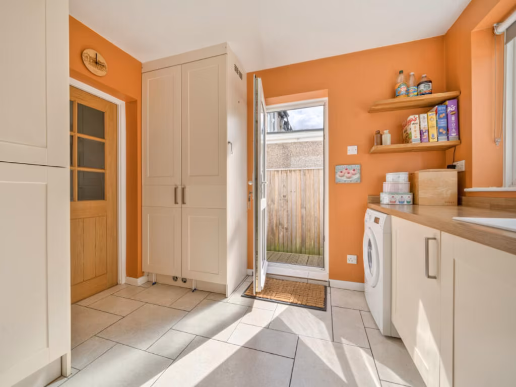
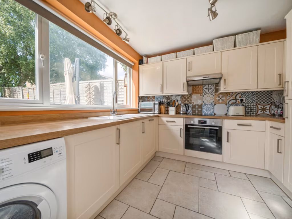
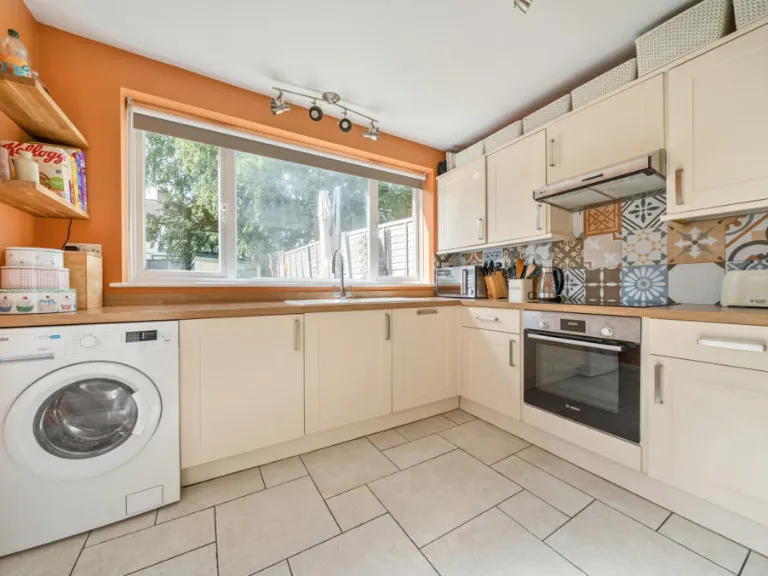
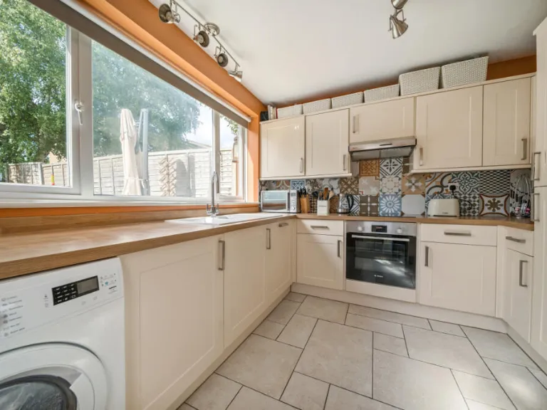
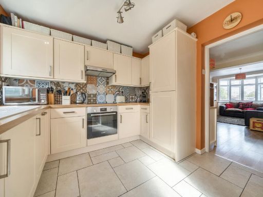
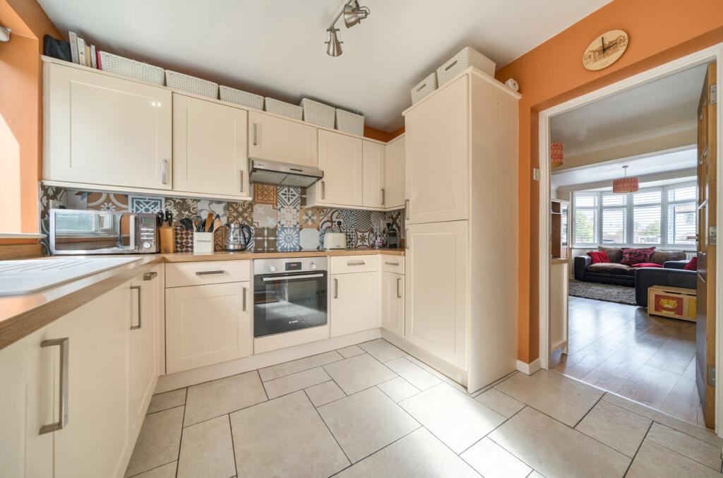
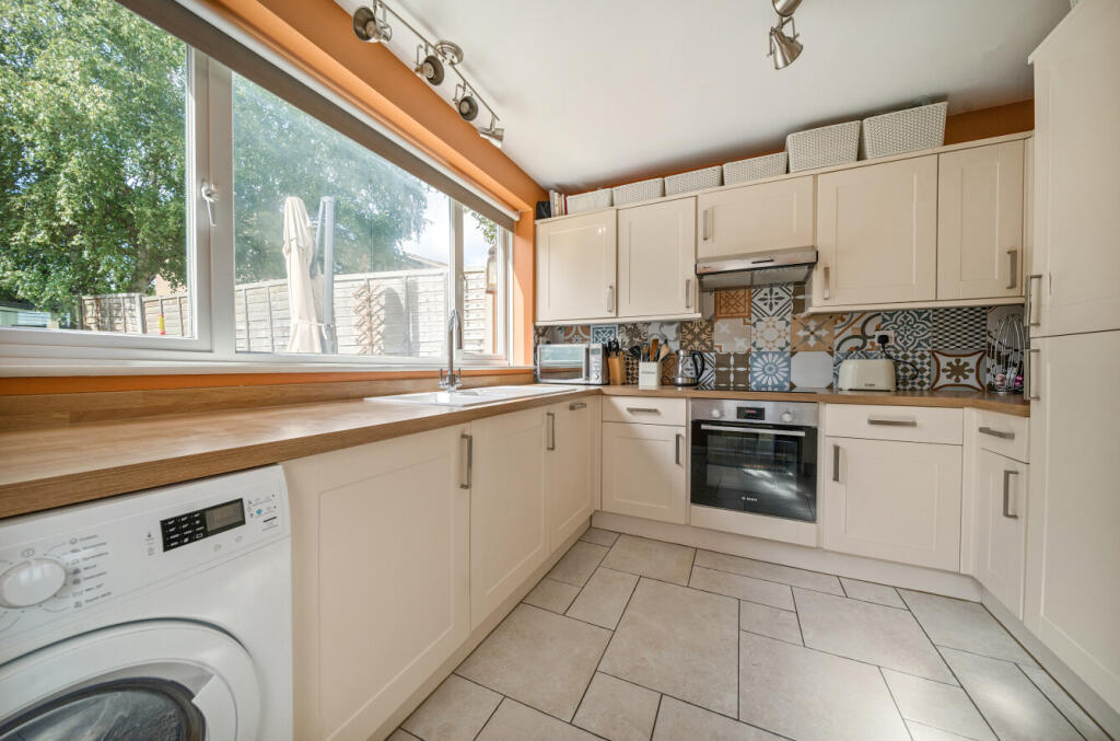
- Kitchen:
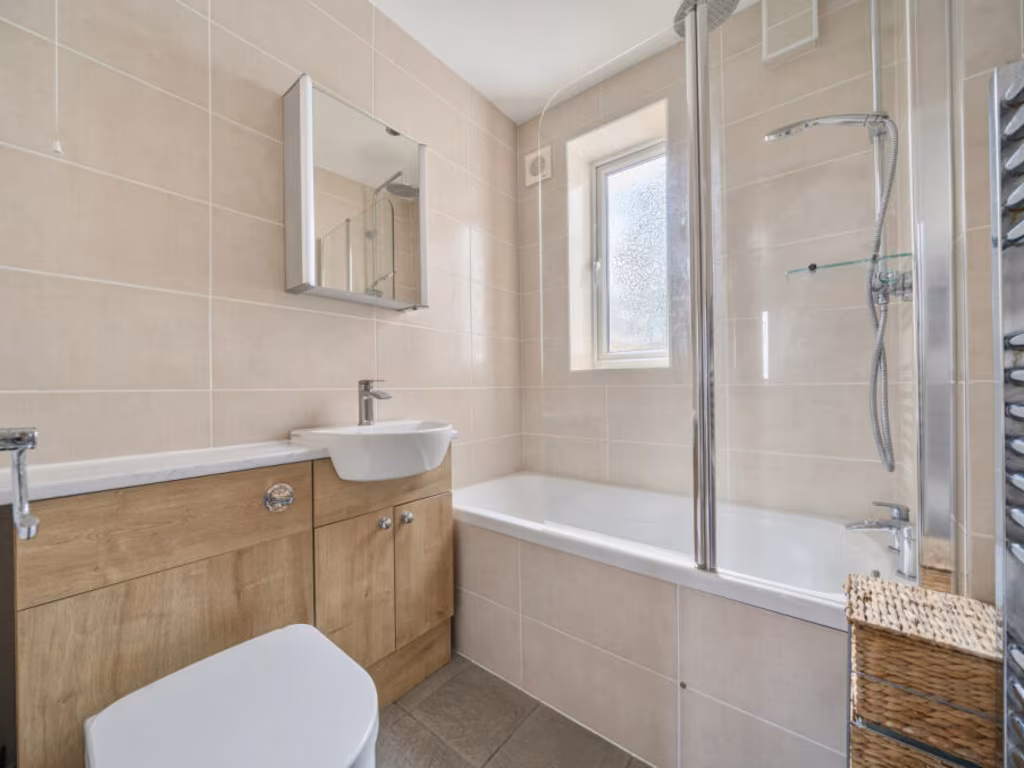
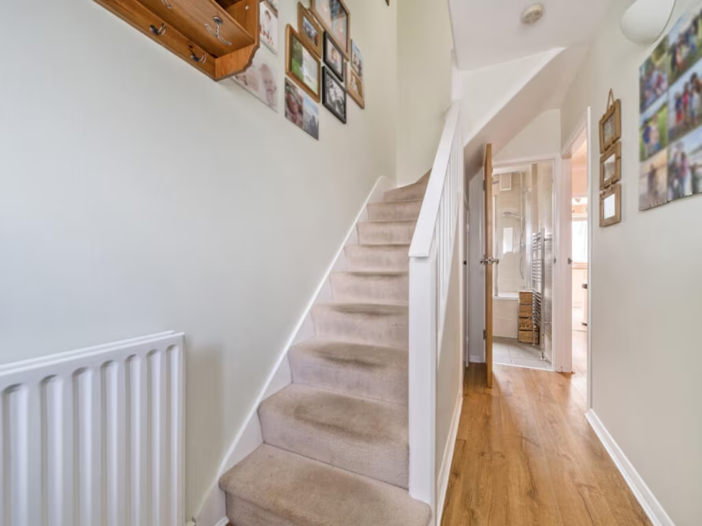
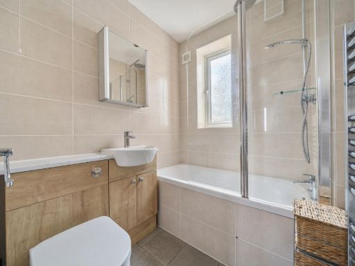
- Bathroom:
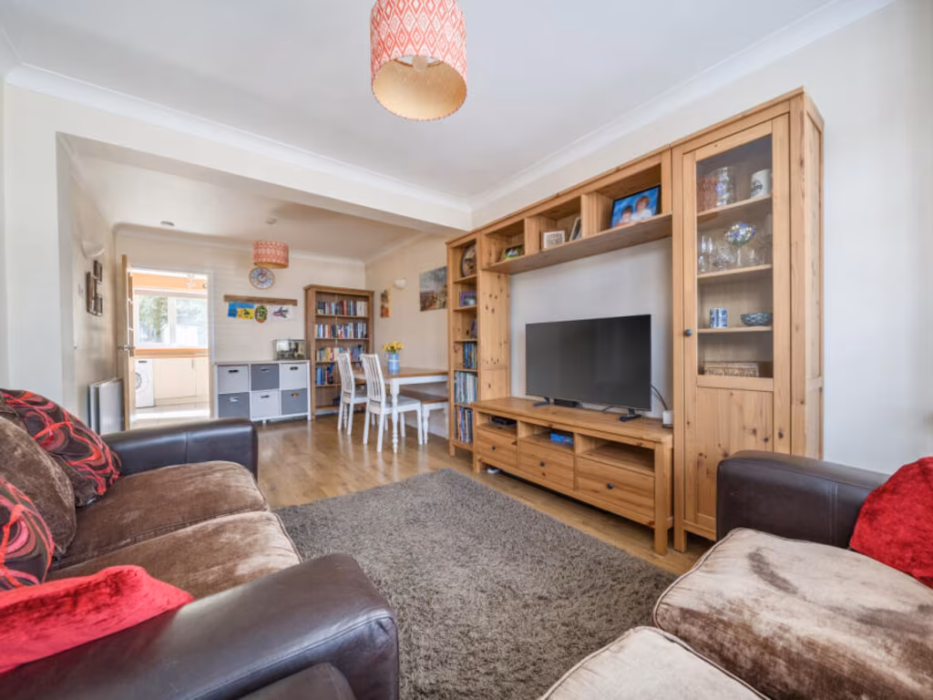
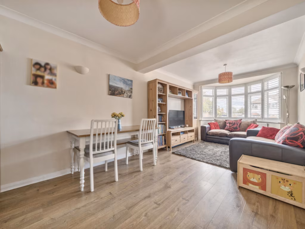
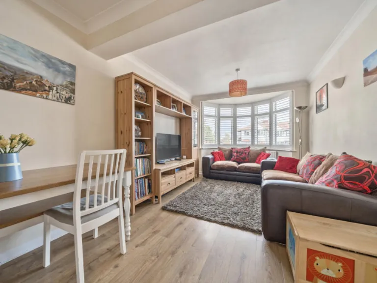
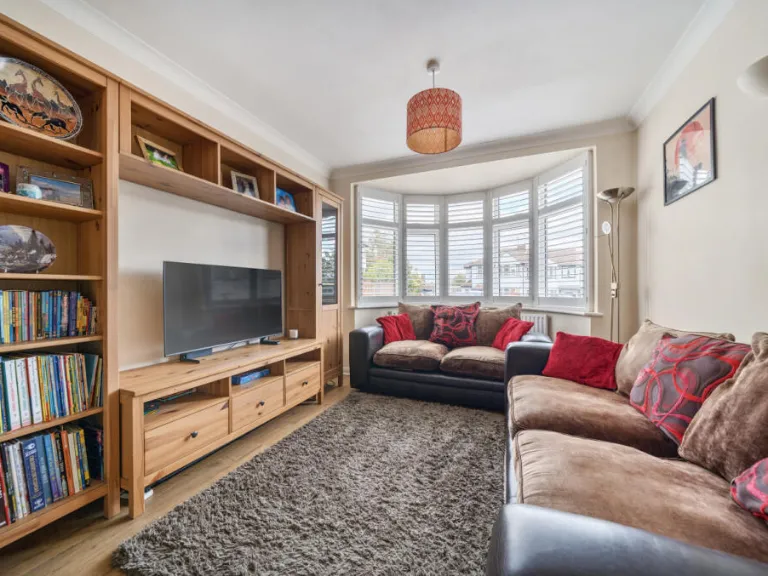
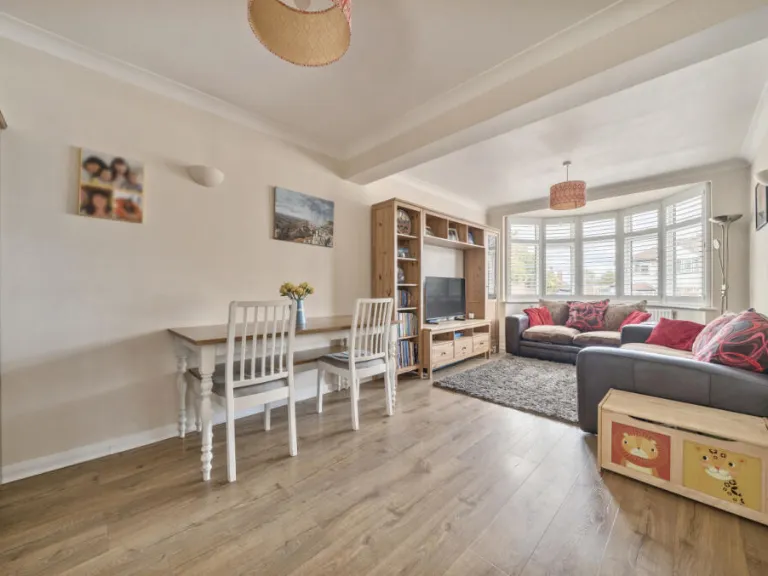
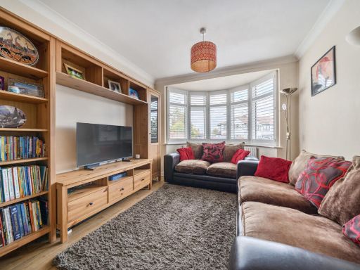
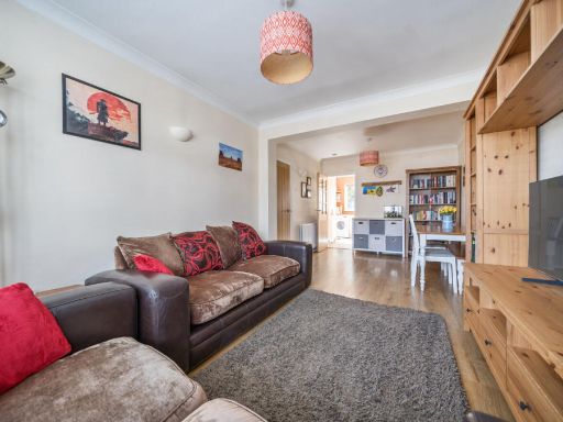
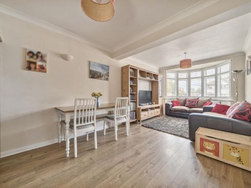
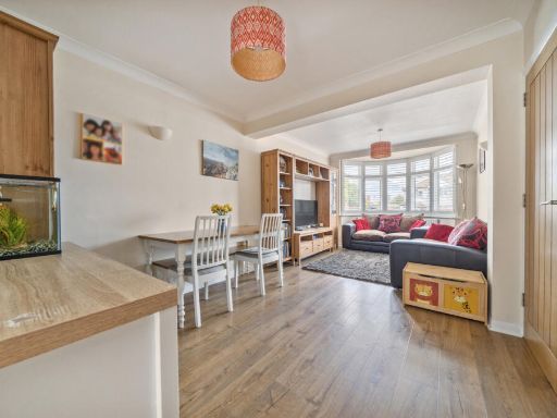
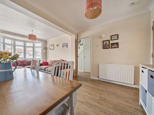
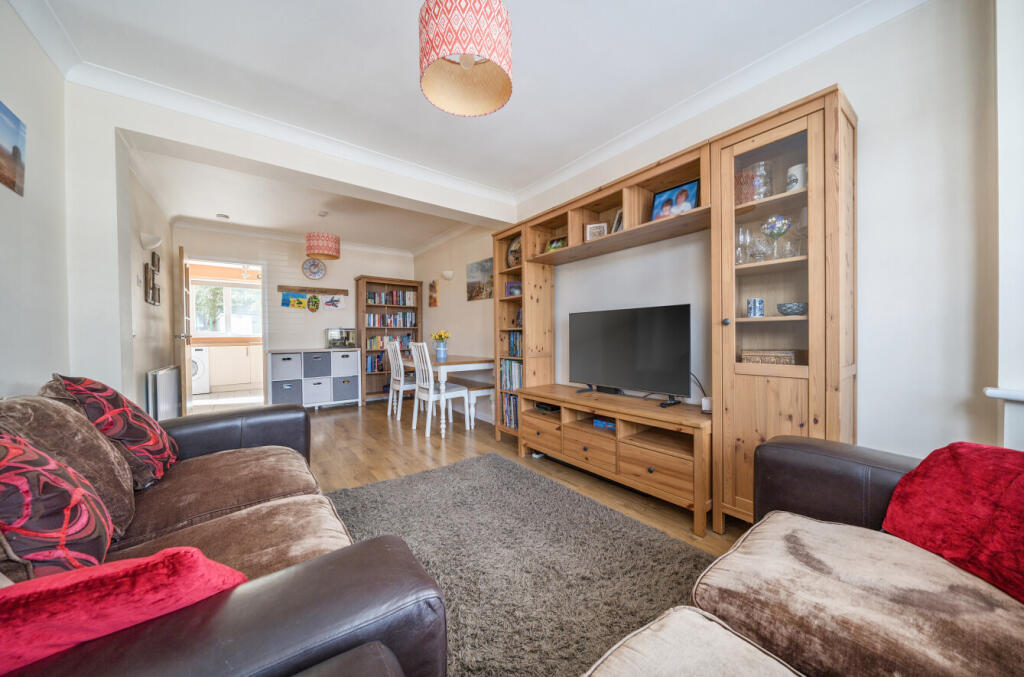
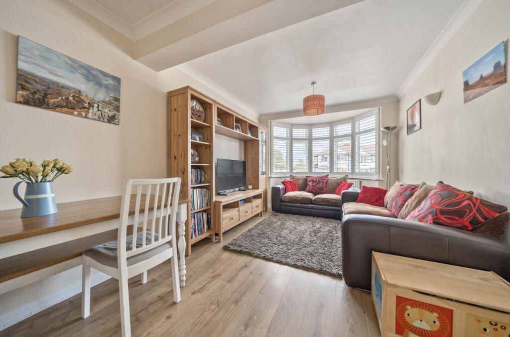
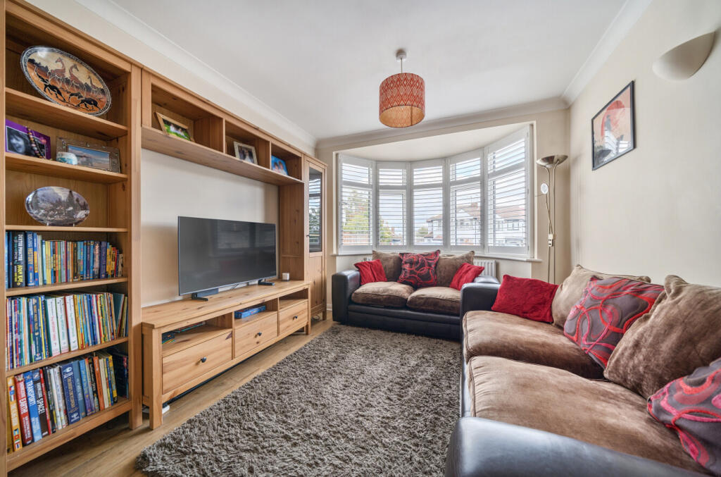
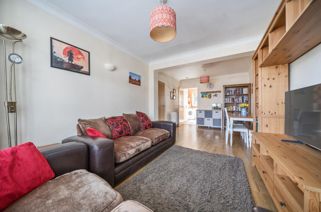
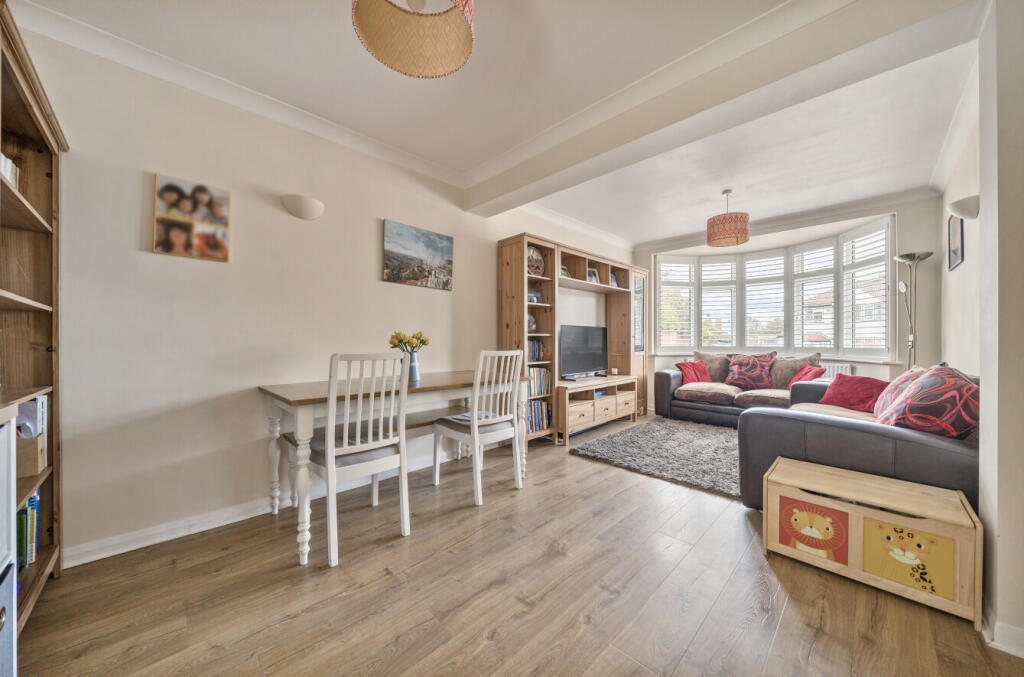
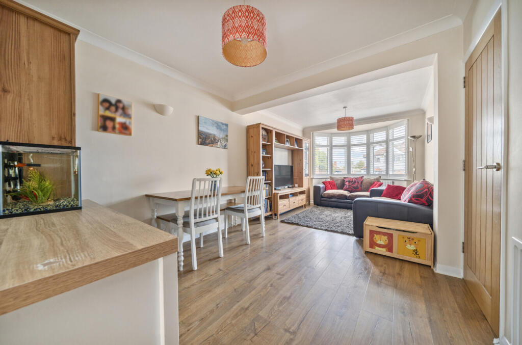
- Reception Room:
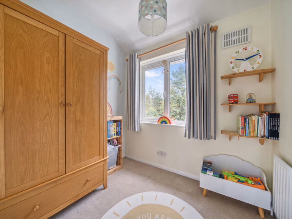
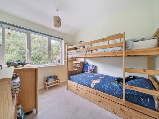
- Bedroom 3:
- Bedroom 2:
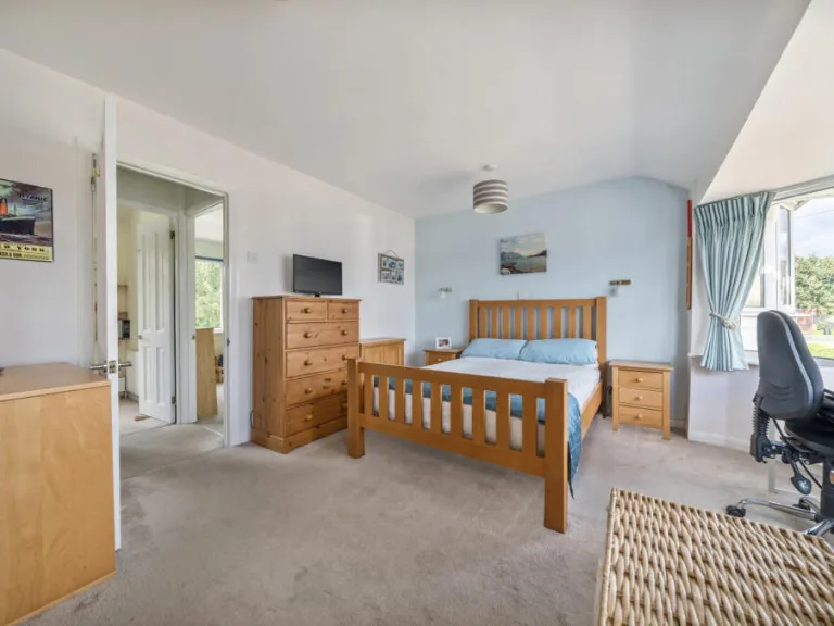
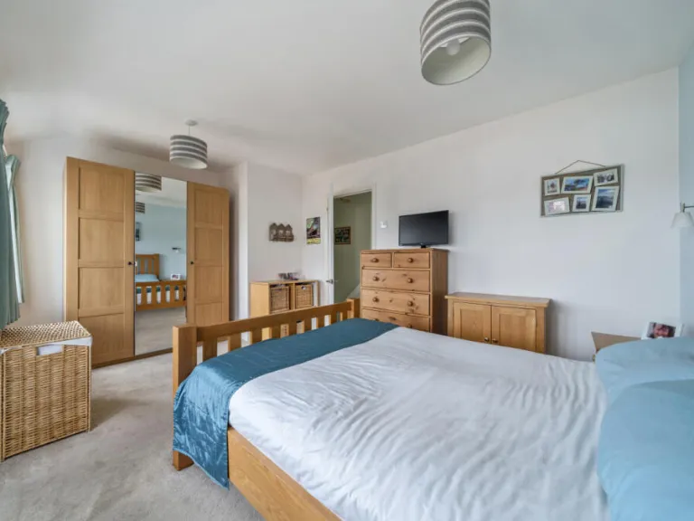
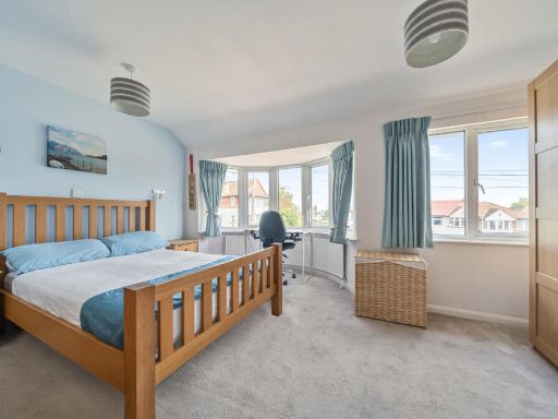
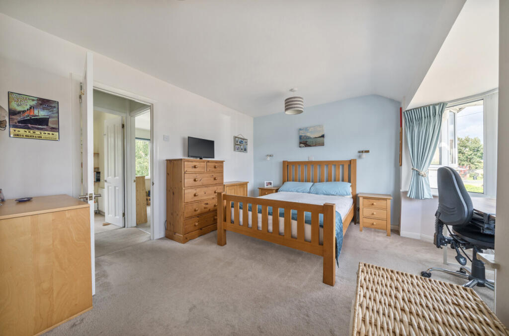
- Bedroom 1:
Textual Property Features
Detected Visual Features
- semi-detached
- 1930s
- bay windows
- brick
- suburban
- garage
- driveway
- roof tiles
- family home
- residential area
- garden
- decking
- shed
- trampoline
- patio
- fenced yard
EPC Details
- Fully double glazed
- Solid brick, as built, no insulation (assumed)
- Boiler and radiators, mains gas
- Low energy lighting in all fixed outlets
- Suspended, no insulation (assumed)
Nearby Schools
- Bickley Park School
- Bullers Wood School
- Montbelle Primary School
- Ravensworth Primary School
- St Olave's Prep School
- Dulverton Primary School
- Eltham Church of England Primary School
- Bromley High School
- St Peter and St Paul Catholic Primary School
- St Nicholas Church of England Primary
- Farringtons School
- Chislehurst School for Girls
- Mead Road Infant School
- Edgebury Primary School
- Longlands Primary School
- St Thomas More Catholic Comprehensive School
- St Mary's Catholic Primary School
- Bullers Wood School for Boys
- Babington House School
- Red Hill Primary School
- St Vincent's Catholic Primary School
- Stationers' Crown Woods Academy
- Coopers School
- Darul Uloom London School
- Elmstead Wood Primary School
- Eltham College
- Wyborne Primary School
Nearest General Shops
- Id: 8807085332
- Tags:
- Addr:
- City: Chislehurst
- Street: High Street
- Name: Briggs & Co London
- Shop: hairdresser
- TagsNormalized:
- Lat: 51.4183783
- Lon: 0.0675817
- FullGeoHash: u10h983jyb2t
- PartitionGeoHash: u10h
- Images:
- FoodStandards: null
- Distance: 462.3
,- Id: 8807085328
- Tags:
- Addr:
- City: Chislehurst
- Street: High Street
- Name: Harvey Jones
- Shop: kitchen
- TagsNormalized:
- Lat: 51.4184349
- Lon: 0.067522
- FullGeoHash: u10h983nj6up
- PartitionGeoHash: u10h
- Images:
- FoodStandards: null
- Distance: 454.8
,- Id: 8807085340
- Tags:
- Addr:
- City: Chislehurst
- Street: High Street
- Name: Linklater & Warren
- Phone: +44 20 8295 5131
- Shop: optician
- Website: linklaterwarren.co.uk
- TagsNormalized:
- Lat: 51.4184933
- Lon: 0.0674708
- FullGeoHash: u10h983nkjvg
- PartitionGeoHash: u10h
- Images:
- FoodStandards: null
- Distance: 447.4
}
Nearest Grocery shops
- Id: 403276956
- Tags:
- Addr:
- City: London
- Housenumber: 60
- Postcode: SE9 4EB
- Street: Kimmeridge Street
- Building: retail
- Building_1: commercial
- Name: The Co-operative Food
- Opening_hours: Mo-Sa 06:00-22:00; Su 10:00-16:00
- Shop: supermarket
- TagsNormalized:
- retail
- the co-operative food
- food
- shop
- Lat: 51.4267205
- Lon: 0.0456983
- FullGeoHash: u10h91cq2ge1
- PartitionGeoHash: u10h
- Images:
- FoodStandards: null
- Distance: 1408.7
,- Id: 4663509868
- Tags:
- Name: The Village Store
- Shop: convenience
- TagsNormalized:
- Lat: 51.4119912
- Lon: 0.0747716
- FullGeoHash: u10h3xq2w3c9
- PartitionGeoHash: u10h
- Images:
- FoodStandards: null
- Distance: 1326.6
,- Id: 10695466781
- Tags:
- Addr:
- City: London
- Housenumber: 90
- Street: Edgehill Road
- Name: Edgehill Minimart
- Shop: convenience
- TagsNormalized:
- Lat: 51.4286353
- Lon: 0.0734656
- FullGeoHash: u10h9dm3xb7z
- PartitionGeoHash: u10h
- Images:
- FoodStandards: null
- Distance: 950.9
}
Nearest Supermarkets
- Id: 2530634771
- Tags:
- Name: Co-op
- Shop: supermarket
- Wheelchair: yes
- TagsNormalized:
- Lat: 51.4384069
- Lon: 0.070926
- FullGeoHash: u10h9s5dkwn3
- PartitionGeoHash: u10h
- Images:
- FoodStandards: null
- Distance: 1865.1
,- Id: 431242856
- Tags:
- Addr:
- City: New Eltham
- Housenumber: 370-380
- Postcode: SE9 2AA
- Street: Footscray Road
- Building: yes
- Name: Co-op
- Operator: Co-Operative
- Shop: supermarket
- Wheelchair: yes
- TagsNormalized:
- Lat: 51.4384011
- Lon: 0.070893
- FullGeoHash: u10h9s5d7uvw
- PartitionGeoHash: u10h
- Images:
- FoodStandards: null
- Distance: 1863.9
,- Id: 179319964
- Tags:
- Addr:
- Housenumber: 73
- Postcode: BR7 5AG
- Street: High Street
- Brand: Sainsbury's
- Brand:wikidata: Q152096
- Building: yes
- Fhrs:
- Name: Sainsbury's
- Shop: supermarket
- TagsNormalized:
- sainsburys
- supermarket
- shop
- Lat: 51.4188255
- Lon: 0.0664776
- FullGeoHash: u10h9882m5c3
- PartitionGeoHash: u10h
- Images:
- FoodStandards:
- Id: 357621
- FHRSID: 357621
- LocalAuthorityBusinessID: 00000/0000/8/793
- BusinessName: Sainsbury's
- BusinessType: Retailers - supermarkets/hypermarkets
- BusinessTypeID: 7840
- AddressLine1: J Sainsbury
- AddressLine2: 73 High Street
- AddressLine3: Chislehurst
- AddressLine4: null
- PostCode: BR7 5AG
- RatingValue: 5
- RatingKey: fhrs_5_en-GB
- RatingDate: 2018-06-14
- LocalAuthorityCode: 505
- LocalAuthorityName: Bromley
- LocalAuthorityWebSite: http://www.bromley.gov.uk
- LocalAuthorityEmailAddress: food@bromley.gov.uk
- Scores:
- Hygiene: 5
- Structural: 5
- ConfidenceInManagement: 5
- NewRatingPending: false
- Geocode:
- Longitude: 0.06580000000000
- Latitude: 51.41920400000000
- Distance: 386.5
}
Nearest Religious buildings
- Id: 863044188
- Tags:
- Alt_name: Church of the Annunciation of the Blessed Virgin Mary
- Amenity: place_of_worship
- Building: church
- Denomination: anglican
- Name: Church of the Annunciation
- Religion: christian
- Subdenomination: anglo_catholic
- Wikidata: Q17542068
- TagsNormalized:
- place of worship
- church
- anglican
- christian
- Lat: 51.4191377
- Lon: 0.0672524
- FullGeoHash: u10h988fpjgp
- PartitionGeoHash: u10h
- Images:
- FoodStandards: null
- Distance: 376.9
,- Id: 14378120
- Tags:
- Name: St Patrick's Church
- Network: London Buses
- Operator: Transport for London
- Public_transport: stop_area
- Public_transport:version: 2
- Type: public_transport
- TagsNormalized:
- Lat: 51.4204122
- Lon: 0.0659072
- FullGeoHash: u10h92zcxexf
- PartitionGeoHash: u10h
- Images:
- FoodStandards: null
- Distance: 208.1
,- Id: 427531604
- Tags:
- Amenity: place_of_worship
- Denomination: roman_catholic
- Name: St Patrick's
- Religion: christian
- TagsNormalized:
- place of worship
- catholic
- roman catholic
- christian
- church
- Lat: 51.4203762
- Lon: 0.0654174
- FullGeoHash: u10h92z9kkfe
- PartitionGeoHash: u10h
- Images:
- FoodStandards: null
- Distance: 199.7
}
Nearest Medical buildings
- Id: 947161419
- Tags:
- Addr:
- City: Mottingham
- Postcode: SE9 3JD
- Street: William Barefoot Drive
- Amenity: doctors
- Building: yes
- Healthcare: doctor
- TagsNormalized:
- doctor
- doctors
- health
- healthcare
- Lat: 51.4312494
- Lon: 0.0583279
- FullGeoHash: u10h96f2xpu3
- PartitionGeoHash: u10h
- Images:
- FoodStandards: null
- Distance: 1106.7
,- Id: 9092458562
- Tags:
- Addr:
- City: Chislehurst
- Street: High Street
- Amenity: pharmacy
- Brand: Lloyds Pharmacy
- Brand:wikidata: Q6662870
- Brand:wikipedia: en:LloydsPharmacy
- Healthcare: pharmacy
- Name: Lloyds Pharmacy
- TagsNormalized:
- pharmacy
- lloyds pharmacy
- health
- healthcare
- Lat: 51.4182275
- Lon: 0.0673596
- FullGeoHash: u10h983hcs6f
- PartitionGeoHash: u10h
- Images:
- FoodStandards: null
- Distance: 470.9
,- Id: 8807085334
- Tags:
- Amenity: doctors
- Healthcare: doctor
- Name: The Chislehurst Medical Practice
- TagsNormalized:
- doctor
- doctors
- health
- healthcare
- Lat: 51.4188439
- Lon: 0.0672843
- FullGeoHash: u10h988brz4z
- PartitionGeoHash: u10h
- Images:
- FoodStandards: null
- Distance: 406.7
,- Id: 9092458557
- Tags:
- Addr:
- City: Chislehurst
- Street: High Street
- Amenity: pharmacy
- Healthcare: pharmacy
- Name: Chemist
- TagsNormalized:
- pharmacy
- health
- healthcare
- chemist
- Lat: 51.4194891
- Lon: 0.0659168
- FullGeoHash: u10h92xupzx0
- PartitionGeoHash: u10h
- Images:
- FoodStandards: null
- Distance: 304.2
}
Nearest Airports
- Id: 260720166
- Tags:
- Aerodrome: international
- Aeroway: aerodrome
- Alt_name: Gatwick Airport
- Ele: 62
- Iata: LGW
- Icao: EGKK
- Internet_access: wlan
- Internet_access:fee: no
- Internet_access:ssid: Gatwick FREE Wi-Fi
- Name: London Gatwick Airport
- Operator: Gatwick Airport Limited
- Ref: LGW
- Website: https://www.gatwickairport.com/
- Wikidata: Q8703
- Wikipedia: en:Gatwick Airport
- TagsNormalized:
- airport
- international airport
- Lat: 51.1540917
- Lon: -0.1883773
- FullGeoHash: gcpg58qf4mzd
- PartitionGeoHash: gcpg
- Images:
- FoodStandards: null
- Distance: 34607.1
,- Id: 121158889
- Tags:
- Aerodrome: continental
- Aeroway: aerodrome
- Fhrs:
- Authority: City of London Corporation
- Iata: LCY
- Icao: EGLC
- Name: London City Airport
- Operator: London City Airport Limited
- Ref: LCY
- Website: https://www.londoncityairport.com/
- Wikidata: Q8982
- Wikipedia: en:London City Airport
- TagsNormalized:
- airport
- continental airport
- Lat: 51.5042658
- Lon: 0.0539987
- FullGeoHash: u10j10p64702
- PartitionGeoHash: u10j
- Images:
- FoodStandards: null
- Distance: 9165.8
,- Id: 103894219
- Tags:
- Aerodrome: international
- Aeroway: aerodrome
- Iata: SEN
- Icao: EGMC
- Name: London Southend Airport
- Old_name: Southend Municipal Airport
- Ref: SEN
- Wikidata: Q1415441
- TagsNormalized:
- airport
- international airport
- Lat: 51.5701749
- Lon: 0.6924624
- FullGeoHash: u10mru04p937
- PartitionGeoHash: u10m
- Images:
- FoodStandards: null
- Distance: 46477.4
}
Nearest Leisure Facilities
- Id: 596944152
- Tags:
- TagsNormalized:
- Lat: 51.4177335
- Lon: 0.060192
- FullGeoHash: u10h927f484r
- PartitionGeoHash: u10h
- Images:
- FoodStandards: null
- Distance: 574.5
,- Id: 596944151
- Tags:
- Leisure: park
- Name: Chislehurst Recreation Ground
- TagsNormalized:
- Lat: 51.4181334
- Lon: 0.0615397
- FullGeoHash: u10h92ku3fz3
- PartitionGeoHash: u10h
- Images:
- FoodStandards: null
- Distance: 490.1
,- Id: 596944150
- Tags:
- Leisure: park
- Name: Walden Recreation Ground
- TagsNormalized:
- Lat: 51.4203963
- Lon: 0.0588835
- FullGeoHash: u10h92fcs0de
- PartitionGeoHash: u10h
- Images:
- FoodStandards: null
- Distance: 440.4
,- Id: 1034236703
- Tags:
- Leisure: pitch
- Sport: soccer
- TagsNormalized:
- Lat: 51.4202241
- Lon: 0.0591096
- FullGeoHash: u10h92g092e2
- PartitionGeoHash: u10h
- Images:
- FoodStandards: null
- Distance: 435.2
,- Id: 597421412
- Tags:
- Leisure: pitch
- Name: Chislehurst Tennis Club
- Sport: tennis
- Surface: asphalt
- TagsNormalized:
- pitch
- leisure
- tennis
- club
- sports
- Lat: 51.418763
- Lon: 0.0631479
- FullGeoHash: u10h92tbp2nk
- PartitionGeoHash: u10h
- Images:
- FoodStandards: null
- Distance: 384.9
}
Nearest Tourist attractions
- Id: 35997706
- Tags:
- TagsNormalized:
- Lat: 51.4149699
- Lon: 0.0915042
- FullGeoHash: u10h6pf9ujn6
- PartitionGeoHash: u10h
- Images:
- FoodStandards: null
- Distance: 2026.1
,- Id: 6028499493
- Tags:
- Addr:
- Name:
- Tourism: guest_house
- TagsNormalized:
- Lat: 51.4386289
- Lon: 0.0704133
- FullGeoHash: u10h9s578xrv
- PartitionGeoHash: u10h
- Images:
- FoodStandards: null
- Distance: 1881.2
,- Id: 693728457
- Tags:
- Name: Chislehurst Caves
- Tourism: attraction
- Wikidata: Q5102117
- Wikipedia: en:Chislehurst Caves
- TagsNormalized:
- Lat: 51.4073601
- Lon: 0.0577529
- FullGeoHash: u10h3q6j9drx
- PartitionGeoHash: u10h
- Images:
- FoodStandards: null
- Distance: 1706.9
}
Nearest Hotels
- Id: 425953936
- Tags:
- Addr:
- City: Bromley
- Postcode: BR1 2LW
- Street: Thornet Wood Road
- Amenity: restaurant
- Fhrs:
- Name: Bickley Manor Hotel and Restaurant
- Tourism: hotel
- TagsNormalized:
- Lat: 51.3968319
- Lon: 0.0591447
- FullGeoHash: u10h3ke04pvk
- PartitionGeoHash: u10h
- Images:
- FoodStandards: null
- Distance: 2835.4
,- Id: 29372721
- Tags:
- Created_by: JOSM
- Name: Sundridge Park hotel and conference Ctr
- Tourism: hotel
- TagsNormalized:
- Lat: 51.4170299
- Lon: 0.0372264
- FullGeoHash: u10h8b5jgmn4
- PartitionGeoHash: u10h
- Images:
- FoodStandards: null
- Distance: 1981.2
,- Id: 740024751
- Tags:
- Addr:
- City: New Eltham
- Housenumber: 738
- Postcode: SE9 3NS
- Street: Sidcup Road
- Brand: Premier Inn
- Brand:wikidata: Q2108626
- Brand:wikipedia: en:Premier Inn
- Building: yes
- Name: Premier Inn - London New Eltham
- Tourism: hotel
- TagsNormalized:
- Lat: 51.4343429
- Lon: 0.0640278
- FullGeoHash: u10h97qdgbqw
- PartitionGeoHash: u10h
- Images:
- FoodStandards: null
- Distance: 1361.8
}
Tags
- semi-detached
- 1930s
- bay windows
- brick
- suburban
- garage
- driveway
- roof tiles
- family home
- residential area
- garden
- decking
- shed
- trampoline
- patio
- fenced yard
Local Market Stats
- Average Price/sqft: £556
- Avg Income: £64100
- Rental Yield: 3.4%
- Social Housing: 6%
- Planning Success Rate: 81%
AirBnB Data
- 1km average: £101/night
- Listings in 1km: 1
Similar Properties
 3 bedroom terraced house for sale in Invicta Close, Chislehurst, BR7 — £490,000 • 3 bed • 1 bath • 1004 ft²
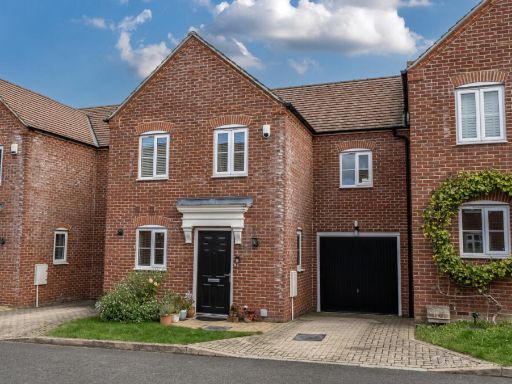 3 bedroom terraced house for sale in Holt Close, Chislehurst, Kent, BR7 — £615,000 • 3 bed • 2 bath • 1297 ft²
 4 bedroom terraced house for sale in Lower Camden, Chislehurst, Kent, BR7 — £750,000 • 4 bed • 2 bath • 1477 ft²
 3 bedroom semi-detached house for sale in Cranmore Road, Chislehurst, BR7 — £595,000 • 3 bed • 2 bath • 1029 ft²
 3 bedroom house for sale in Slades Drive, Chislehurst, BR7 — £575,000 • 3 bed • 1 bath • 1011 ft²
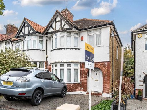 3 bedroom semi-detached house for sale in Westhurst Drive, Chislehurst, BR7 — £575,000 • 3 bed • 1 bath • 856 ft²
Meta
- {
"@context": "https://schema.org",
"@type": "Residence",
"name": "3 bedroom terraced house for sale in Meadow Close, Chislehu…",
"description": "",
"url": "https://propertypiper.co.uk/property/c212ef17-5078-4835-984c-529e92bff3a3",
"image": "https://image-a.propertypiper.co.uk/cda0ec2d-99a1-449a-90c1-e1d206dd6f9c-1024.jpeg",
"address": {
"@type": "PostalAddress",
"streetAddress": "15 MEADOW CLOSE CHISLEHURST",
"postalCode": "BR7 6JB",
"addressLocality": "Bromley",
"addressRegion": "Bromley and Chislehurst",
"addressCountry": "England"
},
"geo": {
"@type": "GeoCoordinates",
"latitude": 51.4221015,
"longitude": 0.0646164
},
"numberOfRooms": 3,
"numberOfBathroomsTotal": 1,
"floorSize": {
"@type": "QuantitativeValue",
"value": 712,
"unitCode": "FTK"
},
"offers": {
"@type": "Offer",
"price": 500000,
"priceCurrency": "GBP",
"availability": "https://schema.org/InStock"
},
"additionalProperty": [
{
"@type": "PropertyValue",
"name": "Feature",
"value": "semi-detached"
},
{
"@type": "PropertyValue",
"name": "Feature",
"value": "1930s"
},
{
"@type": "PropertyValue",
"name": "Feature",
"value": "bay windows"
},
{
"@type": "PropertyValue",
"name": "Feature",
"value": "brick"
},
{
"@type": "PropertyValue",
"name": "Feature",
"value": "suburban"
},
{
"@type": "PropertyValue",
"name": "Feature",
"value": "garage"
},
{
"@type": "PropertyValue",
"name": "Feature",
"value": "driveway"
},
{
"@type": "PropertyValue",
"name": "Feature",
"value": "roof tiles"
},
{
"@type": "PropertyValue",
"name": "Feature",
"value": "family home"
},
{
"@type": "PropertyValue",
"name": "Feature",
"value": "residential area"
},
{
"@type": "PropertyValue",
"name": "Feature",
"value": "garden"
},
{
"@type": "PropertyValue",
"name": "Feature",
"value": "decking"
},
{
"@type": "PropertyValue",
"name": "Feature",
"value": "shed"
},
{
"@type": "PropertyValue",
"name": "Feature",
"value": "trampoline"
},
{
"@type": "PropertyValue",
"name": "Feature",
"value": "patio"
},
{
"@type": "PropertyValue",
"name": "Feature",
"value": "fenced yard"
}
]
}
High Res Floorplan Images
Compatible Floorplan Images
FloorplanImages Thumbnail