SO30 0AQ - 5 bedroom end of terrace house for sale in Watson Court, He…
View on Property Piper
5 bedroom end of terrace house for sale in Watson Court, Hedge End, Southampton, Hampshire, SO30
Property Details
- Price: £455000
- Bedrooms: 5
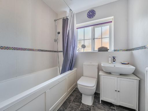
- Bathrooms: 2
- Property Type: undefined
- Property SubType: undefined
Brochure Descriptions
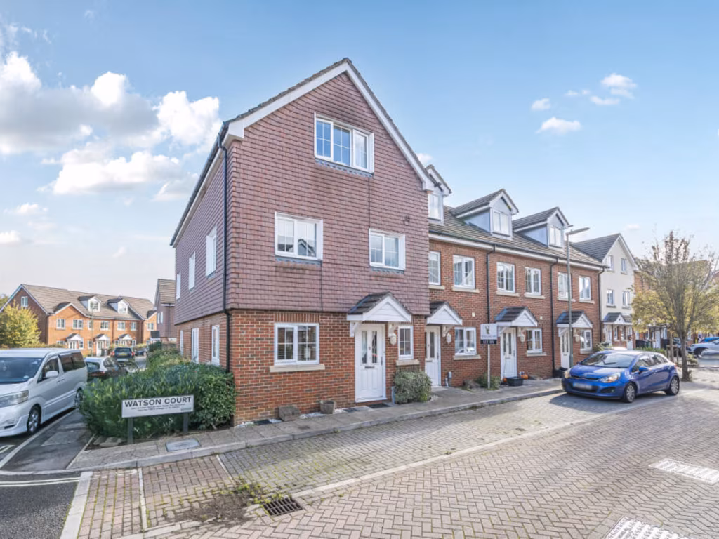
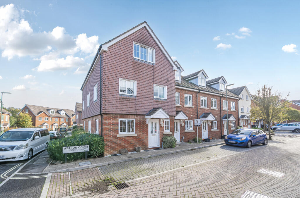
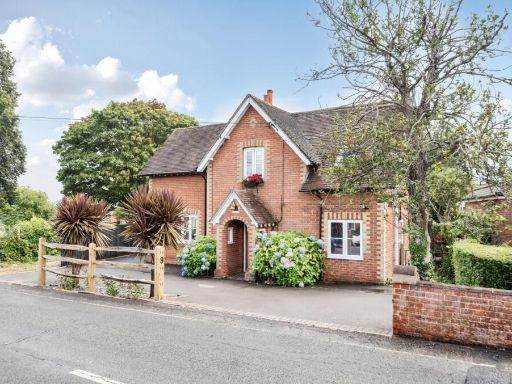
- Modern three-storey end-of-terrace townhouse constructed in brick with tile-clad upper elevations. The property forms part of a contemporary residential development in a suburban setting (Hedge End, Southampton) and sits directly onto a paved street with on-street parking and small planted front borders. Accommodation is likely arranged over three floors with dormer windows to the roof space, suggesting use as bedrooms/ensuite at second floor level. The building presents a compact urban plot with minimal private frontage and likely a small to average rear garden (not visible in image). Overall plot size appears modest; the property would suit a small family, first‑time buyer, or investor looking for low‑maintenance town centre / suburb rental stock. Immediate outlook is residential street with neighbouring similar townhouses and limited long-distance views.
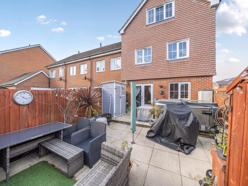
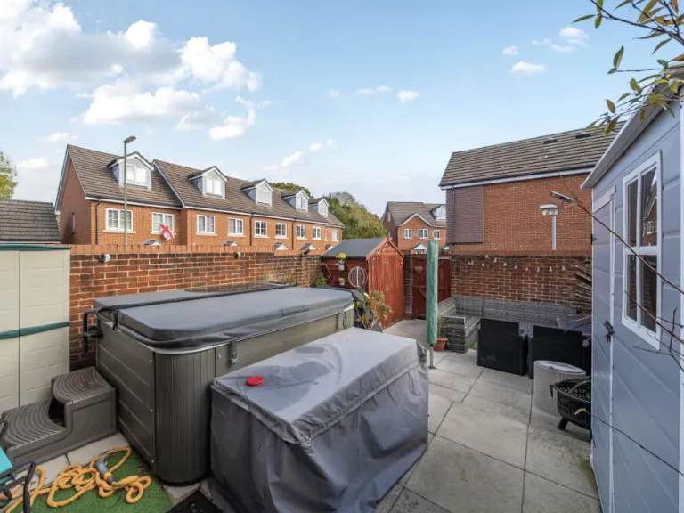
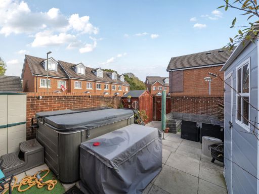
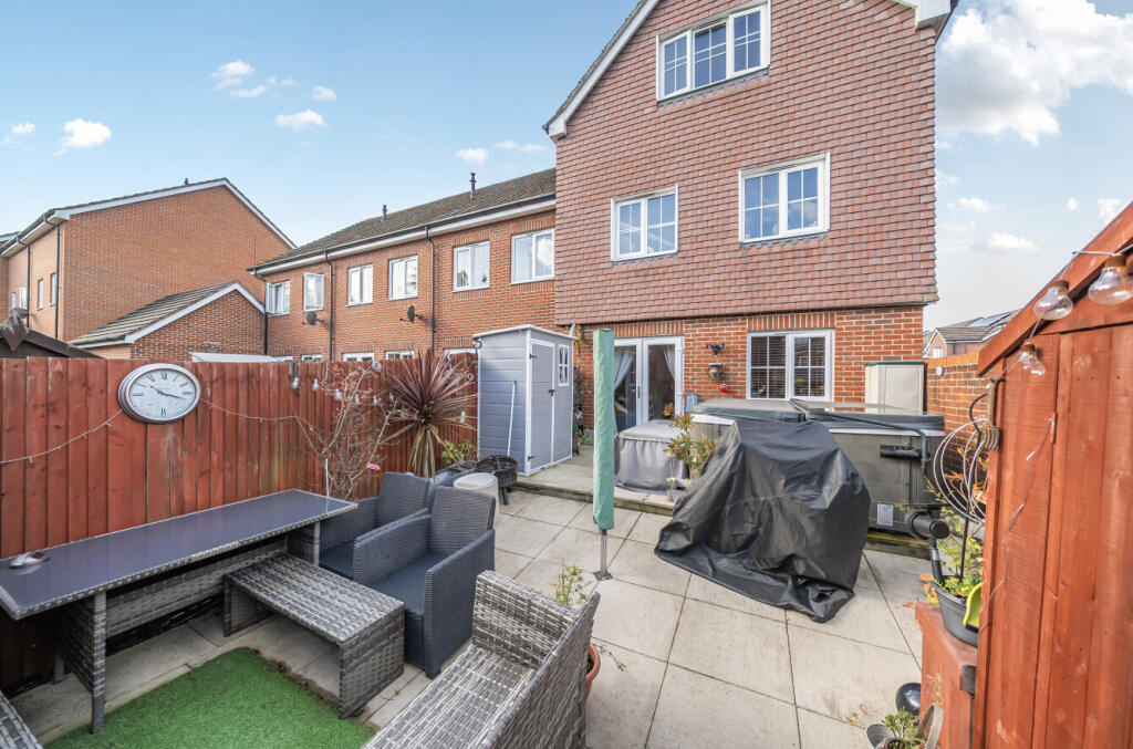
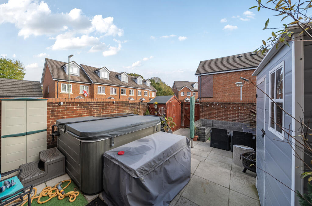
- Three-storey red-brick townhouse (end/terraced appearance) with a small, enclosed rear patio garden. The rear exterior shows paved patio with a compact seating area, a small area of artificial turf, a garden shed, and timber fencing enclosing the garden. Property sits in a modern residential development with neighbouring similar brick houses visible. Garden size: small. Overall property footprint inferred as narrow but extending vertically over three floors, suggesting moderate internal floor area for a townhouse of this form.
Image Descriptions
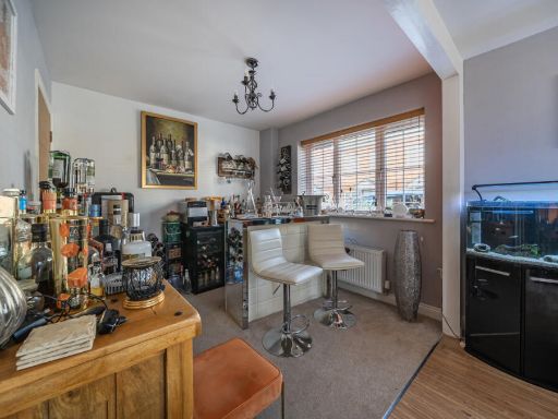
- townhouse modern
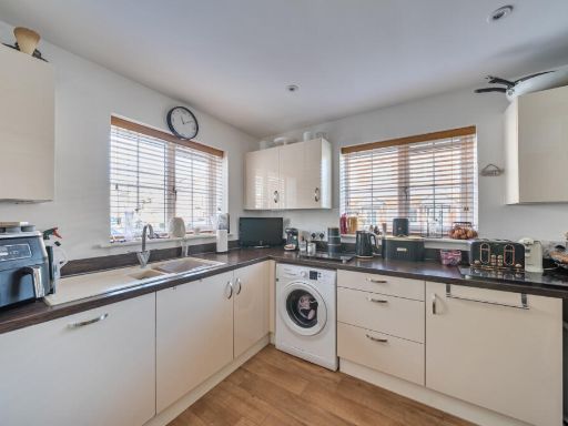
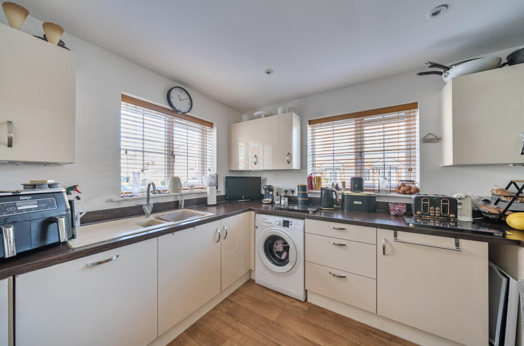
- kitchen modern
Floorplan Description
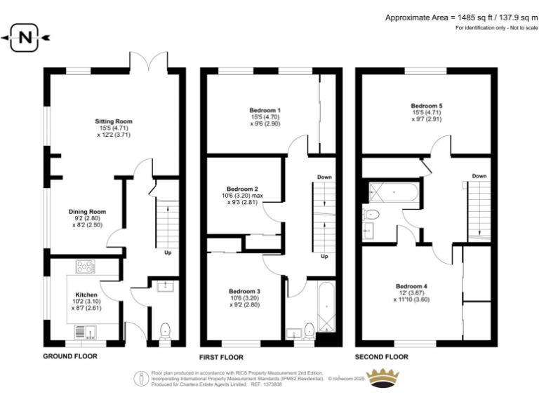
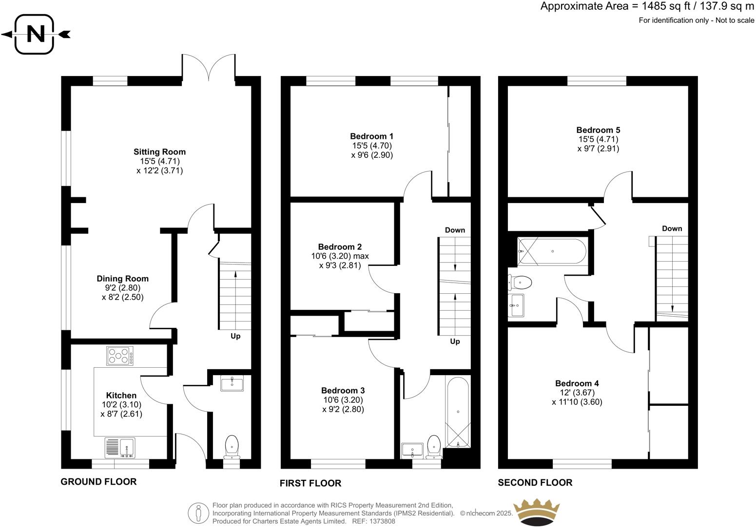
- Floor plan showing rooms and dimensions; approximate area noted as 1485 sq ft.
Rooms
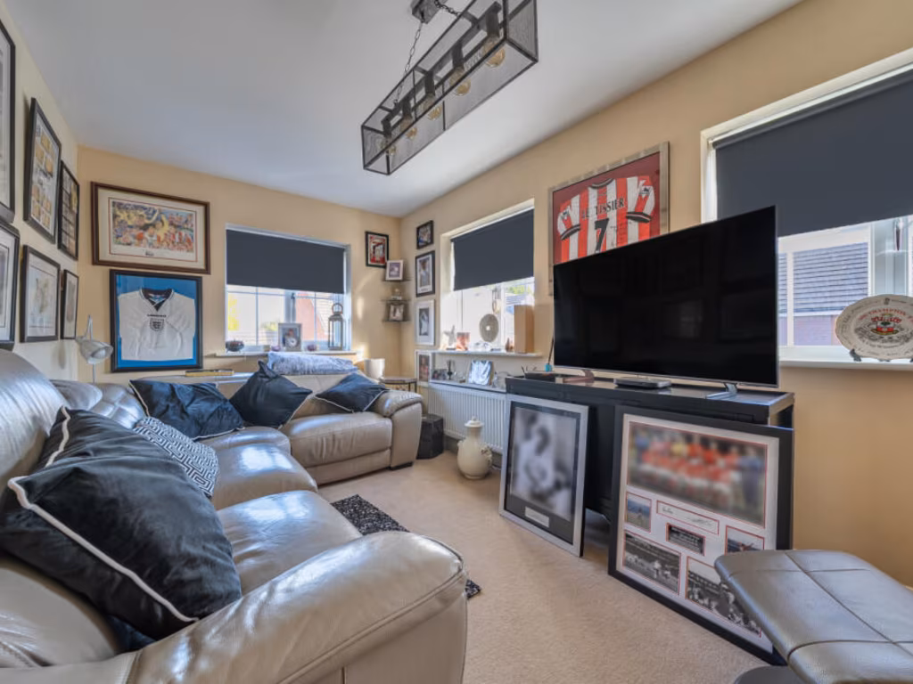
- Sitting Room:
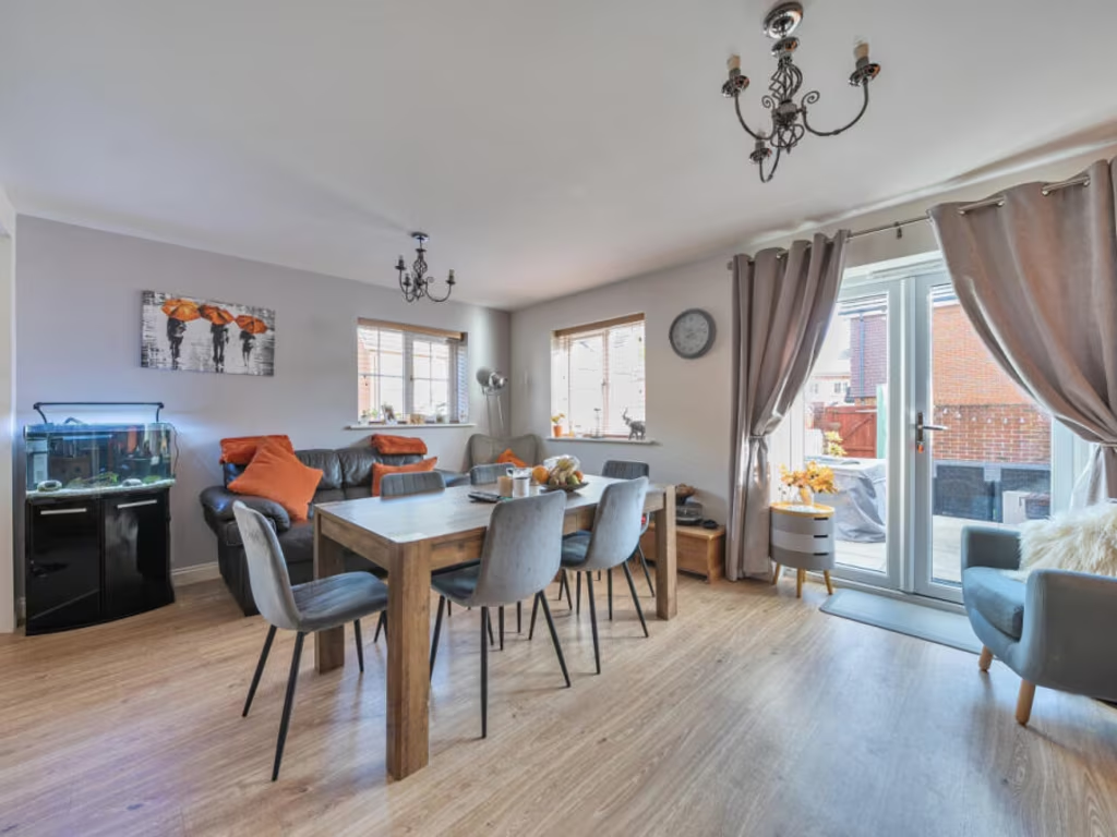
- Dining Room:
- Kitchen:
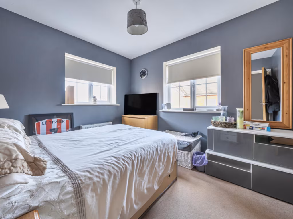
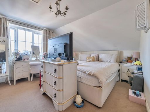
- Bedroom 1:
- Bedroom 2:
- Bedroom 3:
- Bedroom 5:
- Bedroom 4:
Textual Property Features
Detected Visual Features
- modern townhouse
- three-story
- brick exterior
- residential area
- garage
- garden
- off-street parking
- suburban
- modern kitchen
- l-shaped counter
- laminate flooring
- integrated appliances
- dual window lighting
- wooden blinds
- glossy cabinets
EPC Details
- Fully double glazed
- Timber frame, as built, insulated (assumed)
- Boiler and radiators, mains gas
- Low energy lighting in 94% of fixed outlets
- Solid, insulated (assumed)
Nearby Schools
- Brookfield Community School
- Oasis Academy Mayfield
- Freegrounds Infant School
- Freegrounds Junior School
- Deer Park School
- Saint James' Church of England Primary School
- Sarisbury Infant School
- Sarisbury Church of England Junior School
- Valentine Primary School
- Hightown Primary School
- Kanes Hill Primary School
- Berrywood Primary School
- Boorley Park
- Wellstead Primary School
- Durley Church of England Controlled Primary School
- The Hamble School
- Bursledon Church of England Infant School
- Bursledon Junior School(CA)
- Kings Copse Primary School
- Botley Church of England Controlled Primary School
- Woodlands Community College
- Hamble Primary School
- Whiteley Primary School
- Thornhill Primary School
- Wildern School
- Shamblehurst Primary School
Nearest Bars And Restaurants
- Id: 234554486
- Tags:
- Amenity: fast_food
- Building: yes
- Cuisine: chinese
- Name: Hong Kong Garden
- Opening_hours: Mo-Su 17:00-23:30; Fr 17:00-24:00
- Phone: +44 1489 786184
- Source: Survey
- Source:location: Bing Imagery
- Takeaway: yes
- TagsNormalized:
- fast food
- food
- chinese
- takeaway
- Lat: 50.9137993
- Lon: -1.3021073
- FullGeoHash: gcp1dkef6sn6
- PartitionGeoHash: gcp1
- Images:
- FoodStandards: null
- Distance: 892.6
,- Id: 234554487
- Tags:
- Amenity: pub
- Building: yes
- Name: The Barleycorn
- Source: Local Knowledge
- Source:location: Bing Imagery
- TagsNormalized:
- Lat: 50.9137276
- Lon: -1.3022759
- FullGeoHash: gcp1dke9yy8x
- PartitionGeoHash: gcp1
- Images:
- FoodStandards: null
- Distance: 887.4
,- Id: 297179739
- Tags:
- Addr:
- Amenity: fast_food
- Brand: Domino's
- Brand:wikidata: Q839466
- Brand:wikipedia: en:Domino's Pizza
- Contact:
- Website: https://www.dominos.co.uk/pizza-near-me/southampton/unit-6-st-johns-centre
- Cuisine: pizza
- Name: Domino's
- Opening_hours: Mo-Su 10:00-23:00
- Takeaway: yes
- TagsNormalized:
- fast food
- food
- dominos
- pizza
- takeaway
- Lat: 50.9132898
- Lon: -1.3042995
- FullGeoHash: gcp1dk6prt5g
- PartitionGeoHash: gcp1
- Images:
- FoodStandards: null
- Distance: 884.2
,- Id: 297179743
- Tags:
- Amenity: fast_food
- Cuisine: pizza
- Name: Mr Pizza
- TagsNormalized:
- Lat: 50.9129791
- Lon: -1.3039567
- FullGeoHash: gcp1dk6mxe5q
- PartitionGeoHash: gcp1
- Images:
- FoodStandards: null
- Distance: 843.1
,- Id: 842195339
- Tags:
- Amenity: cafe
- Building: retail
- Name: Kettle & Cake
- TagsNormalized:
- Lat: 50.9123819
- Lon: -1.3036672
- FullGeoHash: gcp1dk6dn7g7
- PartitionGeoHash: gcp1
- Images:
- FoodStandards: null
- Distance: 773.9
}
Nearest General Shops
- Id: 5457089114
- Tags:
- Name: Vanilla Rooms
- Shop: beauty
- TagsNormalized:
- Lat: 50.9109086
- Lon: -1.3045755
- FullGeoHash: gcp1dk4191np
- PartitionGeoHash: gcp1
- Images:
- FoodStandards: null
- Distance: 658
,- Id: 4074238929
- Tags:
- Addr:
- City: Hedge End, Southampton
- Street: Bursledon Road
- Name: Mike's Barber Shop
- Shop: hairdresser
- TagsNormalized:
- Lat: 50.9108682
- Lon: -1.3046661
- FullGeoHash: gcp1dk1cr1dq
- PartitionGeoHash: gcp1
- Images:
- FoodStandards: null
- Distance: 657.8
,- Id: 5457089115
- Tags:
- Name: Mike's
- Shop: hairdresser
- TagsNormalized:
- Lat: 50.9108511
- Lon: -1.3046318
- FullGeoHash: gcp1dk1cpys0
- PartitionGeoHash: gcp1
- Images:
- FoodStandards: null
- Distance: 654.9
}
Nearest Grocery shops
- Id: 234553649
- Tags:
- Area: yes
- Shop: greengrocer
- Source: Local Knowledge
- TagsNormalized:
- Lat: 50.913904
- Lon: -1.3034204
- FullGeoHash: gcp1dkdfupe7
- PartitionGeoHash: gcp1
- Images:
- FoodStandards: null
- Distance: 927.3
,- Id: 185578424
- Tags:
- Brand: Co-op Food
- Brand:wikidata: Q3277439
- Brand:wikipedia: en:Co-op Food
- Building: retail
- Name: Co-op Food
- Opening_hours: Mo-Sa 06:00-23:00; Su 10:00-16:00
- Operator: Co-operative Group Limited
- Phone: +441489783808
- Shop: convenience
- Store_ref: 9726
- TagsNormalized:
- co-op
- co-op food
- food
- retail
- convenience
- shop
- Lat: 50.9135168
- Lon: -1.3025643
- FullGeoHash: gcp1dke88p3t
- PartitionGeoHash: gcp1
- Images:
- FoodStandards: null
- Distance: 869.4
,- Id: 668750101
- Tags:
- Addr:
- City: Southampton
- Country: GB
- Postcode: SO30 2SZ
- Street: Tanhouse Lane
- Suburb: Hedge End
- Brand: Tesco Express
- Brand:wikidata: Q98456772
- Building: retail
- Contact:
- Website: https://www.tesco.com/store-locator/southampton/tanhouse-ln
- Name: Tesco Express
- Shop: convenience
- TagsNormalized:
- tesco
- tesco express
- retail
- convenience
- shop
- Lat: 50.9078121
- Lon: -1.2955713
- FullGeoHash: gcp1de2x7pbp
- PartitionGeoHash: gcp1
- Images:
- FoodStandards: null
- Distance: 342.6
}
Nearest Supermarkets
- Id: 1079859432
- Tags:
- Addr:
- City: Southampton
- Postcode: SO19 8BR
- Street: Bursledon Road
- Branch: UK
- Brand: ALDI
- Brand:wikidata: Q41171672
- Brand:wikipedia: en:Aldi
- Building: retail
- Contact:
- Website: https://stores.aldi.co.uk/southampton/bursledon-road
- Name: ALDI
- Shop: supermarket
- TagsNormalized:
- aldi
- retail
- supermarket
- shop
- Lat: 50.9016266
- Lon: -1.3297986
- FullGeoHash: gcp19dremqym
- PartitionGeoHash: gcp1
- Images:
- FoodStandards: null
- Distance: 2181
,- Id: 28888778
- Tags:
- Addr:
- Postcode: SO31 8GN
- Street: Hamble Lane
- Alt_name: Tesco Southampton Bursledon Towers Extra
- Branch: Southampton Bursledon Towers
- Brand: Tesco Extra
- Brand:wikidata: Q25172225
- Brand:wikipedia: en:Tesco Extra
- Building: yes
- Contact:
- Website: https://www.tesco.com/store-locator/southampton/hamble-lane
- Name: Tesco Extra
- Operator: Tesco
- Pharmacy: yes
- Pharmacy:opening_hours: Mo-Fr 09:00-21:00; Sa 08:00-21:00; Su 10:00-16:00
- Phone: +443456779087
- Ref:
- Shop: supermarket
- TagsNormalized:
- tesco
- tesco extra
- supermarket
- shop
- Lat: 50.8947201
- Lon: -1.3204183
- FullGeoHash: gcp19cne0p2z
- PartitionGeoHash: gcp1
- Images:
- FoodStandards: null
- Distance: 1928.4
,- Id: 98452765
- Tags:
- Brand: Sainsbury's
- Brand:wikidata: Q152096
- Building: yes
- Name: Sainsbury's
- Opening_hours: Mo-We 07:00-23:00; Th,Fr 07:00-24:00; Sa 07:00-22:00; Su 10:00-16:00
- Operator: Sainsbury's
- Pharmacy: yes
- Pharmacy:opening_hours: Mo-Fr 08:00-22:00; Sa 08:00-20:00; Su 10:00-16:00
- Phone: +44 1489 790452
- Shop: supermarket
- Wheelchair: yes
- TagsNormalized:
- sainsburys
- supermarket
- shop
- Lat: 50.9193414
- Lon: -1.3127703
- FullGeoHash: gcp1djs4djpw
- PartitionGeoHash: gcp1
- Images:
- FoodStandards: null
- Distance: 1757.6
}
Nearest Religious buildings
- Id: 238459948
- Tags:
- Amenity: place_of_worship
- Building: yes
- Denomination: united_reformed
- Name: Hedge End United Reformed Church
- Phone: +44 1489 787408
- Religion: christian
- Source: survey
- Source:outline: bing
- TagsNormalized:
- place of worship
- united reformed
- church
- christian
- Lat: 50.9124433
- Lon: -1.3044255
- FullGeoHash: gcp1dk64kxmf
- PartitionGeoHash: gcp1
- Images:
- FoodStandards: null
- Distance: 801.9
,- Id: 606506939
- Tags:
- Addr:
- City: Southampton
- Housenumber: 76
- Postcode: SO30 4AF
- Street: Saint John's Road
- Amenity: place_of_worship
- Building: yes
- Denomination: anglican
- Email: office@stjohns-hedgeend.org.uk
- Name: St John's Church
- Phone: +44 1489 790048
- Religion: christian
- Website: https://www.stjohns-hedgeend.org.uk/
- Wikidata: Q26499784
- TagsNormalized:
- place of worship
- anglican
- church
- christian
- Lat: 50.9088428
- Lon: -1.3094199
- FullGeoHash: gcp1d5wt821u
- PartitionGeoHash: gcp1
- Images:
- FoodStandards: null
- Distance: 769
,- Id: 297179747
- Tags:
- Amenity: place_of_worship
- Building: church
- Denomination: catholic
- Name: Catholic Church of Our Lady of the Assumption
- Religion: christian
- TagsNormalized:
- place of worship
- church
- catholic
- christian
- Lat: 50.9123514
- Lon: -1.3031095
- FullGeoHash: gcp1dk71gq5j
- PartitionGeoHash: gcp1
- Images:
- FoodStandards: null
- Distance: 756.7
}
Nearest Medical buildings
- Id: 304090108
- Tags:
- Addr:
- City: Southampton
- Country: GB
- Housenumber: 24
- Postcode: SO30 4FQ
- Street: Lower Northam Road
- Suburb: Hedge End
- Amenity: clinic
- Building: yes
- Name: Hedge End Medical Centre
- Source: survey
- TagsNormalized:
- Lat: 50.9140847
- Lon: -1.3005972
- FullGeoHash: gcp1dksujck3
- PartitionGeoHash: gcp1
- Images:
- FoodStandards: null
- Distance: 908.4
,- Id: 5457089056
- Tags:
- Amenity: dentist
- Name: Acorn Dental Health
- TagsNormalized:
- Lat: 50.9140381
- Lon: -1.300925
- FullGeoHash: gcp1dksey285
- PartitionGeoHash: gcp1
- Images:
- FoodStandards: null
- Distance: 905.5
,- Id: 297179740
- Tags:
- Addr:
- City: Southampton
- Country: GB
- County: Hampshire
- Housenumber: 51
- Place: Hadge End
- Postcode: SO30 4QU
- Street: St Johns Centre
- Amenity: pharmacy
- Dispensing: yes
- Dispensing_hours: Mo-Fr 09:00-12:30,13:30-18:00; Sa 09:00-12:30,13:30-17:00
- Email: hedgeend@everettspharmacy.co.uk
- Name: Everetts Pharmacy
- Opening_hours: Mo-Fr 09:00-18:00; Sa 09:00-17:00
- Operator: H J Everett (Chemist) Ltd
- Phone: +441489787141
- Website: https://everettspharmacy.co.uk/branches/hedge-end
- TagsNormalized:
- Lat: 50.9132342
- Lon: -1.3045153
- FullGeoHash: gcp1dk6p4ddz
- PartitionGeoHash: gcp1
- Images:
- FoodStandards: null
- Distance: 884.4
,- Id: 234554593
- Tags:
- Amenity: dentist
- Building: yes
- Healthcare: dentist
- Name: Hedge End Dentists
- Phone: +441489790661
- Source:
- TagsNormalized:
- Lat: 50.9130703
- Lon: -1.3021641
- FullGeoHash: gcp1dk7y1khn
- PartitionGeoHash: gcp1
- Images:
- FoodStandards: null
- Distance: 814.4
}
Nearest Airports
- Id: 100647893
- Tags:
- Aerodrome: international
- Aerodrome:type: public
- Aeroway: aerodrome
- Contact:
- Vhf:
- Approach: 120.225 MHz
- Tower: 118.2 MHz
- Ele: 44ft
- Iata: SOU
- Icao: EGHI
- Is_in: Hampshire, England,UK
- Name: Southampton Airport
- Operator: Southampton International Airport Limited
- Source: Bing;Gagravarr_Airports
- Wikidata: Q8988
- Wikipedia: en:Southampton Airport
- TagsNormalized:
- airport
- international airport
- Lat: 50.9513872
- Lon: -1.3516684
- FullGeoHash: gcp1c5rtrffz
- PartitionGeoHash: gcp1
- Images:
- FoodStandards: null
- Distance: 6238.4
}
Nearest Leisure Facilities
- Id: 99055896
- Tags:
- Leisure: playground
- Source: Bing
- TagsNormalized:
- Lat: 50.9100269
- Lon: -1.3060591
- FullGeoHash: gcp1d7buqsge
- PartitionGeoHash: gcp1
- Images:
- FoodStandards: null
- Distance: 648
,- Id: 2072212473
- Tags:
- TagsNormalized:
- Lat: 50.9099012
- Lon: -1.3058357
- FullGeoHash: gcp1d7c5ev6m
- PartitionGeoHash: gcp1
- Images:
- FoodStandards: null
- Distance: 627
,- Id: 791879324
- Tags:
- Leisure: playground
- Playground:
- TagsNormalized:
- Lat: 50.9012706
- Lon: -1.3027459
- FullGeoHash: gcp1d6737ud6
- PartitionGeoHash: gcp1
- Images:
- FoodStandards: null
- Distance: 568.7
,- Id: 270623394
- Tags:
- Leisure: park
- Surface: grass
- TagsNormalized:
- Lat: 50.9085937
- Lon: -1.2931595
- FullGeoHash: gcp1dedk51wq
- PartitionGeoHash: gcp1
- Images:
- FoodStandards: null
- Distance: 530.8
,- Id: 7419159340
- Tags:
- Leisure: park
- Name: Sport and Recreational Field
- TagsNormalized:
- Lat: 50.9042208
- Lon: -1.2961579
- FullGeoHash: gcp1ddb4t6d8
- PartitionGeoHash: gcp1
- Images:
- FoodStandards: null
- Distance: 300.8
}
Nearest Tourist attractions
- Id: 2195764702
- Tags:
- Name: Twin Oaks Guest House
- Phone: +44 1489 690054
- Tourism: guest_house
- TagsNormalized:
- Lat: 50.9123762
- Lon: -1.3093752
- FullGeoHash: gcp1dhqd16g1
- PartitionGeoHash: gcp1
- Images:
- FoodStandards: null
- Distance: 997.2
,- Id: 2415821767
- Tags:
- Name: Heather Gables
- Stars: 4
- Tourism: guest_house
- TagsNormalized:
- Lat: 50.9020877
- Lon: -1.3092224
- FullGeoHash: gcp1d4qwhuvh
- PartitionGeoHash: gcp1
- Images:
- FoodStandards: null
- Distance: 807.9
,- Id: 21421150
- Tags:
- Created_by: JOSM
- Name: Paulines Lodge Scout activity centre
- Tourism: camp_site
- TagsNormalized:
- Lat: 50.8988106
- Lon: -1.2988444
- FullGeoHash: gcp1d3y5n9zr
- PartitionGeoHash: gcp1
- Images:
- FoodStandards: null
- Distance: 794.7
}
Nearest Train stations
- Id: 9838822
- Tags:
- Name: Hamble
- Naptan:
- Network: National Rail
- Public_transport: station
- Railway: station
- Ref:
- Wikidata: Q927502
- Wikipedia: en:Hamble railway station
- TagsNormalized:
- Lat: 50.8712423
- Lon: -1.3289942
- FullGeoHash: gcp13ub62nyh
- PartitionGeoHash: gcp1
- Images:
- FoodStandards: null
- Distance: 4379.9
,- Id: 21310084
- Tags:
- Addr:
- City: Southampton
- Country: GB
- Postcode: SO31 1BA
- Name: Swanwick
- Naptan:
- Network: National Rail
- Public_transport: station
- Railway: station
- Ref:
- Wikidata: Q2765966
- Wikipedia: en:Swanwick railway station
- TagsNormalized:
- Lat: 50.8757192
- Lon: -1.2659524
- FullGeoHash: gcp17jwht1mq
- PartitionGeoHash: gcp1
- Images:
- FoodStandards: null
- Distance: 4101.4
,- Id: 9509195
- Tags:
- Addr:
- City: Eastleigh
- Housename: Botley Railway Station
- Postcode: SO30 2DY
- Street: Station Hill
- Name: Botley
- Naptan:
- Network: National Rail
- Public_transport: station
- Railway: station
- Ref:
- Wikidata: Q2041220
- Wikipedia: en:Botley railway station
- TagsNormalized:
- Lat: 50.9163612
- Lon: -1.2590525
- FullGeoHash: gcp1em51mcwm
- PartitionGeoHash: gcp1
- Images:
- FoodStandards: null
- Distance: 3060.6
,- Id: 2430249
- Tags:
- Name: Hedge End
- Naptan:
- Network: National Rail
- Public_transport: station
- Railway: station
- Ref:
- Wikidata: Q2686491
- Wikipedia: en:Hedge End railway station
- TagsNormalized:
- Lat: 50.9323988
- Lon: -1.2944932
- FullGeoHash: gcp1dxcqsp7c
- PartitionGeoHash: gcp1
- Images:
- FoodStandards: null
- Distance: 2961.8
,- Id: 596457
- Tags:
- Name: Bursledon
- Naptan:
- Network: National Rail
- Platforms: 1
- Public_transport: station
- Railway: station
- Ref:
- Wikidata: Q2219439
- Wikipedia: en:Bursledon railway station
- TagsNormalized:
- Lat: 50.8835729
- Lon: -1.305111
- FullGeoHash: gcp16r1dk9qx
- PartitionGeoHash: gcp1
- Images:
- FoodStandards: null
- Distance: 2519.3
}
Nearest Bus stations and stops
- Id: 503403693
- Tags:
- Bus: yes
- Highway: bus_stop
- Name: Sherwood Avenue
- Naptan:
- AtcoCode: 1900HA030415
- Bearing: SE
- CommonName: Sherwood Avenue
- Crossing: Sherwood Avenue
- NaptanCode: hamdjgdj
- Street: Heathhouse Lane
- Verified: no
- Public_transport: platform
- Source: naptan_import
- TagsNormalized:
- Lat: 50.9035064
- Lon: -1.3035035
- FullGeoHash: gcp1d6dy6jm7
- PartitionGeoHash: gcp1
- Images:
- FoodStandards: null
- Distance: 392.5
,- Id: 6234904219
- Tags:
- Bus: yes
- Highway: bus_stop
- Public_transport: platform
- TagsNormalized:
- Lat: 50.9028571
- Lon: -1.3006316
- FullGeoHash: gcp1d6sfth6f
- PartitionGeoHash: gcp1
- Images:
- FoodStandards: null
- Distance: 353.3
,- Id: 6234904218
- Tags:
- Bus: yes
- Highway: bus_stop
- Public_transport: platform
- TagsNormalized:
- Lat: 50.9029104
- Lon: -1.3002551
- FullGeoHash: gcp1d6t4vy78
- PartitionGeoHash: gcp1
- Images:
- FoodStandards: null
- Distance: 342.2
,- Id: 503403702
- Tags:
- Bus: yes
- Highway: bus_stop
- Name: Cranbourne Park
- Naptan:
- AtcoCode: 1900HA030418
- Bearing: W
- CommonName: Cranbourne Park
- Crossing: Woodstock Close
- NaptanCode: hamdjpat
- Street: Kings Copse Avenue
- Verified: no
- Public_transport: platform
- Source: naptan_import
- TagsNormalized:
- Lat: 50.9050918
- Lon: -1.2964397
- FullGeoHash: gcp1d6zzwubk
- PartitionGeoHash: gcp1
- Images:
- FoodStandards: null
- Distance: 232.2
,- Id: 503403699
- Tags:
- Bus: yes
- Highway: bus_stop
- Name: Cranbourne Park
- Naptan:
- AtcoCode: 1900HA030417
- Bearing: E
- CommonName: Cranbourne Park
- Crossing: Woodstock Close
- NaptanCode: hamdjpag
- Street: Kings Copse Avenue
- Verified: no
- Public_transport: platform
- Source: naptan_import
- TagsNormalized:
- Lat: 50.9051205
- Lon: -1.296738
- FullGeoHash: gcp1d6zxzf4p
- PartitionGeoHash: gcp1
- Images:
- FoodStandards: null
- Distance: 211.9
}
Nearest Hotels
- Id: 98841642
- Tags:
- Brand: Holiday Inn Express
- Brand:wikidata: Q5880423
- Building: yes
- Name: Holiday Inn Express
- Source: Bing
- Toilets:
- Tourism: hotel
- Wheelchair: limited
- TagsNormalized:
- Lat: 50.9266165
- Lon: -1.3231778
- FullGeoHash: gcp19yump9rh
- PartitionGeoHash: gcp1
- Images:
- FoodStandards: null
- Distance: 2836.7
,- Id: 208141751
- Tags:
- Addr:
- City: Southampton
- Postcode: SO30 3XH
- Street: Botley Road
- Brand: Hilton
- Brand:wikidata: Q598884
- Building: yes
- Contact:
- Facebook: https://www.facebook.com/HiltonatTheAgeasBowl
- Instagram: https://instagram.com/hiltonageasbowl/
- Twitter: https://twitter.com/hiltonageasbowl
- Email: reservations@hiltonageasbowl.com
- Fax: +44-23-82020901
- Internet_access: wlan
- Internet_access:fee: no
- Layer: 1
- Name: Hilton at the Ageas Bowl, Southampton
- Operator: Hilton Worldwide
- Phone: +44 23 82020900
- Rooms: 171
- Stars: 4
- Tourism: hotel
- Website: https://www.hilton.com/en/hotels/souaghi-hilton-at-the-ageas-bowl-southampton/
- TagsNormalized:
- Lat: 50.9247184
- Lon: -1.3208901
- FullGeoHash: gcp19yw1vp8c
- PartitionGeoHash: gcp1
- Images:
- FoodStandards: null
- Distance: 2571.7
,- Id: 120391033
- Tags:
- Building: yes
- Name: The Legacy Botleigh Grange Hotel
- Source: Bing
- Tourism: hotel
- TagsNormalized:
- Lat: 50.9202278
- Lon: -1.293411
- FullGeoHash: gcp1dtdpv66y
- PartitionGeoHash: gcp1
- Images:
- FoodStandards: null
- Distance: 1643.6
}
Tags
- modern townhouse
- three-story
- brick exterior
- residential area
- garage
- garden
- off-street parking
- suburban
- modern kitchen
- l-shaped counter
- laminate flooring
- integrated appliances
- dual window lighting
- wooden blinds
- glossy cabinets
Local Market Stats
- Average Price/sqft: £361
- Avg Income: £52600
- Rental Yield: 3.7%
- Social Housing: 12%
- Planning Success Rate: 87%
Similar Properties
 5 bedroom detached house for sale in St. Johns Road, Hedge End, Southampton, Hampshire, SO30 — £725,000 • 5 bed • 4 bath • 2411 ft²
 5 bedroom end of terrace house for sale in Watson Court, Hedge End, Southampton, SO30 — £455,000 • 5 bed • 2 bath • 1562 ft²
 4 bedroom detached house for sale in Netley Firs Road, Hedge End, Southampton, SO30 — £650,000 • 4 bed • 1 bath • 1382 ft²
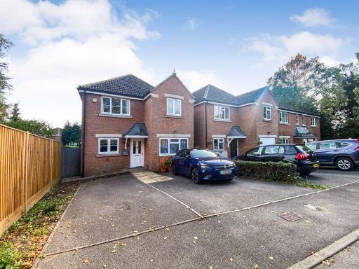 4 bedroom detached house for sale in Lower Northam Road, Hedge End, SO30 — £460,000 • 4 bed • 2 bath • 1147 ft²
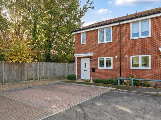 2 bedroom semi-detached house for sale in Simmons Close, Hedge End, Southampton, Hampshire, SO30 — £300,000 • 2 bed • 3 bath • 858 ft²
 4 bedroom detached house for sale in Goodlands Vale, Hedge End, Southampton, Hampshire, SO30 — £475,000 • 4 bed • 2 bath • 1091 ft²
Meta
- {
"@context": "https://schema.org",
"@type": "Residence",
"name": "5 bedroom end of terrace house for sale in Watson Court, He…",
"description": "",
"url": "https://propertypiper.co.uk/property/bbcc41c7-0cee-4a7c-81e6-4b038d017f12",
"image": "https://image-a.propertypiper.co.uk/bf7e7566-be9c-4581-a011-ab430d709d20-1024.jpeg",
"address": {
"@type": "PostalAddress",
"streetAddress": "Watson Court, Hedge End, Southampton, Hampshire, SO30",
"postalCode": "SO30 0AQ",
"addressLocality": "Eastleigh",
"addressRegion": "Eastleigh",
"addressCountry": "England"
},
"geo": {
"@type": "GeoCoordinates",
"latitude": 50.905947,
"longitude": -1.2994603
},
"numberOfRooms": 5,
"numberOfBathroomsTotal": 2,
"floorSize": {
"@type": "QuantitativeValue",
"value": 1400,
"unitCode": "FTK"
},
"offers": {
"@type": "Offer",
"price": 455000,
"priceCurrency": "GBP",
"availability": "https://schema.org/InStock"
},
"additionalProperty": [
{
"@type": "PropertyValue",
"name": "Feature",
"value": "modern townhouse"
},
{
"@type": "PropertyValue",
"name": "Feature",
"value": "three-story"
},
{
"@type": "PropertyValue",
"name": "Feature",
"value": "brick exterior"
},
{
"@type": "PropertyValue",
"name": "Feature",
"value": "residential area"
},
{
"@type": "PropertyValue",
"name": "Feature",
"value": "garage"
},
{
"@type": "PropertyValue",
"name": "Feature",
"value": "garden"
},
{
"@type": "PropertyValue",
"name": "Feature",
"value": "off-street parking"
},
{
"@type": "PropertyValue",
"name": "Feature",
"value": "suburban"
},
{
"@type": "PropertyValue",
"name": "Feature",
"value": "modern kitchen"
},
{
"@type": "PropertyValue",
"name": "Feature",
"value": "l-shaped counter"
},
{
"@type": "PropertyValue",
"name": "Feature",
"value": "laminate flooring"
},
{
"@type": "PropertyValue",
"name": "Feature",
"value": "integrated appliances"
},
{
"@type": "PropertyValue",
"name": "Feature",
"value": "dual window lighting"
},
{
"@type": "PropertyValue",
"name": "Feature",
"value": "wooden blinds"
},
{
"@type": "PropertyValue",
"name": "Feature",
"value": "glossy cabinets"
}
]
}
High Res Floorplan Images
Compatible Floorplan Images
FloorplanImages Thumbnail