AL7 4FF - 2 bedroom apartment for sale in Layton Street, Welwyn Garde…
View on Property Piper
2 bedroom apartment for sale in Layton Street, Welwyn Garden City, AL7
Property Details
- Price: £230000
- Bedrooms: 2
- Bathrooms: 1
- Property Type: undefined
- Property SubType: undefined
Image Descriptions
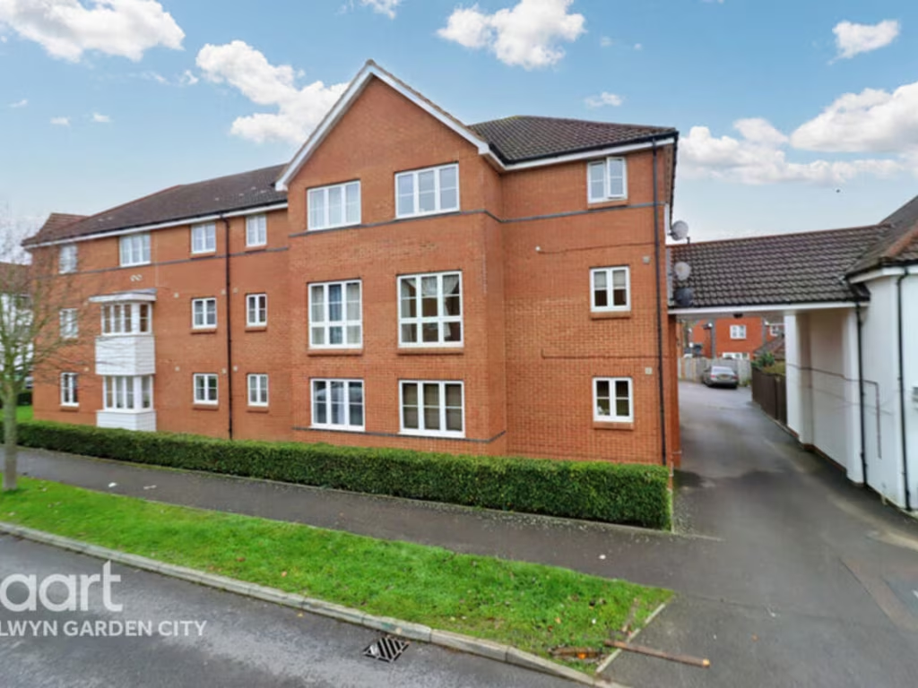
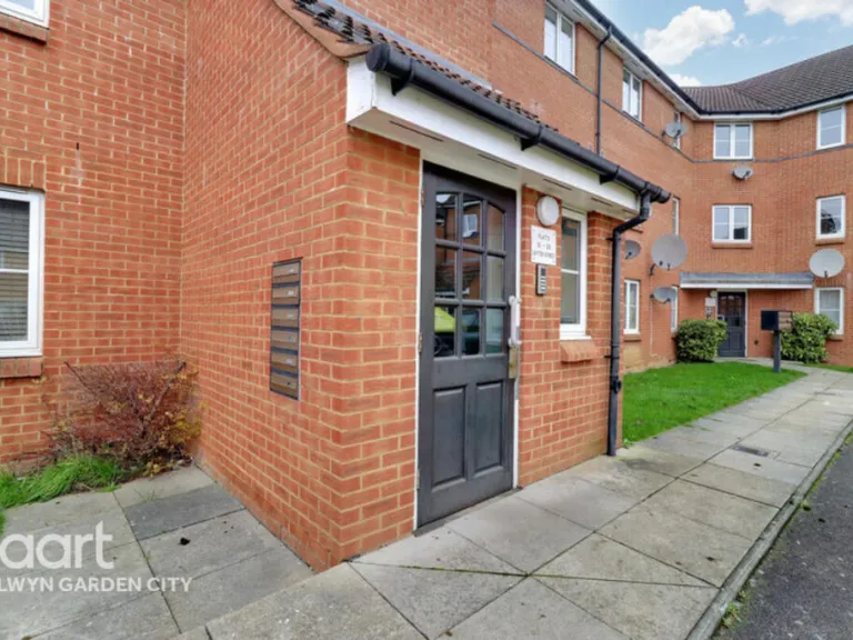
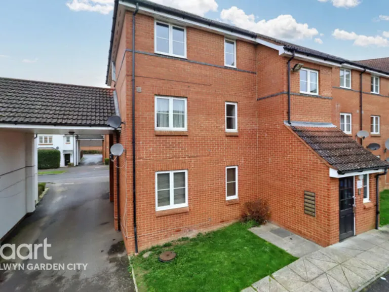
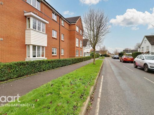
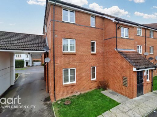
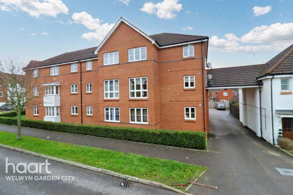
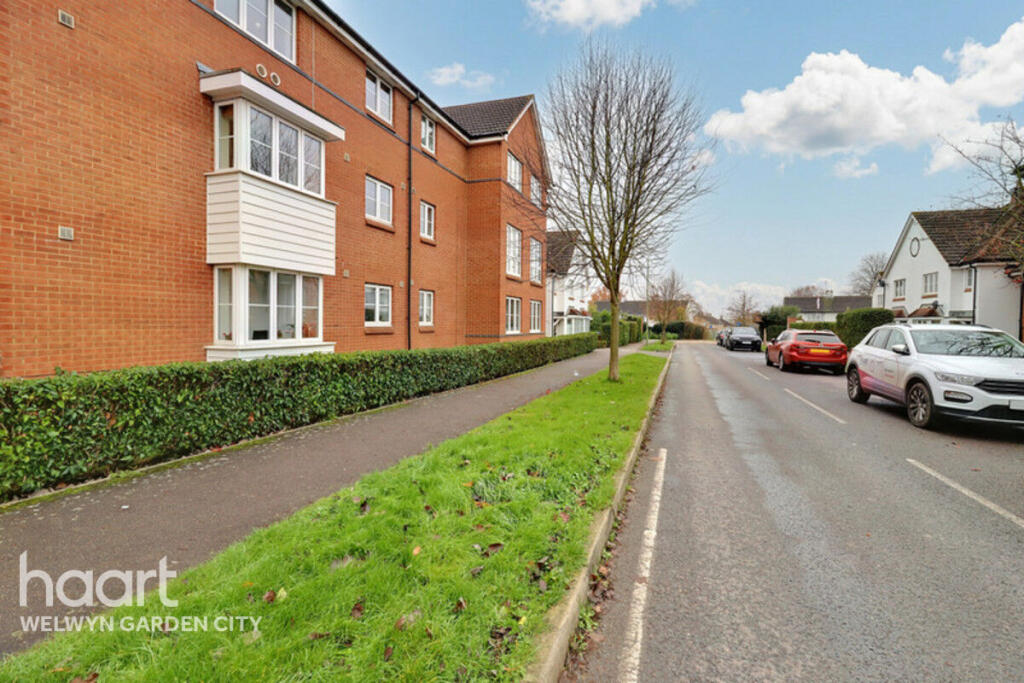
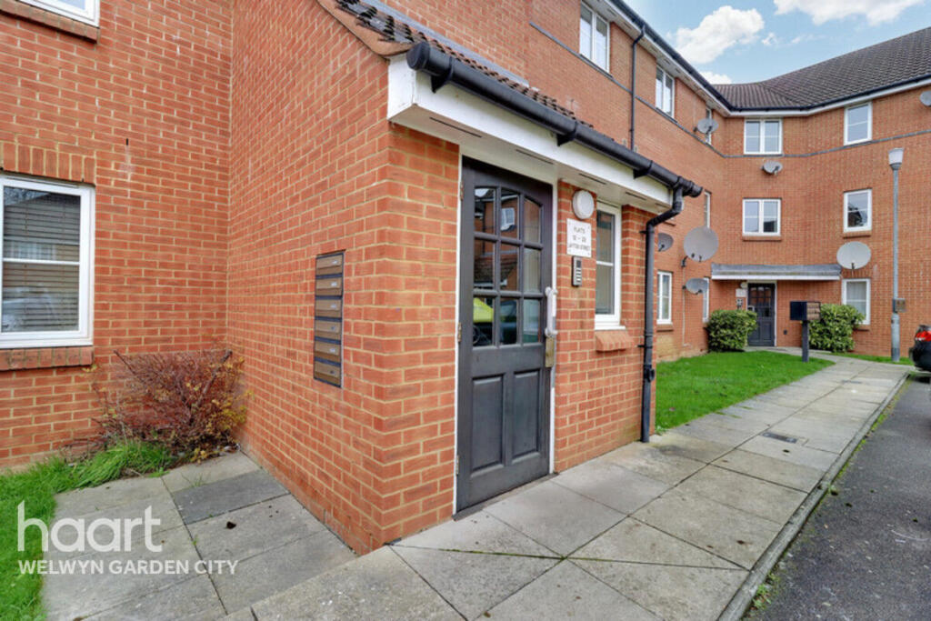
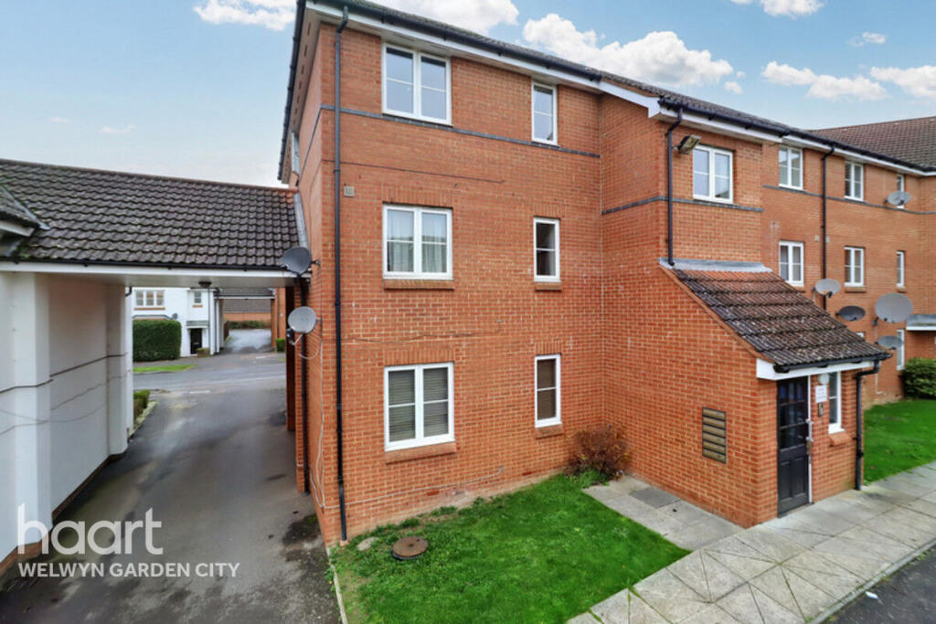
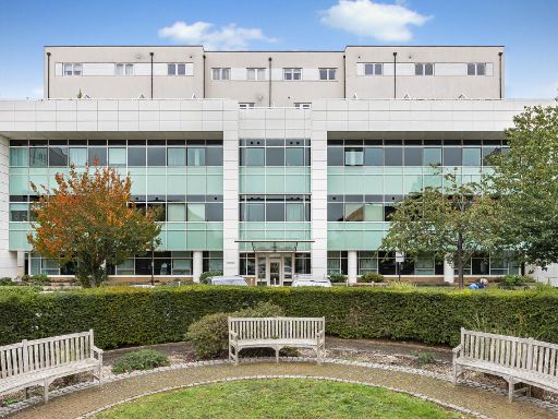
- apartment complex modern
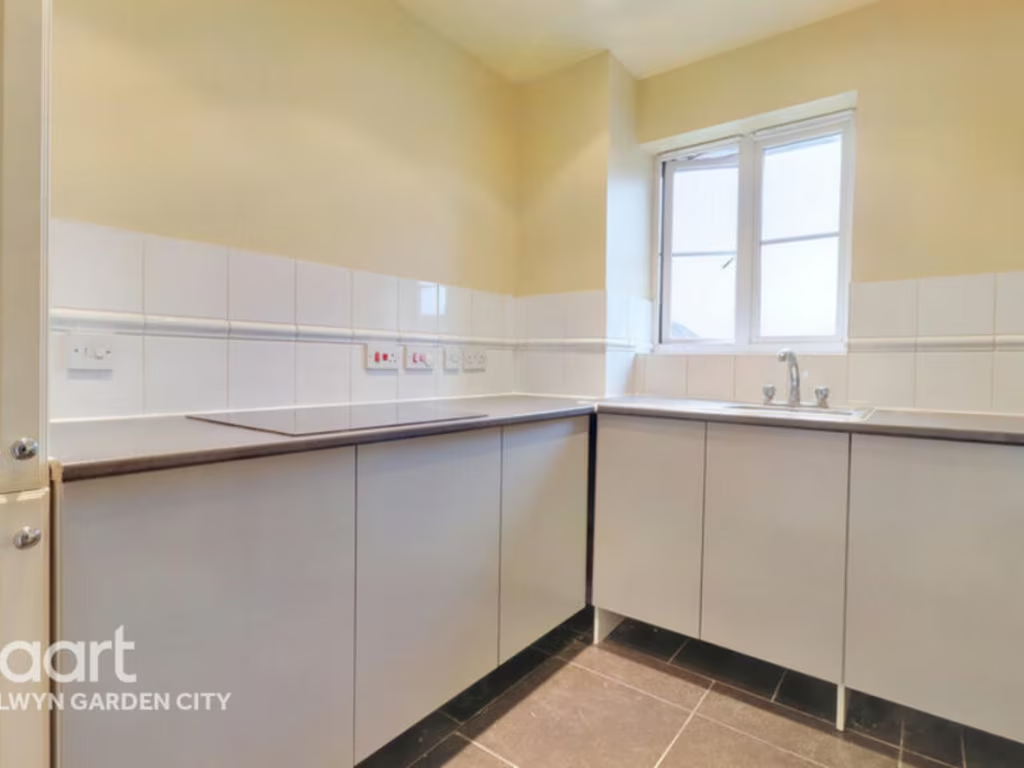
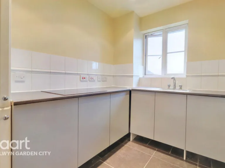
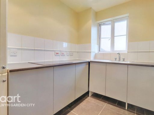
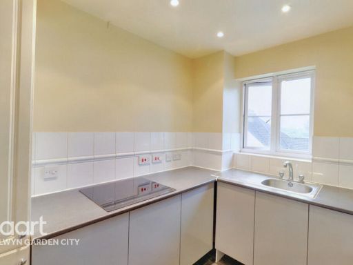
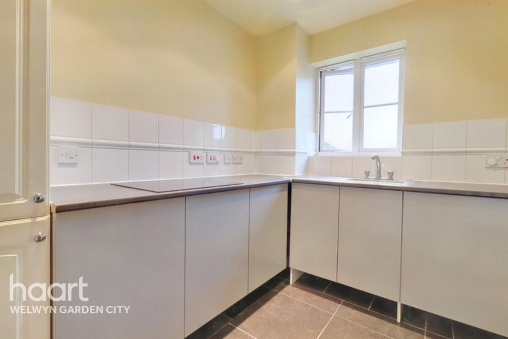
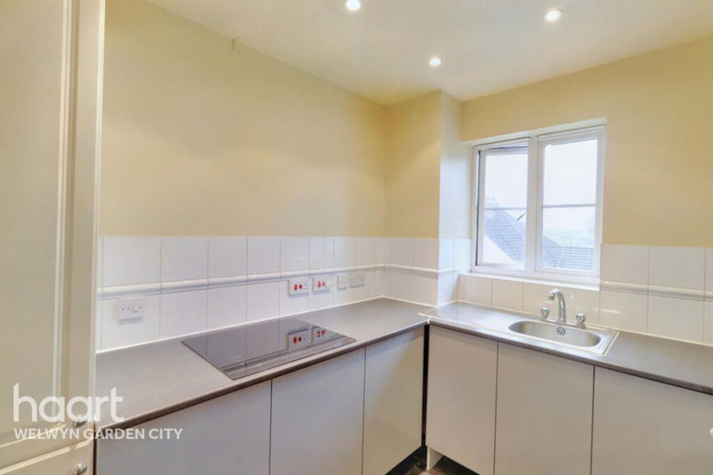
- kitchen modern
Floorplan Description
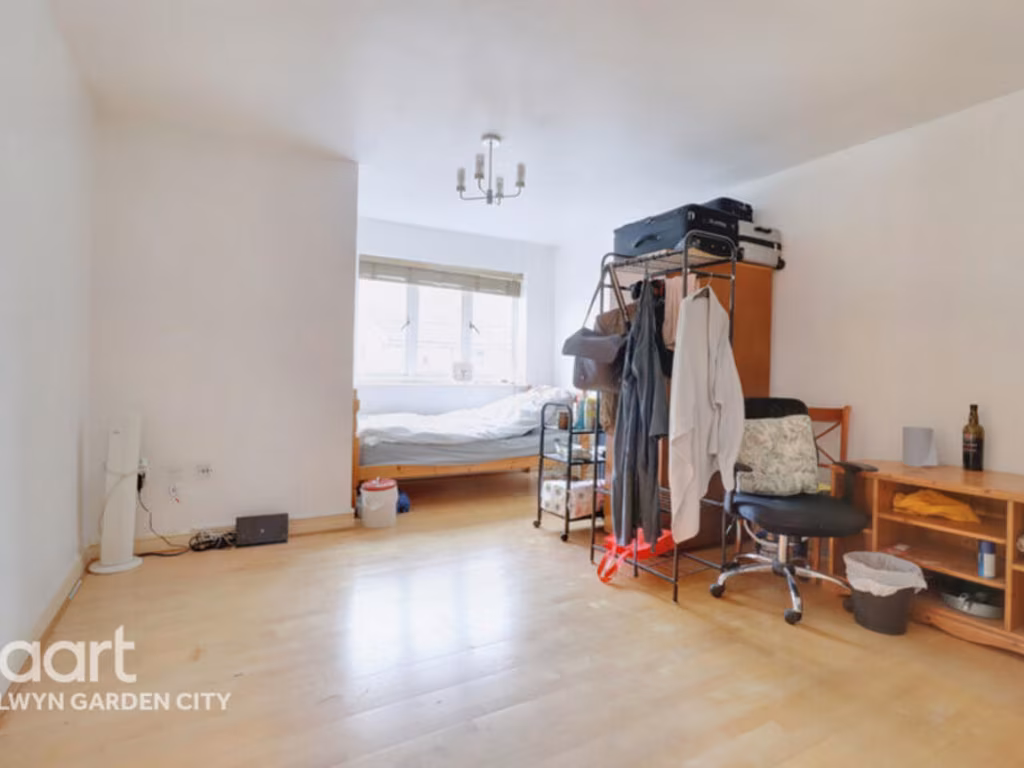
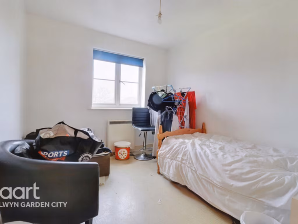
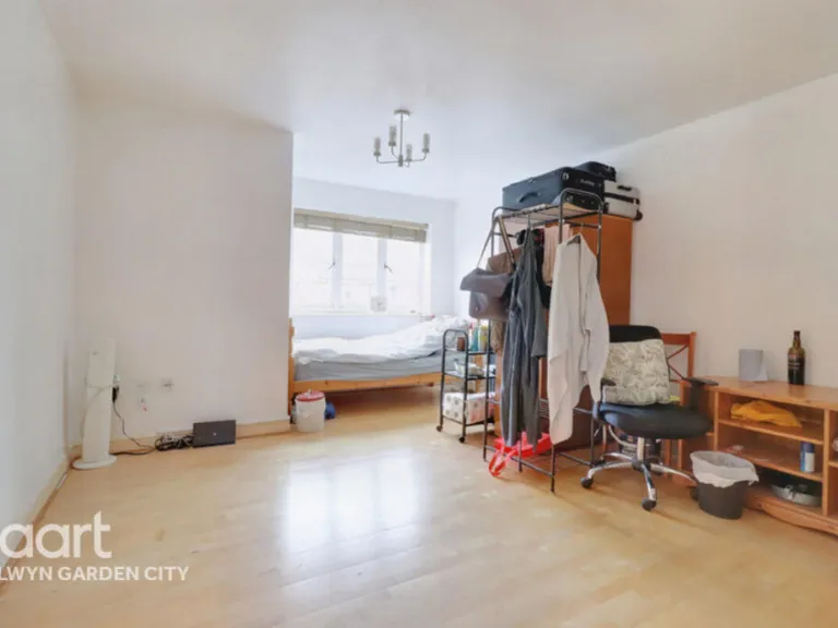
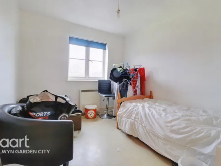
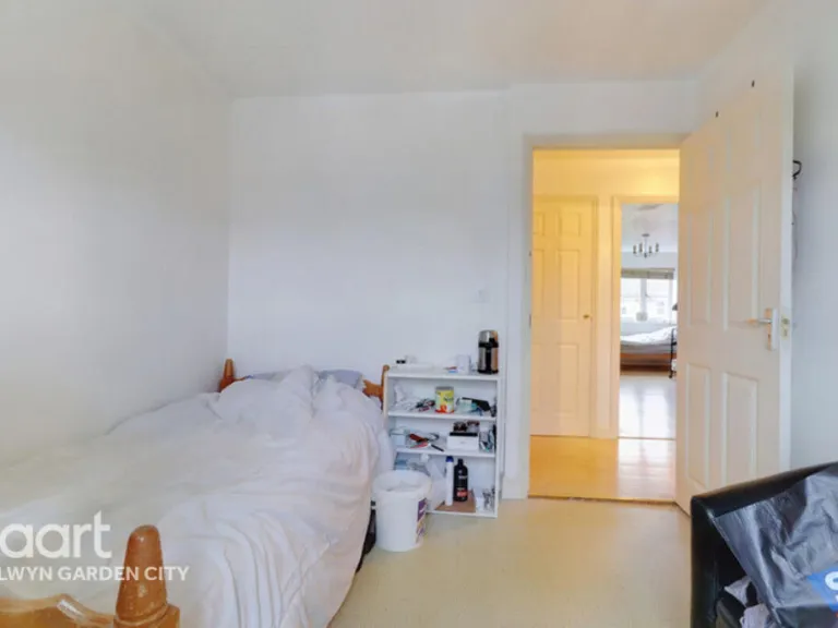
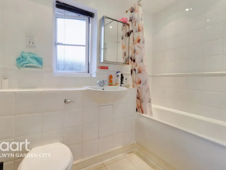
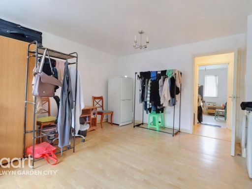
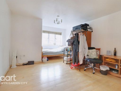
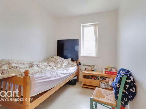
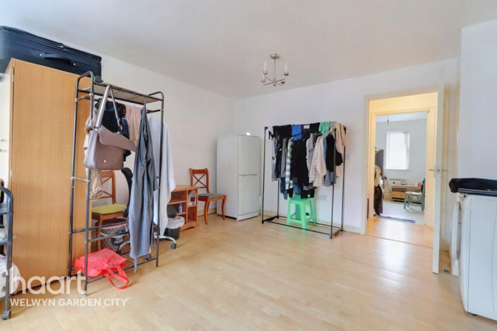
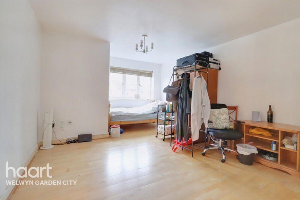
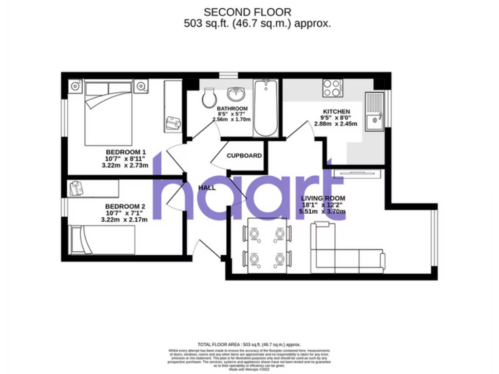
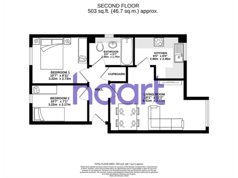
- A compact second floor apartment with two bedrooms, a bathroom, a kitchen, and a large living room.
Rooms
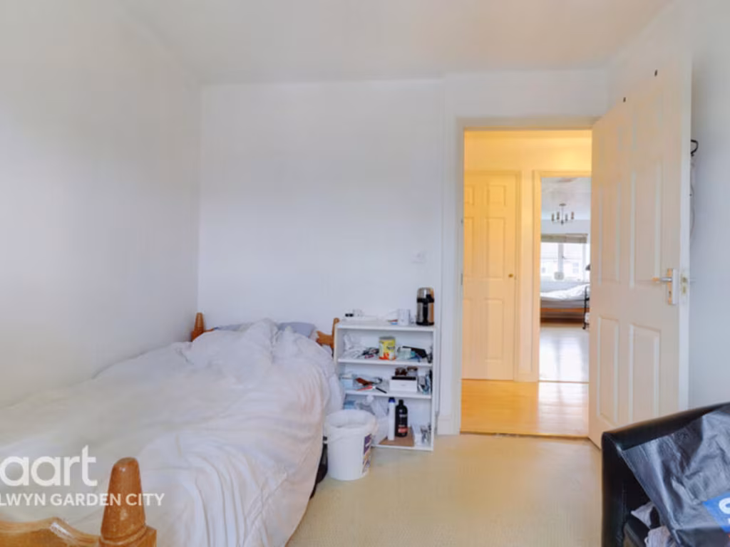
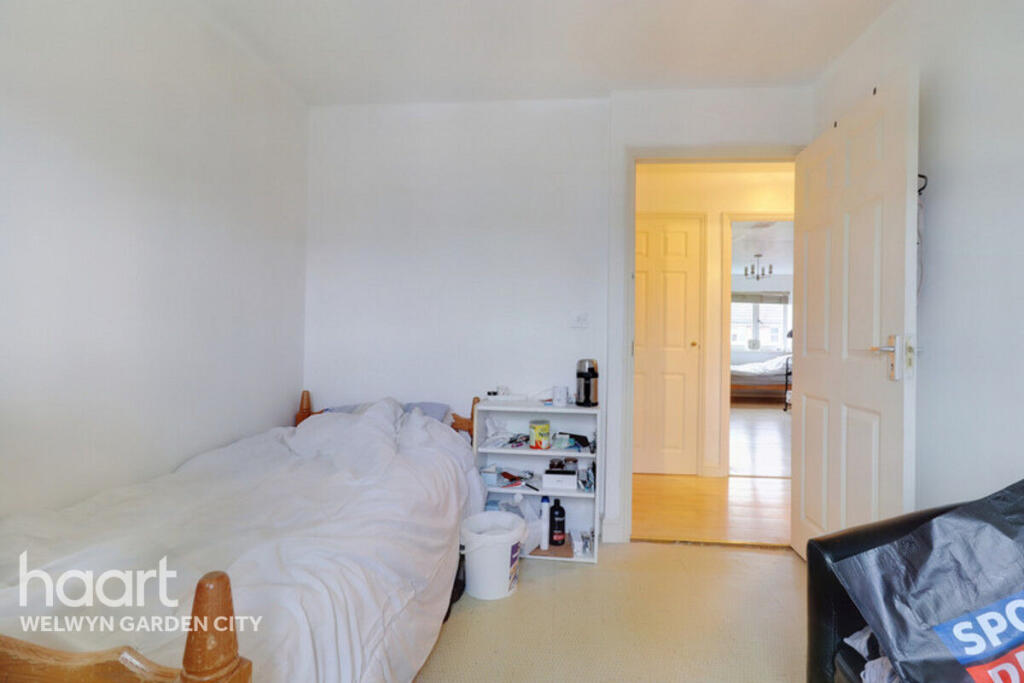
- Bedroom 1: average
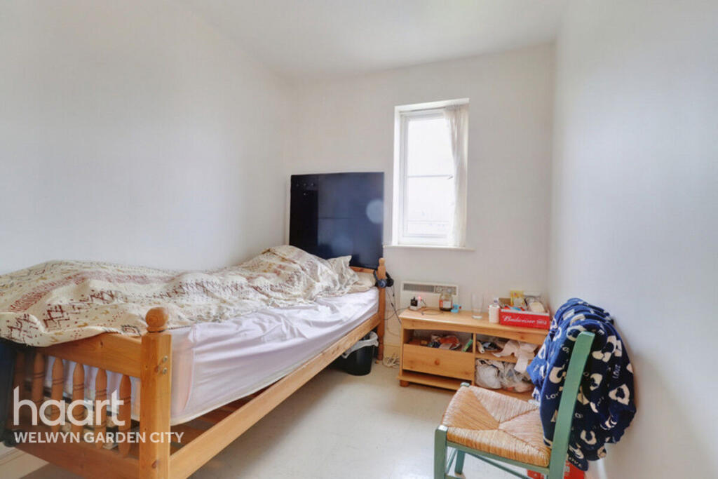
- Bedroom 2: small
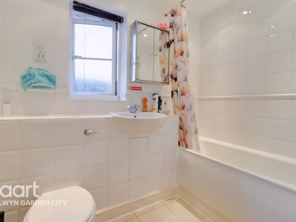
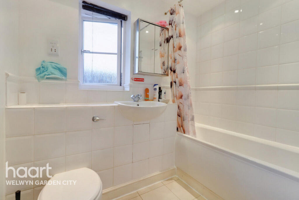
- Bathroom: small
- Kitchen: average
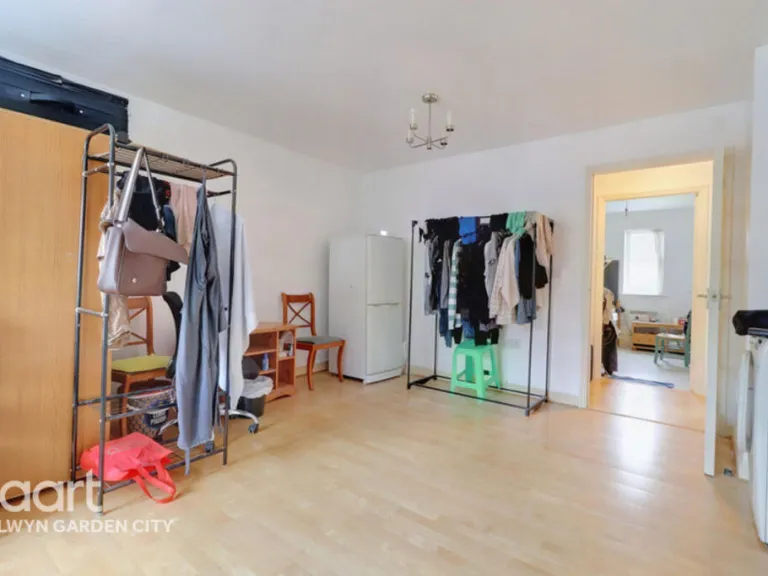
- Living Room: large
Textual Property Features
Detected Visual Features
- modern
- apartment
- complex
- brick
- three-story
- residential
- multi-family
- flats
- urban
- modern kitchen
- compact
- corner layout
- laminate counters
- ceramic tiles
- tiled backsplash
- single window
EPC Details
- Fully double glazed
- Cavity wall, as built, insulated (assumed)
- Electric storage heaters, Room heaters, electric
- Low energy lighting in 56% of fixed outlets
- (another dwelling below)
Nearby Schools
- St Philip Howard Catholic Primary School
- Our Lady Catholic Primary School
- Holwell Primary School
- St John's Voluntary Aided Church of England Primary School, Lemsford
- Panshanger Primary School
- Springmead Primary School
- Templewood Primary School
- The Holy Family Catholic Primary School
- Countess Anne Church of England School
- Birchwood Avenue Primary School
- Green Lanes Primary School
- Applecroft School
- Harwood Hill Junior Mixed Infant and Nursery School
- Homerswood Primary and Nursery School
- Monk's Walk School
- Commonswood Primary & Nursery School
- Stanborough School
- Swallow Dell Primary and Nursery School
- Peartree Primary School
- Watchlytes Primary School
- Ridgeway Academy
- St John's CofE Primary School
- Bishop's Hatfield Girls' School
- Onslow St Audrey's School
- The Ryde School
- Waterside Academy
Nearest Bars And Restaurants
- Id: 1135685212
- Tags:
- Amenity: restaurant
- Name: Bipash
- TagsNormalized:
- Lat: 51.7917142
- Lon: -0.1940932
- FullGeoHash: gcpyes6st739
- PartitionGeoHash: gcpy
- Images:
- FoodStandards: null
- Distance: 786.1
,- Id: 1135685169
- Tags:
- Amenity: restaurant
- Name: East is East
- TagsNormalized:
- Lat: 51.7917209
- Lon: -0.1954879
- FullGeoHash: gcpyes3ssu99
- PartitionGeoHash: gcpy
- Images:
- FoodStandards: null
- Distance: 734.6
,- Id: 1135685167
- Tags:
- Amenity: fast_food
- Name: Green Garden
- TagsNormalized:
- Lat: 51.7917408
- Lon: -0.1957669
- FullGeoHash: gcpyes3ky21x
- PartitionGeoHash: gcpy
- Images:
- FoodStandards: null
- Distance: 727.2
,- Id: 313139268
- Tags:
- Addr:
- Amenity: pub
- Building: pub
- Building:levels: 2
- Name: The Peartree
- Source: Bing
- Wikidata: Q83559027
- TagsNormalized:
- Lat: 51.7900261
- Lon: -0.1970757
- FullGeoHash: gcpyes06zb9e
- PartitionGeoHash: gcpy
- Images:
- FoodStandards: null
- Distance: 516.8
,- Id: 1482158320
- Tags:
- Amenity: pub
- Name: The Hollybush
- Wikidata: Q83559014
- TagsNormalized:
- Lat: 51.7842288
- Lon: -0.1963482
- FullGeoHash: gcpyee10bzbj
- PartitionGeoHash: gcpy
- Images:
- FoodStandards: null
- Distance: 363.3
}
Nearest General Shops
- Id: 1135685139
- Tags:
- TagsNormalized:
- Lat: 51.7917308
- Lon: -0.1938679
- FullGeoHash: gcpyes6udw3s
- PartitionGeoHash: gcpy
- Images:
- FoodStandards: null
- Distance: 796.8
,- Id: 1135685181
- Tags:
- Name: Simmons
- Shop: bakery
- TagsNormalized:
- Lat: 51.7916744
- Lon: -0.1943077
- FullGeoHash: gcpyes6s27ce
- PartitionGeoHash: gcpy
- Images:
- FoodStandards: null
- Distance: 773.9
,- Id: 1135685144
- Tags:
- TagsNormalized:
- Lat: 51.7916777
- Lon: -0.1947047
- FullGeoHash: gcpyes6hrh3x
- PartitionGeoHash: gcpy
- Images:
- FoodStandards: null
- Distance: 758.8
}
Nearest Grocery shops
- Id: 532939567
- Tags:
- Addr:
- Brand: Budgens
- Brand:wikidata: Q4985016
- Building: yes
- Name: Budgens
- Shop: convenience
- TagsNormalized:
- Lat: 51.7933059
- Lon: -0.2106812
- FullGeoHash: gcpyehwtfu08
- PartitionGeoHash: gcpy
- Images:
- FoodStandards: null
- Distance: 1060.3
,- Id: 1135685210
- Tags:
- TagsNormalized:
- Lat: 51.7919
- Lon: -0.1936855
- FullGeoHash: gcpyes6vwvct
- PartitionGeoHash: gcpy
- Images:
- FoodStandards: null
- Distance: 819.4
,- Id: 1482158895
- Tags:
- Brand: Londis
- Brand:wikidata: Q21008564
- Name: Londis
- Shop: convenience
- TagsNormalized:
- Lat: 51.7844902
- Lon: -0.1962945
- FullGeoHash: gcpyee14d08h
- PartitionGeoHash: gcpy
- Images:
- FoodStandards: null
- Distance: 351.7
}
Nearest Supermarkets
- Id: 1538290938
- Tags:
- Brand: Sainsbury's
- Brand:wikidata: Q152096
- Brand:wikipedia: en:Sainsbury's
- Check_date:
- Opening_hours: 2022-09-25
- Name: Sainsbury's
- Opening_hours: Mo-Sa 07:00-22:00; Su 11:00-17:00
- Shop: supermarket
- TagsNormalized:
- sainsburys
- supermarket
- shop
- Lat: 51.8007835
- Lon: -0.2083387
- FullGeoHash: gcpyeq033mgm
- PartitionGeoHash: gcpy
- Images:
- FoodStandards: null
- Distance: 1724.9
,- Id: 161528023
- Tags:
- Addr:
- City: Hatfield
- Housename: Mount Pleasant
- Postcode: AL9 5JY
- Street: Great North Road
- Brand: Tesco Extra
- Brand:wikidata: Q25172225
- Brand:wikipedia: en:Tesco Extra
- Building: retail
- Contact:
- Website: https://www.tesco.com/store-locator/hatfield/great-north-road
- Fhrs:
- Name: Tesco Extra
- Operator: Tesco Stores Ltd
- Shop: supermarket
- Source:
- Addr:
- Postcode: code-point_open
- TagsNormalized:
- tesco
- tesco extra
- retail
- supermarket
- shop
- Lat: 51.7763528
- Lon: -0.2201435
- FullGeoHash: gcpydcxen79n
- PartitionGeoHash: gcpy
- Images:
- FoodStandards:
- Id: 181746
- FHRSID: 181746
- LocalAuthorityBusinessID: PI/000071215
- BusinessName: Tesco
- BusinessType: Retailers - supermarkets/hypermarkets
- BusinessTypeID: 7840
- AddressLine1: Great North Road
- AddressLine2: Hatfield
- AddressLine3: Hertfordshire
- AddressLine4: null
- PostCode: AL9 5JY
- RatingValue: 5
- RatingKey: fhrs_5_en-GB
- RatingDate: 2022-09-12
- LocalAuthorityCode: 164
- LocalAuthorityName: Welwyn Hatfield
- LocalAuthorityWebSite: http://www.welhat.gov.uk
- LocalAuthorityEmailAddress: e.health@welhat.gov.uk
- Scores:
- Hygiene: 5
- Structural: 5
- ConfidenceInManagement: 5
- NewRatingPending: false
- Geocode:
- Longitude: -0.22041500000000
- Latitude: 51.77634300000000
- Distance: 1708.6
,- Id: 1135685204
- Tags:
- Brand: Co-op Food
- Brand:wikidata: Q3277439
- Name: Co-op Food
- Operator: The Co-operative Group
- Shop: supermarket
- TagsNormalized:
- co-op
- co-op food
- food
- supermarket
- shop
- Lat: 51.7916744
- Lon: -0.1952197
- FullGeoHash: gcpyes3u75ce
- PartitionGeoHash: gcpy
- Images:
- FoodStandards: null
- Distance: 739.5
}
Nearest Religious buildings
- Id: 611767692
- Tags:
- Amenity: place_of_worship
- Building: yes
- Building:levels: 1
- Religion: christian
- TagsNormalized:
- place of worship
- christian
- church
- Lat: 51.7908783
- Lon: -0.1979107
- FullGeoHash: gcpyekpzsr7n
- PartitionGeoHash: gcpy
- Images:
- FoodStandards: null
- Distance: 578.8
,- Id: 313139269
- Tags:
- Amenity: place_of_worship
- Building: church
- Building:levels: 1
- Name: Woodhall Lane United Reformed Church
- Religion: christian
- Source: Bing
- TagsNormalized:
- place of worship
- church
- united reformed
- christian
- Lat: 51.7908614
- Lon: -0.1985131
- FullGeoHash: gcpyekprwk3f
- PartitionGeoHash: gcpy
- Images:
- FoodStandards: null
- Distance: 564.1
,- Id: 536913885
- Tags:
- Addr:
- Amenity: place_of_worship
- Building: yes
- Denomination: anglican
- Name: St Mary Magdalene Church
- Religion: christian
- Website: http://www.st-mary-magdalene.org.uk/
- Wikidata: Q105085349
- TagsNormalized:
- place of worship
- anglican
- church
- christian
- Lat: 51.7855705
- Lon: -0.195086
- FullGeoHash: gcpyee3by4j2
- PartitionGeoHash: gcpy
- Images:
- FoodStandards: null
- Distance: 395.6
}
Nearest Medical buildings
- Id: 609252070
- Tags:
- Addr:
- Amenity: doctors
- Building: yes
- Healthcare: doctor
- TagsNormalized:
- doctor
- doctors
- health
- healthcare
- Lat: 51.7970157
- Lon: -0.1979096
- FullGeoHash: gcpyemrgkrec
- PartitionGeoHash: gcpy
- Images:
- FoodStandards: null
- Distance: 1242.1
,- Id: 1736084544
- Tags:
- Amenity: pharmacy
- Brand:
- Name: Boots
- TagsNormalized:
- Lat: 51.7966468
- Lon: -0.1984115
- FullGeoHash: gcpyemr92dv9
- PartitionGeoHash: gcpy
- Images:
- FoodStandards: null
- Distance: 1196.4
,- Id: 47573694
- Tags:
- Amenity: hospital
- Emergency: yes
- Name: Queen Elizabeth II Hospital
- Wikidata: Q7270362
- TagsNormalized:
- Lat: 51.7829774
- Lon: -0.1885156
- FullGeoHash: gcpyedy9xq8s
- PartitionGeoHash: gcpy
- Images:
- FoodStandards: null
- Distance: 908.8
,- Id: 1135685269
- Tags:
- Amenity: pharmacy
- Brand:
- Name: Boots
- TagsNormalized:
- Lat: 51.7916744
- Lon: -0.1945223
- FullGeoHash: gcpyes6k77ce
- PartitionGeoHash: gcpy
- Images:
- FoodStandards: null
- Distance: 765.5
}
Nearest Airports
- Id: 495488524
- Tags:
- Aerodrome: international
- Aerodrome:type: public
- Aeroway: aerodrome
- Alt_name: Stansted
- Iata: STN
- Icao: EGSS
- Is_in: Essex,England,UK
- Name: London Stansted Airport
- Ref: STN
- Source: Gagravarr_Airports
- Website: https://www.stanstedairport.com/
- Wikidata: Q8709
- Wikipedia: en:London Stansted Airport
- TagsNormalized:
- airport
- international airport
- Lat: 51.8869677
- Lon: 0.2429264
- FullGeoHash: u10pjt8zkxg4
- PartitionGeoHash: u10p
- Images:
- FoodStandards: null
- Distance: 32489.4
,- Id: 110273499
- Tags:
- Addr:
- Country: GB
- Postcode: LU2 9LY
- Aerodrome: international
- Aerodrome:type: public
- Aeroway: aerodrome
- Alt_name: London Luton
- Iata: LTN
- Icao: EGGW
- Name: London Luton Airport
- Website: https://www.london-luton.co.uk/
- Wikidata: Q8712
- Wikipedia: en:Luton Airport
- TagsNormalized:
- airport
- international airport
- Lat: 51.8780363
- Lon: -0.3701408
- FullGeoHash: gcpxps47rngh
- PartitionGeoHash: gcpx
- Images:
- FoodStandards: null
- Distance: 15497.3
,- Id: 121158889
- Tags:
- Aerodrome: continental
- Aeroway: aerodrome
- Fhrs:
- Authority: City of London Corporation
- Iata: LCY
- Icao: EGLC
- Name: London City Airport
- Operator: London City Airport Limited
- Ref: LCY
- Website: https://www.londoncityairport.com/
- Wikidata: Q8982
- Wikipedia: en:London City Airport
- TagsNormalized:
- airport
- continental airport
- Lat: 51.5042658
- Lon: 0.0539987
- FullGeoHash: u10j10p64702
- PartitionGeoHash: u10j
- Images:
- FoodStandards: null
- Distance: 35922.3
}
Nearest Leisure Facilities
- Id: 565366291
- Tags:
- Leisure: pitch
- Sport: soccer
- TagsNormalized:
- Lat: 51.7860591
- Lon: -0.1929594
- FullGeoHash: gcpyee77xtp5
- PartitionGeoHash: gcpy
- Images:
- FoodStandards: null
- Distance: 539.2
,- Id: 104065336
- Tags:
- Fixme: Is this really soccer? dimensions are different to the others, but a quick google won't tell me what it is
- Leisure: pitch
- Source: Bing
- Sport: soccer
- TagsNormalized:
- Lat: 51.7859987
- Lon: -0.1937551
- FullGeoHash: gcpyee6gm1ve
- PartitionGeoHash: gcpy
- Images:
- FoodStandards: null
- Distance: 484.4
,- Id: 1105934780
- Tags:
- TagsNormalized:
- Lat: 51.785358
- Lon: -0.2076375
- FullGeoHash: gcpye70z9dqm
- PartitionGeoHash: gcpy
- Images:
- FoodStandards: null
- Distance: 475.7
,- Id: 609236176
- Tags:
- TagsNormalized:
- Lat: 51.7867128
- Lon: -0.2039773
- FullGeoHash: gcpye77rqyzw
- PartitionGeoHash: gcpy
- Images:
- FoodStandards: null
- Distance: 233.1
,- Id: 110199029
- Tags:
- TagsNormalized:
- Lat: 51.7868611
- Lon: -0.2035096
- FullGeoHash: gcpye7eb3fs5
- PartitionGeoHash: gcpy
- Images:
- FoodStandards: null
- Distance: 210.3
}
Nearest Tourist attractions
- Id: 9287553130
- Tags:
- Fixme: needs proper mapping
- Museum: history
- Name: Mill Green Museum & Working Mill
- Tourism: museum
- Website: https://www.millgreenmuseum.co.uk/
- Wikidata: Q6858324
- Wikipedia: en:Mill Green Museum
- TagsNormalized:
- Lat: 51.7728202
- Lon: -0.2040372
- FullGeoHash: gcpye2gqt94y
- PartitionGeoHash: gcpy
- Images:
- FoodStandards: null
- Distance: 1481.1
,- Id: 3986438884
- Tags:
- TagsNormalized:
- Lat: 51.7849652
- Lon: -0.221292
- FullGeoHash: gcpydgnv790t
- PartitionGeoHash: gcpy
- Images:
- FoodStandards: null
- Distance: 1414.3
,- Id: 691098405
- Tags:
- Name: Commons Wood Caravan and Motorhome Club
- Tourism: caravan_site
- TagsNormalized:
- caravan
- common
- wood
- club
- tourism
- Lat: 51.780556
- Lon: -0.188329
- FullGeoHash: gcpyedqgee78
- PartitionGeoHash: gcpy
- Images:
- FoodStandards: null
- Distance: 1049.1
}
Nearest Hotels
- Id: 313139266
- Tags:
- Addr:
- Brand: Premier Inn
- Brand:wikidata: Q2108626
- Building: hotel
- Name: Premier Inn
- Operator: Whitbread plc
- Source: Bing
- Tourism: hotel
- TagsNormalized:
- Lat: 51.7922408
- Lon: -0.2093814
- FullGeoHash: gcpyehrx9j3y
- PartitionGeoHash: gcpy
- Images:
- FoodStandards: null
- Distance: 912.1
,- Id: 309433456
- Tags:
- Addr:
- Building: hotel
- Name: Homestead Court Hotel
- Operator: Best Western
- Postal_code: AL7 4LX
- Source: Bing;survey
- Tourism: hotel
- TagsNormalized:
- Lat: 51.7896481
- Lon: -0.1891059
- FullGeoHash: gcpyesn29d0k
- PartitionGeoHash: gcpy
- Images:
- FoodStandards: null
- Distance: 901.3
,- Id: 667532788
- Tags:
- TagsNormalized:
- Lat: 51.789725
- Lon: -0.1895437
- FullGeoHash: gcpyesjcp23z
- PartitionGeoHash: gcpy
- Images:
- FoodStandards: null
- Distance: 878.5
}
Tags
- modern
- apartment
- complex
- brick
- three-story
- residential
- multi-family
- flats
- urban
- modern kitchen
- compact
- corner layout
- laminate counters
- ceramic tiles
- tiled backsplash
- single window
Local Market Stats
- Average Price/sqft: £435
- Avg Income: £50500
- Rental Yield: 4.4%
- Social Housing: 30%
- Planning Success Rate: 80%
Similar Properties
- 2 bedroom apartment for sale in Bridge Road East, Welwyn Garden City, Hertfordshire, AL7 — £345,000 • 2 bed • 2 bath
 2 bedroom apartment for sale in Bessemer Road, Welwyn Garden City, AL7 — £350,000 • 2 bed • 2 bath • 991 ft²
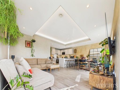 2 bedroom apartment for sale in Groom Place, WELWYN GARDEN CITY, AL7 — £400,000 • 2 bed • 2 bath • 1000 ft²
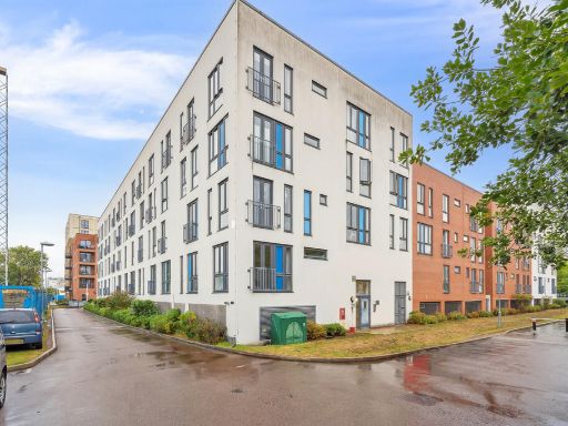 2 bedroom apartment for sale in Salvisberg Court, Welwyn Garden City,, AL7 — £275,000 • 2 bed • 1 bath • 625 ft²
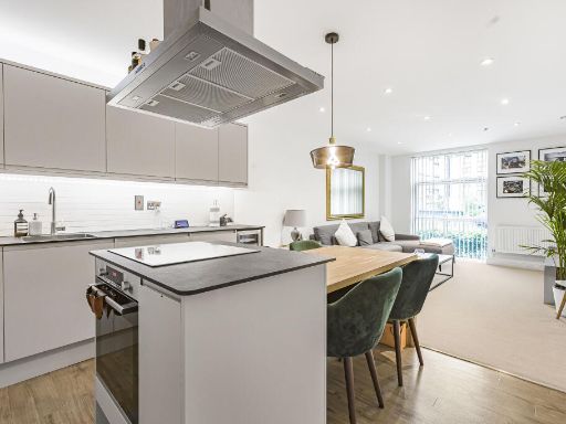 2 bedroom flat for sale in Bessemer Road, Welwyn Garden City, AL7 — £325,000 • 2 bed • 2 bath • 764 ft²
 2 bedroom apartment for sale in Howlands, Welwyn Garden City, AL7 — £250,000 • 2 bed • 1 bath • 577 ft²
Meta
- {
"@context": "https://schema.org",
"@type": "Residence",
"name": "2 bedroom apartment for sale in Layton Street, Welwyn Garde…",
"description": "",
"url": "https://propertypiper.co.uk/property/a8e40671-cc4e-4079-95a9-151b0443f616",
"image": "https://image-a.propertypiper.co.uk/bfe6cd1c-46b1-471c-b2e8-e2d67893338d-1024.jpeg",
"address": {
"@type": "PostalAddress",
"streetAddress": "20 Layton Street",
"postalCode": "AL7 4FF",
"addressLocality": "Welwyn Hatfield",
"addressRegion": "Welwyn Hatfield",
"addressCountry": "England"
},
"geo": {
"@type": "GeoCoordinates",
"latitude": 51.785988627218465,
"longitude": -0.20079742799202088
},
"numberOfRooms": 2,
"numberOfBathroomsTotal": 1,
"floorSize": {
"@type": "QuantitativeValue",
"value": 503,
"unitCode": "FTK"
},
"offers": {
"@type": "Offer",
"price": 230000,
"priceCurrency": "GBP",
"availability": "https://schema.org/InStock"
},
"additionalProperty": [
{
"@type": "PropertyValue",
"name": "Feature",
"value": "modern"
},
{
"@type": "PropertyValue",
"name": "Feature",
"value": "apartment"
},
{
"@type": "PropertyValue",
"name": "Feature",
"value": "complex"
},
{
"@type": "PropertyValue",
"name": "Feature",
"value": "brick"
},
{
"@type": "PropertyValue",
"name": "Feature",
"value": "three-story"
},
{
"@type": "PropertyValue",
"name": "Feature",
"value": "residential"
},
{
"@type": "PropertyValue",
"name": "Feature",
"value": "multi-family"
},
{
"@type": "PropertyValue",
"name": "Feature",
"value": "flats"
},
{
"@type": "PropertyValue",
"name": "Feature",
"value": "urban"
},
{
"@type": "PropertyValue",
"name": "Feature",
"value": "modern kitchen"
},
{
"@type": "PropertyValue",
"name": "Feature",
"value": "compact"
},
{
"@type": "PropertyValue",
"name": "Feature",
"value": "corner layout"
},
{
"@type": "PropertyValue",
"name": "Feature",
"value": "laminate counters"
},
{
"@type": "PropertyValue",
"name": "Feature",
"value": "ceramic tiles"
},
{
"@type": "PropertyValue",
"name": "Feature",
"value": "tiled backsplash"
},
{
"@type": "PropertyValue",
"name": "Feature",
"value": "single window"
}
]
}
High Res Floorplan Images
Compatible Floorplan Images
FloorplanImages Thumbnail