CH43 6WB - 4 bedroom detached house for sale in Taylor Place, Oxton, C…
View on Property Piper
4 bedroom detached house for sale in Taylor Place, Oxton, CH43
Property Details
- Price: £575000
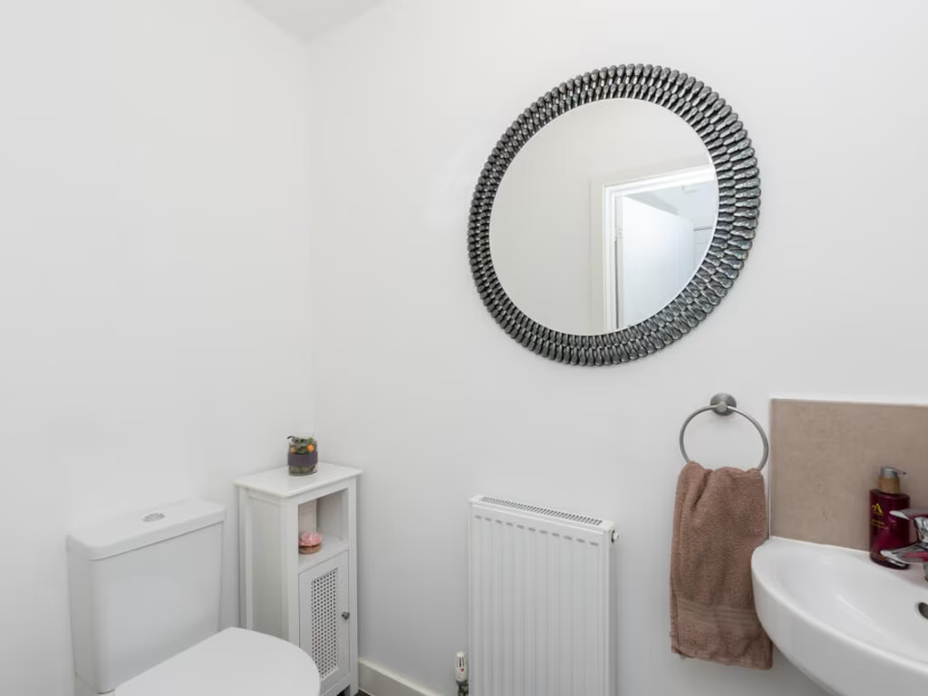
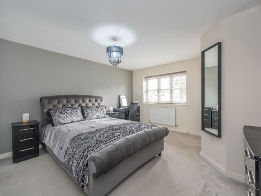
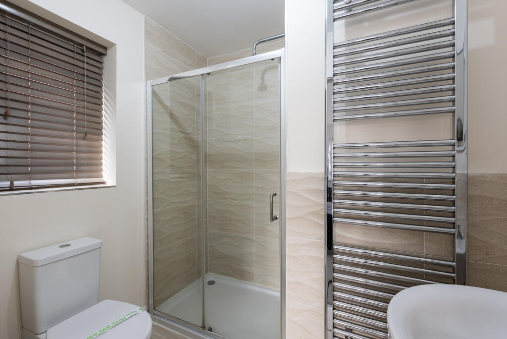
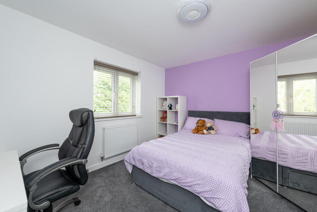
- Bedrooms: 4
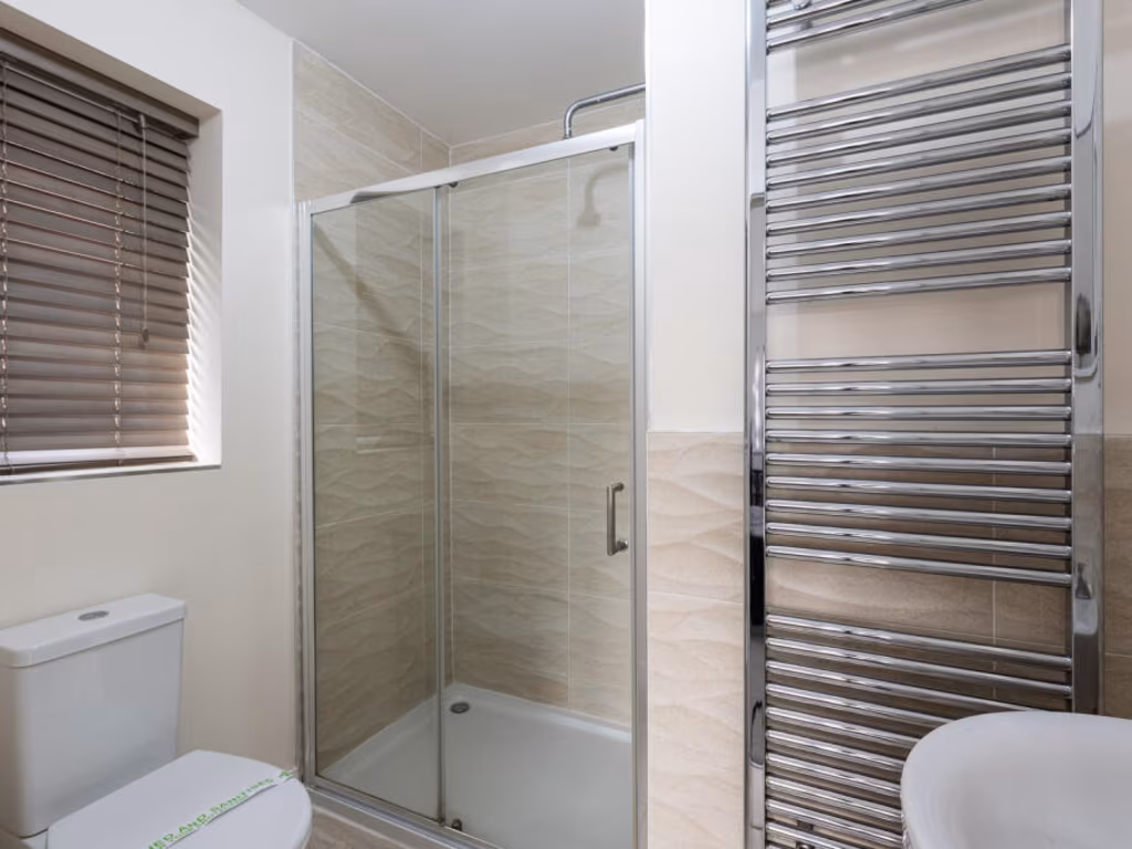
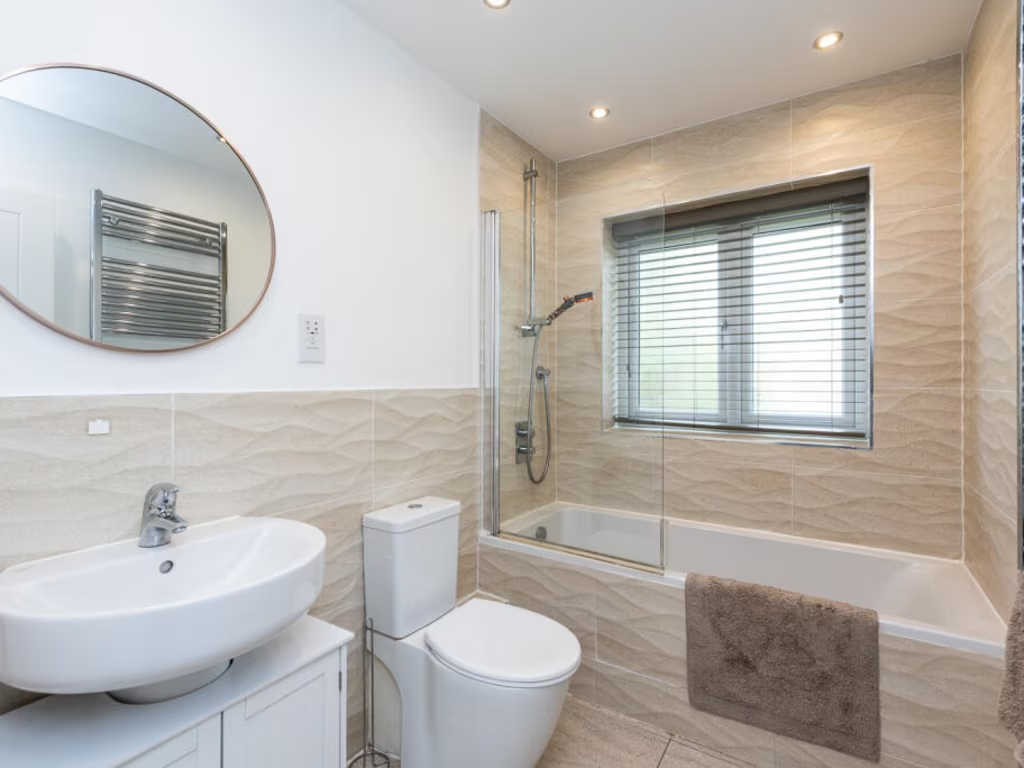
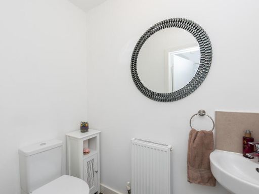
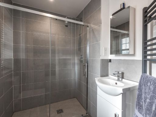
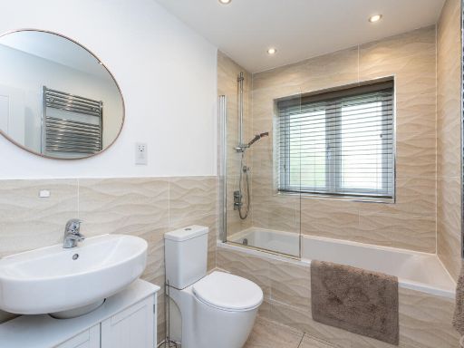
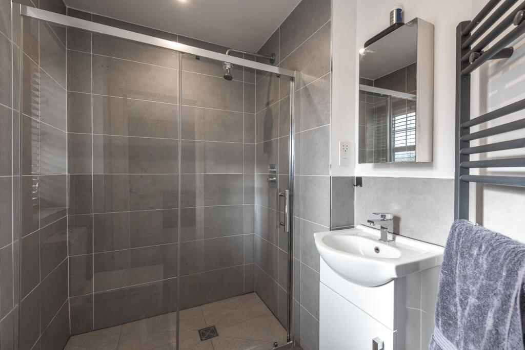
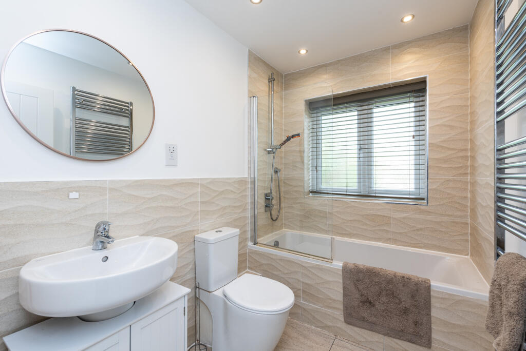
- Bathrooms: 3
- Property Type: undefined
- Property SubType: undefined
Image Descriptions
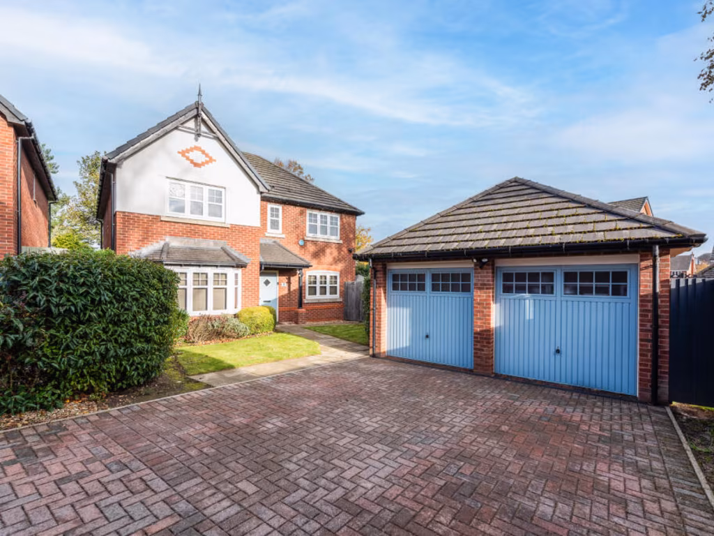
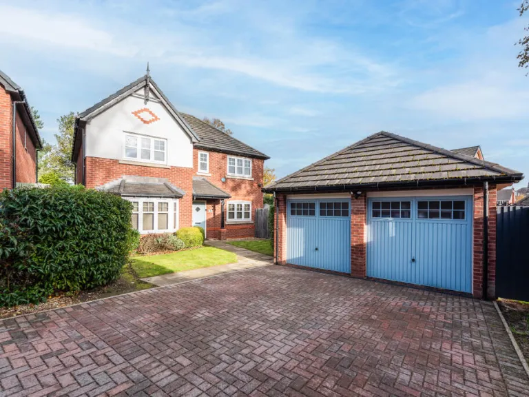
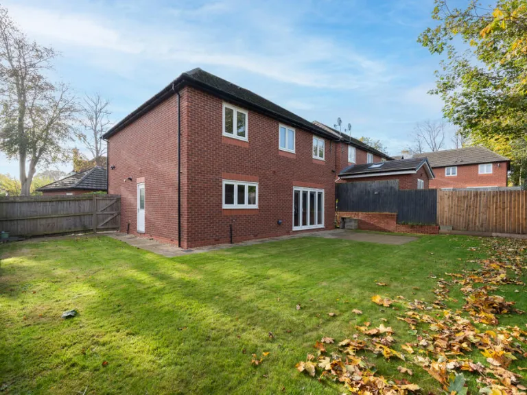
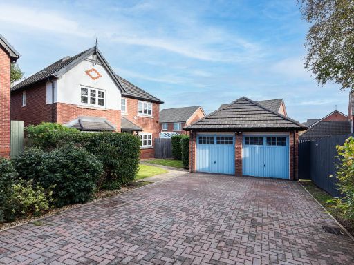
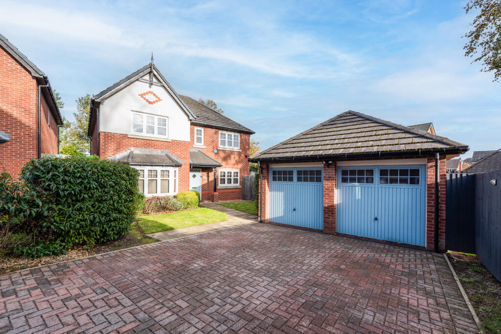
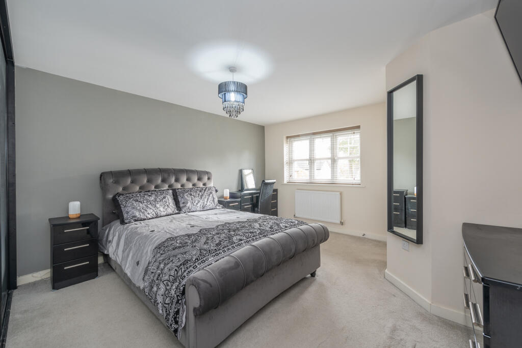
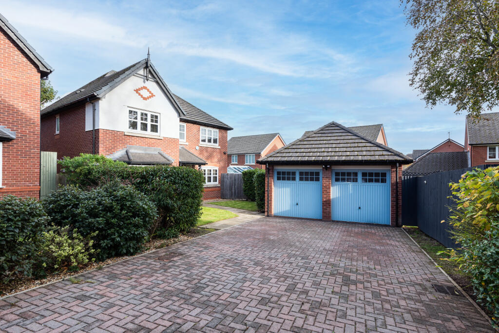
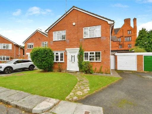
- detached house with garage Modern Suburban
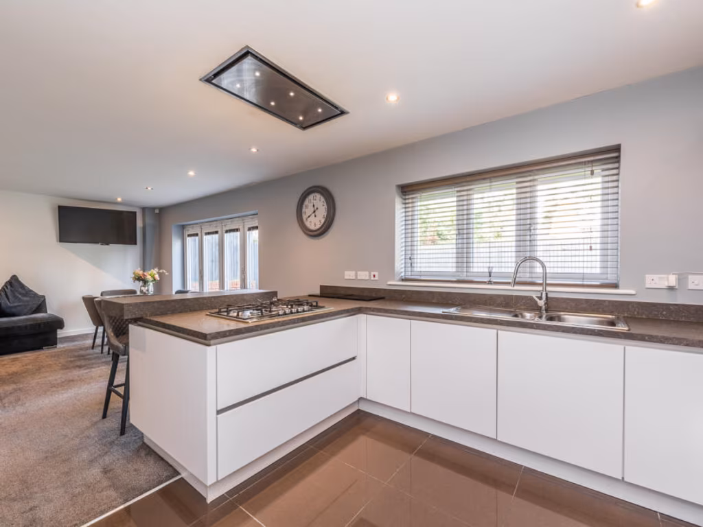
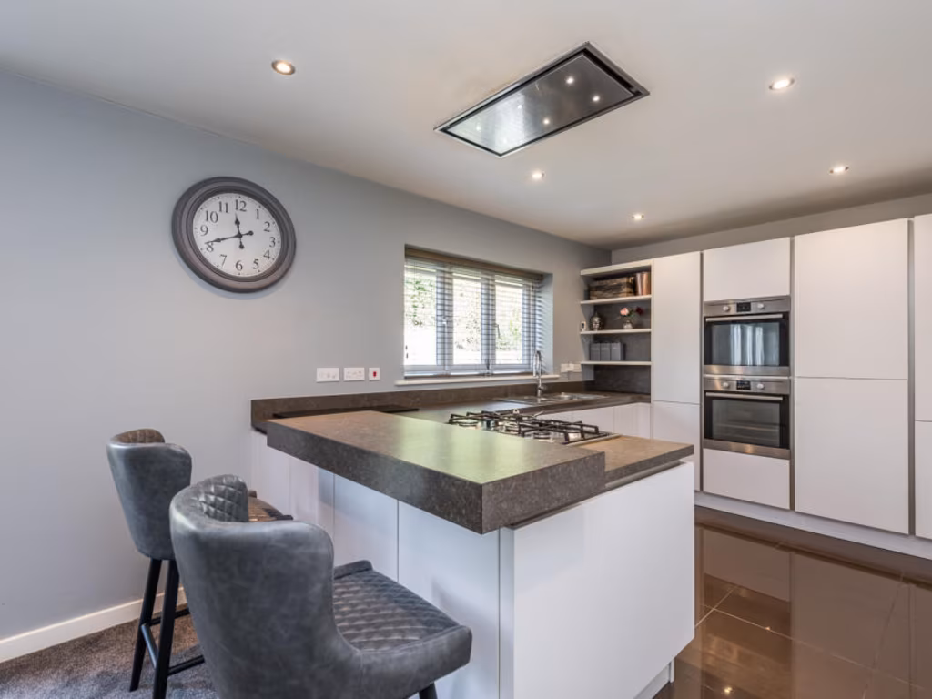
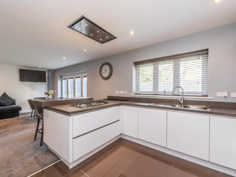
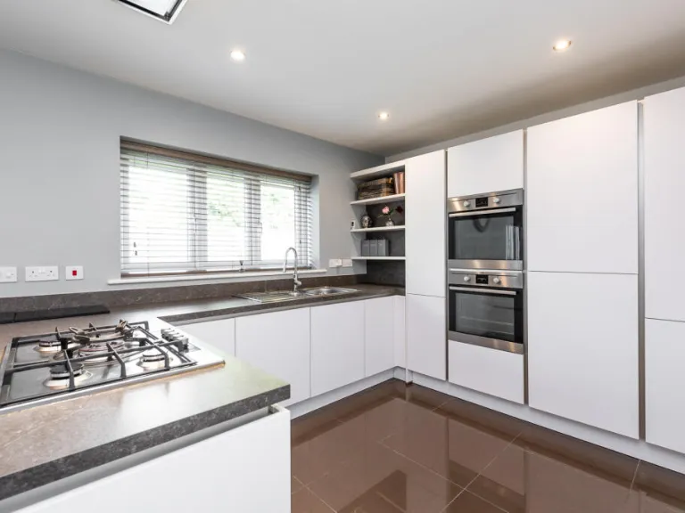
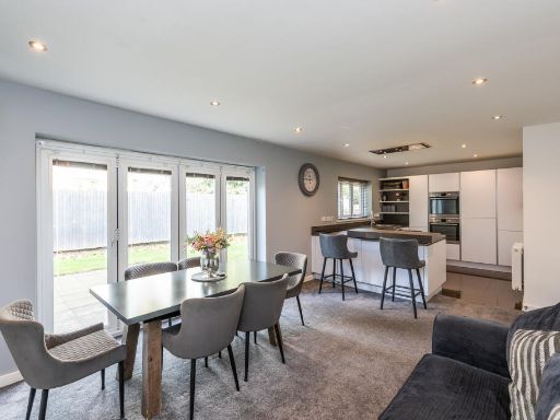
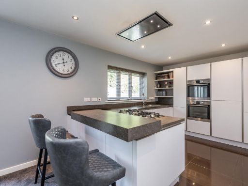
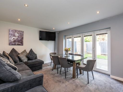
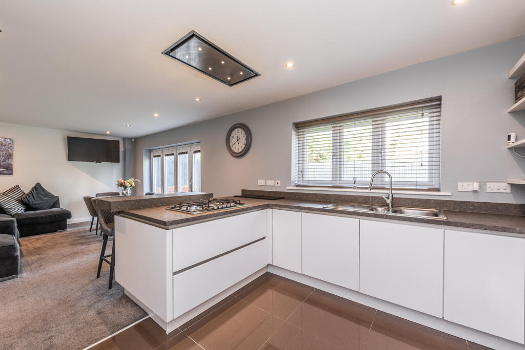
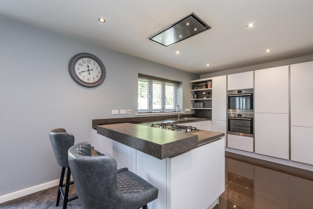
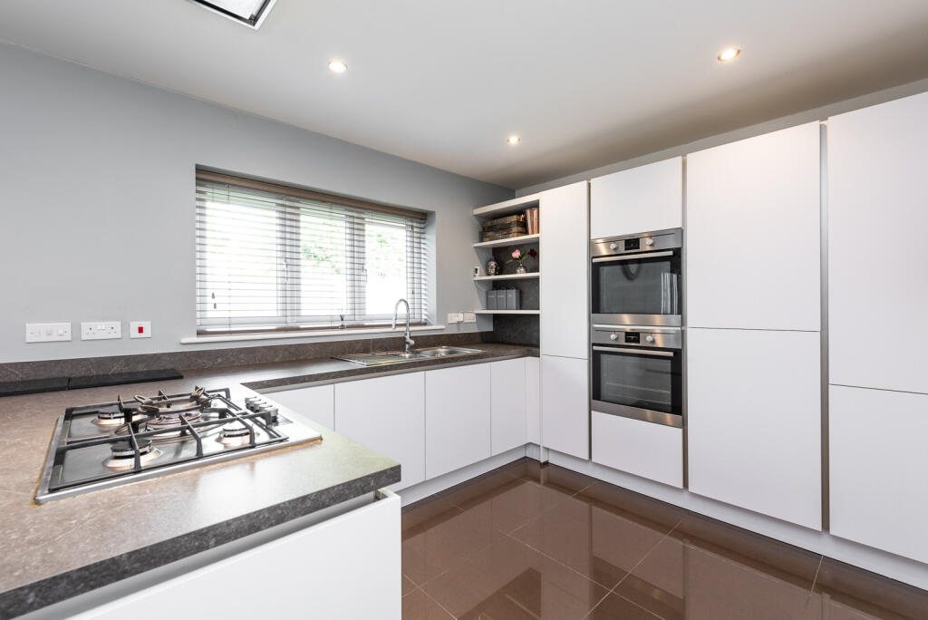
- modern kitchen and dining area contemporary
Floorplan Description
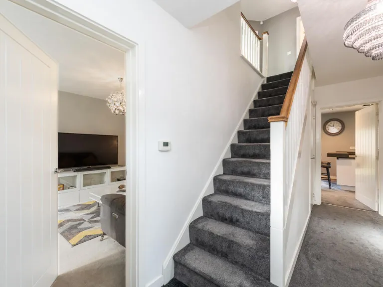
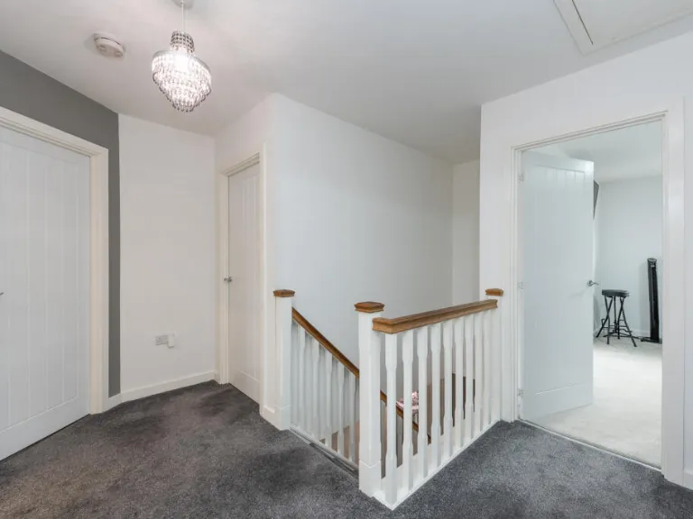
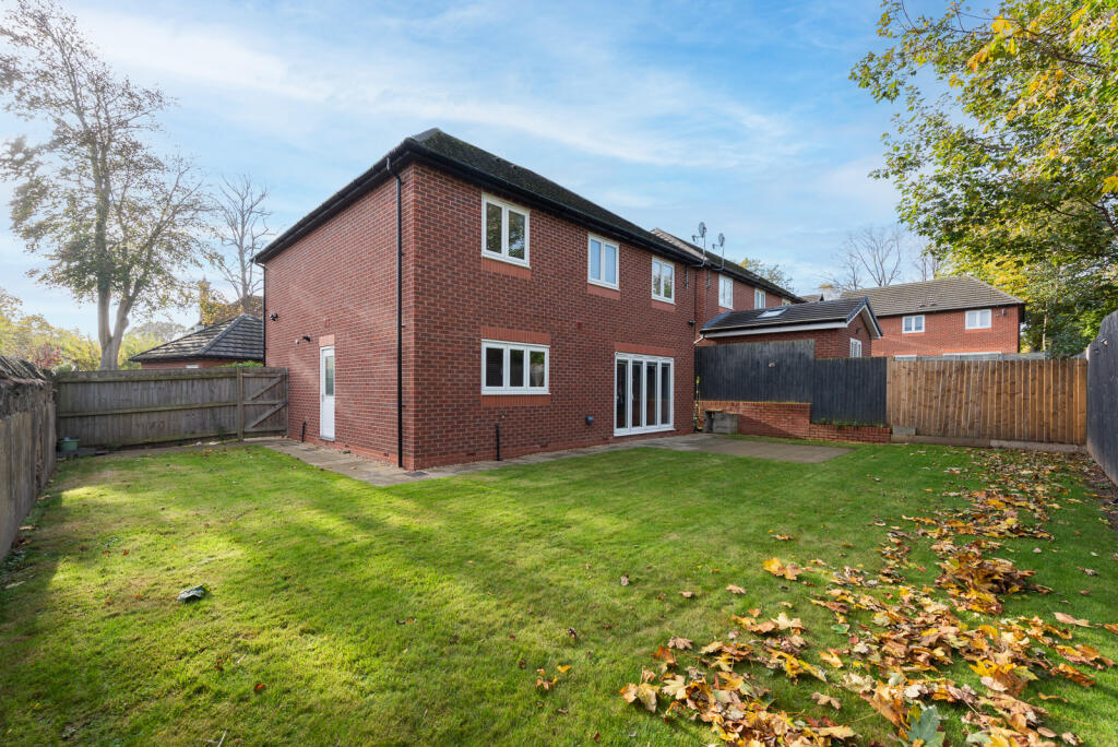
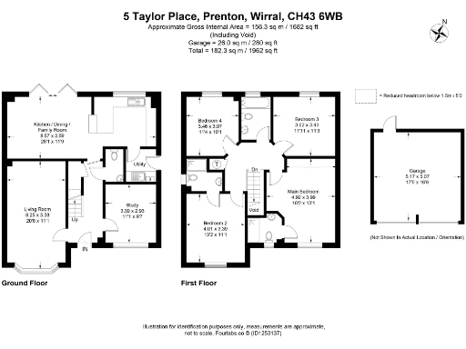
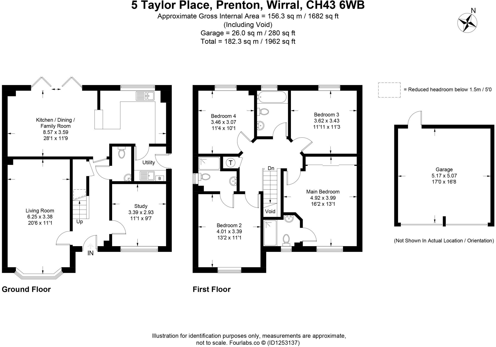
- Two-storey detached house with kitchen/dining/family room, living room, study and four bedrooms.
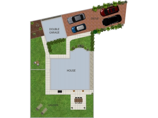
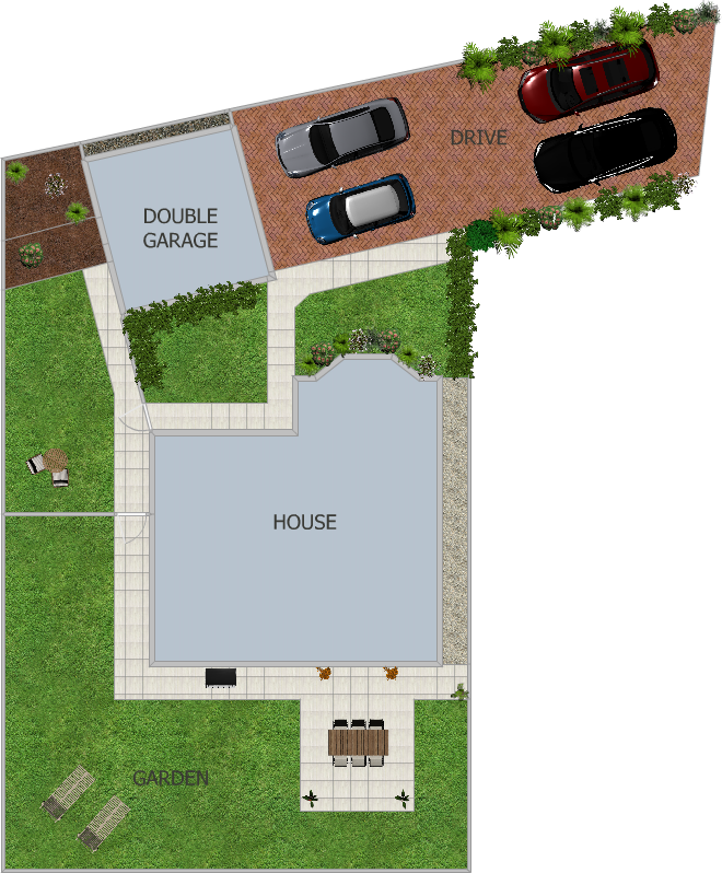
- Site plan showing a house with adjacent double garage, drive and garden.
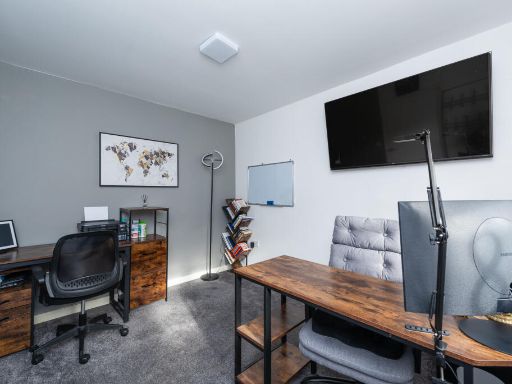
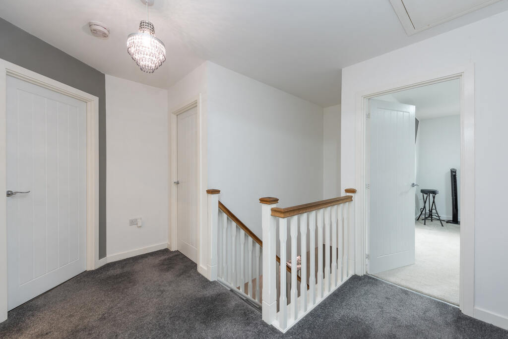
Rooms
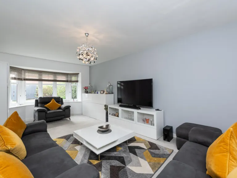
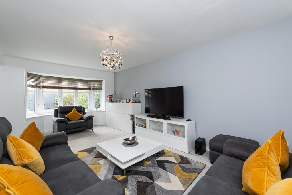
- Living Room: Large
- Kitchen / Dining / Family Room: Large
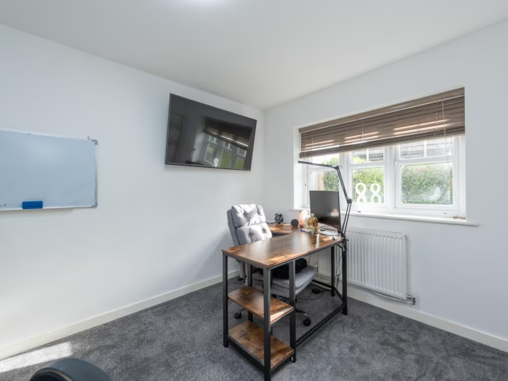
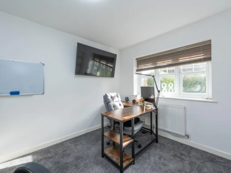
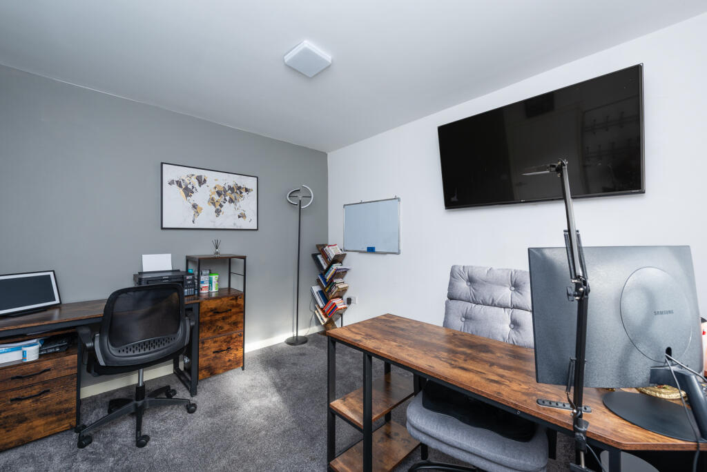
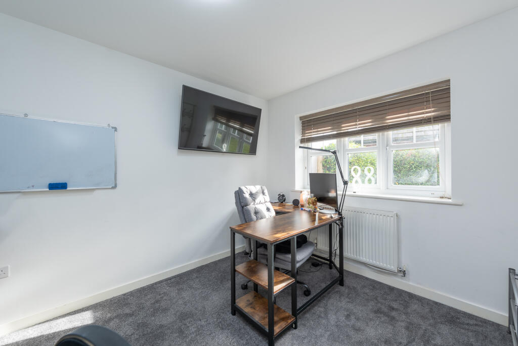
- Study: Average
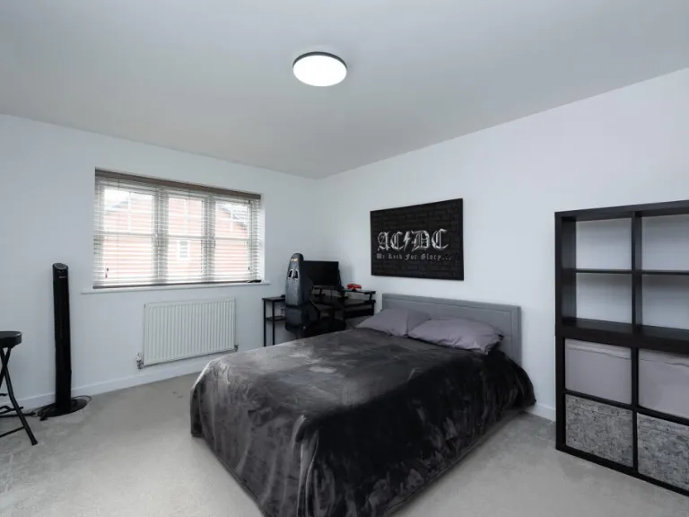
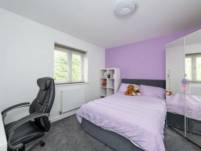
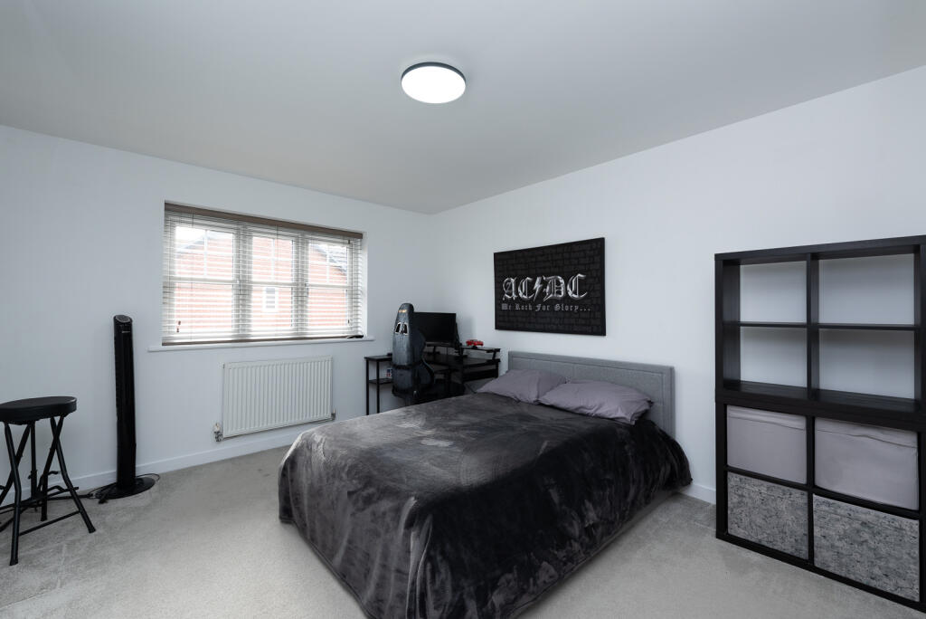
- Bedroom 4: Average
- Bedroom 3: Average
- Bedroom 2: Average
- Main Bedroom: Large
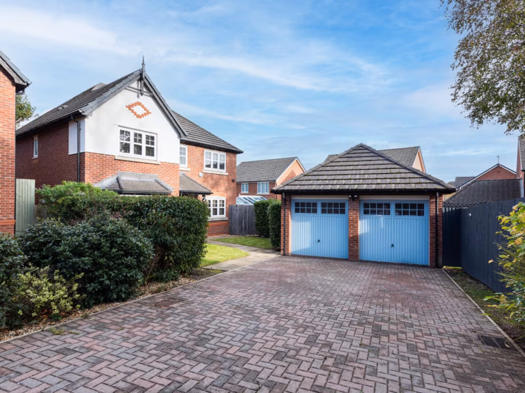
- DOUBLE GARAGE:
- DRIVE:
- HOUSE:
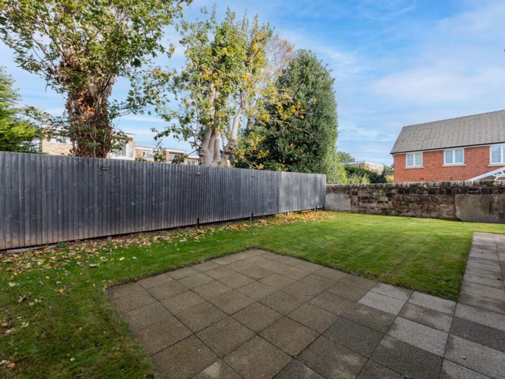
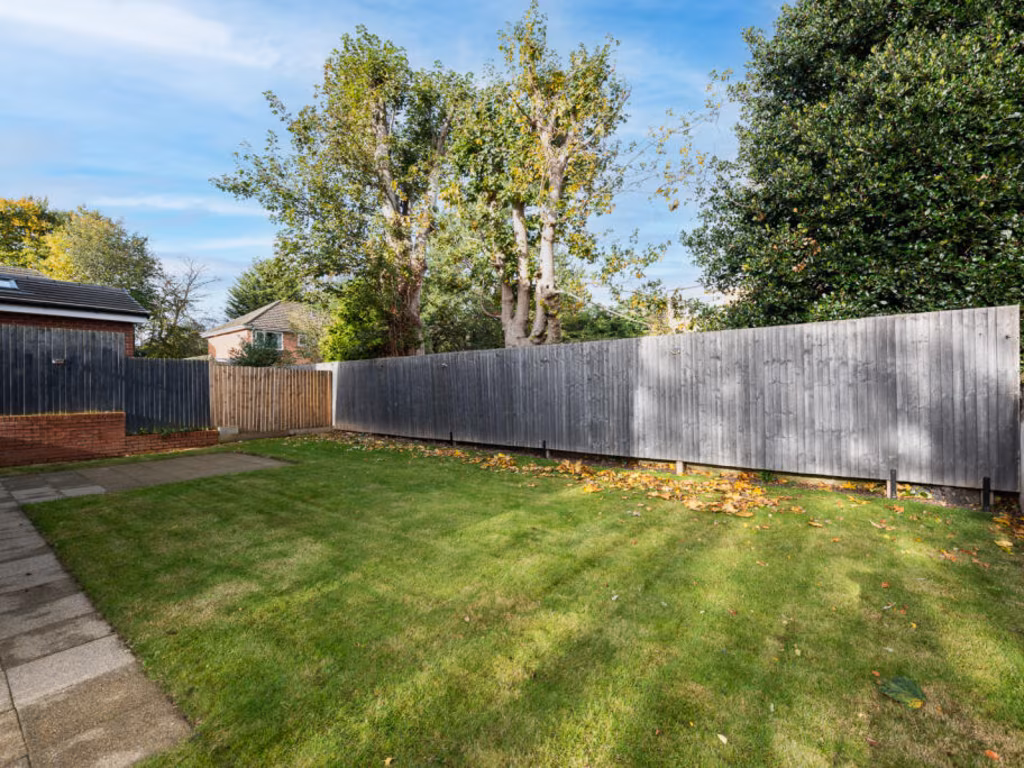
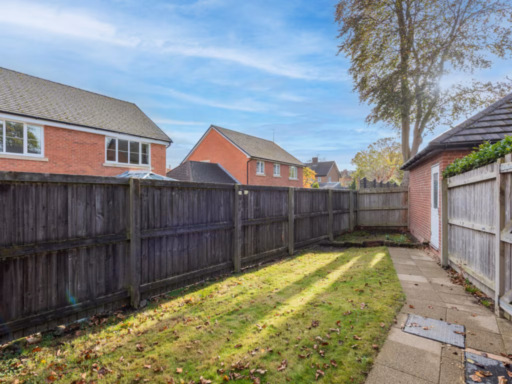
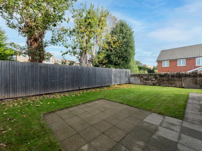
- GARDEN:
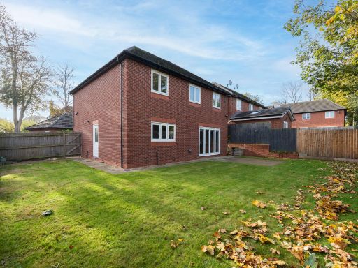
Textual Property Features
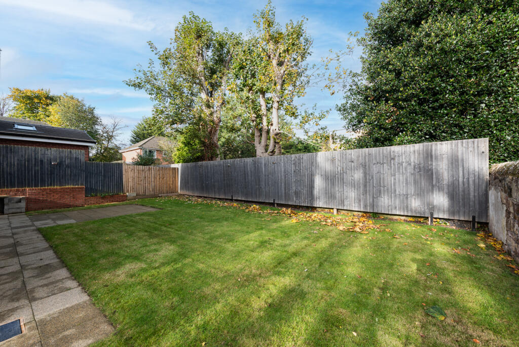
- Has Garden
- Chain Free
- Success
Detected Visual Features
- detached
- modern
- suburban
- garage
- driveway
- garden
- brick construction
- family home
- contemporary
- kitchen
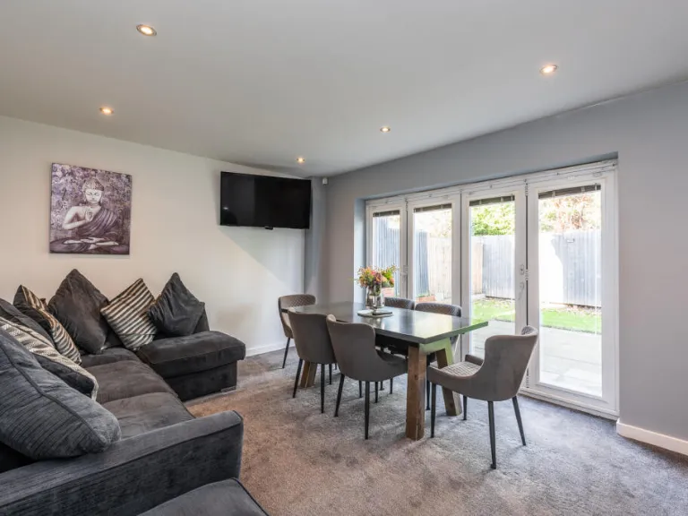
- dining area
- open plan
- glass doors
- natural light
- neutral colors
- integrated appliances
EPC Details
- High performance glazing
- Average thermal transmittance 0.24 W/m-¦K
- Boiler and radiators, mains gas
- Low energy lighting in all fixed outlets
- Average thermal transmittance 0.20 W/m-¦K
Nearby Schools
- Oxton St Saviour's CofE Aided Primary School
- Fender Primary School
- Ridgeway High School
- Birkenhead School
- Birkenhead High School Academy
- Manor Primary School
- The Priory Parish CofE Primary School
- Co-op Academy Portland
- Holy Cross Catholic Primary School
- Prenton Primary School
- St Michael and All Angels Catholic Primary School
- Woodchurch High School
- Birkenhead Christ Church CofE Primary School
- Weatherhead High School
- Townfield Primary School
- Prenton Preparatory School
- St Peter's Catholic Primary School
- St Paul's Catholic Primary School
- Our Lady and St Edward's Catholic Primary School
- St Joseph's Catholic Primary School, Birkenhead
- Woodchurch Road Academy
- Co-Op Academy Hillside
- St Anselm's College
- Birkenhead Park School
- Bidston Avenue Primary School
Nearest General Shops
- Id: 2624855850
- Tags:
- Name: Claughton Dry Cleaners
- Shop: laundry
- TagsNormalized:
- Lat: 53.3947049
- Lon: -3.0580611
- FullGeoHash: gcmzf2jnwn2m
- PartitionGeoHash: gcmz
- Images:
- FoodStandards: null
- Distance: 643.6
,- Id: 2624855852
- Tags:
- Name: Diamond
- Shop: hairdresser
- TagsNormalized:
- Lat: 53.3947052
- Lon: -3.0581478
- FullGeoHash: gcmzf2jneyrx
- PartitionGeoHash: gcmz
- Images:
- FoodStandards: null
- Distance: 642.9
,- Id: 2624855862
- Tags:
- Name: St John's Hospice
- Second_hand: yes
- Shop: clothes
- TagsNormalized:
- Lat: 53.3946982
- Lon: -3.0583159
- FullGeoHash: gcmzf2jn8j4m
- PartitionGeoHash: gcmz
- Images:
- FoodStandards: null
- Distance: 640.9
}
Nearest Grocery shops
- Id: 9123622713
- Tags:
- Brand: McColl's
- Brand:wikidata: Q16997477
- Brand:wikipedia: en:McColl's
- Contact:
- Website: https://www.mccolls.co.uk/storelocator/noctorum-townfield-close/
- Name: McColl's
- Shop: convenience
- TagsNormalized:
- Lat: 53.3784166
- Lon: -3.0642458
- FullGeoHash: gcmzdm0xvfh9
- PartitionGeoHash: gcmz
- Images:
- FoodStandards: null
- Distance: 1217.7
,- Id: 2624855851
- Tags:
- Name: Co-operative
- Shop: convenience
- TagsNormalized:
- Lat: 53.3954214
- Lon: -3.0557493
- FullGeoHash: gcmzf2qfggup
- PartitionGeoHash: gcmz
- Images:
- FoodStandards: null
- Distance: 755.8
,- Id: 2624855865
- Tags:
- Addr:
- Housenumber: 9-15
- Postcode: CH41 0DE
- Street: Upton Road
- Brand: Tesco Express
- Brand:wikidata: Q98456772
- Contact:
- Website: https://www.tesco.com/store-locator/birkenhead/9-15-upton-rd
- Fhrs:
- Name: Tesco Express
- Shop: convenience
- Source:
- TagsNormalized:
- tesco
- tesco express
- convenience
- shop
- Lat: 53.3945934
- Lon: -3.0572941
- FullGeoHash: gcmzf2jwpcsk
- PartitionGeoHash: gcmz
- Images:
- FoodStandards:
- Id: 989590
- FHRSID: 989590
- LocalAuthorityBusinessID: PI/100038209
- BusinessName: Tesco
- BusinessType: Retailers - supermarkets/hypermarkets
- BusinessTypeID: 7840
- AddressLine1: 9-15 Upton Road
- AddressLine2: Claughton
- AddressLine3: Wirral
- AddressLine4: Merseyside
- PostCode: CH41 0DE
- RatingValue: 5
- RatingKey: fhrs_5_en-GB
- RatingDate: 2017-06-23
- LocalAuthorityCode: 435
- LocalAuthorityName: Wirral
- LocalAuthorityWebSite: http://www.wirral.gov.uk
- LocalAuthorityEmailAddress: environmentalhealth@wirral.gov.uk
- Scores:
- Hygiene: 0
- Structural: 5
- ConfidenceInManagement: 0
- NewRatingPending: false
- Geocode:
- Longitude: -3.05691599845886
- Latitude: 53.39471054077150
- Distance: 640
}
Nearest Supermarkets
- Id: 2591695483
- Tags:
- Brand: Co-op Food
- Brand:wikidata: Q3277439
- Brand:wikipedia: en:Co-op Food
- Name: Co-op Food
- Shop: supermarket
- Wheelchair: yes
- TagsNormalized:
- co-op
- co-op food
- food
- supermarket
- shop
- Lat: 53.3865457
- Lon: -3.0836475
- FullGeoHash: gcmz9ydx1v3v
- PartitionGeoHash: gcmz
- Images:
- FoodStandards: null
- Distance: 1635.9
,- Id: 155743721
- Tags:
- Addr:
- Country: GB
- Housenumber: 5
- Postcode: CH41 7BG
- Street: Stanley Road
- Brand: Asda
- Brand:wikidata: Q297410
- Brand:wikipedia: en:Asda
- Building: yes
- Contact:
- Website: https://storelocator.asda.com/north-west/birkenhead/unit-1-stanley-road
- Fhrs:
- Name: Asda
- Operator: Asda Stores Ltd
- Shop: supermarket
- Source: survey
- Source:addr: FHRS Open Data
- TagsNormalized:
- Lat: 53.4032944
- Lon: -3.0601363
- FullGeoHash: gcmzf3g8txsg
- PartitionGeoHash: gcmz
- Images:
- FoodStandards:
- Id: 569880
- FHRSID: 569880
- LocalAuthorityBusinessID: PI/100042233
- BusinessName: Asda
- BusinessType: Retailers - supermarkets/hypermarkets
- BusinessTypeID: 7840
- AddressLine1: 5 Stanley Road
- AddressLine2: Birkenhead
- AddressLine3: Wirral
- AddressLine4: null
- PostCode: null
- RatingValue: 5
- RatingKey: fhrs_5_en-GB
- RatingDate: 2022-11-30
- LocalAuthorityCode: 435
- LocalAuthorityName: Wirral
- LocalAuthorityWebSite: http://www.wirral.gov.uk
- LocalAuthorityEmailAddress: environmentalhealth@wirral.gov.uk
- Scores:
- Hygiene: 5
- Structural: 5
- ConfidenceInManagement: 0
- NewRatingPending: false
- Geocode:
- Longitude: -3.06015370000000
- Latitude: 53.40330220000000
- Distance: 1594.3
,- Id: 2631001651
- Tags:
- Brand: ALDI
- Brand:wikidata: Q41171672
- Brand:wikipedia: en:Aldi
- Contact:
- Website: https://stores.aldi.co.uk/birkenhead/71-laird-street
- Name: ALDI
- Payment:
- Cash: yes
- Credit_cards: yes
- Debit_cards: yes
- Shop: supermarket
- TagsNormalized:
- Lat: 53.3986246
- Lon: -3.0486771
- FullGeoHash: gcmzf8uj89je
- PartitionGeoHash: gcmz
- Images:
- FoodStandards: null
- Distance: 1285
}
Nearest Religious buildings
- Id: 233135985
- Tags:
- Amenity: place_of_worship
- Building: church
- Name: Trinity and Palm Grove United Reformed and Methodist Church
- Religion: christian
- Wikidata: Q15979584
- Wikipedia: en:Trinity with Palm Grove Church, Claughton
- TagsNormalized:
- place of worship
- church
- methodist
- united reformed
- christian
- Lat: 53.3862355
- Lon: -3.0500889
- FullGeoHash: gcmzdwdvrg8g
- PartitionGeoHash: gcmz
- Images:
- FoodStandards: null
- Distance: 683
,- Id: 232692809
- Tags:
- Amenity: place_of_worship
- Building: church
- Name: Hamilton United Reformed Church
- Religion: christian
- TagsNormalized:
- place of worship
- church
- united reformed
- christian
- Lat: 53.3946234
- Lon: -3.0564395
- FullGeoHash: gcmzf2nq5z1x
- PartitionGeoHash: gcmz
- Images:
- FoodStandards: null
- Distance: 657.4
,- Id: 232884346
- Tags:
- Amenity: place_of_worship
- Building: yes
- Height: 9.02
- Height:median: 6.07
- Name: The Holy Name of Jesus RC Church
- Religion: christian
- TagsNormalized:
- place of worship
- church
- christian
- Lat: 53.3846479
- Lon: -3.0556038
- FullGeoHash: gcmzdqqup78s
- PartitionGeoHash: gcmz
- Images:
- FoodStandards: null
- Distance: 539.5
}
Nearest Airports
- Id: 116737532
- Tags:
- Addr:
- City: Liverpool
- Country: GB
- Postcode: L24 1YD
- Street: Speke Hall Avenue
- Aerodrome: international
- Aerodrome:type: public
- Aeroway: aerodrome
- Iata: LPL
- Icao: EGGP
- Is_in: Liverpool,England,UK
- Name: Liverpool John Lennon Airport
- Old_name: Speke Airport
- Operator: Liverpool Airport plc
- Source: wikipedia
- Website: https://www.liverpoolairport.com/
- Wikidata: Q8727
- Wikipedia: en:Liverpool John Lennon Airport
- TagsNormalized:
- airport
- international airport
- Lat: 53.3357677
- Lon: -2.8518179
- FullGeoHash: gcmzrj7r7gdr
- PartitionGeoHash: gcmz
- Images:
- FoodStandards: null
- Distance: 14985.5
}
Nearest Leisure Facilities
- Id: 207756736
- Tags:
- Leisure: pitch
- Sport: tennis
- TagsNormalized:
- Lat: 53.3868239
- Lon: -3.052697
- FullGeoHash: gcmzdwc0g121
- PartitionGeoHash: gcmz
- Images:
- FoodStandards: null
- Distance: 499.3
,- Id: 207756735
- Tags:
- Leisure: pitch
- Sport: tennis
- TagsNormalized:
- Lat: 53.3874711
- Lon: -3.0525633
- FullGeoHash: gcmzdwchw1gv
- PartitionGeoHash: gcmz
- Images:
- FoodStandards: null
- Distance: 477.6
,- Id: 235449594
- Tags:
- TagsNormalized:
- Lat: 53.3884067
- Lon: -3.0529009
- FullGeoHash: gcmzdx0fn225
- PartitionGeoHash: gcmz
- Images:
- FoodStandards: null
- Distance: 429.8
,- Id: 733136962
- Tags:
- Access: private
- Leisure: pitch
- TagsNormalized:
- Lat: 53.3858256
- Lon: -3.0561824
- FullGeoHash: gcmzdqwdcz1n
- PartitionGeoHash: gcmz
- Images:
- FoodStandards: null
- Distance: 406.2
,- Id: 25713320
- Tags:
- Leisure: golf_course
- Name: Wirral Golf Club
- Note: Used to be known as Wirral Ladies' Golf Club, but has now changed. See https://www.wirralgolfclub.com/
- Source: Yahoo;local knowledge
- Source:name: OS OpenData StreetView
- TagsNormalized:
- golf
- golf course
- leisure
- club
- Lat: 53.3877565
- Lon: -3.0644183
- FullGeoHash: gcmzdqbw1zhh
- PartitionGeoHash: gcmz
- Images:
- FoodStandards: null
- Distance: 364.1
}
Nearest Tourist attractions
- Id: 491581360
- Tags:
- Name: Pacific Road Arts Centre
- Tourism: attraction
- TagsNormalized:
- arts centre
- attraction
- tourism
- Lat: 53.3965724
- Lon: -3.0133348
- FullGeoHash: gcmzg2tc84w9
- PartitionGeoHash: gcmz
- Images:
- FoodStandards: null
- Distance: 3164
,- Id: 2606269071
- Tags:
- Name: Transport Museum
- Tourism: museum
- Wikidata: Q8026995
- Wikipedia: en:Wirral Transport Museum
- TagsNormalized:
- Lat: 53.3963162
- Lon: -3.019149
- FullGeoHash: gcmzg2980dz3
- PartitionGeoHash: gcmz
- Images:
- FoodStandards: null
- Distance: 2786
,- Id: 2080077
- Tags:
- Building: public
- Name: Williamson Art Gallery & Museum
- Tourism: museum
- Type: multipolygon
- Wikidata: Q16897654
- Wikipedia: en:Williamson Art Gallery and Museum
- TagsNormalized:
- Lat: 53.3848954
- Lon: -3.0400162
- FullGeoHash: gcmzdy6md3z9
- PartitionGeoHash: gcmz
- Images:
- FoodStandards: null
- Distance: 1357.5
}
Nearest Hotels
- Id: 495620901
- Tags:
- Name: Central Hotel
- Tourism: hotel
- TagsNormalized:
- Lat: 53.3894462
- Lon: -3.0211028
- FullGeoHash: gcmzer2054n7
- PartitionGeoHash: gcmz
- Images:
- FoodStandards: null
- Distance: 2534.6
,- Id: 822297098
- Tags:
- Name: RiverHill Hotel and Bay Tree Restaurant
- Tourism: hotel
- TagsNormalized:
- Lat: 53.3786812
- Lon: -3.04866
- FullGeoHash: gcmzdtk1356k
- PartitionGeoHash: gcmz
- Images:
- FoodStandards: null
- Distance: 1344.2
,- Id: 2624855868
- Tags:
- Addr:
- Housenumber: 50-56
- Postcode: CH41 0DH
- Street: Upton Road
- Amenity: pub
- Fhrs:
- Fixme:
- Name: The Claughton Hotel
- Source:
- TagsNormalized:
- Lat: 53.3947807
- Lon: -3.0577745
- FullGeoHash: gcmzf2jrhsw1
- PartitionGeoHash: gcmz
- Images:
- FoodStandards: null
- Distance: 654.7
}
Tags
- detached
- modern
- suburban
- garage
- driveway
- garden
- brick construction
- family home
- modern
- contemporary
- kitchen
- dining area
- open plan
- glass doors
- natural light
- neutral colors
- integrated appliances
Local Market Stats
- Average Price/sqft: £198
- Avg Income: £38000
- Rental Yield: 4%
- Social Housing: 17%
- Planning Success Rate: 93%
AirBnB Data
- 1km average: £70/night
- Listings in 1km: 1
Similar Properties
 4 bedroom detached house for sale in Claughton Green, Prenton, Wirral, CH43 — £425,000 • 4 bed • 1 bath • 1306 ft²
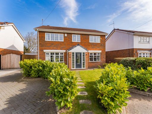 4 bedroom detached house for sale in Kingsmead Grove, Wirral, CH43 — £450,000 • 4 bed • 2 bath • 1523 ft²
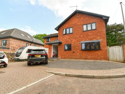 5 bedroom detached house for sale in Beresford Close, Prenton, Wirral, CH43 — £525,000 • 5 bed • 3 bath • 2138 ft²
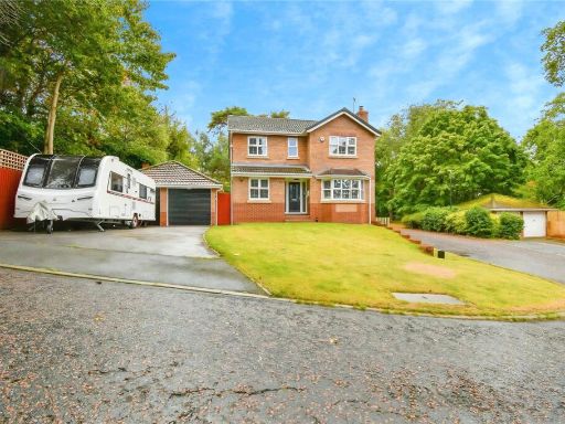 4 bedroom detached house for sale in Devisdale Grove, Prenton, Wirral, CH43 — £500,000 • 4 bed • 2 bath • 1349 ft²
 5 bedroom detached house for sale in Bennetts Hill, Oxton, Wirral, CH43 — £400,000 • 5 bed • 1 bath • 2000 ft²
 4 bedroom detached house for sale in Quaile Park, Prenton, CH43 — £580,000 • 4 bed • 3 bath • 1647 ft²
Meta
- {
"@context": "https://schema.org",
"@type": "Residence",
"name": "4 bedroom detached house for sale in Taylor Place, Oxton, C…",
"description": "",
"url": "https://propertypiper.co.uk/property/a52b0626-0402-48db-883a-477059f98b1f",
"image": "https://image-a.propertypiper.co.uk/652909ca-819e-4a20-b110-233012c1a228-1024.jpeg",
"address": {
"@type": "PostalAddress",
"streetAddress": "5, Taylor Place",
"postalCode": "CH43 6WB",
"addressLocality": "Wirral",
"addressRegion": "Birkenhead",
"addressCountry": "England"
},
"geo": {
"@type": "GeoCoordinates",
"latitude": 53.38896512948652,
"longitude": -3.0593148535719124
},
"numberOfRooms": 4,
"numberOfBathroomsTotal": 3,
"floorSize": {
"@type": "QuantitativeValue",
"value": 1271,
"unitCode": "FTK"
},
"offers": {
"@type": "Offer",
"price": 575000,
"priceCurrency": "GBP",
"availability": "https://schema.org/InStock"
},
"additionalProperty": [
{
"@type": "PropertyValue",
"name": "Feature",
"value": "detached"
},
{
"@type": "PropertyValue",
"name": "Feature",
"value": "modern"
},
{
"@type": "PropertyValue",
"name": "Feature",
"value": "suburban"
},
{
"@type": "PropertyValue",
"name": "Feature",
"value": "garage"
},
{
"@type": "PropertyValue",
"name": "Feature",
"value": "driveway"
},
{
"@type": "PropertyValue",
"name": "Feature",
"value": "garden"
},
{
"@type": "PropertyValue",
"name": "Feature",
"value": "brick construction"
},
{
"@type": "PropertyValue",
"name": "Feature",
"value": "family home"
},
{
"@type": "PropertyValue",
"name": "Feature",
"value": "modern"
},
{
"@type": "PropertyValue",
"name": "Feature",
"value": "contemporary"
},
{
"@type": "PropertyValue",
"name": "Feature",
"value": "kitchen"
},
{
"@type": "PropertyValue",
"name": "Feature",
"value": "dining area"
},
{
"@type": "PropertyValue",
"name": "Feature",
"value": "open plan"
},
{
"@type": "PropertyValue",
"name": "Feature",
"value": "glass doors"
},
{
"@type": "PropertyValue",
"name": "Feature",
"value": "natural light"
},
{
"@type": "PropertyValue",
"name": "Feature",
"value": "neutral colors"
},
{
"@type": "PropertyValue",
"name": "Feature",
"value": "integrated appliances"
}
]
}
High Res Floorplan Images
Compatible Floorplan Images
FloorplanImages Thumbnail