LE1 3UN - 1 bedroom apartment for sale in Navigation Street, City Cen…
View on Property Piper
1 bedroom apartment for sale in Navigation Street, City Centre, LE1
Property Details
- Price: £85000
- Bedrooms: 1
- Bathrooms: 1
- Property Type: undefined
- Property SubType: undefined
Brochure Descriptions
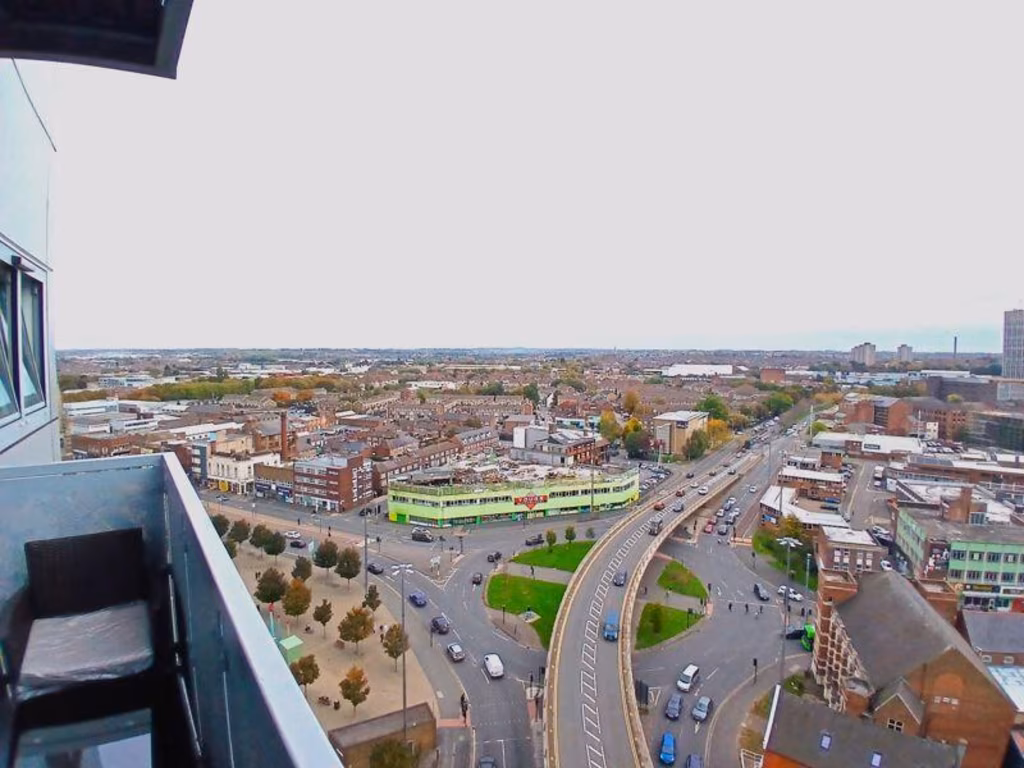
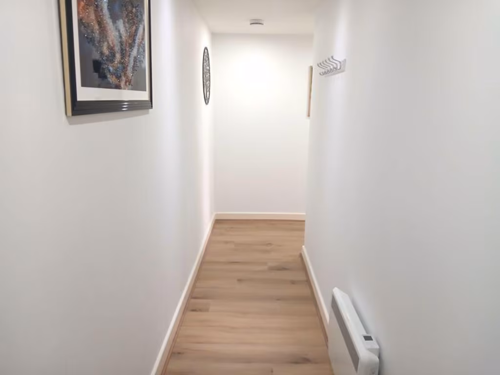
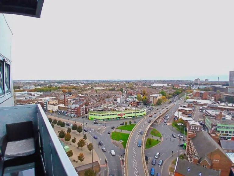
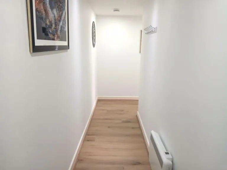
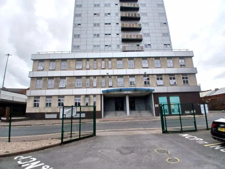
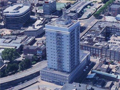
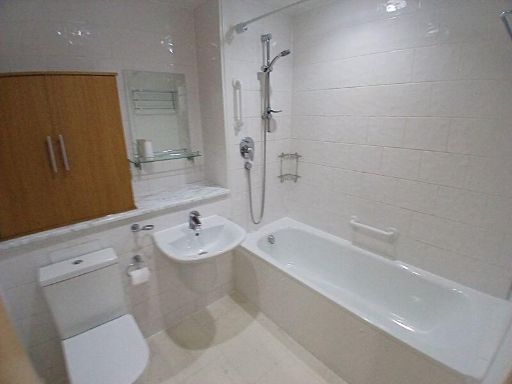
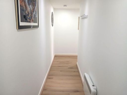
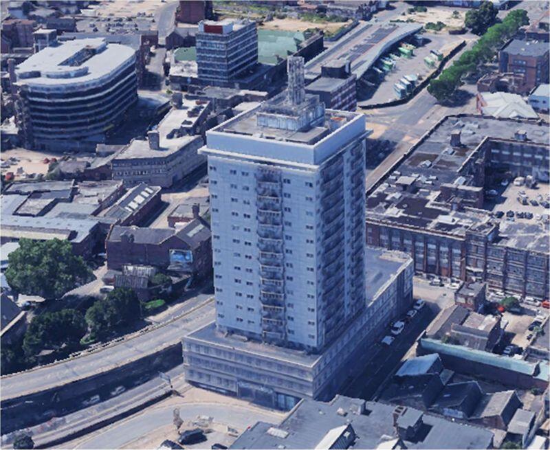
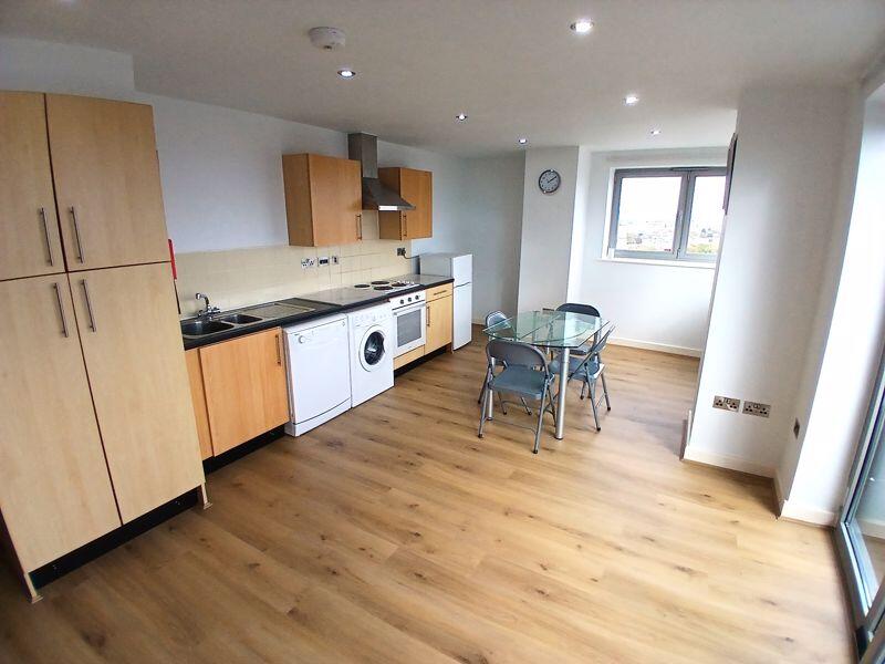
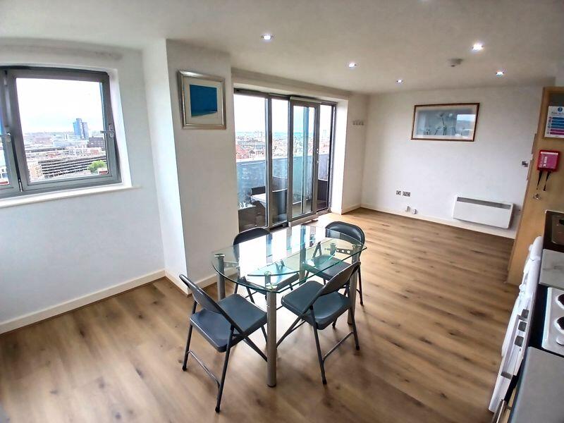
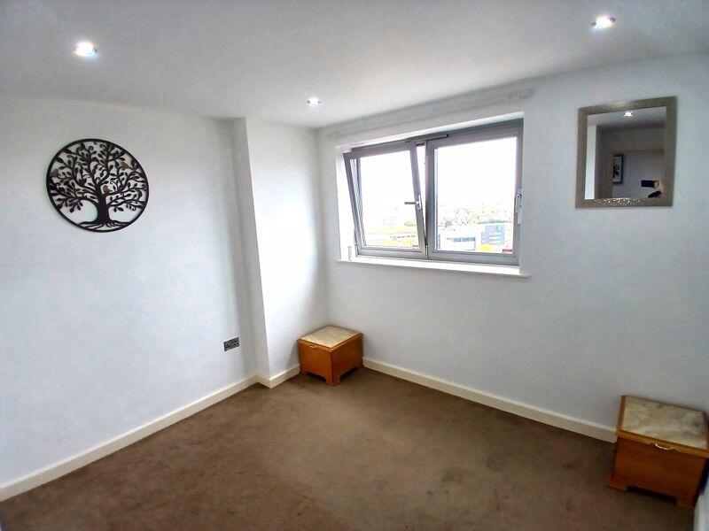
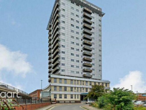
- City-centre high-rise apartment within The Horizon Building on Navigation Street, Leicester (LE1 3UN). The listing is for a high-floor (14th floor as stated) one-bedroom apartment with balcony. Accommodation appears to be open-plan living/kitchen, one bedroom, bathroom and balcony. Property occupies a small apartment footprint typical of city centre one-bed units; internal area is likely small to average for a one-bedroom flat. Building is a multi-storey tower with lift access and communal areas; location offers extensive city views and excellent access to local amenities and transport. Suitable for buy-to-let investors or owner-occupiers seeking a compact city-centre apartment. Overall presentation: well-maintained flat within a large block in a highly convenient central location.
Image Descriptions
- apartment building Brutalist
- urban view
Floorplan Description
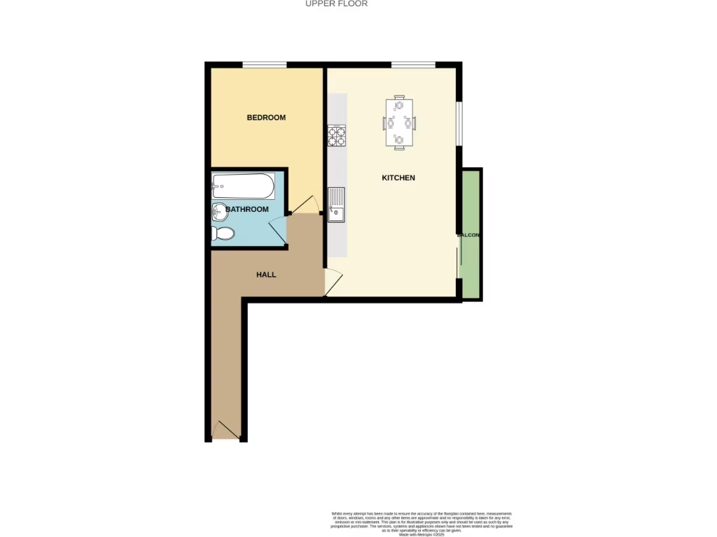
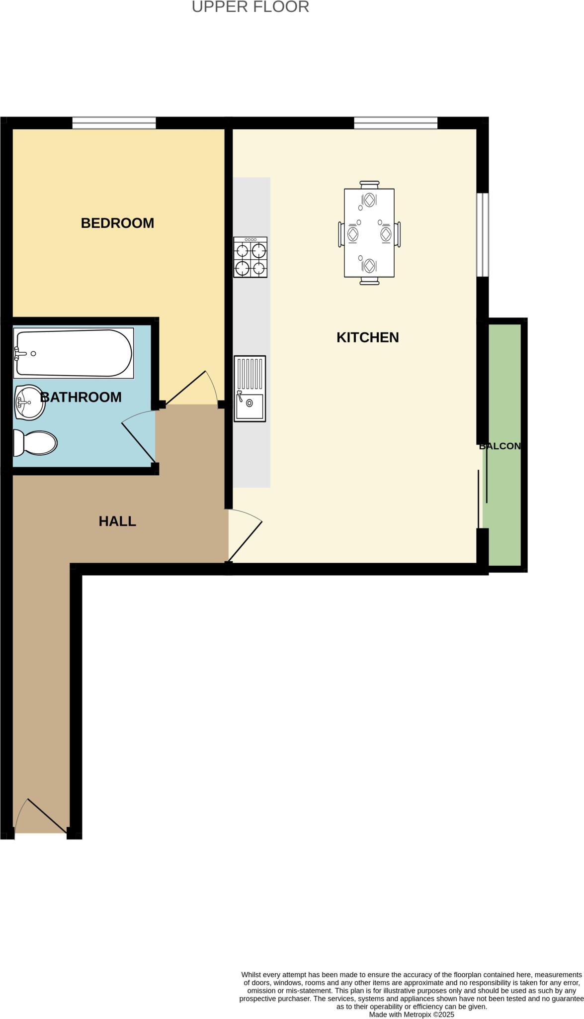
- Upper floor plan showing bedroom, kitchen, bathroom, hall and balcon
Rooms
- BEDROOM:
- KITCHEN:
- BATHROOM:
- HALL:
- BALCON:
Textual Property Features
Detected Visual Features
- apartment building
- high-rise
- Brutalist
- urban
- concrete
- city center
- residential
- multi-story
- apartments
- cityscape
- road
- architecture
- apartment
- balcony
- modern
EPC Details
- Fully double glazed
- System built, as built, insulated (assumed)
- Room heaters, electric
- Low energy lighting in all fixed outlets
- (another dwelling below)
Nearby Schools
- Hazel Community Primary School
- Shaftesbury Junior School
- Sparkenhoe Community Primary School
- Uplands Infant School
- Highfields Primary School
- Brook Mead Academy
- Charnwood Primary School
- Sacred Heart Catholic Voluntary Academy
- Medway Community Primary School
- Al-Islamia Institute for Education
- Moat Community College
- Catherine Infant School
- Saint Patrick's Catholic Voluntary Academy
- Darul Uloom Leicester
- St Peter's CofE Primary School
- Uplands Junior L.E.A.D Academy
- Taylor Road Primary School
- Fosse Mead Primary Academy
- Catherine Junior School
- Mellor Community Primary School
- Wolsey House Primary School
- King Richard III Infant and Nursery School
- Castle Mead Academy
- Slater Primary School
- Abbey Mead Primary Academy
Nearest Bars And Restaurants
- Id: 1940642556
- Tags:
- Amenity: cafe
- Name: Bus Station Cafe
- Source: survey
- TagsNormalized:
- Lat: 52.6393809
- Lon: -1.1341823
- FullGeoHash: gcr5qnwneeu6
- PartitionGeoHash: gcr5
- Images:
- FoodStandards: null
- Distance: 306.8
,- Id: 842137753
- Tags:
- Addr:
- City: Leicester
- Housenumber: 49-51
- Postcode: LE1 3HR
- Street: Belgrave Gate
- Amenity: cafe
- Building: no
- Cuisine: coffee_shop
- Name: Café Conexion
- Ref:
- TagsNormalized:
- Lat: 52.6387766
- Lon: -1.1310087
- FullGeoHash: gcr5qq87je4v
- PartitionGeoHash: gcr5
- Images:
- FoodStandards: null
- Distance: 306.7
,- Id: 8588324758
- Tags:
- Addr:
- City: Leicester
- Housenumber: 253-255
- Postcode: LE1 3HU
- Street: Belgrave Gate
- Amenity: cafe
- Fhrs:
- Name: Love Food Café
- Source:
- TagsNormalized:
- Lat: 52.6430537
- Lon: -1.127672
- FullGeoHash: gcr5qr6u526z
- PartitionGeoHash: gcr5
- Images:
- FoodStandards: null
- Distance: 299.3
,- Id: 1290465846
- Tags:
- Amenity: restaurant
- Cuisine: asian
- Name: haveli
- Opening_hours: Mo-Sa 09:00-09:00; Su 09:00-08:00
- TagsNormalized:
- Lat: 52.6389938
- Lon: -1.1308771
- FullGeoHash: gcr5qq8s2esu
- PartitionGeoHash: gcr5
- Images:
- FoodStandards: null
- Distance: 283.4
,- Id: 9920901139
- Tags:
- Amenity: fast_food
- Check_date: 2022-10-25
- Cuisine: bagel
- Diet:
- Name: The Bagel Café
- Opening_hours: Mo-Sa 07:30-16:00; Su off
- Outdoor_seating: yes
- Payment:
- Wheelchair: no
- TagsNormalized:
- Lat: 52.6406695
- Lon: -1.1297162
- FullGeoHash: gcr5qqcq5sn8
- PartitionGeoHash: gcr5
- Images:
- FoodStandards: null
- Distance: 144.6
}
Nearest General Shops
- Id: 842137754
- Tags:
- Addr:
- City: Leicester
- Housenumber: 53-55
- Postcode: LE1 3HR
- Street: Belgrave Gate
- Building: no
- Email: l.b.academy@hotmail.com
- Female: no
- Male: yes
- Name: Leicester Barbering Academy
- Phone: +44 7526 296769
- Shop: hairdresser
- Website: https://www.leicesterbarberingacademy.co.uk
- TagsNormalized:
- Lat: 52.6388774
- Lon: -1.131033
- FullGeoHash: gcr5qq87tjbw
- PartitionGeoHash: gcr5
- Images:
- FoodStandards: null
- Distance: 295.4
,- Id: 1073830276
- Tags:
- Indoor: area
- Level: 0
- Name: National Express Ticket Office
- Opening_hours: Mo-Th 07:00-17:00; Fr-Su 07:00-19:00
- Operator: National Express
- Shop: ticket
- Website: https://www.nationalexpress.com/en/help/coach-stations/leicester
- TagsNormalized:
- Lat: 52.6398357
- Lon: -1.1333206
- FullGeoHash: gcr5qny9r8wg
- PartitionGeoHash: gcr5
- Images:
- FoodStandards: null
- Distance: 231.4
,- Id: 5072360921
- Tags:
- Addr:
- City: Leicester
- Housenumber: 203
- Postcode: LE1 3HT
- Street: Belgrave Gate
- Fhrs:
- Name: Yours Supermarket
- Operator: Goldens International
- Shop: supermarket
- Source:
- TagsNormalized:
- Lat: 52.6412789
- Lon: -1.1287153
- FullGeoHash: gcr5qr41ej8u
- PartitionGeoHash: gcr5
- Images:
- FoodStandards:
- Id: 733380
- FHRSID: 733380
- LocalAuthorityBusinessID: 14/00562/CP
- BusinessName: Yours Supermarket
- BusinessType: Retailers - supermarkets/hypermarkets
- BusinessTypeID: 7840
- AddressLine1: 203 Belgrave Gate
- AddressLine2: Leicester
- AddressLine3: null
- AddressLine4: null
- PostCode: LE1 3HT
- RatingValue: 3
- RatingKey: fhrs_3_en-GB
- RatingDate: 2019-06-17
- LocalAuthorityCode: 878
- LocalAuthorityName: Leicester City
- LocalAuthorityWebSite: http://www.leicester.gov.uk/food
- LocalAuthorityEmailAddress: food@leicester.gov.uk
- Scores:
- Hygiene: 10
- Structural: 10
- ConfidenceInManagement: 10
- NewRatingPending: false
- Geocode:
- Longitude: -1.12831600000000
- Latitude: 52.64196400000000
- Distance: 178.3
}
Nearest Grocery shops
- Id: 265112445
- Tags:
- Brand: Costcutter
- Brand:wikidata: Q5175072
- Brand:wikipedia: en:Costcutter
- Building: commercial
- Name: Costcutter
- Operator: Costcutter
- Shop: convenience
- Source: Bing
- TagsNormalized:
- costcutter
- convenience
- shop
- Lat: 52.6435094
- Lon: -1.1280499
- FullGeoHash: gcr5qr6wdt3j
- PartitionGeoHash: gcr5
- Images:
- FoodStandards: null
- Distance: 312.1
,- Id: 1073830281
- Tags:
- Indoor: area
- Level: 0
- Operator: ST MARGARETS EXPRESS LTD
- Shop: convenience
- TagsNormalized:
- Lat: 52.6396591
- Lon: -1.1334742
- FullGeoHash: gcr5qny8hpsm
- PartitionGeoHash: gcr5
- Images:
- FoodStandards: null
- Distance: 253.4
,- Id: 8588324768
- Tags:
- Addr:
- City: Leicester
- Housenumber: 233
- Postcode: LE1 3HT
- Street: Belgrave Gate
- Name: Global Groceries
- Shop: convenience
- TagsNormalized:
- Lat: 52.6423995
- Lon: -1.1282713
- FullGeoHash: gcr5qr62jqeb
- PartitionGeoHash: gcr5
- Images:
- FoodStandards: null
- Distance: 227.7
}
Nearest Religious buildings
- Id: 170433141
- Tags:
- Addr:
- City: Leicester
- Housename: Royce Institute
- Housenumber: 11
- Postcode: LE1 3DB
- Street: Crane Street
- Amenity: place_of_worship
- Building: yes
- Name: Dada Darshan
- Ref:
- Religion: hindu
- Source: os_opendata_streetview
- TagsNormalized:
- place of worship
- hindu
- mandir
- hindu temple
- temple
- Lat: 52.6403898
- Lon: -1.1349972
- FullGeoHash: gcr5qnvs2xus
- PartitionGeoHash: gcr5
- Images:
- FoodStandards: null
- Distance: 278.2
,- Id: 669383975
- Tags:
- Addr:
- City: Leicester
- Housenumber: 55
- Postcode: LE1 3JR
- Street: Bedford Street South
- Amenity: place_of_worship
- Building: yes
- Name: New Covenent Church
- Religion: christian
- TagsNormalized:
- place of worship
- church
- christian
- Lat: 52.6396989
- Lon: -1.1293874
- FullGeoHash: gcr5qqc87r5e
- PartitionGeoHash: gcr5
- Images:
- FoodStandards: null
- Distance: 241.8
,- Id: 469922088
- Tags:
- Addr:
- City: Leicester
- Housenumber: 170a
- Postcode: LE1 3XL
- Street: Belgrave Gate
- Amenity: place_of_worship
- Building: yes
- Denomination: sunni
- Name: Masjid An Noor
- Religion: muslim
- TagsNormalized:
- place of worship
- sunni
- muslim
- mosque
- Lat: 52.6411898
- Lon: -1.1303347
- FullGeoHash: gcr5qr0cjm12
- PartitionGeoHash: gcr5
- Images:
- FoodStandards: null
- Distance: 76.7
}
Nearest Airports
- Id: 11359528
- Tags:
- Aerodrome: international
- Aerodrome:type: public
- Aeroway: aerodrome
- Iata: EMA
- Icao: EGNX
- Is_in: Castle Donington,England,UK
- Name: East Midlands Airport
- Old_name: RAF Castle Donington
- Operator: Manchester Airports Holdings Limited
- Operator:type: private
- Ref: EMA
- Type: multipolygon
- Website: https://www.eastmidlandsairport.com/
- Wikidata: Q8977
- Wikipedia: en:East Midlands Airport
- TagsNormalized:
- airport
- international airport
- Lat: 52.8281122
- Lon: -1.3322143
- FullGeoHash: gcrh99jfj1vh
- PartitionGeoHash: gcrh
- Images:
- FoodStandards: null
- Distance: 24766.7
,- Id: 2437117
- Tags:
- Aerodrome: international
- Aerodrome:type: public
- Aeroway: aerodrome
- Ele: 104
- Iata: BHX
- Icao: EGBB
- Internet_access: wlan
- Is_in: Birmingham,England,UK
- Name: Birmingham Airport
- Ref: BHX
- Type: multipolygon
- Website: https://www.birminghamairport.co.uk/
- Wikidata: Q8719
- Wikipedia: en:Birmingham Airport
- TagsNormalized:
- airport
- international airport
- Lat: 52.4543817
- Lon: -1.7468974
- FullGeoHash: gcqf2jpbym6y
- PartitionGeoHash: gcqf
- Images:
- FoodStandards: null
- Distance: 46535.2
}
Nearest Leisure Facilities
- Id: 451971788
- Tags:
- Leisure: garden
- Name: Friendship Gardens
- TagsNormalized:
- Lat: 52.6450806
- Lon: -1.1350645
- FullGeoHash: gcr5qptrz46d
- PartitionGeoHash: gcr5
- Images:
- FoodStandards: null
- Distance: 468.7
,- Id: 669602399
- Tags:
- Building: no
- Indoor: shop
- Leisure: fitness_centre
- Level: 1
- Name: Simply Women
- TagsNormalized:
- fitness
- fitness centre
- leisure
- Lat: 52.6375087
- Lon: -1.1325836
- FullGeoHash: gcr5qnr78yu6
- PartitionGeoHash: gcr5
- Images:
- FoodStandards: null
- Distance: 454.9
,- Id: 924629503
- Tags:
- TagsNormalized:
- Lat: 52.6400419
- Lon: -1.1358001
- FullGeoHash: gcr5qnufmzn1
- PartitionGeoHash: gcr5
- Images:
- FoodStandards: null
- Distance: 344.2
,- Id: 444296506
- Tags:
- Building: civic
- Leisure: sports_centre
- Name: Morningside Arena
- Website: https://www.leicesterarena.co.uk/
- Wheelchair: yes
- Wikidata: Q30133284
- Wikipedia: en:Leicester Arena
- TagsNormalized:
- civic
- sports
- sports centre
- leisure
- Lat: 52.6438963
- Lon: -1.1309819
- FullGeoHash: gcr5qr82yjwc
- PartitionGeoHash: gcr5
- Images:
- FoodStandards: null
- Distance: 264.4
,- Id: 489169736
- Tags:
- Addr:
- City: Leicester
- Housenumber: 61
- Postcode: LE1 3JR
- Street: Bedford Street South
- Area: yes
- Building: yes
- Email: info@splashspa-leisure.co.uk
- Gay:
- Leisure: sauna
- Name: Splash Spa & Leisure
- Name:en: Splash Spa & Leisure
- Opening_hours: Mo-Sa 11:00-22:00; Su 12:00-20:00
- Phone: +44 116 367 3932
- Website: http://splashleisure.co.uk/
- TagsNormalized:
- Lat: 52.6398573
- Lon: -1.1290907
- FullGeoHash: gcr5qqcc6k8g
- PartitionGeoHash: gcr5
- Images:
- FoodStandards: null
- Distance: 239.2
}
Nearest Tourist attractions
- Id: 30889327
- Tags:
- HE_ref: 1074051
- Addr:
- City: Leicester
- Street: Abbey Park Road
- Alt_name: Abbey of Saint Mary de Pratis
- Historic: ruins
- Listed_status: Grade I
- Name: Leicester Abbey
- Source: Bing
- Tourism: attraction
- Wheelchair: limited
- Wikidata: Q1980614
- Wikipedia: en:Leicester Abbey
- TagsNormalized:
- Lat: 52.6486906
- Lon: -1.1369949
- FullGeoHash: gcr5w0khf570
- PartitionGeoHash: gcr5
- Images:
- FoodStandards: null
- Distance: 883.6
,- Id: 3258121169
- Tags:
- Addr:
- Housenumber: 4A
- Postcode: LE1 5DB
- Street: St Martins
- Cafe: yes
- Fhrs:
- Name: King Richard III Visitor Centre
- Note: does evening events with food so may be tad more than cafe
- Source:
- Tourism: attraction
- Website: https://kriii.com/
- Wheelchair: yes
- TagsNormalized:
- Lat: 52.6342074
- Lon: -1.1361035
- FullGeoHash: gcr5qju8qz7u
- PartitionGeoHash: gcr5
- Images:
- FoodStandards: null
- Distance: 875.5
,- Id: 27147814
- Tags:
- Amenity: clock
- Display: analog
- Historic: monument
- Layer: 1
- Name: Clock Tower
- Start_date: 1866
- Support: tower
- Tourism: attraction
- Wheelchair: yes
- Wikidata: Q5686993
- Wikipedia: en:Haymarket Memorial Clock Tower
- TagsNormalized:
- Lat: 52.6362067
- Lon: -1.1331214
- FullGeoHash: gcr5qnnuhk57
- PartitionGeoHash: gcr5
- Images:
- FoodStandards: null
- Distance: 604
}
Nearest Train stations
- Id: 2136829095
- Tags:
- Air_conditioning: no
- Internet_access: no
- Name: South Wigston
- Naptan:
- Network: National Rail
- Operator: East Midlands Railway
- Postal_code: LE18 4XU
- Public_transport: station
- Railway: station
- Ref:
- Wheelchair: limited
- Wikidata: Q2096724
- Wikimedia_commons: Category:South Wigston railway station
- Wikipedia: en:South Wigston railway station
- TagsNormalized:
- Lat: 52.5823924
- Lon: -1.13403
- FullGeoHash: gcr5nhq4xhmu
- PartitionGeoHash: gcr5
- Images:
- FoodStandards: null
- Distance: 6578.1
,- Id: 1139057034
- Tags:
- Addr:
- City: Leicester
- Housename: Leicester North Railway Station
- Postcode: LE4 3BR
- Name: Leicester North
- Naptan:
- Public_transport: station
- Railway: station
- Train: yes
- Usage: tourism
- Wikidata: Q4882689
- TagsNormalized:
- Lat: 52.6678412
- Lon: -1.1332687
- FullGeoHash: gcr5w5yu2vjw
- PartitionGeoHash: gcr5
- Images:
- FoodStandards: null
- Distance: 2928.9
,- Id: 3069843270
- Tags:
- Public_transport: station
- Railway: station
- Usage: tourism
- TagsNormalized:
- Lat: 52.6555015
- Lon: -1.1306721
- FullGeoHash: gcr5w38st2vv
- PartitionGeoHash: gcr5
- Images:
- FoodStandards: null
- Distance: 1554.4
,- Id: 4292139459
- Tags:
- Name: Leicester
- Naptan:
- Network: National Rail
- Platforms: 4
- Postal_code: LE2 0QB
- Public_transport: station
- Railway: station
- Ref:
- Train: yes
- Wheelchair: yes
- Wikidata: Q3399620
- Wikimedia_commons: Category:Leicester Central railway station
- Wikipedia: en:Leicester railway station
- TagsNormalized:
- Lat: 52.6318214
- Lon: -1.1238912
- FullGeoHash: gcr5qmmde6tg
- PartitionGeoHash: gcr5
- Images:
- FoodStandards: null
- Distance: 1190.2
,- Id: 3069878190
- Tags:
- Public_transport: station
- Railway: station
- Train: yes
- Usage: tourism
- Wheelchair: no
- TagsNormalized:
- Lat: 52.6444735
- Lon: -1.1380655
- FullGeoHash: gcr5qpek31hu
- PartitionGeoHash: gcr5
- Images:
- FoodStandards: null
- Distance: 560.4
}
Nearest Hotels
- Id: 474721388
- Tags:
- Addr:
- City: Leicester
- Housenumber: 84-90
- Postcode: LE1 1GE
- Street: Charles Street
- Bar: yes
- Brand: Ramada
- Brand:wikidata: Q1502859
- Brand:wikipedia: en:Ramada
- Building: yes
- Building:levels: 8
- Fhrs:
- Name: Ramada Encore Leicester
- Operator: Wyndham
- Phone: +44 116 366 0150
- Restaurant: yes
- Source:
- Tourism: hotel
- Website: http://www.leicestercitycentrehotel.com
- TagsNormalized:
- Lat: 52.6346221
- Lon: -1.1291462
- FullGeoHash: gcr5qmcfbuxw
- PartitionGeoHash: gcr5
- Images:
- FoodStandards: null
- Distance: 781.8
,- Id: 775382155
- Tags:
- Addr:
- City: Leicester
- Housenumber: 2
- Postcode: LE1 4JS
- Street: Great Central Square
- Brand: Novotel
- Brand:wikidata: Q420545
- Brand:wikipedia: en:Novotel
- Building: yes
- Building:levels: 10
- Name: Novotel
- Opening_date: 2020-01-16
- Rooms: 154
- Tourism: hotel
- TagsNormalized:
- Lat: 52.6372059
- Lon: -1.1403122
- FullGeoHash: gcr5qn39uy3e
- PartitionGeoHash: gcr5
- Images:
- FoodStandards: null
- Distance: 773.7
,- Id: 152178612
- Tags:
- Brand: Campanile
- Brand:wikidata: Q2412064
- Brand:wikipedia: fr:Campanile (chaîne d'hôtels)
- Building: yes
- Name: Campanile
- Tourism: hotel
- TagsNormalized:
- Lat: 52.6406611
- Lon: -1.1275193
- FullGeoHash: gcr5qqfynfkw
- PartitionGeoHash: gcr5
- Images:
- FoodStandards: null
- Distance: 274.3
}
Tags
- apartment building
- high-rise
- Brutalist
- urban
- concrete
- city center
- residential
- multi-story
- apartments
- urban
- cityscape
- road
- architecture
- apartment
- high-rise
- balcony
- modern
Local Market Stats
- Average Price/sqft: £188
- Avg Income: £37200
- Rental Yield: 7.4%
- Social Housing: 26%
- Planning Success Rate: 76%
AirBnB Data
- 1km average: £109/night
- Listings in 1km: 20
Similar Properties
 1 bedroom apartment for sale in Navigation Street, LEICESTER, LE1 — £90,000 • 1 bed • 1 bath • 517 ft²
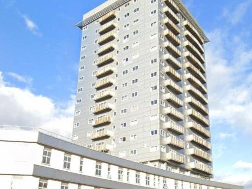 2 bedroom flat for sale in The Horizon, LE1 — £93,000 • 2 bed • 1 bath • 698 ft²
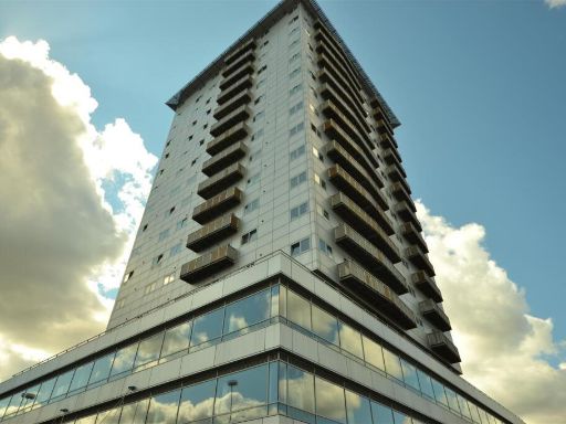 1 bedroom flat for sale in Navigation Street, City Centre, LE1 — £80,000 • 1 bed • 1 bath • 528 ft²
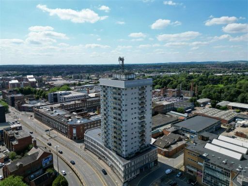 2 bedroom apartment for sale in Navigation Street, Leicester, LE1 3UN, LE1 — £95,000 • 2 bed • 1 bath • 711 ft²
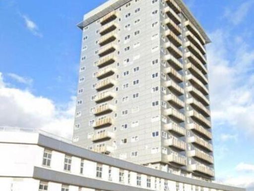 1 bedroom flat for sale in Apartment 23 The Horizon, 2 Navigation Street, Leicester, Leicestershire, LE1 3UJ, LE1 — £65,000 • 1 bed • 1 bath • 334 ft²
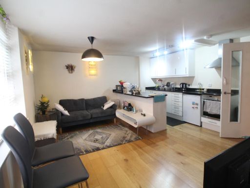 1 bedroom apartment for sale in The Cherub Building, Colton Street, Leicester, Leicestershire, LE1 — £119,995 • 1 bed • 1 bath • 756 ft²
Meta
- {
"@context": "https://schema.org",
"@type": "Residence",
"name": "1 bedroom apartment for sale in Navigation Street, City Cen…",
"description": "",
"url": "https://propertypiper.co.uk/property/a0316a45-7f77-4a20-8baa-0a345b719fd1",
"image": "https://image-a.propertypiper.co.uk/5a3596e7-5f39-4dcc-afbf-f3614bdee921-1024.jpeg",
"address": {
"@type": "PostalAddress",
"streetAddress": "Apartment 93 The Horizon, 2, Navigation Street",
"postalCode": "LE1 3UN",
"addressLocality": "Leicester",
"addressRegion": "Leicester West",
"addressCountry": "England"
},
"geo": {
"@type": "GeoCoordinates",
"latitude": 52.64152779440155,
"longitude": -1.1313253827275653
},
"numberOfRooms": 1,
"numberOfBathroomsTotal": 1,
"floorSize": {
"@type": "QuantitativeValue",
"value": 539,
"unitCode": "FTK"
},
"offers": {
"@type": "Offer",
"price": 85000,
"priceCurrency": "GBP",
"availability": "https://schema.org/InStock"
},
"additionalProperty": [
{
"@type": "PropertyValue",
"name": "Feature",
"value": "apartment building"
},
{
"@type": "PropertyValue",
"name": "Feature",
"value": "high-rise"
},
{
"@type": "PropertyValue",
"name": "Feature",
"value": "Brutalist"
},
{
"@type": "PropertyValue",
"name": "Feature",
"value": "urban"
},
{
"@type": "PropertyValue",
"name": "Feature",
"value": "concrete"
},
{
"@type": "PropertyValue",
"name": "Feature",
"value": "city center"
},
{
"@type": "PropertyValue",
"name": "Feature",
"value": "residential"
},
{
"@type": "PropertyValue",
"name": "Feature",
"value": "multi-story"
},
{
"@type": "PropertyValue",
"name": "Feature",
"value": "apartments"
},
{
"@type": "PropertyValue",
"name": "Feature",
"value": "urban"
},
{
"@type": "PropertyValue",
"name": "Feature",
"value": "cityscape"
},
{
"@type": "PropertyValue",
"name": "Feature",
"value": "road"
},
{
"@type": "PropertyValue",
"name": "Feature",
"value": "architecture"
},
{
"@type": "PropertyValue",
"name": "Feature",
"value": "apartment"
},
{
"@type": "PropertyValue",
"name": "Feature",
"value": "high-rise"
},
{
"@type": "PropertyValue",
"name": "Feature",
"value": "balcony"
},
{
"@type": "PropertyValue",
"name": "Feature",
"value": "modern"
}
]
}
High Res Floorplan Images
Compatible Floorplan Images
FloorplanImages Thumbnail