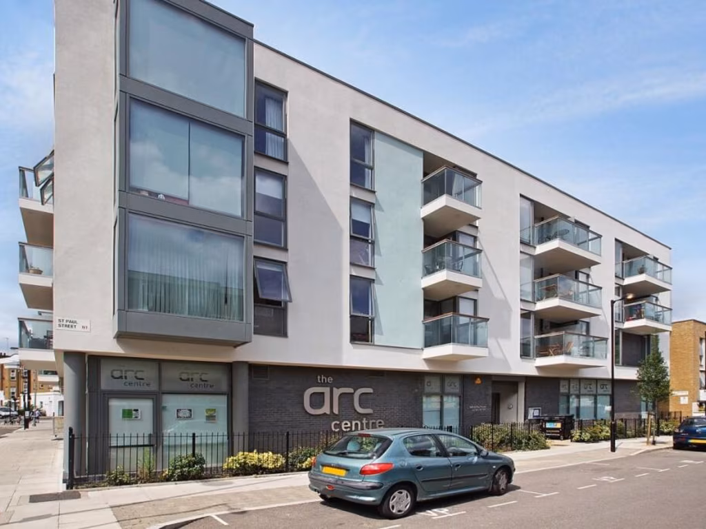
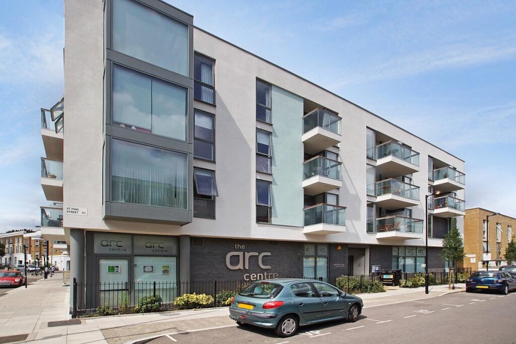
N1 7FZ - 1 bedroom apartment for sale in Packington Street, London,…
View on Property Piper
1 bedroom apartment for sale in Packington Street, London, N1
Property Details
- Price: £425000
- Bedrooms: 1
- Bathrooms: 1
- Property Type: undefined
- Property SubType: undefined
Image Descriptions
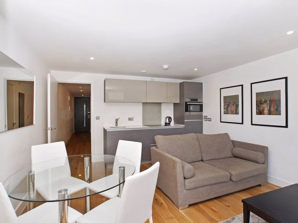
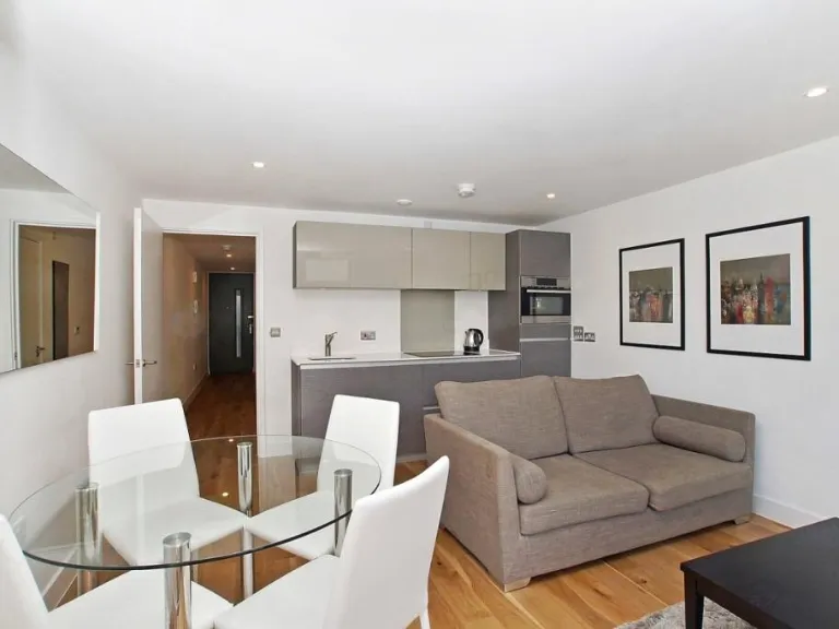
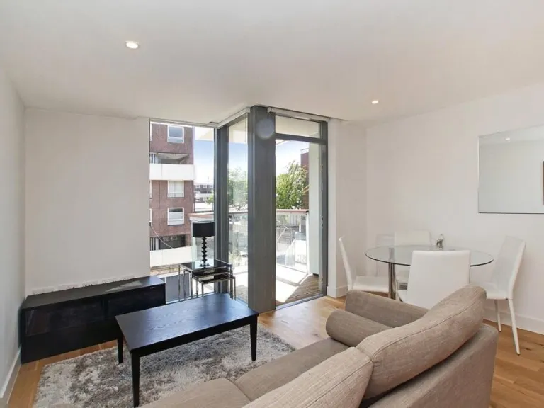
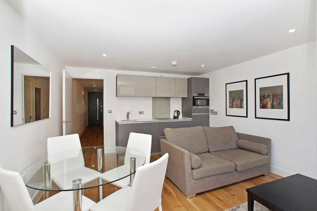
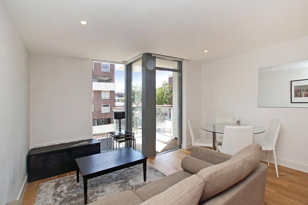
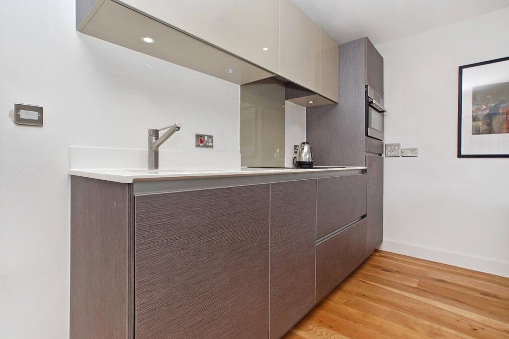
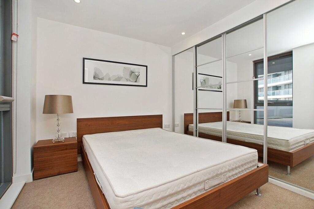
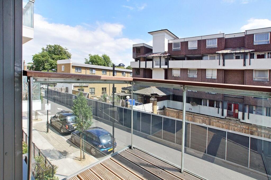
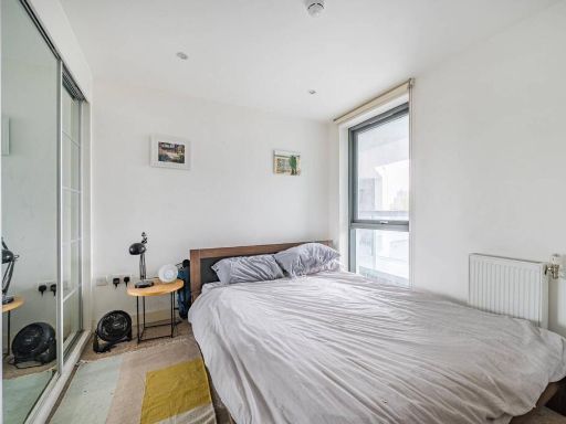
- modern apartment living room Contemporary
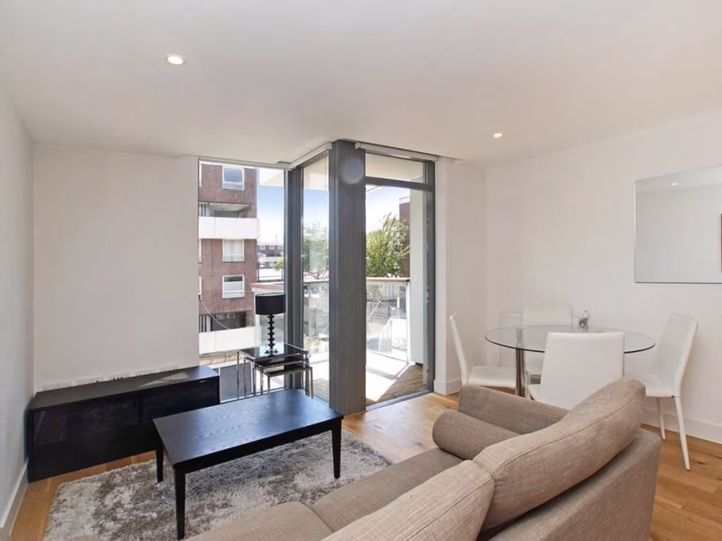
- living room modern
Floorplan Description
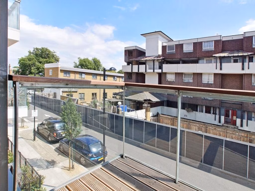
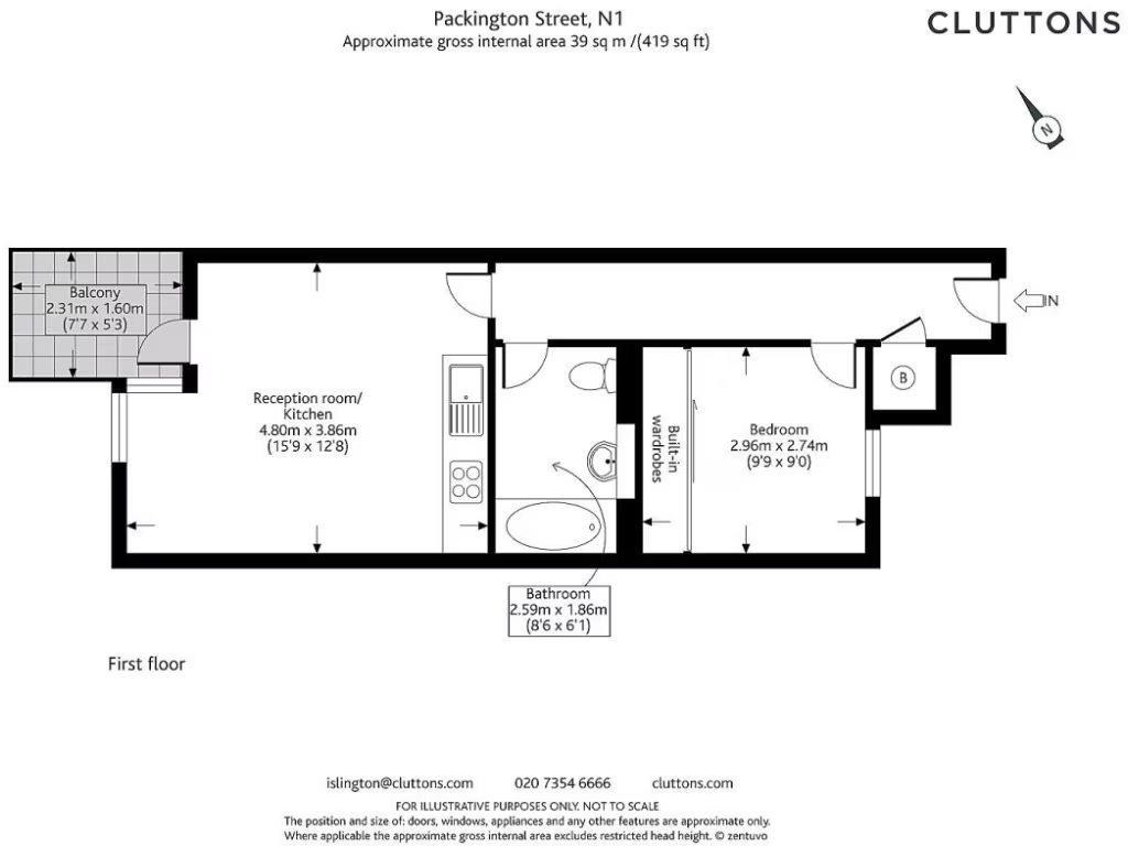
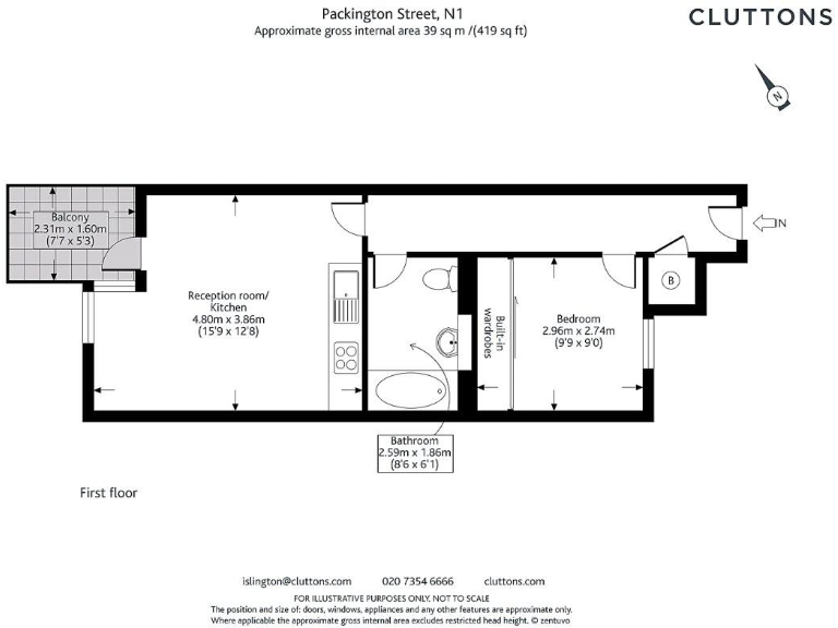
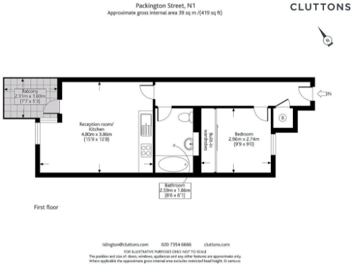
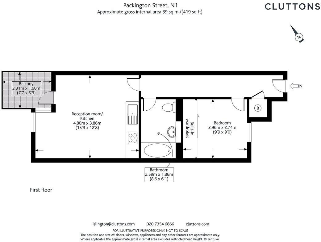
- First-floor one-bedroom flat with reception/kitchen, bathroom and balcony
Rooms
- Reception room/ Kitchen:
- Bedroom:
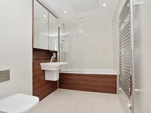
- Bathroom:
- Balcony:
Textual Property Features
Detected Visual Features
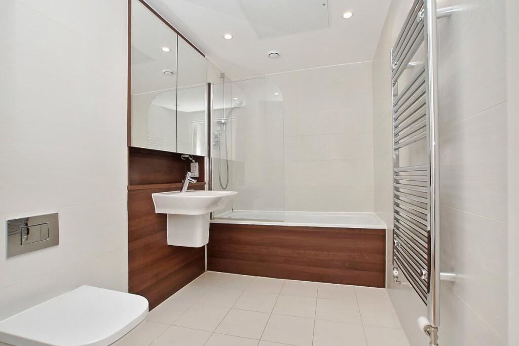
- modern apartment
- contemporary
- open-plan
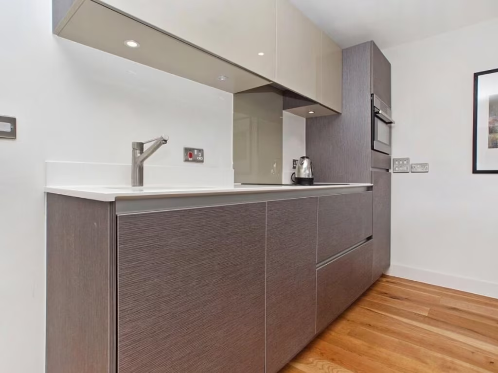
- integrated kitchen
- hardwood flooring
- white walls
- urban living
- living room
- balcony
- city view
- clean space
- natural light
EPC Details
- Fully double glazed
- System built, as built, insulated (assumed)
- Community scheme
- Low energy lighting in all fixed outlets
- (another dwelling below)
Nearby Schools
- St Luke's CofE Primary School
- City of London Academy, Shoreditch Park
- City of London Academy Islington
- St Mary's CofE Primary School
- St Paul's Steiner School
- Dallington School
- Hugh Myddelton Primary School
- Moreland Primary School
- The ArtsXchange
- St John the Baptist Voluntary Aided Church of England Primary School
- St John Evangelist RC Primary School
- The New North Academy
- Canonbury Primary School
- St Peter and St Paul Catholic Primary School
- Thomas Fairchild Community School
- Rosemary Works School
- North Bridge House Senior Canonbury School
- London Scandinavian School
- City of London Primary Academy, Islington
- Hanover Primary School
- Shoreditch Park Primary School
- Rotherfield Primary School
- William Tyndale Primary School
- Laycock Primary School
- City of London Academy Highbury Grove
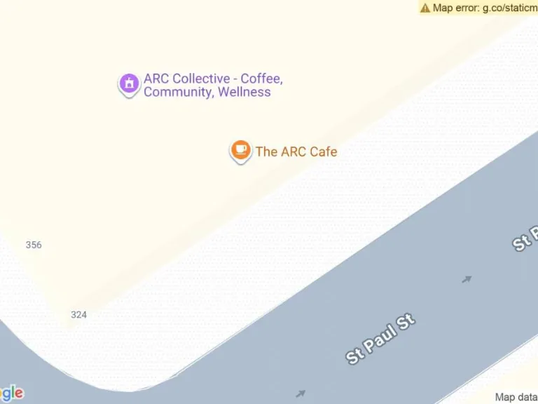
Nearest Bars And Restaurants
- Id: 10092511647
- Tags:
- Addr:
- City: London
- Housenumber: 33
- Postcode: N1 7DU
- Street: Linton Street
- Amenity: pub
- Brewery: madri;birra_moretti;guinness
- Name: The Hanbury
- Opening_hours: Mo 15:00-22:00; Tu-Th 12:00-22:00; Fr-Sa 12:00-23:00; Su 12:00-22:00
- Website: https://www.thehanbury.co.uk/
- TagsNormalized:
- Lat: 51.5361093
- Lon: -0.0934055
- FullGeoHash: gcpvjvggx7pf
- PartitionGeoHash: gcpv
- Images:
- FoodStandards: null
- Distance: 189.7
,- Id: 815398933
- Tags:
- Addr:
- Housenumber: 39
- Postcode: N1 8NQ
- Street: Queen's Head Street
- Amenity: pub
- Comedy: yes
- Name: The Bill Murray
- Website: https://www.angelcomedy.co.uk/
- TagsNormalized:
- Lat: 51.5362508
- Lon: -0.0988191
- FullGeoHash: gcpvjvbh3m7n
- PartitionGeoHash: gcpv
- Images:
- FoodStandards: null
- Distance: 187.2
,- Id: 390556647
- Tags:
- Addr:
- City: London
- Housenumber: 1a
- Postcode: N1 8NT
- Street: Rheidol Terrace
- Amenity: restaurant
- Cuisine: japanese
- Email: info@taru.uk
- Name: Taru
- Old_name: Snack Box
- Website: https://www.taru.uk/
- TagsNormalized:
- Lat: 51.5352163
- Lon: -0.0975051
- FullGeoHash: gcpvjv8yruwg
- PartitionGeoHash: gcpv
- Images:
- FoodStandards: null
- Distance: 128.4
,- Id: 306036143
- Tags:
- Amenity: cafe
- Created_by: Potlatch 0.10e
- Cuisine: italian
- Name: Saponara
- TagsNormalized:
- Lat: 51.5369333
- Lon: -0.0962864
- FullGeoHash: gcpvjy1bkkew
- PartitionGeoHash: gcpv
- Images:
- FoodStandards: null
- Distance: 104.2
,- Id: 9083718817
- Tags:
- Amenity: cafe
- Name: Pophams
- TagsNormalized:
- Lat: 51.536851
- Lon: -0.0963384
- FullGeoHash: gcpvjvczgjkg
- PartitionGeoHash: gcpv
- Images:
- FoodStandards: null
- Distance: 95.5
}
Nearest General Shops
- Id: 814275654
- Tags:
- Brand: Ladbrokes
- Brand:wikidata: Q1799875
- Name: Ladbrokes
- Shop: bookmaker
- TagsNormalized:
- Lat: 51.5337386
- Lon: -0.0978797
- FullGeoHash: gcpvjv2tz1ps
- PartitionGeoHash: gcpv
- Images:
- FoodStandards: null
- Distance: 278.8
,- Id: 390356899
- Tags:
- Name: Prebend Express
- Shop: newsagent
- TagsNormalized:
- Lat: 51.5368851
- Lon: -0.0963156
- FullGeoHash: gcpvjy1b5ety
- PartitionGeoHash: gcpv
- Images:
- FoodStandards: null
- Distance: 99
,- Id: 390356900
- Tags:
- Name: Ferretti
- Shop: butcher
- TagsNormalized:
- Lat: 51.5367854
- Lon: -0.0963779
- FullGeoHash: gcpvjvczd1p7
- PartitionGeoHash: gcpv
- Images:
- FoodStandards: null
- Distance: 88.7
}
Nearest Grocery shops
- Id: 299614297
- Tags:
- Addr:
- Housenumber: 78
- Street: Essex Road
- Name: Essex Food and Wine
- Shop: convenience
- TagsNormalized:
- Lat: 51.5382452
- Lon: -0.0990696
- FullGeoHash: gcpvjwrb590r
- PartitionGeoHash: gcpv
- Images:
- FoodStandards: null
- Distance: 321.3
,- Id: 279580541
- Tags:
- Name: SRH News
- Shop: convenience
- Source: survey
- TagsNormalized:
- Lat: 51.5366315
- Lon: -0.0932406
- FullGeoHash: gcpvjvunek6v
- PartitionGeoHash: gcpv
- Images:
- FoodStandards: null
- Distance: 212.7
,- Id: 2682305534
- Tags:
- Contact:
- Website: https://stores.welcome-stores.co.uk/london/london/47-49-packington-street.html
- Name: Welcome
- Opening_hours: Mo-Su 07:00-22:00
- Shop: convenience
- TagsNormalized:
- Lat: 51.5361997
- Lon: -0.0963297
- FullGeoHash: gcpvjvcu57gm
- PartitionGeoHash: gcpv
- Images:
- FoodStandards: null
- Distance: 25.6
}
Nearest Religious buildings
- Id: 41832367
- Tags:
- Amenity: place_of_worship
- Building: yes
- Denomination: baptist
- Name: Cross Street Baptist Church
- Religion: christian
- TagsNormalized:
- place of worship
- baptist
- church
- christian
- Lat: 51.539023
- Lon: -0.0997088
- FullGeoHash: gcpvjwrksd5x
- PartitionGeoHash: gcpv
- Images:
- FoodStandards: null
- Distance: 416.8
,- Id: 44130630
- Tags:
- Amenity: place_of_worship
- Building: church
- Denomination: roman_catholic
- Name: Our Lady of Czestochowa
- Religion: christian
- TagsNormalized:
- place of worship
- church
- catholic
- roman catholic
- christian
- Lat: 51.5341403
- Lon: -0.1007434
- FullGeoHash: gcpvjtw8hs03
- PartitionGeoHash: gcpv
- Images:
- FoodStandards: null
- Distance: 379.5
,- Id: 34064925
- Tags:
- Amenity: place_of_worship
- Building: church
- Denomination: anglican
- Name: St James
- Religion: christian
- Wikidata: Q18161928
- TagsNormalized:
- place of worship
- church
- anglican
- christian
- Lat: 51.5371528
- Lon: -0.095722
- FullGeoHash: gcpvjy439t8e
- PartitionGeoHash: gcpv
- Images:
- FoodStandards: null
- Distance: 131.4
}
Nearest Medical buildings
- Id: 504921234
- Tags:
- Addr:
- Housenumber: 16
- Postcode: N1 8JG
- Street: St Peter's Street
- Amenity: doctors
- Healthcare: doctor
- Name: St Peters Street Medical Practice
- Phone: +44 844 477 8717
- TagsNormalized:
- doctor
- doctors
- health
- healthcare
- Lat: 51.5356955
- Lon: -0.1009449
- FullGeoHash: gcpvjty3pvfn
- PartitionGeoHash: gcpv
- Images:
- FoodStandards: null
- Distance: 333.8
,- Id: 390556694
- Tags:
- Amenity: pharmacy
- Healthcare: pharmacy
- Name: St Peter's Pharmacy
- TagsNormalized:
- Lat: 51.5347163
- Lon: -0.0984536
- FullGeoHash: gcpvjv873z7t
- PartitionGeoHash: gcpv
- Images:
- FoodStandards: null
- Distance: 214.3
,- Id: 306035966
- Tags:
- Amenity: pharmacy
- Dispensing: yes
- Healthcare: pharmacy
- Name: Benzpharm
- TagsNormalized:
- Lat: 51.5368353
- Lon: -0.0963483
- FullGeoHash: gcpvjvczffmt
- PartitionGeoHash: gcpv
- Images:
- FoodStandards: null
- Distance: 93.9
,- Id: 306034565
- Tags:
- Amenity: doctors
- Healthcare: doctor
- Name: Prebend Street Surgery
- Opening_hours: Mo-Tu,Th-Fr 09:30-13:00,17:00-19:00; We 09:30-13:00
- Phone: +44 20 7226 9090
- Postal_code: N1 8PG
- TagsNormalized:
- doctor
- doctors
- health
- healthcare
- surgery
- Lat: 51.53662
- Lon: -0.0964775
- FullGeoHash: gcpvjvcwxfm1
- PartitionGeoHash: gcpv
- Images:
- FoodStandards: null
- Distance: 72.6
}
Nearest Airports
- Id: 121158889
- Tags:
- Aerodrome: continental
- Aeroway: aerodrome
- Fhrs:
- Authority: City of London Corporation
- Iata: LCY
- Icao: EGLC
- Name: London City Airport
- Operator: London City Airport Limited
- Ref: LCY
- Website: https://www.londoncityairport.com/
- Wikidata: Q8982
- Wikipedia: en:London City Airport
- TagsNormalized:
- airport
- continental airport
- Lat: 51.5042658
- Lon: 0.0539987
- FullGeoHash: u10j10p64702
- PartitionGeoHash: u10j
- Images:
- FoodStandards: null
- Distance: 10971.3
,- Id: 14001268
- Tags:
- Access: yes
- Aerodrome: international
- Aerodrome:type: public
- Aeroway: aerodrome
- Alt_name: London Heathrow
- Alt_name_2: London Heathrow Airport
- Ele: 25
- Iata: LHR
- Icao: EGLL
- Int_name: Heathrow Airport
- Name: London Heathrow Airport
- Note: area still approx
- Old_name: London Airport
- Operator: Heathrow Airport Limited
- Rank_aci:
- Ref: LHR
- Short_name: Heathrow
- Type: multipolygon
- Website: https://www.heathrow.com/
- Wikidata: Q8691
- Wikipedia: en:Heathrow Airport
- TagsNormalized:
- airport
- international airport
- Lat: 51.4677522
- Lon: -0.4547736
- FullGeoHash: gcpsv9kv7h2h
- PartitionGeoHash: gcps
- Images:
- FoodStandards: null
- Distance: 25957.6
}
Nearest Leisure Facilities
- Id: 34082365
- Tags:
- TagsNormalized:
- Lat: 51.5354064
- Lon: -0.0972237
- FullGeoHash: gcpvjv9pw80c
- PartitionGeoHash: gcpv
- Images:
- FoodStandards: null
- Distance: 99.8
,- Id: 711128477
- Tags:
- Leisure: pitch
- Note: Only one basketball hoop
- Sport: basketball
- Surface: asphalt
- TagsNormalized:
- pitch
- leisure
- basketball
- sports
- Lat: 51.5351957
- Lon: -0.0955255
- FullGeoHash: gcpvjvdqq0g0
- PartitionGeoHash: gcpv
- Images:
- FoodStandards: null
- Distance: 99.2
,- Id: 546522447
- Tags:
- Leisure: garden
- Website: http://www.parksandgardens.org/places-and-people/site/8855
- TagsNormalized:
- Lat: 51.5368658
- Lon: -0.095824
- FullGeoHash: gcpvjy40p0h7
- PartitionGeoHash: gcpv
- Images:
- FoodStandards: null
- Distance: 98.7
,- Id: 475555011
- Tags:
- Leisure: park
- Name: Packington Square
- TagsNormalized:
- Lat: 51.5353282
- Lon: -0.0956127
- FullGeoHash: gcpvjvdrh16p
- PartitionGeoHash: gcpv
- Images:
- FoodStandards: null
- Distance: 83.3
,- Id: 959125796
- Tags:
- Access: yes
- Leisure: playground
- TagsNormalized:
- Lat: 51.535356
- Lon: -0.0957311
- FullGeoHash: gcpvjvdr1q9t
- PartitionGeoHash: gcpv
- Images:
- FoodStandards: null
- Distance: 77.2
}
Nearest Tourist attractions
- Id: 10142424090
- Tags:
- Name: Kasama Potters
- Tourism: gallery
- Website: https://www.kasamapotters.com/
- TagsNormalized:
- Lat: 51.5384046
- Lon: -0.1030854
- FullGeoHash: gcpvjwkbvyvy
- PartitionGeoHash: gcpv
- Images:
- FoodStandards: null
- Distance: 549.5
,- Id: 4712977392
- Tags:
- Addr:
- Housenumber: 1
- Street: Shillingford Street
- Name: Lie Lie Land
- Opening_hours: 24/7
- Tourism: museum
- TagsNormalized:
- Lat: 51.5392769
- Lon: -0.1010821
- FullGeoHash: gcpvjwqqh9ed
- PartitionGeoHash: gcpv
- Images:
- FoodStandards: null
- Distance: 499.4
,- Id: 9866715620
- Tags:
- Addr:
- City: London
- Housenumber: 84
- Street: St. Peter's Street
- Name: Art Space Gallery
- Tourism: gallery
- Website: https://www.artspacegallery.co.uk/
- TagsNormalized:
- Lat: 51.5332726
- Lon: -0.0974104
- FullGeoHash: gcpvjv3544m9
- PartitionGeoHash: gcpv
- Images:
- FoodStandards: null
- Distance: 315.8
}
Nearest Train stations
- Id: 7147509511
- Tags:
- Addr:
- City: London
- Country: GB
- Postcode: N1 2PG
- Street: Wallace Road
- Alt_name: Canonbury ELL
- Landuse: railway
- Line: Overground
- Name: Canonbury
- Name:fr: Gare de Canonbury
- Naptan:
- Network: London Overground
- Operator: London Overground
- Platforms: 4
- Public_transport: station
- Railway: station
- Ref:
- Source: Survey of 2015-09-23
- Source:network: Sign
- Source_ref: http://en.wikipedia.org/wiki/List_of_London_railway_stations;http://en.wikipedia.org/wiki/London_Overground#Stations
- Wheelchair: limited
- Wheelchair:description: Board the train using a staff-operated ramp.
- Wikidata: Q800611
- Wikipedia: en:Canonbury railway station
- TagsNormalized:
- Lat: 51.5485632
- Lon: -0.0930239
- FullGeoHash: gcpvmbhk0ksm
- PartitionGeoHash: gcpv
- Images:
- FoodStandards: null
- Distance: 1413.4
,- Id: 70804547
- Tags:
- Addr:
- City: London
- Street: Old Street
- Fare_zone: 1
- Line: Northern City;Northern
- Name: Old Street
- Name:da: Old Street Station
- Name:ru: Олд-стрит
- Naptan:
- Network: National Rail;London Underground
- Network:subway: London Underground
- Network:train: National Rail
- Operator: London Underground
- Public_transport: station
- Railway: station
- Ref:
- Source_ref: http://en.wikipedia.org/wiki/List_of_London_railway_stations
- Station: subway
- Subway: yes
- Train: yes
- Wheelchair: no
- Wheelchair:description: Steps between lower Northern & higher National Rail station levels. No Lifts.
- Wikidata: Q801299
- Wikipedia: en:Old Street station
- TagsNormalized:
- station
- railway
- subway
- train
- Lat: 51.5256284
- Lon: -0.0876094
- FullGeoHash: gcpvn5bnw939
- PartitionGeoHash: gcpv
- Images:
- FoodStandards: null
- Distance: 1295.7
,- Id: 6414163635
- Tags:
- Addr:
- City: London
- Country: GB
- Housename: Highbury & Islington Station
- Postcode: N5 1RA
- Street: Holloway Road
- Alt_name: Highbury and Islington ELL
- Fare_zone: 2
- Internet_access: wlan
- Internet_access:fee: partial
- Line: Overground;Victoria
- Name: Highbury & Islington
- Name:el: Χίβυρή & Ίσλινγκτον
- Naptan:
- Network: National Rail;London Underground;London Overground
- Operator: London Underground
- Platforms: 8
- Public_transport: station
- Railway: station
- Ref:
- Source: survey
- Station: subway
- Subway: yes
- Website: http://www.nationalrail.co.uk/stations_destinations/HHY.aspx
- Website:overground: https://tfl.gov.uk/overground/stop/910GHGHI/highbury-islington-rail-station
- Website:tube: https://tfl.gov.uk/tube/stop/940GZZLUHAI/highbury-islington-underground-station
- Wheelchair: limited
- Wheelchair:description: Level street access. Lifts from concourse to Overground platforms (1,2,7,8) + portable ramps. Escalators, then stairs to Victoria and GN platforms (3,4,5,6) No interchange underground.
- Wikidata: Q800922
- Wikipedia: en:Highbury & Islington station
- TagsNormalized:
- Lat: 51.5463679
- Lon: -0.1036544
- FullGeoHash: gcpvjxsx2emt
- PartitionGeoHash: gcpv
- Images:
- Q800922-1
- Q800922-2
- Q800922-3
- FoodStandards: null
- Distance: 1264.4
,- Id: 1670707904
- Tags:
- Addr:
- City: London
- Postcode: N1 9LQ
- Street: Islington High Street
- Fare_zone: 1
- Internet_access: wlan
- Line: Northern
- Name: Angel
- Name:da: Angel Station
- Name:ru: Энджел
- Naptan:
- Network: London Underground
- Operator: London Underground
- Public_transport: station
- Railway: station
- Source_ref: http://en.wikipedia.org/wiki/List_of_London_Underground_stations
- Station: subway
- Subway: yes
- Wheelchair: no
- Wikidata: Q531444
- Wikipedia: en:Angel tube station
- TagsNormalized:
- Lat: 51.5324874
- Lon: -0.1060356
- FullGeoHash: gcpvjt4y3pyj
- PartitionGeoHash: gcpv
- Images:
- FoodStandards: null
- Distance: 787.9
,- Id: 7158669749
- Tags:
- Name: Essex Road
- Naptan:
- Network: National Rail
- Operator: Great Northern
- Public_transport: station
- Railway: station
- Ref:
- Source_ref: http://en.wikipedia.org/wiki/List_of_London_railway_stations
- Toilets:
- Train: yes
- Wheelchair: no
- Wikidata: Q682124
- Wikipedia: en:Essex Road railway station
- TagsNormalized:
- Lat: 51.5407328
- Lon: -0.0961859
- FullGeoHash: gcpvjy9yw8yw
- PartitionGeoHash: gcpv
- Images:
- FoodStandards: null
- Distance: 526.2
}
Nearest Hotels
- Id: 38965896
- Tags:
- Addr:
- City: London
- Postcode: EC1V 8DS
- Street: Central Street
- Building: yes
- Building:levels: 7
- Contact:
- Phone: +44 871 3769004
- Website: http://www.thistle.com/en/hotels/united_kingdom/london/thistle_city_barbican/index.html
- Name: Thistle City Barbican Hotel
- Roof:
- Stars: 4
- Tourism: hotel
- Wheelchair: yes
- TagsNormalized:
- Lat: 51.5275038
- Lon: -0.0959186
- FullGeoHash: gcpvju61kyvu
- PartitionGeoHash: gcpv
- Images:
- FoodStandards: null
- Distance: 945
,- Id: 44105061
- Tags:
- Building: yes
- Name: St Mark's Apartments
- Operator: Citadines
- Smoking: outside
- Source: My experience
- Tourism: hotel
- TagsNormalized:
- Lat: 51.5297753
- Lon: -0.0988689
- FullGeoHash: gcpvju8n8nq4
- PartitionGeoHash: gcpv
- Images:
- FoodStandards: null
- Distance: 717.5
,- Id: 102273815
- Tags:
- Addr:
- City: London
- Housenumber: 53
- Postcode: N1 0UY
- Street: Upper Street
- Suburb: Islington
- Brand: Hilton
- Brand:wikidata: Q598884
- Brand:wikipedia: en:Hilton Hotels & Resorts
- Building: yes
- Building:levels: 2
- Contact:
- Facebook: https://www.facebook.com/HiltonIslington
- Twitter: https://twitter.com/hiltonislington
- Email: lonis_Islington@hilton.com
- Fhrs:
- Internet_access: wlan
- Internet_access:fee: yes
- Name: Hilton London Angel Islington
- Operator: Hilton
- Phone: +44 20 7354 7700
- Rooms: 188
- Smoking: no
- Source:
- Stars: 4
- Tourism: hotel
- Website: https://www.hilton.com/en/hotels/lonishn-hilton-london-angel-islington/
- TagsNormalized:
- Lat: 51.5361195
- Lon: -0.1047507
- FullGeoHash: gcpvjtgexhup
- PartitionGeoHash: gcpv
- Images:
- FoodStandards: null
- Distance: 595.5
}
Tags
- modern apartment
- contemporary
- open-plan
- integrated kitchen
- hardwood flooring
- white walls
- urban living
- modern apartment
- living room
- balcony
- city view
- clean space
- natural light
Local Market Stats
- Average Price/sqft: £934
- Avg Income: £64300
- Rental Yield: 4.5%
- Social Housing: 37%
- Planning Success Rate: 71%
AirBnB Data
- 1km average: £161/night
- Listings in 1km: 150
Similar Properties
 1 bedroom flat for sale in Prebend Street, N1, Islington, London, N1 — £475,000 • 1 bed • 1 bath • 507 ft²
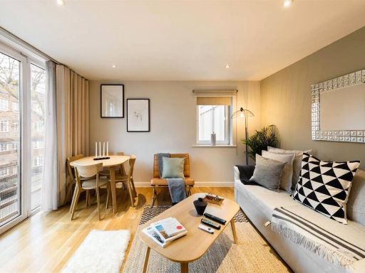 1 bedroom apartment for sale in Coleman Fields, London, N1 — £450,000 • 1 bed • 1 bath • 535 ft²
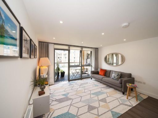 1 bedroom flat for sale in Arlington Avenue, London, N1 — £500,000 • 1 bed • 1 bath • 453 ft²
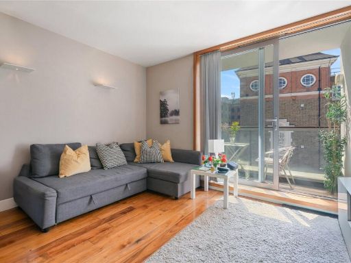 1 bedroom apartment for sale in White Lion Street, Islington, London, N1 — £550,000 • 1 bed • 1 bath • 550 ft²
 1 bedroom flat for sale in Canalside Square,
Islington, N1 — £550,000 • 1 bed • 1 bath • 556 ft²
1 bedroom flat for sale in Canalside Square,
Islington, N1 — £550,000 • 1 bed • 1 bath • 556 ft²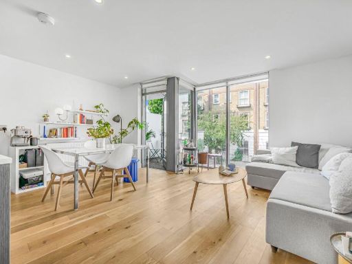 1 bedroom flat for sale in Prebend Street,
Islington, N1 — £475,000 • 1 bed • 1 bath • 515 ft²
1 bedroom flat for sale in Prebend Street,
Islington, N1 — £475,000 • 1 bed • 1 bath • 515 ft²
Meta
- {
"@context": "https://schema.org",
"@type": "Residence",
"name": "1 bedroom apartment for sale in Packington Street, London,…",
"description": "",
"url": "https://propertypiper.co.uk/property/9d958492-d70d-461f-9d5f-2c07018f3d6e",
"image": "https://image-a.propertypiper.co.uk/87b42325-4cfe-4b16-86f7-f58f8fc6c442-1024.jpeg",
"address": {
"@type": "PostalAddress",
"streetAddress": "Packington Street, N1",
"postalCode": "N1 7FZ",
"addressLocality": "Islington",
"addressRegion": "Islington South and Finsbury",
"addressCountry": "England"
},
"geo": {
"@type": "GeoCoordinates",
"latitude": 51.5360009,
"longitude": -0.0961432
},
"numberOfRooms": 1,
"numberOfBathroomsTotal": 1,
"floorSize": {
"@type": "QuantitativeValue",
"value": 419,
"unitCode": "FTK"
},
"offers": {
"@type": "Offer",
"price": 425000,
"priceCurrency": "GBP",
"availability": "https://schema.org/InStock"
},
"additionalProperty": [
{
"@type": "PropertyValue",
"name": "Feature",
"value": "modern apartment"
},
{
"@type": "PropertyValue",
"name": "Feature",
"value": "contemporary"
},
{
"@type": "PropertyValue",
"name": "Feature",
"value": "open-plan"
},
{
"@type": "PropertyValue",
"name": "Feature",
"value": "integrated kitchen"
},
{
"@type": "PropertyValue",
"name": "Feature",
"value": "hardwood flooring"
},
{
"@type": "PropertyValue",
"name": "Feature",
"value": "white walls"
},
{
"@type": "PropertyValue",
"name": "Feature",
"value": "urban living"
},
{
"@type": "PropertyValue",
"name": "Feature",
"value": "modern apartment"
},
{
"@type": "PropertyValue",
"name": "Feature",
"value": "living room"
},
{
"@type": "PropertyValue",
"name": "Feature",
"value": "balcony"
},
{
"@type": "PropertyValue",
"name": "Feature",
"value": "city view"
},
{
"@type": "PropertyValue",
"name": "Feature",
"value": "clean space"
},
{
"@type": "PropertyValue",
"name": "Feature",
"value": "natural light"
}
]
}
High Res Floorplan Images
Compatible Floorplan Images
FloorplanImages Thumbnail