BN16 4EJ - 4 bedroom detached house for sale in Langmead Place, Angmer…
View on Property Piper
4 bedroom detached house for sale in Langmead Place,
Angmering,
Littlehampton,
BN16 4EJ, BN16
Property Details
- Price: £529995
- Bedrooms: 4
- Bathrooms: 1
- Property Type: undefined
- Property SubType: undefined
Brochure Descriptions
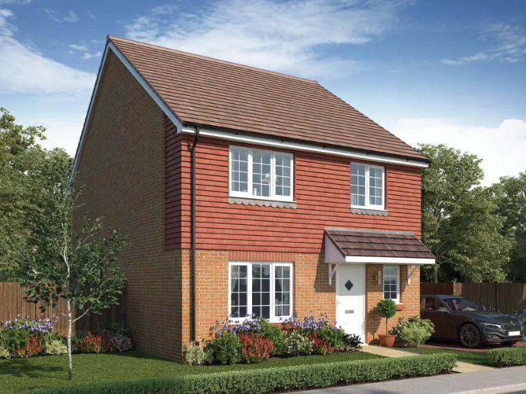
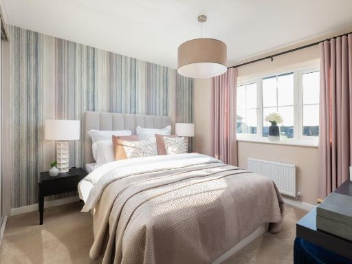
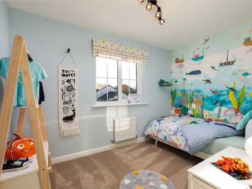
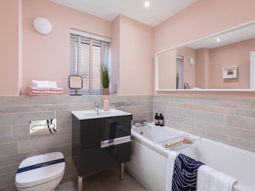
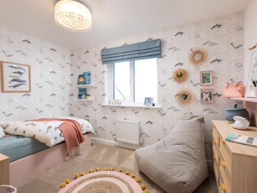
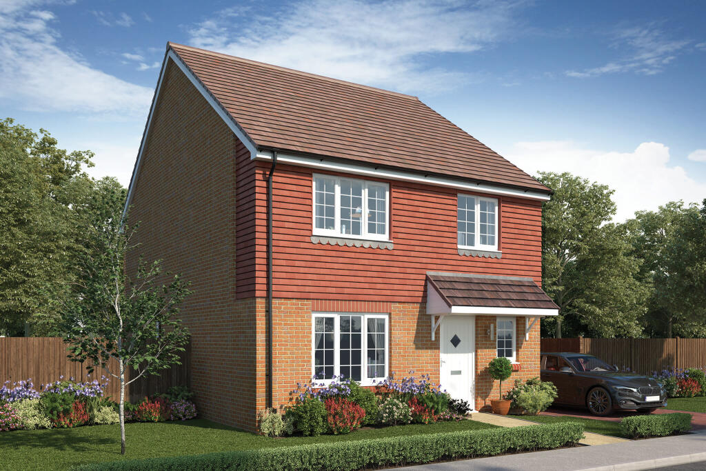
- Detached two-storey four-bedroom family house presented as a modern suburban home. Construction features a pitched, tiled roof, brick ground floor with tile-hanging/clad first floor, a small gabled porch over the front door and uPVC-style framed windows. The property sits on a modest plot with a formal front lawn and low hedge, planted borders and a single-car driveway/parking space to the side. Garden and immediate surroundings appear typical of a residential estate with mature trees visible beyond the rear boundary — no exceptional views (sea/river/city) are evident. Room and garden sizes inferred from the façade: internal living space and plot are medium for a four-bedroom detached property; front garden is small, rear garden likely average but cannot be seen in full. Overall valuation notes: a well-proportioned, modern family home suitable for a young family, offering conventional accommodation and kerb appeal consistent with recent suburban new-builds.
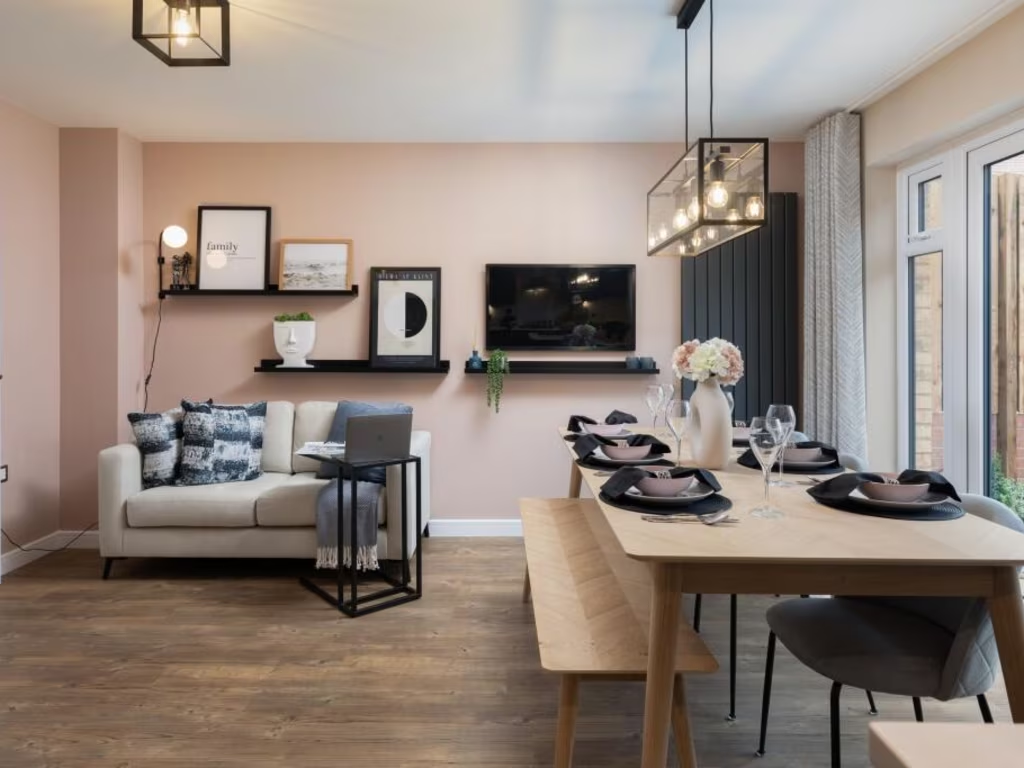
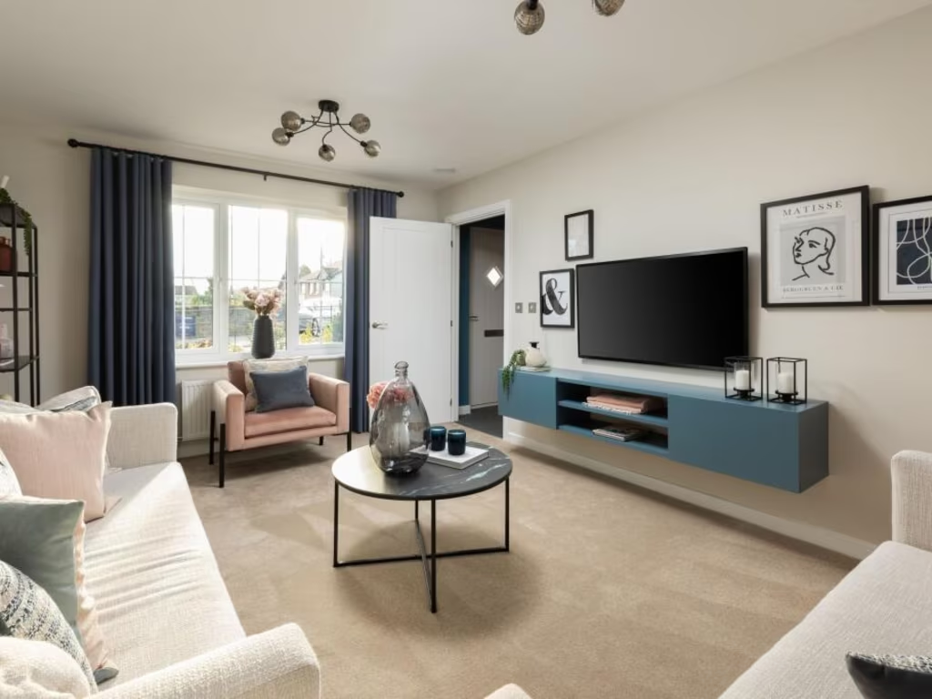
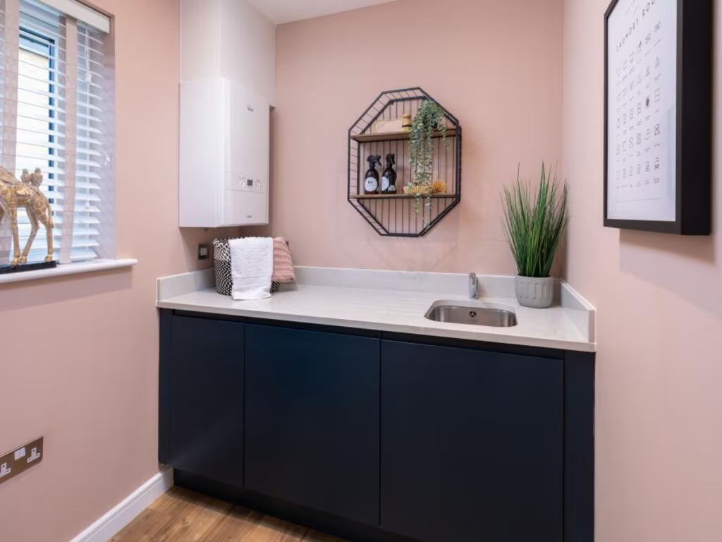
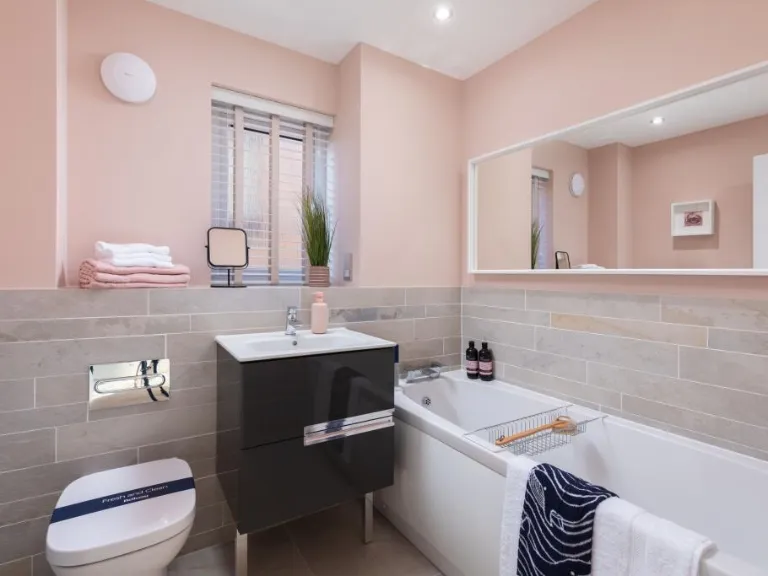
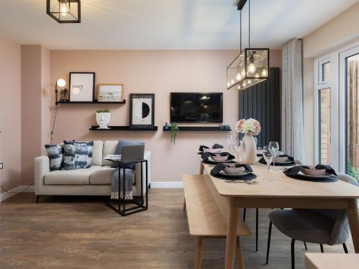
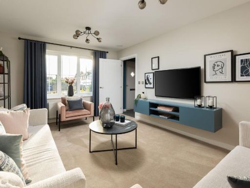
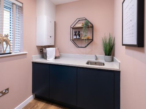
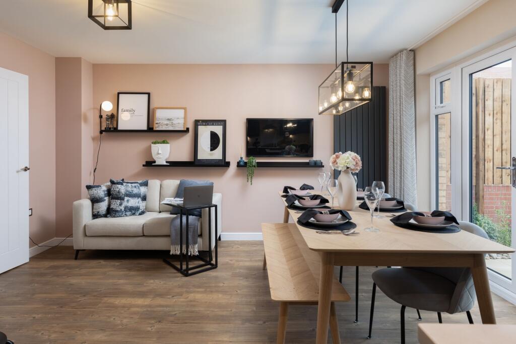
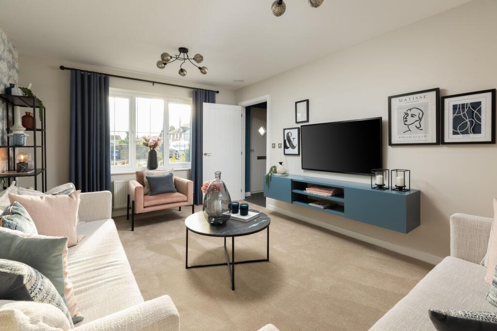
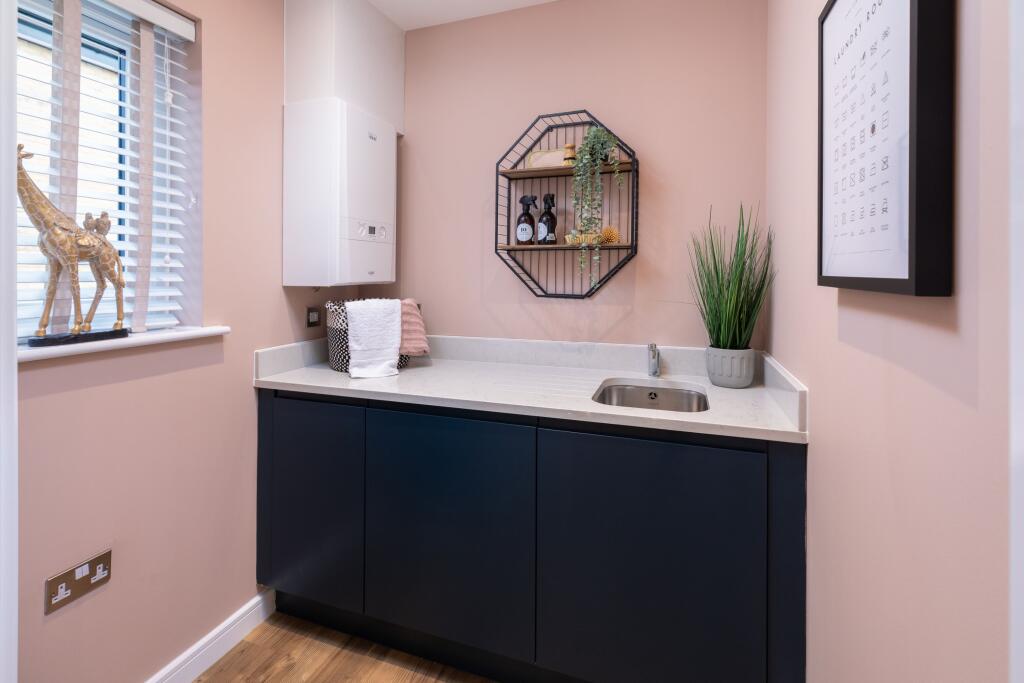
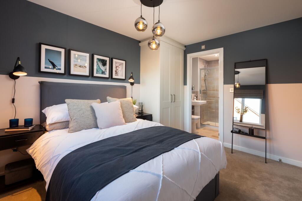
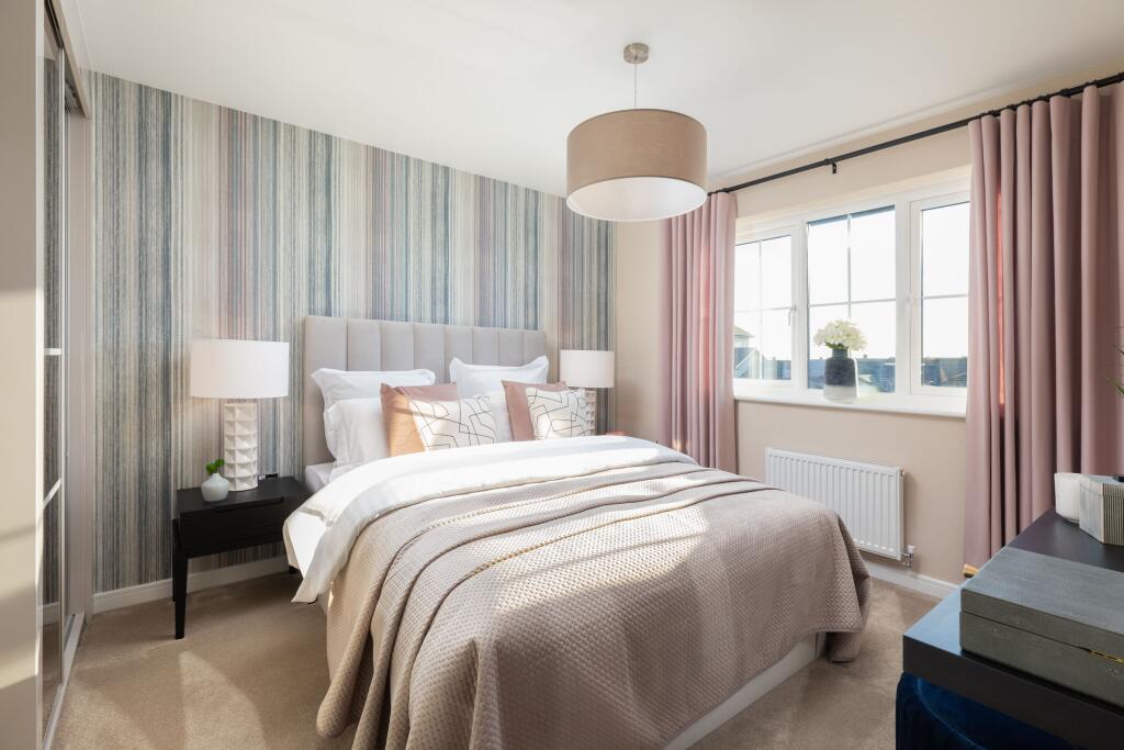
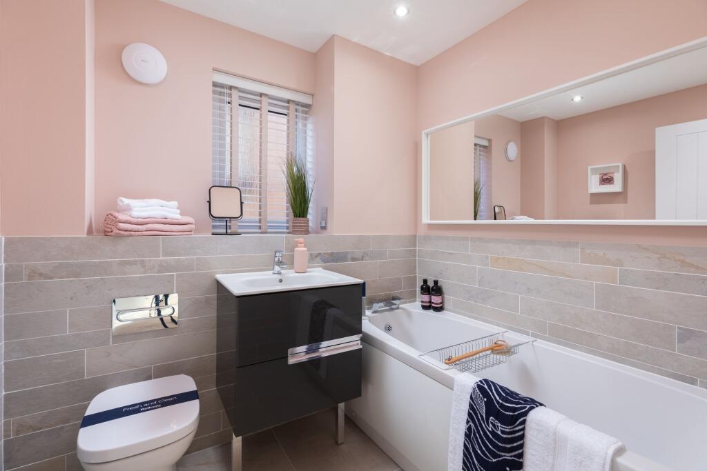
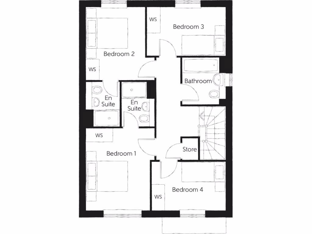
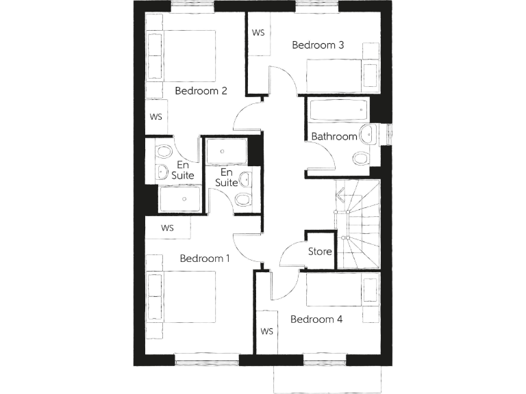
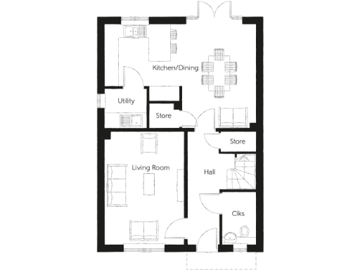
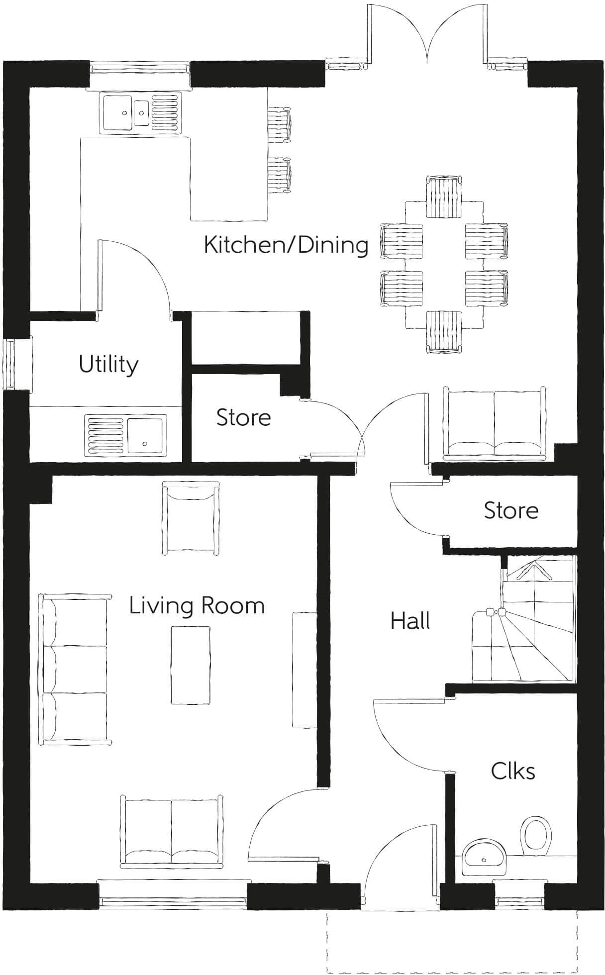
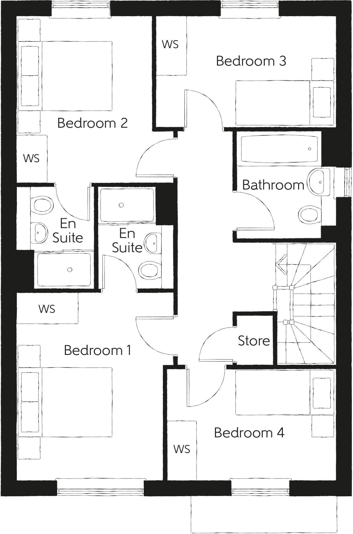
- Two-storey four-bedroom family home (floorplan). Ground floor: entrance hall, separate living room, open-plan kitchen / dining / family area with rear doors, utility room and a downstairs cloakroom/WC. First floor: four bedrooms including a master bedroom with en-suite shower room, plus a family bathroom. Layout indicates built-in wardrobes in some bedrooms and a central stair core. Garden to rear (typical). Room and garden sizes appear average for a modern suburban family house; overall property size is medium. No specific external views (sea/river/city/woodland) are indicated on the plan.
- Large planned residential development comprising a mix of 1–2 bedroom apartments and 2–4 bedroom houses arranged around landscaped public open spaces. The site plan shows clustered terraces, semi‑detached and detached houses of varied house types (labelled by name/colour), pocket greens, a village pond/pond feature and a SUDS basin. There is a peripheral green corridor and tree planting, on‑site pedestrian routes, local play area (LEAP) and designated parking courts/driveways. A proposed commercial park is shown adjacent to the development. Gardens vary by house type but are generally small to medium for apartment/terrace plots and medium to large for detached plots. Overall property size is substantial (site scale) — a multi‑acre housing development rather than a single residential property.
- A new development of 2-, 3- and 4-bedroom homes in Angmering, West Sussex. The images indicate properties sited near a tidal river or estuary with mooring pontoons and boats visible, and substantial mature tree cover on the opposite bank. There is an elevated historic building or castle visible in the distance, providing an attractive and potentially unique outlook. The setting suggests a semi-rural/suburban location with scenic water and woodland views. Plot sizes cannot be determined precisely from the images, but gardens are likely small-to-average for new homes of this type; the overall development appears medium in scale. Valuator-style comment: the combination of water-side views, mature tree screening and proximity to village amenities in Angmering would typically increase market appeal for family buyers and second‑home purchasers. Expect demand to be driven by the 3- and 4-bedroom units; site-specific factors (flood risk, access, local services) would need review to refine valuation.
- New-build residential development location (Langmead Place) in Angmering, West Sussex. Based on the map and branding this appears to be a planned or completed Bellway housing development situated just south of the A27 on the edge of Angmering village. The setting is suburban/semi-rural with immediate road links (A27/A280) and proximity to local village high street. No interior or specific dwelling details are visible; the plot appears to be part of a small-to-medium sized development rather than an isolated large estate. Likely offers family housing with average to medium-sized gardens and typical new-build specifications. Overall valuation considerations: good transport accessibility, village amenities nearby, and the benefits of a modern developer (Bellway) which support marketability; precise size, bedrooms and finish cannot be determined from the images provided.
- Brochure-style marketing for a residential property in a seaside town. Images show a pebble beach with a long pier and sea views, pedestrianised town streets with boutique shops, outdoor cafés and mature planting, plus a formal garden area with an ornate pavilion/landmark building set within colourful flower beds. The brochure emphasises proximity to the seafront, town centre amenities and attractive public gardens. Property setting: coastal/town centre location with very good local amenity access and notable views of the pier/sea and nearby formal gardens. Garden size cannot be determined from images; overall property size not inferable but the brochure imagery suggests a town-centre apartment or small to medium-sized house marketed for lifestyle/position rather than large grounds.
- New development named Langmead Place comprising 2-, 3- and 4-bedroom homes located in Angmering, West Sussex. The promotional image shows the development set beside a tidal river or estuary with moored boats and distant views of a large castle-like landmark across the water. The setting suggests a semi-rural riverside location with attractive water and countryside views. Based on the marketing style and unit mix, the scheme is likely a medium-sized residential development offering family homes with average to generous private gardens and parking provision. Overall property scale: medium development of family houses rather than high-density apartments.
- New homes development (Langmead Place) located in Angmering, West Sussex. Image is a location map rather than internal photographs; the listing indicates a newly built residential scheme close to the A27 and local village centre. As a valuator: likely a modern, planned development offering standard suburban house types (terraces, semis and/or detached units) with private gardens of average size and on-plot parking. The site benefits from good road access and proximity to local amenities in Angmering. No internal layout, room sizes or exact plot sizes are visible on the images, so total floor area and specific room/garden dimensions cannot be determined from the provided material.
- Brochure imagery indicates a residential property located on or very near the seafront with direct views of a pebble beach and a pier. Secondary images show a nearby town centre with pedestrianised shopping streets and café terraces, plus a formal garden/ornamental park and period architecture nearby. The property therefore appears to benefit from strong coastal and town-centre amenity — likely within easy walking distance of shops, restaurants and public green space. Garden size (based on images) appears small to average; overall dwelling scale is most consistent with a small-to-medium apartment or a terraced/period house rather than a large detached estate. The setting would suit purchasers seeking sea views, seaside leisure and convenient town access.
Image Descriptions
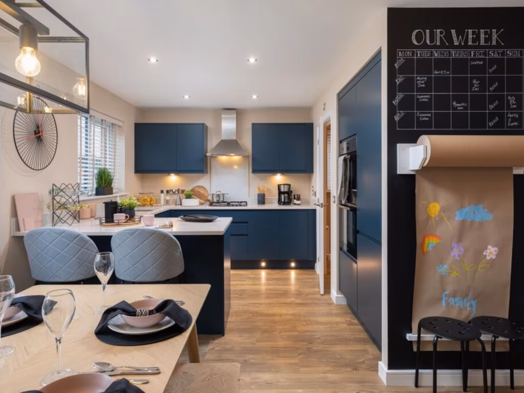
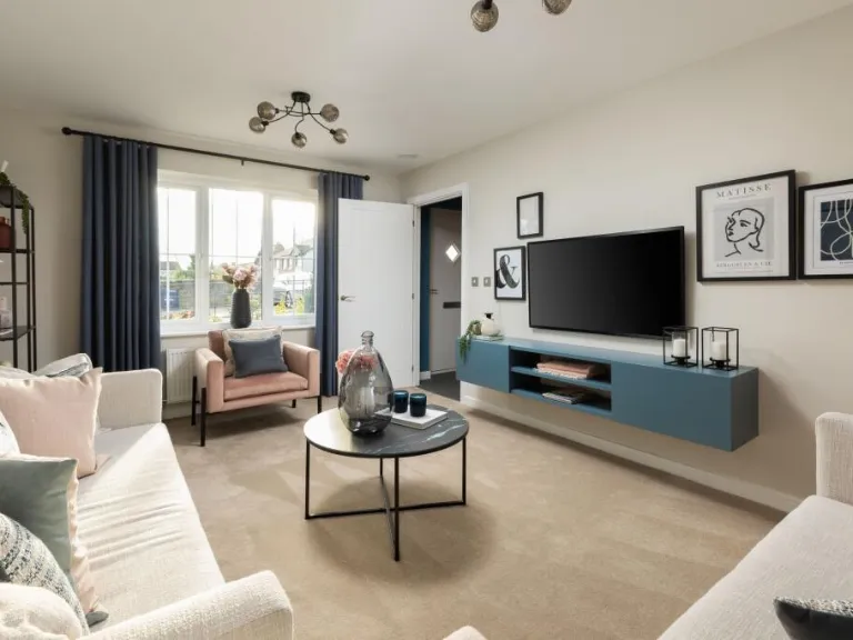
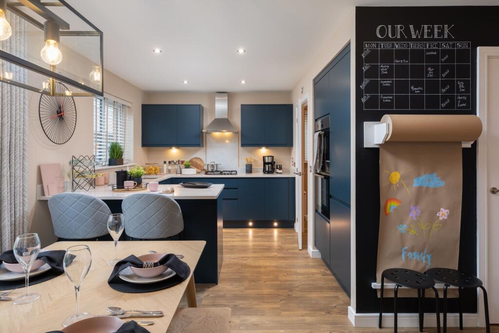
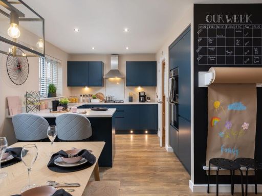
- modern kitchen contemporary
- detached house contemporary
Rooms
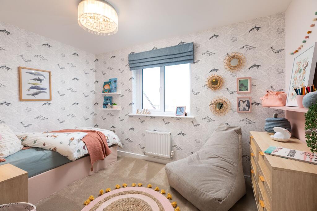
- Bedroom 2:
- Bedroom 3:
- En Suite:
- En Suite:
- Bedroom 1:
- Bathroom:
- Store:
- Bedroom 4:
Textual Property Features
- Is New Build
- Has Garden
- Chain Free
- Success
Detected Visual Features
- modern kitchen
- contemporary style
- open plan
- natural light
- wood flooring
- kitchen island
- functional design
- detached
- modern construction
- two-story
- brick and panel facade
- pitched roof
- suburban
- garage
- garden
- driveway
- landscaped
Nearby Schools
- River Beach Primary School
- East Preston Infant School
- Goring-By-Sea CofE (Aided) Primary School
- Orchards Junior School
- East Preston Junior School
- St Oscar Romero Catholic School
- White Meadows Primary Academy
- St Catherine's Catholic Primary School, Littlehampton
- Lyminster Primary School
- English Martyrs Catholic Primary School, Worthing
- Durrington High School
- The Laurels Primary School, Worthing
- Clapham and Patching CofE Primary School
- Ferring C of E Primary School
- West Park CofE Primary (Controlled) School
- Orchards Infant School
- The Angmering School
- Georgian Gardens Community Primary School
- The Littlehampton Academy
- Rustington Community Primary School
- St Wilfrids Catholic Primary School
- Durrington Junior School
- St Margaret's CofE Primary School
Nearest General Shops
- Id: 6192342523
- Tags:
- Name: The Barbers Lounge
- Shop: hairdresser
- TagsNormalized:
- Lat: 50.8290169
- Lon: -0.4832309
- FullGeoHash: gcp9jj0h7zsb
- PartitionGeoHash: gcp9
- Images:
- FoodStandards: null
- Distance: 206.2
,- Id: 661435549
- Tags:
- Building: yes
- Name: The Enchanted Florst
- Shop: florist
- TagsNormalized:
- Lat: 50.829056
- Lon: -0.4833253
- FullGeoHash: gcp9jj0h9wy9
- PartitionGeoHash: gcp9
- Images:
- FoodStandards: null
- Distance: 206.2
,- Id: 7004433460
- Tags:
- Name: The Enchanted Florist
- Shop: florist
- TagsNormalized:
- Lat: 50.829087
- Lon: -0.4832847
- FullGeoHash: gcp9jj0hfssf
- PartitionGeoHash: gcp9
- Images:
- FoodStandards: null
- Distance: 201.8
}
Nearest Religious buildings
- Id: 562486665
- Tags:
- Amenity: place_of_worship
- Building: yes
- Religion: christian
- TagsNormalized:
- place of worship
- christian
- church
- Lat: 50.824733
- Lon: -0.4865295
- FullGeoHash: gcp9humex0cm
- PartitionGeoHash: gcp9
- Images:
- FoodStandards: null
- Distance: 735
,- Id: 562486666
- Tags:
- Amenity: place_of_worship
- Building: yes
- Religion: christian
- TagsNormalized:
- place of worship
- christian
- church
- Lat: 50.8247196
- Lon: -0.4863091
- FullGeoHash: gcp9humgknmt
- PartitionGeoHash: gcp9
- Images:
- FoodStandards: null
- Distance: 729.3
,- Id: 885074546
- Tags:
- Amenity: place_of_worship
- Building: church
- Denomination: anglican
- Name: Saint Margaret's
- Religion: christian
- Wikidata: Q17553454
- Wikipedia: en:St Margaret's Church, Angmering
- TagsNormalized:
- place of worship
- church
- anglican
- christian
- Lat: 50.8289498
- Lon: -0.48613
- FullGeoHash: gcp9hvnh06gp
- PartitionGeoHash: gcp9
- Images:
- FoodStandards: null
- Distance: 362.7
}
Nearest Medical buildings
- Id: 306221902
- Tags:
- Addr:
- City: Littlehampton
- Country: GB
- Housename: Station Parade
- Postcode: BN16 3AE
- Street: Station Road
- Village: East Preston
- Amenity: pharmacy
- Dispensing: yes
- Healthcare: pharmacy
- Name: Kamson's Pharmacy
- Wheelchair: yes
- TagsNormalized:
- Lat: 50.8156644
- Lon: -0.4904777
- FullGeoHash: gcp9hfdyen3m
- PartitionGeoHash: gcp9
- Images:
- FoodStandards: null
- Distance: 1770.8
,- Id: 730666507
- Tags:
- Building: yes
- Leisure: fitness_centre
- Name: Lanes Health Club
- TagsNormalized:
- fitness
- fitness centre
- leisure
- health
- club
- Lat: 50.8223093
- Lon: -0.5030168
- FullGeoHash: gcp9hectqv57
- PartitionGeoHash: gcp9
- Images:
- FoodStandards: null
- Distance: 1759.7
,- Id: 661435511
- Tags:
- Amenity: clinic
- Building: yes
- Healthcare: clinic
- Name: Angmering Medical Centre
- TagsNormalized:
- Lat: 50.8275261
- Lon: -0.4863986
- FullGeoHash: gcp9huvgf1dg
- PartitionGeoHash: gcp9
- Images:
- FoodStandards: null
- Distance: 475.8
,- Id: 1486965743
- Tags:
- Amenity: pharmacy
- Brand: Lloyds Pharmacy
- Brand:wikidata: Q6662870
- Brand:wikipedia: en:LloydsPharmacy
- Healthcare: pharmacy
- Name: Lloyds Pharmacy
- TagsNormalized:
- pharmacy
- lloyds pharmacy
- health
- healthcare
- Lat: 50.8276391
- Lon: -0.4861614
- FullGeoHash: gcp9huvurwev
- PartitionGeoHash: gcp9
- Images:
- FoodStandards: null
- Distance: 455.1
}
Nearest Leisure Facilities
- Id: 559455073
- Tags:
- TagsNormalized:
- Lat: 50.833477
- Lon: -0.4834146
- FullGeoHash: gcp9hvzyrwgv
- PartitionGeoHash: gcp9
- Images:
- FoodStandards: null
- Distance: 344.4
,- Id: 737252377
- Tags:
- TagsNormalized:
- Lat: 50.8297101
- Lon: -0.4862882
- FullGeoHash: gcp9hvmbs8tp
- PartitionGeoHash: gcp9
- Images:
- FoodStandards: null
- Distance: 339.2
,- Id: 737252375
- Tags:
- TagsNormalized:
- Lat: 50.8287423
- Lon: -0.4845286
- FullGeoHash: gcp9hvp4vsm6
- PartitionGeoHash: gcp9
- Images:
- FoodStandards: null
- Distance: 287.2
,- Id: 738211758
- Tags:
- Access: yes
- Fee: no
- Garden:
- Leisure: garden
- Name: St Nicholas Garden
- TagsNormalized:
- Lat: 50.8295403
- Lon: -0.4848872
- FullGeoHash: gcp9hvnzt31f
- PartitionGeoHash: gcp9
- Images:
- FoodStandards: null
- Distance: 254.6
,- Id: 841301588
- Tags:
- Access: customers
- Leisure: outdoor_seating
- Operator: The Lamb Inn
- TagsNormalized:
- outdoor
- outdoor seating
- leisure
- Lat: 50.8294627
- Lon: -0.4842683
- FullGeoHash: gcp9hvpr5dx7
- PartitionGeoHash: gcp9
- Images:
- FoodStandards: null
- Distance: 221.5
}
Nearest Tourist attractions
- Id: 142891762
- Tags:
- Name: Island Meadow Caravan Park
- Tourism: caravan_site
- TagsNormalized:
- Lat: 50.8158945
- Lon: -0.4531365
- FullGeoHash: gcp9jdy011kf
- PartitionGeoHash: gcp9
- Images:
- FoodStandards: null
- Distance: 2585.1
,- Id: 9866011369
- Tags:
- Name: Fox Wood Campsite
- Tourism: camp_site
- TagsNormalized:
- Lat: 50.8441836
- Lon: -0.4721305
- FullGeoHash: gcp9jrbhydcc
- PartitionGeoHash: gcp9
- Images:
- FoodStandards: null
- Distance: 1653.7
,- Id: 3061253775
- Tags:
- TagsNormalized:
- Lat: 50.8333447
- Lon: -0.4651713
- FullGeoHash: gcp9jmvm8wr0
- PartitionGeoHash: gcp9
- Images:
- FoodStandards: null
- Distance: 1198.1
}
Nearest Hotels
- Id: 272428716
- Tags:
- Brand: Premier Inn
- Brand:wikidata: Q2108626
- Brand:wikipedia: en:Premier Inn
- Building: yes
- Internet_access: wlan
- Name: Premier Inn
- Operator: Premier Inn
- Tourism: hotel
- TagsNormalized:
- Lat: 50.8176568
- Lon: -0.4758427
- FullGeoHash: gcp9j5jd21cf
- PartitionGeoHash: gcp9
- Images:
- FoodStandards: null
- Distance: 1494.4
,- Id: 818777358
- Tags:
- Building: yes
- Name: Angmering Manor
- Tourism: hotel
- TagsNormalized:
- Lat: 50.8284228
- Lon: -0.4805921
- FullGeoHash: gcp9jj4112u8
- PartitionGeoHash: gcp9
- Images:
- FoodStandards: null
- Distance: 251.8
,- Id: 871164967
- Tags:
- Addr:
- Postcode: BN16 4AG
- Street: High Street
- Name: Angmering Manor Hotel
- Tourism: hotel
- Website: https://www.relaxinnz.co.uk/hotels/angmering-manor/
- TagsNormalized:
- Lat: 50.8285291
- Lon: -0.4806882
- FullGeoHash: gcp9jj1cxhsf
- PartitionGeoHash: gcp9
- Images:
- FoodStandards: null
- Distance: 238.5
}
Tags
- modern kitchen
- contemporary style
- open plan
- natural light
- wood flooring
- kitchen island
- functional design
- detached
- modern construction
- two-story
- brick and panel facade
- pitched roof
- suburban
- garage
- garden
- driveway
- landscaped
Local Market Stats
- Average Price/sqft: £394
- Avg Income: £44400
- Rental Yield: 3.4%
- Social Housing: 5%
- Planning Success Rate: 91%
AirBnB Data
- 1km average: £103/night
- Listings in 1km: 3
Similar Properties
 4 bedroom detached house for sale in Langmead Place,
Angmering,
Littlehampton,
BN16 4EJ, BN16 — £529,995 • 4 bed • 1 bath • 1292 ft²
4 bedroom detached house for sale in Langmead Place,
Angmering,
Littlehampton,
BN16 4EJ, BN16 — £529,995 • 4 bed • 1 bath • 1292 ft² 3 bedroom semi-detached house for sale in Langmead Place,
Angmering,
Littlehampton,
BN16 4EJ, BN16 — £439,995 • 3 bed • 1 bath • 1011 ft²
3 bedroom semi-detached house for sale in Langmead Place,
Angmering,
Littlehampton,
BN16 4EJ, BN16 — £439,995 • 3 bed • 1 bath • 1011 ft² 3 bedroom semi-detached house for sale in Langmead Place,
Angmering,
Littlehampton,
BN16 4EJ, BN16 — £429,995 • 3 bed • 1 bath • 1010 ft²
3 bedroom semi-detached house for sale in Langmead Place,
Angmering,
Littlehampton,
BN16 4EJ, BN16 — £429,995 • 3 bed • 1 bath • 1010 ft²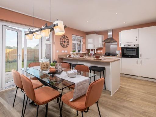 3 bedroom semi-detached house for sale in Langmead Place,
Angmering,
Littlehampton,
BN16 4EJ, BN16 — £439,995 • 3 bed • 1 bath • 1011 ft²
3 bedroom semi-detached house for sale in Langmead Place,
Angmering,
Littlehampton,
BN16 4EJ, BN16 — £439,995 • 3 bed • 1 bath • 1011 ft²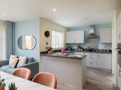 3 bedroom detached house for sale in Langmead Place,
Angmering,
Littlehampton,
BN16 4EJ, BN16 — £459,995 • 3 bed • 1 bath • 1043 ft²
3 bedroom detached house for sale in Langmead Place,
Angmering,
Littlehampton,
BN16 4EJ, BN16 — £459,995 • 3 bed • 1 bath • 1043 ft² 3 bedroom semi-detached house for sale in Langmead Place,
Angmering,
Littlehampton,
BN16 4EJ, BN16 — £424,995 • 3 bed • 1 bath • 1011 ft²
3 bedroom semi-detached house for sale in Langmead Place,
Angmering,
Littlehampton,
BN16 4EJ, BN16 — £424,995 • 3 bed • 1 bath • 1011 ft²
Meta
- {
"@context": "https://schema.org",
"@type": "Residence",
"name": "4 bedroom detached house for sale in Langmead Place, Angmer…",
"description": "",
"url": "https://propertypiper.co.uk/property/9b1ab464-bec6-41ca-a9f9-26cdcbe555c9",
"image": "https://image-a.propertypiper.co.uk/5161f486-6d39-4092-8696-512acd3dc294-1024.jpeg",
"address": {
"@type": "PostalAddress",
"streetAddress": "6 WATER LANE ANGMERING LITTLEHAMPTON",
"postalCode": "BN16 4EJ",
"addressLocality": "Arun",
"addressRegion": "Arundel and South Downs",
"addressCountry": "England"
},
"geo": {
"@type": "GeoCoordinates",
"latitude": 50.8305841,
"longitude": -0.481661
},
"numberOfRooms": 4,
"numberOfBathroomsTotal": 1,
"floorSize": {
"@type": "QuantitativeValue",
"value": 1292,
"unitCode": "FTK"
},
"offers": {
"@type": "Offer",
"price": 529995,
"priceCurrency": "GBP",
"availability": "https://schema.org/InStock"
},
"additionalProperty": [
{
"@type": "PropertyValue",
"name": "Feature",
"value": "modern kitchen"
},
{
"@type": "PropertyValue",
"name": "Feature",
"value": "contemporary style"
},
{
"@type": "PropertyValue",
"name": "Feature",
"value": "open plan"
},
{
"@type": "PropertyValue",
"name": "Feature",
"value": "natural light"
},
{
"@type": "PropertyValue",
"name": "Feature",
"value": "wood flooring"
},
{
"@type": "PropertyValue",
"name": "Feature",
"value": "kitchen island"
},
{
"@type": "PropertyValue",
"name": "Feature",
"value": "functional design"
},
{
"@type": "PropertyValue",
"name": "Feature",
"value": "detached"
},
{
"@type": "PropertyValue",
"name": "Feature",
"value": "modern construction"
},
{
"@type": "PropertyValue",
"name": "Feature",
"value": "two-story"
},
{
"@type": "PropertyValue",
"name": "Feature",
"value": "brick and panel facade"
},
{
"@type": "PropertyValue",
"name": "Feature",
"value": "pitched roof"
},
{
"@type": "PropertyValue",
"name": "Feature",
"value": "suburban"
},
{
"@type": "PropertyValue",
"name": "Feature",
"value": "garage"
},
{
"@type": "PropertyValue",
"name": "Feature",
"value": "garden"
},
{
"@type": "PropertyValue",
"name": "Feature",
"value": "driveway"
},
{
"@type": "PropertyValue",
"name": "Feature",
"value": "landscaped"
}
]
}
High Res Floorplan Images
Compatible Floorplan Images
FloorplanImages Thumbnail