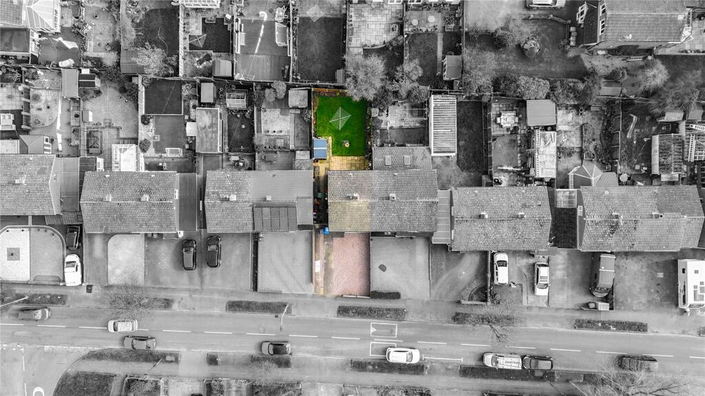
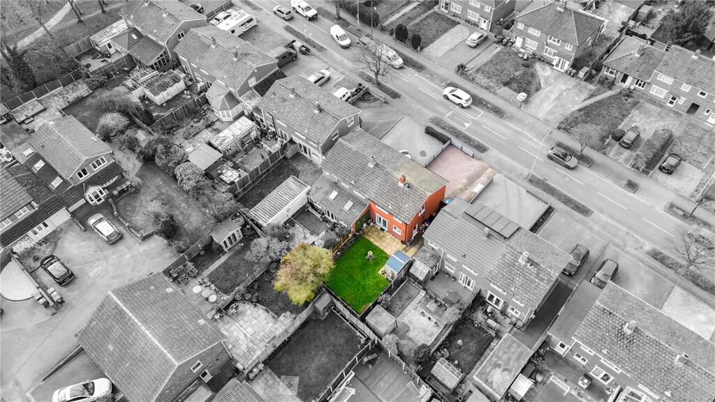
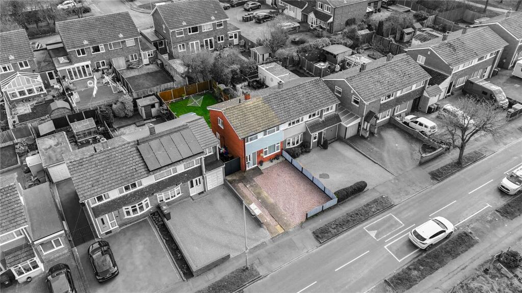
B77 3JP - 3 bedroom semidetached house for sale in Sheepcote Lane, Ta…
View on Property Piper
3 bedroom semi-detached house for sale in Sheepcote Lane, Tamworth, Staffordshire, B77
Property Details
- Price: £225000
- Bedrooms: 3
- Bathrooms: 1
- Property Type: undefined
- Property SubType: undefined
Image Descriptions
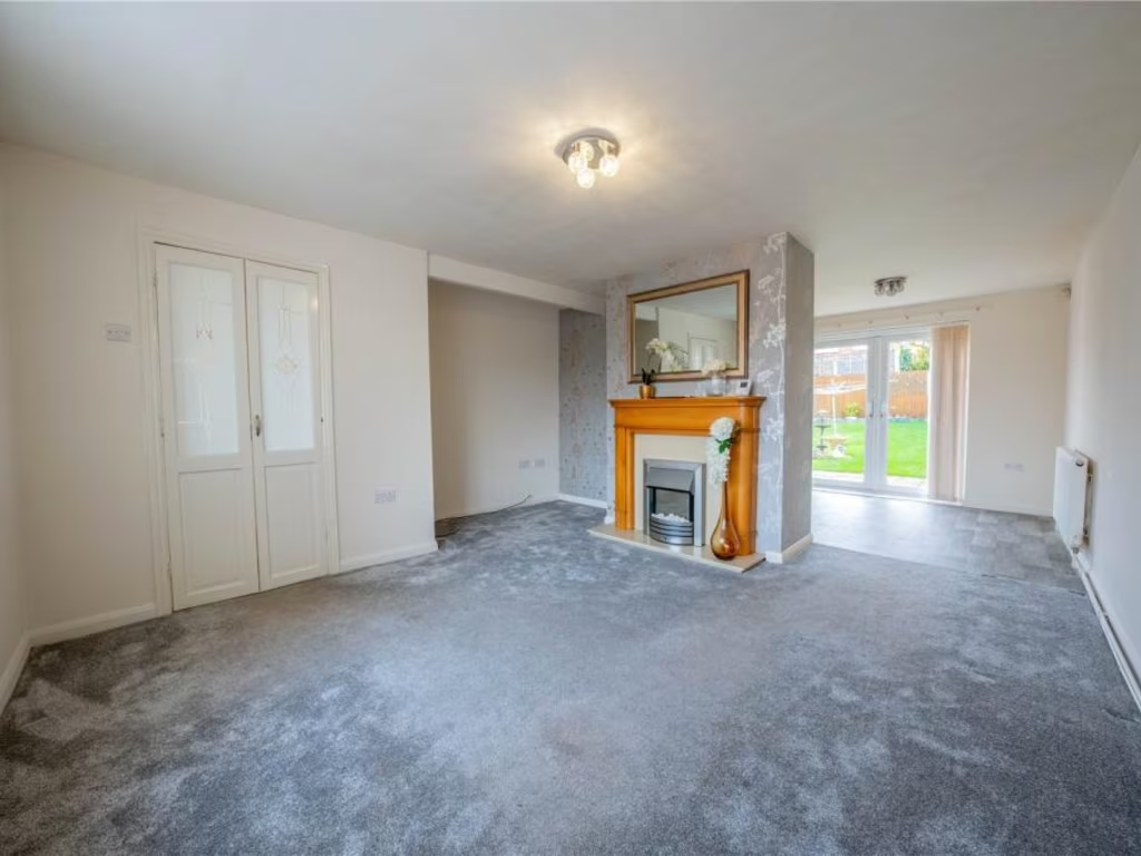
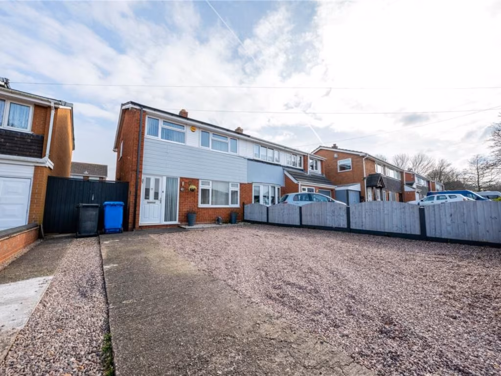
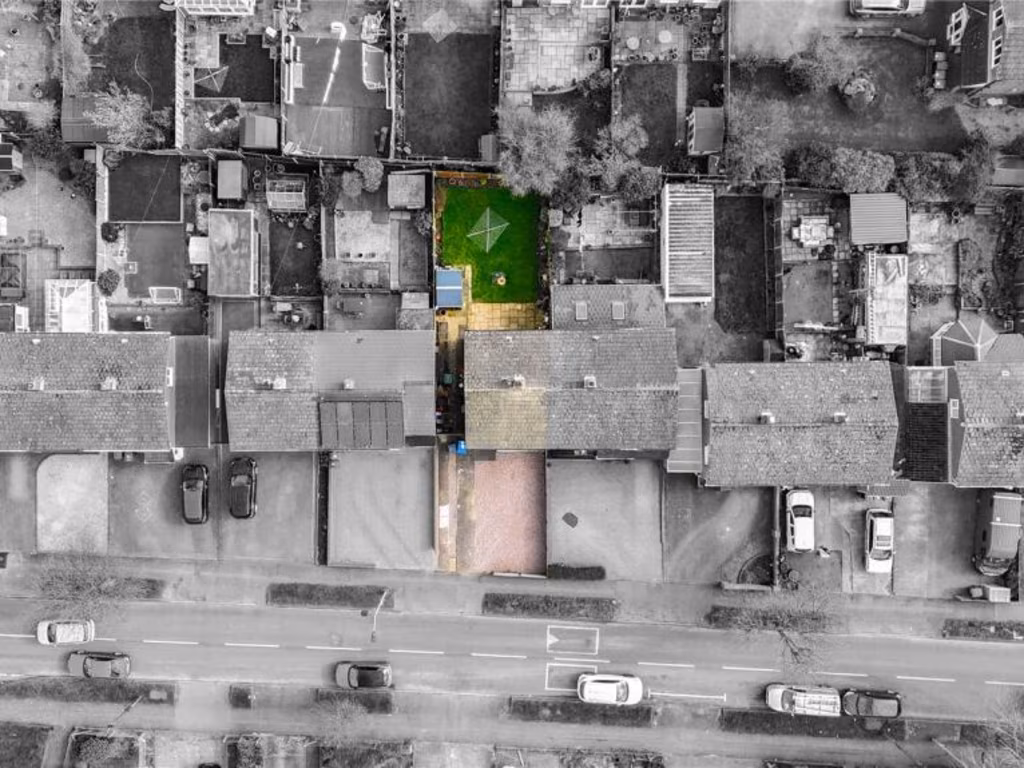
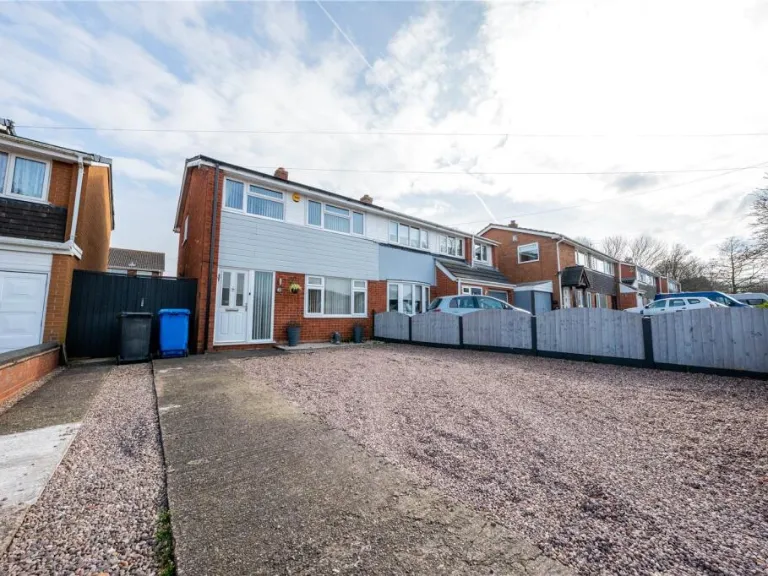
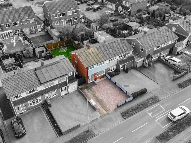
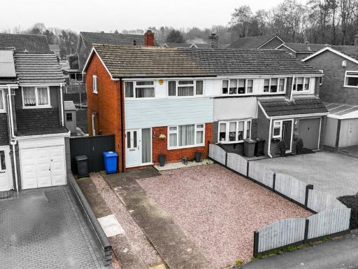
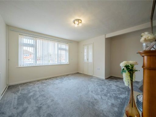
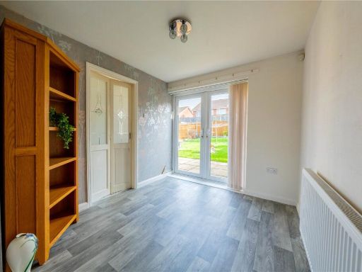
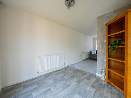
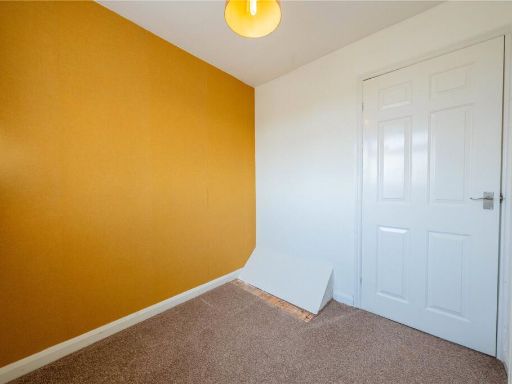
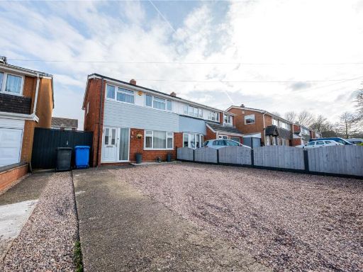
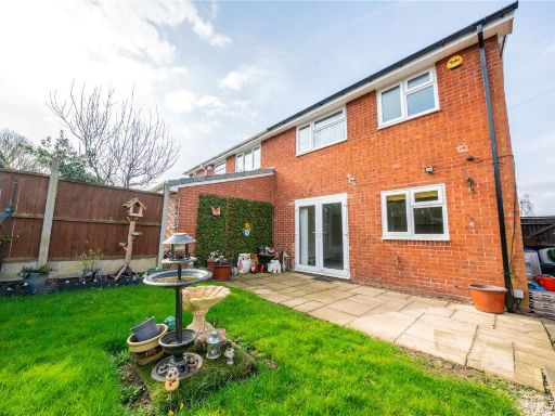
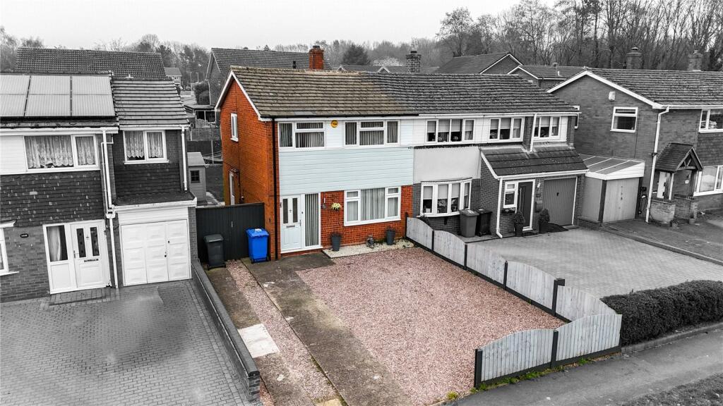
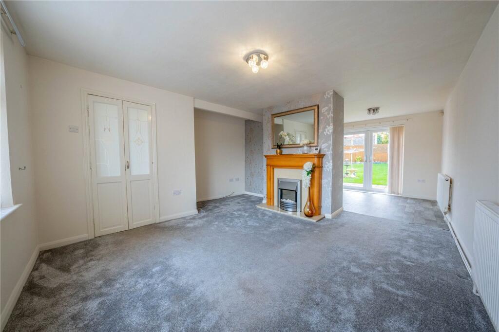
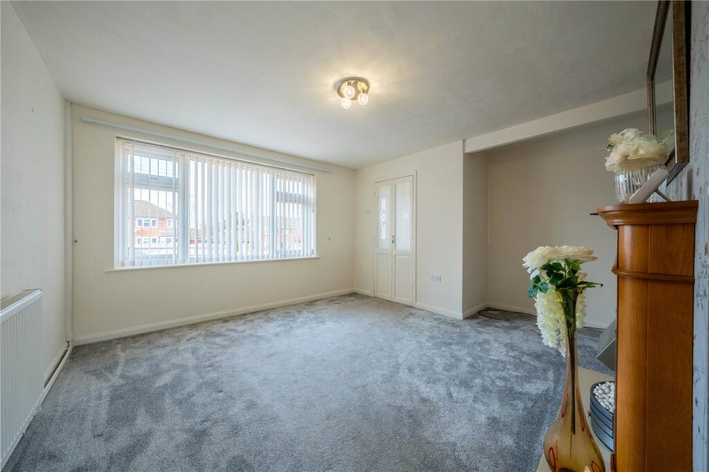
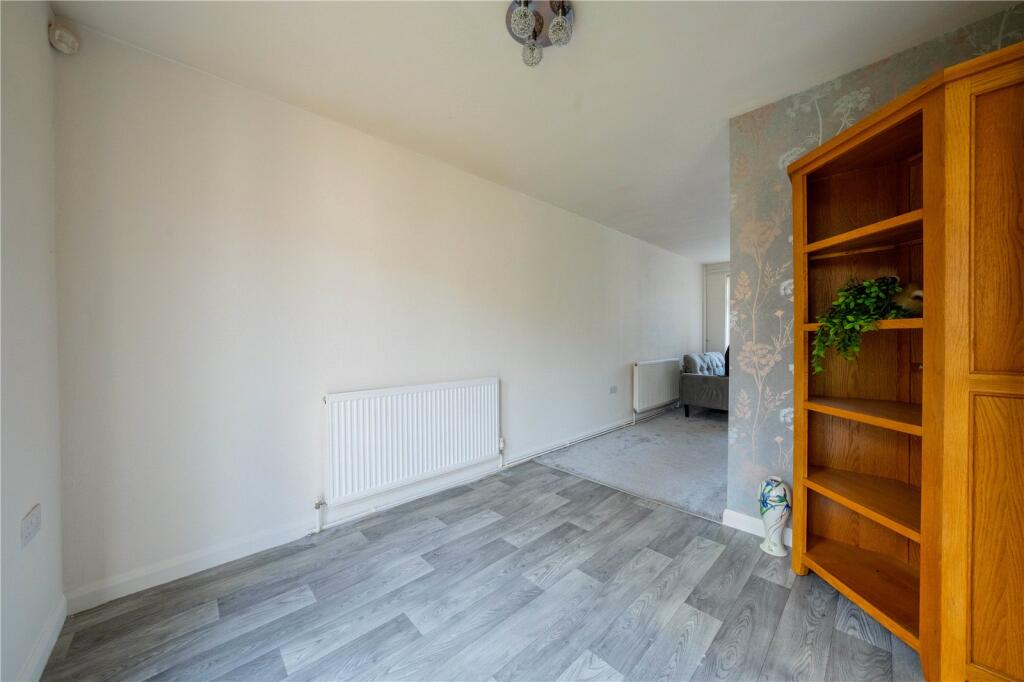
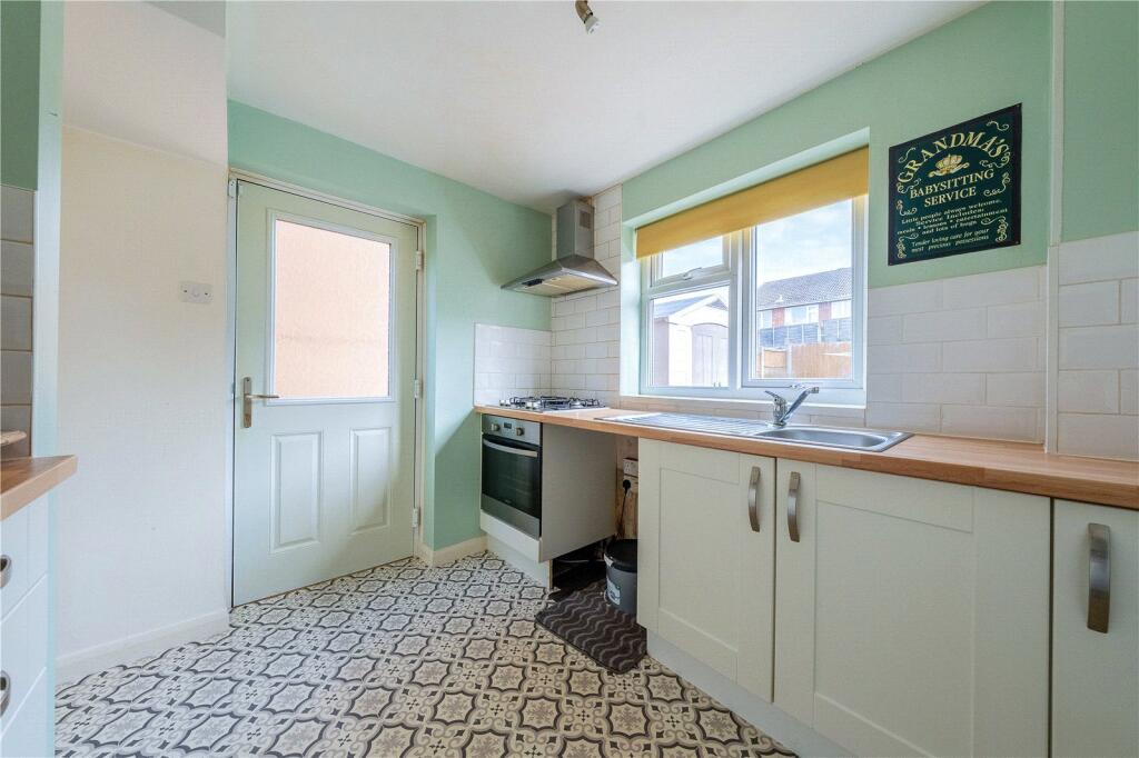
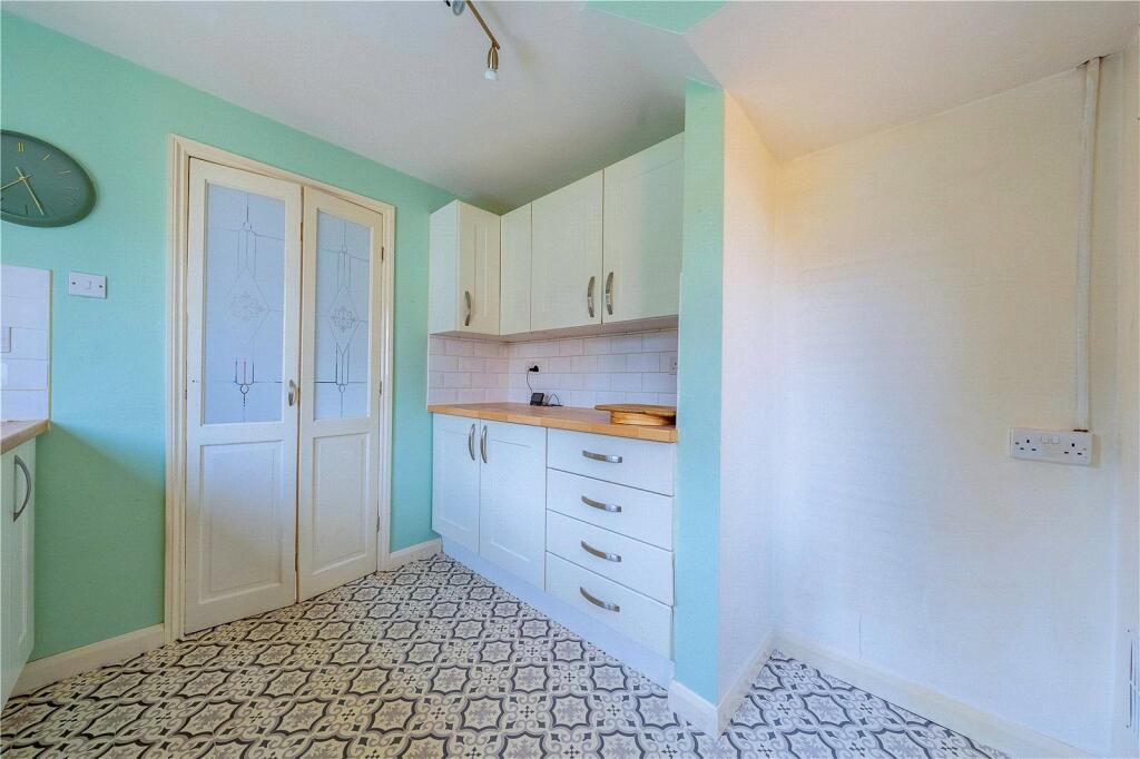
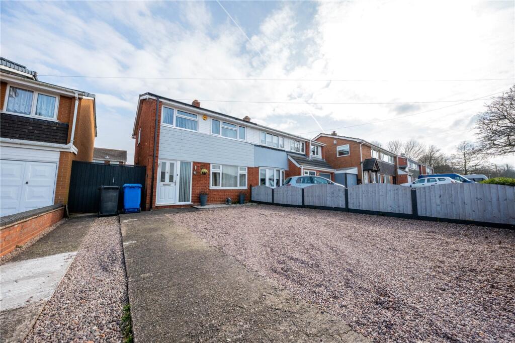
- semi-detached house Mid-20th Century
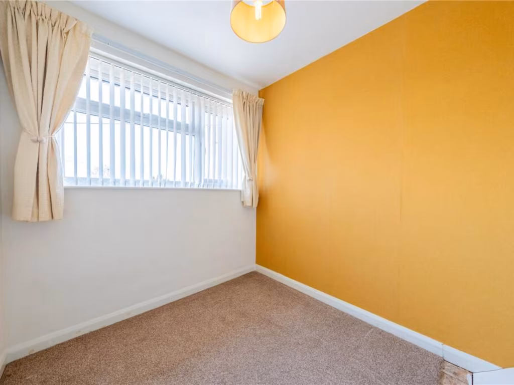
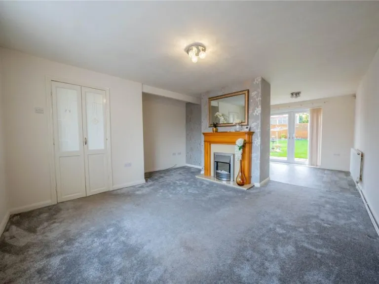
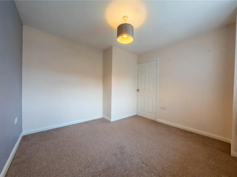
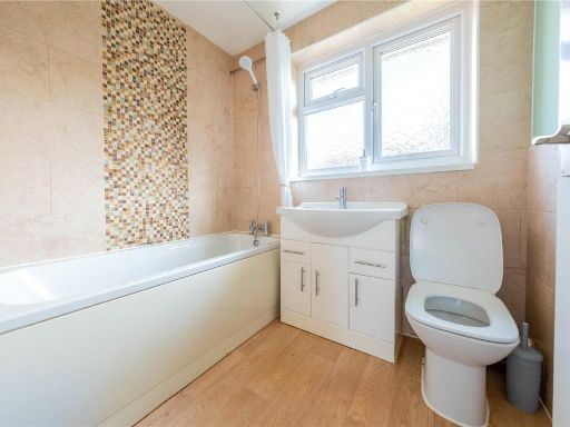
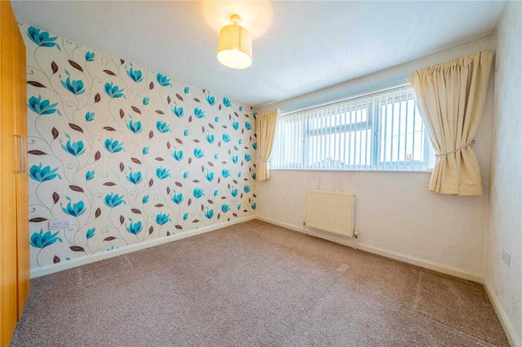
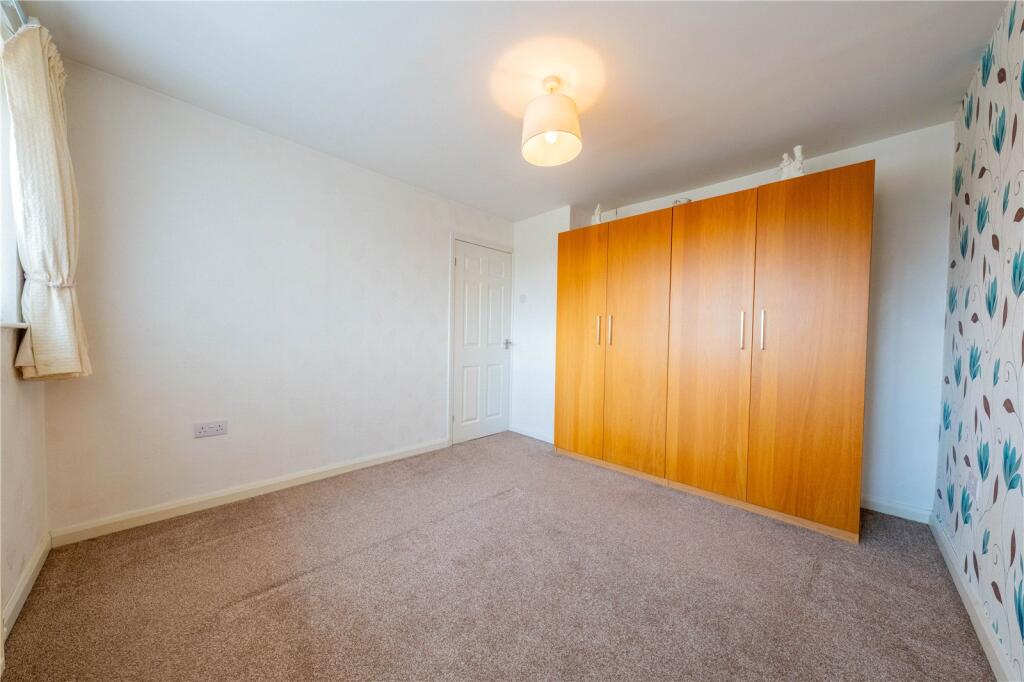
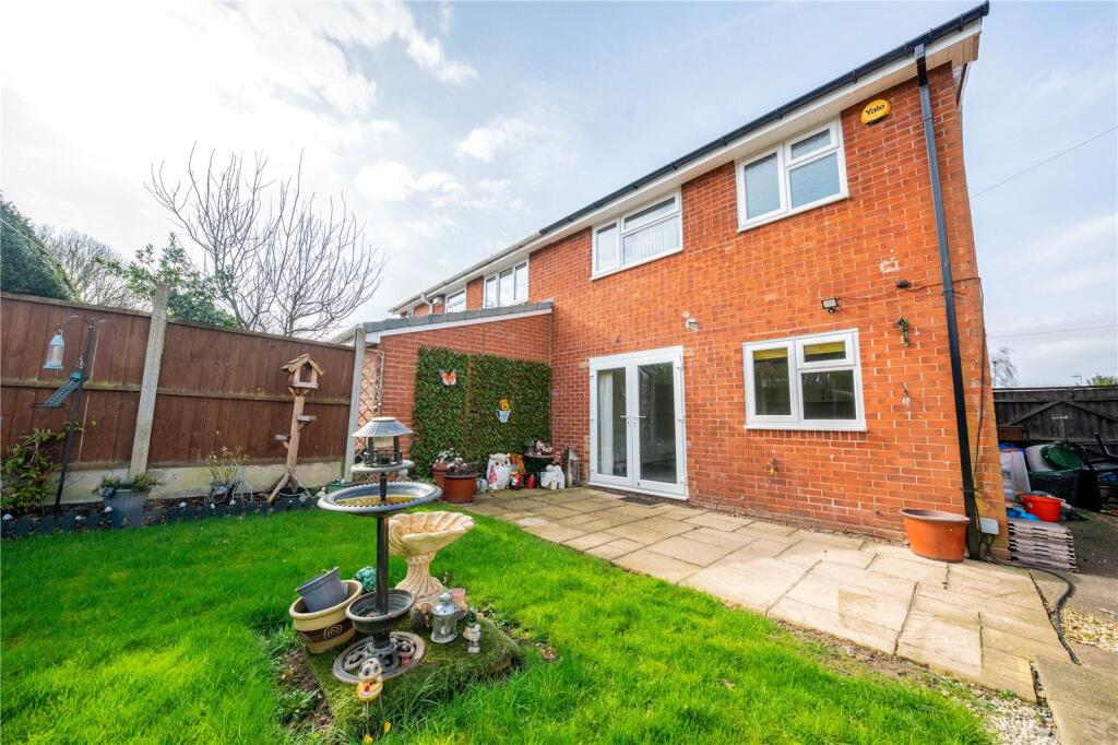
- living room modern
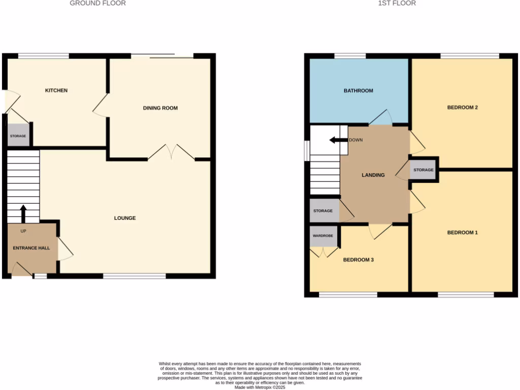
Floorplan Description
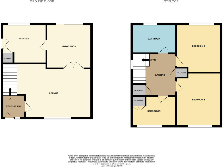
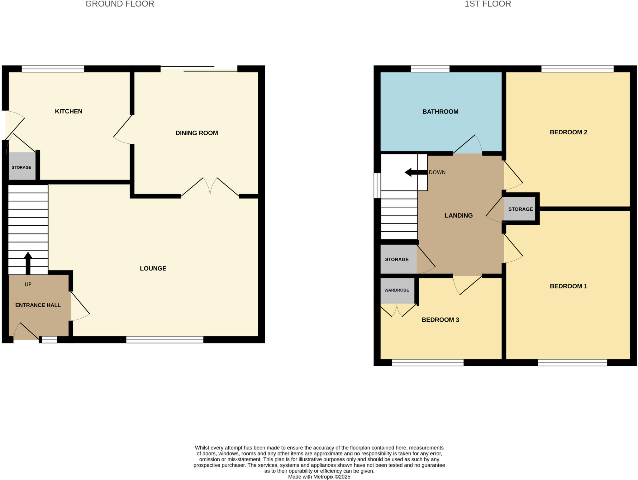
- A two-story residential property with three bedrooms, a bathroom, and living spaces.
Rooms
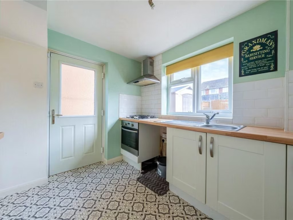
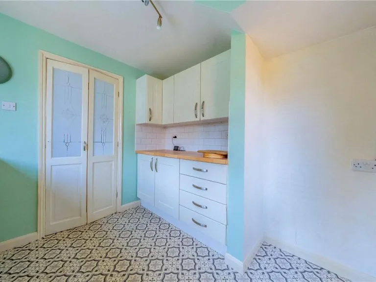
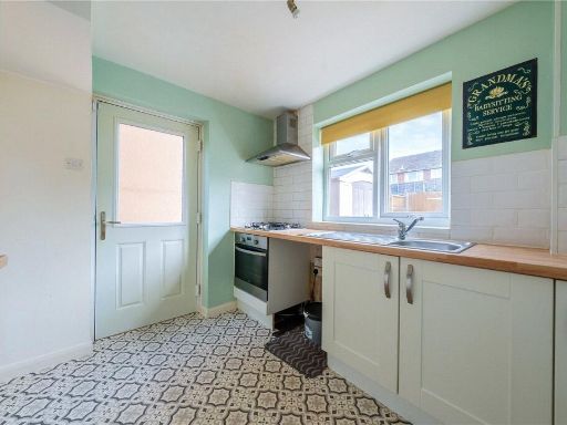
- Kitchen:
- Dining Room:
- Lounge:
- Entrance Hall:
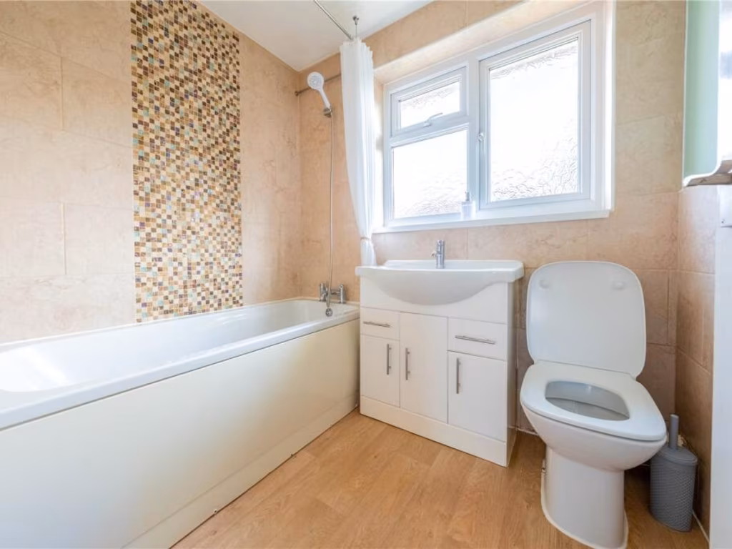
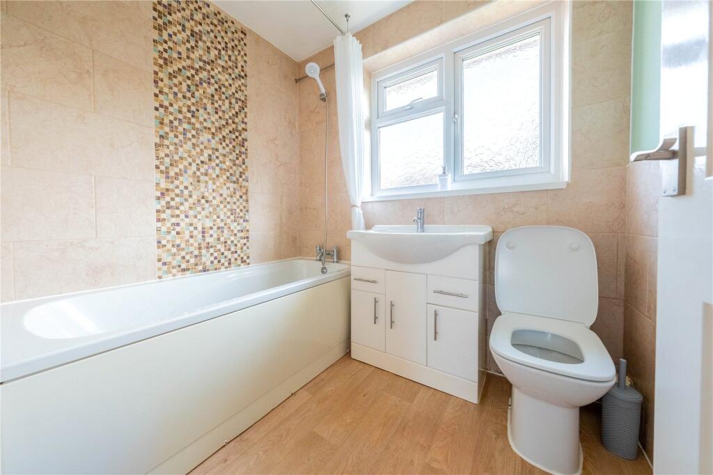
- Bathroom:
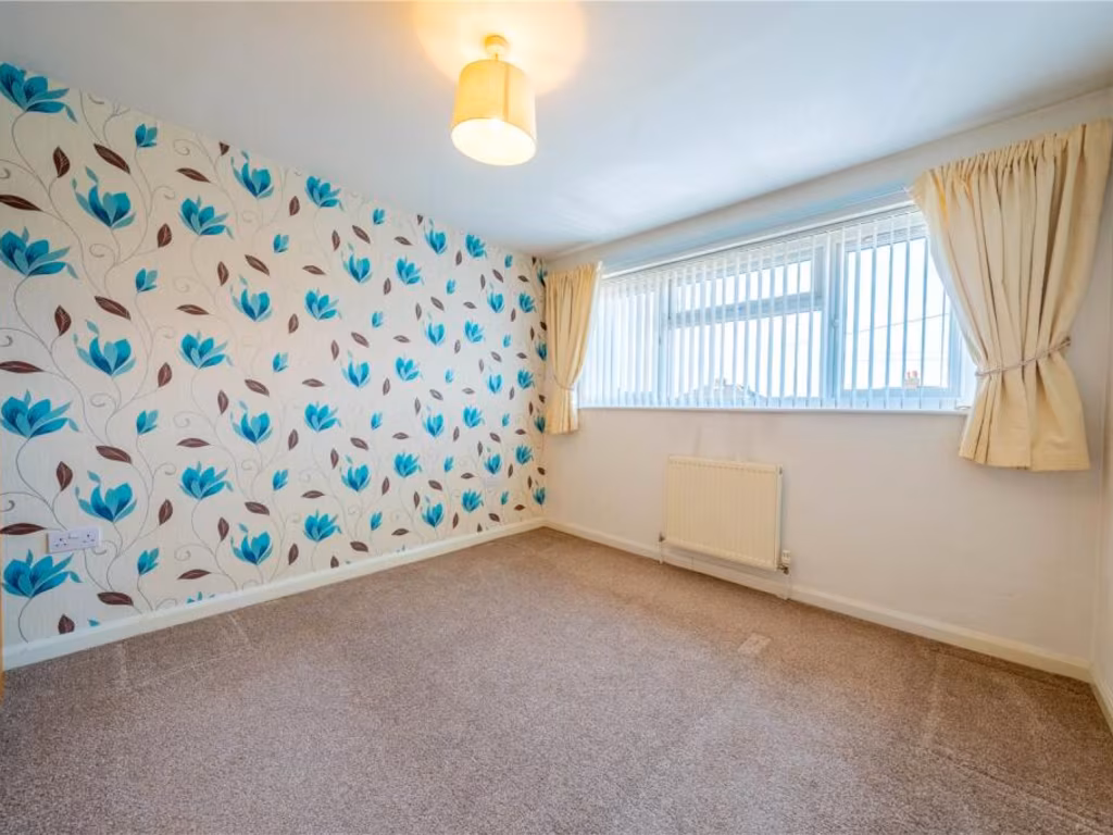
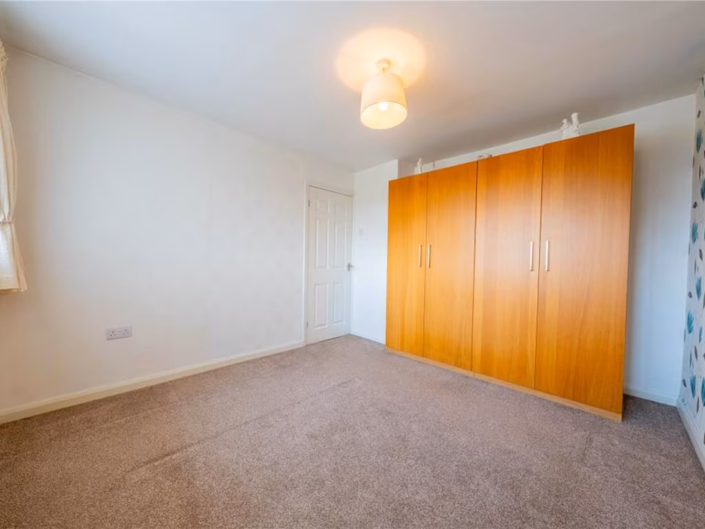
- Bedroom 1:
- Bedroom 2:
- Bedroom 3:
- Landing:
Textual Property Features
Detected Visual Features
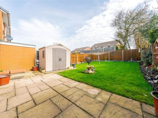
- semi-detached
- mid-20th century
- brickwork
- two-story
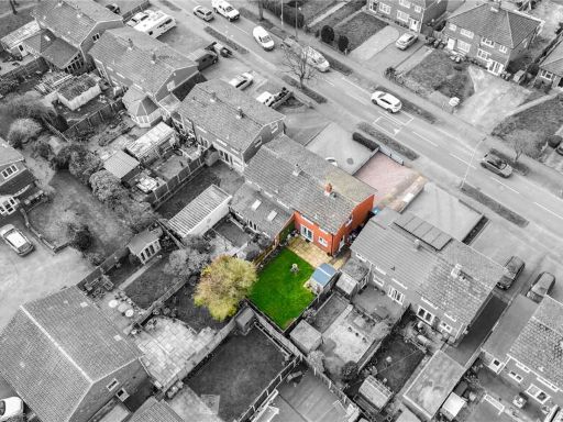
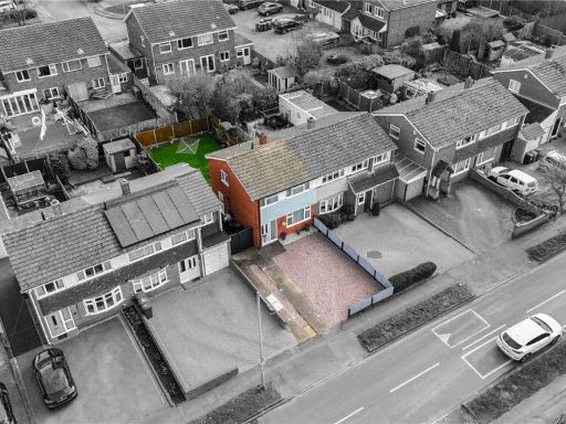
- suburban
- driveway
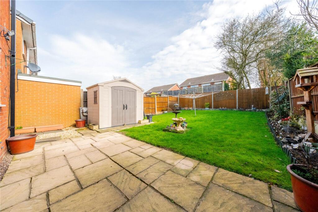
- no garden
- renovation potential
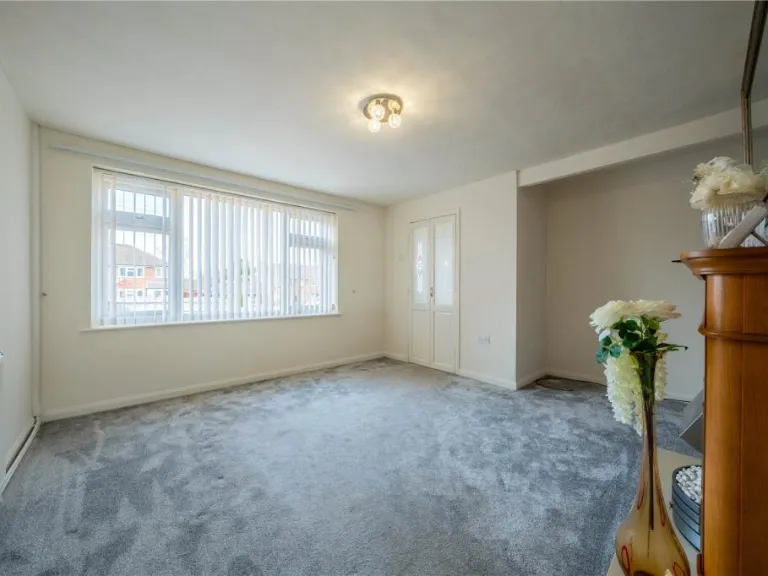
- modern
- living room
- fireplace
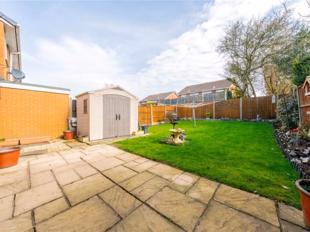
- patio doors
- garden view
- carpeted
- paint
- central lighting
- neutral colors
EPC Details
- Fully double glazed
- Cavity wall, filled cavity
- Boiler and radiators, mains gas
- Low energy lighting in all fixed outlets
- Solid, no insulation (assumed)
Nearby Schools
- Three Peaks Primary Academy
- Oakhill Primary School
- Lakeside Primary School
- William MacGregor Primary School
- Landau Forte Academy, Amington
- Moorgate Primary Academy
- Landau Forte Academy Greenacres
- Landau Forte Academy, QEMS
- Wilnecote Junior Academy
- St Gabriel's Catholic Primary School
- Stoneydelph Primary School
- Hanbury's Farm Community Primary School
- Glascote Academy
- Ashcroft Infants' School
- Heathfields Infant Academy
- Bird's Bush Primary School
- Amington Heath Primary School and Nursery
- Florendine Primary School
- Ankermoor Primary Academy
- Flax Hill Junior Academy
- Anker Valley Primary Academy
- The Wilnecote School
- Two Gates Primary School
- Tamworth Enterprise College and AET Academy
- The Woodlands Community Primary School
Nearest General Shops
- Id: 384585150
- Tags:
- Addr:
- Housenumber: 19
- Postcode: B77 3EY
- Street: St Mary's Way
- Beauty: tanning
- Building: yes
- Contact:
- Name: Flamingo Bay
- Phone: +44 1827 319806
- Shop: beauty
- Website: https://flamingo-bay.co.uk/
- TagsNormalized:
- Lat: 52.6317522
- Lon: -1.6701738
- FullGeoHash: gcqg3vrf4jsp
- PartitionGeoHash: gcqg
- Images:
- FoodStandards: null
- Distance: 474.3
,- Id: 384585149
- Tags:
- Addr:
- Housenumber: 21
- Postcode: B77 3EY
- Street: St Mary's Way
- Building: yes
- Contact:
- Name: Eclips Hair and Beauty
- Shop: hairdresser
- TagsNormalized:
- Lat: 52.6317537
- Lon: -1.6700473
- FullGeoHash: gcqg3vrfjn42
- PartitionGeoHash: gcqg
- Images:
- FoodStandards: null
- Distance: 469.3
,- Id: 384585148
- Tags:
- Addr:
- City: Tamworth
- Housenumber: 23
- Postcode: B77 3EY
- Street: St Mary's Way
- Beauty: tanning
- Building: yes
- Name: Flamingo Bay
- Phone: +44 1827 319806
- Shop: beauty
- Website: https://flamingo-bay.co.uk/
- TagsNormalized:
- Lat: 52.6317543
- Lon: -1.6699254
- FullGeoHash: gcqg3vrfpyj7
- PartitionGeoHash: gcqg
- Images:
- FoodStandards: null
- Distance: 464.5
}
Nearest Grocery shops
- Id: 926247590
- Tags:
- Addr:
- City: Tamworth
- Housenumber: 1
- Postcode: B77 2RP
- Street: Swift
- Brand: Premier
- Brand:wikidata: Q7240340
- Brand:wikipedia: en:Premier Stores
- Building: yes
- Name: Premier
- Opening_hours: Mo-Sa 07:00-21:00, Su 08:00-21:00
- Phone: +44 1827 282031
- Shop: convenience
- Website: https://www.premier-stores.co.uk/our-stores/lakeside-stores
- TagsNormalized:
- Lat: 52.6247619
- Lon: -1.6719403
- FullGeoHash: gcqg3un92ywu
- PartitionGeoHash: gcqg
- Images:
- FoodStandards: null
- Distance: 571.3
,- Id: 901549646
- Tags:
- Name: Lakeside News, Food and Wine
- Shop: supermarket
- TagsNormalized:
- Lat: 52.6248103
- Lon: -1.6719518
- FullGeoHash: gcqg3un98xwm
- PartitionGeoHash: gcqg
- Images:
- FoodStandards: null
- Distance: 568.1
,- Id: 788834292
- Tags:
- Addr:
- City: Tamworth
- Housenumber: 479
- Postcode: B77 2BZ
- Street: Glascote Road
- Brand: Costcutter
- Brand:wikidata: Q5175072
- Brand:wikipedia: en:Costcutter
- Building: yes
- Contact:
- Website: https://store-locator.costcutter.co.uk/costcutter-723d566e9484
- Name: Costcutter
- Opening_hours: Mo-Su 08:00-20:00
- Phone: +44 1827 65800
- Shop: convenience
- TagsNormalized:
- costcutter
- convenience
- shop
- Lat: 52.627433
- Lon: -1.6666459
- FullGeoHash: gcqg6hd3h2dd
- PartitionGeoHash: gcqg
- Images:
- FoodStandards: null
- Distance: 114.9
}
Nearest Supermarkets
- Id: 357894263
- Tags:
- Addr:
- Housenumber: 107
- Postcode: B77 3LN
- Street: Amington Road
- Brand: Co-op Food
- Brand:wikidata: Q3277439
- Brand:wikipedia: en:Co-op Food
- Building: yes
- Contact:
- Phone: +44 1827 64529
- Website: http://www.co-operative.coop/store/food/B77-3LN/107-amington-rd
- Name: Co-op Food
- Opening_hours: Mo-Sa 07:30-22:00; Su 08:00-20:00
- Operator: Tamworth Co-operative Society
- Shop: supermarket
- TagsNormalized:
- co-op
- co-op food
- food
- supermarket
- shop
- Lat: 52.6330564
- Lon: -1.6771953
- FullGeoHash: gcqg3vd9y8be
- PartitionGeoHash: gcqg
- Images:
- FoodStandards: null
- Distance: 923.5
,- Id: 239848845
- Tags:
- Addr:
- Housenumber: 148
- Postcode: B77 2AF
- Street: Glascote Road
- Brand: Co-op Food
- Brand:wikidata: Q3277439
- Brand:wikipedia: en:Co-op Food
- Building: yes
- Name: Co-op Food
- Old_name: The Anchor Inn
- Opening_hours: Mo-Sa 07:00-23:00, Su 08:00-22:00
- Operator: Tamworth Co-operative Society
- Shop: supermarket
- Source: Bing
- TagsNormalized:
- co-op
- co-op food
- food
- supermarket
- shop
- Lat: 52.6287304
- Lon: -1.6795106
- FullGeoHash: gcqg3uc08d6j
- PartitionGeoHash: gcqg
- Images:
- FoodStandards: null
- Distance: 919.2
,- Id: 786977206
- Tags:
- Addr:
- City: Tamworth
- Postcode: B77 2BS
- Street: Glascote Road
- Brand: ALDI
- Brand:wikidata: Q41171672
- Brand:wikipedia: en:Aldi
- Building: yes
- Contact:
- Website: https://stores.aldi.co.uk/tamworth/glascote-road-glascote
- Name: ALDI
- Opening_hours: Mo-Sa 08:00-20:00, Su 10:00-16:00
- Self_checkout: yes
- Shop: supermarket
- TagsNormalized:
- Lat: 52.6268686
- Lon: -1.6698418
- FullGeoHash: gcqg6h2j9z7e
- PartitionGeoHash: gcqg
- Images:
- FoodStandards: null
- Distance: 313.4
}
Nearest Religious buildings
- Id: 787900048
- Tags:
- Addr:
- City: Tamworth
- Postcode: B77 2AT
- Street: Bamford Street
- Amenity: place_of_worship
- Building: yes
- Denomination: pentecostal
- Name: Elim Church
- Phone: +44 1827 302430
- Religion: christian
- Website: https://tamworth-elim.org.uk/Groups/269899/Tamworth_Elim_Church.aspx
- TagsNormalized:
- place of worship
- pentecostal
- church
- christian
- Lat: 52.6281296
- Lon: -1.6764788
- FullGeoHash: gcqg3uejp4qv
- PartitionGeoHash: gcqg
- Images:
- FoodStandards: null
- Distance: 714.1
,- Id: 787900053
- Tags:
- Addr:
- City: Tamworth
- Postcode: B77 2BA
- Street: Neville Street
- Amenity: place_of_worship
- Building: yes
- Denomination: methodist
- Name: Glascote Methodist Church
- Phone: +44 1827 895939
- Religion: christian
- Website: https://tamworthandlichfieldmethodist.org.uk/churches/glascote/
- TagsNormalized:
- place of worship
- methodist
- church
- christian
- Lat: 52.6279226
- Lon: -1.6761521
- FullGeoHash: gcqg3ue7ygf6
- PartitionGeoHash: gcqg
- Images:
- FoodStandards: null
- Distance: 693.3
,- Id: 387309355
- Tags:
- Addr:
- Postcode: B77 2EA
- Street: Silver Link Road
- Amenity: place_of_worship
- Building: yes
- Denomination: catholic
- Name: Sacred Heart
- Religion: christian
- TagsNormalized:
- place of worship
- catholic
- christian
- church
- Lat: 52.6244347
- Lon: -1.6616167
- FullGeoHash: gcqg65yp998u
- PartitionGeoHash: gcqg
- Images:
- FoodStandards: null
- Distance: 524.1
}
Nearest Airports
- Id: 11359528
- Tags:
- Aerodrome: international
- Aerodrome:type: public
- Aeroway: aerodrome
- Iata: EMA
- Icao: EGNX
- Is_in: Castle Donington,England,UK
- Name: East Midlands Airport
- Old_name: RAF Castle Donington
- Operator: Manchester Airports Holdings Limited
- Operator:type: private
- Ref: EMA
- Type: multipolygon
- Website: https://www.eastmidlandsairport.com/
- Wikidata: Q8977
- Wikipedia: en:East Midlands Airport
- TagsNormalized:
- airport
- international airport
- Lat: 52.8281122
- Lon: -1.3322143
- FullGeoHash: gcrh99jfj1vh
- PartitionGeoHash: gcrh
- Images:
- FoodStandards: null
- Distance: 31595.1
,- Id: 2437117
- Tags:
- Aerodrome: international
- Aerodrome:type: public
- Aeroway: aerodrome
- Ele: 104
- Iata: BHX
- Icao: EGBB
- Internet_access: wlan
- Is_in: Birmingham,England,UK
- Name: Birmingham Airport
- Ref: BHX
- Type: multipolygon
- Website: https://www.birminghamairport.co.uk/
- Wikidata: Q8719
- Wikipedia: en:Birmingham Airport
- TagsNormalized:
- airport
- international airport
- Lat: 52.4543817
- Lon: -1.7468974
- FullGeoHash: gcqf2jpbym6y
- PartitionGeoHash: gcqf
- Images:
- FoodStandards: null
- Distance: 20106.4
}
Nearest Leisure Facilities
- Id: 384662158
- Tags:
- Access: permit
- Leisure: pitch
- Lit: yes
- Sport: soccer
- Surface: artificial_turf
- TagsNormalized:
- Lat: 52.6316032
- Lon: -1.6605849
- FullGeoHash: gcqg6jqc39fn
- PartitionGeoHash: gcqg
- Images:
- FoodStandards: null
- Distance: 508.6
,- Id: 787108100
- Tags:
- Access: customers
- Leisure: pitch
- Sport: bowls
- TagsNormalized:
- Lat: 52.6264269
- Lon: -1.6710421
- FullGeoHash: gcqg3ur5jvh8
- PartitionGeoHash: gcqg
- Images:
- FoodStandards: null
- Distance: 408.2
,- Id: 384597496
- Tags:
- TagsNormalized:
- Lat: 52.6314837
- Lon: -1.6686302
- FullGeoHash: gcqg6j2bw5ej
- PartitionGeoHash: gcqg
- Images:
- FoodStandards: null
- Distance: 392.7
,- Id: 421342575
- Tags:
- TagsNormalized:
- Lat: 52.6267728
- Lon: -1.6633669
- FullGeoHash: gcqg6hkv0trx
- PartitionGeoHash: gcqg
- Images:
- FoodStandards: null
- Distance: 246.3
,- Id: 791039880
- Tags:
- Access: yes
- Fitness_station: fitness_station
- Leisure: fitness_station
- Sport: fitness
- TagsNormalized:
- fitness
- fitness station
- station
- leisure
- sports
- Lat: 52.6274285
- Lon: -1.6656392
- FullGeoHash: gcqg6he0gz9r
- PartitionGeoHash: gcqg
- Images:
- FoodStandards: null
- Distance: 105.5
}
Nearest Tourist attractions
- Id: 516306561
- Tags:
- Building: yes
- Source: Bing
- Tourism: hostel
- TagsNormalized:
- Lat: 52.6139898
- Lon: -1.6954552
- FullGeoHash: gcqg36j6tn8f
- PartitionGeoHash: gcqg
- Images:
- FoodStandards: null
- Distance: 2556.1
,- Id: 516954873
- Tags:
- Source: Bing
- Tourism: caravan_site
- TagsNormalized:
- Lat: 52.6383856
- Lon: -1.6362678
- FullGeoHash: gcqg6y88b4q2
- PartitionGeoHash: gcqg
- Images:
- FoodStandards: null
- Distance: 2289.6
,- Id: 1273540627
- Tags:
- Name: Belmont
- Tourism: guest_house
- TagsNormalized:
- Lat: 52.6399695
- Lon: -1.6939216
- FullGeoHash: gcqg3qyd0c89
- PartitionGeoHash: gcqg
- Images:
- FoodStandards: null
- Distance: 2289.1
}
Nearest Train stations
- Id: 392821344
- Tags:
- Name: Harvesters
- Public_transport: station
- Railway: station
- Usage: tourism
- TagsNormalized:
- Lat: 52.5615629
- Lon: -1.6990466
- FullGeoHash: gcqg12dc337p
- PartitionGeoHash: gcqg
- Images:
- FoodStandards: null
- Distance: 7757.9
,- Id: 763170872
- Tags:
- Name: Far Leys Station
- Notes: Officially opened 15 May 2010
- Public_transport: station
- Railway: station
- Usage: tourism
- TagsNormalized:
- Lat: 52.5657715
- Lon: -1.6934055
- FullGeoHash: gcqg13qcuf12
- PartitionGeoHash: gcqg
- Images:
- FoodStandards: null
- Distance: 7203.5
,- Id: 2598492716
- Tags:
- Name: Polesworth
- Naptan:
- Network: National Rail
- Public_transport: station
- Railway: station
- Ref:
- Source: NPE
- Wikidata: Q2749317
- Wikipedia: en:Polesworth railway station
- TagsNormalized:
- Lat: 52.6258348
- Lon: -1.6107049
- FullGeoHash: gcqg7k5peyek
- PartitionGeoHash: gcqg
- Images:
- FoodStandards: null
- Distance: 3736.4
,- Id: 252862890
- Tags:
- Name: Wilnecote
- Naptan:
- Network: National Rail
- Note: Operator refers to the station not the train services
- Operator: London Midland
- Public_transport: station
- Railway: station
- Ref:
- Source: NPE
- Wikidata: Q2247229
- Wikipedia: en:Wilnecote railway station
- TagsNormalized:
- Lat: 52.6105794
- Lon: -1.6797073
- FullGeoHash: gcqg3c2ygfz6
- PartitionGeoHash: gcqg
- Images:
- FoodStandards: null
- Distance: 2186
,- Id: 7153786344
- Tags:
- Addr:
- Postcode: B79 7JT
- Street: Victoria Road
- Name: Tamworth
- Name:ur: ٹیم ورتھ
- Naptan:
- Network: National Rail
- Operator: London Northwestern Railway
- Public_transport: station
- Railway: station
- Ref:
- Train: yes
- Wikidata: Q768018
- Wikipedia: en:Tamworth railway station
- TagsNormalized:
- Lat: 52.6375245
- Lon: -1.6870818
- FullGeoHash: gcqg3w7eb1u8
- PartitionGeoHash: gcqg
- Images:
- FoodStandards: null
- Distance: 1755
}
Nearest Hotels
- Id: 391844336
- Tags:
- Addr:
- Postcode: B79 7AT
- Street: Lower Gungate
- Amenity: pub
- Building: yes
- Name: The Globe Inn
- Opening_hours: Mo-Th 11:00-23:00, Fr-Sa 11:00-00:00, Su 12:00-23:00
- Phone: +44 1827 60455
- Tourism: hotel
- TagsNormalized:
- Lat: 52.6357839
- Lon: -1.6937201
- FullGeoHash: gcqg3qn9tmqc
- PartitionGeoHash: gcqg
- Images:
- FoodStandards: null
- Distance: 2050.5
,- Id: 304205629
- Tags:
- Addr:
- City: Tamworth
- Housename: Leisure Island
- Postcode: B79 7ND
- Street: Riverdrive
- Brand: Holiday Inn Express
- Brand:wikidata: Q5880423
- Brand:wikipedia: en:Holiday Inn Express
- Building: yes
- Contact:
- Phone: +44 1827 303220
- Website: http://www.hiextamworth.co.uk/
- Name: Holiday Inn Express
- Source: Local observation
- Tourism: hotel
- TagsNormalized:
- Lat: 52.6284807
- Lon: -1.6932274
- FullGeoHash: gcqg3kxp0gy5
- PartitionGeoHash: gcqg
- Images:
- FoodStandards: null
- Distance: 1844.1
,- Id: 1801695537
- Tags:
- Addr:
- Postcode: B79 7PB
- Street: Bolebridge Street
- Brand: Travelodge
- Brand:wikidata: Q9361374
- Brand:wikipedia: en:Travelodge UK
- Contact:
- Website: https://www.travelodge.co.uk/hotels/551/Tamworth-Central-hotel
- Internet_access: wlan
- Internet_access:fee: customers
- Internet_access:ssid: Travelodge WiFi
- Name: Travelodge Tamworth Central
- Tourism: hotel
- TagsNormalized:
- Lat: 52.6318599
- Lon: -1.6880539
- FullGeoHash: gcqg3t6fc3zc
- PartitionGeoHash: gcqg
- Images:
- FoodStandards: null
- Distance: 1544.6
}
Tags
- semi-detached
- mid-20th century
- brickwork
- two-story
- suburban
- driveway
- no garden
- renovation potential
- modern
- living room
- fireplace
- patio doors
- garden view
- carpeted
- paint
- central lighting
- neutral colors
Local Market Stats
- Average Price/sqft: £257
- Avg Income: £42700
- Rental Yield: 4.3%
- Social Housing: 14%
- Planning Success Rate: 90%
AirBnB Data
- 1km average: £40/night
- Listings in 1km: 1
Similar Properties
 3 bedroom semi-detached house for sale in Sheepcote Lane, Tamworth, Staffordshire, B77 — £250,000 • 3 bed • 1 bath • 1027 ft²
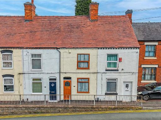 3 bedroom terraced house for sale in Sharpe Street, Tamworth, Staffordshire, B77 — £200,000 • 3 bed • 1 bath • 597 ft²
 3 bedroom terraced house for sale in Florendine Street, Amington, Tamworth, Staffordshire, B77 — £200,000 • 3 bed • 1 bath • 740 ft²
 3 bedroom semi-detached house for sale in Barlaston Way, Amington, Tamworth, Staffordshire, B77 — £270,000 • 3 bed • 2 bath • 993 ft²
 3 bedroom semi-detached house for sale in Bracklesham Way, Amington, B77 — £230,000 • 3 bed • 1 bath • 717 ft²
 3 bedroom semi-detached house for sale in Sheepcote Lane, Tamworth, B77 — £225,000 • 3 bed • 1 bath • 587 ft²
Meta
- {
"@context": "https://schema.org",
"@type": "Residence",
"name": "3 bedroom semidetached house for sale in Sheepcote Lane, Ta…",
"description": "",
"url": "https://propertypiper.co.uk/property/93b2cd16-e43e-4796-b869-69c6328647c4",
"image": "https://image-a.propertypiper.co.uk/7f9f8fba-dbc0-41ff-82e2-96f7bcbca090-1024.jpeg",
"address": {
"@type": "PostalAddress",
"streetAddress": "42 SHEEPCOTE LANE TAMWORTH",
"postalCode": "B77 3JP",
"addressLocality": "Tamworth",
"addressRegion": "Tamworth",
"addressCountry": "England"
},
"geo": {
"@type": "GeoCoordinates",
"latitude": 52.628363771004935,
"longitude": -1.6659050692782587
},
"numberOfRooms": 3,
"numberOfBathroomsTotal": 1,
"floorSize": {
"@type": "QuantitativeValue",
"value": 786,
"unitCode": "FTK"
},
"offers": {
"@type": "Offer",
"price": 225000,
"priceCurrency": "GBP",
"availability": "https://schema.org/InStock"
},
"additionalProperty": [
{
"@type": "PropertyValue",
"name": "Feature",
"value": "semi-detached"
},
{
"@type": "PropertyValue",
"name": "Feature",
"value": "mid-20th century"
},
{
"@type": "PropertyValue",
"name": "Feature",
"value": "brickwork"
},
{
"@type": "PropertyValue",
"name": "Feature",
"value": "two-story"
},
{
"@type": "PropertyValue",
"name": "Feature",
"value": "suburban"
},
{
"@type": "PropertyValue",
"name": "Feature",
"value": "driveway"
},
{
"@type": "PropertyValue",
"name": "Feature",
"value": "no garden"
},
{
"@type": "PropertyValue",
"name": "Feature",
"value": "renovation potential"
},
{
"@type": "PropertyValue",
"name": "Feature",
"value": "modern"
},
{
"@type": "PropertyValue",
"name": "Feature",
"value": "living room"
},
{
"@type": "PropertyValue",
"name": "Feature",
"value": "fireplace"
},
{
"@type": "PropertyValue",
"name": "Feature",
"value": "patio doors"
},
{
"@type": "PropertyValue",
"name": "Feature",
"value": "garden view"
},
{
"@type": "PropertyValue",
"name": "Feature",
"value": "carpeted"
},
{
"@type": "PropertyValue",
"name": "Feature",
"value": "paint"
},
{
"@type": "PropertyValue",
"name": "Feature",
"value": "central lighting"
},
{
"@type": "PropertyValue",
"name": "Feature",
"value": "neutral colors"
}
]
}
High Res Floorplan Images
Compatible Floorplan Images
FloorplanImages Thumbnail