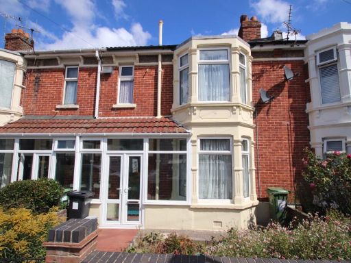
PO3 6BT - 3 bedroom terraced house for sale in Langstone Road, Portsm…
View on Property Piper
3 bedroom terraced house for sale in Langstone Road, Portsmouth, Hampshire, PO3
Property Details
- Price: £275000
- Bedrooms: 3
- Bathrooms: 1
- Property Type: undefined
- Property SubType: undefined
Brochure Descriptions
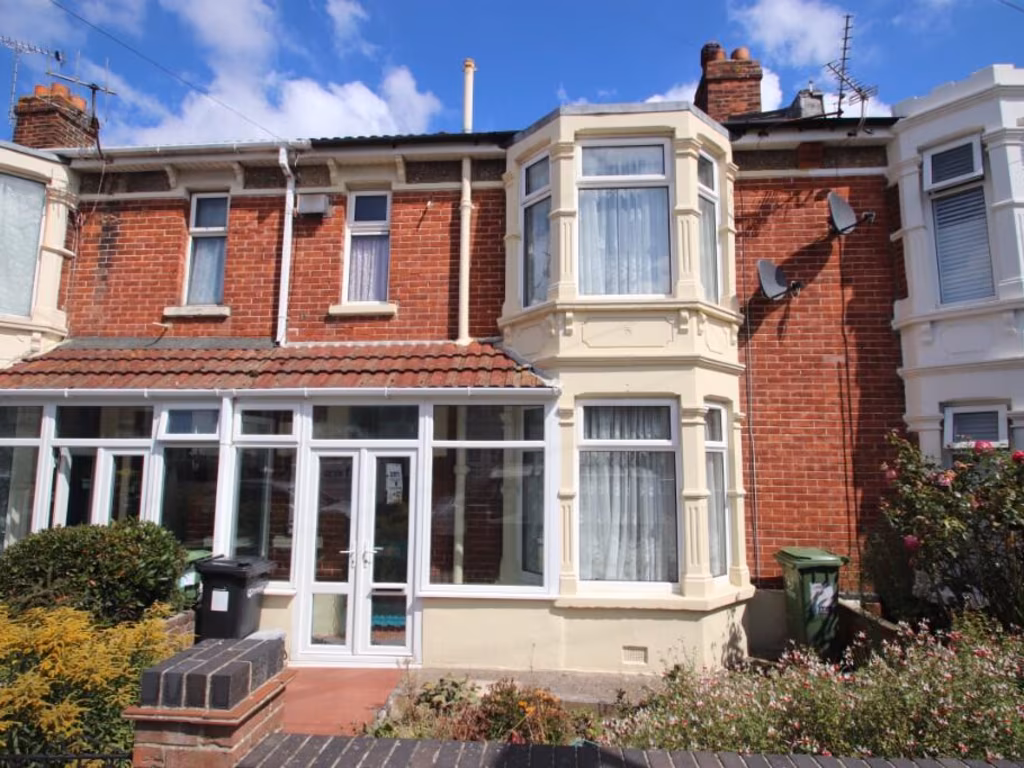
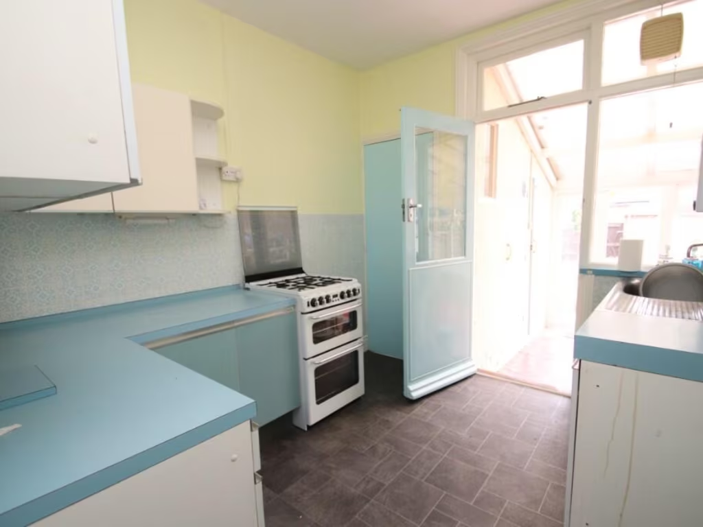
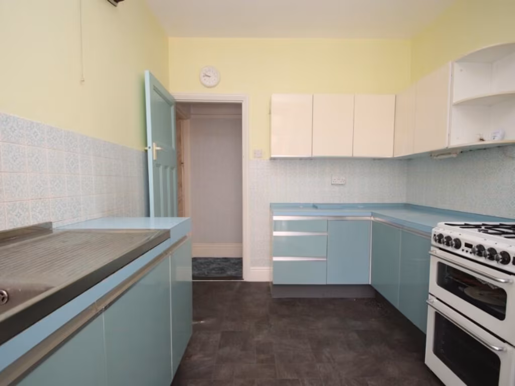
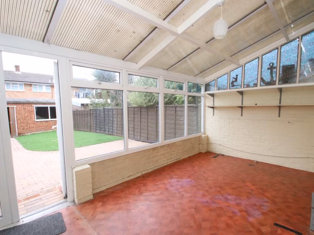
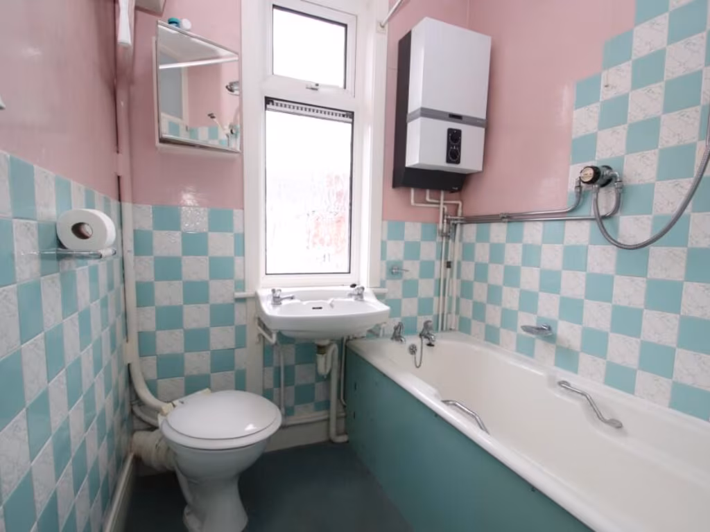
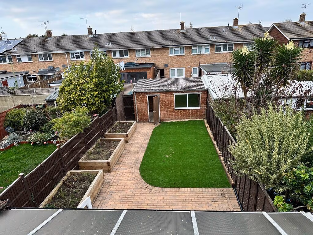
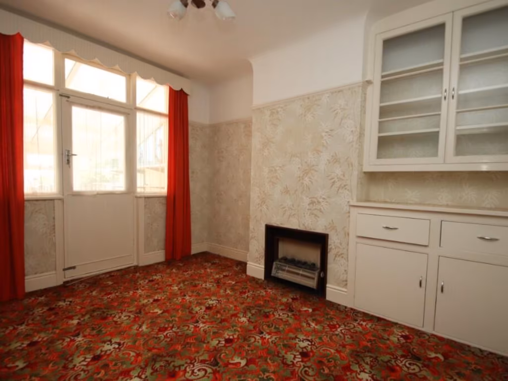
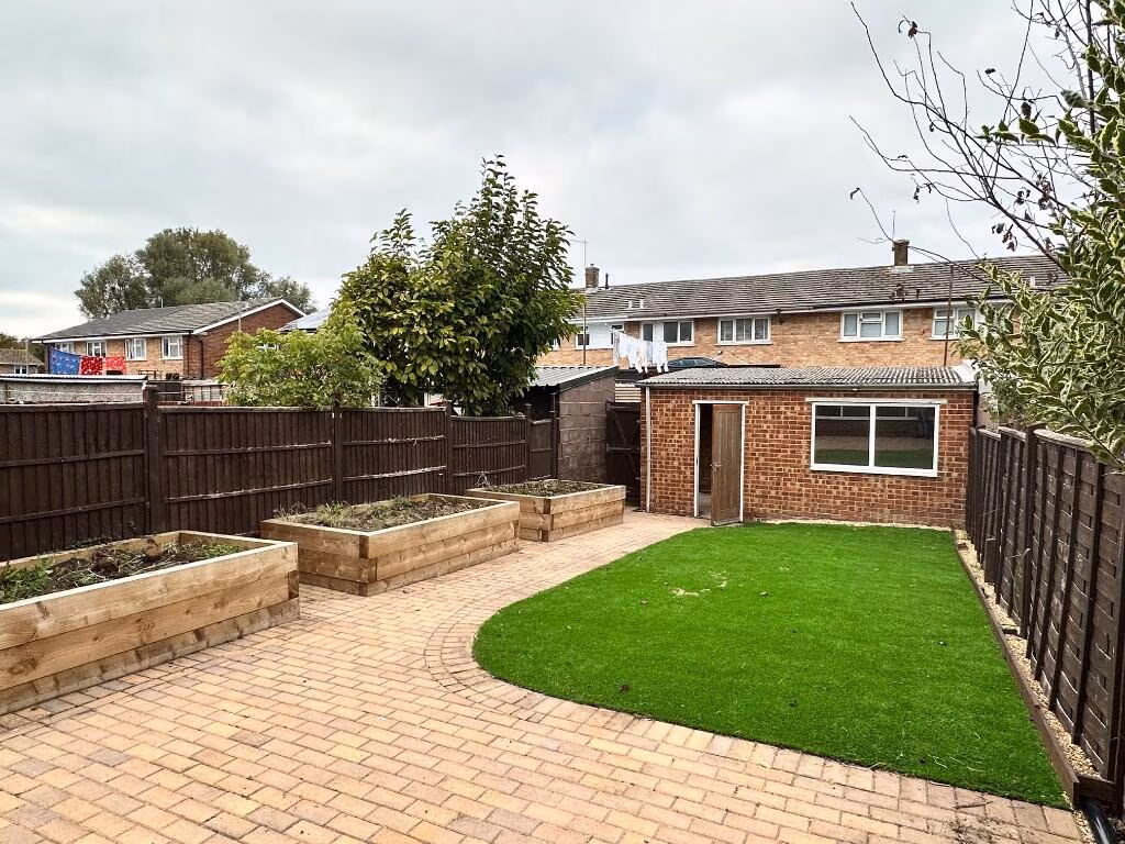
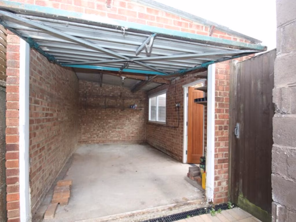
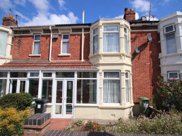
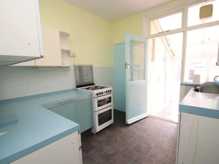
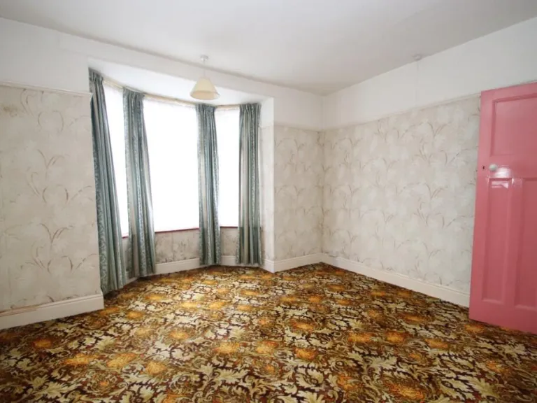
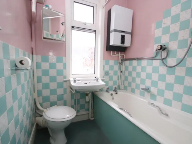
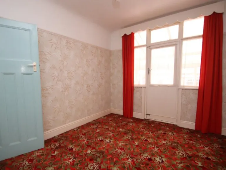
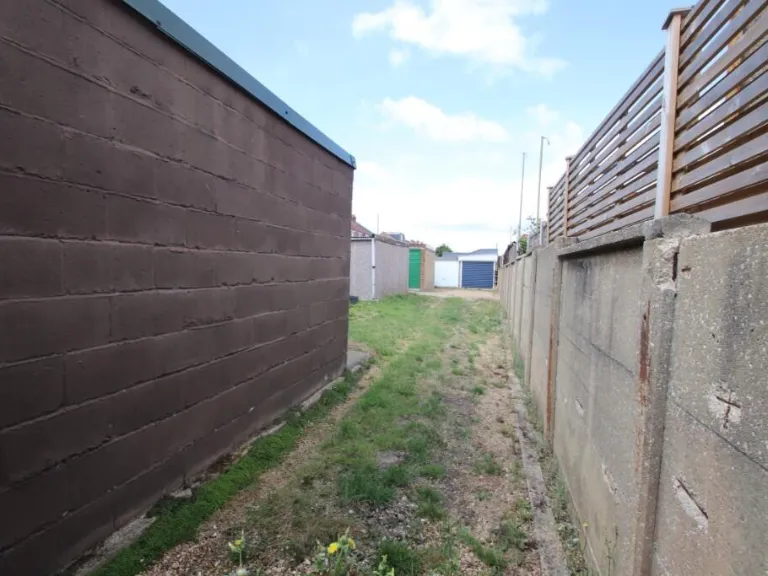
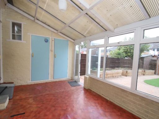
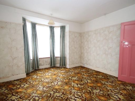
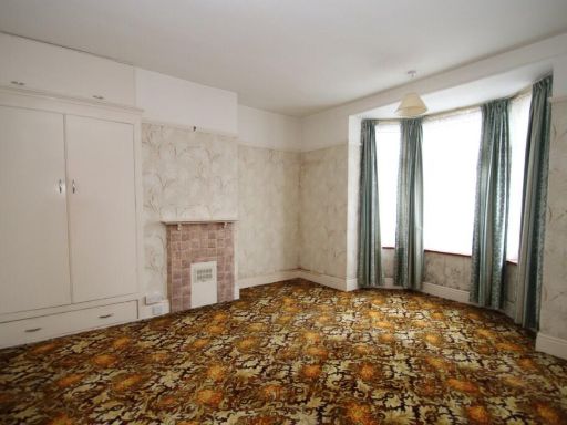
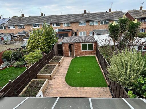
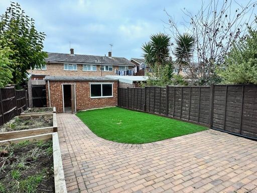
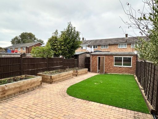
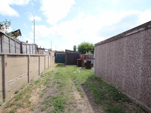
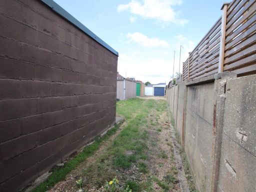
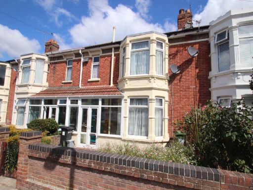
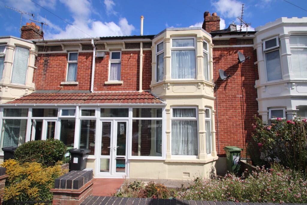
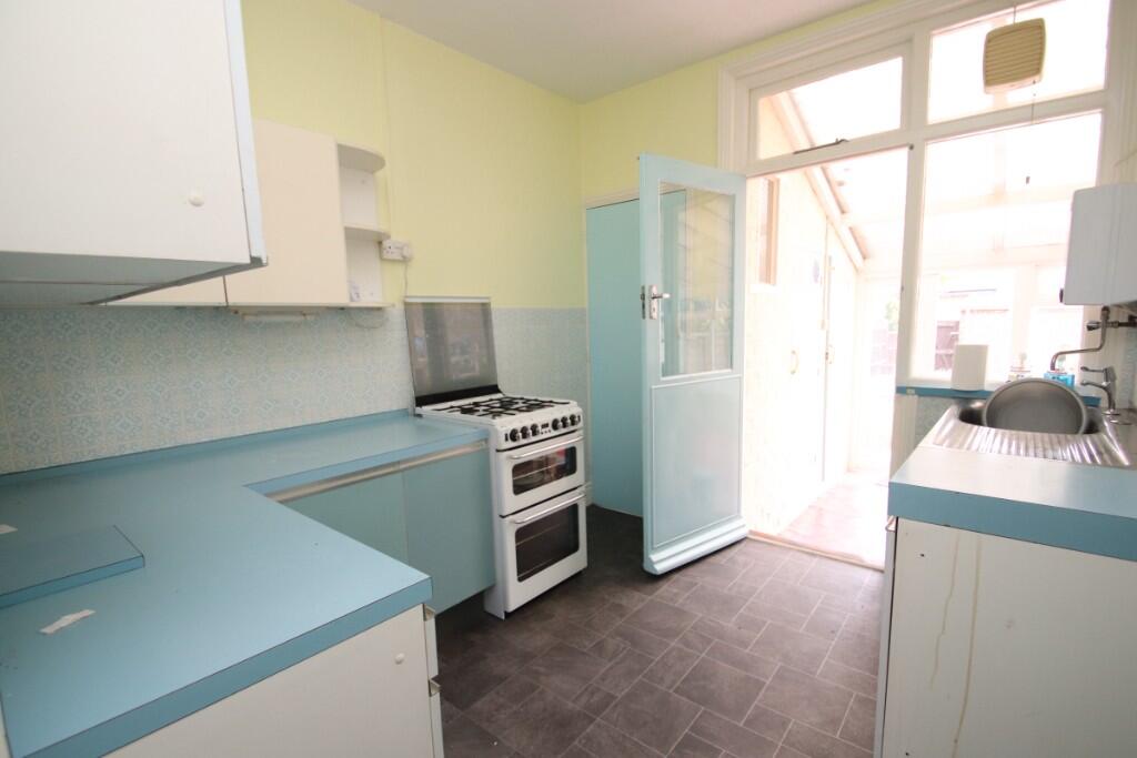
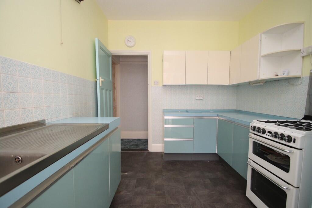
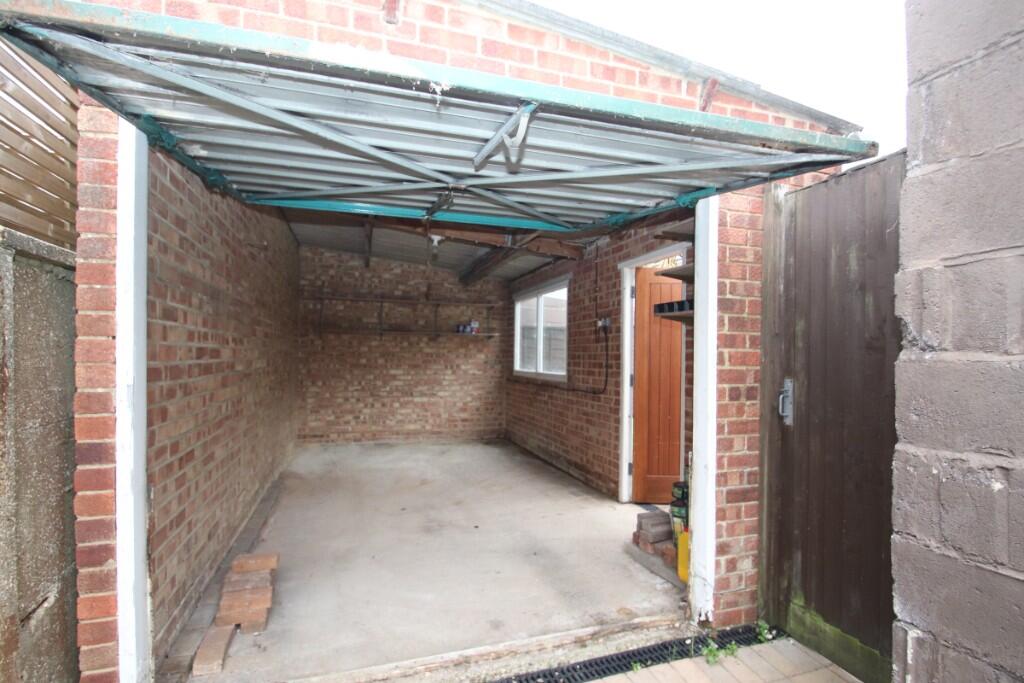
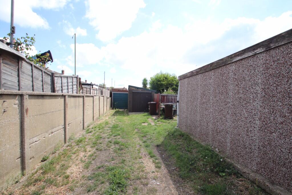
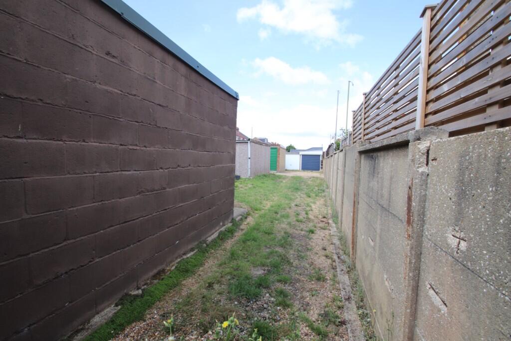
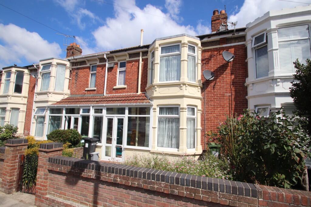
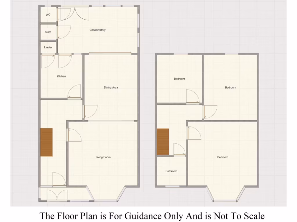
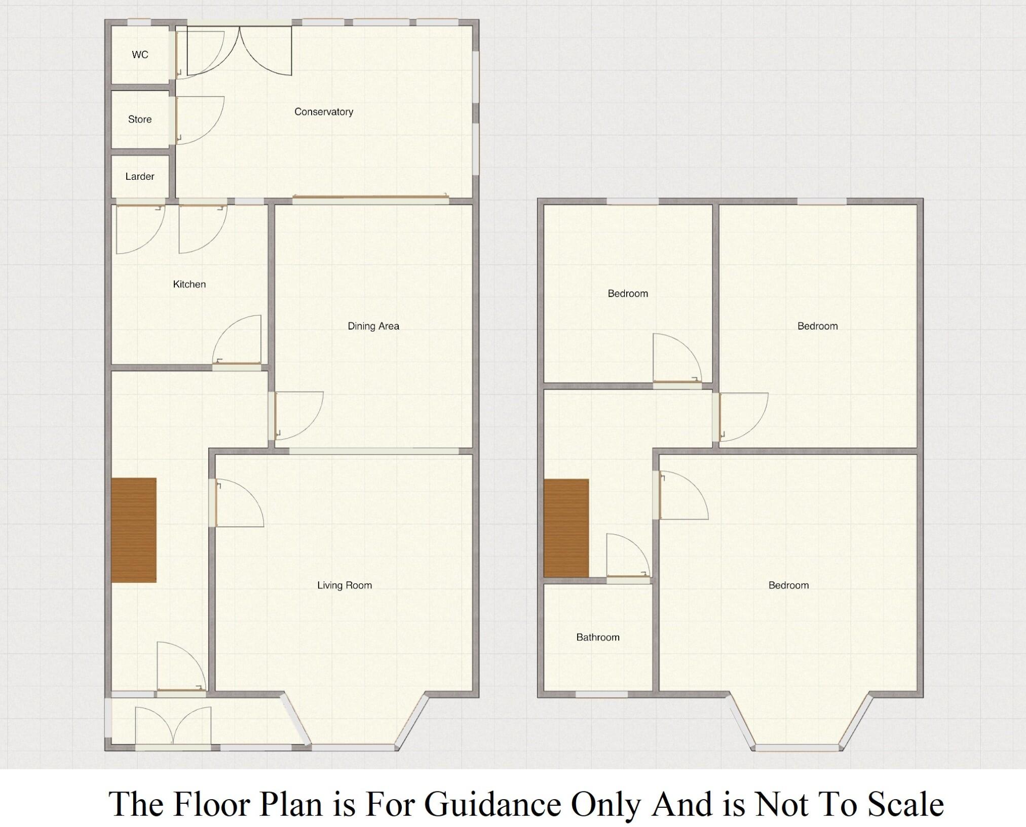
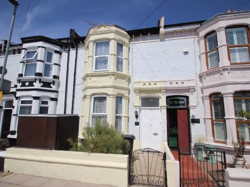
- Mid-terrace Victorian/Edwardian style house with bay window to the front. The property appears to be a traditional two-storey family home featuring a front porch/conservatory, entrance hall, front-aspect lounge, rear-aspect dining room, kitchen, conservatory and ground-floor WC. Upstairs includes three bedrooms and a bathroom suite. Rear garden is fully enclosed, paved with an area of artificial turf and relatively low-maintenance; there is a storage garage at the rear. Property benefits include double glazing and electric heating. Plot and room sizes look typical for an inner-suburban terraced house — garden is small-to-average, overall property footprint is average for a three-bedroom terrace. No forward chain is noted.
Image Descriptions
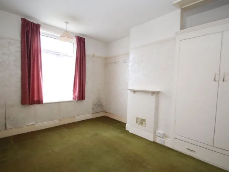
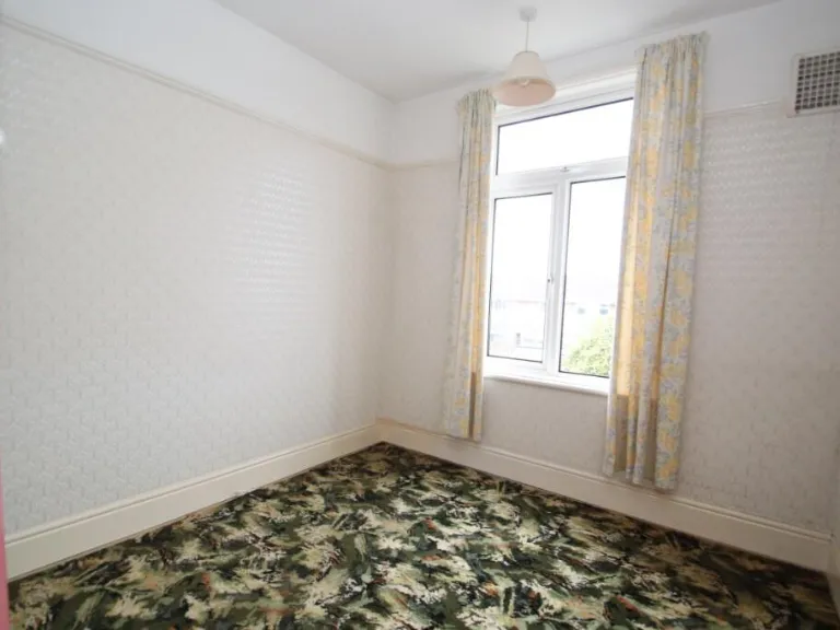
- mid-terrace house Edwardian
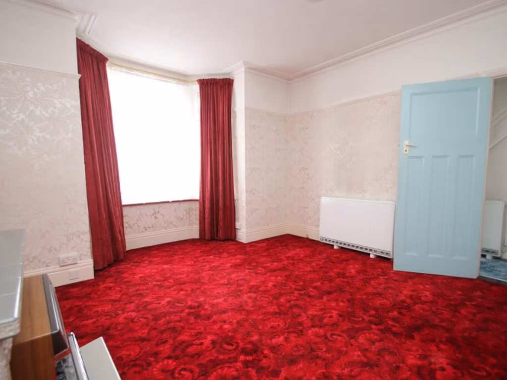
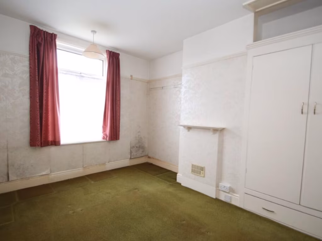
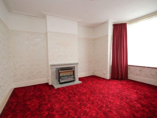
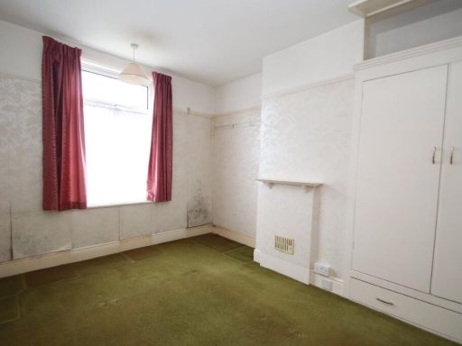
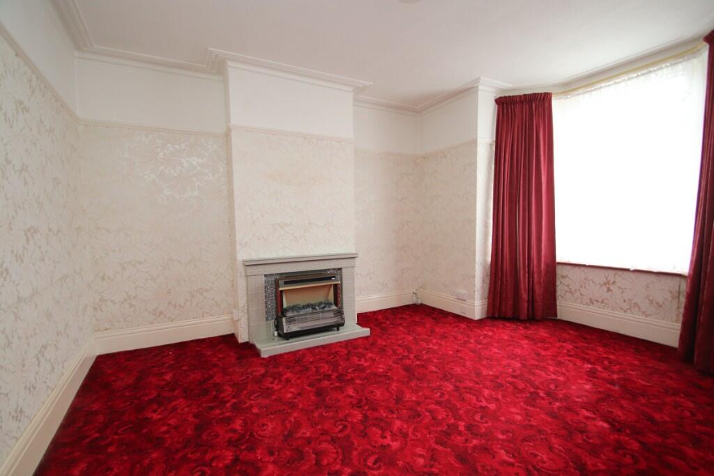
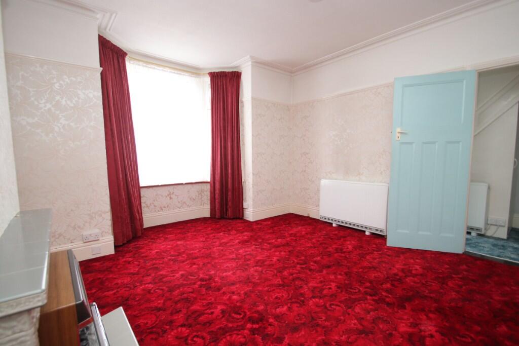
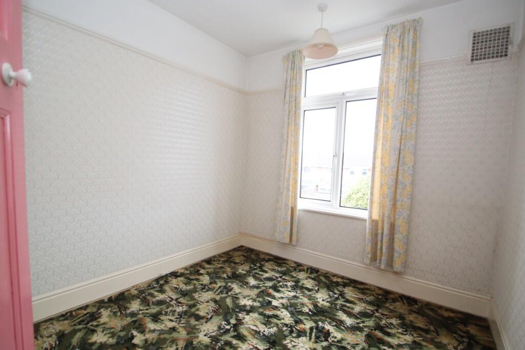
- living room Mid-20th Century
Rooms
- WC:
- Store:
- Larder:
- Conservatory:
- Kitchen:
- Dining Area:
- Living Room:
- Bedroom:
- Bedroom:
- Bedroom:
- Bathroom:
Textual Property Features
- Has Garden
- Chain Free
- Success
Detected Visual Features
- Edwardian
- mid-terrace
- bay window
- red brick
- Victorian-style
- needs modernisation
- roof
- chimney
- conservatory
- front garden
- Mid-20th Century
- living room
- fireplace
- red
- patterned wallpaper
- dated
- needs modernization
- potential
- investment
EPC Details
- Mostly double glazing
- Cavity wall, as built, no insulation (assumed)
- Boiler and radiators, mains gas
- Low energy lighting in all fixed outlets
- Suspended, no insulation (assumed)
Nearby Schools
- Cumberland Infant School
- Bramble Infant School and Nursery
- Wimborne Primary School
- Fernhurst Junior School
- Meon Junior School
- Meon Infant School
- The Portsmouth Academy
- Madani Academy
- Devonshire Infant School
- St John's Cathedral Catholic Primary School
- Miltoncross Academy
- Manor Infant and Nursery School
- Penbridge Junior School
- Westover Primary School
- Admiral Lord Nelson School
- Milton Park Primary School
- Priory School
- Ark Ayrton Primary Academy
- Penbridge Infant School & Nursery
- New Horizons Primary School
- Copnor Primary School
- King's Academy College Park (Junior)
- Craneswater Junior School
- Moorings Way Infant School
- Arundel Court Primary Academy and Nursery
- Langstone Junior Academy
- King's Academy College Park (Infant)
Nearest General Shops
- Id: 215424167
- Tags:
- Building: yes
- Name: The Big Yellow Self Storage Company
- Shop: storage_rental
- TagsNormalized:
- storage
- storage rental
- shop
- Lat: 50.7984464
- Lon: -1.0614631
- FullGeoHash: gcp0zze46hg8
- PartitionGeoHash: gcp0
- Images:
- FoodStandards: null
- Distance: 582.9
,- Id: 3206737701
- Tags:
- Name: Copperfields Hair Studio
- Shop: hairdresser
- TagsNormalized:
- Lat: 50.8063929
- Lon: -1.0600327
- FullGeoHash: gcp1pch0eqn6
- PartitionGeoHash: gcp1
- Images:
- FoodStandards: null
- Distance: 547.2
,- Id: 2456014326
- Tags:
- Addr:
- Housename: Community Cycle Centre
- Postcode: PO3 6DN
- Street: Walsall Road
- Name: Community Cycle Centre
- Shop: bicycle
- Website: communitycyclecentre.co.uk
- TagsNormalized:
- Lat: 50.8032658
- Lon: -1.0602427
- FullGeoHash: gcp1pb7yqx1s
- PartitionGeoHash: gcp1
- Images:
- FoodStandards: null
- Distance: 332.3
}
Nearest Religious buildings
- Id: 215655432
- Tags:
- Amenity: place_of_worship
- Building: church
- Denomination: anglican
- Name: St. Cuthbert's Church
- Religion: christian
- Toilets:
- Wheelchair: yes
- Wheelchair:description: Brilliant purpose built accessible doctors surgery. Ramp to the front and a lift inside to make the rooms upstairs accessible to all. Plenty of space in the waiting rooms for wheelchairs and push chairs.
- Wikidata: Q26617989
- TagsNormalized:
- place of worship
- church
- anglican
- christian
- Lat: 50.8062077
- Lon: -1.061491
- FullGeoHash: gcp1pbgp97wf
- PartitionGeoHash: gcp1
- Images:
- FoodStandards: null
- Distance: 593.8
,- Id: 329464887
- Tags:
- Amenity: place_of_worship
- Building: yes
- TagsNormalized:
- Lat: 50.79931
- Lon: -1.0593682
- FullGeoHash: gcp0zzsx6vtz
- PartitionGeoHash: gcp0
- Images:
- FoodStandards: null
- Distance: 414.3
,- Id: 215610963
- Tags:
- Amenity: place_of_worship
- Building: yes
- Name: Langstone Church
- Religion: christian
- TagsNormalized:
- place of worship
- church
- christian
- Lat: 50.802192
- Lon: -1.051591
- FullGeoHash: gcp300620nuz
- PartitionGeoHash: gcp3
- Images:
- FoodStandards: null
- Distance: 294.9
}
Nearest Airports
- Id: 100647893
- Tags:
- Aerodrome: international
- Aerodrome:type: public
- Aeroway: aerodrome
- Contact:
- Vhf:
- Approach: 120.225 MHz
- Tower: 118.2 MHz
- Ele: 44ft
- Iata: SOU
- Icao: EGHI
- Is_in: Hampshire, England,UK
- Name: Southampton Airport
- Operator: Southampton International Airport Limited
- Source: Bing;Gagravarr_Airports
- Wikidata: Q8988
- Wikipedia: en:Southampton Airport
- TagsNormalized:
- airport
- international airport
- Lat: 50.9513872
- Lon: -1.3516684
- FullGeoHash: gcp1c5rtrffz
- PartitionGeoHash: gcp1
- Images:
- FoodStandards: null
- Distance: 26569
}
Nearest Leisure Facilities
- Id: 394906677
- Tags:
- TagsNormalized:
- Lat: 50.8011168
- Lon: -1.0596712
- FullGeoHash: gcp1pbh3gyec
- PartitionGeoHash: gcp1
- Images:
- FoodStandards: null
- Distance: 301.6
,- Id: 2272845618
- Tags:
- TagsNormalized:
- Lat: 50.8037256
- Lon: -1.0593446
- FullGeoHash: gcp1pbs95kz7
- PartitionGeoHash: gcp1
- Images:
- FoodStandards: null
- Distance: 298
,- Id: 119823259
- Tags:
- Leisure: pitch
- Sport: multi
- Surface: artificial_turf
- TagsNormalized:
- Lat: 50.8004658
- Lon: -1.0588281
- FullGeoHash: gcp0zzuypt0w
- PartitionGeoHash: gcp0
- Images:
- FoodStandards: null
- Distance: 293.1
,- Id: 394906676
- Tags:
- Leisure: pitch
- Sport: tennis
- Surface: paved
- TagsNormalized:
- Lat: 50.8009297
- Lon: -1.0583771
- FullGeoHash: gcp1pbj2f58v
- PartitionGeoHash: gcp1
- Images:
- FoodStandards: null
- Distance: 235.2
,- Id: 32146845
- Tags:
- Leisure: park
- Name: Tamworth Park
- Source: Local Knowledge
- TagsNormalized:
- Lat: 50.8034745
- Lon: -1.0583306
- FullGeoHash: gcp1pbmren59
- PartitionGeoHash: gcp1
- Images:
- FoodStandards: null
- Distance: 223.5
}
Nearest Tourist attractions
- Id: 7291574313
- Tags:
- Addr:
- City: Eastney
- Housename: Gas Engine House
- Postcode: PO4 9JF
- Street: Henderson Road
- Description: Grade II listed former municipal pumping station with historic gas engines and pumps as well as a collection of stationary engines. Generally open to the public with free admission on the last Sunday of each month, See Website for opening times.
- Facebook: https://www.facebook.com/groups/824230658021566/
- Name: Eastney Gas Engine House
- Opening_hours: Su[-1] 11:00 - 17:00
- Operator: Portsmouth City Museums
- Operator:type: public
- Tourism: museum
- Website: http://portsmouthmuseums.co.uk/museum-service/Eastney-Beam-Engine-House
- TagsNormalized:
- Lat: 50.7890647
- Lon: -1.0463194
- FullGeoHash: gcp2bjy5dzzs
- PartitionGeoHash: gcp2
- Images:
- FoodStandards: null
- Distance: 1611.9
,- Id: 1274361894
- Tags:
- Addr:
- City: Portsmouth
- Country: GB
- Housenumber: 183
- Postcode: PO2 7QU
- Street: New Road
- Amenity: pub
- Fhrs:
- Name: The Stag
- Source:
- Tourism: guest_house
- TagsNormalized:
- Lat: 50.8095025
- Lon: -1.0703194
- FullGeoHash: gcp1p9sdgcb0
- PartitionGeoHash: gcp1
- Images:
- FoodStandards:
- Id: 150749
- FHRSID: 150749
- LocalAuthorityBusinessID: 990
- BusinessName: The Stag Hotel
- BusinessType: Hotel/bed & breakfast/guest house
- BusinessTypeID: 7842
- AddressLine1: 183 New Road
- AddressLine2: Portsmouth
- AddressLine3: null
- AddressLine4: null
- PostCode: PO2 7QU
- RatingValue: 5
- RatingKey: fhrs_5_en-GB
- RatingDate: 2019-11-12
- LocalAuthorityCode: 876
- LocalAuthorityName: Portsmouth
- LocalAuthorityWebSite: http://www.portsmouth.gov.uk
- LocalAuthorityEmailAddress: public.protection@portsmouthcc.gov.uk
- Scores:
- Hygiene: 5
- Structural: 5
- ConfidenceInManagement: 5
- NewRatingPending: false
- Geocode:
- Longitude: -1.06927394866943
- Latitude: 50.80966186523440
- Distance: 1300
,- Id: 8829028418
- Tags:
- Name: St. James Playground
- Tourism: picnic_site
- TagsNormalized:
- playground
- picnic
- picnic site
- tourism
- Lat: 50.7950682
- Lon: -1.0493782
- FullGeoHash: gcp2bngyexnb
- PartitionGeoHash: gcp2
- Images:
- FoodStandards: null
- Distance: 918.6
}
Nearest Train stations
- Id: 13973356
- Tags:
- Alt_name: Cosham Railway Station
- Name: Cosham
- Naptan:
- Network: National Rail
- Operator: South West Trains
- Public_transport: station
- Railway: station
- Ref:
- Source: NPE
- Wikidata: Q5172759
- Wikipedia: en:Cosham railway station
- TagsNormalized:
- Lat: 50.8418849
- Lon: -1.0673875
- FullGeoHash: gcp1pxqz2n60
- PartitionGeoHash: gcp1
- Images:
- FoodStandards: null
- Distance: 4479.9
,- Id: 6010353229
- Tags:
- Name: Portsmouth Harbour
- Naptan:
- Network: National Rail
- Public_transport: station
- Railway: station
- Ref:
- Source: Landsat photo
- Wikidata: Q2228512
- Wikipedia: en:Portsmouth Harbour railway station
- TagsNormalized:
- Lat: 50.7967035
- Lon: -1.1087807
- FullGeoHash: gcp0yz285xc5
- PartitionGeoHash: gcp0
- Images:
- FoodStandards: null
- Distance: 3775.5
,- Id: 28971477
- Tags:
- Name: Hilsea
- Naptan:
- Network: National Rail
- Operator: South Western Railway
- Public_transport: station
- Railway: station
- Ref:
- Website: https://www.nationalrail.co.uk/stations/HLS/details.html
- Wikidata: Q5391111
- Wikipedia: en:Hilsea railway station
- TagsNormalized:
- Lat: 50.8283898
- Lon: -1.058643
- FullGeoHash: gcp1pvj0gfde
- PartitionGeoHash: gcp1
- Images:
- FoodStandards: null
- Distance: 2911.5
,- Id: 6010790017
- Tags:
- Name: Portsmouth and Southsea
- Naptan:
- Network: National Rail
- Operator: South West Trains
- Public_transport: station
- Railway: station
- Ref:
- Source: survey
- Wikidata: Q3305372
- Wikipedia: en:Portsmouth & Southsea railway station
- TagsNormalized:
- Lat: 50.7982014
- Lon: -1.0906787
- FullGeoHash: gcp0zptbcr54
- PartitionGeoHash: gcp0
- Images:
- FoodStandards: null
- Distance: 2493.6
,- Id: 17479415
- Tags:
- Name: Fratton
- Naptan:
- Network: National Rail
- Operator: South Westen Railway
- Public_transport: station
- Railway: station
- Ref:
- Wheelchair: yes
- Wikidata: Q2618118
- Wikipedia: en:Fratton railway station
- TagsNormalized:
- Lat: 50.7964461
- Lon: -1.0732559
- FullGeoHash: gcp0zx4qxrf7
- PartitionGeoHash: gcp0
- Images:
- FoodStandards: null
- Distance: 1388
}
Nearest Hotels
- Id: 392878880
- Tags:
- Addr:
- City: Portsmouth
- Country: GB
- Housenumber: 35
- Postcode: PO4 0HL
- Street: Francis Avenue
- Amenity: pub
- Fhrs:
- Name: Northcote Hotel
- Real_ale: yes
- Source:
- TagsNormalized:
- Lat: 50.787741
- Lon: -1.0723227
- FullGeoHash: gcp0ztehj145
- PartitionGeoHash: gcp0
- Images:
- FoodStandards: null
- Distance: 1990.1
,- Id: 1342101468
- Tags:
- Addr:
- City: Portsmouth
- Country: GB
- Housenumber: 124
- Postcode: PO4 9HT
- Street: Prince Albert Road
- Amenity: pub
- Fhrs:
- Name: The Eastfield Hotel
- Wikidata: Q26403637
- TagsNormalized:
- Lat: 50.789602
- Lon: -1.0595153
- FullGeoHash: gcp0zvuqzs01
- PartitionGeoHash: gcp0
- Images:
- FoodStandards: null
- Distance: 1432.6
,- Id: 215423555
- Tags:
- Addr:
- City: Portsmouth
- Country: GB
- Postcode: PO4 8SL
- Street: Fratton Way
- Brand: Ibis Budget
- Brand:wikidata: Q1458135
- Brand:wikipedia: en:Ibis Budget
- Building: yes
- Fhrs:
- Name: Ibis Budget
- Old_name: Etap Hotel
- Operator: Ibis Budget
- Source:
- Tourism: hotel
- TagsNormalized:
- Lat: 50.7954727
- Lon: -1.0663409
- FullGeoHash: gcp0zxp906qt
- PartitionGeoHash: gcp0
- Images:
- FoodStandards: null
- Distance: 1058.9
}
Tags
- Edwardian
- mid-terrace
- bay window
- red brick
- Victorian-style
- needs modernisation
- roof
- chimney
- conservatory
- front garden
- Mid-20th Century
- living room
- fireplace
- bay window
- red
- patterned wallpaper
- dated
- needs modernization
- potential
- investment
Local Market Stats
- Average Price/sqft: £280
- Avg Income: £45500
- Rental Yield: 5.4%
- Social Housing: 11%
- Planning Success Rate: 50%
Similar Properties
 3 bedroom terraced house for sale in Wadham Road, Portsmouth, Hampshire, PO2 — £280,000 • 3 bed • 2 bath • 1292 ft²
 3 bedroom semi-detached house for sale in Whimbrel Close, Portsmouth, Hampshire, PO4 — £340,000 • 3 bed • 1 bath • 969 ft²
 3 bedroom terraced house for sale in Langstone Road, Copnor PO3 6BX, PO3 — £269,500 • 3 bed • 1 bath • 893 ft²
 3 bedroom terraced house for sale in Devon Road, Portsmouth, PO3 — £280,000 • 3 bed • 1 bath • 883 ft²
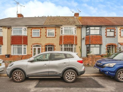 3 bedroom terraced house for sale in Rosebery Avenue, Portsmouth, Hampshire, PO6 — £335,000 • 3 bed • 1 bath • 1047 ft²
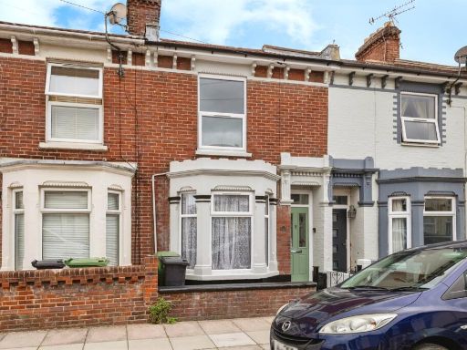 3 bedroom terraced house for sale in Highgate Road, Portsmouth, PO3 — £285,000 • 3 bed • 2 bath • 605 ft²
Meta
- {
"@context": "https://schema.org",
"@type": "Residence",
"name": "3 bedroom terraced house for sale in Langstone Road, Portsm…",
"description": "",
"url": "https://propertypiper.co.uk/property/90db8223-a4df-4b00-ae71-7623e2ff8ab9",
"image": "https://image-a.propertypiper.co.uk/79eb3eb2-5340-4c6e-9005-7fdfaf827c81-1024.jpeg",
"address": {
"@type": "PostalAddress",
"streetAddress": "Langstone Road, Portsmouth, Hampshire, PO3",
"postalCode": "PO3 6BT",
"addressLocality": "Portsmouth",
"addressRegion": "Portsmouth North",
"addressCountry": "England"
},
"geo": {
"@type": "GeoCoordinates",
"latitude": 50.8022686,
"longitude": -1.0557858
},
"numberOfRooms": 3,
"numberOfBathroomsTotal": 1,
"floorSize": {
"@type": "QuantitativeValue",
"value": 936,
"unitCode": "FTK"
},
"offers": {
"@type": "Offer",
"price": 275000,
"priceCurrency": "GBP",
"availability": "https://schema.org/InStock"
},
"additionalProperty": [
{
"@type": "PropertyValue",
"name": "Feature",
"value": "Edwardian"
},
{
"@type": "PropertyValue",
"name": "Feature",
"value": "mid-terrace"
},
{
"@type": "PropertyValue",
"name": "Feature",
"value": "bay window"
},
{
"@type": "PropertyValue",
"name": "Feature",
"value": "red brick"
},
{
"@type": "PropertyValue",
"name": "Feature",
"value": "Victorian-style"
},
{
"@type": "PropertyValue",
"name": "Feature",
"value": "needs modernisation"
},
{
"@type": "PropertyValue",
"name": "Feature",
"value": "roof"
},
{
"@type": "PropertyValue",
"name": "Feature",
"value": "chimney"
},
{
"@type": "PropertyValue",
"name": "Feature",
"value": "conservatory"
},
{
"@type": "PropertyValue",
"name": "Feature",
"value": "front garden"
},
{
"@type": "PropertyValue",
"name": "Feature",
"value": "Mid-20th Century"
},
{
"@type": "PropertyValue",
"name": "Feature",
"value": "living room"
},
{
"@type": "PropertyValue",
"name": "Feature",
"value": "fireplace"
},
{
"@type": "PropertyValue",
"name": "Feature",
"value": "bay window"
},
{
"@type": "PropertyValue",
"name": "Feature",
"value": "red"
},
{
"@type": "PropertyValue",
"name": "Feature",
"value": "patterned wallpaper"
},
{
"@type": "PropertyValue",
"name": "Feature",
"value": "dated"
},
{
"@type": "PropertyValue",
"name": "Feature",
"value": "needs modernization"
},
{
"@type": "PropertyValue",
"name": "Feature",
"value": "potential"
},
{
"@type": "PropertyValue",
"name": "Feature",
"value": "investment"
}
]
}
High Res Floorplan Images
Compatible Floorplan Images
FloorplanImages Thumbnail