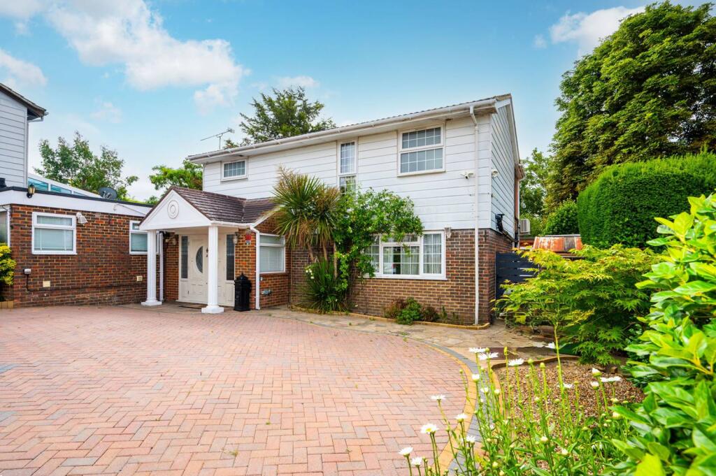
KT4 7HT - 4 bedroom detached house for sale in Parklands Way, Worcest…
View on Property Piper
4 bedroom detached house for sale in Parklands Way, Worcester Park, KT4
Property Details
- Price: £975000
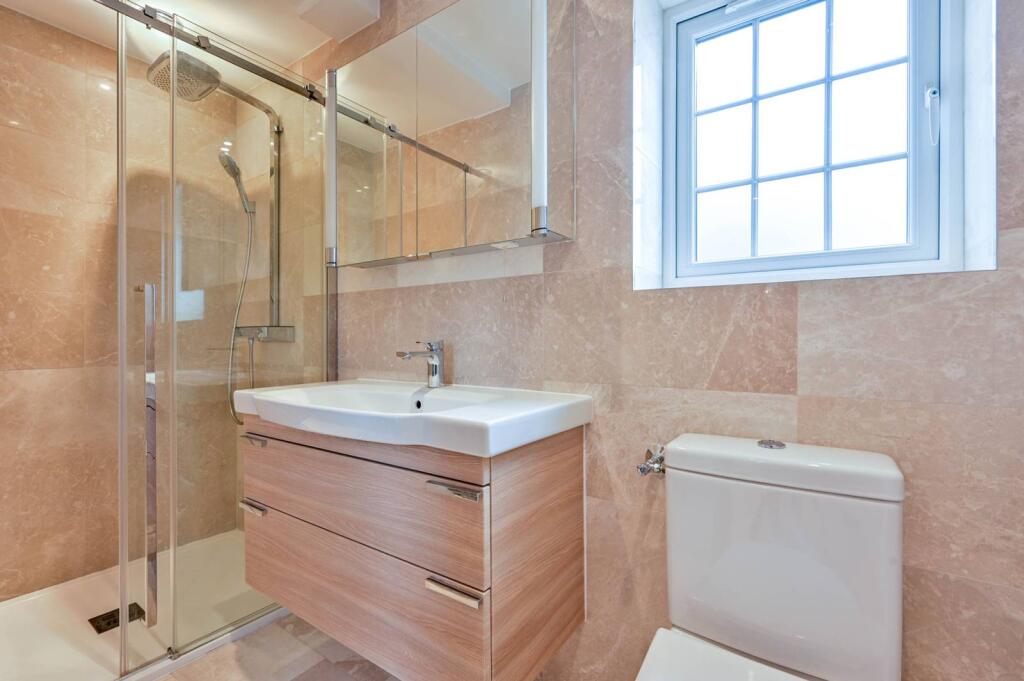
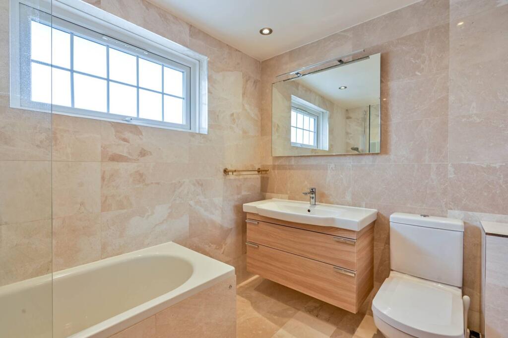
- Bedrooms: 4
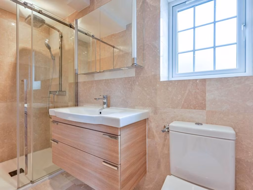
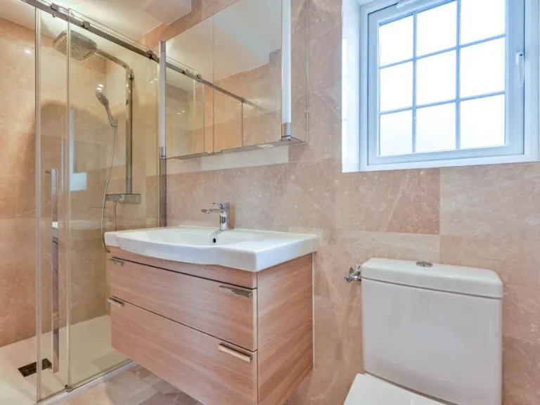
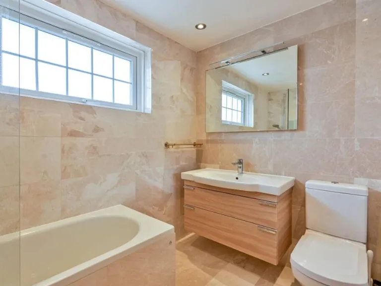
- Bathrooms: 3
- Property Type: undefined
- Property SubType: undefined
Image Descriptions
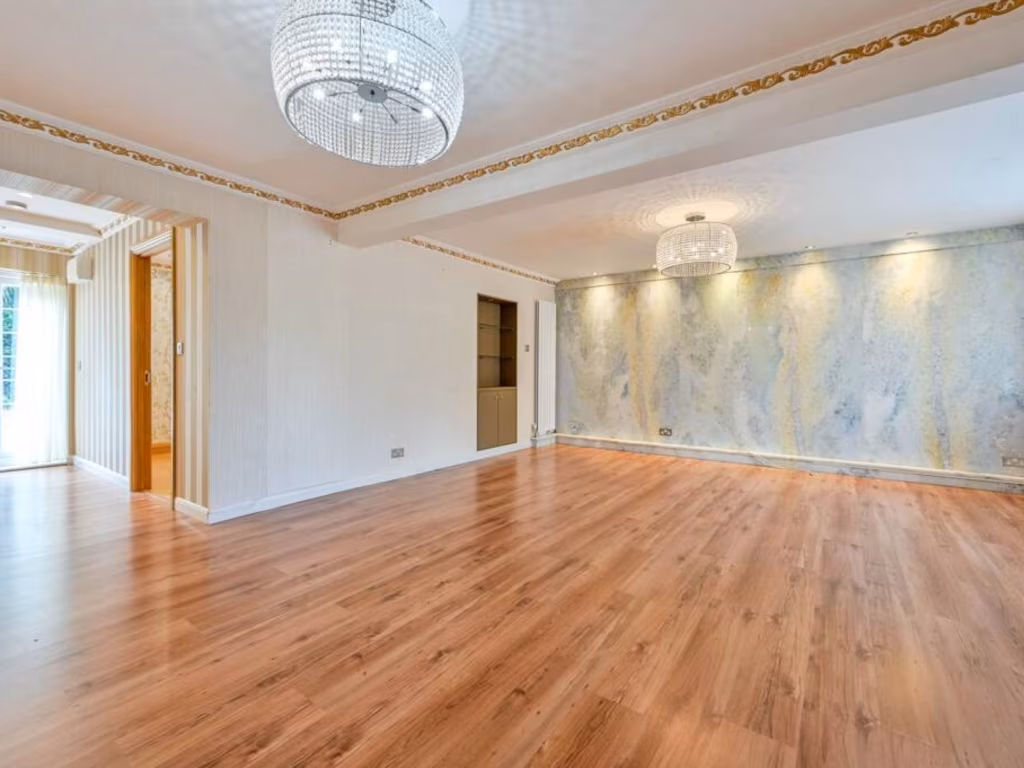
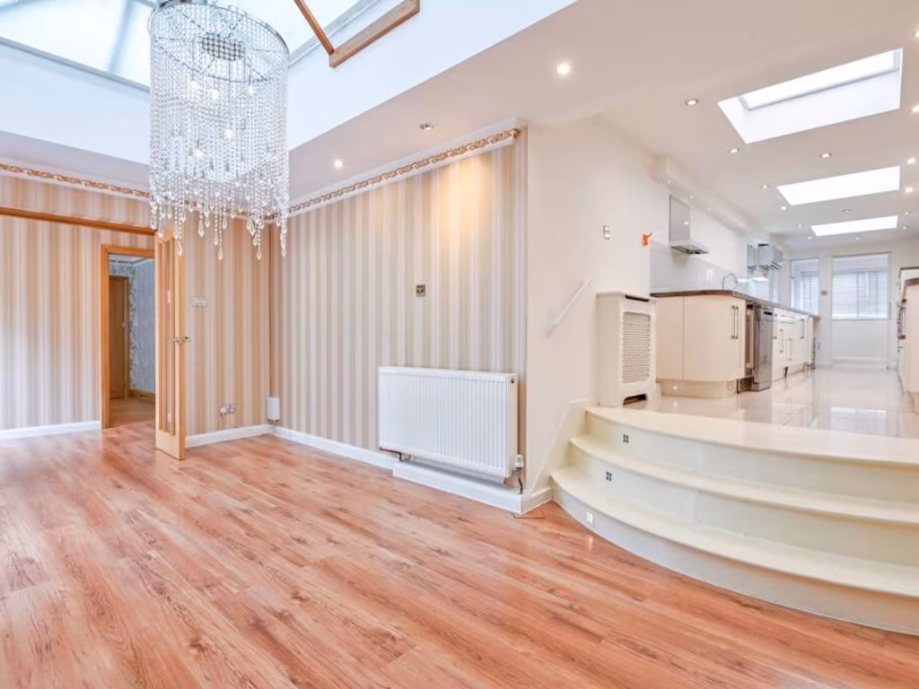
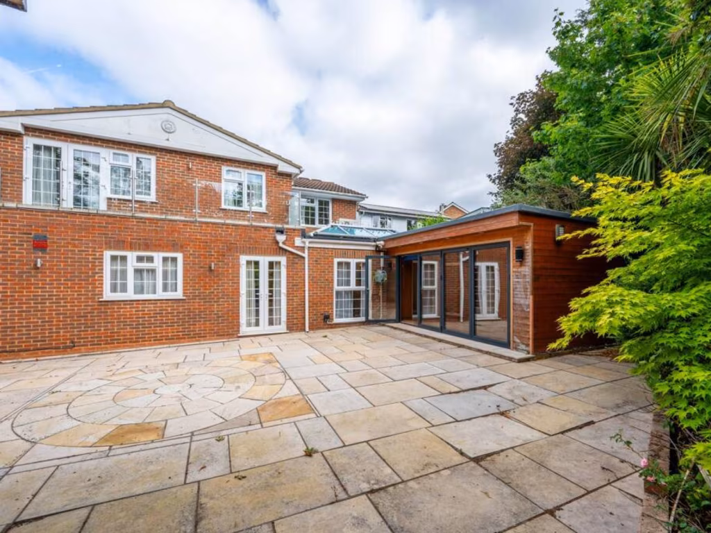
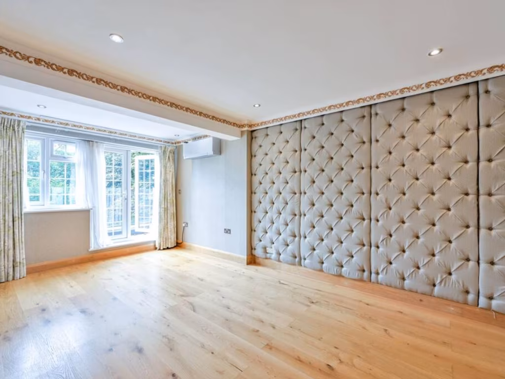
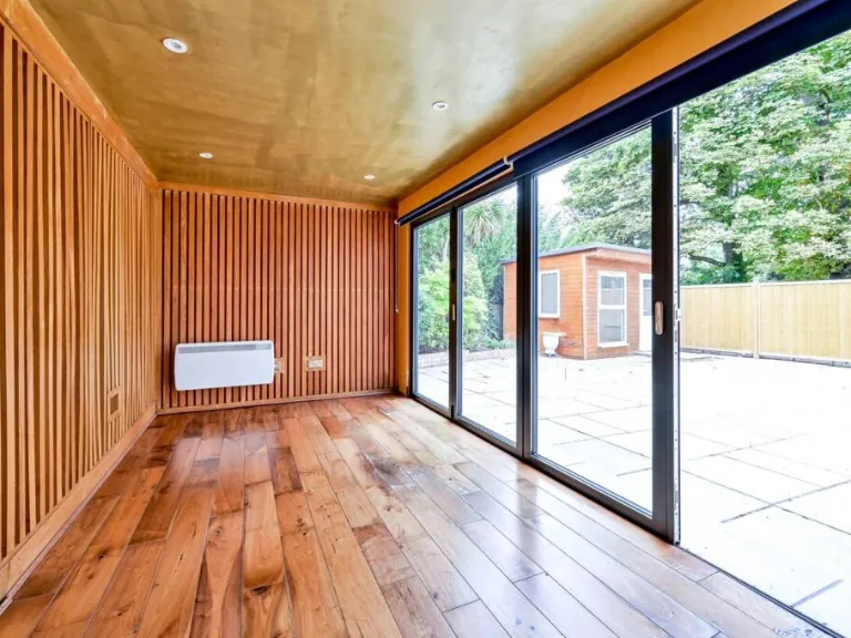
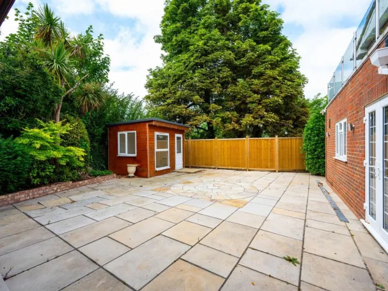
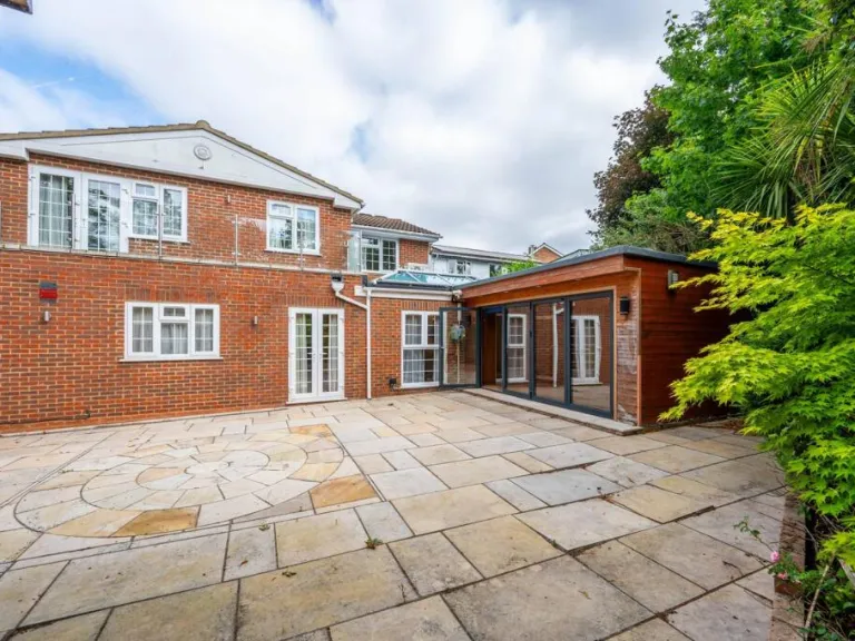
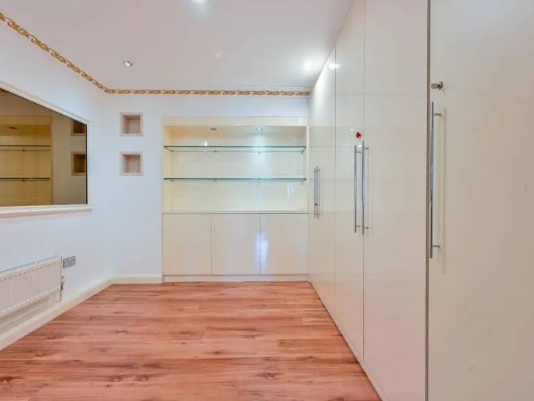
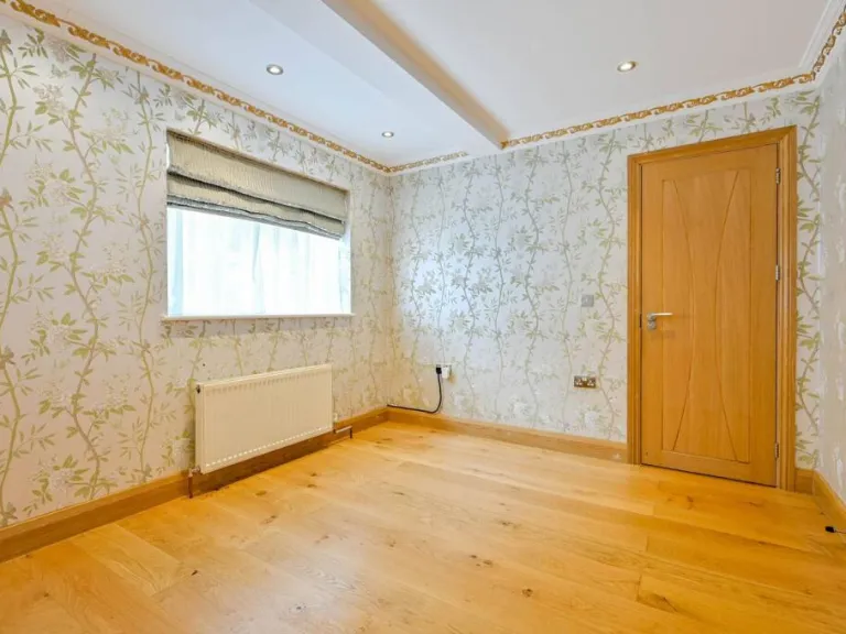
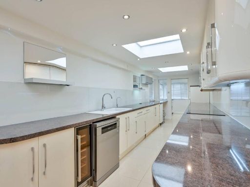
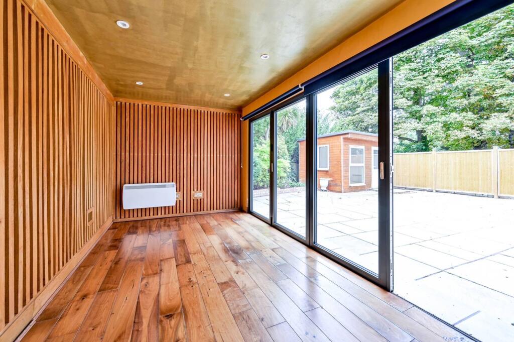
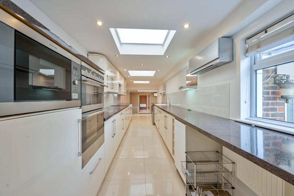
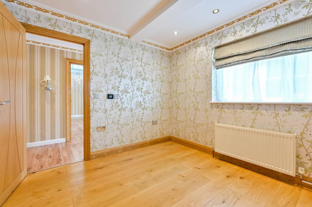
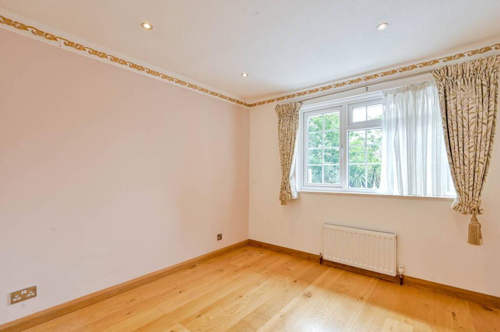
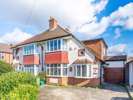
- detached house mid-20th century suburban
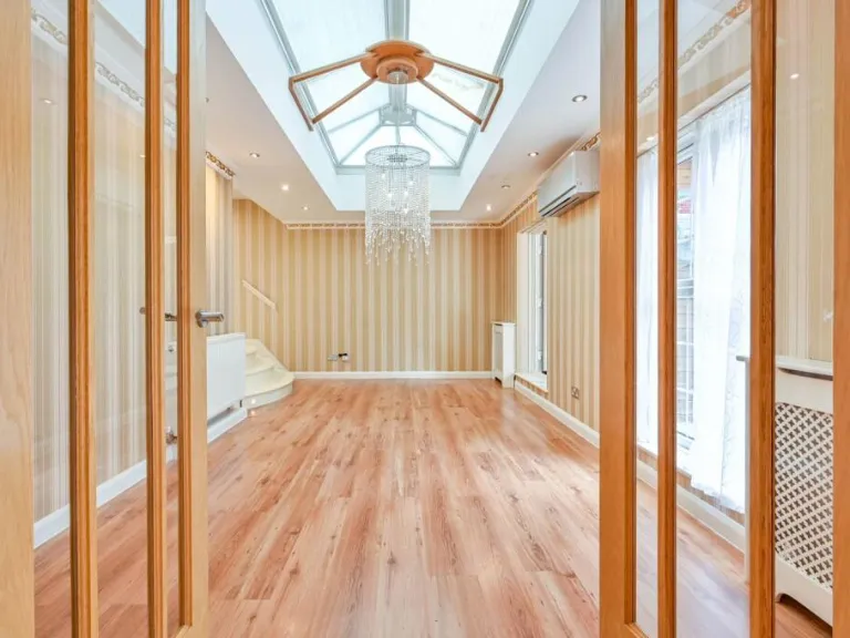
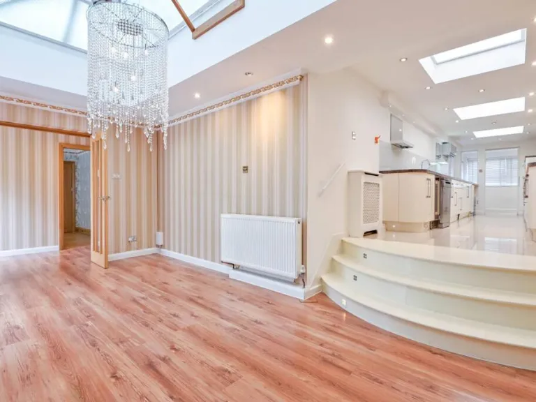
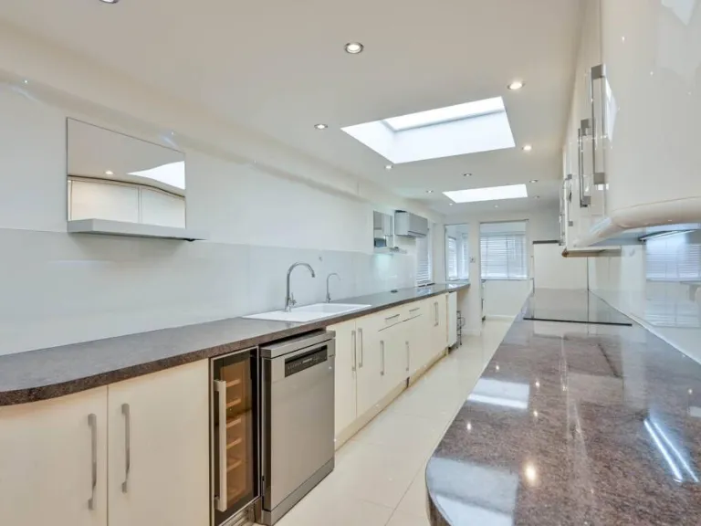
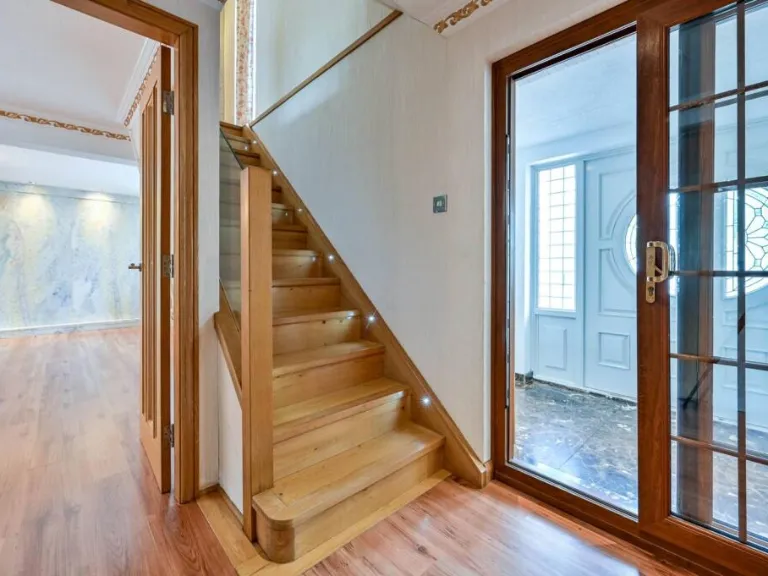
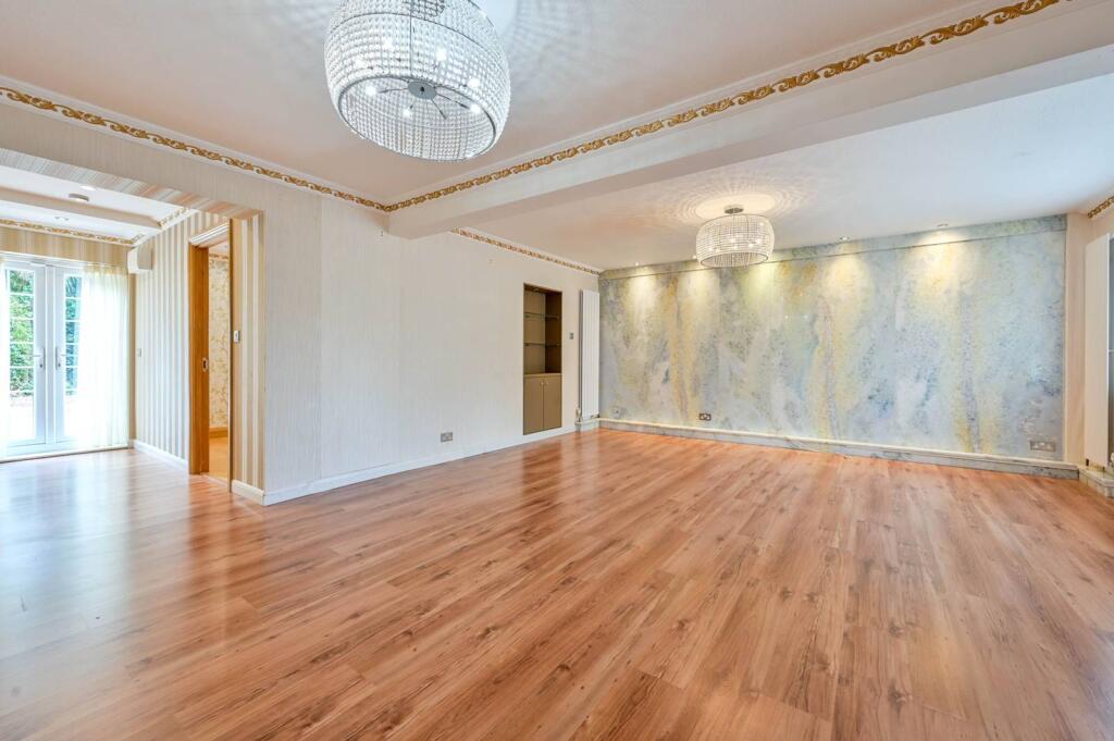
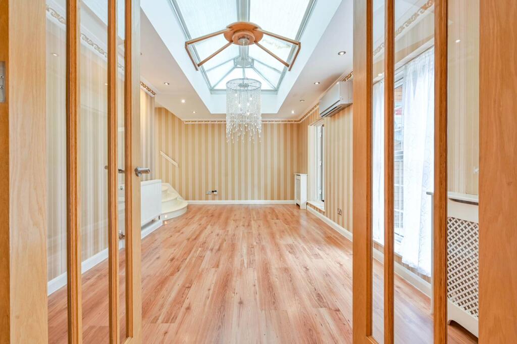
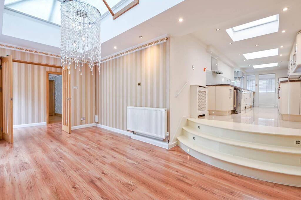
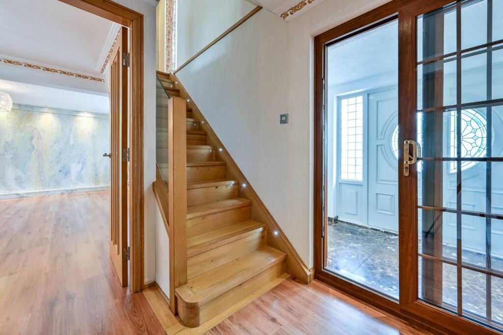
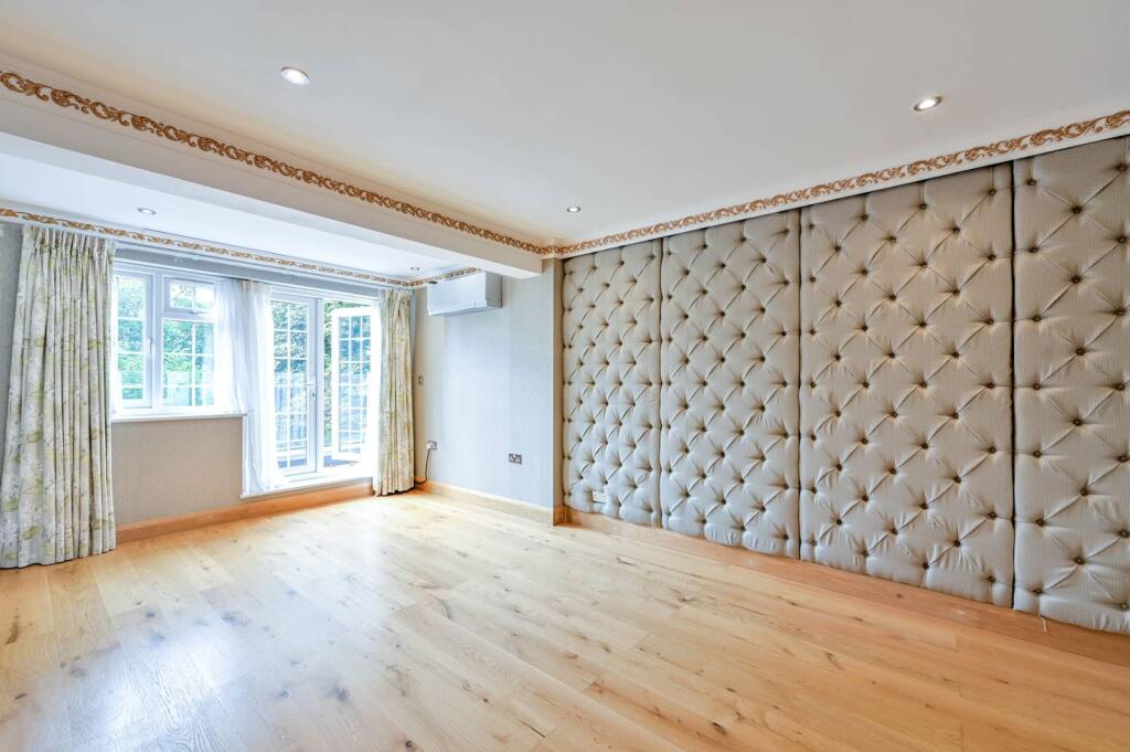
- interior living room contemporary
Floorplan Description
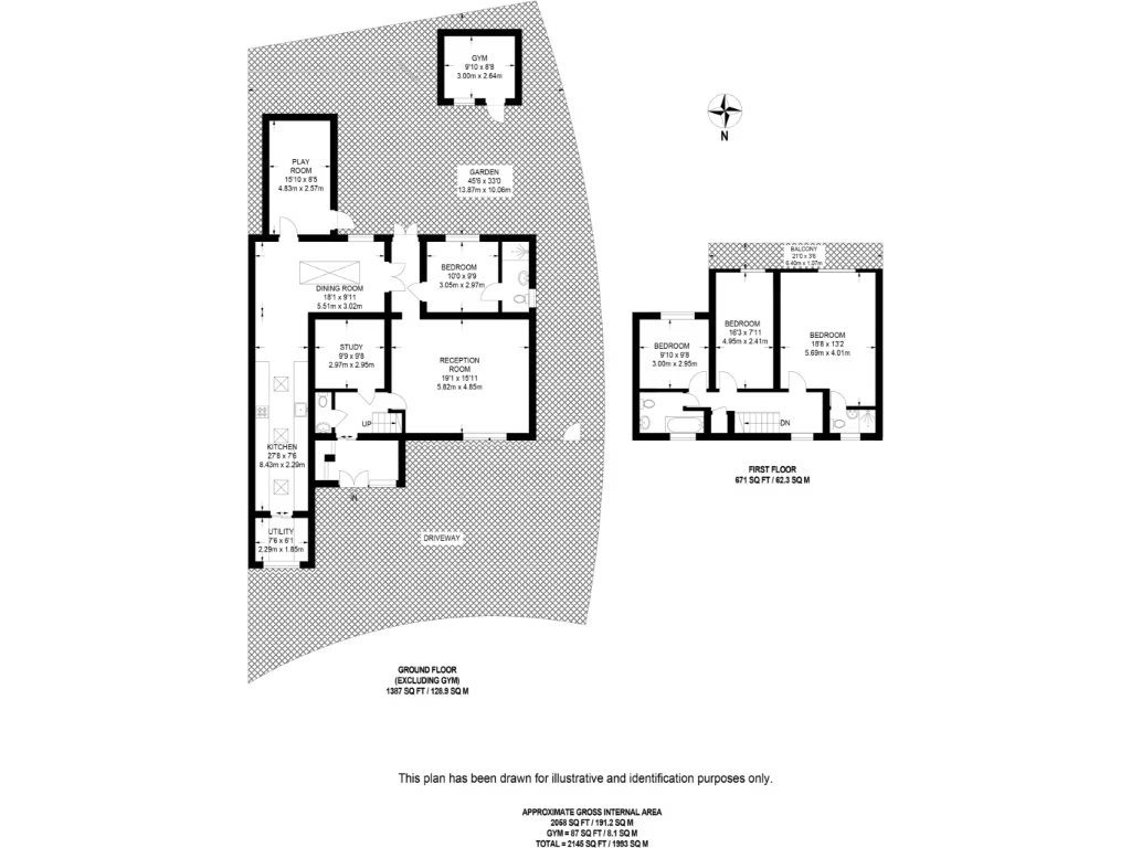
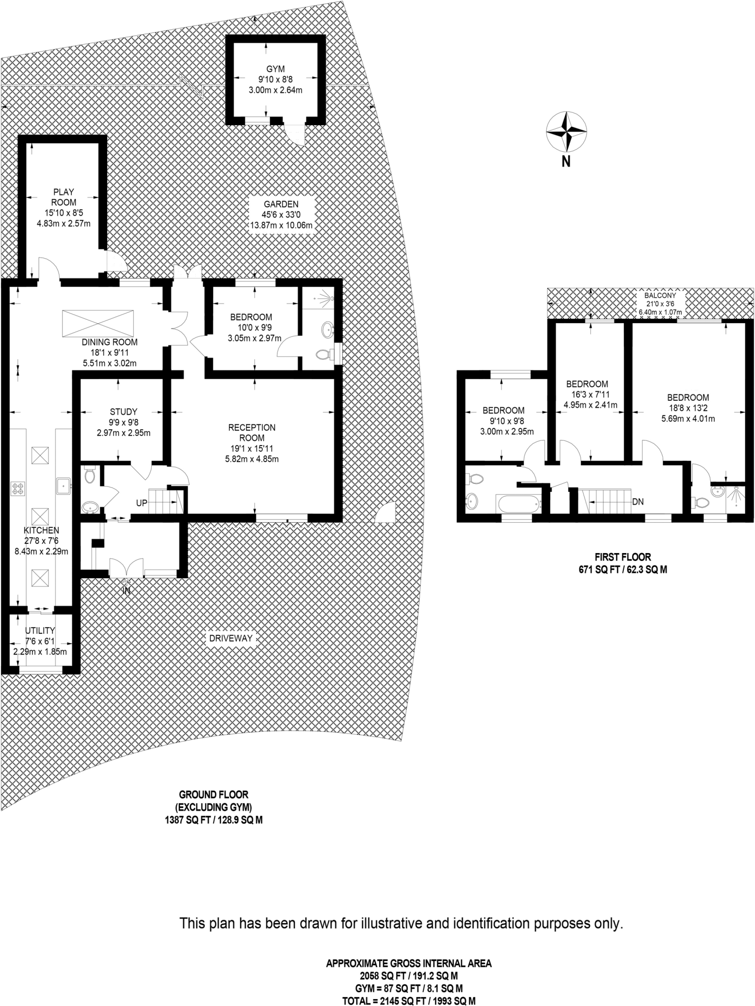
- Two-storey residential property (ground and first floor) excluding external gym and balcony.
Rooms
- PLAY ROOM:
- DINING ROOM:
- STUDY:
- RECEPTION ROOM:
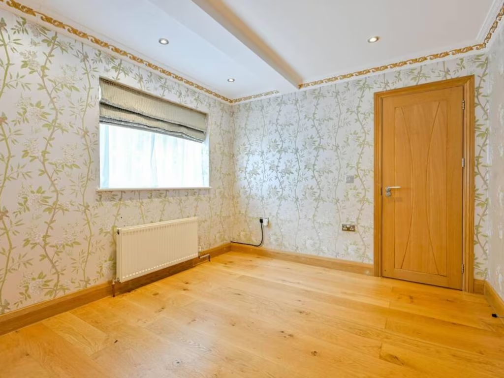
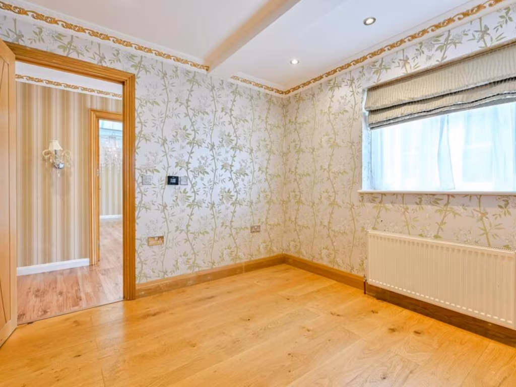
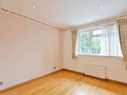
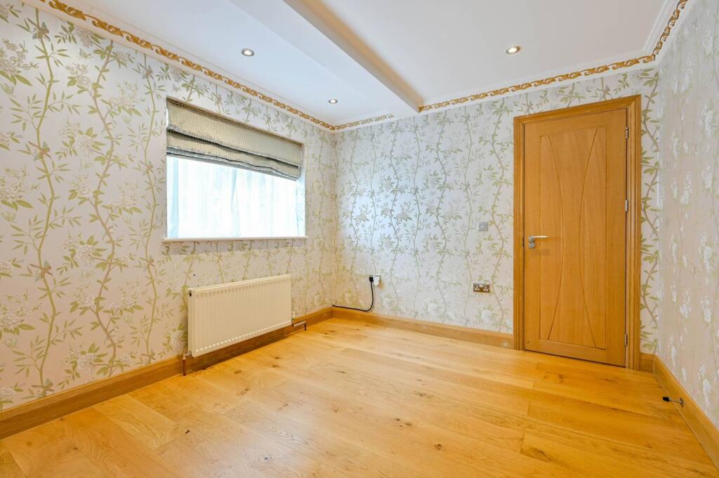
- BEDROOM:
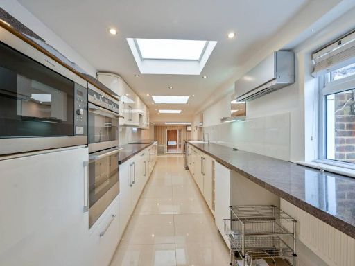
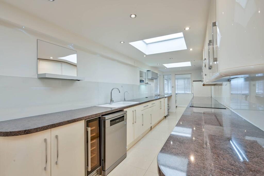
- KITCHEN:
- UTILITY:
- GYM:
- BEDROOM:
- BEDROOM:
- BEDROOM:
- BALCONY: external - excluded from totals
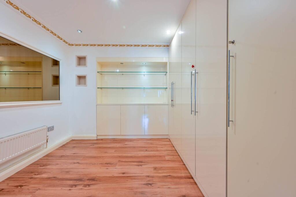
Textual Property Features
Detected Visual Features
- detached house
- suburban
- mid-20th century
- patio
- curb appeal
- driveway
- well-maintained
- composite siding
- two-story
- brick
- contemporary
- modern
- large living room
- wood flooring
- chandelier lighting
- open space
- neutral tones
- built-in storage
- ceiling moulding
EPC Details
- Fully double glazed
- Cavity wall, filled cavity
- Boiler and radiators, mains gas
- Low energy lighting in all fixed outlets
- Solid, no insulation (assumed)
Nearby Schools
- St Clement's Catholic Primary School
- Danetree Primary School
- Epsom and Ewell High School
- Auriol Junior School
- Cheam Common Infants' Academy
- Richard Challoner School
- Green Lane Primary and Nursery School
- Burlington Infant and Nursery School
- West Ewell Primary School and Nursery
- Riverview CofE Primary and Nursery School VA
- Malden Manor Primary and Nursery School
- The Holy Cross School
- Ewell Castle School
- Nonsuch Primary School
- Meadow Primary School
- The Mead Infant and Nursery School
- Cuddington Community Primary School
- Knollmead Primary School
- Malden Parochial CofE Primary School
- Coombe Boys' School
- Westbury House School
- Burlington Junior School
- Cheam Common Junior Academy
- Dorchester Primary School
- Tennis Avenue School
- Grand Avenue Primary and Nursery School
Nearest General Shops
- Id: 907894027
- Tags:
- Addr:
- City: Worcester Park
- Housenumber: 157
- Postcode: KT4 8DT
- Street: Central Road
- Building: yes
- Name: Short Bark & Sides
- Shop: pet_grooming
- TagsNormalized:
- Lat: 51.3792578
- Lon: -0.2436282
- FullGeoHash: gcpu63q9g5ce
- PartitionGeoHash: gcpu
- Images:
- FoodStandards: null
- Distance: 1052.7
,- Id: 907896988
- Tags:
- Addr:
- City: Worcester Park
- Housenumber: 163
- Postcode: KT4 8DT
- Street: Central Road
- Building: yes
- Name: Moonlight Unisex Hairdresser
- Shop: hairdresser
- TagsNormalized:
- Lat: 51.3794059
- Lon: -0.2437749
- FullGeoHash: gcpu63q6xxkq
- PartitionGeoHash: gcpu
- Images:
- FoodStandards: null
- Distance: 1050.6
,- Id: 469390655
- Tags:
- Addr:
- Housenumber: 5
- Street: Ruxley Lane
- Postal_code: KT19 0JB
- Shop: car
- TagsNormalized:
- Lat: 51.3678789
- Lon: -0.2653962
- FullGeoHash: gcpu1znxxfdm
- PartitionGeoHash: gcpu
- Images:
- FoodStandards: null
- Distance: 992
}
Nearest Religious buildings
- Id: 28054914
- Tags:
- Addr:
- Street: Stoneleigh Crescent
- Amenity: place_of_worship
- Building: yes
- Denomination: methodist
- Name: Stoneleigh Methodist Church
- Religion: christian
- Service_times: 1030
- TagsNormalized:
- place of worship
- methodist
- church
- christian
- Lat: 51.3659158
- Lon: -0.2496743
- FullGeoHash: gcpu4qfhnhtq
- PartitionGeoHash: gcpu
- Images:
- FoodStandards: null
- Distance: 1169
,- Id: 274785338
- Tags:
- Amenity: place_of_worship
- Building: church
- Denomination: anglican
- Name: St John The Baptist
- Religion: christian
- Wikidata: Q26479411
- TagsNormalized:
- place of worship
- church
- anglican
- baptist
- christian
- Lat: 51.3822985
- Lon: -0.2612649
- FullGeoHash: gcpu61cg84dv
- PartitionGeoHash: gcpu
- Images:
- FoodStandards: null
- Distance: 827.4
,- Id: 28016225
- Tags:
- Addr:
- Postcode: KT4 7HH
- Street: The Avenue
- Amenity: place_of_worship
- Building: yes
- Denomination: anglican
- Fhrs:
- Name: The Parish Church of St Mary the Virgin, Cuddington
- Religion: christian
- Source:
- Wikidata: Q26279719
- TagsNormalized:
- place of worship
- anglican
- church
- parish
- christian
- Lat: 51.3765613
- Lon: -0.2561156
- FullGeoHash: gcpu60vd0j4m
- PartitionGeoHash: gcpu
- Images:
- FoodStandards:
- Id: 24003
- FHRSID: 24003
- LocalAuthorityBusinessID: 07230/2003/2/000
- BusinessName: St Mary's Church Cuddington
- BusinessType: Restaurant/Cafe/Canteen
- BusinessTypeID: 1
- AddressLine1: The Avenue
- AddressLine2: Worcester Park
- AddressLine3: Surrey
- AddressLine4: null
- PostCode: KT4 7HH
- RatingValue: 5
- RatingKey: fhrs_5_en-GB
- RatingDate: 2015-11-04
- LocalAuthorityCode: 306
- LocalAuthorityName: Epsom and Ewell
- LocalAuthorityWebSite: http://www.epsom-ewell.gov.uk
- LocalAuthorityEmailAddress: ehpublichealth@epsom-ewell.gov.uk
- Scores:
- Hygiene: 0
- Structural: 0
- ConfidenceInManagement: 0
- NewRatingPending: false
- Geocode:
- Longitude: -0.25328000000000
- Latitude: 51.37720900000000
- Distance: 168.8
}
Nearest Airports
- Id: 260720166
- Tags:
- Aerodrome: international
- Aeroway: aerodrome
- Alt_name: Gatwick Airport
- Ele: 62
- Iata: LGW
- Icao: EGKK
- Internet_access: wlan
- Internet_access:fee: no
- Internet_access:ssid: Gatwick FREE Wi-Fi
- Name: London Gatwick Airport
- Operator: Gatwick Airport Limited
- Ref: LGW
- Website: https://www.gatwickairport.com/
- Wikidata: Q8703
- Wikipedia: en:Gatwick Airport
- TagsNormalized:
- airport
- international airport
- Lat: 51.1540917
- Lon: -0.1883773
- FullGeoHash: gcpg58qf4mzd
- PartitionGeoHash: gcpg
- Images:
- FoodStandards: null
- Distance: 25057.5
,- Id: 121158889
- Tags:
- Aerodrome: continental
- Aeroway: aerodrome
- Fhrs:
- Authority: City of London Corporation
- Iata: LCY
- Icao: EGLC
- Name: London City Airport
- Operator: London City Airport Limited
- Ref: LCY
- Website: https://www.londoncityairport.com/
- Wikidata: Q8982
- Wikipedia: en:London City Airport
- TagsNormalized:
- airport
- continental airport
- Lat: 51.5042658
- Lon: 0.0539987
- FullGeoHash: u10j10p64702
- PartitionGeoHash: u10j
- Images:
- FoodStandards: null
- Distance: 25914.3
,- Id: 14001268
- Tags:
- Access: yes
- Aerodrome: international
- Aerodrome:type: public
- Aeroway: aerodrome
- Alt_name: London Heathrow
- Alt_name_2: London Heathrow Airport
- Ele: 25
- Iata: LHR
- Icao: EGLL
- Int_name: Heathrow Airport
- Name: London Heathrow Airport
- Note: area still approx
- Old_name: London Airport
- Operator: Heathrow Airport Limited
- Rank_aci:
- Ref: LHR
- Short_name: Heathrow
- Type: multipolygon
- Website: https://www.heathrow.com/
- Wikidata: Q8691
- Wikipedia: en:Heathrow Airport
- TagsNormalized:
- airport
- international airport
- Lat: 51.4677522
- Lon: -0.4547736
- FullGeoHash: gcpsv9kv7h2h
- PartitionGeoHash: gcps
- Images:
- FoodStandards: null
- Distance: 17120.3
}
Nearest Leisure Facilities
- Id: 28016290
- Tags:
- Leisure: pitch
- Sport: tennis
- TagsNormalized:
- Lat: 51.3708837
- Lon: -0.2566888
- FullGeoHash: gcpu4pv14dyc
- PartitionGeoHash: gcpu
- Images:
- FoodStandards: null
- Distance: 489.4
,- Id: 28016242
- Tags:
- Leisure: park
- Name: Shadbolt Park
- TagsNormalized:
- Lat: 51.3763082
- Lon: -0.2517238
- FullGeoHash: gcpu62b8wmvp
- PartitionGeoHash: gcpu
- Images:
- FoodStandards: null
- Distance: 409.4
,- Id: 107287765
- Tags:
- TagsNormalized:
- Lat: 51.3744961
- Lon: -0.2623833
- FullGeoHash: gcpu602ynh0y
- PartitionGeoHash: gcpu
- Images:
- FoodStandards: null
- Distance: 357.7
,- Id: 957860058
- Tags:
- TagsNormalized:
- Lat: 51.3747013
- Lon: -0.2528708
- FullGeoHash: gcpu60rz7dmy
- PartitionGeoHash: gcpu
- Images:
- FoodStandards: null
- Distance: 319.1
,- Id: 28016330
- Tags:
- TagsNormalized:
- Lat: 51.3732262
- Lon: -0.2604755
- FullGeoHash: gcpu604qdrrr
- PartitionGeoHash: gcpu
- Images:
- FoodStandards: null
- Distance: 312.3
}
Nearest Tourist attractions
- Id: 425669383
- Tags:
- Description: A historic tudor home with later additions from the Stuart, Georgian and Victorian periods.
- Flickr: https://www.flickr.com/photos/25829192@N03/3960636881/
- Name: Whitehall
- Tourism: museum
- Website: http://www.friendsofwhitehallcheam.co.uk
- Wikidata: Q7995973
- Wikipedia: en:Whitehall (Sutton)
- TagsNormalized:
- Lat: 51.3594267
- Lon: -0.2171332
- FullGeoHash: gcpu5j9yk7jc
- PartitionGeoHash: gcpu
- Images:
- FoodStandards: null
- Distance: 3302.7
,- Id: 8694873017
- Tags:
- Addr:
- Housenumber: 10A
- Postcode: KT6 6QL
- Street: Langley Avenue
- Name: Yew Lodge
- Tourism: apartment
- TagsNormalized:
- Lat: 51.3849882
- Lon: -0.3015526
- FullGeoHash: gcpu34k7m244
- PartitionGeoHash: gcpu
- Images:
- FoodStandards: null
- Distance: 3250.8
,- Id: 6266973817
- Tags:
- Fee: no
- Name: Bourne hall
- Tourism: museum
- Website: https://www.bournehall.org/
- TagsNormalized:
- Lat: 51.3503373
- Lon: -0.2524295
- FullGeoHash: gcpu4k01muwv
- PartitionGeoHash: gcpu
- Images:
- FoodStandards: null
- Distance: 2793
}
Nearest Hotels
- Id: 1729750835
- Tags:
- Addr:
- Postcode: KT6 7EL
- Street: Tolworth Broadway
- Brand: Travelodge
- Brand:wikidata: Q9361374
- Brand:wikipedia: en:Travelodge UK
- Fhrs:
- Name: Travelodge
- Source:
- Tourism: hotel
- TagsNormalized:
- Lat: 51.3805078
- Lon: -0.2807418
- FullGeoHash: gcpu39e94hze
- PartitionGeoHash: gcpu
- Images:
- FoodStandards: null
- Distance: 1723.1
,- Id: 28055159
- Tags:
- Addr:
- City: Surbiton
- Housenumber: 12
- Postcode: KT5 9NU
- Street: Kingston Road
- Suburb: Tolworth
- Brand: Premier Inn
- Brand:wikidata: Q2108626
- Brand:wikipedia: en:Premier Inn
- Building: yes
- Fhrs:
- Id: 1385464
- Local_authority_id: 17/96006/RBK
- Name: Premier Inn
- Tourism: hotel
- TagsNormalized:
- Lat: 51.3765042
- Lon: -0.2786795
- FullGeoHash: gcpu38v1f699
- PartitionGeoHash: gcpu
- Images:
- FoodStandards: null
- Distance: 1484.8
,- Id: 28036933
- Tags:
- Building: yes
- Name: Orchid Epsom Hotel
- Tourism: hotel
- TagsNormalized:
- Lat: 51.3644419
- Lon: -0.257376
- FullGeoHash: gcpu4nsed9yw
- PartitionGeoHash: gcpu
- Images:
- FoodStandards: null
- Distance: 1203.4
}
Tags
- detached house
- suburban
- mid-20th century
- patio
- curb appeal
- driveway
- well-maintained
- composite siding
- two-story
- brick
- contemporary
- modern
- large living room
- wood flooring
- chandelier lighting
- open space
- neutral tones
- built-in storage
- ceiling moulding
Local Market Stats
- Average Price/sqft: £558
- Avg Income: £63900
- Rental Yield: 4.2%
- Social Housing: 8%
- Planning Success Rate: 61%
AirBnB Data
- 1km average: £115/night
- Listings in 1km: 1
Similar Properties
 4 bedroom semi-detached house for sale in Fairford Gardens, New Malden, Worcester Park, KT4 — £875,000 • 4 bed • 2 bath • 1830 ft²
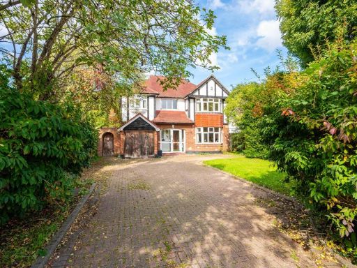 4 bedroom detached house for sale in Edenfield Gardens, Worcester Park, KT4 — £1,200,000 • 4 bed • 2 bath • 2170 ft²
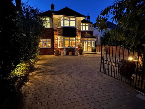 4 bedroom detached house for sale in Edenfield Gardens, Worcester Park, KT4 — £1,350,000 • 4 bed • 2 bath • 1702 ft²
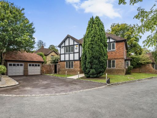 5 bedroom detached house for sale in The Denningtons, Worcester Park, Surrey, KT4 — £1,385,000 • 5 bed • 3 bath • 2272 ft²
 4 bedroom semi-detached house for sale in Amesbury Close, Worcester Park, KT4 — £600,000 • 4 bed • 1 bath • 1133 ft²
 4 bedroom terraced house for sale in Green Lane, Worcester Park, KT4 — £800,000 • 4 bed • 2 bath • 1335 ft²
Meta
- {
"@context": "https://schema.org",
"@type": "Residence",
"name": "4 bedroom detached house for sale in Parklands Way, Worcest…",
"description": "",
"url": "https://propertypiper.co.uk/property/83496469-c190-47d4-8546-fe10bec229a8",
"image": "https://image-a.propertypiper.co.uk/f0dc9be0-4bd7-4942-a171-dec6d0b14af2-1024.jpeg",
"address": {
"@type": "PostalAddress",
"streetAddress": "7 PARKLANDS WAY WORCESTER PARK",
"postalCode": "KT4 7HT",
"addressLocality": "Epsom and Ewell",
"addressRegion": "Epsom and Ewell",
"addressCountry": "England"
},
"geo": {
"@type": "GeoCoordinates",
"latitude": 51.375264215485174,
"longitude": -0.25737951029796036
},
"numberOfRooms": 4,
"numberOfBathroomsTotal": 3,
"floorSize": {
"@type": "QuantitativeValue",
"value": 2145,
"unitCode": "FTK"
},
"offers": {
"@type": "Offer",
"price": 975000,
"priceCurrency": "GBP",
"availability": "https://schema.org/InStock"
},
"additionalProperty": [
{
"@type": "PropertyValue",
"name": "Feature",
"value": "detached house"
},
{
"@type": "PropertyValue",
"name": "Feature",
"value": "suburban"
},
{
"@type": "PropertyValue",
"name": "Feature",
"value": "mid-20th century"
},
{
"@type": "PropertyValue",
"name": "Feature",
"value": "patio"
},
{
"@type": "PropertyValue",
"name": "Feature",
"value": "curb appeal"
},
{
"@type": "PropertyValue",
"name": "Feature",
"value": "driveway"
},
{
"@type": "PropertyValue",
"name": "Feature",
"value": "well-maintained"
},
{
"@type": "PropertyValue",
"name": "Feature",
"value": "composite siding"
},
{
"@type": "PropertyValue",
"name": "Feature",
"value": "two-story"
},
{
"@type": "PropertyValue",
"name": "Feature",
"value": "brick"
},
{
"@type": "PropertyValue",
"name": "Feature",
"value": "contemporary"
},
{
"@type": "PropertyValue",
"name": "Feature",
"value": "modern"
},
{
"@type": "PropertyValue",
"name": "Feature",
"value": "large living room"
},
{
"@type": "PropertyValue",
"name": "Feature",
"value": "wood flooring"
},
{
"@type": "PropertyValue",
"name": "Feature",
"value": "chandelier lighting"
},
{
"@type": "PropertyValue",
"name": "Feature",
"value": "open space"
},
{
"@type": "PropertyValue",
"name": "Feature",
"value": "neutral tones"
},
{
"@type": "PropertyValue",
"name": "Feature",
"value": "built-in storage"
},
{
"@type": "PropertyValue",
"name": "Feature",
"value": "ceiling moulding"
}
]
}
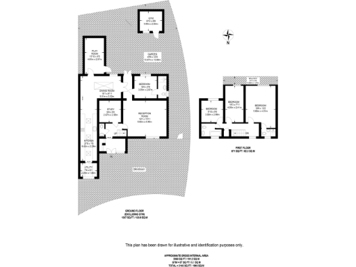
High Res Floorplan Images
Compatible Floorplan Images
FloorplanImages Thumbnail