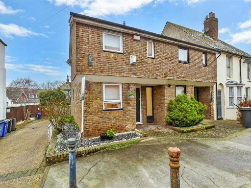
CT5 1JR - 1 bedroom ground floor flat for sale in Argyle Road, Whitst…
View on Property Piper
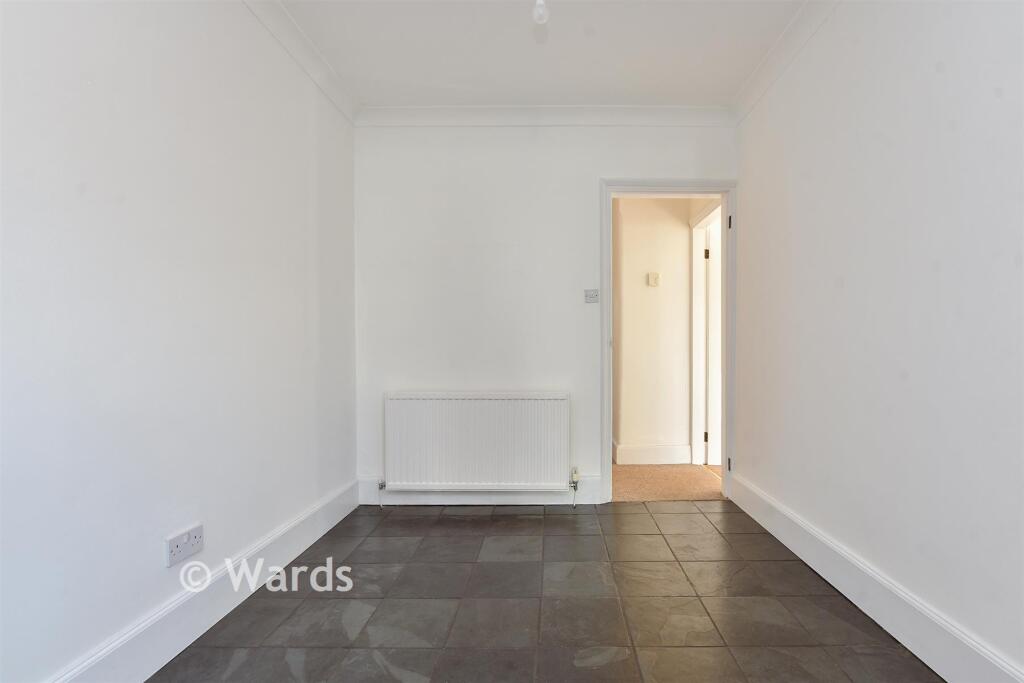
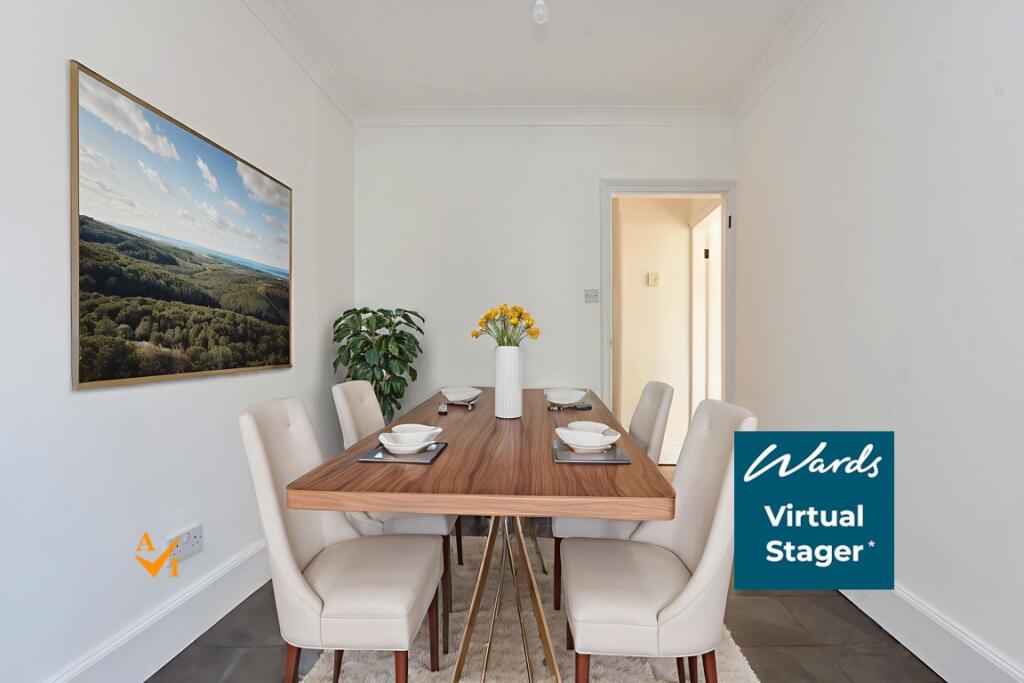
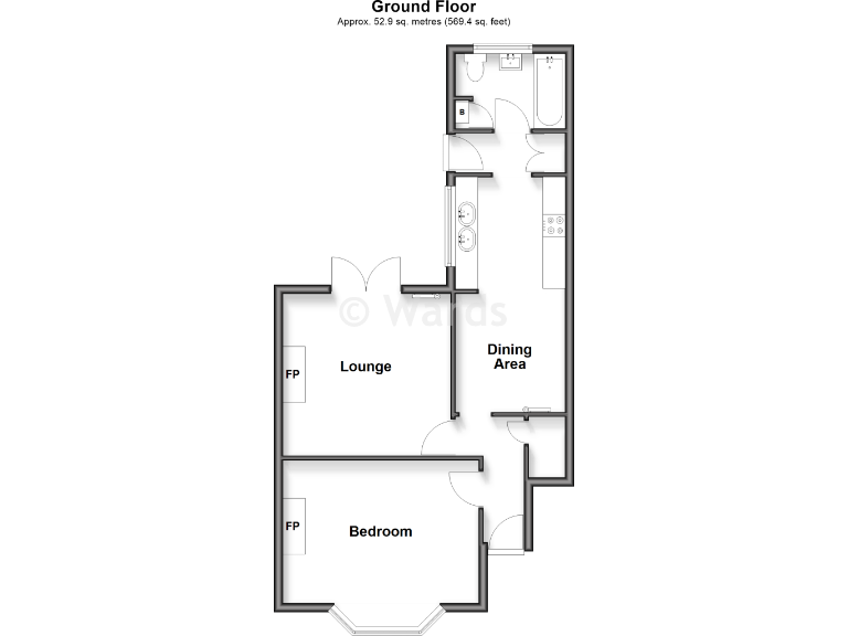
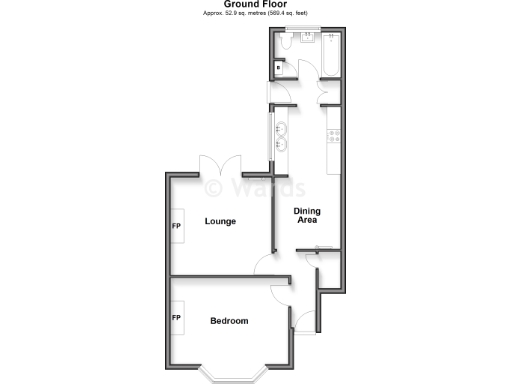
1 bedroom ground floor flat for sale in Argyle Road, Whitstable, Kent, CT5
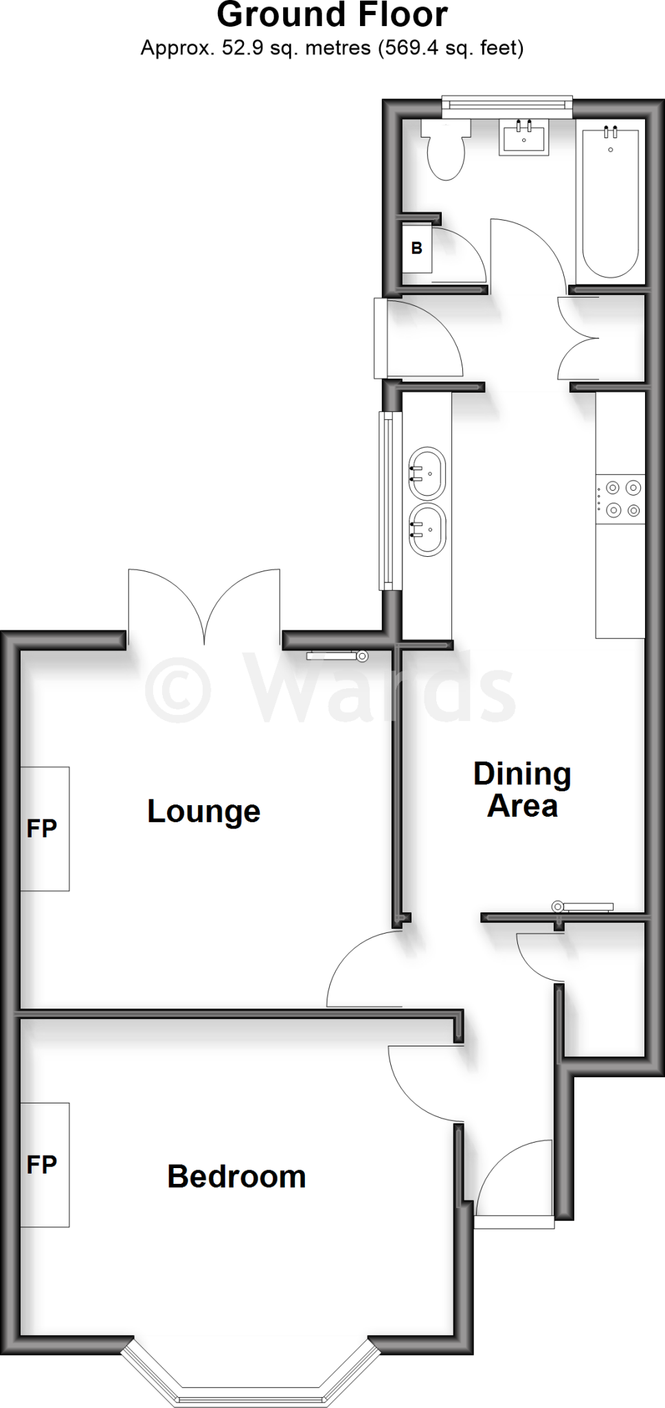
Property Details
- Price: £285000
- Bedrooms: 1
- Bathrooms: 1
- Property Type: undefined
- Property SubType: undefined
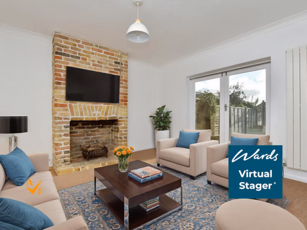
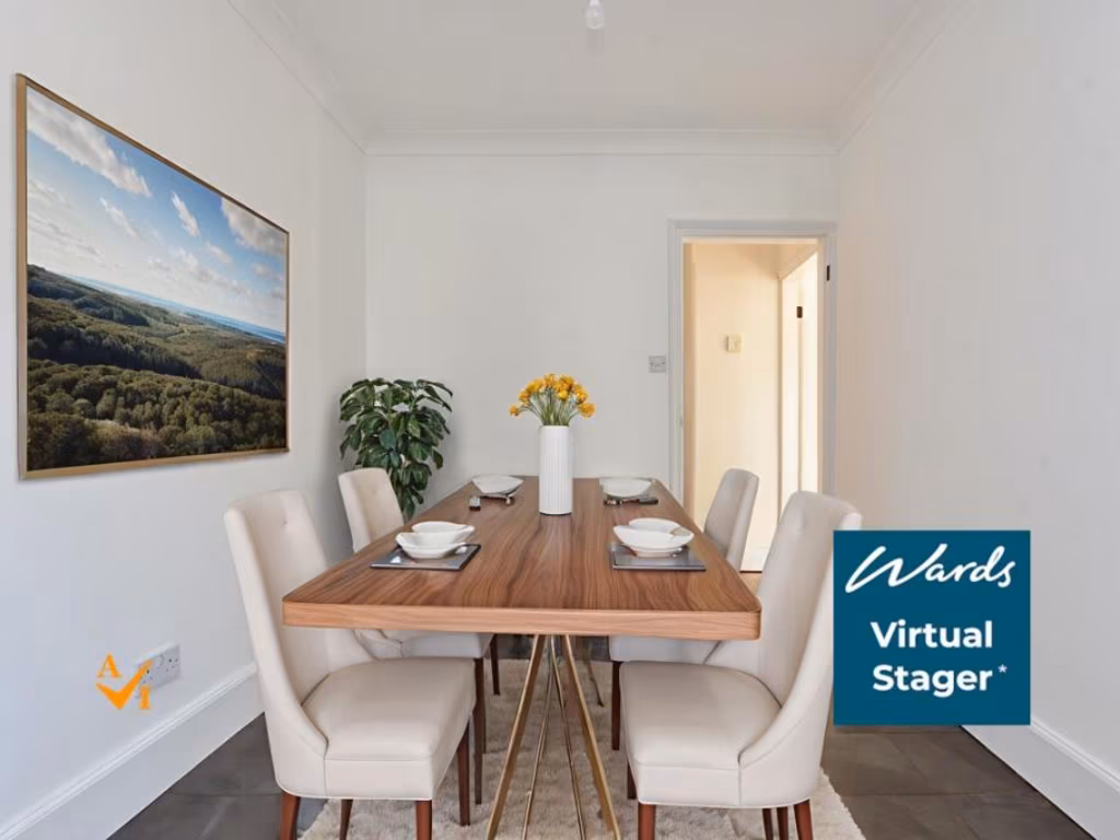
Image Descriptions
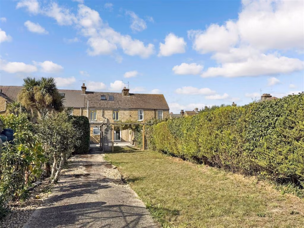
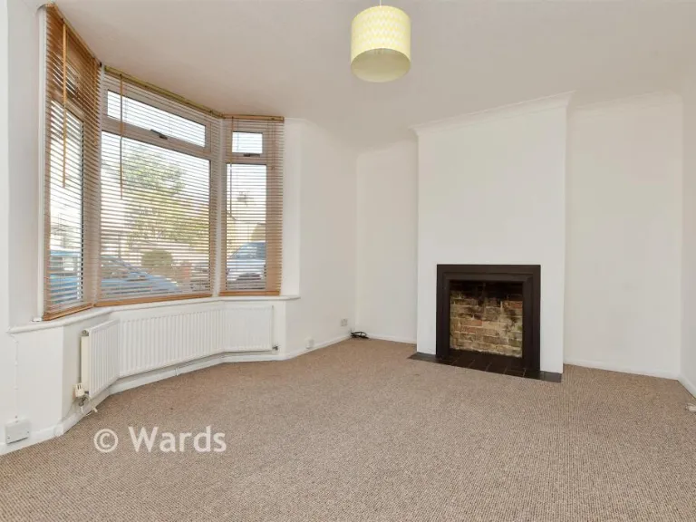
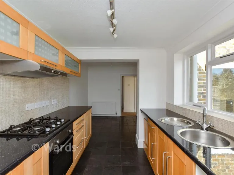
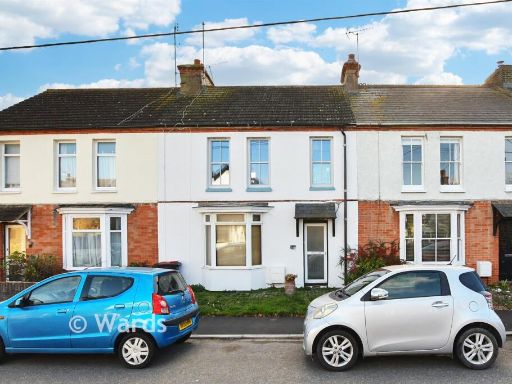
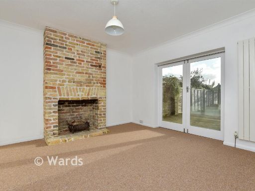
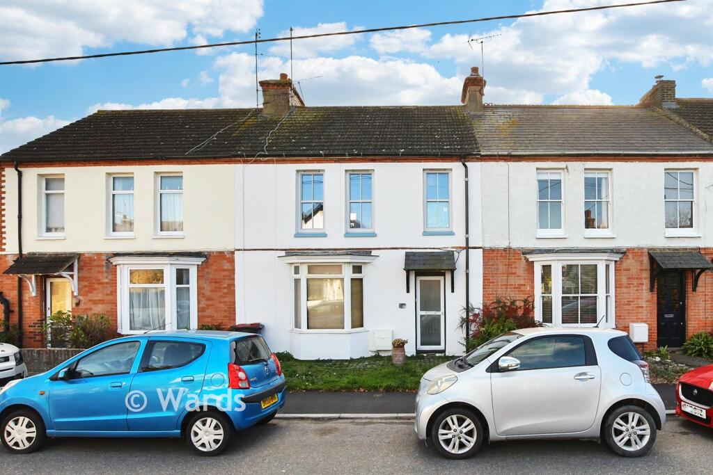
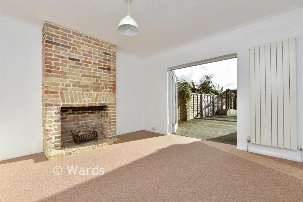
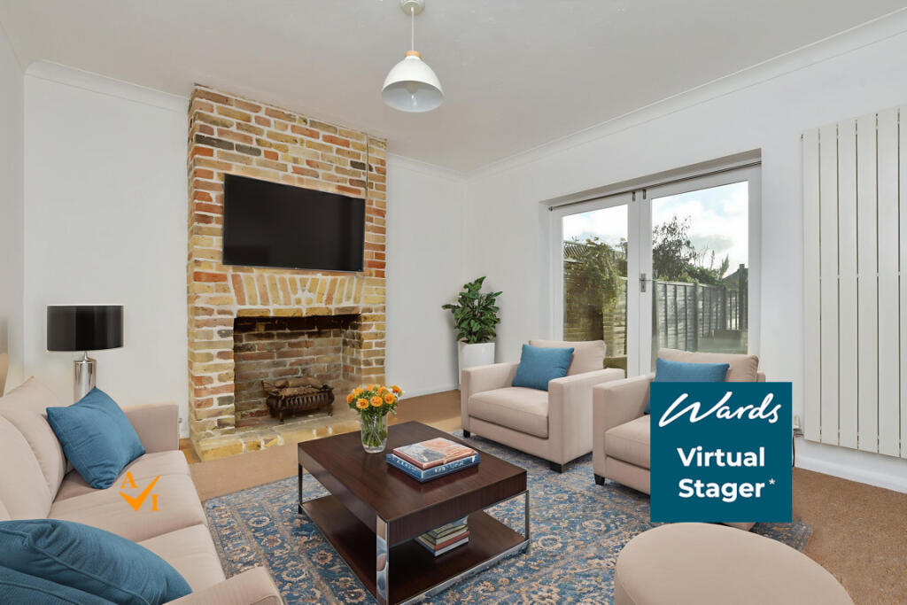
- terraced house Victorian
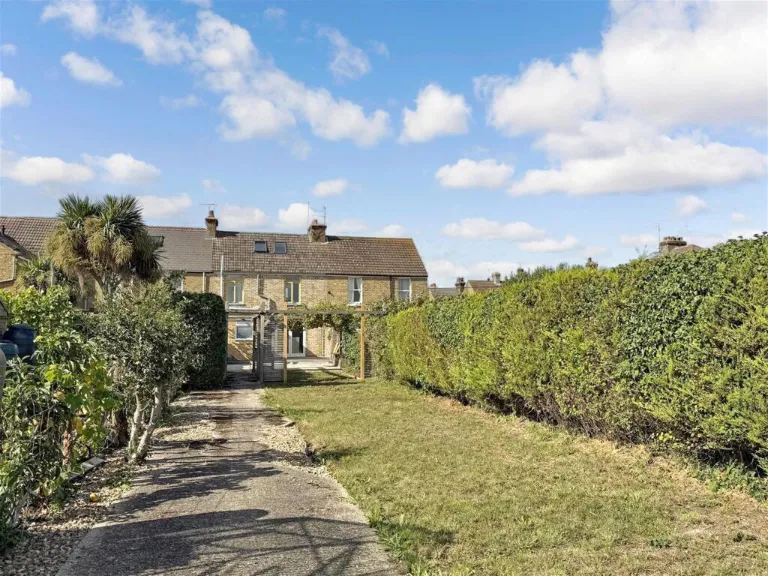
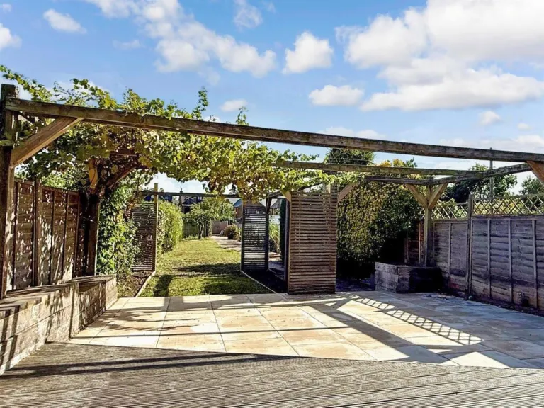
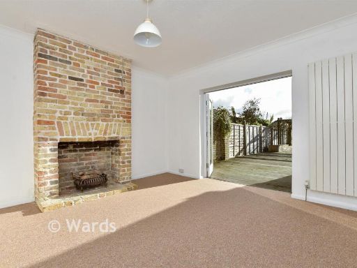
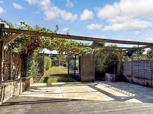
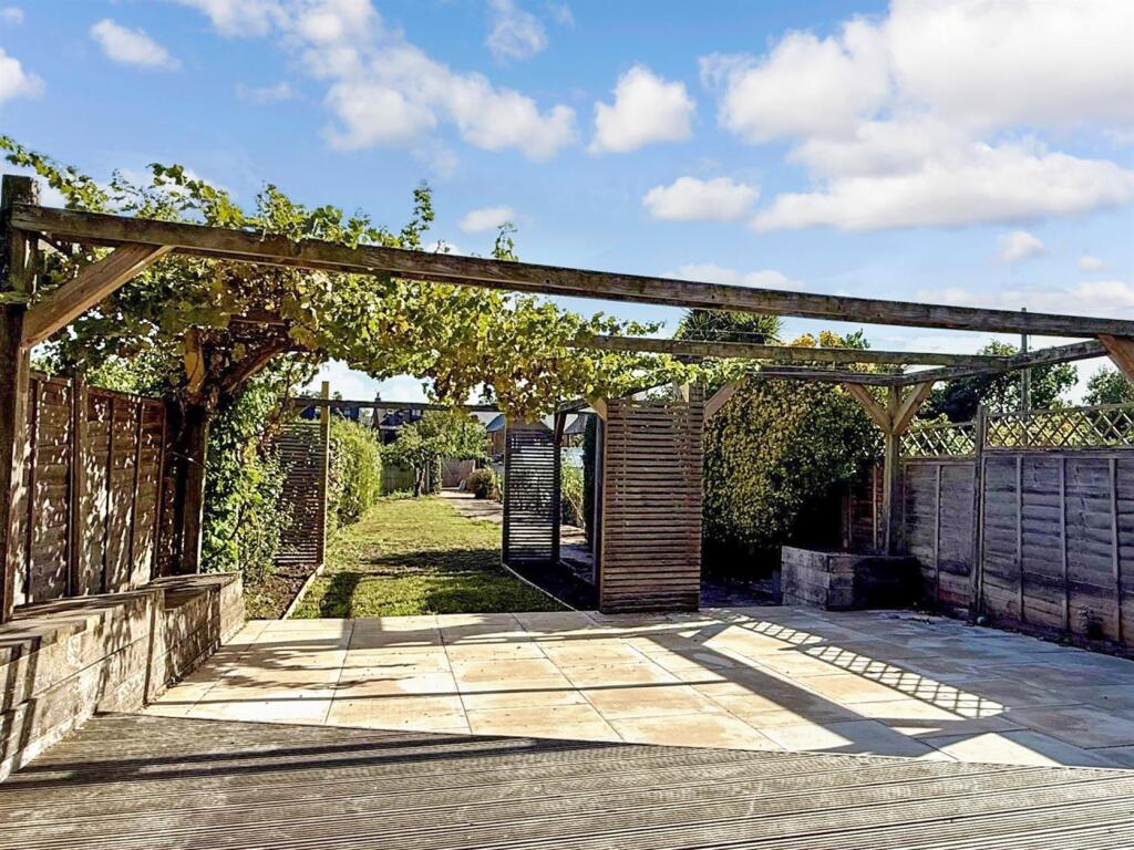
- backyard of a terraced house Victorian
Textual Property Features
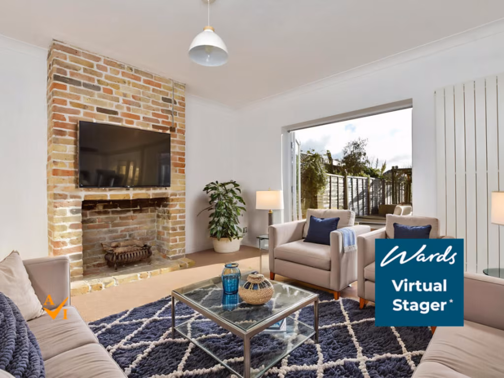
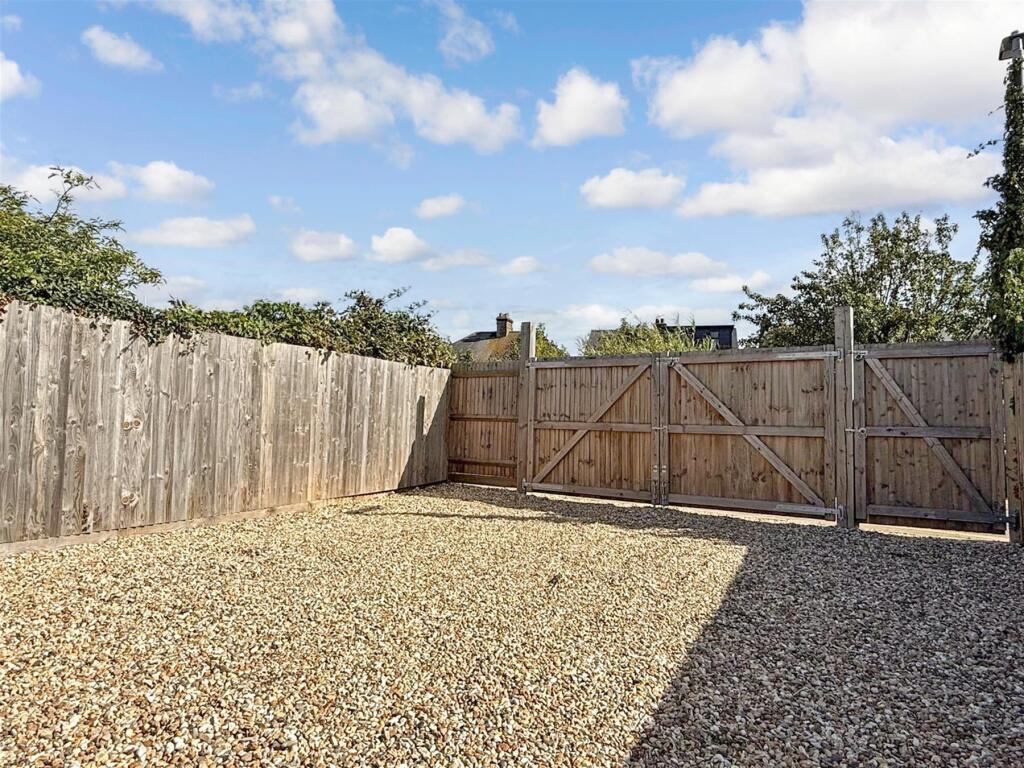
- Has Garden
- Chain Free
- Success
Detected Visual Features
- Victorian
- terraced
- 2-story
- central location
- fixer-upper
- front garden
- dated exterior
- chimney
- brickwork
- terraced house
- garden
- patio
- outdoor space
- traditional style
- hedges
- stone facade
EPC Details
- Fully double glazed
- Average thermal transmittance 0.27 W/m-¦K
- Boiler and radiators, mains gas
- Low energy lighting in all fixed outlets
- Average thermal transmittance 0.21 W/m-¦K
Nearby Schools
- Parkside Community Primary School
- St Stephen's Infant School
- Sturry Church of England Primary School
- Herne Church of England Junior School
- Whitstable and Seasalter Endowed Church of England Junior School
- Swalecliffe Community Primary School
- St Stephen's Junior School
- Briary Primary School
- Westmeads Community Infant School
- Herne Bay Infant School
- Graveney Primary School
- Kent College International Study Centre
- Kent College (Canterbury)
- The Archbishop's School
- Blean Primary School
- Junior King's School
- Joy Lane Primary Foundation School
- Boughton-under-Blean and Dunkirk Primary School
- Hernhill Church of England Primary School
- St Edmund's School Canterbury
- The Whitstable School
- Whitstable Junior School
- St Alphege Church of England Infant School
- St Mary's Catholic Primary School, Whitstable
- Herne Bay High School
- Hampton Primary School
- Herne Bay Junior School
Nearest General Shops
- Id: 9948822983
- Tags:
- Addr:
- City: Whitstable
- Postcode: CT5 1AY
- Street: High Street
- Name: Pilgrims Hospices Furniture
- Shop: charity
- Source:
- Addr:
- Postcode: code-point_open;interpolation
- TagsNormalized:
- furniture
- hospice
- charity
- shop
- Lat: 51.3573634
- Lon: 1.0249144
- FullGeoHash: u10spm6664rt
- PartitionGeoHash: u10s
- Images:
- FoodStandards: null
- Distance: 181.8
,- Id: 357892678
- Tags:
- Addr:
- City: Whitstable
- Country: GB
- County: Kent
- Housenumber: 103-105
- Postcode: CT5 1AY
- Street: High Street
- Name: Herberts Cycles
- Phone: +44 1227 272072
- Shop: bicycle
- Source:
- Addr:
- Postcode: http://www.herbertscycles.co.uk/contact.php
- Phone: http://www.herbertscycles.co.uk/contact.php
- Website: https://www.herbertscycles.co.uk/
- TagsNormalized:
- Lat: 51.3574155
- Lon: 1.0249222
- FullGeoHash: u10spm66dkjk
- PartitionGeoHash: u10s
- Images:
- FoodStandards: null
- Distance: 181.7
,- Id: 1069902875
- Tags:
- Brand: Jewson
- Brand:wikidata: Q6190226
- Brand:wikipedia: en:Jewson
- Building: retail
- Contact:
- Website: https://www.jewson.co.uk/branch-finder/whitstable-branch/
- Name: Jewson
- Ref:
- Shop: trade
- Trade: building_supplies
- TagsNormalized:
- Lat: 51.3582111
- Lon: 1.028966
- FullGeoHash: u10spmmr28kw
- PartitionGeoHash: u10s
- Images:
- FoodStandards: null
- Distance: 145.3
}
Nearest Grocery shops
- Id: 9948822949
- Tags:
- Addr:
- City: Whitstable
- Housenumber: 55
- Postcode: CT5 1AP
- Street: High Street
- Brand: Holland & Barrett
- Brand:wikidata: Q5880870
- Fhrs:
- Name: Holland & Barrett
- Shop: health_food
- Source:
- Website: https://www.hollandandbarrett.com/stores/whitstable-4012/
- TagsNormalized:
- holland & barrett
- health
- health food
- food
- shop
- Lat: 51.35884
- Lon: 1.0246575
- FullGeoHash: u10spmd4um8n
- PartitionGeoHash: u10s
- Images:
- FoodStandards:
- Id: 1102887
- FHRSID: 1102887
- LocalAuthorityBusinessID: 74772
- BusinessName: Holland & Barrett
- BusinessType: Retailers - other
- BusinessTypeID: 4613
- AddressLine1: 55 High Street
- AddressLine2: Whitstable
- AddressLine3: null
- AddressLine4: null
- PostCode: CT5 1AP
- RatingValue: 4
- RatingKey: fhrs_4_en-GB
- RatingDate: 2014-11-13
- LocalAuthorityCode: 180
- LocalAuthorityName: Canterbury City
- LocalAuthorityWebSite: http://www.canterbury.gov.uk
- LocalAuthorityEmailAddress: null
- Scores:
- Hygiene: 5
- Structural: 10
- ConfidenceInManagement: 5
- NewRatingPending: false
- Geocode:
- Longitude: 1.02483260000000
- Latitude: 51.35885710000000
- Distance: 265.5
,- Id: 9948822974
- Tags:
- Addr:
- City: Whitstable
- Housenumber: 81
- Postcode: CT5 1AY
- Street: High Street
- Name: Whitstable Nutrition Centre
- Shop: health_food
- Website: https://www.whitstablenutrition.com/
- TagsNormalized:
- health
- health food
- food
- shop
- Lat: 51.3581658
- Lon: 1.024862
- FullGeoHash: u10spm6r1002
- PartitionGeoHash: u10s
- Images:
- FoodStandards: null
- Distance: 210.6
,- Id: 9948822980
- Tags:
- Addr:
- City: Whitstable
- Housenumber: 91
- Postcode: CT5 1AY
- Street: High Street
- Shop: greengrocer
- Source:
- Addr:
- Postcode: code-point_open;interpolation
- TagsNormalized:
- Lat: 51.3579473
- Lon: 1.0249061
- FullGeoHash: u10spm6mdp32
- PartitionGeoHash: u10s
- Images:
- FoodStandards: null
- Distance: 197.3
}
Nearest Religious buildings
- Id: 144784679
- Tags:
- Amenity: place_of_worship
- Denomination: evangelical
- Name: Hamilton Road Evangelical Church
- Religion: christian
- TagsNormalized:
- place of worship
- evangelical
- church
- christian
- Lat: 51.3585054
- Lon: 1.029515
- FullGeoHash: u10spmt8vrq4
- PartitionGeoHash: u10s
- Images:
- FoodStandards: null
- Distance: 195.3
,- Id: 30575750
- Tags:
- Addr:
- City: Whitstable
- Country: GB
- County: Kent
- Postcode: CT5 1JS
- Street: Argyle Road
- Amenity: place_of_worship
- Denomination: methodist
- Fhrs:
- Name: St. John's Methodist Church
- Religion: christian
- Wikidata: Q26379535
- TagsNormalized:
- place of worship
- methodist
- church
- christian
- Lat: 51.3571349
- Lon: 1.0251989
- FullGeoHash: u10spm68bzgd
- PartitionGeoHash: u10s
- Images:
- FoodStandards:
- Id: 1103165
- FHRSID: 1103165
- LocalAuthorityBusinessID: 79017
- BusinessName: Saint Johns Methodist Church
- BusinessType: Other catering premises
- BusinessTypeID: 7841
- AddressLine1: Argyle Road
- AddressLine2: Whitstable
- AddressLine3: Kent
- AddressLine4: null
- PostCode: CT5 1JS
- RatingValue: 5
- RatingKey: fhrs_5_en-GB
- RatingDate: 2014-07-14
- LocalAuthorityCode: 180
- LocalAuthorityName: Canterbury City
- LocalAuthorityWebSite: http://www.canterbury.gov.uk
- LocalAuthorityEmailAddress: null
- Scores:
- Hygiene: 0
- Structural: 0
- ConfidenceInManagement: 0
- NewRatingPending: false
- Geocode:
- Longitude: 1.02573704719543
- Latitude: 51.35709381103520
- Distance: 162.3
,- Id: 762803760
- Tags:
- Addr:
- City: Whitstable
- Street: High Street
- Amenity: place_of_worship
- Building: yes
- Denomination: anglican
- Name: St. Alphege Church
- Ref:
- Religion: christian
- Website: https://stalphege.org.uk/
- Wikidata: Q105092506
- TagsNormalized:
- place of worship
- anglican
- church
- christian
- Lat: 51.3577002
- Lon: 1.0253739
- FullGeoHash: u10spm6skcnn
- PartitionGeoHash: u10s
- Images:
- FoodStandards: null
- Distance: 157.2
}
Nearest Medical buildings
- Id: 729541494
- Tags:
- Amenity: hospital
- Emergency: no
- Name: Whitstable and Tankerton Hospital
- TagsNormalized:
- Lat: 51.3610152
- Lon: 1.0505891
- FullGeoHash: u10spvvp8e0j
- PartitionGeoHash: u10s
- Images:
- FoodStandards: null
- Distance: 1654.7
,- Id: 10298360710
- Tags:
- Amenity: pharmacy
- Name: Numark Pharmacy
- TagsNormalized:
- Lat: 51.3631991
- Lon: 1.0310152
- FullGeoHash: u10spqqu26k9
- PartitionGeoHash: u10s
- Images:
- FoodStandards: null
- Distance: 703.1
,- Id: 167255935
- Tags:
- Amenity: doctors
- Building: medical
- Healthcare: doctor
- Name: Whitstable Health Centre
- TagsNormalized:
- doctor
- doctors
- health
- healthcare
- health centre
- Lat: 51.3626633
- Lon: 1.0300445
- FullGeoHash: u10spqq11y2u
- PartitionGeoHash: u10s
- Images:
- FoodStandards: null
- Distance: 625.4
,- Id: 1765965155
- Tags:
- Addr:
- City: Whitstable
- Postcode: CT5 1AP
- Street: High Street
- Amenity: pharmacy
- Brand: Boots
- Brand:wikidata: Q6123139
- Brand:wikipedia: en:Boots UK
- Healthcare: pharmacy
- Name: Boots
- Source:
- Addr:
- Postcode: code-point_open;interpolation
- Website: https://www.boots.com/stores/1090-whitstable-high-street-ct5-1ap
- TagsNormalized:
- pharmacy
- boots
- health
- healthcare
- Lat: 51.359288
- Lon: 1.0244979
- FullGeoHash: u10spmdj891n
- PartitionGeoHash: u10s
- Images:
- FoodStandards: null
- Distance: 308.2
}
Nearest Airports
- Id: 103894219
- Tags:
- Aerodrome: international
- Aeroway: aerodrome
- Iata: SEN
- Icao: EGMC
- Name: London Southend Airport
- Old_name: Southend Municipal Airport
- Ref: SEN
- Wikidata: Q1415441
- TagsNormalized:
- airport
- international airport
- Lat: 51.5701749
- Lon: 0.6924624
- FullGeoHash: u10mru04p937
- PartitionGeoHash: u10m
- Images:
- FoodStandards: null
- Distance: 33155.4
}
Nearest Leisure Facilities
- Id: 1111813617
- Tags:
- Addr:
- City: Whitstable
- Parentstreet: Warwick Road
- Street: Reeves Yard
- Building: commercial
- Leisure: fitness_centre
- Name: Pilates Movement Matters
- Sport: pilates
- Website: https://www.pilatesmovementmatters.co.uk/
- TagsNormalized:
- fitness
- fitness centre
- leisure
- pilates
- sports
- Lat: 51.3599273
- Lon: 1.0283339
- FullGeoHash: u10spmuc3bmk
- PartitionGeoHash: u10s
- Images:
- FoodStandards: null
- Distance: 301.5
,- Id: 1111813618
- Tags:
- Addr:
- City: Whitstable
- Housenumber: 10-16
- Parentstreet: Warwick Road
- Street: Reeves Yard
- Building: commercial
- Leisure: fitness_centre
- Name: Fighting Lions
- Phone: +44 1227 277200
- Sport: martial_arts;fitness
- TagsNormalized:
- fitness
- fitness centre
- leisure
- martial
- martial arts
- sports
- Lat: 51.3598539
- Lon: 1.0284563
- FullGeoHash: u10spmubuf8w
- PartitionGeoHash: u10s
- Images:
- FoodStandards: null
- Distance: 295.3
,- Id: 967612672
- Tags:
- Leisure: outdoor_seating
- Operator: Umbrella Centre
- TagsNormalized:
- outdoor
- outdoor seating
- leisure
- Lat: 51.3568703
- Lon: 1.0238141
- FullGeoHash: u10spm1x2we0
- PartitionGeoHash: u10s
- Images:
- FoodStandards: null
- Distance: 261.5
,- Id: 985867578
- Tags:
- TagsNormalized:
- Lat: 51.3584054
- Lon: 1.02621
- FullGeoHash: u10spme22ktt
- PartitionGeoHash: u10s
- Images:
- FoodStandards: null
- Distance: 156.6
,- Id: 985867579
- Tags:
- TagsNormalized:
- Lat: 51.3566739
- Lon: 1.026194
- FullGeoHash: u10spm5q21cs
- PartitionGeoHash: u10s
- Images:
- FoodStandards: null
- Distance: 113.4
}
Nearest Tourist attractions
- Id: 9949320647
- Tags:
- Addr:
- City: Whitstable
- Housenumber: 41
- Postcode: CT5 1AH
- Street: Harbour Street
- Name: Flat 41
- Note: Flat above Birdies Restaurant
- Tourism: apartment
- Website: https://www.birdiesrestaurant.co.uk/flat-41
- TagsNormalized:
- Lat: 51.360707
- Lon: 1.0246937
- FullGeoHash: u10spmfjv1ep
- PartitionGeoHash: u10s
- Images:
- FoodStandards: null
- Distance: 430.6
,- Id: 31953621
- Tags:
- Bicycle: no
- Designation: public_footpath
- Foot: designated
- Highway: footway
- Lit: no
- Name: Squeeze Gut Alley
- Note: Physically not possible to wheel a bicycle down here. Sharp and very narrow turn on the west end means it's impossible to fit a bicycle around this corner.
- Prow_ref: CWX11
- Source: survey
- Surface: paved
- Tourism: attraction
- TagsNormalized:
- Lat: 51.3597015
- Lon: 1.0230405
- FullGeoHash: u10spm8zyw63
- PartitionGeoHash: u10s
- Images:
- FoodStandards: null
- Distance: 413
,- Id: 9953124123
- Tags:
- Addr:
- City: Whitstable
- Housename: Foresters' Hall
- Housenumber: 5A
- Postcode: CT5 1DB
- Street: Oxford Street
- Name: Whitstable Museum and Gallery
- Tourism: museum
- Website: https://www.whitstablemuseum.org/
- TagsNormalized:
- Lat: 51.3567761
- Lon: 1.0246454
- FullGeoHash: u10spm4nguyy
- PartitionGeoHash: u10s
- Images:
- FoodStandards: null
- Distance: 207.3
}
Nearest Train stations
- Id: 6688385697
- Tags:
- Name: Sturry
- Naptan:
- Network: National Rail
- Platforms: 2
- Public_transport: station
- Railway: station
- Ref:
- Wikidata: Q2519465
- Wikipedia: en:Sturry railway station
- TagsNormalized:
- Lat: 51.300986
- Lon: 1.1222644
- FullGeoHash: u10gce11ysuv
- PartitionGeoHash: u10g
- Images:
- FoodStandards: null
- Distance: 9082.1
,- Id: 3453612249
- Tags:
- Name: Canterbury West
- Naptan:
- Network: National Rail
- Operator: Southeastern
- Platforms: 2
- Public_transport: station
- Railway: station
- Ref:
- Train: yes
- Wheelchair: yes
- Wikidata: Q671106
- Wikipedia: en:Canterbury West railway station
- TagsNormalized:
- Lat: 51.2842245
- Lon: 1.0753092
- FullGeoHash: u10gb2p0282e
- PartitionGeoHash: u10g
- Images:
- FoodStandards: null
- Distance: 8774
,- Id: 6743987558
- Tags:
- Name: Herne Bay
- Naptan:
- Network: National Rail
- Platforms: 2
- Public_transport: station
- Railway: station
- Ref:
- Wheelchair: yes
- Wikidata: Q2294609
- Wikipedia: en:Herne Bay railway station
- TagsNormalized:
- Lat: 51.3644375
- Lon: 1.1183071
- FullGeoHash: u10u1qw7d3nh
- PartitionGeoHash: u10u
- Images:
- FoodStandards: null
- Distance: 6353.3
,- Id: 3727341271
- Tags:
- Name: Chestfield & Swalecliffe
- Naptan:
- Network: National Rail
- Operator: Southeastern
- Platforms: 2
- Public_transport: station
- Railway: station
- Ref:
- Wikidata: Q5093891
- Wikipedia: en:Chestfield & Swalecliffe railway station
- TagsNormalized:
- Lat: 51.3602828
- Lon: 1.0674411
- FullGeoHash: u10u0mc734tu
- PartitionGeoHash: u10u
- Images:
- FoodStandards: null
- Distance: 2791.7
,- Id: 3726214975
- Tags:
- Name: Whitstable
- Naptan:
- Network: National Rail
- Platforms: 2
- Public_transport: station
- Railway: station
- Ref:
- Wikidata: Q2555569
- Wikipedia: en:Whitstable railway station
- TagsNormalized:
- Lat: 51.3576861
- Lon: 1.0343648
- FullGeoHash: u10spt3hnqw6
- PartitionGeoHash: u10s
- Images:
- FoodStandards: null
- Distance: 477.1
}
Nearest Hotels
- Id: 4766443434
- Tags:
- Amenity: cafe;bar
- Level: 0
- Name: Hotel Continental Bar
- TagsNormalized:
- Lat: 51.3644727
- Lon: 1.0322128
- FullGeoHash: u10spqxesr9w
- PartitionGeoHash: u10s
- Images:
- FoodStandards: null
- Distance: 865.2
,- Id: 967599225
- Tags:
- Addr:
- City: Whitstable
- Country: GB
- County: Kent
- Housenumber: 2
- Postcode: CT5 1BQ
- Street: High Street
- Building: yes
- Building:levels: 2
- Fhrs:
- Name: The Duke of Cumberland Hotel
- Roof:
- Tourism: hotel
- Wikidata: Q26369898
- TagsNormalized:
- Lat: 51.360445
- Lon: 1.0241386
- FullGeoHash: u10spmcu20vh
- PartitionGeoHash: u10s
- Images:
- FoodStandards: null
- Distance: 425
,- Id: 967871706
- Tags:
- Addr:
- City: Whitstable
- Country: GB
- County: Kent
- Housenumber: 72
- Postcode: CT5 1DA
- Street: Oxford Street
- Amenity: pub
- Brewery: Shepherd Neame
- Building: yes
- Contact:
- Phone: +44 1227 272018
- Website: http://www.eastkenthotel.co.uk/
- Diet:
- Fhrs:
- Food: yes
- Name: The East Kent Hotel
- Opening_hours: Su-Th 12:00-23:30; Fr 12:00-00:00; Sa 11:00-00:00
- Outdoor_seating: yes
- Source:
- Survey:
- Tourism: hotel
- TagsNormalized:
- bar
- pub
- vegetarian
- hotel
- tourism
- Lat: 51.3547526
- Lon: 1.0250978
- FullGeoHash: u10spkf7ne8r
- PartitionGeoHash: u10s
- Images:
- FoodStandards: null
- Distance: 326.1
}
Tags
- Victorian
- terraced
- 2-story
- central location
- fixer-upper
- front garden
- dated exterior
- chimney
- brickwork
- terraced house
- Victorian
- garden
- patio
- outdoor space
- traditional style
- hedges
- stone facade
Local Market Stats
- Average Price/sqft: £430
- Avg Income: £44200
- Rental Yield: 3.6%
- Social Housing: 4%
- Planning Success Rate: 87%
AirBnB Data
- 1km average: £89/night
- Listings in 1km: 47
Similar Properties
 2 bedroom end of terrace house for sale in Middle Wall, Whitstable, Kent, CT5 — £315,000 • 2 bed • 1 bath • 700 ft²
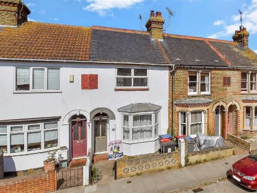 3 bedroom terraced house for sale in Nelson Road, Whitstable, Kent, CT5 — £400,000 • 3 bed • 1 bath • 797 ft²
 1 bedroom ground floor flat for sale in Middle Wall, Whitstable, Kent, CT5 — £180,000 • 1 bed • 1 bath • 410 ft²
 3 bedroom end of terrace house for sale in Canterbury Road, Whitstable, Kent, CT5 — £425,000 • 3 bed • 2 bath • 1109 ft²
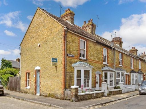 2 bedroom end of terrace house for sale in Sydenham Street, Whitstable, Kent, CT5 — £310,000 • 2 bed • 1 bath • 699 ft²
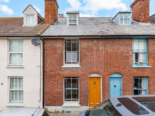 3 bedroom terraced house for sale in Sydenham Street, Whitstable, CT5 — £425,000 • 3 bed • 1 bath • 1103 ft²
Meta
- {
"@context": "https://schema.org",
"@type": "Residence",
"name": "1 bedroom ground floor flat for sale in Argyle Road, Whitst…",
"description": "",
"url": "https://propertypiper.co.uk/property/7d70d561-316b-4344-9046-8bffed30b951",
"image": "https://image-a.propertypiper.co.uk/d6a54dc0-f063-4785-82b2-4ae1871dceeb-1024.jpeg",
"address": {
"@type": "PostalAddress",
"streetAddress": "68 ARGYLE ROAD WHITSTABLE ",
"postalCode": "CT5 1JR",
"addressLocality": "Canterbury",
"addressRegion": "Canterbury",
"addressCountry": "England"
},
"geo": {
"@type": "GeoCoordinates",
"latitude": 51.35726262218411,
"longitude": 1.0275273609742943
},
"numberOfRooms": 1,
"numberOfBathroomsTotal": 1,
"floorSize": {
"@type": "QuantitativeValue",
"value": 1249,
"unitCode": "FTK"
},
"offers": {
"@type": "Offer",
"price": 285000,
"priceCurrency": "GBP",
"availability": "https://schema.org/InStock"
},
"additionalProperty": [
{
"@type": "PropertyValue",
"name": "Feature",
"value": "Victorian"
},
{
"@type": "PropertyValue",
"name": "Feature",
"value": "terraced"
},
{
"@type": "PropertyValue",
"name": "Feature",
"value": "2-story"
},
{
"@type": "PropertyValue",
"name": "Feature",
"value": "central location"
},
{
"@type": "PropertyValue",
"name": "Feature",
"value": "fixer-upper"
},
{
"@type": "PropertyValue",
"name": "Feature",
"value": "front garden"
},
{
"@type": "PropertyValue",
"name": "Feature",
"value": "dated exterior"
},
{
"@type": "PropertyValue",
"name": "Feature",
"value": "chimney"
},
{
"@type": "PropertyValue",
"name": "Feature",
"value": "brickwork"
},
{
"@type": "PropertyValue",
"name": "Feature",
"value": "terraced house"
},
{
"@type": "PropertyValue",
"name": "Feature",
"value": "Victorian"
},
{
"@type": "PropertyValue",
"name": "Feature",
"value": "garden"
},
{
"@type": "PropertyValue",
"name": "Feature",
"value": "patio"
},
{
"@type": "PropertyValue",
"name": "Feature",
"value": "outdoor space"
},
{
"@type": "PropertyValue",
"name": "Feature",
"value": "traditional style"
},
{
"@type": "PropertyValue",
"name": "Feature",
"value": "hedges"
},
{
"@type": "PropertyValue",
"name": "Feature",
"value": "stone facade"
}
]
}
High Res Floorplan Images
Compatible Floorplan Images
FloorplanImages Thumbnail