NG10 2EZ - 2 bedroom end of terrace house for sale in Armitage Drive,…
View on Property Piper
2 bedroom end of terrace house for sale in Armitage Drive, Long Eaton, Nottingham, Derbyshire, NG10
Property Details
- Price: £235000
- Bedrooms: 2
- Bathrooms: 1
- Property Type: undefined
- Property SubType: undefined
Image Descriptions
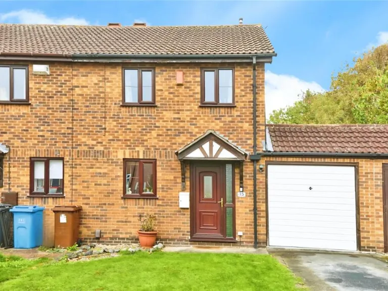
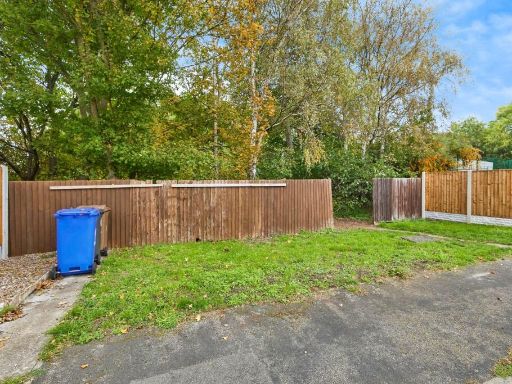
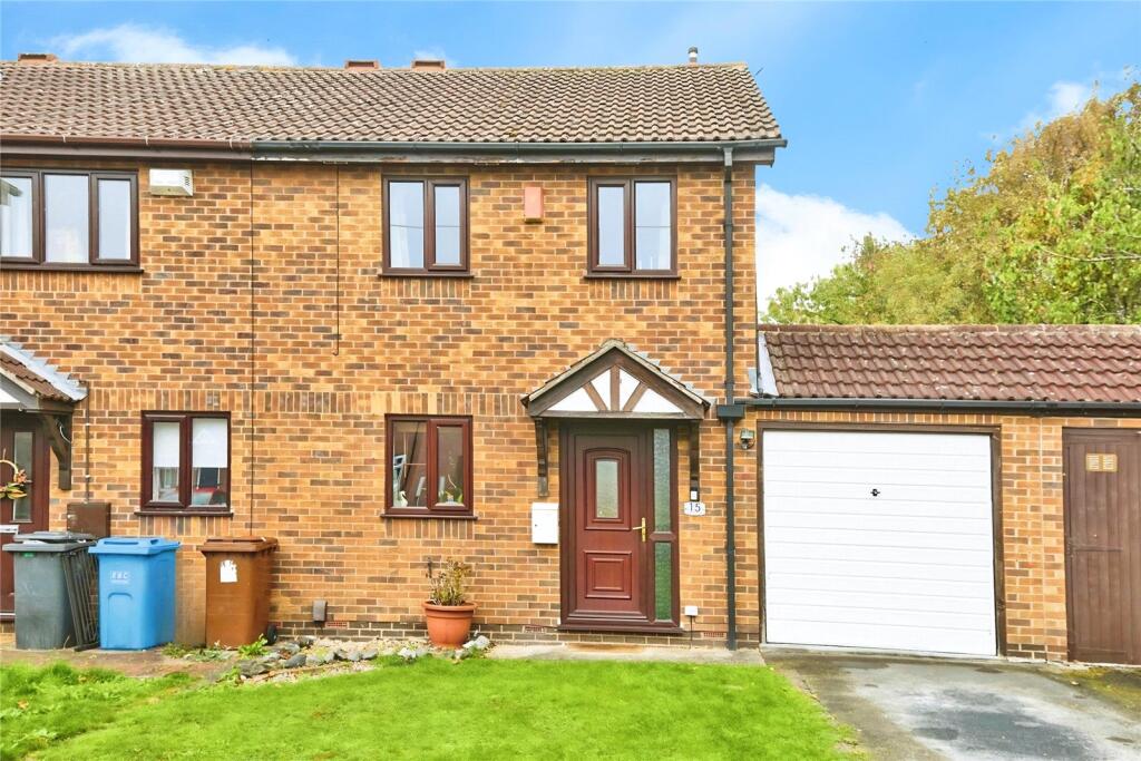
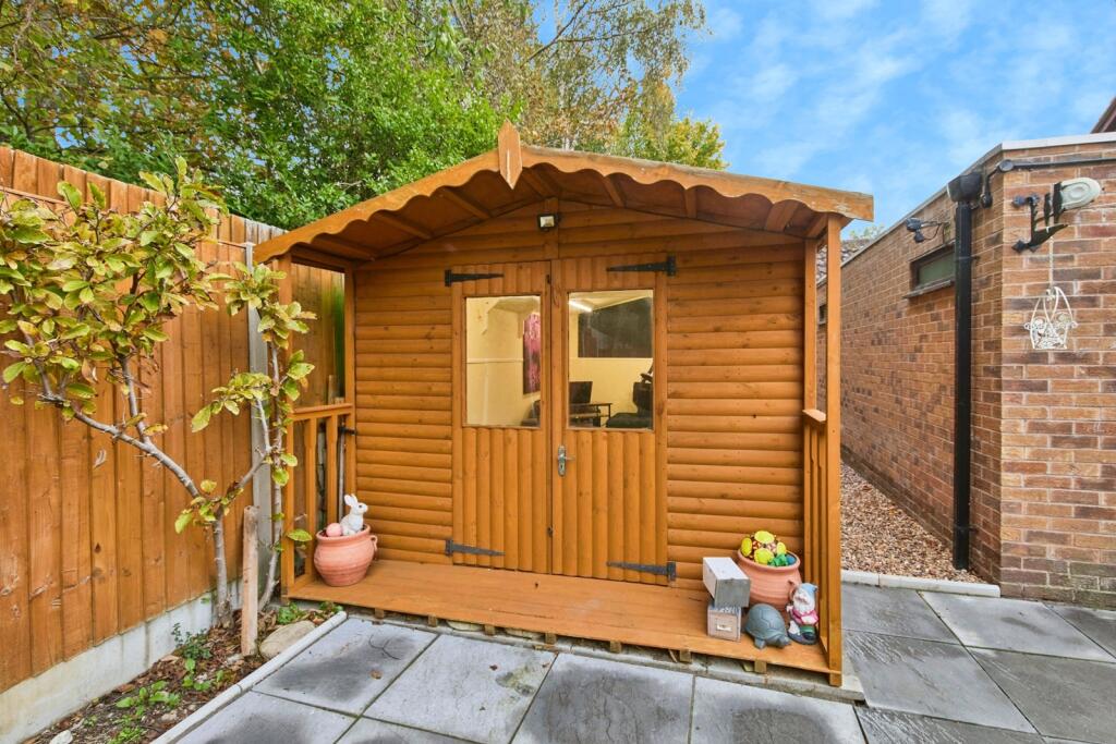
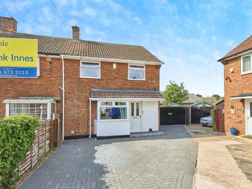
- front exterior modern semi-detached
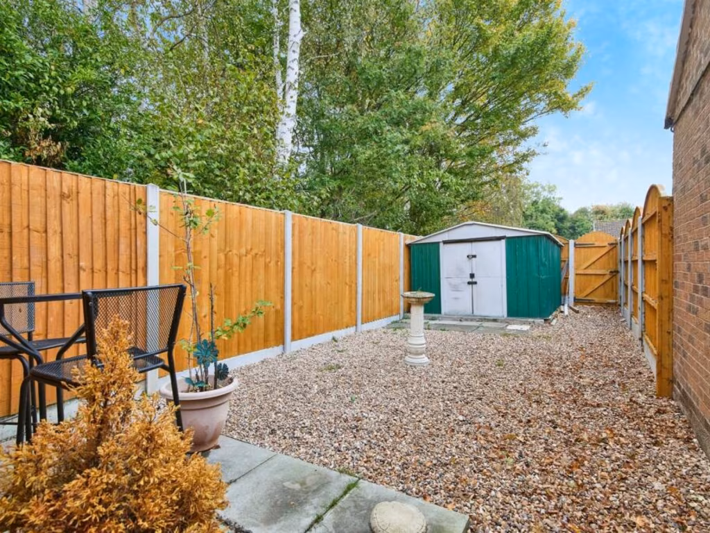
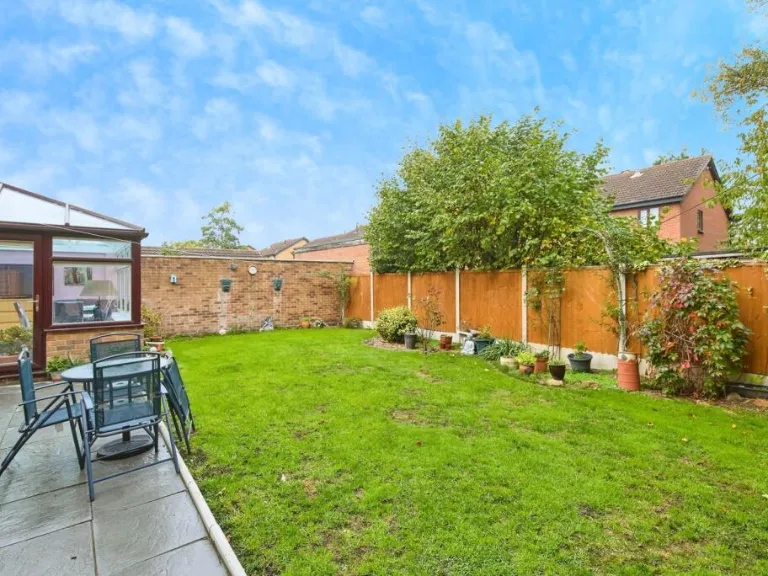
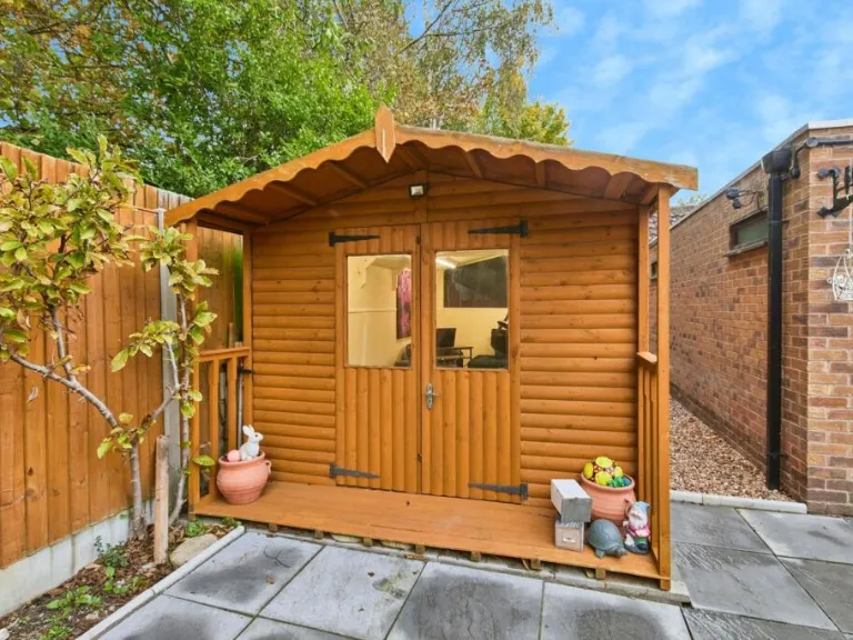
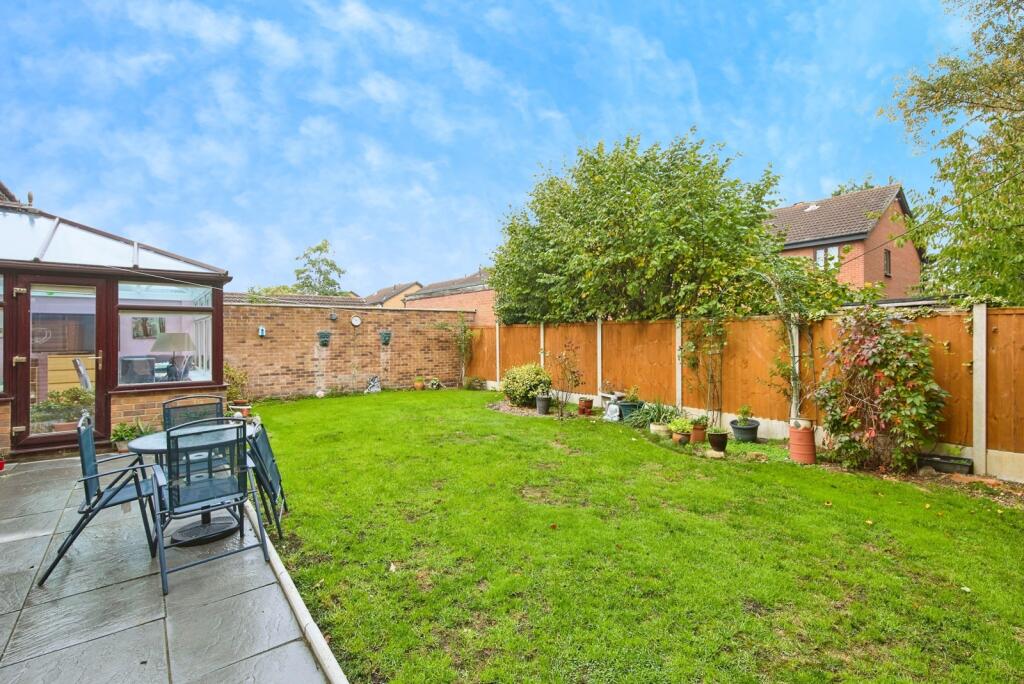
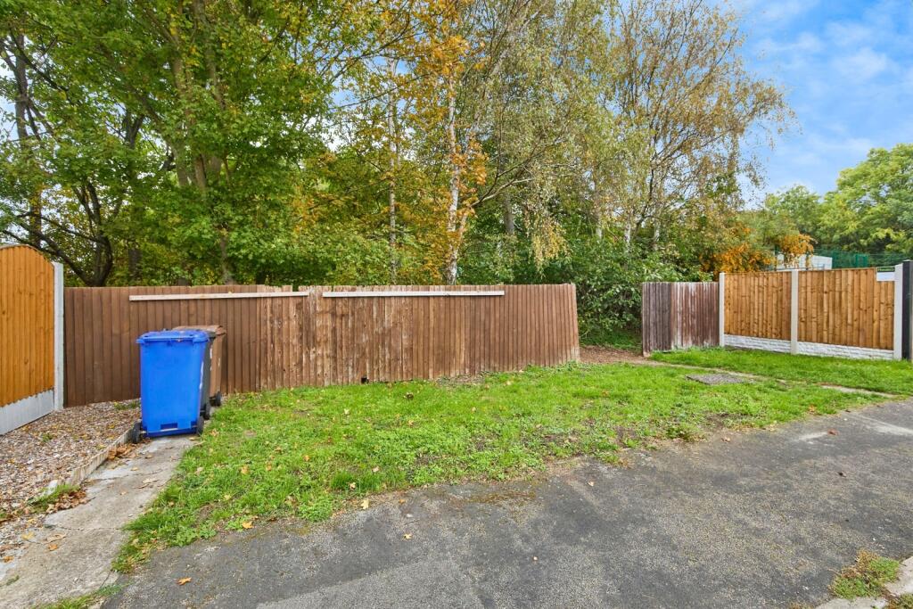
- back garden
Floorplan Description
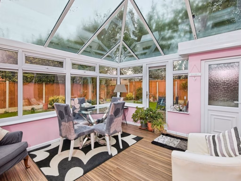
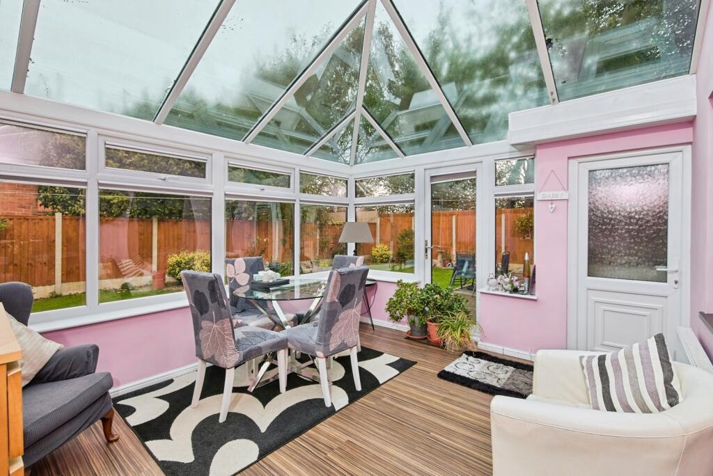
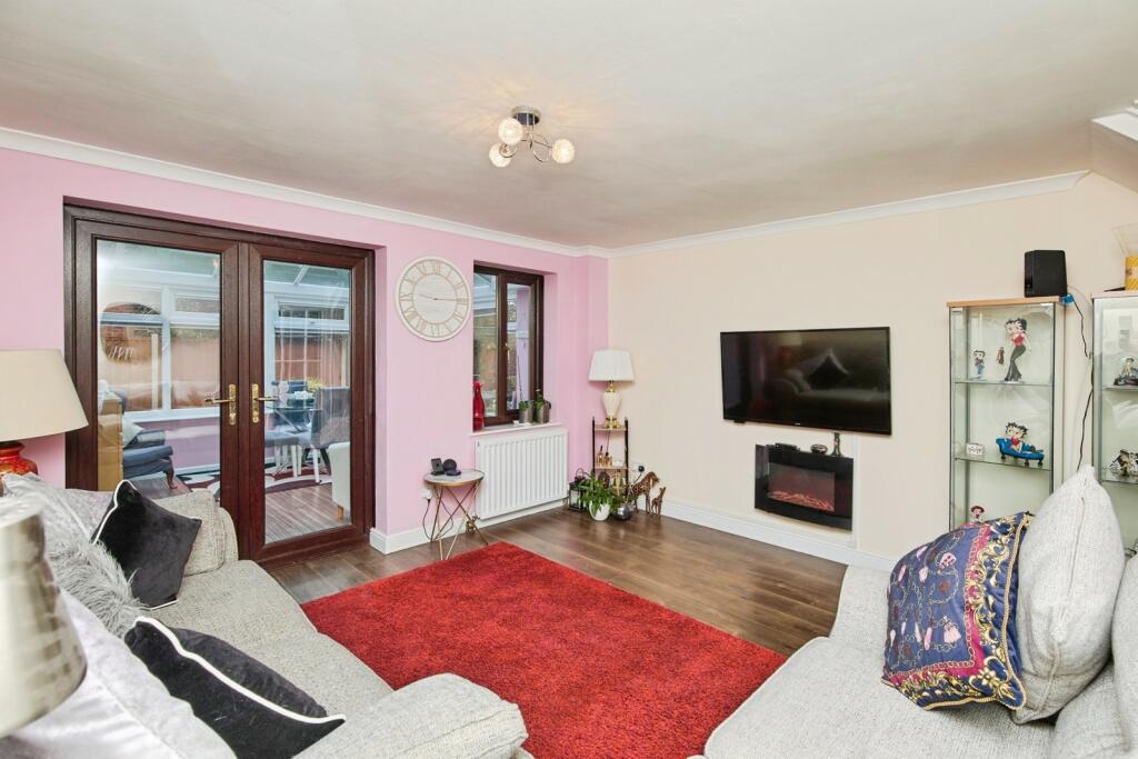
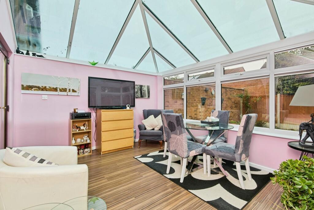
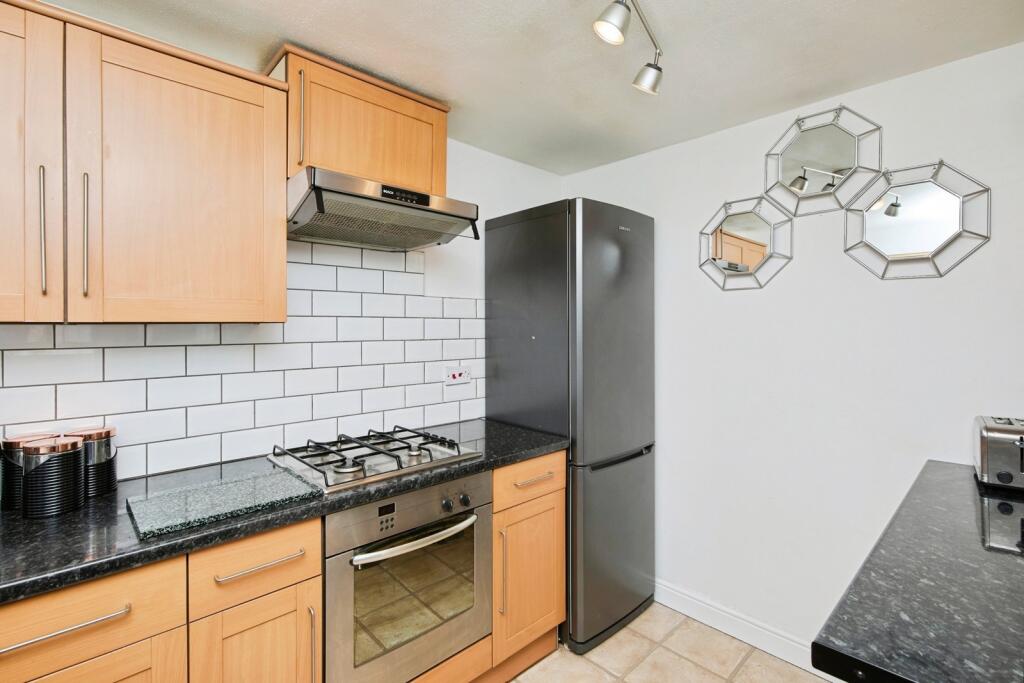
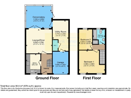
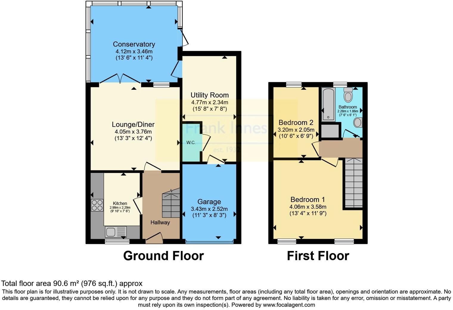
- Two-storey house with lounge/diner, conservatory, utility and two bedrooms
Rooms
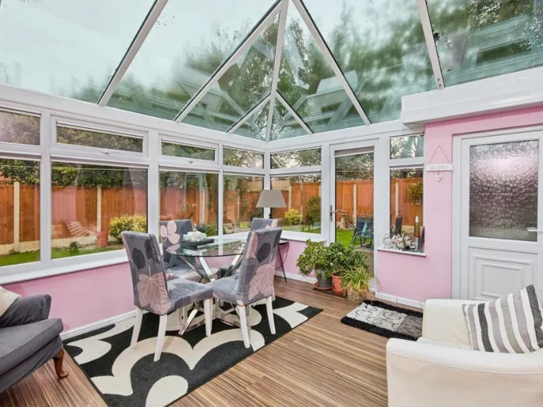
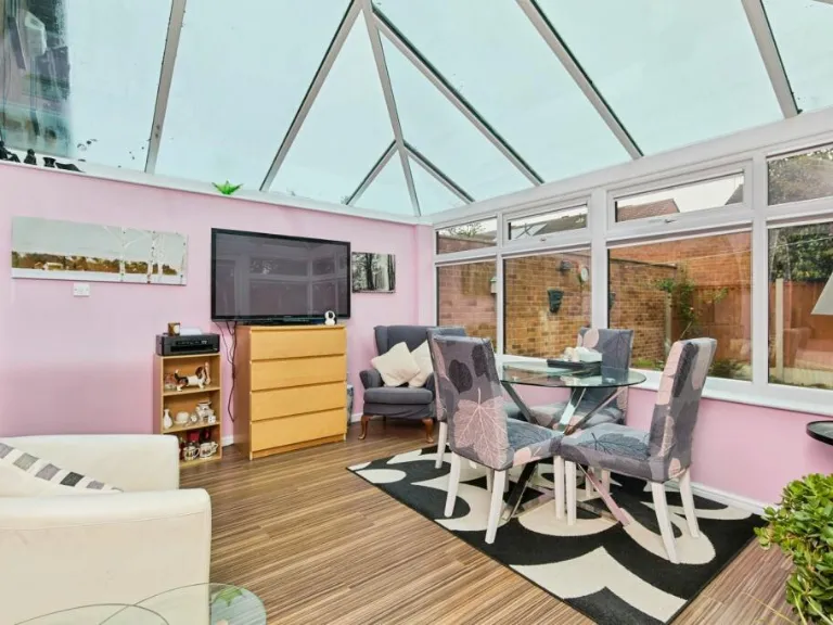
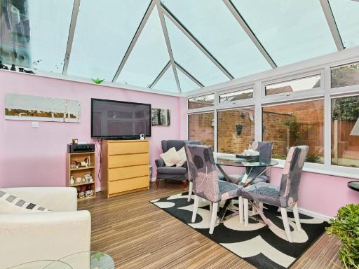
- Conservatory:
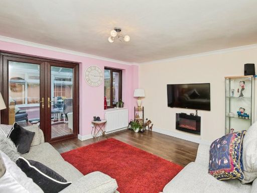
- Lounge/Diner:
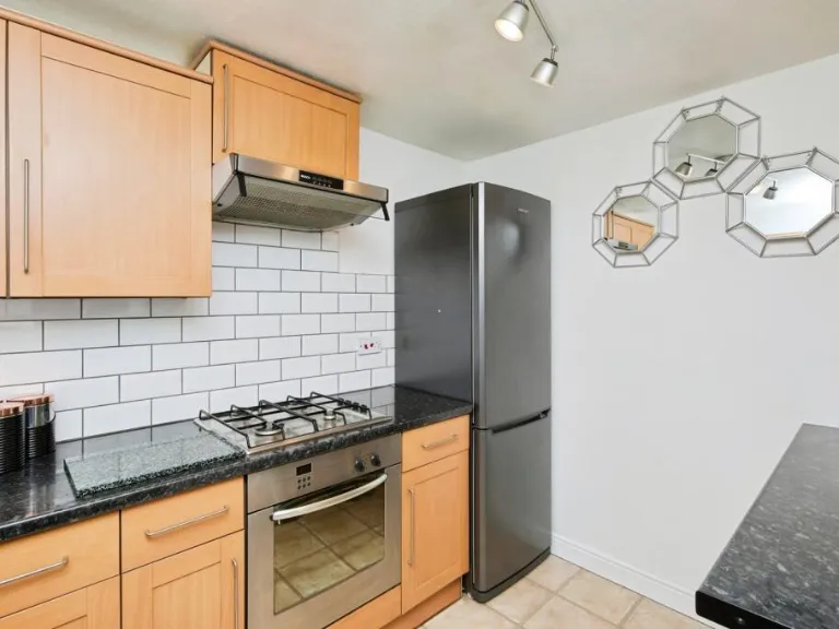
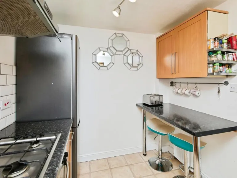
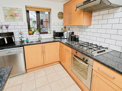
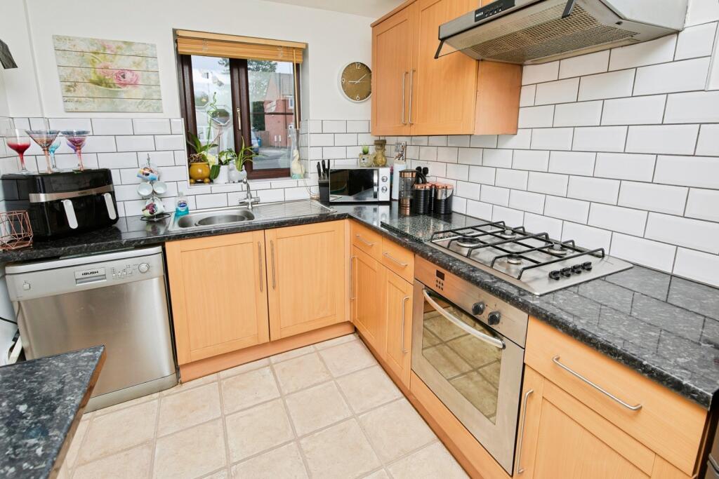
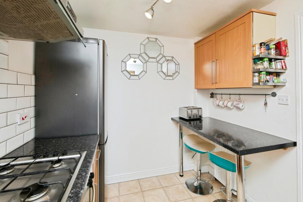
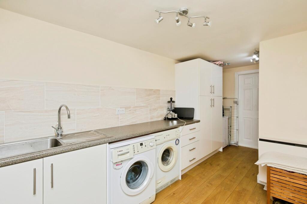
- Kitchen:
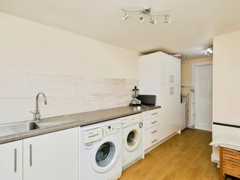
- Utility Room:
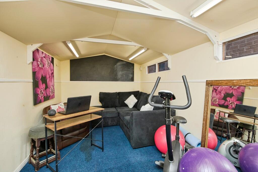
- Garage:
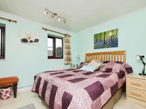
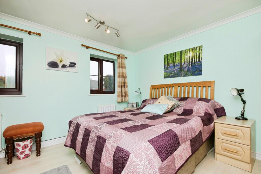
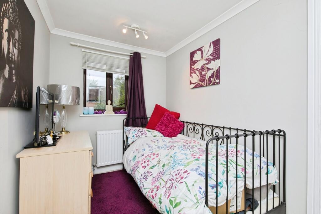
- Bedroom 1:
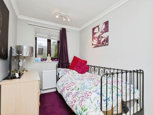
- Bedroom 2:
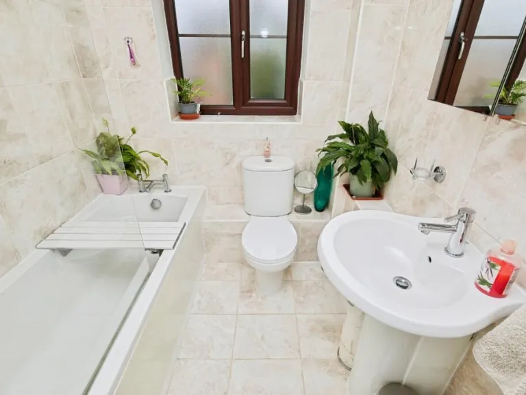
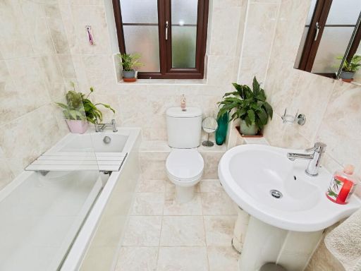
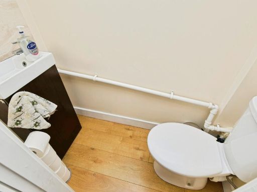
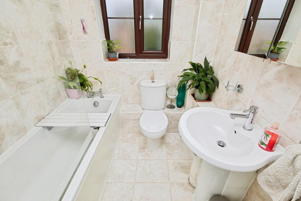
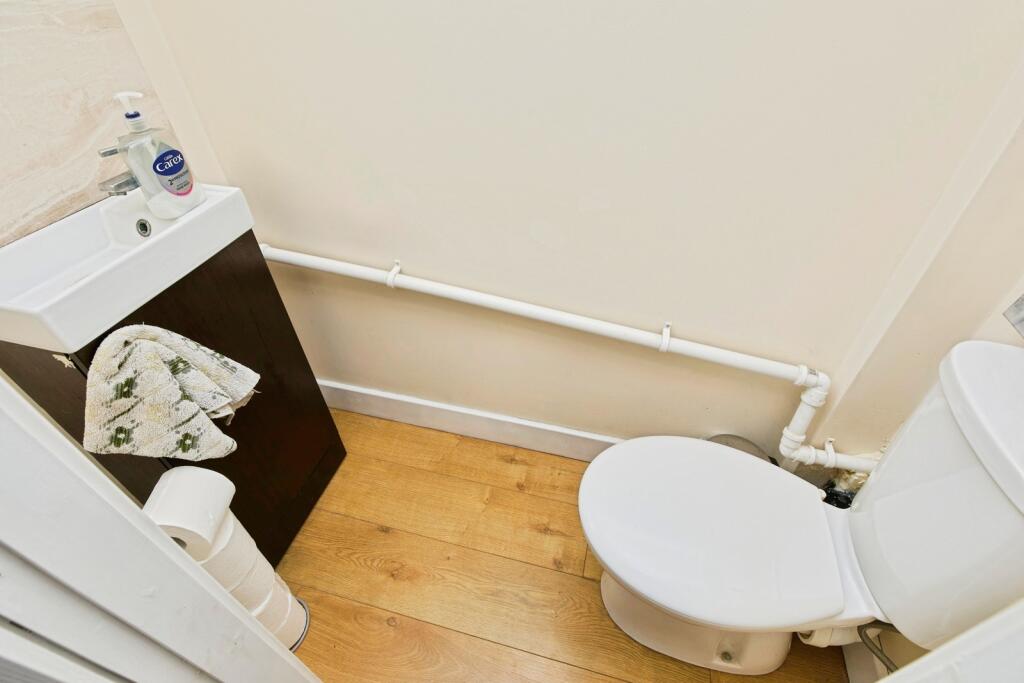
- Bathroom:
Textual Property Features
Detected Visual Features
- modern
- semi-detached
- brick
- attached garage
- front garden
- double glazed windows
- two-storey
- gabled roof
- paved driveway
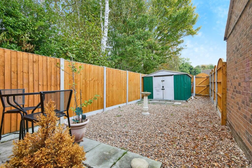
- garden
- lawn
- patio
- fence
- paved area
- private
EPC Details
- High performance glazing
- Average thermal transmittance 0.21 W/m-¦K
- Boiler and radiators, mains gas
- Low energy lighting in all fixed outlets
- Average thermal transmittance 0.12 W/m-¦K
Nearby Schools
- St Laurence CofE Primary School
- The Long Eaton School
- Trent College
- Parklands Infant and Nursery School
- Wilsthorpe School
- OneSchool Global Uk Nottingham Campus
- Toton Banks Road Infant and Nursery School
- Chetwynd Spencer Academy
- Toton Bispham Drive Junior School
- Alderman Pounder Infant and Nursery School
- William Lilley Infant and Nursery School
- Fairfield Spencer Academy
- Grange Primary School
- Harrington Junior School
- The Lanes Primary School
- George Spencer Academy
- Alderman White School
- Wadsworth Fields Primary School
- Brooklands Primary School
- Chilwell School
- Eskdale Junior School
- Sunnyside Spencer Academy
- Bramcote CofE Primary School
- Albany Junior School
- Dovedale Primary School
- English Martyrs' Catholic Voluntary Academy
- Longmoor Primary School
- St John's CofE Primary School
Nearest General Shops
- Id: 289419832
- Tags:
- Addr:
- Housename: Wilson's Yard
- Street: Clifton Avenue
- Building: industrial
- Car_parts: tyres
- Name: AG Services
- Shop: car_parts
- Source: survey; Bing
- TagsNormalized:
- industrial
- service
- car parts
- shop
- Lat: 52.8931501
- Lon: -1.2574408
- FullGeoHash: gcrhgkukgtb4
- PartitionGeoHash: gcrh
- Images:
- FoodStandards: null
- Distance: 216.2
,- Id: 289420186
- Tags:
- Addr:
- City: Nottingham
- Street: Clifton Avenue
- Suburb: Long Eaton
- Building: industrial
- Name: P.C. Auto Services
- Shop: car_repair
- Source: survey; Bing
- TagsNormalized:
- industrial
- service
- car repair
- repair
- shop
- Lat: 52.8930189
- Lon: -1.2563824
- FullGeoHash: gcrhgkvhhjm7
- PartitionGeoHash: gcrh
- Images:
- FoodStandards: null
- Distance: 211.1
,- Id: 289420195
- Tags:
- Addr:
- City: Nottingham
- Street: Clifton Avenue
- Suburb: Long Eaton
- Building: industrial
- Name: Thorpe Leys Motor Company
- Second_hand: yes
- Shop: car
- Source: survey; Bing
- Website: https://www.thorpeleys.co.uk/
- TagsNormalized:
- Lat: 52.8930387
- Lon: -1.2565344
- FullGeoHash: gcrhgkvh29h1
- PartitionGeoHash: gcrh
- Images:
- FoodStandards: null
- Distance: 210.2
}
Nearest Religious buildings
- Id: 320462337
- Tags:
- Addr:
- City: Nottingham
- Postcode: NG10 1GJ
- Street: Station Street
- Suburb: Long Eaton
- Amenity: church_hall
- Building: yes
- Denomination: baptist
- Name: Baptist Church Hall
- Religion: christian
- Source:
- Start_date: 1907
- TagsNormalized:
- church
- church hall
- baptist
- christian
- Lat: 52.8960467
- Lon: -1.2658406
- FullGeoHash: gcrhgjqjzcbc
- PartitionGeoHash: gcrh
- Images:
- FoodStandards: null
- Distance: 668
,- Id: 145472760
- Tags:
- Addr:
- Postcode: NG10 1GJ
- Street: Station Street
- Amenity: place_of_worship
- Building: church
- Denomination: baptist
- Name: Long Eaton Baptist Church
- Religion: christian
- Source: survey;Bing
- Website: https://www.longeatonbaptistchurch.co.uk/
- TagsNormalized:
- place of worship
- church
- baptist
- christian
- Lat: 52.8959346
- Lon: -1.2655841
- FullGeoHash: gcrhgjqmjubh
- PartitionGeoHash: gcrh
- Images:
- FoodStandards: null
- Distance: 648.8
,- Id: 320596690
- Tags:
- Addr:
- City: Nottingham
- Postcode: NG10 2DL
- Street: New Tythe Street
- Suburb: Long Eaton
- Amenity: place_of_worship
- Building: church
- Denomination: jehovahs_witness
- Name: Kingdom Hall of Jehovah's Witnesses
- Religion: christian
- Source: survey
- Source:area: Bing
- TagsNormalized:
- place of worship
- church
- jehovah
- jehovahs witness
- christian
- Lat: 52.8959908
- Lon: -1.2645517
- FullGeoHash: gcrhgjrjmz3g
- PartitionGeoHash: gcrh
- Images:
- FoodStandards: null
- Distance: 582
}
Nearest Airports
- Id: 11359528
- Tags:
- Aerodrome: international
- Aerodrome:type: public
- Aeroway: aerodrome
- Iata: EMA
- Icao: EGNX
- Is_in: Castle Donington,England,UK
- Name: East Midlands Airport
- Old_name: RAF Castle Donington
- Operator: Manchester Airports Holdings Limited
- Operator:type: private
- Ref: EMA
- Type: multipolygon
- Website: https://www.eastmidlandsairport.com/
- Wikidata: Q8977
- Wikipedia: en:East Midlands Airport
- TagsNormalized:
- airport
- international airport
- Lat: 52.8281122
- Lon: -1.3322143
- FullGeoHash: gcrh99jfj1vh
- PartitionGeoHash: gcrh
- Images:
- FoodStandards: null
- Distance: 9016.7
}
Nearest Tourist attractions
- Id: 8308672118
- Tags:
- TagsNormalized:
- Lat: 52.8965431
- Lon: -1.2808267
- FullGeoHash: gcrhfve2dw66
- PartitionGeoHash: gcrh
- Images:
- FoodStandards: null
- Distance: 1671.1
,- Id: 30785830
- Tags:
- Addr:
- City: Nottingham
- Postcode: NG9 6DY
- Street: Barton Lane
- Suburb: Attenborough
- Alt_name: Visitor Centre
- Building: yes
- Fhrs:
- Name: Attenborough Nature Centre
- Source: Yahoo
- Source:postcode: ONS
- Tourism: attraction
- Wheelchair: yes
- TagsNormalized:
- Lat: 52.899657
- Lon: -1.2356799
- FullGeoHash: gcrhgyh4ydf3
- PartitionGeoHash: gcrh
- Images:
- FoodStandards:
- Id: 1334774
- FHRSID: 1334774
- LocalAuthorityBusinessID: 21/00032/MOBIL
- BusinessName: Attenborough Nature Centre
- BusinessType: Mobile caterer
- BusinessTypeID: 7846
- AddressLine1: Barton Lane
- AddressLine2: Attenborough
- AddressLine3: Nottinghamshire
- AddressLine4: null
- PostCode: NG9 6DY
- RatingValue: 5
- RatingKey: fhrs_5_en-GB
- RatingDate: 2021-03-24
- LocalAuthorityCode: 261
- LocalAuthorityName: Broxtowe
- LocalAuthorityWebSite: http://www.broxtowe.gov.uk
- LocalAuthorityEmailAddress: health@broxtowe.gov.uk
- Scores:
- Hygiene: 5
- Structural: 5
- ConfidenceInManagement: 5
- NewRatingPending: false
- Geocode:
- Longitude: -1.23839100000000
- Latitude: 52.90184200000000
- Distance: 1465.7
,- Id: 322731555
- Tags:
- Addr:
- City: Nottingham
- Housenumber: 16
- Postcode: NG10 1GR
- Street: Main Street
- Suburb: Long Eaton
- Building: house
- Name: Beeches Guest House
- Source: survey
- Source:area: Bing
- Tourism: guest_house
- TagsNormalized:
- Lat: 52.8946395
- Lon: -1.2658806
- FullGeoHash: gcrhgjnjwg7n
- PartitionGeoHash: gcrh
- Images:
- FoodStandards: null
- Distance: 659.3
}
Nearest Train stations
- Id: 324257221
- Tags:
- Name: Ruddington Fields
- Public_transport: station
- Railway: station
- Train: yes
- Usage: tourism
- TagsNormalized:
- Lat: 52.8845732
- Lon: -1.1479442
- FullGeoHash: gcrhvgk4fyyz
- PartitionGeoHash: gcrh
- Images:
- FoodStandards: null
- Distance: 7344.1
,- Id: 4292892169
- Tags:
- Is_in:
- Layer: 2
- Name: Beeston
- Naptan:
- Network: National Rail
- Public_transport: station
- Railway: station
- Ref:
- Wheelchair: yes
- Wikidata: Q3299120
- Wikipedia: en:Beeston railway station
- TagsNormalized:
- Lat: 52.9207938
- Lon: -1.2075065
- FullGeoHash: gcrjh9btzncz
- PartitionGeoHash: gcrj
- Images:
- FoodStandards: null
- Distance: 4346.1
,- Id: 2136826434
- Tags:
- Addr:
- Name: East Midlands Parkway
- Naptan:
- Network: National Rail
- Operator: East Midlands Railway
- Public_transport: station
- Railway: station
- Ref:
- Train: yes
- Wikidata: Q5328988
- Wikipedia: en:East Midlands Parkway railway station
- TagsNormalized:
- Lat: 52.862275
- Lon: -1.262883
- FullGeoHash: gcrher23hdq1
- PartitionGeoHash: gcrh
- Images:
- FoodStandards: null
- Distance: 3657.4
,- Id: 1587569090
- Tags:
- Name: Long Eaton
- Naptan:
- Network: National Rail
- Public_transport: station
- Railway: station
- Ref:
- Train: yes
- Wheelchair: limited
- Wheelchair:description: Both platforms have a lift available. Sloped access is steep.
- Wikidata: Q2357399
- Wikipedia: en:Long Eaton railway station
- TagsNormalized:
- Lat: 52.8849595
- Lon: -1.2872899
- FullGeoHash: gcrhfeqt5yzp
- PartitionGeoHash: gcrh
- Images:
- FoodStandards: null
- Distance: 2369.1
,- Id: 6415345182
- Tags:
- Name: Attenborough
- Naptan:
- Network: National Rail
- Public_transport: station
- Railway: station
- Ref:
- Wikidata: Q2098552
- Wikipedia: en:Attenborough railway station
- TagsNormalized:
- Lat: 52.9064132
- Lon: -1.2311523
- FullGeoHash: gcrhgzrd0n4r
- PartitionGeoHash: gcrh
- Images:
- FoodStandards: null
- Distance: 2104.4
}
Nearest Bus stations and stops
- Id: 2609622687
- Tags:
- Bench: no
- Bus: yes
- Check_date:
- Highway: bus_stop
- Name: Nottingham Road / Marlborough Road
- Public_transport: platform
- Shelter: yes
- Source: survey
- Tactile_paving: no
- TagsNormalized:
- Lat: 52.9006205
- Lon: -1.2618622
- FullGeoHash: gcrhgq30kqrm
- PartitionGeoHash: gcrh
- Images:
- FoodStandards: null
- Distance: 744.9
,- Id: 1591863790
- Tags:
- Bus: yes
- Highway: bus_stop
- Name: Fields Farm Road / Manor House Road
- Public_transport: platform
- Shelter: no
- Source: survey
- TagsNormalized:
- Lat: 52.8919178
- Lon: -1.2648755
- FullGeoHash: gcrhghwvy207
- PartitionGeoHash: gcrh
- Images:
- FoodStandards: null
- Distance: 678.3
,- Id: 1591863801
- Tags:
- Bus: yes
- Highway: bus_stop
- Name: Fields Farm Road / Manor House Road
- Public_transport: platform
- Shelter: no
- Source: survey
- TagsNormalized:
- Lat: 52.8921908
- Lon: -1.2650556
- FullGeoHash: gcrhghwz64fp
- PartitionGeoHash: gcrh
- Images:
- FoodStandards: null
- Distance: 674.7
,- Id: 2609622691
- Tags:
- Bus: yes
- Highway: bus_stop
- Name: Nottingham Road / Station Road
- Public_transport: platform
- Shelter: yes
- Source: survey
- TagsNormalized:
- Lat: 52.9005965
- Lon: -1.2566691
- FullGeoHash: gcrhgqkbm3zt
- PartitionGeoHash: gcrh
- Images:
- FoodStandards: null
- Distance: 633.8
,- Id: 1605259794
- Tags:
- Bus: yes
- Highway: bus_stop
- Name: Nottingham Road / Station Road
- Public_transport: platform
- Shelter: yes
- Source: survey
- TagsNormalized:
- Lat: 52.9003976
- Lon: -1.2575225
- FullGeoHash: gcrhgqhr1sg7
- PartitionGeoHash: gcrh
- Images:
- FoodStandards: null
- Distance: 618.2
}
Nearest Hotels
- Id: 73305225
- Tags:
- Addr:
- City: Nottingham
- Postcode: NG10 4EP
- Street: Bostocks Lane
- Suburb: Long Eaton
- Brand: Novotel
- Brand:wikidata: Q420545
- Brand:wikipedia: en:Novotel
- Building: hotel
- Fhrs:
- Name: Novotel
- Source:
- Tourism: hotel
- TagsNormalized:
- Lat: 52.910471
- Lon: -1.298113
- FullGeoHash: gcrj42n9zf8v
- PartitionGeoHash: gcrj
- Images:
- FoodStandards: null
- Distance: 3308.9
,- Id: 29877078
- Tags:
- Addr:
- City: Nottingham
- Postcode: NG9 6DL
- Street: Brailsford Way
- Suburb: Attenborough
- Alt_name: Village Hotels
- Building: yes
- Fhrs:
- Name: The Village Hotel
- Source:
- Tourism: hotel
- Website: https://www.village-hotels.co.uk/hotels/nottingham/welcome
- TagsNormalized:
- Lat: 52.9030019
- Lon: -1.2408004
- FullGeoHash: gcrhgy8qr624
- PartitionGeoHash: gcrh
- Images:
- FoodStandards: null
- Distance: 1363.1
,- Id: 316454505
- Tags:
- Addr:
- City: Nottingham
- Housenumber: 20-22
- Postcode: NG10 1LW
- Street: Derby Road
- Suburb: Long Eaton
- Bar: yes
- Building: commercial
- Fhrs:
- Name: Bennetts
- Old_name: Europa Hotel
- Restaurant: yes
- Source:
- Tourism: hotel
- Website: http://www.bennettslongeaton.co.uk/
- TagsNormalized:
- Lat: 52.9004252
- Lon: -1.2741741
- FullGeoHash: gcrhgn0pmd4b
- PartitionGeoHash: gcrh
- Images:
- FoodStandards: null
- Distance: 1361
}
Tags
- modern
- semi-detached
- brick
- attached garage
- front garden
- double glazed windows
- two-storey
- gabled roof
- paved driveway
- garden
- lawn
- patio
- fence
- paved area
- private
Local Market Stats
- Average Price/sqft: £233
- Avg Income: £39600
- Rental Yield: 4.4%
- Social Housing: 9%
- Planning Success Rate: 95%
AirBnB Data
- 1km average: £75/night
- Listings in 1km: 1
Similar Properties
 2 bedroom end of terrace house for sale in Bramble Close, Long Eaton, Nottingham, Derbyshire, NG10 — £200,000 • 2 bed • 1 bath • 915 ft²
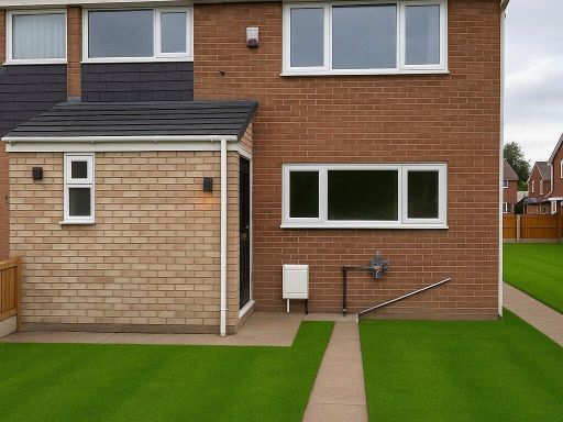 3 bedroom semi-detached house for sale in Lodge Road, Long Eaton, Nottingham, Derbyshire, NG10 — £270,000 • 3 bed • 1 bath • 987 ft²
 3 bedroom semi-detached house for sale in Grange Road, Long Eaton, Nottingham, Derbyshire, NG10 — £200,000 • 3 bed • 1 bath • 911 ft²
 2 bedroom semi-detached house for sale in Briar Gate, Long Eaton, NG10 — £218,000 • 2 bed • 1 bath • 641 ft²
 3 bedroom detached house for sale in Douglas Road, Long Eaton, Nottingham, Derbyshire, NG10 — £290,000 • 3 bed • 1 bath • 1139 ft²
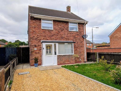 3 bedroom detached house for sale in Windermere Road, Long Eaton, NG10 — £240,000 • 3 bed • 1 bath • 862 ft²
Meta
- {
"@context": "https://schema.org",
"@type": "Residence",
"name": "2 bedroom end of terrace house for sale in Armitage Drive,…",
"description": "",
"url": "https://propertypiper.co.uk/property/7cd249e6-b63e-465c-9862-54e5033ae233",
"image": "https://image-a.propertypiper.co.uk/e0a221fb-964b-47d7-90b9-8dab12a1f574-1024.jpeg",
"address": {
"@type": "PostalAddress",
"streetAddress": "15 ARMITAGE DRIVE LONG EATON NOTTINGHAM",
"postalCode": "NG10 2EZ",
"addressLocality": "Erewash",
"addressRegion": "Erewash",
"addressCountry": "England"
},
"geo": {
"@type": "GeoCoordinates",
"latitude": 52.8949079,
"longitude": -1.2560631
},
"numberOfRooms": 2,
"numberOfBathroomsTotal": 1,
"floorSize": {
"@type": "QuantitativeValue",
"value": 783,
"unitCode": "FTK"
},
"offers": {
"@type": "Offer",
"price": 235000,
"priceCurrency": "GBP",
"availability": "https://schema.org/InStock"
},
"additionalProperty": [
{
"@type": "PropertyValue",
"name": "Feature",
"value": "modern"
},
{
"@type": "PropertyValue",
"name": "Feature",
"value": "semi-detached"
},
{
"@type": "PropertyValue",
"name": "Feature",
"value": "brick"
},
{
"@type": "PropertyValue",
"name": "Feature",
"value": "attached garage"
},
{
"@type": "PropertyValue",
"name": "Feature",
"value": "front garden"
},
{
"@type": "PropertyValue",
"name": "Feature",
"value": "double glazed windows"
},
{
"@type": "PropertyValue",
"name": "Feature",
"value": "two-storey"
},
{
"@type": "PropertyValue",
"name": "Feature",
"value": "gabled roof"
},
{
"@type": "PropertyValue",
"name": "Feature",
"value": "paved driveway"
},
{
"@type": "PropertyValue",
"name": "Feature",
"value": "garden"
},
{
"@type": "PropertyValue",
"name": "Feature",
"value": "lawn"
},
{
"@type": "PropertyValue",
"name": "Feature",
"value": "patio"
},
{
"@type": "PropertyValue",
"name": "Feature",
"value": "fence"
},
{
"@type": "PropertyValue",
"name": "Feature",
"value": "paved area"
},
{
"@type": "PropertyValue",
"name": "Feature",
"value": "private"
}
]
}
High Res Floorplan Images
Compatible Floorplan Images
FloorplanImages Thumbnail