YO8 4HN - 2 bedroom apartment for sale in Chapel House Court, Selby,…
View on Property Piper
2 bedroom apartment for sale in Chapel House Court, Selby, YO8
Property Details
- Price: £119000
- Bedrooms: 2
- Bathrooms: 2
- Property Type: undefined
- Property SubType: undefined
Brochure Descriptions
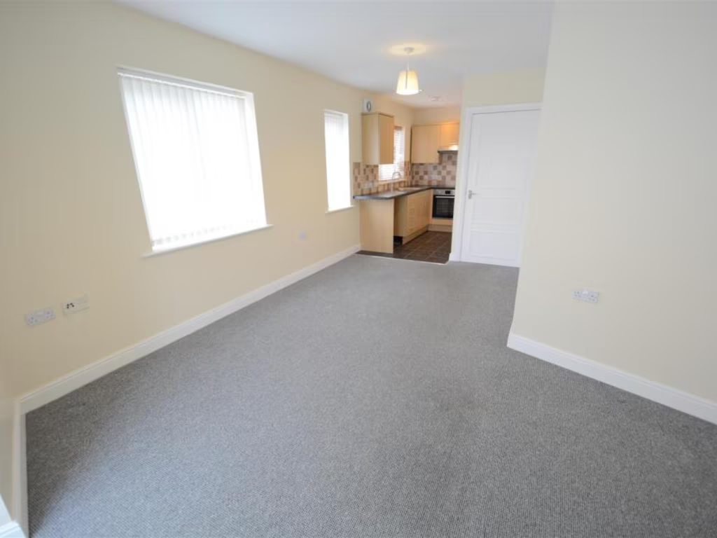
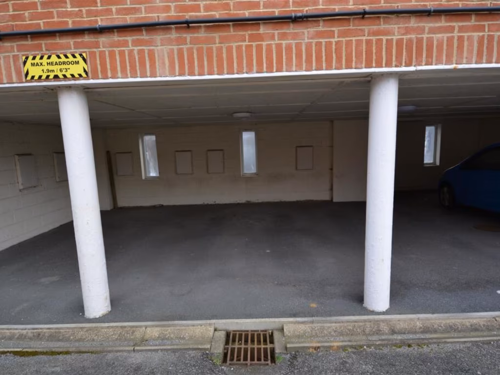
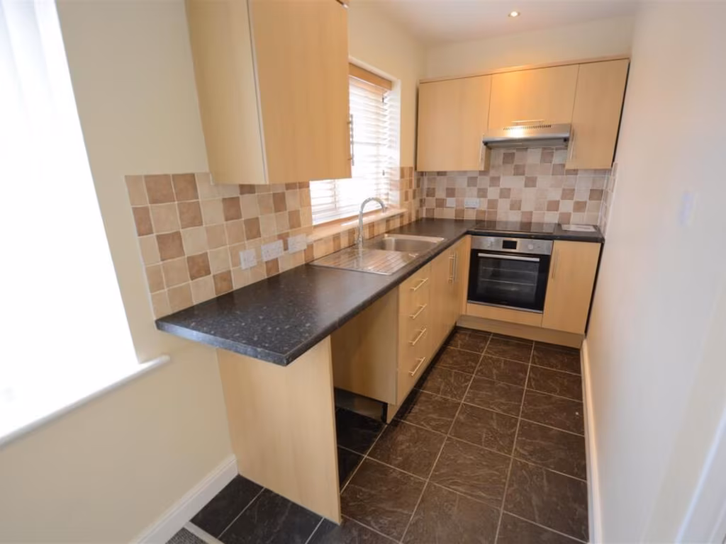
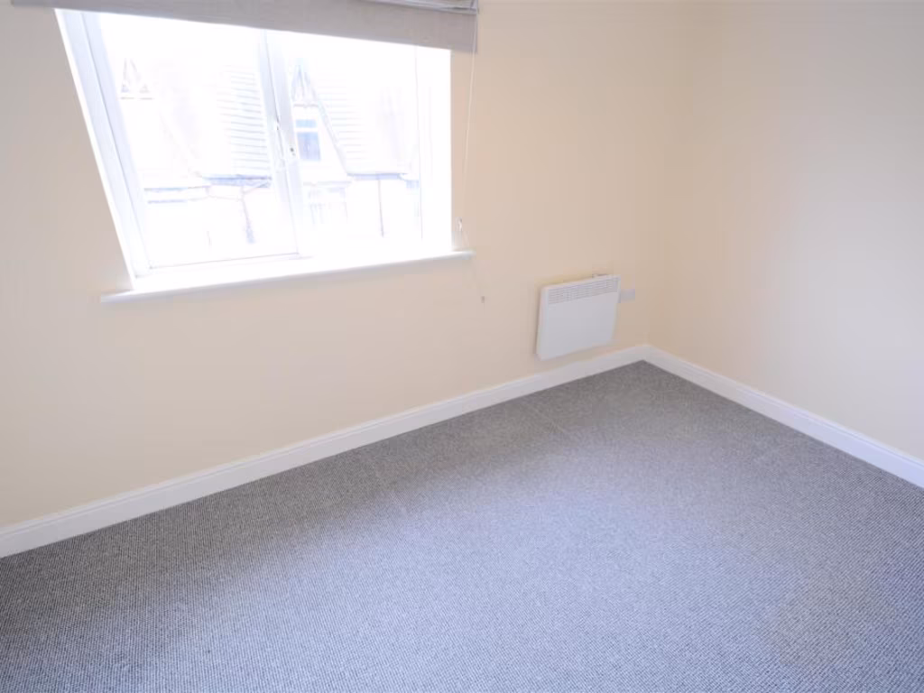
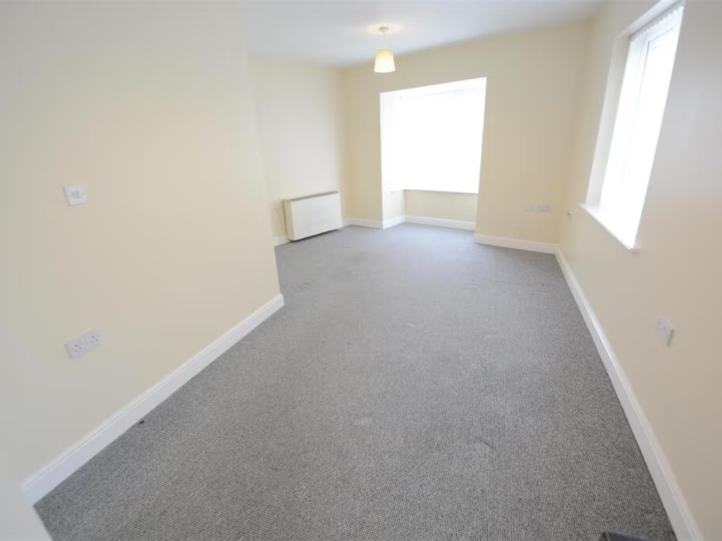
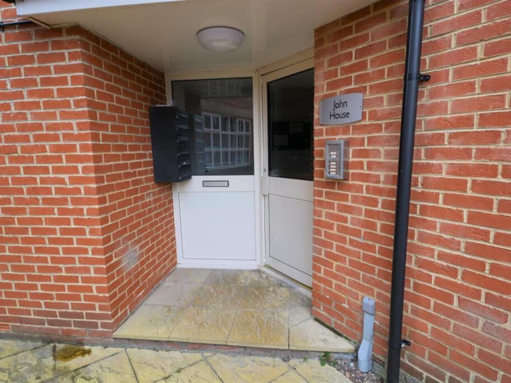
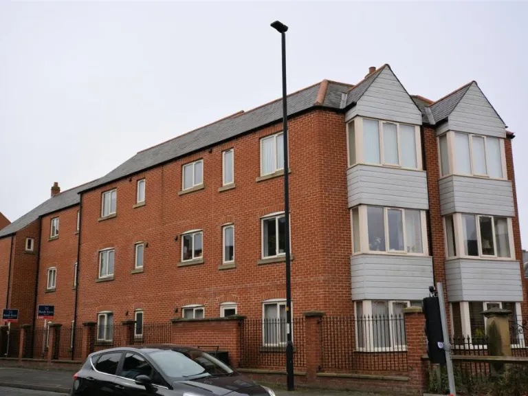
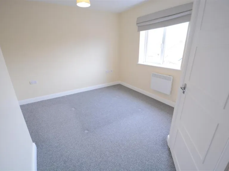
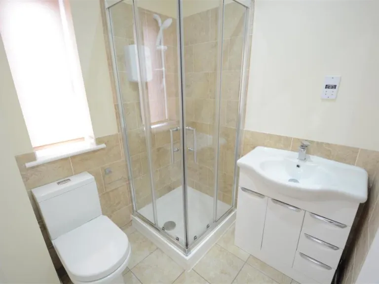
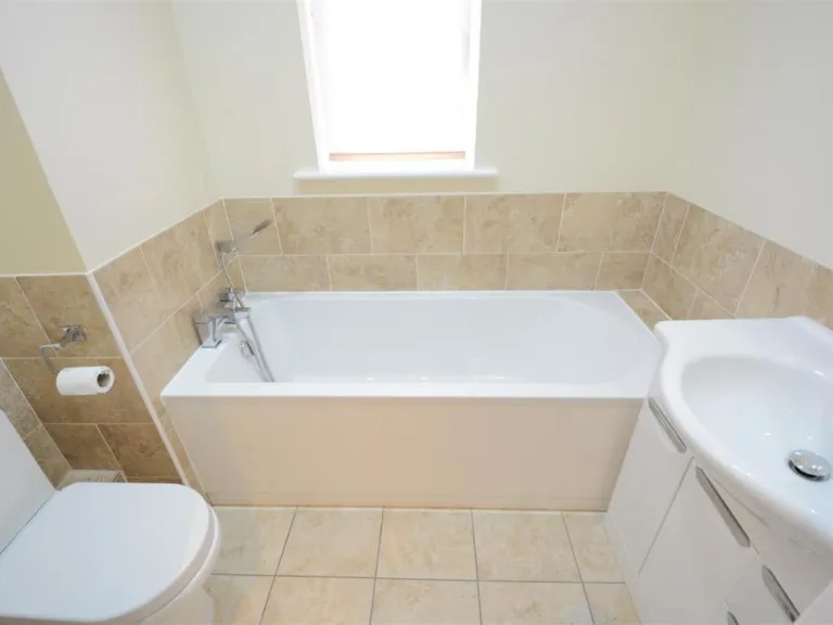
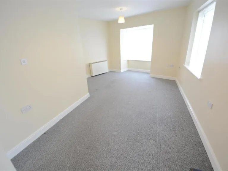
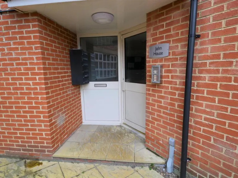
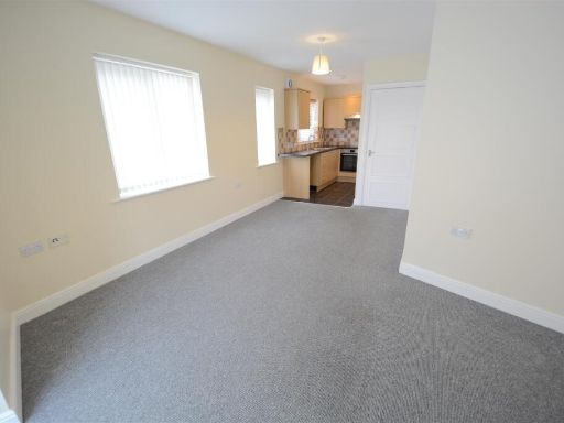
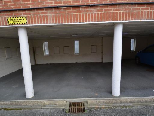
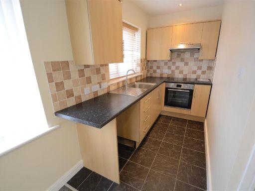
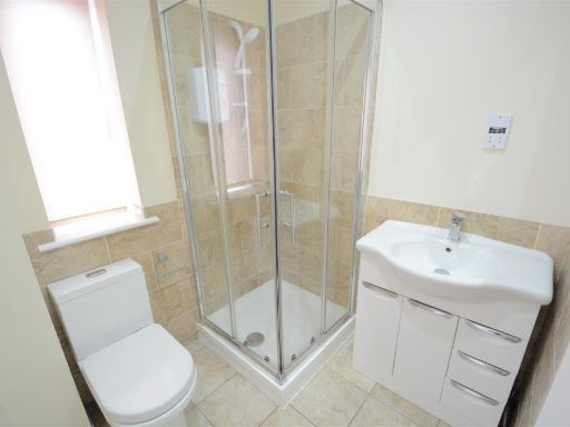
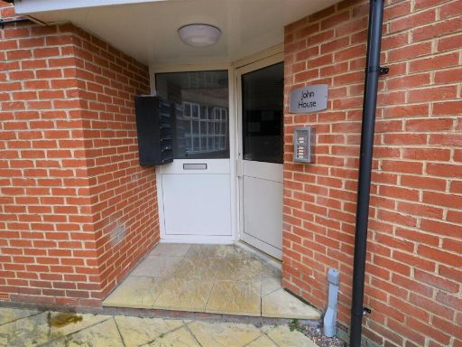
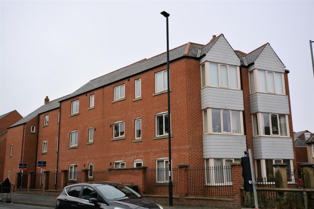
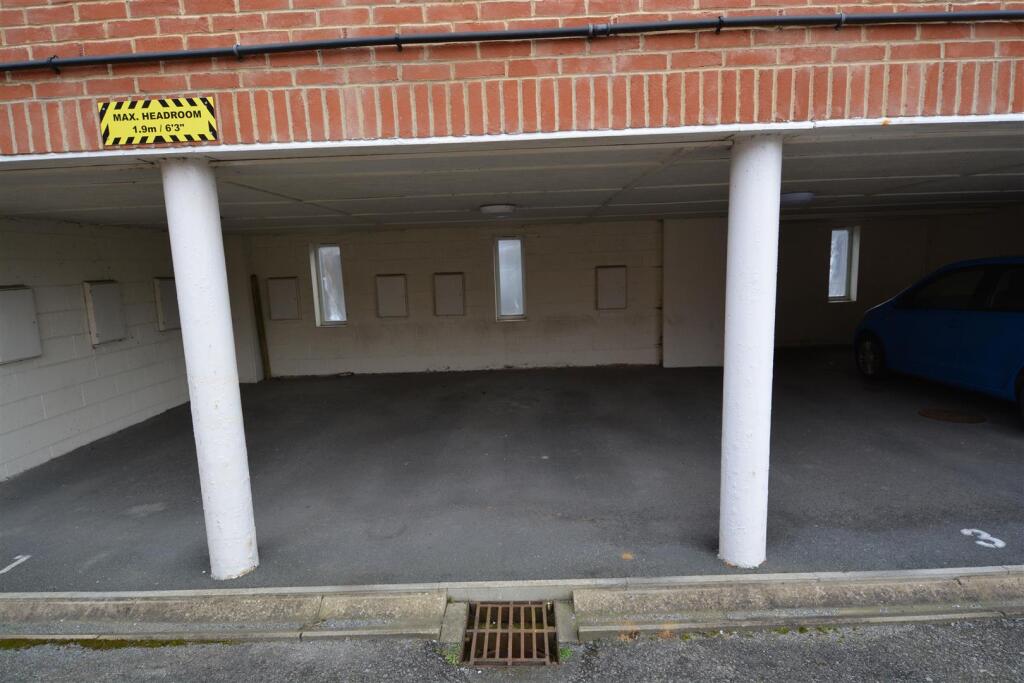
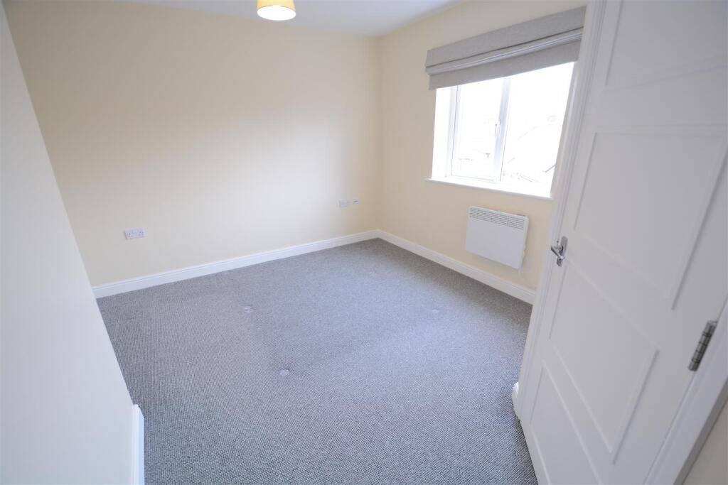
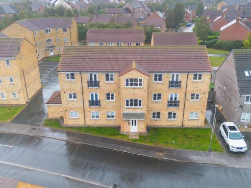
- Top-floor two-bedroom apartment in a modern (c.2014) purpose-built block in the centre of Selby. The property offers two well-proportioned bedrooms (one with en-suite), a main bathroom, and an open-plan kitchen/diner/lounge providing flexible living space suitable for first-time buyers, downsizers or investors. Electric heating is installed and the apartment benefits from undercover car parking. As a top-floor unit there will be good privacy and potentially improved outlooks compared with lower floors; there is no private garden. The location is town-centre convenient with shops, cafés and amenities within easy walking distance. Overall the apartment is of average internal size for a two-bedroom town-centre flat and presents as a low-maintenance, city-edge residential investment or owner-occupied purchase.
Image Descriptions
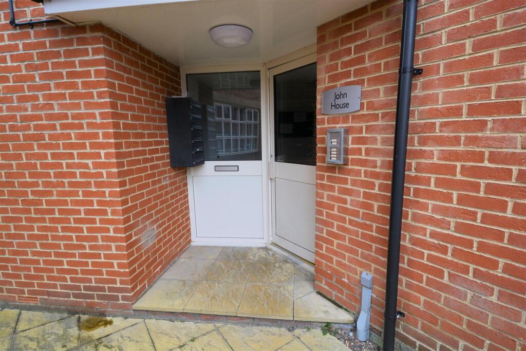
- apartment complex Modern
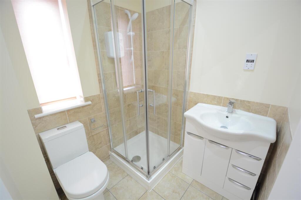
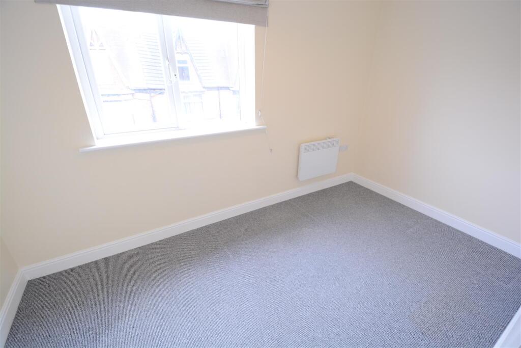
- interior modern
Floorplan Description
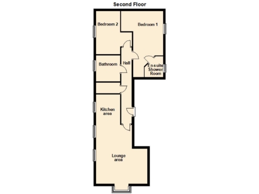
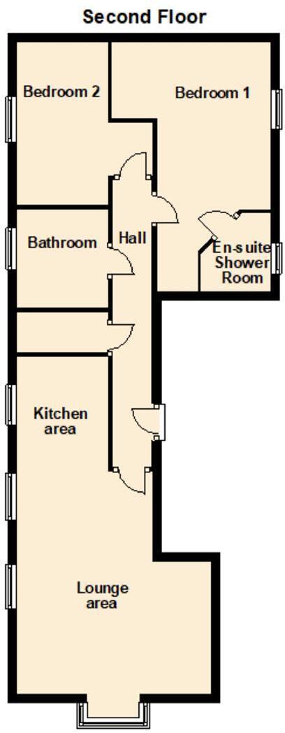
- Second Floor flat plan showing two bedrooms, lounge area, kitchen area, bathroom, en-suite shower room and hall.
Rooms
- Bedroom 2:
- Bedroom 1:
- Bathroom:
- Hall:
- En-suite\nShower Room:
- Kitchen area:
- Lounge area:
Textual Property Features
Detected Visual Features
- modern
- apartment
- red brick
- three-storey
- bay windows
- urban
- contemporary
- low-maintenance
- semi-detached
- neutral decor
- new build
- clean
- tidy
- double glazed
- natural light
- open plan kitchen
- composite front door
EPC Details
- High performance glazing
- Average thermal transmittance 0.18 W/m-¦K
- Boiler and radiators, mains gas
- Low energy lighting in all fixed outlets
- Average thermal transmittance 0.23 W/m-¦K
Nearby Schools
- Read School
- Hemingbrough Community Primary School
- Carlton Primary School
- Holy Family Catholic High School, A Voluntary Academy
- Camblesforth Community Primary Academy
- Staynor Hall Primary Academy
- St Mary's Catholic Primary School, a Voluntary Academy
- Selby Community Primary School
- Barlby Community Primary School
- Brayton Church of England Primary School
- Selby, Longman's Hill Community Primary School
- Barwic Parade Community Primary School, Selby
- Selby High School Specialist School for the Arts and Science
- Barlby High School
- Wistow Parochial Church of England Voluntary Controlled Primary School
- Cawood Church of England Voluntary Aided Primary School
- Kellington Primary School
- Selby Abbey Church of England Voluntary Controlled Primary School
- Barlby Bridge Community Primary School
- Riccall Community Primary School
- Hambleton Church of England Voluntary Controlled Primary School
- Thorpe Willoughby Community Primary School
- Brayton Academy
Nearest General Shops
- Id: 569314817
- Tags:
- Addr:
- City: Selby
- Housenumber: 49
- Postcode: YO8 4HE
- Street: Gowthorpe
- Name: Selby Cycle Centre
- Shop: bicycle
- TagsNormalized:
- Lat: 53.7835188
- Lon: -1.0722364
- FullGeoHash: gcx1zwgpxndd
- PartitionGeoHash: gcx1
- Images:
- FoodStandards: null
- Distance: 136.1
,- Id: 6854411617
- Tags:
- Name: Sun Days
- Shop: tanning
- TagsNormalized:
- Lat: 53.7822086
- Lon: -1.0730204
- FullGeoHash: gcx1zwf8hf3f
- PartitionGeoHash: gcx1
- Images:
- FoodStandards: null
- Distance: 102.4
,- Id: 756684038
- Tags:
- Name: Wilco Motosave
- Service: parts;tyres;repair
- Shop: car
- TagsNormalized:
- Lat: 53.7834832
- Lon: -1.0735522
- FullGeoHash: gcx1zwfr2rvq
- PartitionGeoHash: gcx1
- Images:
- FoodStandards: null
- Distance: 71.2
}
Nearest Grocery shops
- Id: 660522717
- Tags:
- Name: Flaxley Road Newsagent and Convenience Store
- Shop: convenience
- TagsNormalized:
- Lat: 53.7859326
- Lon: -1.076788
- FullGeoHash: gcx1zrrvv089
- PartitionGeoHash: gcx1
- Images:
- FoodStandards: null
- Distance: 381.8
,- Id: 300442558
- Tags:
- Addr:
- City: Selby
- Street: Market Cross Shopping Centre
- Brand: Holland & Barrett
- Brand:wikidata: Q5880870
- Brand:wikipedia: en:Holland & Barrett
- Building: retail
- Name: Holland & Barrett
- Shop: health_food
- TagsNormalized:
- holland & barrett
- retail
- health
- health food
- food
- shop
- Lat: 53.7833621
- Lon: -1.0695771
- FullGeoHash: gcx1zwvnv13e
- PartitionGeoHash: gcx1
- Images:
- FoodStandards: null
- Distance: 297
,- Id: 300442564
- Tags:
- Addr:
- City: Selby
- Street: Market Cross Shopping Centre
- Building: yes
- Shop: greengrocer
- TagsNormalized:
- Lat: 53.7832652
- Lon: -1.069955
- FullGeoHash: gcx1zwuyhpr9
- PartitionGeoHash: gcx1
- Images:
- FoodStandards: null
- Distance: 270.8
}
Nearest Supermarkets
- Id: 229833554
- Tags:
- Addr:
- City: Selby
- Postcode: YO8 4QQ
- Street: Portholme Road
- Brand: Tesco
- Brand:wikidata: Q487494
- Brand:wikipedia: en:Tesco
- Building: supermarket
- Contact:
- Website: https://www.tesco.com/store-locator/selby/portholme-rd
- Name: Tesco
- Operator: Tesco
- Shop: supermarket
- TagsNormalized:
- Lat: 53.7799284
- Lon: -1.0712306
- FullGeoHash: gcx1zw7fy928
- PartitionGeoHash: gcx1
- Images:
- FoodStandards: null
- Distance: 379.1
,- Id: 46511754
- Tags:
- Addr:
- City: Selby
- Postcode: YO8 4JS
- Street: Market Cross Shopping Centre
- Brand: Morrisons
- Brand:wikidata: Q922344
- Brand:wikipedia: en:Morrisons
- Building: supermarket
- Contact:
- Website: https://my.morrisons.com/storefinder/228
- Fhrs:
- Name: Morrisons
- Operator: Morrisons
- Shop: supermarket
- Source:
- TagsNormalized:
- Lat: 53.7824684
- Lon: -1.0684095
- FullGeoHash: gcx1zwy186b0
- PartitionGeoHash: gcx1
- Images:
- FoodStandards:
- Id: 430328
- FHRSID: 430328
- LocalAuthorityBusinessID: PI/000003501
- BusinessName: Wm Morrison Supermarkets Limited
- BusinessType: Retailers - supermarkets/hypermarkets
- BusinessTypeID: 7840
- AddressLine1: Supermarket
- AddressLine2: Market Cross
- AddressLine3: Selby
- AddressLine4: North Yorkshire
- PostCode: YO8 4JS
- RatingValue: 4
- RatingKey: fhrs_4_en-GB
- RatingDate: 2022-02-14
- LocalAuthorityCode: 256
- LocalAuthorityName: Selby
- LocalAuthorityWebSite: http://www.selby.gov.uk
- LocalAuthorityEmailAddress: info@selby.gov.uk
- Scores:
- Hygiene: 10
- Structural: 5
- ConfidenceInManagement: 5
- NewRatingPending: false
- Geocode:
- Longitude: null
- Latitude: null
- Distance: 372.7
,- Id: 47467011
- Tags:
- Addr:
- City: Selby
- Housenumber: 18
- Postcode: YO8 4DZ
- Street: Abbey Walk
- Brand: Sainsbury's
- Brand:wikidata: Q152096
- Brand:wikipedia: en:Sainsbury's
- Building: supermarket
- Name: Sainsbury's
- Operator: Sainsbury's
- Shop: supermarket
- TagsNormalized:
- sainsburys
- supermarket
- shop
- Lat: 53.7848681
- Lon: -1.0711789
- FullGeoHash: gcx1zx5zxdp5
- PartitionGeoHash: gcx1
- Images:
- FoodStandards: null
- Distance: 287.4
}
Nearest Religious buildings
- Id: 594910538
- Tags:
- Amenity: place_of_worship
- Denomination: evangelical
- Name: King's Church
- Religion: christian
- TagsNormalized:
- place of worship
- evangelical
- church
- christian
- Lat: 53.7830929
- Lon: -1.0704506
- FullGeoHash: gcx1zwut0xnj
- PartitionGeoHash: gcx1
- Images:
- FoodStandards: null
- Distance: 236.2
,- Id: 613969083
- Tags:
- Amenity: place_of_worship
- Denomination: roman_catholic
- Name: St Mary's
- Religion: christian
- Wikidata: Q26425488
- TagsNormalized:
- place of worship
- catholic
- roman catholic
- christian
- church
- Lat: 53.7822053
- Lon: -1.0773525
- FullGeoHash: gcx1zqz2pcez
- PartitionGeoHash: gcx1
- Images:
- FoodStandards: null
- Distance: 231.7
,- Id: 396993744
- Tags:
- Amenity: place_of_worship
- Building: church
- Denomination: anglican
- Name: St James
- Religion: christian
- Wikidata: Q26461069
- TagsNormalized:
- place of worship
- church
- anglican
- christian
- Lat: 53.7824952
- Lon: -1.0712907
- FullGeoHash: gcx1zwgctpgb
- PartitionGeoHash: gcx1
- Images:
- FoodStandards: null
- Distance: 185.9
}
Nearest Medical buildings
- Id: 7476031849
- Tags:
- Addr:
- City: Selby
- Housenumber: 28
- Postcode: YO8 4QB
- Street: New Lane
- Amenity: dentist
- Healthcare: dentist
- Name: Selby Dental Care
- Phone: +44 1757 703128
- TagsNormalized:
- dentist
- health
- healthcare
- dental
- Lat: 53.7832164
- Lon: -1.0703485
- FullGeoHash: gcx1zwutgn4q
- PartitionGeoHash: gcx1
- Images:
- FoodStandards: null
- Distance: 244.5
,- Id: 799368089
- Tags:
- Addr:
- City: Selby
- Postcode: YO8 4QB
- Street: New Lane
- Amenity: dentist
- Building: yes
- Healthcare: dentist
- Healthcare:speciality: orthodontics
- Name: Trinity House Orthodontics
- TagsNormalized:
- dentist
- health
- healthcare
- orthodontics
- Lat: 53.7820783
- Lon: -1.0707715
- FullGeoHash: gcx1zwsr34nc
- PartitionGeoHash: gcx1
- Images:
- FoodStandards: null
- Distance: 233.3
,- Id: 6228581714
- Tags:
- Addr:
- City: Selby
- Housenumber: 23a
- Postcode: YO8 4HE
- Street: Gowthorpe
- Amenity: pharmacy
- Brand: Day Lewis Pharmacy
- Brand:wikidata: Q62563772
- Healthcare: pharmacy
- Name: Day Lewis Pharmacy
- TagsNormalized:
- pharmacy
- day lewis pharmacy
- health
- healthcare
- Lat: 53.7837234
- Lon: -1.0712266
- FullGeoHash: gcx1zx5bysex
- PartitionGeoHash: gcx1
- Images:
- FoodStandards: null
- Distance: 205.4
,- Id: 493481923
- Tags:
- Addr:
- City: Selby
- Housenumber: 51
- Postcode: YO8 4HE
- Street: Gowthorpe
- Amenity: dentist
- Healthcare: dentist
- Name: Abbey Dental Practice
- TagsNormalized:
- dentist
- health
- healthcare
- dental
- Lat: 53.7834806
- Lon: -1.0724078
- FullGeoHash: gcx1zwgp7p6y
- PartitionGeoHash: gcx1
- Images:
- FoodStandards: null
- Distance: 124.3
}
Nearest Airports
- Id: 100889514
- Tags:
- Addr:
- Aerodrome: international
- Aerodrome:type: public
- Area: yes
- Cities_served: Doncaster, Sheffield
- Closest_town: Doncaster
- Disused:
- Ele: 17
- Iata: DSA
- Icao: EGCN
- Ifr: yes
- Is_in: Finningley
- Name: Doncaster Sheffield Airport
- Old_iata: FNY
- Old_icao: EGXI
- Old_name: RAF Finningley
- Old_operator: Royal Air Force
- Old_type: military
- Operator: Doncaster Sheffield Airport Limited/Peel Airports
- Source: wikipedia
- Tower_frequency: 128.775
- Vfr: yes
- Website: https://www.robinhoodairport.com/
- Wikidata: Q8996
- Wikipedia: en:Robin Hood Airport Doncaster Sheffield
- TagsNormalized:
- airport
- international airport
- Lat: 53.4761577
- Lon: -1.0054086
- FullGeoHash: gcx21p5chq34
- PartitionGeoHash: gcx2
- Images:
- FoodStandards: null
- Distance: 34408
,- Id: 11519546
- Tags:
- Addr:
- City: Leeds
- Postcode: LS19 7TU
- Aerodrome: international
- Aerodrome:type: public
- Aeroway: aerodrome
- Iata: LBA
- Icao: EGNM
- Name: Leeds Bradford Airport
- Operator: Leeds Bradford Airport Limited
- Operator:type: private
- Ref: LBA
- Type: multipolygon
- Website: https://www.leedsbradfordairport.co.uk/
- Wikidata: Q8699
- Wikipedia: en:Leeds Bradford Airport
- TagsNormalized:
- airport
- international airport
- Lat: 53.8667047
- Lon: -1.660138
- FullGeoHash: gcwf6nph7cx3
- PartitionGeoHash: gcwf
- Images:
- Q8699-1
- Q8699-2
- Q8699-3
- Q8699-4
- FoodStandards: null
- Distance: 39580.4
}
Nearest Leisure Facilities
- Id: 9842697653
- Tags:
- TagsNormalized:
- picnic
- picnic table
- leisure
- Lat: 53.784872
- Lon: -1.073173
- FullGeoHash: gcx1zx4x96b4
- PartitionGeoHash: gcx1
- Images:
- FoodStandards: null
- Distance: 225.5
,- Id: 667784813
- Tags:
- Addr:
- City: Selby
- Postcode: YO8 4BL
- Street: Scott Road
- Building: public
- Leisure: sports_centre
- Name: Summit Indoor Adventure
- TagsNormalized:
- sports
- sports centre
- leisure
- Lat: 53.7846109
- Lon: -1.0755816
- FullGeoHash: gcx1zx0y14hj
- PartitionGeoHash: gcx1
- Images:
- FoodStandards: null
- Distance: 214.9
,- Id: 154860670
- Tags:
- Leisure: pitch
- Source: Bing
- TagsNormalized:
- Lat: 53.7838847
- Lon: -1.0767269
- FullGeoHash: gcx1zrpcy6y1
- PartitionGeoHash: gcx1
- Images:
- FoodStandards: null
- Distance: 207.6
,- Id: 154860665
- Tags:
- Leisure: pitch
- Source: Bing
- Sport: skateboard
- TagsNormalized:
- pitch
- leisure
- skateboard
- sports
- Lat: 53.7834472
- Lon: -1.076616
- FullGeoHash: gcx1zwbp310z
- PartitionGeoHash: gcx1
- Images:
- FoodStandards: null
- Distance: 179.9
,- Id: 667784815
- Tags:
- Addr:
- City: Selby
- Postcode: YO8 4BL
- Street: Scott Road
- Building: public
- Leisure: sports_centre
- Name: Selby Leisure Centre
- TagsNormalized:
- sports
- sports centre
- leisure
- Lat: 53.7841259
- Lon: -1.0755013
- FullGeoHash: gcx1zx0g5pb0
- PartitionGeoHash: gcx1
- Images:
- FoodStandards: null
- Distance: 166.2
}
Nearest Tourist attractions
- Id: 1606796779
- Tags:
- Addr:
- City: Selby
- Postcode: YO8 3RE
- Name: Moss Hagg Farm Campsite
- Tourism: camp_site
- TagsNormalized:
- Lat: 53.7949122
- Lon: -1.1260684
- FullGeoHash: gcx4n3h40dqw
- PartitionGeoHash: gcx4
- Images:
- FoodStandards: null
- Distance: 3669.5
,- Id: 812958806
- Tags:
- Addr:
- City: Selby
- Postcode: YO8 3RJ
- Street: Flaxley Road
- Name: Greenacres Mobile Home Park
- Tourism: caravan_site
- TagsNormalized:
- Lat: 53.7903466
- Lon: -1.0979383
- FullGeoHash: gcx4p00x2pmg
- PartitionGeoHash: gcx4
- Images:
- FoodStandards: null
- Distance: 1774.9
,- Id: 1091297071
- Tags:
- Addr:
- City: Selby
- Housenumber: 10
- Postcode: YO8 4HX
- Street: Leeds Road
- Building: yes
- Name: Sallow Tree House
- Tourism: guest_house
- TagsNormalized:
- Lat: 53.7818974
- Lon: -1.0792832
- FullGeoHash: gcx1zqwn6bk4
- PartitionGeoHash: gcx1
- Images:
- FoodStandards: null
- Distance: 362.8
}
Nearest Bus stations and stops
- Id: 659622271
- Tags:
- Bus: yes
- Highway: bus_stop
- Public_transport: platform
- Route: 42;402;403;406
- Shelter: yes
- TagsNormalized:
- Lat: 53.7838101
- Lon: -1.0710754
- FullGeoHash: gcx1zxh16huk
- PartitionGeoHash: gcx1
- Images:
- FoodStandards: null
- Distance: 218.6
,- Id: 603340204
- Tags:
- Bus: yes
- Highway: bus_stop
- Public_transport: platform
- TagsNormalized:
- Lat: 53.7844937
- Lon: -1.0744508
- FullGeoHash: gcx1zx1t7kr6
- PartitionGeoHash: gcx1
- Images:
- FoodStandards: null
- Distance: 178.3
,- Id: 659622272
- Tags:
- Bus: yes
- Highway: bus_stop
- Public_transport: platform
- Route: 150;405
- Shelter: no
- TagsNormalized:
- Lat: 53.7824899
- Lon: -1.0741414
- FullGeoHash: gcx1zwccdwy0
- PartitionGeoHash: gcx1
- Images:
- FoodStandards: null
- Distance: 47.1
,- Id: 2298034785
- Tags:
- Bus: yes
- Highway: bus_stop
- Local_ref: 32000335
- Name: St Mary's School (E-Bound)
- Naptan:
- Public_transport: platform
- TagsNormalized:
- Lat: 53.7830308
- Lon: -1.0745117
- FullGeoHash: gcx1zwcsf5d5
- PartitionGeoHash: gcx1
- Images:
- FoodStandards: null
- Distance: 34.2
,- Id: 2298034784
- Tags:
- Bus: yes
- Highway: bus_stop
- Local_ref: 32000334
- Name: St Mary's School (W-Bound)
- Naptan:
- Public_transport: platform
- TagsNormalized:
- Lat: 53.7829263
- Lon: -1.0744125
- FullGeoHash: gcx1zwcsk25u
- PartitionGeoHash: gcx1
- Images:
- FoodStandards: null
- Distance: 25
}
Nearest Hotels
- Id: 644198893
- Tags:
- Addr:
- City: Selby
- Housenumber: 36
- Postcode: YO8 4NH
- Street: Ousegate
- Name: Waterfront Hotel
- Tourism: hotel
- TagsNormalized:
- Lat: 53.7848696
- Lon: -1.0656957
- FullGeoHash: gcx1zxpzx6rs
- PartitionGeoHash: gcx1
- Images:
- FoodStandards: null
- Distance: 589.5
,- Id: 300354777
- Tags:
- Addr:
- City: Selby
- Postcode: YO8 4EQ
- Street: Micklegate
- Amenity: pub
- Building: yes
- Name: Griffin Hotel
- Smoking: outside
- TagsNormalized:
- Lat: 53.7847779
- Lon: -1.06812
- FullGeoHash: gcx1zxnpp121
- PartitionGeoHash: gcx1
- Images:
- FoodStandards: null
- Distance: 440.6
,- Id: 300352518
- Tags:
- Addr:
- City: Selby
- Housename: The Londesborough Arms
- Postcode: YO8 4NS
- Street: Market Place
- Building: yes
- Name: The George Inn
- Operator: Stonegate Pub Co
- Phone: +44 1757 707355
- Smoking: outside
- Tourism: hotel
- Wikidata: Q26425489
- TagsNormalized:
- Lat: 53.784299
- Lon: -1.0685245
- FullGeoHash: gcx1zxjum842
- PartitionGeoHash: gcx1
- Images:
- FoodStandards: null
- Distance: 393.5
}
Tags
- modern
- apartment
- red brick
- three-storey
- bay windows
- urban
- contemporary
- low-maintenance
- modern
- semi-detached
- neutral decor
- new build
- clean
- tidy
- double glazed
- natural light
- open plan kitchen
- composite front door
Local Market Stats
- Average Price/sqft: £229
- Avg Income: £44000
- Rental Yield: 3.7%
- Social Housing: 4%
- Planning Success Rate: 88%
AirBnB Data
- 1km average: £60/night
- Listings in 1km: 1
Similar Properties
 2 bedroom apartment for sale in Rose Court, Selby, North Yorkshire YO8 8FF, YO8 — £130,000 • 2 bed • 1 bath • 560 ft²
 1 bedroom apartment for sale in Portholme Road, Selby, YO8 — £90,000 • 1 bed • 1 bath • 426 ft²
 1 bedroom apartment for sale in Station Houses, Ousegate, Selby, YO8 — £69,000 • 1 bed • 1 bath • 361 ft²
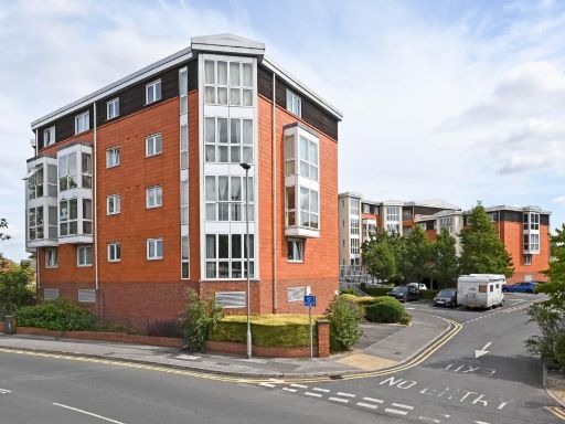 2 bedroom apartment for sale in Nautica, The Waterfront, Selby, YO8 — £125,000 • 2 bed • 1 bath • 789 ft²
 1 bedroom apartment for sale in The Crescent, Selby, North Yorkshire, YO8 — £70,000 • 1 bed • 1 bath • 371 ft²
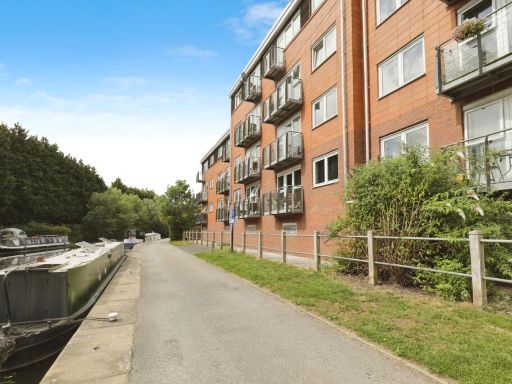 2 bedroom flat for sale in The Waterfront, Selby, North Yorkshire, YO8 — £123,000 • 2 bed • 1 bath • 633 ft²
Meta
- {
"@context": "https://schema.org",
"@type": "Residence",
"name": "2 bedroom apartment for sale in Chapel House Court, Selby,…",
"description": "",
"url": "https://propertypiper.co.uk/property/7cc4ede3-6adb-4ccd-b6a1-00a0ec9b3a6f",
"image": "https://image-a.propertypiper.co.uk/efe087d6-9b1d-4281-ba97-88beefe98509-1024.jpeg",
"address": {
"@type": "PostalAddress",
"streetAddress": "7 JOHN HOUSE, CHAPEL HOUSE COURT, SELBY",
"postalCode": "YO8 4HN",
"addressLocality": "Selby",
"addressRegion": "Selby and Ainsty",
"addressCountry": "England"
},
"geo": {
"@type": "GeoCoordinates",
"latitude": 53.782909,
"longitude": -1.0740329
},
"numberOfRooms": 2,
"numberOfBathroomsTotal": 2,
"floorSize": {
"@type": "QuantitativeValue",
"value": 1497,
"unitCode": "FTK"
},
"offers": {
"@type": "Offer",
"price": 119000,
"priceCurrency": "GBP",
"availability": "https://schema.org/InStock"
},
"additionalProperty": [
{
"@type": "PropertyValue",
"name": "Feature",
"value": "modern"
},
{
"@type": "PropertyValue",
"name": "Feature",
"value": "apartment"
},
{
"@type": "PropertyValue",
"name": "Feature",
"value": "red brick"
},
{
"@type": "PropertyValue",
"name": "Feature",
"value": "three-storey"
},
{
"@type": "PropertyValue",
"name": "Feature",
"value": "bay windows"
},
{
"@type": "PropertyValue",
"name": "Feature",
"value": "urban"
},
{
"@type": "PropertyValue",
"name": "Feature",
"value": "contemporary"
},
{
"@type": "PropertyValue",
"name": "Feature",
"value": "low-maintenance"
},
{
"@type": "PropertyValue",
"name": "Feature",
"value": "modern"
},
{
"@type": "PropertyValue",
"name": "Feature",
"value": "semi-detached"
},
{
"@type": "PropertyValue",
"name": "Feature",
"value": "neutral decor"
},
{
"@type": "PropertyValue",
"name": "Feature",
"value": "new build"
},
{
"@type": "PropertyValue",
"name": "Feature",
"value": "clean"
},
{
"@type": "PropertyValue",
"name": "Feature",
"value": "tidy"
},
{
"@type": "PropertyValue",
"name": "Feature",
"value": "double glazed"
},
{
"@type": "PropertyValue",
"name": "Feature",
"value": "natural light"
},
{
"@type": "PropertyValue",
"name": "Feature",
"value": "open plan kitchen"
},
{
"@type": "PropertyValue",
"name": "Feature",
"value": "composite front door"
}
]
}
High Res Floorplan Images
Compatible Floorplan Images
FloorplanImages Thumbnail