TN9 2SL - 2 bedroom ground floor flat for sale in Waterloo Road, Tonb…
View on Property Piper
2 bedroom ground floor flat for sale in Waterloo Road, Tonbridge, Kent, TN9
Property Details
- Price: £140500
- Bedrooms: 2
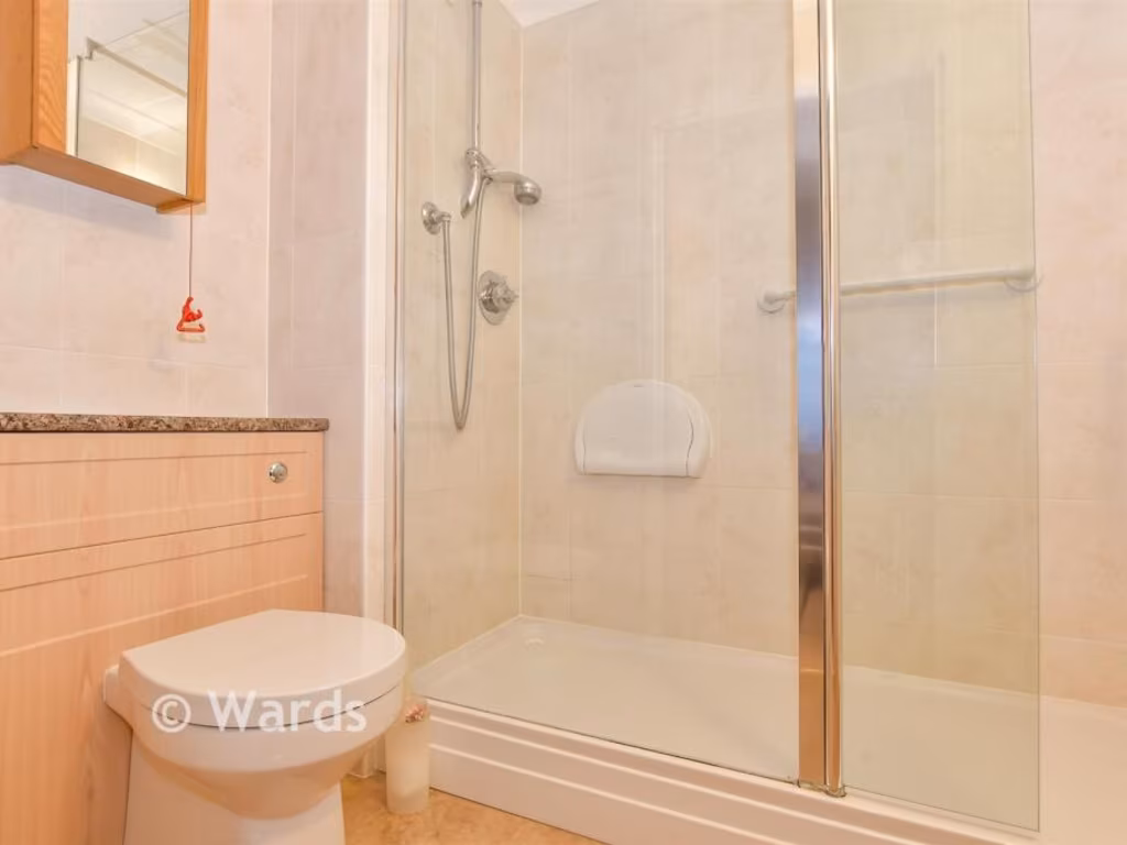
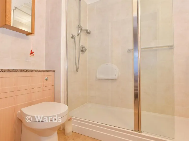
- Bathrooms: 1
- Property Type: undefined
- Property SubType: undefined
Image Descriptions
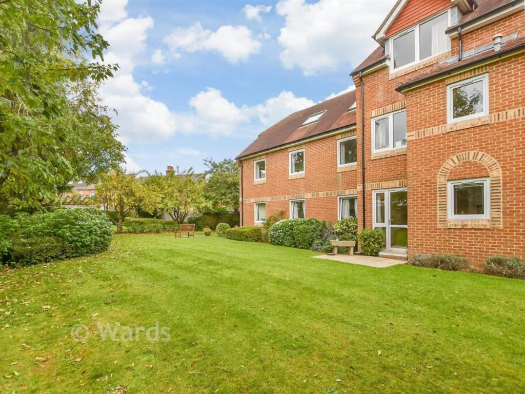
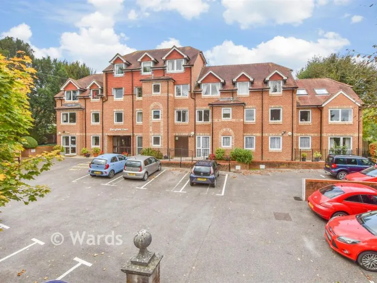
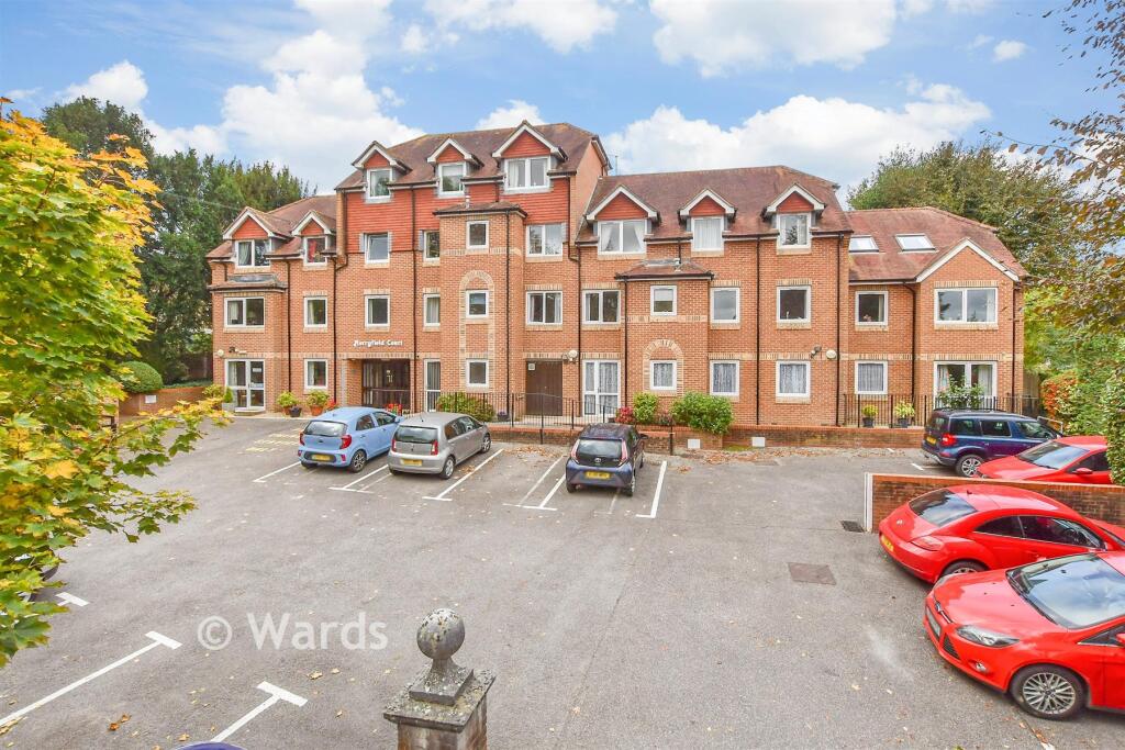
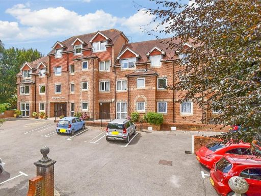
- apartment building Modern
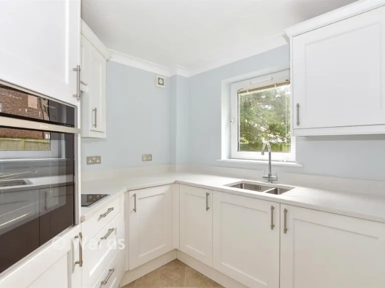
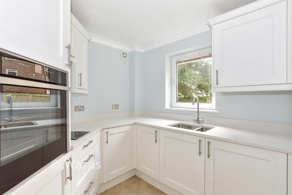
- kitchen modern
Floorplan Description
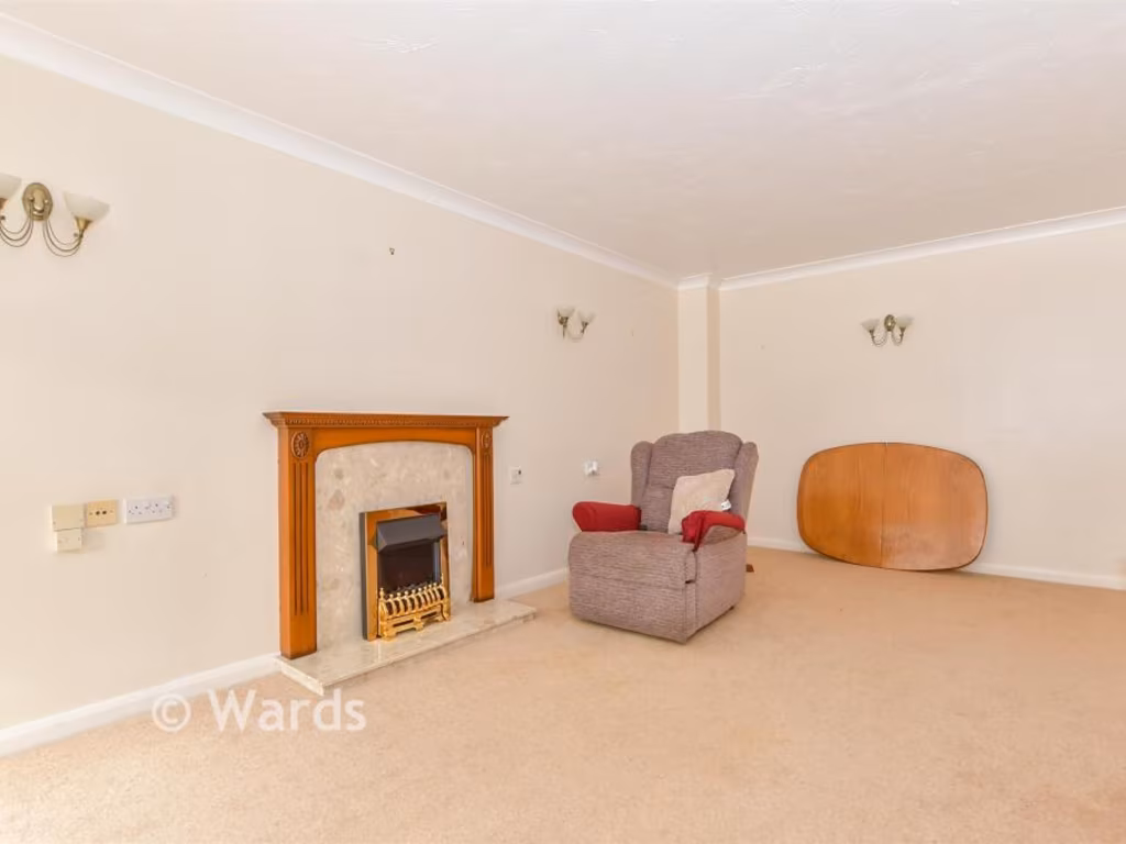
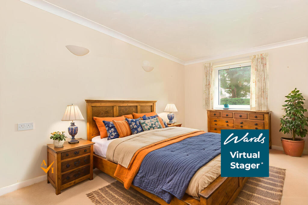
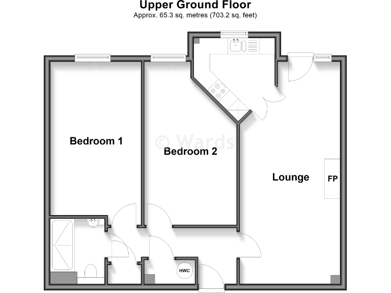
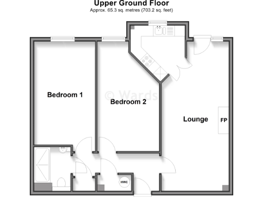
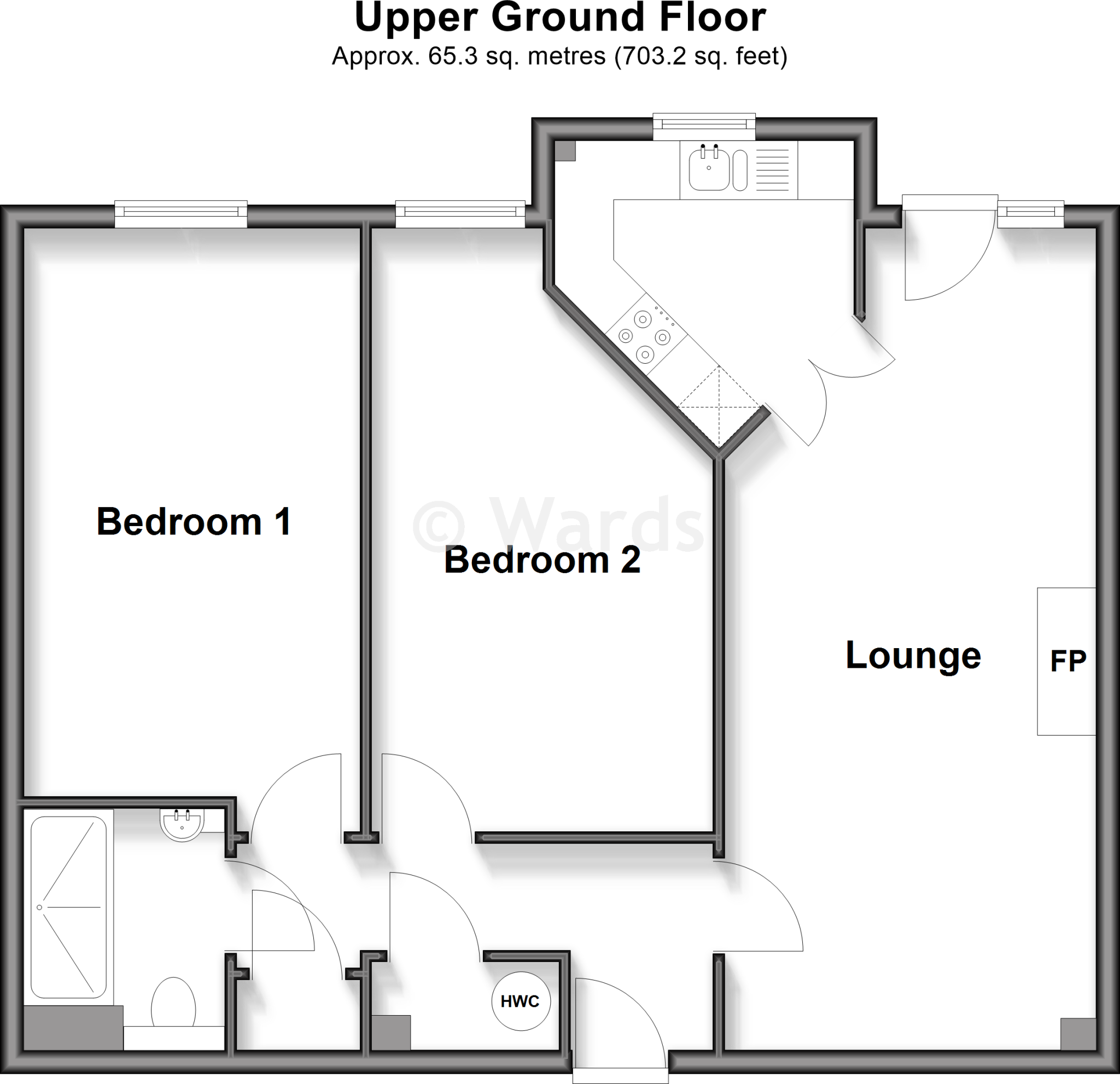
- Ground floor plan showing Lounge, Bedroom 1, Bedroom 2 and HWC.
Rooms
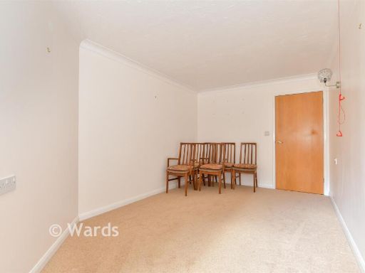
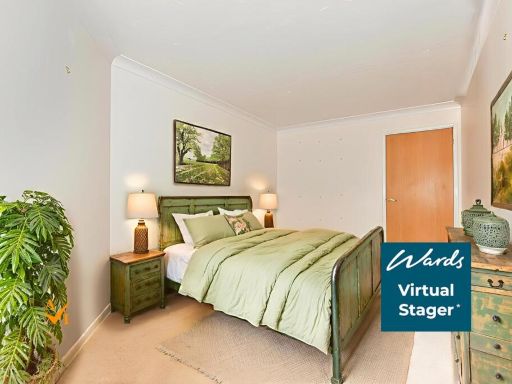
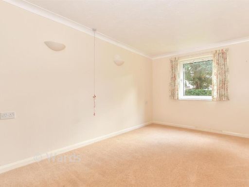
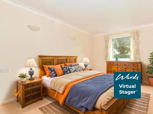
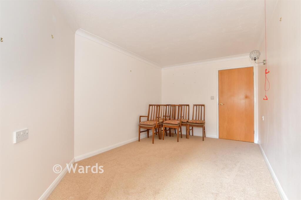
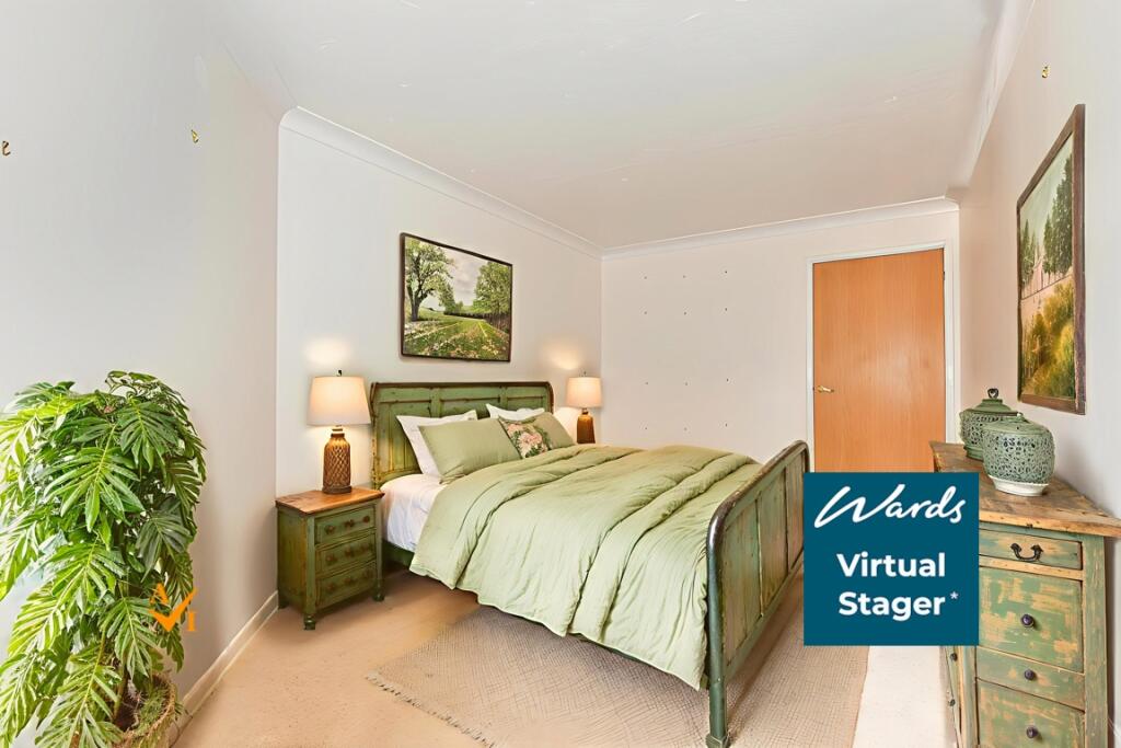
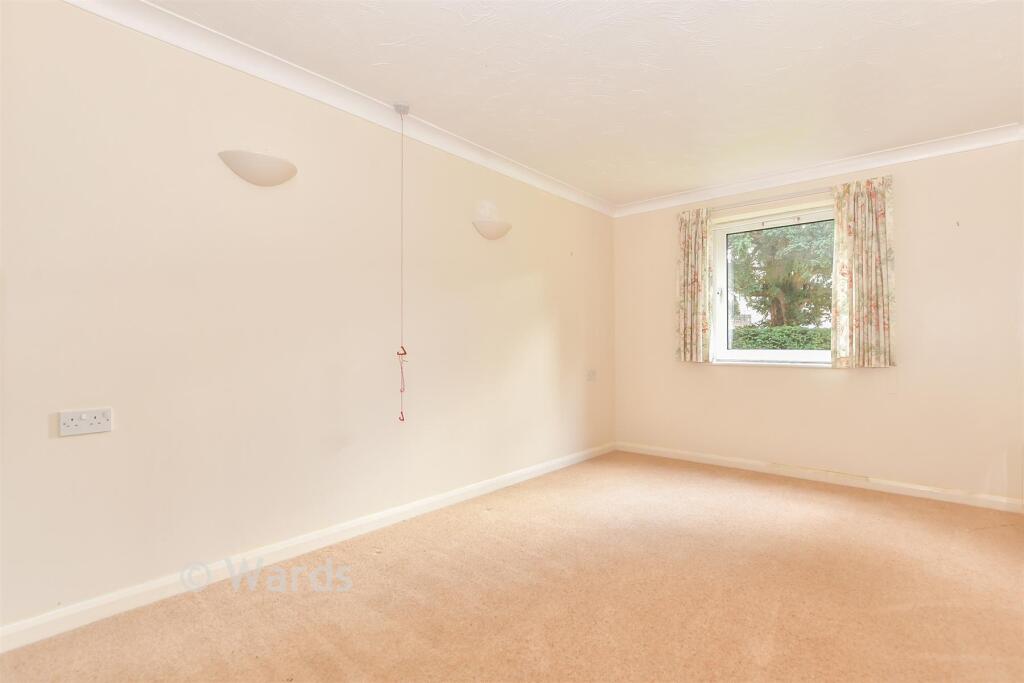
- Bedroom 1:
- Bedroom 2:
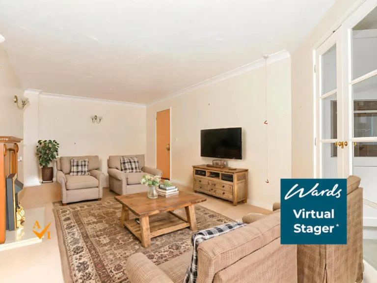
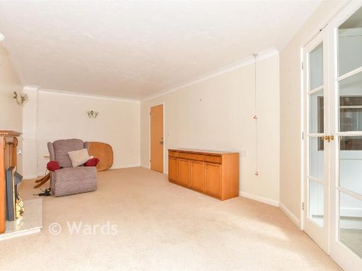
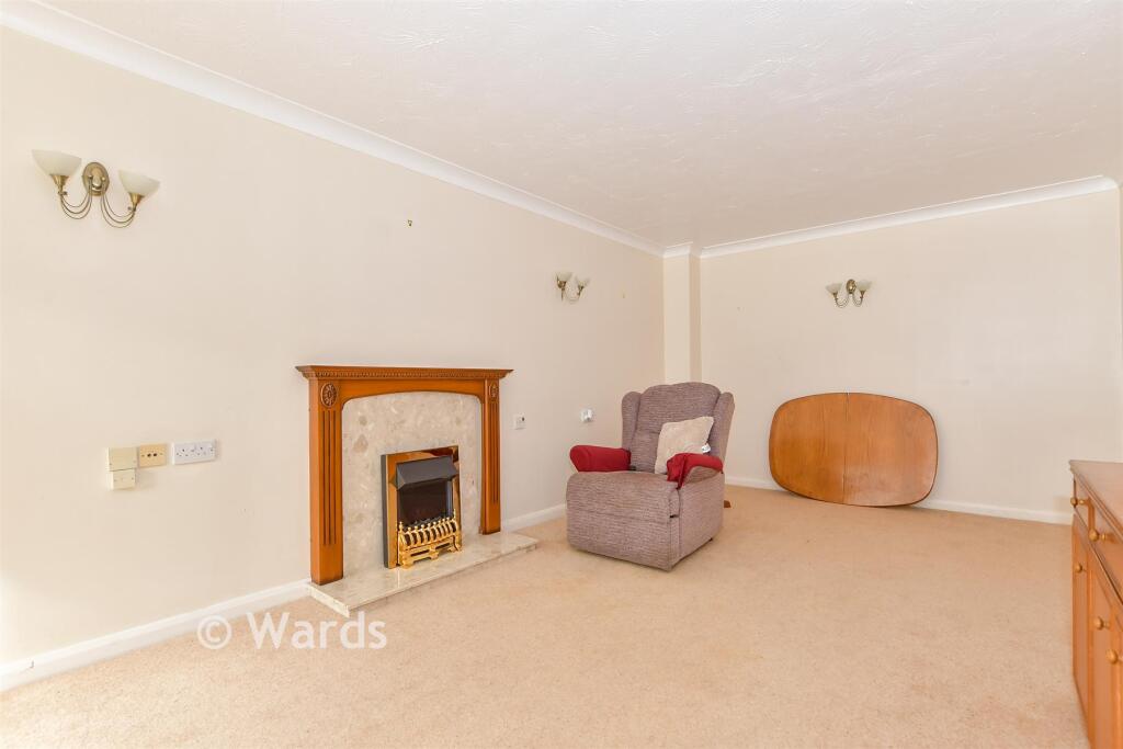
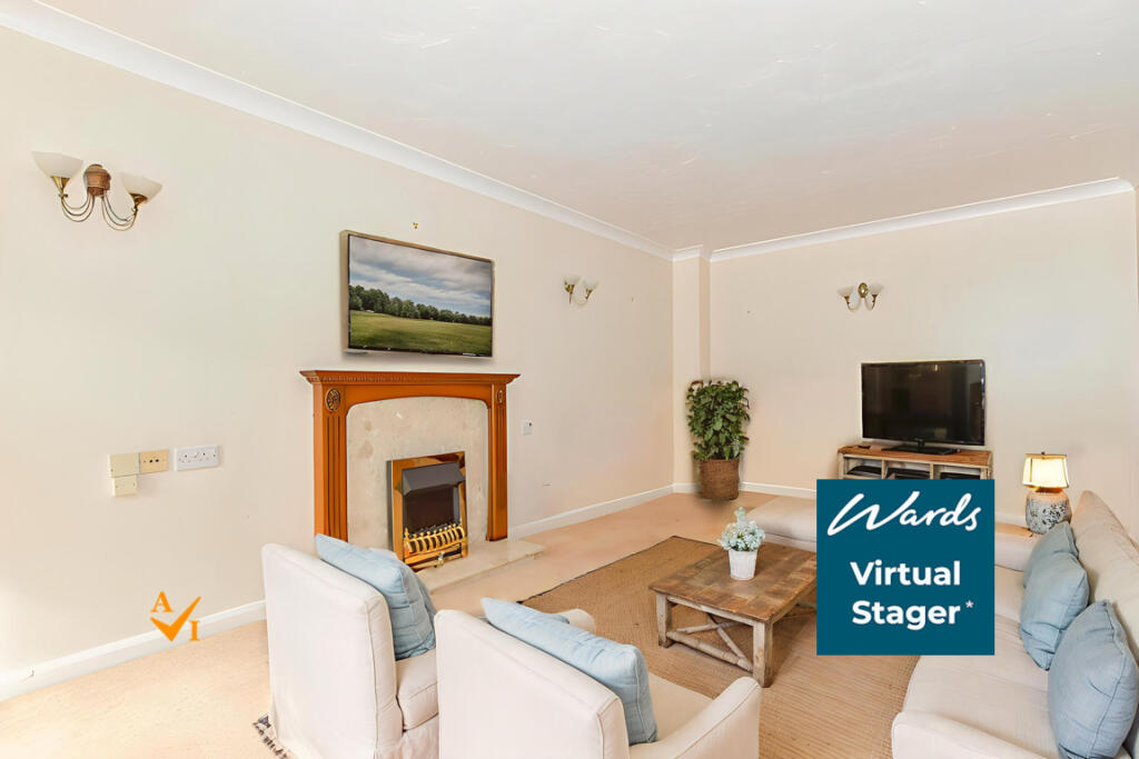
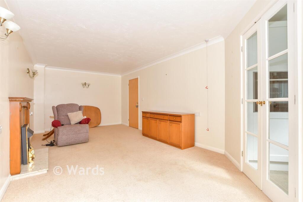
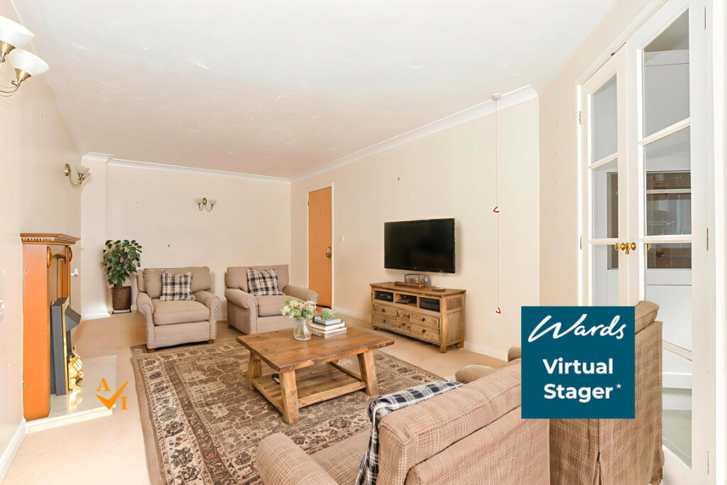
- Lounge:
- HWC:
Textual Property Features
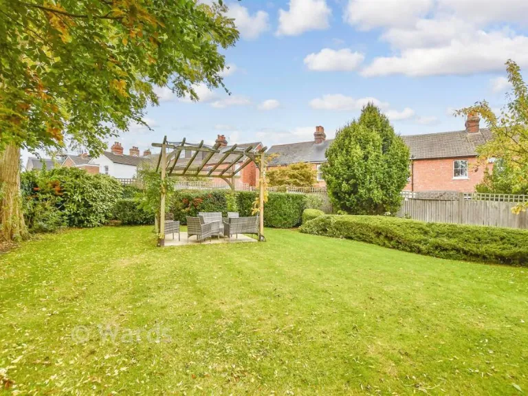
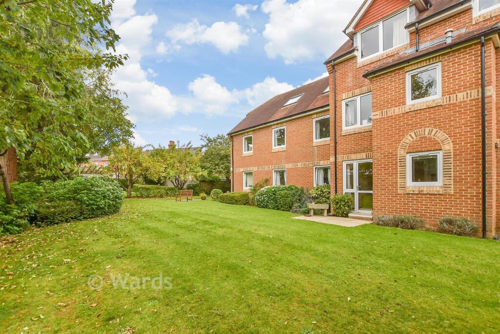
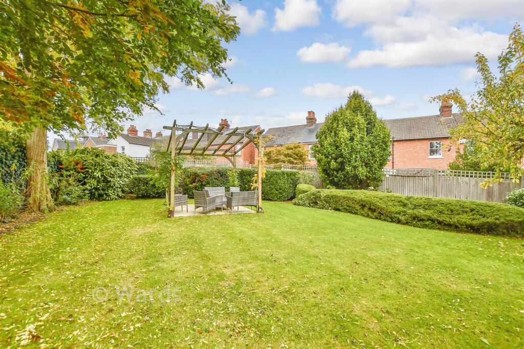
- Has Garden
- Chain Free
- Is Retirement
- Success
Detected Visual Features
- apartment building
- modern construction
- red brick façade
- pitched roof
- windows
- small parking area
- communal
- residential
- multi-story
- kitchen
- modern
- white cabinets
- laminate countertops
- single sink
- built-in oven
- electric stove
- tile floor
- bright
- corner layout
EPC Details
- Fully double glazed
- Cavity wall, as built, insulated (assumed)
- Electric storage heaters
- Low energy lighting in 77% of fixed outlets
- Suspended, no insulation (assumed)
Nearby Schools
- St Gregory's Catholic School
- Southborough CofE Primary School
- Weald of Kent Grammar School
- Somerhill
- Bishop Chavasse Primary School
- Sussex Road Community Primary School
- Woodlands Primary School
- Sackville School
- St Matthew's High Brooms Church of England Voluntary Controlled Primary School
- Bidborough Church of England Voluntary Controlled Primary School
- Hilden Oaks Preparatory School and Nursery
- St Margaret Clitherow Catholic Primary School
- Hillview School for Girls
- Royal Rise Primary School
- Hilden Grange School
- Long Mead Community Primary School
- Cage Green Primary School
- Hildenborough Church of England Primary School
- Tunbridge Wells Grammar School for Boys
- Tonbridge Grammar School
- The Judd School
- Leigh Academy Tonbridge
- Slade Primary School and Attached Unit for Children with Hearing Impairment
- Tonbridge School
- Stocks Green Primary School
Nearest Bars And Restaurants
- Id: 4707238288
- Tags:
- Addr:
- City: Tonbridge
- Housename: Platforms 1&2 Tonbridge Station
- Postcode: TN9 1TT
- Street: Barden Road
- Amenity: cafe
- Name: Pumpkin
- Operator: Select Service Partner (SSP) UK
- Outdoor_seating: no
- Smoking: no
- TagsNormalized:
- Lat: 51.1914487
- Lon: 0.2695717
- FullGeoHash: u105nph7c3xn
- PartitionGeoHash: u105
- Images:
- FoodStandards: null
- Distance: 231
,- Id: 6790319691
- Tags:
- Amenity: fast_food
- Cuisine: fish_and_chips
- Name: The Quarry
- TagsNormalized:
- Lat: 51.1903121
- Lon: 0.2702031
- FullGeoHash: u105nnuv0jy4
- PartitionGeoHash: u105
- Images:
- FoodStandards: null
- Distance: 181.9
,- Id: 6790319685
- Tags:
- Addr:
- Housenumber: 51-52
- Street: Quarry Hill Road
- Amenity: pub
- Contact:
- Website: https://www.forestersarmstonbridge.co.uk/
- Name: Foresters Arms
- TagsNormalized:
- Lat: 51.1882327
- Lon: 0.268233
- FullGeoHash: u105nne3461j
- PartitionGeoHash: u105
- Images:
- FoodStandards: null
- Distance: 166.1
,- Id: 6790319692
- Tags:
- Amenity: fast_food
- Cuisine: kebab
- Name: Kebab Express
- TagsNormalized:
- Lat: 51.1901533
- Lon: 0.2700488
- FullGeoHash: u105nnusk84y
- PartitionGeoHash: u105
- Images:
- FoodStandards: null
- Distance: 165.7
,- Id: 6790281184
- Tags:
- Addr:
- Housenumber: 44
- Street: Quarry Hill Road
- Amenity: fast_food
- Cuisine: chinese
- Name: May Mei Garden
- TagsNormalized:
- Lat: 51.188669
- Lon: 0.2685401
- FullGeoHash: u105nnee97w0
- PartitionGeoHash: u105
- Images:
- FoodStandards: null
- Distance: 126.2
}
Nearest General Shops
- Id: 6813677000
- Tags:
- Addr:
- Housenumber: 47
- Street: Quarry Hill Road
- Name: Carpet Centre
- Shop: carpet
- Website: http://flooringtonbridge.co.uk/
- TagsNormalized:
- Lat: 51.1884387
- Lon: 0.2683885
- FullGeoHash: u105nne6mbsf
- PartitionGeoHash: u105
- Images:
- FoodStandards: null
- Distance: 146.4
,- Id: 6814317731
- Tags:
- Name: Vaporium
- Shop: e-cigarette
- TagsNormalized:
- Lat: 51.1902122
- Lon: 0.2696853
- FullGeoHash: u105nnuks55y
- PartitionGeoHash: u105
- Images:
- FoodStandards: null
- Distance: 144.3
,- Id: 6822004275
- Tags:
- Name: Bespoke Property Improvements
- Shop: glaziery
- Website: http://www.bespokepi.co.uk/
- TagsNormalized:
- Lat: 51.1901609
- Lon: 0.2696224
- FullGeoHash: u105nnuk69th
- PartitionGeoHash: u105
- Images:
- FoodStandards: null
- Distance: 138
}
Nearest Grocery shops
- Id: 3611485372
- Tags:
- Name: Barden Road store
- Shop: convenience
- TagsNormalized:
- Lat: 51.1933961
- Lon: 0.2654176
- FullGeoHash: u105np3r0stw
- PartitionGeoHash: u105
- Images:
- FoodStandards: null
- Distance: 442.9
,- Id: 2445086121
- Tags:
- Name: Railway Groceries
- Opening_hours: Mo-Su 08:00-20:00
- Shop: convenience
- TagsNormalized:
- Lat: 51.191787
- Lon: 0.2712869
- FullGeoHash: u105npjtc2y0
- PartitionGeoHash: u105
- Images:
- FoodStandards: null
- Distance: 336.9
,- Id: 6814317732
- Tags:
- Addr:
- City: Tonbridge
- Country: GB
- Housenumber: 7
- Postcode: TN9 2HR
- Street: Quarry Hill Parade
- Name: Tonbridge International Food Centre ltd
- Phone: +44 1732 364519
- Shop: grocery
- TagsNormalized:
- Lat: 51.1900685
- Lon: 0.2700006
- FullGeoHash: u105nnueg2rh
- PartitionGeoHash: u105
- Images:
- FoodStandards: null
- Distance: 159.9
}
Nearest Supermarkets
- Id: 162073982
- Tags:
- Addr:
- Postcode: TN9 1RG
- Street: Sovereign Way
- Brand: Waitrose & Partners
- Brand:wikidata: Q771734
- Brand:wikipedia: en:Waitrose & Partners
- Building: retail
- Name: Waitrose
- Operator: Waitrose & Partners
- Shop: supermarket
- TagsNormalized:
- waitrose
- retail
- supermarket
- shop
- Lat: 51.194405
- Lon: 0.2756362
- FullGeoHash: u105nr8tnbc1
- PartitionGeoHash: u105
- Images:
- FoodStandards: null
- Distance: 757.1
,- Id: 177478488
- Tags:
- Addr:
- Postcode: TN9 1SF
- Street: Angel Centre
- Brand: Sainsbury's
- Brand:wikidata: Q152096
- Building: retail
- Name: Sainsbury's
- Shop: supermarket
- TagsNormalized:
- sainsburys
- retail
- supermarket
- shop
- Lat: 51.1923211
- Lon: 0.2750457
- FullGeoHash: u105nr22ch2f
- PartitionGeoHash: u105
- Images:
- FoodStandards: null
- Distance: 584
,- Id: 6190258015
- Tags:
- Addr:
- City: Tonbridge
- Country: GB
- Housenumber: 5-8
- Postcode: TN9 2RH
- Street: Quarry Hill Road
- Brand: Lidl
- Brand:wikidata: Q151954
- Brand:wikipedia: en:Lidl
- Fhrs:
- Name: Lidl
- Shop: supermarket
- TagsNormalized:
- Lat: 51.1909132
- Lon: 0.270269
- FullGeoHash: u105nphb9tz5
- PartitionGeoHash: u105
- Images:
- FoodStandards:
- Id: 291189
- FHRSID: 291189
- LocalAuthorityBusinessID: 03041/0006/2/000
- BusinessName: Lidl Foodstores
- BusinessType: Retailers - supermarkets/hypermarkets
- BusinessTypeID: 7840
- AddressLine1: 5-8 Quarry Hill Road
- AddressLine2: Tonbridge
- AddressLine3: Kent
- AddressLine4: null
- PostCode: TN9 2RH
- RatingValue: 5
- RatingKey: fhrs_5_en-GB
- RatingDate: 2022-04-20
- LocalAuthorityCode: 191
- LocalAuthorityName: Tonbridge and Malling
- LocalAuthorityWebSite: http://www.tmbc.gov.uk
- LocalAuthorityEmailAddress: foodandsafety@tmbc.gov.uk
- Scores:
- Hygiene: 0
- Structural: 5
- ConfidenceInManagement: 0
- NewRatingPending: false
- Geocode:
- Longitude: 0.27002900000000
- Latitude: 51.19080000000000
- Distance: 219.6
}
Nearest Religious buildings
- Id: 1110566193
- Tags:
- Amenity: place_of_worship
- Denomination: baptist
- Name: Pembury Road Baptist Chapel
- Religion: christian
- Source: OS OpenData StreetView
- Website: http://www.pemburyroadbaptist.org.uk/
- TagsNormalized:
- place of worship
- baptist
- chapel
- christian
- church
- Lat: 51.1879777
- Lon: 0.2721392
- FullGeoHash: u105nnqpt69s
- PartitionGeoHash: u105
- Images:
- FoodStandards: null
- Distance: 358.9
,- Id: 822873769
- Tags:
- Amenity: place_of_worship
- Building: yes
- Name: Evangelical Free Church
- Religion: christian
- TagsNormalized:
- place of worship
- church
- evangelical
- christian
- Lat: 51.1905998
- Lon: 0.2664204
- FullGeoHash: u105nnfnb53q
- PartitionGeoHash: u105
- Images:
- FoodStandards: null
- Distance: 138
,- Id: 360742736
- Tags:
- Addr:
- Postcode: TN9 2SW
- Street: Waterloo Road
- Amenity: place_of_worship
- Building: church
- Denomination: anglican
- Name: St Stephen's Church
- Phone: +44 1732 771977
- Religion: christian
- Website: http://www.ststephenstonbridge.org/
- Wikidata: Q105102812
- TagsNormalized:
- place of worship
- church
- anglican
- christian
- Lat: 51.1899133
- Lon: 0.2688535
- FullGeoHash: u105nngfberx
- PartitionGeoHash: u105
- Images:
- FoodStandards: null
- Distance: 78.3
}
Nearest Medical buildings
- Id: 1035142744
- Tags:
- Amenity: pharmacy
- Building: yes
- Dispensing: yes
- TagsNormalized:
- Lat: 51.1973358
- Lon: 0.2792082
- FullGeoHash: u105q25q450s
- PartitionGeoHash: u105
- Images:
- FoodStandards: null
- Distance: 1164
,- Id: 8754413425
- Tags:
- Addr:
- City: Tonbridge
- Country: GB
- Housenumber: 3
- Postcode: TN9 1EP
- Street: River Lawn Road
- Amenity: doctors
- Name: Tonbridge Medical Group
- Opening_hours: Mo,We,Th,Fr 08:00-18:00; Tu 08:00-20:00
- Phone: +44 1732 352907
- Website: https://www.tonbridgemedicalgroup.co.uk/
- TagsNormalized:
- Lat: 51.1932266
- Lon: 0.2714167
- FullGeoHash: u105npmwhmng
- PartitionGeoHash: u105
- Images:
- FoodStandards: null
- Distance: 466.8
,- Id: 712449983
- Tags:
- Amenity: doctors
- Building: yes
- Building:levels: 2
- Healthcare: doctor
- Name: Tonbridge Medical Group
- TagsNormalized:
- doctor
- doctors
- health
- healthcare
- Lat: 51.1932341
- Lon: 0.2713797
- FullGeoHash: u105npmw5we2
- PartitionGeoHash: u105
- Images:
- FoodStandards: null
- Distance: 466.1
,- Id: 35132506
- Tags:
- Addr:
- City: Tonbridge
- Country: GB
- Housenumber: 1
- Postcode: TN9 1EP
- Street: River Lawn Road
- Amenity: pharmacy
- Contact:
- Email: tonbridge@hobbspharmacy.co.uk
- Fax: +44-1732-353950
- Dispensing: yes
- Name: Hobbs Pharmacy
- Opening_hours: Mo-Fr 09:00-13:00,14:00-17:30; Sa 09:00-13:00
- Phone: +44 1732 353950
- Website: https://www.hobbspharmacy.co.uk/tonbridge/
- TagsNormalized:
- Lat: 51.1931537
- Lon: 0.2714626
- FullGeoHash: u105npmttx90
- PartitionGeoHash: u105
- Images:
- FoodStandards: null
- Distance: 461.8
}
Nearest Airports
- Id: 260720166
- Tags:
- Aerodrome: international
- Aeroway: aerodrome
- Alt_name: Gatwick Airport
- Ele: 62
- Iata: LGW
- Icao: EGKK
- Internet_access: wlan
- Internet_access:fee: no
- Internet_access:ssid: Gatwick FREE Wi-Fi
- Name: London Gatwick Airport
- Operator: Gatwick Airport Limited
- Ref: LGW
- Website: https://www.gatwickairport.com/
- Wikidata: Q8703
- Wikipedia: en:Gatwick Airport
- TagsNormalized:
- airport
- international airport
- Lat: 51.1540917
- Lon: -0.1883773
- FullGeoHash: gcpg58qf4mzd
- PartitionGeoHash: gcpg
- Images:
- FoodStandards: null
- Distance: 32047.9
}
Nearest Leisure Facilities
- Id: 5694837371
- Tags:
- TagsNormalized:
- picnic
- picnic table
- leisure
- Lat: 51.1882623
- Lon: 0.2647063
- FullGeoHash: u105nn8c0peq
- PartitionGeoHash: u105
- Images:
- FoodStandards: null
- Distance: 267.5
,- Id: 5694837369
- Tags:
- TagsNormalized:
- picnic
- picnic table
- leisure
- Lat: 51.1883833
- Lon: 0.2645828
- FullGeoHash: u105nn89vnr0
- PartitionGeoHash: u105
- Images:
- FoodStandards: null
- Distance: 266.8
,- Id: 5694837368
- Tags:
- TagsNormalized:
- picnic
- picnic table
- leisure
- Lat: 51.1883017
- Lon: 0.2647395
- FullGeoHash: u105nn8c2zh1
- PartitionGeoHash: u105
- Images:
- FoodStandards: null
- Distance: 263
,- Id: 499482996
- Tags:
- Building:
- Leisure: park
- Roof:
- TagsNormalized:
- Lat: 51.1882562
- Lon: 0.2648449
- FullGeoHash: u105nn8c5qdd
- PartitionGeoHash: u105
- Images:
- FoodStandards: null
- Distance: 260.2
,- Id: 775360802
- Tags:
- Leisure: pitch
- Surface: asphalt
- TagsNormalized:
- Lat: 51.1887386
- Lon: 0.2650294
- FullGeoHash: u105nn8up8kp
- PartitionGeoHash: u105
- Images:
- FoodStandards: null
- Distance: 219.7
}
Nearest Tourist attractions
- Id: 4795945621
- Tags:
- Addr:
- Housenumber: 83
- Postcode: TN4 9BD
- Street: Colebrook Road
- Internet_access: wlan
- Tourism: hostel
- TagsNormalized:
- Lat: 51.1519158
- Lon: 0.275076
- FullGeoHash: u104yrbm98px
- PartitionGeoHash: u104
- Images:
- FoodStandards: null
- Distance: 4232
,- Id: 754370477
- Tags:
- Addr:
- Housename: Tonbridge Old Fire Station
- Street: Castle Street
- Building: yes
- Fee: no
- Name: Escape Art Centre
- Tourism: gallery
- Website: https://escapeartcentre.co.uk/
- TagsNormalized:
- Lat: 51.1971051
- Lon: 0.2744619
- FullGeoHash: u105q0pug2je
- PartitionGeoHash: u105
- Images:
- FoodStandards: null
- Distance: 945.9
,- Id: 83156108
- Tags:
- Building: yes
- Castle_type: defensive
- Historic: castle
- Name: Tonbridge Castle Gatehouse
- Source:
- Building: OS_OpenData_StreetView
- Tourism: museum
- Website: https://www.tonbridgecastle.org/
- Wikidata: Q7820768
- Wikipedia: en:Tonbridge Castle
- TagsNormalized:
- Lat: 51.1965169
- Lon: 0.2739024
- FullGeoHash: u105q0p3q6kr
- PartitionGeoHash: u105
- Images:
- FoodStandards: null
- Distance: 869.7
}
Nearest Train stations
- Id: 3157682910
- Tags:
- Addr:
- Name: Tunbridge Wells
- Naptan:
- Network: National Rail
- Public_transport: station
- Railway: station
- Ref:
- Train: yes
- Wheelchair: yes
- Wikidata: Q3381300
- Wikipedia: en:Tunbridge Wells railway station
- TagsNormalized:
- Lat: 51.1300963
- Lon: 0.2629955
- FullGeoHash: u104vgzw2hz8
- PartitionGeoHash: u104
- Images:
- FoodStandards: null
- Distance: 6636
,- Id: 19241063
- Tags:
- Addr:
- Name: Penshurst
- Naptan:
- Network: National Rail
- Public_transport: station
- Railway: station
- Ref:
- Wikidata: Q2675582
- Wikipedia: en:Penshurst railway station
- TagsNormalized:
- Lat: 51.1972229
- Lon: 0.1734867
- FullGeoHash: u1057bnm6w14
- PartitionGeoHash: u105
- Images:
- FoodStandards: null
- Distance: 6624.1
,- Id: 4350841607
- Tags:
- Addr:
- Postcode: TN2 3XE
- Street: North Farm Road
- Name: High Brooms
- Naptan:
- Network: National Rail
- Public_transport: station
- Railway: station
- Ref:
- Website: http://www.nationalrail.co.uk/stations/hib/details.html
- Wikidata: Q2289866
- Wikipedia: en:High Brooms railway station
- TagsNormalized:
- Lat: 51.1497792
- Lon: 0.2779622
- FullGeoHash: u104yrd3hczt
- PartitionGeoHash: u104
- Images:
- FoodStandards: null
- Distance: 4495.3
,- Id: 921345697
- Tags:
- Building: train_station
- Public_transport: station
- TagsNormalized:
- station
- train
- train station
- Lat: 51.2145504
- Lon: 0.2276576
- FullGeoHash: u105m5mf2u1v
- PartitionGeoHash: u105
- Images:
- FoodStandards: null
- Distance: 3930.8
,- Id: 3749263910
- Tags:
- Name: Hildenborough
- Naptan:
- Network: National Rail
- Public_transport: station
- Railway: station
- Ref:
- Wikidata: Q1946568
- Wikipedia: en:Hildenborough railway station
- TagsNormalized:
- Lat: 51.2145812
- Lon: 0.2278823
- FullGeoHash: u105m5mfw1ck
- PartitionGeoHash: u105
- Images:
- FoodStandards: null
- Distance: 3922.1
}
Nearest Hotels
- Id: 624370819
- Tags:
- Addr:
- Postcode: TN10 3AN
- Street: London Road
- Brand: Premier Inn
- Brand:wikidata: Q2108626
- Brand:wikipedia: en:Premier Inn
- Contact:
- Website: https://www.premierinn.com/gb/en/hotels/england/kent/tonbridge/tonbridge-north.html
- Internet_access: wlan
- Internet_access:fee: customers
- Internet_access:operator: Virgin Media
- Internet_access:ssid: Premier Inn Free Wi-Fi
- Name: Premier Inn Tonbridge
- Operator: Premier Inn
- Source:
- Addr:
- Postcode: code-point_open
- Tourism: hotel
- TagsNormalized:
- Lat: 51.2060484
- Lon: 0.2620238
- FullGeoHash: u105mcybce70
- PartitionGeoHash: u105
- Images:
- FoodStandards: null
- Distance: 1861.7
,- Id: 380593557
- Tags:
- Brand: Premier Inn
- Brand:wikidata: Q2108626
- Building: yes
- Internet_access: wlan
- Internet_access:fee: customers
- Internet_access:operator: Virgin Media
- Internet_access:ssid: Premier Inn Free Wi-Fi
- Name: Premier Inn
- Tourism: hotel
- TagsNormalized:
- Lat: 51.1817844
- Lon: 0.2818578
- FullGeoHash: u105nmm5xb0k
- PartitionGeoHash: u105
- Images:
- FoodStandards: null
- Distance: 1317.9
,- Id: 311155093
- Tags:
- Created_by: Potlatch 0.10f
- Name: The Rose and Crown
- Tourism: hotel
- TagsNormalized:
- Lat: 51.1969895
- Lon: 0.2755591
- FullGeoHash: u105q20shfxf
- PartitionGeoHash: u105
- Images:
- FoodStandards: null
- Distance: 975
}
Tags
- apartment building
- modern construction
- red brick façade
- pitched roof
- windows
- small parking area
- communal
- residential
- multi-story
- kitchen
- modern
- white cabinets
- laminate countertops
- single sink
- built-in oven
- electric stove
- tile floor
- bright
- corner layout
Local Market Stats
- Average Price/sqft: £441
- Avg Income: £56800
- Rental Yield: 4.3%
- Social Housing: 14%
- Planning Success Rate: 88%
Similar Properties
 2 bedroom flat for sale in Waterloo Road, Tonbridge, Kent, TN9 — £123,000 • 2 bed • 1 bath • 625 ft²
 2 bedroom ground floor flat for sale in Springwell Road, Tonbridge, Kent, TN9 — £185,500 • 2 bed • 1 bath • 549 ft²
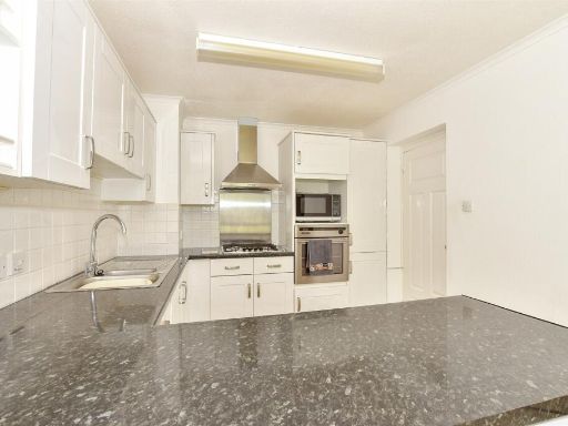 2 bedroom ground floor flat for sale in Mill Crescent, Tonbridge, Kent, TN9 — £175,500 • 2 bed • 1 bath • 581 ft²
 2 bedroom flat for sale in Waterloo Road, Tonbridge, Kent, TN9 — £175,000 • 2 bed • 1 bath • 625 ft²
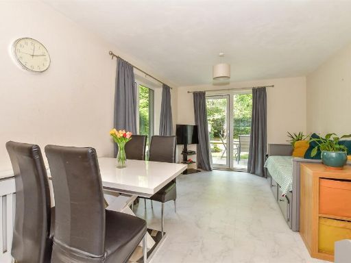 2 bedroom ground floor flat for sale in Medway Road, Tunbridge Wells, Kent, TN1 — £165,500 • 2 bed • 2 bath • 646 ft²
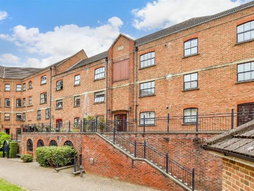 2 bedroom ground floor flat for sale in Whitefriars Wharf, Tonbridge, Kent, TN9 — £165,000 • 2 bed • 1 bath • 625 ft²
Meta
- {
"@context": "https://schema.org",
"@type": "Residence",
"name": "2 bedroom ground floor flat for sale in Waterloo Road, Tonb…",
"description": "",
"url": "https://propertypiper.co.uk/property/7c2c65d9-9049-4b74-8219-d2e972d0f187",
"image": "https://image-a.propertypiper.co.uk/66e4daa3-6edc-4b2b-adf6-d351e0a007ef-1024.jpeg",
"address": {
"@type": "PostalAddress",
"streetAddress": "Flat 7, Merryfield Court, Waterloo Road",
"postalCode": "TN9 2SL",
"addressLocality": "Tonbridge and Malling",
"addressRegion": "Tonbridge and Malling",
"addressCountry": "England"
},
"geo": {
"@type": "GeoCoordinates",
"latitude": 51.18969972778306,
"longitude": 0.26778336179903534
},
"numberOfRooms": 2,
"numberOfBathroomsTotal": 1,
"floorSize": {
"@type": "QuantitativeValue",
"value": 657,
"unitCode": "FTK"
},
"offers": {
"@type": "Offer",
"price": 140500,
"priceCurrency": "GBP",
"availability": "https://schema.org/InStock"
},
"additionalProperty": [
{
"@type": "PropertyValue",
"name": "Feature",
"value": "apartment building"
},
{
"@type": "PropertyValue",
"name": "Feature",
"value": "modern construction"
},
{
"@type": "PropertyValue",
"name": "Feature",
"value": "red brick façade"
},
{
"@type": "PropertyValue",
"name": "Feature",
"value": "pitched roof"
},
{
"@type": "PropertyValue",
"name": "Feature",
"value": "windows"
},
{
"@type": "PropertyValue",
"name": "Feature",
"value": "small parking area"
},
{
"@type": "PropertyValue",
"name": "Feature",
"value": "communal"
},
{
"@type": "PropertyValue",
"name": "Feature",
"value": "residential"
},
{
"@type": "PropertyValue",
"name": "Feature",
"value": "multi-story"
},
{
"@type": "PropertyValue",
"name": "Feature",
"value": "kitchen"
},
{
"@type": "PropertyValue",
"name": "Feature",
"value": "modern"
},
{
"@type": "PropertyValue",
"name": "Feature",
"value": "white cabinets"
},
{
"@type": "PropertyValue",
"name": "Feature",
"value": "laminate countertops"
},
{
"@type": "PropertyValue",
"name": "Feature",
"value": "single sink"
},
{
"@type": "PropertyValue",
"name": "Feature",
"value": "built-in oven"
},
{
"@type": "PropertyValue",
"name": "Feature",
"value": "electric stove"
},
{
"@type": "PropertyValue",
"name": "Feature",
"value": "tile floor"
},
{
"@type": "PropertyValue",
"name": "Feature",
"value": "bright"
},
{
"@type": "PropertyValue",
"name": "Feature",
"value": "corner layout"
}
]
}
High Res Floorplan Images
Compatible Floorplan Images
FloorplanImages Thumbnail