SW11 6QN - 2 bedroom flat for sale in Northcote Road, London, SW11
View on Property Piper
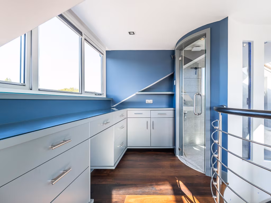
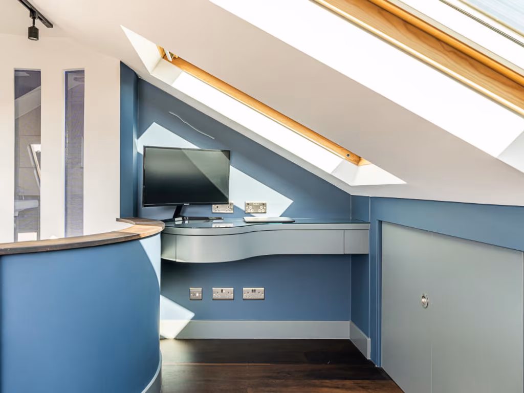
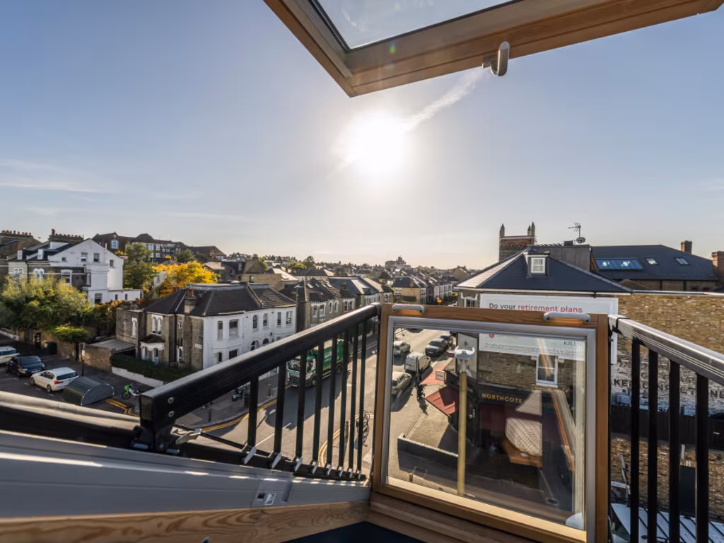
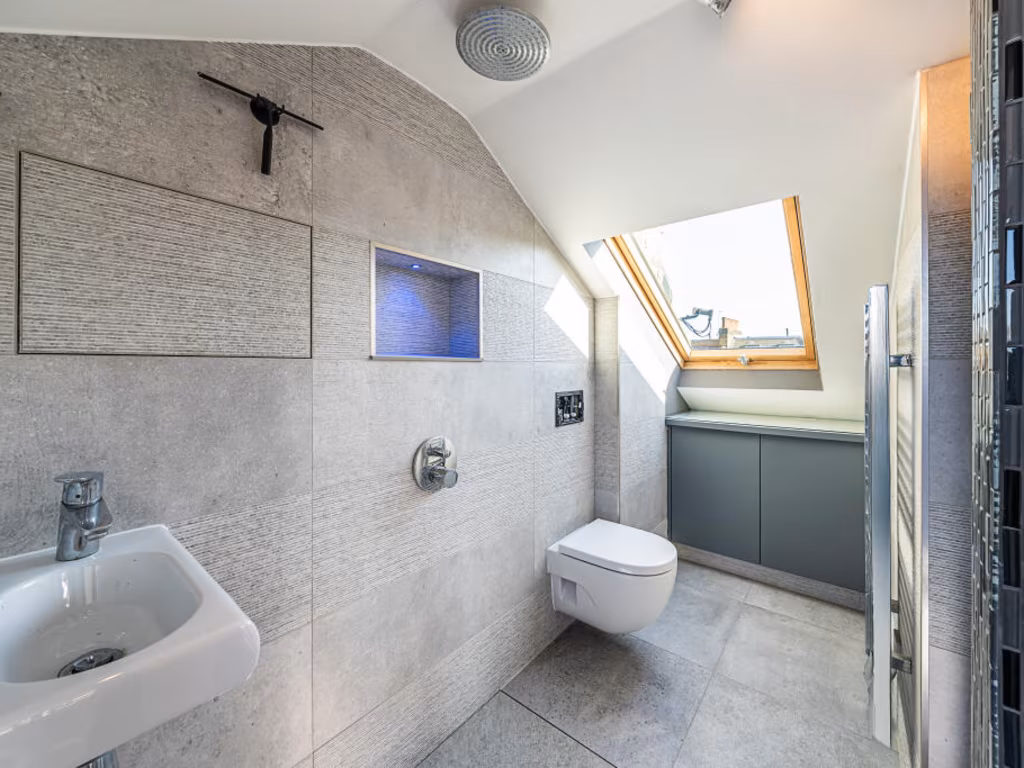
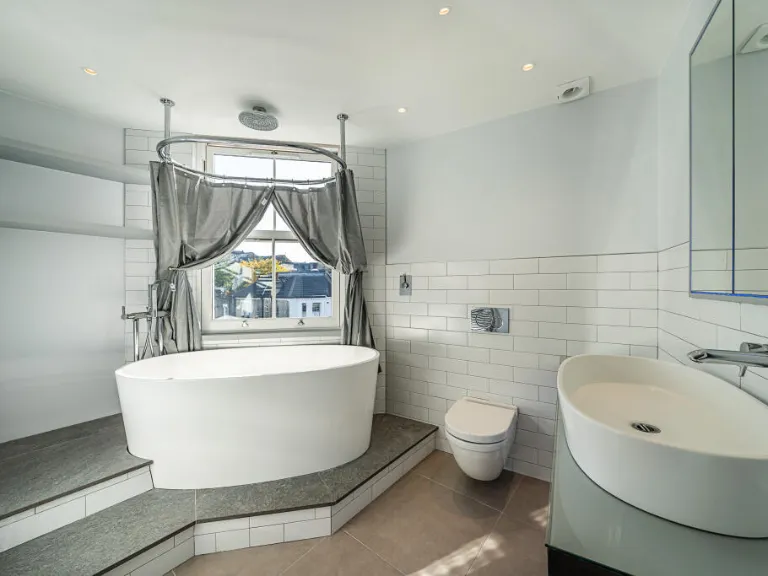
2 bedroom flat for sale in Northcote Road, London, SW11
Property Details
- Price: £795000
- Bedrooms: 2
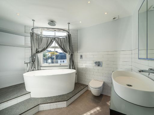
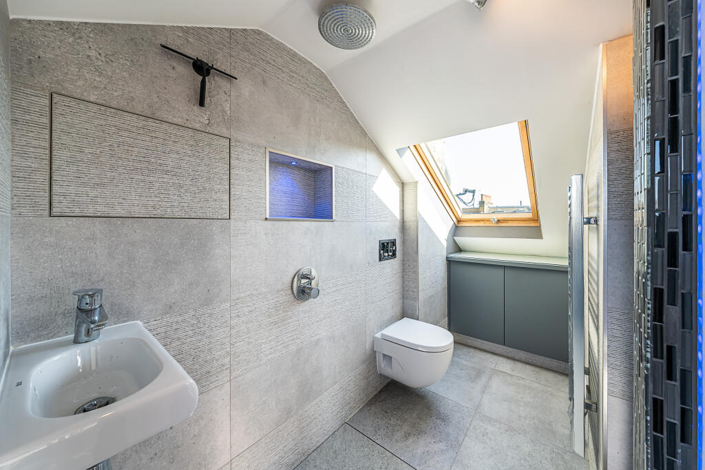
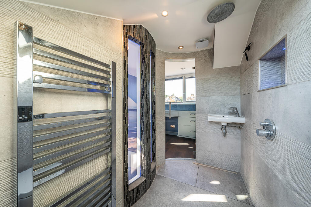
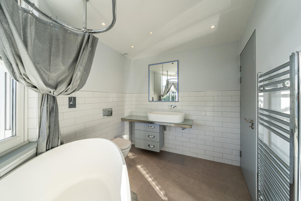
- Bathrooms: 2
- Property Type: undefined
- Property SubType: undefined
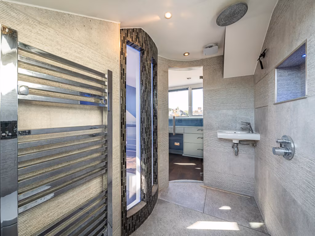
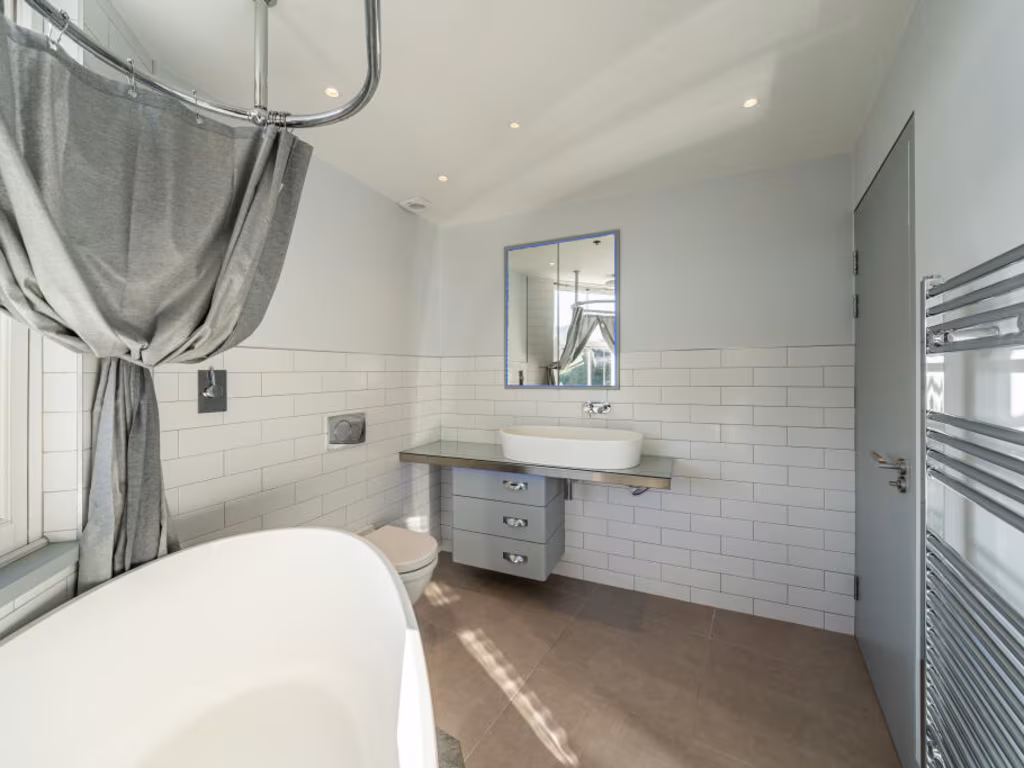
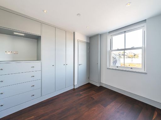
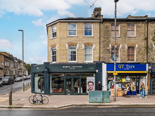
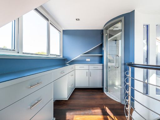
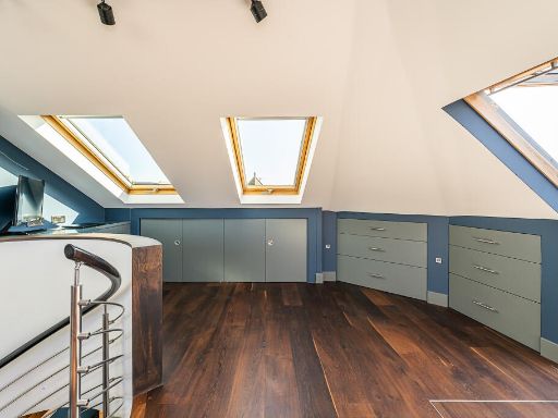
Image Descriptions
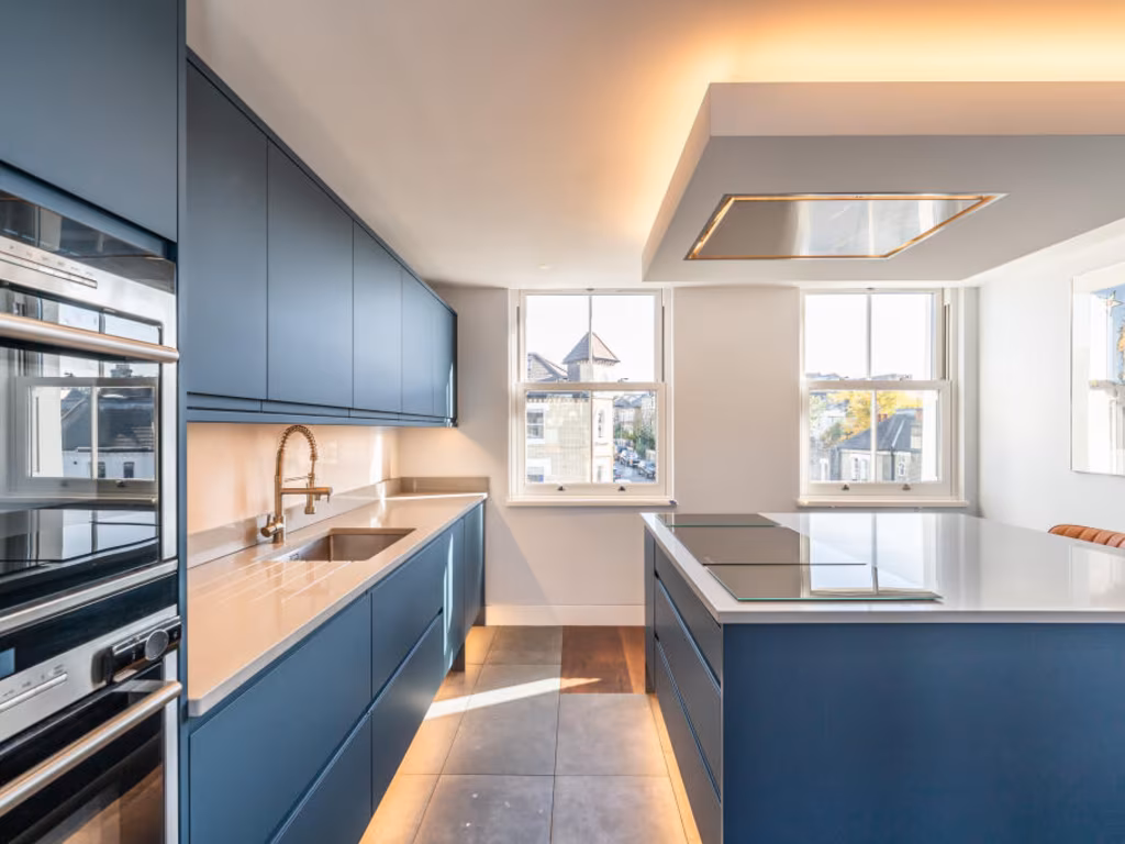
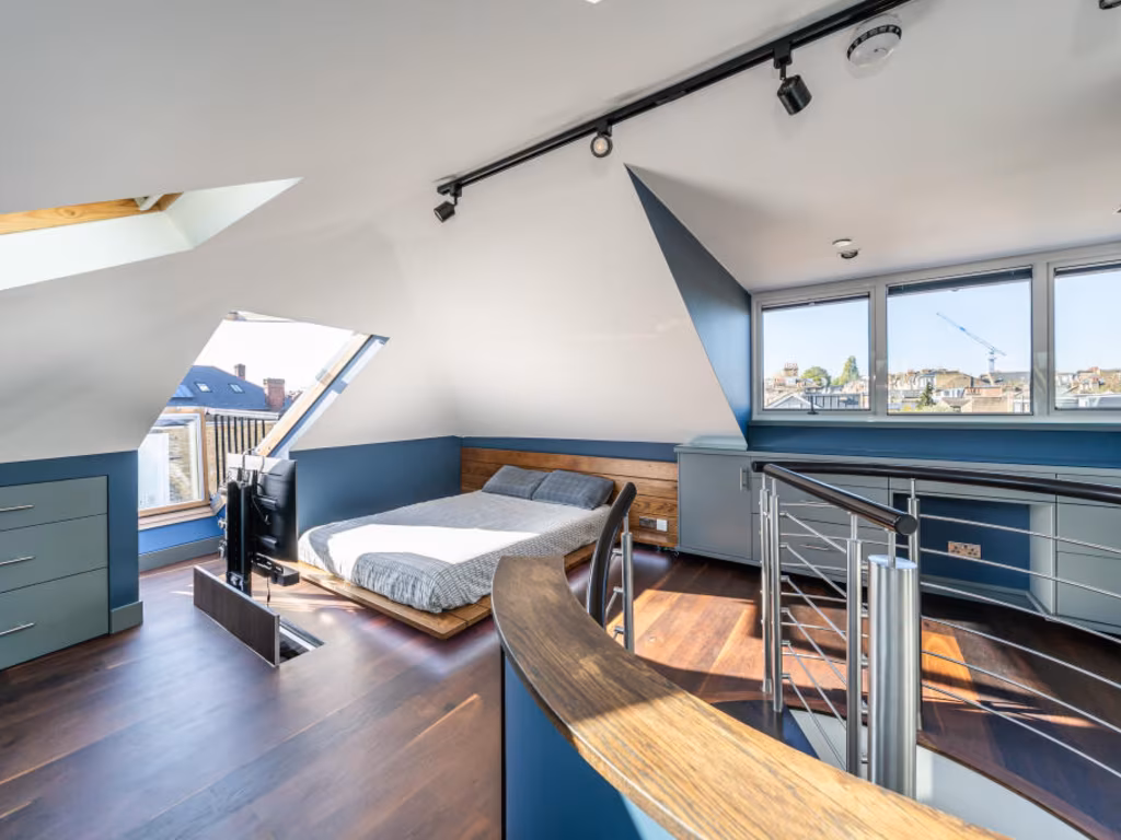
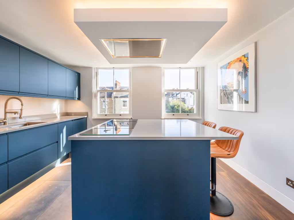
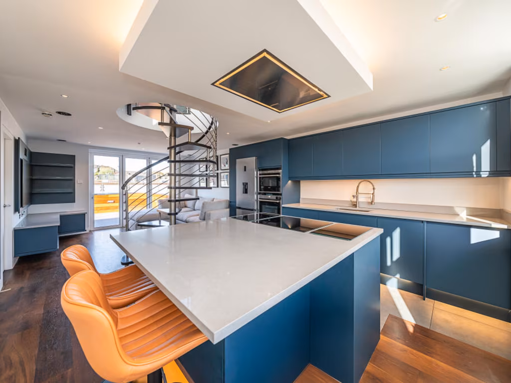
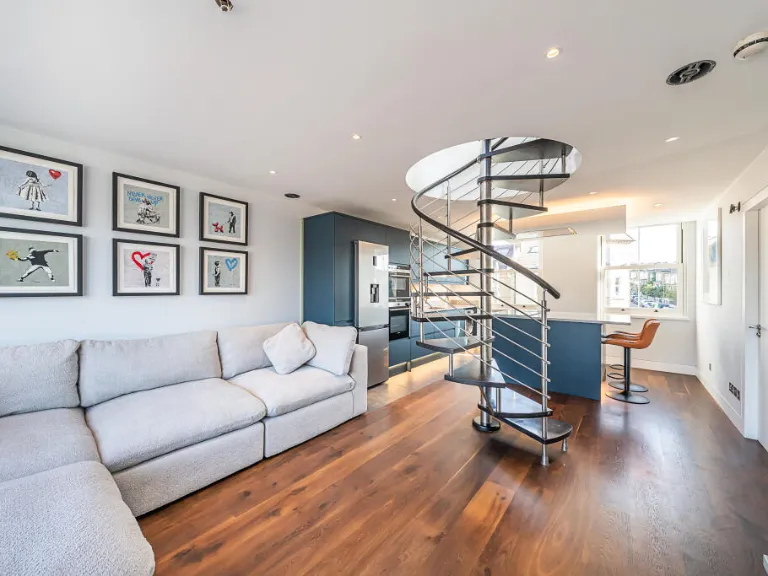
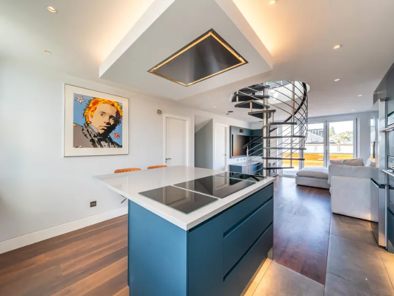
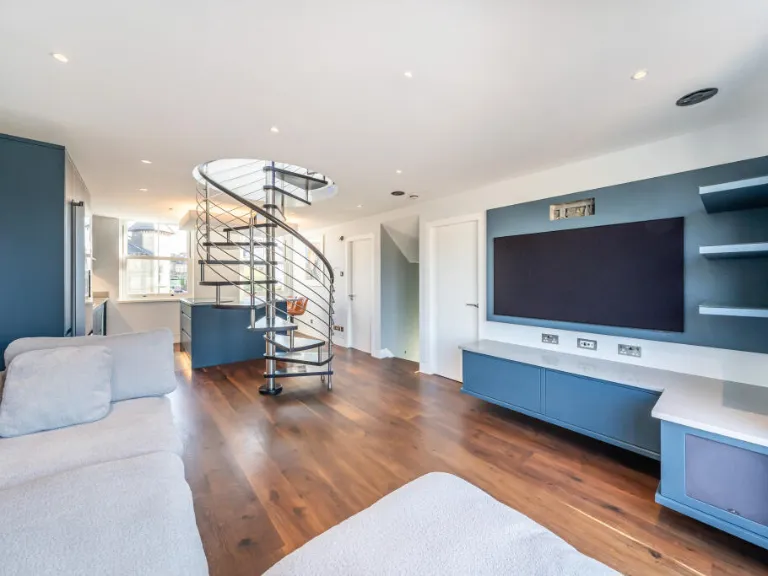
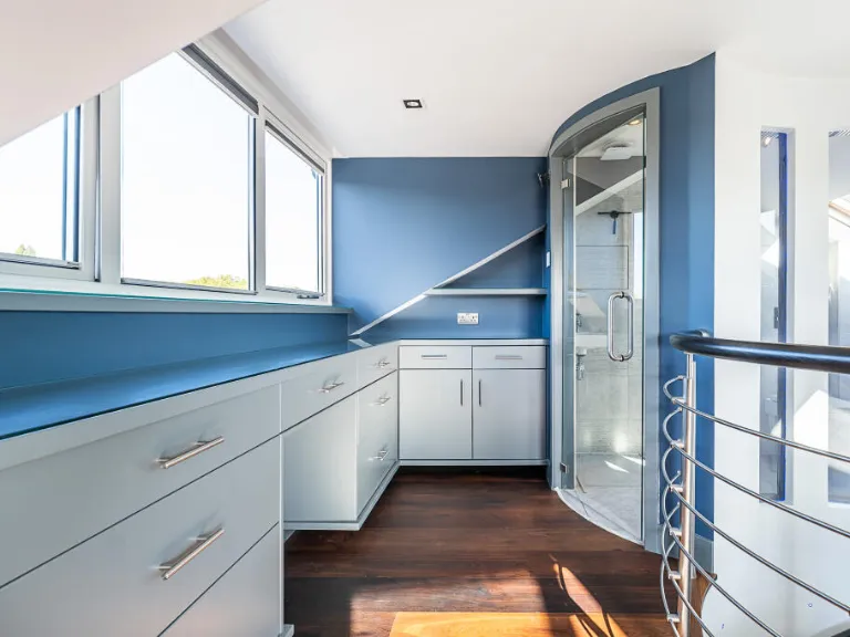
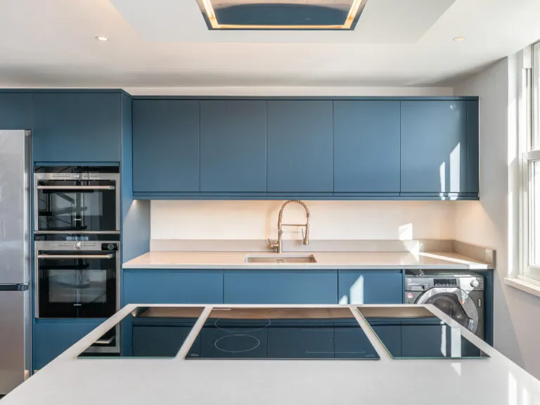
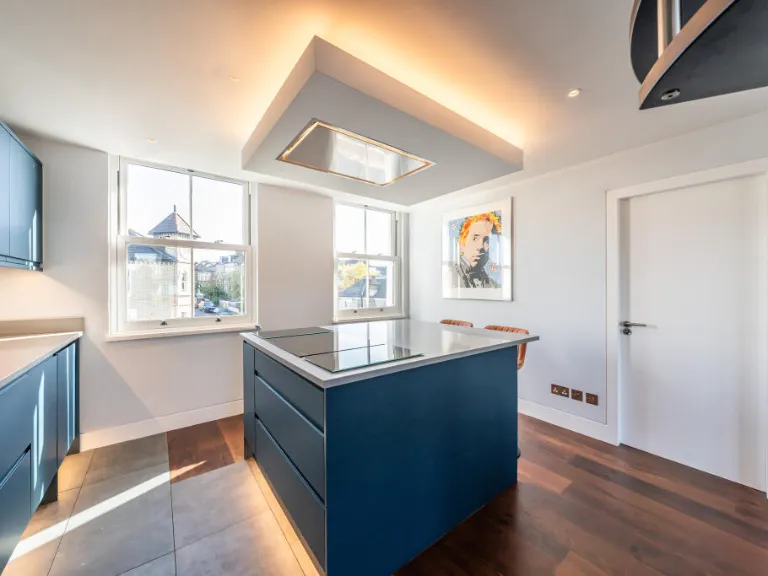
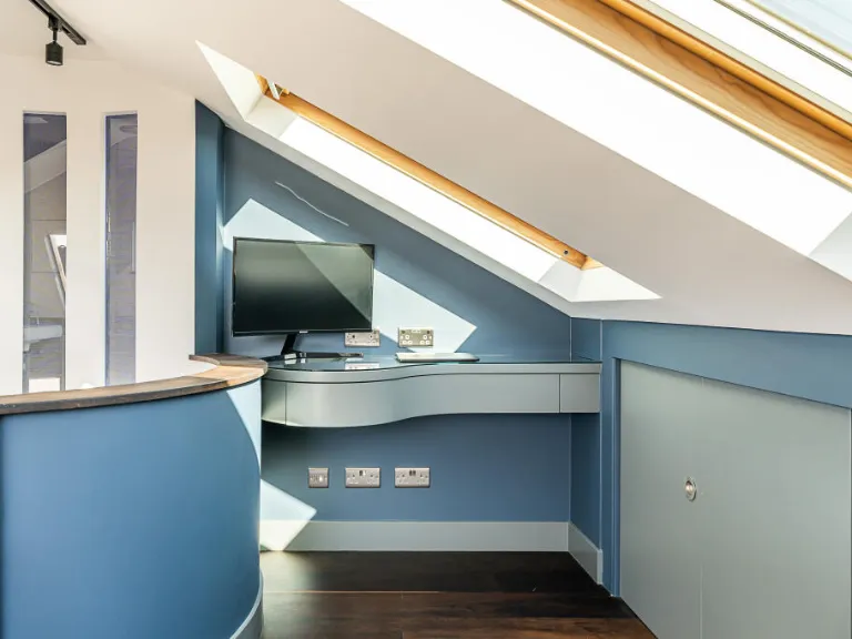
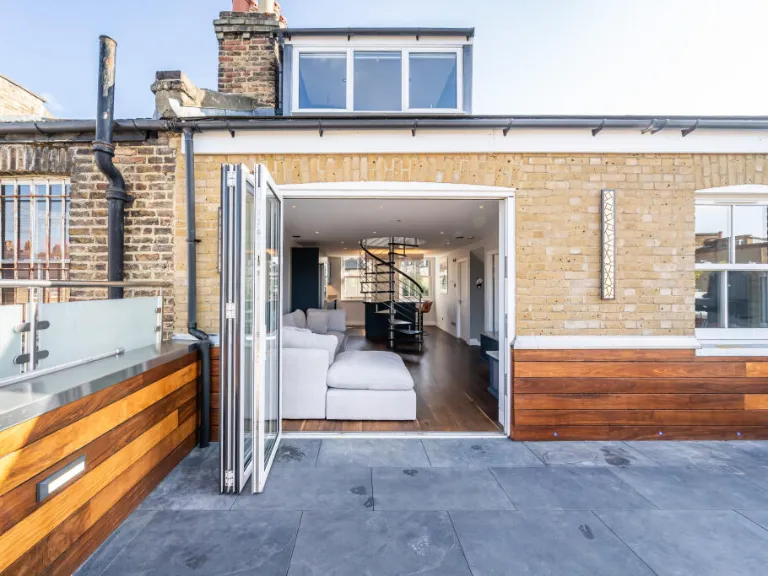
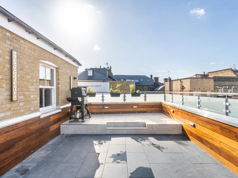
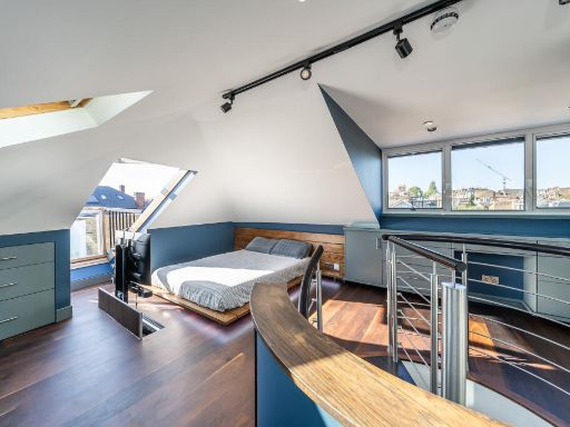
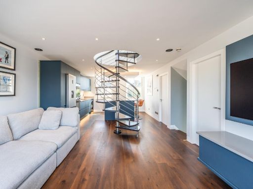
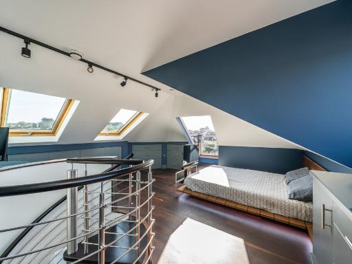
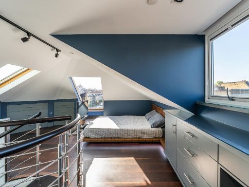
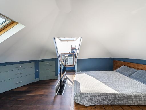
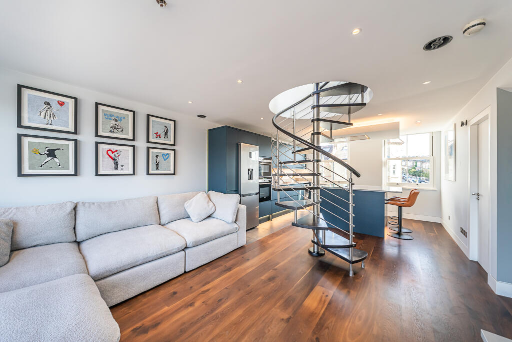
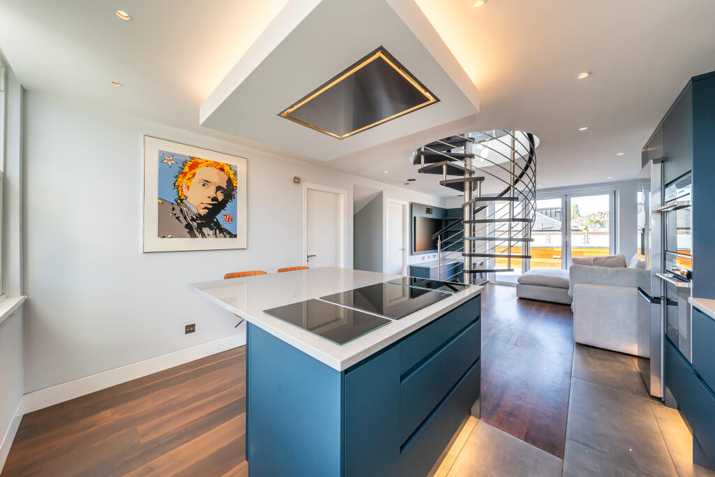
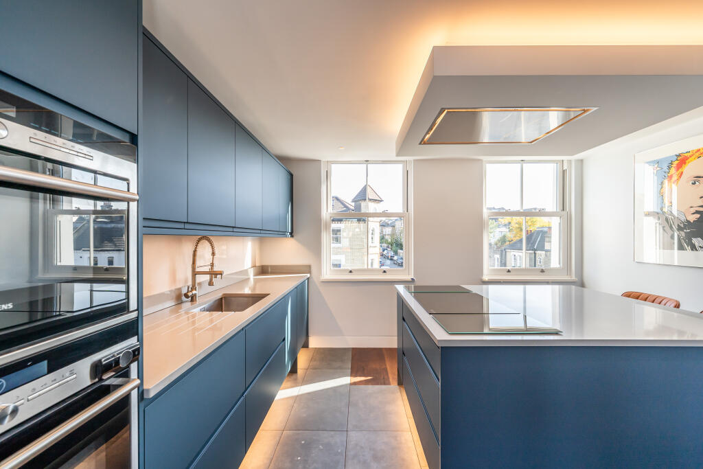
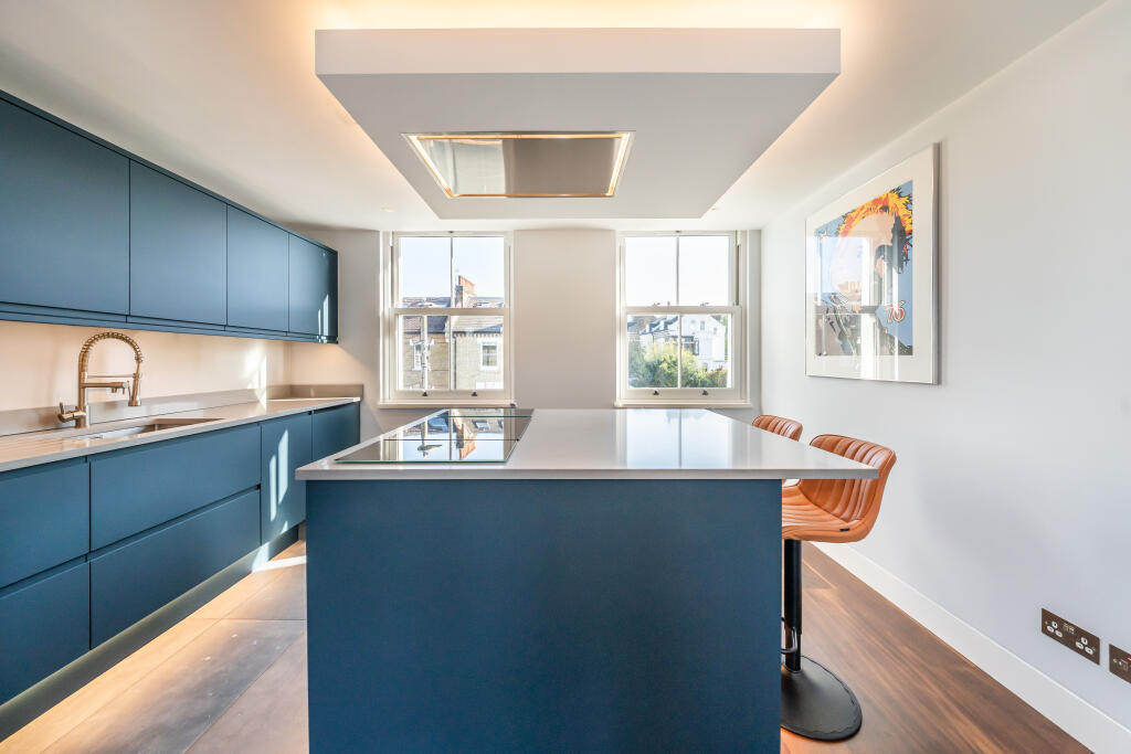
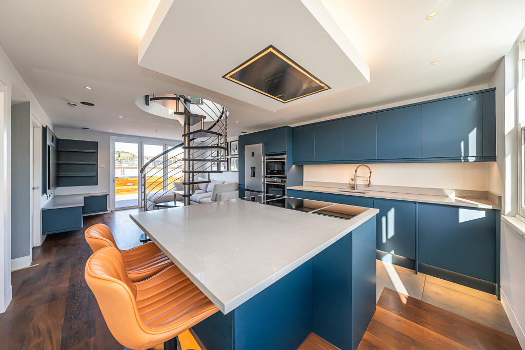
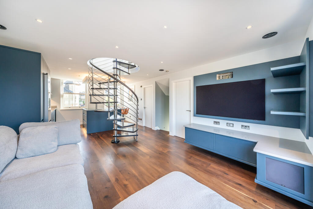
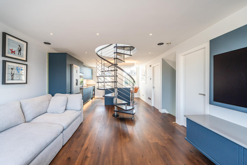
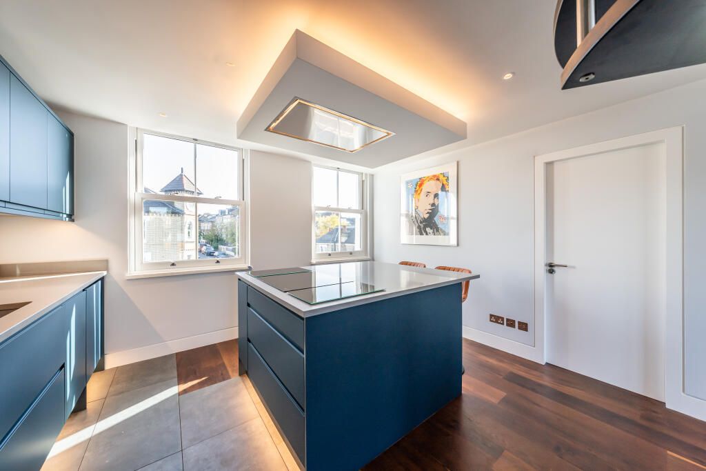
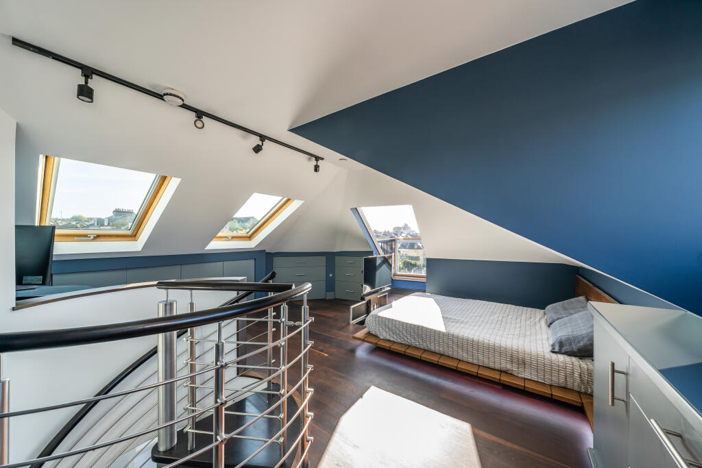
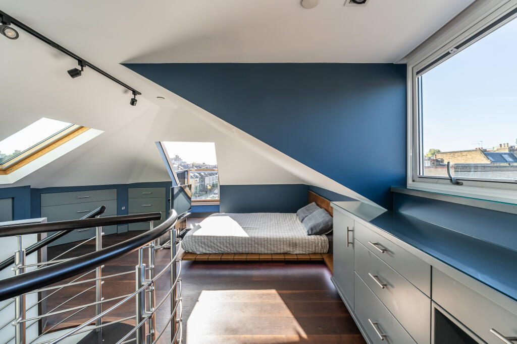
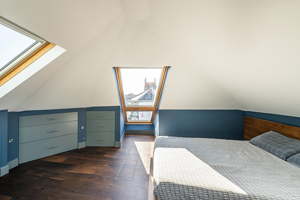
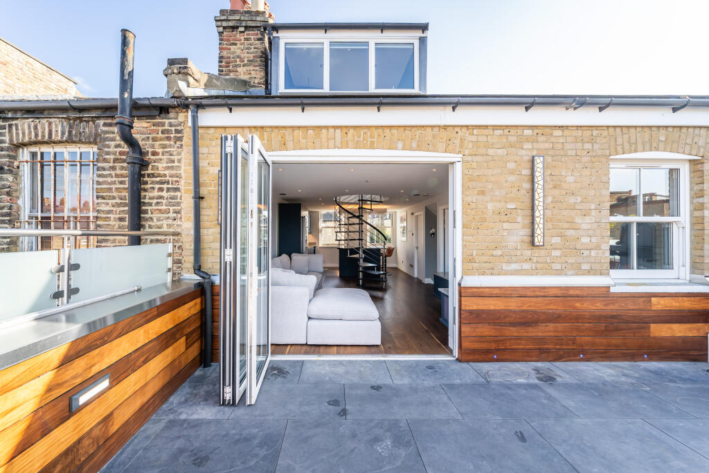
- modern living room with spiral staircase contemporary
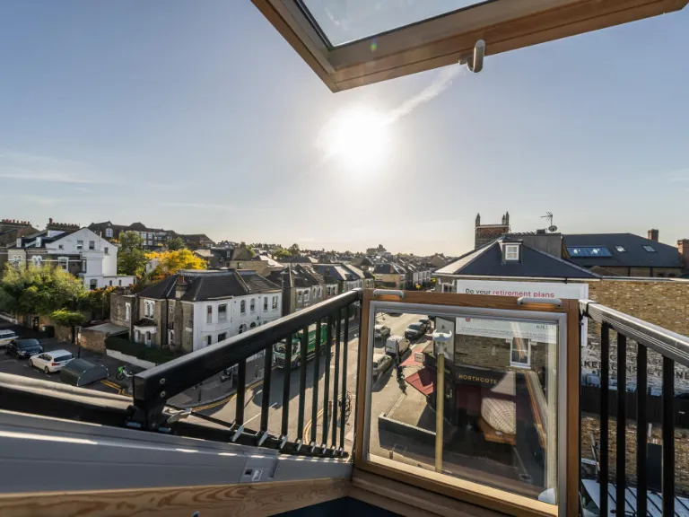
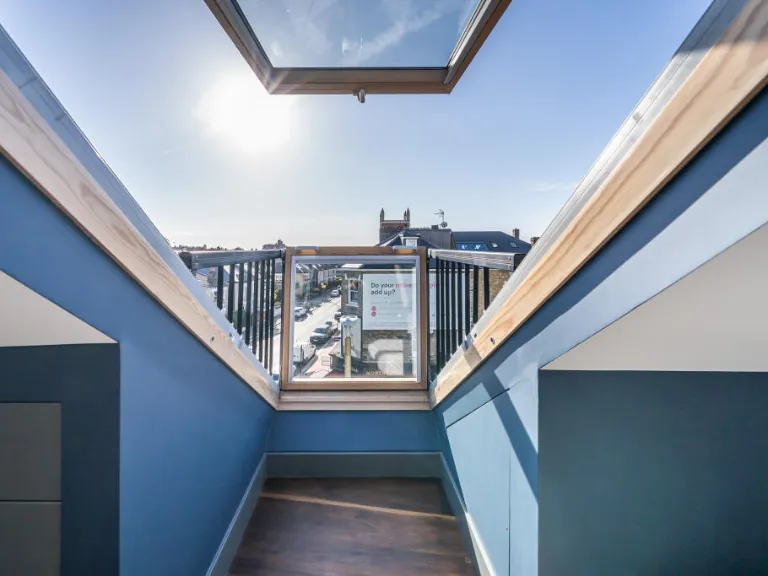
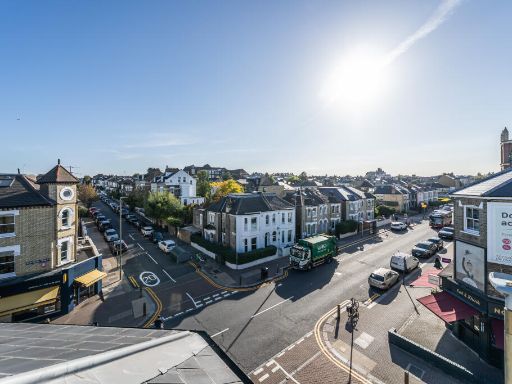
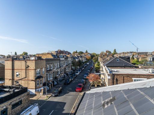
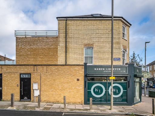
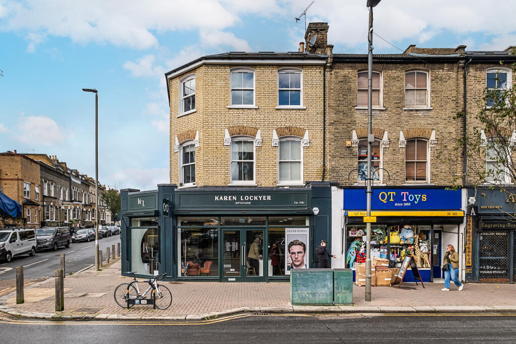
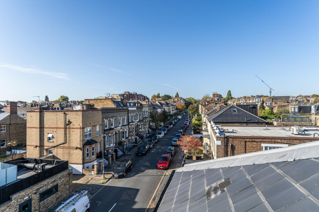
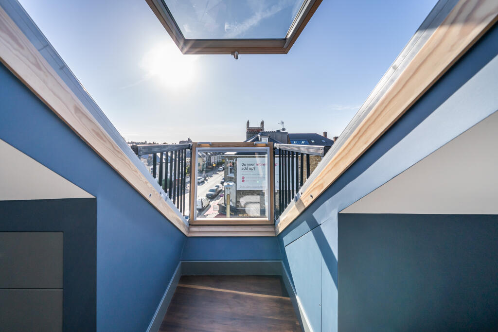
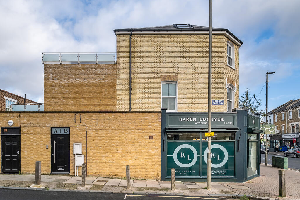
- street view Victorian terrace
Floorplan Description
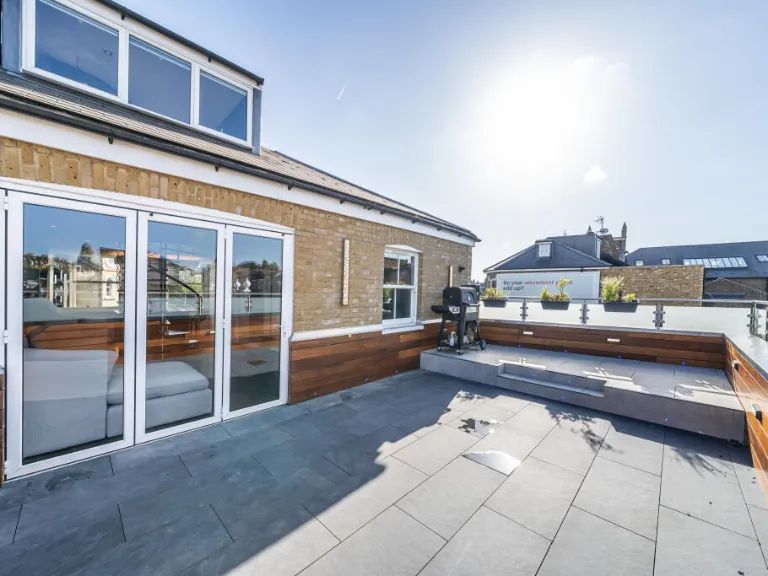
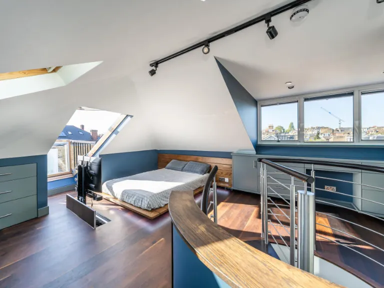
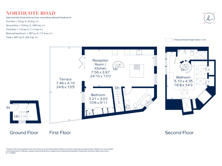
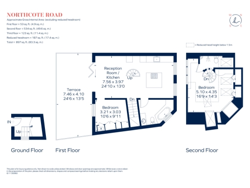
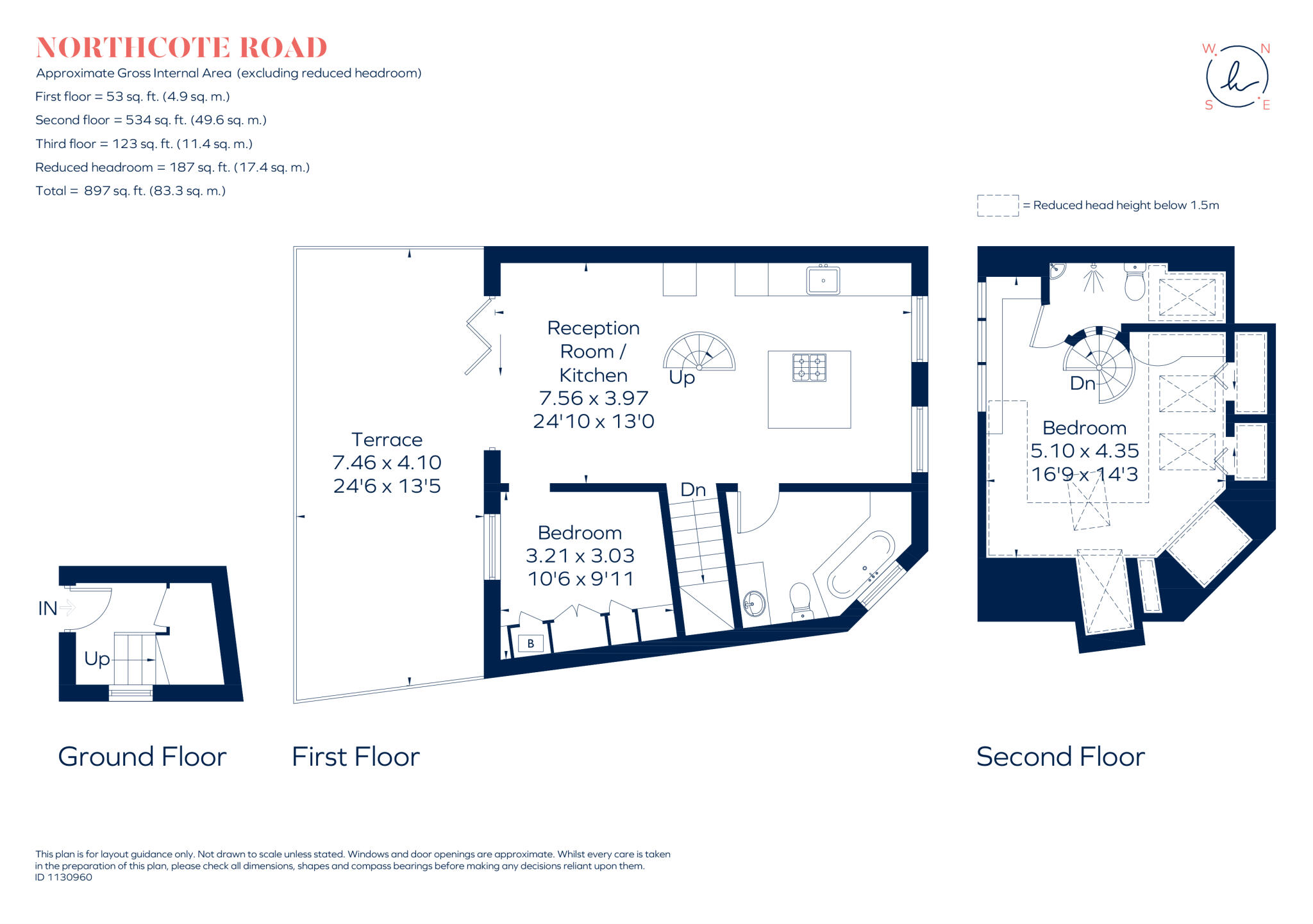
- Floorplan showing reception/kitchen, two bedrooms and a terrace.
Rooms
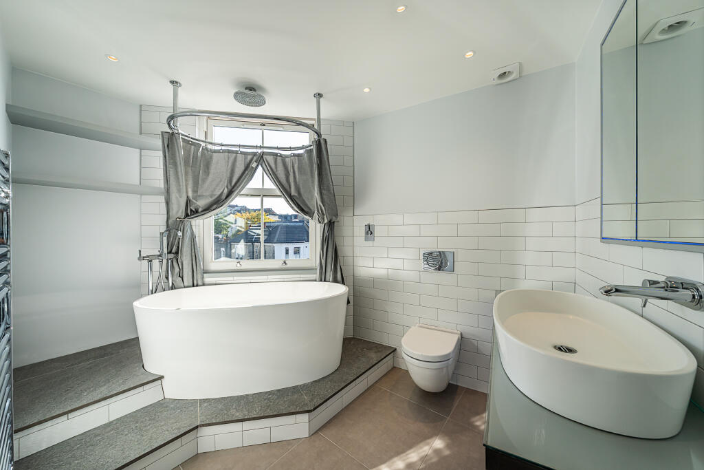
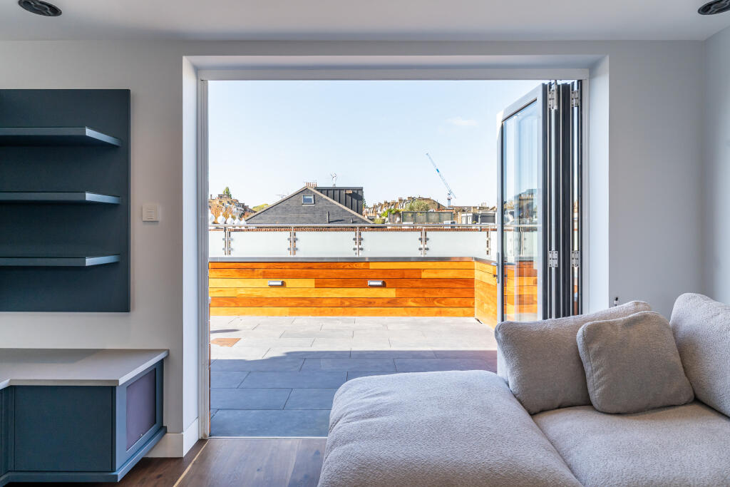
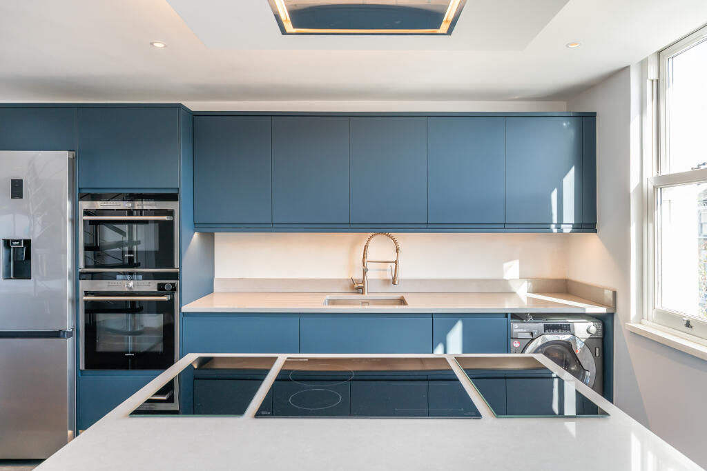
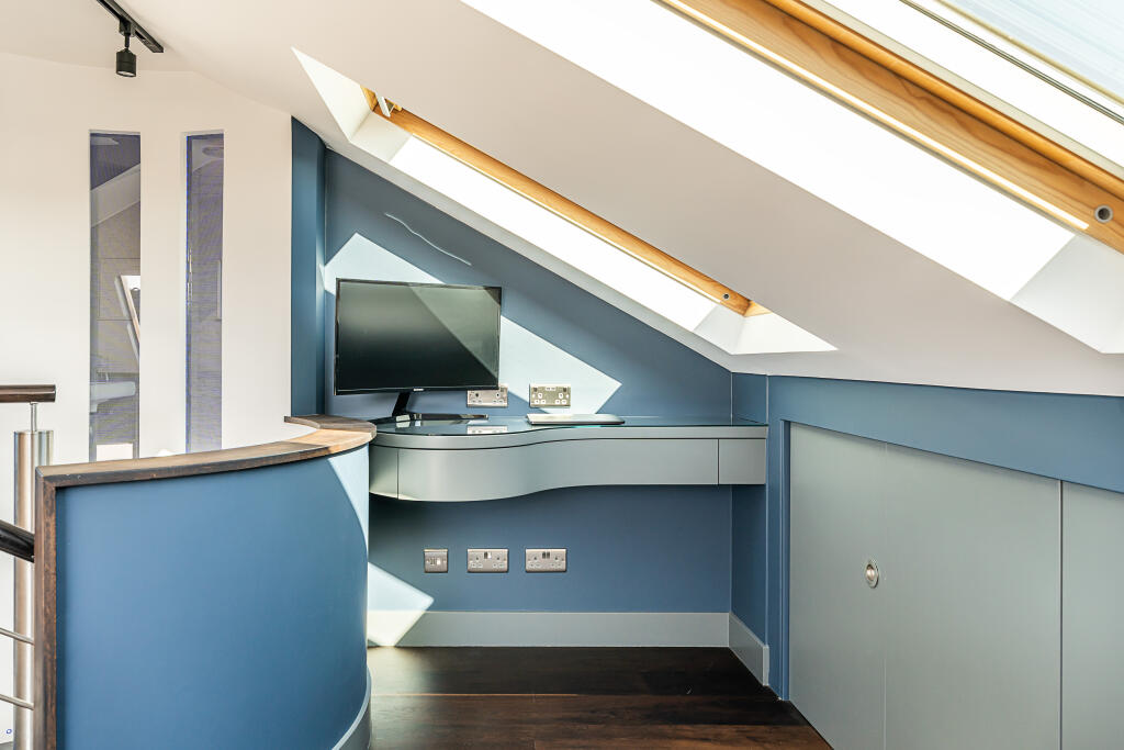
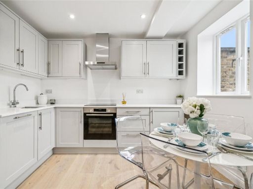
- Reception Room / Kitchen:
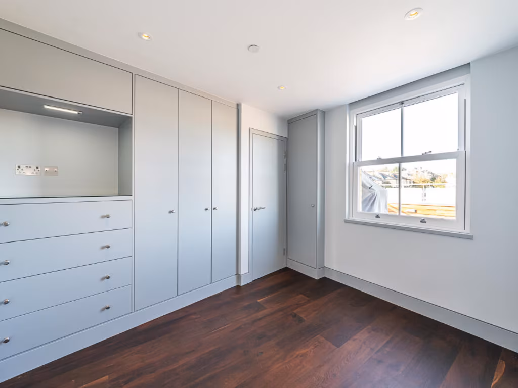
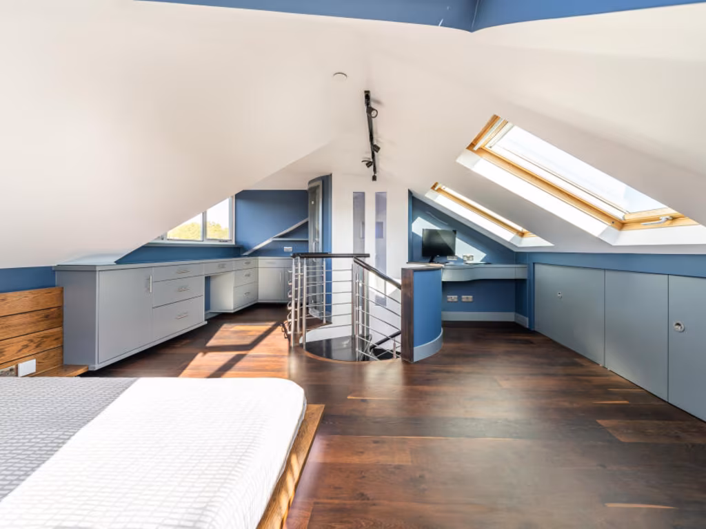
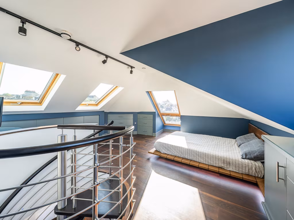
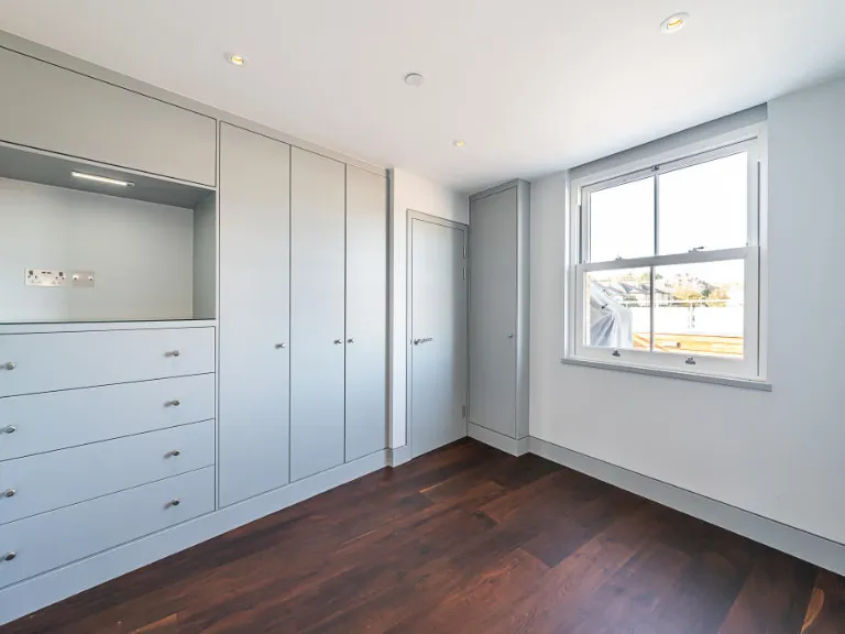
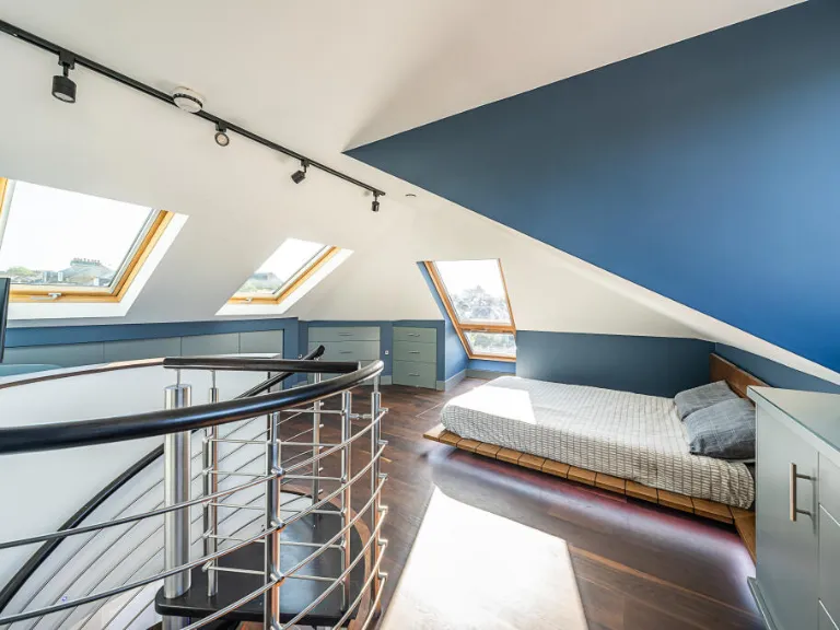
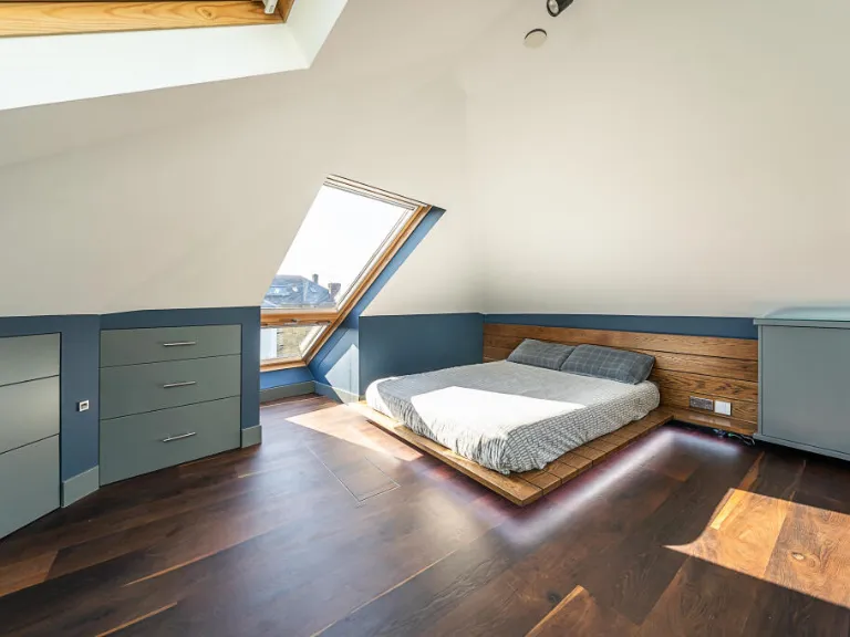
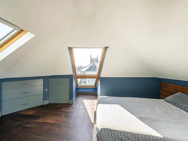
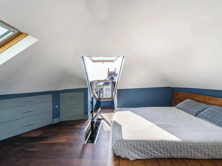
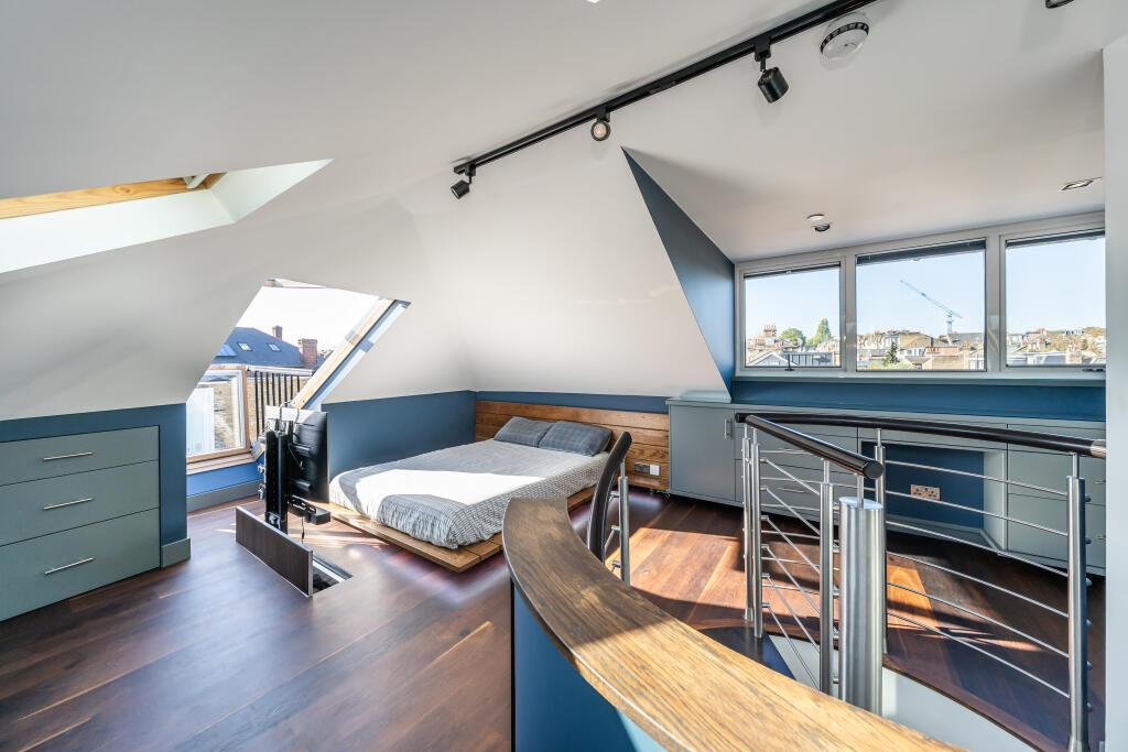
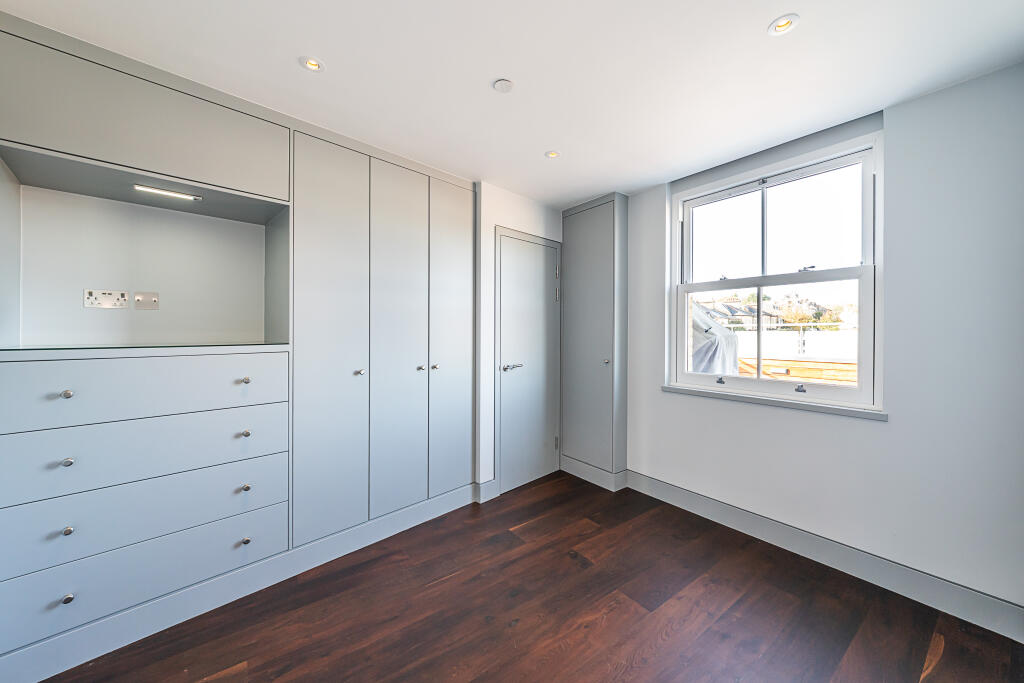
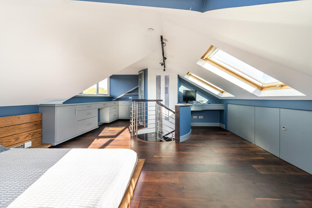
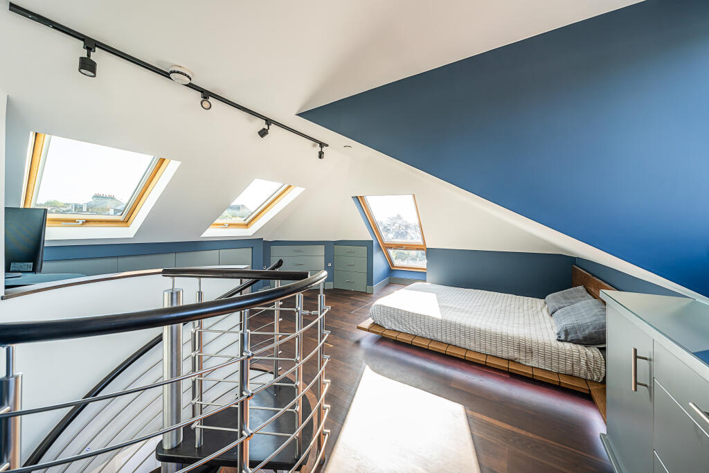
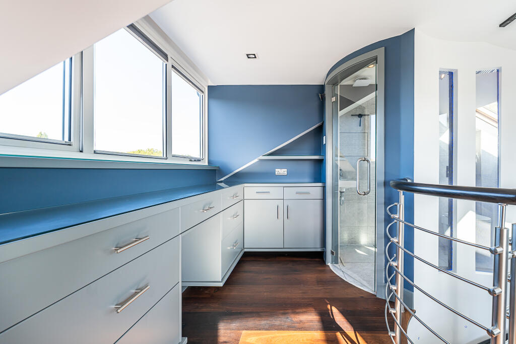
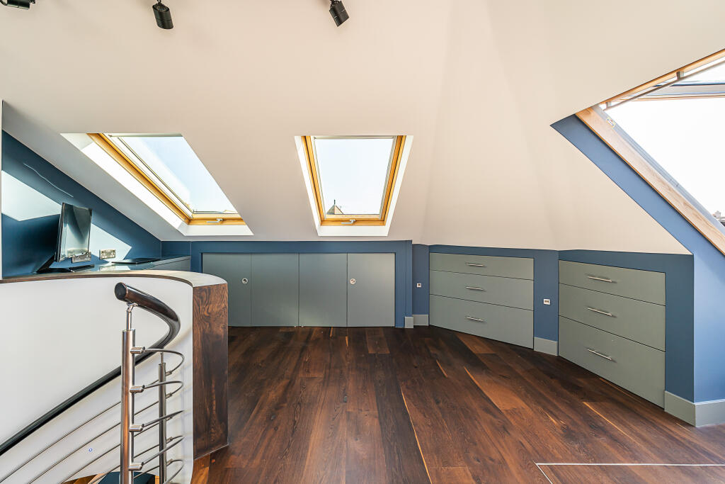
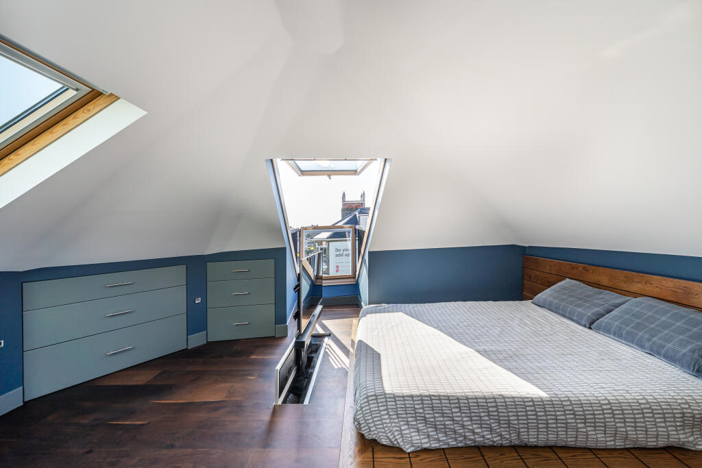
- Bedroom:
- Bedroom:
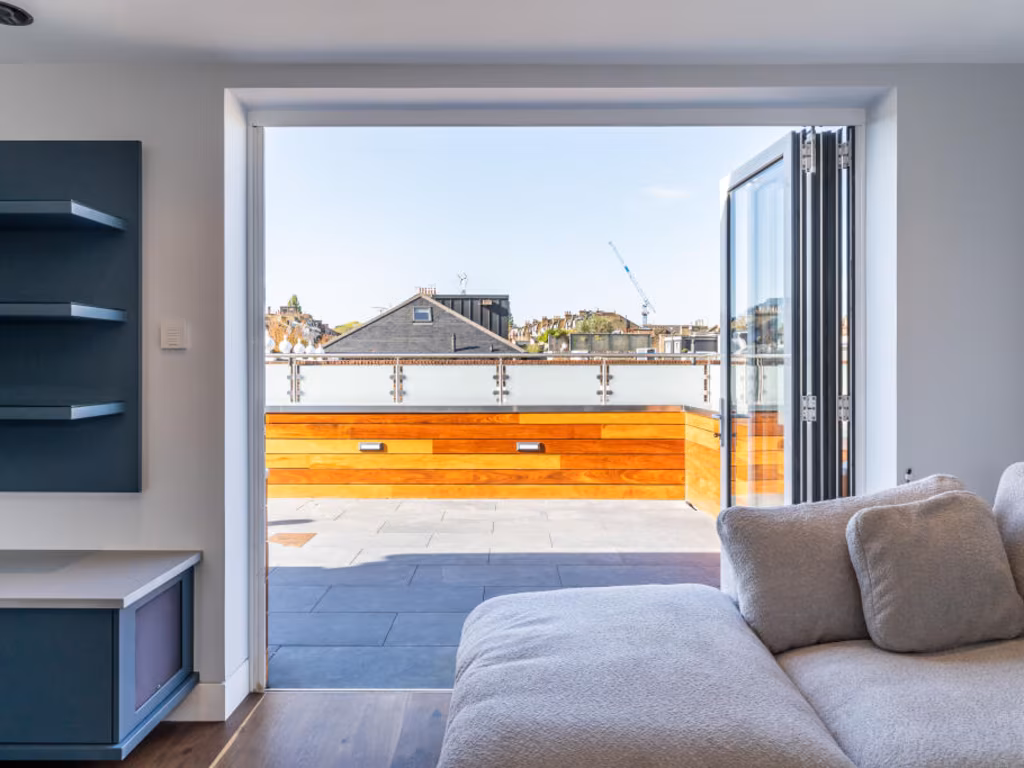
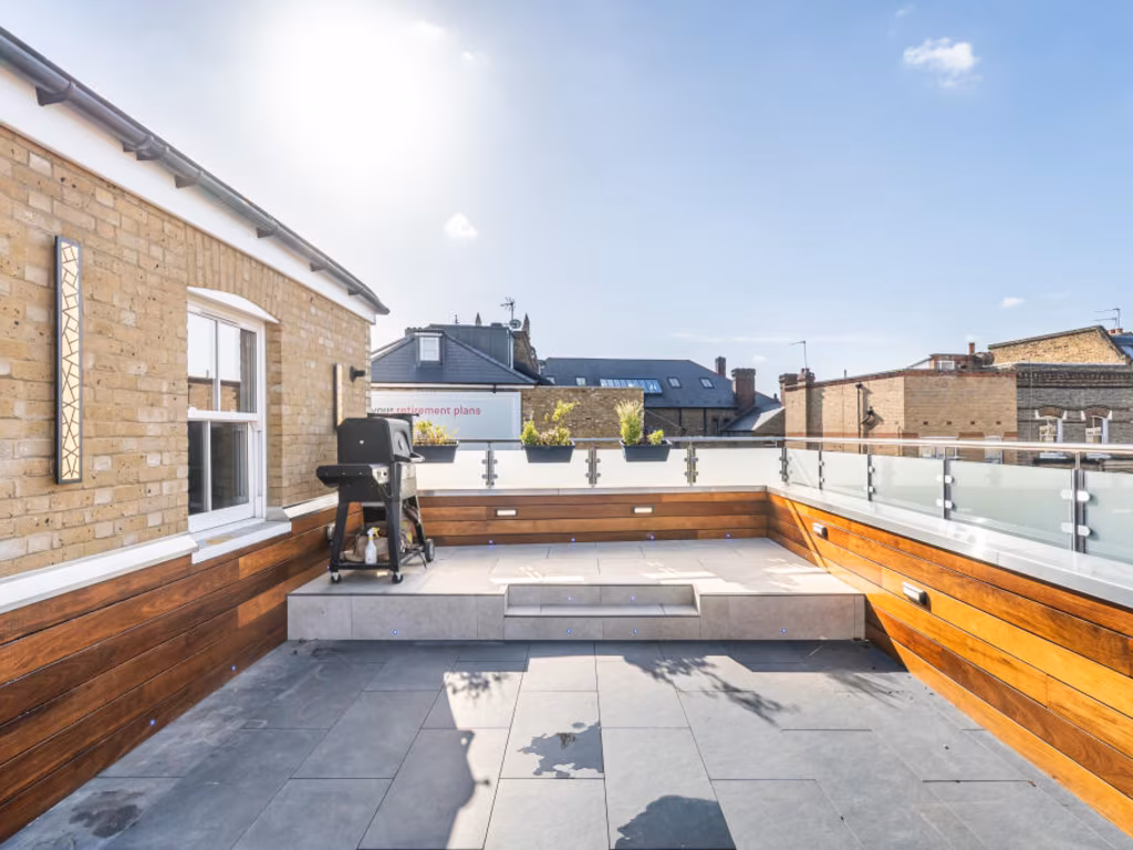
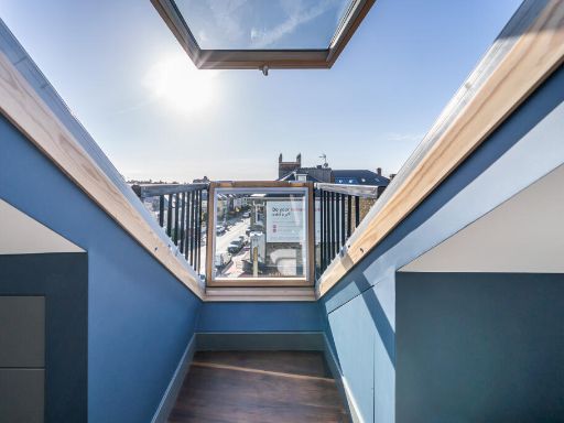
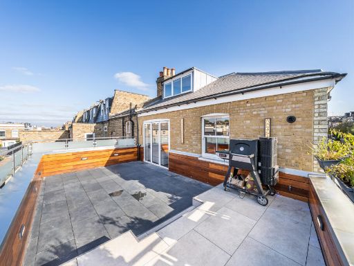
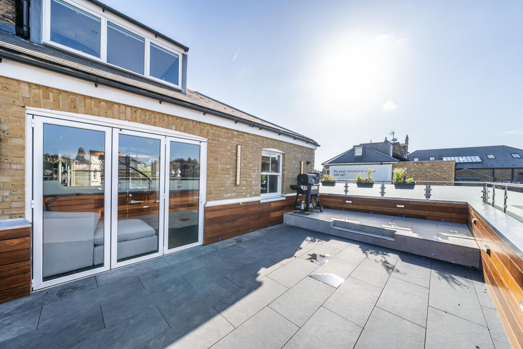
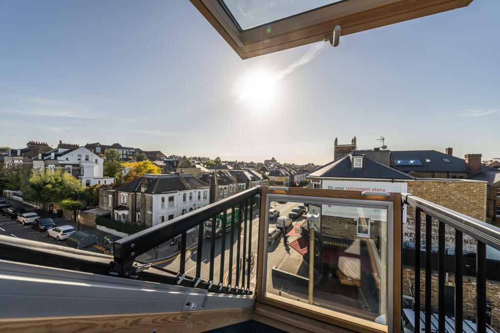
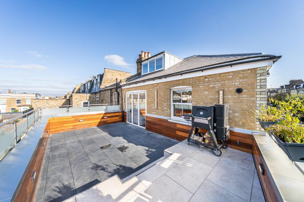
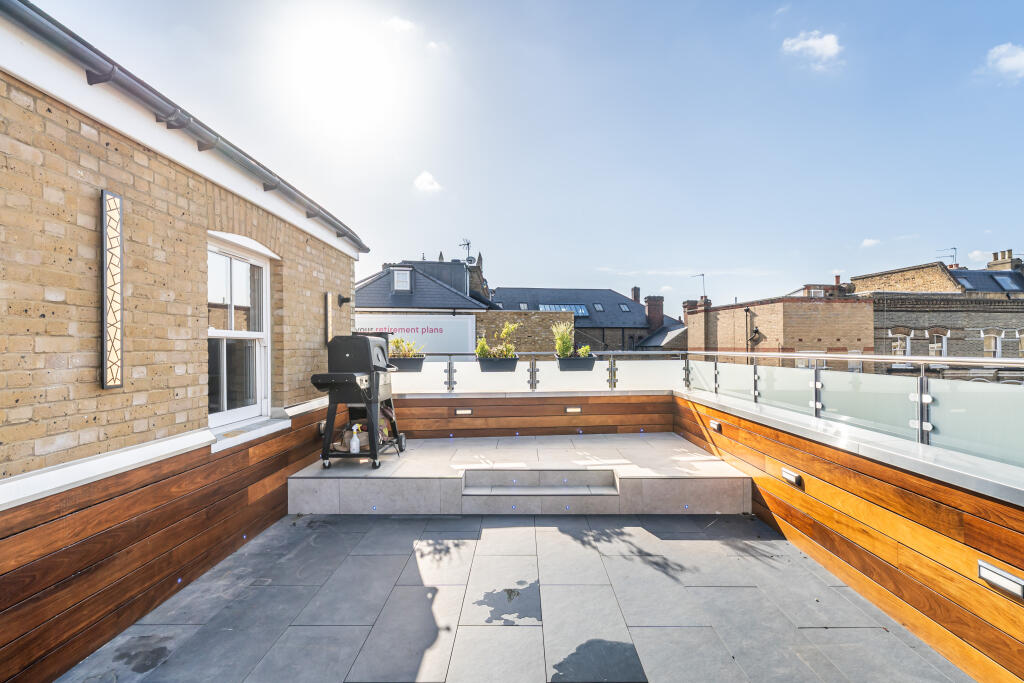
- Terrace:
Textual Property Features
Detected Visual Features
- modern
- open-plan
- spiral staircase
- contemporary
- kitchen
- living area
- wood flooring
- open layout
- bright
- Victorian terrace
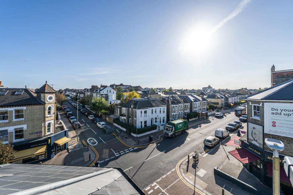
- street view
- residential area
- urban
- corner property
EPC Details
- Fully double glazed
- Average thermal transmittance 0.29 W/m-¦K
- Boiler and radiators, mains gas
- Low energy lighting in all fixed outlets
- Average thermal transmittance 0.14 W/m-¦K
Nearby Schools
- Broomwood Hall School
- Northcote Lodge School
- Ark Bolingbroke Academy
- Dolphin School (Incorporating Noahs Ark Nursery Schools)
- Belleville Primary School
- Parkgate House School
- Belleville Wix Academy
- Thames Christian School
- Falconbrook Primary School
- Shaftesbury Park Primary School
- John Burns Primary School
- L'Ecole de Battersea
- London Park School Clapham
- Thomas's Clapham
- ARK John Archer Primary Academy
- Sacred Heart Catholic Primary School, Battersea
- Harris Academy Battersea
- Finton House School
- Chestnut Grove Academy
- Hornsby House School
- Holy Ghost Catholic Primary School
- Wandsworth Preparatory School
- Honeywell Junior School
- Honeywell Infant School
- Emanuel School
- Eaton House the Manor School
Nearest Bars And Restaurants
- Id: 4564898430
- Tags:
- Amenity: restaurant
- Name: MEATLiquor
- Website: https://meatliquor.com/
- TagsNormalized:
- Lat: 51.4582508
- Lon: -0.1662083
- FullGeoHash: gcpuspwyp14n
- PartitionGeoHash: gcpu
- Images:
- FoodStandards: null
- Distance: 68.7
,- Id: 1968294040
- Tags:
- Addr:
- Housenumber: 74-76
- Postcode: SW11 6QL
- Street: Northcote Road
- Amenity: restaurant
- Cuisine: pizza
- Fhrs:
- Name: Franco Manca
- TagsNormalized:
- Lat: 51.4581922
- Lon: -0.1661839
- FullGeoHash: gcpuspwvxwk3
- PartitionGeoHash: gcpu
- Images:
- FoodStandards: null
- Distance: 62
,- Id: 1112279154
- Tags:
- Addr:
- Housenumber: 78
- Postcode: SW11 6QL
- Street: Northcote Road
- Amenity: restaurant
- Cuisine: greek
- Name: opa-opa
- TagsNormalized:
- Lat: 51.4581486
- Lon: -0.1661647
- FullGeoHash: gcpuspxj2n4s
- PartitionGeoHash: gcpu
- Images:
- FoodStandards: null
- Distance: 57.1
,- Id: 3090725415
- Tags:
- Addr:
- City: London
- Housenumber: 89
- Postcode: SW11 6PL
- Street: Northcote Road
- Amenity: restaurant
- Name: Sea Fare Fish & Chips
- Phone: +44 20 7228 9046
- TagsNormalized:
- Lat: 51.4579865
- Lon: -0.1657178
- FullGeoHash: gcpuspxk6rzy
- PartitionGeoHash: gcpu
- Images:
- FoodStandards: null
- Distance: 46.8
,- Id: 1112279162
- Tags:
- Addr:
- Housenumber: 94
- Postcode: SW11 6QW
- Street: Northcote Road
- Amenity: pub
- Fhrs:
- Name: Brewdog The Northcote
- Website: https://www.brewdog.com
- TagsNormalized:
- Lat: 51.4574347
- Lon: -0.1659716
- FullGeoHash: gcpuspx1k94d
- PartitionGeoHash: gcpu
- Images:
- FoodStandards: null
- Distance: 24
}
Nearest General Shops
- Id: 3107632867
- Tags:
- Addr:
- City: London
- Housenumber: 86
- Postcode: SW11 6QN
- Street: Northcote Road
- Name: Trotters
- Phone: +44 20 7585 0572
- Shop: Childrenswear
- Website: https://www.trotters.co.uk/
- TagsNormalized:
- Lat: 51.4578015
- Lon: -0.1660857
- FullGeoHash: gcpuspx53vmw
- PartitionGeoHash: gcpu
- Images:
- FoodStandards: null
- Distance: 18.3
,- Id: 3090725413
- Tags:
- Addr:
- City: London
- Housenumber: 88
- Postcode: SW11 6QN
- Street: Northcote Road
- Name: Asquiths
- Phone: +44 20 7978 7722
- Shop: jewelry
- Website: https://www.asquithsoflondon.co.uk/
- TagsNormalized:
- Lat: 51.4577576
- Lon: -0.1660513
- FullGeoHash: gcpuspx54tr0
- PartitionGeoHash: gcpu
- Images:
- FoodStandards: null
- Distance: 13.7
,- Id: 1958644309
- Tags:
- Addr:
- City: London
- Country: GB
- Housenumber: 90
- Postcode: SW11 6QN
- Street: Northcote Road
- Name: Q.T. Toys
- Shop: toys
- TagsNormalized:
- Lat: 51.4577016
- Lon: -0.1660409
- FullGeoHash: gcpuspx4ffyf
- PartitionGeoHash: gcpu
- Images:
- FoodStandards: null
- Distance: 8
}
Nearest Grocery shops
- Id: 441209934
- Tags:
- Addr:
- City: London
- Country: GB
- Housenumber: 15-17
- Postcode: SW11 1NG
- Street: Northcote Road
- Fhrs:
- Name: The Co-operative Food
- Shop: convenience
- TagsNormalized:
- the co-operative food
- food
- convenience
- shop
- Lat: 51.4601667
- Lon: -0.166522
- FullGeoHash: gcpuu0n9py25
- PartitionGeoHash: gcpu
- Images:
- FoodStandards: null
- Distance: 282.8
,- Id: 3090725417
- Tags:
- Addr:
- City: London
- Housenumber: 95
- Postcode: SW11 6PL
- Street: Northcote Road
- Name: Bayley & Sage
- Operator: Bayley & Sage
- Shop: convenience
- Website: https://www.bayley-sage.co.uk/
- TagsNormalized:
- Lat: 51.4578398
- Lon: -0.1656901
- FullGeoHash: gcpuspx7ehsd
- PartitionGeoHash: gcpu
- Images:
- FoodStandards: null
- Distance: 35.9
,- Id: 1958644319
- Tags:
- Addr:
- City: London
- Country: GB
- Housenumber: 92
- Postcode: SW11 6QN
- Street: Northcote Road
- Name: Windfall Natural
- Shop: health_food
- TagsNormalized:
- health
- health food
- food
- shop
- Lat: 51.4576431
- Lon: -0.1660245
- FullGeoHash: gcpuspx47rgj
- PartitionGeoHash: gcpu
- Images:
- FoodStandards: null
- Distance: 4.8
}
Nearest Supermarkets
- Id: 35824042
- Tags:
- Addr:
- Country: GB
- Housenumber: 204
- Postcode: SW11 1JG
- Street: Lavender Hill
- Atm: yes
- Brand: Asda
- Brand:wikidata: Q297410
- Brand:wikipedia: en:Asda
- Building: yes
- Contact:
- Facebook: https://www.facebook.com/asda/
- Twitter: @asda
- Website: https://storelocator.asda.com/london/london/204-lavender-hill-battersea
- Fhrs:
- Name: Asda
- Opening_hours: Mo 07:30-24:00;Tu-Fr 00:00-24:00;Sa 00:00-22:00;Su 11:00-17:00
- Operator: Asda Stores Ltd
- Shop: supermarket
- Source:
- Toilets: yes
- Wheelchair: yes
- TagsNormalized:
- Lat: 51.4655207
- Lon: -0.1649233
- FullGeoHash: gcpuu1pbmh2m
- PartitionGeoHash: gcpu
- Images:
- FoodStandards: null
- Distance: 880.4
,- Id: 35824055
- Tags:
- Addr:
- City: London
- Country: GB
- Housenumber: 141
- Postcode: SW11 2PE
- Street: Falcon Lane
- Brand: Lidl
- Brand:wikidata: Q151954
- Brand:wikipedia: en:Lidl
- Building: yes
- Fhrs:
- Name: Lidl
- Opening_hours: Mo-Fr 08:00-23:00; Sa 08:00-22:00; Su 11:00-17:00
- Shop: supermarket
- Website: https://www.lidl.co.uk/
- Wheelchair: yes
- TagsNormalized:
- Lat: 51.464937
- Lon: -0.1670748
- FullGeoHash: gcpuu0ykfzeg
- PartitionGeoHash: gcpu
- Images:
- FoodStandards: null
- Distance: 814.6
,- Id: 1112279406
- Tags:
- Brand: Waitrose
- Brand:wikidata: Q771734
- Brand:wikipedia: en:Waitrose & Partners
- Name: Waitrose
- Official_name: Waitrose & Partners
- Operator: Waitrose & Partners
- Shop: supermarket
- TagsNormalized:
- Lat: 51.4626128
- Lon: -0.1677865
- FullGeoHash: gcpuu0mz6q36
- PartitionGeoHash: gcpu
- Images:
- FoodStandards: null
- Distance: 565.6
}
Nearest Religious buildings
- Id: 183530931
- Tags:
- Amenity: place_of_worship
- Building: yes
- Denomination: african_methodist_episcopal_zion
- Name: Ransom African Methodist Episcopal Zion Church
- Religion: christian
- Source:
- TagsNormalized:
- place of worship
- african
- methodist
- church
- christian
- Lat: 51.4576591
- Lon: -0.1695114
- FullGeoHash: gcpuspsdd4gj
- PartitionGeoHash: gcpu
- Images:
- FoodStandards: null
- Distance: 236.9
,- Id: 184875202
- Tags:
- Addr:
- Amenity: place_of_worship
- Building: yes
- Name: Battersea Spiritualist Church
- Religion: spiritualist
- TagsNormalized:
- place of worship
- church
- spiritualist
- Lat: 51.4575658
- Lon: -0.1675392
- FullGeoHash: gcpuspw40198
- PartitionGeoHash: gcpu
- Images:
- FoodStandards: null
- Distance: 100.5
,- Id: 184423051
- Tags:
- Amenity: place_of_worship
- Building: church
- Building:levels: 1
- Denomination: baptist
- Name: Northcote Road Baptist Church
- Religion: christian
- TagsNormalized:
- place of worship
- church
- baptist
- christian
- Lat: 51.4571178
- Lon: -0.1660284
- FullGeoHash: gcpusprp7q02
- PartitionGeoHash: gcpu
- Images:
- FoodStandards: null
- Distance: 57.9
}
Nearest Medical buildings
- Id: 3070295687
- Tags:
- Addr:
- City: London
- Housenumber: 1
- Postcode: SW11 6RY
- Street: Ashness Road
- Amenity: dentist
- Name: Dental Surgery
- Phone: +44 20 7223 2029
- TagsNormalized:
- Lat: 51.45664
- Lon: -0.1626006
- FullGeoHash: gcpusr3sehuj
- PartitionGeoHash: gcpu
- Images:
- FoodStandards: null
- Distance: 266.2
,- Id: 1958598643
- Tags:
- Addr:
- Housenumber: 130
- Street: Northcote Road
- Amenity: pharmacy
- Name: Northcote Pharmacy
- TagsNormalized:
- Lat: 51.4558863
- Lon: -0.1653077
- FullGeoHash: gcpuspr8k03t
- PartitionGeoHash: gcpu
- Images:
- FoodStandards: null
- Distance: 202.1
,- Id: 9524929498
- Tags:
- Addr:
- City: London
- Postcode: SW11 6BF
- Street: Wakehurst Road
- Amenity: doctors
- Healthcare: doctor
- Healthcare:speciality: surgery
- Name: Bolingbroke Medical Centre
- Operator: Bolingbroke Medical Centre
- TagsNormalized:
- doctor
- doctors
- health
- healthcare
- surgery
- Lat: 51.4563793
- Lon: -0.1679934
- FullGeoHash: gcpuspmejkr4
- PartitionGeoHash: gcpu
- Images:
- FoodStandards: null
- Distance: 192.1
,- Id: 3090725395
- Tags:
- Addr:
- City: London
- Housenumber: 120
- Postcode: SW11 6QU
- Street: Northcote Road
- Amenity: clinic
- Healthcare: clinic
- Name: Smart Medical Clinics
- TagsNormalized:
- Lat: 51.4562567
- Lon: -0.1655263
- FullGeoHash: gcpuspr6qvqx
- PartitionGeoHash: gcpu
- Images:
- FoodStandards: null
- Distance: 158.4
}
Nearest Airports
- Id: 260720166
- Tags:
- Aerodrome: international
- Aeroway: aerodrome
- Alt_name: Gatwick Airport
- Ele: 62
- Iata: LGW
- Icao: EGKK
- Internet_access: wlan
- Internet_access:fee: no
- Internet_access:ssid: Gatwick FREE Wi-Fi
- Name: London Gatwick Airport
- Operator: Gatwick Airport Limited
- Ref: LGW
- Website: https://www.gatwickairport.com/
- Wikidata: Q8703
- Wikipedia: en:Gatwick Airport
- TagsNormalized:
- airport
- international airport
- Lat: 51.1540917
- Lon: -0.1883773
- FullGeoHash: gcpg58qf4mzd
- PartitionGeoHash: gcpg
- Images:
- FoodStandards: null
- Distance: 33788.2
,- Id: 121158889
- Tags:
- Aerodrome: continental
- Aeroway: aerodrome
- Fhrs:
- Authority: City of London Corporation
- Iata: LCY
- Icao: EGLC
- Name: London City Airport
- Operator: London City Airport Limited
- Ref: LCY
- Website: https://www.londoncityairport.com/
- Wikidata: Q8982
- Wikipedia: en:London City Airport
- TagsNormalized:
- airport
- continental airport
- Lat: 51.5042658
- Lon: 0.0539987
- FullGeoHash: u10j10p64702
- PartitionGeoHash: u10j
- Images:
- FoodStandards: null
- Distance: 16099
,- Id: 14001268
- Tags:
- Access: yes
- Aerodrome: international
- Aerodrome:type: public
- Aeroway: aerodrome
- Alt_name: London Heathrow
- Alt_name_2: London Heathrow Airport
- Ele: 25
- Iata: LHR
- Icao: EGLL
- Int_name: Heathrow Airport
- Name: London Heathrow Airport
- Note: area still approx
- Old_name: London Airport
- Operator: Heathrow Airport Limited
- Rank_aci:
- Ref: LHR
- Short_name: Heathrow
- Type: multipolygon
- Website: https://www.heathrow.com/
- Wikidata: Q8691
- Wikipedia: en:Heathrow Airport
- TagsNormalized:
- airport
- international airport
- Lat: 51.4677522
- Lon: -0.4547736
- FullGeoHash: gcpsv9kv7h2h
- PartitionGeoHash: gcps
- Images:
- FoodStandards: null
- Distance: 20030.5
}
Nearest Leisure Facilities
- Id: 5974291419
- Tags:
- Leisure: sports_centre
- Name: Psycle
- Sport: bicycle
- TagsNormalized:
- sports
- sports centre
- leisure
- bicycle
- Lat: 51.4608214
- Lon: -0.1680544
- FullGeoHash: gcpuu0jth03s
- PartitionGeoHash: gcpu
- Images:
- FoodStandards: null
- Distance: 379.3
,- Id: 221187704
- Tags:
- Leisure: playground
- Name: Wandsworth Common disabled children's adventure playground
- TagsNormalized:
- Lat: 51.4565584
- Lon: -0.171244
- FullGeoHash: gcpusp7k1txp
- PartitionGeoHash: gcpu
- Images:
- FoodStandards: null
- Distance: 376.5
,- Id: 221187709
- Tags:
- Leisure: pitch
- Lit: no
- Sport: soccer
- Surface: grass
- TagsNormalized:
- Lat: 51.454929
- Lon: -0.1691922
- FullGeoHash: gcpusphf9tcp
- PartitionGeoHash: gcpu
- Images:
- FoodStandards: null
- Distance: 369.8
,- Id: 221187707
- Tags:
- TagsNormalized:
- Lat: 51.4569597
- Lon: -0.1713095
- FullGeoHash: gcpusp7q80w2
- PartitionGeoHash: gcpu
- Images:
- FoodStandards: null
- Distance: 369.2
,- Id: 221187711
- Tags:
- Leisure: pitch
- Lit: no
- Sport: soccer
- Surface: grass
- TagsNormalized:
- Lat: 51.455798
- Lon: -0.1697903
- FullGeoHash: gcpusphrexgp
- PartitionGeoHash: gcpu
- Images:
- FoodStandards: null
- Distance: 327.8
}
Nearest Tourist attractions
- Id: 270105298
- Tags:
- Name: Clapham South Deep Level Shelter
- Tourism: museum
- Website: https://www.ltmuseum.co.uk/hidden-london/clapham-south
- TagsNormalized:
- Lat: 51.4534785
- Lon: -0.1474099
- FullGeoHash: gcpuswudjpe4
- PartitionGeoHash: gcpu
- Images:
- FoodStandards: null
- Distance: 1374.6
,- Id: 5280872623
- Tags:
- Addr:
- Housenumber: 17
- Street: Severus Road
- Name: Victoire
- Tourism: apartment
- TagsNormalized:
- Lat: 51.4625904
- Lon: -0.1686792
- FullGeoHash: gcpuu0mpm6pt
- PartitionGeoHash: gcpu
- Images:
- FoodStandards: null
- Distance: 579.2
,- Id: 3077501613
- Tags:
- Addr:
- City: London
- Housenumber: 50
- Postcode: SW11 1PA
- Street: Northcote Road
- Name: Clarendon
- Tourism: gallery
- TagsNormalized:
- Lat: 51.4589949
- Lon: -0.1664771
- FullGeoHash: gcpuspyf2gct
- PartitionGeoHash: gcpu
- Images:
- FoodStandards: null
- Distance: 153.3
}
Nearest Hotels
- Id: 5680294721
- Tags:
- TagsNormalized:
- Lat: 51.4471511
- Lon: -0.1733916
- FullGeoHash: gcpusj9trsjf
- PartitionGeoHash: gcpu
- Images:
- FoodStandards: null
- Distance: 1270.9
,- Id: 160666422
- Tags:
- Addr:
- City: London
- Housenumber: 155
- Postcode: SW11 2PD
- Street: Falcon Road
- Brand: Travelodge
- Brand:wikidata: Q9361374
- Building: yes
- Fhrs:
- Authority: Wandsworth
- Id: 1516756
- Local_authority_id: 190845
- Internet_access: wlan
- Internet_access:fee: customers
- Internet_access:ssid: Travelodge WiFi
- Name: Travelodge
- Source: Bing
- Tourism: hotel
- TagsNormalized:
- Lat: 51.4643973
- Lon: -0.1677417
- FullGeoHash: gcpuu0vcg6fx
- PartitionGeoHash: gcpu
- Images:
- FoodStandards: null
- Distance: 760.3
,- Id: 8520930016
- Tags:
- TagsNormalized:
- Lat: 51.4634916
- Lon: -0.1654264
- FullGeoHash: gcpuu0xs961j
- PartitionGeoHash: gcpu
- Images:
- FoodStandards: null
- Distance: 652.6
}
Tags
- modern
- open-plan
- spiral staircase
- contemporary
- kitchen
- living area
- wood flooring
- open layout
- bright
- Victorian terrace
- street view
- residential area
- urban
- corner property
Local Market Stats
- Average Price/sqft: £855
- Avg Income: £75300
- Rental Yield: 4.5%
- Social Housing: 19%
- Planning Success Rate: 91%
AirBnB Data
- 1km average: £144/night
- Listings in 1km: 43
Similar Properties
 3 bedroom apartment for sale in Northcote Road, London, SW11 — £775,000 • 3 bed • 2 bath • 873 ft²
 1 bedroom flat for sale in Boutflower Road, Battersea, London, SW11 — £525,000 • 1 bed • 1 bath • 437 ft²
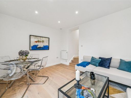 2 bedroom apartment for sale in Northcote Road, London, SW11 — £525,000 • 2 bed • 1 bath • 510 ft²
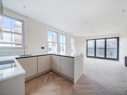 3 bedroom flat for sale in Latchmere Road, Battersea, London, SW11 — £750,000 • 3 bed • 2 bath • 831 ft²
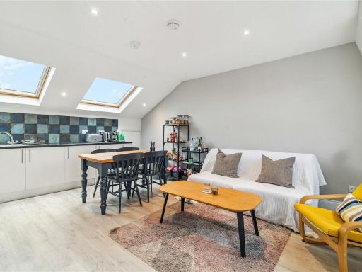 2 bedroom apartment for sale in Northcote Road, London, SW11 — £700,000 • 2 bed • 1 bath • 826 ft²
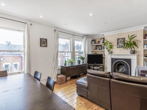 2 bedroom flat for sale in Comyn Road, London, SW11 — £700,000 • 2 bed • 2 bath • 997 ft²
Meta
- {
"@context": "https://schema.org",
"@type": "Residence",
"name": "2 bedroom flat for sale in Northcote Road, London, SW11",
"description": "",
"url": "https://propertypiper.co.uk/property/77218587-47b2-45bd-8ca7-8aea7bd25777",
"image": "https://image-a.propertypiper.co.uk/63342268-fc13-4ed5-b804-d355f80b6287-1024.jpeg",
"address": {
"@type": "PostalAddress",
"streetAddress": "92a, Northcote Road",
"postalCode": "SW11 6QN",
"addressLocality": "Wandsworth",
"addressRegion": "Tooting",
"addressCountry": "England"
},
"geo": {
"@type": "GeoCoordinates",
"latitude": 51.457637064313225,
"longitude": -0.1660930415639566
},
"numberOfRooms": 2,
"numberOfBathroomsTotal": 2,
"floorSize": {
"@type": "QuantitativeValue",
"value": 897,
"unitCode": "FTK"
},
"offers": {
"@type": "Offer",
"price": 795000,
"priceCurrency": "GBP",
"availability": "https://schema.org/InStock"
},
"additionalProperty": [
{
"@type": "PropertyValue",
"name": "Feature",
"value": "modern"
},
{
"@type": "PropertyValue",
"name": "Feature",
"value": "open-plan"
},
{
"@type": "PropertyValue",
"name": "Feature",
"value": "spiral staircase"
},
{
"@type": "PropertyValue",
"name": "Feature",
"value": "contemporary"
},
{
"@type": "PropertyValue",
"name": "Feature",
"value": "kitchen"
},
{
"@type": "PropertyValue",
"name": "Feature",
"value": "living area"
},
{
"@type": "PropertyValue",
"name": "Feature",
"value": "wood flooring"
},
{
"@type": "PropertyValue",
"name": "Feature",
"value": "open layout"
},
{
"@type": "PropertyValue",
"name": "Feature",
"value": "bright"
},
{
"@type": "PropertyValue",
"name": "Feature",
"value": "Victorian terrace"
},
{
"@type": "PropertyValue",
"name": "Feature",
"value": "street view"
},
{
"@type": "PropertyValue",
"name": "Feature",
"value": "residential area"
},
{
"@type": "PropertyValue",
"name": "Feature",
"value": "urban"
},
{
"@type": "PropertyValue",
"name": "Feature",
"value": "corner property"
}
]
}
High Res Floorplan Images
Compatible Floorplan Images
FloorplanImages Thumbnail