SS2 4UX - 2 bedroom flat for sale in Southchurch Boulevard, Southendo…
View on Property Piper
2 bedroom flat for sale in Southchurch Boulevard, Southend-on-sea, SS2
Property Details
- Price: £275000
- Bedrooms: 2
- Bathrooms: 1
- Property Type: undefined
- Property SubType: undefined
Image Descriptions
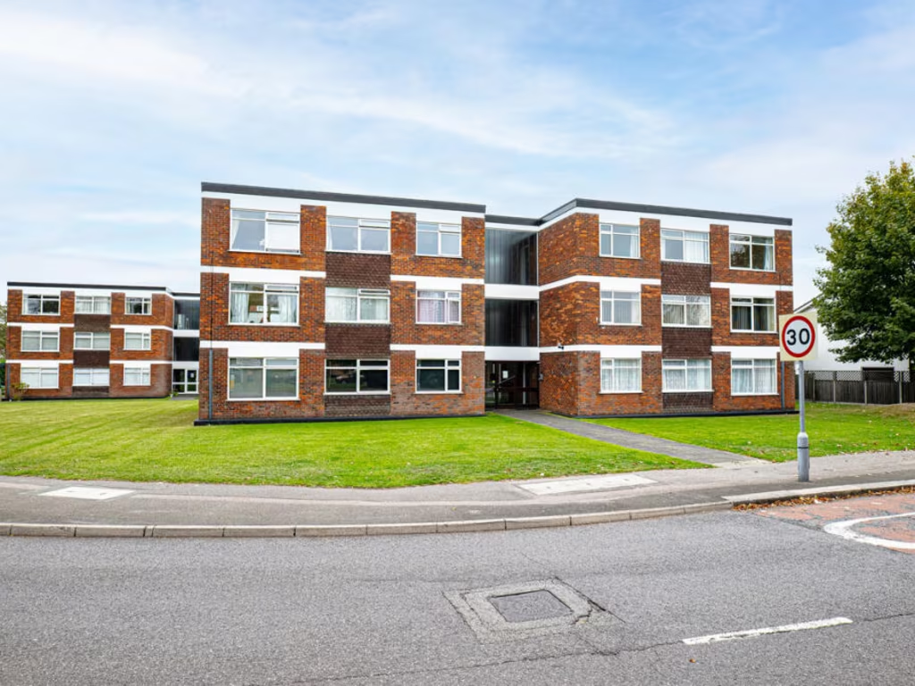
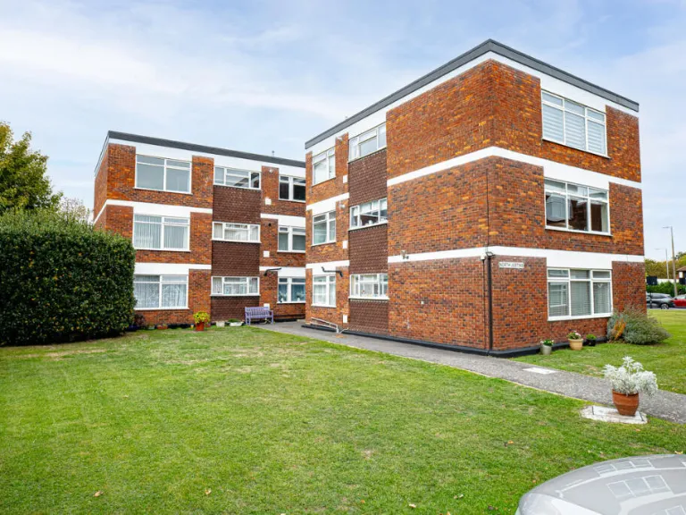
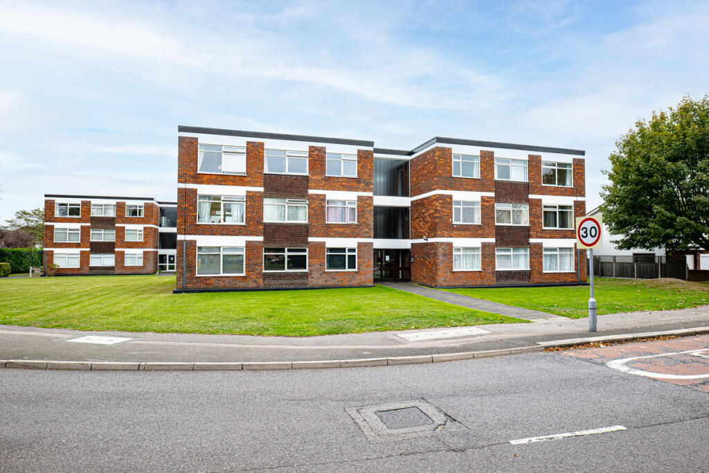
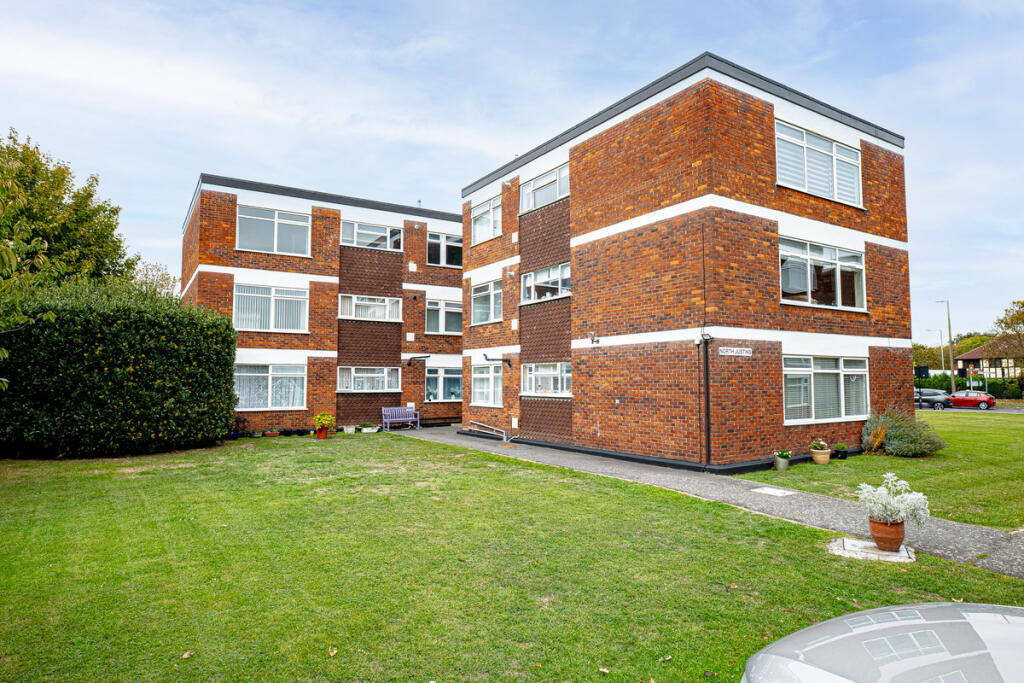
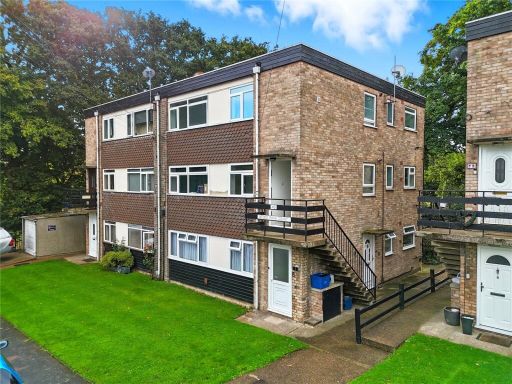
- apartment building Mid-20th Century
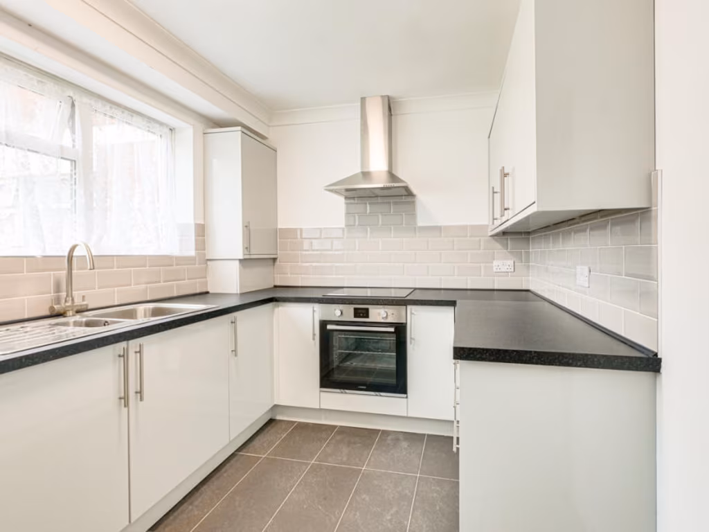
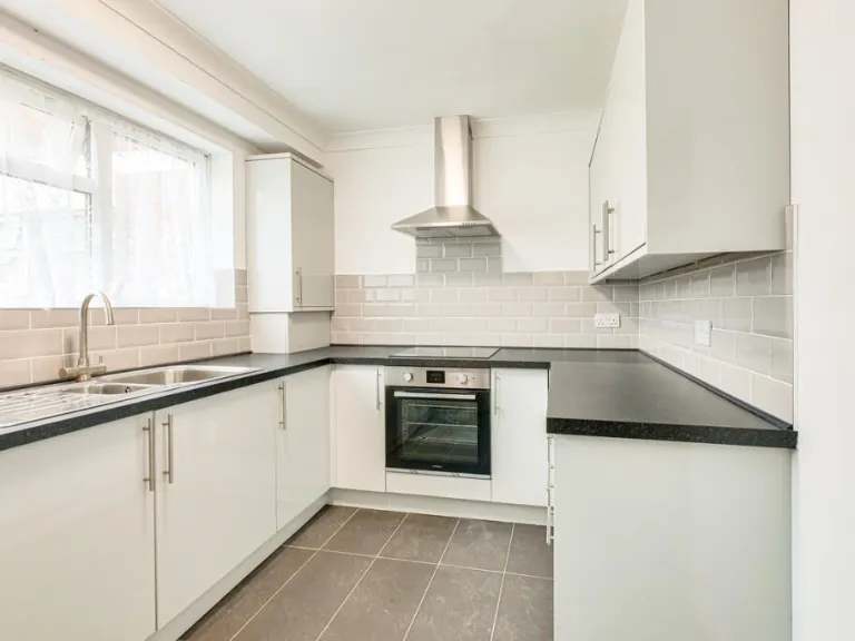
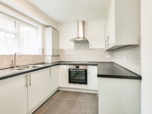
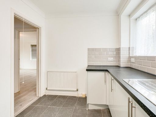
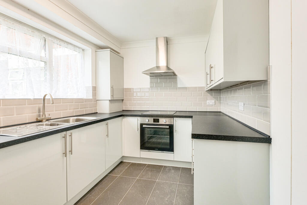
- kitchen modern
Floorplan Description
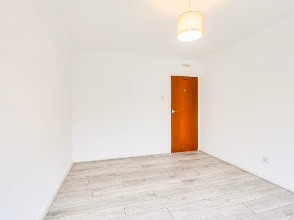
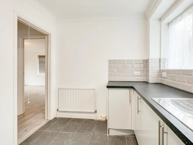
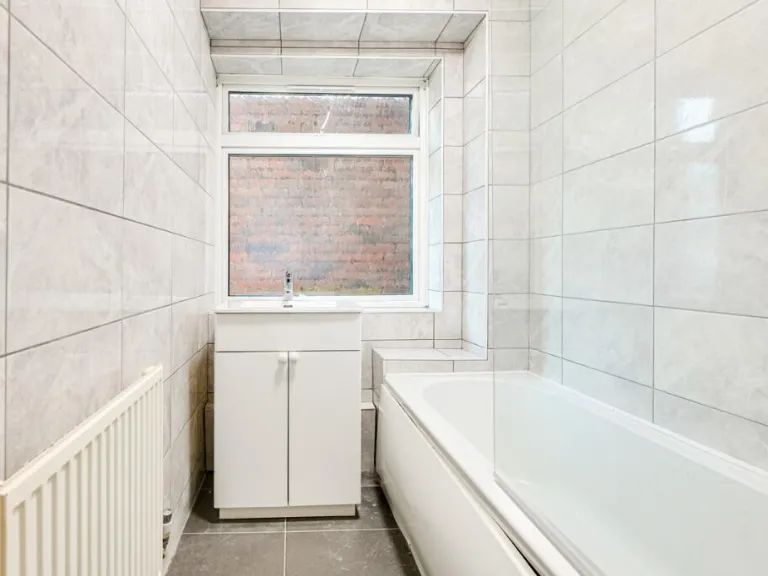
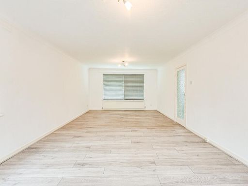
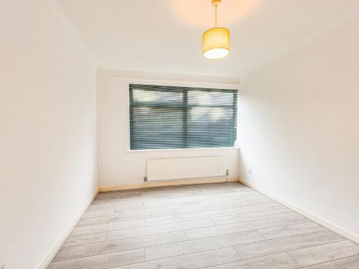
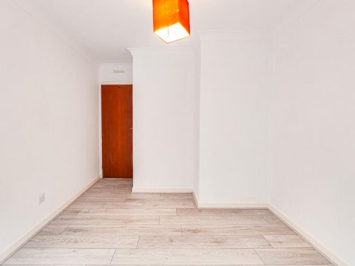
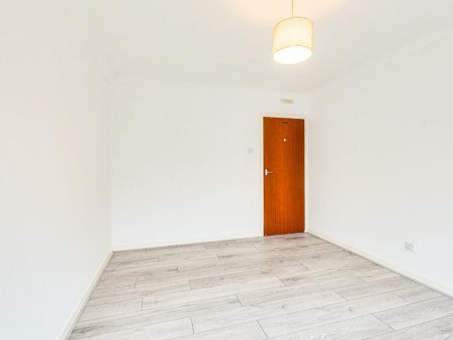
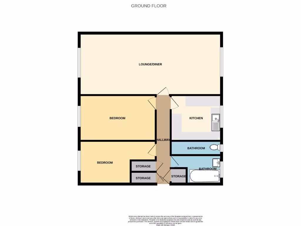
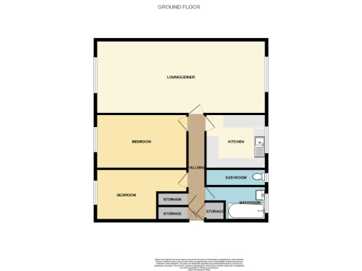
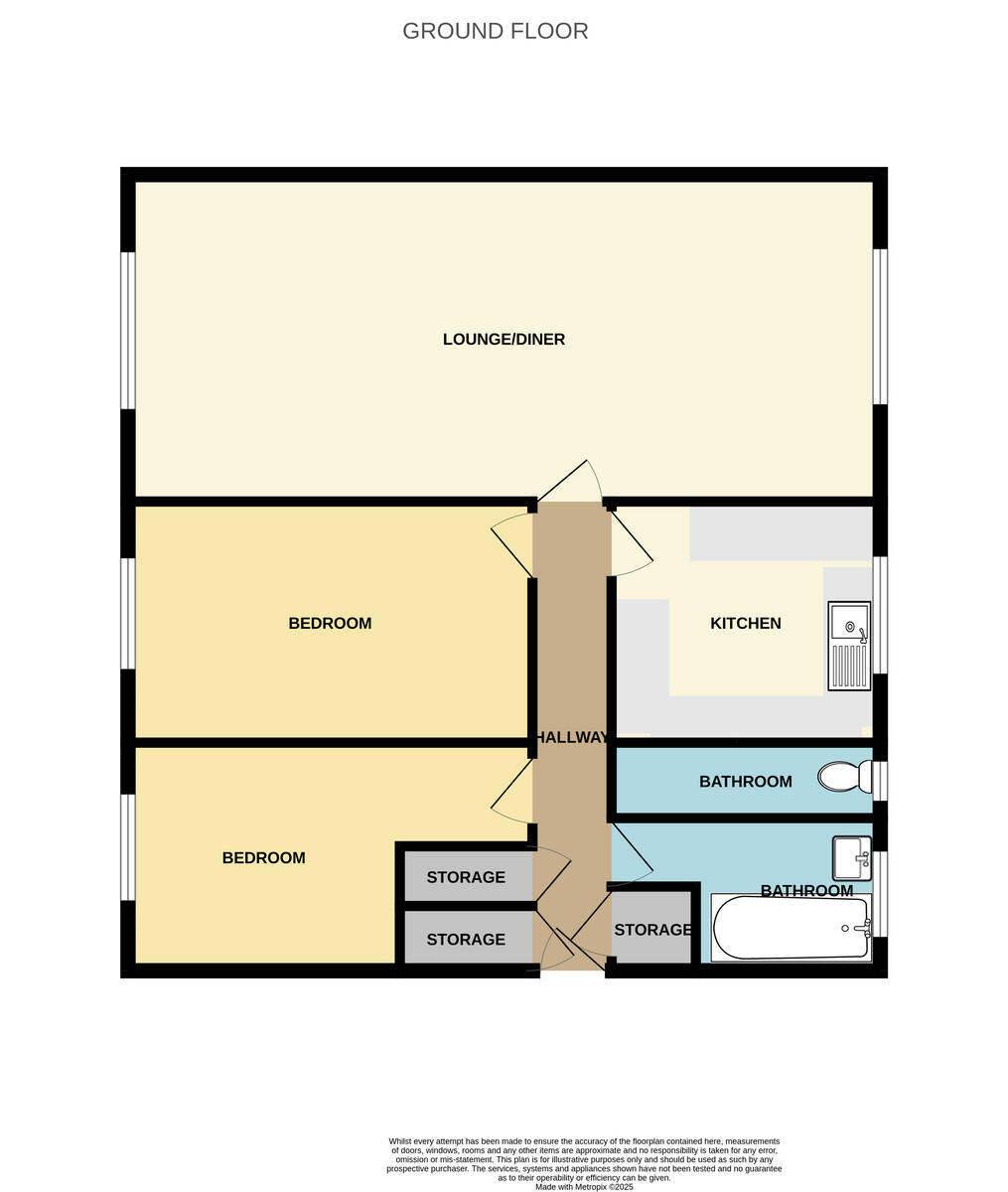
- Ground floor plan showing lounge/diner, two bedrooms, kitchen, hallway, two bathrooms and three storage rooms
Rooms
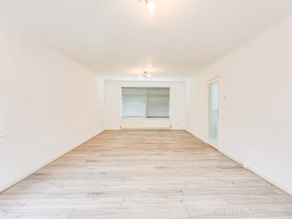
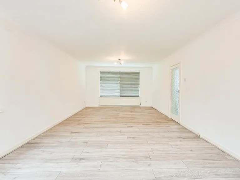
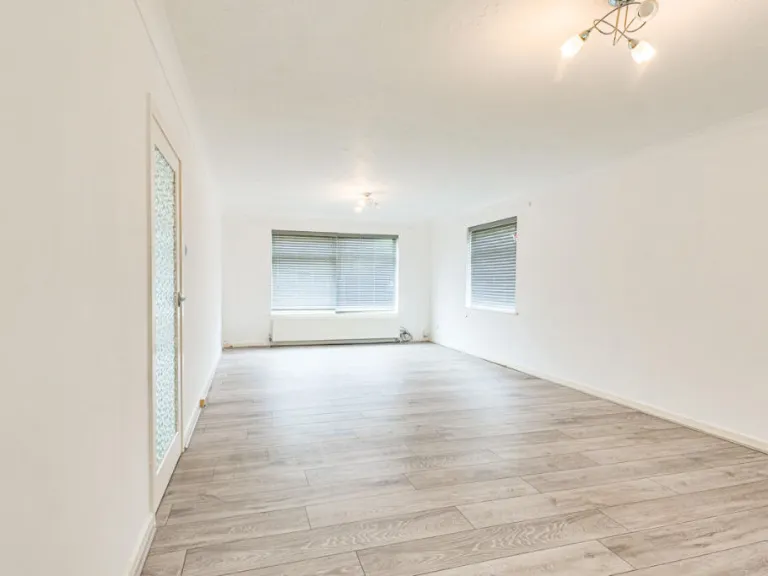
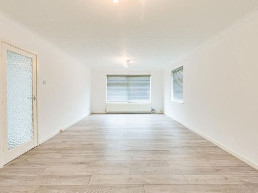
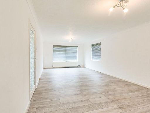
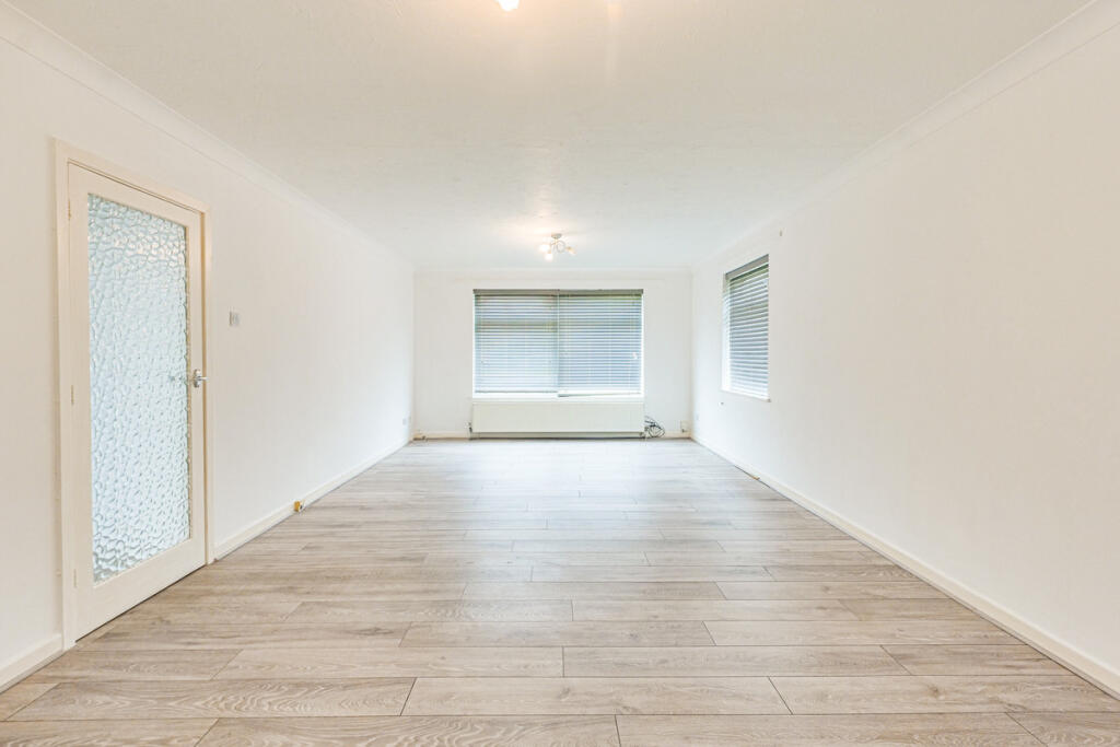
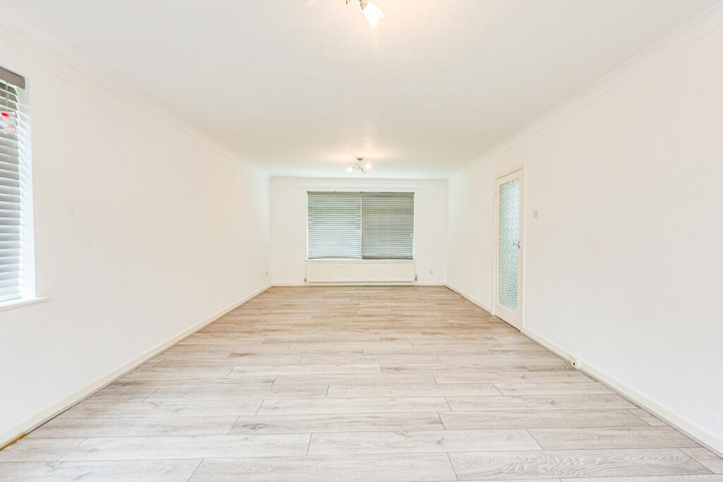
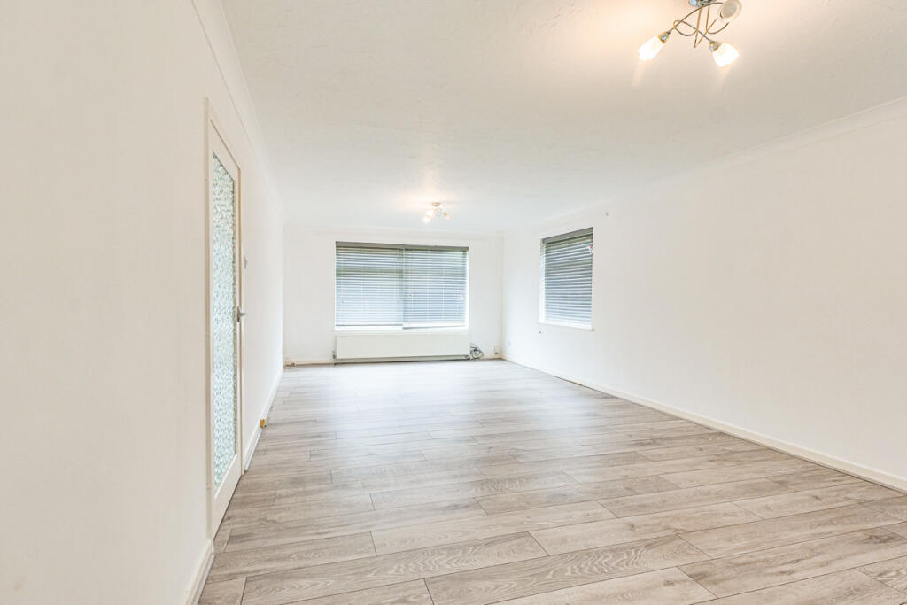
- LOUNGE/DINER:
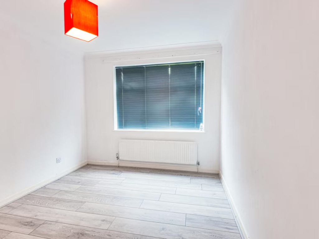
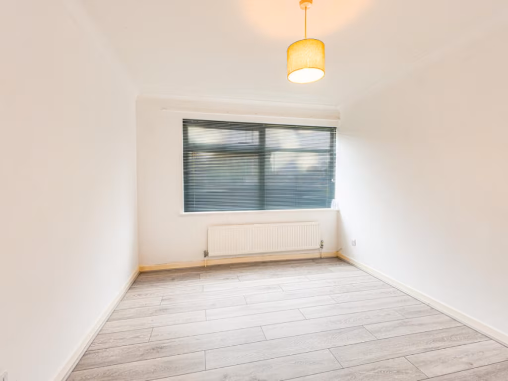
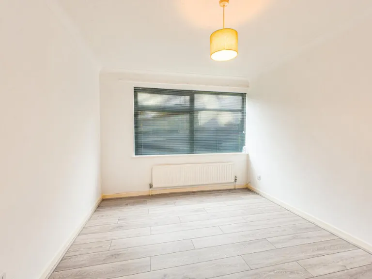
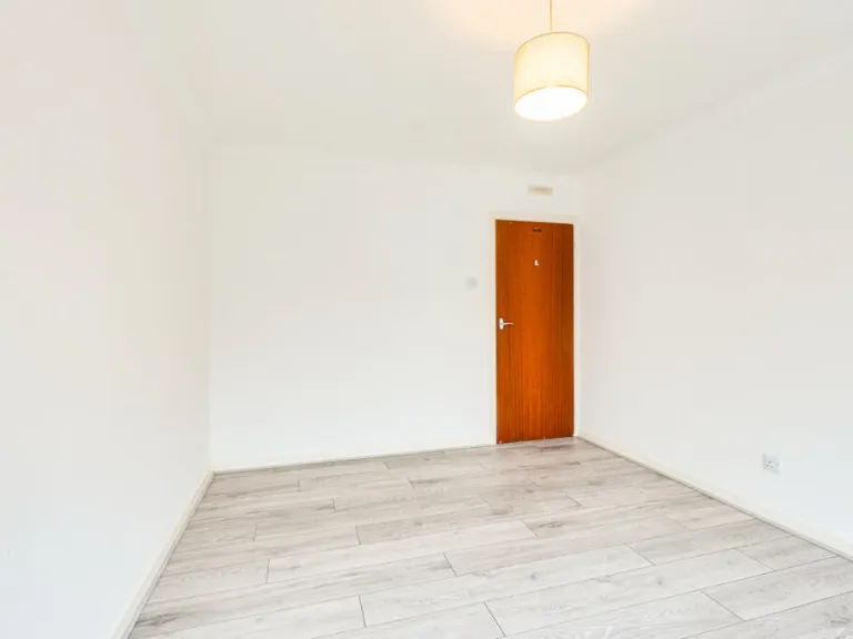
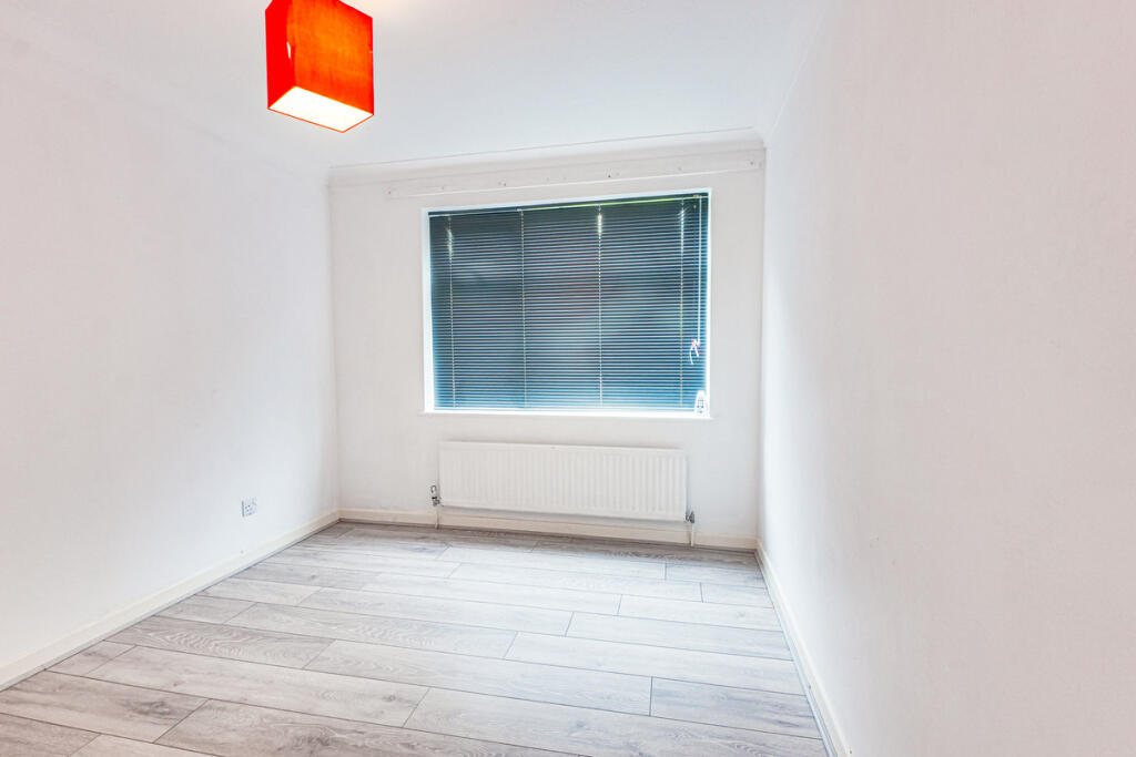
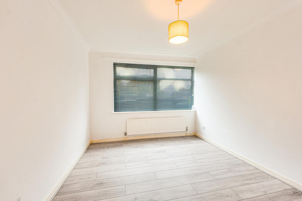
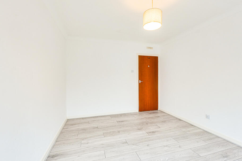
- BEDROOM:
- BEDROOM:
- KITCHEN:
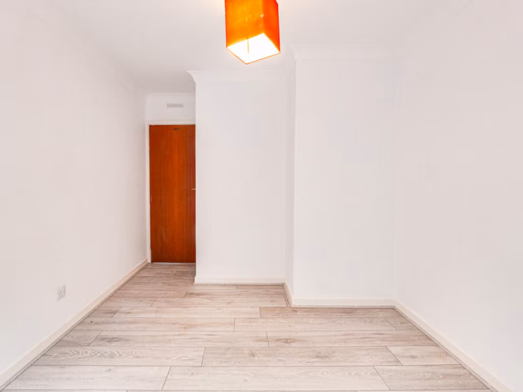
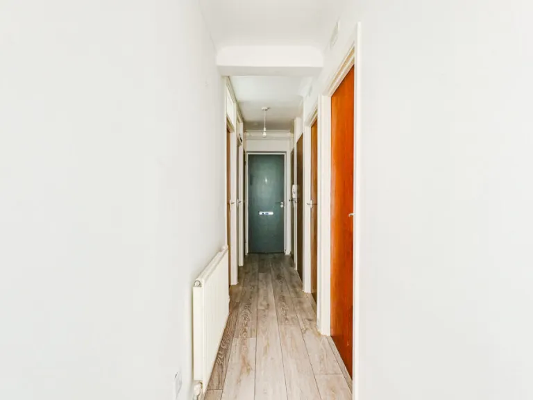
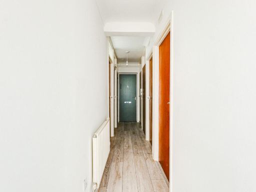
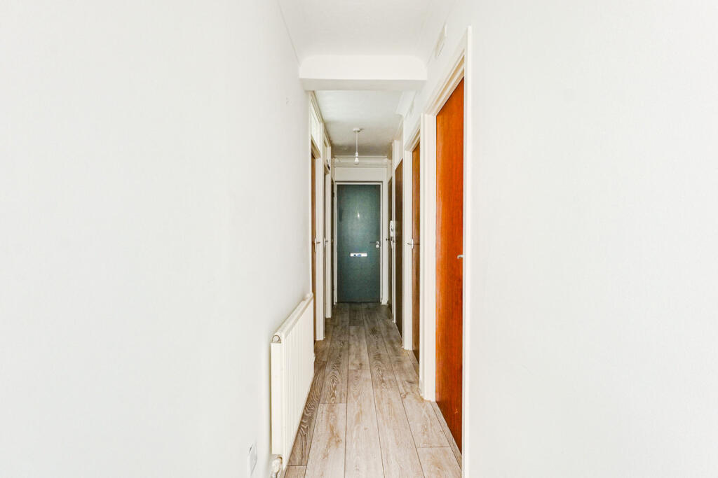
- HALLWAY:
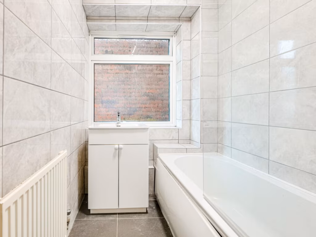
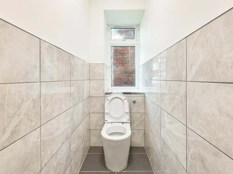
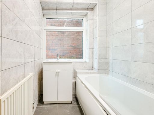
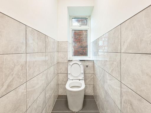
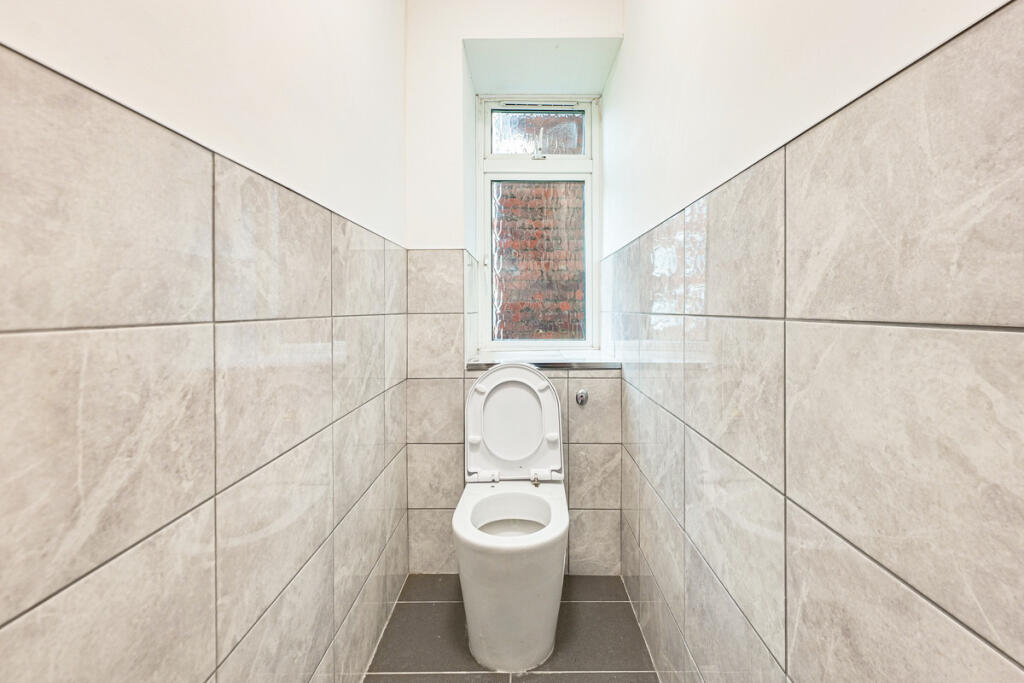
- BATHROOM:
- BATHROOM:
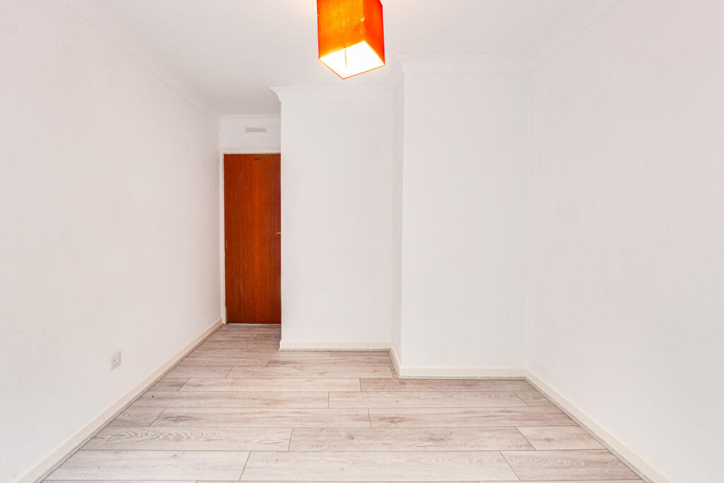
- STORAGE:
- STORAGE:
- STORAGE:
Textual Property Features
Detected Visual Features
- apartment
- brick
- flat
- mid-century
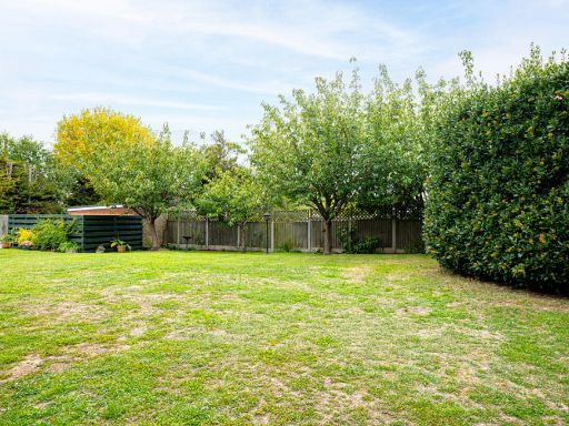
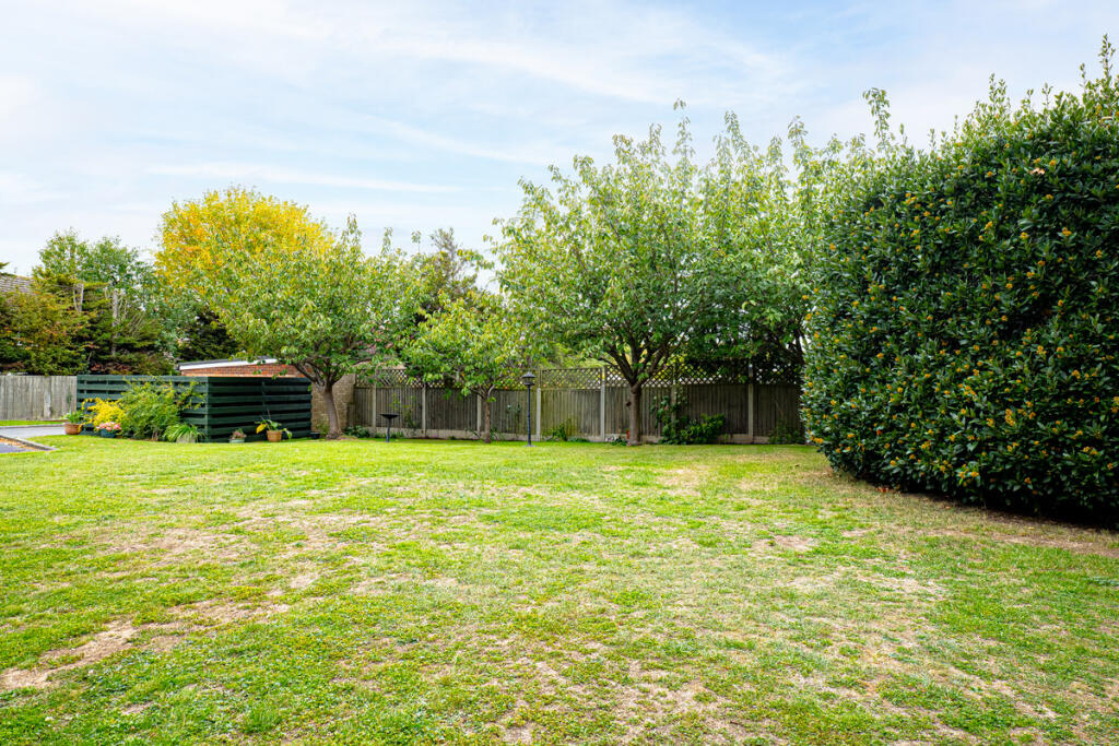
- shared lawn
- communal grounds
- investment property
- maintenance required
- residential
- multiple units
- modern
- kitchen
- white cabinetry
- subway tile backsplash
- stainless steel appliances
- corner positioning
- tile flooring
EPC Details
- Fully double glazed
- Cavity wall, as built, no insulation (assumed)
- Boiler and radiators, mains gas
- Low energy lighting in all fixed outlets
- Suspended, no insulation (assumed)
Nearby Schools
- Porters Grange Primary School and Nursery
- Southchurch High School
- Hamstel Infant School and Nursery
- Thorpe Hall School
- Alleyn Court Preparatory School
- Victory Park Academy
- Shoeburyness High School
- Greenways Primary School
- Friars Primary School and Nursery
- Bournes Green Junior School
- Bournes Green Infant School
- Temple Sutton Primary School
- Great Wakering Primary Academy
- Hinguar Community Primary School
- Richmond Avenue Primary and Nursery School
- Sacred Heart Catholic Primary School
- St Helen's Catholic Primary School
- St Mary's, Prittlewell, CofE Primary School
- Bournemouth Park Academy
- Hamstel Junior School
- Barling Magna Primary Academy
- Thorpedene Primary School
- St George's Catholic Primary School
- Southend High School for Girls
- Southend YMCA Community School
- Cecil Jones Academy
- Stambridge Primary School
Nearest Bars And Restaurants
- Id: 5477421134
- Tags:
- Addr:
- City: Southend-on-Sea
- Housenumber: 781
- Postcode: SS1 2PP
- Street: Southchurch Road
- Amenity: pub
- Name: Mawson's Micropub
- Pub: micropub
- TagsNormalized:
- Lat: 51.5414236
- Lon: 0.7366102
- FullGeoHash: u10t0yb6s38r
- PartitionGeoHash: u10t
- Images:
- FoodStandards: null
- Distance: 1266.1
,- Id: 389684953
- Tags:
- Amenity: pub
- Name: The Rose
- TagsNormalized:
- Lat: 51.5524358
- Lon: 0.7603584
- FullGeoHash: u10t32cdtws6
- PartitionGeoHash: u10t
- Images:
- FoodStandards: null
- Distance: 1049.4
,- Id: 4318505935
- Tags:
- Addr:
- City: Thorpe Bay, Southend-on-Sea
- Housenumber: 132
- Postcode: SS1 3ES
- Street: The Broadway
- Amenity: cafe
- Name: Cafe Ciao
- TagsNormalized:
- Lat: 51.5357046
- Lon: 0.7610507
- FullGeoHash: u10t1mf1jz8s
- PartitionGeoHash: u10t
- Images:
- FoodStandards: null
- Distance: 998.3
,- Id: 4116795163
- Tags:
- Addr:
- Housenumber: 34
- Postcode: SS1 3PA
- Street: Barnstable Road
- Amenity: cafe
- Fhrs:
- Name: Firing Imaginations Pottery Painting Cafe
- Source: survey
- Source:addr: FHRS Open Data
- TagsNormalized:
- Lat: 51.538305
- Lon: 0.7605553
- FullGeoHash: u10t1q3b6hrh
- PartitionGeoHash: u10t
- Images:
- FoodStandards: null
- Distance: 731.6
,- Id: 2910051538
- Tags:
- Amenity: fast_food
- Cuisine: fish_and_chips
- TagsNormalized:
- Lat: 51.5440409
- Lon: 0.7570387
- FullGeoHash: u10t1pr3b38u
- PartitionGeoHash: u10t
- Images:
- FoodStandards: null
- Distance: 176.3
}
Nearest General Shops
- Id: 4116795147
- Tags:
- Addr:
- Housenumber: 42
- Postcode: SS1 3PA
- Street: Barnstable Road
- Dance:
- Leisure: dance
- Name: Just Ballet
- Shop: dance
- Source: survey
- Website: https://www.justballet.co.uk/
- TagsNormalized:
- Lat: 51.5382616
- Lon: 0.7609013
- FullGeoHash: u10t1q604k31
- PartitionGeoHash: u10t
- Images:
- FoodStandards: null
- Distance: 749.4
,- Id: 4116795146
- Tags:
- Addr:
- Housenumber: 40
- Postcode: SS1 3PA
- Street: Barnstable Road
- Name: Silvers
- Shop: hairdresser
- Source: survey
- TagsNormalized:
- Lat: 51.5382783
- Lon: 0.7608047
- FullGeoHash: u10t1q600p3j
- PartitionGeoHash: u10t
- Images:
- FoodStandards: null
- Distance: 744
,- Id: 4116795155
- Tags:
- Addr:
- Housenumber: 36
- Postcode: SS1 3PA
- Street: Barnstable Road
- Shop: beauty
- Source: survey
- TagsNormalized:
- Lat: 51.5382965
- Lon: 0.7606411
- FullGeoHash: u10t1q3bk4z1
- PartitionGeoHash: u10t
- Images:
- FoodStandards: null
- Distance: 735.8
}
Nearest Religious buildings
- Id: 150978215
- Tags:
- Amenity: place_of_worship
- Building: church
- Denomination: anglican
- Name: Holy Trinity, Southchurch
- Religion: christian
- Wikidata: Q17557088
- Wikipedia: en:Holy Trinity Church, Southchurch
- TagsNormalized:
- place of worship
- church
- anglican
- christian
- Lat: 51.5417666
- Lon: 0.7410324
- FullGeoHash: u10t0ygse39v
- PartitionGeoHash: u10t
- Images:
- FoodStandards: null
- Distance: 959.2
,- Id: 543990615
- Tags:
- Addr:
- City: Southend On Sea
- Postcode: SS2 4WA
- Street: Whittingham Avenue
- Amenity: place_of_worship
- Building: church
- Denomination: methodist
- Name: United Methodist Church
- Religion: christian
- TagsNormalized:
- place of worship
- church
- methodist
- christian
- Lat: 51.5468598
- Lon: 0.7420165
- FullGeoHash: u10t0zu64ppe
- PartitionGeoHash: u10t
- Images:
- FoodStandards: null
- Distance: 934
,- Id: 297519750
- Tags:
- Addr:
- Amenity: school
- Capacity: 840
- Isced:
- Max_age: 16
- Min_age: 11
- Name: Southchurch High School
- Phone: +44 1702 900777
- Ref:
- Ref:edubase:group: 5485
- Religion: none
- School:
- Boarding: no
- Gender: mixed
- Selective: no
- Trust: yes
- Type: academy
- School:trust:name: Partnership Learning
- School:trust:type: multi_academy
- Source:
- Addr:
- Postcode: get-information-schools.service.gov.uk
- Website: http://www.southchurchschool.com/
- Wikidata: Q5510884
- Wikipedia: en:Southchurch High School
- TagsNormalized:
- Lat: 51.541082
- Lon: 0.7494686
- FullGeoHash: u10t1nc8xfh3
- PartitionGeoHash: u10t
- Images:
- FoodStandards: null
- Distance: 457.2
}
Nearest Medical buildings
- Id: 902053803
- Tags:
- Amenity: hospital
- Healthcare: hospital
- Name: Wellesley Hospital
- Operator: Spire Healthcare
- Ref:
- Website: https://www.spirehealthcare.com/spire-wellesley-hospital/
- Wheelchair: yes
- TagsNormalized:
- Lat: 51.5541559
- Lon: 0.7272361
- FullGeoHash: u10t291s9z4w
- PartitionGeoHash: u10t
- Images:
- FoodStandards: null
- Distance: 2216.3
,- Id: 7494280719
- Tags:
- Amenity: pharmacy
- Brand: Asda
- Brand:wikidata: Q297410
- Brand:wikipedia: en:Asda
- Contact:
- Phone: +44 1702 382510
- Website: https://storelocator.asda.com/east-of-england/shoeburyness/north-shoebury-road/pharmacy
- Dispensing: yes
- Drive_through: no
- Fixme: Location not accurate
- Healthcare: pharmacy
- Name: Asda
- Opening_hours:
- Covid19: Mo-We, Sa 08:30-20:00; Th 08:30-21:00; Fr 09:00-18:00; Su 10:00-16:00
- Operator: Asda Stores Ltd
- TagsNormalized:
- pharmacy
- asda
- health
- healthcare
- Lat: 51.5391787
- Lon: 0.7811826
- FullGeoHash: u10t1y2v6z7b
- PartitionGeoHash: u10t
- Images:
- FoodStandards: null
- Distance: 1910.3
,- Id: 265088711
- Tags:
- Amenity: dentist
- Building: yes
- Healthcare: dentist
- TagsNormalized:
- Lat: 51.5307397
- Lon: 0.7462806
- FullGeoHash: u10t0uzkmd55
- PartitionGeoHash: u10t
- Images:
- FoodStandards: null
- Distance: 1552.2
,- Id: 1782979609
- Tags:
- Amenity: clinic
- Healthcare: clinic
- Name: Thorpdene clinic
- TagsNormalized:
- Lat: 51.5360184
- Lon: 0.7693859
- FullGeoHash: u10t1tb5pfps
- PartitionGeoHash: u10t
- Images:
- FoodStandards: null
- Distance: 1336.8
}
Nearest Airports
- Id: 103894219
- Tags:
- Aerodrome: international
- Aeroway: aerodrome
- Iata: SEN
- Icao: EGMC
- Name: London Southend Airport
- Old_name: Southend Municipal Airport
- Ref: SEN
- Wikidata: Q1415441
- TagsNormalized:
- airport
- international airport
- Lat: 51.5701749
- Lon: 0.6924624
- FullGeoHash: u10mru04p937
- PartitionGeoHash: u10m
- Images:
- FoodStandards: null
- Distance: 5203.3
}
Nearest Leisure Facilities
- Id: 390255686
- Tags:
- Leisure: park
- Name: Bournes Green Park
- TagsNormalized:
- Lat: 51.547218
- Lon: 0.7446457
- FullGeoHash: u10t0zyhr9bh
- PartitionGeoHash: u10t
- Images:
- FoodStandards: null
- Distance: 787.3
,- Id: 604983543
- Tags:
- Leisure: pitch
- Sport: basketball
- TagsNormalized:
- pitch
- leisure
- basketball
- sports
- Lat: 51.5497711
- Lon: 0.7599202
- FullGeoHash: u10t32375mvd
- PartitionGeoHash: u10t
- Images:
- FoodStandards: null
- Distance: 768.9
,- Id: 409805481
- Tags:
- Leisure: park
- Source: Bing
- TagsNormalized:
- Lat: 51.5385468
- Lon: 0.7619099
- FullGeoHash: u10t1q6ccc3n
- PartitionGeoHash: u10t
- Images:
- FoodStandards: null
- Distance: 768.3
,- Id: 604983544
- Tags:
- Leisure: pitch
- Sport: cricket
- TagsNormalized:
- pitch
- leisure
- cricket
- sports
- Lat: 51.5494906
- Lon: 0.7597223
- FullGeoHash: u10t3231wcd1
- PartitionGeoHash: u10t
- Images:
- FoodStandards: null
- Distance: 735
,- Id: 286410248
- Tags:
- Leisure: pitch
- Name: Southend Lawn Tennis Club
- Pitch:
- Source: Bing
- Source:name: survey
- Sport: tennis
- TagsNormalized:
- pitch
- leisure
- tennis
- club
- sports
- Lat: 51.5411569
- Lon: 0.7587146
- FullGeoHash: u10t1qb3p248
- PartitionGeoHash: u10t
- Images:
- FoodStandards: null
- Distance: 405.4
}
Nearest Tourist attractions
- Id: 106524886
- Tags:
- Area: yes
- Name: Adventure Island Pleasure Park
- Tourism: theme_park
- Wikidata: Q169442
- Wikipedia: en:Adventure Island (amusement park)
- TagsNormalized:
- Lat: 51.5326767
- Lon: 0.7161068
- FullGeoHash: u10t0m1rw7py
- PartitionGeoHash: u10t
- Images:
- FoodStandards: null
- Distance: 2928.2
,- Id: 1325660877
- Tags:
- Barrier: entrance
- Name: Southend Pier Entrance
- Tourism: attraction
- Wheelchair: yes
- Wikidata: Q6273174
- Wikipedia: en:Southend Pier
- TagsNormalized:
- Lat: 51.5331363
- Lon: 0.7157882
- FullGeoHash: u10t0m34r0fk
- PartitionGeoHash: u10t
- Images:
- FoodStandards: null
- Distance: 2927.2
,- Id: 117690305
- Tags:
- Building: yes
- Name: Sea Life Adventure Aquarium
- Tourism: aquarium
- TagsNormalized:
- Lat: 51.5316759
- Lon: 0.7260765
- FullGeoHash: u10t0t09yb9u
- PartitionGeoHash: u10t
- Images:
- FoodStandards: null
- Distance: 2381
}
Nearest Train stations
- Id: 6733461093
- Tags:
- Name: Southend Central
- Naptan:
- Network: National Rail
- Public_transport: station
- Railway: station
- Ref:
- Wikidata: Q593051
- Wikipedia: en:Southend Central railway station
- TagsNormalized:
- Lat: 51.5373587
- Lon: 0.7116503
- FullGeoHash: u10t0nn4yeuz
- PartitionGeoHash: u10t
- Images:
- FoodStandards: null
- Distance: 3049.5
,- Id: 7140234411
- Tags:
- Addr:
- Name: Southend Victoria
- Naptan:
- Network: National Rail
- Public_transport: station
- Railway: station
- Ref:
- Website: http://www.nationalrail.co.uk/stations/sov/details.html
- Wikidata: Q3254036
- Wikipedia: en:Southend Victoria railway station
- TagsNormalized:
- Lat: 51.5429361
- Lon: 0.7114814
- FullGeoHash: u10t0pn56ewy
- PartitionGeoHash: u10t
- Images:
- FoodStandards: null
- Distance: 2979.1
,- Id: 316787076
- Tags:
- Layer: 1
- Name: Shore
- Public_transport: station
- Railway: station
- Tourism: light_railway
- Train: yes
- Usage: tourism
- Wheelchair: yes
- Wikidata: Q23018785
- Wikipedia: en:Shore railway station
- TagsNormalized:
- station
- railway
- tourism
- train
- Lat: 51.5326972
- Lon: 0.7158518
- FullGeoHash: u10t0m1r8x1b
- PartitionGeoHash: u10t
- Images:
- FoodStandards: null
- Distance: 2943.2
,- Id: 6733461091
- Tags:
- Name: Southend East
- Naptan:
- Network: National Rail
- Public_transport: station
- Railway: station
- Ref:
- Train: yes
- Wikidata: Q2311959
- Wikipedia: en:Southend East railway station
- TagsNormalized:
- Lat: 51.5389057
- Lon: 0.73149
- FullGeoHash: u10t0wkeuuq7
- PartitionGeoHash: u10t
- Images:
- FoodStandards: null
- Distance: 1681.7
,- Id: 6733461092
- Tags:
- Name: Thorpe Bay
- Naptan:
- Network: National Rail
- Operator: C2C
- Public_transport: station
- Railway: station
- Ref:
- Wikidata: Q7796686
- Wikipedia: en:Thorpe Bay railway station
- TagsNormalized:
- Lat: 51.5376596
- Lon: 0.7619363
- FullGeoHash: u10t1q4udkhf
- PartitionGeoHash: u10t
- Images:
- FoodStandards: null
- Distance: 845.8
}
Nearest Bus stations and stops
- Id: 7726598453
- Tags:
- Highway: bus_stop
- Name: LA Fitness
- Naptan:
- AtcoCode: 15800086
- NaptanCode: soadajdt
- Verified: no
- Public_transport: platform
- Source: naptan
- TagsNormalized:
- Lat: 51.5444101
- Lon: 0.7581037
- FullGeoHash: u10t1r25cn7n
- PartitionGeoHash: u10t
- Images:
- FoodStandards: null
- Distance: 258
,- Id: 7726155145
- Tags:
- Bus: yes
- Highway: bus_stop
- Name: LA Fitness
- Naptan:
- AtcoCode: 15800092
- NaptanCode: soadgtma
- Verified: no
- Public_transport: platform
- Source: naptan
- TagsNormalized:
- Lat: 51.5453212
- Lon: 0.7572212
- FullGeoHash: u10t1px3k831
- PartitionGeoHash: u10t
- Images:
- FoodStandards: null
- Distance: 257
,- Id: 7726094234
- Tags:
- Bus: yes
- Highway: bus_stop
- Name: Bournes Green Roundabout
- Naptan:
- AtcoCode: 15800102
- NaptanCode: soadapjd
- Verified: no
- Public_transport: platform
- Source: naptan
- TagsNormalized:
- Lat: 51.5435278
- Lon: 0.7556067
- FullGeoHash: u10t1pnnycvp
- PartitionGeoHash: u10t
- Images:
- FoodStandards: null
- Distance: 76.6
,- Id: 7726155155
- Tags:
- Bus: yes
- Highway: bus_stop
- Name: Bournes Green Roundabout
- Naptan:
- AtcoCode: 15800087
- NaptanCode: soadgamj
- Verified: no
- Public_transport: platform
- Source: naptan
- TagsNormalized:
- Lat: 51.5440944
- Lon: 0.7539305
- FullGeoHash: u10t1pkfpge7
- PartitionGeoHash: u10t
- Images:
- FoodStandards: null
- Distance: 59.5
,- Id: 1831472048
- Tags:
- Bus: yes
- Highway: bus_stop
- Name: Bournes Green Roundabout
- Naptan:
- AtcoCode: 15800103
- NaptanCode: soadajmt
- Verified: no
- Public_transport: platform
- Source: naptan
- TagsNormalized:
- Lat: 51.5438513
- Lon: 0.754165
- FullGeoHash: u10t1pm0tq61
- PartitionGeoHash: u10t
- Images:
- FoodStandards: null
- Distance: 30
}
Nearest Hotels
- Id: 10702746514
- Tags:
- Name: The Hope Hotel
- Phone: 0172467413
- Tourism: hotel
- TagsNormalized:
- Lat: 51.533068
- Lon: 0.7203636
- FullGeoHash: u10t0mk9csnh
- PartitionGeoHash: u10t
- Images:
- FoodStandards: null
- Distance: 2644
,- Id: 265088714
- Tags:
- Brand: Premier Inn
- Brand:wikidata: Q2108626
- Brand:wikipedia: en:Premier Inn
- Building: yes
- Internet_access: wlan
- Internet_access:fee: customers
- Internet_access:operator: Virgin Media
- Internet_access:ssid: Premier Inn Free Wi-Fi
- Name: Premier Inn
- Operator: Premier Inn
- Tourism: hotel
- TagsNormalized:
- Lat: 51.5309621
- Lon: 0.745049
- FullGeoHash: u10t0uyt8gsf
- PartitionGeoHash: u10t
- Images:
- FoodStandards: null
- Distance: 1563.1
,- Id: 179649631
- Tags:
- Addr:
- Housenumber: 10-12
- Postcode: SS1 3BG
- Street: Thorpe Bay Esplanade
- Amenity: restaurant
- Building: yes
- Name: Roslin Beach Hotel
- Phone: +44 1702 586 375
- Tourism: hotel
- Website: https://www.roslinhotel.com/
- TagsNormalized:
- restaurant
- beach
- hotel
- tourism
- Lat: 51.5302967
- Lon: 0.7480217
- FullGeoHash: u10t1hb9wpt3
- PartitionGeoHash: u10t
- Images:
- FoodStandards: null
- Distance: 1559.1
}
Tags
- apartment
- brick
- flat
- mid-century
- shared lawn
- communal grounds
- investment property
- maintenance required
- residential
- multiple units
- modern
- kitchen
- white cabinetry
- subway tile backsplash
- stainless steel appliances
- corner positioning
- tile flooring
Local Market Stats
- Average Price/sqft: £329
- Avg Income: £41100
- Rental Yield: 4.5%
- Social Housing: 15%
- Planning Success Rate: 21%
Similar Properties
 2 bedroom apartment for sale in St. Lawrence Gardens, Leigh-on-Sea, Essex, SS9 — £200,000 • 2 bed • 1 bath • 671 ft²
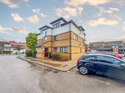 2 bedroom flat for sale in Rectory Road, Rochford, SS4 — £200,000 • 2 bed • 1 bath • 465 ft²
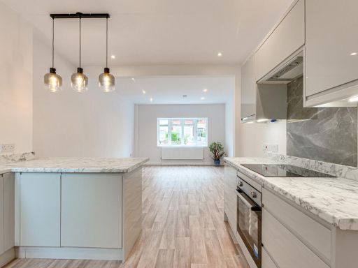 2 bedroom flat for sale in Pall Mall, Leigh-on-sea, SS9 — £300,000 • 2 bed • 1 bath • 636 ft²
 2 bedroom flat for sale in 122 Rayleigh Road, Westwood Lodge, SS7 — £230,000 • 2 bed • 1 bath • 710 ft²
 2 bedroom flat for sale in Cranley Road, Westcliff-On-Sea, SS0 — £260,000 • 2 bed • 1 bath • 570 ft²
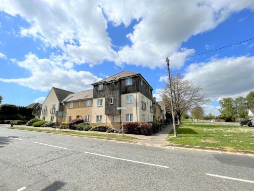 2 bedroom flat for sale in Prince Avenue, Westcliff-On-Sea, Essex, SS0 — £270,000 • 2 bed • 2 bath • 652 ft²
Meta
- {
"@context": "https://schema.org",
"@type": "Residence",
"name": "2 bedroom flat for sale in Southchurch Boulevard, Southendo…",
"description": "",
"url": "https://propertypiper.co.uk/property/762e224e-2e2d-4cf8-938c-83a3b42bf9b5",
"image": "https://image-a.propertypiper.co.uk/84d21eb7-cc2a-4622-9f5c-c889f904ba8a-1024.jpeg",
"address": {
"@type": "PostalAddress",
"streetAddress": "NORTH JUSTINS FLAT 4 SOUTHCHURCH BOULEVARD SOUTHEND-ON-SEA",
"postalCode": "SS2 4UX",
"addressLocality": "Southend-on-Sea",
"addressRegion": "Rochford and Southend East",
"addressCountry": "England"
},
"geo": {
"@type": "GeoCoordinates",
"latitude": 51.54371857859329,
"longitude": 0.7545424323738137
},
"numberOfRooms": 2,
"numberOfBathroomsTotal": 1,
"offers": {
"@type": "Offer",
"price": 275000,
"priceCurrency": "GBP",
"availability": "https://schema.org/InStock"
},
"additionalProperty": [
{
"@type": "PropertyValue",
"name": "Feature",
"value": "apartment"
},
{
"@type": "PropertyValue",
"name": "Feature",
"value": "brick"
},
{
"@type": "PropertyValue",
"name": "Feature",
"value": "flat"
},
{
"@type": "PropertyValue",
"name": "Feature",
"value": "mid-century"
},
{
"@type": "PropertyValue",
"name": "Feature",
"value": "shared lawn"
},
{
"@type": "PropertyValue",
"name": "Feature",
"value": "communal grounds"
},
{
"@type": "PropertyValue",
"name": "Feature",
"value": "investment property"
},
{
"@type": "PropertyValue",
"name": "Feature",
"value": "maintenance required"
},
{
"@type": "PropertyValue",
"name": "Feature",
"value": "residential"
},
{
"@type": "PropertyValue",
"name": "Feature",
"value": "multiple units"
},
{
"@type": "PropertyValue",
"name": "Feature",
"value": "modern"
},
{
"@type": "PropertyValue",
"name": "Feature",
"value": "kitchen"
},
{
"@type": "PropertyValue",
"name": "Feature",
"value": "white cabinetry"
},
{
"@type": "PropertyValue",
"name": "Feature",
"value": "subway tile backsplash"
},
{
"@type": "PropertyValue",
"name": "Feature",
"value": "stainless steel appliances"
},
{
"@type": "PropertyValue",
"name": "Feature",
"value": "corner positioning"
},
{
"@type": "PropertyValue",
"name": "Feature",
"value": "tile flooring"
}
]
}
High Res Floorplan Images
Compatible Floorplan Images
FloorplanImages Thumbnail