BN8 4FA - 5 bedroom detached house for sale in Mantell Close, Newick,…
View on Property Piper
5 bedroom detached house for sale in Mantell Close, Newick, BN8
Property Details
- Price: £975000
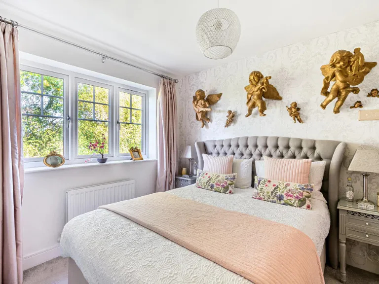
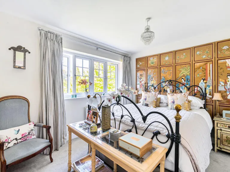
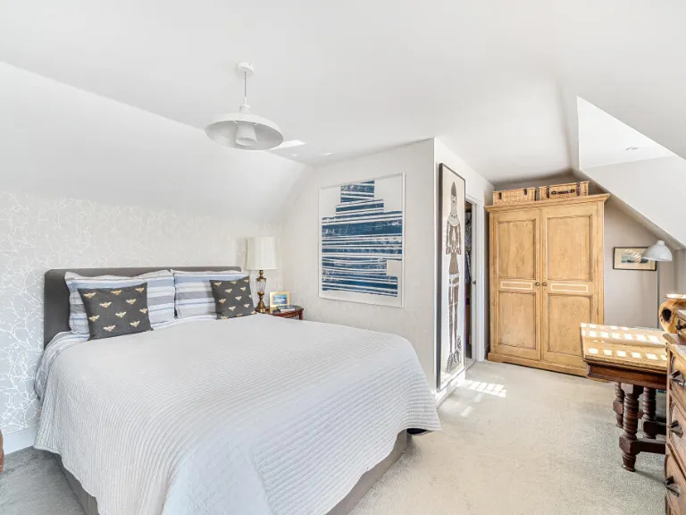
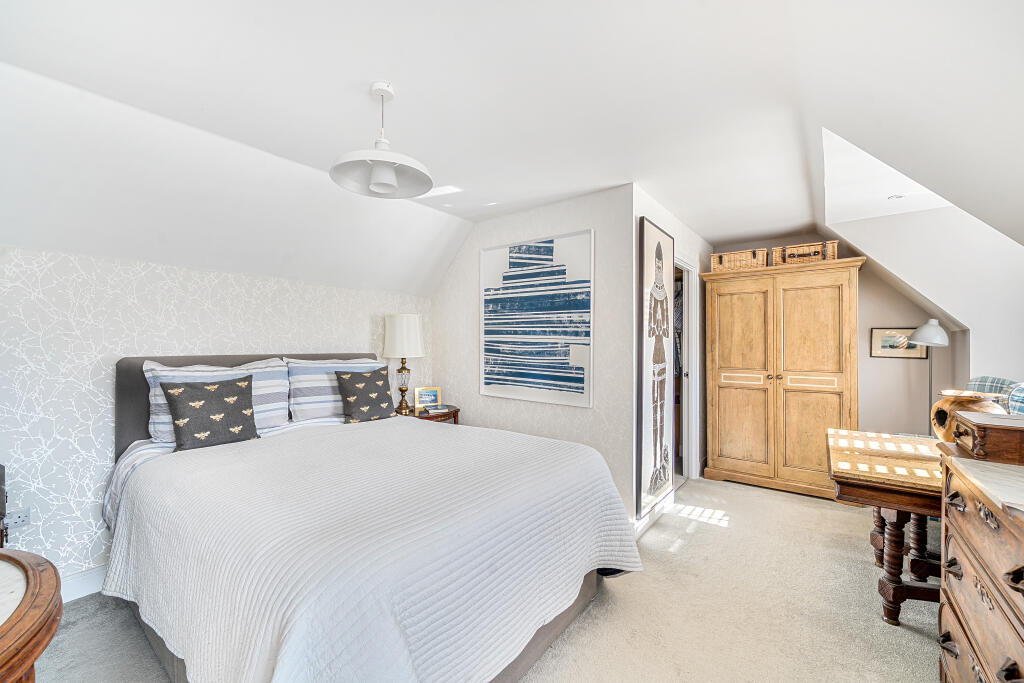
- Bedrooms: 5
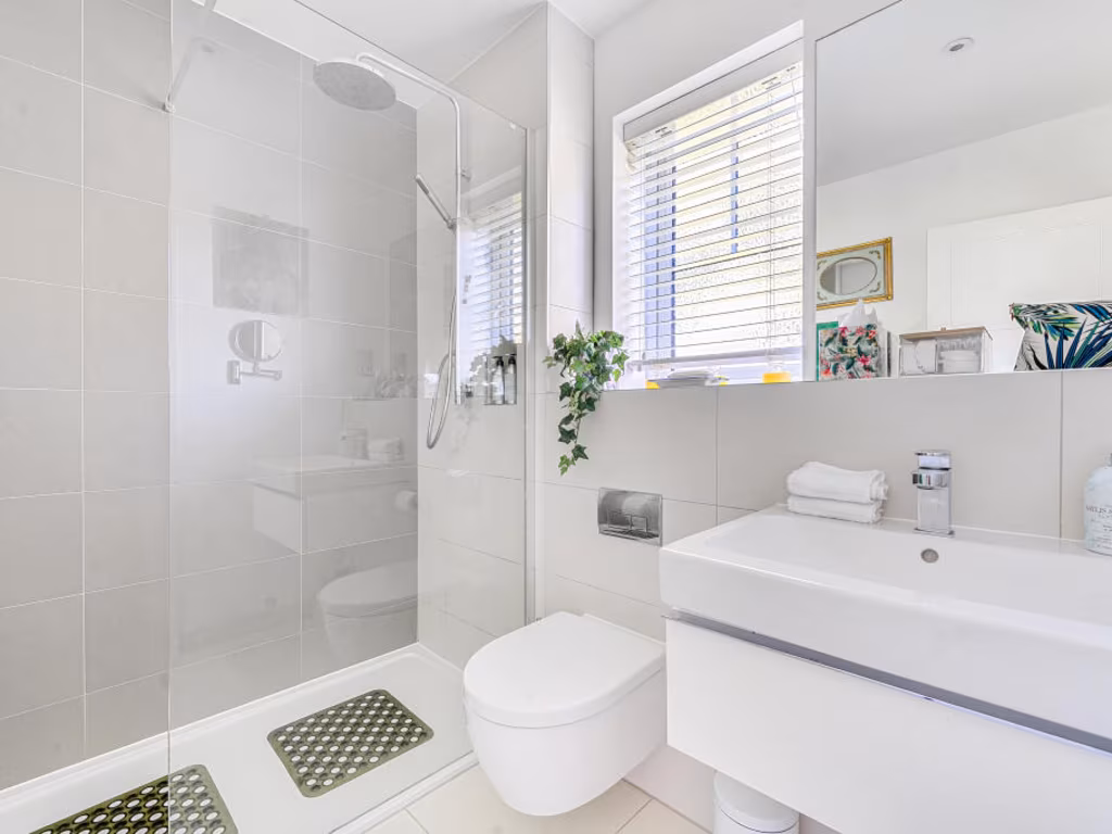
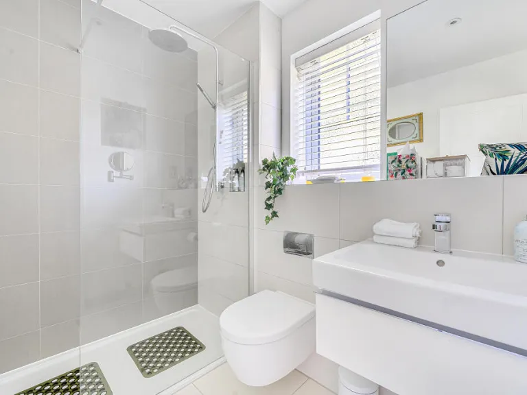
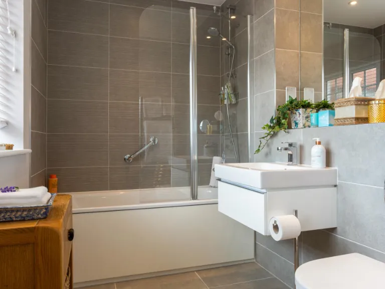
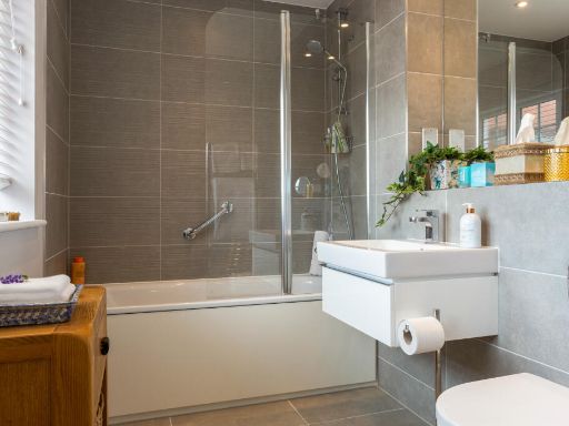
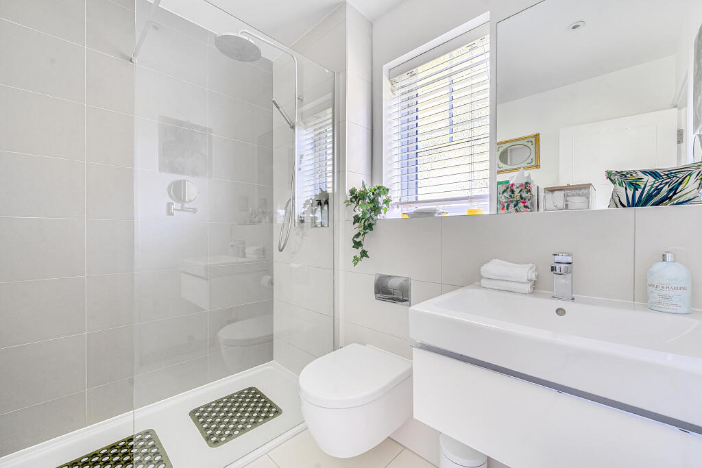
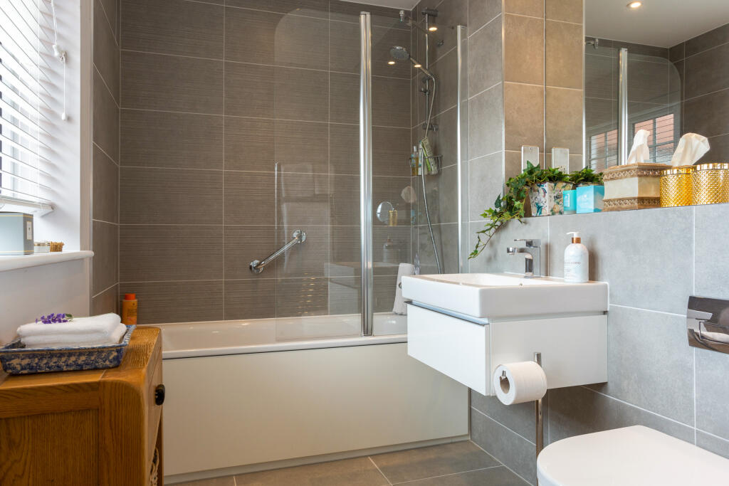
- Bathrooms: 4
- Property Type: undefined
- Property SubType: undefined
Image Descriptions
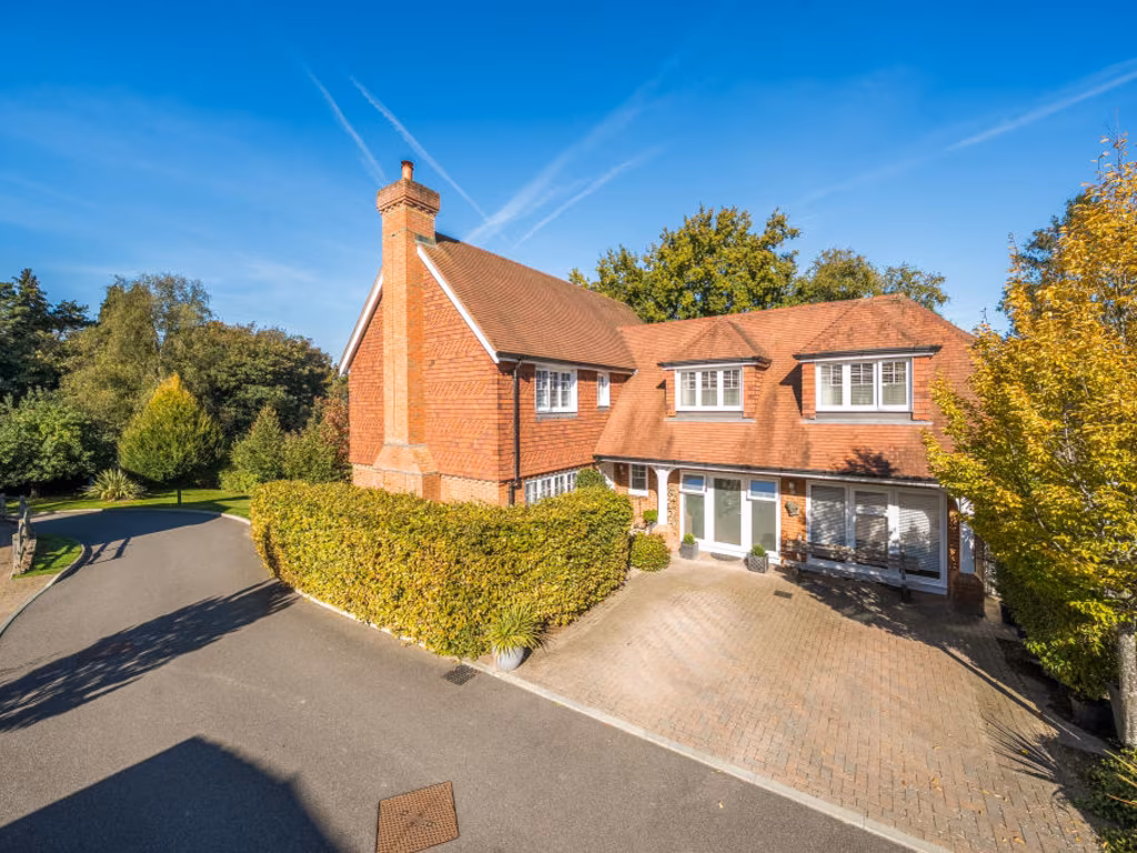
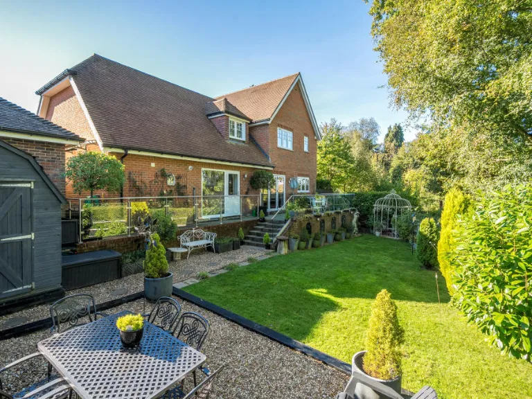
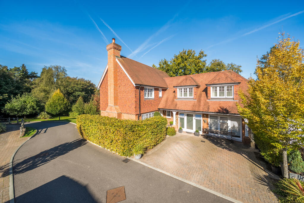
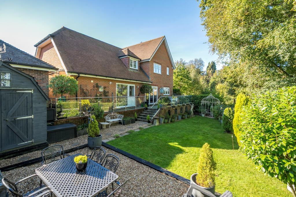
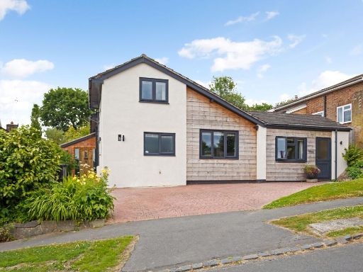
- detached house modern
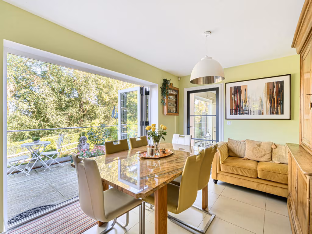
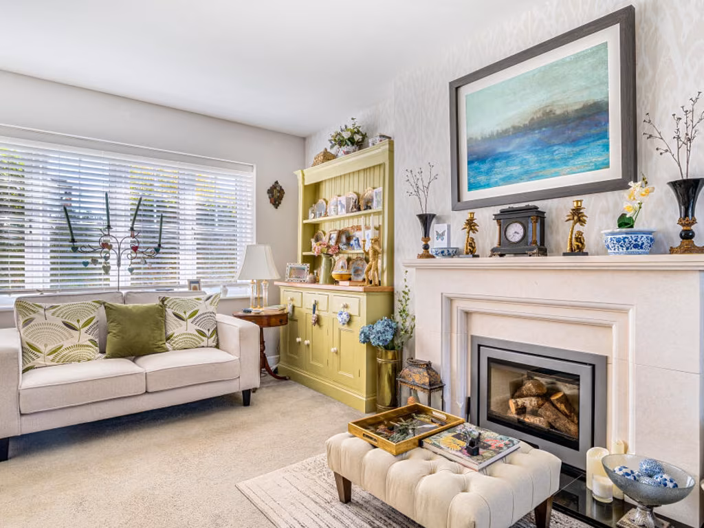
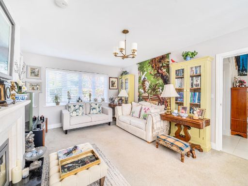
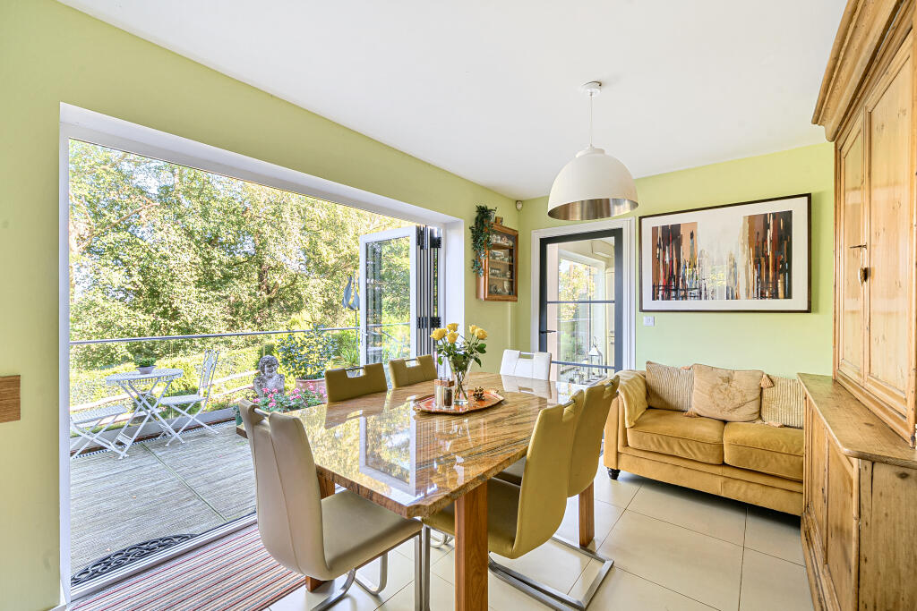
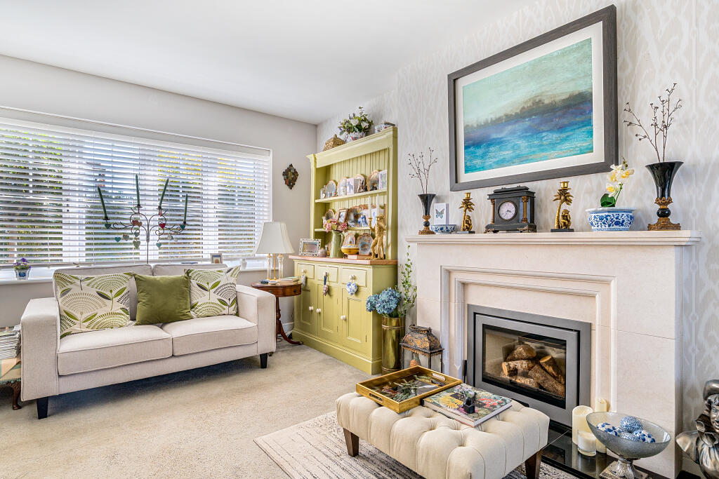
- living_dining_area modern
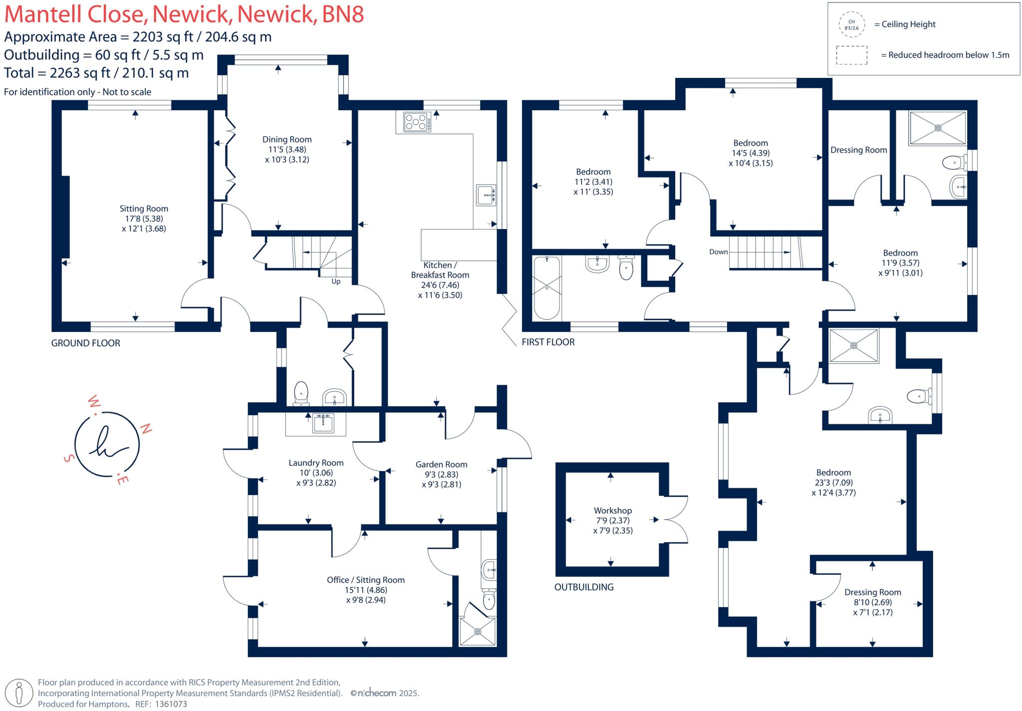
Floorplan Description
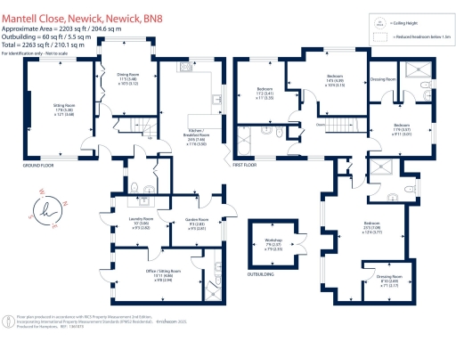
- Two-storey residential property with multiple reception rooms, kitchen/breakfast room and bedrooms
Rooms
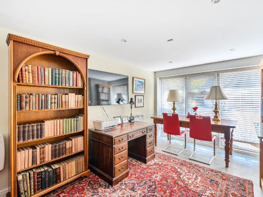
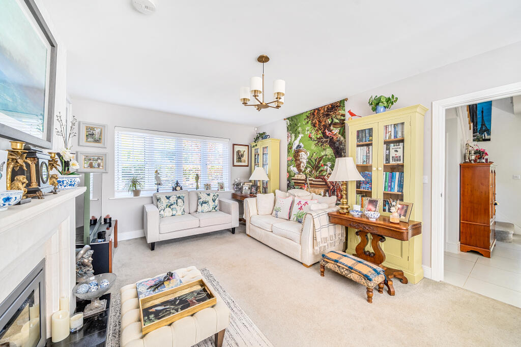
- Sitting Room:
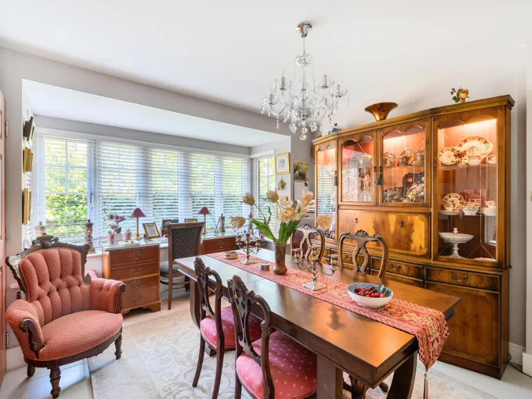
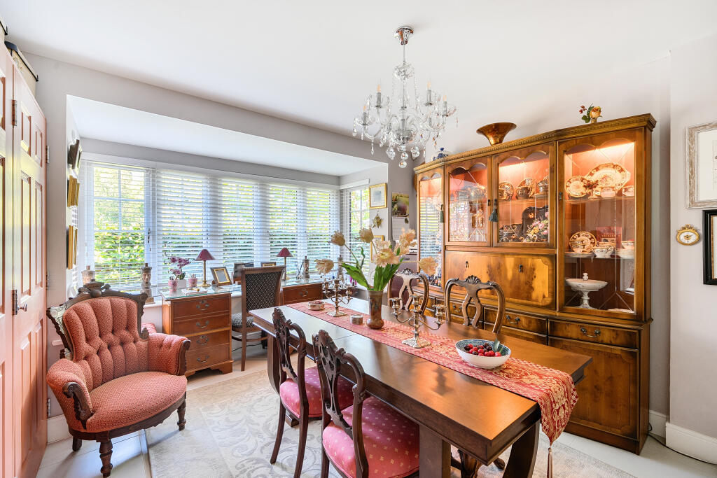
- Dining Room:
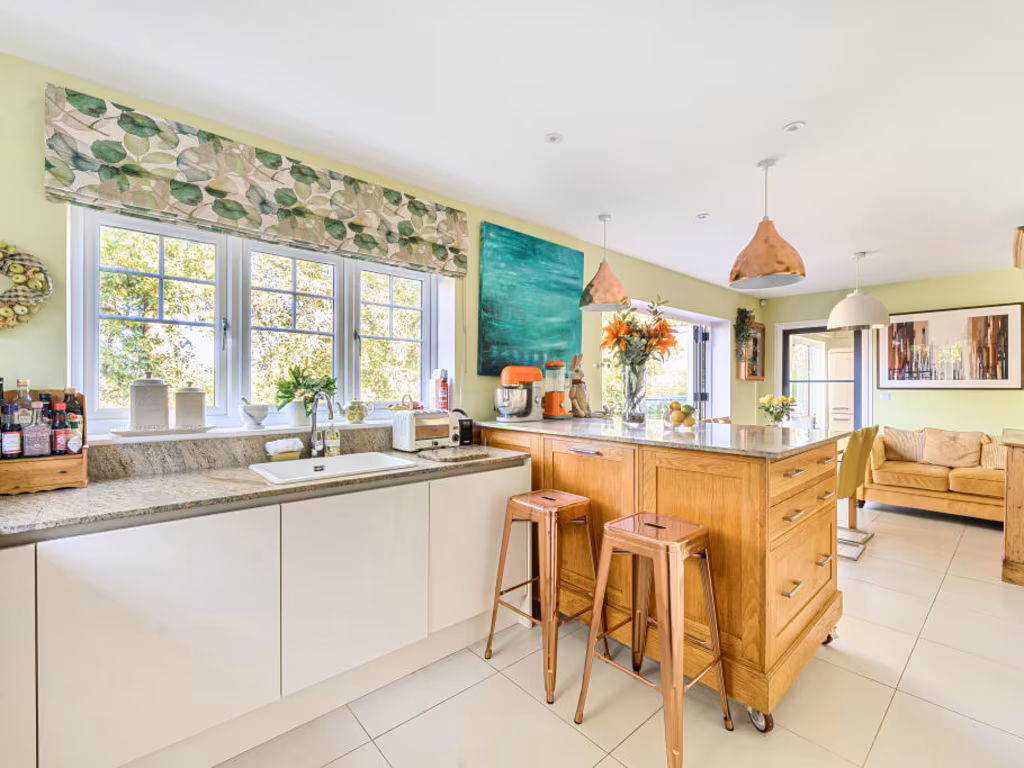
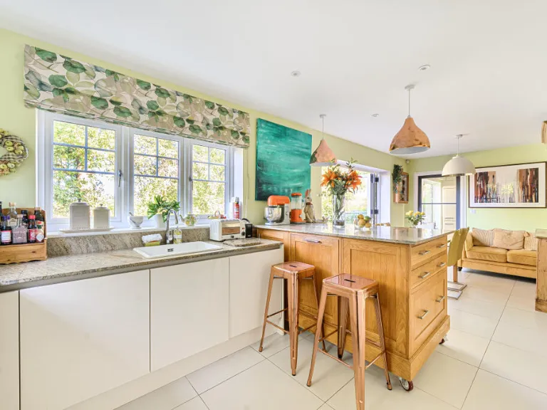
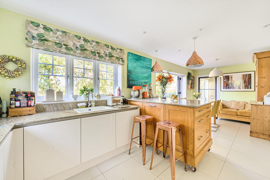
- Kitchen/ Breakfast Room:
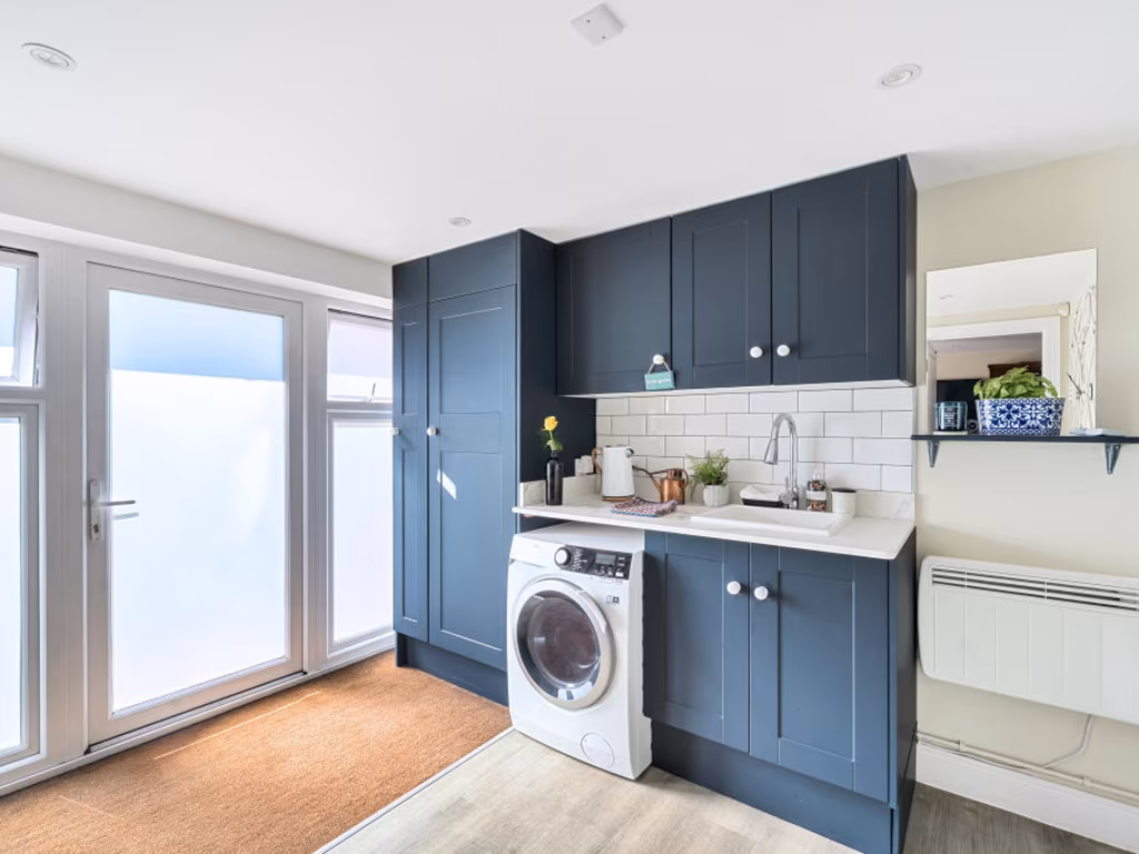
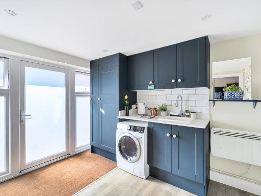
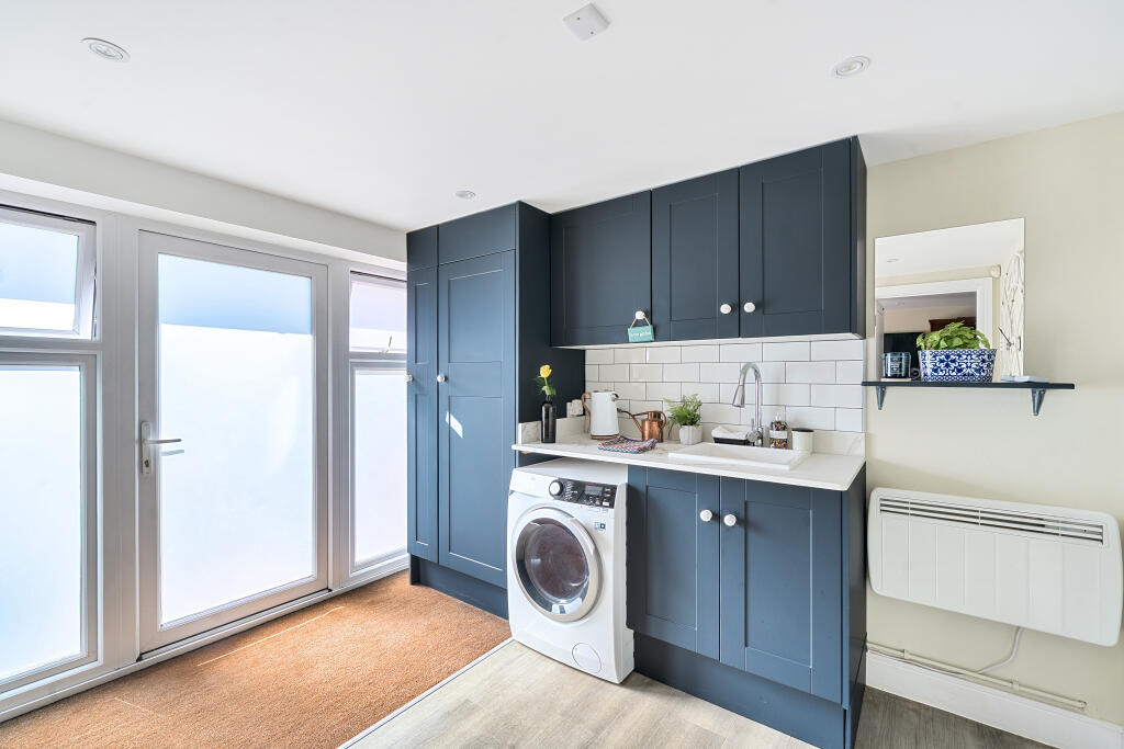
- Laundry Room:
- Garden Room:
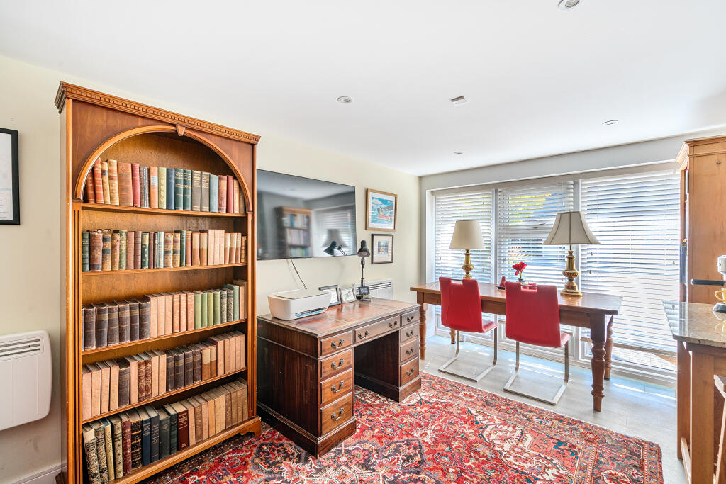
- Office / Sitting Room:
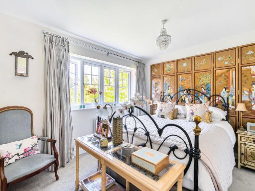
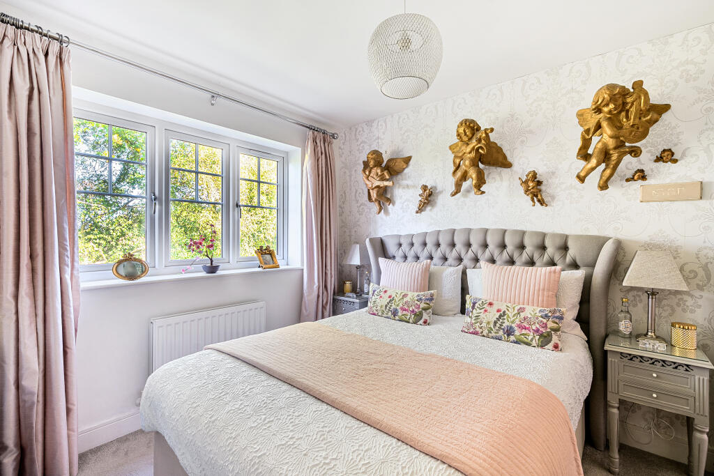
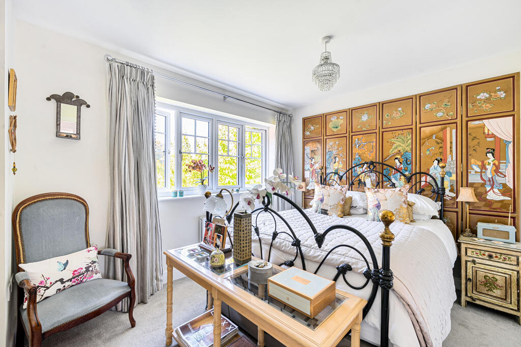
- Bedroom:
- Bedroom:
- Bedroom:
- Bedroom:
- Dressing Room:
- Workshop:
Textual Property Features
Detected Visual Features
- modern
- detached
- two-story
- red brick
- well-maintained
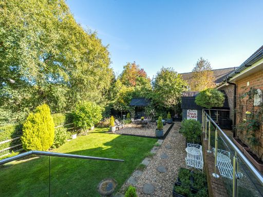
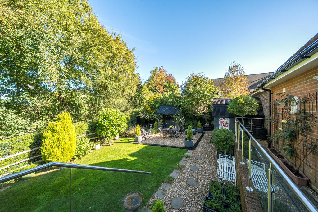
- landscaped garden
- large driveway
- dormer windows
- open plan
- large windows
- bright
- balcony
- garden access
- bright colors
- contemporary lighting
EPC Details
- High performance glazing
- Average thermal transmittance 0.24 W/m-¦K
- Boiler and radiators, mains gas
- Low energy lighting in all fixed outlets
- Average thermal transmittance 0.16 W/m-¦K
Nearby Schools
- Cumnor House School
- St Giles CofE Primary School
- Harlands Primary School
- Buxted CofE Primary School
- Bonners CofE School
- Hamsey Community Primary School
- St Augustine's CofE Primary School
- Northlands Wood Primary Academy
- Nutley Church of England Primary School
- St Philip's Catholic Primary School
- Manor Primary School
- Plumpton Primary School
- Chailey St Peter's Church of England Primary School
- St Wilfrid's CofE Primary School
- Danehill Church of England Primary School
- Oathall Community College
- Great Walstead School
- Blackthorns Community Primary Academy
- Lindfield Primary Academy
- Barcombe Church of England Primary School
- Rocks Park Primary School
- Chailey School
- Wivelsfield Primary School
- Little Horsted Church of England Primary School
- Uckfield College
- Fletching Church of England Primary School
Nearest Bars And Restaurants
- Id: 451797443
- Tags:
- Addr:
- City: Lewes
- Housename: Crown Inn
- Housenumber: 22
- Locality: Newick
- Postcode: BN8 4JX
- Street: Church Road
- Amenity: pub
- Building: yes
- Name: The Crown Inn
- Wheelchair: yes
- TagsNormalized:
- Lat: 50.9715596
- Lon: 0.0204829
- FullGeoHash: u101brnfv73h
- PartitionGeoHash: u101
- Images:
- FoodStandards: null
- Distance: 714.3
,- Id: 9020224835
- Tags:
- Amenity: cafe
- Name: The Pantry
- Phone: +44 1825 721118
- Website: https://www.facebook.com/newick.co.uk/
- TagsNormalized:
- Lat: 50.9718332
- Lon: 0.0204058
- FullGeoHash: u101brnu7qrs
- PartitionGeoHash: u101
- Images:
- FoodStandards: null
- Distance: 685.6
,- Id: 451797432
- Tags:
- Addr:
- Housenumber: 7-9
- Postcode: BN8 4JU
- Street: Church Road
- Amenity: restaurant
- Building: yes
- Name: Newick Tandoori
- TagsNormalized:
- Lat: 50.9725115
- Lon: 0.0201513
- FullGeoHash: u101brq8mscf
- PartitionGeoHash: u101
- Images:
- FoodStandards: null
- Distance: 612.9
,- Id: 598368501
- Tags:
- Addr:
- City: Newick
- Housenumber: 1
- Postcode: BN8 4JU
- Street: Church Road
- Amenity: pub
- Building: yes
- Name: Royal Oak
- Wikidata: Q26530964
- TagsNormalized:
- Lat: 50.9730487
- Lon: 0.0198222
- FullGeoHash: u101brq7tbux
- PartitionGeoHash: u101
- Images:
- FoodStandards: null
- Distance: 550.9
,- Id: 451797442
- Tags:
- Addr:
- City: Lewes
- Locality: Newick
- Postcode: BN8 4LA
- Street: The Green
- Amenity: pub
- Building: yes
- Name: The Bull
- Wikidata: Q26531079
- TagsNormalized:
- Lat: 50.9736257
- Lon: 0.0188261
- FullGeoHash: u101brmwystc
- PartitionGeoHash: u101
- Images:
- FoodStandards: null
- Distance: 458.3
}
Nearest General Shops
- Id: 9020224836
- Tags:
- Name: HS K9's
- Phone: +44 1825 724488
- Shop: pet_grooming
- Website: https://www.thegooddogguide.com/east-sussex/newick/dog-grooming-groomers/hs-k9/22606
- TagsNormalized:
- Lat: 50.971764
- Lon: 0.0202611
- FullGeoHash: u101brnu017z
- PartitionGeoHash: u101
- Images:
- FoodStandards: null
- Distance: 686.8
,- Id: 451797440
- Tags:
- Addr:
- Housenumber: 15
- Postcode: BN8 4JU
- Street: Church Road
- Building: yes
- Name: P & K Autos
- Shop: car_repair
- TagsNormalized:
- Lat: 50.9722171
- Lon: 0.0203719
- FullGeoHash: u101brnydtyq
- PartitionGeoHash: u101
- Images:
- FoodStandards: null
- Distance: 648.7
,- Id: 451797426
- Tags:
- Addr:
- City: Lewes
- Housenumber: 10
- Locality: Newick
- Postcode: BN8 4LB
- Street: The Green
- Building: yes
- Name: Cottage Bakery
- Phone: +44 1825 722206
- Shop: bakery
- TagsNormalized:
- Lat: 50.9740759
- Lon: 0.0182728
- FullGeoHash: u101brt39b3n
- PartitionGeoHash: u101
- Images:
- FoodStandards: null
- Distance: 395.1
}
Nearest Grocery shops
- Id: 4510762898
- Tags:
- Addr:
- City: Fletching
- Housename: Fletching Stores
- Postcode: TN22 3SS
- Street: High Street
- Fhrs:
- Name: Village Stores
- Shop: convenience
- Source:
- TagsNormalized:
- Lat: 50.9933801
- Lon: 0.0344231
- FullGeoHash: u1040g11fp58
- PartitionGeoHash: u104
- Images:
- FoodStandards: null
- Distance: 2263
,- Id: 534584997
- Tags:
- Building: yes
- Description: Newsagent, grocery, off licence, lotto etc
- Name: Newick News & General Store
- Opening_hours: Mo-Su 06:00-19:30
- Shop: convenience
- TagsNormalized:
- Lat: 50.9729105
- Lon: 0.0113554
- FullGeoHash: u101br268x5n
- PartitionGeoHash: u101
- Images:
- FoodStandards: null
- Distance: 530.5
,- Id: 451797452
- Tags:
- Addr:
- Housenumber: 1
- Postcode: BN8 4LA
- Street: The Green
- Brand: Premier
- Brand:wikidata: Q7240340
- Brand:wikipedia: en:Premier Stores
- Building: yes
- Name: Sussex Village Store
- Opening_hours: Mo-Sa 07:00-21:00;Su 07:00-18:00
- Shop: convenience
- TagsNormalized:
- Lat: 50.9744699
- Lon: 0.0186904
- FullGeoHash: u101brteg9bt
- PartitionGeoHash: u101
- Images:
- FoodStandards: null
- Distance: 377.9
}
Nearest Medical buildings
- Id: 968483836
- Tags:
- Addr:
- City: Lewes
- Locality: North Chailey
- Postcode: BN8 4JN
- Street: Beggars Wood Road
- Amenity: clinic
- Building: yes
- Healthcare: clinic
- Name: Chailey Clinical Services
- TagsNormalized:
- clinic
- health
- healthcare
- service
- Lat: 50.972128
- Lon: -0.0321159
- FullGeoHash: gcpczr0w5tke
- PartitionGeoHash: gcpc
- Images:
- FoodStandards: null
- Distance: 3354.5
,- Id: 645740880
- Tags:
- Addr:
- City: Lewes
- Housename: The Surgery
- Locality: North Chailey
- Postcode: BN8 4HD
- Street: Station Road
- Amenity: dentist
- Building: yes
- Email: northchailey@dentistryforyou.co.uk
- Healthcare: dentist
- Name: North Chailey Dental Care
- Operator: Dentistry For You
- Phone: +44 1825 724694
- Website: https://www.dentistryforyou.co.uk/north-chailey-dental-care/
- TagsNormalized:
- dentist
- health
- healthcare
- dental
- Lat: 50.9720286
- Lon: -0.0170098
- FullGeoHash: gcpczx5tedud
- PartitionGeoHash: gcpc
- Images:
- FoodStandards: null
- Distance: 2320
,- Id: 451797450
- Tags:
- Addr:
- City: Newick
- Housenumber: 9
- Postcode: BN8 4LA
- Street: The Green
- Amenity: pharmacy
- Brand: Lloyds Pharmacy
- Brand:wikidata: Q6662870
- Brand:wikipedia: en:LloydsPharmacy
- Building: yes
- Healthcare: pharmacy
- Name: Lloyds Pharmacy
- TagsNormalized:
- pharmacy
- lloyds pharmacy
- health
- healthcare
- Lat: 50.9744833
- Lon: 0.0191424
- FullGeoHash: u101brtgyh3t
- PartitionGeoHash: u101
- Images:
- FoodStandards: null
- Distance: 398.3
,- Id: 451697193
- Tags:
- Addr:
- Postcode: BN8 4LT
- Street: Marbles Road
- Amenity: doctors
- Building: yes
- Healthcare: doctor
- Name: Newick Health Centre
- TagsNormalized:
- doctor
- doctors
- health
- healthcare
- health centre
- Lat: 50.9740899
- Lon: 0.0177964
- FullGeoHash: u101brscwejf
- PartitionGeoHash: u101
- Images:
- FoodStandards: null
- Distance: 376.4
}
Nearest Airports
- Id: 260720166
- Tags:
- Aerodrome: international
- Aeroway: aerodrome
- Alt_name: Gatwick Airport
- Ele: 62
- Iata: LGW
- Icao: EGKK
- Internet_access: wlan
- Internet_access:fee: no
- Internet_access:ssid: Gatwick FREE Wi-Fi
- Name: London Gatwick Airport
- Operator: Gatwick Airport Limited
- Ref: LGW
- Website: https://www.gatwickairport.com/
- Wikidata: Q8703
- Wikipedia: en:Gatwick Airport
- TagsNormalized:
- airport
- international airport
- Lat: 51.1540917
- Lon: -0.1883773
- FullGeoHash: gcpg58qf4mzd
- PartitionGeoHash: gcpg
- Images:
- FoodStandards: null
- Distance: 24287.3
}
Nearest Leisure Facilities
- Id: 973284316
- Tags:
- Leisure: pitch
- Sport: equestrian
- TagsNormalized:
- pitch
- leisure
- equestrian
- sports
- Lat: 50.9762631
- Lon: 0.0109546
- FullGeoHash: u101bpzyr20q
- PartitionGeoHash: u101
- Images:
- FoodStandards: null
- Distance: 306.5
,- Id: 698946153
- Tags:
- Leisure: pitch
- Sport: tennis
- Surface: asphalt
- TagsNormalized:
- Lat: 50.9762198
- Lon: 0.0124768
- FullGeoHash: u101brcn48p7
- PartitionGeoHash: u101
- Images:
- FoodStandards: null
- Distance: 208.5
,- Id: 698946154
- Tags:
- Leisure: pitch
- Sport: tennis
- Surface: asphalt
- TagsNormalized:
- Lat: 50.9764905
- Lon: 0.012974
- FullGeoHash: u101brcrw6d4
- PartitionGeoHash: u101
- Images:
- FoodStandards: null
- Distance: 164.4
,- Id: 5836995084
- Tags:
- TagsNormalized:
- Lat: 50.9775586
- Lon: 0.0170442
- FullGeoHash: u10402hmv1tj
- PartitionGeoHash: u104
- Images:
- FoodStandards: null
- Distance: 144.3
,- Id: 974638701
- Tags:
- Leisure: pitch
- Sport: equestrian
- TagsNormalized:
- pitch
- leisure
- equestrian
- sports
- Lat: 50.9778081
- Lon: 0.0156025
- FullGeoHash: u104025r784n
- PartitionGeoHash: u104
- Images:
- FoodStandards: null
- Distance: 91.1
}
Nearest Tourist attractions
- Id: 227760006
- Tags:
- Name: Wowo Campsite - Lower Brook
- Tourism: camp_site
- TagsNormalized:
- Lat: 50.9917191
- Lon: -0.0059816
- FullGeoHash: gcpfpfg8k97u
- PartitionGeoHash: gcpf
- Images:
- FoodStandards: null
- Distance: 2203.2
,- Id: 820163937
- Tags:
- Name: Wowo Campsite - Grassy Field
- Tourism: camp_site
- TagsNormalized:
- Lat: 50.9903722
- Lon: -0.0071864
- FullGeoHash: gcpfpfdb2w36
- PartitionGeoHash: gcpf
- Images:
- FoodStandards: null
- Distance: 2155.1
,- Id: 5839453717
- Tags:
- Addr:
- City: Newick
- Postcode: BN8 4FB
- Street: Jackies Lane
- Name: Wyld Wood Campsite
- Tourism: camp_site
- TagsNormalized:
- Lat: 50.977721
- Lon: 0.0086879
- FullGeoHash: u10400nqdryn
- PartitionGeoHash: u104
- Images:
- FoodStandards: null
- Distance: 459.1
}
Nearest Train stations
- Id: 430255726
- Tags:
- Name: Isfield
- Operator: The Lavender Line
- Public_transport: station
- Railway: station
- Railway:preserved: yes
- Usage: tourism
- Website: https://www.lavender-line.co.uk
- Wikidata: Q6079829
- TagsNormalized:
- Lat: 50.9354781
- Lon: 0.065492
- FullGeoHash: u101c2x8wj66
- PartitionGeoHash: u101
- Images:
- FoodStandards: null
- Distance: 5812.6
,- Id: 403865122
- Tags:
- Building: train_station
- Name: Uckfield
- Public_transport: station
- TagsNormalized:
- station
- train
- train station
- Lat: 50.9686698
- Lon: 0.0966685
- FullGeoHash: u101fnw6h89q
- PartitionGeoHash: u101
- Images:
- FoodStandards: null
- Distance: 5782.7
,- Id: 5882031666
- Tags:
- Addr:
- Name: Uckfield
- Naptan:
- Network: National Rail
- Public_transport: station
- Railway: station
- Ref:
- Source: Landsat photo
- Wikidata: Q2209876
- Wikipedia: en:Uckfield railway station
- TagsNormalized:
- Lat: 50.9687382
- Lon: 0.0966299
- FullGeoHash: u101fnw67tkq
- PartitionGeoHash: u101
- Images:
- FoodStandards: null
- Distance: 5778.8
,- Id: 1910148507
- Tags:
- Name: Worth Halt
- Operator: The Lavender Line
- Public_transport: station
- Railway: station
- Railway:preserved: yes
- Usage: tourism
- Website: https://www.lavender-line.co.uk
- TagsNormalized:
- Lat: 50.946582
- Lon: 0.0732256
- FullGeoHash: u101cdt3670z
- PartitionGeoHash: u101
- Images:
- FoodStandards: null
- Distance: 5292.3
,- Id: 29629192
- Tags:
- Name: Sheffield Park
- Naptan:
- Operator: Bluebell Railway
- Public_transport: station
- Railway: station
- Railway:preserved: yes
- Source: npe
- Toilets:
- Usage: tourism
- Website: http://www.bluebell-railway.co.uk
- Wheelchair: yes
- Wikidata: Q7492725
- TagsNormalized:
- Lat: 50.9955844
- Lon: -0.0012346
- FullGeoHash: gcpfpgrng1zq
- PartitionGeoHash: gcpf
- Images:
- FoodStandards: null
- Distance: 2359.9
}
Nearest Bus stations and stops
- Id: 5726655351
- Tags:
- Bus: yes
- Highway: bus_stop
- Name: Newick South Rough
- Public_transport: platform
- TagsNormalized:
- Lat: 50.9705782
- Lon: 0.0124313
- FullGeoHash: u101bqcj1smq
- PartitionGeoHash: u101
- Images:
- FoodStandards: null
- Distance: 743.2
,- Id: 5836995073
- Tags:
- Bus: yes
- Highway: bus_stop
- Name: Newick Bull Inn
- Public_transport: platform
- TagsNormalized:
- Lat: 50.9738425
- Lon: 0.0191512
- FullGeoHash: u101brtbnkbn
- PartitionGeoHash: u101
- Images:
- FoodStandards: null
- Distance: 452.2
,- Id: 5801788698
- Tags:
- Bus: yes
- Highway: bus_stop
- Name: Newick Harmers Hill
- Public_transport: platform
- TagsNormalized:
- Lat: 50.9744298
- Lon: 0.0102542
- FullGeoHash: u101bpx7wfqj
- PartitionGeoHash: u101
- Images:
- FoodStandards: null
- Distance: 449.3
,- Id: 5667417852
- Tags:
- Bus: yes
- Highway: bus_stop
- Name: Newick The Green
- Public_transport: platform
- TagsNormalized:
- Lat: 50.9740984
- Lon: 0.0193157
- FullGeoHash: u101brw1dhdv
- PartitionGeoHash: u101
- Images:
- FoodStandards: null
- Distance: 437.8
,- Id: 5836995072
- Tags:
- Bus: yes
- Highway: bus_stop
- Public_transport: platform
- TagsNormalized:
- Lat: 50.9752857
- Lon: 0.0151075
- FullGeoHash: u101brg081bz
- PartitionGeoHash: u101
- Images:
- FoodStandards: null
- Distance: 194.9
}
Nearest Hotels
- Id: 538499424
- Tags:
- Addr:
- City: Buxted
- Postcode: TN22 4AY
- Street: Station Road
- Fhrs:
- Name: Buxted Park Hotel
- Source:
- Tourism: hotel
- Wikidata: Q17556990
- TagsNormalized:
- Lat: 50.9856145
- Lon: 0.1145226
- FullGeoHash: u10449eksx6j
- PartitionGeoHash: u104
- Images:
- FoodStandards: null
- Distance: 7021.3
,- Id: 373025972
- Tags:
- Addr:
- City: Little Horsted
- Postcode: TN22 5TS
- Street: Lewes Road
- Building: yes
- Fhrs:
- Name: Horsted Place
- Source:
- Tourism: hotel
- Wikidata: Q21061841
- TagsNormalized:
- Lat: 50.9472992
- Lon: 0.0906804
- FullGeoHash: u101f4dj90bj
- PartitionGeoHash: u101
- Images:
- FoodStandards: null
- Distance: 6237.9
,- Id: 844733035
- Tags:
- Addr:
- City: Uckfield
- Place: Ashdown Business Park
- Brand: Premier Inn
- Brand:wikidata: Q2108626
- Brand:wikipedia: en:Premier Inn
- Internet_access: wlan
- Internet_access:fee: customers
- Internet_access:operator: Virgin Media
- Internet_access:ssid: Premier Inn Free Wi-Fi
- Name: Premier Inn
- Tourism: hotel
- TagsNormalized:
- Lat: 50.9946733
- Lon: 0.0780888
- FullGeoHash: u1041g2ce855
- PartitionGeoHash: u104
- Images:
- FoodStandards: null
- Distance: 4822
}
Tags
- modern
- detached
- two-story
- red brick
- well-maintained
- landscaped garden
- large driveway
- dormer windows
- modern
- open plan
- large windows
- bright
- balcony
- garden access
- well-maintained
- bright colors
- contemporary lighting
Local Market Stats
- Average Price/sqft: £422
- Avg Income: £51100
- Rental Yield: 2.8%
- Social Housing: 5%
- Planning Success Rate: 84%
AirBnB Data
- 1km average: £110/night
- Listings in 1km: 1
Similar Properties
 5 bedroom detached house for sale in Newick Drive, Newick, BN8 — £725,000 • 5 bed • 4 bath • 1985 ft²
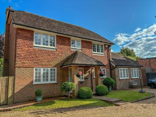 4 bedroom detached house for sale in Western Road, Newick, BN8 — £850,000 • 4 bed • 2 bath • 2036 ft²
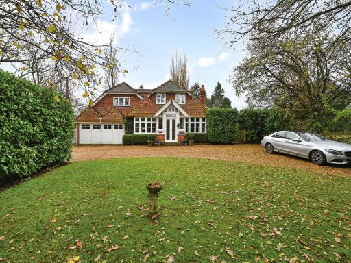 4 bedroom detached house for sale in Goldbridge Road, Newick, BN8 — £1,100,000 • 4 bed • 4 bath • 3479 ft²
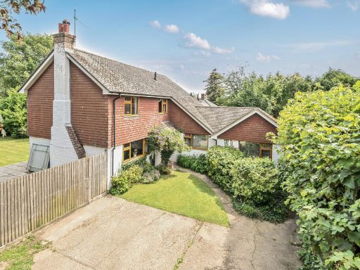 4 bedroom detached house for sale in South Rough, Newick, BN8 — £675,000 • 4 bed • 2 bath • 1449 ft²
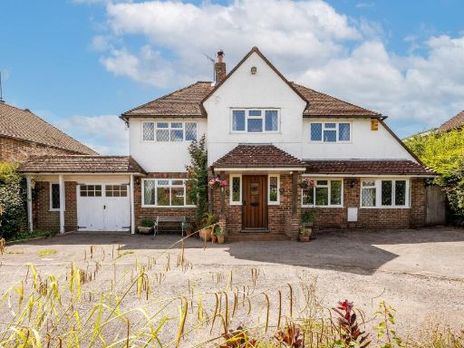 4 bedroom detached house for sale in High Hurst Close, Newick, BN8 — £975,000 • 4 bed • 2 bath • 2116 ft²
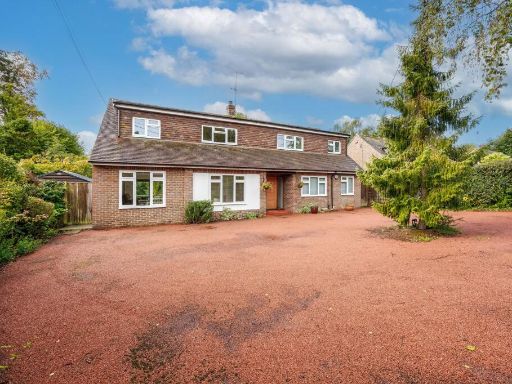 5 bedroom detached house for sale in Lower Station Road, Newick, BN8 — £975,000 • 5 bed • 2 bath • 2267 ft²
Meta
- {
"@context": "https://schema.org",
"@type": "Residence",
"name": "5 bedroom detached house for sale in Mantell Close, Newick,…",
"description": "",
"url": "https://propertypiper.co.uk/property/6bdb76ed-6880-41ae-9145-186bf3fde44e",
"image": "https://image-a.propertypiper.co.uk/18584c20-876a-43e3-8906-708ad029ef18-1024.jpeg",
"address": {
"@type": "PostalAddress",
"streetAddress": "Mantell Close, Newick, Newick, BN8",
"postalCode": "BN8 4FA",
"addressLocality": "Lewes",
"addressRegion": "Lewes",
"addressCountry": "England"
},
"geo": {
"@type": "GeoCoordinates",
"latitude": 50.97703825757907,
"longitude": 0.015155759820900923
},
"numberOfRooms": 5,
"numberOfBathroomsTotal": 4,
"floorSize": {
"@type": "QuantitativeValue",
"value": 2230,
"unitCode": "FTK"
},
"offers": {
"@type": "Offer",
"price": 975000,
"priceCurrency": "GBP",
"availability": "https://schema.org/InStock"
},
"additionalProperty": [
{
"@type": "PropertyValue",
"name": "Feature",
"value": "modern"
},
{
"@type": "PropertyValue",
"name": "Feature",
"value": "detached"
},
{
"@type": "PropertyValue",
"name": "Feature",
"value": "two-story"
},
{
"@type": "PropertyValue",
"name": "Feature",
"value": "red brick"
},
{
"@type": "PropertyValue",
"name": "Feature",
"value": "well-maintained"
},
{
"@type": "PropertyValue",
"name": "Feature",
"value": "landscaped garden"
},
{
"@type": "PropertyValue",
"name": "Feature",
"value": "large driveway"
},
{
"@type": "PropertyValue",
"name": "Feature",
"value": "dormer windows"
},
{
"@type": "PropertyValue",
"name": "Feature",
"value": "modern"
},
{
"@type": "PropertyValue",
"name": "Feature",
"value": "open plan"
},
{
"@type": "PropertyValue",
"name": "Feature",
"value": "large windows"
},
{
"@type": "PropertyValue",
"name": "Feature",
"value": "bright"
},
{
"@type": "PropertyValue",
"name": "Feature",
"value": "balcony"
},
{
"@type": "PropertyValue",
"name": "Feature",
"value": "garden access"
},
{
"@type": "PropertyValue",
"name": "Feature",
"value": "well-maintained"
},
{
"@type": "PropertyValue",
"name": "Feature",
"value": "bright colors"
},
{
"@type": "PropertyValue",
"name": "Feature",
"value": "contemporary lighting"
}
]
}
High Res Floorplan Images
Compatible Floorplan Images
FloorplanImages Thumbnail