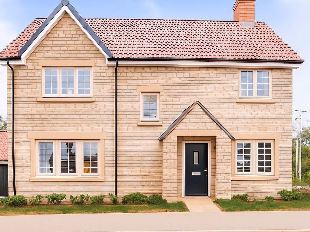
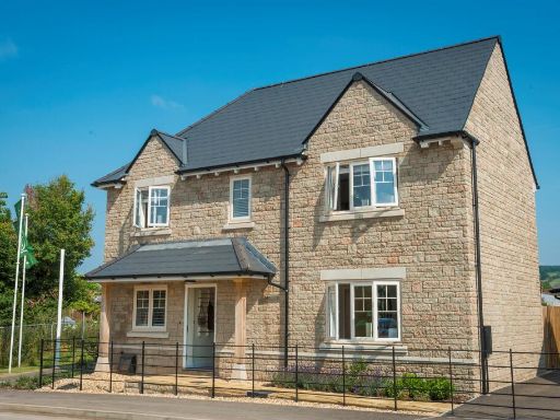
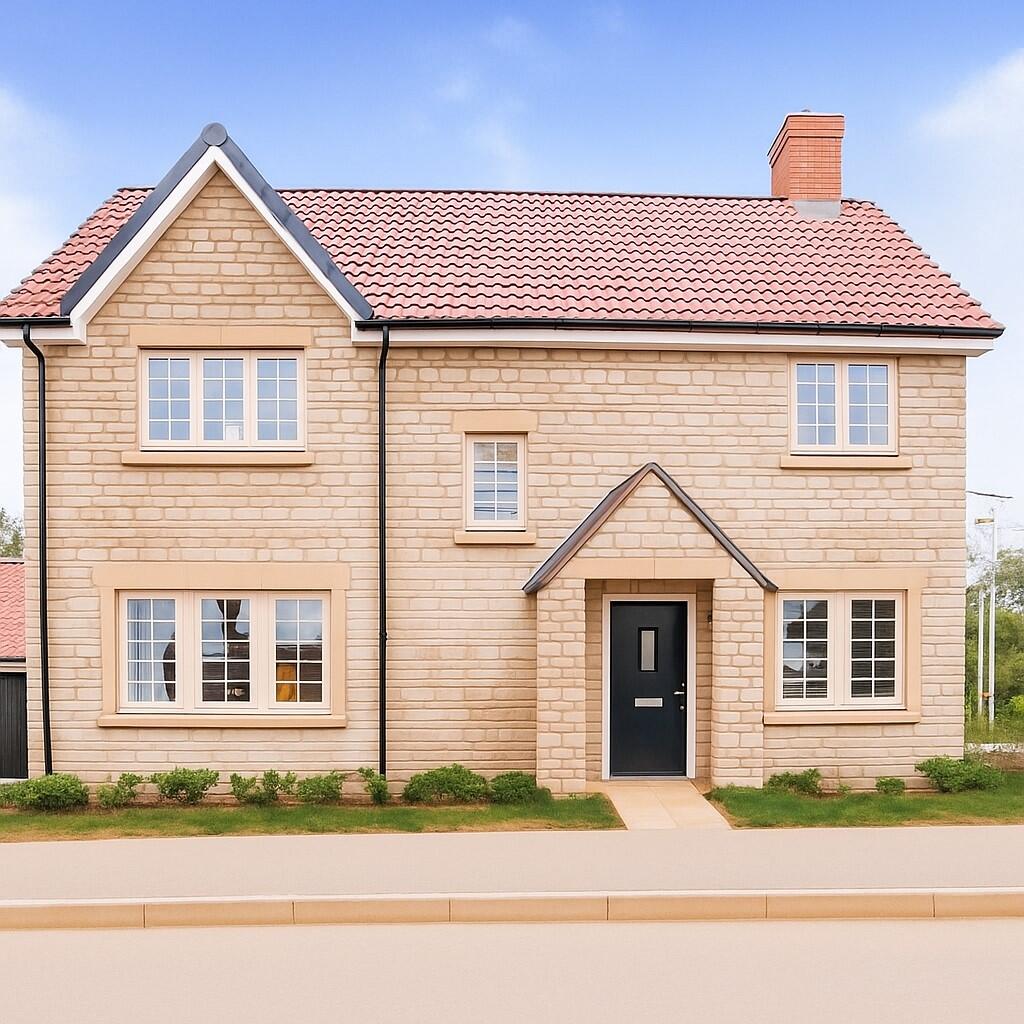
BS37 6LU - 4 bedroom detached house for sale in Badminton Road, Old So…
View on Property Piper
4 bedroom detached house for sale in Badminton Road, Old Sodbury, Bristol, BS37
Property Details
- Price: £650000
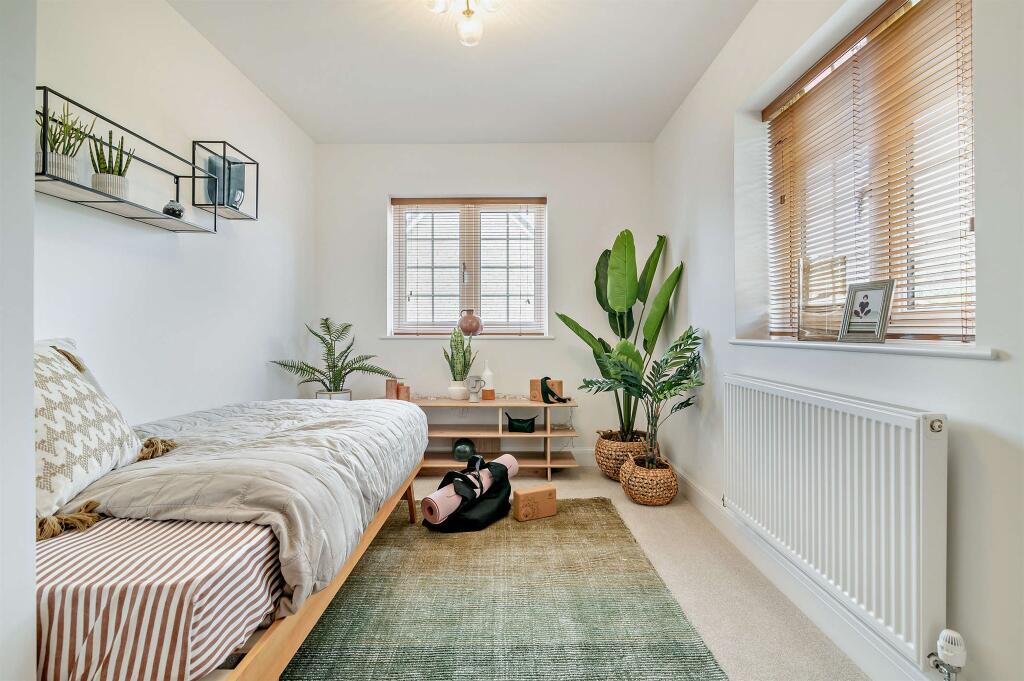
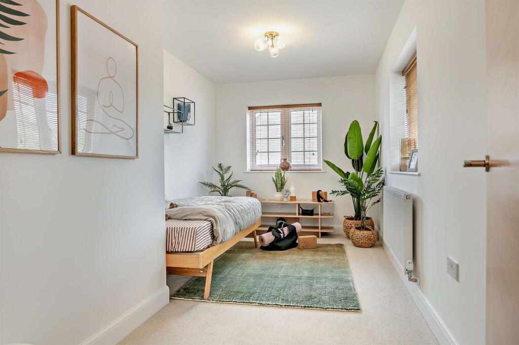
- Bedrooms: 4
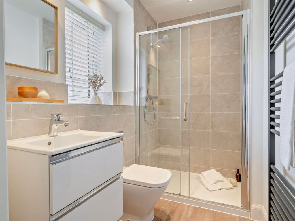
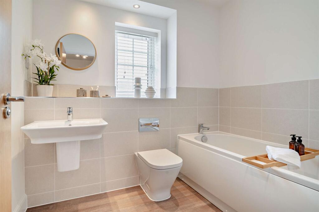
- Bathrooms: 2
- Property Type: undefined
- Property SubType: undefined
Image Descriptions
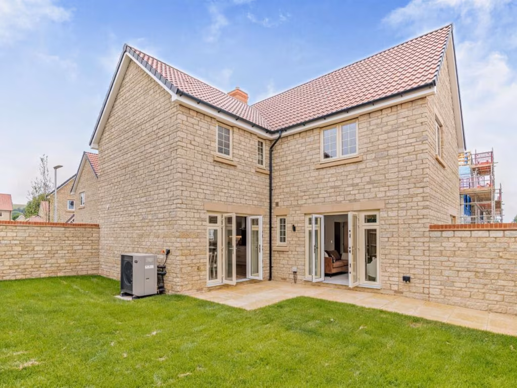
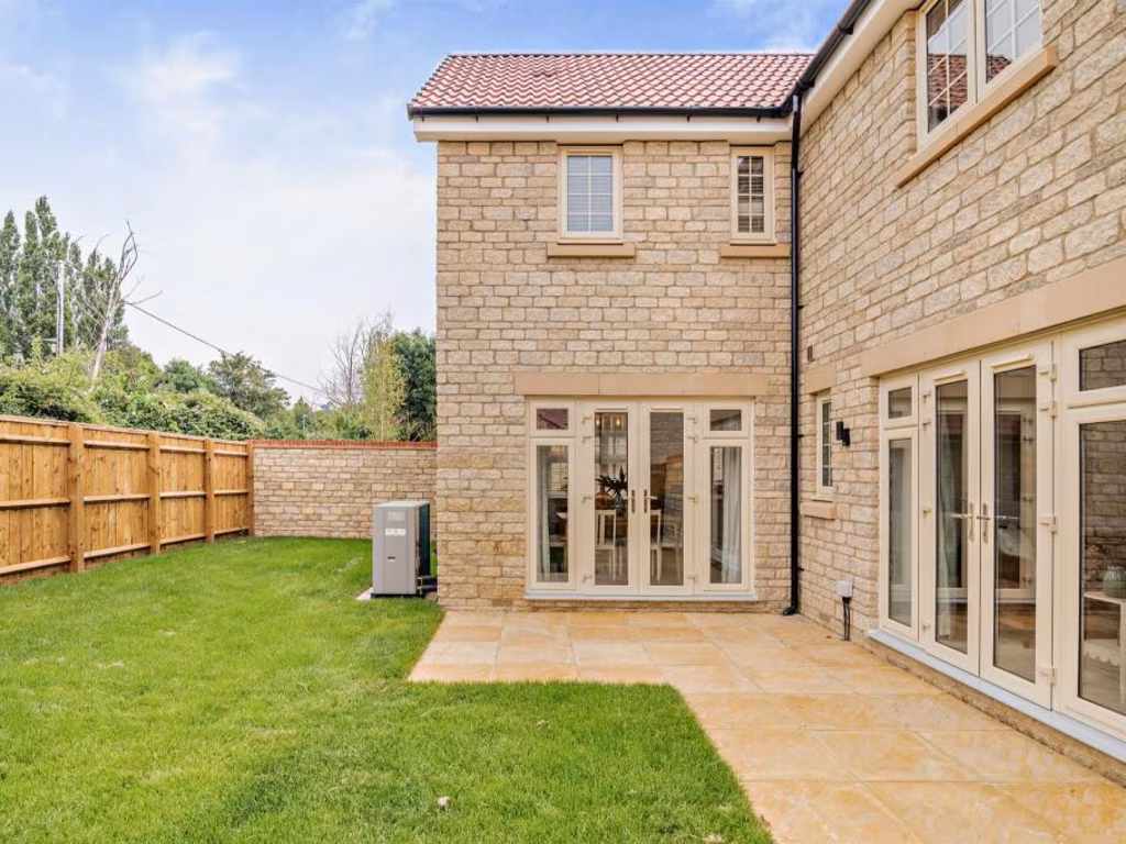
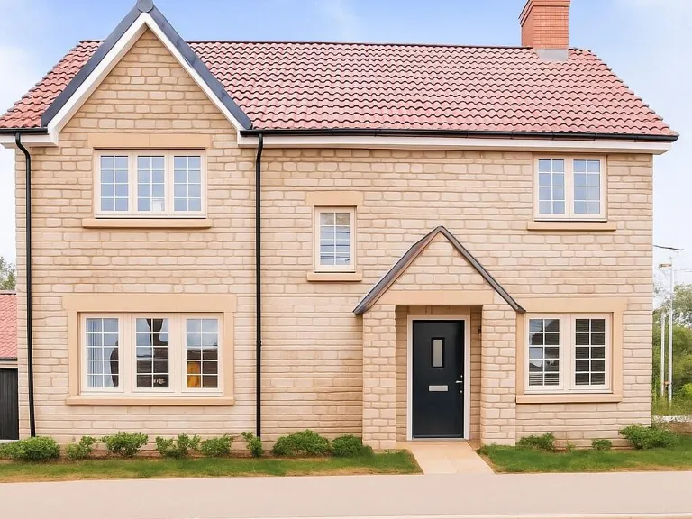
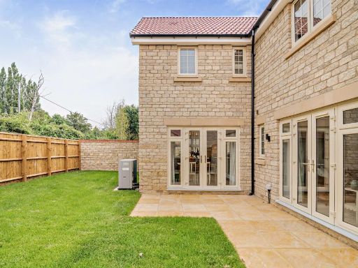
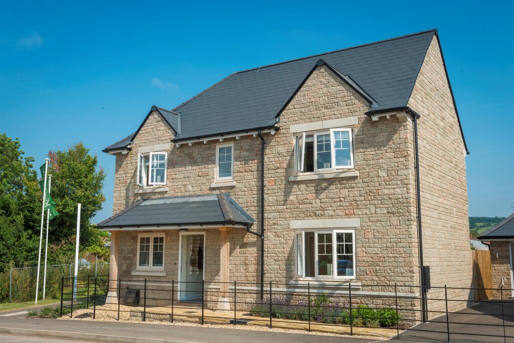
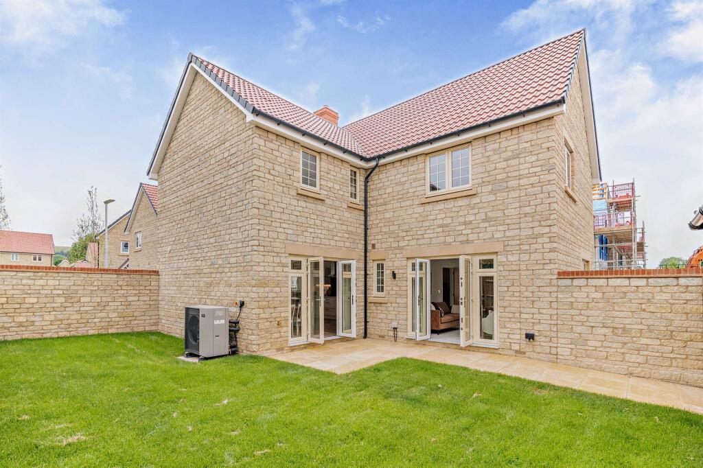
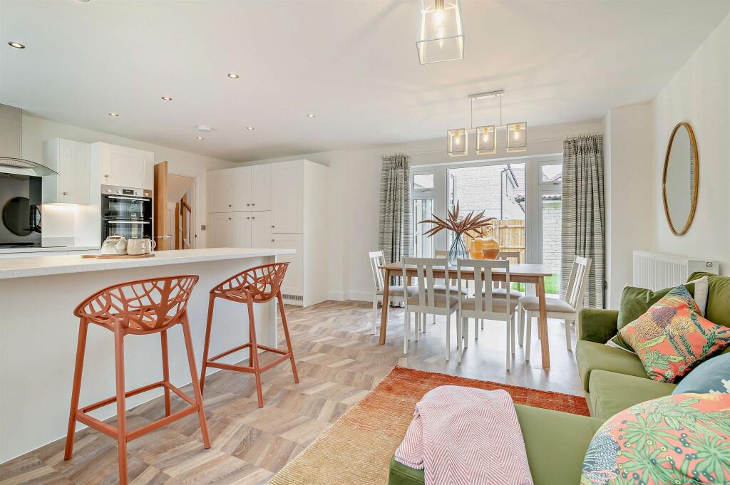
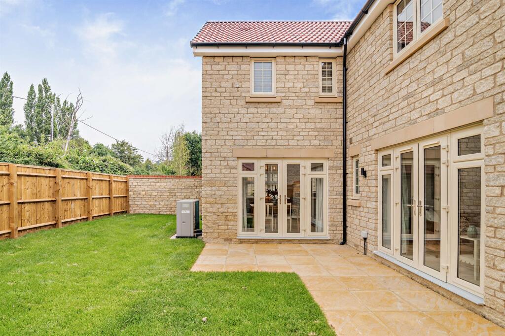
- exterior modern detached
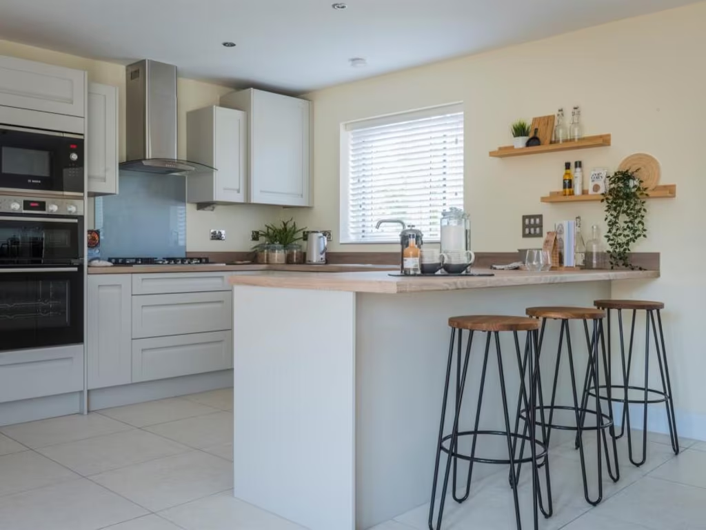
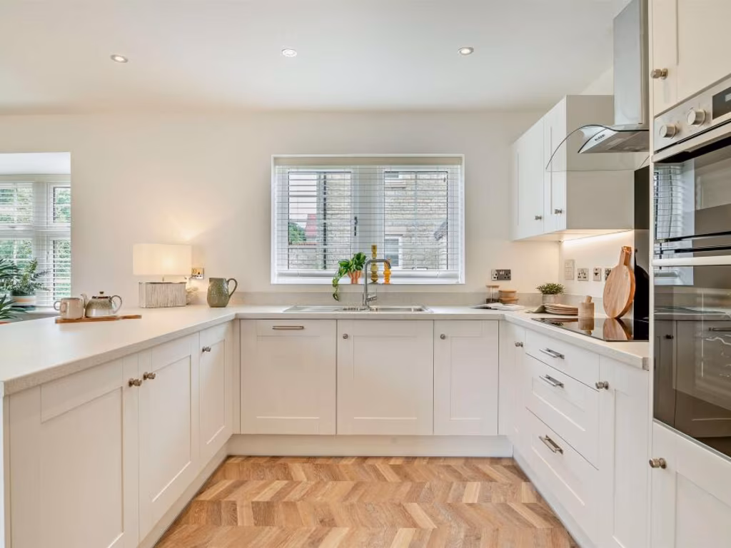
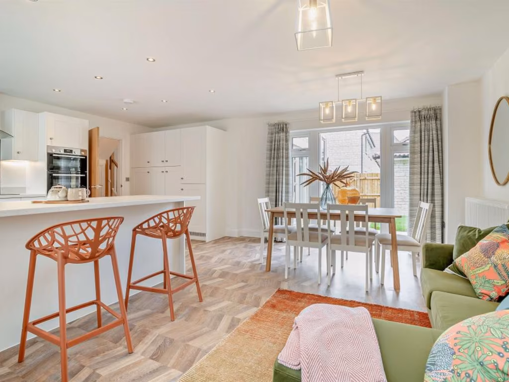
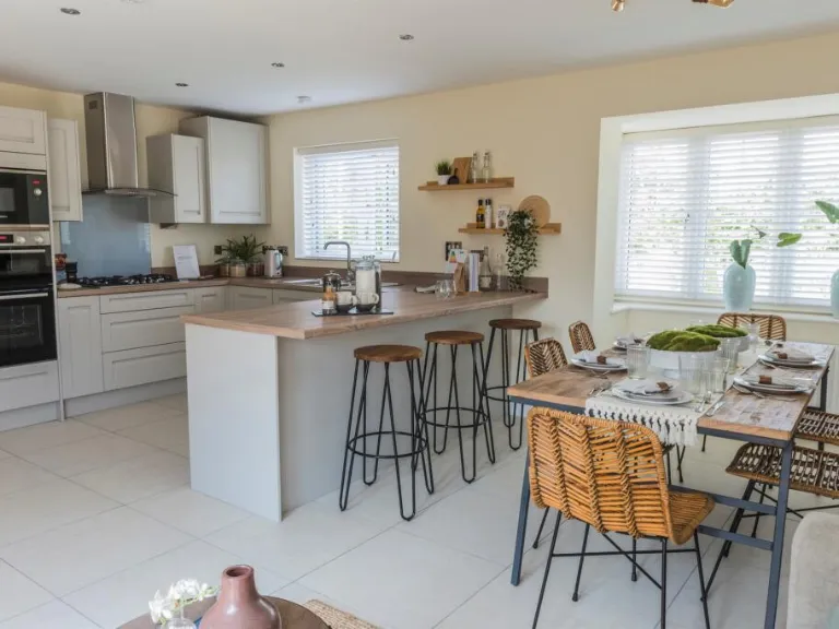
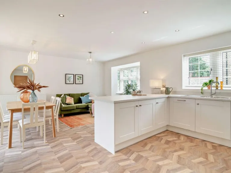
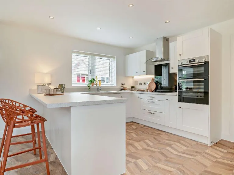
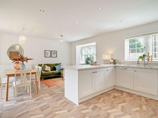
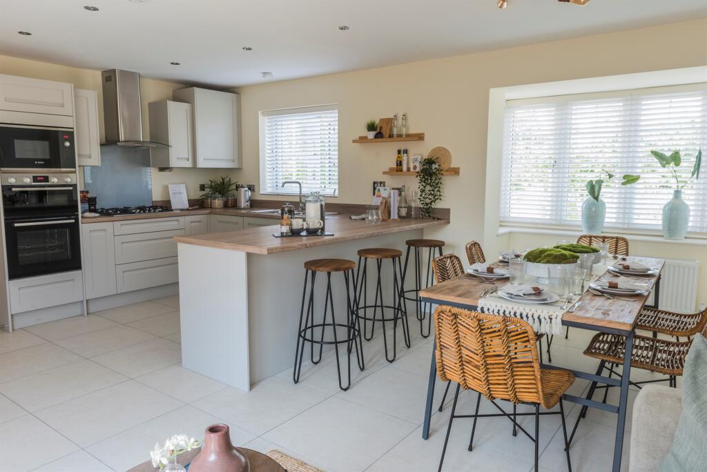
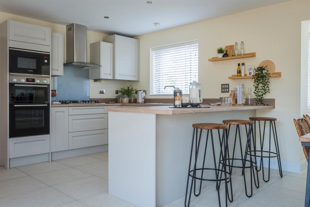
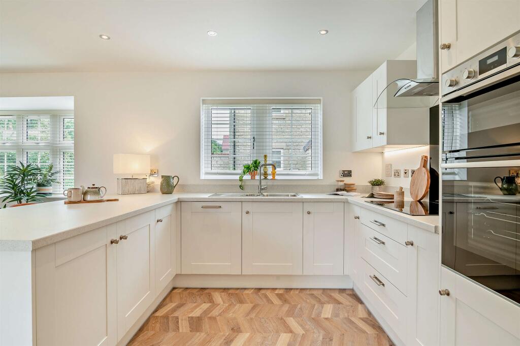
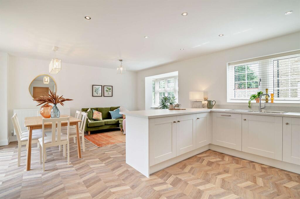
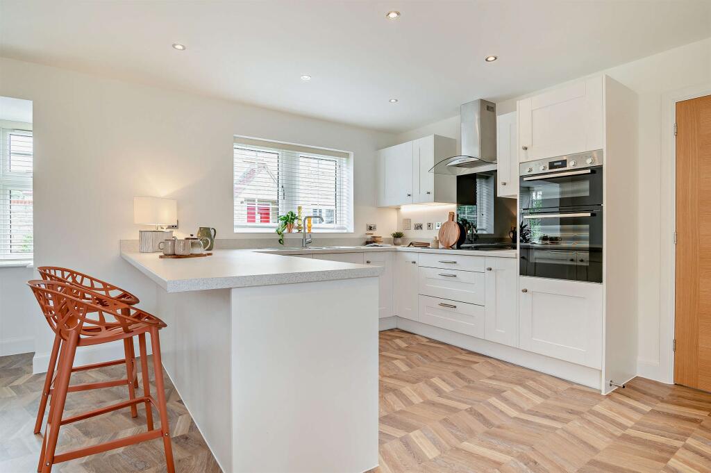
- kitchen modern
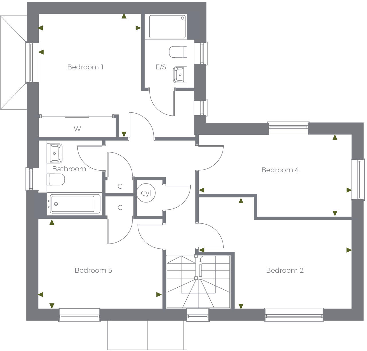
Rooms
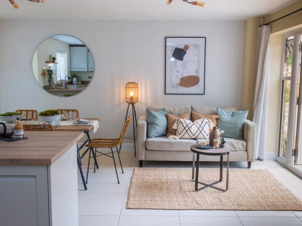
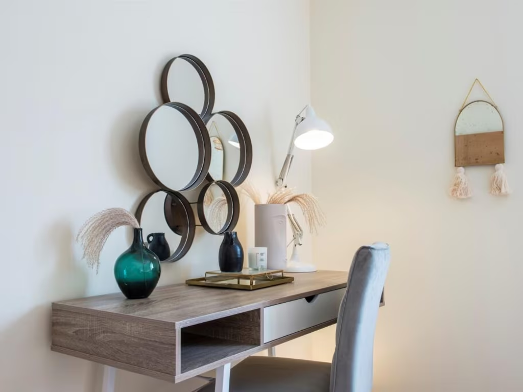
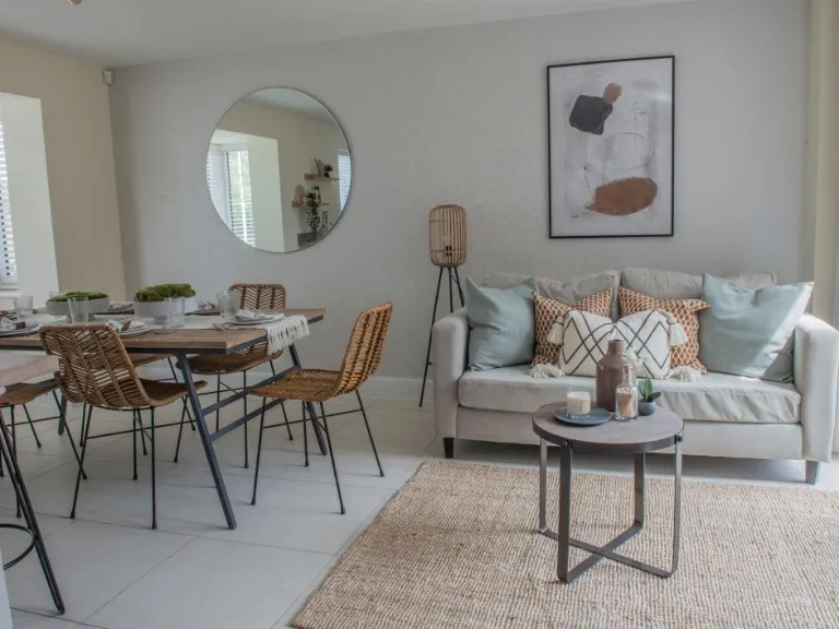
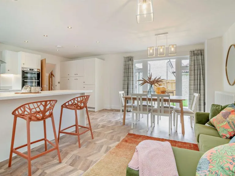
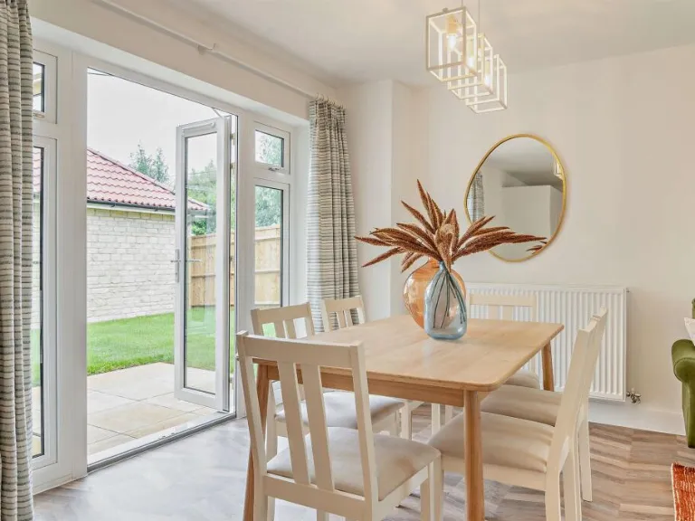
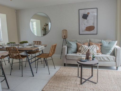
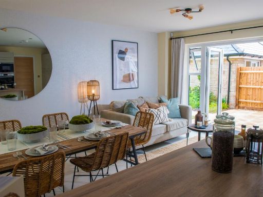
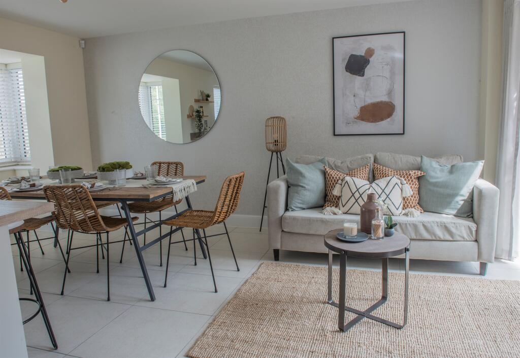
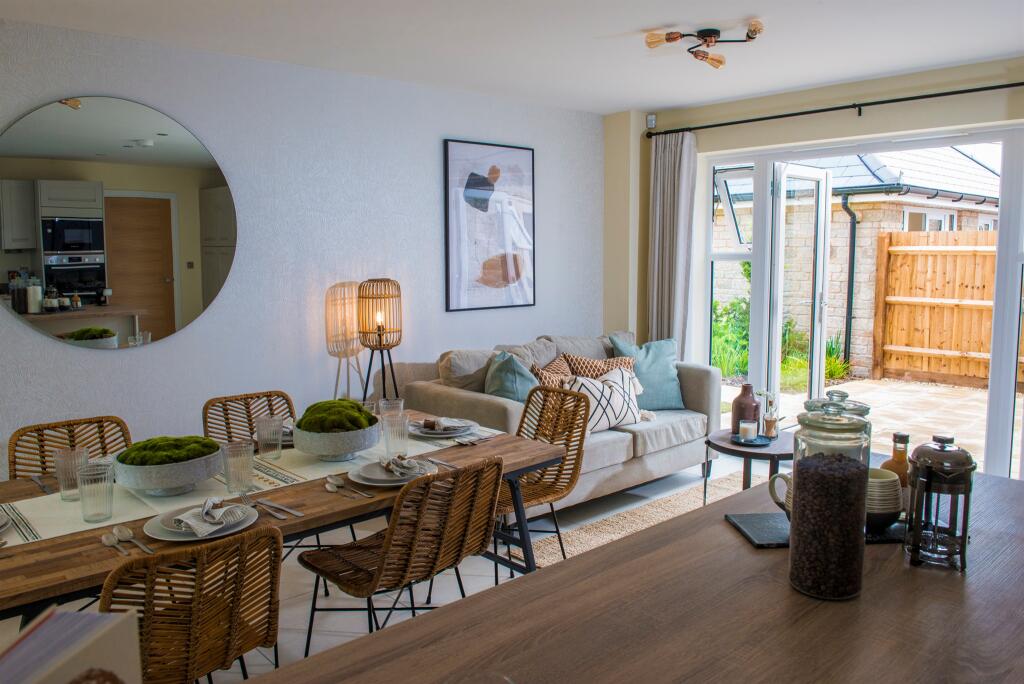
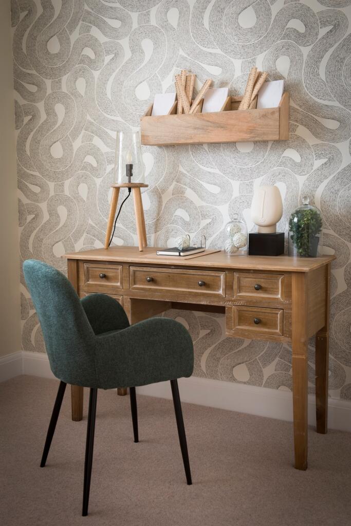
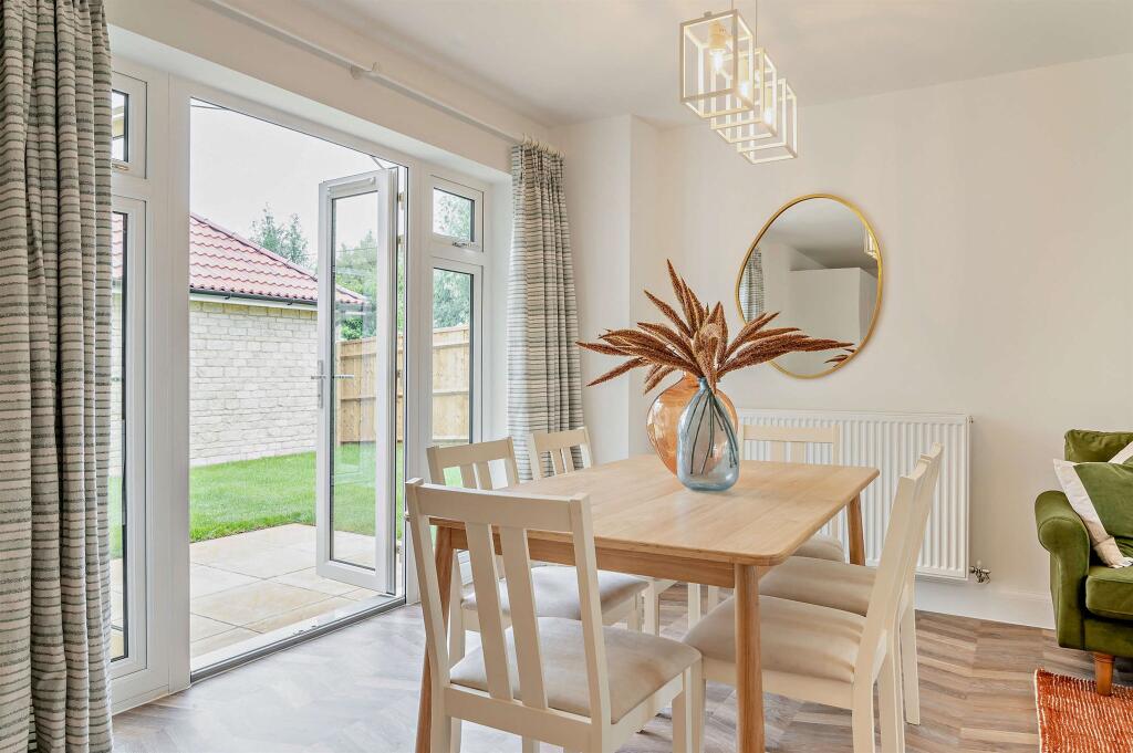
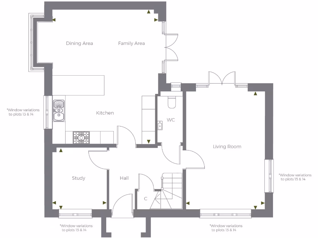
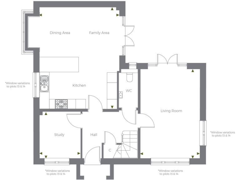
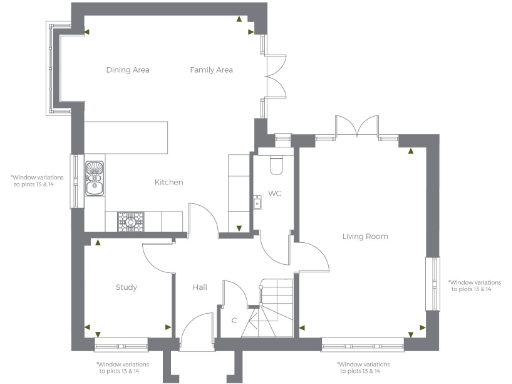
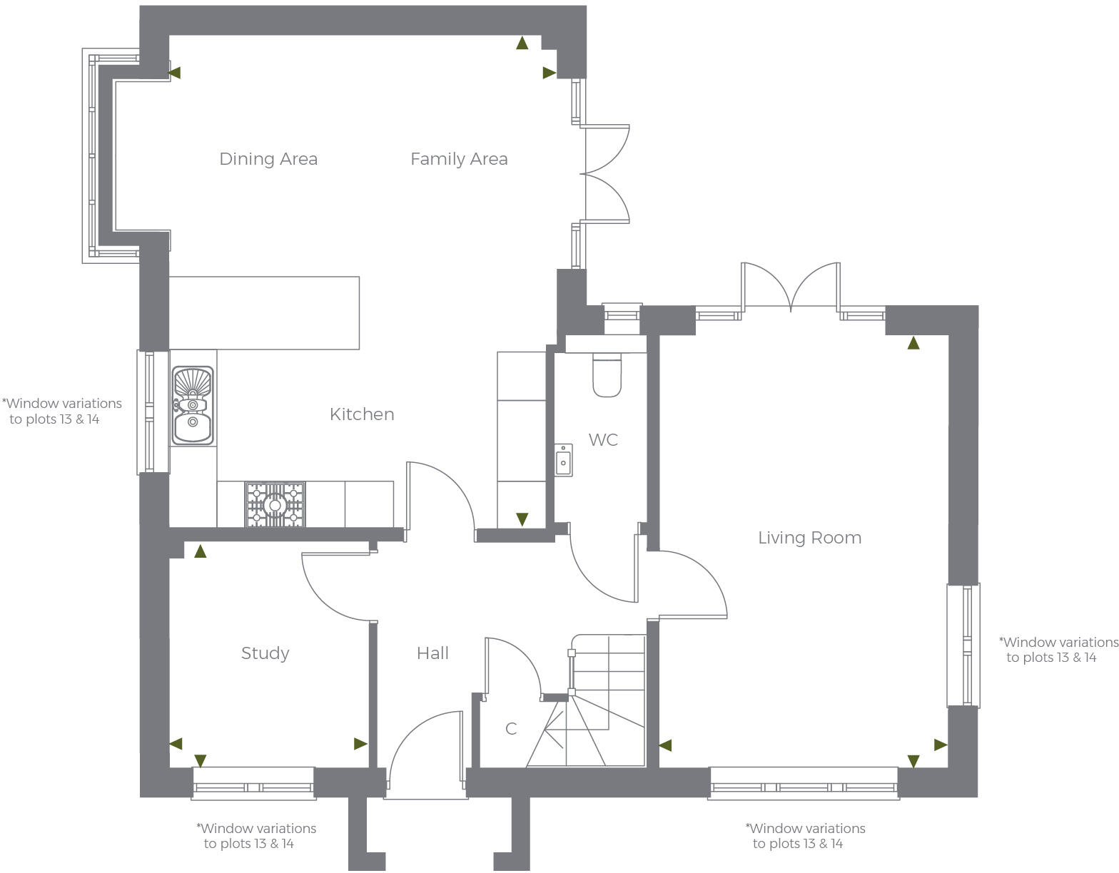
- Dining Area:
- Family Area:
- Kitchen:
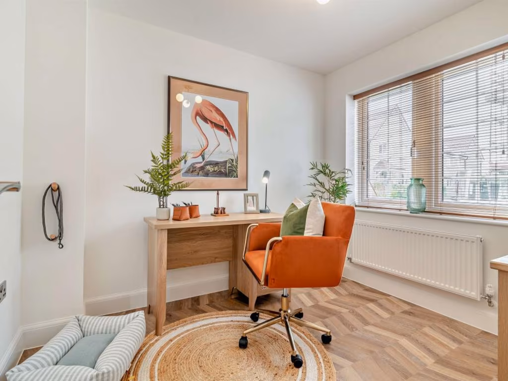
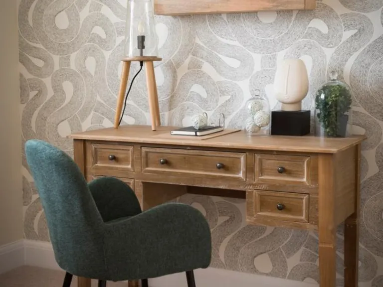
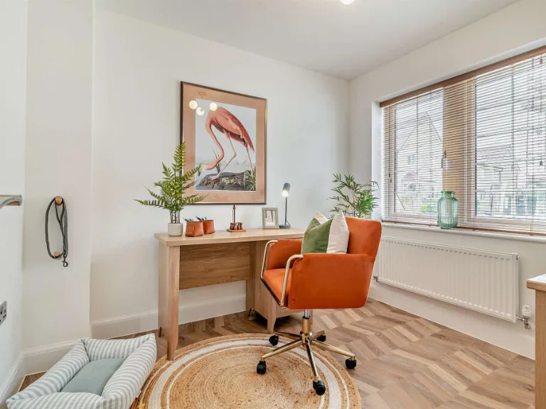
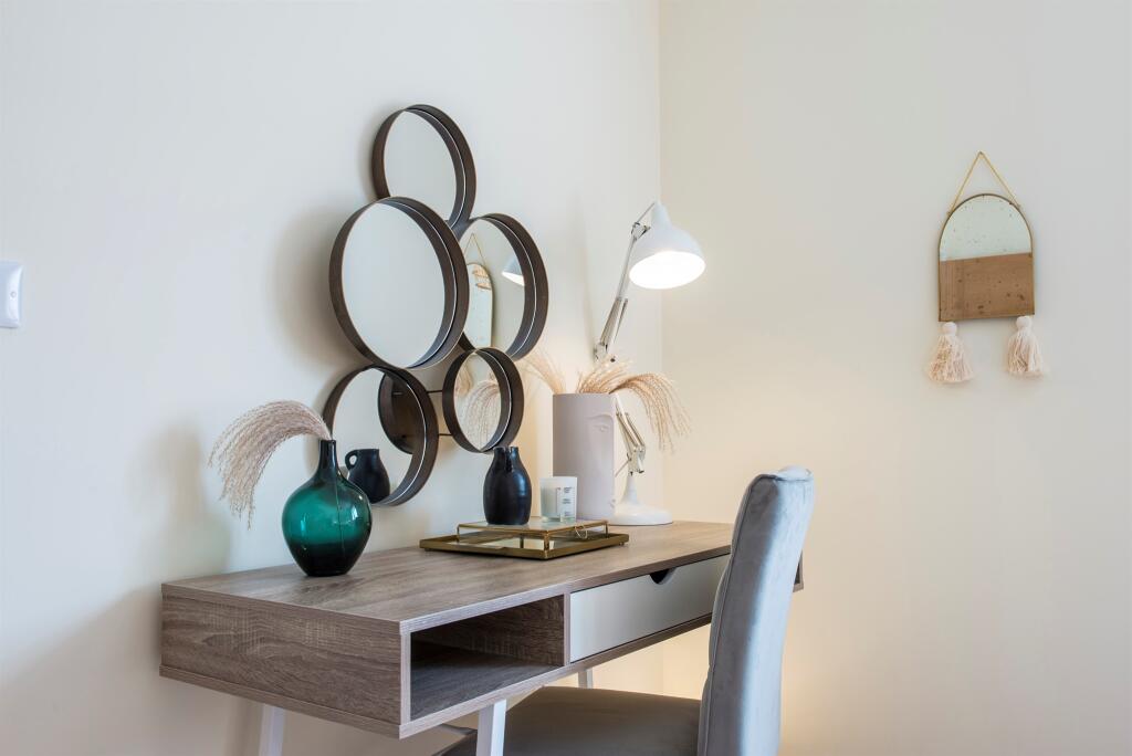
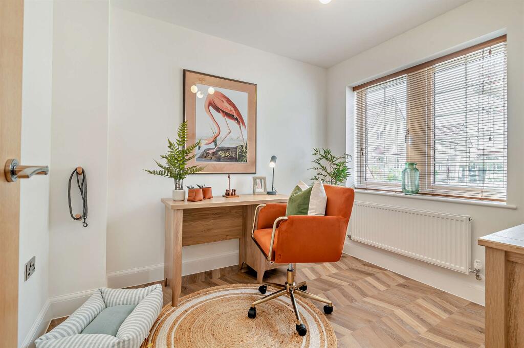
- Study:
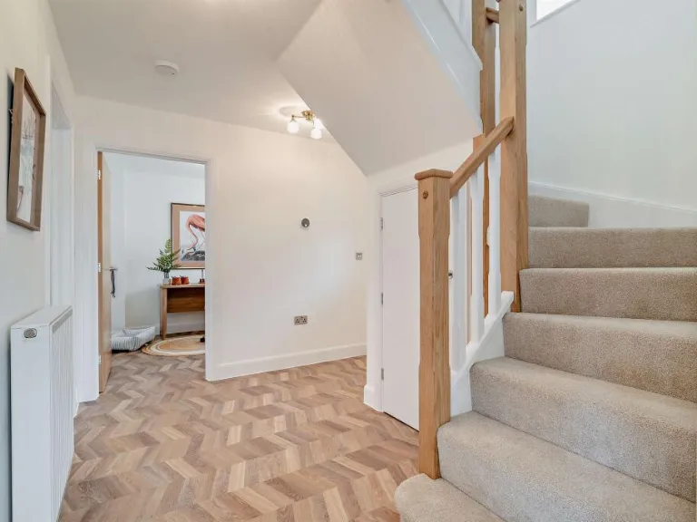
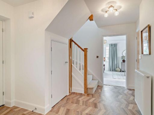
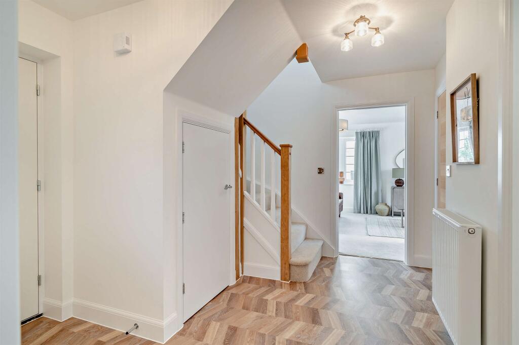
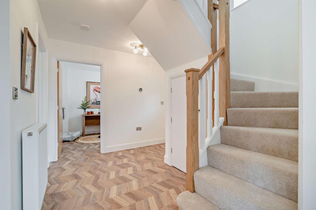
- Hall:
- WC:
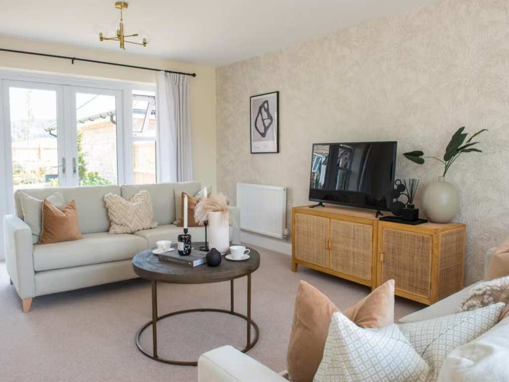
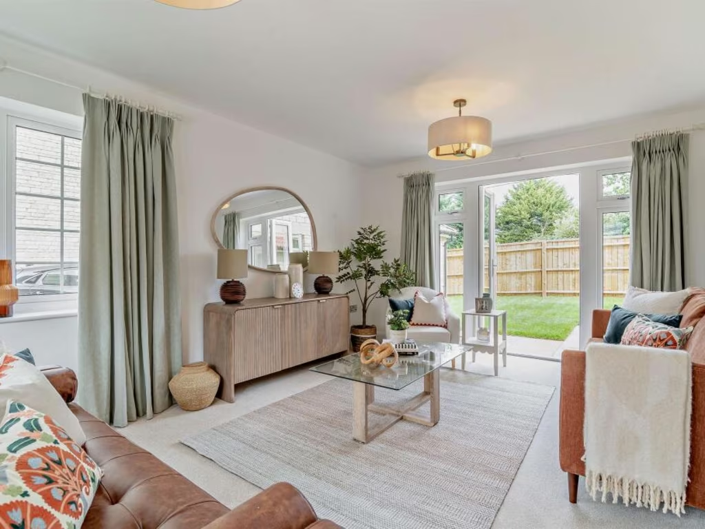
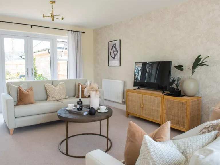
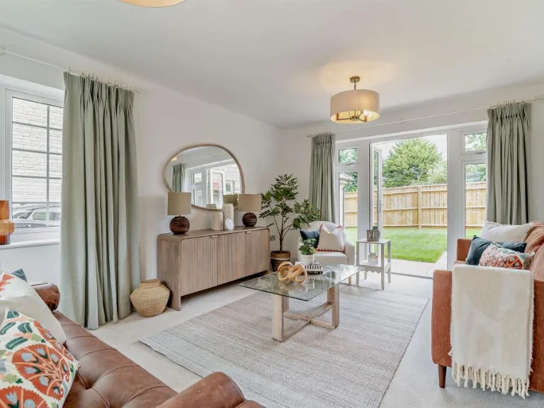
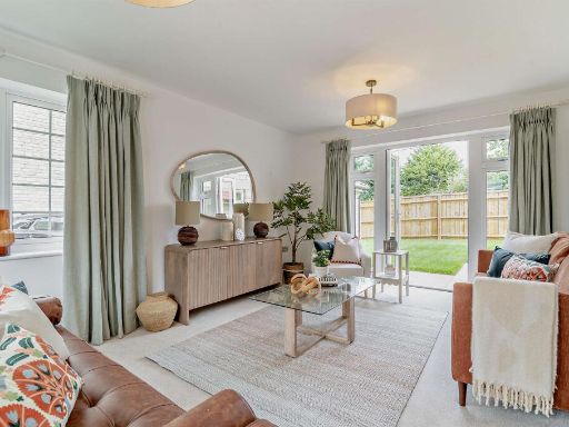
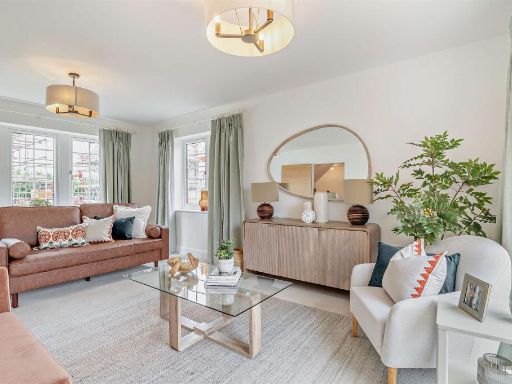
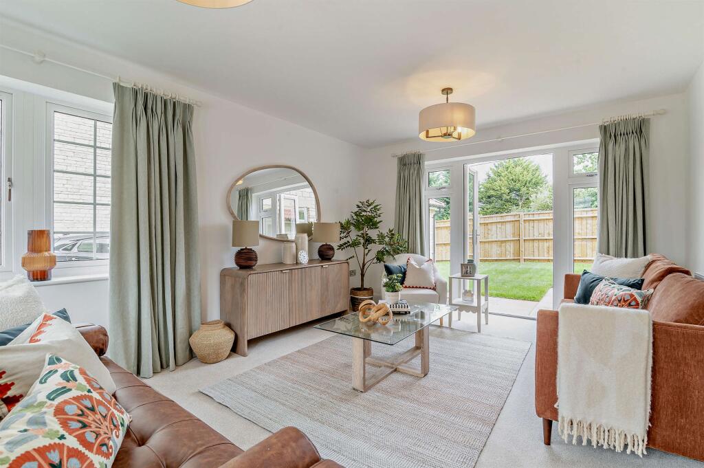
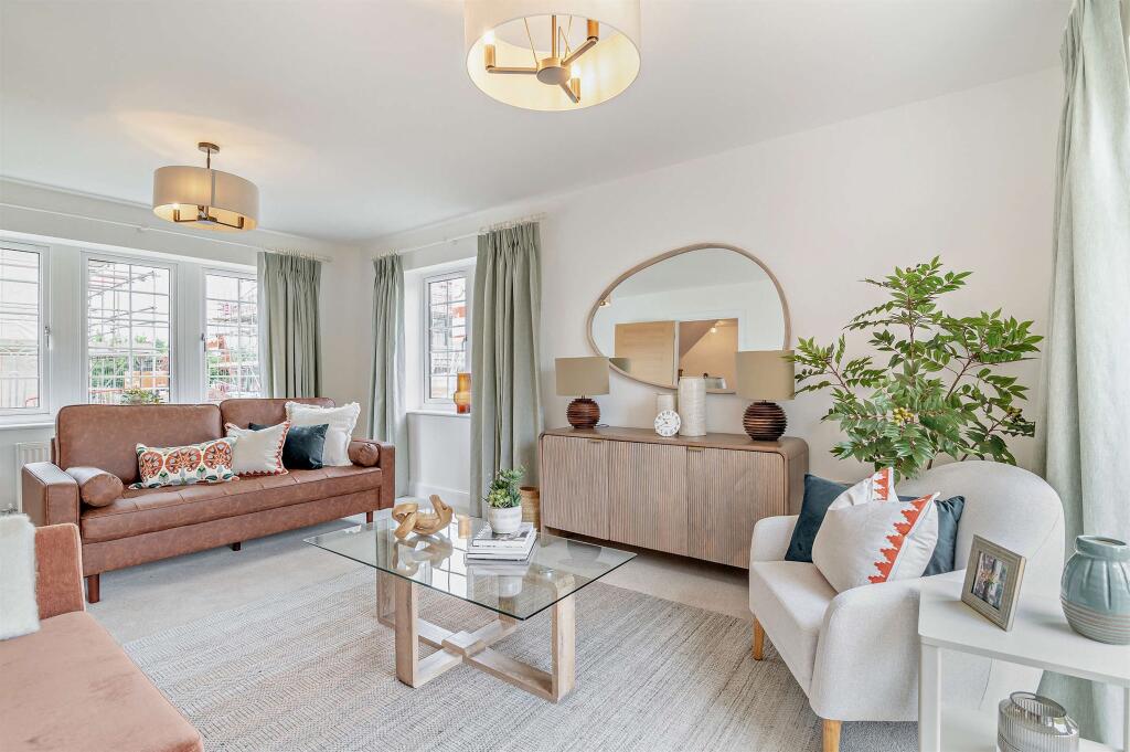
- Living Room:
- C:
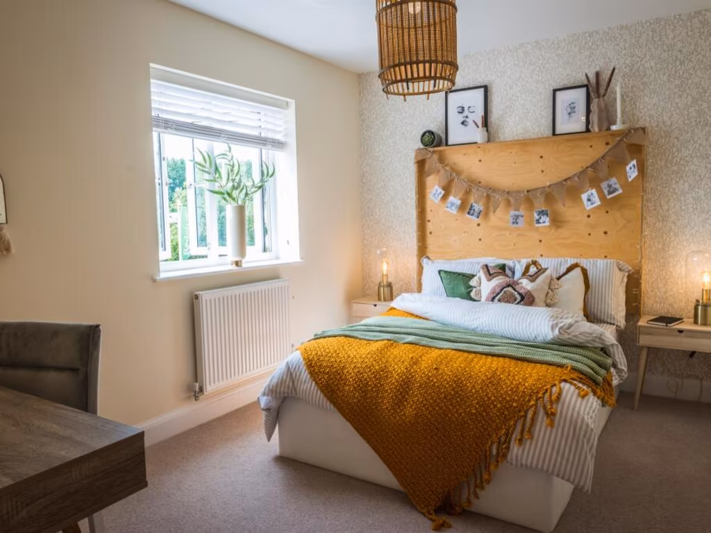
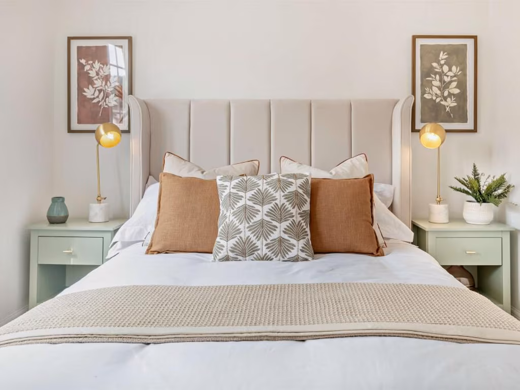
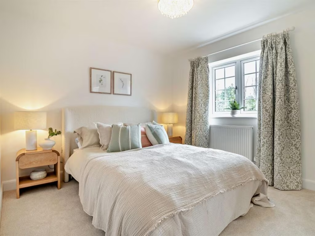
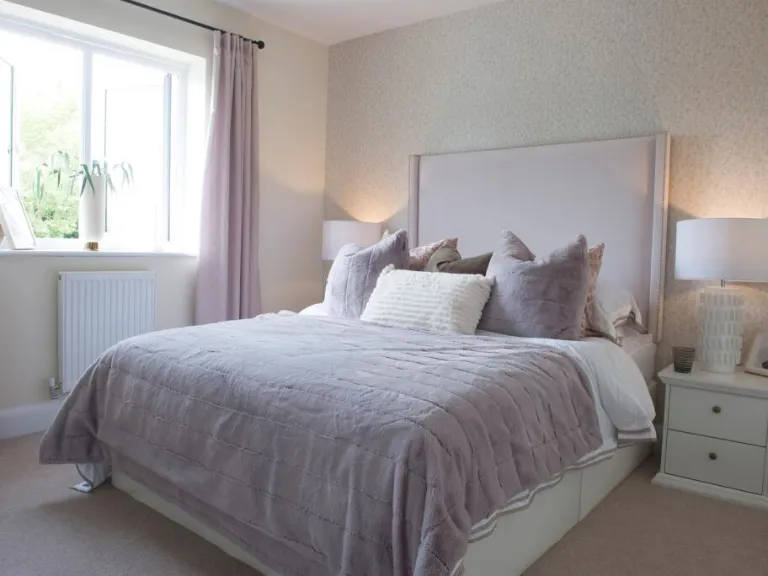
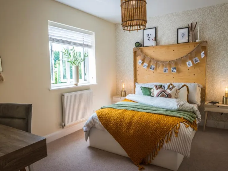
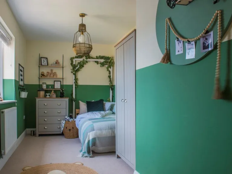
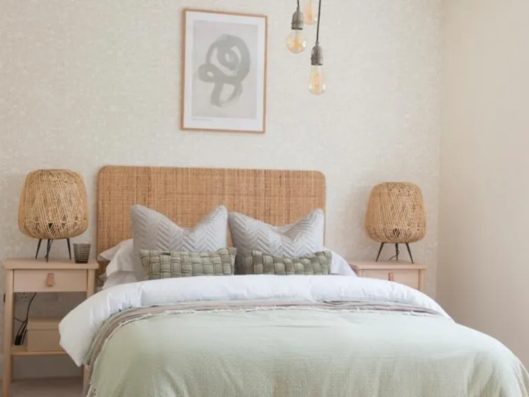
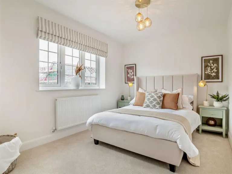
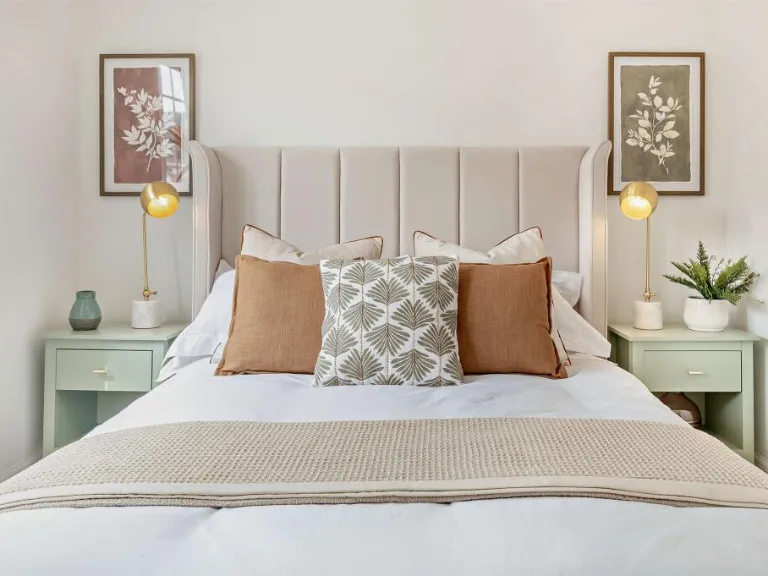
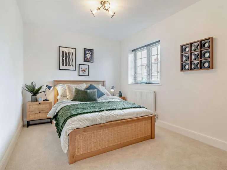
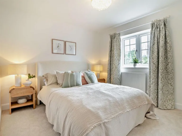
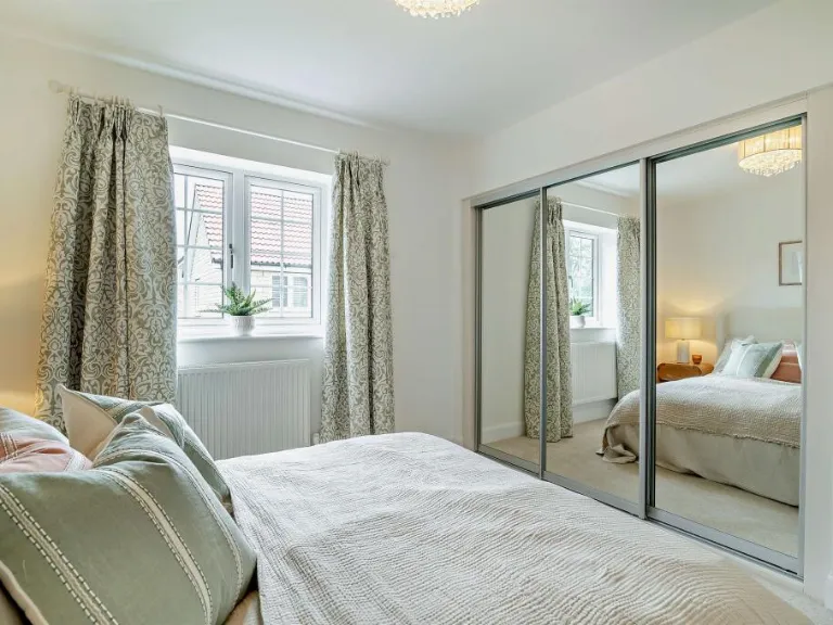
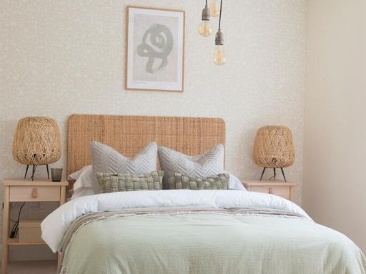
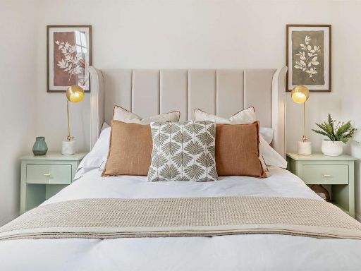
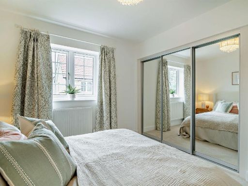
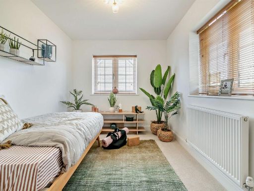
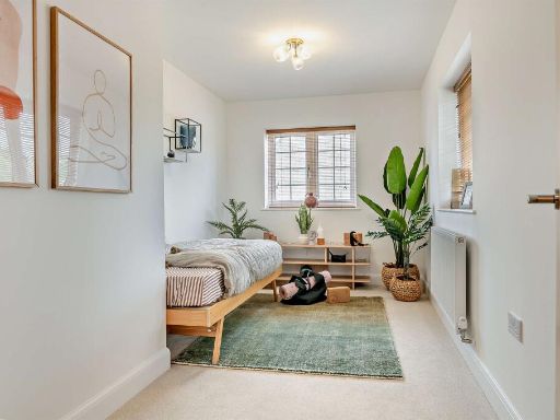
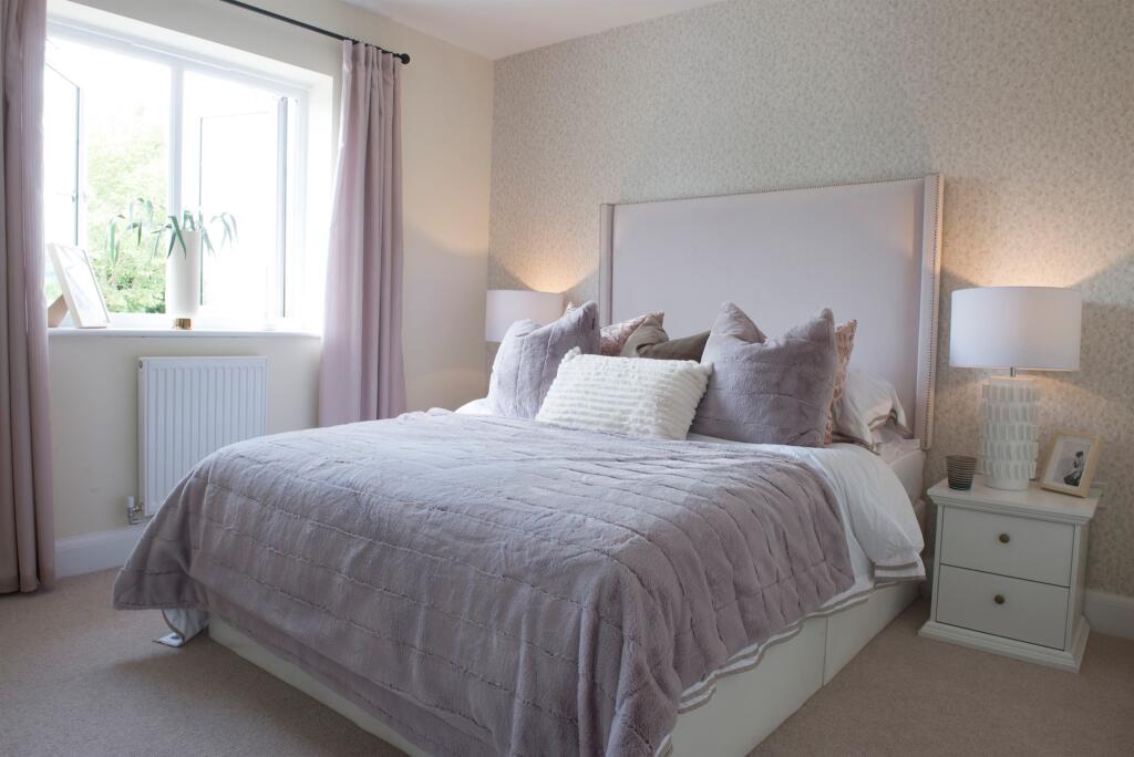
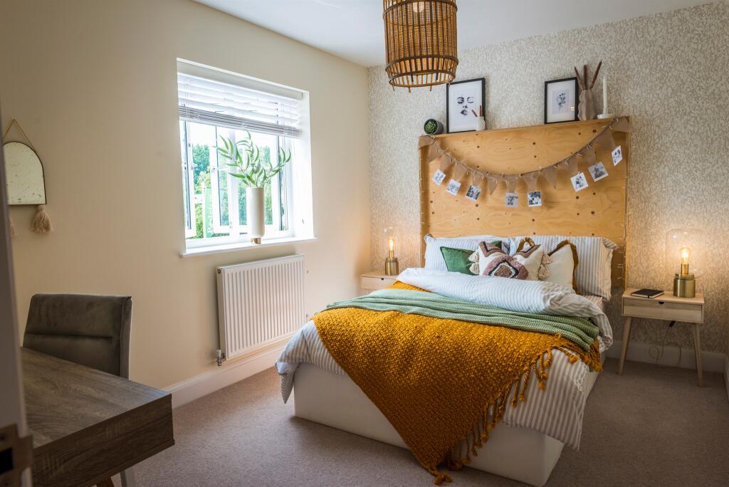
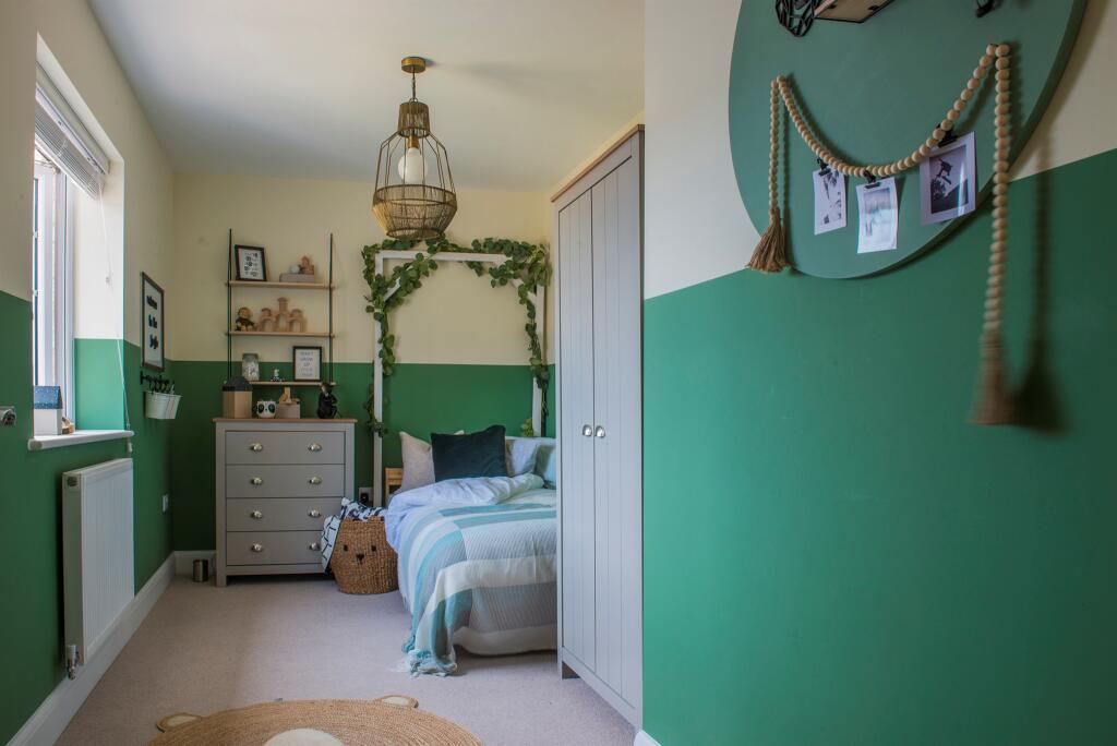
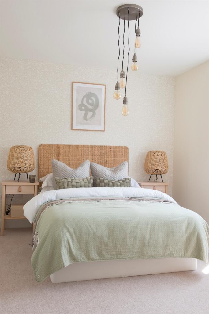
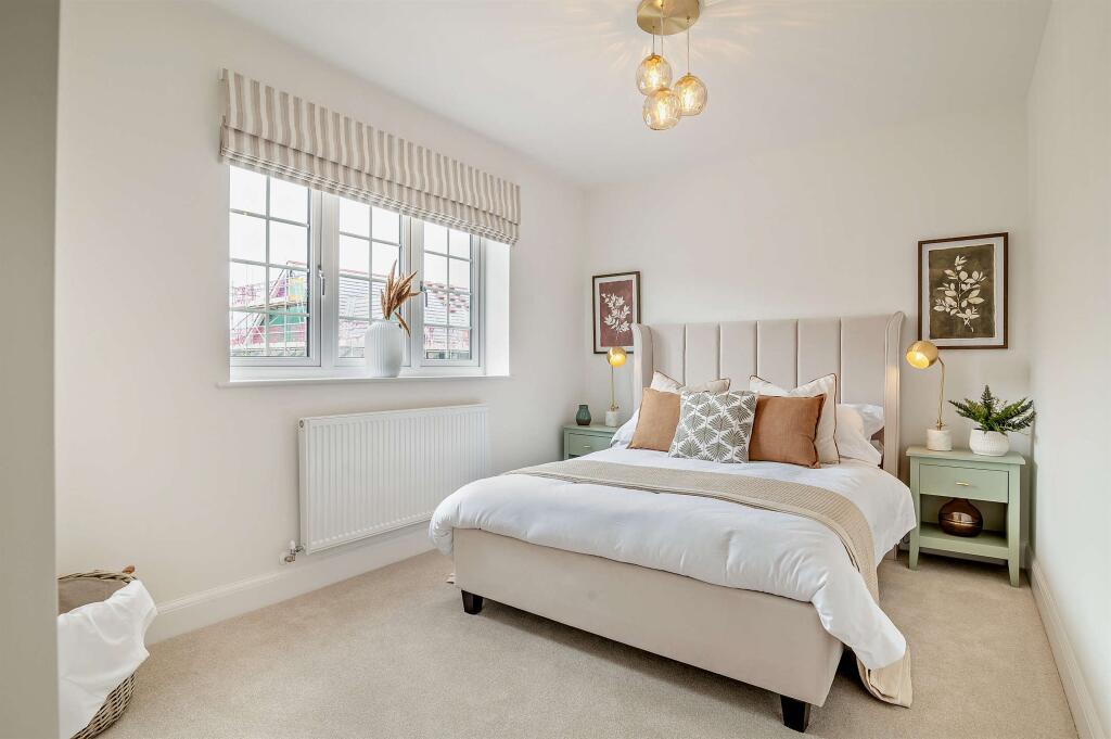
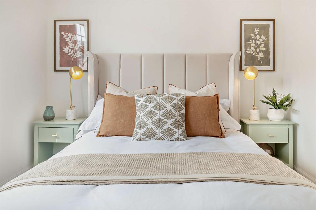
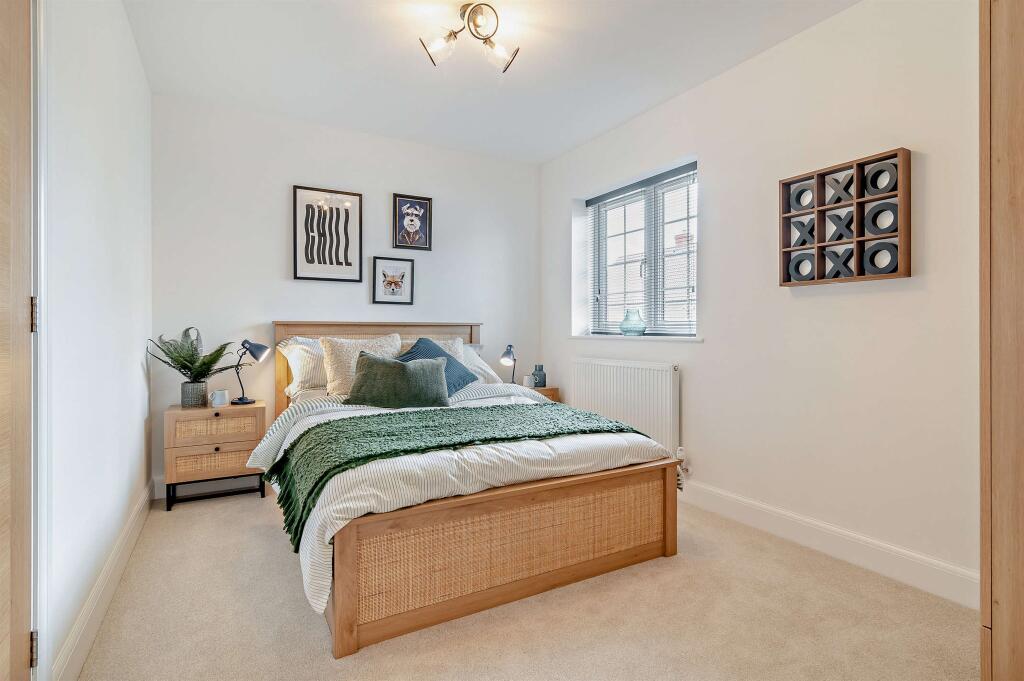
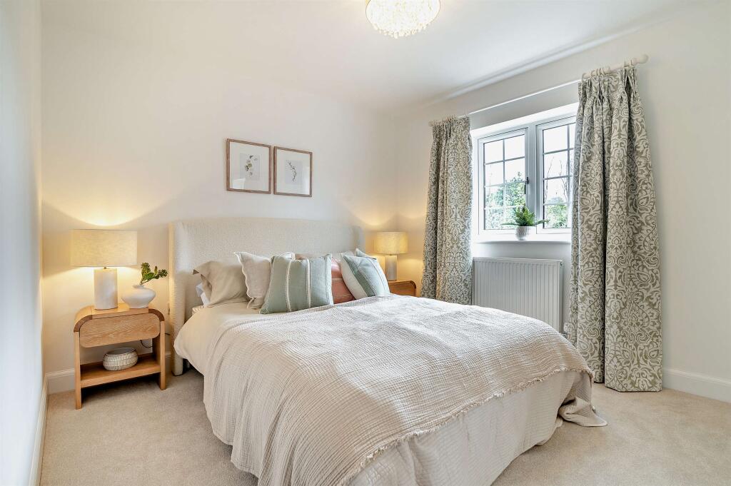
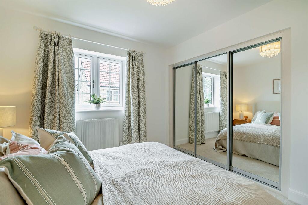
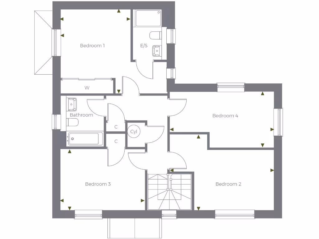
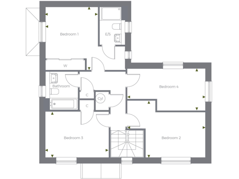
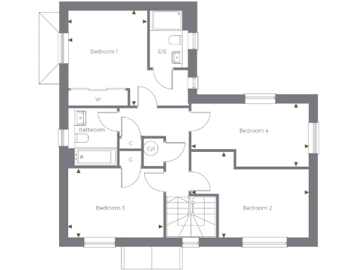
- Bedroom 1:
- E/S:
- W:
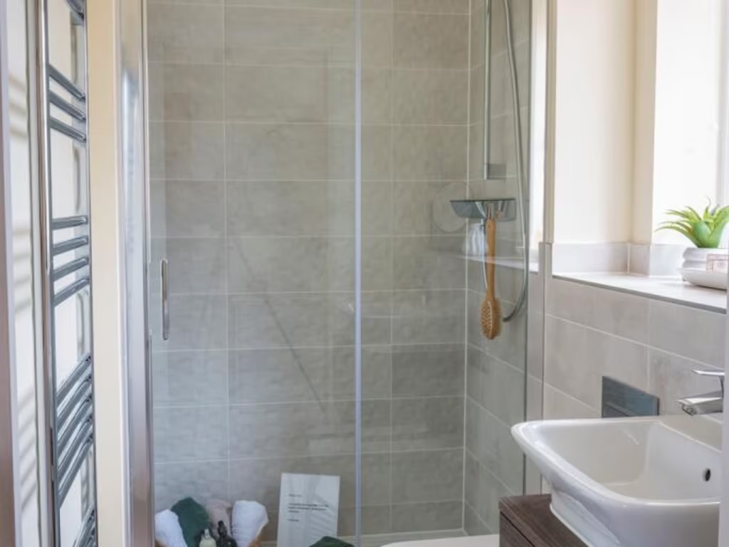
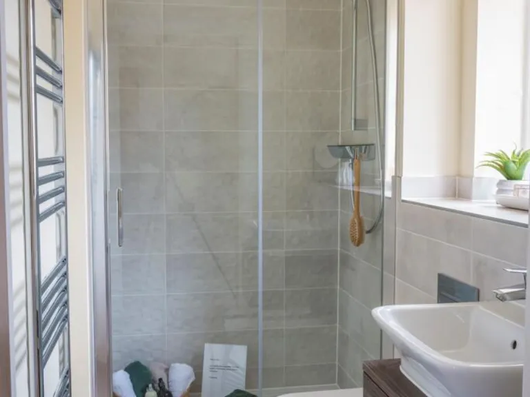
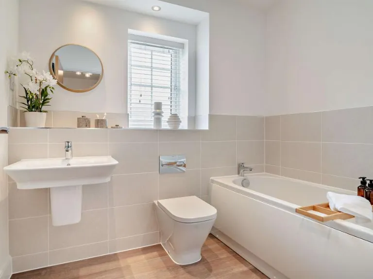
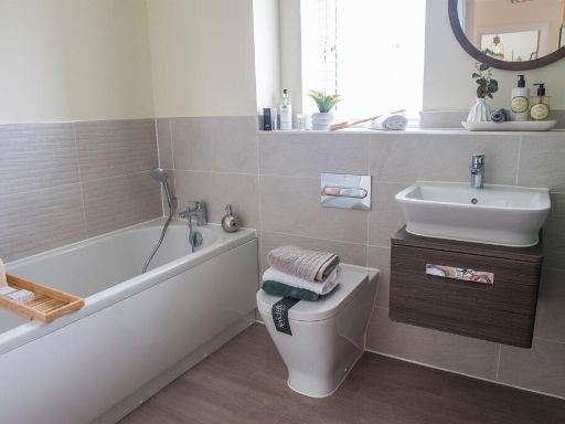
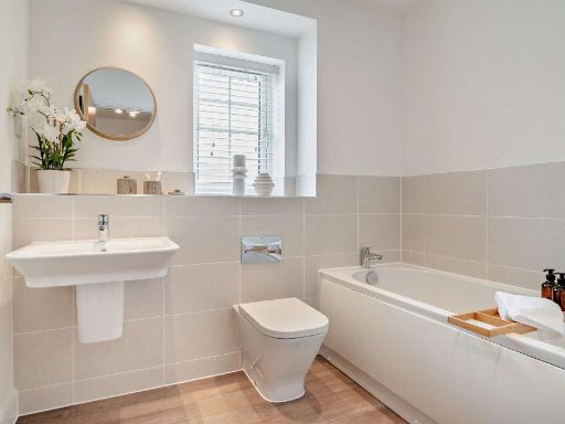
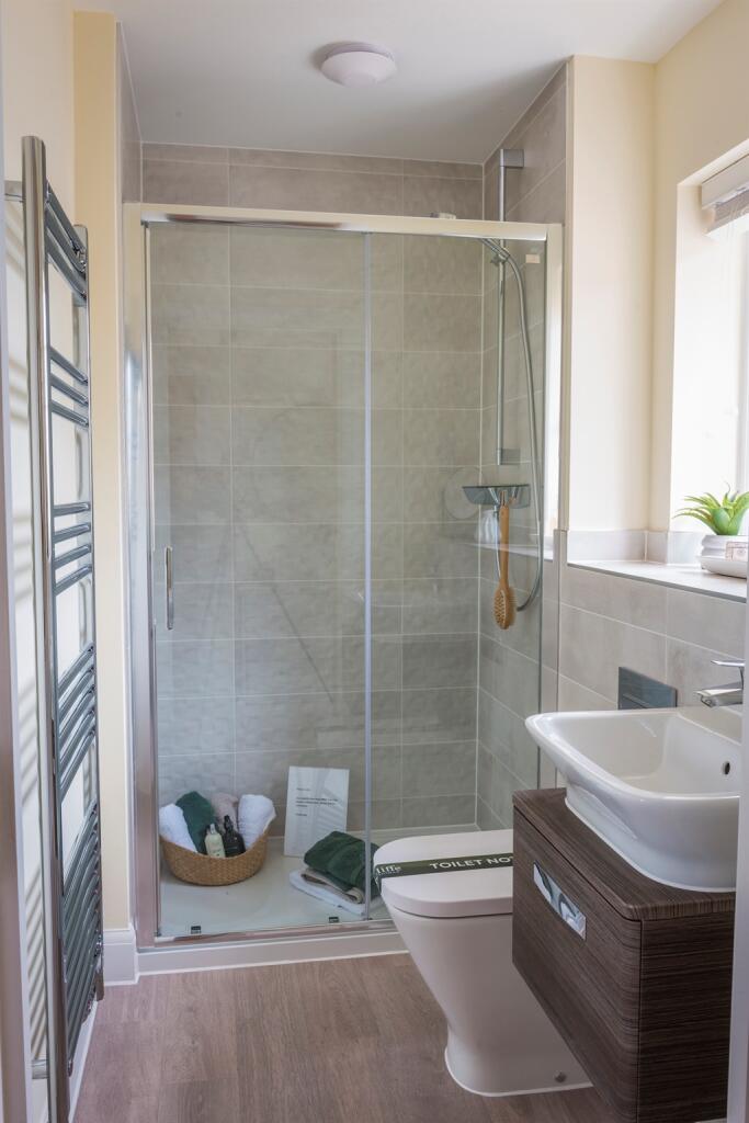
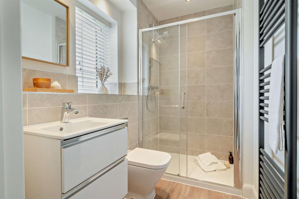
- Bathroom:
- C:
- C:
- Cyl:
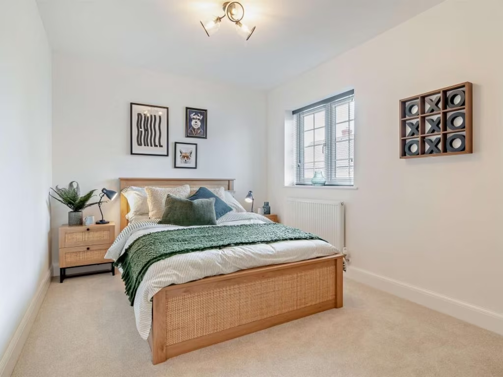
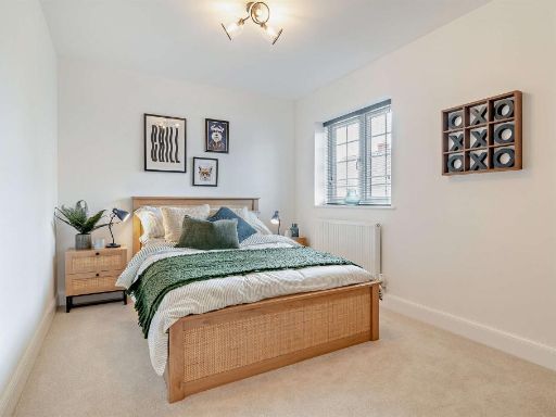
- Bedroom 3:
- Bedroom 4:
- Bedroom 2:
Textual Property Features
- Is New Build
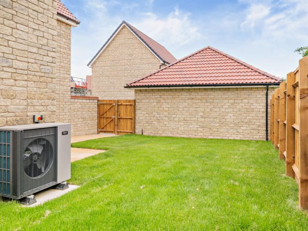
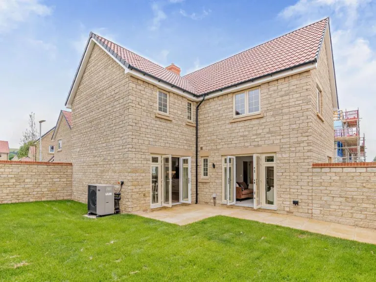
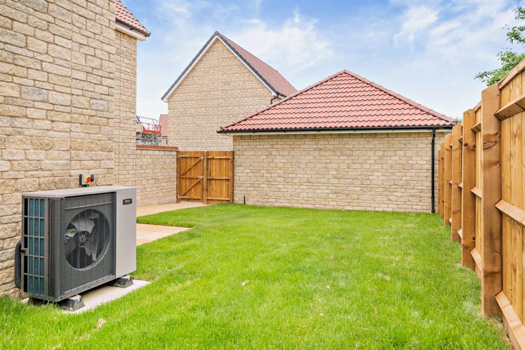
- Has Garden
- Chain Free
- Success
Detected Visual Features
- modern
- detached
- stone exterior
- pitched roof
- double-glazed windows
- two-storey
- residential
- suburban
- modern kitchen
- open plan
- contemporary design
- central island
- glass splashback
- neutral colors
EPC Details
- Fully double glazed
- Cavity wall, as built, insulated (assumed)
- Boiler and radiators, LPG
- Low energy lighting in 25% of fixed outlets
- Solid, no insulation (assumed)
Nearby Schools
- St Paul's Catholic Primary School
- Tyndale Primary School
- Iron Acton Church of England Primary School
- Lyde Green Primary School
- Watermore Primary School
- Woodlands Primary School
- St Mary's Church of England Primary School, Yate
- Marshfield Church of England Primary School
- Immanuel Christian School
- The Manor Church of England Primary School
- Trinity Church of England Primary School
- Chipping Sodbury School
- St John's Mead Church of England Primary School
- Horton CofE VA Primary School
- Alexander Hosea Primary School
- Pucklechurch CofE VC Primary School
- Wellesley Primary School
- Abbotswood Primary School
- Old Sodbury Church of England Primary School
- Yate Academy
- North Road Community Primary School
- Brimsham Green School
- Hawkesbury Church of England Primary School
- Hillesley Church of England Primary School
Nearest General Shops
- Id: 266395223
- Tags:
- TagsNormalized:
- Lat: 51.5325134
- Lon: -2.3603415
- FullGeoHash: gcnm4m1q8hcb
- PartitionGeoHash: gcnm
- Images:
- FoodStandards: null
- Distance: 778.3
,- Id: 722226741
- Tags:
- Name: Chipping Sodbury Caravans
- Shop: caravan
- TagsNormalized:
- Lat: 51.5340473
- Lon: -2.3817144
- FullGeoHash: gcnm1v3xw49n
- PartitionGeoHash: gcnm
- Images:
- FoodStandards: null
- Distance: 710
,- Id: 965603979
- Tags:
- Addr:
- Brand: Kwik Fit
- Brand:wikidata: Q958053
- Brand:wikipedia: en:Kwik Fit
- Building: yes
- Name: Kwik Fit
- Shop: car_repair
- TagsNormalized:
- kwik fit
- car repair
- repair
- shop
- Lat: 51.5334769
- Lon: -2.3806072
- FullGeoHash: gcnm1v6krb6e
- PartitionGeoHash: gcnm
- Images:
- FoodStandards: null
- Distance: 628.3
}
Nearest Religious buildings
- Id: 121022830
- Tags:
- Addr:
- City: Chipping Sodbury
- Postcode: BS37 6AH
- Street: High Street
- Amenity: place_of_worship
- Building: yes
- Denomination: baptist
- Fhrs:
- Name: Chipping Sodbury Baptist Church
- Religion: christian
- Source:
- TagsNormalized:
- place of worship
- baptist
- church
- christian
- Lat: 51.5375892
- Lon: -2.3942246
- FullGeoHash: gcnm1w0s4wbw
- PartitionGeoHash: gcnm
- Images:
- FoodStandards:
- Id: 1026587
- FHRSID: 1026587
- LocalAuthorityBusinessID: 148034
- BusinessName: Chipping Sodbury Baptist Church
- BusinessType: Restaurant/Cafe/Canteen
- BusinessTypeID: 1
- AddressLine1: High Street
- AddressLine2: Chipping Sodbury
- AddressLine3: South Gloucestershire
- AddressLine4: null
- PostCode: BS37 6AH
- RatingValue: 5
- RatingKey: fhrs_5_en-GB
- RatingDate: 2022-07-27
- LocalAuthorityCode: 856
- LocalAuthorityName: South Gloucestershire
- LocalAuthorityWebSite: http://www.southglos.gov.uk
- LocalAuthorityEmailAddress: foodandhealth@southglos.gov.uk
- Scores:
- Hygiene: 5
- Structural: 5
- ConfidenceInManagement: 5
- NewRatingPending: false
- Geocode:
- Longitude: -2.39509510993958
- Latitude: 51.53791046142580
- Distance: 1642.3
,- Id: 100900236
- Tags:
- Amenity: place_of_worship
- Building: church
- Denomination: catholic
- Name: St Lawrence
- Religion: christian
- Source:
- Wikidata: Q66478489
- TagsNormalized:
- place of worship
- church
- catholic
- christian
- Lat: 51.5387141
- Lon: -2.3925719
- FullGeoHash: gcnm1w3fc09h
- PartitionGeoHash: gcnm
- Images:
- FoodStandards: null
- Distance: 1577.3
,- Id: 191545875
- Tags:
- Addr:
- City: Old Sodbury
- Housename: St John the Baptist Church
- Postcode: BS37 6NB
- Street: Church Lane
- Amenity: place_of_worship
- Building: church
- Denomination: anglican
- Name: Saint John the Baptist
- Religion: christian
- Source: survey
- Source:outline: Bing
- Wikidata: Q17557016
- TagsNormalized:
- place of worship
- church
- anglican
- baptist
- christian
- Lat: 51.5346084
- Lon: -2.3537166
- FullGeoHash: gcnm4mw4f7m9
- PartitionGeoHash: gcnm
- Images:
- FoodStandards: null
- Distance: 1241.6
}
Nearest Medical buildings
- Id: 674043123
- Tags:
- Amenity: clinic
- Building: yes
- Building:levels: 1
- Name: Birch House Osteopathic Clinic
- TagsNormalized:
- Lat: 51.5413474
- Lon: -2.4116617
- FullGeoHash: gcnm1ngfh5w9
- PartitionGeoHash: gcnm
- Images:
- FoodStandards: null
- Distance: 2918.2
,- Id: 908041682
- Tags:
- Addr:
- City: Bristol
- Housenumber: 86
- Postcode: BS37 7AG
- Street: Firgrove Crescent
- Amenity: dentist
- Building: yes
- Building:levels: 2
- Name: The Ridge Dental Surgery
- Roof:
- Website: https://www.ridgedental.com/
- TagsNormalized:
- Lat: 51.542513
- Lon: -2.4047456
- FullGeoHash: gcnm1r0bvkgd
- PartitionGeoHash: gcnm
- Images:
- FoodStandards: null
- Distance: 2517.9
,- Id: 8954300577
- Tags:
- Addr:
- Housenumber: 8
- Street: Hounds Road
- Amenity: dentist
- Healthcare: dentist
- Name: Hounds Road Dental Practice
- Opening_hours: Mo 09:15-13:00,14:00-17:00; Tu-We 09:00-13:00,14:00-17:00; Th 09:15-12:00,12:15-14:30; Fr 09:00-13:00,14:00-16:30
- Website: https://houndsroaddental.co.uk/
- TagsNormalized:
- dentist
- health
- healthcare
- dental
- Lat: 51.5377176
- Lon: -2.3935332
- FullGeoHash: gcnm1w1hfwuk
- PartitionGeoHash: gcnm
- Images:
- FoodStandards: null
- Distance: 1601.1
,- Id: 120870340
- Tags:
- Addr:
- City: Chipping Sodbury
- Housename: Old Bank House
- Housenumber: 79
- Postcode: BS37 6AD
- Street: Broad Street
- Amenity: clinic
- Building: yes
- Name: The Medical
- Source:
- Wikidata: Q26599529
- TagsNormalized:
- Lat: 51.538561
- Lon: -2.3919868
- FullGeoHash: gcnm1w61ysj7
- PartitionGeoHash: gcnm
- Images:
- FoodStandards: null
- Distance: 1533.4
}
Nearest Airports
- Id: 47483196
- Tags:
- Aerodrome: international
- Aeroway: aerodrome
- Iata: BRS
- Icao: EGGD
- Internet_access: wlan
- Internet_access:fee: no
- Name: Bristol Airport
- Type: public
- Website: https://www.bristolairport.co.uk/
- Wikidata: Q8725
- Wikipedia: en:Bristol Airport
- TagsNormalized:
- airport
- international airport
- Lat: 51.3830799
- Lon: -2.7186615
- FullGeoHash: gcnh64h24s74
- PartitionGeoHash: gcnh
- Images:
- FoodStandards: null
- Distance: 29278.4
}
Nearest Leisure Facilities
- Id: 953967962
- Tags:
- Leisure: pitch
- Sport: soccer
- TagsNormalized:
- Lat: 51.5332138
- Lon: -2.3595178
- FullGeoHash: gcnm4m3fer24
- PartitionGeoHash: gcnm
- Images:
- FoodStandards: null
- Distance: 831
,- Id: 971649514
- Tags:
- Leisure: pitch
- Sport: equestrian
- TagsNormalized:
- pitch
- leisure
- equestrian
- sports
- Lat: 51.5277132
- Lon: -2.3648127
- FullGeoHash: gcnm4hmfxvgv
- PartitionGeoHash: gcnm
- Images:
- FoodStandards: null
- Distance: 770.7
,- Id: 971625909
- Tags:
- Access: private
- Leisure: swimming_pool
- Location: outdoor
- TagsNormalized:
- swimming
- swimming pool
- pool
- leisure
- Lat: 51.5325923
- Lon: -2.3613003
- FullGeoHash: gcnm4m0x1eqy
- PartitionGeoHash: gcnm
- Images:
- FoodStandards: null
- Distance: 711.4
,- Id: 1018475178
- Tags:
- Leisure: pitch
- Sport: equestrian
- TagsNormalized:
- pitch
- leisure
- equestrian
- sports
- Lat: 51.5370566
- Lon: -2.3635776
- FullGeoHash: gcnm4nnchesv
- PartitionGeoHash: gcnm
- Images:
- FoodStandards: null
- Distance: 694.7
,- Id: 971625882
- Tags:
- Access: private
- Leisure: swimming_pool
- Location: outdoor
- TagsNormalized:
- swimming
- swimming pool
- pool
- leisure
- Lat: 51.5341591
- Lon: -2.3679749
- FullGeoHash: gcnm4je8nptc
- PartitionGeoHash: gcnm
- Images:
- FoodStandards: null
- Distance: 266.3
}
Nearest Tourist attractions
- Id: 103503799
- Tags:
- Building: yes
- Name: Yate Heritage Centre
- Source:
- Tourism: attraction
- TagsNormalized:
- Lat: 51.5424745
- Lon: -2.4137142
- FullGeoHash: gcnm1p42smsh
- PartitionGeoHash: gcnm
- Images:
- FoodStandards: null
- Distance: 3092.8
,- Id: 610000233
- Tags:
- Addr:
- Postcode: BS37 6RP
- Street: Tormarton Road
- Alt_name: Windylands Bed and Breakfast
- Building: yes
- Internet_access: wlan
- Internet_access:fee: no
- Name: Windylands
- Phone: +441454323653
- Tourism: guest_house
- TagsNormalized:
- Lat: 51.5245607
- Lon: -2.3382894
- FullGeoHash: gcnm4gc23fm0
- PartitionGeoHash: gcnm
- Images:
- FoodStandards: null
- Distance: 2494
,- Id: 991974693
- Tags:
- Addr:
- City: Bristol
- Postcode: BS37 6PZ
- Street: Portway Lane
- Contact:
- Email: cotswoldmeadowcamping@gmail.com
- Phone: +44 7789 081899
- Website: https://www.cotswoldmeadowcamping.co.uk
- Name: Cotswold Meadow Camping
- Tourism: camp_site
- TagsNormalized:
- Lat: 51.5424065
- Lon: -2.3663445
- FullGeoHash: gcnm4phbk0vw
- PartitionGeoHash: gcnm
- Images:
- FoodStandards: null
- Distance: 1080.4
}
Nearest Train stations
- Id: 26512125
- Tags:
- Name: Oldfield Park
- Naptan:
- Network: National Rail
- Public_transport: station
- Railway: station
- Ref:
- Wheelchair: yes
- Wikidata: Q2275914
- Wikipedia: en:Oldfield Park railway station
- TagsNormalized:
- Lat: 51.379219
- Lon: -2.3801898
- FullGeoHash: gcnk3c6c9s9g
- PartitionGeoHash: gcnk
- Images:
- FoodStandards: null
- Distance: 17137.1
,- Id: 26152727
- Tags:
- Name: Keynsham
- Naptan:
- Network: National Rail
- Public_transport: station
- Railway: station
- Ref:
- Wikidata: Q2658052
- Wikipedia: en:Keynsham railway station
- TagsNormalized:
- Lat: 51.418071
- Lon: -2.4958797
- FullGeoHash: gcnhx0qecz1h
- PartitionGeoHash: gcnh
- Images:
- FoodStandards: null
- Distance: 15432.8
,- Id: 278435766
- Tags:
- Name: Filton Abbey Wood
- Naptan:
- Network: National Rail
- Postal_code: BS34 7JW
- Public_transport: station
- Railway: station
- Ref:
- Train: yes
- Wheelchair: yes
- Wikidata: Q2311503
- Wikipedia: en:Filton Abbey Wood railway station
- TagsNormalized:
- Lat: 51.503393
- Lon: -2.563826
- FullGeoHash: gcnhvxvj482f
- PartitionGeoHash: gcnh
- Images:
- FoodStandards: null
- Distance: 13713.1
,- Id: 6605149667
- Tags:
- Addr:
- City: Bristol
- Postcode: BS34 8PU
- Street: Station Approach Road
- Name: Bristol Parkway
- Naptan:
- Network: National Rail
- Public_transport: station
- Railway: station
- Ref:
- Wheelchair: yes
- Wikidata: Q800574
- Wikipedia: en:Bristol Parkway railway station
- TagsNormalized:
- Lat: 51.5138815
- Lon: -2.542979
- FullGeoHash: gcnjn1u60792
- PartitionGeoHash: gcnj
- Images:
- FoodStandards: null
- Distance: 12055.3
,- Id: 17207692
- Tags:
- Name: Yate
- Naptan:
- Network: National Rail
- Postal_code: BS37 5JF
- Public_transport: station
- Railway: station
- Ref:
- Wikidata: Q3900748
- Wikipedia: en:Yate railway station
- TagsNormalized:
- Lat: 51.5413993
- Lon: -2.4321734
- FullGeoHash: gcnm0wufqm0n
- PartitionGeoHash: gcnm
- Images:
- FoodStandards: null
- Distance: 4291.2
}
Nearest Hotels
- Id: 100900234
- Tags:
- Addr:
- City: Chipping Sodbury
- Housename: The George Hotel
- Housenumber: 63
- Postcode: BS37 6AD
- Street: Broad Street
- Amenity: pub
- Building: pub
- Fhrs:
- Name: The George Hotel
- Source:
- Wikidata: Q17556972
- TagsNormalized:
- Lat: 51.5385695
- Lon: -2.3930116
- FullGeoHash: gcnm1w33yv9n
- PartitionGeoHash: gcnm
- Images:
- FoodStandards: null
- Distance: 1599.4
,- Id: 120340755
- Tags:
- Addr:
- City: Chipping Sodbury
- Housename: The Portcullis Hotel
- Housenumber: 11
- Postcode: BS37 6DA
- Street: Horse Street
- Amenity: pub
- Building: yes
- Fhrs:
- Name: The Portcullis Hotel
- Wikidata: Q26422134
- TagsNormalized:
- Lat: 51.538254
- Lon: -2.3912053
- FullGeoHash: gcnm1w6b0fuh
- PartitionGeoHash: gcnm
- Images:
- FoodStandards: null
- Distance: 1470.4
,- Id: 971625899
- Tags:
- Addr:
- City: Old Sodbury
- Postcode: BS37 6LU
- Street: Badminton Road
- Building: yes
- Name: Sodbury House Hotel
- Phone: +44 1454 312847
- Rooms: 7
- Tourism: hotel
- Website: http://www.sodburyhouse.co.uk/
- TagsNormalized:
- Lat: 51.5326334
- Lon: -2.3652529
- FullGeoHash: gcnm4jjxme5s
- PartitionGeoHash: gcnm
- Images:
- FoodStandards: null
- Distance: 439.6
}
Tags
- modern
- detached
- stone exterior
- pitched roof
- double-glazed windows
- two-storey
- residential
- suburban
- modern kitchen
- open plan
- contemporary design
- central island
- glass splashback
- neutral colors
Local Market Stats
- Average Price/sqft: £334
- Avg Income: £49400
- Rental Yield: 4.6%
- Social Housing: 6%
- Planning Success Rate: 83%
AirBnB Data
- 1km average: £65/night
- Listings in 1km: 1
Similar Properties
 4 bedroom detached house for sale in Badminton Road, Old Sodbury, Bristol, BS37 — £655,000 • 4 bed • 2 bath • 1509 ft²
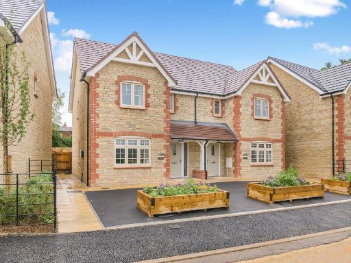 3 bedroom detached house for sale in Badminton Road, Old Sodbury, Bristol, BS37 — £450,000 • 3 bed • 2 bath • 1017 ft²
 3 bedroom character property for sale in Chapel Lane, Old Sodbury, Bristol, BS37 — £550,000 • 3 bed • 2 bath • 1088 ft²
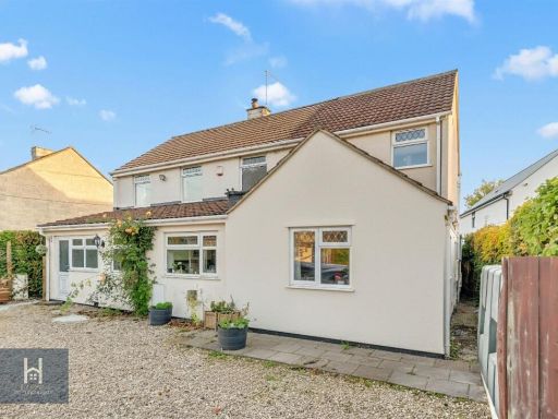 5 bedroom detached house for sale in Badminton Road, Old Sodbury, Bristol, BS37 — £895,000 • 5 bed • 3 bath • 2222 ft²
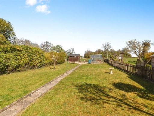 3 bedroom semi-detached house for sale in Westmoreland Terrace, Old Sodbury, Bristol, BS37 — £410,000 • 3 bed • 1 bath • 1077 ft²
 3 bedroom detached bungalow for sale in The Greenaways, Chipping Sodbury, Bristol, BS37 — £550,000 • 3 bed • 2 bath • 1389 ft²
Meta
- {
"@context": "https://schema.org",
"@type": "Residence",
"name": "4 bedroom detached house for sale in Badminton Road, Old So…",
"description": "",
"url": "https://propertypiper.co.uk/property/5ee5bf4a-66b6-4c49-b608-b5c9192dcc45",
"image": "https://image-a.propertypiper.co.uk/c08cd1c7-2925-4a3f-ba1e-cd7dfb10064f-1024.jpeg",
"address": {
"@type": "PostalAddress",
"streetAddress": "THE TYTHE BARN BADMINTON ROAD OLD SODBURY BRISTOL",
"postalCode": "BS37 6LU",
"addressLocality": "South Gloucestershire",
"addressRegion": "Thornbury and Yate",
"addressCountry": "England"
},
"geo": {
"@type": "GeoCoordinates",
"latitude": 51.5332419,
"longitude": -2.3715319
},
"numberOfRooms": 4,
"numberOfBathroomsTotal": 2,
"floorSize": {
"@type": "QuantitativeValue",
"value": 1509,
"unitCode": "FTK"
},
"offers": {
"@type": "Offer",
"price": 650000,
"priceCurrency": "GBP",
"availability": "https://schema.org/InStock"
},
"additionalProperty": [
{
"@type": "PropertyValue",
"name": "Feature",
"value": "modern"
},
{
"@type": "PropertyValue",
"name": "Feature",
"value": "detached"
},
{
"@type": "PropertyValue",
"name": "Feature",
"value": "stone exterior"
},
{
"@type": "PropertyValue",
"name": "Feature",
"value": "pitched roof"
},
{
"@type": "PropertyValue",
"name": "Feature",
"value": "double-glazed windows"
},
{
"@type": "PropertyValue",
"name": "Feature",
"value": "two-storey"
},
{
"@type": "PropertyValue",
"name": "Feature",
"value": "residential"
},
{
"@type": "PropertyValue",
"name": "Feature",
"value": "suburban"
},
{
"@type": "PropertyValue",
"name": "Feature",
"value": "modern kitchen"
},
{
"@type": "PropertyValue",
"name": "Feature",
"value": "open plan"
},
{
"@type": "PropertyValue",
"name": "Feature",
"value": "contemporary design"
},
{
"@type": "PropertyValue",
"name": "Feature",
"value": "central island"
},
{
"@type": "PropertyValue",
"name": "Feature",
"value": "glass splashback"
},
{
"@type": "PropertyValue",
"name": "Feature",
"value": "neutral colors"
}
]
}
High Res Floorplan Images
Compatible Floorplan Images
FloorplanImages Thumbnail