CB9 7UD - 4 bedroom detached house for sale in Haverhill Road, Haverh…
View on Property Piper
4 bedroom detached house for sale in Haverhill Road,
Haverhill,
Suffolk,
CB9 7UD
, CB9
Property Details
- Price: £545000
- Bedrooms: 4
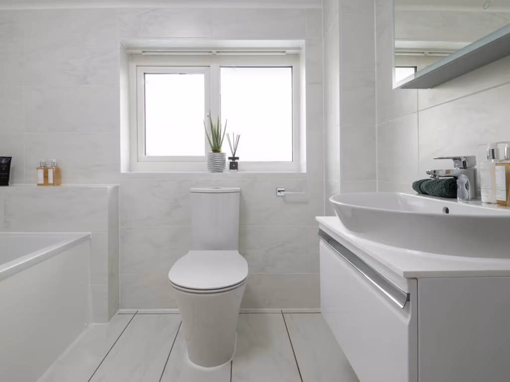
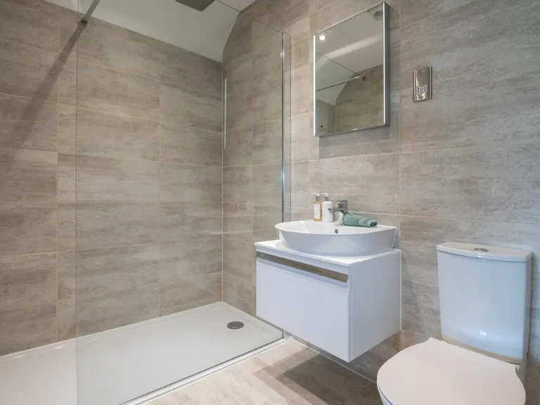
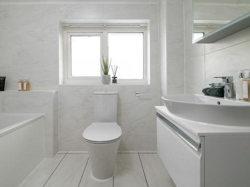
- Bathrooms: 1
- Property Type: undefined
- Property SubType: undefined
Brochure Descriptions
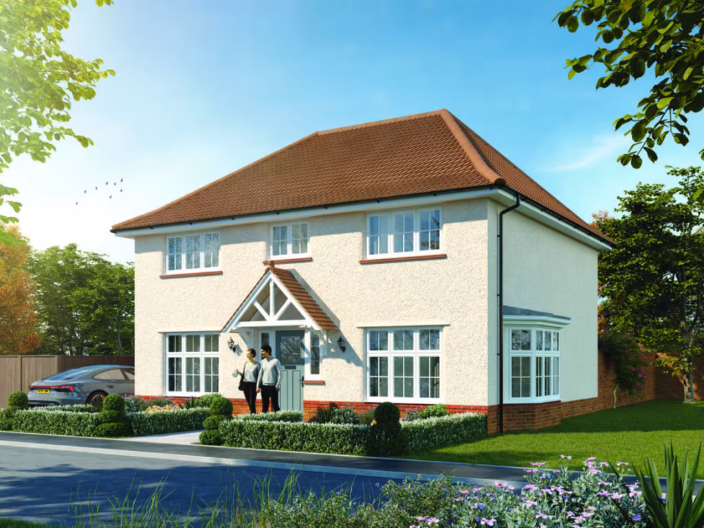
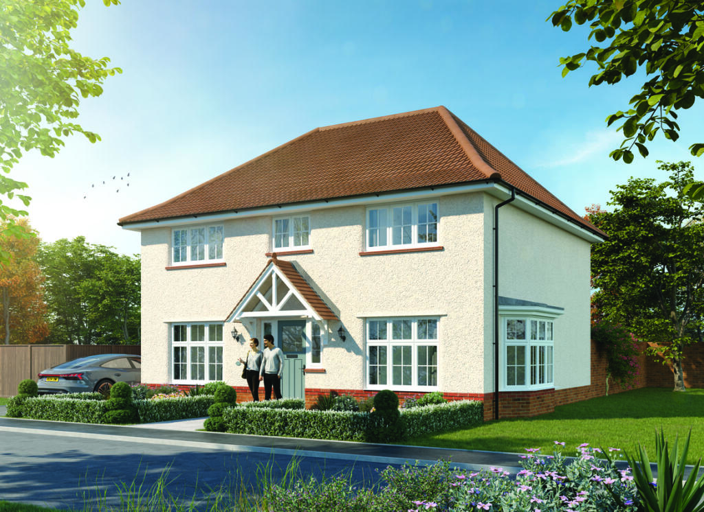
- The property appears to be part of a new residential development named 'The Parklands' at Great Wilsey Park, located in Haverhill. As it is a development, it likely comprises newly built homes with modern design features. No views can be observed in the image, and there are no indications of property size, garden size, or room numbers.
- The property appears to be part of a new development called The Parklands at Great Wilsey Park, located in Haverhill, Suffolk. As it is associated with a named parkland development, it is likely designed for residential use with new-build houses, potentially offering views over landscaped communal park areas. The size of individual houses or apartments cannot be determined precisely from this image, but developments like these typically offer a range of property sizes (from small starter homes to larger detached houses). The overall area of the Parklands suggests a sizeable, planned community development.
- The Parklands appears to be a new residential development within Great Wilsey Park, Haverhill. Judging from the site plan, the area consists of planned streets with detached and semi-detached homes, likely modern style as illustrated by the house image. The layout suggests spacious plots with medium to large gardens and plenty of green community space, including nearby parks and schools. The development is surrounded by open countryside, so many homes will benefit from pleasant green views with some exceptional open landscape vistas possible. The overall property sizes in this development look to be average to large for contemporary suburban homes, suitable for families.
- The property indicated appears to be part of a residential development called The Parklands, situated within Great Wilsey Park in Haverhill. It is likely to be a modern residential home, potentially with well-planned landscaping. Given the development branding, the homes may feature average to large room sizes and pleasant surroundings, possibly with parkland or landscaped views. Specific details about the number of rooms, style, or garden size cannot be determined from this image.
- The property appears to be a residential development known as The Parklands at Great Wilsey Park, located in Haverhill, Suffolk. This likely consists of newly built houses or apartments in a modern estate. The development's name suggests landscaped surroundings, possibly spacious communal or private gardens, and a suburban location. Specific details on property size, views, or garden cannot be deduced from this image.
- The property consists of newly developed homes in 'The Parklands' area within Great Wilsey Park, located in Haverhill. Based on the development illustration, the homes are detached and semi-detached modern houses with private driveways and gardens. The estate has a planned layout with green spaces and parkland, indicating some properties may benefit from views over community parks or natural landscaped areas. Overall, the homes appear average to large in size regarding both rooms and gardens, suitable for families, with well-spaced streets and access to local amenities based on the map.
Image Descriptions
- detached house Contemporary
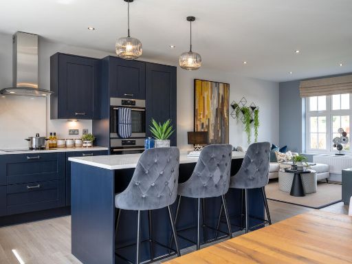
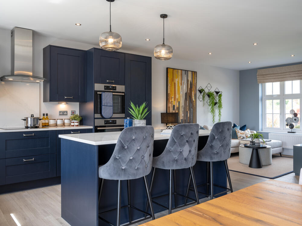
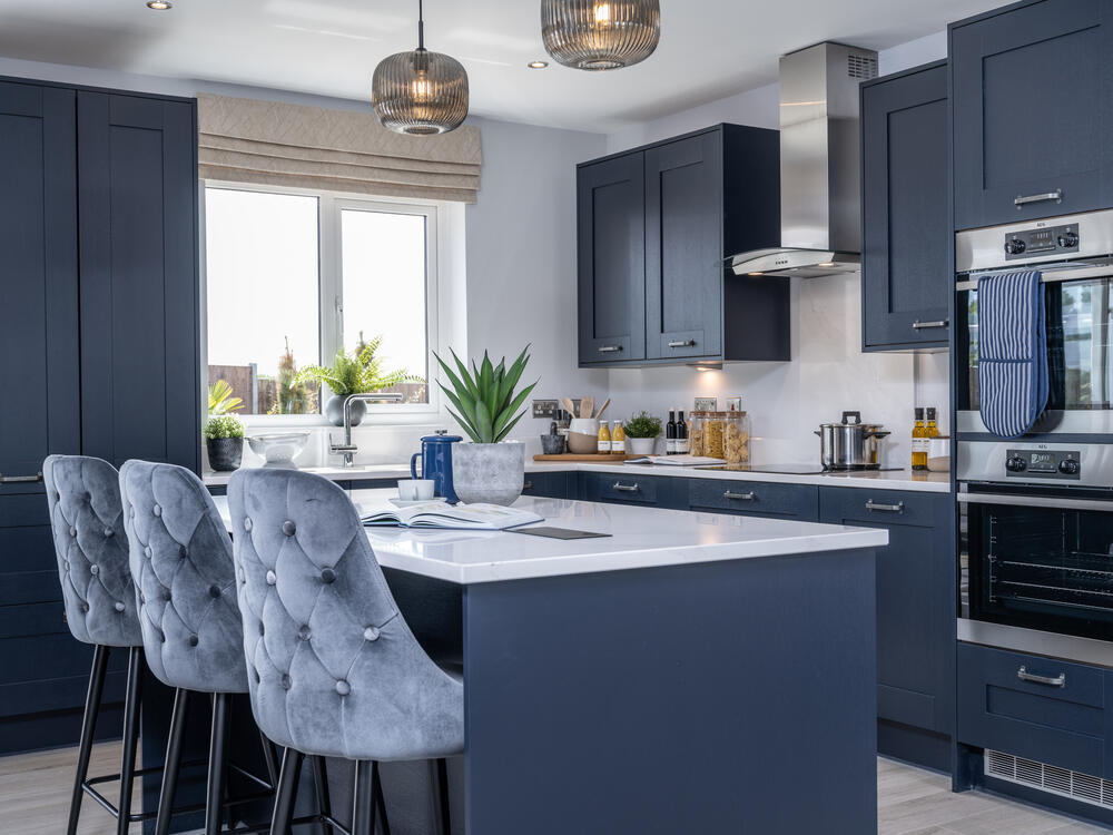
- kitchen contemporary
Floorplan Description
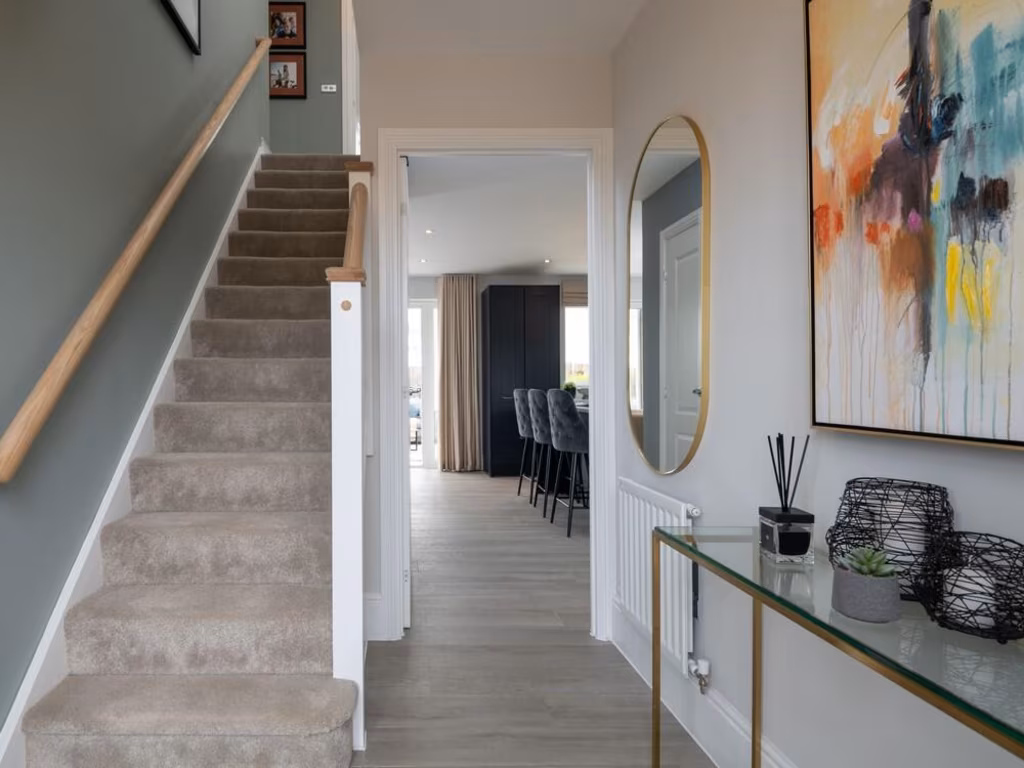
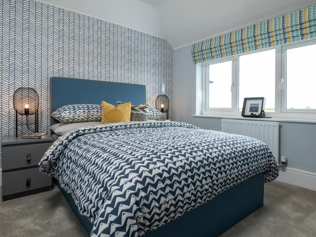
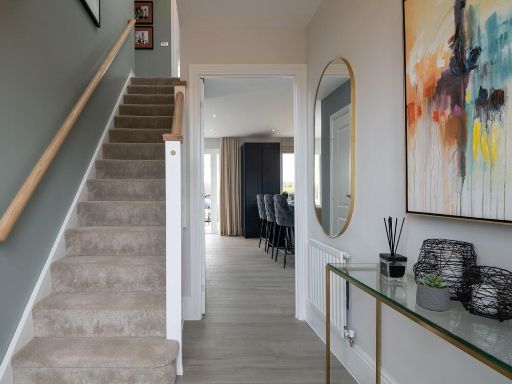
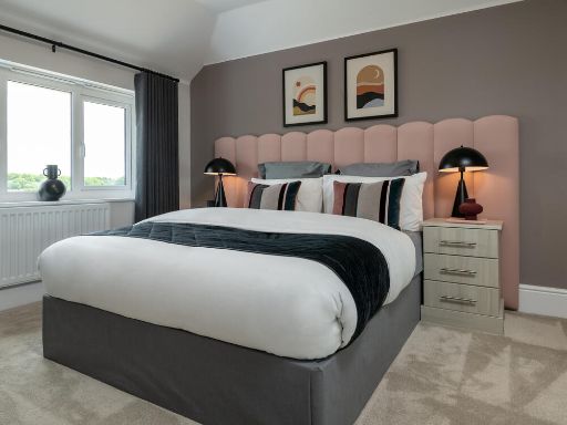
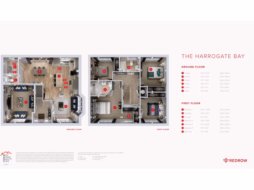
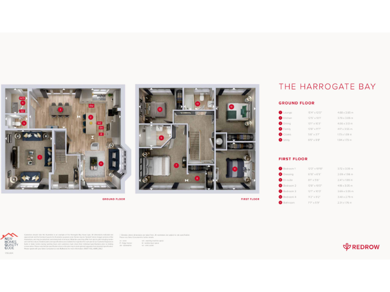
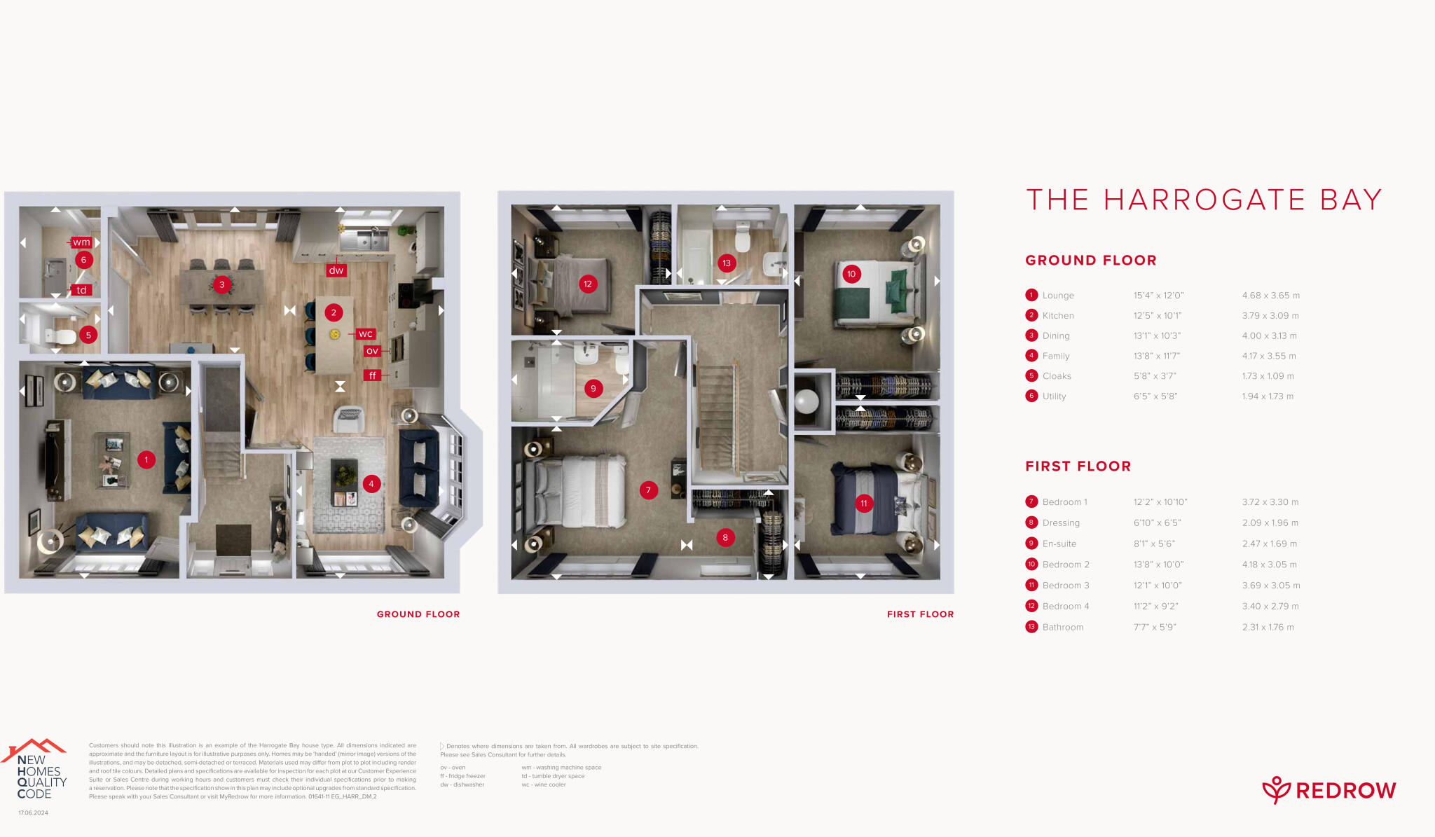
- The Harrogate Bay features a spacious layout with four bedrooms and multiple living spaces on two floors.
Rooms
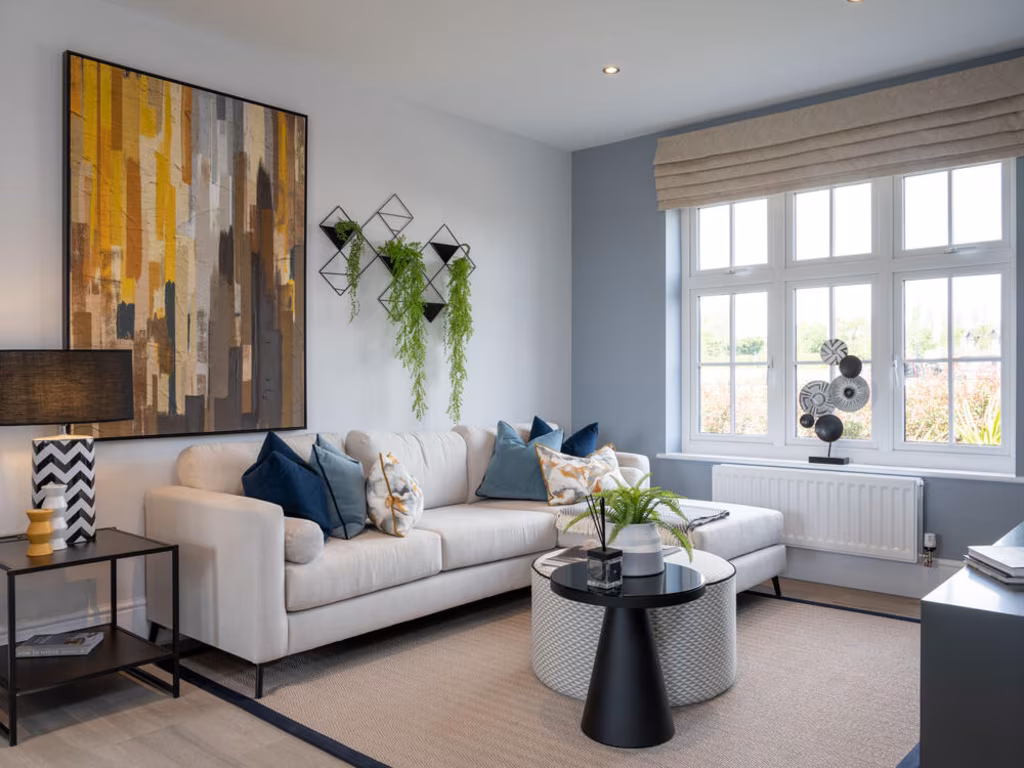
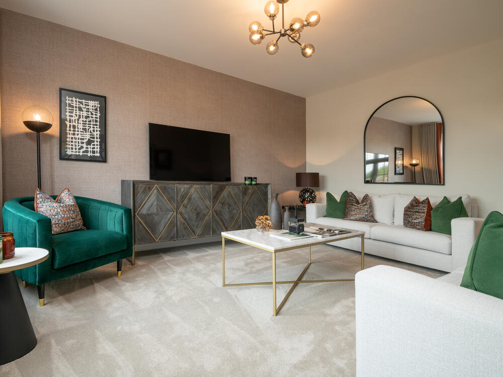
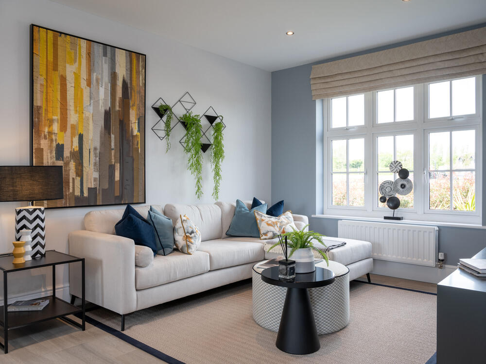
- Lounge: Large
- Kitchen: Average
- Dining: Average
- Family: Average
- Cloaks: Small
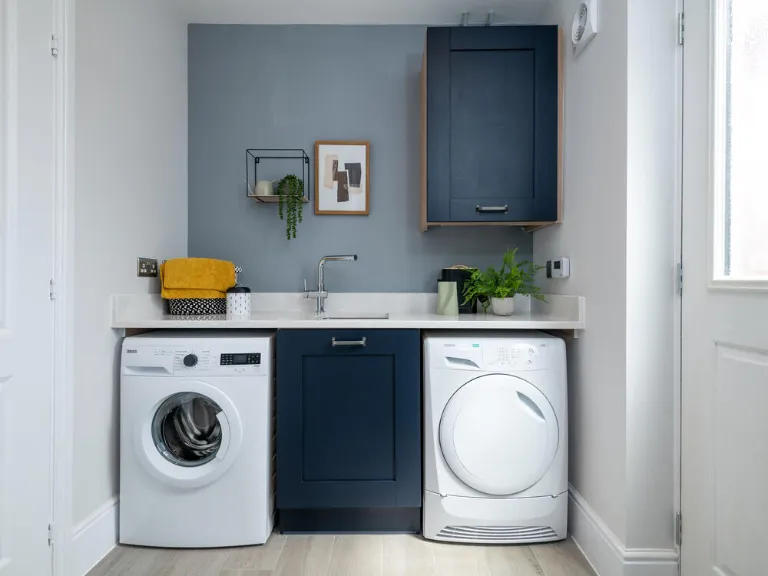
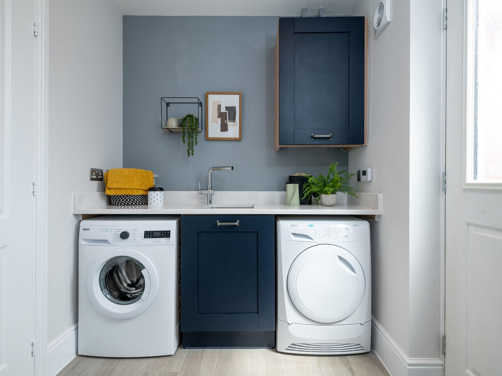
- Utility: Small
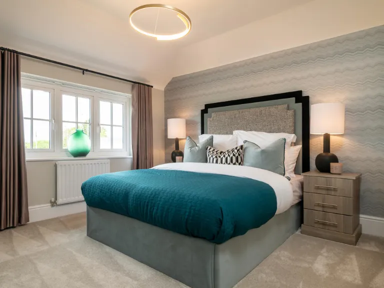
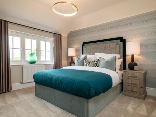
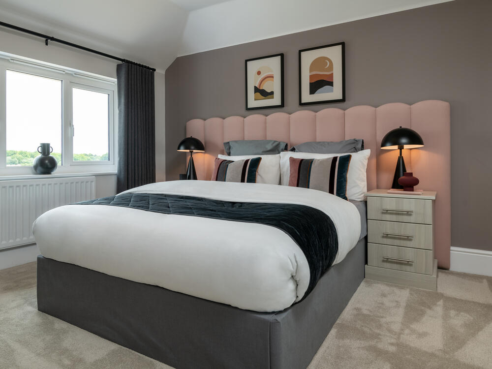
- Bedroom 1: Large
- Dressing: Small
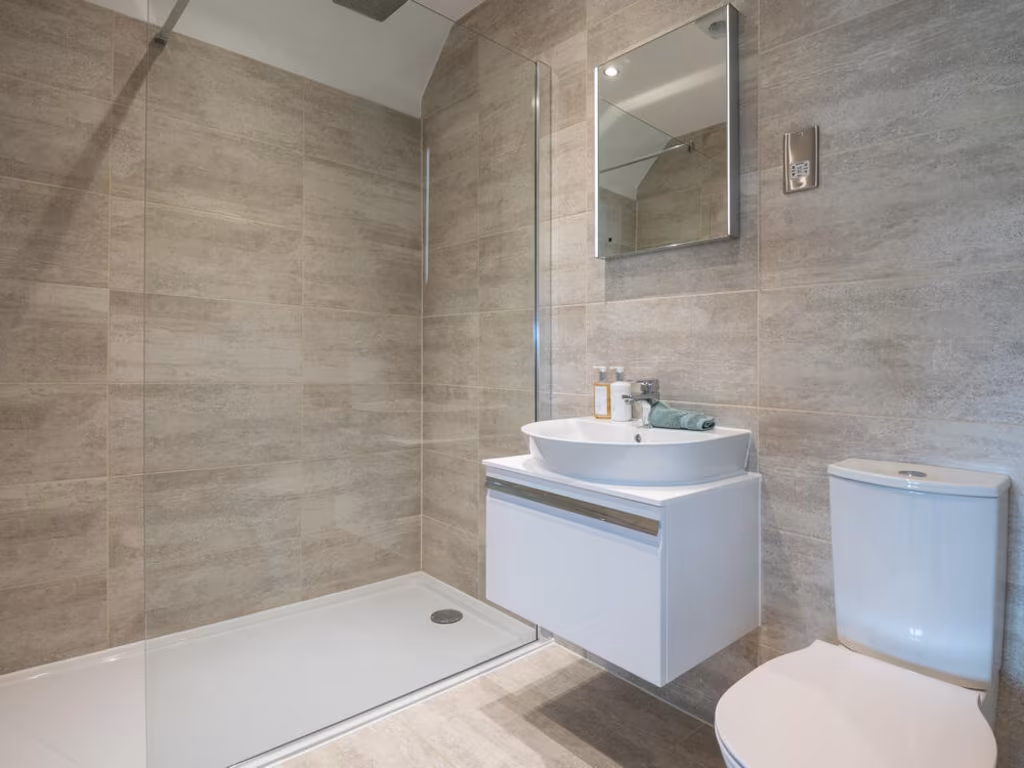
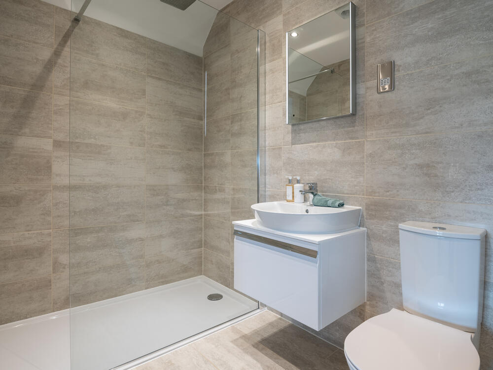
- En-suite: Small
- Bedroom 2: Large
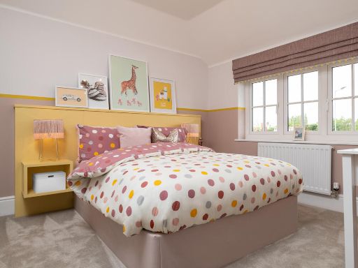
- Bedroom 3: Average
- Bedroom 4: Average
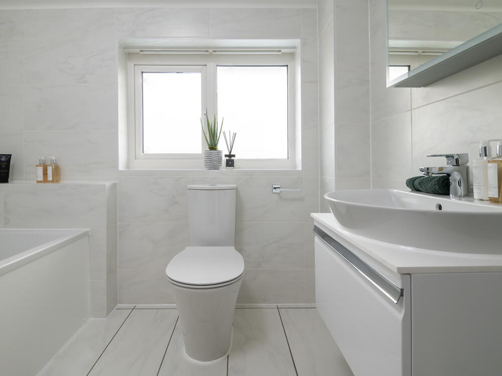
- Bathroom: Small
Textual Property Features
- Is New Build
- Has Garden
- Success
Detected Visual Features
- detached
- modern
- two-story
- spacious
- large windows
- new build
- suburban
- gabled roof
- brickwork base
- landscaped garden
- contemporary
- kitchen
- open-plan
- pendant lighting
- breakfast bar
- navy cabinets
- wood flooring
Nearby Schools
- Ridgewell Church of England Primary School
- Burton End Primary Academy
- Place Farm Primary Academy
- Westfield Primary Academy
- Samuel Ward Academy
- Hundon Community Primary School
- Steeple Bumpstead Primary School
- Stoke College
- Castle Camps Church of England (Controlled) Primary School
- Clements Primary Academy
- Coupals Primary Academy
- St Felix Roman Catholic Primary School, Haverhill
- Kedington Primary Academy
- Castle Manor Academy
- New Cangle Community Primary School
- Barnardiston Hall Preparatory School
- Thurlow Voluntary Controlled Primary School
Nearest General Shops
- Id: 8224477750
- Tags:
- Addr:
- City: Haverhill
- Housename: 17A Market Hill
- Postcode: CB9 8AD
- Brand: Shoe Zone
- Brand:wikidata: Q7500016
- Brand:wikipedia: en:Shoe Zone
- Contact:
- Website: https://www.shoezone.com/Stores/Haverhill-1906
- Name: Shoe Zone
- Operator: Shoe Zone
- Shop: shoes
- TagsNormalized:
- Lat: 52.0825703
- Lon: 0.438956
- FullGeoHash: u1223crduqv3
- PartitionGeoHash: u122
- Images:
- FoodStandards: null
- Distance: 1524.3
,- Id: 6331361479
- Tags:
- Name: Magic Scissors
- Shop: hairdresser
- TagsNormalized:
- Lat: 52.08318
- Lon: 0.4375969
- FullGeoHash: u1223cqws8ry
- PartitionGeoHash: u122
- Images:
- FoodStandards: null
- Distance: 1517.2
,- Id: 6331361459
- Tags:
- Name: Extremes
- Shop: hairdresser
- TagsNormalized:
- Lat: 52.0832098
- Lon: 0.4376908
- FullGeoHash: u1223cqwwyjb
- PartitionGeoHash: u122
- Images:
- FoodStandards: null
- Distance: 1510.8
}
Nearest Grocery shops
- Id: 1907067101
- Tags:
- Addr:
- Postcode: CB9 7UU
- Street: Sturmer Road
- Brand: Budgens
- Brand:wikidata: Q4985016
- Brand:wikipedia: en:Budgens
- Name: Budgens
- Shop: convenience
- TagsNormalized:
- Lat: 52.0751819
- Lon: 0.4525837
- FullGeoHash: u1224rcxcvqz
- PartitionGeoHash: u122
- Images:
- FoodStandards: null
- Distance: 2141.6
,- Id: 884313326
- Tags:
- Building: yes
- Shop: convenience
- TagsNormalized:
- Lat: 52.0783084
- Lon: 0.4337813
- FullGeoHash: u1223bef5u6f
- PartitionGeoHash: u122
- Images:
- FoodStandards: null
- Distance: 2113
,- Id: 237312361
- Tags:
- Addr:
- City: Haverhill
- Housenumber: 20
- Postcode: CB9 8AR
- Street: High Street
- Branch_name: Haverhill
- Brand: Iceland
- Brand:wikidata: Q721810
- Brand:wikipedia: en:Iceland (supermarket)
- Building: yes
- Contact:
- Website: https://www.iceland.co.uk/store-finder/store?StoreID=1221&StoreName=HAVERHILL
- Fhrs:
- Name: Iceland
- Old_name: Woolworths
- Opening_hours: Mo-Sa 08:00-19:00; Su 10:00-16:00
- Shop: frozen_food
- TagsNormalized:
- iceland
- frozen food
- food
- shop
- Lat: 52.0815643
- Lon: 0.4396475
- FullGeoHash: u122610jhe2b
- PartitionGeoHash: u122
- Images:
- FoodStandards:
- Id: 1114048
- FHRSID: 1114048
- LocalAuthorityBusinessID: PI/000216027
- BusinessName: Iceland
- BusinessType: Retailers - supermarkets/hypermarkets
- BusinessTypeID: 7840
- AddressLine1: 20 High Street
- AddressLine2: Haverhill
- AddressLine3: Suffolk
- AddressLine4: null
- PostCode: CB9 8AR
- RatingValue: 5
- RatingKey: fhrs_5_en-GB
- RatingDate: 2022-09-01
- LocalAuthorityCode: 298
- LocalAuthorityName: West Suffolk
- LocalAuthorityWebSite: http://www.westsuffolk.gov.uk
- LocalAuthorityEmailAddress: food&safety@westsuffolk.gov.uk
- Scores:
- Hygiene: 5
- Structural: 5
- ConfidenceInManagement: 0
- NewRatingPending: false
- Geocode:
- Longitude: 0.44043400000000
- Latitude: 52.08098800000000
- Distance: 1599.7
}
Nearest Religious buildings
- Id: 930598561
- Tags:
- Amenity: place_of_worship
- Building: church
- Denomination: evangelical
- Name: West End Congregational Church
- Religion: christian
- TagsNormalized:
- place of worship
- church
- evangelical
- congregational
- christian
- Lat: 52.0853723
- Lon: 0.4350743
- FullGeoHash: u1223cug3cnu
- PartitionGeoHash: u122
- Images:
- FoodStandards: null
- Distance: 1442.7
,- Id: 145503981
- Tags:
- Amenity: place_of_worship
- Building: church
- Denomination: anglican
- Name: Saint Marys (Little Wratting Parish Church)
- Religion: christian
- Wikidata: Q17545498
- TagsNormalized:
- place of worship
- church
- anglican
- parish
- christian
- Lat: 52.1013388
- Lon: 0.4667011
- FullGeoHash: u1226sgb6cmx
- PartitionGeoHash: u122
- Images:
- FoodStandards: null
- Distance: 1363.3
,- Id: 502672813
- Tags:
- Addr:
- Amenity: school
- Capacity: 70
- Max_age: 18
- Min_age: 8
- Name: Churchill Special Free School
- Phone: +44 1440 760338
- Ref:
- Ref:edubase:group: 4454
- Religion: none
- School:
- Boarding: no
- Gender: mixed
- Selective: no
- Trust: yes
- Type: free
- School:trust:name: Unity Schools Partnership
- School:trust:type: multi_academy
- Source: OS OpenMap Local
- Website: http://www.churchillschool.co.uk/
- Wikidata: Q66166398
- TagsNormalized:
- Lat: 52.0897277
- Lon: 0.4482397
- FullGeoHash: u12264wkstp9
- PartitionGeoHash: u122
- Images:
- FoodStandards: null
- Distance: 536.3
}
Nearest Airports
- Id: 495488524
- Tags:
- Aerodrome: international
- Aerodrome:type: public
- Aeroway: aerodrome
- Alt_name: Stansted
- Iata: STN
- Icao: EGSS
- Is_in: Essex,England,UK
- Name: London Stansted Airport
- Ref: STN
- Source: Gagravarr_Airports
- Website: https://www.stanstedairport.com/
- Wikidata: Q8709
- Wikipedia: en:London Stansted Airport
- TagsNormalized:
- airport
- international airport
- Lat: 51.8869677
- Lon: 0.2429264
- FullGeoHash: u10pjt8zkxg4
- PartitionGeoHash: u10p
- Images:
- FoodStandards: null
- Distance: 27083.2
}
Nearest Leisure Facilities
- Id: 386409693
- Tags:
- Leisure: pitch
- Name: New Croft
- TagsNormalized:
- Lat: 52.0865077
- Lon: 0.4491767
- FullGeoHash: u12264p1fsf3
- PartitionGeoHash: u122
- Images:
- FoodStandards: null
- Distance: 879.4
,- Id: 886953275
- Tags:
- TagsNormalized:
- Lat: 52.0931679
- Lon: 0.4402765
- FullGeoHash: u1226528enmf
- PartitionGeoHash: u122
- Images:
- FoodStandards: null
- Distance: 695.4
,- Id: 886953277
- Tags:
- TagsNormalized:
- Lat: 52.092425
- Lon: 0.4426163
- FullGeoHash: u122654k3eye
- PartitionGeoHash: u122
- Images:
- FoodStandards: null
- Distance: 566
,- Id: 1054476215
- Tags:
- TagsNormalized:
- Lat: 52.0919526
- Lon: 0.4449584
- FullGeoHash: u12265h187c1
- PartitionGeoHash: u122
- Images:
- FoodStandards: null
- Distance: 452.3
,- Id: 1127810917
- Tags:
- TagsNormalized:
- Lat: 52.0937488
- Lon: 0.4525178
- FullGeoHash: u122673s06te
- PartitionGeoHash: u122
- Images:
- FoodStandards: null
- Distance: 169.8
}
Nearest Tourist attractions
- Id: 185892295
- Tags:
- Name: Dovecote
- Tourism: attraction
- TagsNormalized:
- Lat: 52.0614542
- Lon: 0.5371713
- FullGeoHash: u122hjrpuyrz
- PartitionGeoHash: u122
- Images:
- FoodStandards: null
- Distance: 6977.7
,- Id: 386868456
- Tags:
- Name: Anne of Cleves House
- Source: gps survey
- Tourism: attraction
- TagsNormalized:
- Lat: 52.0786687
- Lon: 0.4437658
- FullGeoHash: u12260ehhrrz
- PartitionGeoHash: u122
- Images:
- FoodStandards: null
- Distance: 1803.4
,- Id: 502672835
- Tags:
- Building: yes
- Name: Haverhill Arts Centre
- Source: OS OpenMap Local
- Tourism: gallery
- Wikidata: Q26656314
- TagsNormalized:
- arts centre
- gallery
- tourism
- Lat: 52.0806991
- Lon: 0.4405855
- FullGeoHash: u122610b43ur
- PartitionGeoHash: u122
- Images:
- FoodStandards: null
- Distance: 1659.5
}
Nearest Train stations
- Id: 6137852399
- Tags:
- Name: Newport
- Naptan:
- Network: National Rail
- Public_transport: station
- Railway: station
- Ref:
- Wikidata: Q2342586
- Wikipedia: en:Newport railway station (Essex)
- TagsNormalized:
- Lat: 51.9796918
- Lon: 0.2153128
- FullGeoHash: u10psysg9hug
- PartitionGeoHash: u10p
- Images:
- FoodStandards: null
- Distance: 20516.5
,- Id: 3724898176
- Tags:
- Name: Kennett
- Naptan:
- Network: National Rail
- Public_transport: station
- Railway: station
- Ref:
- Wikidata: Q3926161
- Wikipedia: en:Kennett railway station
- TagsNormalized:
- Lat: 52.2772508
- Lon: 0.4900933
- FullGeoHash: u1237huch1b5
- PartitionGeoHash: u123
- Images:
- FoodStandards: null
- Distance: 20513.9
,- Id: 6137852401
- Tags:
- Name: Whittlesford Parkway
- Naptan:
- Network: National Rail
- Note: Name changed in Summer 2007 timetables
- Public_transport: station
- Railway: station
- Ref:
- Wikidata: Q1985489
- Wikipedia: en:Whittlesford Parkway railway station
- TagsNormalized:
- Lat: 52.1035456
- Lon: 0.1656879
- FullGeoHash: u1207v0thucu
- PartitionGeoHash: u120
- Images:
- FoodStandards: null
- Distance: 19464.9
,- Id: 6137852400
- Tags:
- Name: Audley End
- Naptan:
- Network: National Rail
- Public_transport: station
- Railway: station
- Ref:
- Crs: AUD
- Stanox: 47321
- Tiploc: AUDLEYE
- Wikidata: Q2574881
- Wikipedia: en:Audley End railway station
- TagsNormalized:
- Lat: 52.0044805
- Lon: 0.2070947
- FullGeoHash: u10puenu19v1
- PartitionGeoHash: u10p
- Images:
- FoodStandards: null
- Distance: 19402.2
,- Id: 258501327
- Tags:
- Name: Audley End Miniature Railway
- Public_transport: station
- Railway: station
- Usage: tourism
- TagsNormalized:
- Lat: 52.0192173
- Lon: 0.217517
- FullGeoHash: u10puvy3usbq
- PartitionGeoHash: u10p
- Images:
- FoodStandards: null
- Distance: 17974.7
}
Nearest Hotels
- Id: 385148069
- Tags:
- Addr:
- Housenumber: 12
- Postcode: CO10 8NN
- Street: Market Hill
- Town: Clare
- Amenity: pub
- Building: yes
- Description: Currently (April 2021) closed, may reopen.
- Fhrs:
- Name: The Bell
- Source: survey
- Source:addr: FHRS Open Data
- Tourism: hotel
- Wikidata: Q26489426
- TagsNormalized:
- Lat: 52.0785856
- Lon: 0.5818537
- FullGeoHash: u122m0xewpvx
- PartitionGeoHash: u122
- Images:
- FoodStandards: null
- Distance: 9161.4
,- Id: 111507283
- Tags:
- Brand: Travelodge
- Brand:wikidata: Q9361374
- Brand:wikipedia: en:Travelodge UK
- Building: yes
- Internet_access: wlan
- Internet_access:fee: customers
- Internet_access:ssid: Travelodge WiFi
- Name: Travelodge
- Tourism: hotel
- TagsNormalized:
- Lat: 52.0705618
- Lon: 0.4436033
- FullGeoHash: u1224p5j08q8
- PartitionGeoHash: u122
- Images:
- FoodStandards: null
- Distance: 2688.2
,- Id: 55324570
- Tags:
- Amenity: restaurant
- Created_by: JOSM
- Name: Woodlands Hotel and Restaurant
- Tourism: hotel
- TagsNormalized:
- Lat: 52.0769097
- Lon: 0.4663567
- FullGeoHash: u1226879fzsf
- PartitionGeoHash: u122
- Images:
- FoodStandards: null
- Distance: 2233.2
}
Tags
- detached
- modern
- two-story
- spacious
- large windows
- new build
- suburban
- gabled roof
- brickwork base
- landscaped garden
- contemporary
- modern
- kitchen
- open-plan
- pendant lighting
- breakfast bar
- navy cabinets
- wood flooring
Local Market Stats
- Average Price/sqft: £304
- Avg Income: £46400
- Rental Yield: 3.7%
- Social Housing: 9%
- Planning Success Rate: 92%
Similar Properties
 4 bedroom detached house for sale in Haverhill Road,
Haverhill,
Suffolk,
CB9 7UD
, CB9 — £525,000 • 4 bed • 1 bath
4 bedroom detached house for sale in Haverhill Road,
Haverhill,
Suffolk,
CB9 7UD
, CB9 — £525,000 • 4 bed • 1 bath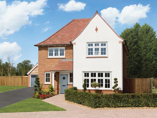 4 bedroom detached house for sale in Haverhill Road,
Haverhill,
Suffolk,
CB9 7UD
, CB9 — £470,000 • 4 bed • 1 bath • 1203 ft²
4 bedroom detached house for sale in Haverhill Road,
Haverhill,
Suffolk,
CB9 7UD
, CB9 — £470,000 • 4 bed • 1 bath • 1203 ft²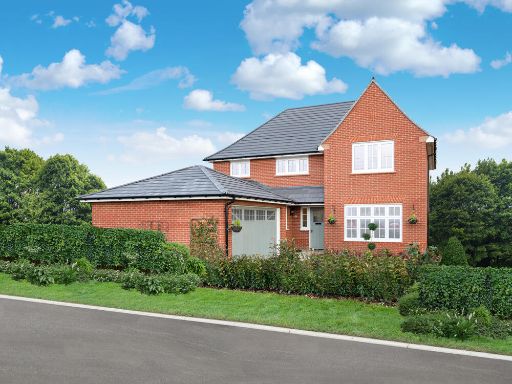 4 bedroom detached house for sale in Haverhill Road,
Haverhill,
Suffolk,
CB9 7UD
, CB9 — £645,000 • 4 bed • 1 bath • 1880 ft²
4 bedroom detached house for sale in Haverhill Road,
Haverhill,
Suffolk,
CB9 7UD
, CB9 — £645,000 • 4 bed • 1 bath • 1880 ft²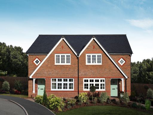 3 bedroom semi-detached house for sale in Haverhill Road,
Haverhill,
Suffolk,
CB9 7UD
, CB9 — £350,000 • 3 bed • 1 bath • 779 ft²
3 bedroom semi-detached house for sale in Haverhill Road,
Haverhill,
Suffolk,
CB9 7UD
, CB9 — £350,000 • 3 bed • 1 bath • 779 ft²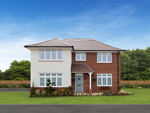 4 bedroom detached house for sale in Haverhill Road,
Haverhill,
Suffolk,
CB9 7UD
, CB9 — £485,000 • 4 bed • 1 bath • 1126 ft²
4 bedroom detached house for sale in Haverhill Road,
Haverhill,
Suffolk,
CB9 7UD
, CB9 — £485,000 • 4 bed • 1 bath • 1126 ft²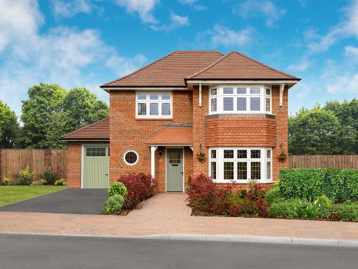 3 bedroom detached house for sale in Haverhill Road,
Haverhill,
Suffolk,
CB9 7UD
, CB9 — £500,000 • 3 bed • 1 bath • 1214 ft²
3 bedroom detached house for sale in Haverhill Road,
Haverhill,
Suffolk,
CB9 7UD
, CB9 — £500,000 • 3 bed • 1 bath • 1214 ft²
Meta
- {
"@context": "https://schema.org",
"@type": "Residence",
"name": "4 bedroom detached house for sale in Haverhill Road, Haverh…",
"description": "",
"url": "https://propertypiper.co.uk/property/59531917-2a3a-498b-849f-51648a1b2dd8",
"image": "https://image-a.propertypiper.co.uk/736972aa-621e-4569-9ef5-f98b396833da-1024.jpeg",
"address": {
"@type": "PostalAddress",
"streetAddress": "Haverhill Road,\r\nHaverhill, \r\nSuffolk, \r\nCB9 7UD\r\n",
"postalCode": "CB9 7UD",
"addressLocality": "West Suffolk",
"addressRegion": "West Suffolk",
"addressCountry": "England"
},
"geo": {
"@type": "GeoCoordinates",
"latitude": 52.094388373057555,
"longitude": 0.45026020118917376
},
"numberOfRooms": 4,
"numberOfBathroomsTotal": 1,
"floorSize": {
"@type": "QuantitativeValue",
"value": 1346,
"unitCode": "FTK"
},
"offers": {
"@type": "Offer",
"price": 545000,
"priceCurrency": "GBP",
"availability": "https://schema.org/InStock"
},
"additionalProperty": [
{
"@type": "PropertyValue",
"name": "Feature",
"value": "detached"
},
{
"@type": "PropertyValue",
"name": "Feature",
"value": "modern"
},
{
"@type": "PropertyValue",
"name": "Feature",
"value": "two-story"
},
{
"@type": "PropertyValue",
"name": "Feature",
"value": "spacious"
},
{
"@type": "PropertyValue",
"name": "Feature",
"value": "large windows"
},
{
"@type": "PropertyValue",
"name": "Feature",
"value": "new build"
},
{
"@type": "PropertyValue",
"name": "Feature",
"value": "suburban"
},
{
"@type": "PropertyValue",
"name": "Feature",
"value": "gabled roof"
},
{
"@type": "PropertyValue",
"name": "Feature",
"value": "brickwork base"
},
{
"@type": "PropertyValue",
"name": "Feature",
"value": "landscaped garden"
},
{
"@type": "PropertyValue",
"name": "Feature",
"value": "contemporary"
},
{
"@type": "PropertyValue",
"name": "Feature",
"value": "modern"
},
{
"@type": "PropertyValue",
"name": "Feature",
"value": "kitchen"
},
{
"@type": "PropertyValue",
"name": "Feature",
"value": "open-plan"
},
{
"@type": "PropertyValue",
"name": "Feature",
"value": "pendant lighting"
},
{
"@type": "PropertyValue",
"name": "Feature",
"value": "breakfast bar"
},
{
"@type": "PropertyValue",
"name": "Feature",
"value": "navy cabinets"
},
{
"@type": "PropertyValue",
"name": "Feature",
"value": "wood flooring"
}
]
}
High Res Floorplan Images
Compatible Floorplan Images
FloorplanImages Thumbnail