CW5 7QX - 4 bedroom detached house for sale in Park Lane, Hatherton,…
View on Property Piper
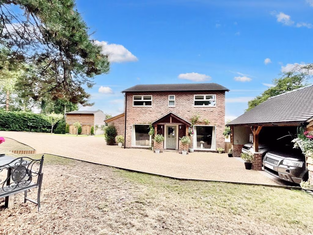
4 bedroom detached house for sale in Park Lane, Hatherton, CW5
Property Details
- Price: £895000
- Bedrooms: 4
- Bathrooms: 3
- Property Type: undefined
- Property SubType: undefined
Image Descriptions
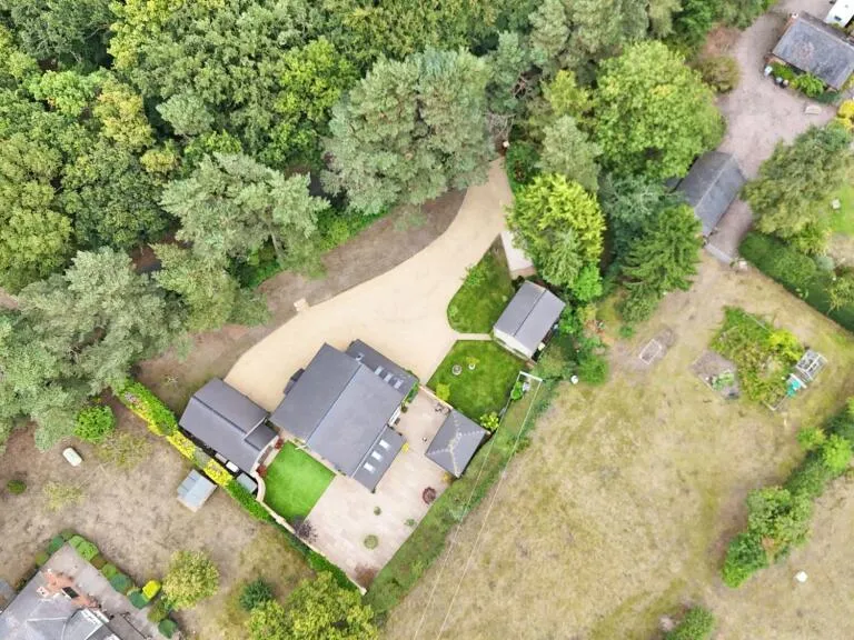
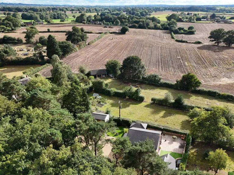
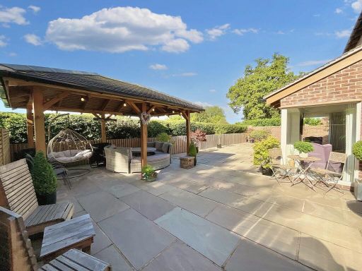
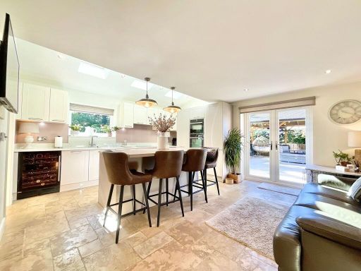
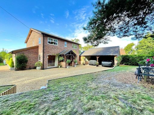
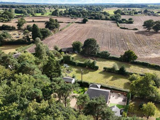
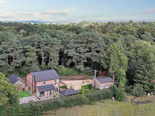
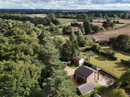
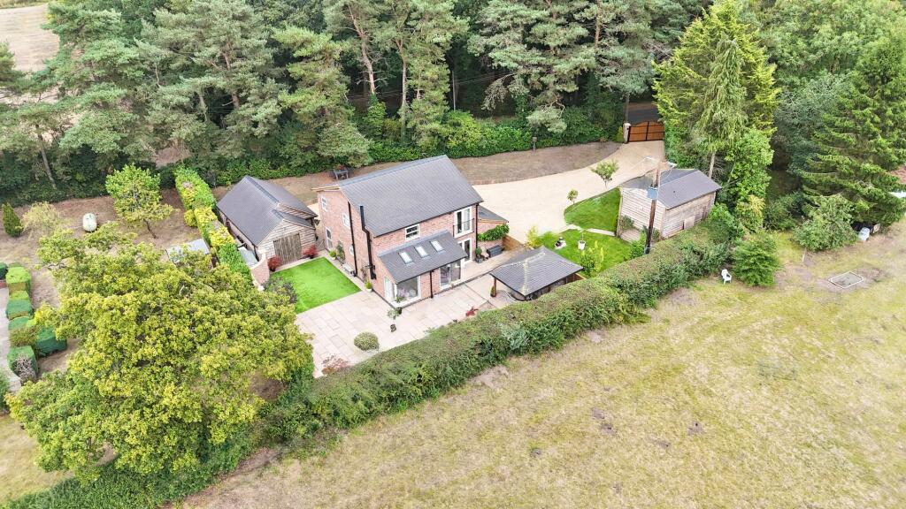
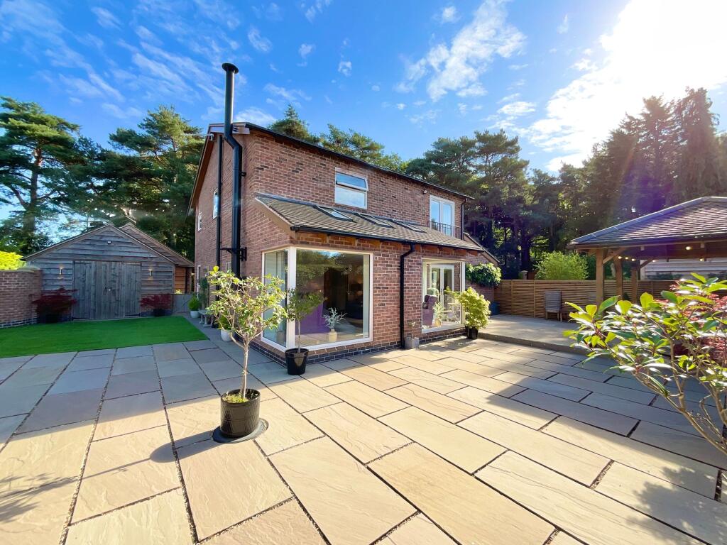
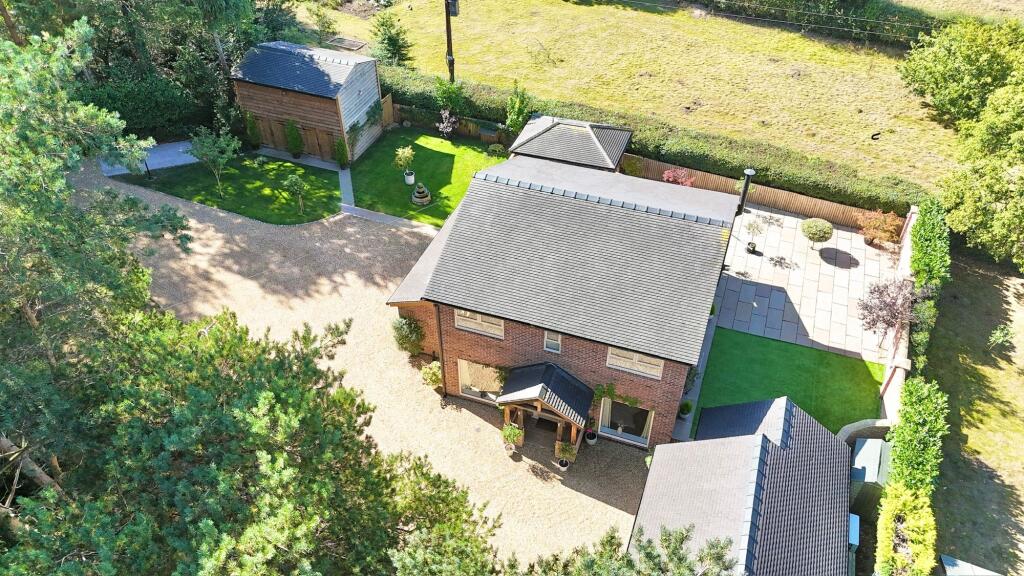
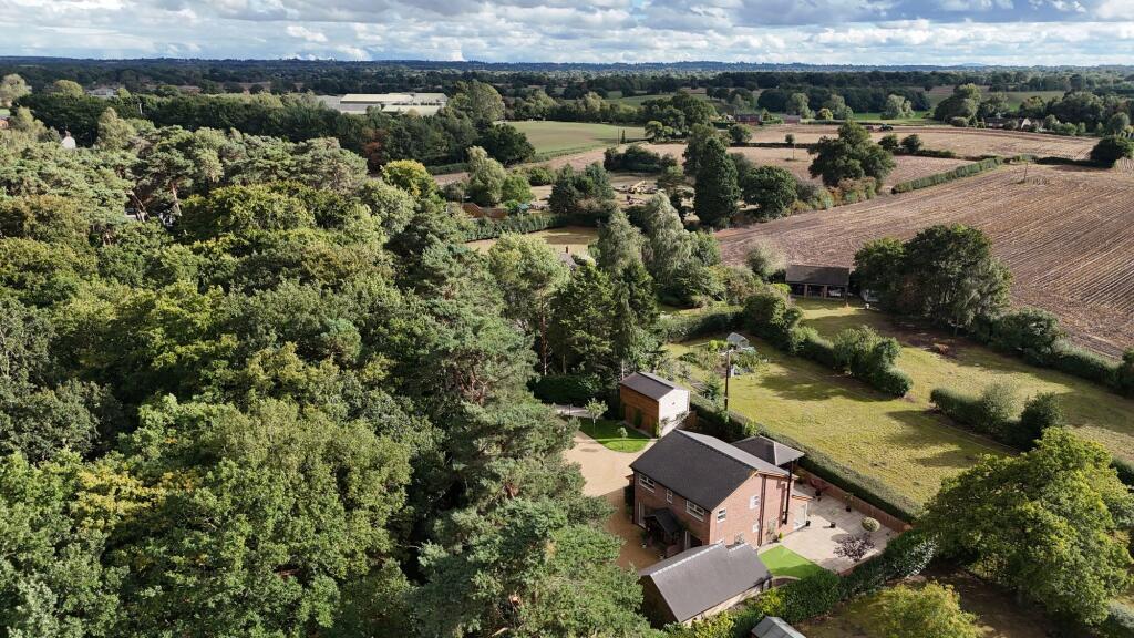
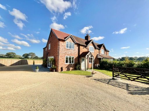
- detached house modern
- modern detached house modern
Floorplan Description
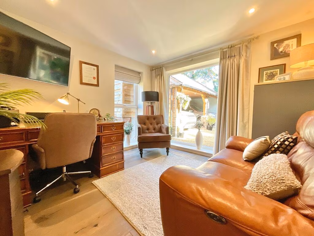
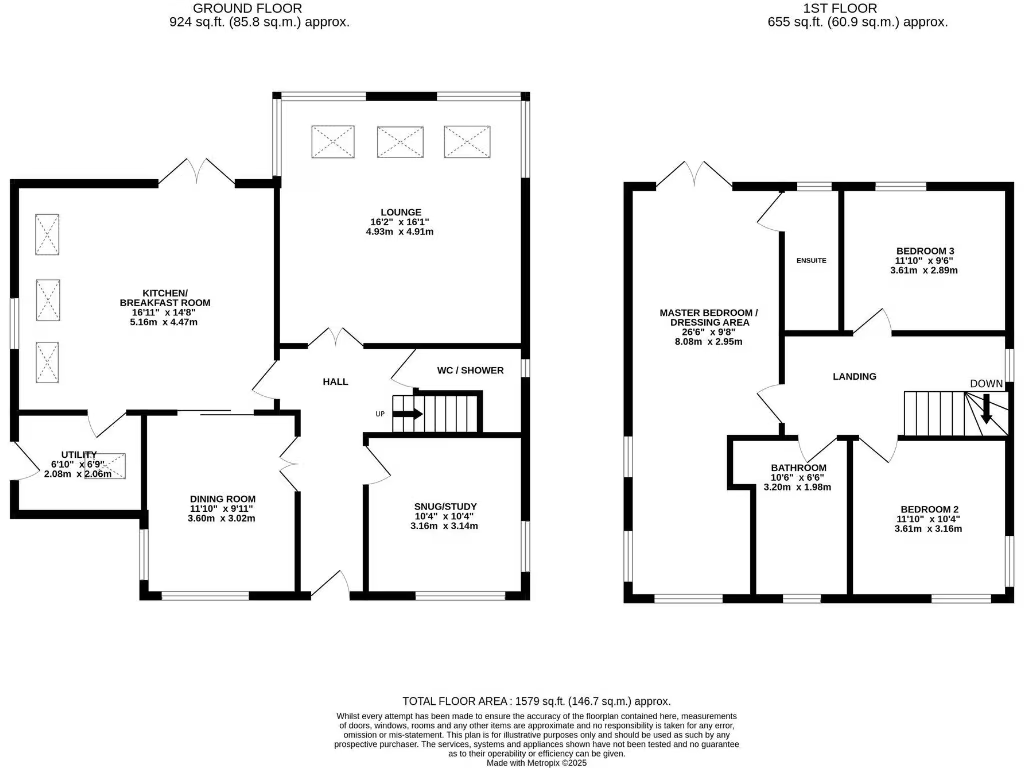
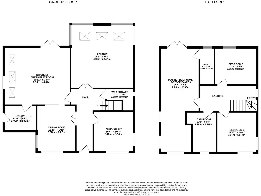
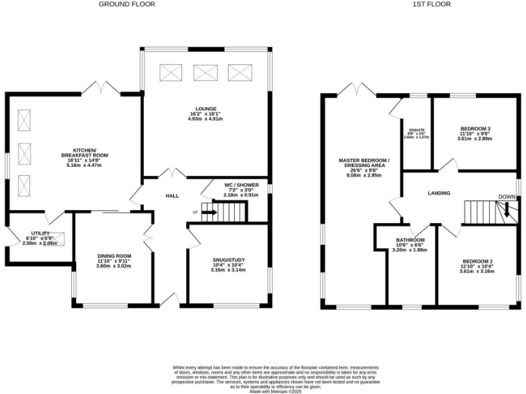
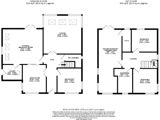
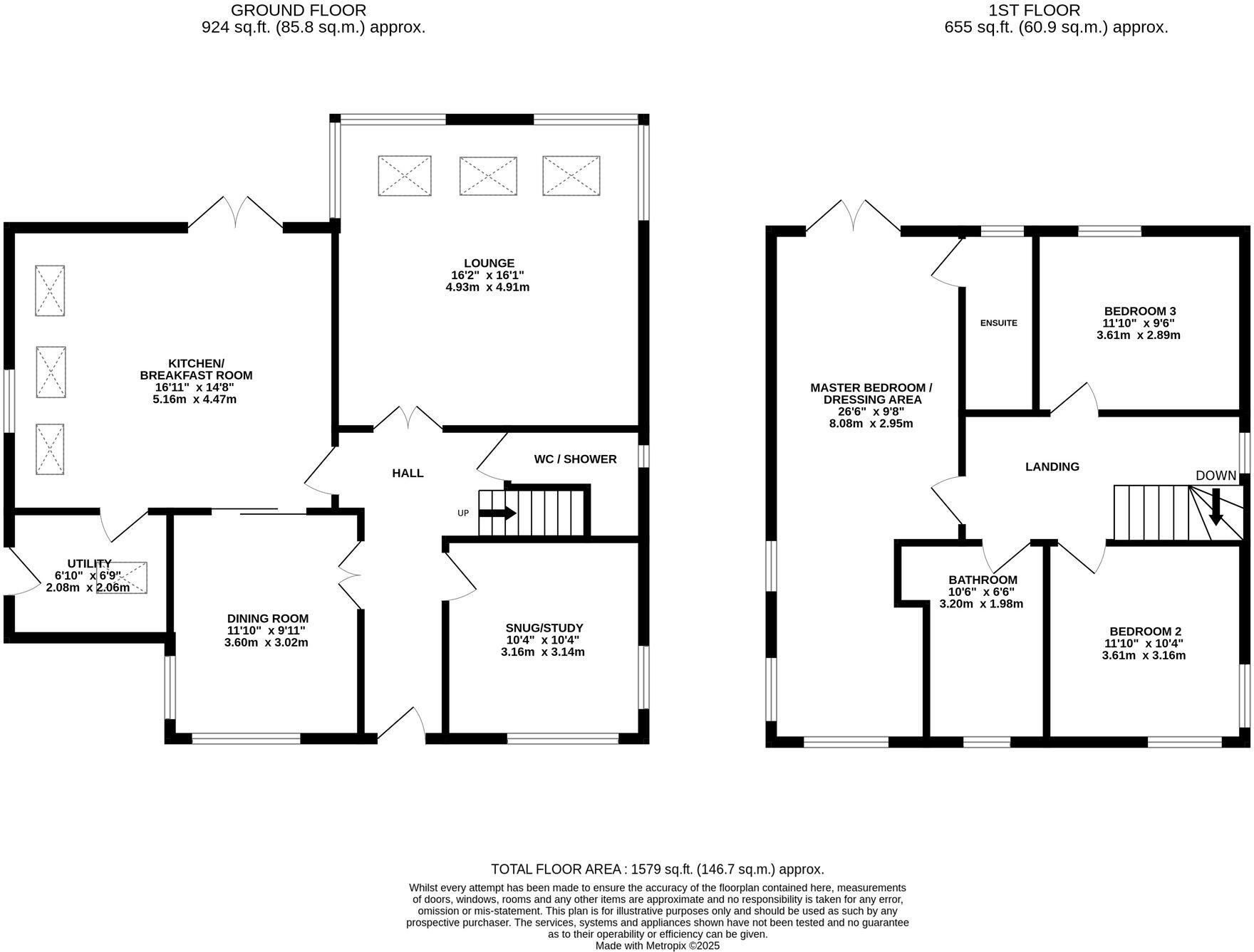
- Two-storey residential property with lounge, kitchen/breakfast room, dining room, snug/study and three bedrooms.
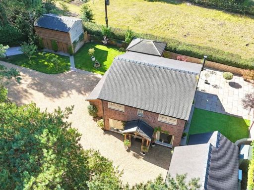
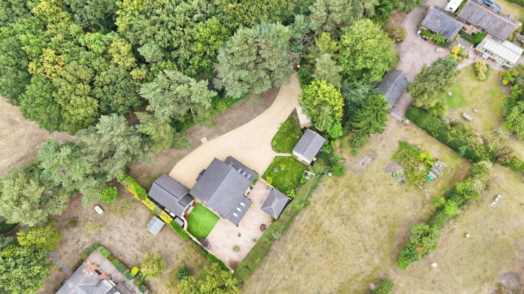
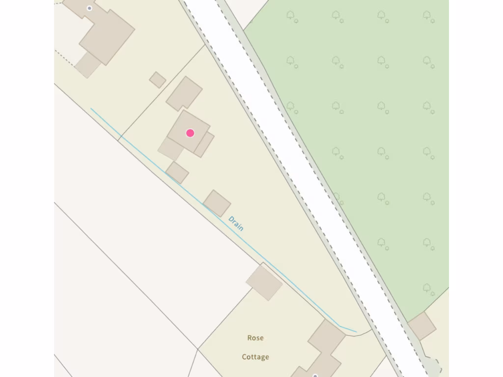
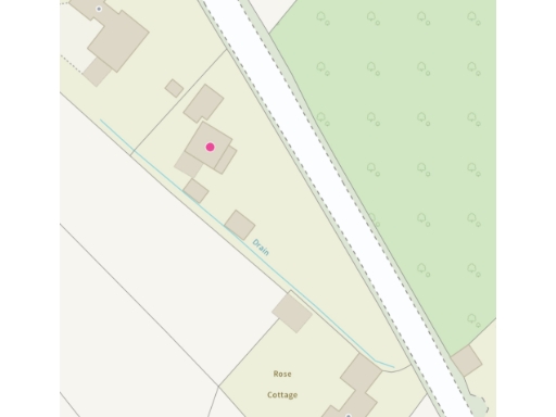
- Exterior map view showing property named 'Rose Cottage' and surrounding buildings; no internal floorplan or room dimensions are provided.
- Two-storey house with kitchen/breakfast room, lounge and reception rooms on ground floor and four bedrooms and bathrooms on first floor
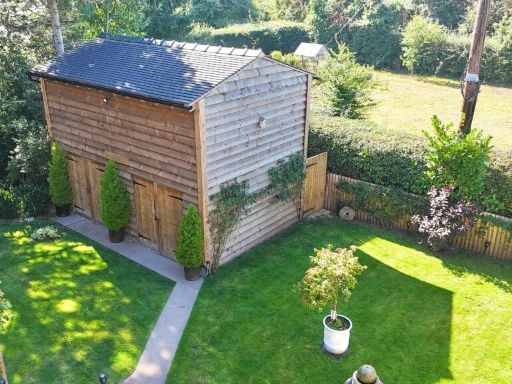
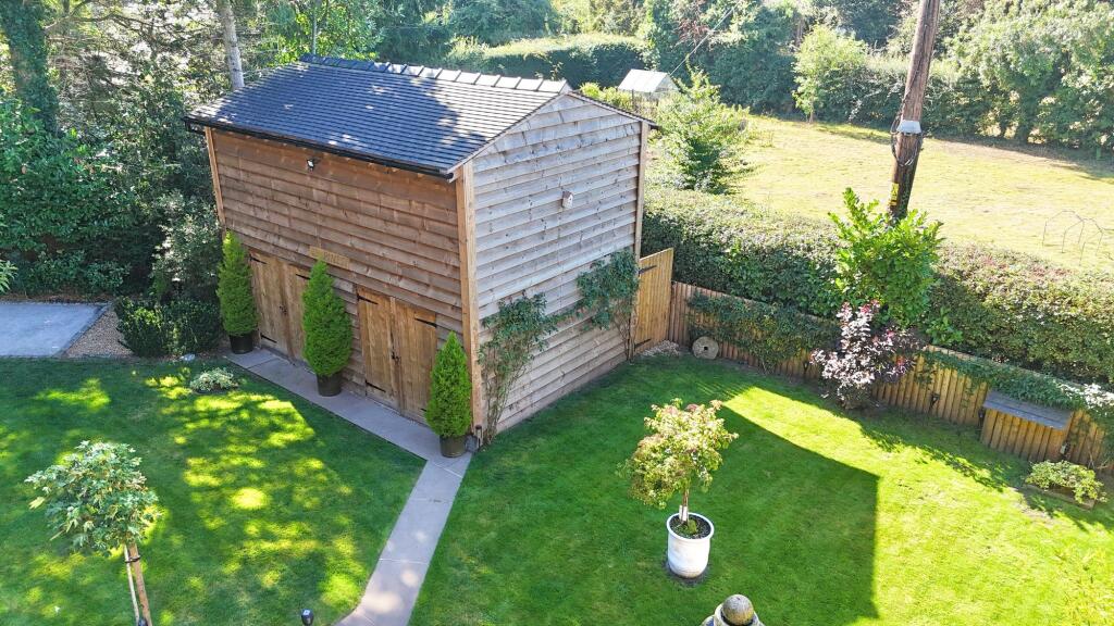
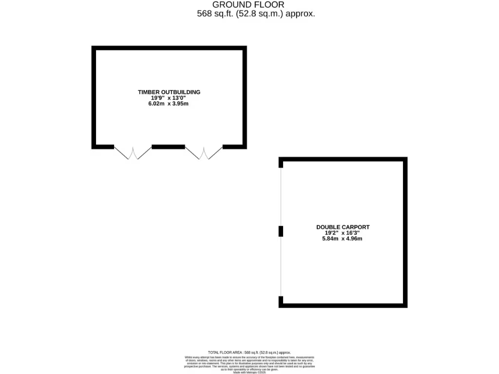
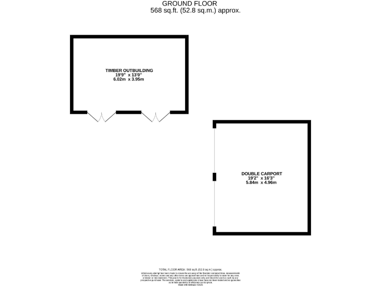
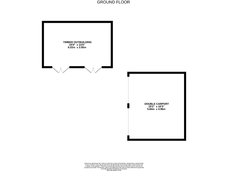
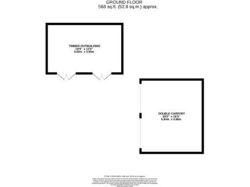
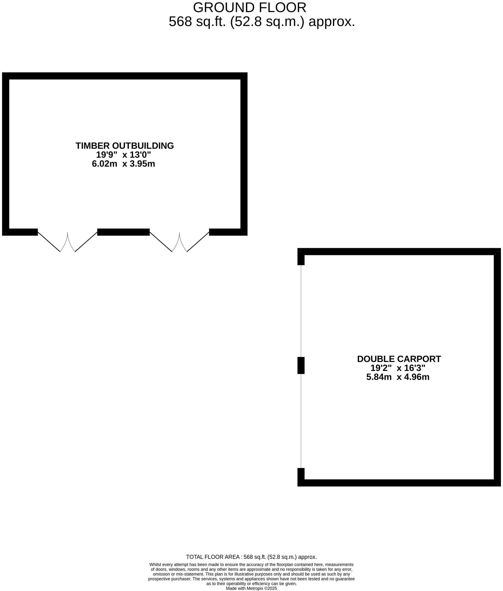
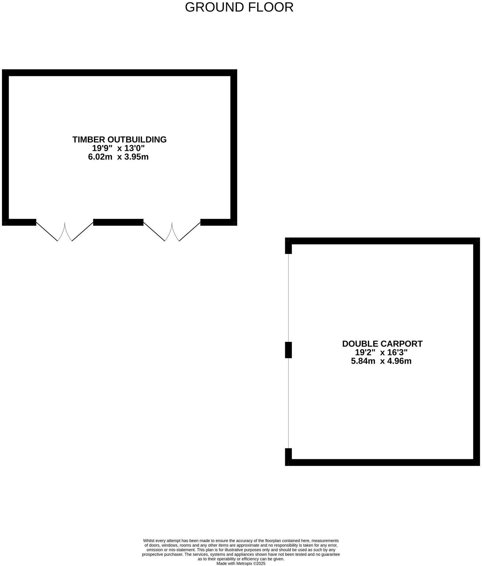
- Ground floor plan showing a timber outbuilding and a double carport.
Rooms
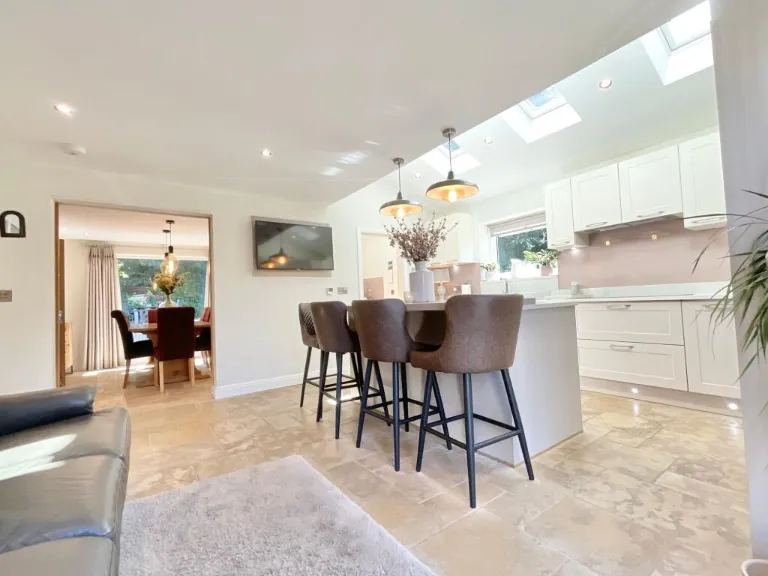
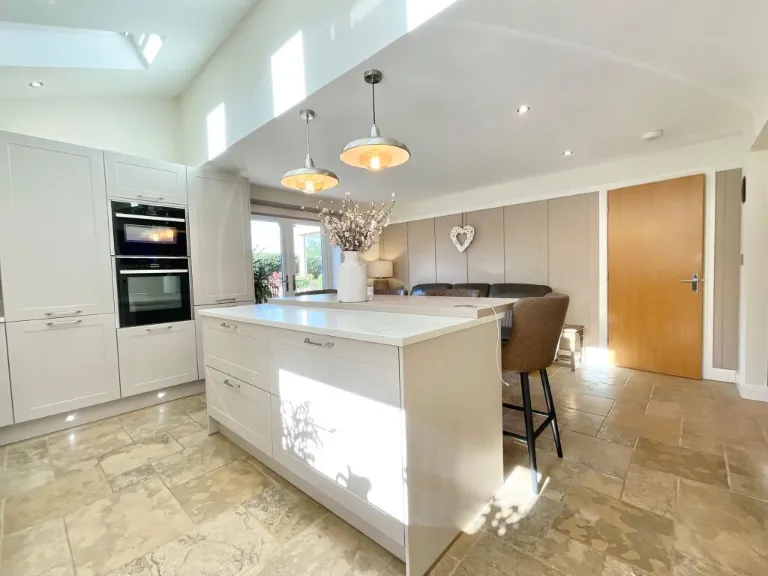
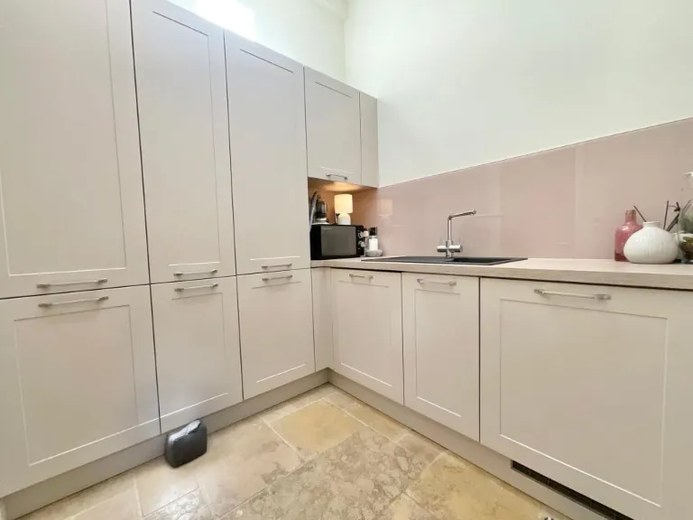
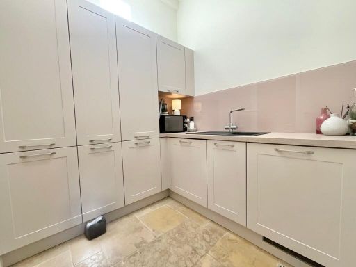
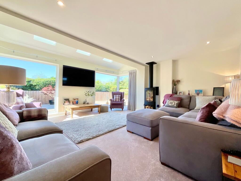
- KITCHEN/ BREAKFAST ROOM:
- UTILITY:
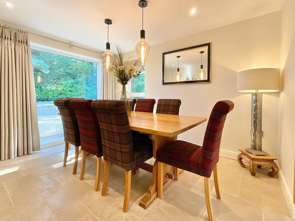
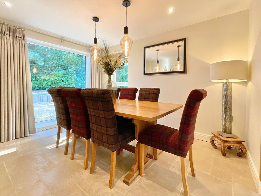
- DINING ROOM:
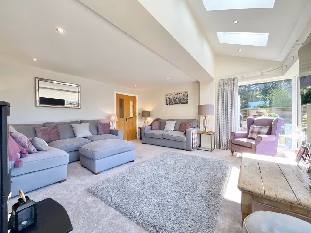
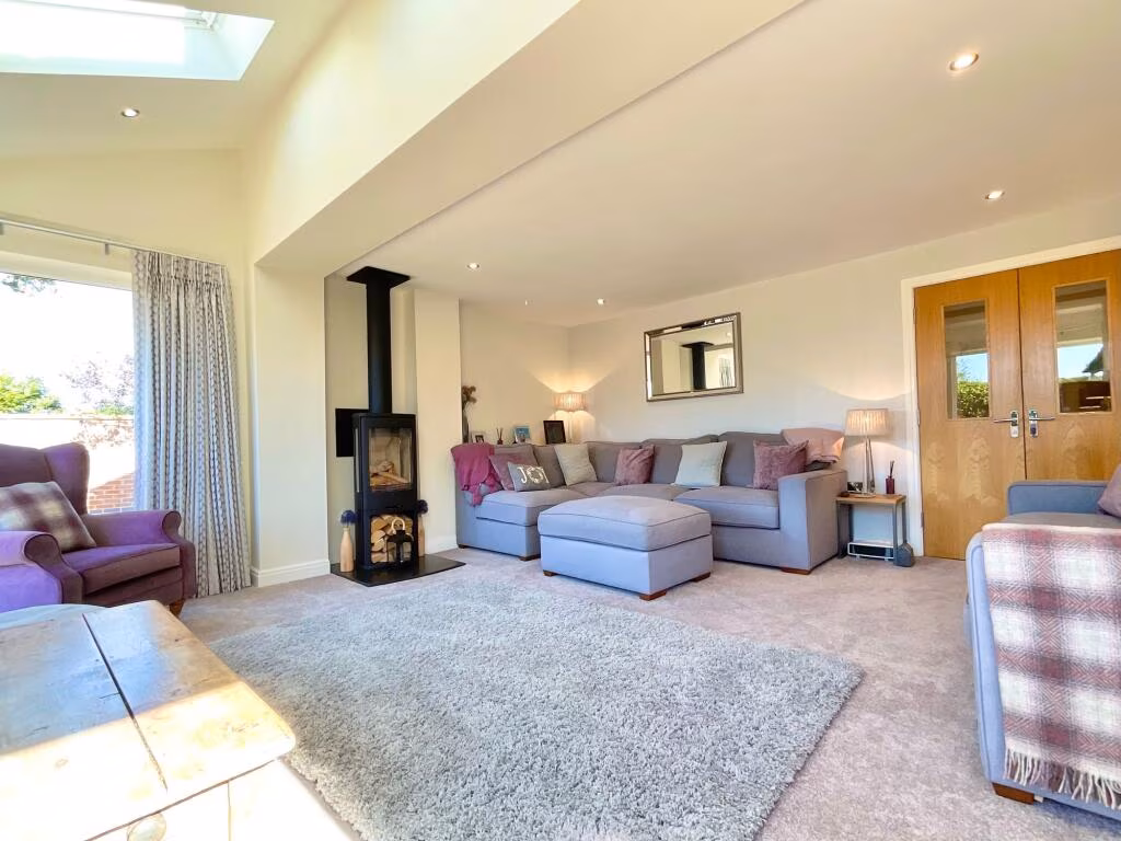
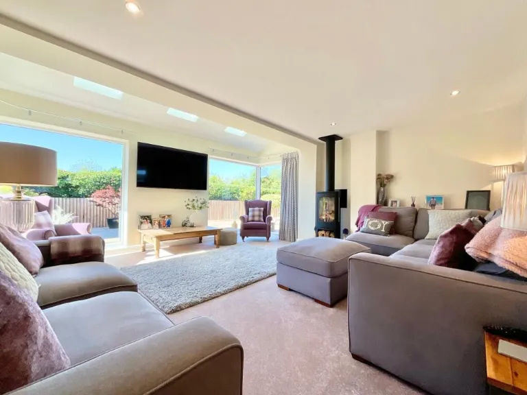
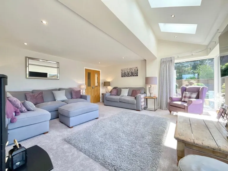
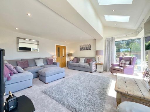
- LOUNGE:
- SNUG/STUDY:
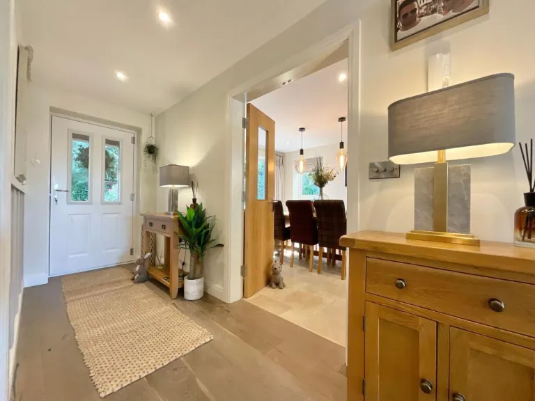
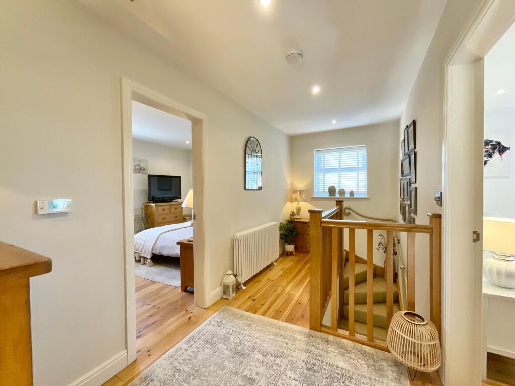
- HALL:
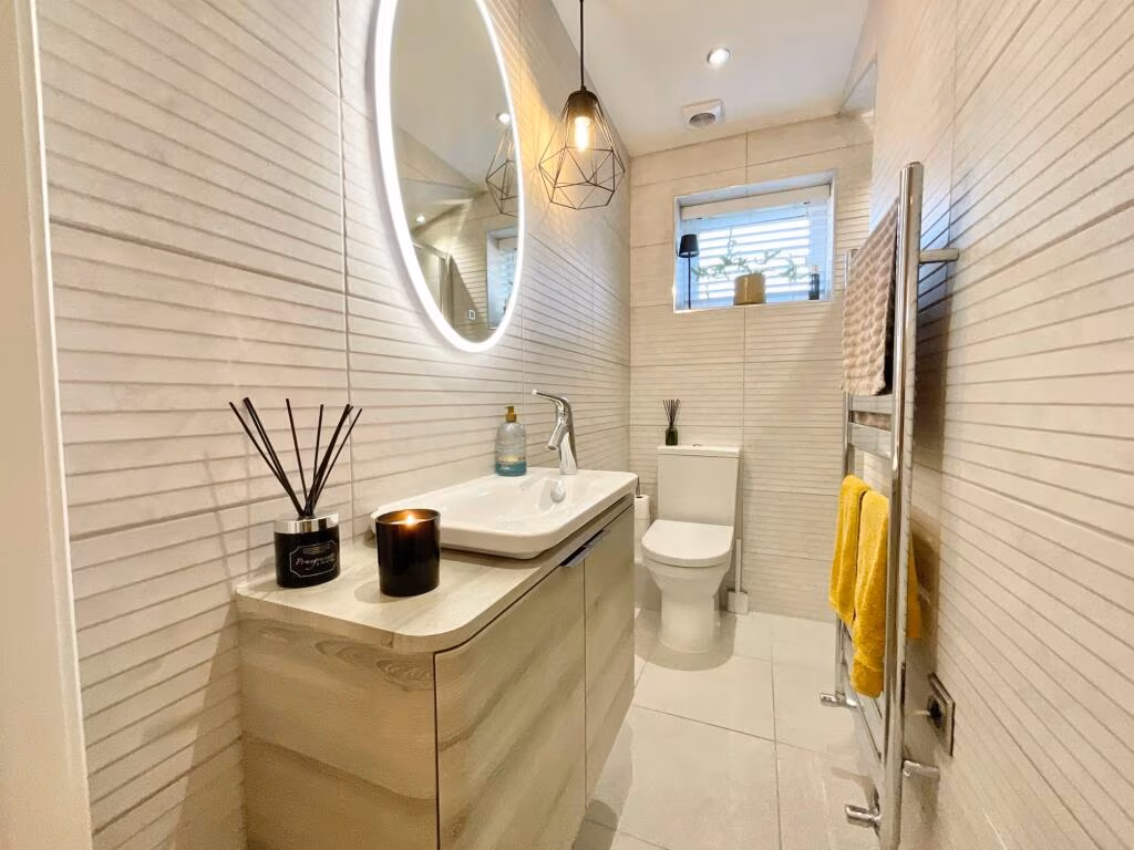
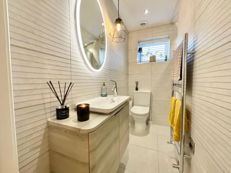
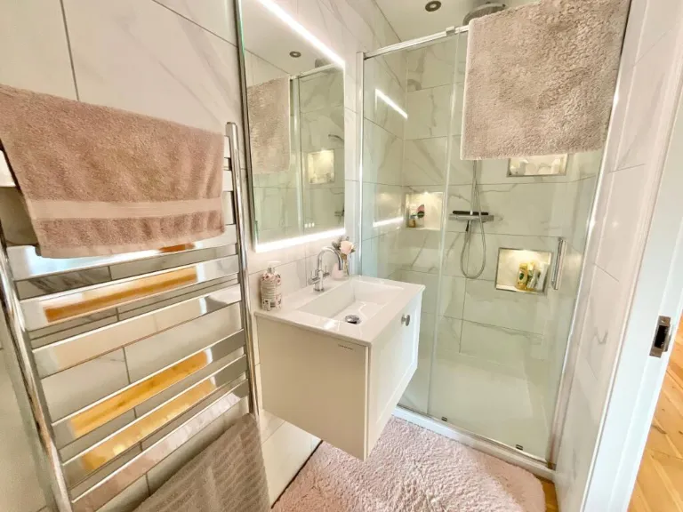
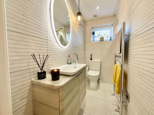
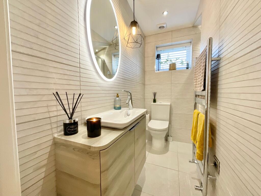
- WC / SHOWER:
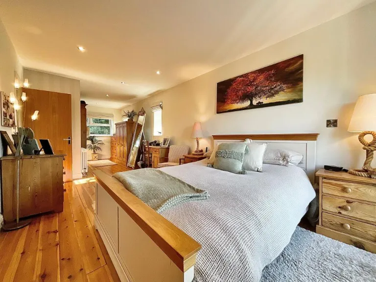
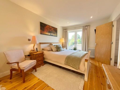
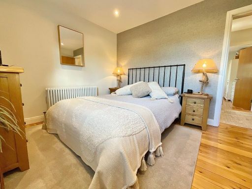
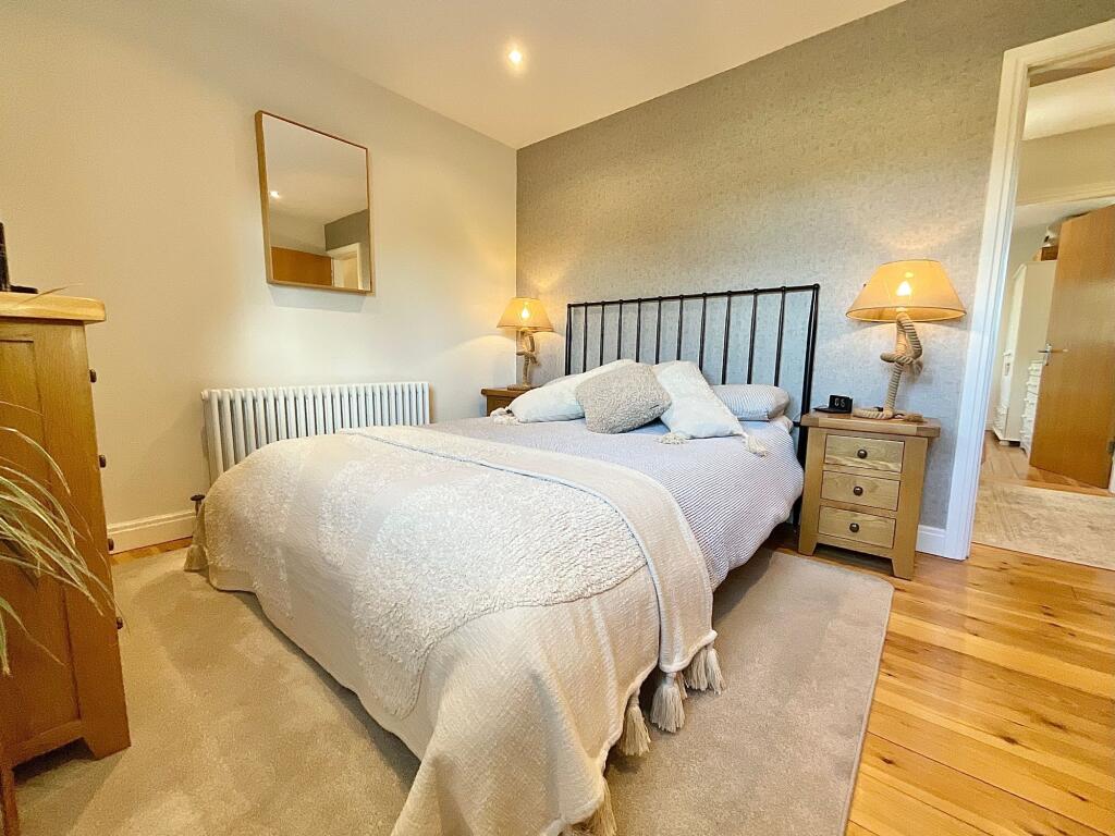
- MASTER BEDROOM / DRESSING AREA:
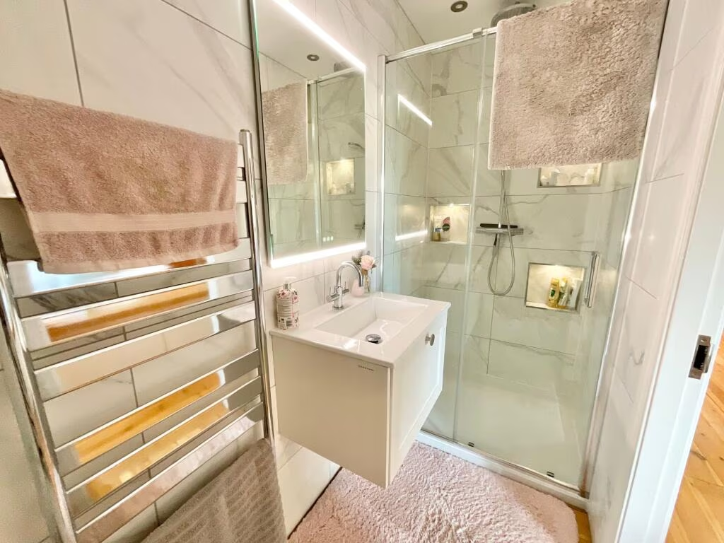
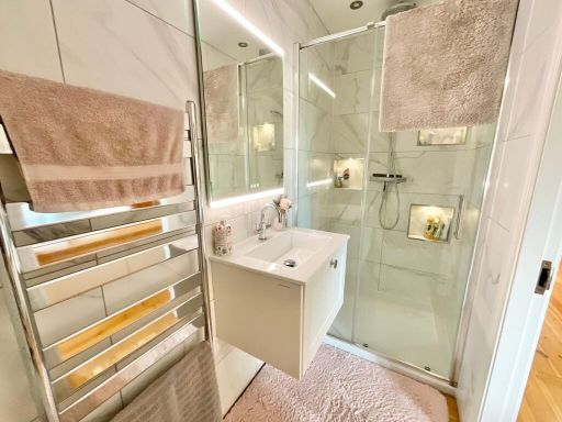
- ENSUITE:
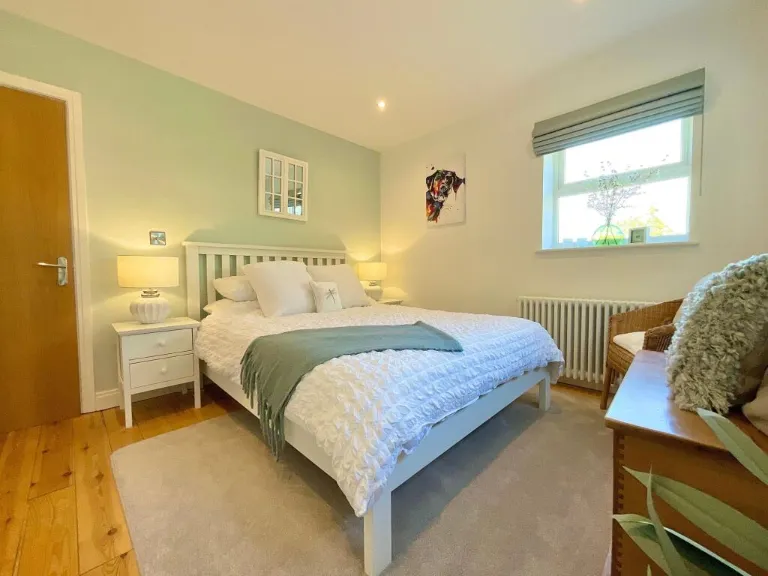
- BEDROOM 3:
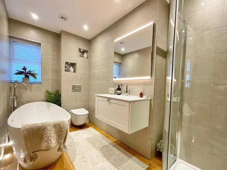
- BATHROOM:
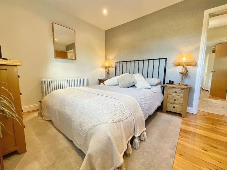
- BEDROOM 2:
- TIMBER OUTBUILDING:
- DOUBLE CARPORT:
- KITCHEN/ BREAKFAST ROOM:
- LOUNGE:
- UTILITY:
- DINING ROOM:
- SNUG/STUDY:
- WC / SHOWER:
- MASTER BEDROOM / DRESSING AREA:
- ENSUITE:
- BEDROOM 3:
- BATHROOM:
- BEDROOM 2:
- TIMBER OUTBUILDING:
- DOUBLE CARPORT:
Textual Property Features
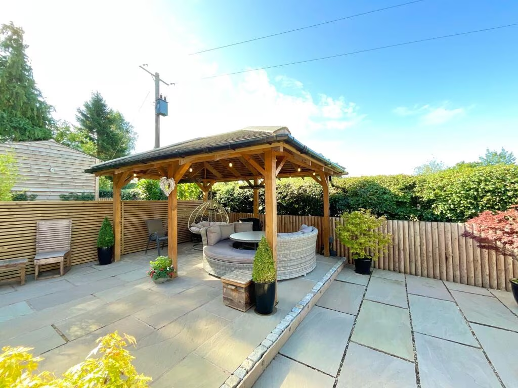
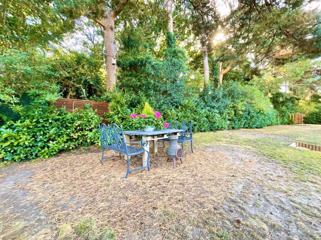
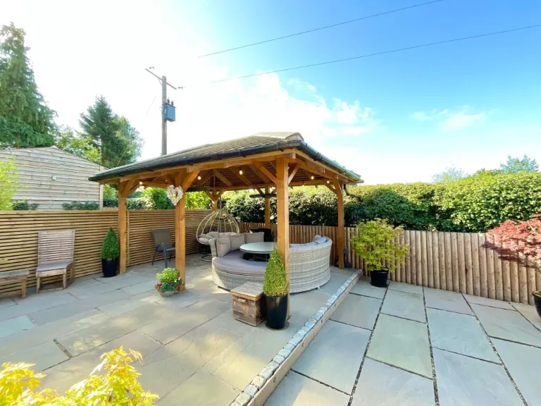
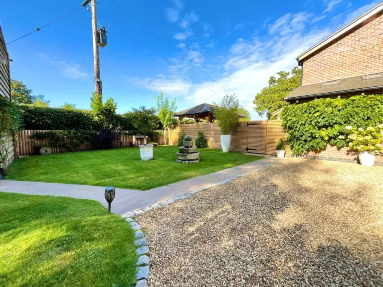
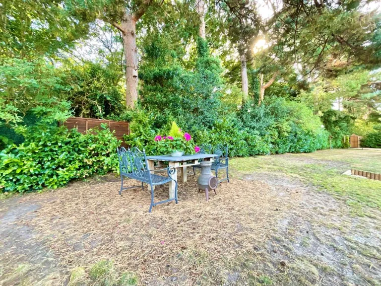
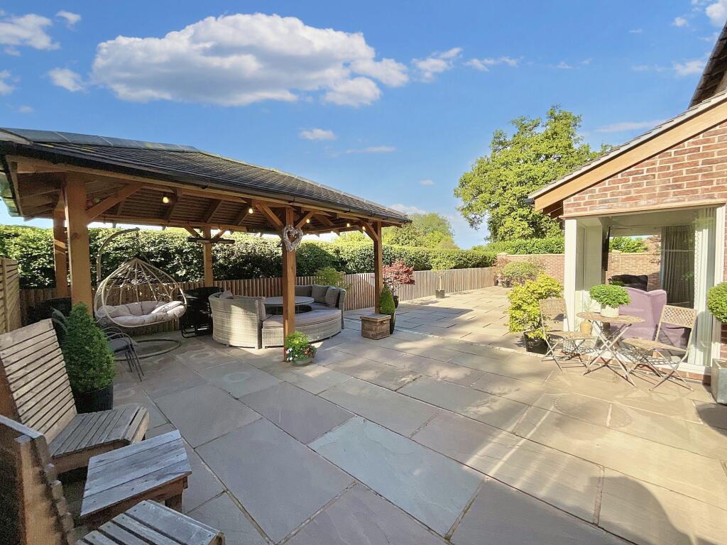
- Has Garden
- Chain Free
- Success
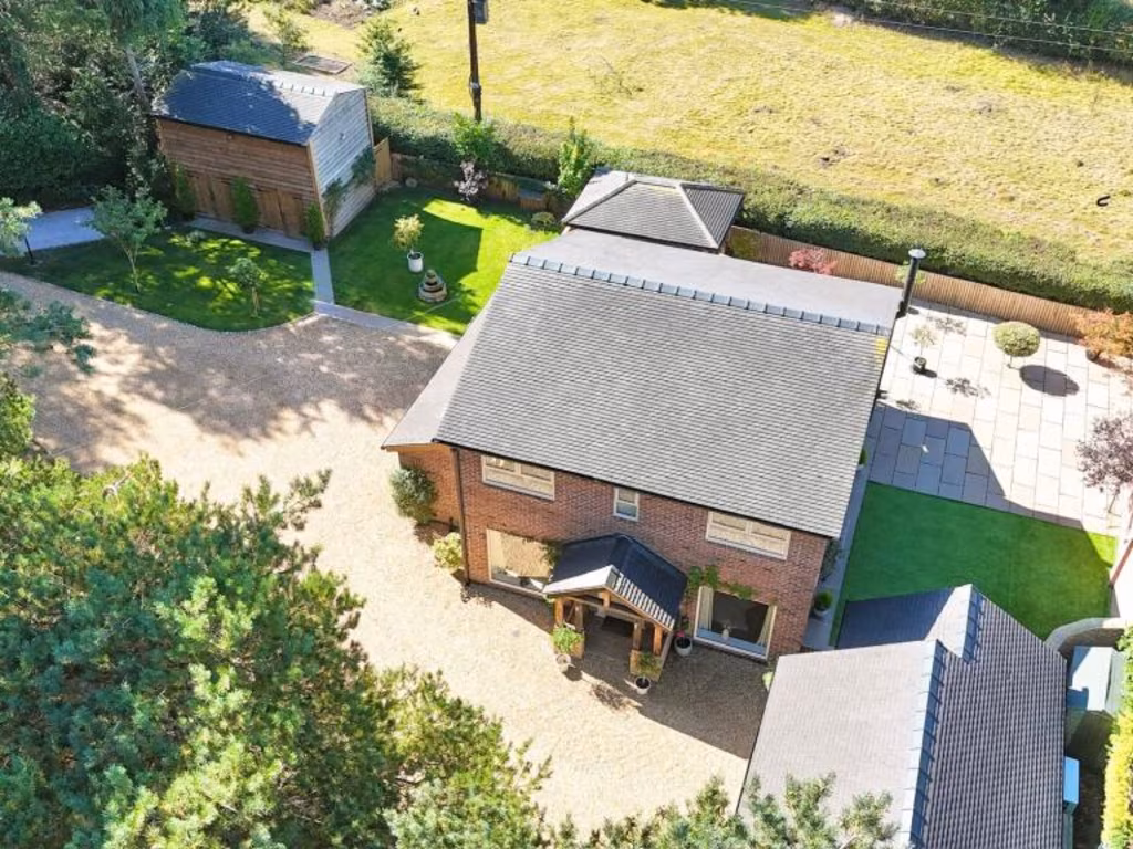
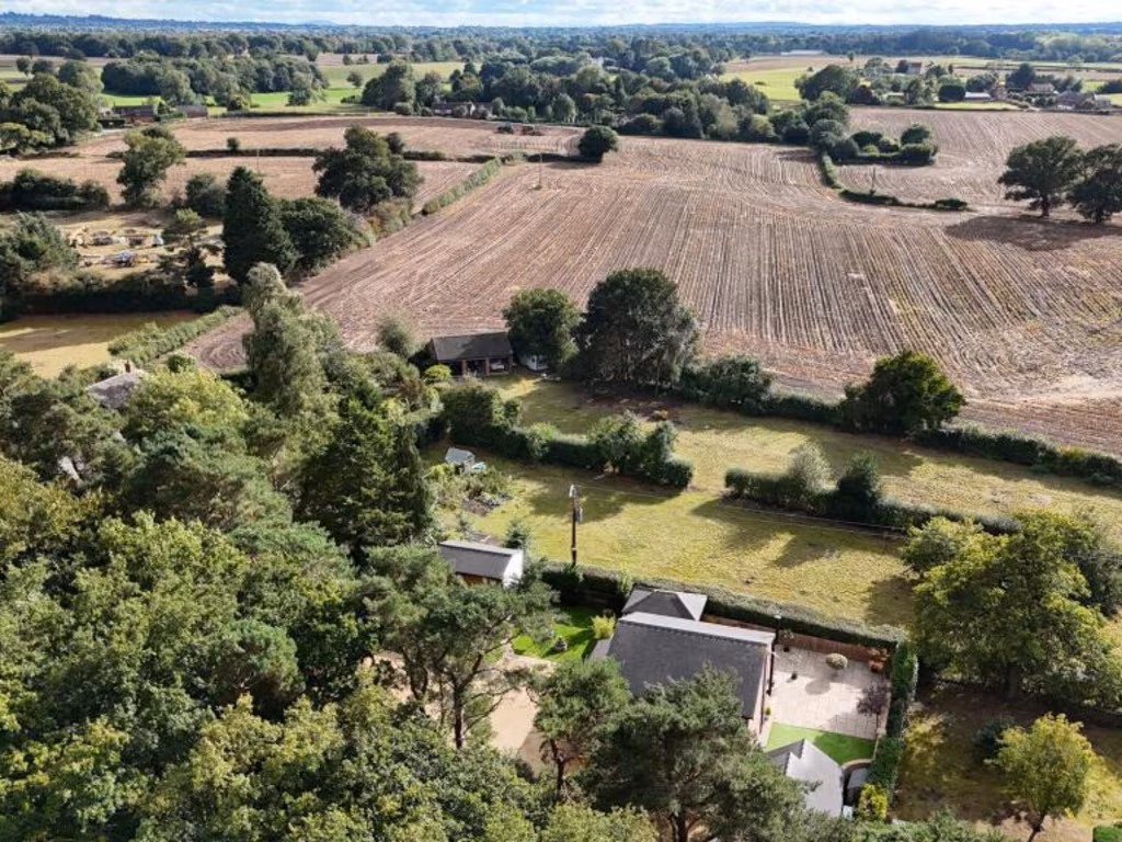
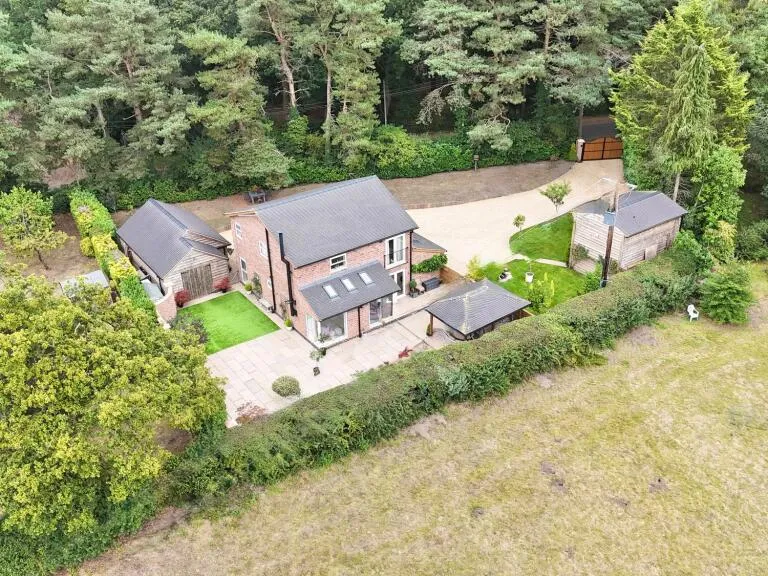
Detected Visual Features
- modern property
- detached house
- contemporary design
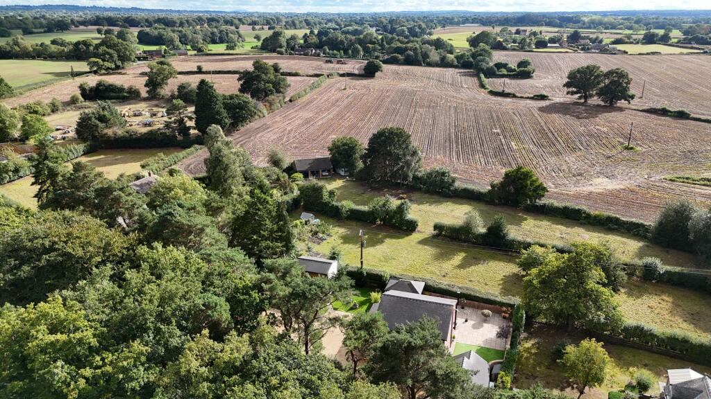
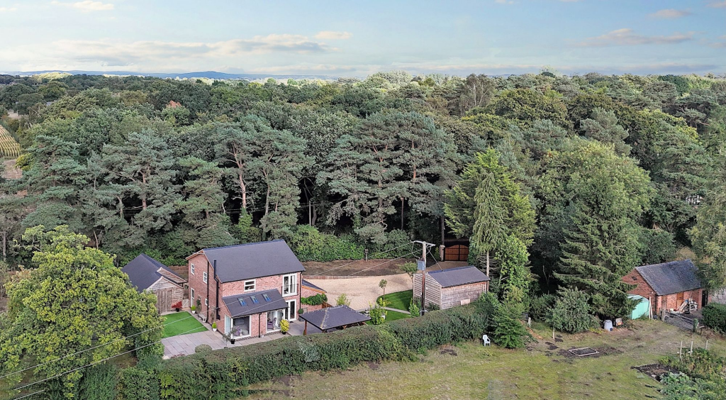
- landscaped garden
- garage
- driveway
- air conditioning
- open-floor plan
- modern
- detached
- two-story
- brick
- large driveway
- garden
- well-maintained
EPC Details
- High performance glazing
- Average thermal transmittance 0.25 W/m-¦K
- Air source heat pump, underfloor, electric
- Low energy lighting in all fixed outlets
- Average thermal transmittance 0.12 W/m-¦K
Nearby Schools
- Wybunbury Delves CofE Primary School
- Wistaston Church Lane Academy
- Vine Tree Primary School
- St Thomas More Catholic High School
- Ruskin Community High School
- Pear Tree Primary School
- Malbank School and Sixth Form College
- Highfields Academy
- Gainsborough Primary and Nursery School
- Wistaston Academy
- The Oaks Academy
- Stapeley Broad Lane CofE Primary School
- Bridgemere CofE Primary School
- Shavington Primary School
- Willaston Primary Academy
- Edleston Primary School
- Weaver Primary School
- Brine Leas School
- St Anne's Catholic Primary School
- Nantwich Primary Academy
- Woore Primary and Nursery School
- Audlem St James' CofE Primary School
- Weston Village Primary School
- Shavington Academy
- The Berkeley Academy
- Pebble Brook Primary School
- St Mary's Catholic Primary School, Crewe
- Millfields Primary Academy
- Adderley CofE Primary School
Nearest Religious buildings
- Id: 789359277
- Tags:
- Amenity: place_of_worship
- Building: church
- Denomination: anglican
- Name: St Chad's
- Religion: christian
- Wikidata: Q111718682
- TagsNormalized:
- place of worship
- church
- anglican
- christian
- Lat: 53.0454643
- Lon: -2.4543942
- FullGeoHash: gcqmb0su0rpp
- PartitionGeoHash: gcqm
- Images:
- FoodStandards: null
- Distance: 2473.3
,- Id: 789341942
- Tags:
- Amenity: place_of_worship
- Building: church
- Denomination: anglican
- Name: St John the Evangelist
- Religion: christian
- Wikidata: Q7593544
- Wikipedia: en:St John's Church, Doddington
- TagsNormalized:
- place of worship
- church
- anglican
- evangelist
- christian
- Lat: 53.013126
- Lon: -2.444307
- FullGeoHash: gcqm86spgdbw
- PartitionGeoHash: gcqm
- Images:
- FoodStandards: null
- Distance: 2162.9
,- Id: 8839236
- Tags:
- Leaf_type: broadleaved
- Name: Chapel Wood
- Natural: wood
- Type: multipolygon
- TagsNormalized:
- Lat: 53.0168618
- Lon: -2.4466352
- FullGeoHash: gcqm876mt72e
- PartitionGeoHash: gcqm
- Images:
- FoodStandards: null
- Distance: 1797.5
}
Nearest Medical buildings
- Id: 4779858021
- Tags:
- Addr:
- Housenumber: 19A
- Postcode: CW5 5BZ
- Street: Pillory Street
- Amenity: dentist
- Healthcare: dentist
- Name: Nantwich Smile Design
- Source: survey; Bing
- Website: www.nantwichsmiledesign.co.uk
- TagsNormalized:
- Lat: 53.0658669
- Lon: -2.5212735
- FullGeoHash: gcqjysk544d4
- PartitionGeoHash: gcqj
- Images:
- FoodStandards: null
- Distance: 5687.9
,- Id: 1635365598
- Tags:
- Amenity: pharmacy
- Dispensing: yes
- Healthcare: pharmacy
- Name: Morrisons
- Opening_hours: Mo-Th 09:00-19:00; Fr-Sa 09:00-20:00; Su 10:00-16:00
- Wheelchair: yes
- TagsNormalized:
- pharmacy
- health
- healthcare
- morrisons
- Lat: 53.06502
- Lon: -2.5189619
- FullGeoHash: gcqjysjwputy
- PartitionGeoHash: gcqj
- Images:
- FoodStandards: null
- Distance: 5519.7
,- Id: 531900563
- Tags:
- Addr:
- Postcode: CW5 5SF
- Street: Crewe Road End
- Amenity: veterinary
- Building: yes
- Name: Nantwich Veterinary Hospital
- Source: local knowledge
- Website: www.nantwichvetgroup.co.uk
- Wheelchair: yes
- TagsNormalized:
- Lat: 53.0662049
- Lon: -2.5144819
- FullGeoHash: gcqjyu3j03d6
- PartitionGeoHash: gcqj
- Images:
- FoodStandards: null
- Distance: 5455.8
,- Id: 531169598
- Tags:
- Amenity: doctors
- Building: office
- Healthcare: doctor
- Source: Bing
- TagsNormalized:
- doctor
- doctors
- office
- health
- healthcare
- Lat: 52.9899604
- Lon: -2.50969
- FullGeoHash: gcqjqys2zuxd
- PartitionGeoHash: gcqj
- Images:
- FoodStandards: null
- Distance: 4746.7
}
Nearest Leisure Facilities
- Id: 9962753610
- Tags:
- TagsNormalized:
- picnic
- picnic table
- leisure
- Lat: 53.0171032
- Lon: -2.5271378
- FullGeoHash: gcqjw7rz12m7
- PartitionGeoHash: gcqj
- Images:
- FoodStandards: null
- Distance: 3948.8
,- Id: 9962753611
- Tags:
- TagsNormalized:
- picnic
- picnic table
- leisure
- Lat: 53.0169773
- Lon: -2.5269963
- FullGeoHash: gcqjw7ryk8yu
- PartitionGeoHash: gcqj
- Images:
- FoodStandards: null
- Distance: 3942.8
,- Id: 9962753612
- Tags:
- TagsNormalized:
- picnic
- picnic table
- leisure
- Lat: 53.0169475
- Lon: -2.5269735
- FullGeoHash: gcqjw7ryj5rf
- PartitionGeoHash: gcqj
- Images:
- FoodStandards: null
- Distance: 3942.1
,- Id: 789359264
- Tags:
- TagsNormalized:
- Lat: 53.0449443
- Lon: -2.4543264
- FullGeoHash: gcqmb0sc4n3d
- PartitionGeoHash: gcqm
- Images:
- FoodStandards: null
- Distance: 2422.7
,- Id: 25662711
- Tags:
- Leisure: golf_course
- Name: Brookfield Golf Club
- Note: position only estimate
- TagsNormalized:
- golf
- golf course
- leisure
- club
- Lat: 53.0055153
- Lon: -2.4798414
- FullGeoHash: gcqjx965x80n
- PartitionGeoHash: gcqj
- Images:
- FoodStandards: null
- Distance: 2292.7
}
Nearest Tourist attractions
- Id: 158848819
- Tags:
- Building: bunker
- Name: Hack Green secret Nuclear Bunker
- Source: Bing
- Tourism: museum
- Website: http://www.hackgreen.co.uk/
- Wikidata: Q5637175
- Wikipedia: en:Hack Green Secret Nuclear Bunker
- TagsNormalized:
- Lat: 53.0270204
- Lon: -2.530557
- FullGeoHash: gcqjwmm2c9pc
- PartitionGeoHash: gcqj
- Images:
- FoodStandards: null
- Distance: 4078
,- Id: 3599577582
- Tags:
- TagsNormalized:
- Lat: 53.0459133
- Lon: -2.5138183
- FullGeoHash: gcqjyb9qzfcn
- PartitionGeoHash: gcqj
- Images:
- FoodStandards: null
- Distance: 3744.7
,- Id: 310831533
- Tags:
- Name: Dagfields Craft Centre
- Tourism: attraction
- TagsNormalized:
- Lat: 53.0278507
- Lon: -2.4617905
- FullGeoHash: gcqjxvrms5gf
- PartitionGeoHash: gcqj
- Images:
- FoodStandards: null
- Distance: 602.8
}
Nearest Train stations
- Id: 133359965
- Tags:
- Addr:
- Postcode: ST7 2XW
- Street: Sandbach Road
- Amenity: shelter
- Building: train_station
- Source: Bing
- TagsNormalized:
- shelter
- station
- train
- train station
- Lat: 53.0930812
- Lon: -2.299024
- FullGeoHash: gcqq59mcsgem
- PartitionGeoHash: gcqq
- Images:
- FoodStandards: null
- Distance: 13674.5
,- Id: 7355012701
- Tags:
- Name: Silverdale
- Public_transport: station
- Railway: station
- Usage: tourism
- TagsNormalized:
- Lat: 53.0329455
- Lon: -2.2658653
- FullGeoHash: gcqmsqq53986
- PartitionGeoHash: gcqm
- Images:
- FoodStandards: null
- Distance: 13655.4
,- Id: 1080583548
- Tags:
- Name: Wrenbury
- Naptan:
- Network: National Rail
- Operator: Trafnidiaeth Cymru
- Operator:cy: Trafnidiaeth Cymru
- Operator:en: Transport for Wales
- Public_transport: station
- Railway: station
- Ref:
- Request_stop: yes
- Wikidata: Q2669037
- Wikipedia: en:Wrenbury railway station
- TagsNormalized:
- Lat: 53.0195948
- Lon: -2.5956111
- FullGeoHash: gcqjsgvvtbu4
- PartitionGeoHash: gcqj
- Images:
- FoodStandards: null
- Distance: 8447.5
,- Id: 6004512801
- Tags:
- Name: Crewe
- Name:cy: Cryw
- Name:en: Crewe
- Naptan:
- Network: National Rail
- Public_transport: station
- Railway: station
- Ref:
- Wheelchair: yes
- Wikipedia: en:Crewe railway station
- TagsNormalized:
- Lat: 53.0889629
- Lon: -2.4326364
- FullGeoHash: gcqq08s9e7yz
- PartitionGeoHash: gcqq
- Images:
- FoodStandards: null
- Distance: 7509.1
,- Id: 1080583474
- Tags:
- Name: Nantwich
- Naptan:
- Network: National Rail
- Operator: Trafnidiaeth Cymru
- Operator:cy: Trafnidiaeth Cymru
- Operator:en: Transport for Wales
- Public_transport: station
- Railway: station
- Ref:
- Wikipedia: en:Nantwich railway station
- TagsNormalized:
- Lat: 53.0635485
- Lon: -2.5187309
- FullGeoHash: gcqjyevvt66h
- PartitionGeoHash: gcqj
- Images:
- FoodStandards: null
- Distance: 5379.9
}
Nearest Hotels
- Id: 625981559
- Tags:
- Amenity: pub
- Name: The Swan Hotel
- TagsNormalized:
- Lat: 52.9787721
- Lon: -2.4039208
- FullGeoHash: gcqm3k3x8wft
- PartitionGeoHash: gcqm
- Images:
- FoodStandards: null
- Distance: 6782.6
,- Id: 1624102228
- Tags:
- Addr:
- Postcode: CW5 5AS
- Street: High Street
- Email: info@crownhotelnantwich.com
- Fhrs:
- Internet_access: wlan
- Name: Crown Hotel, Bar & Grill
- Phone: +44 1270 625283
- Rooms: 18
- Source:
- Addr: Food Hygiene Open Data
- Stars: 2
- Tourism: hotel
- Website: www.crownhotelnantwich.com
- Wheelchair: no
- Wikidata: Q5189382
- Wikipedia: en:Crown Hotel, Nantwich
- TagsNormalized:
- Lat: 53.0673406
- Lon: -2.5227636
- FullGeoHash: gcqjysdgxm71
- PartitionGeoHash: gcqj
- Images:
- FoodStandards: null
- Distance: 5878.6
,- Id: 1681808160
- Tags:
- Brand: Premier Inn
- Brand:wikidata: Q2108626
- Brand:wikipedia: en:Premier Inn
- Internet_access: wlan
- Internet_access:fee: customers
- Internet_access:operator: Virgin Media
- Internet_access:ssid: Premier Inn Free Wi-Fi
- Name: Premier Inn
- Tourism: hotel
- TagsNormalized:
- Lat: 53.0692074
- Lon: -2.4970759
- FullGeoHash: gcqjzhvwtcm3
- PartitionGeoHash: gcqj
- Images:
- FoodStandards: null
- Distance: 5225.1
}
Tags
- modern property
- detached house
- contemporary design
- landscaped garden
- garage
- driveway
- air conditioning
- open-floor plan
- modern
- detached
- two-story
- brick
- large driveway
- garden
- well-maintained
- garage
Local Market Stats
- Average Price/sqft: £257
- Avg Income: £45200
- Rental Yield: 3.4%
- Social Housing: 4%
- Planning Success Rate: 85%
AirBnB Data
- 1km average: £62/night
- Listings in 1km: 1
Similar Properties
 4 bedroom semi-detached house for sale in Pewit Lane, Hunsterson, CW5 — £775,000 • 4 bed • 4 bath • 1589 ft²
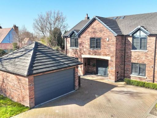 5 bedroom detached house for sale in Audlem Road, Hankelow, CW3 — £795,000 • 5 bed • 3 bath • 3245 ft²
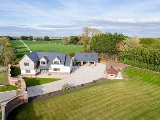 5 bedroom detached house for sale in "The Farthings", London Road, Bridgemere, CW5 — £999,000 • 5 bed • 4 bath • 3000 ft²
 4 bedroom detached house for sale in 6 Cheney Close, Off Cheerbrook Road, Willaston, CW5 — £699,000 • 4 bed • 2 bath • 5247 ft²
 4 bedroom detached house for sale in Gainsborough Drive, Nantwich, CW5 — £585,000 • 4 bed • 2 bath • 1942 ft²
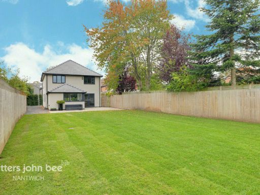 4 bedroom detached house for sale in Audlem Road, Hankelow, CW3 — £600,000 • 4 bed • 2 bath
Meta
- {
"@context": "https://schema.org",
"@type": "Residence",
"name": "4 bedroom detached house for sale in Park Lane, Hatherton,…",
"description": "",
"url": "https://propertypiper.co.uk/property/570313fa-c0b3-47ef-8139-1f6901c531dc",
"image": "https://image-a.propertypiper.co.uk/353cfdbf-425f-40e4-af60-f822b3bf85e8-1024.jpeg",
"address": {
"@type": "PostalAddress",
"streetAddress": "The Pines, Park Lane, Hatherton",
"postalCode": "CW5 7QX",
"addressLocality": "Cheshire East",
"addressRegion": "Crewe and Nantwich",
"addressCountry": "England"
},
"geo": {
"@type": "GeoCoordinates",
"latitude": 53.02520255947368,
"longitude": -2.4696557357549396
},
"numberOfRooms": 4,
"numberOfBathroomsTotal": 3,
"floorSize": {
"@type": "QuantitativeValue",
"value": 1679,
"unitCode": "FTK"
},
"offers": {
"@type": "Offer",
"price": 895000,
"priceCurrency": "GBP",
"availability": "https://schema.org/InStock"
},
"additionalProperty": [
{
"@type": "PropertyValue",
"name": "Feature",
"value": "modern property"
},
{
"@type": "PropertyValue",
"name": "Feature",
"value": "detached house"
},
{
"@type": "PropertyValue",
"name": "Feature",
"value": "contemporary design"
},
{
"@type": "PropertyValue",
"name": "Feature",
"value": "landscaped garden"
},
{
"@type": "PropertyValue",
"name": "Feature",
"value": "garage"
},
{
"@type": "PropertyValue",
"name": "Feature",
"value": "driveway"
},
{
"@type": "PropertyValue",
"name": "Feature",
"value": "air conditioning"
},
{
"@type": "PropertyValue",
"name": "Feature",
"value": "open-floor plan"
},
{
"@type": "PropertyValue",
"name": "Feature",
"value": "modern"
},
{
"@type": "PropertyValue",
"name": "Feature",
"value": "detached"
},
{
"@type": "PropertyValue",
"name": "Feature",
"value": "two-story"
},
{
"@type": "PropertyValue",
"name": "Feature",
"value": "brick"
},
{
"@type": "PropertyValue",
"name": "Feature",
"value": "large driveway"
},
{
"@type": "PropertyValue",
"name": "Feature",
"value": "garden"
},
{
"@type": "PropertyValue",
"name": "Feature",
"value": "well-maintained"
},
{
"@type": "PropertyValue",
"name": "Feature",
"value": "garage"
}
]
}
High Res Floorplan Images
Compatible Floorplan Images
FloorplanImages Thumbnail