BD20 6DY - 3 bedroom semidetached house for sale in Shann Lane, Keighl…
View on Property Piper
3 bedroom semi-detached house for sale in Shann Lane,
Keighley,
BD20 6DY, BD20
Property Details
- Price: £259995
- Bedrooms: 3
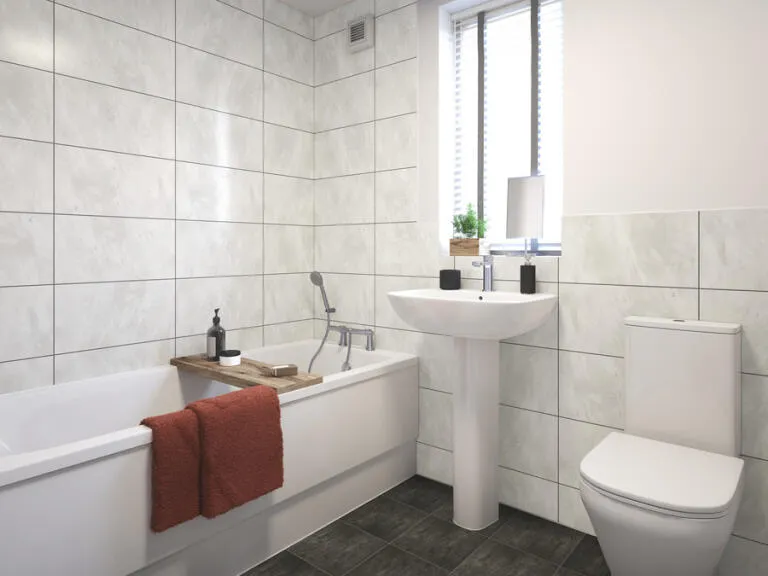
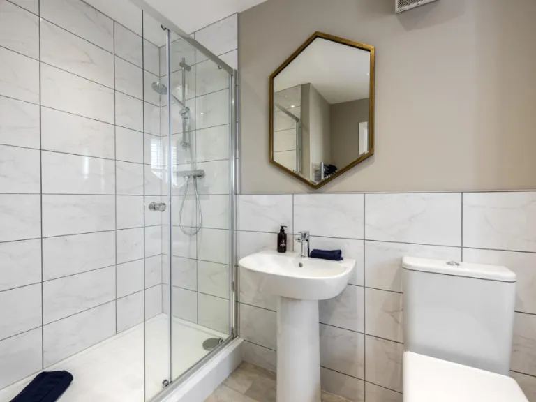
- Bathrooms: 1
- Property Type: undefined
- Property SubType: undefined
Brochure Descriptions
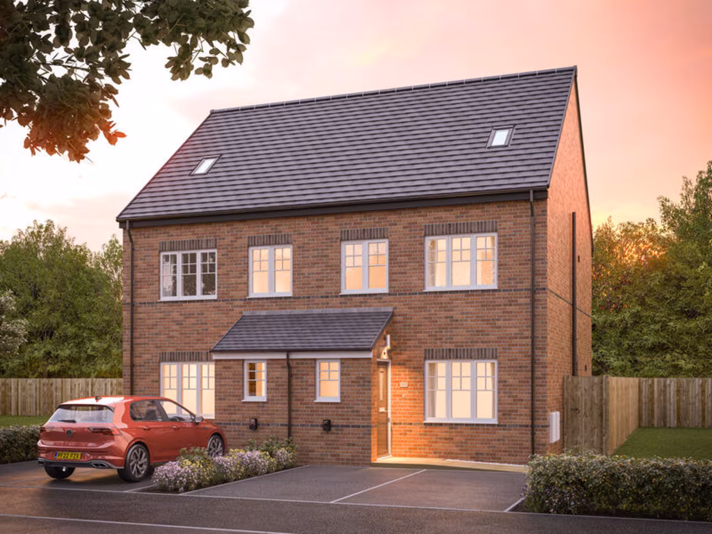
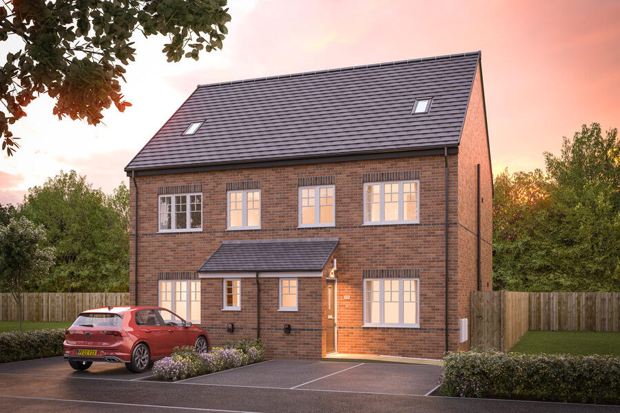
- New-build residential development made up of two-storey detached and semi‑detached brick houses. Street scene shows modern traditional-style elevations with pitched roofs, bay/large windows and driveways/parking in front of each dwelling. Landscaping includes low hedges, small front lawns and communal green space with tree planting. Likely a suburban family development offering small-to-average private gardens and off‑street parking; property footprints would typically be medium-sized family homes (3–4 bedroom equivalent). No interior details visible. No exceptional views (urban/suburban setting).
- New-build residential development name/plot (Odette's Point) marketed by Avant Homes. The image is a cover/marketing page rather than internal photographs, so only the development name and location (Keighley, Bradford) can be confirmed. As a valuator-style description: this appears to be part of a modern new‑build housing development offering standard specification homes aimed at the mainstream market. Likely features (typical for this developer) include contemporary finishes, energy‑efficient construction and modest private gardens. The site size cannot be determined from the image; individual garden sizes are likely small-to-average for a suburban development. No internal layout, room counts or exact floor area are shown, so a detailed valuation would require floorplans, plot position, specification and local comparable sales.
- Document is a development brochure contents page for a new-build scheme called "Odette's Point" by Avant Homes, referencing living in Keighley. As presented there are multiple house type floor plans, a development plan and specification sections — indicating a planned new residential development rather than a single existing address. No specific house number or street is shown on this page. From the brochure context a valuator would note this is new-build housing stock in the Keighley area, likely comprising a mix of house types (various floor plans), aimed at buyers of new homes. Garden and room sizes cannot be determined from this image; the development scale appears to be more than one dwelling but total property size and individual unit footprints are not discernible.
Image Descriptions
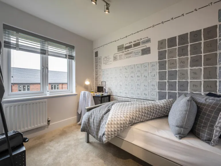
- Exterior of a newly constructed semidetached house Modern
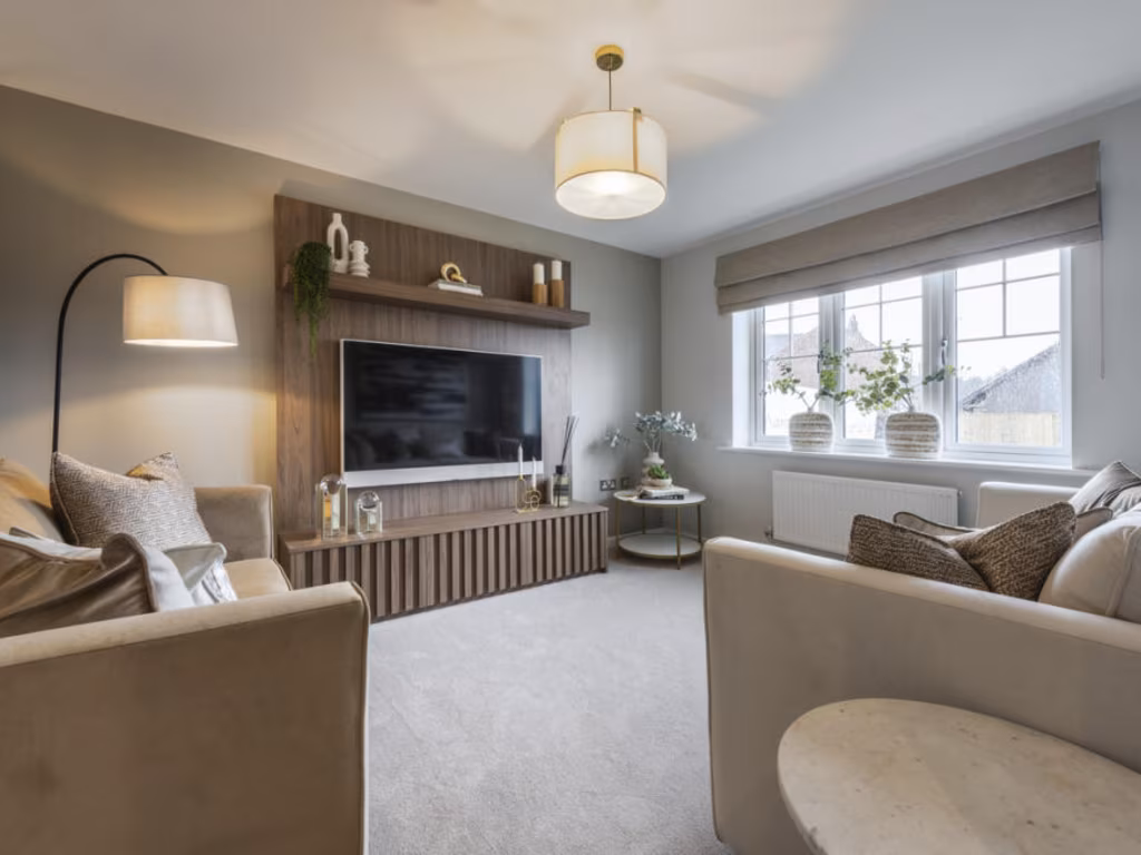
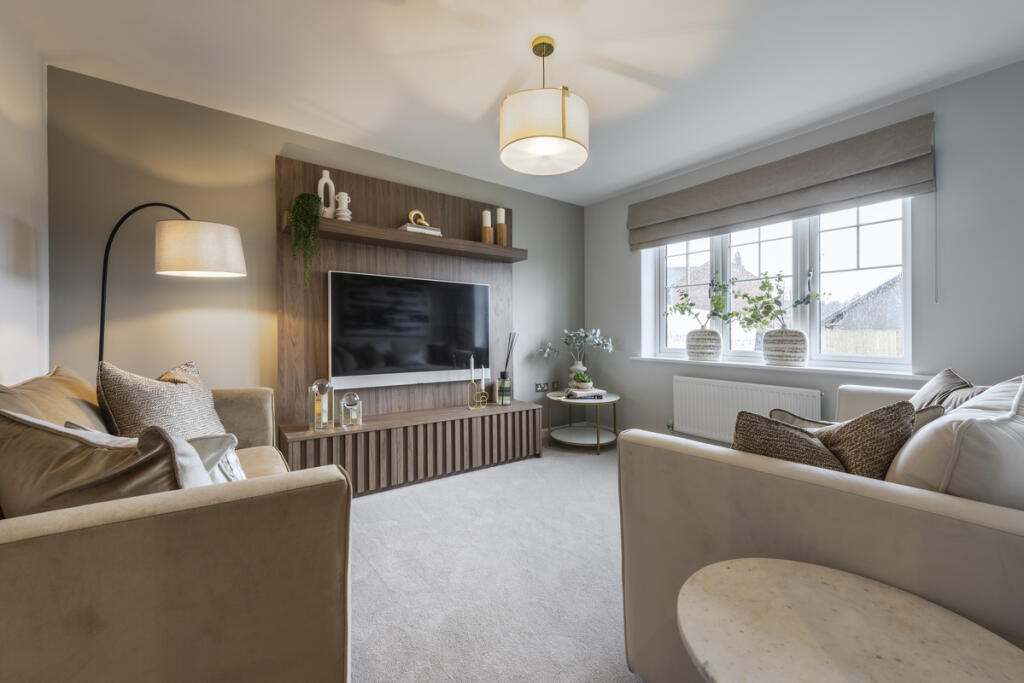
- living room contemporary
Floorplan Description
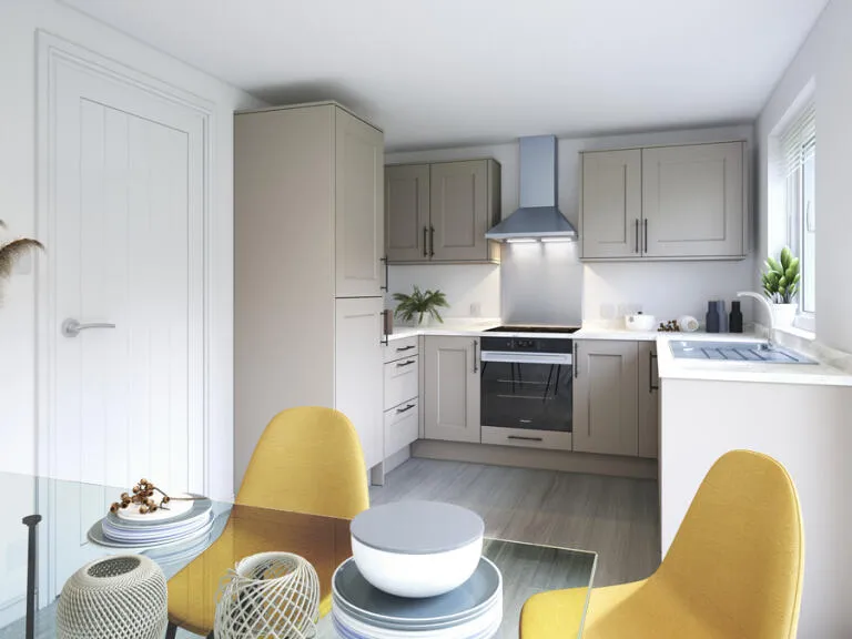
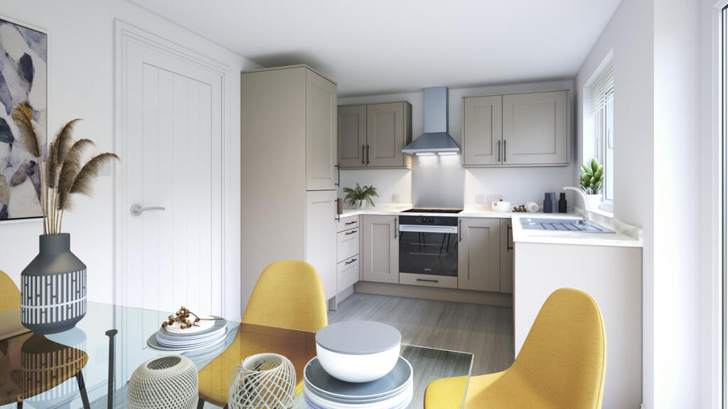
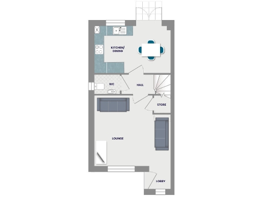
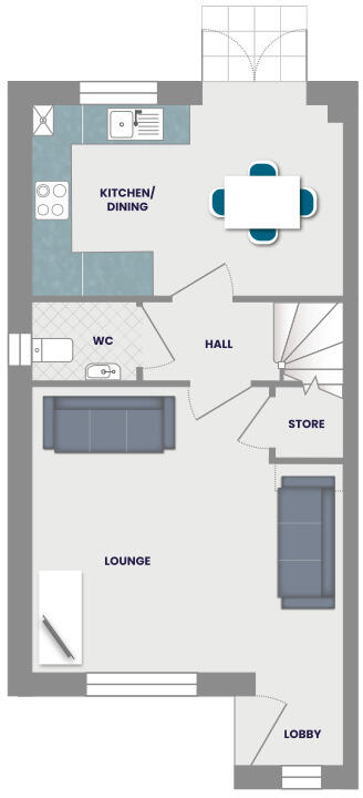
- Ground-floor plan showing labelled KITCHEN/ DINING, WC, HALL, STORE, LOUNGE and LOBBY.
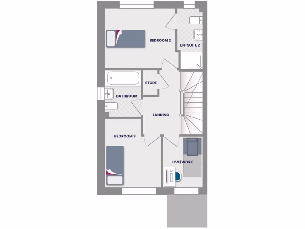
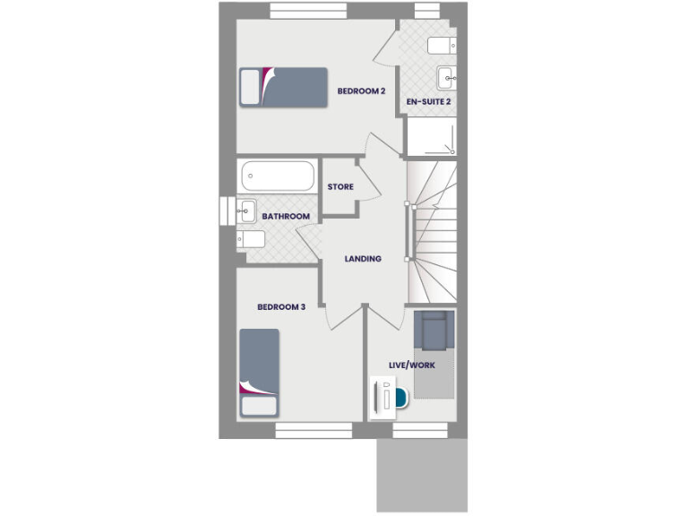
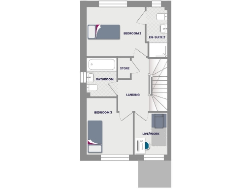
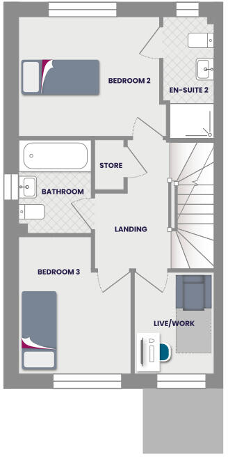
- Floor plan showing two bedrooms (Bedroom 2 and Bedroom 3), en-suite, bathroom, store, landing and a live/work area.
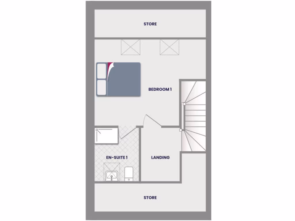
- Floorplan showing BEDROOM 1, EN-SUITE 1, LANDING and two STORE areas.
Rooms
- KITCHEN/ DINING:
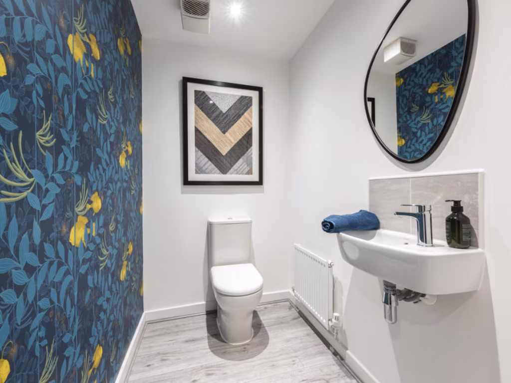
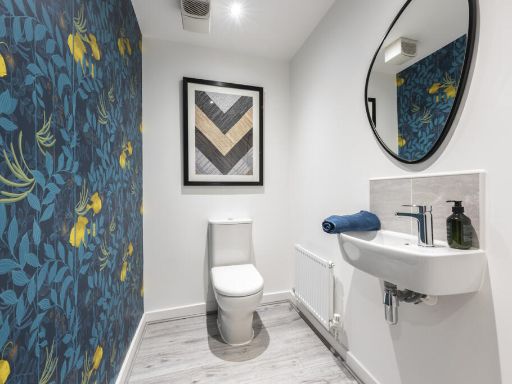
- WC:
- HALL:
- STORE:
- LOUNGE:
- LOBBY:
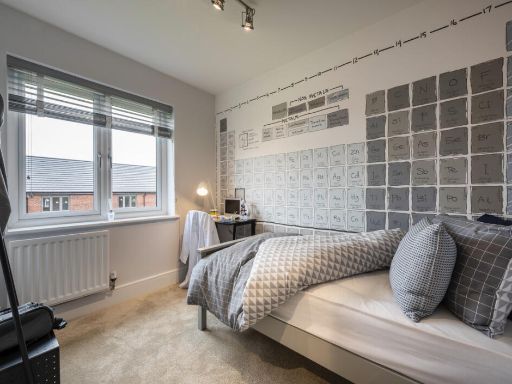
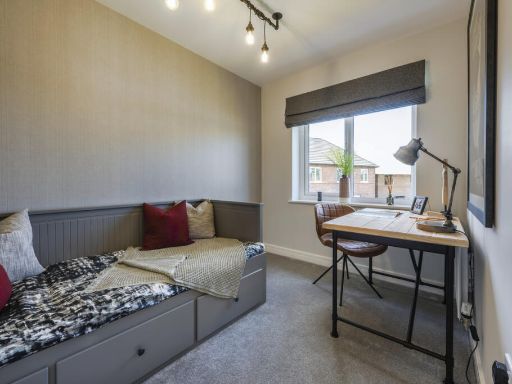
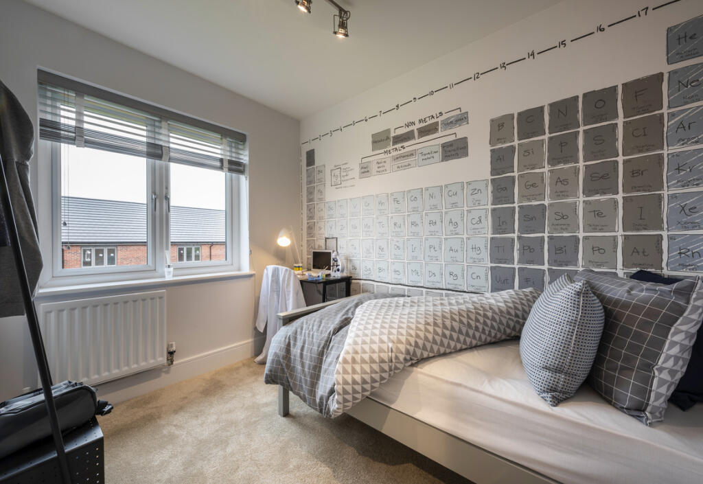
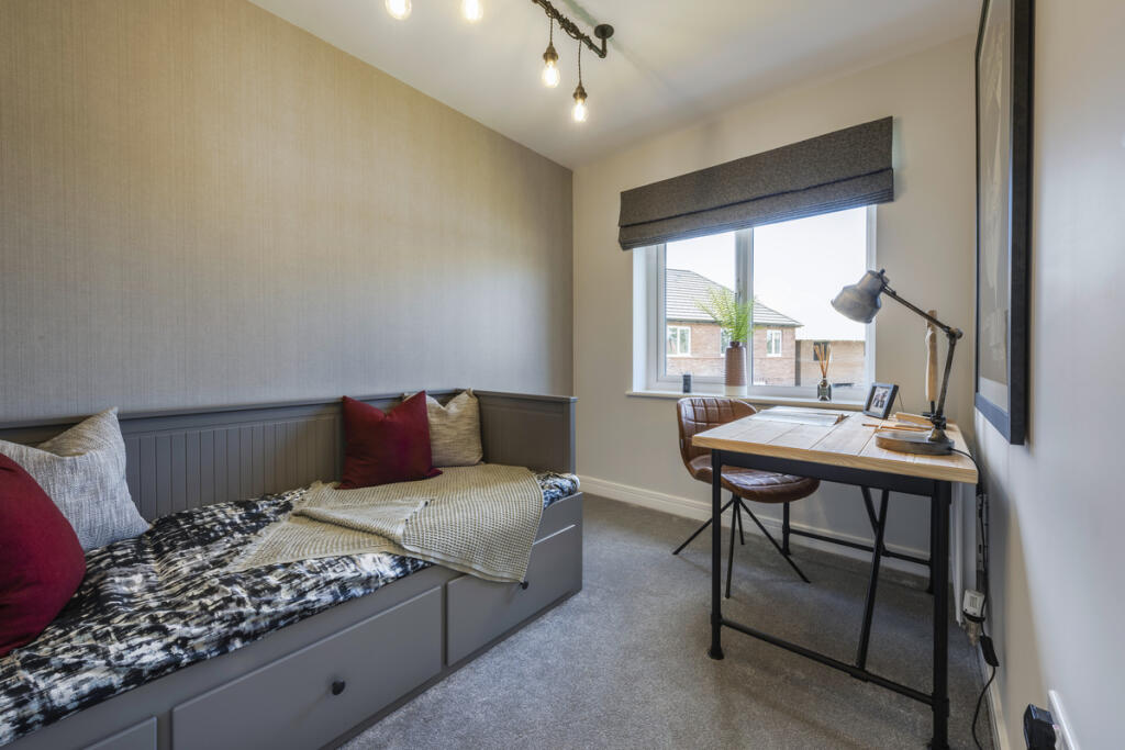
- BEDROOM 2:
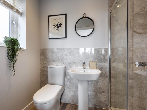
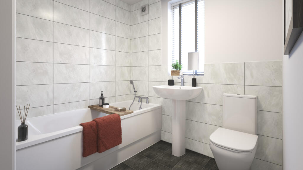
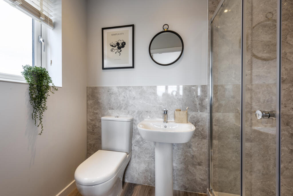
- EN-SUITE 2:
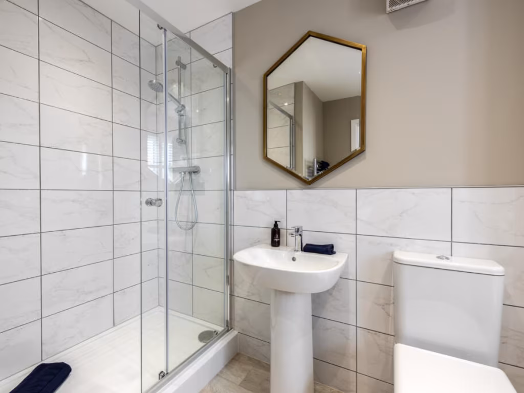
- BATHROOM:
- STORE:
- LANDING:
- BEDROOM 3:
- LIVE/WORK:
- STORE:
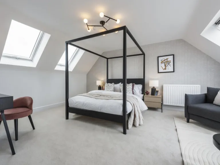
- BEDROOM 1:
- EN-SUITE 1:
- LANDING:
- STORE:
Textual Property Features
Detected Visual Features
- new build
- semidetached
- brick exterior
- modern design
- three-story
- off-street parking
- contemporary
- living room
- bright
- neutral decor
- large windows
- natural light
- fresh
- clean
- comfortable
- suburban
Nearby Schools
- Cullingworth Village Primary School
- Oakworth Primary School
- Long Lee Primary School
- St Anne's Catholic Primary School
- Riddlesden St Mary's CofE Primary School
- Steeton Primary School
- Kildwick Church of England Voluntary Controlled Primary School
- Silsden Primary School
- Lees Primary School
- Harden Primary School
- Beckfoot Oakbank
- Ingrow Primary School
- St Joseph's Catholic Primary School
- Holycroft Primary School
- Keighley St Andrew's CofE Primary School and Nursery
- Merlin Top Primary Academy
- Victoria Primary School
- Eastwood Community School
- The Holy Family Catholic School, a Voluntary Academy
- Carlton Keighley
- Parkside School
- Haworth Primary School
- Beckfoot Nessfield
- Worth Valley Primary School
- Parkwood Primary School
- Laycock Primary School
- Our Lady of Victories Catholic School
Nearest General Shops
- Id: 1957575016
- Tags:
- Craft: upholsterer
- Name: Lowbridge Upholstery
- Shop: furniture
- TagsNormalized:
- Lat: 53.8692539
- Lon: -1.9100445
- FullGeoHash: gcwdkw95hsz8
- PartitionGeoHash: gcwd
- Images:
- FoodStandards: null
- Distance: 1276.9
,- Id: 359401771
- Tags:
- Brand: The Co-operative Funeralcare
- Building: yes
- Name: Maurice Leach & Son
- Operator: The Co-operative Group
- Shop: funeral_directors
- TagsNormalized:
- funeral
- the co-operative funeralcare
- funeral directors
- shop
- Lat: 53.8714669
- Lon: -1.909981
- FullGeoHash: gcwdkx10n1qc
- PartitionGeoHash: gcwd
- Images:
- FoodStandards: null
- Distance: 1203.6
,- Id: 446308493
- Tags:
- Name: Ruby News
- Shop: newsagent
- Wheelchair: no
- TagsNormalized:
- Lat: 53.8667767
- Lon: -1.9197326
- FullGeoHash: gcwdkq4hdyzx
- PartitionGeoHash: gcwd
- Images:
- FoodStandards: null
- Distance: 951.7
}
Nearest Grocery shops
- Id: 446308495
- Tags:
- Shop: convenience
- Wheelchair: no
- TagsNormalized:
- Lat: 53.8688085
- Lon: -1.9155619
- FullGeoHash: gcwdkqt0s1tx
- PartitionGeoHash: gcwd
- Images:
- FoodStandards: null
- Distance: 984
,- Id: 6348333028
- Tags:
- Addr:
- City: Keighley
- Housenumber: 79-81
- Postcode: BD21 2HD
- Street: Highfield Lane
- Fhrs:
- Name: Sowdens Stores
- Shop: convenience
- TagsNormalized:
- Lat: 53.8694016
- Lon: -1.915151
- FullGeoHash: gcwdkqtkj8rc
- PartitionGeoHash: gcwd
- Images:
- FoodStandards:
- Id: 326879
- FHRSID: 326879
- LocalAuthorityBusinessID: 50660
- BusinessName: Sowdens Stores
- BusinessType: Retailers - other
- BusinessTypeID: 4613
- AddressLine1: null
- AddressLine2: 79-81 Highfield Lane
- AddressLine3: Keighley
- AddressLine4: null
- PostCode: BD21 2HD
- RatingValue: 5
- RatingKey: fhrs_5_en-GB
- RatingDate: 2013-01-15
- LocalAuthorityCode: 404
- LocalAuthorityName: Bradford
- LocalAuthorityWebSite: http://www.bradford.gov.uk
- LocalAuthorityEmailAddress: eh.admin@bradford.gov.uk
- Scores:
- Hygiene: 5
- Structural: 0
- ConfidenceInManagement: 5
- NewRatingPending: false
- Geocode:
- Longitude: -1.91654900000000
- Latitude: 53.86983300000000
- Distance: 970.9
,- Id: 6348333020
- Tags:
- Addr:
- City: Keighley
- Housenumber: 35-37
- Postcode: BD21 2HL
- Street: Belgrave Road
- Fhrs:
- Name: Number One Convienience Store
- Shop: convenience
- TagsNormalized:
- Lat: 53.8697463
- Lon: -1.9154782
- FullGeoHash: gcwdkqtnn0ec
- PartitionGeoHash: gcwd
- Images:
- FoodStandards:
- Id: 326593
- FHRSID: 326593
- LocalAuthorityBusinessID: 41835
- BusinessName: Number One Convienience Store
- BusinessType: Retailers - other
- BusinessTypeID: 4613
- AddressLine1: null
- AddressLine2: 35-37 Belgrave Road
- AddressLine3: Keighley
- AddressLine4: null
- PostCode: BD21 2HL
- RatingValue: 4
- RatingKey: fhrs_4_en-GB
- RatingDate: 2015-04-14
- LocalAuthorityCode: 404
- LocalAuthorityName: Bradford
- LocalAuthorityWebSite: http://www.bradford.gov.uk
- LocalAuthorityEmailAddress: eh.admin@bradford.gov.uk
- Scores:
- Hygiene: 5
- Structural: 10
- ConfidenceInManagement: 0
- NewRatingPending: false
- Geocode:
- Longitude: -1.91587900000000
- Latitude: 53.87060500000000
- Distance: 933.2
}
Nearest Religious buildings
- Id: 475027402
- Tags:
- Addr:
- City: Keighley
- Place: Braithwaite Village
- Postcode: BD22 6PX
- Amenity: place_of_worship
- Denomination: swedenborgian
- Name: Keighley New Church
- Religion: christian
- TagsNormalized:
- place of worship
- church
- christian
- Lat: 53.8698187
- Lon: -1.9433188
- FullGeoHash: gcwd7y8ymqh3
- PartitionGeoHash: gcwd
- Images:
- FoodStandards: null
- Distance: 1106.9
,- Id: 661275465
- Tags:
- Addr:
- City: Keighley
- Hamlet: Utley
- Postcode: BD20 6ED
- Street: Green Head Lane
- Amenity: place_of_worship
- Building: church
- Denomination: anglican
- Name: St Mark's Church, Utley
- Religion: christian
- Source: DigitalGlobe Premium Imagery, survey
- Wikidata: Q105084411
- TagsNormalized:
- place of worship
- church
- anglican
- christian
- Lat: 53.8806065
- Lon: -1.9178331
- FullGeoHash: gcwds2emr1pc
- PartitionGeoHash: gcwd
- Images:
- FoodStandards: null
- Distance: 998.7
,- Id: 678007199
- Tags:
- Addr:
- City: Keighley
- Postcode: BD21 2PN
- Street: Highfield Lane
- Amenity: place_of_worship
- Building: church
- Denomination: anglican
- Fhrs:
- Name: All Saints' church
- Religion: christian
- Wikidata: Q105084387
- TagsNormalized:
- place of worship
- church
- anglican
- christian
- Lat: 53.869449
- Lon: -1.9156793
- FullGeoHash: gcwdkqth33ju
- PartitionGeoHash: gcwd
- Images:
- FoodStandards: null
- Distance: 938.5
}
Nearest Medical buildings
- Id: 183088869
- Tags:
- Addr:
- City: Keighley
- Housenumber: 49
- Postcode: BD21 2JH
- Street: Scott Street
- Amenity: doctors
- Building: yes
- Name: Ling House Medical Practice
- TagsNormalized:
- Lat: 53.8693993
- Lon: -1.9107862
- FullGeoHash: gcwdkw8egrye
- PartitionGeoHash: gcwd
- Images:
- FoodStandards: null
- Distance: 1225.8
,- Id: 373510147
- Tags:
- Amenity: pharmacy
- Dispensing: yes
- Wheelchair: no
- TagsNormalized:
- Lat: 53.8712146
- Lon: -1.9097372
- FullGeoHash: gcwdkwcqefk8
- PartitionGeoHash: gcwd
- Images:
- FoodStandards: null
- Distance: 1225.6
,- Id: 183088868
- Tags:
- Addr:
- City: Keighley
- Housenumber: 47
- Postcode: BD21 2JH
- Street: Scott Street
- Amenity: pharmacy
- Brand: Well Pharmacy
- Brand:wikidata: Q7726524
- Building: yes
- Dispensing: yes
- Healthcare: pharmacy
- Name: Well Pharmacy
- Opening_hours: Mo-Fr 08:30-18:00
- Wheelchair: yes
- TagsNormalized:
- pharmacy
- well pharmacy
- health
- healthcare
- Lat: 53.8692775
- Lon: -1.9110504
- FullGeoHash: gcwdkw87m31t
- PartitionGeoHash: gcwd
- Images:
- FoodStandards: null
- Distance: 1215.6
,- Id: 6348336942
- Tags:
- Addr:
- City: Keighley
- Housenumber: 50
- Postcode: BD21 2EH
- Street: Highfield Lane
- Amenity: pharmacy
- Name: Olive Late Night Pharmacy
- TagsNormalized:
- Lat: 53.8694934
- Lon: -1.914553
- FullGeoHash: gcwdkqtue9mv
- PartitionGeoHash: gcwd
- Images:
- FoodStandards: null
- Distance: 999.8
}
Nearest Airports
- Id: 11519546
- Tags:
- Addr:
- City: Leeds
- Postcode: LS19 7TU
- Aerodrome: international
- Aerodrome:type: public
- Aeroway: aerodrome
- Iata: LBA
- Icao: EGNM
- Name: Leeds Bradford Airport
- Operator: Leeds Bradford Airport Limited
- Operator:type: private
- Ref: LBA
- Type: multipolygon
- Website: https://www.leedsbradfordairport.co.uk/
- Wikidata: Q8699
- Wikipedia: en:Leeds Bradford Airport
- TagsNormalized:
- airport
- international airport
- Lat: 53.8667047
- Lon: -1.660138
- FullGeoHash: gcwf6nph7cx3
- PartitionGeoHash: gcwf
- Images:
- Q8699-1
- Q8699-2
- Q8699-3
- Q8699-4
- FoodStandards: null
- Distance: 17572.2
}
Nearest Leisure Facilities
- Id: 151659563
- Tags:
- Leisure: pitch
- Source: Bing
- TagsNormalized:
- Lat: 53.8703741
- Lon: -1.919221
- FullGeoHash: gcwdkqf3wvt4
- PartitionGeoHash: gcwd
- Images:
- FoodStandards: null
- Distance: 687.6
,- Id: 389430077
- Tags:
- Leisure: pitch
- Sport: soccer
- Surface: grass
- TagsNormalized:
- Lat: 53.8766871
- Lon: -1.9190571
- FullGeoHash: gcwdkrfw6wrm
- PartitionGeoHash: gcwd
- Images:
- FoodStandards: null
- Distance: 658.8
,- Id: 151659562
- Tags:
- Leisure: pitch
- Source: Bing
- Sport: bowls
- TagsNormalized:
- Lat: 53.8705578
- Lon: -1.9198742
- FullGeoHash: gcwdkqcfxxy4
- PartitionGeoHash: gcwd
- Images:
- FoodStandards: null
- Distance: 640.8
,- Id: 1022009460
- Tags:
- TagsNormalized:
- Lat: 53.870692
- Lon: -1.9222483
- FullGeoHash: gcwdkqb782gf
- PartitionGeoHash: gcwd
- Images:
- FoodStandards: null
- Distance: 510.5
,- Id: 1022009459
- Tags:
- TagsNormalized:
- Lat: 53.8702741
- Lon: -1.9231097
- FullGeoHash: gcwdknz9h6cq
- PartitionGeoHash: gcwd
- Images:
- FoodStandards: null
- Distance: 506.8
}
Nearest Tourist attractions
- Id: 8634950657
- Tags:
- Addr:
- City: Keighley
- Postcode: BD21 4JU
- Street: Riverside
- Name: Keighley Bus Museum
- Source: Bing
- Tourism: museum
- Website: http://www.kbmt.org.uk
- TagsNormalized:
- Lat: 53.8676618
- Lon: -1.8944818
- FullGeoHash: gcwdkyk3z7gz
- PartitionGeoHash: gcwd
- Images:
- FoodStandards: null
- Distance: 2295.9
,- Id: 199166463
- Tags:
- Addr:
- Building: yes
- Fhrs:
- Image: https://www.geograph.org.uk/photo/5382415
- Name: Museum of Rail Travel
- Operator: Vintage Carriage Trust
- Source: Bing
- Tourism: museum
- Website: https://www.vintagecarriagestrust.org/ToIngrow.htm
- Wikidata: Q6941001
- Wikipedia: en:Museum of Rail Travel
- TagsNormalized:
- Lat: 53.8554388
- Lon: -1.9129494
- FullGeoHash: gcwdkkp49j3w
- PartitionGeoHash: gcwd
- Images:
- FoodStandards:
- Id: 326895
- FHRSID: 326895
- LocalAuthorityBusinessID: 51163
- BusinessName: Vintage Railway Carriage Museum
- BusinessType: Retailers - other
- BusinessTypeID: 4613
- AddressLine1: null
- AddressLine2: South Street
- AddressLine3: Keighley
- AddressLine4: null
- PostCode: BD21 5AX
- RatingValue: 5
- RatingKey: fhrs_5_en-GB
- RatingDate: 1999-10-14
- LocalAuthorityCode: 404
- LocalAuthorityName: Bradford
- LocalAuthorityWebSite: http://www.bradford.gov.uk
- LocalAuthorityEmailAddress: eh.admin@bradford.gov.uk
- Scores:
- Hygiene: 0
- Structural: 5
- ConfidenceInManagement: 5
- NewRatingPending: false
- Geocode:
- Longitude: -1.91569800000000
- Latitude: 53.85453500000000
- Distance: 2270.3
,- Id: 357477635
- Tags:
- Name: Cliffe Castle
- Tourism: museum
- Wheelchair: limited
- Wikidata: Q5132823
- Wikipedia: en:Cliffe Castle Museum
- TagsNormalized:
- Lat: 53.8751275
- Lon: -1.9136767
- FullGeoHash: gcwdkrwt25ej
- PartitionGeoHash: gcwd
- Images:
- FoodStandards: null
- Distance: 942.2
}
Nearest Train stations
- Id: 3713696172
- Tags:
- Name: Bingley
- Naptan:
- Network: National Rail
- Public_transport: station
- Railway: station
- Ref:
- Source: GPX
- Wikidata: Q672653
- Wikipedia: en:Bingley railway station
- TagsNormalized:
- Lat: 53.8487153
- Lon: -1.837164
- FullGeoHash: gcwdq4y5wbp4
- PartitionGeoHash: gcwd
- Images:
- FoodStandards: null
- Distance: 6573.4
,- Id: 21652987
- Tags:
- Name: Haworth
- Naptan:
- Public_transport: station
- Railway: station
- Usage: tourism
- Wikidata: Q5685412
- Wikipedia: en:Haworth railway station
- TagsNormalized:
- Lat: 53.8313183
- Lon: -1.9488416
- FullGeoHash: gcwd5xsyhtn3
- PartitionGeoHash: gcwd
- Images:
- FoodStandards: null
- Distance: 4925.8
,- Id: 21652997
- Tags:
- Name: Oakworth
- Naptan:
- Public_transport: station
- Railway: station
- Source: OS 1:25k
- Usage: tourism
- Wikidata: Q7074337
- Wikipedia: en:Oakworth railway station
- TagsNormalized:
- Lat: 53.8413266
- Lon: -1.9419575
- FullGeoHash: gcwd7c9bmnex
- PartitionGeoHash: gcwd
- Images:
- FoodStandards: null
- Distance: 3733.2
,- Id: 21653016
- Tags:
- Name: Ingrow (West)
- Naptan:
- Public_transport: station
- Railway: station
- Usage: tourism
- Wikidata: Q6033350
- Wikipedia: en:Ingrow (West) railway station
- TagsNormalized:
- Lat: 53.8536646
- Lon: -1.9151443
- FullGeoHash: gcwdk7v2mfsy
- PartitionGeoHash: gcwd
- Images:
- FoodStandards: null
- Distance: 2395.8
,- Id: 3713706488
- Tags:
- Name: Keighley
- Naptan:
- Network: National Rail
- Public_transport: station
- Railway: station
- Ref:
- Wheelchair: limited
- Wikidata: Q518724
- Wikipedia: en:Keighley railway station
- TagsNormalized:
- Lat: 53.867932
- Lon: -1.9013628
- FullGeoHash: gcwdkwr7rn34
- PartitionGeoHash: gcwd
- Images:
- FoodStandards: null
- Distance: 1859.6
}
Nearest Bus stations and stops
- Id: 7744123568
- Tags:
- Highway: bus_stop
- Name: Green Head Road
- Public_transport: platform
- TagsNormalized:
- Lat: 53.8781937
- Lon: -1.9126685
- FullGeoHash: gcwds2pppx6b
- PartitionGeoHash: gcwd
- Images:
- FoodStandards: null
- Distance: 1108
,- Id: 7744123574
- Tags:
- Highway: bus_stop
- Name: Ashgrove Road
- Public_transport: platform
- TagsNormalized:
- Lat: 53.8827828
- Lon: -1.9229239
- FullGeoHash: gcwds1pcbwsp
- PartitionGeoHash: gcwd
- Images:
- FoodStandards: null
- Distance: 1044.4
,- Id: 7744123573
- Tags:
- Highway: bus_stop
- Name: Ashgrove Road
- Public_transport: platform
- TagsNormalized:
- Lat: 53.8829018
- Lon: -1.9235965
- FullGeoHash: gcwds1p68uym
- PartitionGeoHash: gcwd
- Images:
- FoodStandards: null
- Distance: 1044.2
,- Id: 7744123571
- Tags:
- Highway: bus_stop
- Name: Ferncliffe Drive
- Public_transport: platform
- TagsNormalized:
- Lat: 53.8818433
- Lon: -1.9204301
- FullGeoHash: gcwds2cs6xxe
- PartitionGeoHash: gcwd
- Images:
- FoodStandards: null
- Distance: 1013.6
,- Id: 7744123572
- Tags:
- Highway: bus_stop
- Name: Ferncliffe Drive
- Public_transport: platform
- TagsNormalized:
- Lat: 53.8816327
- Lon: -1.9200305
- FullGeoHash: gcwds2cgk036
- PartitionGeoHash: gcwd
- Images:
- FoodStandards: null
- Distance: 1006.3
}
Nearest Hotels
- Id: 1065941777
- Tags:
- Addr:
- City: Keighley
- Postcode: BD21 4BB
- Street: Bradford Road
- Brand: Travelodge
- Brand:wikidata: Q9361374
- Building: yes
- Internet_access: wlan
- Internet_access:fee: customers
- Internet_access:ssid: Travelodge WiFi
- Name: Travelodge Keighley
- Tourism: hotel
- TagsNormalized:
- Lat: 53.8724508
- Lon: -1.8966224
- FullGeoHash: gcwdkz4vv2xy
- PartitionGeoHash: gcwd
- Images:
- FoodStandards: null
- Distance: 2055.6
,- Id: 415511088
- Tags:
- Addr:
- City: Keighley
- Postcode: BD21 1AA
- Street: Bridge Street
- Amenity: pub
- Fhrs:
- Name: Albert Hotel
- TagsNormalized:
- Lat: 53.8653077
- Lon: -1.9105855
- FullGeoHash: gcwdktbu0jhh
- PartitionGeoHash: gcwd
- Images:
- FoodStandards: null
- Distance: 1480.1
,- Id: 919626989
- Tags:
- Addr:
- City: Keighley
- Country: GB
- Housenumber: 406
- Postcode: BD20 6HP
- Street: Skipton Road
- Amenity: restaurant
- Building: yes
- Fhrs:
- Name: Dalesgate Hotel
- Tourism: hotel
- TagsNormalized:
- Lat: 53.8821944
- Lon: -1.9210295
- FullGeoHash: gcwds2cnsc09
- PartitionGeoHash: gcwd
- Images:
- FoodStandards: null
- Distance: 1030.2
}
Tags
- new build
- semidetached
- brick exterior
- modern design
- three-story
- off-street parking
- contemporary
- living room
- bright
- neutral decor
- large windows
- natural light
- modern design
- fresh
- clean
- comfortable
- suburban
Local Market Stats
- Average Price/sqft: £234
- Avg Income: £42900
- Rental Yield: 3.6%
- Social Housing: 6%
- Planning Success Rate: 84%
AirBnB Data
- 1km average: £70/night
- Listings in 1km: 1
Similar Properties
 3 bedroom semi-detached house for sale in Shann Lane,
Keighley,
BD20 6DY, BD20 — £249,995 • 3 bed • 1 bath • 825 ft²
3 bedroom semi-detached house for sale in Shann Lane,
Keighley,
BD20 6DY, BD20 — £249,995 • 3 bed • 1 bath • 825 ft²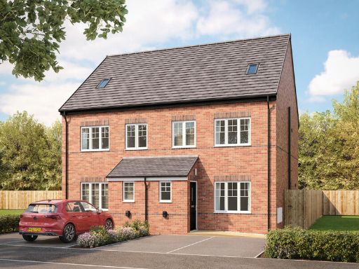 3 bedroom semi-detached house for sale in Shann Lane,
Keighley,
BD20 6DY, BD20 — £264,995 • 3 bed • 1 bath • 825 ft²
3 bedroom semi-detached house for sale in Shann Lane,
Keighley,
BD20 6DY, BD20 — £264,995 • 3 bed • 1 bath • 825 ft²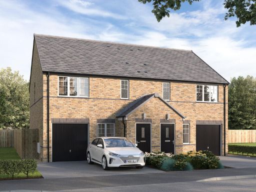 3 bedroom semi-detached house for sale in Shann Lane,
Keighley,
BD20 6DY, BD20 — £214,995 • 3 bed • 1 bath • 908 ft²
3 bedroom semi-detached house for sale in Shann Lane,
Keighley,
BD20 6DY, BD20 — £214,995 • 3 bed • 1 bath • 908 ft² 3 bedroom semi-detached house for sale in Shann Lane,
Keighley,
BD20 6DY, BD20 — £209,995 • 3 bed • 1 bath • 908 ft²
3 bedroom semi-detached house for sale in Shann Lane,
Keighley,
BD20 6DY, BD20 — £209,995 • 3 bed • 1 bath • 908 ft²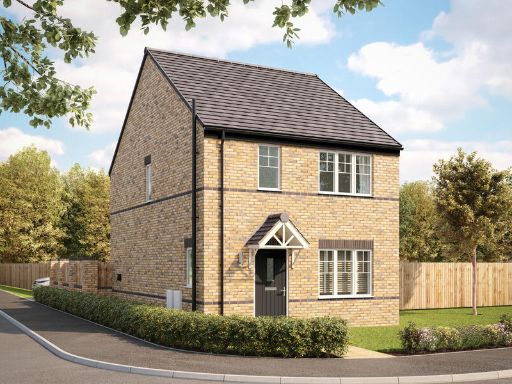 3 bedroom detached house for sale in Shann Lane,
Keighley,
BD20 6DY, BD20 — £239,995 • 3 bed • 1 bath • 811 ft²
3 bedroom detached house for sale in Shann Lane,
Keighley,
BD20 6DY, BD20 — £239,995 • 3 bed • 1 bath • 811 ft² 4 bedroom detached house for sale in Prospect Mount, Shipley, BD18 — £300,000 • 4 bed • 2 bath • 1318 ft²
Meta
- {
"@context": "https://schema.org",
"@type": "Residence",
"name": "3 bedroom semidetached house for sale in Shann Lane, Keighl…",
"description": "",
"url": "https://propertypiper.co.uk/property/4d9c0727-f15b-4040-844f-1edc764c7438",
"image": "https://image-a.propertypiper.co.uk/96d16084-15e0-4baa-95b5-da48891a4020-1024.jpeg",
"address": {
"@type": "PostalAddress",
"streetAddress": "105, Shann Lane, KEIGHLEY",
"postalCode": "BD20 6DY",
"addressLocality": "Bradford",
"addressRegion": "Keighley",
"addressCountry": "England"
},
"geo": {
"@type": "GeoCoordinates",
"latitude": 53.87385792227159,
"longitude": -1.9278868459648868
},
"numberOfRooms": 3,
"numberOfBathroomsTotal": 1,
"floorSize": {
"@type": "QuantitativeValue",
"value": 825,
"unitCode": "FTK"
},
"offers": {
"@type": "Offer",
"price": 259995,
"priceCurrency": "GBP",
"availability": "https://schema.org/InStock"
},
"additionalProperty": [
{
"@type": "PropertyValue",
"name": "Feature",
"value": "new build"
},
{
"@type": "PropertyValue",
"name": "Feature",
"value": "semidetached"
},
{
"@type": "PropertyValue",
"name": "Feature",
"value": "brick exterior"
},
{
"@type": "PropertyValue",
"name": "Feature",
"value": "modern design"
},
{
"@type": "PropertyValue",
"name": "Feature",
"value": "three-story"
},
{
"@type": "PropertyValue",
"name": "Feature",
"value": "off-street parking"
},
{
"@type": "PropertyValue",
"name": "Feature",
"value": "contemporary"
},
{
"@type": "PropertyValue",
"name": "Feature",
"value": "living room"
},
{
"@type": "PropertyValue",
"name": "Feature",
"value": "bright"
},
{
"@type": "PropertyValue",
"name": "Feature",
"value": "neutral decor"
},
{
"@type": "PropertyValue",
"name": "Feature",
"value": "large windows"
},
{
"@type": "PropertyValue",
"name": "Feature",
"value": "natural light"
},
{
"@type": "PropertyValue",
"name": "Feature",
"value": "modern design"
},
{
"@type": "PropertyValue",
"name": "Feature",
"value": "fresh"
},
{
"@type": "PropertyValue",
"name": "Feature",
"value": "clean"
},
{
"@type": "PropertyValue",
"name": "Feature",
"value": "comfortable"
},
{
"@type": "PropertyValue",
"name": "Feature",
"value": "suburban"
}
]
}
High Res Floorplan Images
Compatible Floorplan Images
FloorplanImages Thumbnail