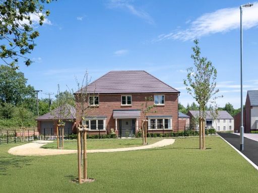
IP31 3DJ - 4 bedroom detached house for sale in Hunston Road, Badwell…
View on Property Piper
4 bedroom detached house for sale in Hunston Road,
Badwell Ash,
Suffolk,
IP31 3DJ, IP31
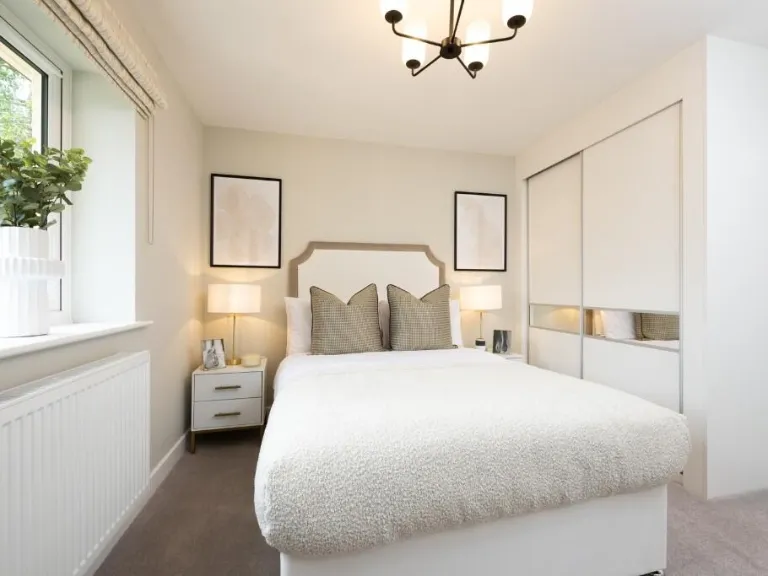
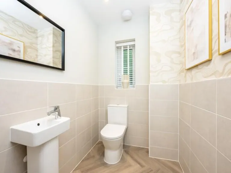
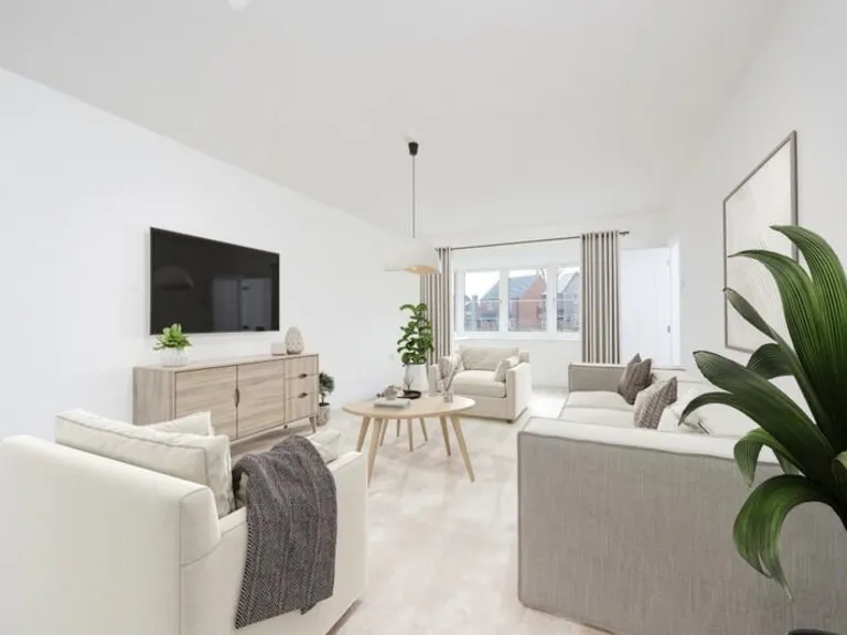
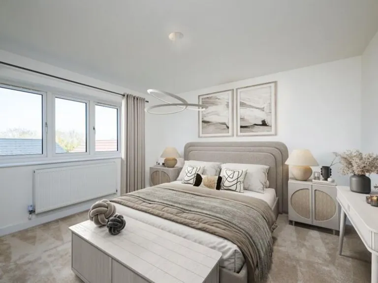
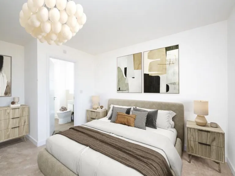
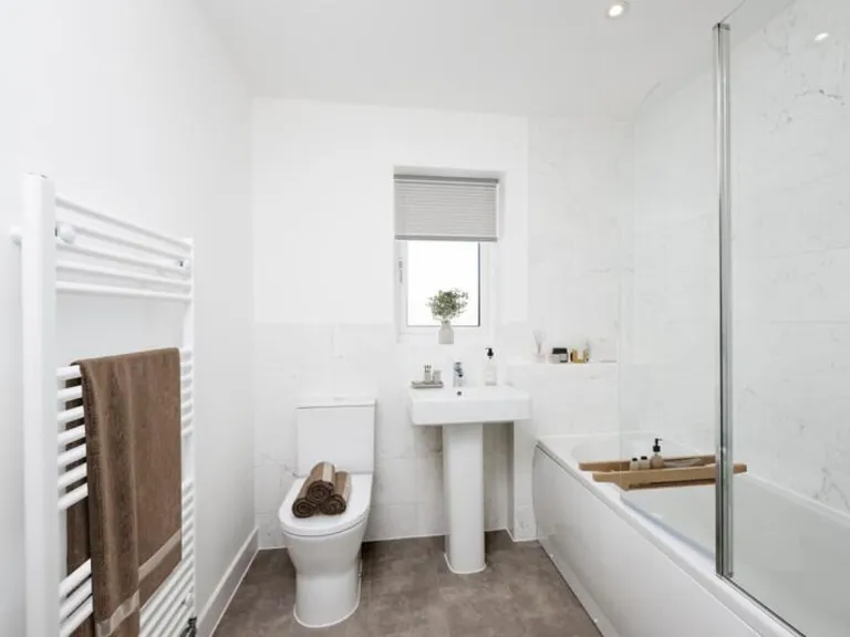
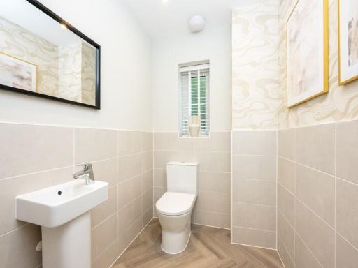
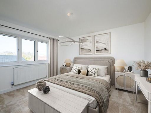
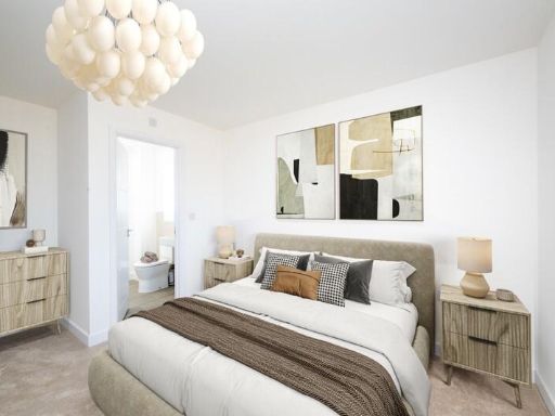
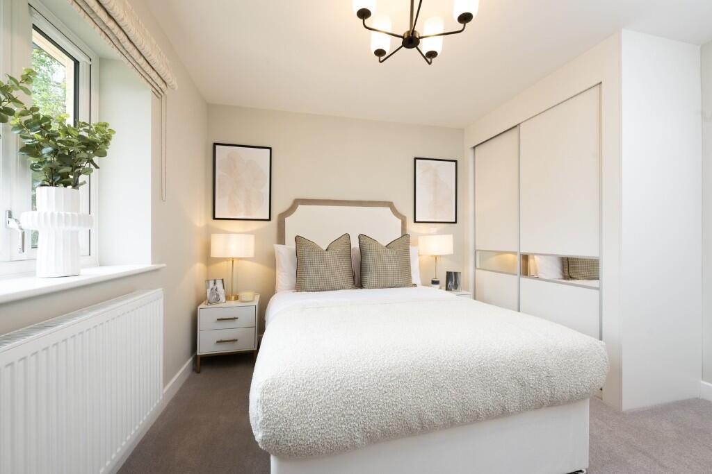
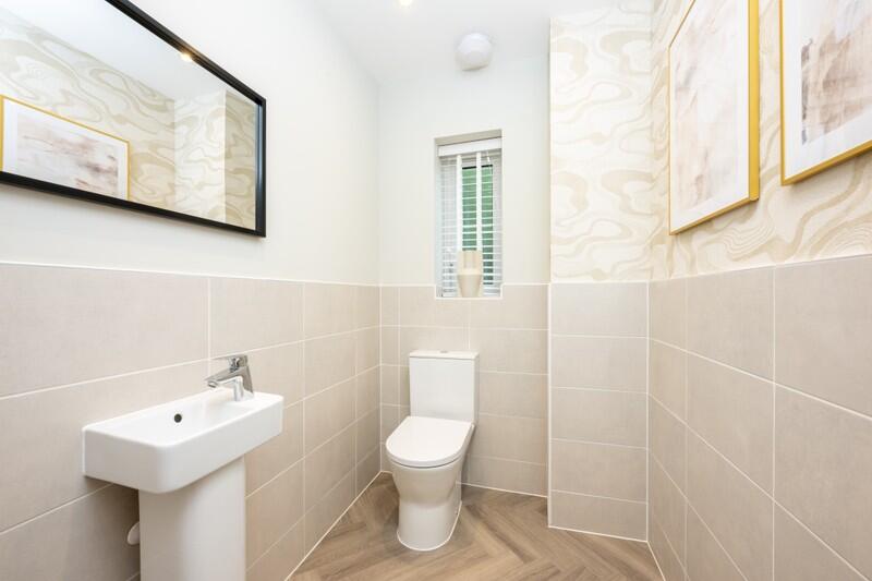
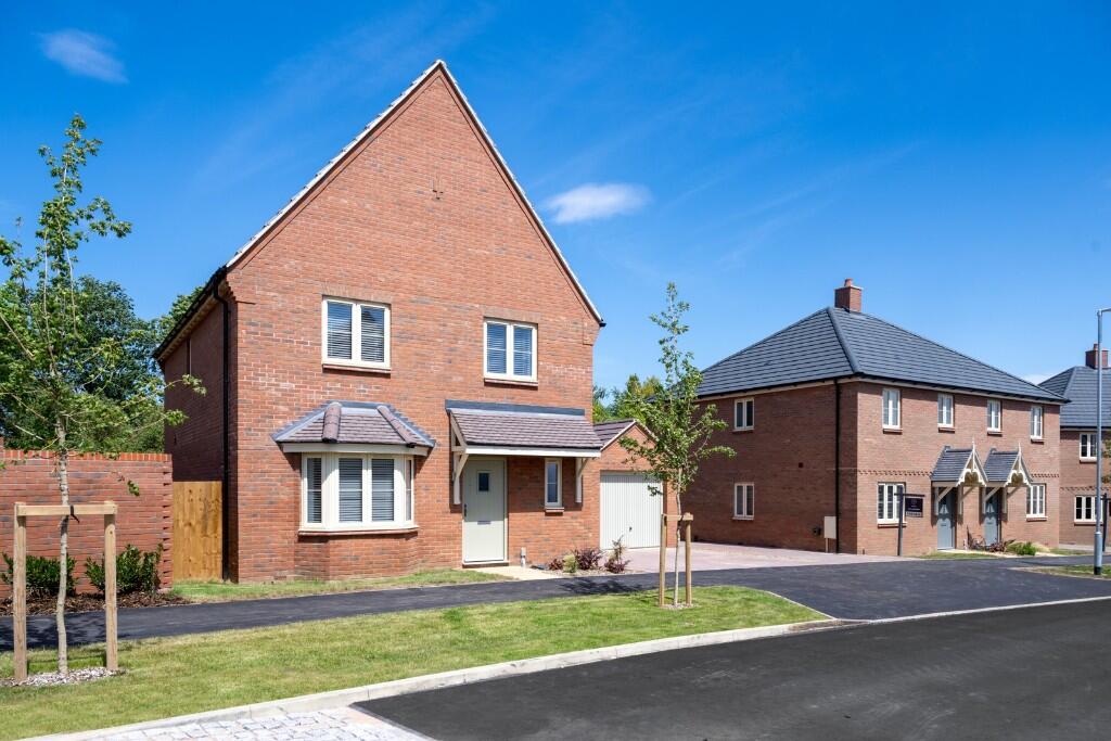
Property Details
- Price: £625000
- Bedrooms: 4
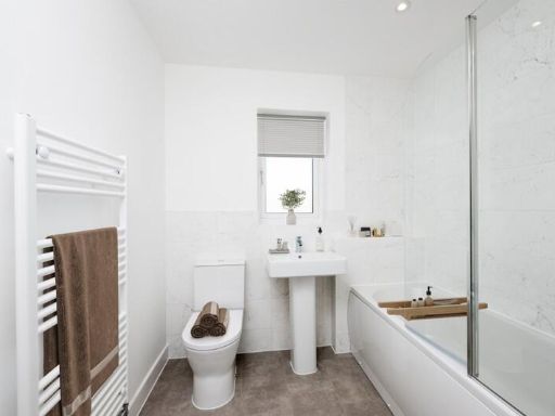
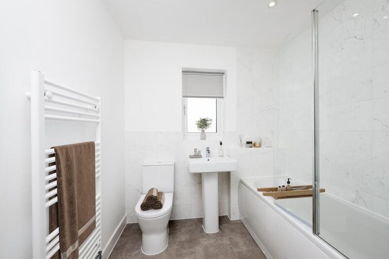
- Bathrooms: 1
- Property Type: undefined
- Property SubType: undefined
Image Descriptions
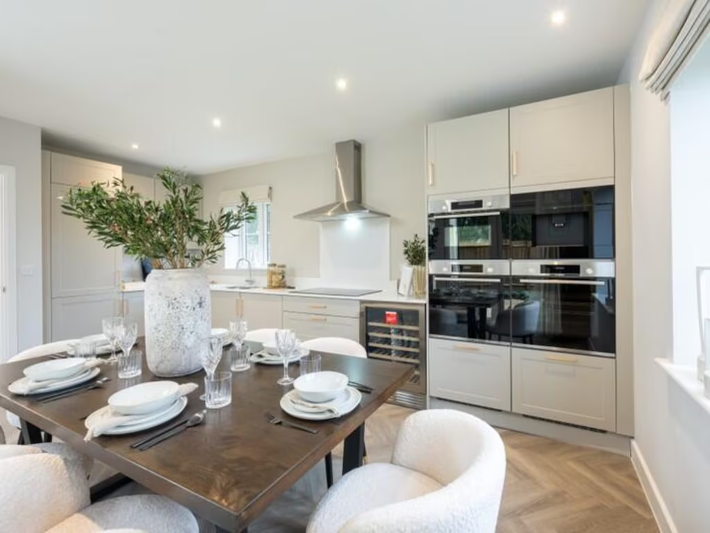
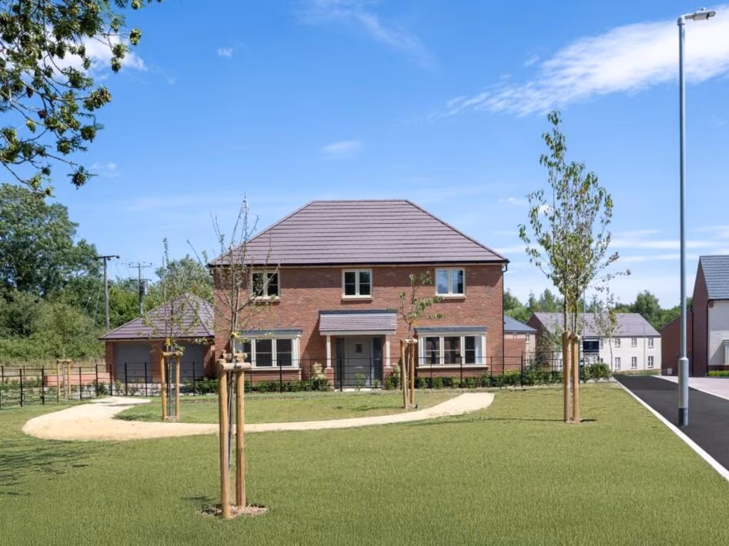
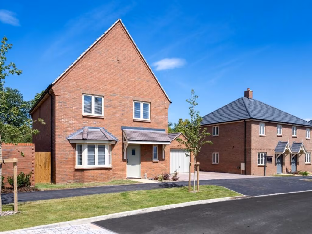
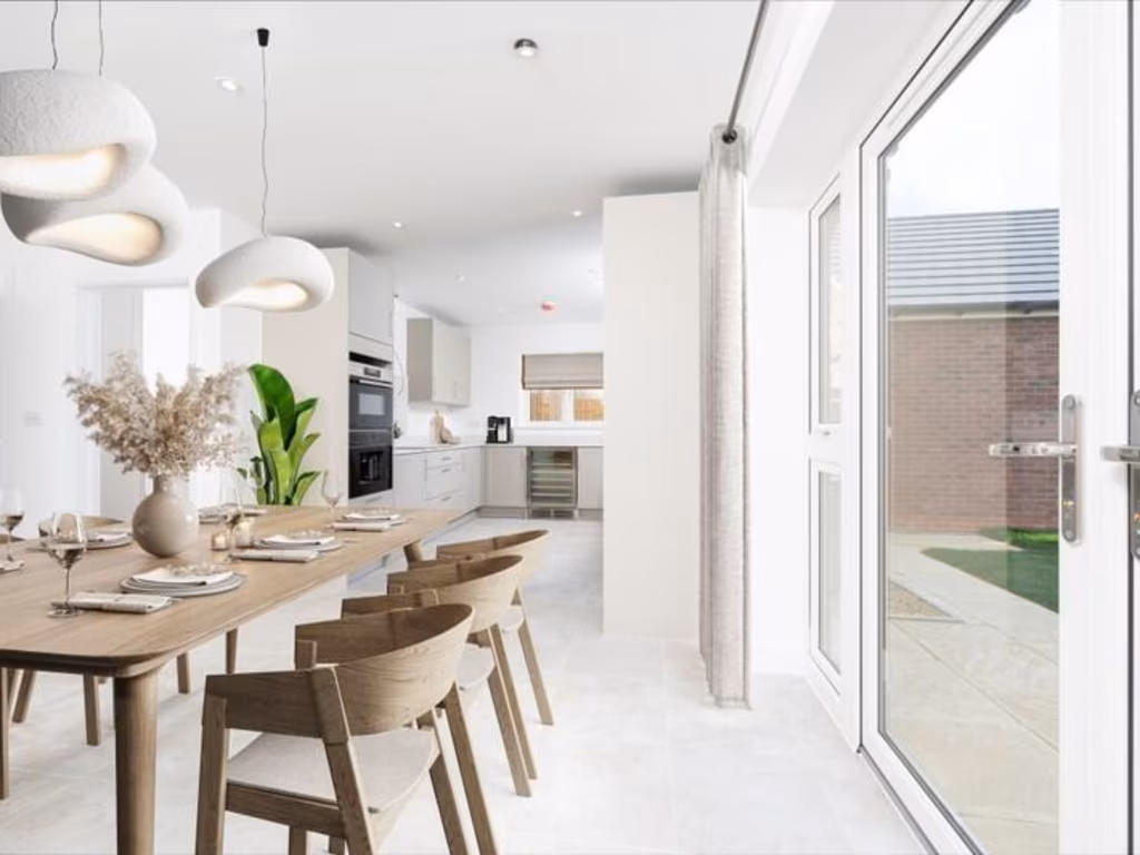
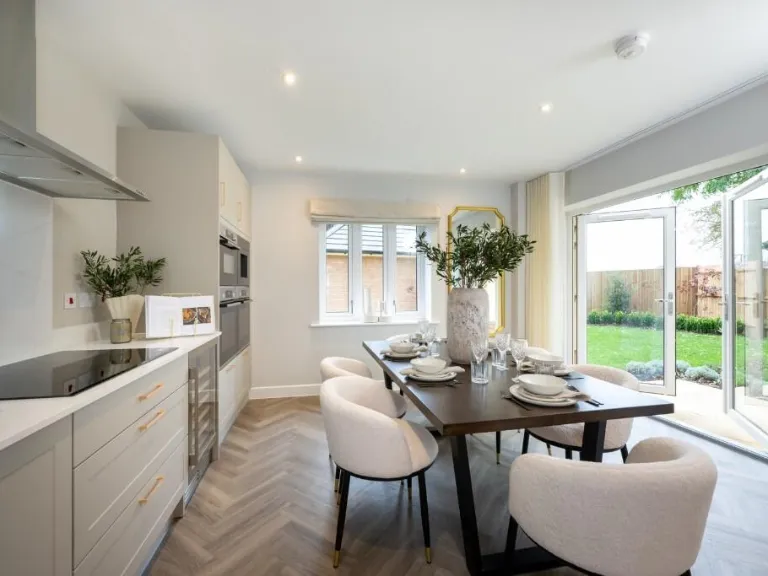
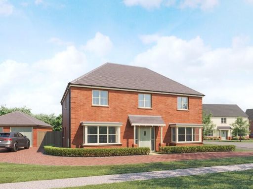
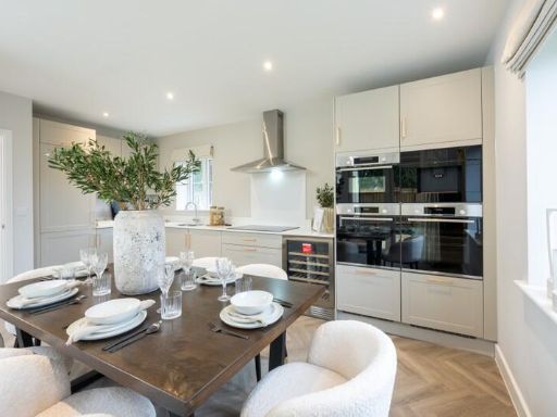
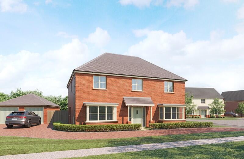
- modern detached house modern
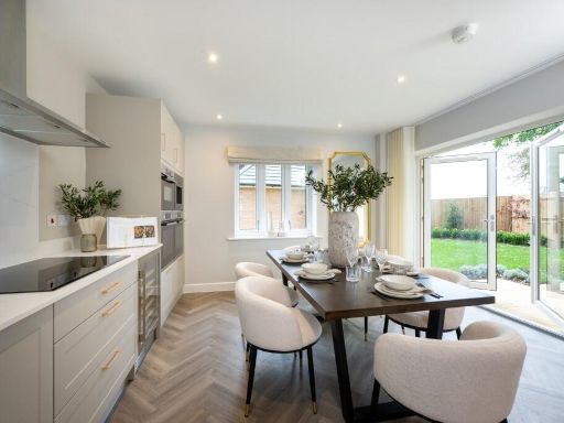
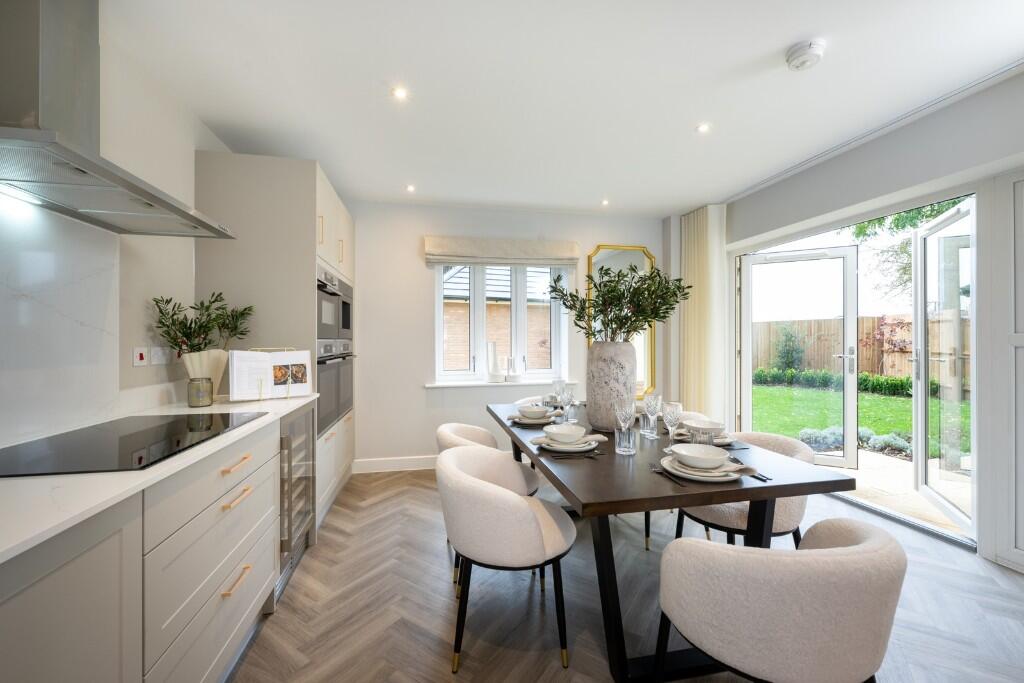
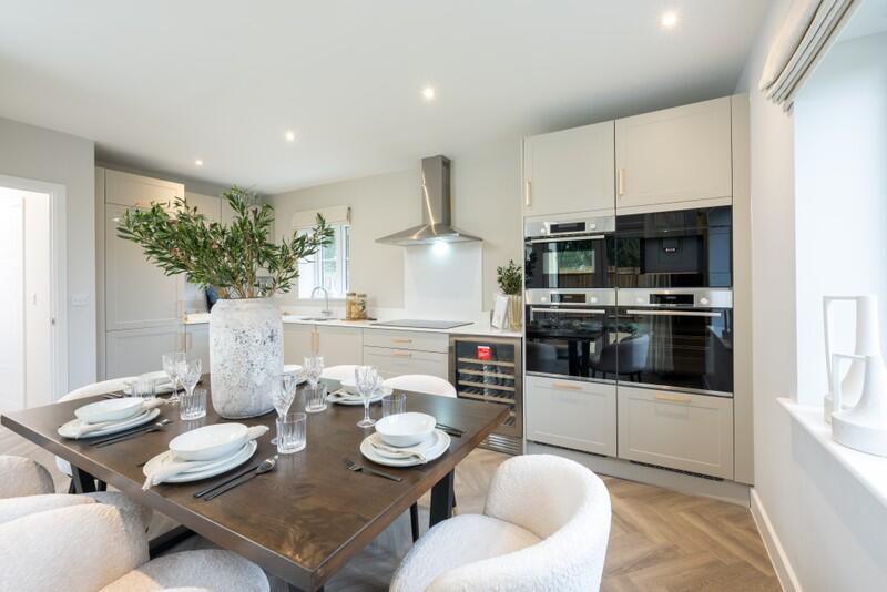
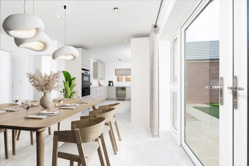
- kitchen dining area contemporary
Floorplan Description
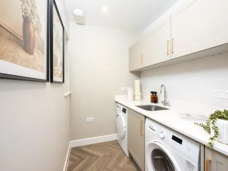
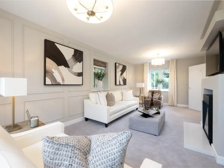
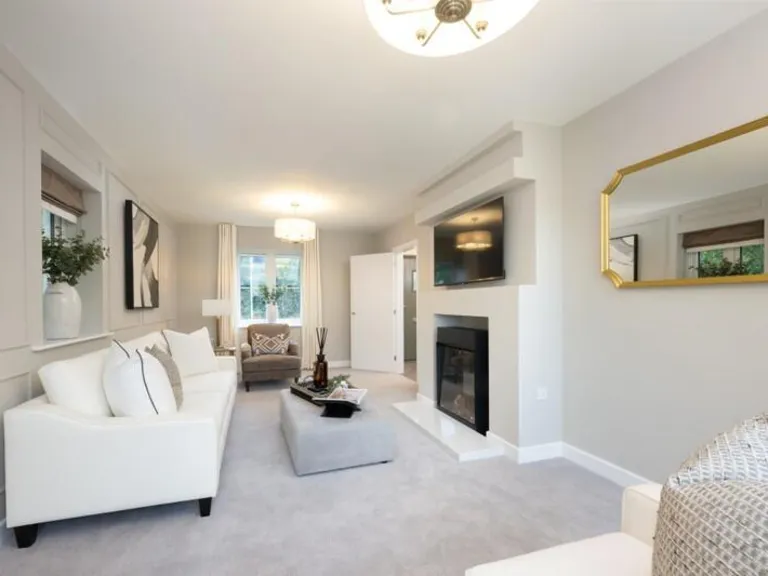
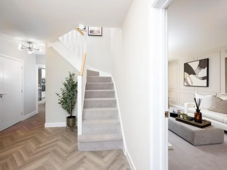
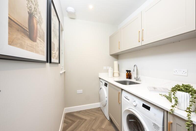
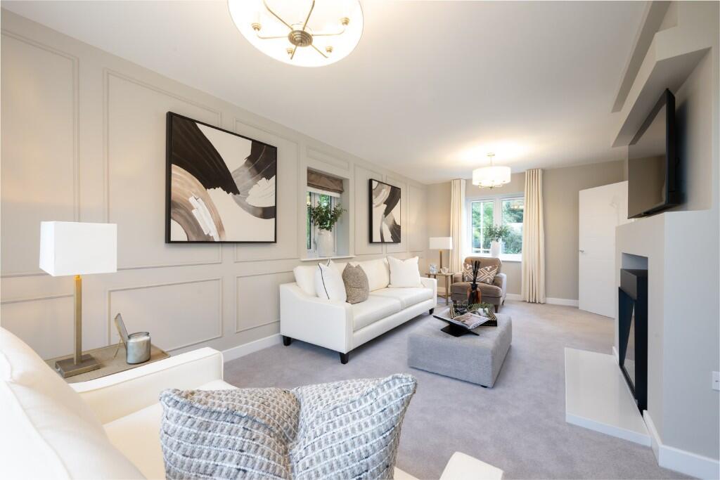
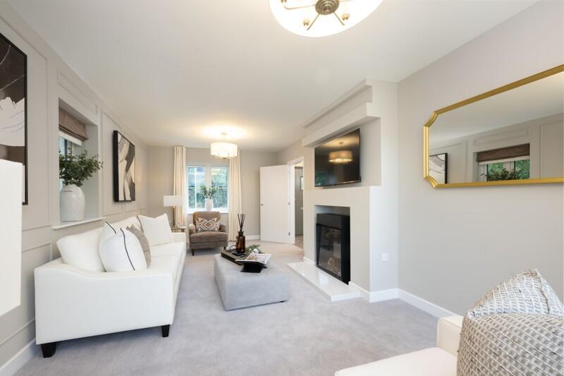
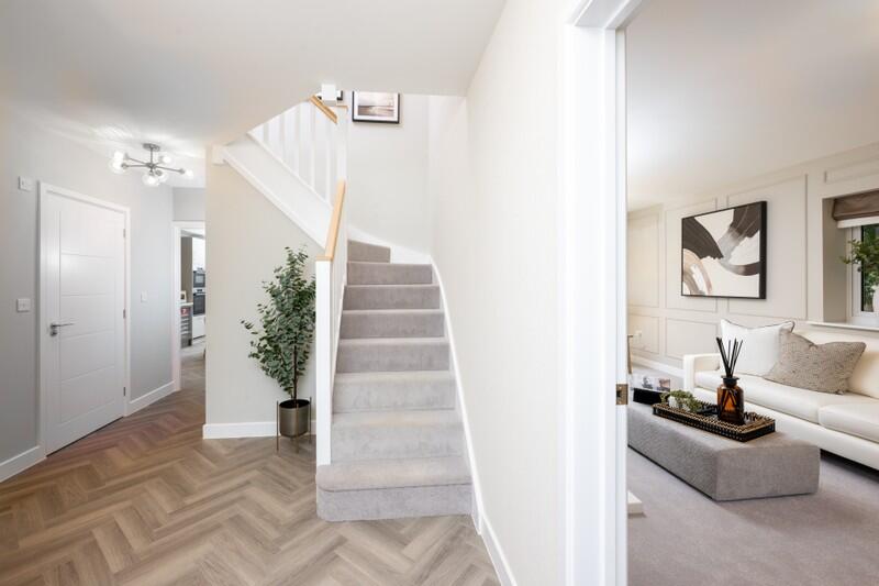
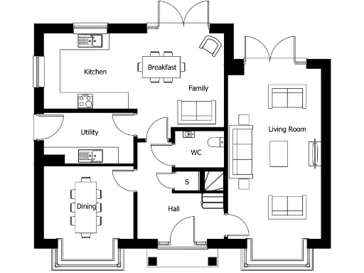
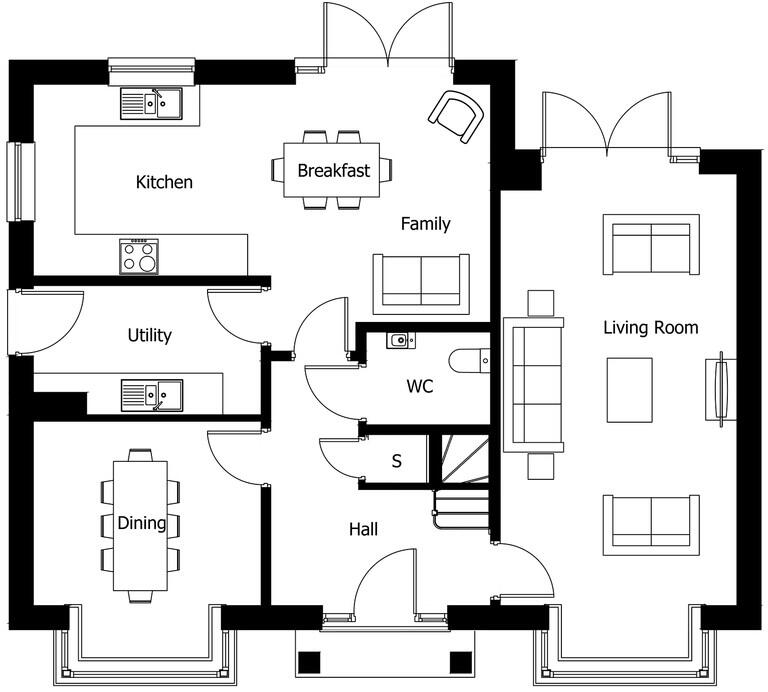
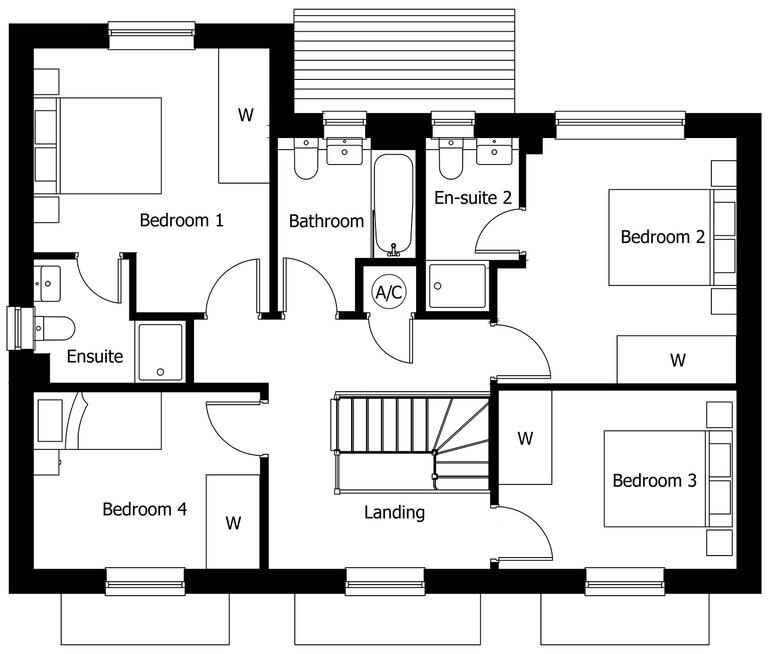
- A floorplan depicting a residence with multiple defined rooms including a kitchen, breakfast area, family room, utility room, dining room, living room, hall, and WC.
Rooms
- Kitchen: Average
- Breakfast: Small
- Family: Average
- Utility: Small
- Dining: Average
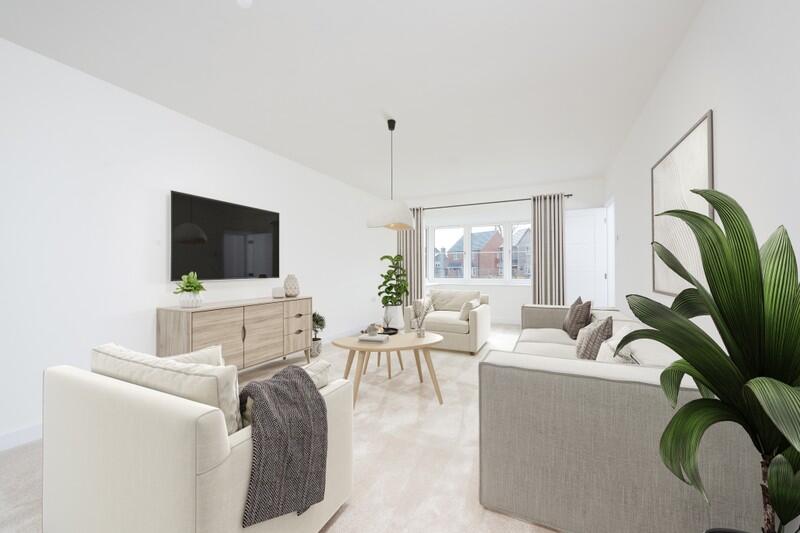
- Living Room: Large
- WC: Small
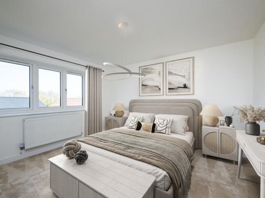
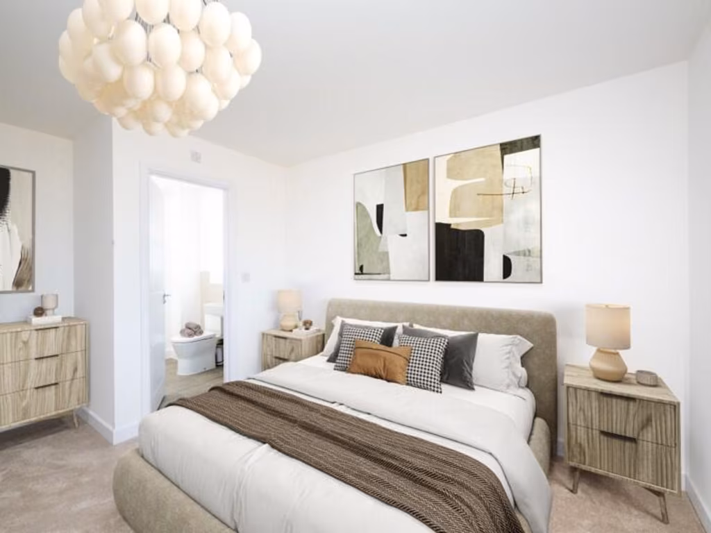
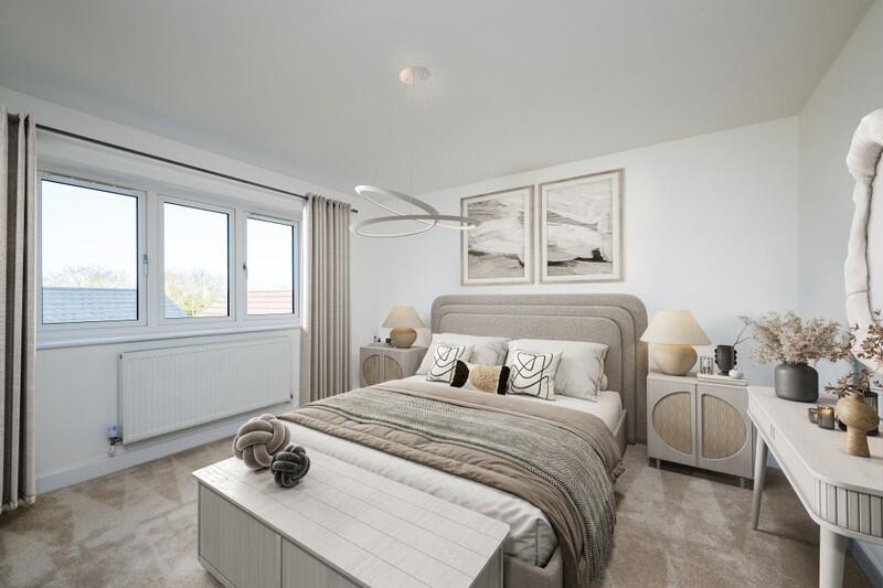
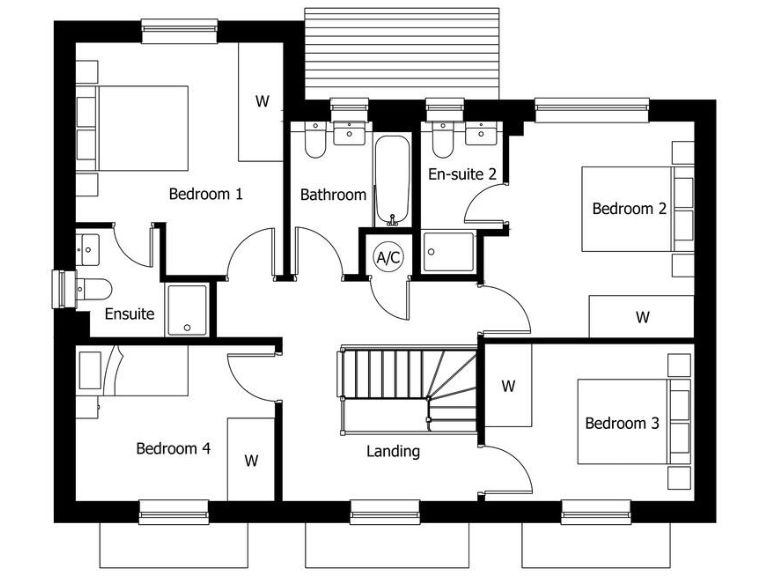
- Bedroom 1:
- Ensuite:
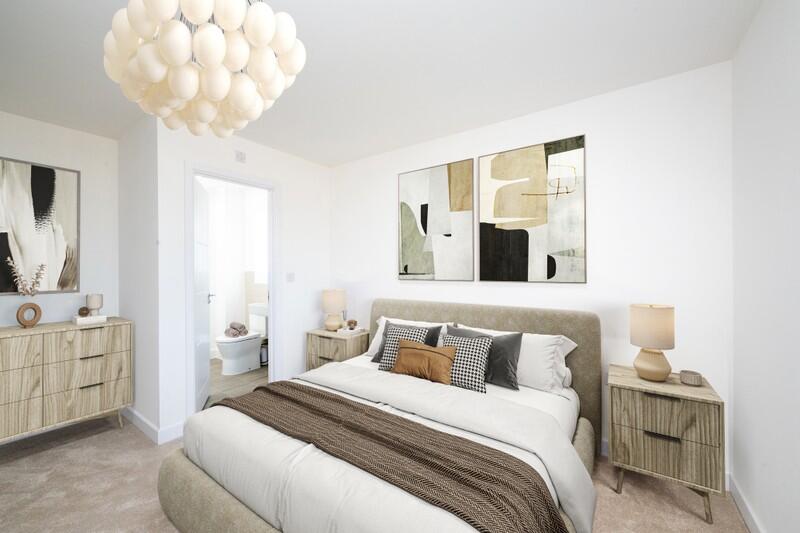
- Bedroom 4:
- Bathroom:
- En-suite 2:
- Bedroom 2:
- Bedroom 3:
- Landing:
- A/C:
Textual Property Features
- Is New Build
- Has Garden
- Success
Detected Visual Features
- modern house
- detached
- two-story
- red brick
- new build
- driveway
- bay windows
- contemporary style
- open-plan
- kitchen dining area
- integrated appliances
- natural light
- patio doors
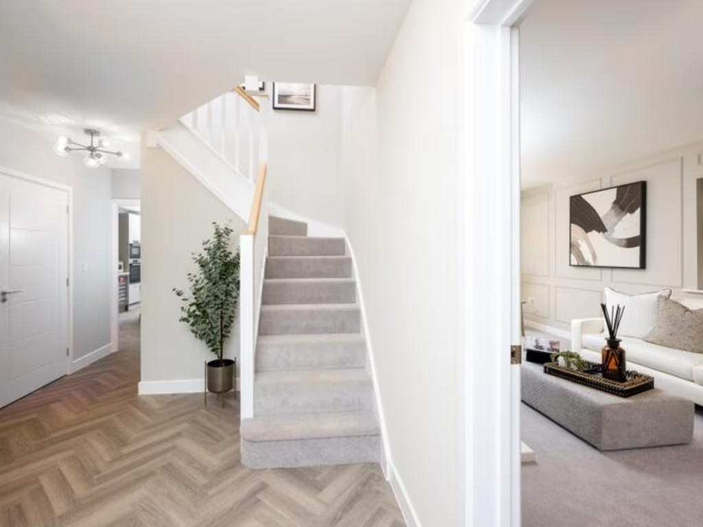
- herringbone flooring
Nearby Schools
- Bacton Primary School
- Thurston Church of England Primary Academy
- Set Ixworth School
- Crawford's Church of England Primary School
- Norton CEVC Primary School
- Ixworth Church of England Primary School
- Woolpit Primary Academy
- Thurston Community College
- Walsham-le-Willows Church of England Voluntary Controlled Primary School
- Stanton Community Primary School
- Bardwell Church of England Primary School
- Elmswell Community Primary School
Nearest General Shops
- Id: 554665680
- Tags:
- Addr:
- Postcode: IP31 2DW
- Street: Wyken Road
- Building: yes
- Fhrs:
- Name: Leaping Hare Country Store
- Shop: gift
- Source: Bing
- Url: http://wykenvineyards.co.uk/country-store/
- TagsNormalized:
- Lat: 52.3080133
- Lon: 0.880612
- FullGeoHash: u129s43hr8rv
- PartitionGeoHash: u129
- Images:
- FoodStandards:
- Id: 1114235
- FHRSID: 1114235
- LocalAuthorityBusinessID: PI/000230135
- BusinessName: The Leaping Hare Country Store
- BusinessType: Retailers - other
- BusinessTypeID: 4613
- AddressLine1: Farmers Market
- AddressLine2: Wyken Hall
- AddressLine3: Wyken Road
- AddressLine4: Stanton
- PostCode: null
- RatingValue: 4
- RatingKey: fhrs_4_en-GB
- RatingDate: 2022-07-02
- LocalAuthorityCode: 298
- LocalAuthorityName: West Suffolk
- LocalAuthorityWebSite: http://www.westsuffolk.gov.uk
- LocalAuthorityEmailAddress: food&safety@westsuffolk.gov.uk
- Scores:
- Hygiene: 5
- Structural: 10
- ConfidenceInManagement: 5
- NewRatingPending: false
- Geocode:
- Longitude: 0.88387499787469
- Latitude: 52.31928000034290
- Distance: 3735.7
,- Id: 165734401
- Tags:
- Building: yes
- Name: The Pine House Co.
- Shop: furniture
- Url: http://www.thepinehousecompany.co.uk/
- TagsNormalized:
- Lat: 52.2739527
- Lon: 0.8589406
- FullGeoHash: u1297s1myg09
- PartitionGeoHash: u129
- Images:
- FoodStandards: null
- Distance: 3496.7
,- Id: 12417401
- Tags:
- Addr:
- City: Bury St Edmunds
- Housename: The Butchers Shop
- Postcode: IP31 3AZ
- Village: Walsham le Willows
- Building: yes
- Fhrs:
- Fixme:
- Name: Rolfes of Walsham
- Phone: +44 1359 259225
- Shop: butcher
- Source:
- Addr: FHRS Open Data
- Outline: Bing
- Type: multipolygon
- Website: https://www.rolfesbutchers.co.uk
- TagsNormalized:
- Lat: 52.3034282
- Lon: 0.9356514
- FullGeoHash: u129t393d38q
- PartitionGeoHash: u129
- Images:
- FoodStandards: null
- Distance: 3202.9
}
Nearest Grocery shops
- Id: 478596015
- Tags:
- Addr:
- City: Bury St Edmunds
- Postcode: IP30 9HD
- Street: Station Road
- Village: Elmswell
- Brand: Mace
- Brand:wikidata: Q75240338
- Fhrs:
- Name: Mace
- Phone: +44 1359 240234
- Shop: convenience
- TagsNormalized:
- Lat: 52.2390679
- Lon: 0.9144789
- FullGeoHash: u129hvcfsuhf
- PartitionGeoHash: u129
- Images:
- FoodStandards: null
- Distance: 4503.4
,- Id: 732164547
- Tags:
- Addr:
- Postcode: IP31 3LU
- Street: Woolpit Road
- Alt_name: Norton Service Station Shop
- Brand: Budgens
- Brand:wikidata: Q4985016
- Building: yes
- Fhrs:
- Name: Budgens
- Shop: convenience
- Source:
- Addr: FSA Food Hygiene Ratings Database
- Outline: Bing
- TagsNormalized:
- Lat: 52.2546017
- Lon: 0.8666409
- FullGeoHash: u12978xj45y2
- PartitionGeoHash: u129
- Images:
- FoodStandards: null
- Distance: 4020.1
,- Id: 411358234
- Tags:
- Addr:
- Postcode: IP31 3DG
- Street: The Street
- Brand: Londis
- Brand:wikidata: Q21008564
- Building: yes
- Fhrs:
- Name: Londis
- Shop: convenience
- Source:
- Addr: FSA Food Hygiene Ratings Database
- TagsNormalized:
- Lat: 52.2840197
- Lon: 0.9168078
- FullGeoHash: u129ky587ptm
- PartitionGeoHash: u129
- Images:
- FoodStandards: null
- Distance: 708.4
}
Nearest Religious buildings
- Id: 95236117
- Tags:
- Amenity: place_of_worship
- Building: yes
- Denomination: anglican
- Name: St Michael
- Religion: christian
- Wikidata: Q17536171
- TagsNormalized:
- place of worship
- anglican
- christian
- church
- Lat: 52.2750742
- Lon: 0.8946508
- FullGeoHash: u129kk7kqu5u
- PartitionGeoHash: u129
- Images:
- FoodStandards: null
- Distance: 1124.3
,- Id: 95236077
- Tags:
- Amenity: place_of_worship
- Building: yes
- Denomination: anglican
- Name: St Mary the Virgin, Langham
- Religion: christian
- Wikidata: Q17540235
- TagsNormalized:
- place of worship
- anglican
- christian
- church
- Lat: 52.283657
- Lon: 0.9021516
- FullGeoHash: u129ktbymshf
- PartitionGeoHash: u129
- Images:
- FoodStandards: null
- Distance: 686.4
,- Id: 411358241
- Tags:
- Amenity: place_of_worship
- Building: church
- Denomination: anglican
- Name: St Mary
- Religion: christian
- Wikidata: Q17542807
- TagsNormalized:
- place of worship
- church
- anglican
- christian
- Lat: 52.2829541
- Lon: 0.9153692
- FullGeoHash: u129kvfd39h9
- PartitionGeoHash: u129
- Images:
- FoodStandards: null
- Distance: 555.3
}
Nearest Medical buildings
- Id: 505147514
- Tags:
- Amenity: doctors
- Building: yes
- Healthcare: doctor
- Name: Stanton Surgery
- Source: Bing
- TagsNormalized:
- doctor
- doctors
- health
- healthcare
- surgery
- Lat: 52.3256854
- Lon: 0.8832197
- FullGeoHash: u129sje5hw8r
- PartitionGeoHash: u129
- Images:
- FoodStandards: null
- Distance: 5443.2
,- Id: 180020703
- Tags:
- Addr:
- Housenumber: 12
- Postcode: IP31 2XA
- Street: The Chase
- Amenity: clinic
- Building: yes
- Healthcare: clinic
- Name: Stanton Health Centre
- TagsNormalized:
- clinic
- health
- healthcare
- health centre
- Lat: 52.3255412
- Lon: 0.8826677
- FullGeoHash: u129sjddreue
- PartitionGeoHash: u129
- Images:
- FoodStandards: null
- Distance: 5440.6
,- Id: 110416776
- Tags:
- Addr:
- City: Bury St Edmunds
- Postcode: IP30 9HA
- Street: Station Road
- Village: Elmswell
- Amenity: veterinary
- Building: yes
- Name: Old Tea Room Veterinary Surgery
- Source:
- Url: http://elmswellvets.co.uk/
- TagsNormalized:
- Lat: 52.2377558
- Lon: 0.9128543
- FullGeoHash: u129hv8dzp3x
- PartitionGeoHash: u129
- Images:
- FoodStandards: null
- Distance: 4642.3
,- Id: 1783113798
- Tags:
- Amenity: pharmacy
- Dispensing: yes
- Healthcare: pharmacy
- Name: Station Pharmacy
- TagsNormalized:
- Lat: 52.2379587
- Lon: 0.9138336
- FullGeoHash: u129hv9kjv79
- PartitionGeoHash: u129
- Images:
- FoodStandards: null
- Distance: 4623.5
}
Nearest Leisure Facilities
- Id: 284672929
- Tags:
- Leisure: pitch
- Source: Bing
- Sport: multi
- TagsNormalized:
- Lat: 52.3071529
- Lon: 0.932667
- FullGeoHash: u129t4ppk8nb
- PartitionGeoHash: u129
- Images:
- FoodStandards: null
- Distance: 3458.1
,- Id: 752672950
- Tags:
- TagsNormalized:
- Lat: 52.3009591
- Lon: 0.9439233
- FullGeoHash: u129t3p75j2j
- PartitionGeoHash: u129
- Images:
- FoodStandards: null
- Distance: 3344.4
,- Id: 908413660
- Tags:
- Leisure: playground
- Source:
- Outline: land_registry_index_polygons
- TagsNormalized:
- Lat: 52.3022735
- Lon: 0.9409722
- FullGeoHash: u129t3m4y4rw
- PartitionGeoHash: u129
- Images:
- FoodStandards: null
- Distance: 3317.6
,- Id: 532275931
- Tags:
- Leisure: pitch
- Source: Bing
- Sport: bowls
- TagsNormalized:
- Lat: 52.3024719
- Lon: 0.9335889
- FullGeoHash: u129t1rgfpqm
- PartitionGeoHash: u129
- Images:
- FoodStandards: null
- Distance: 3037.2
,- Id: 860380079
- Tags:
- Designation: roadside_nature_reserve
- Leisure: nature_reserve
- Operator: suffolk_county_council
- TagsNormalized:
- Lat: 52.3062884
- Lon: 0.9118331
- FullGeoHash: u129sdpfpqb5
- PartitionGeoHash: u129
- Images:
- FoodStandards: null
- Distance: 2987.7
}
Nearest Tourist attractions
- Id: 5709413335
- Tags:
- Name: Orchard House B&B
- Tourism: guest_house
- TagsNormalized:
- Lat: 52.2564169
- Lon: 0.8655844
- FullGeoHash: u12978yr9w4s
- PartitionGeoHash: u129
- Images:
- FoodStandards: null
- Distance: 3938.4
,- Id: 5308870267
- Tags:
- Addr:
- City: Bury St Edmunds
- Postcode: IP31 2DW
- Street: Wyken Road
- Name: Wyken Vinyards
- Tourism: attraction
- Website: https://wykenvineyards.co.uk/
- TagsNormalized:
- Lat: 52.3080775
- Lon: 0.880632
- FullGeoHash: u129s43k8hqu
- PartitionGeoHash: u129
- Images:
- FoodStandards: null
- Distance: 3741
,- Id: 8025962897
- Tags:
- Addr:
- Email: julie.rayson@googlemail.com
- Internet_access: wlan
- Name: Stable End Holiday Cottage
- Phone: +44 1359 258877
- Tourism: chalet
- Website: http://stableendholidaycottage.co.uk
- TagsNormalized:
- Lat: 52.2922765
- Lon: 0.9547154
- FullGeoHash: u129mxx0w6z7
- PartitionGeoHash: u129
- Images:
- FoodStandards: null
- Distance: 3387.2
}
Nearest Train stations
- Id: 7362947493
- Tags:
- Name: Diss
- Naptan:
- Network: National Rail
- Public_transport: station
- Railway: station
- Ref:
- Wikidata: Q2716714
- Wikipedia: en:Diss railway station
- TagsNormalized:
- Lat: 52.3736162
- Lon: 1.1235411
- FullGeoHash: u12ccw64kmsv
- PartitionGeoHash: u12c
- Images:
- FoodStandards: null
- Distance: 17919.8
,- Id: 3788869872
- Tags:
- Name: Needham Market
- Naptan:
- Network: National Rail
- Public_transport: station
- Railway: station
- Ref:
- Source: NPE
- Wikidata: Q2526515
- Wikipedia: en:Needham Market railway station
- TagsNormalized:
- Lat: 52.1526149
- Lon: 1.0555379
- FullGeoHash: u12b8n0e5b41
- PartitionGeoHash: u12b
- Images:
- FoodStandards: null
- Distance: 17258.4
,- Id: 5004989085
- Tags:
- Name: Dovebrook
- Public_transport: station
- Railway: station
- Usage: tourism
- TagsNormalized:
- Lat: 52.2502347
- Lon: 1.1228264
- FullGeoHash: u12c1xceev8n
- PartitionGeoHash: u12c
- Images:
- FoodStandards: null
- Distance: 14873.7
,- Id: 3788871517
- Tags:
- Name: Stowmarket
- Naptan:
- Network: National Rail
- Phone: +44 800 028 28 78
- Public_transport: station
- Railway: station
- Ref:
- Source: http://www.nationalrail.co.uk/stations/SMK/details.html
- Wheelchair: limited
- Wikidata: Q2618103
- Wikipedia: en:Stowmarket railway station
- TagsNormalized:
- Lat: 52.1897991
- Lon: 1.000257
- FullGeoHash: u128yub7eetw
- PartitionGeoHash: u128
- Images:
- FoodStandards: null
- Distance: 11728.1
,- Id: 3788853257
- Tags:
- Internet_access: no
- Name: Elmswell
- Naptan:
- Network: National Rail
- Operator: Greater Anglia
- Public_transport: station
- Railway: station
- Ref:
- Wheelchair: yes
- Wikidata: Q2980360
- Wikipedia: en:Elmswell railway station
- TagsNormalized:
- Lat: 52.2381588
- Lon: 0.9125333
- FullGeoHash: u129hv8mrdd5
- PartitionGeoHash: u129
- Images:
- FoodStandards: null
- Distance: 4596.5
}
Nearest Hotels
- Id: 157355706
- Tags:
- Addr:
- City: Diss
- Postcode: IP22 1BN
- Street: The Street
- Amenity: pub
- Fhrs:
- Fixme:
- Village: Rickinghall Inferior
- Name: The Bell Inn
- Source: survey
- Source:name: voice
- Tourism: hotel
- Url: http://www.thebellrickinghall.co.uk/
- TagsNormalized:
- Lat: 52.3417935
- Lon: 1.0031806
- FullGeoHash: u129ybd3pc98
- PartitionGeoHash: u129
- Images:
- FoodStandards: null
- Distance: 9411.1
,- Id: 568985817
- Tags:
- Addr:
- City: Stowmarket
- Postcode: IP14 3PY
- Village: Haughley
- Brand: Travelodge
- Brand:wikidata: Q9361374
- Brand:wikipedia: en:Travelodge UK
- Building: yes
- Fhrs:
- Authority: Mid Suffolk
- Id: 1404476
- Local_authority_id: FR/000002546
- Name: Travelodge
- Source:
- Tourism: hotel
- TagsNormalized:
- Lat: 52.2136081
- Lon: 0.9641084
- FullGeoHash: u129jcnn3652
- PartitionGeoHash: u129
- Images:
- FoodStandards: null
- Distance: 8210.4
,- Id: 430344902
- Tags:
- Addr:
- City: Bury St Edmunds
- Housename: The Grange
- Postcode: IP31 3PQ
- Street: Barton Road
- Village: Thurston
- Building: yes
- Fhrs:
- Fixme: Outline is approximate, from Bing image
- Name: The Grange Hotel
- Source: personal visit + Bing maps
- Tourism: hotel
- Website: http://www.burystedmundshotel.com/
- TagsNormalized:
- Lat: 52.2636153
- Lon: 0.801312
- FullGeoHash: u12964r3xuj9
- PartitionGeoHash: u129
- Images:
- FoodStandards: null
- Distance: 7572
}
Tags
- modern house
- detached
- two-story
- red brick
- new build
- driveway
- bay windows
- contemporary style
- open-plan
- kitchen dining area
- integrated appliances
- natural light
- patio doors
- herringbone flooring
Local Market Stats
- Average Price/sqft: £320
- Avg Income: £47400
- Rental Yield: 3.7%
- Social Housing: 7%
- Planning Success Rate: 86%
AirBnB Data
- 1km average: £71/night
- Listings in 1km: 1
Similar Properties
 4 bedroom detached house for sale in Hunston Road,
Badwell Ash,
Suffolk,
IP31 3DJ, IP31 — £575,000 • 4 bed • 1 bath • 1554 ft²
4 bedroom detached house for sale in Hunston Road,
Badwell Ash,
Suffolk,
IP31 3DJ, IP31 — £575,000 • 4 bed • 1 bath • 1554 ft² 4 bedroom detached house for sale in Hunston Road,
Badwell Ash,
Suffolk,
IP31 3DJ, IP31 — £665,000 • 4 bed • 1 bath • 1792 ft²
4 bedroom detached house for sale in Hunston Road,
Badwell Ash,
Suffolk,
IP31 3DJ, IP31 — £665,000 • 4 bed • 1 bath • 1792 ft²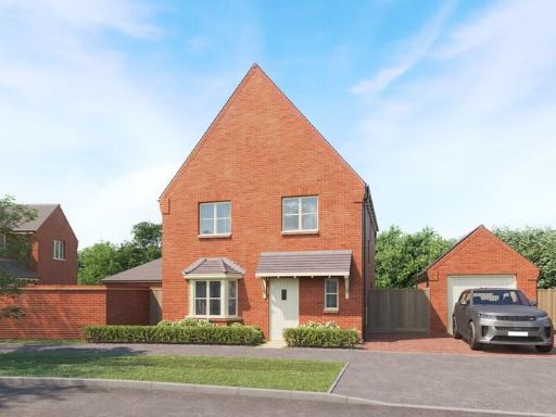 4 bedroom detached house for sale in Hunston Road,
Badwell Ash,
Suffolk,
IP31 3DJ, IP31 — £465,000 • 4 bed • 1 bath • 1292 ft²
4 bedroom detached house for sale in Hunston Road,
Badwell Ash,
Suffolk,
IP31 3DJ, IP31 — £465,000 • 4 bed • 1 bath • 1292 ft²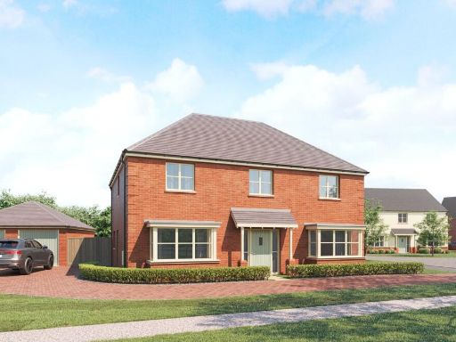 4 bedroom detached house for sale in The Approach, Hunston Road, Badwell Ash, Bury St. Edmunds, IP31 — £650,000 • 4 bed • 3 bath
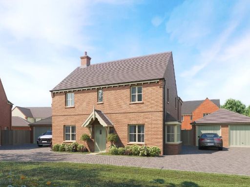 4 bedroom detached house for sale in Hunston Road,
Badwell Ash,
Suffolk,
IP31 3DJ, IP31 — £590,000 • 4 bed • 1 bath • 1554 ft²
4 bedroom detached house for sale in Hunston Road,
Badwell Ash,
Suffolk,
IP31 3DJ, IP31 — £590,000 • 4 bed • 1 bath • 1554 ft² 3 bedroom terraced house for sale in Hunston Road,
Badwell Ash,
Suffolk,
IP31 3DJ, IP31 — £320,000 • 3 bed • 1 bath • 937 ft²
3 bedroom terraced house for sale in Hunston Road,
Badwell Ash,
Suffolk,
IP31 3DJ, IP31 — £320,000 • 3 bed • 1 bath • 937 ft²
Meta
- {
"@context": "https://schema.org",
"@type": "Residence",
"name": "4 bedroom detached house for sale in Hunston Road, Badwell…",
"description": "",
"url": "https://propertypiper.co.uk/property/45596155-1f5d-47c5-8b6b-5ddbc9273392",
"image": "https://image-a.propertypiper.co.uk/665ef0fb-3932-4236-b590-5765711ab4e2-1024.jpeg",
"address": {
"@type": "PostalAddress",
"streetAddress": "THE POPLARS HUNSTON ROAD BADWELL ASH BURY ST EDMUNDS",
"postalCode": "IP31 3DJ",
"addressLocality": "Mid Suffolk",
"addressRegion": "Bury St Edmunds",
"addressCountry": "England"
},
"geo": {
"@type": "GeoCoordinates",
"latitude": 52.2794554677854,
"longitude": 0.9095436894511766
},
"numberOfRooms": 4,
"numberOfBathroomsTotal": 1,
"floorSize": {
"@type": "QuantitativeValue",
"value": 1792,
"unitCode": "FTK"
},
"offers": {
"@type": "Offer",
"price": 625000,
"priceCurrency": "GBP",
"availability": "https://schema.org/InStock"
},
"additionalProperty": [
{
"@type": "PropertyValue",
"name": "Feature",
"value": "modern house"
},
{
"@type": "PropertyValue",
"name": "Feature",
"value": "detached"
},
{
"@type": "PropertyValue",
"name": "Feature",
"value": "two-story"
},
{
"@type": "PropertyValue",
"name": "Feature",
"value": "red brick"
},
{
"@type": "PropertyValue",
"name": "Feature",
"value": "new build"
},
{
"@type": "PropertyValue",
"name": "Feature",
"value": "driveway"
},
{
"@type": "PropertyValue",
"name": "Feature",
"value": "bay windows"
},
{
"@type": "PropertyValue",
"name": "Feature",
"value": "contemporary style"
},
{
"@type": "PropertyValue",
"name": "Feature",
"value": "open-plan"
},
{
"@type": "PropertyValue",
"name": "Feature",
"value": "kitchen dining area"
},
{
"@type": "PropertyValue",
"name": "Feature",
"value": "integrated appliances"
},
{
"@type": "PropertyValue",
"name": "Feature",
"value": "natural light"
},
{
"@type": "PropertyValue",
"name": "Feature",
"value": "patio doors"
},
{
"@type": "PropertyValue",
"name": "Feature",
"value": "herringbone flooring"
}
]
}
High Res Floorplan Images
Compatible Floorplan Images
FloorplanImages Thumbnail