M40 3GL - 2 bedroom terraced house for sale in Hazeldene Road, New Mo…
View on Property Piper
2 bedroom terraced house for sale in Hazeldene Road, New Moston, Manchester, M40
Property Details
- Price: £180000
- Bedrooms: 2
- Bathrooms: 1
- Property Type: undefined
- Property SubType: undefined
Image Descriptions
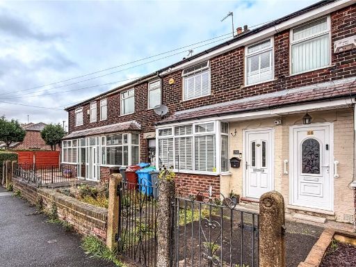
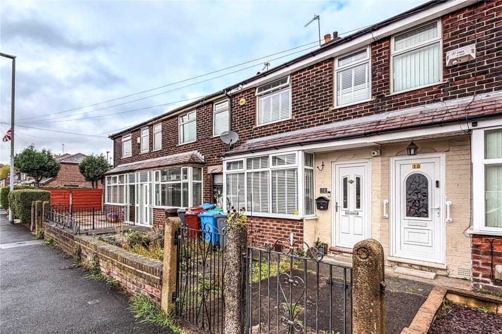
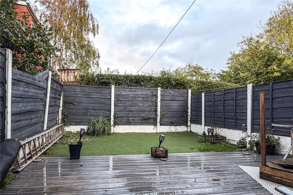
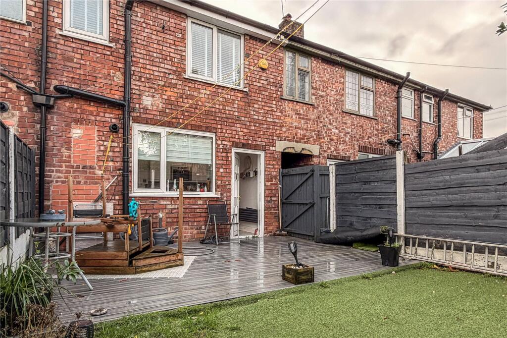
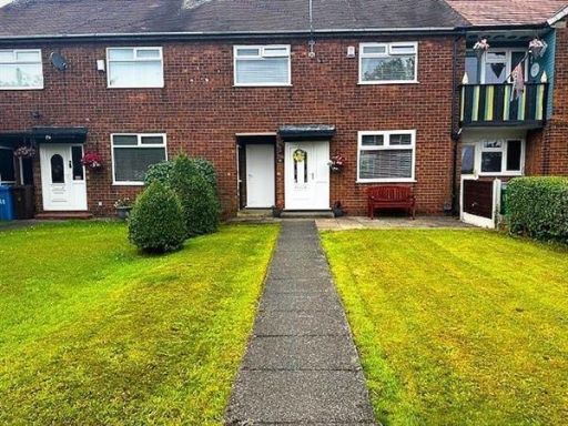
- end terrace house Mid 20th Century
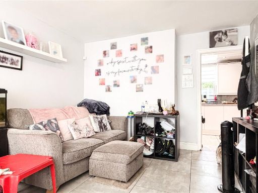
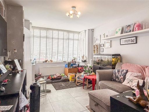
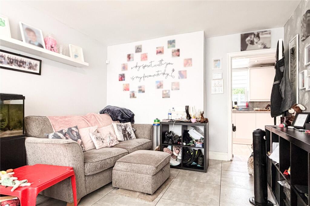
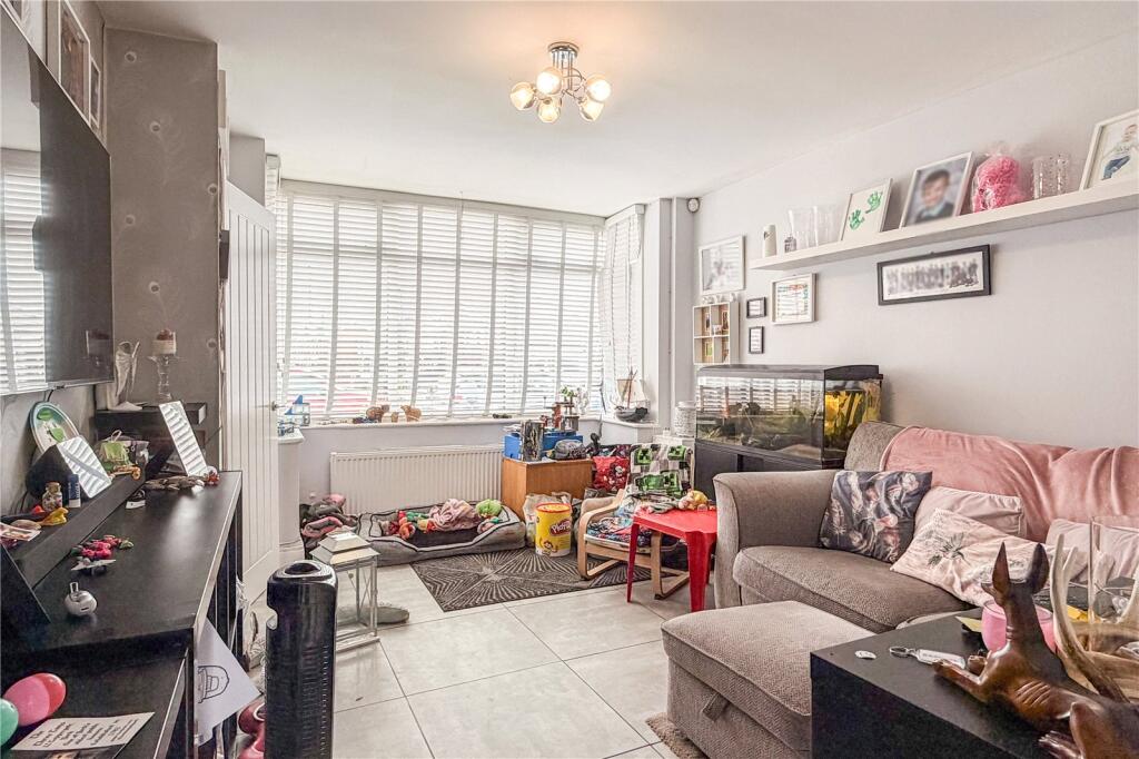
- living room modern
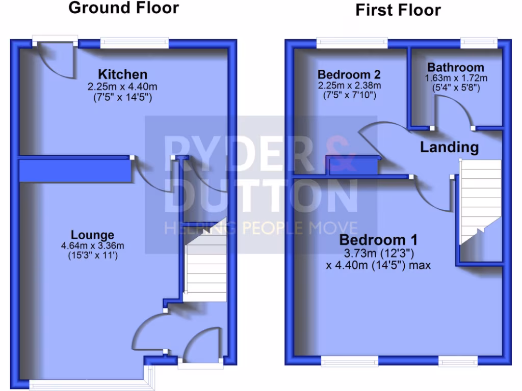
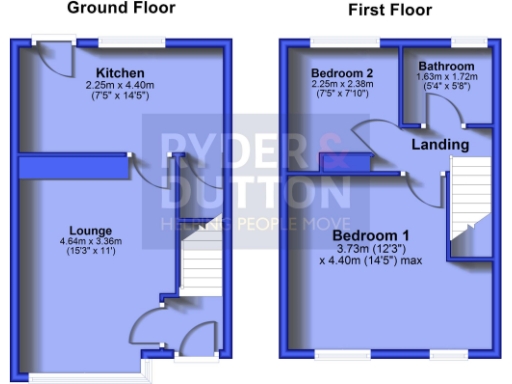
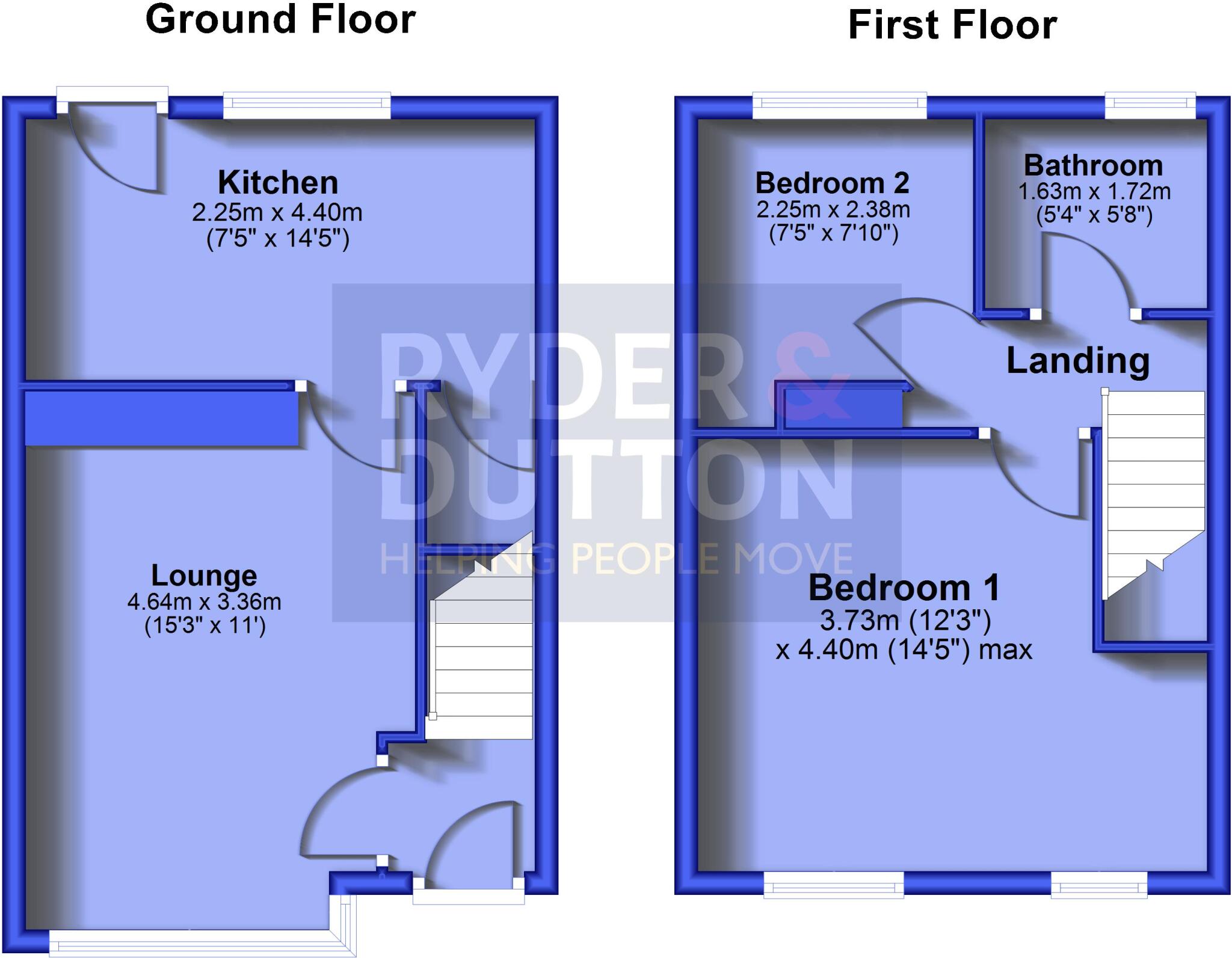
Rooms
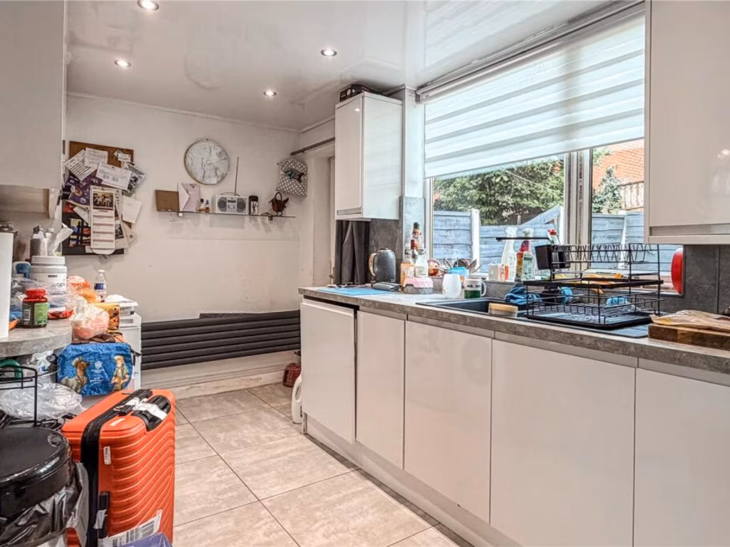
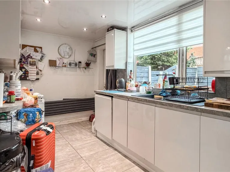
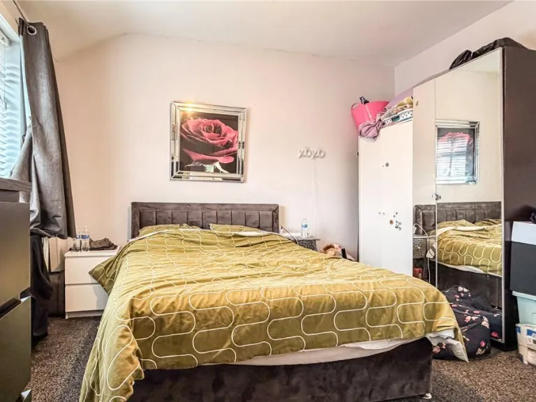
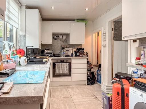
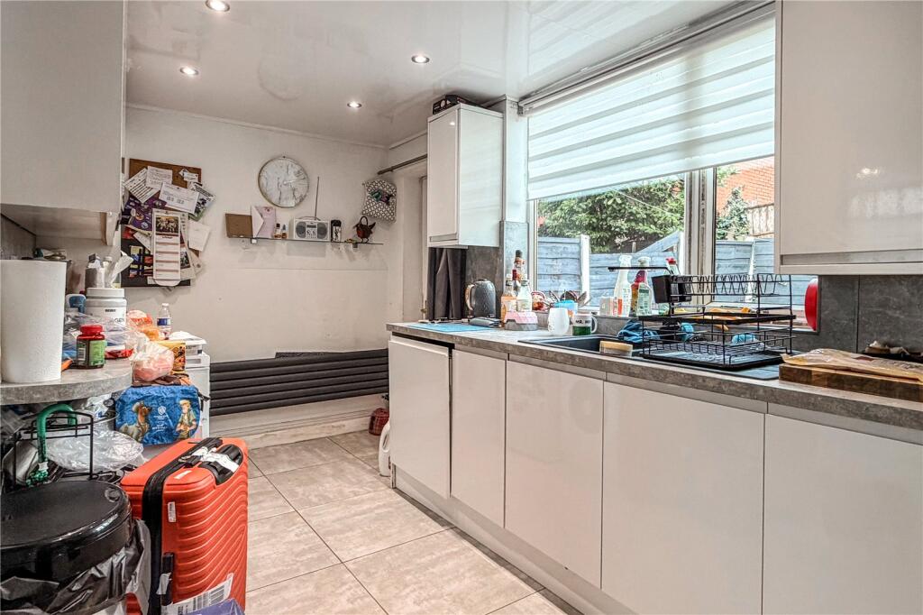
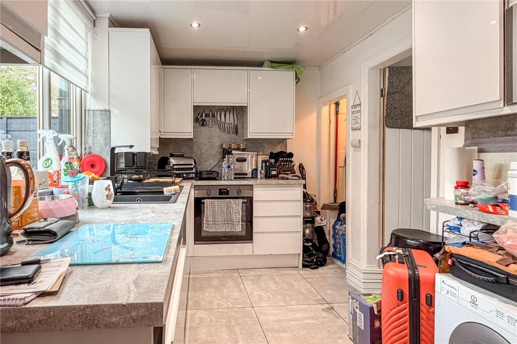
- Kitchen:
- Lounge:
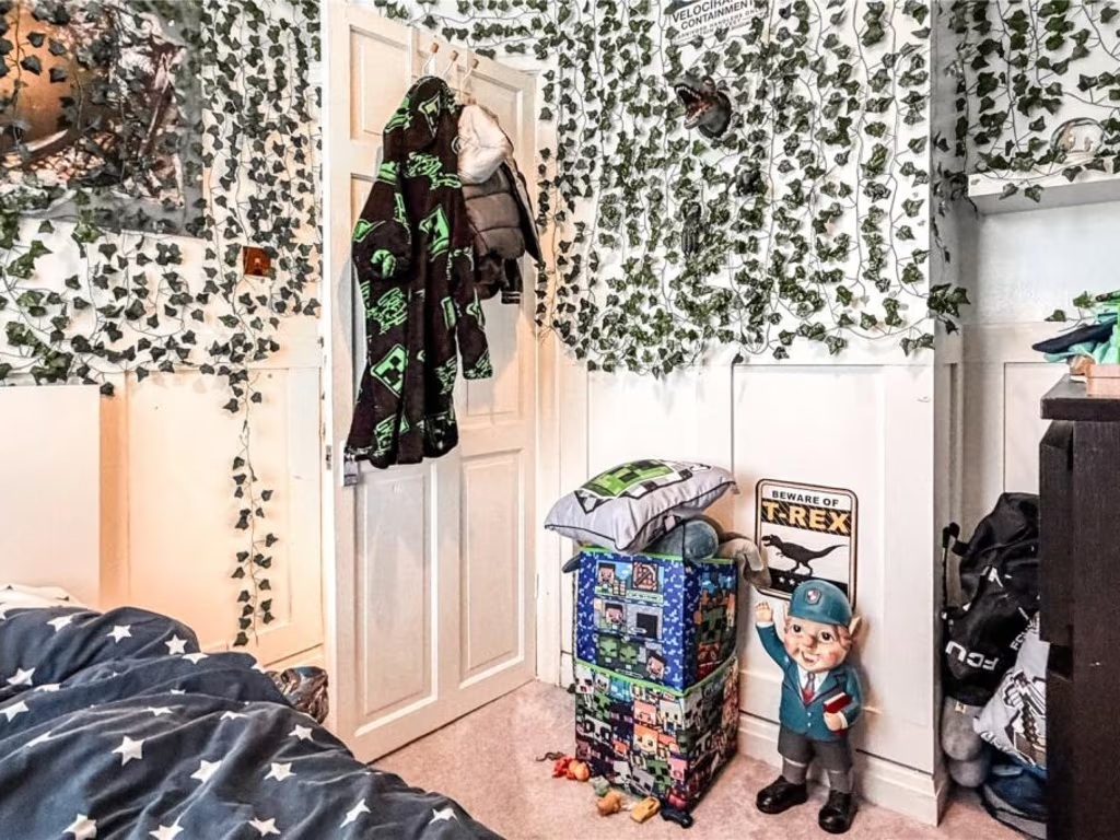
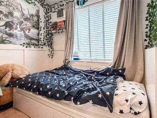
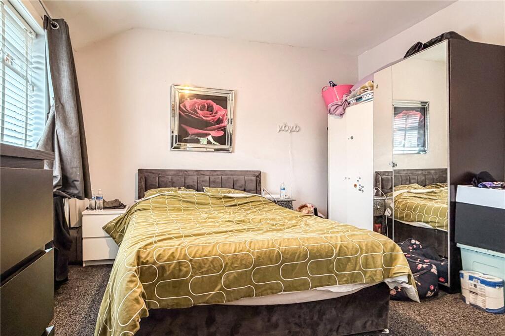
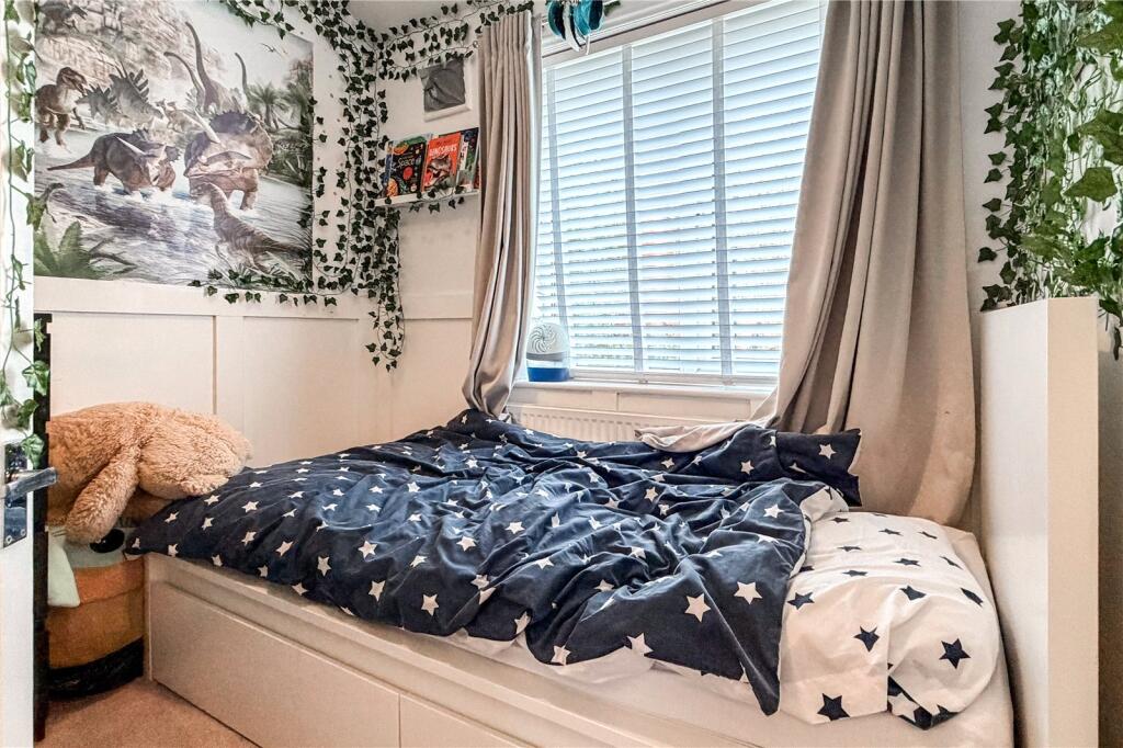
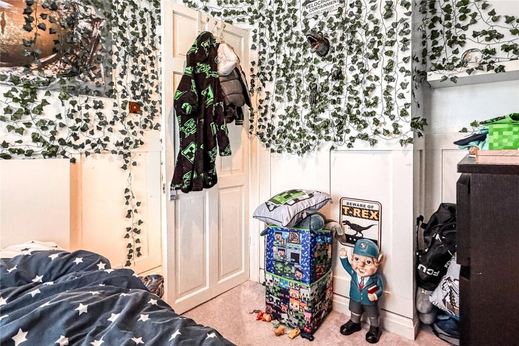
- Bedroom 2:
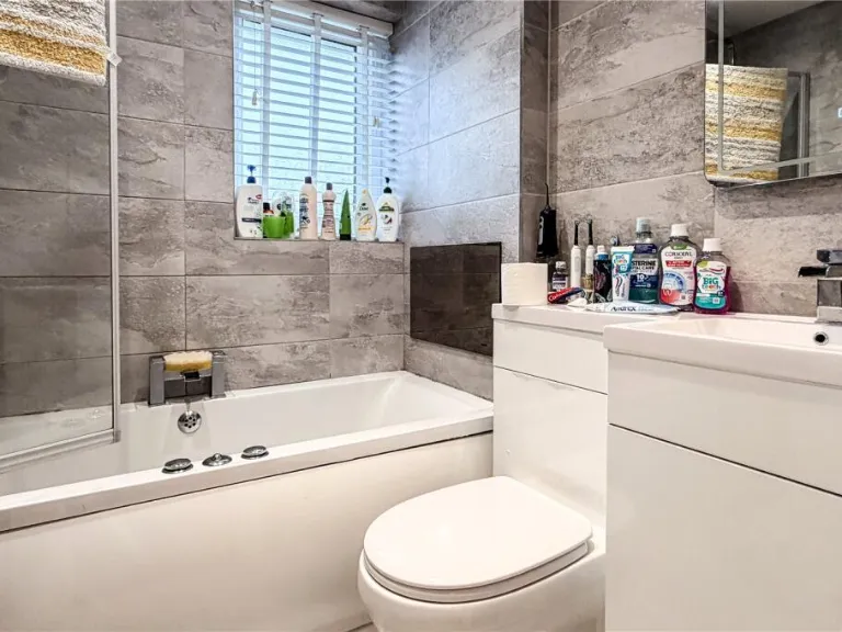
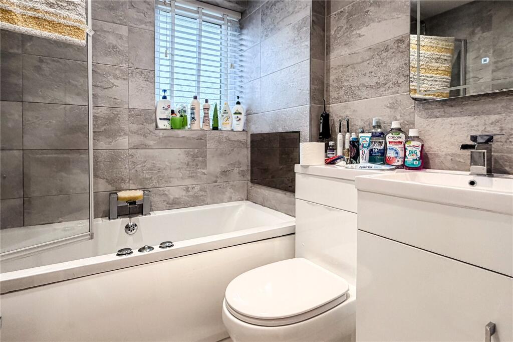
- Bathroom:
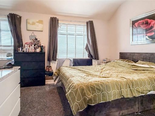
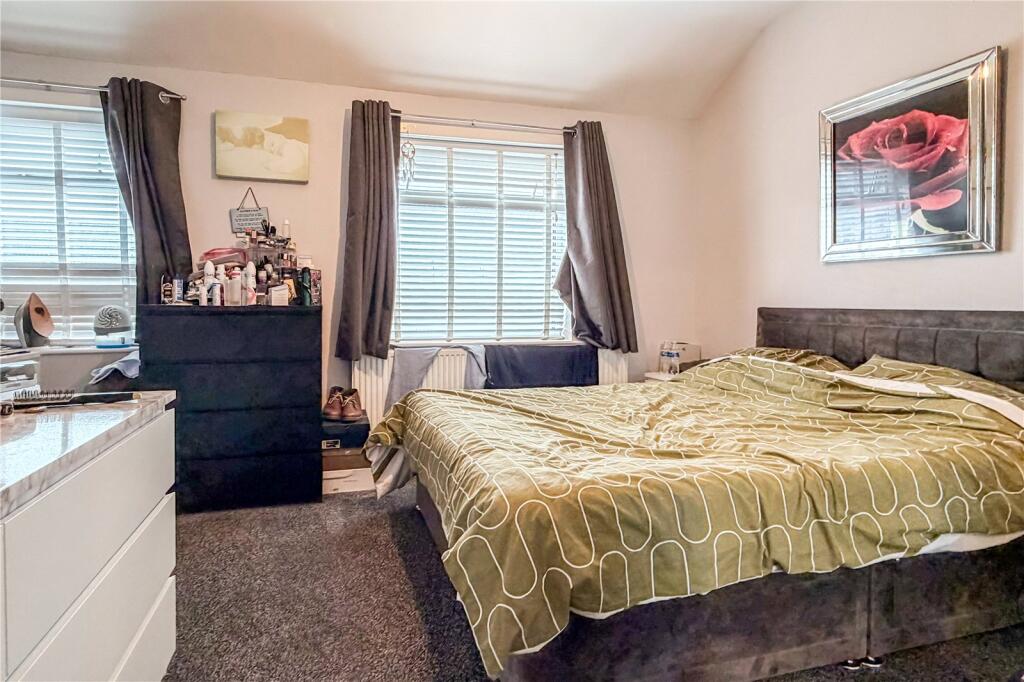
- Bedroom 1:
Textual Property Features
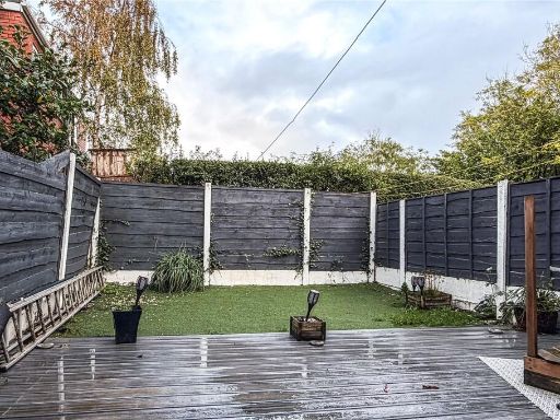
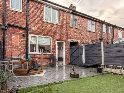
Detected Visual Features
- end terrace
- 1950s
- brick
- two-storey
- residential area
- double-glazed windows
- conservatory
- front porch
- gated driveway
- modern
- small living room
- open plan
- tiles
- minimalist decor
- natural light
Nearby Schools
- Greater Manchester Independent School
- St Mary's RC Primary School
- Propps Hall Junior Infant and Nursery School
- Co-op Academy Failsworth
- St John's Church of England Primary School
- St Matthew's RC High School
- St Margaret's CofE Junior Infant and Nursery School
- Whitegate End Primary and Nursery School
- St Margaret Mary's RC Primary School Manchester
- Yew Tree Community School
- Higher Failsworth Primary School
- St Mary's CofE Primary School Moston
- St Wilfrid's CofE Junior and Infant School
- All Saints C of E Primary School
- Co-op Academy Broadhurst
- Stanley Road Primary School
- Christ The King RC Primary School Manchester
- South Failsworth Community Primary School
- Mather Street Primary School
- New Moston Primary School
- Corpus Christi RC Primary School
- Blessed John Henry Newman Roman Catholic College
Nearest Bars And Restaurants
- Id: 287027072
- Tags:
- Amenity: pub
- Name: Crown & Cushion
- TagsNormalized:
- Lat: 53.5110199
- Lon: -2.156378
- FullGeoHash: gcw2qvmu2c05
- PartitionGeoHash: gcw2
- Images:
- FoodStandards: null
- Distance: 743.6
,- Id: 286954151
- Tags:
- Amenity: pub
- Name: Royal Oak
- TagsNormalized:
- Lat: 53.5114347
- Lon: -2.1555946
- FullGeoHash: gcw2qvqqen2j
- PartitionGeoHash: gcw2
- Images:
- FoodStandards: null
- Distance: 734.2
,- Id: 1666058766
- Tags:
- Amenity: pub
- Name: The Bricklayers Arms
- TagsNormalized:
- Lat: 53.5106202
- Lon: -2.1635772
- FullGeoHash: gcw2qv29byxf
- PartitionGeoHash: gcw2
- Images:
- FoodStandards: null
- Distance: 685.8
,- Id: 646934400
- Tags:
- Amenity: restaurant
- Brand: Beefeater
- Brand:wikidata: Q4879766
- Building: yes
- Building:levels: 1.5
- Cuisine: british
- Roof:
- Levels: 0.25
- Shape: gabled
- TagsNormalized:
- Lat: 53.5224829
- Lon: -2.164308
- FullGeoHash: gcw2qxrzpcyy
- PartitionGeoHash: gcw2
- Images:
- FoodStandards: null
- Distance: 654
,- Id: 915748671
- Tags:
- Amenity: pub
- Name: The Broadway
- TagsNormalized:
- Lat: 53.5166348
- Lon: -2.1686533
- FullGeoHash: gcw2qwkufxyc
- PartitionGeoHash: gcw2
- Images:
- FoodStandards: null
- Distance: 425.6
}
Nearest General Shops
- Id: 35963805
- Tags:
- Building: yes
- Name: Housing Units
- Shop: furniture
- TagsNormalized:
- Lat: 53.5163063
- Lon: -2.1516104
- FullGeoHash: gcw2rn35pfe1
- PartitionGeoHash: gcw2
- Images:
- FoodStandards: null
- Distance: 703
,- Id: 35963806
- Tags:
- Building: yes
- Name: Housing Units
- Shop: furniture
- TagsNormalized:
- Lat: 53.5157268
- Lon: -2.1527846
- FullGeoHash: gcw2rn0rsqx3
- PartitionGeoHash: gcw2
- Images:
- FoodStandards: null
- Distance: 633.7
,- Id: 35963807
- Tags:
- Building: retail
- Name: Housing Units
- Shop: furniture
- TagsNormalized:
- Lat: 53.5158873
- Lon: -2.1532409
- FullGeoHash: gcw2rn209u7n
- PartitionGeoHash: gcw2
- Images:
- FoodStandards: null
- Distance: 601
}
Nearest Grocery shops
- Id: 661452913
- Tags:
- Building: yes
- Building:levels: 1.75
- Name: GoLocal
- Roof:
- Shop: convenience
- TagsNormalized:
- Lat: 53.5145946
- Lon: -2.1802929
- FullGeoHash: gcw2qqh357rz
- PartitionGeoHash: gcw2
- Images:
- FoodStandards: null
- Distance: 1218.5
,- Id: 904847028
- Tags:
- Addr:
- Postcode: OL8 3RB
- Street: Manchester Road
- Brand: Spar
- Brand:wikidata: Q610492
- Building: yes
- Fhrs:
- Name: Spar
- Shop: convenience
- Source:
- Start_date: 2018-11-15
- TagsNormalized:
- Lat: 53.5188771
- Lon: -2.1444184
- FullGeoHash: gcw2rny6p3v9
- PartitionGeoHash: gcw2
- Images:
- FoodStandards:
- Id: 1102017
- FHRSID: 1102017
- LocalAuthorityBusinessID: 65137
- BusinessName: Esso - Hollinwood Service Station
- BusinessType: Retailers - other
- BusinessTypeID: 4613
- AddressLine1: Euro Garages Ltd
- AddressLine2: Hollinwood Service Station
- AddressLine3: A 62 Manchester Road
- AddressLine4: Oldham
- PostCode: OL8 3RB
- RatingValue: 5
- RatingKey: fhrs_5_en-GB
- RatingDate: 2020-10-28
- LocalAuthorityCode: 418
- LocalAuthorityName: Oldham
- LocalAuthorityWebSite: https://www.oldham.gov.uk
- LocalAuthorityEmailAddress: FHRS@oldham.gov.uk
- Scores:
- Hygiene: 0
- Structural: 0
- ConfidenceInManagement: 0
- NewRatingPending: false
- Geocode:
- Longitude: -2.14556002616882
- Latitude: 53.51821899414060
- Distance: 1200.7
,- Id: 3075742989
- Tags:
- Brand: Morrisons
- Brand:wikidata: Q922344
- Brand:wikipedia: en:Morrisons
- Name: Morrisons
- Note: Petrol station shop attached to larger store (located about 750m SW)
- Shop: convenience
- Website: https://my.morrisons.com/storefinder/22
- TagsNormalized:
- Lat: 53.5096995
- Lon: -2.1611085
- FullGeoHash: gcw2qv4kddbw
- PartitionGeoHash: gcw2
- Images:
- FoodStandards: null
- Distance: 785.7
}
Nearest Supermarkets
- Id: 303377113
- Tags:
- Brand: Tesco Extra
- Brand:wikidata: Q25172225
- Brand:wikipedia: en:Tesco Extra
- Building: retail
- Contact:
- Website: https://www.tesco.com/store-locator/manchester/ashton-road
- Name: Tesco Extra
- Shop: supermarket
- Source: Bing
- TagsNormalized:
- tesco
- tesco extra
- retail
- supermarket
- shop
- Lat: 53.5085325
- Lon: -2.1587067
- FullGeoHash: gcw2quujf3rt
- PartitionGeoHash: gcw2
- Images:
- FoodStandards: null
- Distance: 941.1
,- Id: 381802171
- Tags:
- Brand: ALDI
- Brand:wikidata: Q41171672
- Brand:wikipedia: en:Aldi
- Building: yes
- Contact:
- Website: https://stores.aldi.co.uk/failsworth/sisson-street
- Name: Aldi
- Shop: supermarket
- TagsNormalized:
- Lat: 53.5099764
- Lon: -2.1588876
- FullGeoHash: gcw2qv5ynq8d
- PartitionGeoHash: gcw2
- Images:
- FoodStandards: null
- Distance: 783.1
,- Id: 166300578
- Tags:
- Brand: Morrisons
- Brand:wikidata: Q922344
- Brand:wikipedia: en:Morrisons
- Contact:
- Website: https://my.morrisons.com/storefinder/57
- Name: Morrisons
- Shop: supermarket
- TagsNormalized:
- Lat: 53.5213768
- Lon: -2.1536829
- FullGeoHash: gcw2qzr8xec8
- PartitionGeoHash: gcw2
- Images:
- FoodStandards: null
- Distance: 764.8
}
Nearest Religious buildings
- Id: 303377124
- Tags:
- Amenity: place_of_worship
- Building: church
- Denomination: anglican
- Name: St John the Evangelist (Failsworth Parish Church)
- Religion: christian
- Source: survey
- Source:geometry: Bing
- Wikidata: Q26639076
- TagsNormalized:
- place of worship
- church
- anglican
- evangelist
- parish
- christian
- Lat: 53.5117199
- Lon: -2.1546044
- FullGeoHash: gcw2qvx065dd
- PartitionGeoHash: gcw2
- Images:
- FoodStandards: null
- Distance: 751.2
,- Id: 286954152
- Tags:
- Amenity: pub
- Name: Church Inn
- TagsNormalized:
- Lat: 53.5123028
- Lon: -2.1549453
- FullGeoHash: gcw2qvwgf0k2
- PartitionGeoHash: gcw2
- Images:
- FoodStandards: null
- Distance: 688.5
,- Id: 836773171
- Tags:
- Amenity: place_of_worship
- Building: church
- Denomination: anglican
- Name: St Chad
- Religion: christian
- Wikidata: Q105100483
- TagsNormalized:
- place of worship
- church
- anglican
- christian
- Lat: 53.5162494
- Lon: -2.1618533
- FullGeoHash: gcw2qy3f9pvq
- PartitionGeoHash: gcw2
- Images:
- FoodStandards: null
- Distance: 59.1
}
Nearest Medical buildings
- Id: 655056448
- Tags:
- Addr:
- Housenumber: 872-874
- Postcode: OL8 4SR
- Street: Hollins Road
- Amenity: dentist
- Building: yes
- Healthcare: dentist
- Old_amenity: pub
- Old_fhrs:
- Old_name: Gardener's Arms
- Source:
- Addr: FHRS Open Data
- Old_amenity: FHRS Open Data;Bing;Naptan
- TagsNormalized:
- Lat: 53.5199715
- Lon: -2.1396876
- FullGeoHash: gcw2rr1bmtv3
- PartitionGeoHash: gcw2
- Images:
- FoodStandards: null
- Distance: 1532.5
,- Id: 287027171
- Tags:
- Amenity: dentist
- Healthcare: dentist
- TagsNormalized:
- Lat: 53.5085959
- Lon: -2.1632816
- FullGeoHash: gcw2qubwpvhr
- PartitionGeoHash: gcw2
- Images:
- FoodStandards: null
- Distance: 907.7
,- Id: 3566928911
- Tags:
- Amenity: doctors
- Healthcare: doctor
- TagsNormalized:
- doctor
- doctors
- health
- healthcare
- Lat: 53.5096916
- Lon: -2.1567321
- FullGeoHash: gcw2qvjs83rz
- PartitionGeoHash: gcw2
- Images:
- FoodStandards: null
- Distance: 863.1
,- Id: 3566930658
- Tags:
- Amenity: pharmacy
- Healthcare: pharmacy
- TagsNormalized:
- Lat: 53.5098798
- Lon: -2.1569199
- FullGeoHash: gcw2qvjmshef
- PartitionGeoHash: gcw2
- Images:
- FoodStandards: null
- Distance: 838.9
}
Nearest Airports
- Id: 1224469
- Tags:
- Addr:
- City: Manchester
- Country: GB
- Postcode: M90 1QX
- Aerodrome: international
- Aeroway: aerodrome
- Arp: yes
- Atis: 128.175
- Iata: MAN
- Icao: EGCC
- Name: Manchester Airport
- Note: rough sketched outline referring to Yahoo imagery - true boundary is where?
- Old_name: Ringway
- Operator: Manchester Airport PLC
- Size: 18720000
- Source:
- Tower_frequency: 118.625,119.400
- Type: multipolygon
- Website: https://www.manchesterairport.co.uk/
- Wikidata: Q8694
- Wikipedia: en:Manchester Airport
- TagsNormalized:
- airport
- international airport
- Lat: 53.3503197
- Lon: -2.2798822
- FullGeoHash: gcqrs05u4ukt
- PartitionGeoHash: gcqr
- Images:
- FoodStandards: null
- Distance: 20079.1
}
Nearest Leisure Facilities
- Id: 912939655
- Tags:
- Leisure: pitch
- Sport: bowls
- Surface: grass
- TagsNormalized:
- Lat: 53.5147539
- Lon: -2.1564987
- FullGeoHash: gcw2qyjdjcnj
- PartitionGeoHash: gcw2
- Images:
- FoodStandards: null
- Distance: 437.6
,- Id: 553723678
- Tags:
- TagsNormalized:
- Lat: 53.5180139
- Lon: -2.1647455
- FullGeoHash: gcw2qwxtjbbu
- PartitionGeoHash: gcw2
- Images:
- FoodStandards: null
- Distance: 219.4
,- Id: 553723672
- Tags:
- TagsNormalized:
- Lat: 53.5168899
- Lon: -2.1654367
- FullGeoHash: gcw2qwrnmxm7
- PartitionGeoHash: gcw2
- Images:
- FoodStandards: null
- Distance: 213.5
,- Id: 102315780
- Tags:
- Leisure: park
- Name: Nuthurst Park
- TagsNormalized:
- Lat: 53.5172648
- Lon: -2.165004
- FullGeoHash: gcw2qwx2xv0p
- PartitionGeoHash: gcw2
- Images:
- FoodStandards: null
- Distance: 193.4
,- Id: 553723671
- Tags:
- TagsNormalized:
- Lat: 53.5171844
- Lon: -2.1642981
- FullGeoHash: gcw2qy800nnr
- PartitionGeoHash: gcw2
- Images:
- FoodStandards: null
- Distance: 146.3
}
Nearest Tourist attractions
- Id: 430960781
- Tags:
- TagsNormalized:
- Lat: 53.4918435
- Lon: -2.178025
- FullGeoHash: gcw2q3yh866g
- PartitionGeoHash: gcw2
- Images:
- FoodStandards: null
- Distance: 2958.6
,- Id: 430960765
- Tags:
- TagsNormalized:
- Lat: 53.4914734
- Lon: -2.1672678
- FullGeoHash: gcw2q9vf6vrg
- PartitionGeoHash: gcw2
- Images:
- FoodStandards: null
- Distance: 2828.7
,- Id: 430960768
- Tags:
- TagsNormalized:
- Lat: 53.4920869
- Lon: -2.1682959
- FullGeoHash: gcw2q9vjgp9r
- PartitionGeoHash: gcw2
- Images:
- FoodStandards: null
- Distance: 2770
}
Nearest Hotels
- Id: 424062544
- Tags:
- Amenity: pub
- Building: pub
- Name: Gardeners Arms Hotel
- Operator: WM Lees
- Real_ale: yes
- TagsNormalized:
- Lat: 53.5250548
- Lon: -2.1763766
- FullGeoHash: gcw2qrznn9ru
- PartitionGeoHash: gcw2
- Images:
- FoodStandards: null
- Distance: 1316.1
,- Id: 166164543
- Tags:
- Brand: Travelodge
- Brand:wikidata: Q9361374
- Brand:wikipedia: en:Travelodge UK
- Building: motel
- Internet_access: wlan
- Internet_access:fee: customers
- Internet_access:ssid: Travelodge WiFi
- Name: Travelodge
- Tourism: hotel
- TagsNormalized:
- Lat: 53.5283191
- Lon: -2.1600418
- FullGeoHash: gcw2wbe153uj
- PartitionGeoHash: gcw2
- Images:
- FoodStandards: null
- Distance: 1296.2
,- Id: 646934397
- Tags:
- Brand: Premier Inn
- Brand:wikidata: Q2108626
- Building: yes
- Building:levels: 1.5
- Internet_access: wlan
- Internet_access:fee: customers
- Internet_access:operator: Virgin Media
- Internet_access:ssid: Premier Inn Free Wi-Fi
- Name: Premier Inn
- Roof:
- Levels: 0.25
- Shape: hipped
- Tourism: hotel
- TagsNormalized:
- Lat: 53.5228004
- Lon: -2.1641629
- FullGeoHash: gcw2qz80gm5h
- PartitionGeoHash: gcw2
- Images:
- FoodStandards: null
- Distance: 686.7
}
Tags
- end terrace
- 1950s
- brick
- two-storey
- residential area
- double-glazed windows
- conservatory
- front porch
- gated driveway
- modern
- small living room
- open plan
- tiles
- minimalist decor
- natural light
Local Market Stats
- Average Price/sqft: £197
- Avg Income: £34700
- Rental Yield: 6.2%
- Social Housing: 38%
- Planning Success Rate: 86%
Similar Properties
 3 bedroom town house for sale in Sulby Street, Manchester, M40 — £200,000 • 3 bed • 1 bath
 2 bedroom terraced house for sale in Leabrook Drive, Manchester, M40 — £190,000 • 2 bed • 1 bath • 840 ft²
 3 bedroom terraced house for sale in Moston Lane East, New Moston, Manchester, M40 — £230,000 • 3 bed • 1 bath • 1316 ft²
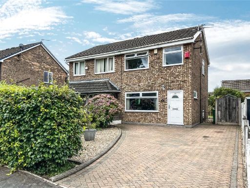 3 bedroom semi-detached house for sale in Lindrick Close, New Moston, Manchester, M40 — £240,000 • 3 bed • 1 bath • 723 ft²
 3 bedroom end of terrace house for sale in Dean Brook Close, Moston, Manchester, M40 — £190,000 • 3 bed • 1 bath • 587 ft²
 3 bedroom terraced house for sale in Nuthurst Road, New Moston, Manchester, M40 — £250,000 • 3 bed • 1 bath • 1012 ft²
Meta
- {
"@context": "https://schema.org",
"@type": "Residence",
"name": "2 bedroom terraced house for sale in Hazeldene Road, New Mo…",
"description": "",
"url": "https://propertypiper.co.uk/property/41d9ef3c-fe19-43b9-806d-a6bd71b916e2",
"image": "https://image-a.propertypiper.co.uk/7fad191e-ce07-4290-940b-1cd1cd454a01-1024.jpeg",
"address": {
"@type": "PostalAddress",
"streetAddress": "12 HAZELDENE ROAD MANCHESTER",
"postalCode": "M40 3GL",
"addressLocality": "Manchester",
"addressRegion": "Manchester Central",
"addressCountry": "England"
},
"geo": {
"@type": "GeoCoordinates",
"latitude": 53.51673432868067,
"longitude": -2.1622186896062106
},
"numberOfRooms": 2,
"numberOfBathroomsTotal": 1,
"floorSize": {
"@type": "QuantitativeValue",
"value": 538,
"unitCode": "FTK"
},
"offers": {
"@type": "Offer",
"price": 180000,
"priceCurrency": "GBP",
"availability": "https://schema.org/InStock"
},
"additionalProperty": [
{
"@type": "PropertyValue",
"name": "Feature",
"value": "end terrace"
},
{
"@type": "PropertyValue",
"name": "Feature",
"value": "1950s"
},
{
"@type": "PropertyValue",
"name": "Feature",
"value": "brick"
},
{
"@type": "PropertyValue",
"name": "Feature",
"value": "two-storey"
},
{
"@type": "PropertyValue",
"name": "Feature",
"value": "residential area"
},
{
"@type": "PropertyValue",
"name": "Feature",
"value": "double-glazed windows"
},
{
"@type": "PropertyValue",
"name": "Feature",
"value": "conservatory"
},
{
"@type": "PropertyValue",
"name": "Feature",
"value": "front porch"
},
{
"@type": "PropertyValue",
"name": "Feature",
"value": "gated driveway"
},
{
"@type": "PropertyValue",
"name": "Feature",
"value": "modern"
},
{
"@type": "PropertyValue",
"name": "Feature",
"value": "small living room"
},
{
"@type": "PropertyValue",
"name": "Feature",
"value": "open plan"
},
{
"@type": "PropertyValue",
"name": "Feature",
"value": "tiles"
},
{
"@type": "PropertyValue",
"name": "Feature",
"value": "minimalist decor"
},
{
"@type": "PropertyValue",
"name": "Feature",
"value": "natural light"
}
]
}
High Res Floorplan Images
Compatible Floorplan Images
FloorplanImages Thumbnail