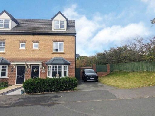
WN8 6HN - 3 bedroom end of terrace house for sale in Vines Cross Way,…
View on Property Piper
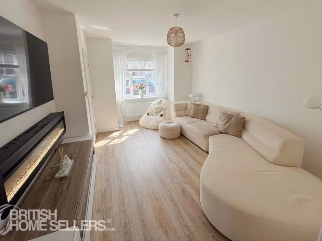
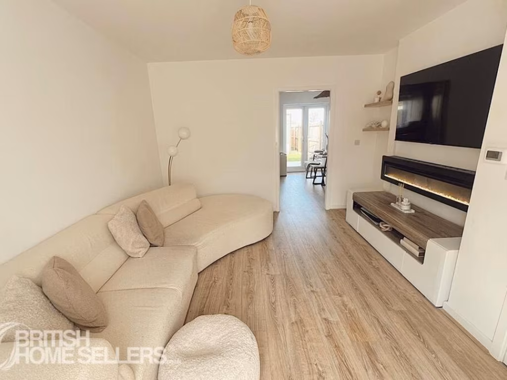
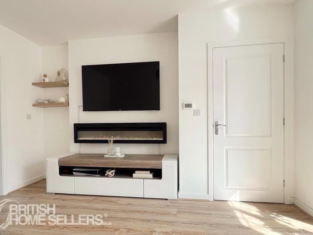
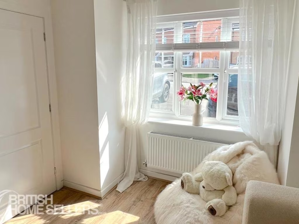
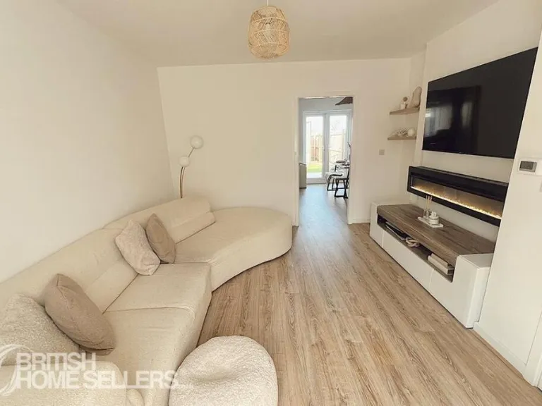
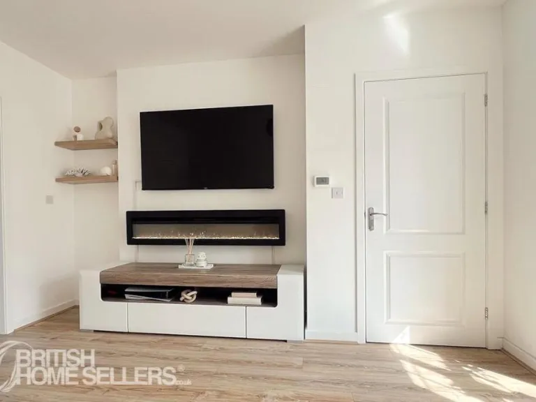
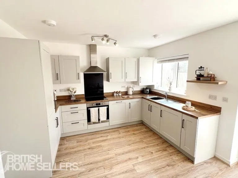
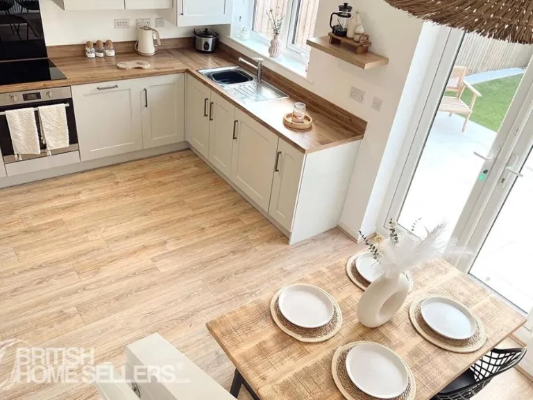
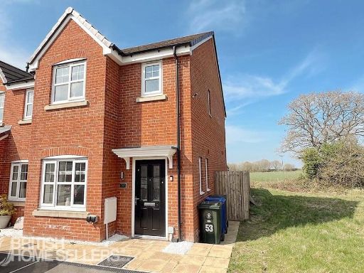
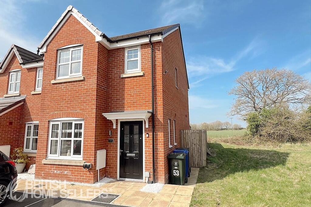
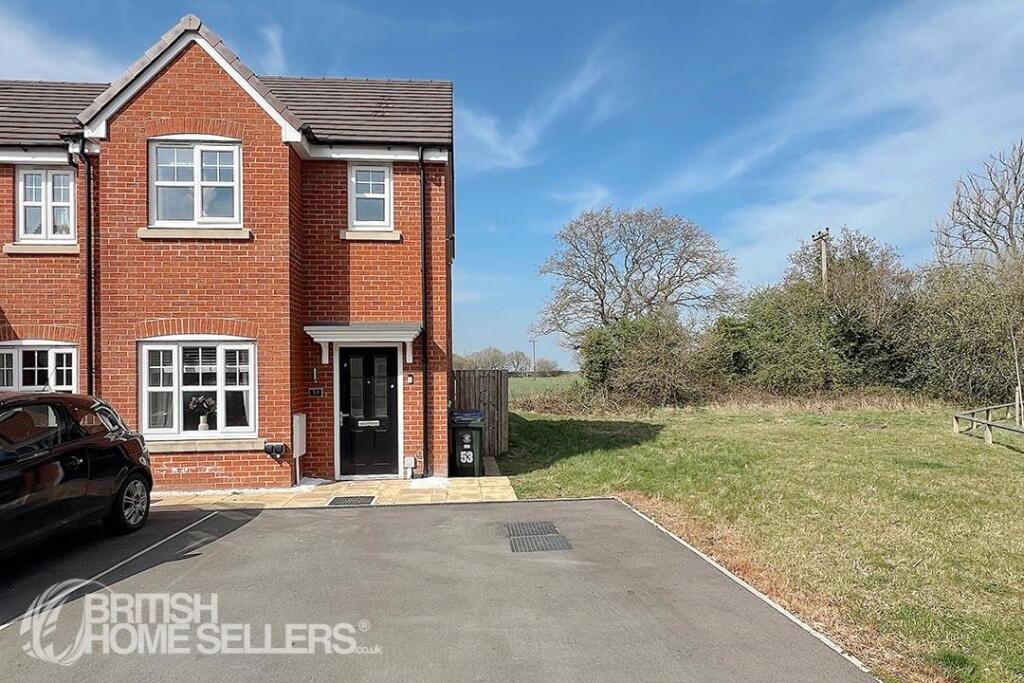
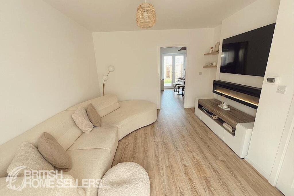
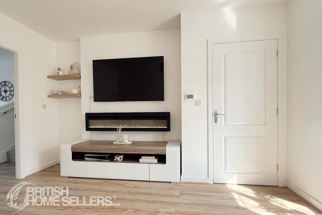
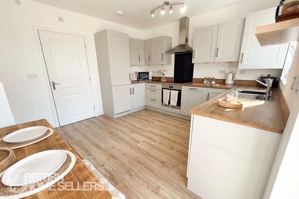
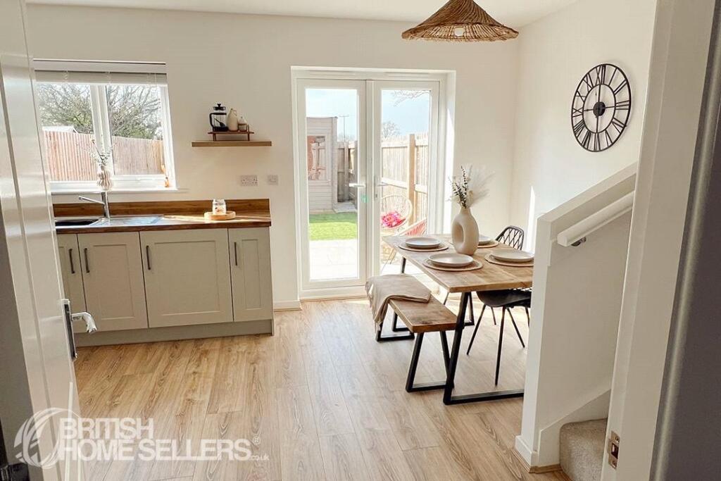
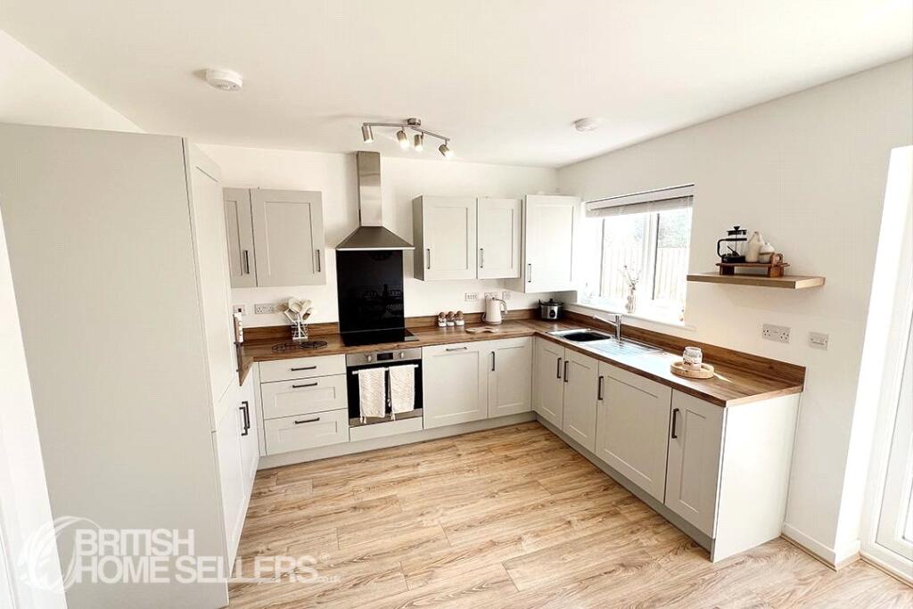
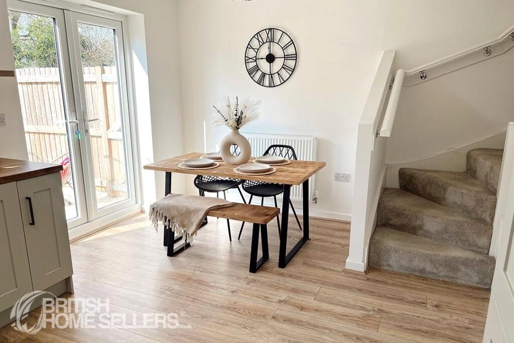
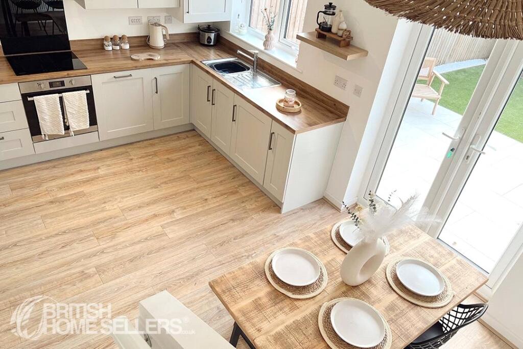
3 bedroom end of terrace house for sale in Vines Cross Way, Skelmersdale, Lancashire, WN8
Property Details
- Price: £210000
- Bedrooms: 3
- Bathrooms: 2
- Property Type: undefined
- Property SubType: undefined
Image Descriptions
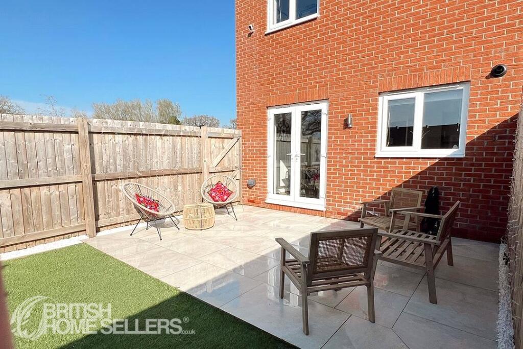
- semi-detached house modern
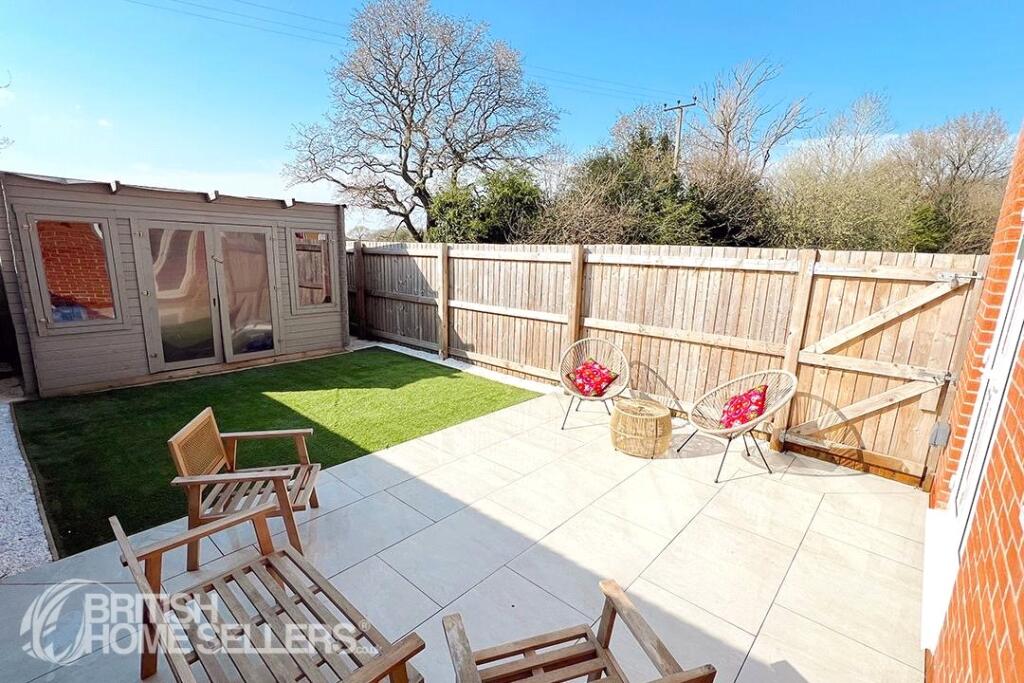
- semi-detached house modern
Rooms
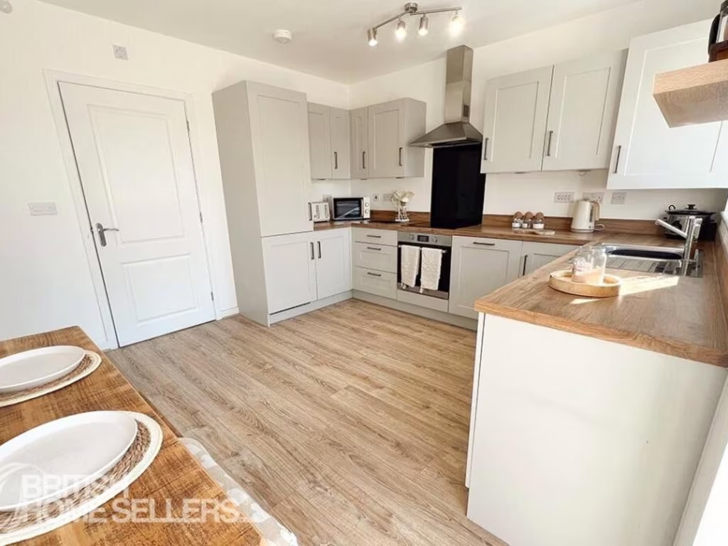
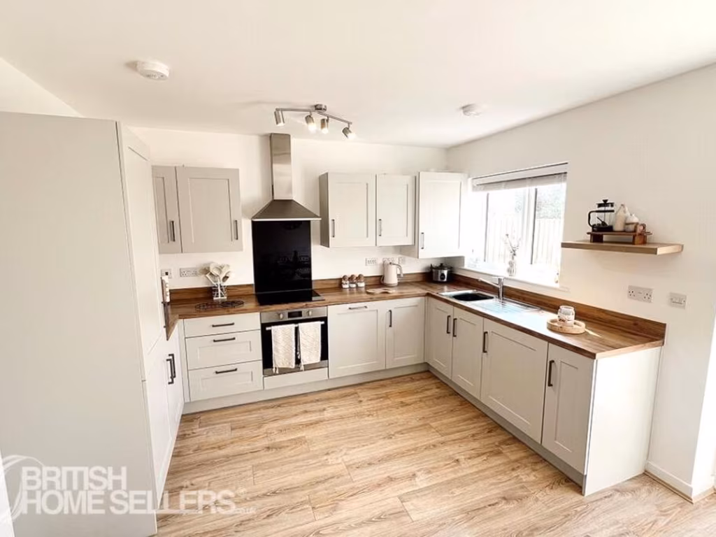
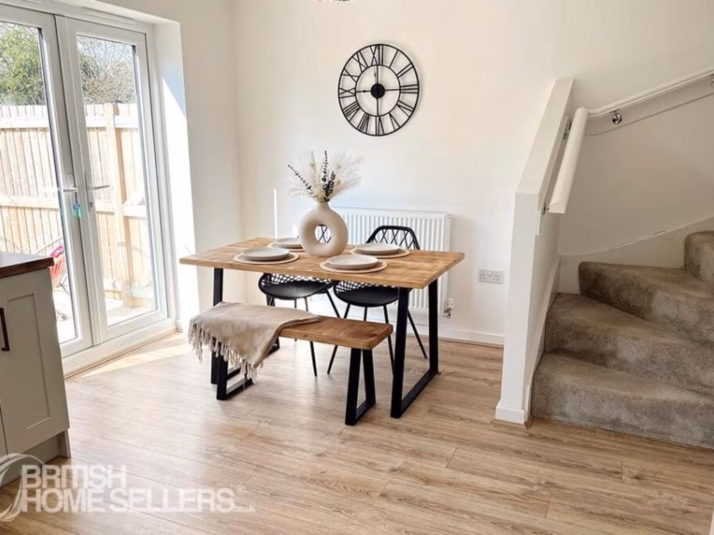
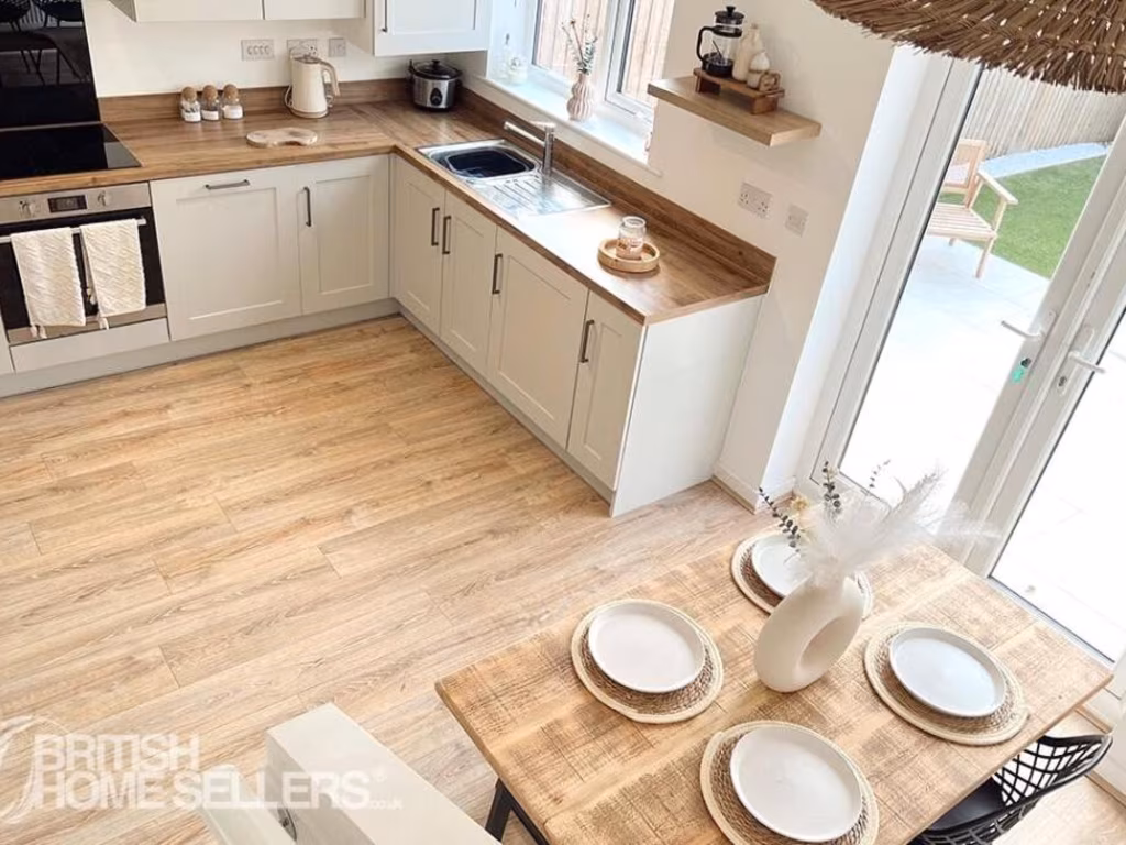
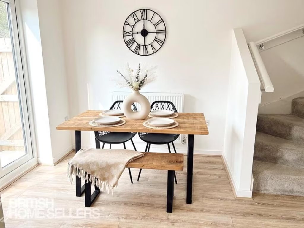
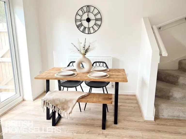
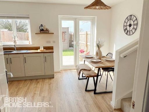
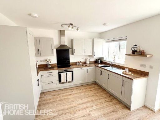
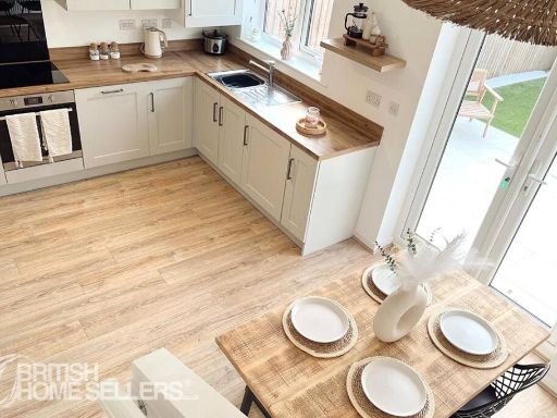
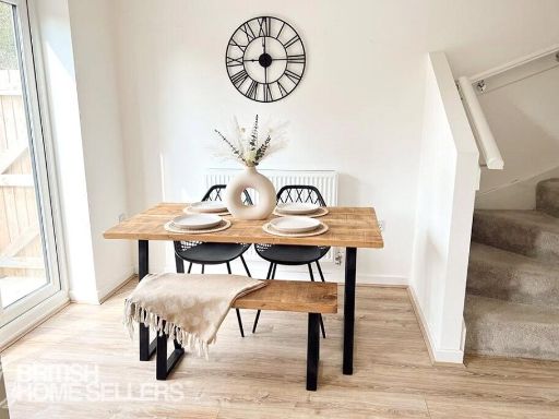
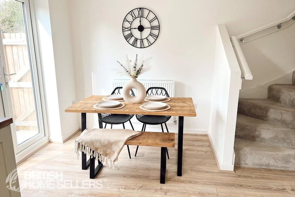
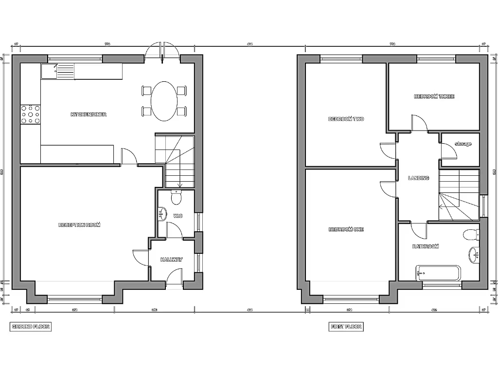
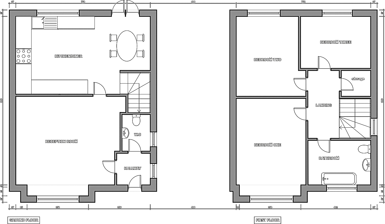
- KITCHEN/DINER:
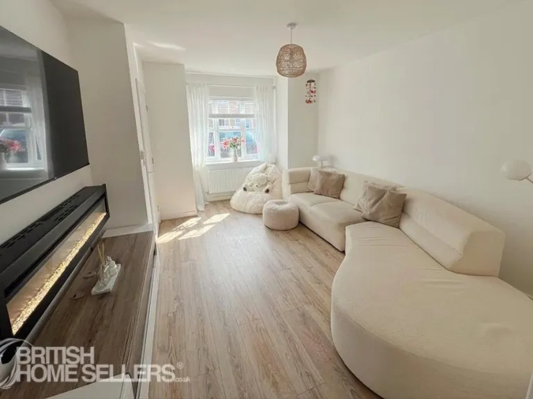
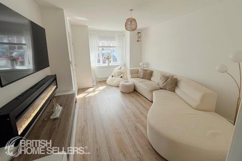
- RECEPTION ROOM:
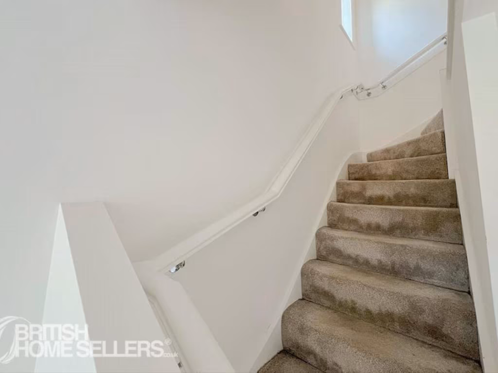
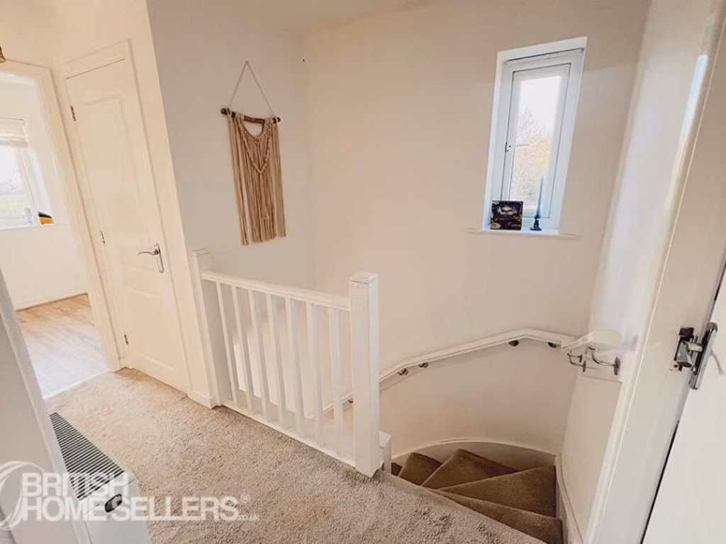
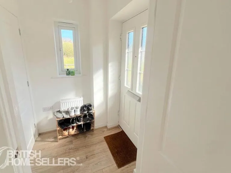
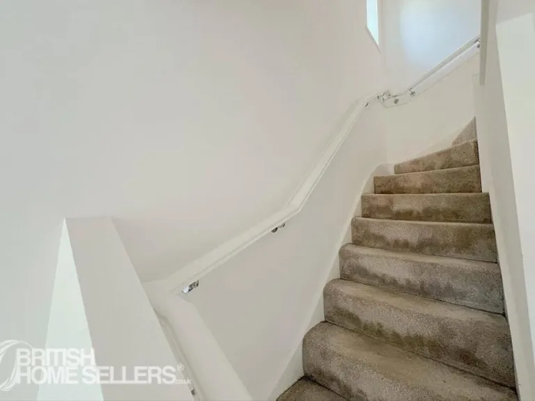
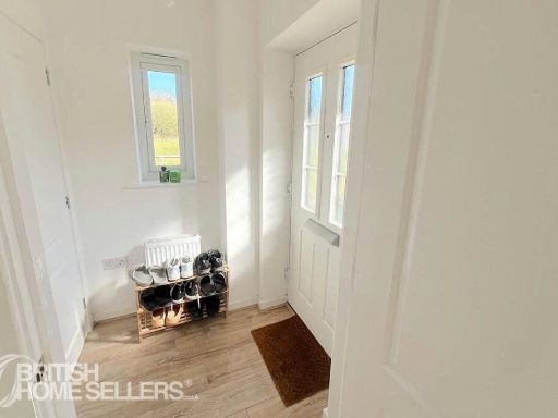
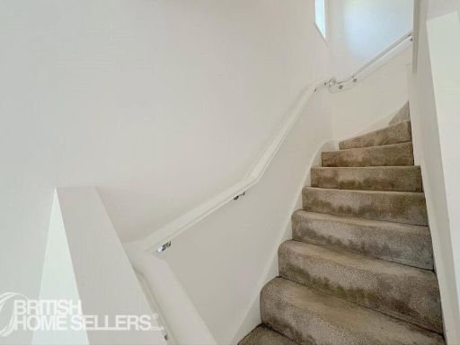
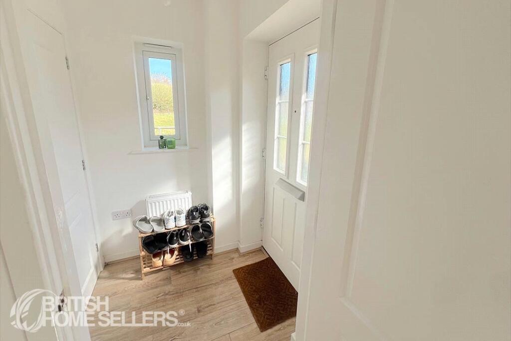
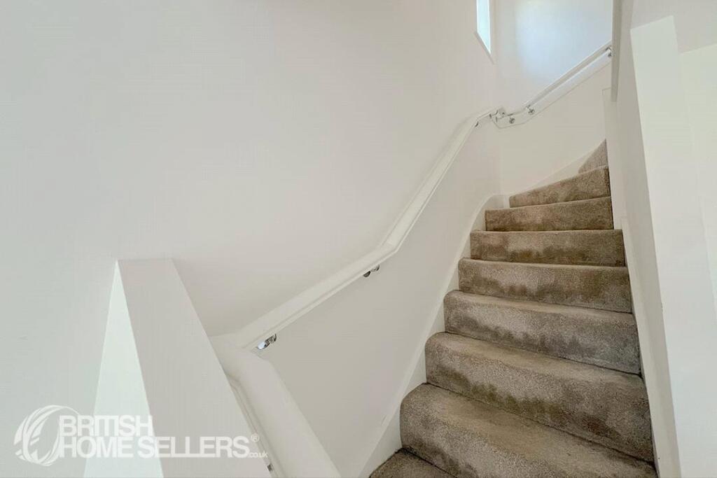
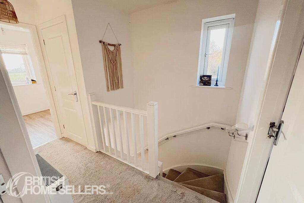
- HALLWAY:
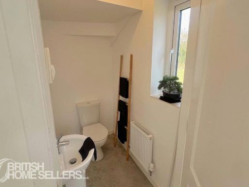
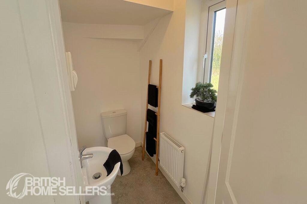
- W.C:
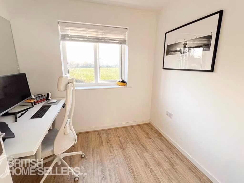
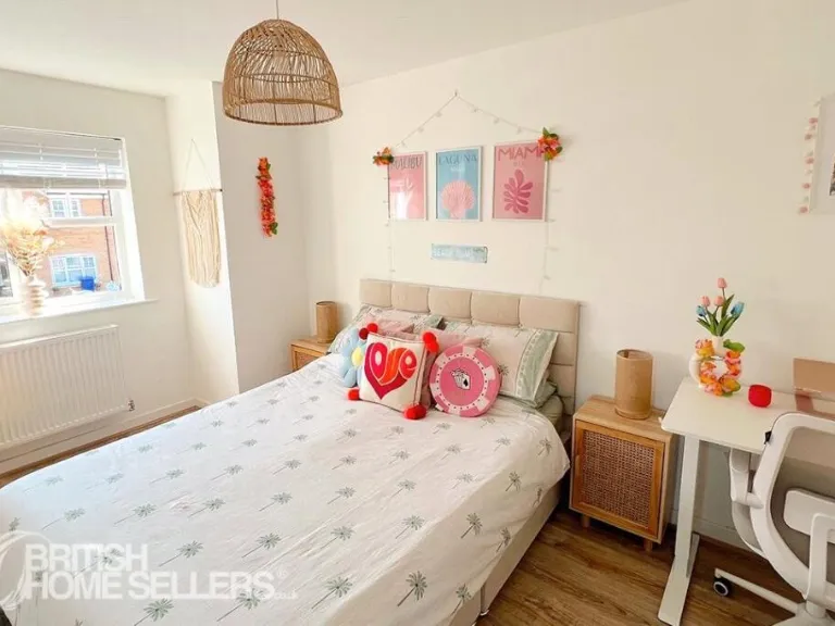
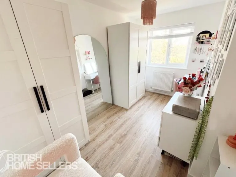
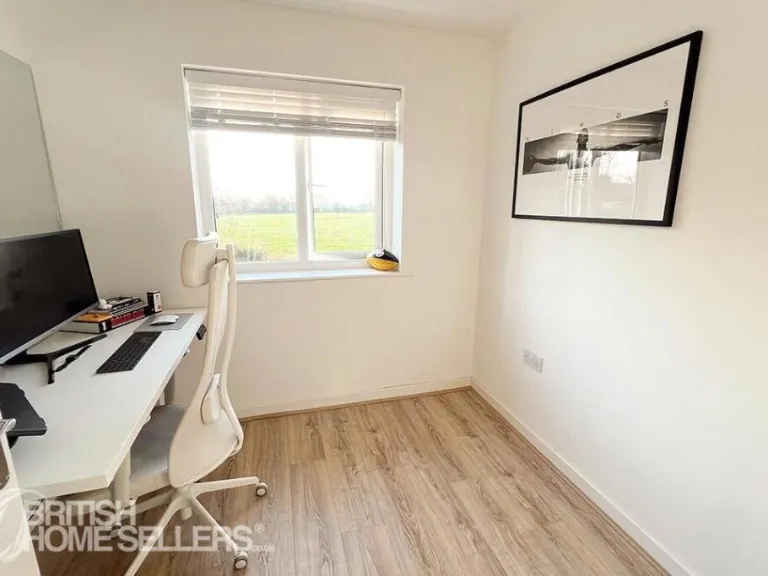
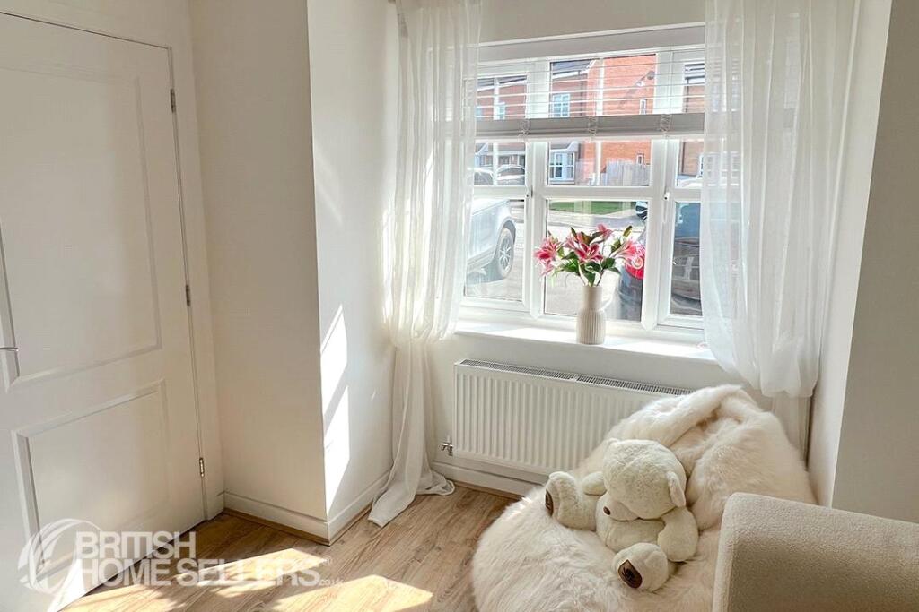
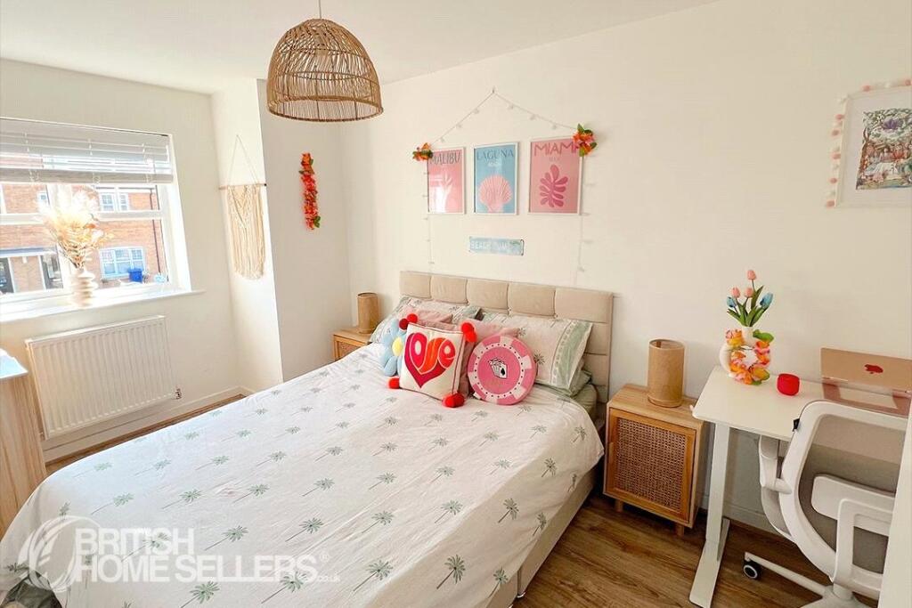
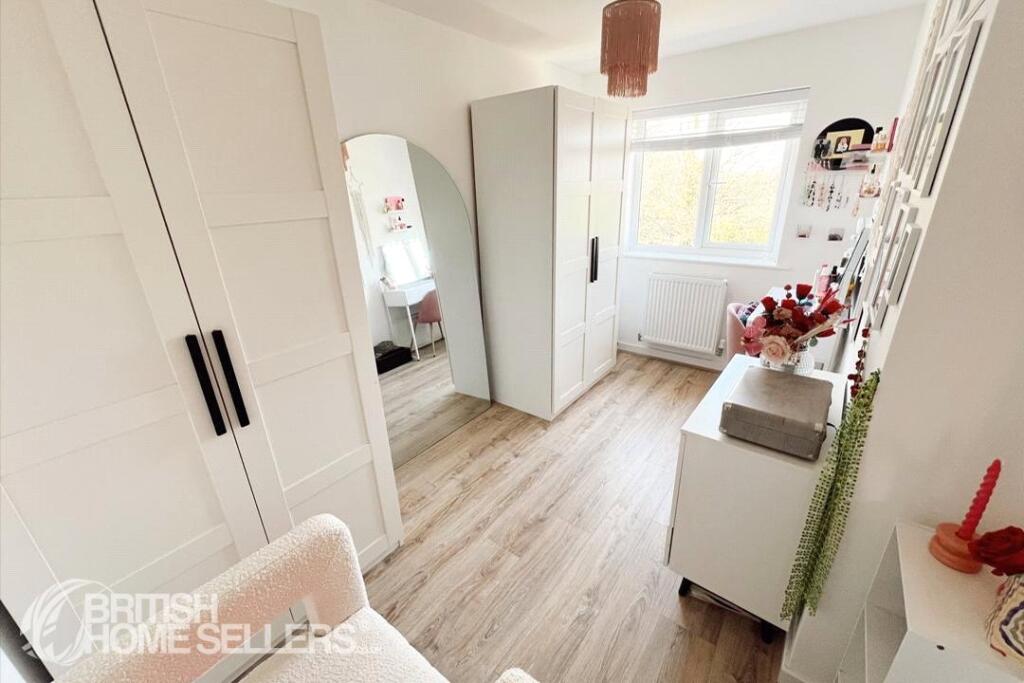
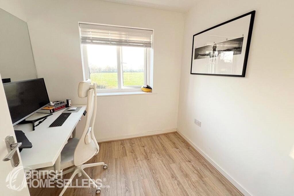
- BEDROOM TWO:
- BEDROOM THREE:
- BEDROOM ONE:
- LANDING:
- storage:
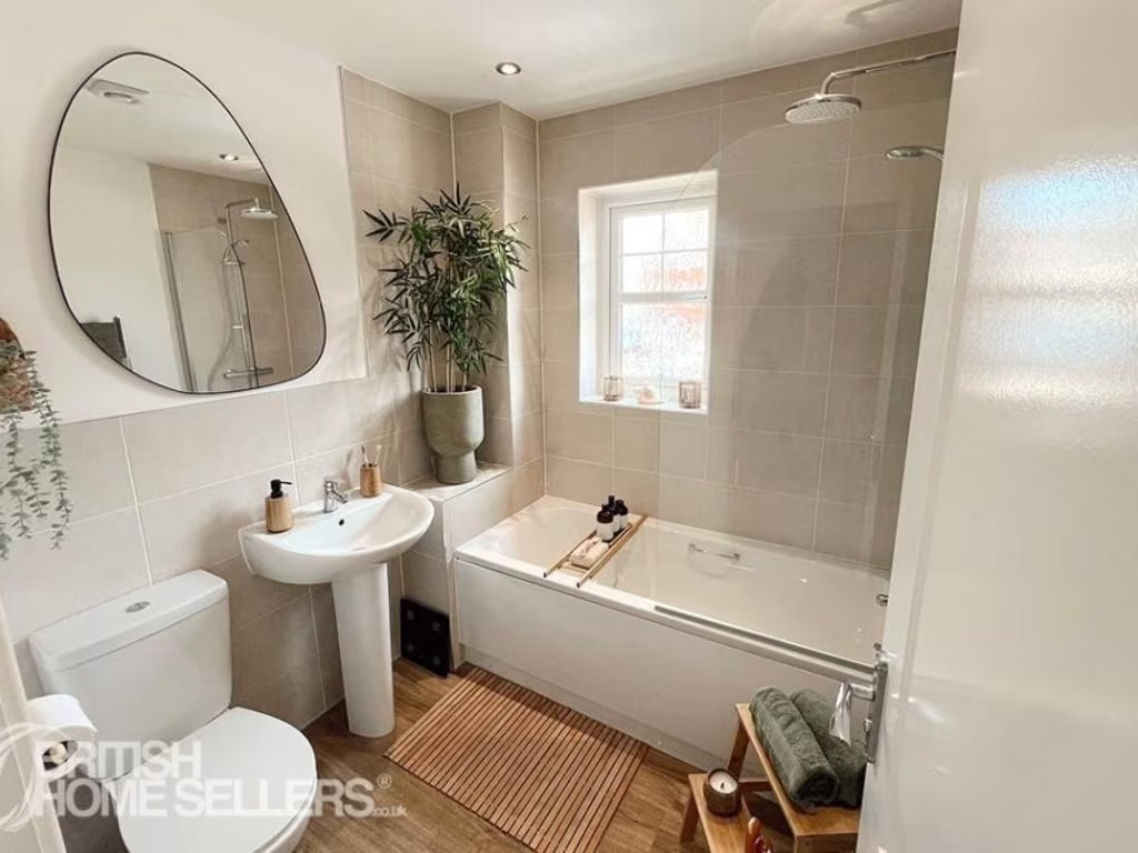
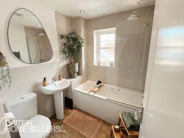
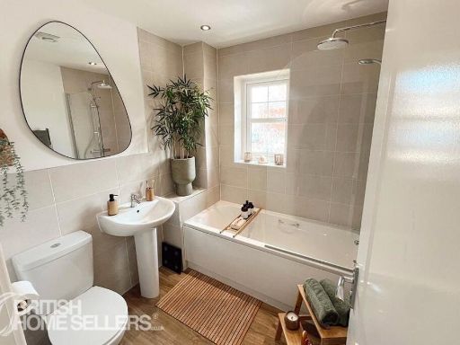
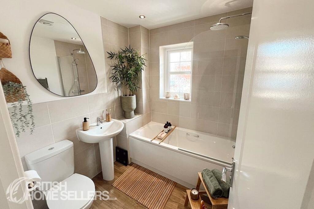
- BATHROOM:
Textual Property Features
Detected Visual Features
- semi-detached
- modern
- red brick
- two-storey
- double-glazed windows
- traditional roof
- bay window
- suburban
- new build
- residential
- brick
- driveway
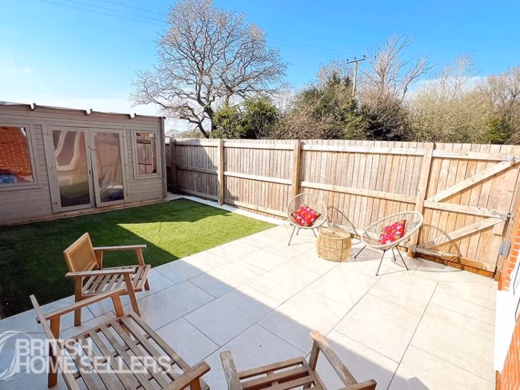
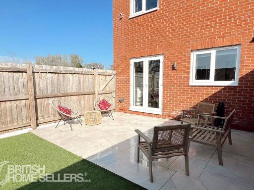
- family home
- garden
EPC Details
- High performance glazing
- Average thermal transmittance 0.27 W/m-¦K
- Boiler and radiators, mains gas
- Low energy lighting in all fixed outlets
- Average thermal transmittance 0.16 W/m-¦K
Nearby Schools
- Delph Side Community Primary School
- Hillside Community Primary School
- St Richard's Catholic Primary School, Skelmersdale
- St John's Catholic Primary School, Skelmersdale
- Brookfield Park Primary School
- Lathom High School : A Technology College
- Our Lady Queen of Peace Catholic Engineering College
- Dalton St Michael's Church of England Primary School
- Newburgh Church of England Primary School
- Parbold Douglas Church of England Academy
- Richard Durning's Endowed Primary School
- Bishop Martin Church of England Primary School
- Moorside Community Primary Academy School
- St Francis of Assisi Catholic Primary School
- Holland Moor Primary School
- Cobbs Brow School
- St James' Catholic Primary School, Skelmersdale
- Ormskirk Lathom Park Church of England Primary School
- Trinity Church of England/Methodist School
- Crow Orchard Primary School
- Upholland Roby Mill CofE Voluntary Aided Primary School
- Our Lady and All Saints Roman Catholic Primary School, Parbold
- Little Digmoor Primary School
- St Edmund's Catholic Primary School
- Woodlands Community Primary School
- Maharishi Free School
Nearest General Shops
- Id: 1146802082
- Tags:
- Building: apartments
- Shop: yes
- TagsNormalized:
- Lat: 53.552632
- Lon: -2.7731363
- FullGeoHash: gcw08uuwtnpt
- PartitionGeoHash: gcw0
- Images:
- FoodStandards: null
- Distance: 1960.8
,- Id: 10678711593
- Tags:
- Name: A Greener Weigh
- Operator: The Wayfarer
- Shop: refill
- Website: https://www.wayfarerparbold.co.uk/AGW.html
- TagsNormalized:
- Lat: 53.5867976
- Lon: -2.7716748
- FullGeoHash: gcw0bgjtxr16
- PartitionGeoHash: gcw0
- Images:
- FoodStandards: null
- Distance: 1938.4
,- Id: 768381734
- Tags:
- Addr:
- Brand: Vauxhall Motors
- Building: yes
- Shop: car
- TagsNormalized:
- Lat: 53.5542911
- Lon: -2.7751891
- FullGeoHash: gcw08v70m7mn
- PartitionGeoHash: gcw0
- Images:
- FoodStandards: null
- Distance: 1755.8
}
Nearest Grocery shops
- Id: 1088046277
- Tags:
- Brand: Asda on the Move
- Brand:wikidata: Q105221621
- Building: yes
- Name: Asda On The Move
- Shop: convenience
- TagsNormalized:
- Lat: 53.5506287
- Lon: -2.8086296
- FullGeoHash: gcw08hdg40ty
- PartitionGeoHash: gcw0
- Images:
- FoodStandards: null
- Distance: 2903.1
,- Id: 1080146119
- Tags:
- Brand: Shell Select
- Brand:wikidata: Q110716465
- Building: yes
- Name: Shell Select
- Shop: convenience
- TagsNormalized:
- shell
- shell select
- convenience
- shop
- Lat: 53.5459736
- Lon: -2.7829864
- FullGeoHash: gcw08etrzsyy
- PartitionGeoHash: gcw0
- Images:
- FoodStandards: null
- Distance: 2675.4
,- Id: 608567865
- Tags:
- Addr:
- Country: GB
- Housenumber: 17
- Postcode: WN8 7HA
- Street: The Common
- Brand: Morrisons Daily
- Brand:wikidata: Q99752411
- Contact:
- Website: https://my.morrisons.com/storefinder/36063
- Fhrs:
- Name: Morrisons Daily
- Operator: McColl's
- Operator:website: https://www.mccolls.co.uk/storelocator/parbold-the-common/
- Operator:wikidata: Q16997477
- Shop: convenience
- TagsNormalized:
- morrisons
- morrisons daily
- convenience
- shop
- Lat: 53.5919875
- Lon: -2.7703822
- FullGeoHash: gcw0bunevqt3
- PartitionGeoHash: gcw0
- Images:
- FoodStandards:
- Id: 182645
- FHRSID: 182645
- LocalAuthorityBusinessID: PI/000078554
- BusinessName: Morrisons Daily
- BusinessType: Retailers - other
- BusinessTypeID: 4613
- AddressLine1: 17 The Common
- AddressLine2: Parbold
- AddressLine3: Lancashire
- AddressLine4: null
- PostCode: WN8 7HA
- RatingValue: 4
- RatingKey: fhrs_4_en-GB
- RatingDate: 2022-06-15
- LocalAuthorityCode: 206
- LocalAuthorityName: West Lancashire
- LocalAuthorityWebSite: http://www.westlancs.gov.uk
- LocalAuthorityEmailAddress: EnvHealth.Admin@westlancs.gov.uk
- Scores:
- Hygiene: 5
- Structural: 10
- ConfidenceInManagement: 5
- NewRatingPending: false
- Geocode:
- Longitude: -2.77002700000000
- Latitude: 53.59179900000000
- Distance: 2519.2
}
Nearest Supermarkets
- Id: 166708802
- Tags:
- Brand: Tesco
- Brand:wikidata: Q487494
- Brand:wikipedia: en:Tesco
- Building: yes
- Contact:
- Website: https://www.tesco.com/store-locator/ormskirk/liverpool-rd-north
- Name: Tesco
- Opening_hours: Mo-Sa 08:00-22:00; Su 10:00-16:00
- Shop: supermarket
- Wheelchair: yes
- TagsNormalized:
- Lat: 53.6047686
- Lon: -2.8435379
- FullGeoHash: gctbzq3qkv0k
- PartitionGeoHash: gctb
- Images:
- FoodStandards: null
- Distance: 5758.5
,- Id: 1065117148
- Tags:
- Brand: Lidl
- Brand:wikidata: Q151954
- Building: yes
- Layer: 1
- Name: Lidl
- Shop: supermarket
- TagsNormalized:
- Lat: 53.5518046
- Lon: -2.7764051
- FullGeoHash: gcw08uf3c5fm
- PartitionGeoHash: gcw0
- Images:
- FoodStandards: null
- Distance: 2021.4
,- Id: 118910188
- Tags:
- Addr:
- City: Skelmersdale
- Country: GB
- Postcode: WN8 6LU
- Street: Ingram
- Brand: Asda
- Brand:wikidata: Q297410
- Brand:wikipedia: en:Asda
- Building: yes
- Contact:
- Website: https://storelocator.asda.com/north-west/skelmersdale/ingram-road
- Name: Asda
- Opening_hours: Mo-Fr 06:00-24:00; Sa 06:00-22:00; Su 10:30-16:30
- Operator: Asda Stores Ltd
- Shop: supermarket
- TagsNormalized:
- Lat: 53.5540432
- Lon: -2.7780382
- FullGeoHash: gcw08v1ngj0x
- PartitionGeoHash: gcw0
- Images:
- FoodStandards: null
- Distance: 1766.3
}
Nearest Religious buildings
- Id: 970511426
- Tags:
- Addr:
- City: Skelmersdale
- Housenumber: 58
- Postcode: WN8 6JZ
- Street: Ashurst Road
- Amenity: place_of_worship
- Building: yes
- Name: St Mary Queen of Apostles Church
- Religion: christian
- Website: http://www.strichard-skelmersdale.org.uk/Groups/169885/St_Richard_Skelmersdale/Our_Churches/St_Mary_Queen/St_Mary_Queen.aspx
- TagsNormalized:
- place of worship
- church
- christian
- Lat: 53.5595363
- Lon: -2.779845
- FullGeoHash: gcw08wpybvjq
- PartitionGeoHash: gcw0
- Images:
- FoodStandards: null
- Distance: 1155.7
,- Id: 403275658
- Tags:
- Amenity: place_of_worship
- Building: church
- Denomination: anglican
- Name: St Michael
- Religion: christian
- Wikidata: Q26330790
- TagsNormalized:
- place of worship
- church
- anglican
- christian
- Lat: 53.5669578
- Lon: -2.7636943
- FullGeoHash: gcw09ped1k8j
- PartitionGeoHash: gcw0
- Images:
- FoodStandards: null
- Distance: 1063.4
,- Id: 403275657
- Tags:
- Addr:
- Amenity: school
- Capacity: 84
- Denomination: anglican
- Diocese: Diocese of Liverpool
- Isced:
- Max_age: 11
- Min_age: 4
- Name: Dalton St Michael's Church of England Primary School
- Phone: +44 1257 462082
- Ref:
- Religion: christian
- School:
- Boarding: no
- Gender: mixed
- Selective: no
- Trust: no
- Type: voluntary_aided
- Source:
- Addr:
- Postcode: get-information-schools.service.gov.uk
- Website: https://www.dalton-stmichaels.co.uk/
- Wikidata: Q66137710
- TagsNormalized:
- school
- anglican
- church
- christian
- Lat: 53.5680023
- Lon: -2.7634209
- FullGeoHash: gcw09pg8pxkh
- PartitionGeoHash: gcw0
- Images:
- FoodStandards: null
- Distance: 1051
}
Nearest Medical buildings
- Id: 4395407675
- Tags:
- Amenity: veterinary
- Name: Sunrise Vetinary Surgery
- TagsNormalized:
- veterinary
- surgery
- vetinary
- Lat: 53.5913783
- Lon: -2.7702768
- FullGeoHash: gcw0bun8rugz
- PartitionGeoHash: gcw0
- Images:
- FoodStandards: null
- Distance: 2454.9
,- Id: 768381733
- Tags:
- Addr:
- City: Skelmersdale
- Street: Northway
- Brand: Bannatyne Health Club
- Brand:wikidata: Q24993691
- Building: yes
- Leisure: fitness_centre
- Name: Bannatyne Health Club
- TagsNormalized:
- health
- club
- fitness
- fitness centre
- leisure
- Lat: 53.5535909
- Lon: -2.7753208
- FullGeoHash: gcw08v5h62fv
- PartitionGeoHash: gcw0
- Images:
- FoodStandards: null
- Distance: 1831.7
,- Id: 7500263868
- Tags:
- Amenity: pharmacy
- Brand: Asda
- Brand:wikidata: Q297410
- Brand:wikipedia: en:Asda
- Contact:
- Phone: +44 1695 567010
- Website: https://storelocator.asda.com/north-west/skelmersdale/ingram-road/pharmacy
- Healthcare: pharmacy
- Name: Asda
- Operator: Asda Stores Ltd
- TagsNormalized:
- pharmacy
- asda
- health
- healthcare
- Lat: 53.5537978
- Lon: -2.7776527
- FullGeoHash: gcw08v1mkp2p
- PartitionGeoHash: gcw0
- Images:
- FoodStandards: null
- Distance: 1794.7
,- Id: 8764771603
- Tags:
- Addr:
- City: Skelmersdale
- Housename: 21
- Postcode: WN8 6UJ
- Street: Lyndale
- Amenity: pharmacy
- Brand: Rowlands Pharmacy
- Brand:wikidata: Q62663235
- Dispensing: yes
- Healthcare: pharmacy
- Name: Rowlands Pharmacy
- TagsNormalized:
- pharmacy
- rowlands pharmacy
- health
- healthcare
- Lat: 53.5631899
- Lon: -2.7734223
- FullGeoHash: gcw08yuknw63
- PartitionGeoHash: gcw0
- Images:
- FoodStandards: null
- Distance: 834
}
Nearest Airports
- Id: 1224469
- Tags:
- Addr:
- City: Manchester
- Country: GB
- Postcode: M90 1QX
- Aerodrome: international
- Aeroway: aerodrome
- Arp: yes
- Atis: 128.175
- Iata: MAN
- Icao: EGCC
- Name: Manchester Airport
- Note: rough sketched outline referring to Yahoo imagery - true boundary is where?
- Old_name: Ringway
- Operator: Manchester Airport PLC
- Size: 18720000
- Source:
- Tower_frequency: 118.625,119.400
- Type: multipolygon
- Website: https://www.manchesterairport.co.uk/
- Wikidata: Q8694
- Wikipedia: en:Manchester Airport
- TagsNormalized:
- airport
- international airport
- Lat: 53.3503197
- Lon: -2.2798822
- FullGeoHash: gcqrs05u4ukt
- PartitionGeoHash: gcqr
- Images:
- FoodStandards: null
- Distance: 41086.8
,- Id: 116737532
- Tags:
- Addr:
- City: Liverpool
- Country: GB
- Postcode: L24 1YD
- Street: Speke Hall Avenue
- Aerodrome: international
- Aerodrome:type: public
- Aeroway: aerodrome
- Iata: LPL
- Icao: EGGP
- Is_in: Liverpool,England,UK
- Name: Liverpool John Lennon Airport
- Old_name: Speke Airport
- Operator: Liverpool Airport plc
- Source: wikipedia
- Website: https://www.liverpoolairport.com/
- Wikidata: Q8727
- Wikipedia: en:Liverpool John Lennon Airport
- TagsNormalized:
- airport
- international airport
- Lat: 53.3357677
- Lon: -2.8518179
- FullGeoHash: gcmzrj7r7gdr
- PartitionGeoHash: gcmz
- Images:
- FoodStandards: null
- Distance: 26478.9
}
Nearest Leisure Facilities
- Id: 1021960106
- Tags:
- Leisure: track
- Sport: cycling
- TagsNormalized:
- track
- leisure
- cycling
- sports
- Lat: 53.5635315
- Lon: -2.7903319
- FullGeoHash: gcw08wbnhtcx
- PartitionGeoHash: gcw0
- Images:
- FoodStandards: null
- Distance: 1031.3
,- Id: 1021960104
- Tags:
- Leisure: track
- Name: BMX Bike Track
- Sport: cycling
- TagsNormalized:
- track
- leisure
- bike
- bmx
- cycling
- sports
- Lat: 53.5637124
- Lon: -2.7903232
- FullGeoHash: gcw08wbphz8n
- PartitionGeoHash: gcw0
- Images:
- FoodStandards: null
- Distance: 1017.1
,- Id: 769039961
- Tags:
- Leisure: playground
- Name: Summer St Playarea
- TagsNormalized:
- Lat: 53.5616579
- Lon: -2.7855489
- FullGeoHash: gcw08week08n
- PartitionGeoHash: gcw0
- Images:
- FoodStandards: null
- Distance: 1015
,- Id: 1021960105
- Tags:
- Leisure: track
- Sport: cycling
- TagsNormalized:
- track
- leisure
- cycling
- sports
- Lat: 53.5634726
- Lon: -2.7898173
- FullGeoHash: gcw08wbtbdcr
- PartitionGeoHash: gcw0
- Images:
- FoodStandards: null
- Distance: 1011.6
,- Id: 630480611
- Tags:
- Leisure: park
- Source: bing
- TagsNormalized:
- Lat: 53.568181
- Lon: -2.7774214
- FullGeoHash: gcw08zc932sq
- PartitionGeoHash: gcw0
- Images:
- FoodStandards: null
- Distance: 219.6
}
Nearest Tourist attractions
- Id: 122074846
- Tags:
- Building: yes
- Name: Merseyside Scouts County HQ
- Tourism: camp_site
- TagsNormalized:
- Lat: 53.586524
- Lon: -2.8020186
- FullGeoHash: gcw0b5pshhp6
- PartitionGeoHash: gcw0
- Images:
- FoodStandards: null
- Distance: 2391.2
,- Id: 1147664567
- Tags:
- Addr:
- City: Newburgh
- Housename: Eden Tearoom & Galleries
- Postcode: WN8 7UB
- Street: Course Lane
- Building: yes
- Contact:
- Name: Eden
- Phone: +44 01257 581998
- Tourism: gallery
- Website: https://edentearoom.com/
- TagsNormalized:
- Lat: 53.5876501
- Lon: -2.7899601
- FullGeoHash: gcw0be26tnnb
- PartitionGeoHash: gcw0
- Images:
- FoodStandards: null
- Distance: 2100.2
,- Id: 186637453
- Tags:
- Name: Tawd Vale Scout Camp
- Natural: wood
- Tourism: camp_site
- TagsNormalized:
- Lat: 53.5811971
- Lon: -2.8010741
- FullGeoHash: gcw0b60m45pf
- PartitionGeoHash: gcw0
- Images:
- FoodStandards: null
- Distance: 1922.5
}
Nearest Train stations
- Id: 30581723
- Tags:
- Name: Upholland
- Naptan:
- Network: National Rail
- Public_transport: station
- Railway: station
- Ref:
- Source: npe
- Wikipedia: en:Upholland railway station
- TagsNormalized:
- Lat: 53.5284097
- Lon: -2.7410475
- FullGeoHash: gcw098s18fyc
- PartitionGeoHash: gcw0
- Images:
- FoodStandards: null
- Distance: 5252.7
,- Id: 29393747
- Tags:
- Name: Burscough Junction
- Naptan:
- Network: National Rail
- Operator: Northern
- Public_transport: station
- Railway: station
- Ref:
- Source: npe
- Train: yes
- Wikipedia: en:Burscough Junction railway station
- TagsNormalized:
- Lat: 53.5975512
- Lon: -2.8405323
- FullGeoHash: gctbzm5s6g9w
- PartitionGeoHash: gctb
- Images:
- FoodStandards: null
- Distance: 5092.8
,- Id: 3713687531
- Tags:
- Name: Appley Bridge
- Naptan:
- Network: National Rail
- Public_transport: station
- Railway: station
- Ref:
- Wikidata: Q4781444
- Wikipedia: en:Appley Bridge railway station
- TagsNormalized:
- Lat: 53.578708
- Lon: -2.7195791
- FullGeoHash: gcw0f1ewt5nf
- PartitionGeoHash: gcw0
- Images:
- FoodStandards: null
- Distance: 4043.6
,- Id: 3713687529
- Tags:
- Name: Hoscar
- Naptan:
- Network: National Rail
- Public_transport: station
- Railway: station
- Ref:
- Train: yes
- Wikidata: Q4391703
- Wikipedia: en:Hoscar railway station
- TagsNormalized:
- Lat: 53.5977688
- Lon: -2.8046076
- FullGeoHash: gcw0bjjtxukb
- PartitionGeoHash: gcw0
- Images:
- FoodStandards: null
- Distance: 3528
,- Id: 3713687528
- Tags:
- Name: Parbold
- Naptan:
- Network: National Rail
- Public_transport: station
- Railway: station
- Ref:
- Wikidata: Q2024428
- Wikipedia: en:Parbold railway station
- TagsNormalized:
- Lat: 53.5908551
- Lon: -2.7711373
- FullGeoHash: gcw0bgyj7g6q
- PartitionGeoHash: gcw0
- Images:
- FoodStandards: null
- Distance: 2385.4
}
Nearest Bus stations and stops
- Id: 8981601482
- Tags:
- Bus: yes
- Departures_board: no
- Highway: bus_stop
- Name: Ashurst Gardens
- Public_transport: platform
- Shelter: no
- TagsNormalized:
- Lat: 53.565007
- Lon: -2.7798577
- FullGeoHash: gcw08xpyb95b
- PartitionGeoHash: gcw0
- Images:
- FoodStandards: null
- Distance: 548.9
,- Id: 8981601481
- Tags:
- Bus: yes
- Departures_board: timetable
- Highway: bus_stop
- Name: Briars Green
- Public_transport: platform
- Shelter: no
- TagsNormalized:
- Lat: 53.5650932
- Lon: -2.779486
- FullGeoHash: gcw08z0p3315
- PartitionGeoHash: gcw0
- Images:
- FoodStandards: null
- Distance: 537.4
,- Id: 9907819089
- Tags:
- Bus: yes
- Highway: bus_stop
- Public_transport: platform
- TagsNormalized:
- Lat: 53.5679978
- Lon: -2.7753931
- FullGeoHash: gcw08zg00wsc
- PartitionGeoHash: gcw0
- Images:
- FoodStandards: null
- Distance: 320.2
,- Id: 9907819090
- Tags:
- Bus: yes
- Highway: bus_stop
- Public_transport: platform
- TagsNormalized:
- Lat: 53.5678988
- Lon: -2.7755899
- FullGeoHash: gcw08zdzsh45
- PartitionGeoHash: gcw0
- Images:
- FoodStandards: null
- Distance: 318.3
,- Id: 9907819091
- Tags:
- Bus: yes
- Highway: bus_stop
- Public_transport: platform
- TagsNormalized:
- Lat: 53.568237
- Lon: -2.7813319
- FullGeoHash: gcw08xy9w70s
- PartitionGeoHash: gcw0
- Images:
- FoodStandards: null
- Distance: 241.9
}
Nearest Hotels
- Id: 1119993823
- Tags:
- Name: Douglas Valley Hotel
- Tourism: hotel
- TagsNormalized:
- Lat: 53.5902397
- Lon: -2.7702293
- FullGeoHash: gcw0bgycbbxr
- PartitionGeoHash: gcw0
- Images:
- FoodStandards: null
- Distance: 2332.8
,- Id: 146575196
- Tags:
- Amenity: pub
- Building: yes
- Name: Red Lion Hotel
- Source: local_knowledge
- TagsNormalized:
- Lat: 53.5864963
- Lon: -2.7809621
- FullGeoHash: gcw0bengyyum
- PartitionGeoHash: gcw0
- Images:
- FoodStandards: null
- Distance: 1848
,- Id: 4775104688
- Tags:
- Name: Red Lion Hotel
- Tourism: hotel
- TagsNormalized:
- Lat: 53.5863961
- Lon: -2.7809221
- FullGeoHash: gcw0bengru4p
- PartitionGeoHash: gcw0
- Images:
- FoodStandards: null
- Distance: 1836.7
}
Tags
- semi-detached
- modern
- red brick
- two-storey
- double-glazed windows
- traditional roof
- bay window
- suburban
- new build
- residential
- modern
- semi-detached
- brick
- driveway
- two-storey
- family home
- residential
- new build
- garden
Local Market Stats
- Average Price/sqft: £172
- Avg Income: £38500
- Rental Yield: 3.9%
- Social Housing: 8%
- Planning Success Rate: 100%
AirBnB Data
- 1km average: £61/night
- Listings in 1km: 1
Similar Properties
 3 bedroom semi-detached house for sale in Jackfield Way, Skelmersdale, Lancashire, WN8 — £240,000 • 3 bed • 2 bath • 1104 ft²
 3 bedroom semi-detached house for sale in De Haviland Way, Skelmersdale, Lancashire, WN8 — £180,000 • 3 bed • 1 bath • 665 ft²
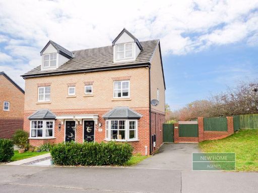 3 bedroom semi-detached house for sale in Jackfield Way Skelmersdale, WN8 6EU, WN8 — £240,000 • 3 bed • 2 bath • 1152 ft²
 4 bedroom detached house for sale in Derby Road, Skelmersdale, Lancashire, WN8 — £250,000 • 4 bed • 2 bath • 1308 ft²
 3 bedroom terraced house for sale in Ashwall Street, Old Skelmersdale, WN8 — £125,000 • 3 bed • 1 bath • 678 ft²
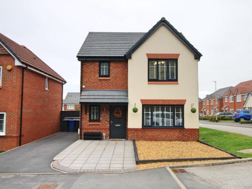 3 bedroom detached house for sale in Oxton Road, Skelmersdale, WN8 — £285,000 • 3 bed • 2 bath • 956 ft²
Meta
- {
"@context": "https://schema.org",
"@type": "Residence",
"name": "3 bedroom end of terrace house for sale in Vines Cross Way,…",
"description": "",
"url": "https://propertypiper.co.uk/property/3f791003-4723-4661-8698-a0ca399286ad",
"image": "https://image-a.propertypiper.co.uk/335e9ea7-a98d-4615-a396-f295afa51959-1024.jpeg",
"address": {
"@type": "PostalAddress",
"streetAddress": "53 VINES CROSS WAY SKELMERSDALE",
"postalCode": "WN8 6HN",
"addressLocality": "West Lancashire",
"addressRegion": "West Lancashire",
"addressCountry": "England"
},
"geo": {
"@type": "GeoCoordinates",
"latitude": 53.56991752629995,
"longitude": -2.7790066041265042
},
"numberOfRooms": 3,
"numberOfBathroomsTotal": 2,
"floorSize": {
"@type": "QuantitativeValue",
"value": 776,
"unitCode": "FTK"
},
"offers": {
"@type": "Offer",
"price": 210000,
"priceCurrency": "GBP",
"availability": "https://schema.org/InStock"
},
"additionalProperty": [
{
"@type": "PropertyValue",
"name": "Feature",
"value": "semi-detached"
},
{
"@type": "PropertyValue",
"name": "Feature",
"value": "modern"
},
{
"@type": "PropertyValue",
"name": "Feature",
"value": "red brick"
},
{
"@type": "PropertyValue",
"name": "Feature",
"value": "two-storey"
},
{
"@type": "PropertyValue",
"name": "Feature",
"value": "double-glazed windows"
},
{
"@type": "PropertyValue",
"name": "Feature",
"value": "traditional roof"
},
{
"@type": "PropertyValue",
"name": "Feature",
"value": "bay window"
},
{
"@type": "PropertyValue",
"name": "Feature",
"value": "suburban"
},
{
"@type": "PropertyValue",
"name": "Feature",
"value": "new build"
},
{
"@type": "PropertyValue",
"name": "Feature",
"value": "residential"
},
{
"@type": "PropertyValue",
"name": "Feature",
"value": "modern"
},
{
"@type": "PropertyValue",
"name": "Feature",
"value": "semi-detached"
},
{
"@type": "PropertyValue",
"name": "Feature",
"value": "brick"
},
{
"@type": "PropertyValue",
"name": "Feature",
"value": "driveway"
},
{
"@type": "PropertyValue",
"name": "Feature",
"value": "two-storey"
},
{
"@type": "PropertyValue",
"name": "Feature",
"value": "family home"
},
{
"@type": "PropertyValue",
"name": "Feature",
"value": "residential"
},
{
"@type": "PropertyValue",
"name": "Feature",
"value": "new build"
},
{
"@type": "PropertyValue",
"name": "Feature",
"value": "garden"
}
]
}
High Res Floorplan Images
Compatible Floorplan Images
FloorplanImages Thumbnail