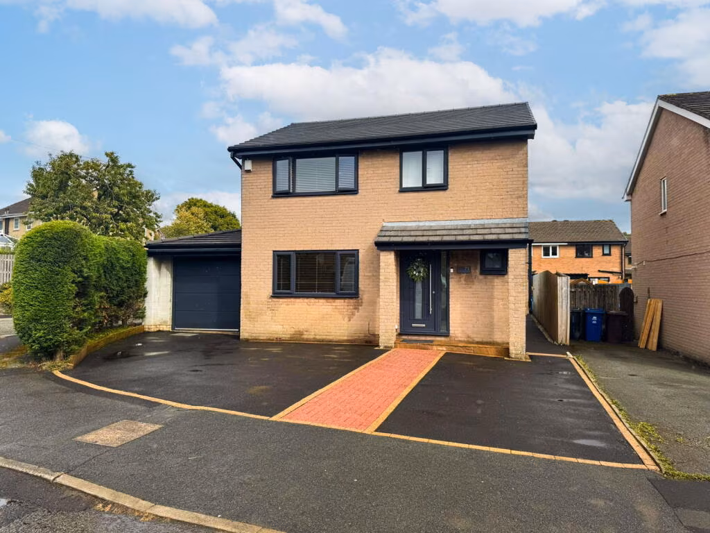
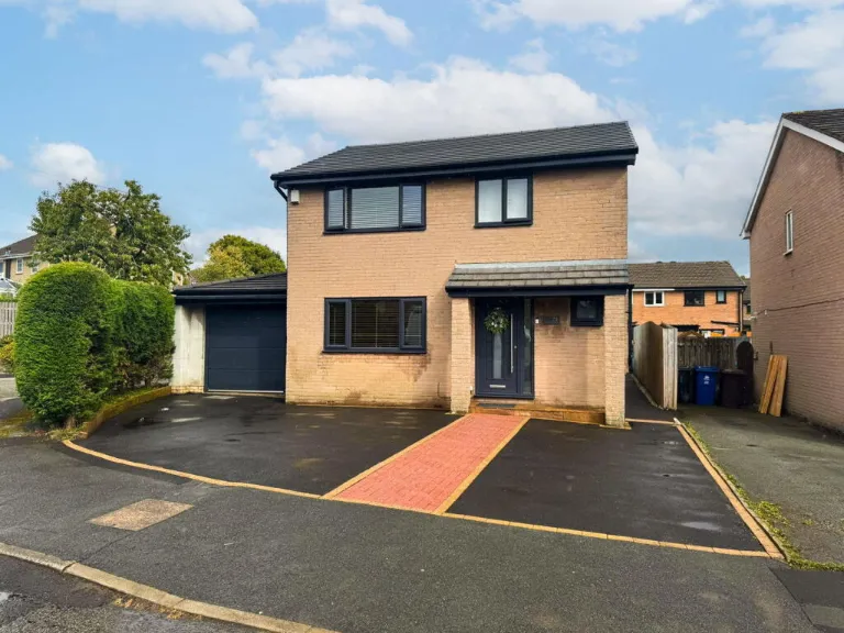
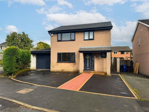
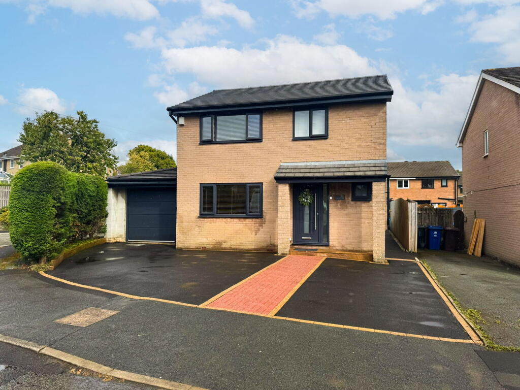
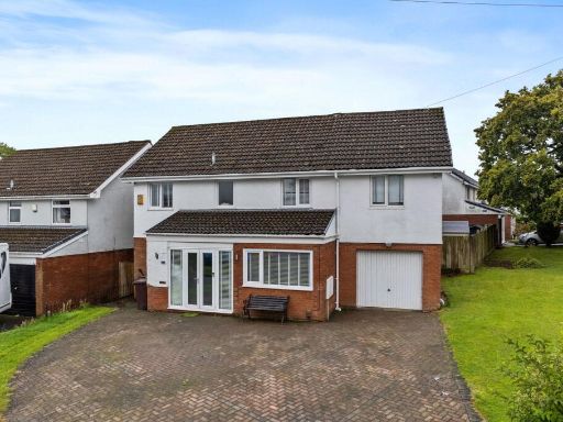
BB12 8AT - 4 bedroom detached house for sale in Castlerigg Drive, Burn…
View on Property Piper
4 bedroom detached house for sale in Castlerigg Drive, Burnley, Lancashire, BB12 8AT, BB12
Property Details
- Price: £375000
- Bedrooms: 4
- Bathrooms: 2
- Property Type: undefined
- Property SubType: undefined
Image Descriptions
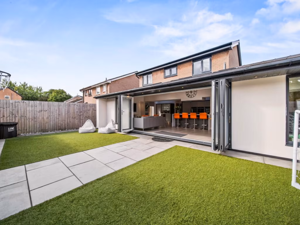
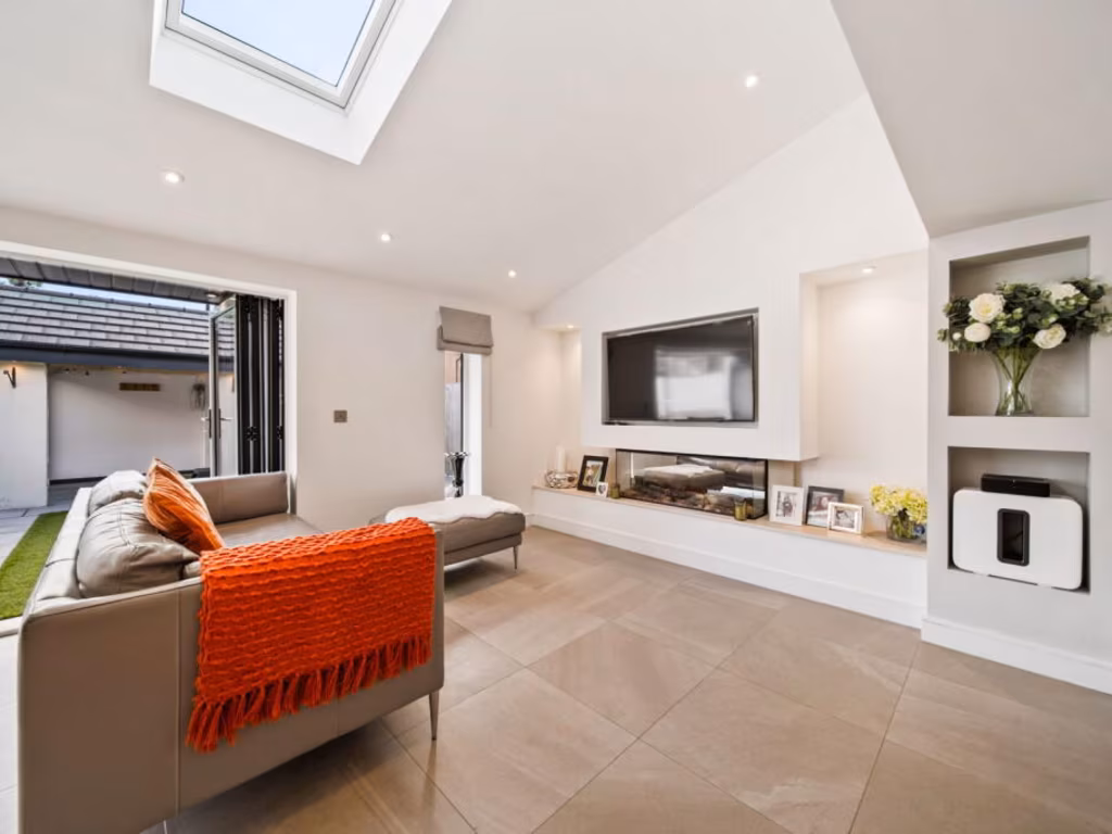
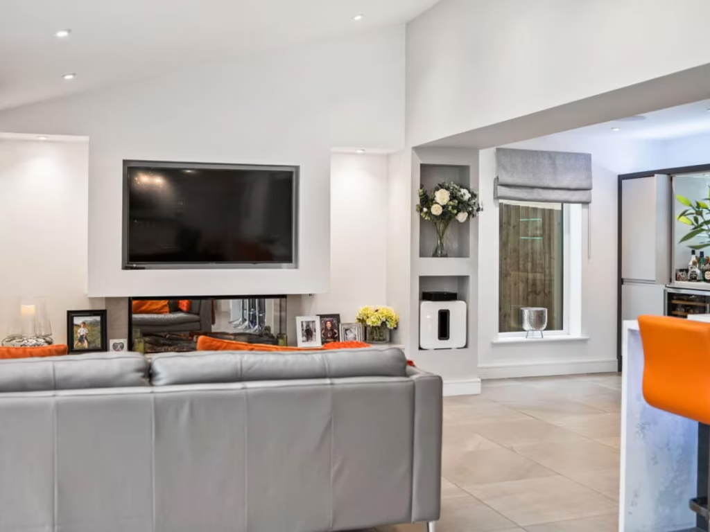
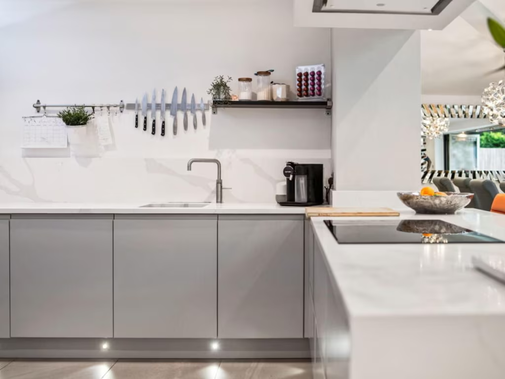
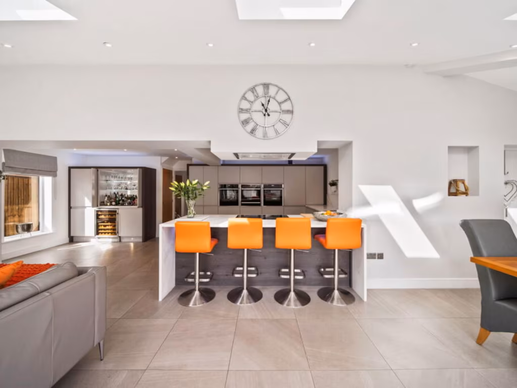
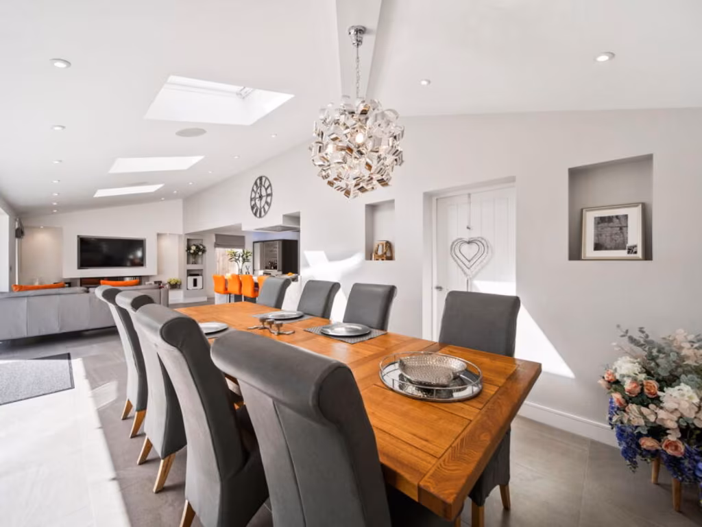
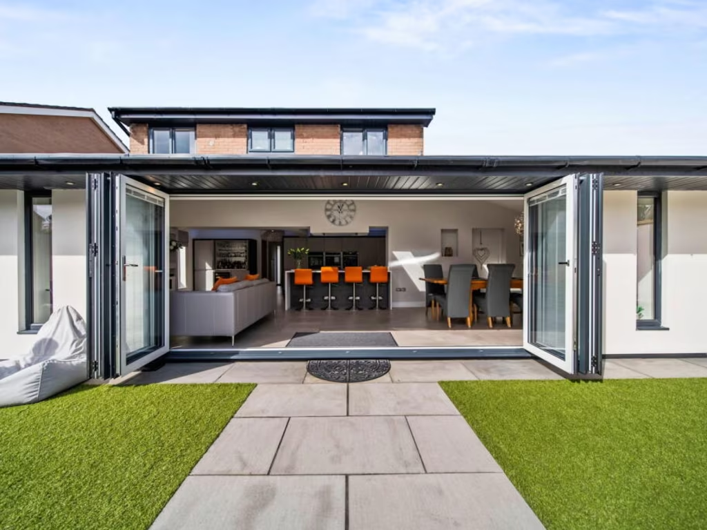
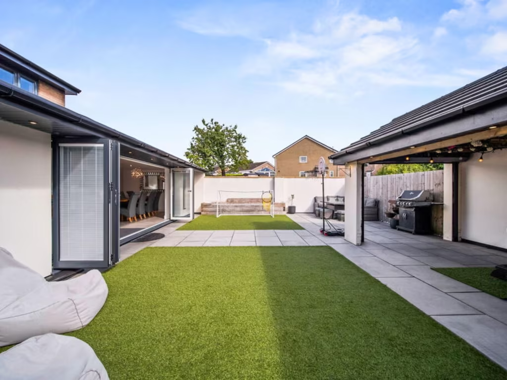
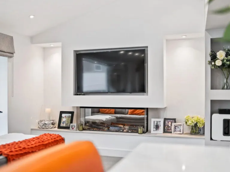
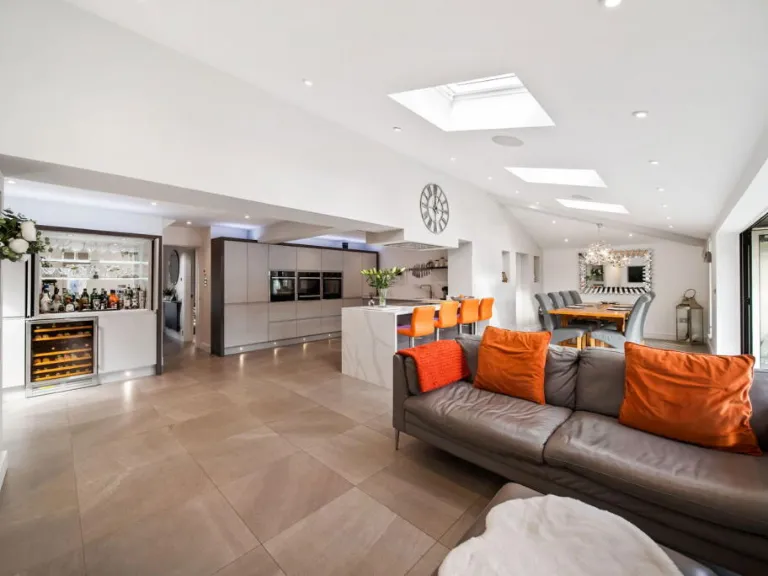
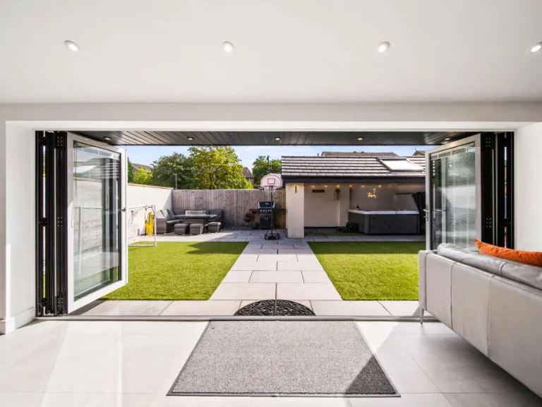
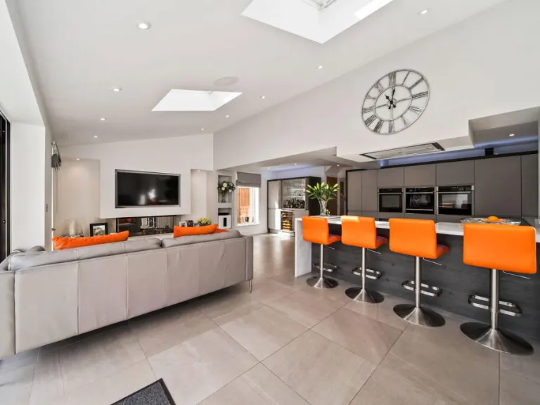
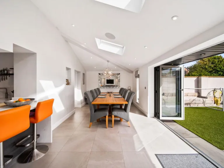
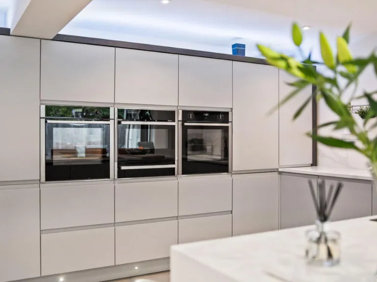
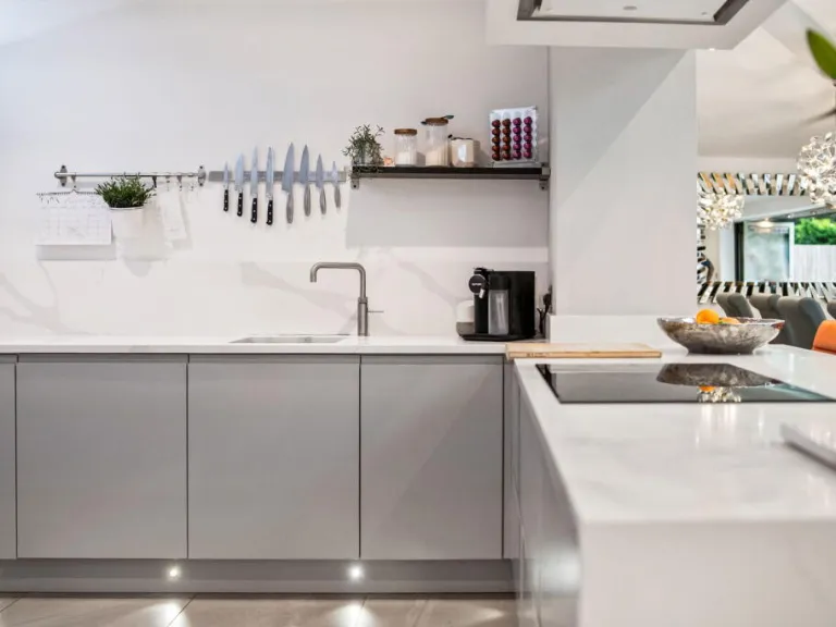
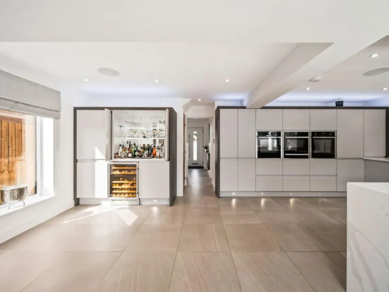
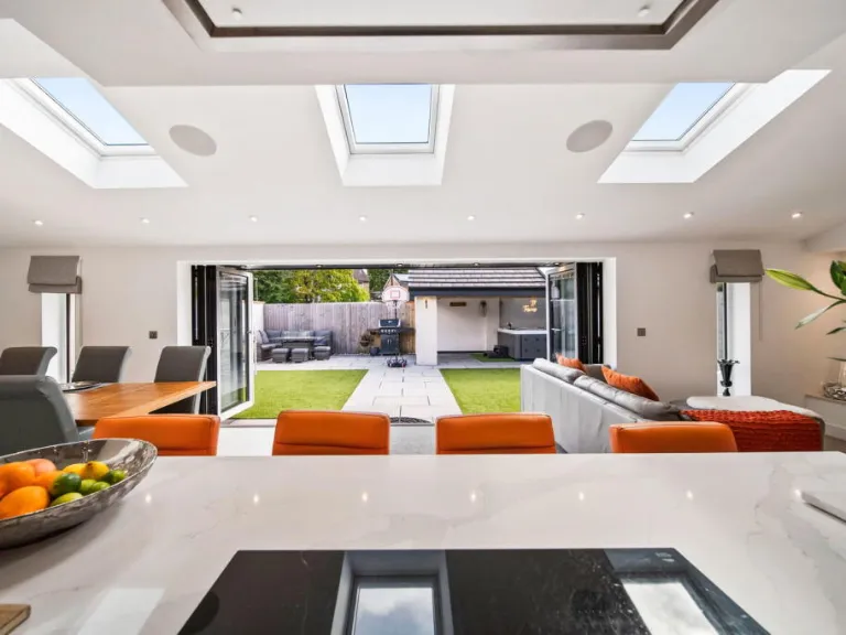
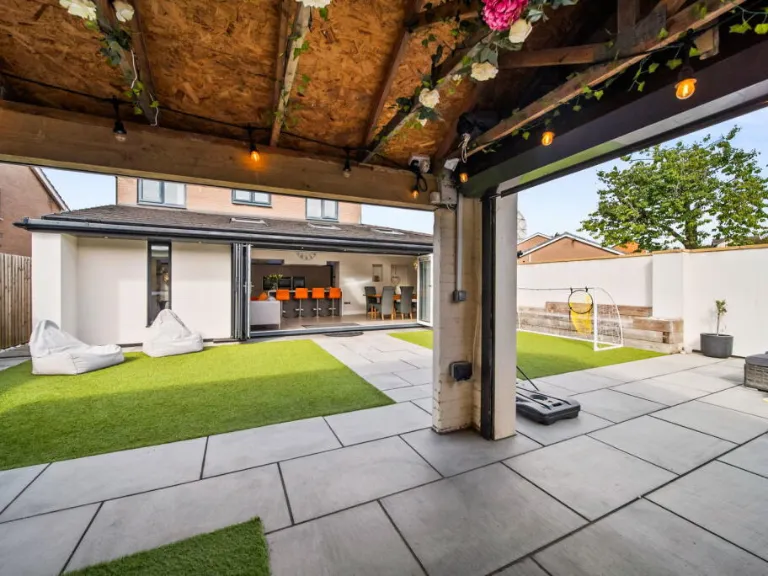
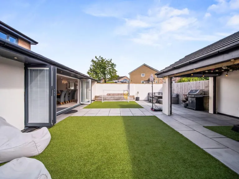
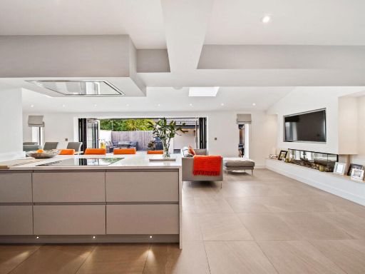
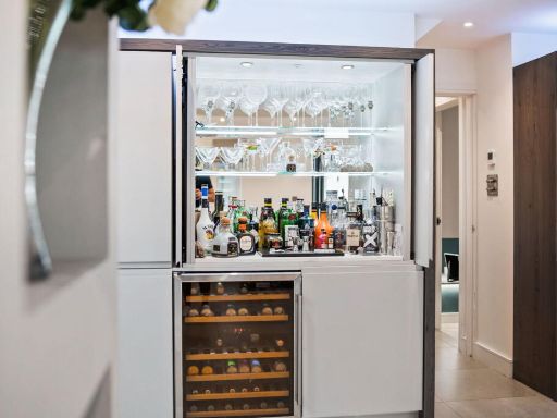
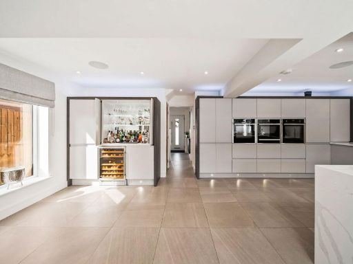
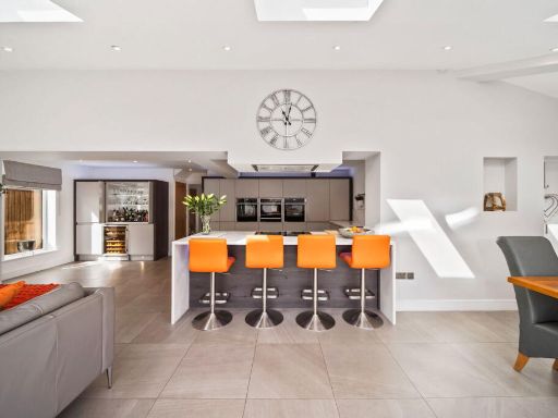
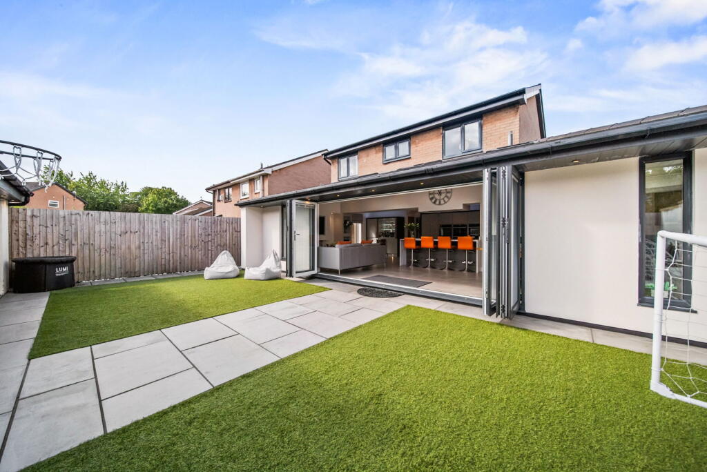
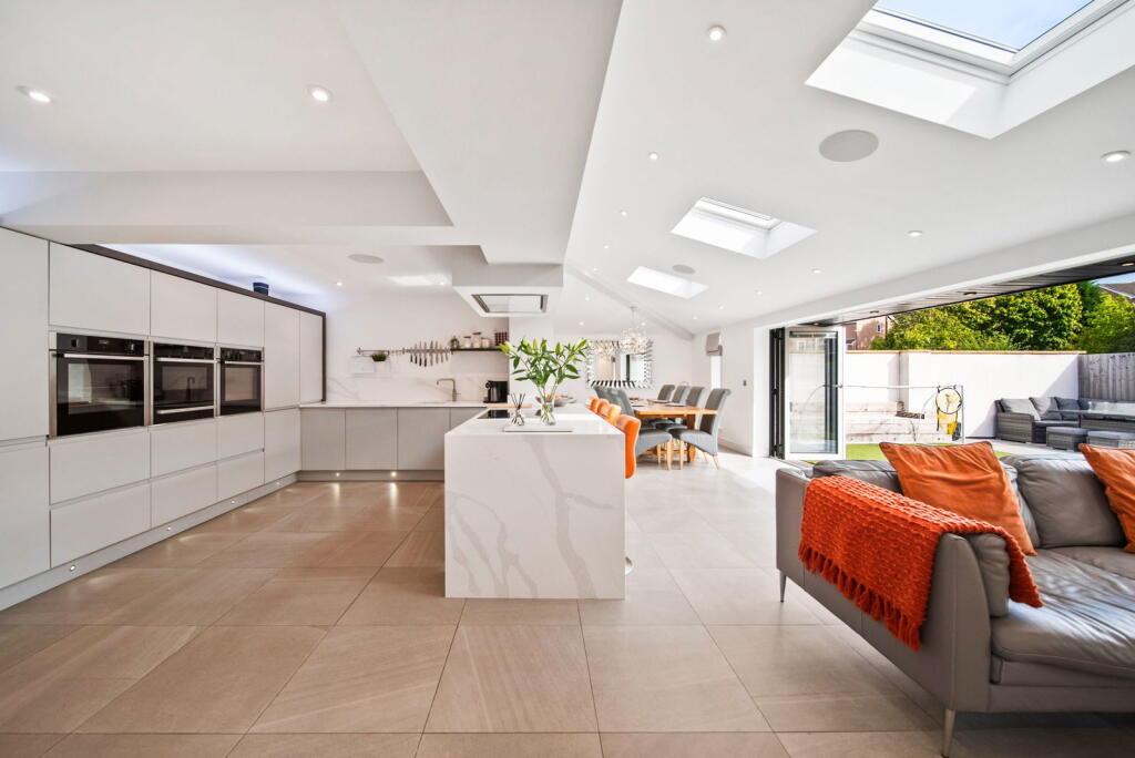
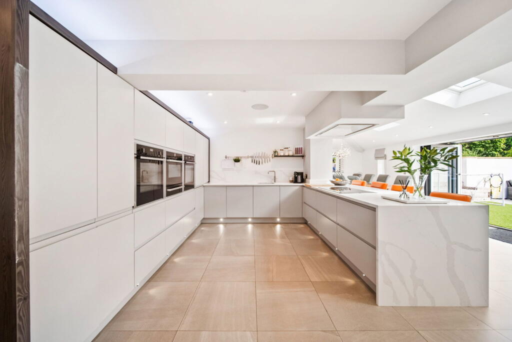
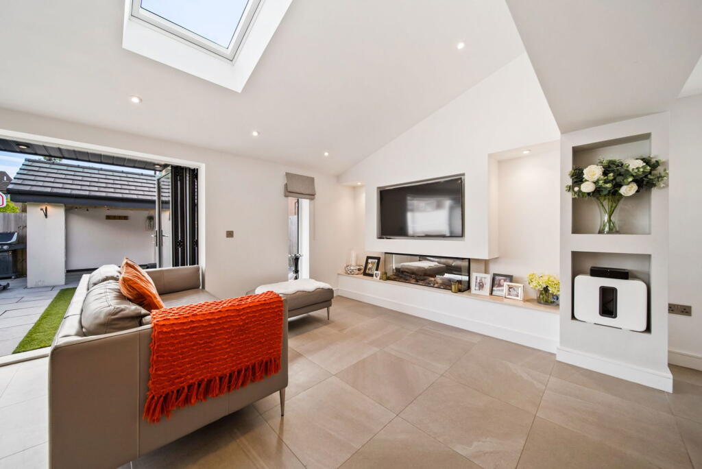
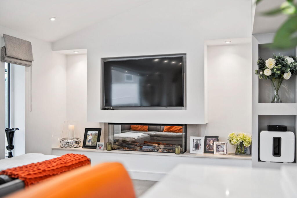
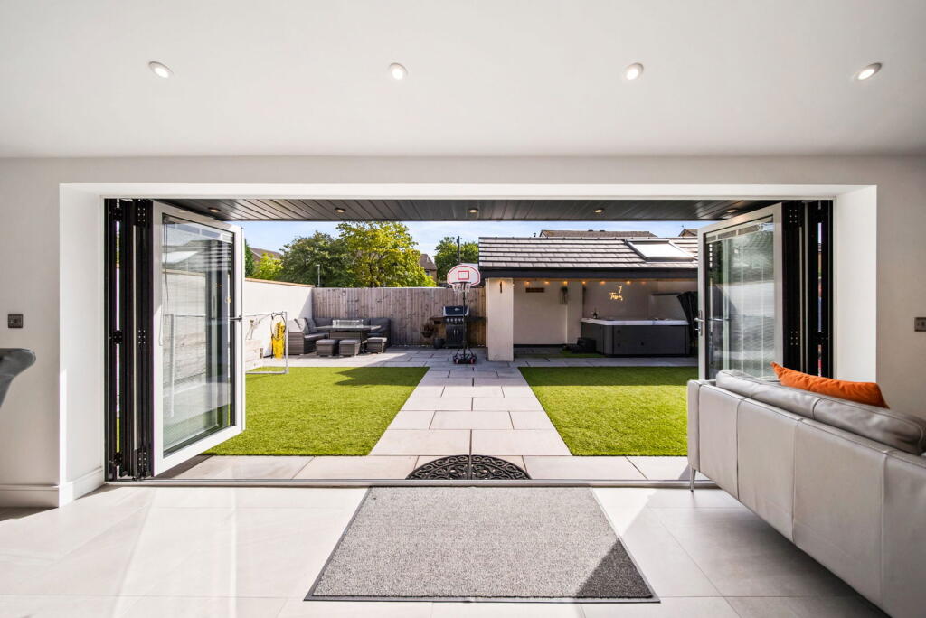
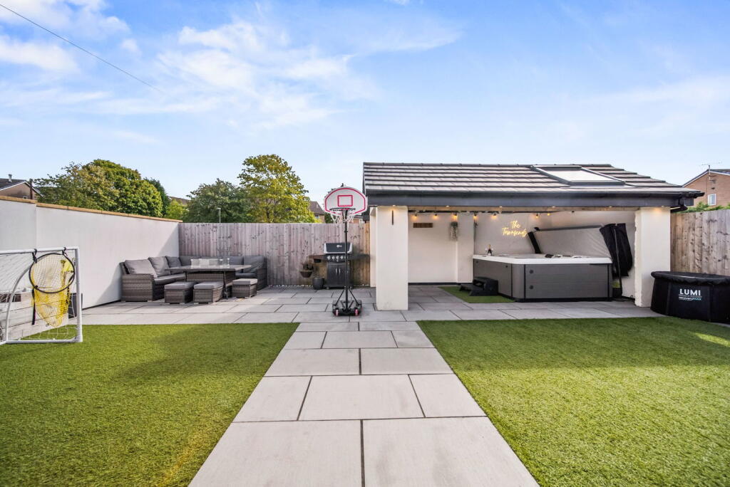
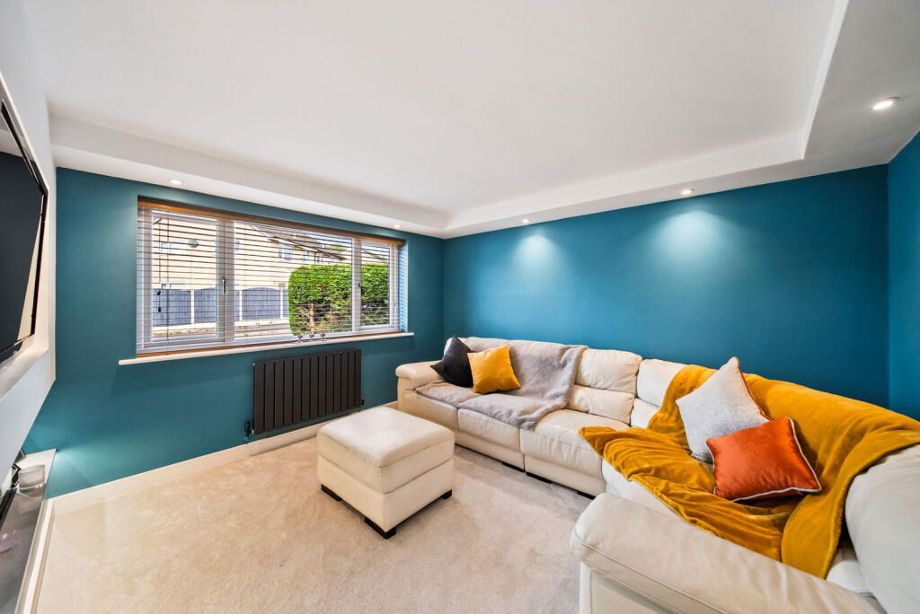
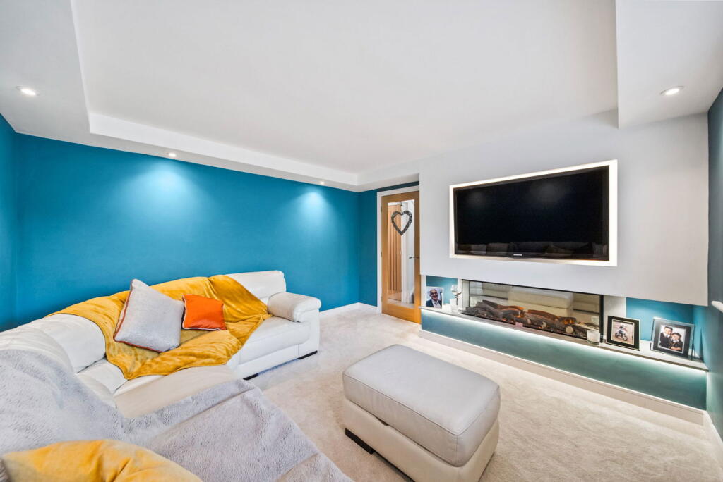
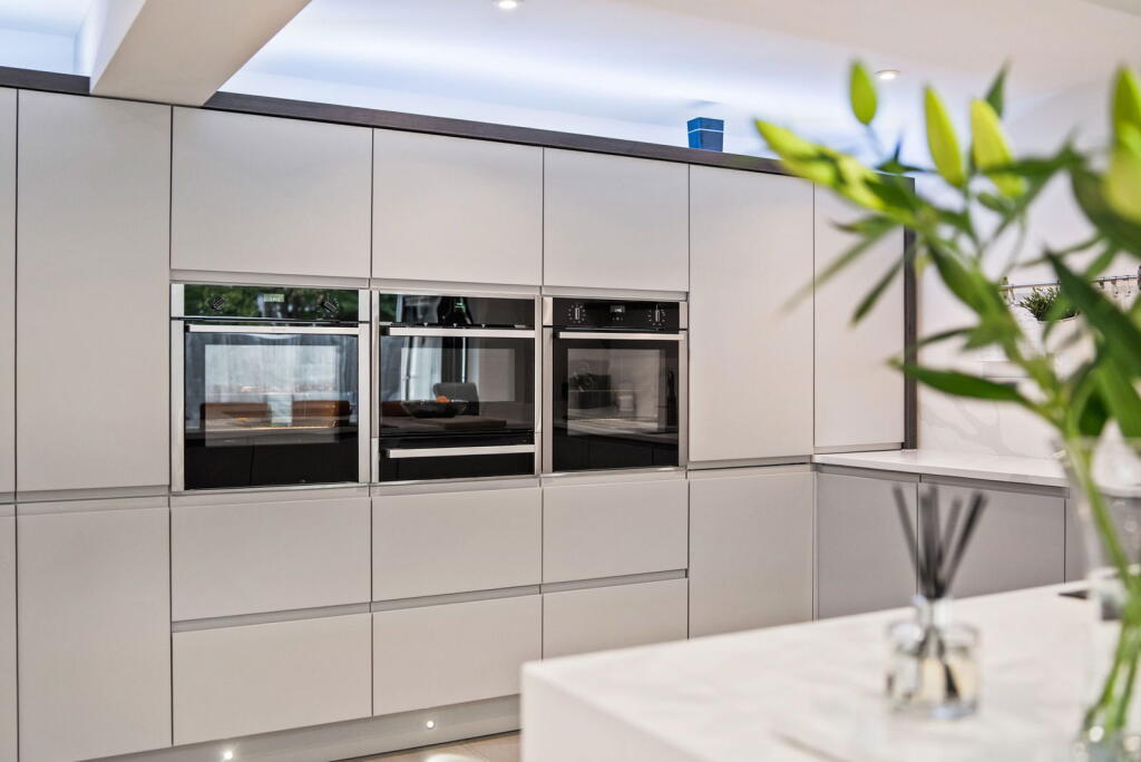
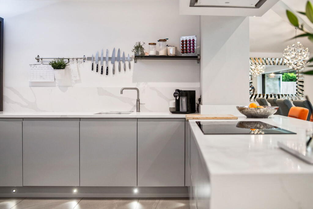
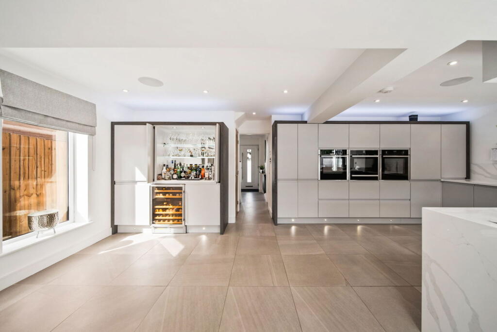
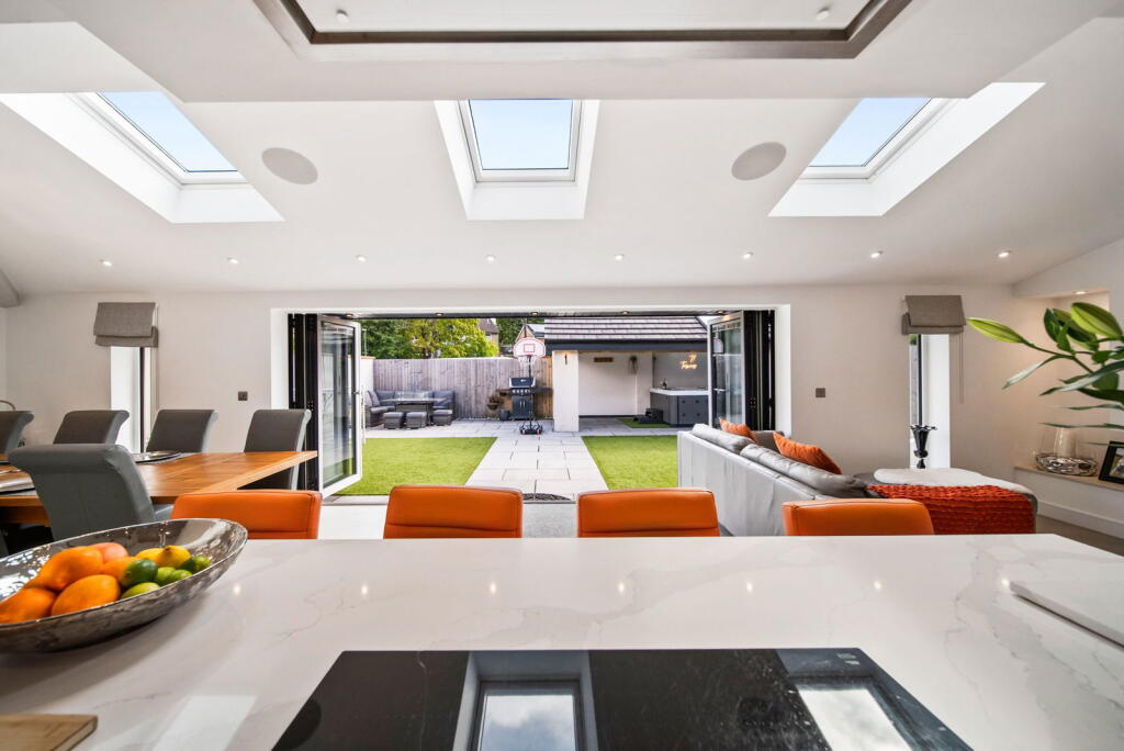
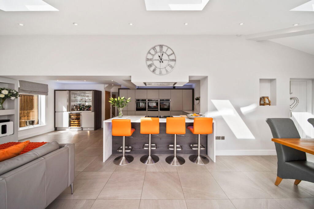
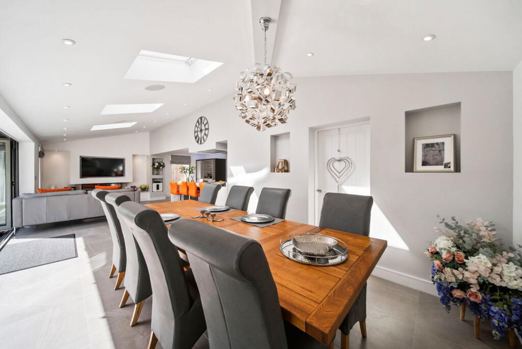
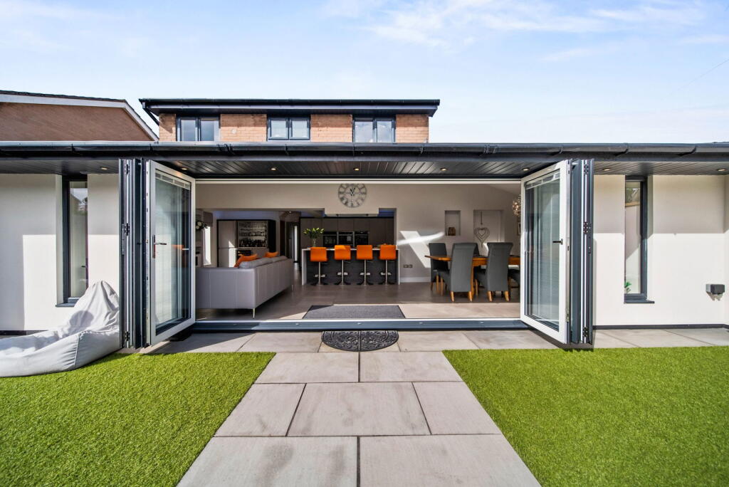
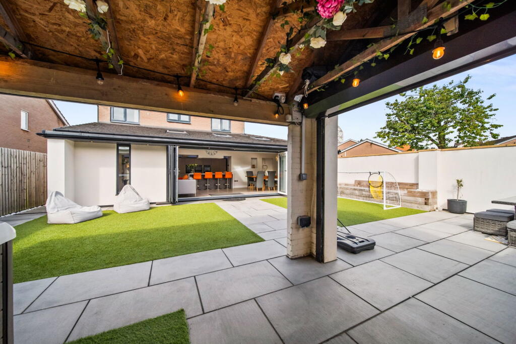
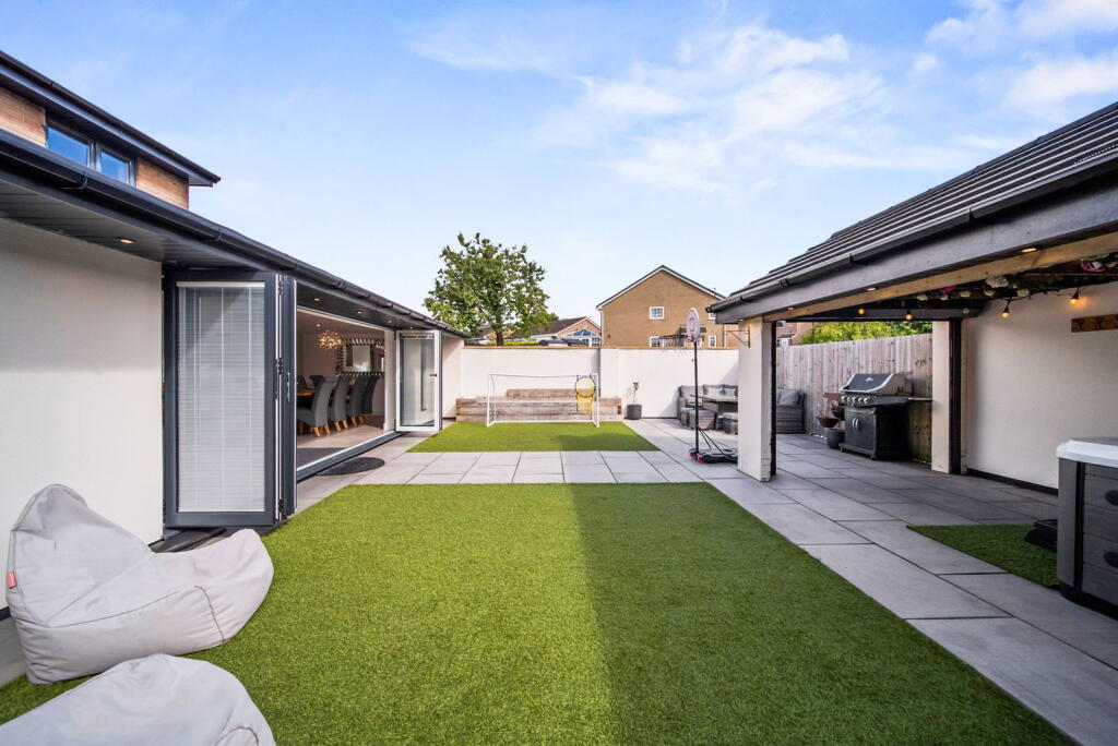
- modern extension with open plan kitchen contemporary
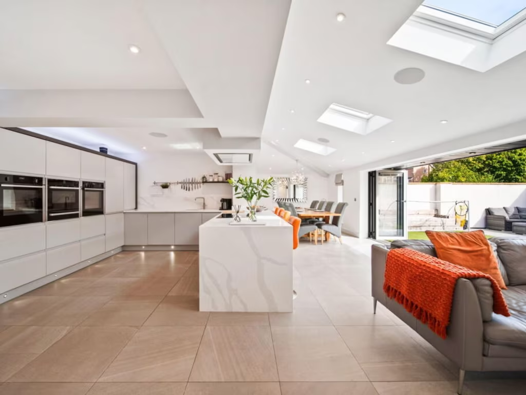
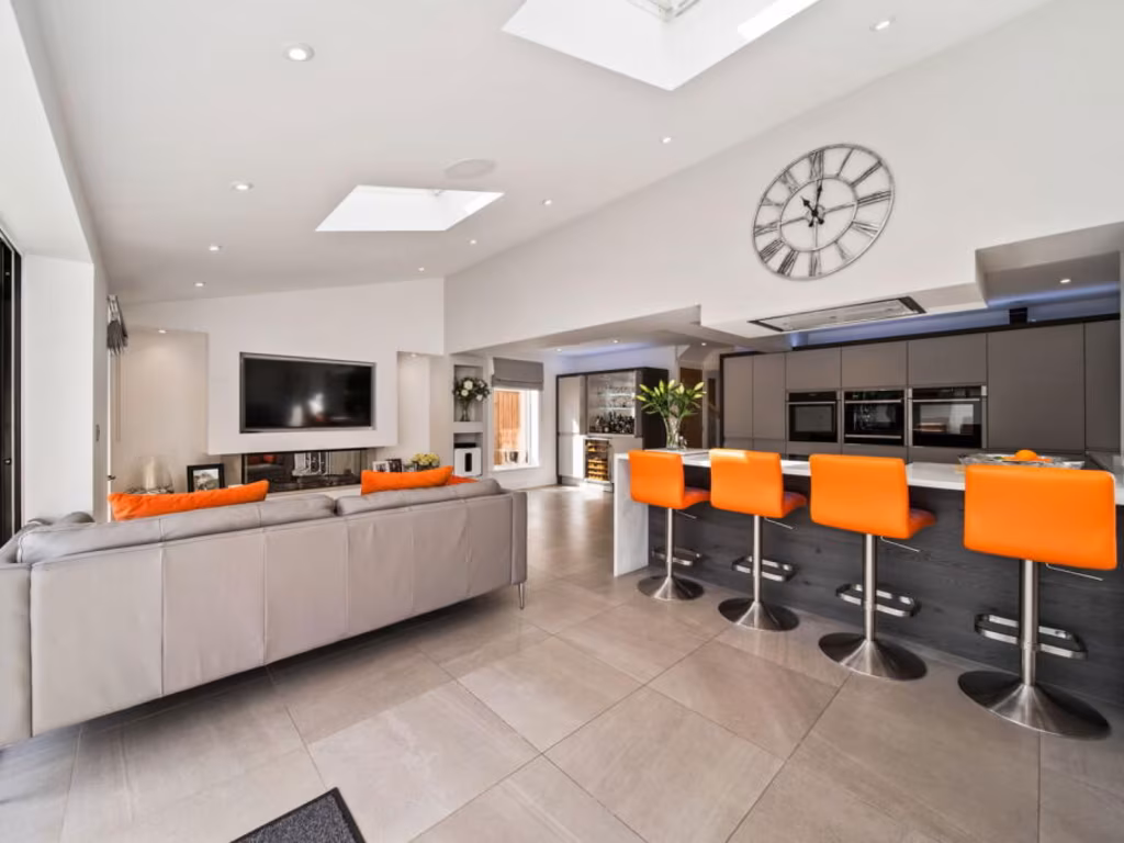
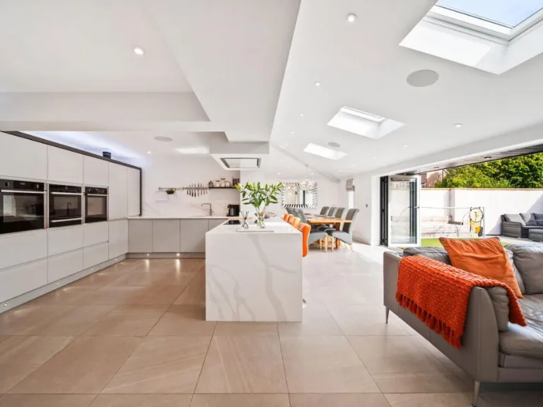
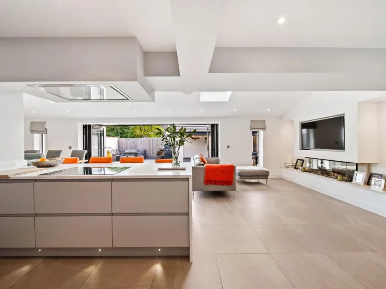
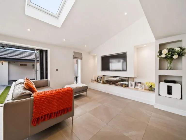
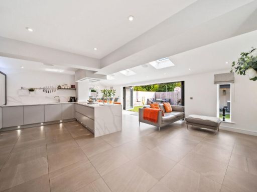
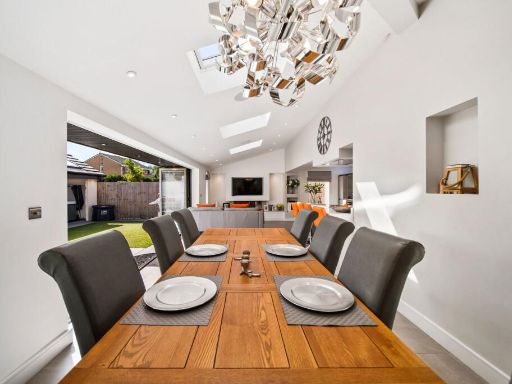
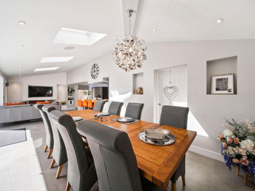
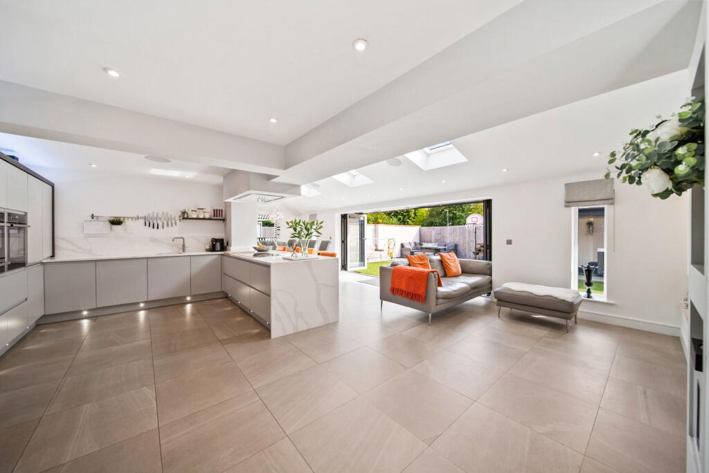
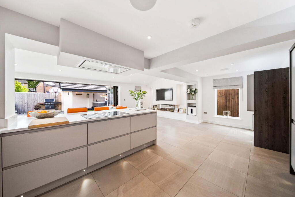
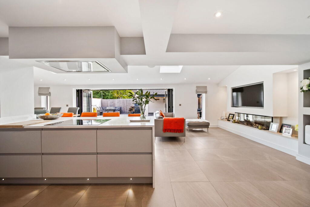
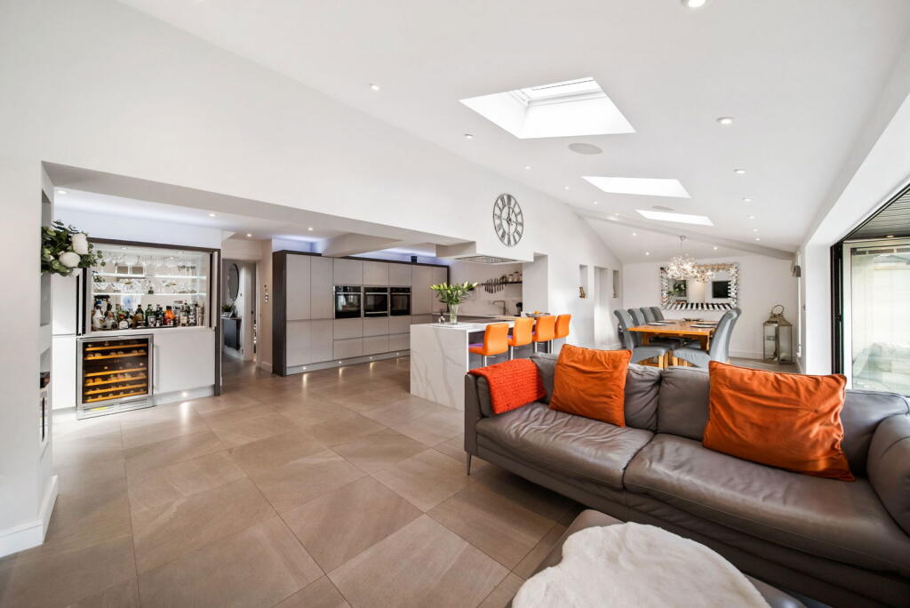
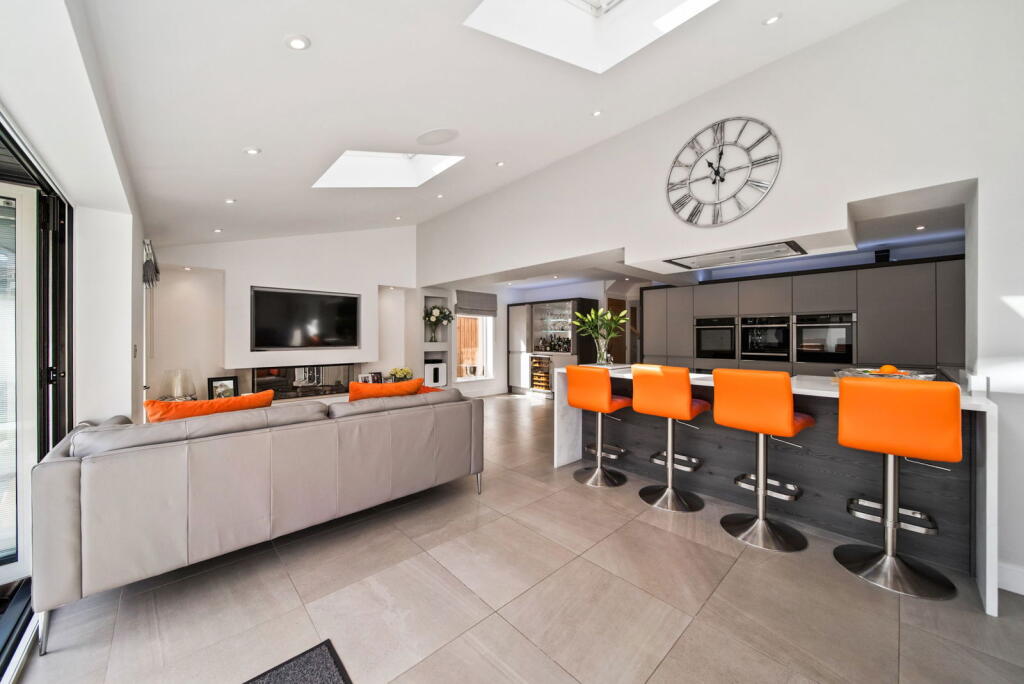
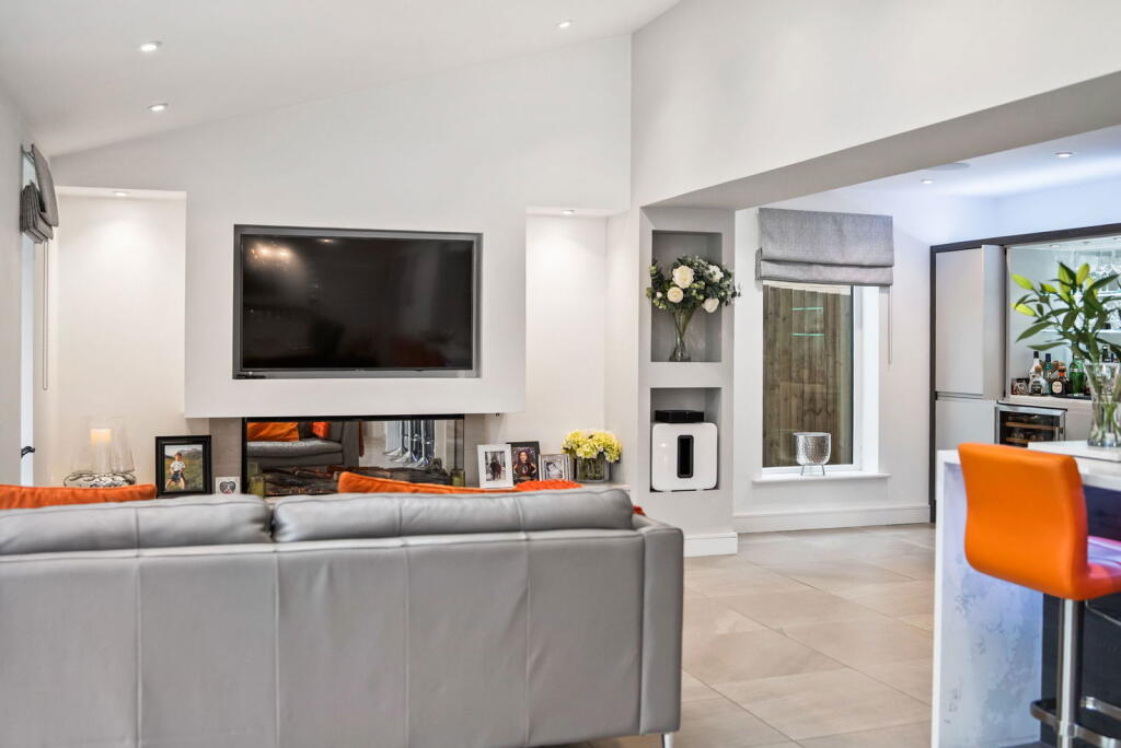
- modern kitchen and living area contemporary
Floorplan Description
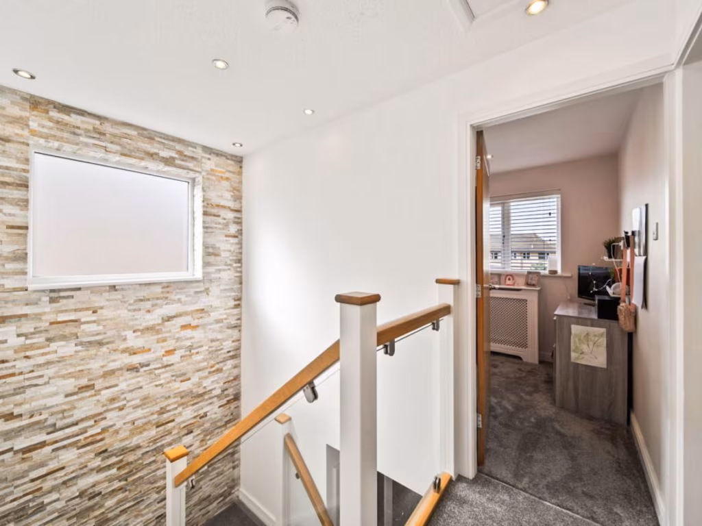
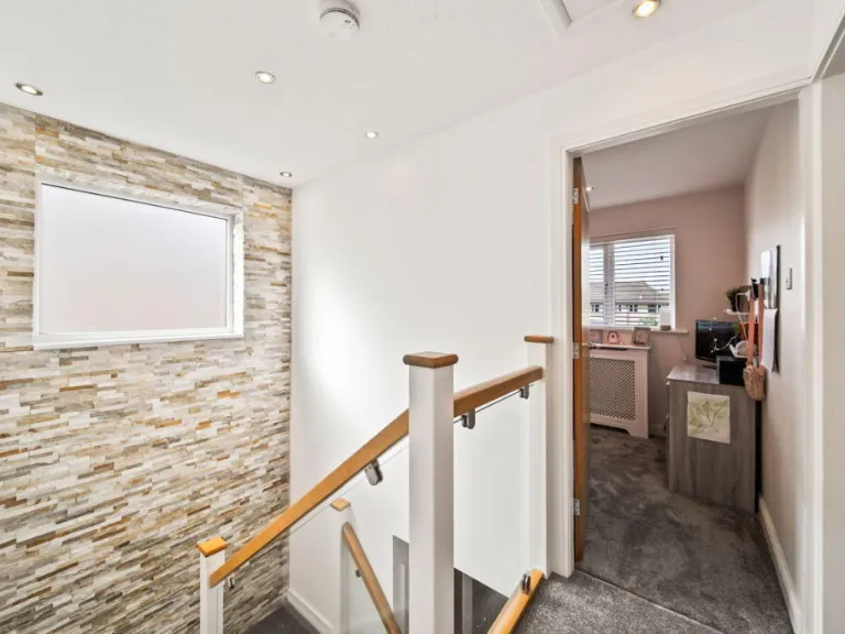
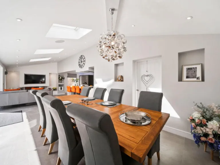
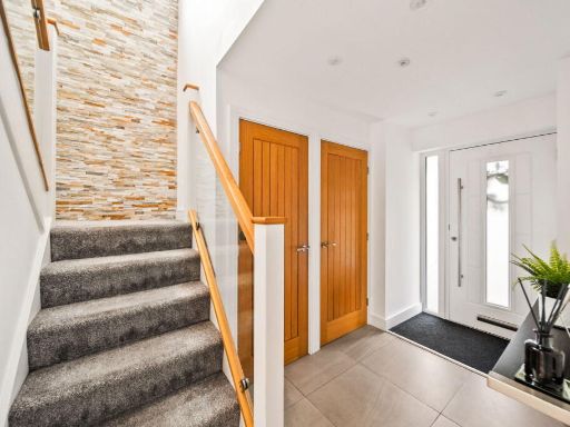
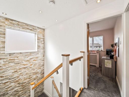
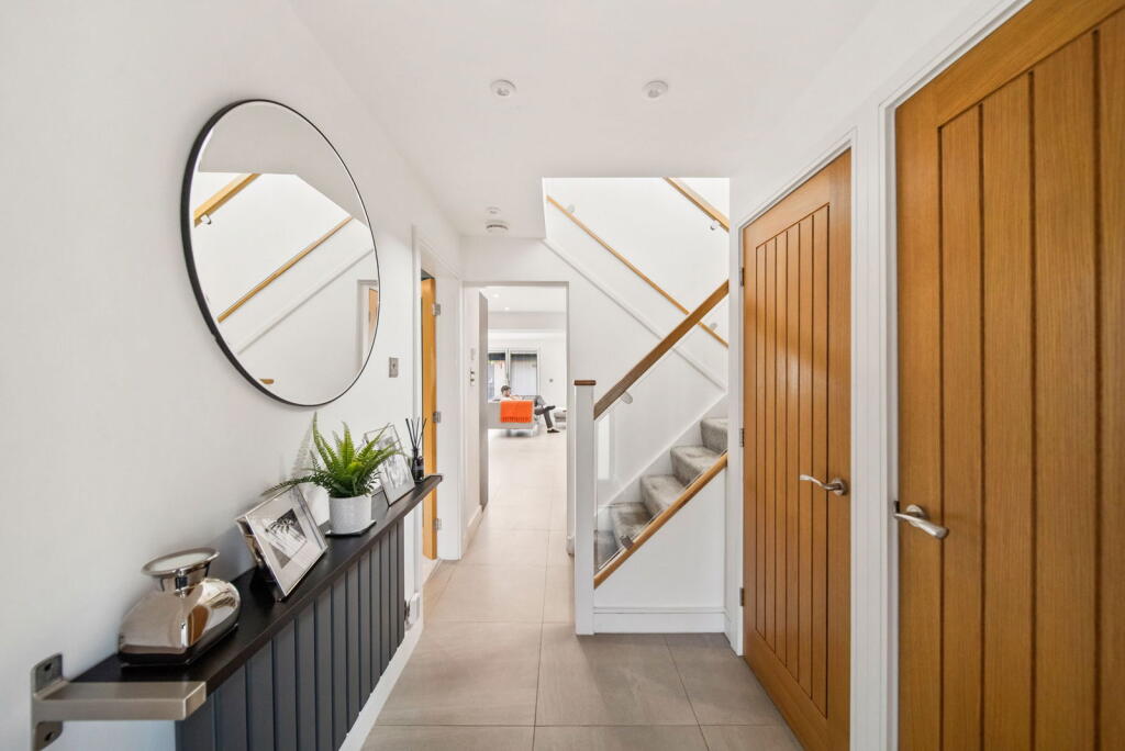
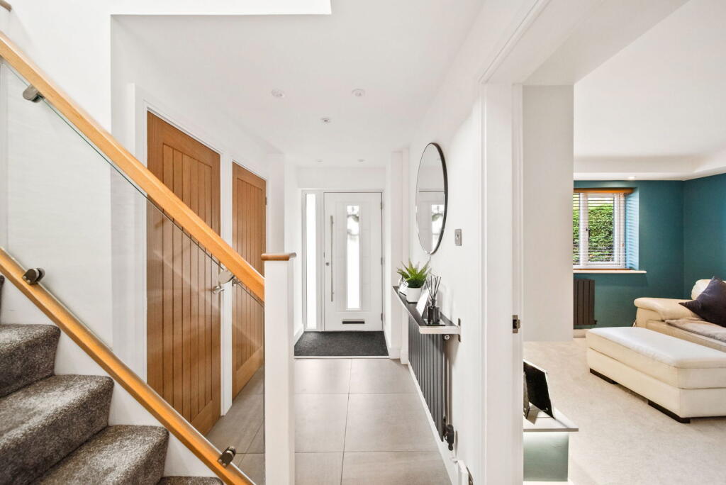
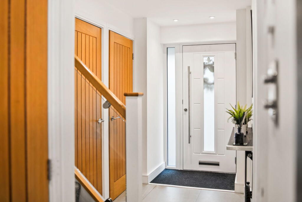
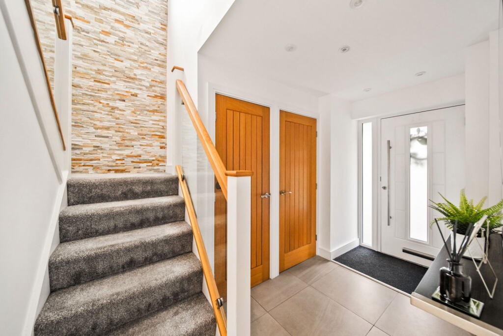
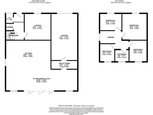
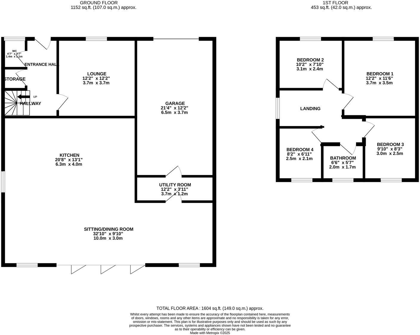
- Two-storey residential property with large open sitting/dining area, separate kitchen, garage and four bedrooms.
Rooms
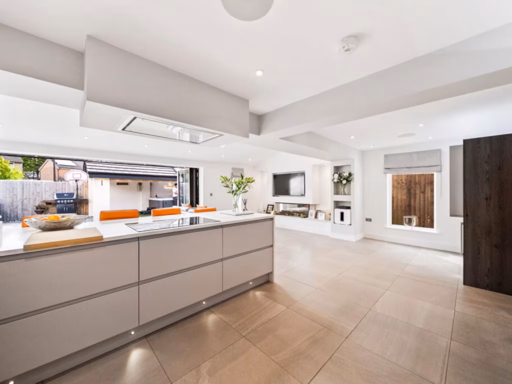
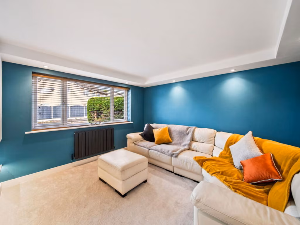
- LOUNGE:
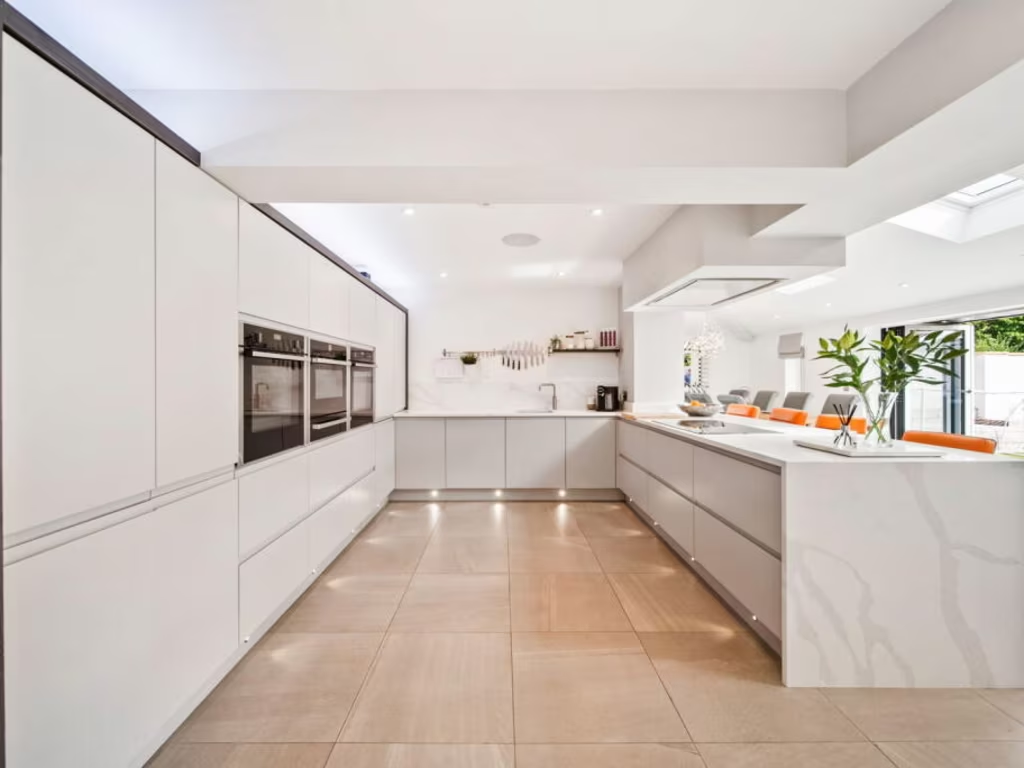
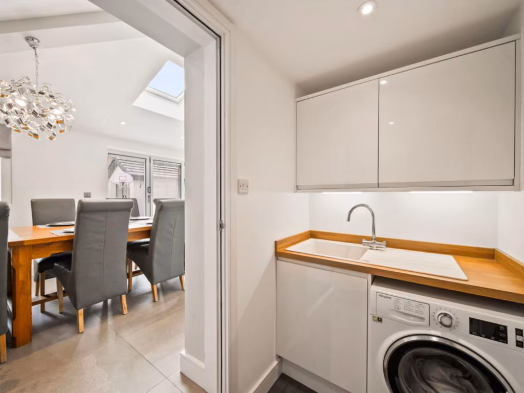
- KITCHEN:
- SITTING/DINING ROOM:
- GARAGE:
- UTILITY ROOM:
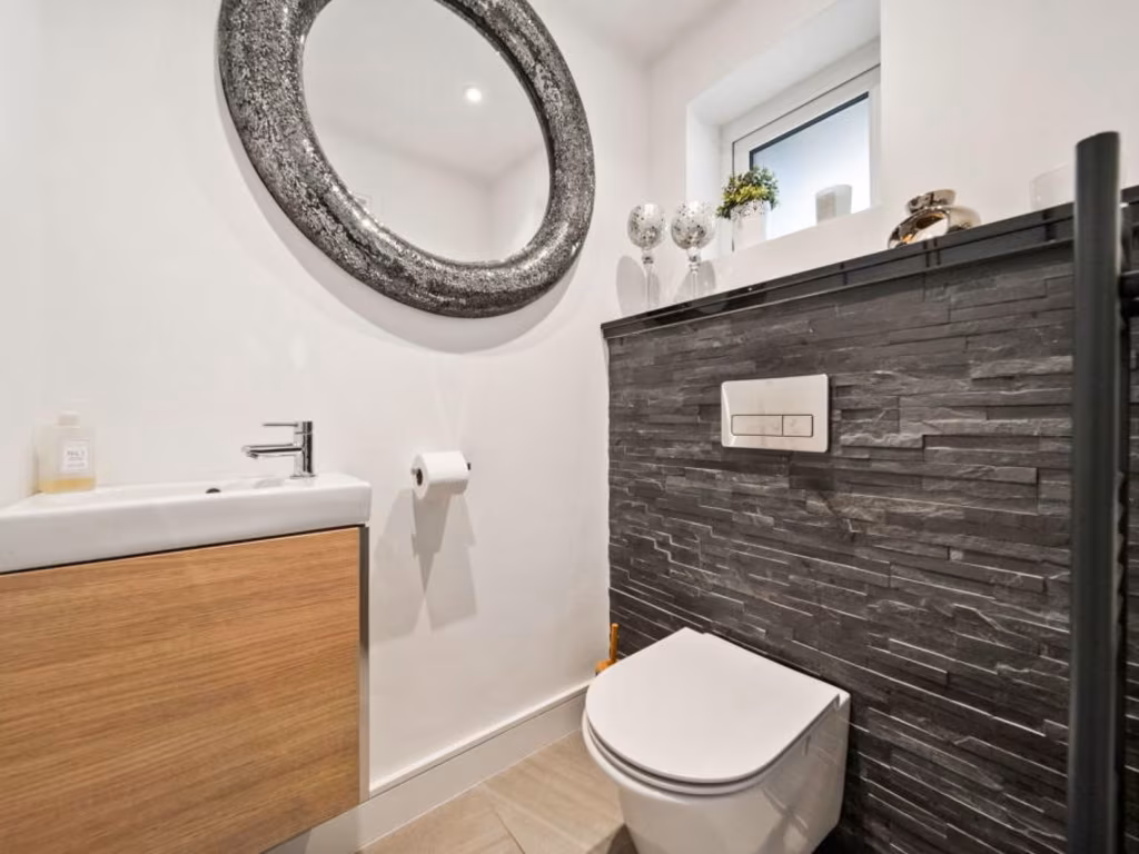
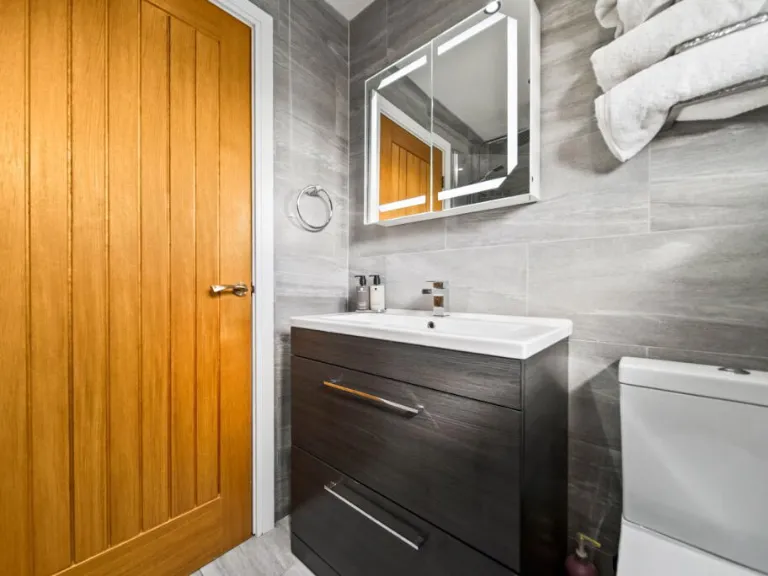
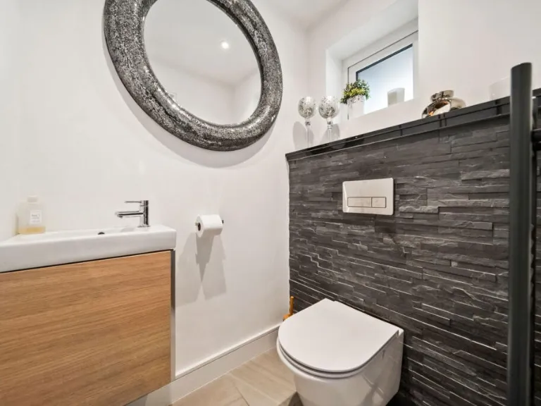
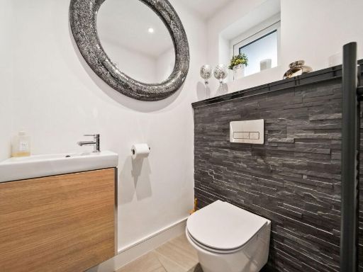
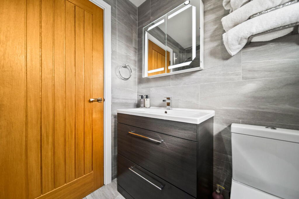
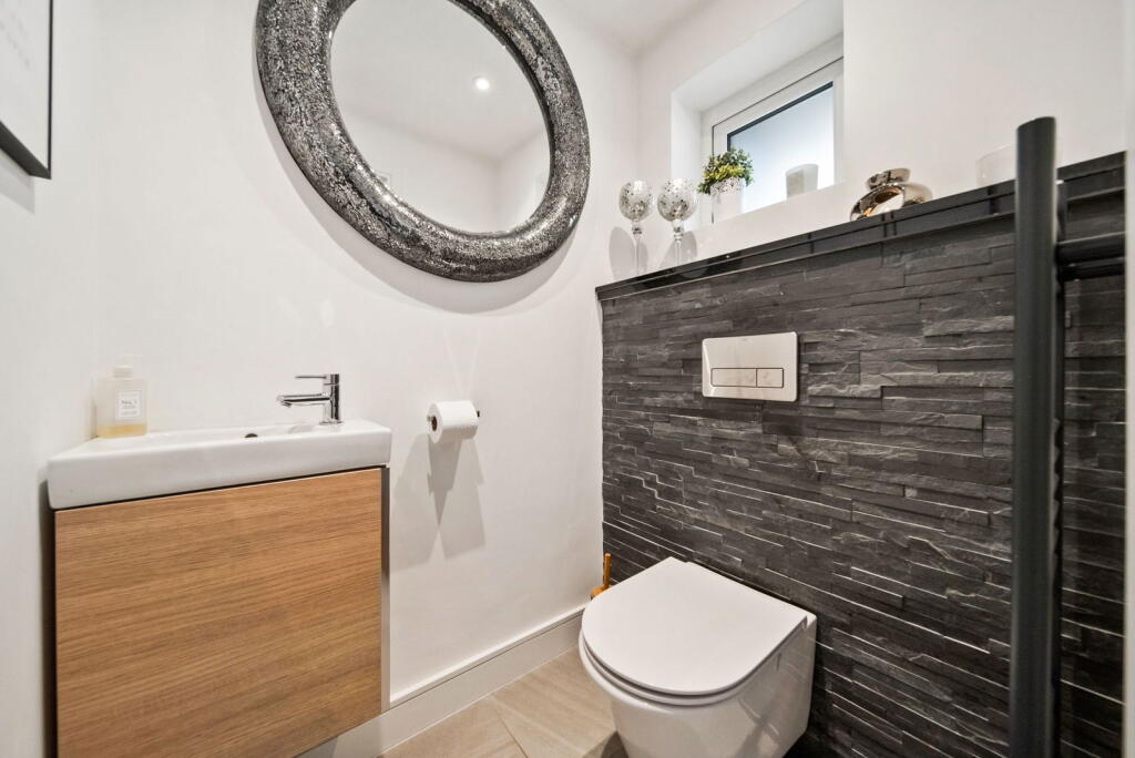
- WC:
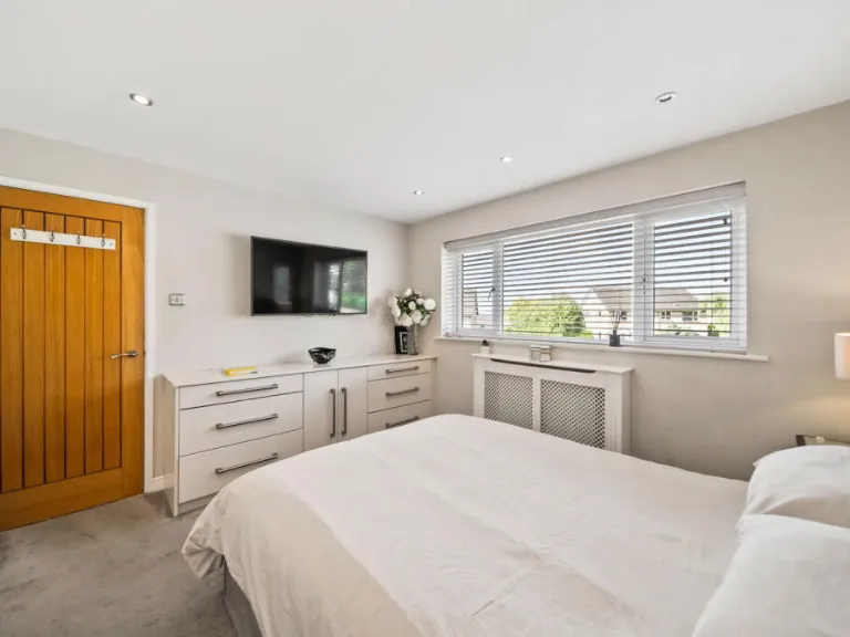
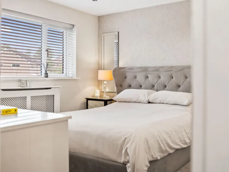
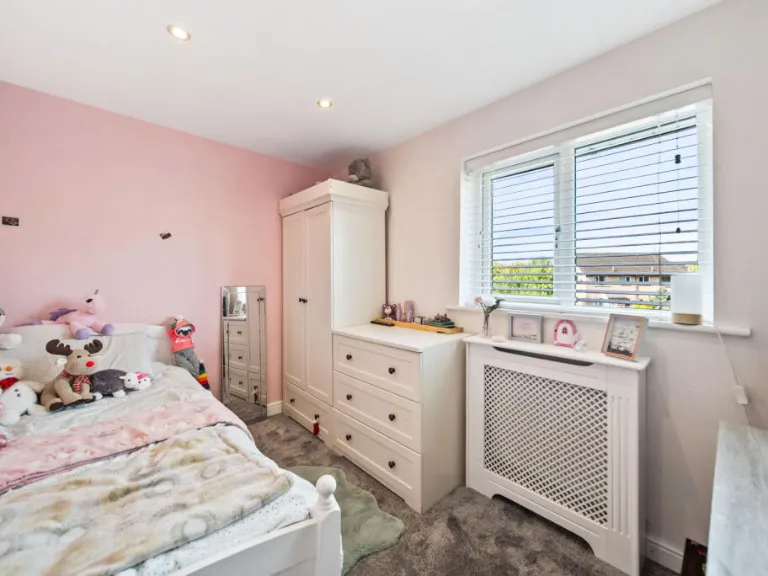
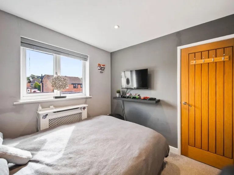
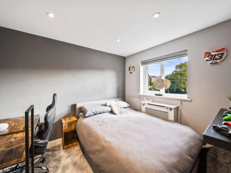
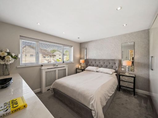
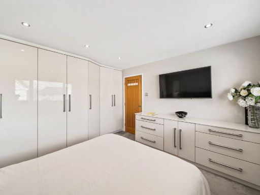
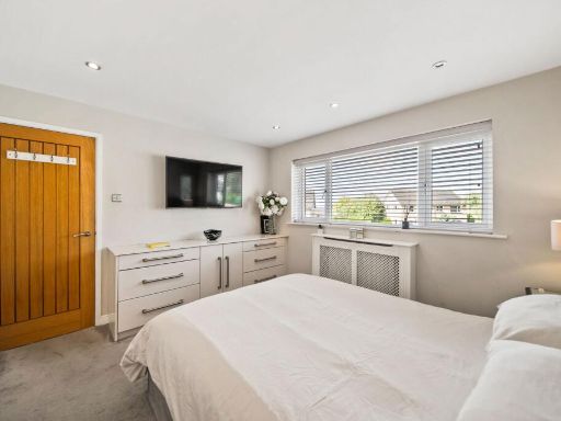
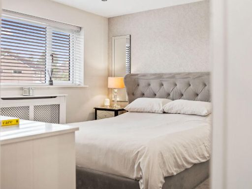
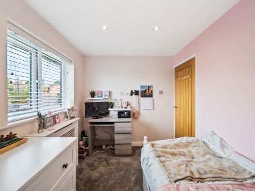
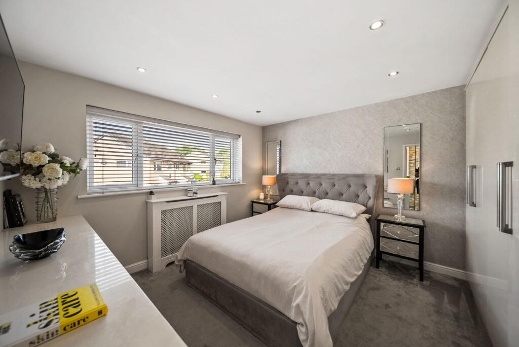
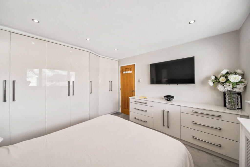
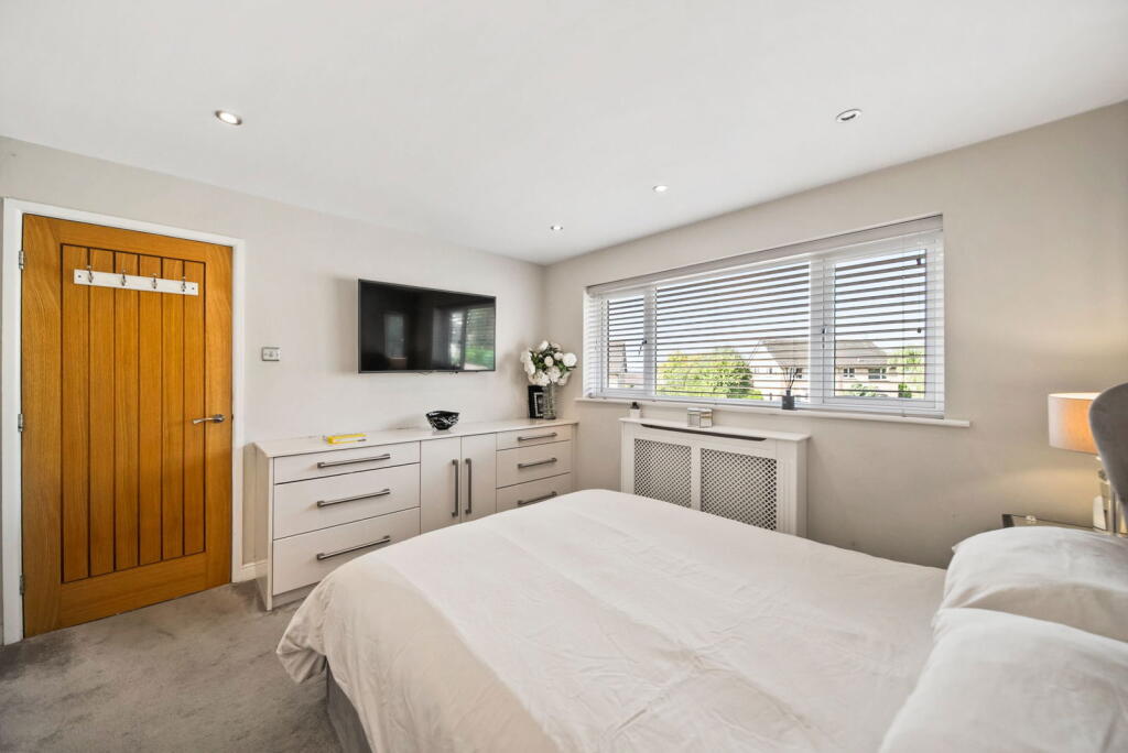
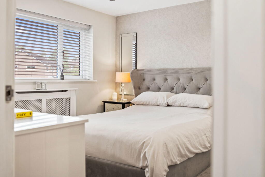
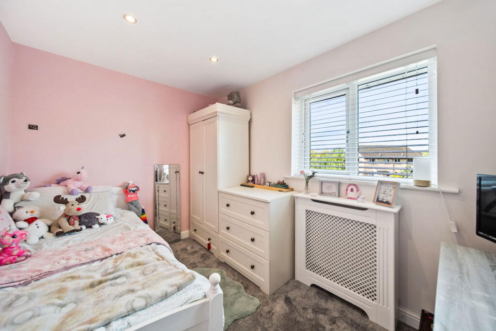
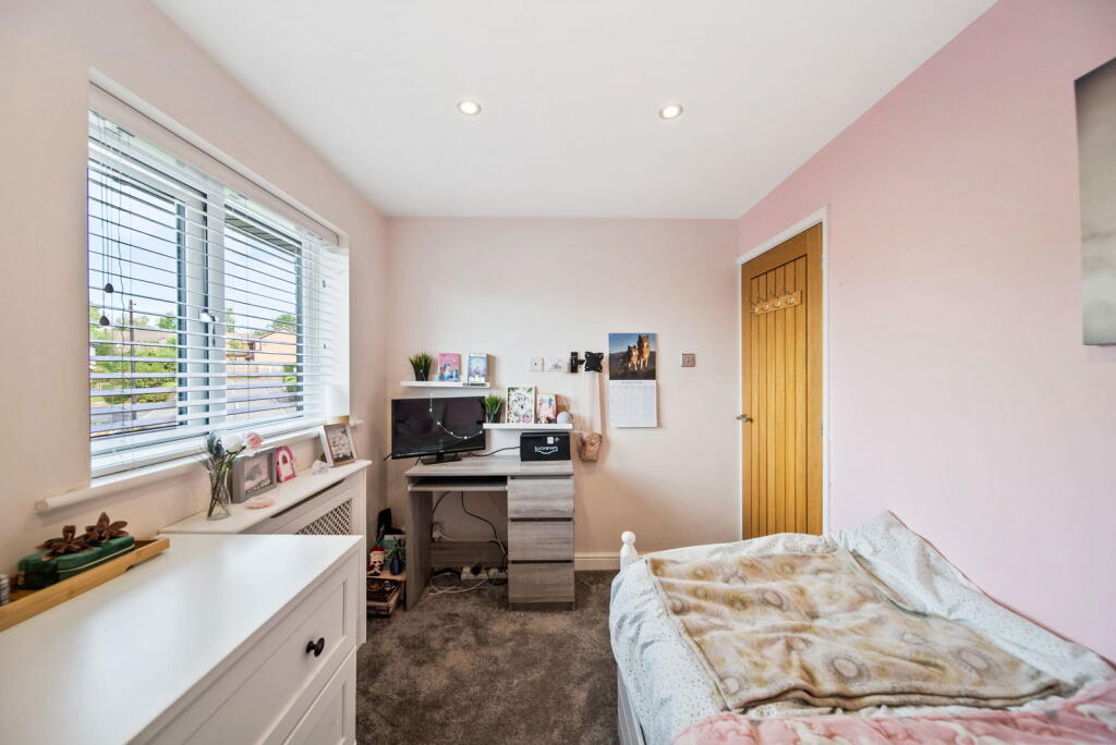
- BEDROOM 1:
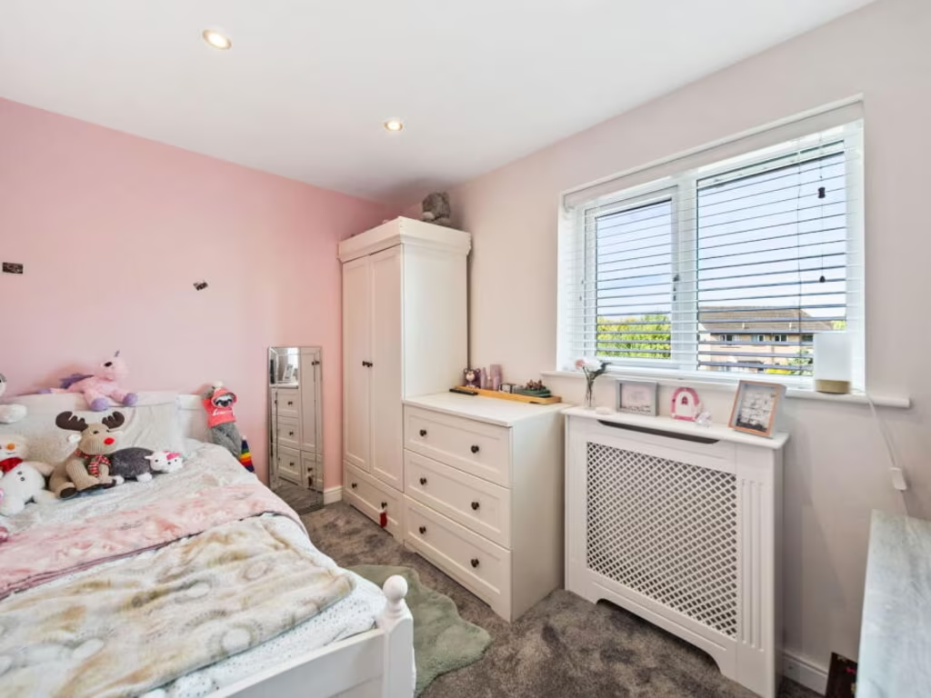
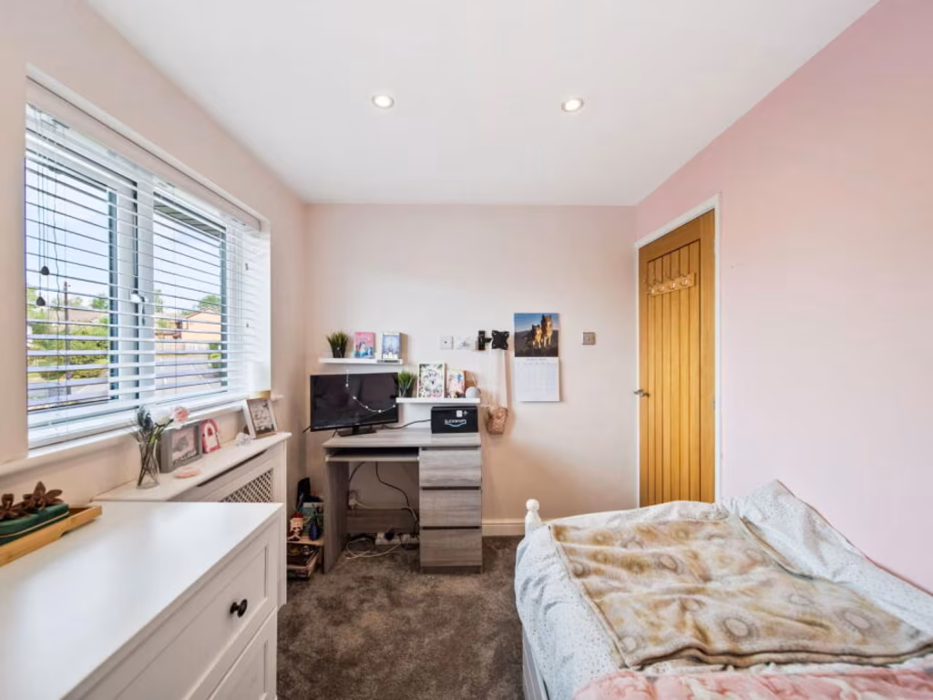
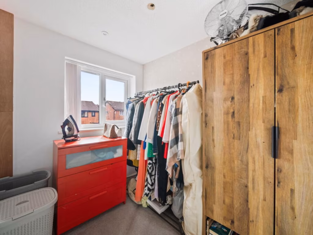
- BEDROOM 2:
- BEDROOM 3:
- BEDROOM 4:
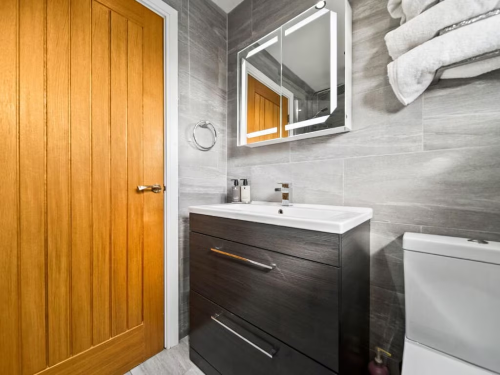
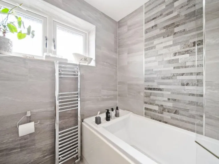
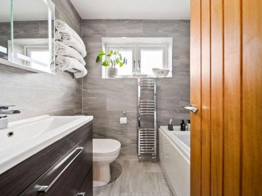
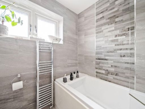
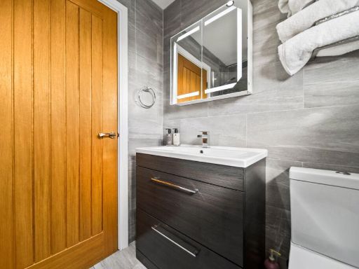
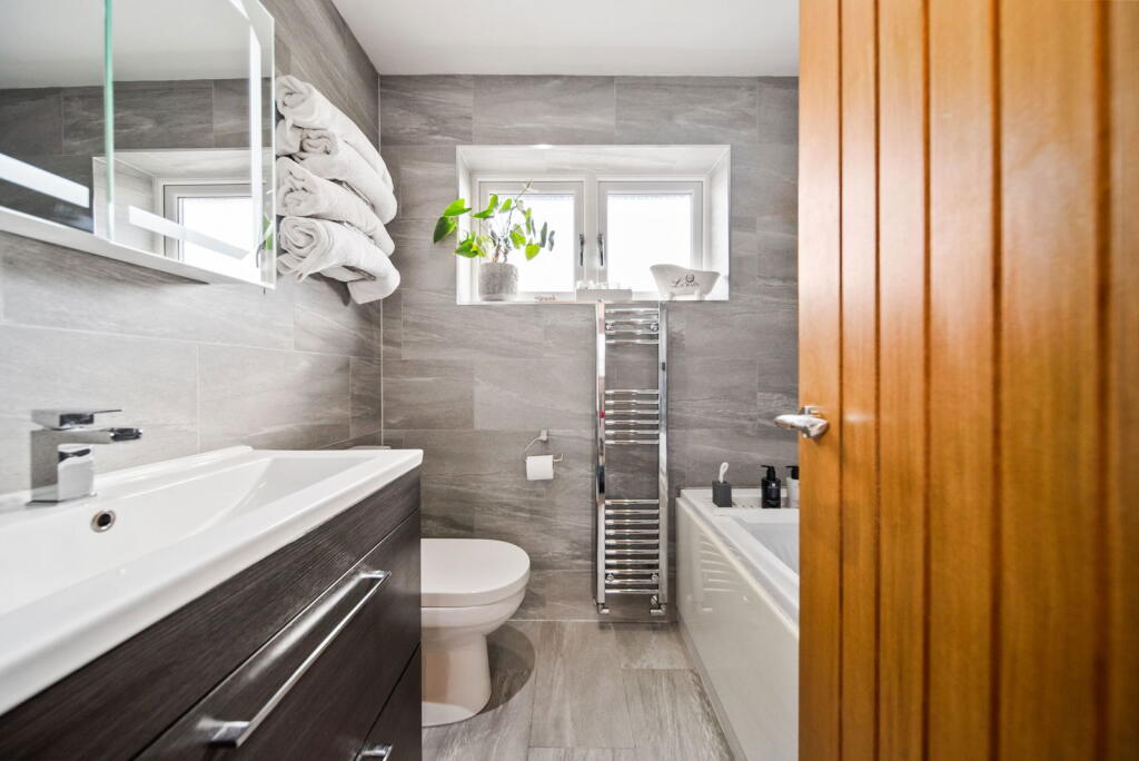
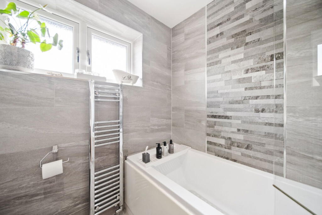
- BATHROOM:
Textual Property Features
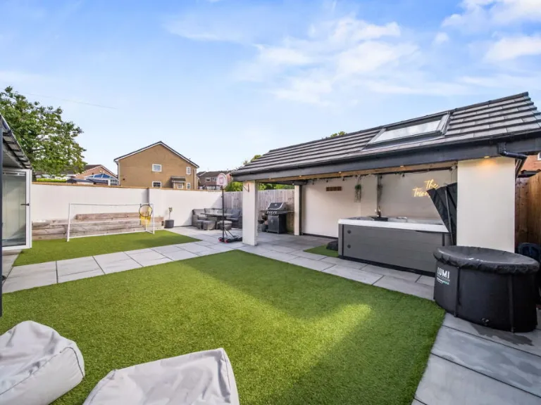
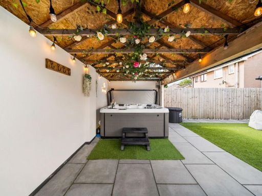
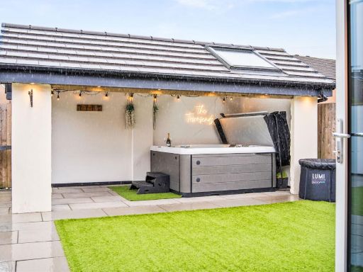
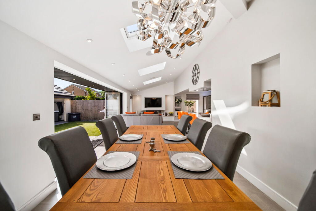
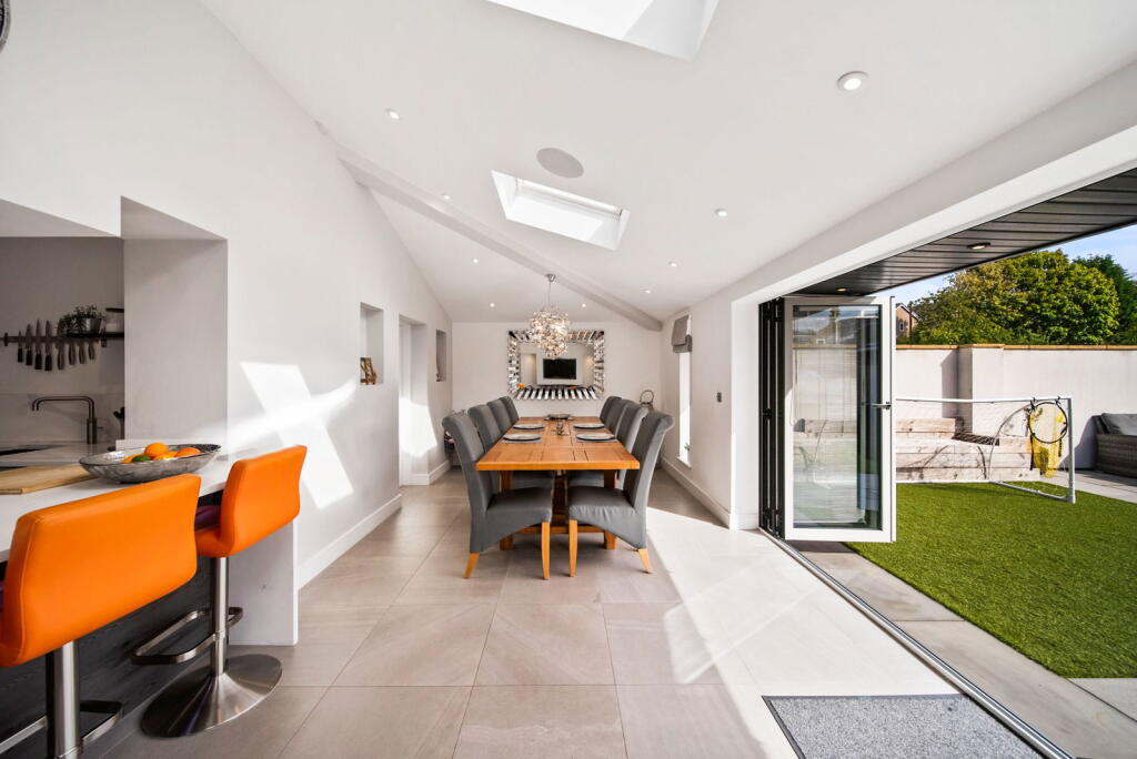
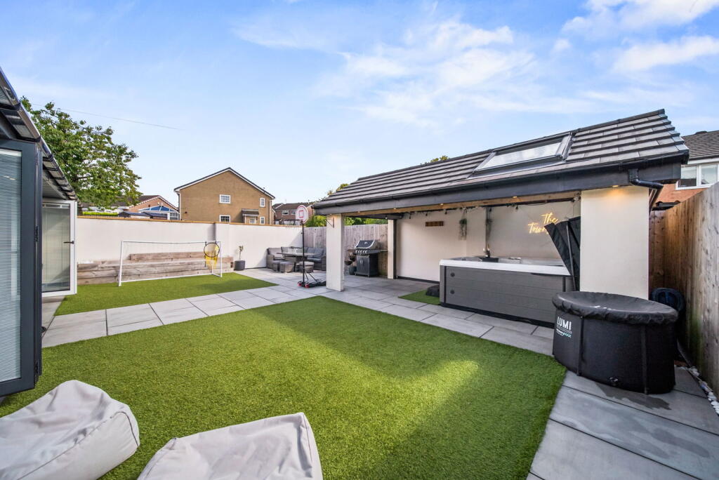
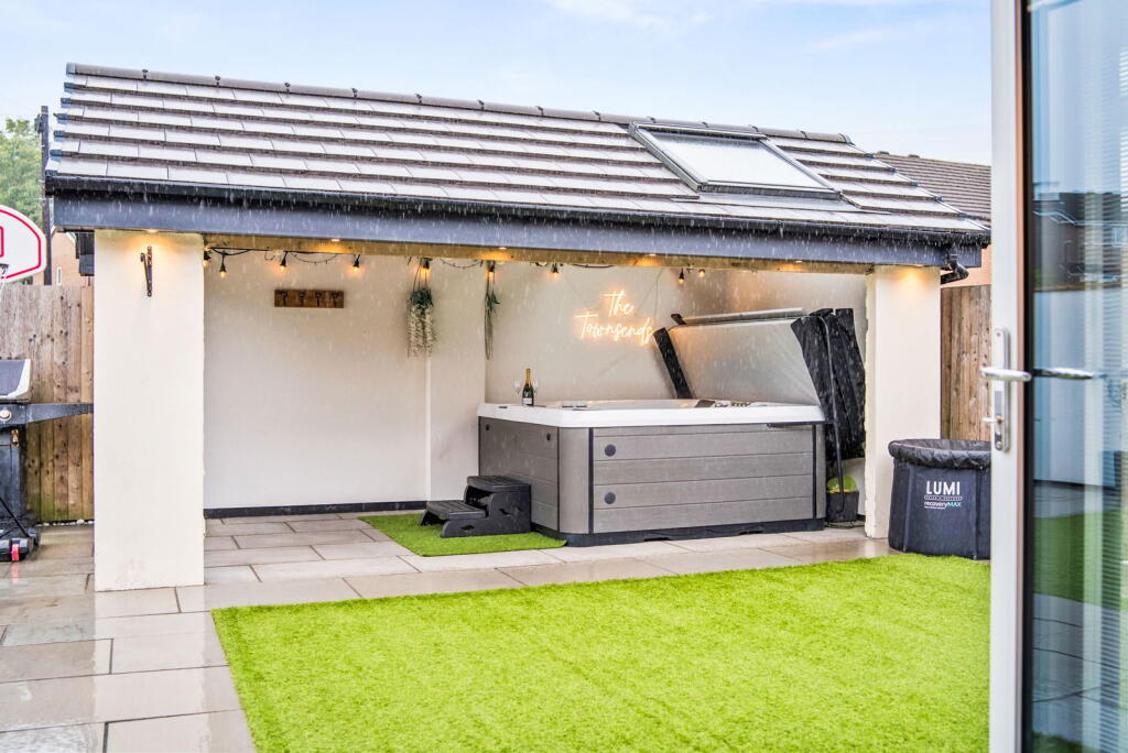
Detected Visual Features
- modern
- contemporary
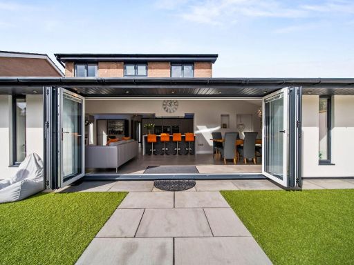
- extension
- open plan
- glass doors
- bi-fold doors
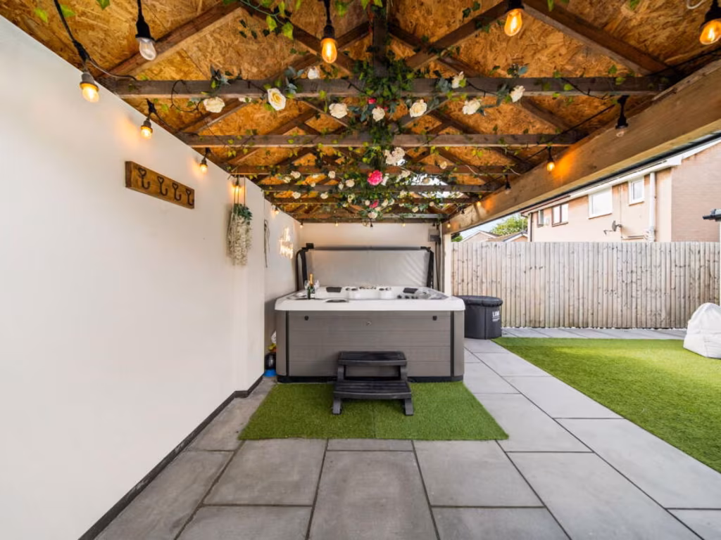
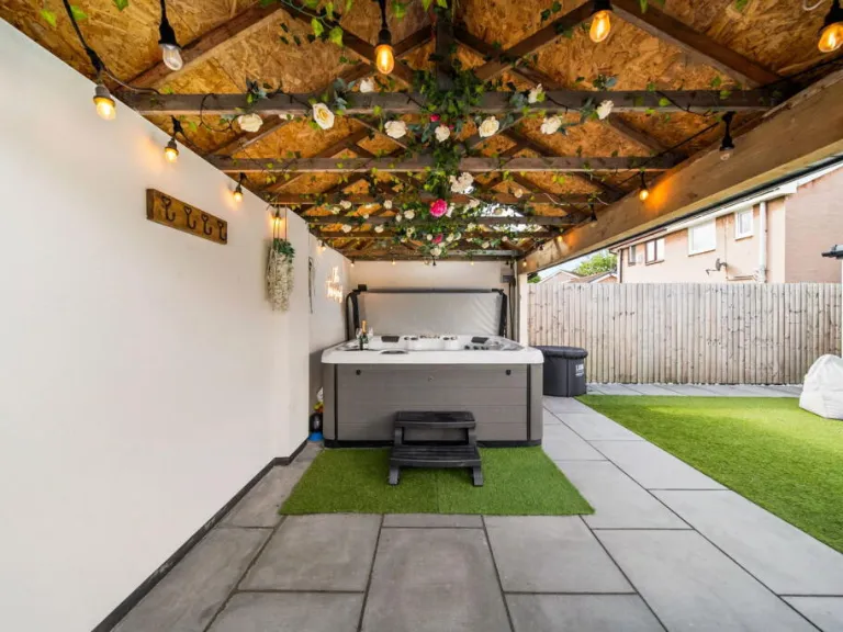
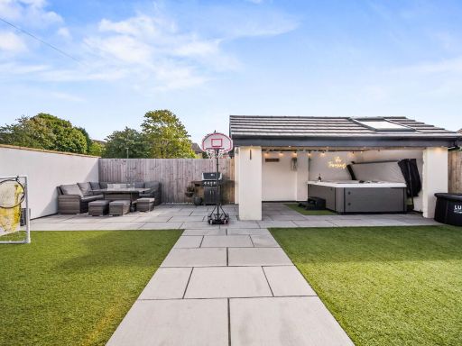
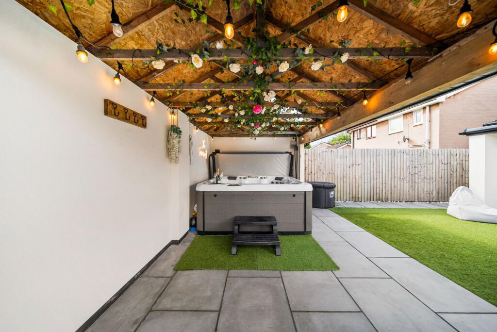
- garden
- patio
- kitchen island
- outdoor space
- open-plan
- kitchen
- light-filled
- skylights
EPC Details
- Fully double glazed
- Cavity wall, filled cavity
- Boiler and radiators, mains gas
- Low energy lighting in 79% of fixed outlets
- Suspended, no insulation (assumed)
Nearby Schools
- Burnley Holy Trinity Church of England Primary School
- Whittlefield Primary School
- Burnley Stoneyholme Community Primary School
- Rawdhatul Uloom
- Cherry Fold Community Primary School
- Coal Clough Academy
- Burnley St Peter's Church of England Primary School
- Padiham Green Church of England Primary School
- Shuttleworth College
- The Heights Burnley
- Christ The King Roman Catholic Primary School, a Voluntary Academy
- Rosegrove Infant School
- St Augustine of Canterbury RC Primary School, A Voluntary Academy
- Olive High
- Burnley Ightenhill Primary School
- St John the Baptist Roman Catholic Primary School, Padiham
- Wellfield Methodist and Anglican Church School
- St Mary Magdalene Catholic Primary School, a Voluntary Academy
- Higham St John's Church of England Primary School
- Rosewood Primary School
- Burnley Lowerhouse Junior School
- Lincoln House School
- Burnley High School
- St Joseph's Park Hill School
- Padiham Primary School
- Barden Primary School
Nearest Bars And Restaurants
- Id: 527206388
- Tags:
- Amenity: cafe
- Historic: yes
- TagsNormalized:
- Lat: 53.8023874
- Lon: -2.2962599
- FullGeoHash: gcw65drvt7bw
- PartitionGeoHash: gcw6
- Images:
- FoodStandards: null
- Distance: 1433.9
,- Id: 444331856
- Tags:
- Addr:
- City: Burnley
- Housenumber: 1
- Postcode: BB11 4SB
- Street: Barracks Road
- Amenity: restaurant
- Building: yes
- Name: Kenanks
- TagsNormalized:
- Lat: 53.7894247
- Lon: -2.2610968
- FullGeoHash: gcw6h81d0es0
- PartitionGeoHash: gcw6
- Images:
- FoodStandards: null
- Distance: 1357.7
,- Id: 479811513
- Tags:
- Addr:
- City: Burnley
- Postcode: BB12 6EH
- Street: Rosegrove Lane
- Amenity: pub
- Building: yes
- Name: The Junction
- TagsNormalized:
- Lat: 53.7874753
- Lon: -2.2816488
- FullGeoHash: gcw3updwc8p7
- PartitionGeoHash: gcw3
- Images:
- FoodStandards: null
- Distance: 1242.4
,- Id: 550211836
- Tags:
- Addr:
- City: Burnley
- Postcode: BB12 6LG
- Street: Padiham Road
- Amenity: pub
- Building: yes
- Name: George IV
- Outdoor_seating: yes
- Phone: +44 1282 771436
- Smoking: outside
- TagsNormalized:
- Lat: 53.7968609
- Lon: -2.2910202
- FullGeoHash: gcw65c7trmex
- PartitionGeoHash: gcw6
- Images:
- FoodStandards: null
- Distance: 1016.5
,- Id: 91932414
- Tags:
- Amenity: pub
- Building: yes
- Name: The Tim Bobbin
- TagsNormalized:
- Lat: 53.7935966
- Lon: -2.2691626
- FullGeoHash: gcw6h2gdktjw
- PartitionGeoHash: gcw6
- Images:
- FoodStandards: null
- Distance: 656.9
}
Nearest General Shops
- Id: 444329771
- Tags:
- Addr:
- City: Burnley
- Housenumber: 215-233
- Postcode: BB11 5ES
- Street: Accrington Road
- Building: yes
- Name: The Fireplace Warehouse
- Shop: fireplace
- Website: https://www.thefireplacewarehouse.co.uk/
- TagsNormalized:
- Lat: 53.7868911
- Lon: -2.2685753
- FullGeoHash: gcw3urs5675x
- PartitionGeoHash: gcw3
- Images:
- FoodStandards: null
- Distance: 1328.6
,- Id: 479811505
- Tags:
- Addr:
- City: Burnley
- Postcode: BB12 6EH
- Street: Rosegrove Lane
- Building: yes
- Name: Motorpoint
- Second_hand: only
- Shop: car
- Website: https://motorpoint.co.uk/
- TagsNormalized:
- Lat: 53.7876515
- Lon: -2.2799911
- FullGeoHash: gcw3upezb2gr
- PartitionGeoHash: gcw3
- Images:
- FoodStandards: null
- Distance: 1193.4
,- Id: 944186219
- Tags:
- Building: yes
- Second_hand: only
- Shop: car
- TagsNormalized:
- Lat: 53.7888921
- Lon: -2.2764293
- FullGeoHash: gcw3upyr525r
- PartitionGeoHash: gcw3
- Images:
- FoodStandards: null
- Distance: 1022.6
}
Nearest Grocery shops
- Id: 444626410
- Tags:
- Addr:
- City: Burnley
- Housenumber: 47-51
- Postcode: BB11 4NS
- Street: Coal Clough Lane
- Building: yes
- Name: Premier - Singhs Convenience Store
- Shop: alcohol
- Website: https://premier-stores.co.uk/
- TagsNormalized:
- convenience
- premier
- alcohol
- shop
- Lat: 53.7863373
- Lon: -2.2587982
- FullGeoHash: gcw3uxe0n5vz
- PartitionGeoHash: gcw3
- Images:
- FoodStandards: null
- Distance: 1712.9
,- Id: 444329773
- Tags:
- Addr:
- City: Burnley
- Housenumber: 200
- Postcode: BB11 5ES
- Street: Cog Lane
- Brand: Farmfoods
- Brand:wikidata: Q5435841
- Brand:wikipedia: en:Farmfoods
- Building: yes
- Contact:
- Website: https://www.farmfoods.co.uk/store-finder.php?branch_code=339
- Name: Farmfoods
- Opening_hours:
- Url: https://www.farmfoods.co.uk/store-finder.php?branch_code=339
- Shop: frozen_food
- TagsNormalized:
- farmfoods
- frozen food
- food
- shop
- Lat: 53.7864036
- Lon: -2.2678932
- FullGeoHash: gcw3urs8d227
- PartitionGeoHash: gcw3
- Images:
- FoodStandards: null
- Distance: 1395.3
,- Id: 1093982188
- Tags:
- Brand: Spar
- Brand:wikidata: Q610492
- Building: yes
- Name: Spar
- Shop: convenience
- TagsNormalized:
- Lat: 53.7885348
- Lon: -2.2621914
- FullGeoHash: gcw3uxbszjeu
- PartitionGeoHash: gcw3
- Images:
- FoodStandards: null
- Distance: 1382.4
}
Nearest Religious buildings
- Id: 102657410
- Tags:
- Amenity: place_of_worship
- Building: yes
- Source: OS StreetView
- TagsNormalized:
- Lat: 53.7963263
- Lon: -2.2593268
- FullGeoHash: gcw6h96f3f5f
- PartitionGeoHash: gcw6
- Images:
- FoodStandards: null
- Distance: 1091.6
,- Id: 527425246
- Tags:
- Addr:
- City: Burnley
- Housenumber: 638
- Postcode: BB12 6TQ
- Street: Padiham Road
- Amenity: place_of_worship
- Building: yes
- Denomination: anglican
- Name: All Saints with St John the Baptist
- Phone: +44 1282 771530
- Religion: christian
- Website: http://www.allsaintsburnley.net/
- Wikidata: Q26537582
- TagsNormalized:
- place of worship
- anglican
- baptist
- christian
- church
- Lat: 53.7973461
- Lon: -2.291041
- FullGeoHash: gcw65ce8qbhj
- PartitionGeoHash: gcw6
- Images:
- FoodStandards: null
- Distance: 1012.1
,- Id: 102657418
- Tags:
- Amenity: place_of_worship
- Building: church
- Denomination: methodist
- Name: Padiham Road Methodist Church
- Religion: christian
- Source: OS StreetView
- TagsNormalized:
- place of worship
- church
- methodist
- christian
- Lat: 53.7950937
- Lon: -2.2720668
- FullGeoHash: gcw6h31e1h21
- PartitionGeoHash: gcw6
- Images:
- FoodStandards: null
- Distance: 408
}
Nearest Medical buildings
- Id: 7497223032
- Tags:
- Addr:
- City: Burnley
- Country: GB
- Postcode: BB12 0EQ
- Street: Princess Way
- Amenity: pharmacy
- Brand: Asda
- Brand:wikidata: Q297410
- Brand:wikipedia: en:Asda
- Contact:
- Phone: +44 1282 838177
- Website: https://storelocator.asda.com/north-west/burnley/princess-way/pharmacy
- Fhrs:
- Fixme: Location not accurate
- Healthcare: pharmacy
- Name: Asda
- Operator: Asda Stores Ltd
- TagsNormalized:
- pharmacy
- asda
- health
- healthcare
- Lat: 53.7952015
- Lon: -2.2443386
- FullGeoHash: gcw6hcjez07u
- PartitionGeoHash: gcw6
- Images:
- FoodStandards: null
- Distance: 2083.2
,- Id: 485945187
- Tags:
- Addr:
- City: Burnley
- Postcode: BB11 5JX
- Street: Venice Avenue
- Amenity: clinic
- Building: yes
- Healthcare: clinic
- Name: The Fold
- Website: nhs.uk
- TagsNormalized:
- Lat: 53.7815158
- Lon: -2.2660722
- FullGeoHash: gcw3uqtuh9nn
- PartitionGeoHash: gcw3
- Images:
- FoodStandards: null
- Distance: 1946.8
,- Id: 473868309
- Tags:
- Addr:
- City: Burnley
- Housenumber: 68-70
- Postcode: BB11 4NW
- Street: Coal Clough Lane
- Amenity: pharmacy
- Building: yes
- Name: Cohens Chemist
- Website: https://www.cohenschemist.co.uk/
- TagsNormalized:
- pharmacy
- chemist
- cohens chemist
- Lat: 53.7850327
- Lon: -2.2580463
- FullGeoHash: gcw3ux78x8y9
- PartitionGeoHash: gcw3
- Images:
- FoodStandards: null
- Distance: 1856.3
,- Id: 457320563
- Tags:
- Addr:
- City: Burnley
- Postcode: BB11 4PQ
- Street: Howard Street
- Amenity: community_centre
- Building: yes
- Name: Howard Street Community Health Centre - NHS Choices
- Operator: National Health Service
- Website: nhs.uk
- TagsNormalized:
- community centre
- health
- health centre
- nhs
- Lat: 53.7873422
- Lon: -2.2595573
- FullGeoHash: gcw3uxdturrf
- PartitionGeoHash: gcw3
- Images:
- FoodStandards: null
- Distance: 1595.8
}
Nearest Leisure Facilities
- Id: 913294457
- Tags:
- Leisure: pitch
- Sport: bowls
- TagsNormalized:
- Lat: 53.7970817
- Lon: -2.2698073
- FullGeoHash: gcw6h37ntwvh
- PartitionGeoHash: gcw6
- Images:
- FoodStandards: null
- Distance: 401.3
,- Id: 23361738
- Tags:
- Created_by: Potlatch 0.7b
- Leisure: park
- Source: yahoo
- TagsNormalized:
- Lat: 53.7946728
- Lon: -2.2762998
- FullGeoHash: gcw6h1n2wmgf
- PartitionGeoHash: gcw6
- Images:
- FoodStandards: null
- Distance: 380.8
,- Id: 102657420
- Tags:
- Leisure: park
- Name: Ightenhill Park
- Source: OS StreetView
- TagsNormalized:
- Lat: 53.7969502
- Lon: -2.2715059
- FullGeoHash: gcw6h33vyn67
- PartitionGeoHash: gcw6
- Images:
- FoodStandards: null
- Distance: 301.5
,- Id: 852711368
- Tags:
- TagsNormalized:
- Lat: 53.7987429
- Lon: -2.2777533
- FullGeoHash: gcw6h1v2ks81
- PartitionGeoHash: gcw6
- Images:
- FoodStandards: null
- Distance: 154.9
,- Id: 852711369
- Tags:
- TagsNormalized:
- Lat: 53.79871
- Lon: -2.277732
- FullGeoHash: gcw6h1v2hyrv
- PartitionGeoHash: gcw6
- Images:
- FoodStandards: null
- Distance: 152
}
Nearest Tourist attractions
- Id: 2080130458
- Tags:
- Name: Height Top Farm
- Source: survey
- Tourism: guest_house
- TagsNormalized:
- Lat: 53.832386
- Lon: -2.2879754
- FullGeoHash: gcw65zvuqk1f
- PartitionGeoHash: gcw6
- Images:
- FoodStandards: null
- Distance: 3899.3
,- Id: 1371242127
- Tags:
- Name: Ormerod
- Tourism: guest_house
- TagsNormalized:
- Lat: 53.794089
- Lon: -2.2332877
- FullGeoHash: gcw6j0vv295b
- PartitionGeoHash: gcw6
- Images:
- FoodStandards: null
- Distance: 2819.4
,- Id: 52345147
- Tags:
- Building: house
- Historic: manor
- Name: Gawthorpe Hall
- Tourism: museum
- Wikidata: Q5528499
- Wikipedia: en:Gawthorpe Hall
- TagsNormalized:
- Lat: 53.8027522
- Lon: -2.2948019
- FullGeoHash: gcw65f2zxpzw
- PartitionGeoHash: gcw6
- Images:
- FoodStandards: null
- Distance: 1359
}
Nearest Bus stations and stops
- Id: 4897528436
- Tags:
- Highway: bus_stop
- Name: Dugdale Road
- Public_transport: platform
- TagsNormalized:
- Lat: 53.7954062
- Lon: -2.2735635
- FullGeoHash: gcw6h30kyns1
- PartitionGeoHash: gcw6
- Images:
- FoodStandards: null
- Distance: 328
,- Id: 4897528435
- Tags:
- Highway: bus_stop
- Name: Lockyer Avenue
- Public_transport: platform
- TagsNormalized:
- Lat: 53.7960445
- Lon: -2.2750026
- FullGeoHash: gcw6h1r2ste1
- PartitionGeoHash: gcw6
- Images:
- FoodStandards: null
- Distance: 230.4
,- Id: 4897528434
- Tags:
- Highway: bus_stop
- Name: Lockyer Avenue
- Public_transport: platform
- TagsNormalized:
- Lat: 53.7963594
- Lon: -2.2767808
- FullGeoHash: gcw6h1q4e0jp
- PartitionGeoHash: gcw6
- Images:
- FoodStandards: null
- Distance: 204.3
,- Id: 5003175662
- Tags:
- Highway: bus_stop
- Name: Grisedale Drive
- Public_transport: platform
- TagsNormalized:
- Lat: 53.7982242
- Lon: -2.2780491
- FullGeoHash: gcw6h1tjmeg7
- PartitionGeoHash: gcw6
- Images:
- FoodStandards: null
- Distance: 156.4
,- Id: 5003175663
- Tags:
- Highway: bus_stop
- Name: Castlerigg Drive
- Public_transport: platform
- TagsNormalized:
- Lat: 53.7988574
- Lon: -2.2758332
- FullGeoHash: gcw6h1yc11zu
- PartitionGeoHash: gcw6
- Images:
- FoodStandards: null
- Distance: 87.3
}
Nearest Hotels
- Id: 36931375
- Tags:
- Addr:
- City: Burnley
- Postcode: BB10 3EF
- Street: Queen Victoria Road
- Brand: Premier Inn
- Brand:wikidata: Q2108626
- Building: yes
- Contact:
- Website: https://www.premierinn.com/gb/en/hotels/england/lancashire/burnley/burnley.html
- Name: Premier Inn
- Source: yahoo_imagery
- Tourism: hotel
- TagsNormalized:
- Lat: 53.7965741
- Lon: -2.2329245
- FullGeoHash: gcw6j1q5c06b
- PartitionGeoHash: gcw6
- Images:
- FoodStandards: null
- Distance: 2813.1
,- Id: 444331855
- Tags:
- Addr:
- City: Burnley
- Street: Barracks Road
- Brand: Travelodge
- Brand:wikidata: Q9361374
- Building: yes
- Internet_access: yes
- Internet_access:fee: customers
- Internet_access:ssid: Travelodge WiFi
- Name: Travelodge
- Smoking: outside
- Stars: 3
- Tourism: hotel
- Website: https://www.travelodge.co.uk
- TagsNormalized:
- Lat: 53.7895033
- Lon: -2.260505
- FullGeoHash: gcw6h81fw6jm
- PartitionGeoHash: gcw6
- Images:
- FoodStandards: null
- Distance: 1379.4
,- Id: 773641254
- Tags:
- Name: Holiday Inn Express Burnley
- Phone: +44 1282 855 955
- Source: OS OpenData StreetView
- Tourism: hotel
- Website: https://www.hiexburnley.com/
- TagsNormalized:
- Lat: 53.7938815
- Lon: -2.2563814
- FullGeoHash: gcw6h8uund24
- PartitionGeoHash: gcw6
- Images:
- FoodStandards: null
- Distance: 1350.7
}
Tags
- modern
- contemporary
- extension
- open plan
- glass doors
- bi-fold doors
- garden
- patio
- kitchen island
- outdoor space
- modern
- open-plan
- kitchen
- bi-fold doors
- light-filled
- contemporary
- skylights
- patio
- garden
Local Market Stats
- Average Price/sqft: £160
- Avg Income: £38300
- Rental Yield: 3.9%
- Social Housing: 7%
- Planning Success Rate: 83%
AirBnB Data
- 1km average: £70/night
- Listings in 1km: 1
Similar Properties
 5 bedroom detached house for sale in Helvellyn Drive, Burnley, BB12 0TA, BB12 — £425,000 • 5 bed • 3 bath • 1642 ft²
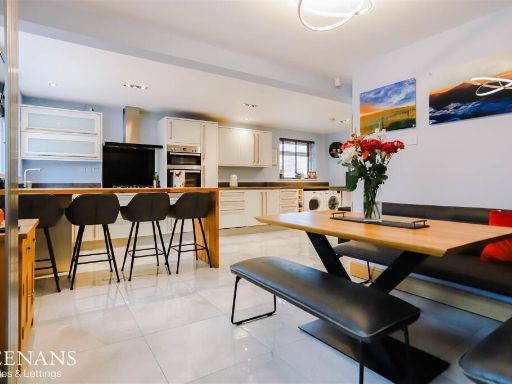 4 bedroom detached house for sale in Helvellyn Drive, Burnley, BB12 — £399,950 • 4 bed • 2 bath • 2213 ft²
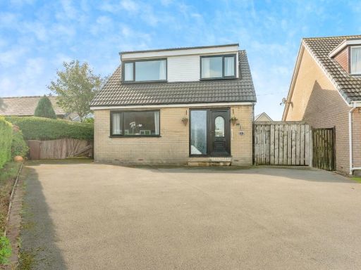 4 bedroom detached house for sale in Plane Tree Close, Burnley, Lancashire, BB11 — £220,000 • 4 bed • 2 bath • 1056 ft²
 4 bedroom detached house for sale in Brantfell Drive, Burnley, BB12 — £335,000 • 4 bed • 2 bath • 1406 ft²
 4 bedroom detached house for sale in Cumbrian Way, Burnley, BB12 — £400,000 • 4 bed • 2 bath • 1792 ft²
 4 bedroom detached house for sale in Richmond Avenue, Burnley, BB10 — £360,000 • 4 bed • 2 bath • 1653 ft²
Meta
- {
"@context": "https://schema.org",
"@type": "Residence",
"name": "4 bedroom detached house for sale in Castlerigg Drive, Burn…",
"description": "",
"url": "https://propertypiper.co.uk/property/2eb3150f-9380-40f4-ba3f-506490912871",
"image": "https://image-a.propertypiper.co.uk/8d2adf90-313f-4c7a-87b2-a9a1b3a5287d-1024.jpeg",
"address": {
"@type": "PostalAddress",
"streetAddress": "71 CASTLERIGG DRIVE BURNLEY",
"postalCode": "BB12 8AT",
"addressLocality": "Burnley",
"addressRegion": "Burnley",
"addressCountry": "England"
},
"geo": {
"@type": "GeoCoordinates",
"latitude": 53.7980779,
"longitude": -2.2756807
},
"numberOfRooms": 4,
"numberOfBathroomsTotal": 2,
"floorSize": {
"@type": "QuantitativeValue",
"value": 1604,
"unitCode": "FTK"
},
"offers": {
"@type": "Offer",
"price": 375000,
"priceCurrency": "GBP",
"availability": "https://schema.org/InStock"
},
"additionalProperty": [
{
"@type": "PropertyValue",
"name": "Feature",
"value": "modern"
},
{
"@type": "PropertyValue",
"name": "Feature",
"value": "contemporary"
},
{
"@type": "PropertyValue",
"name": "Feature",
"value": "extension"
},
{
"@type": "PropertyValue",
"name": "Feature",
"value": "open plan"
},
{
"@type": "PropertyValue",
"name": "Feature",
"value": "glass doors"
},
{
"@type": "PropertyValue",
"name": "Feature",
"value": "bi-fold doors"
},
{
"@type": "PropertyValue",
"name": "Feature",
"value": "garden"
},
{
"@type": "PropertyValue",
"name": "Feature",
"value": "patio"
},
{
"@type": "PropertyValue",
"name": "Feature",
"value": "kitchen island"
},
{
"@type": "PropertyValue",
"name": "Feature",
"value": "outdoor space"
},
{
"@type": "PropertyValue",
"name": "Feature",
"value": "modern"
},
{
"@type": "PropertyValue",
"name": "Feature",
"value": "open-plan"
},
{
"@type": "PropertyValue",
"name": "Feature",
"value": "kitchen"
},
{
"@type": "PropertyValue",
"name": "Feature",
"value": "bi-fold doors"
},
{
"@type": "PropertyValue",
"name": "Feature",
"value": "light-filled"
},
{
"@type": "PropertyValue",
"name": "Feature",
"value": "contemporary"
},
{
"@type": "PropertyValue",
"name": "Feature",
"value": "skylights"
},
{
"@type": "PropertyValue",
"name": "Feature",
"value": "patio"
},
{
"@type": "PropertyValue",
"name": "Feature",
"value": "garden"
}
]
}
High Res Floorplan Images
Compatible Floorplan Images
FloorplanImages Thumbnail