RM10 8XL - 3 bedroom detached bungalow for sale in Cadiz Road, Dagenha…
View on Property Piper
3 bedroom detached bungalow for sale in Cadiz Road, Dagenham, RM10
Property Details
- Price: £550000
- Bedrooms: 3
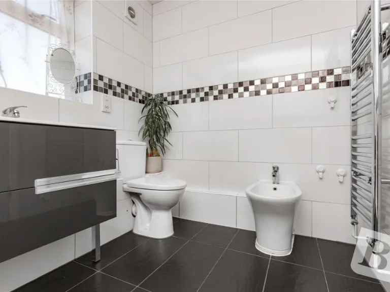
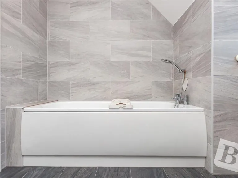
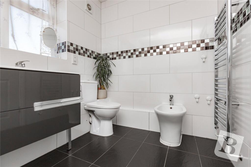
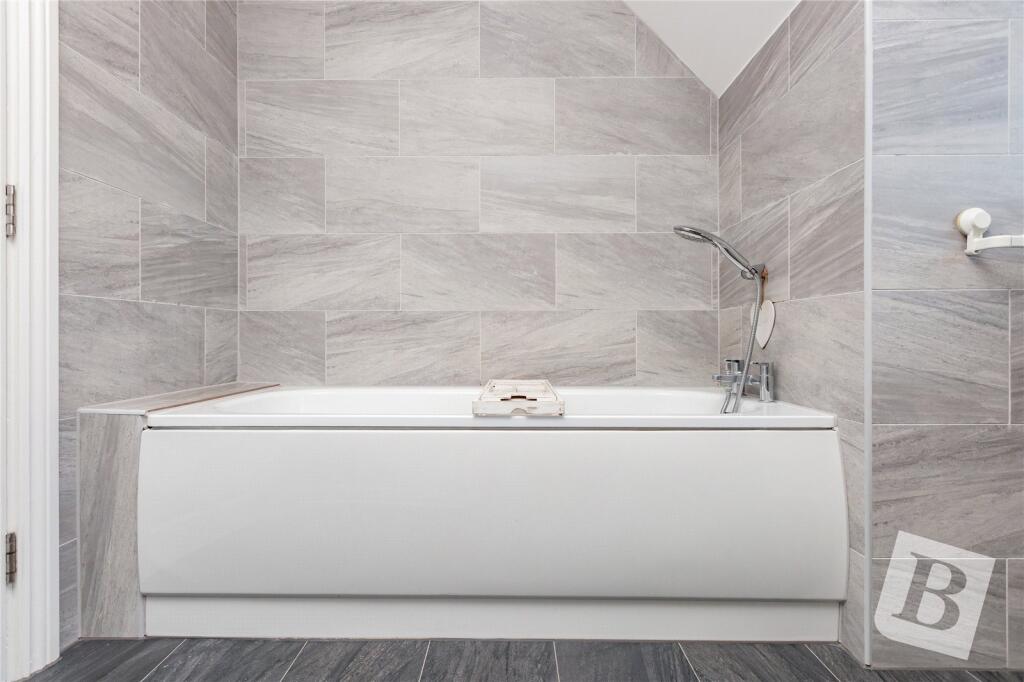
- Bathrooms: 2
- Property Type: undefined
- Property SubType: undefined
Brochure Descriptions
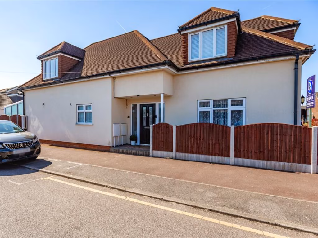
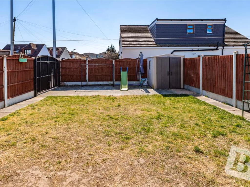
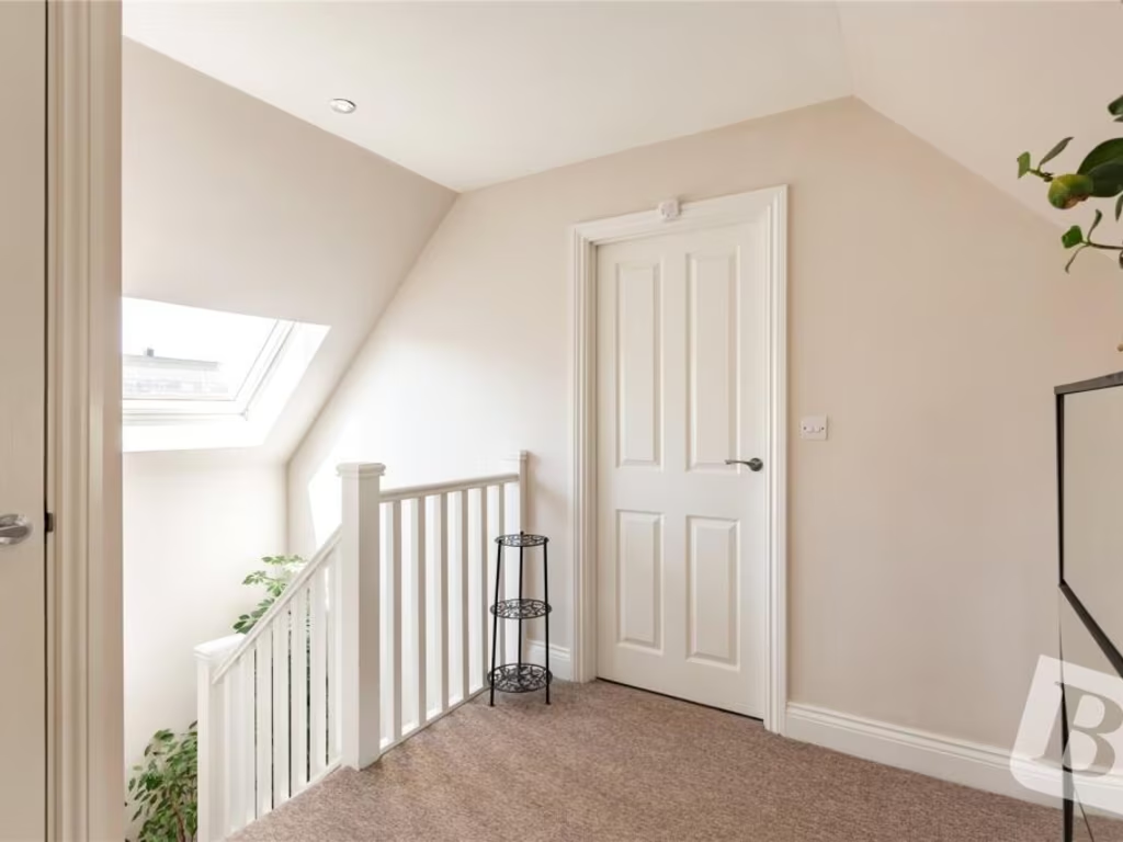
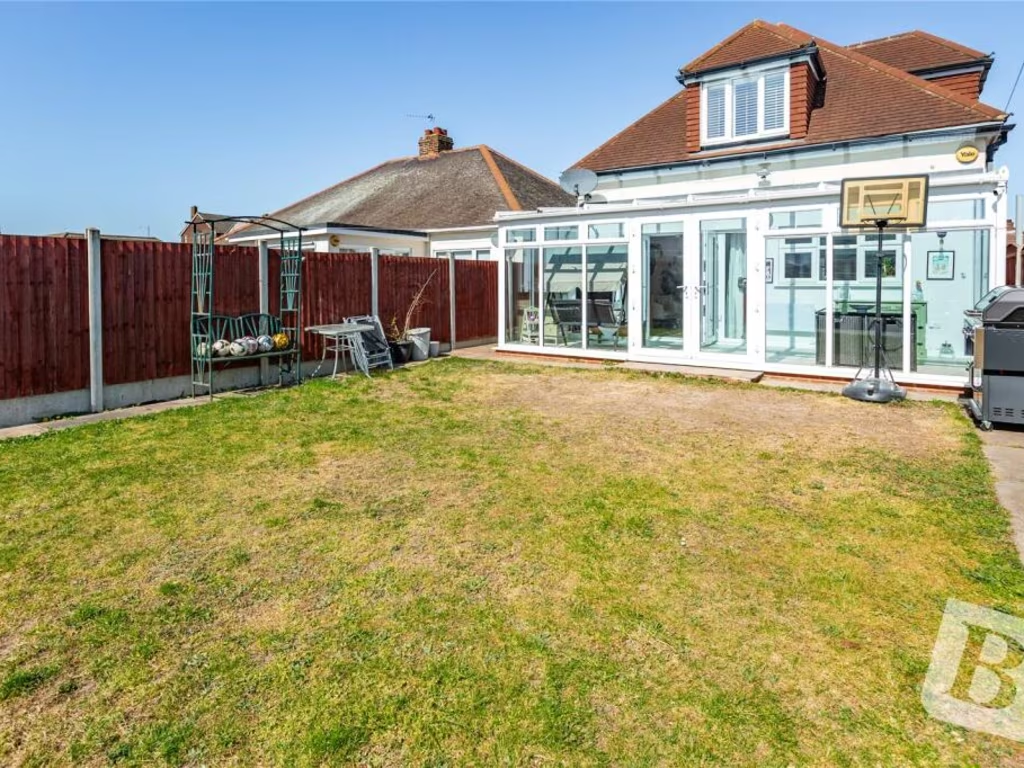
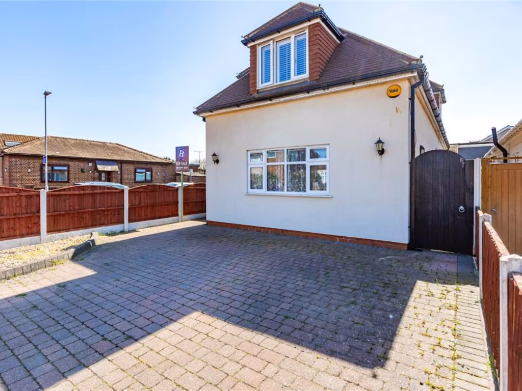
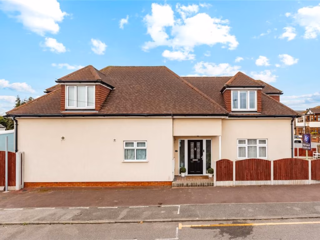
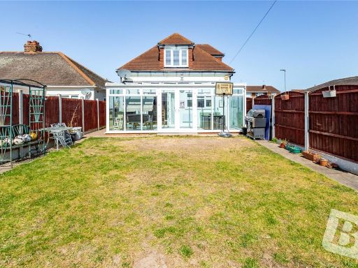
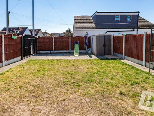
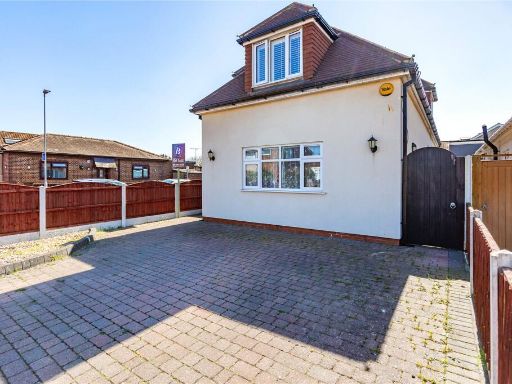
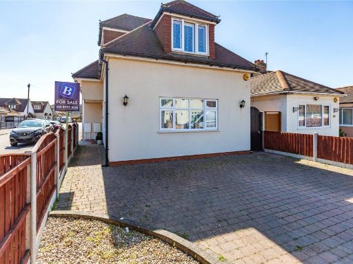
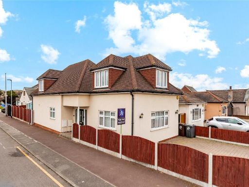
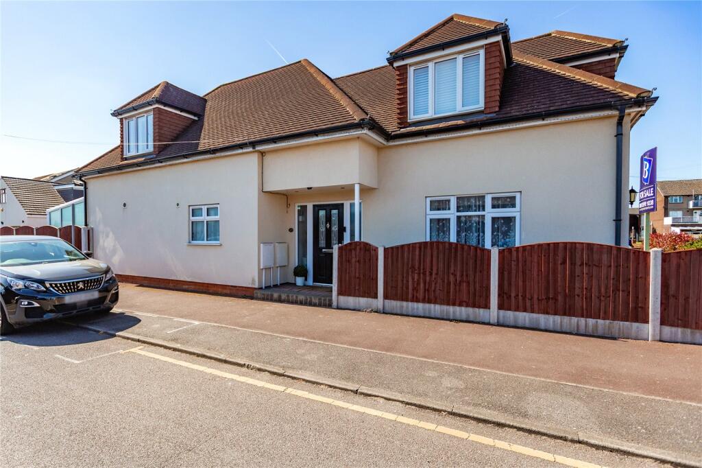
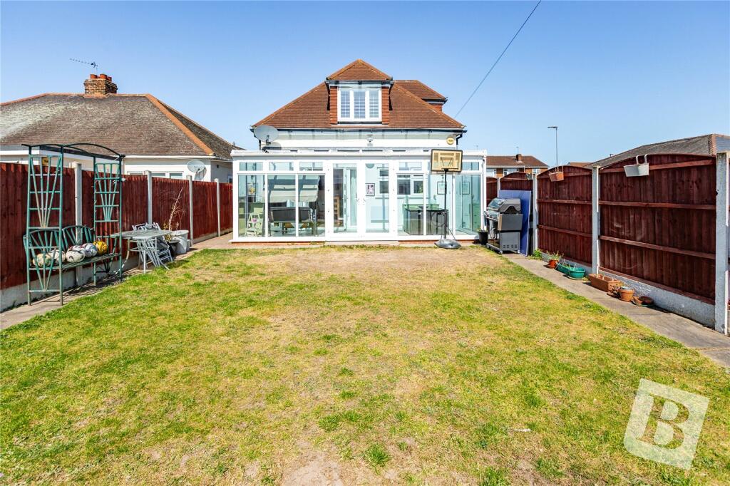
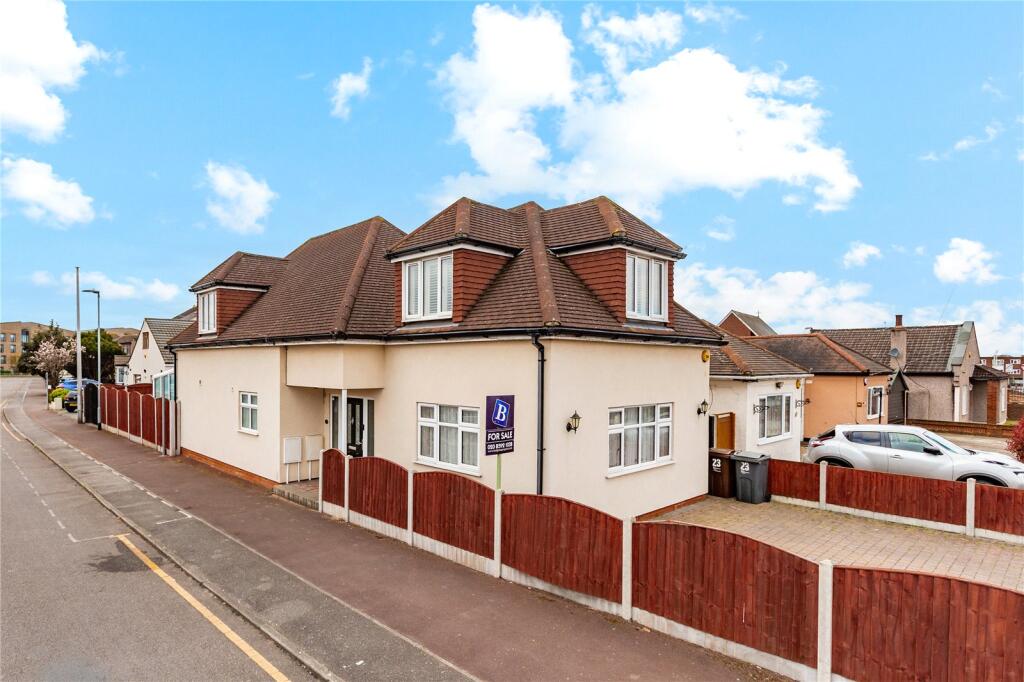
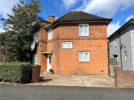
- This property is a well-maintained semi-detached house situated on Cadiz Road, Dagenham. It features a modern, although possibly modest-sized garden given the fencing, and a driveway for parking. The house enjoys a traditional architectural design with dormer windows providing additional space and light in the upper floor. The roof is clad with reddish safety tiles and the property is constructed with a smooth beige facade that complements the fence and surrounding neighbourhood aesthetic. The street-facing aspect offers a broad view without immediate obstructions, adding to a sense of openness.
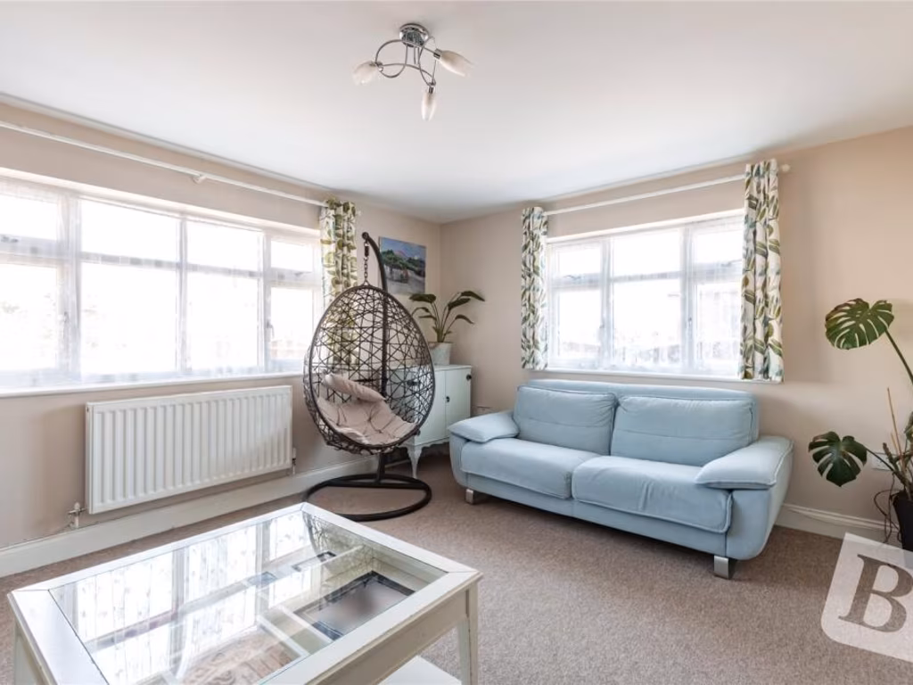
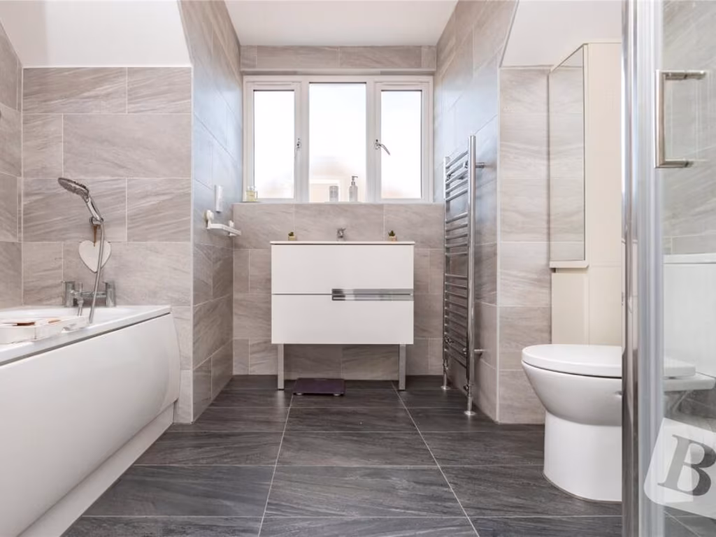
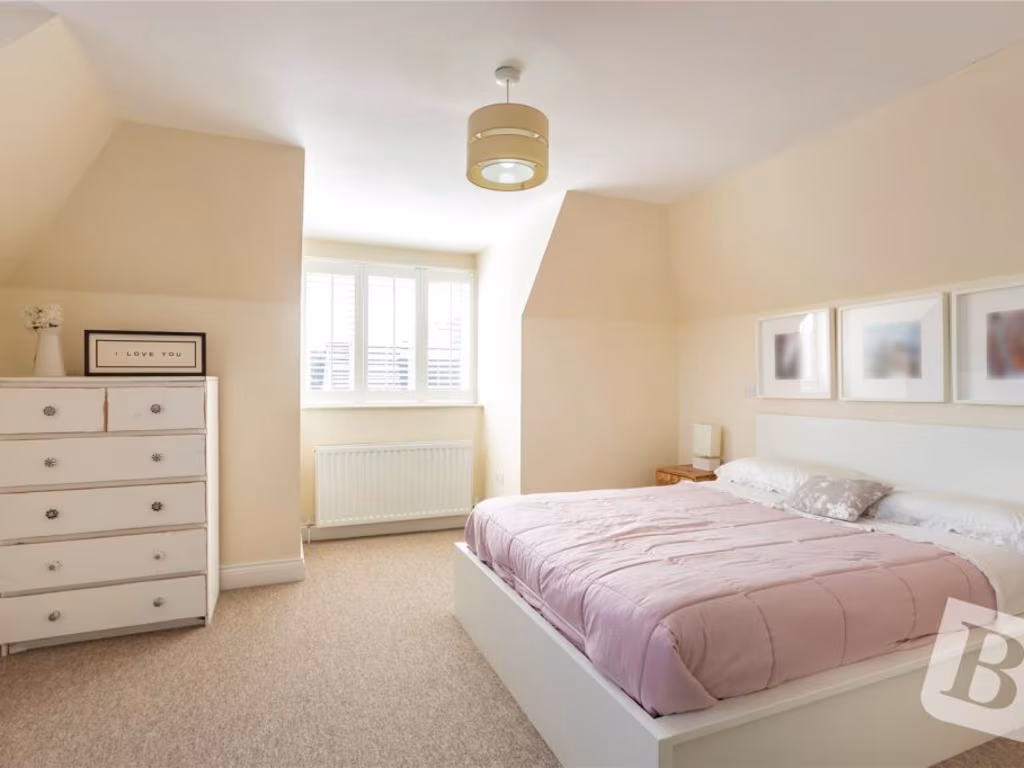
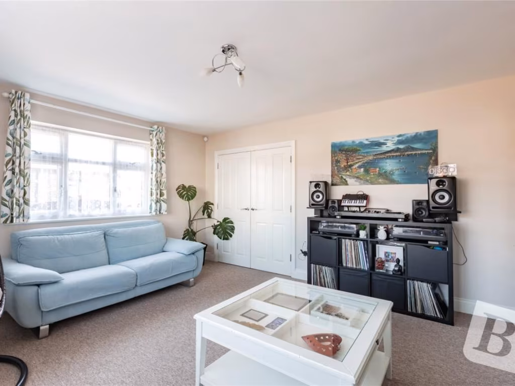
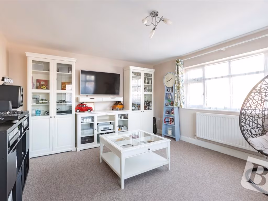
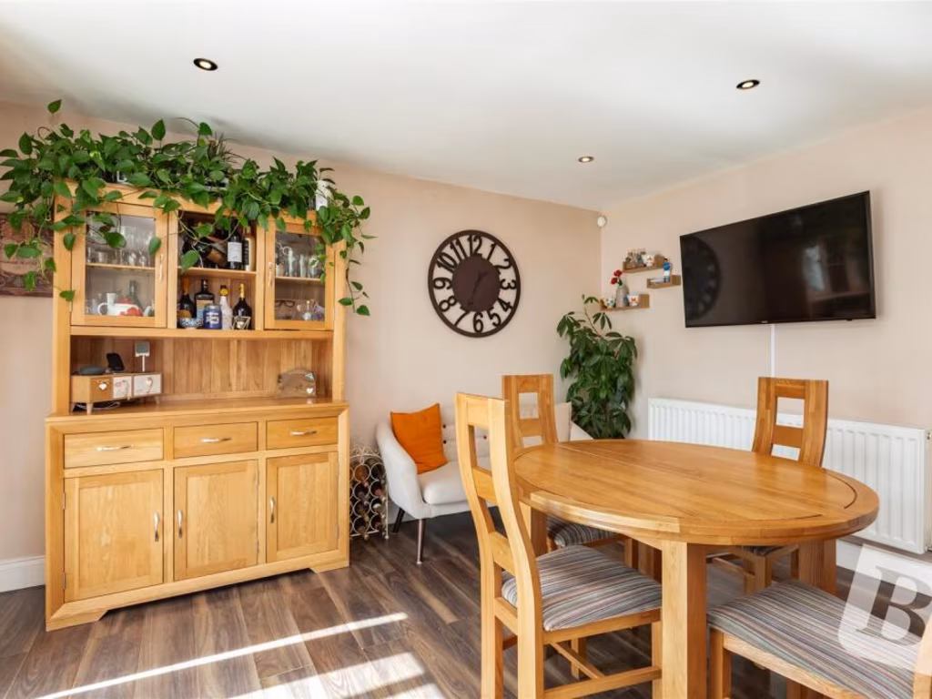
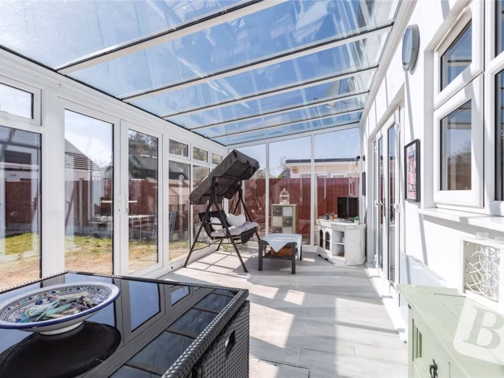
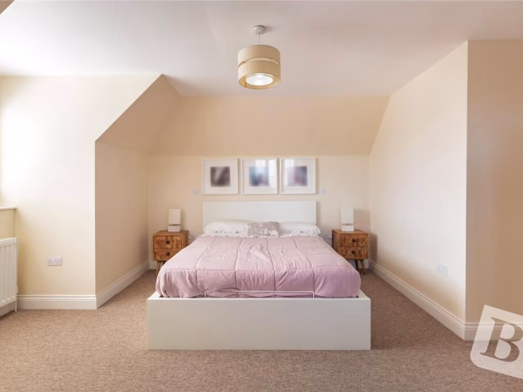
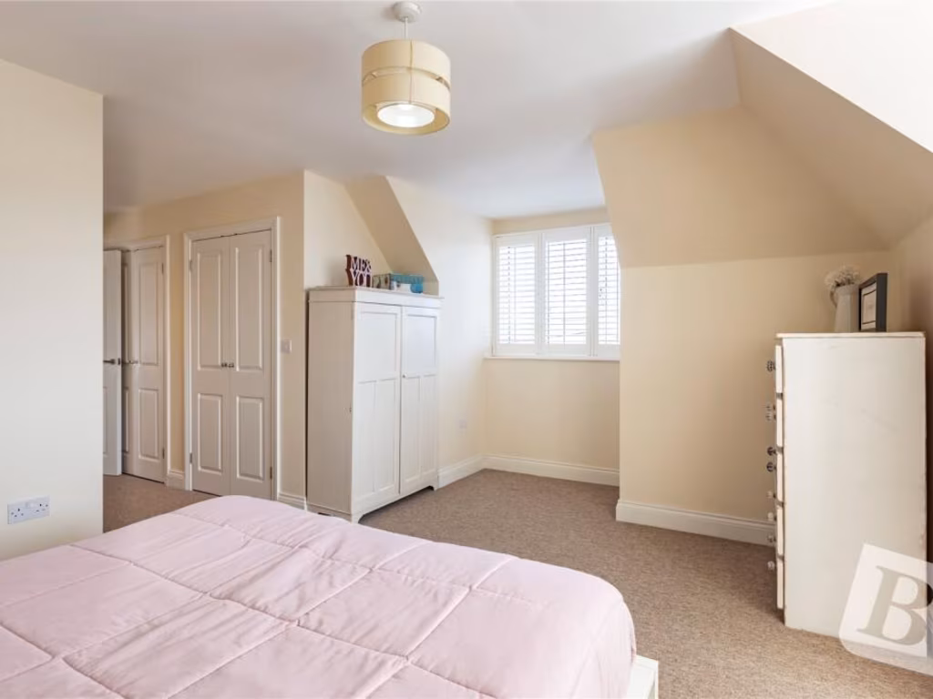
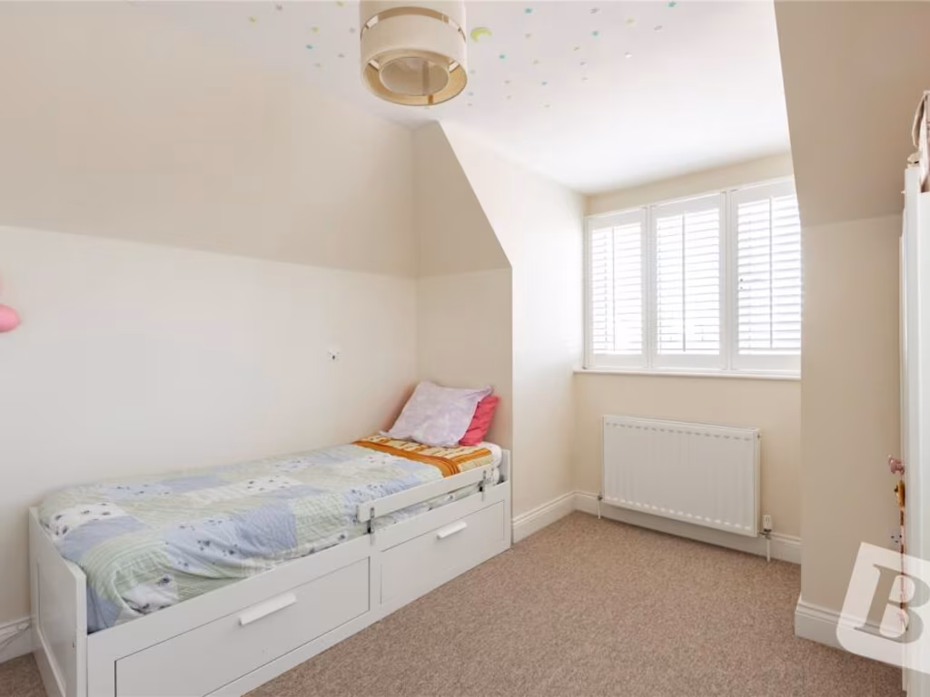
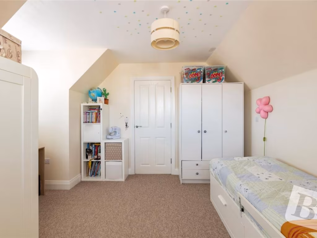
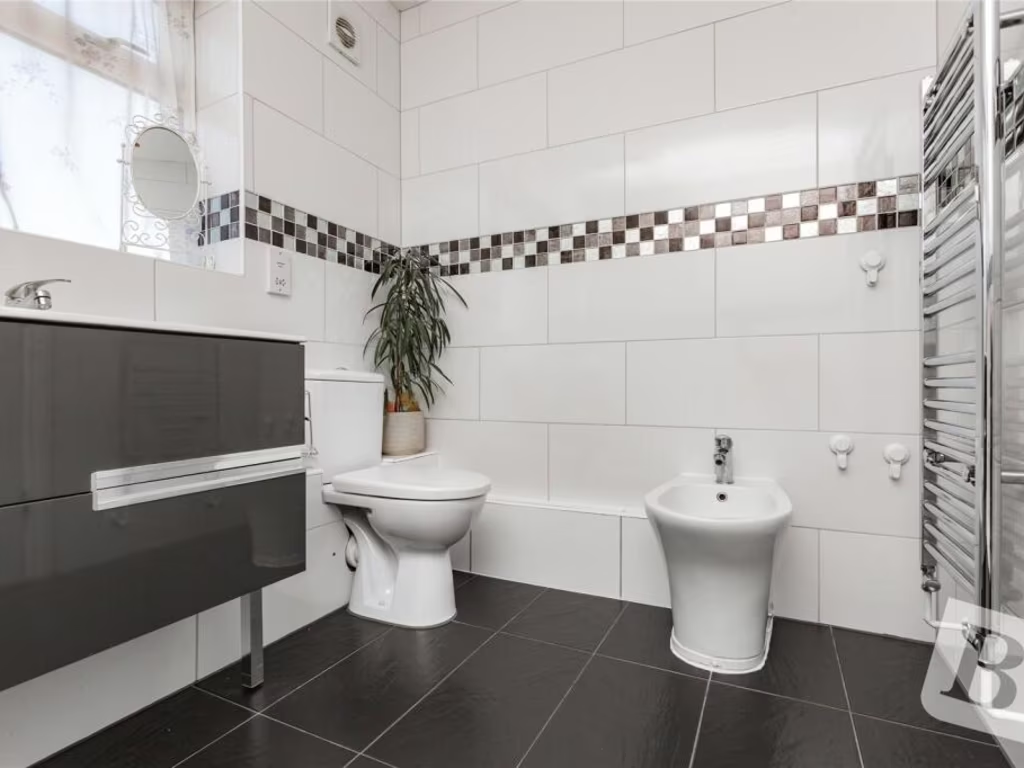
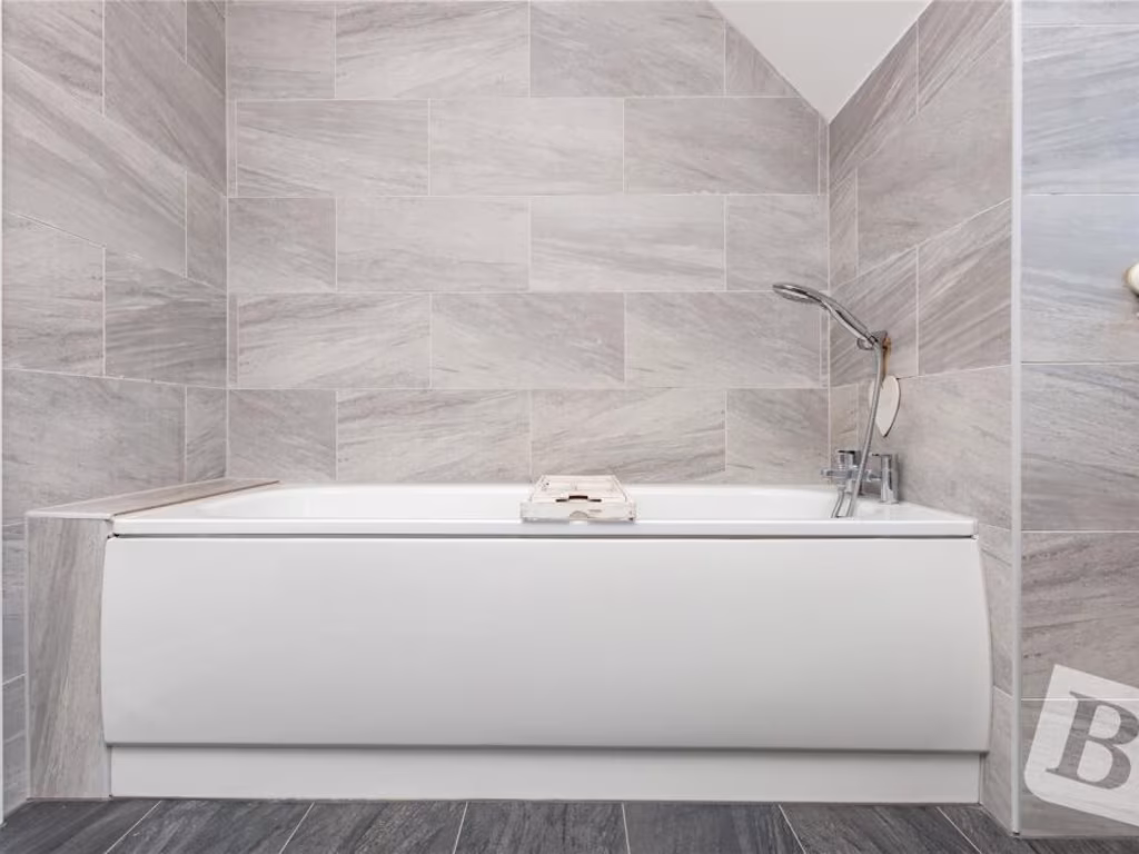
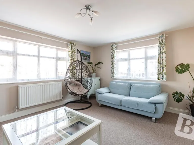
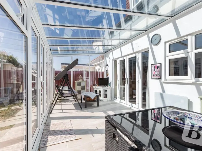
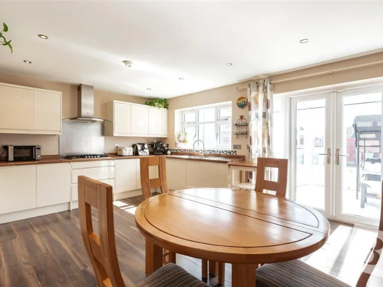
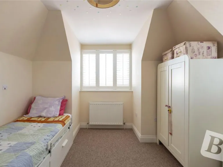
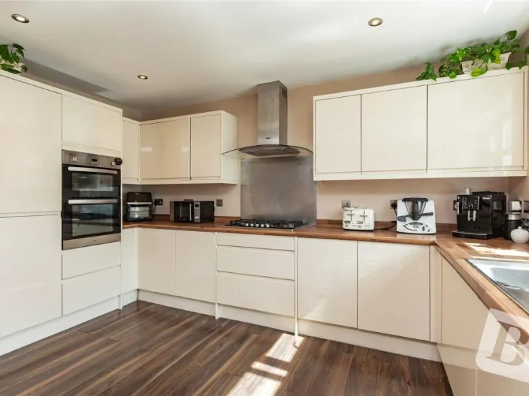
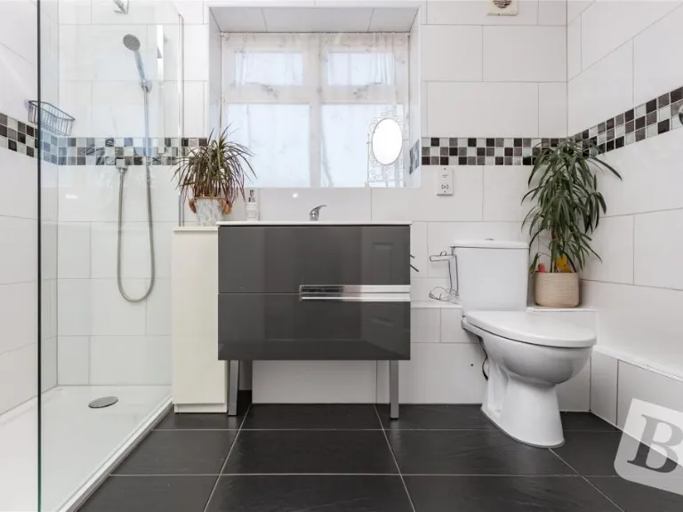
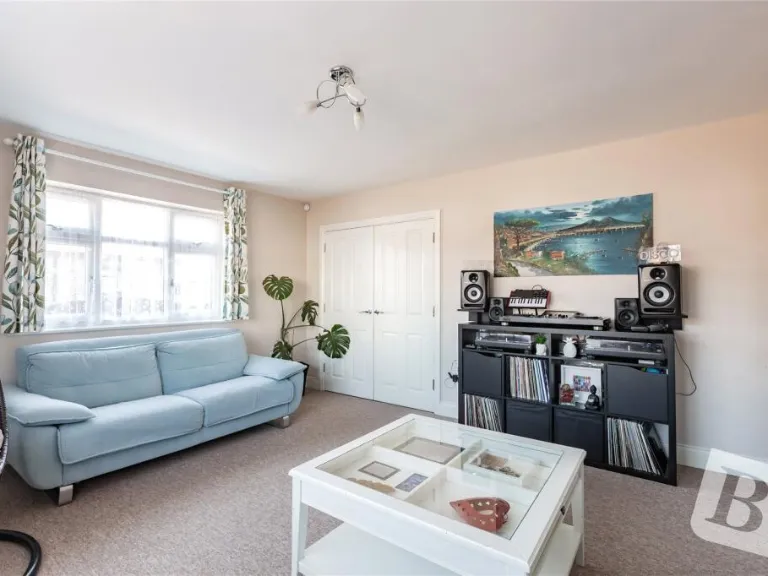
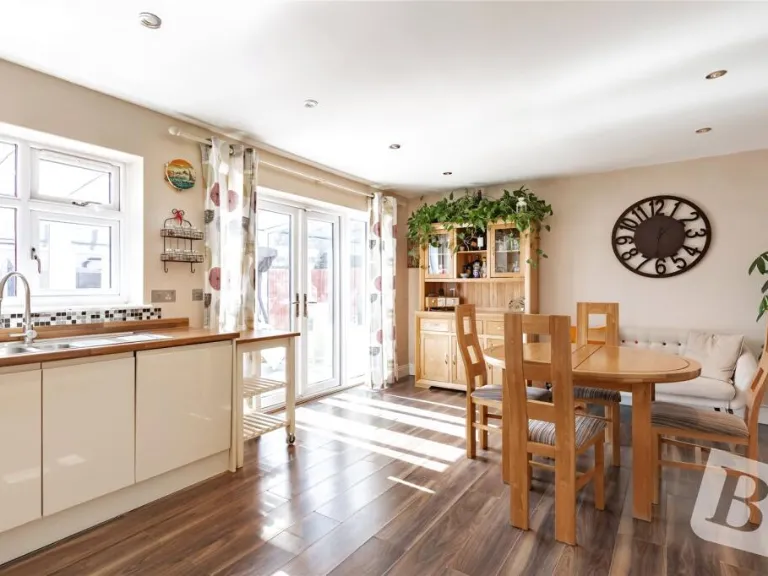
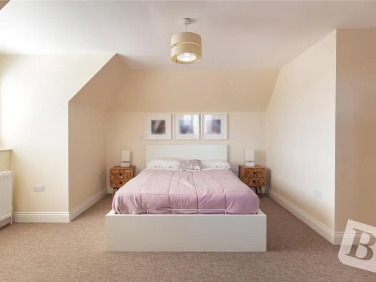
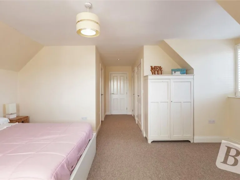
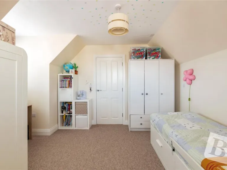
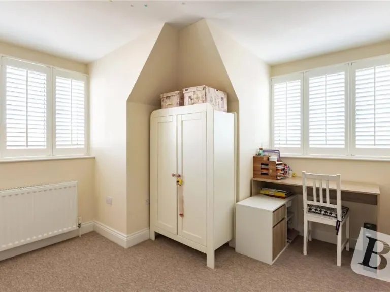
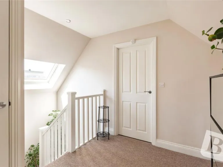
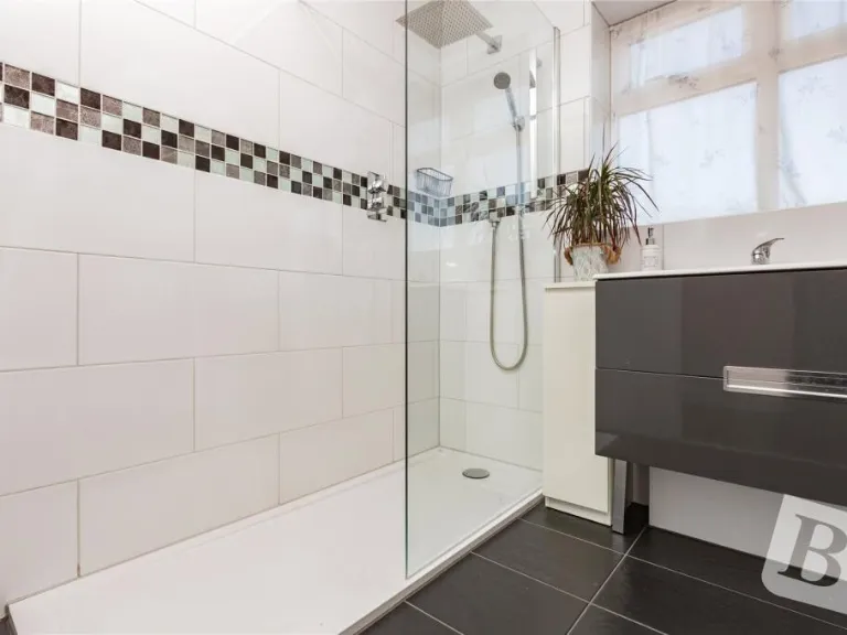
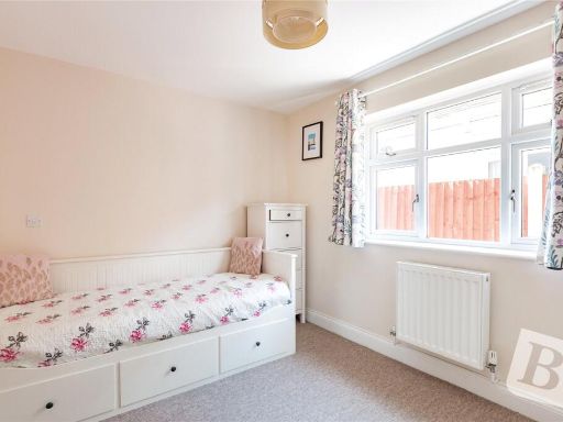
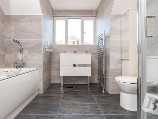
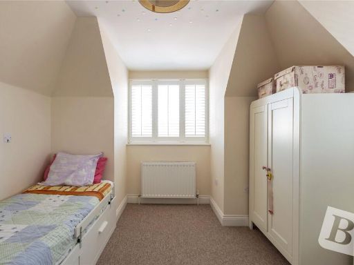
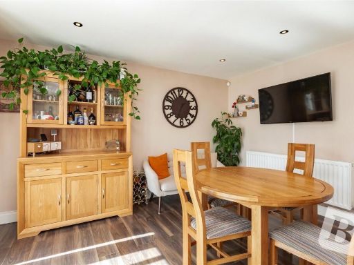
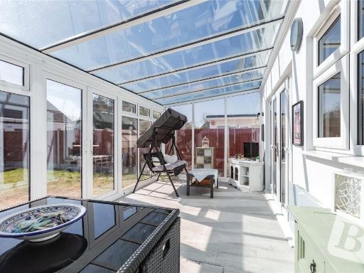
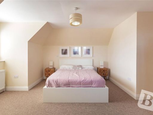
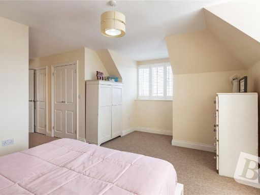
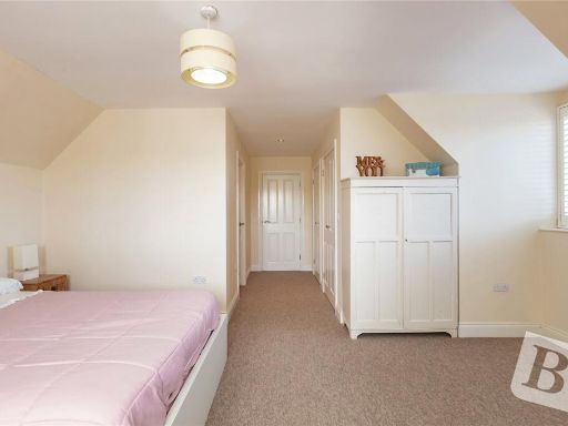
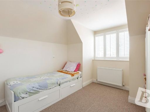
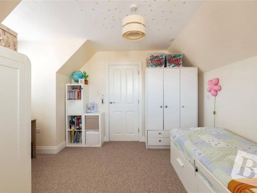
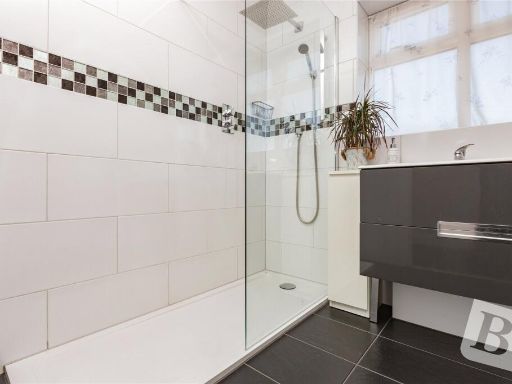
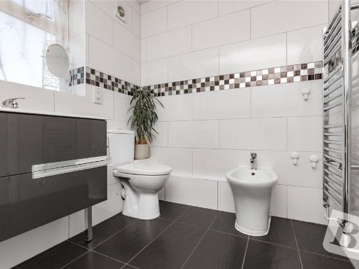
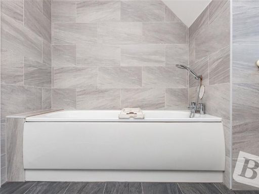
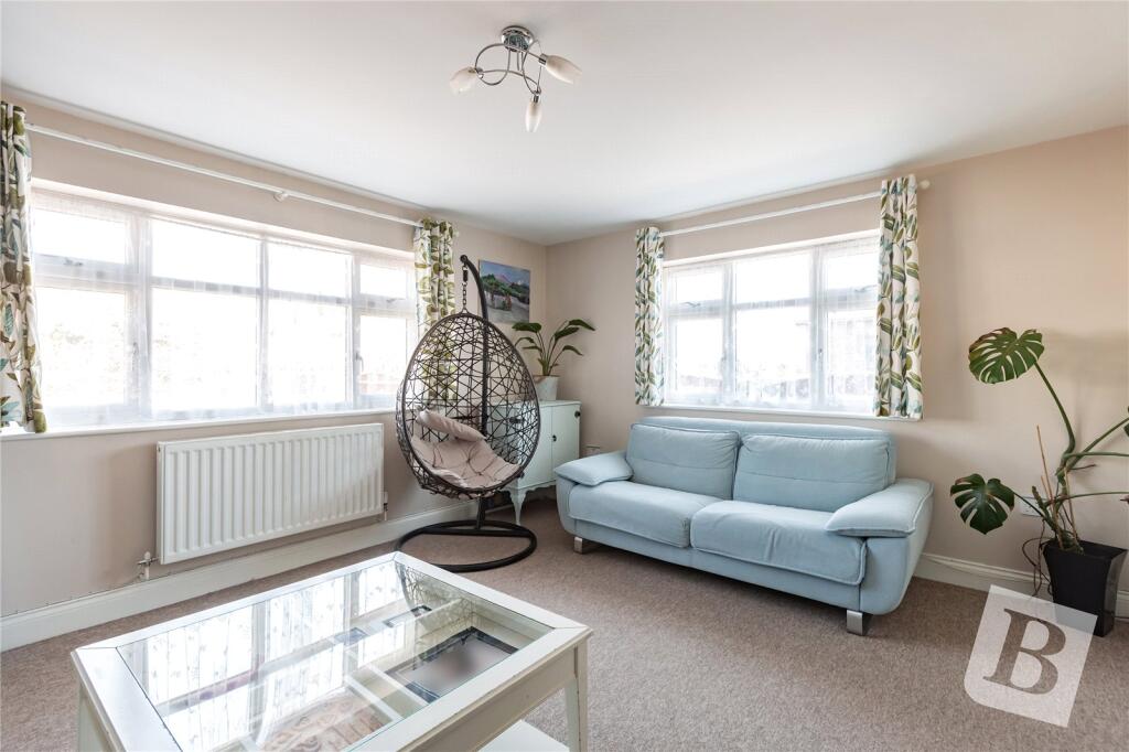
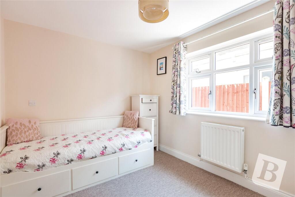
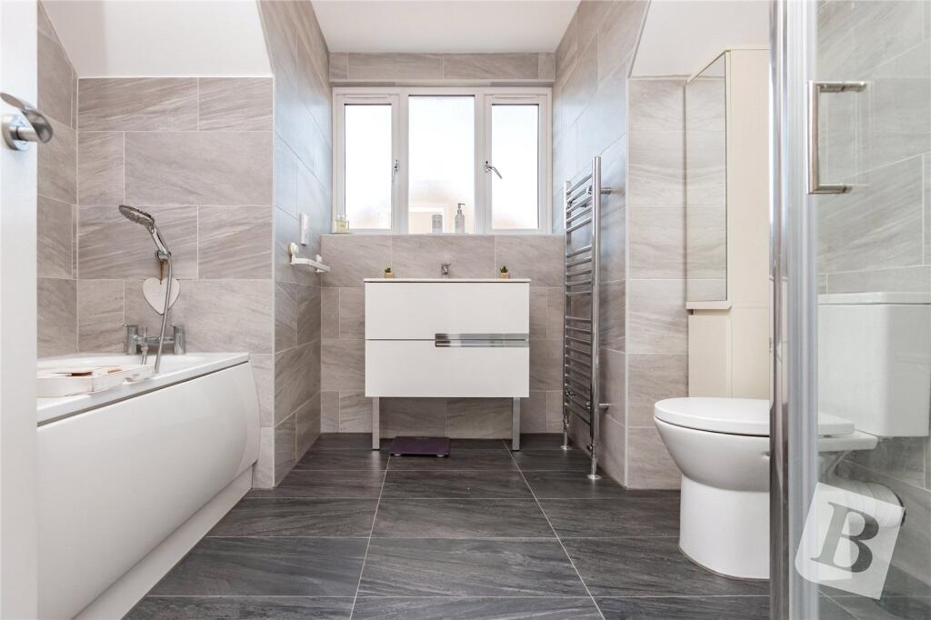
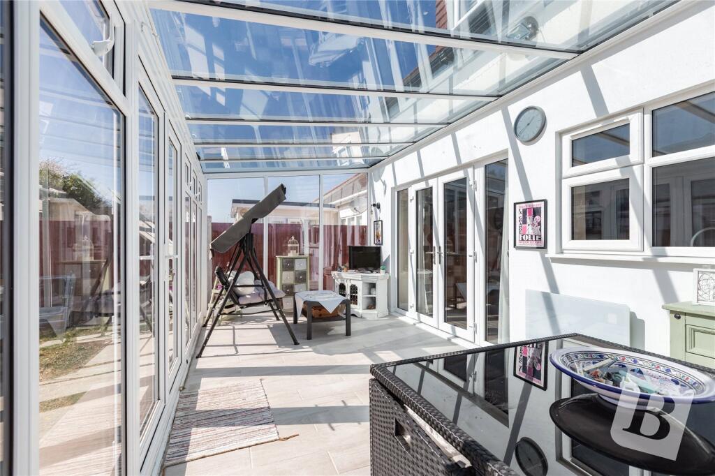
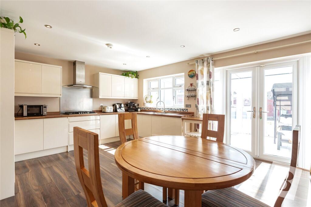
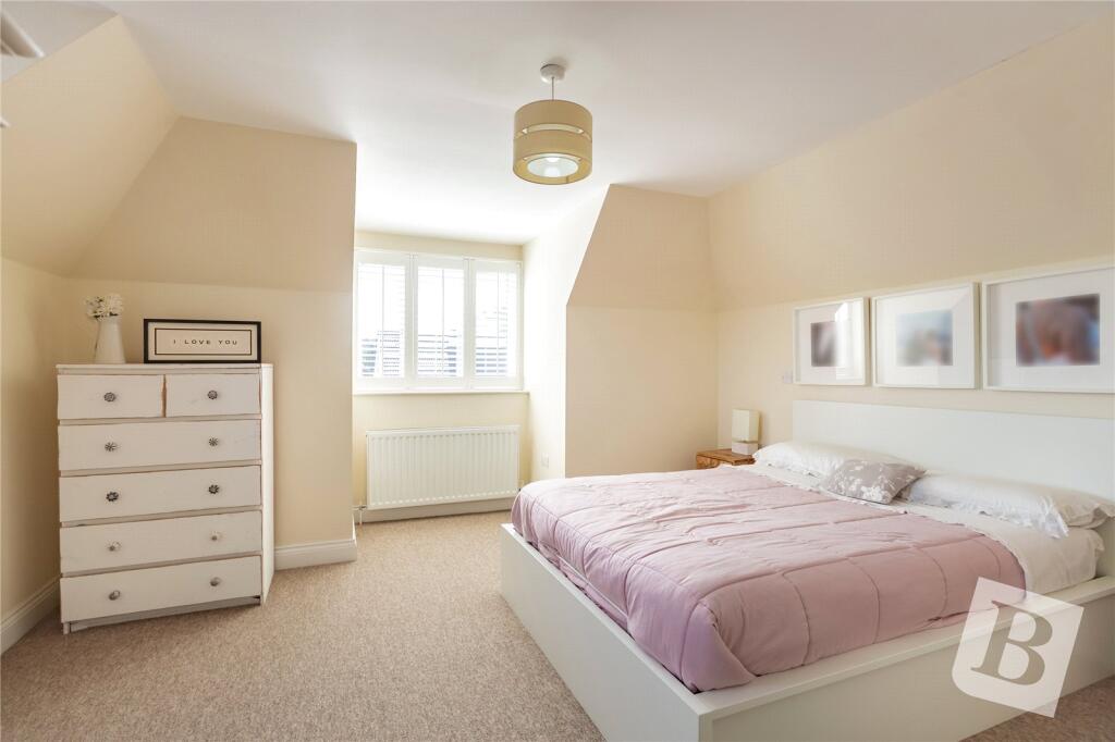
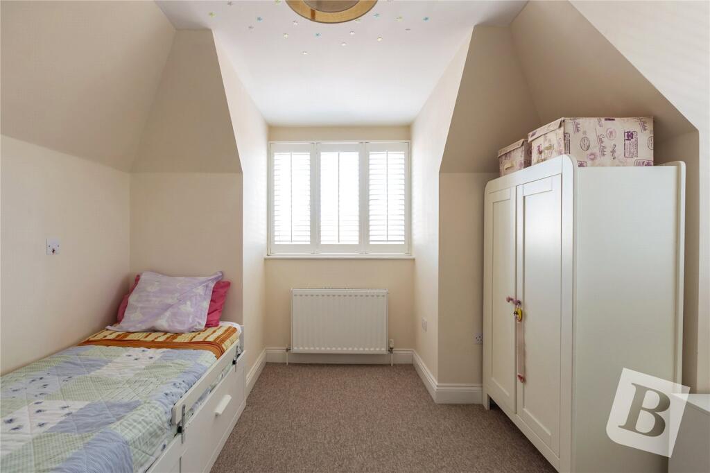
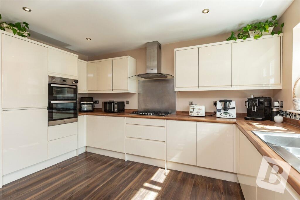
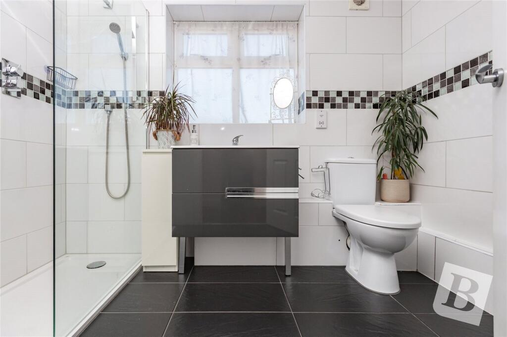
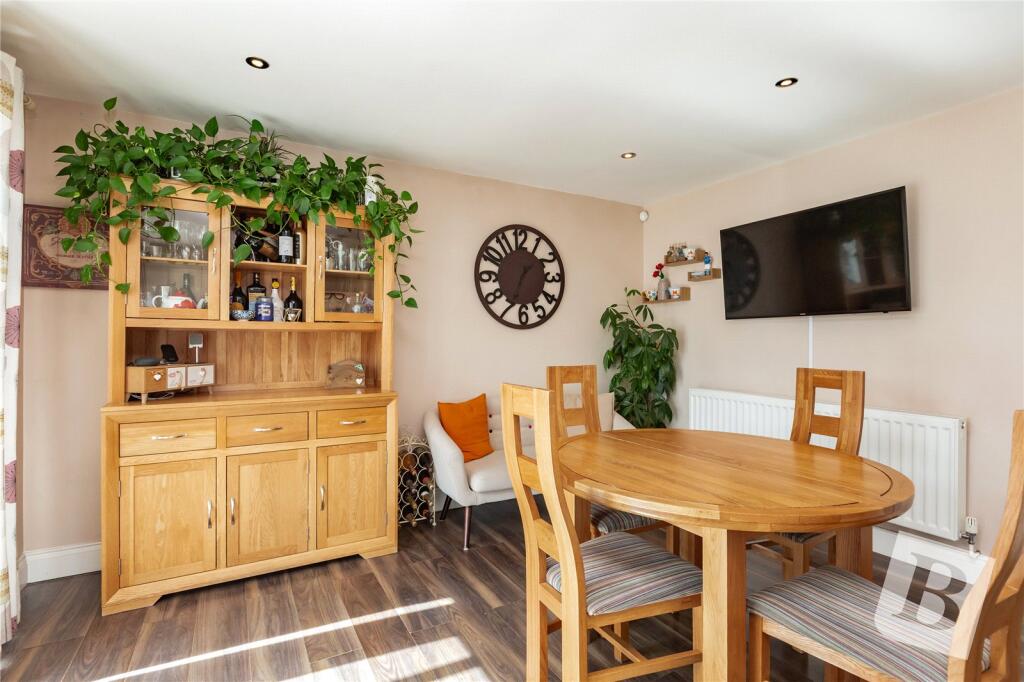
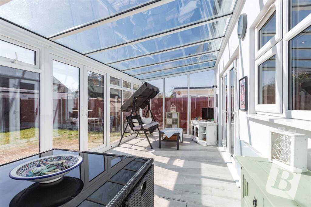
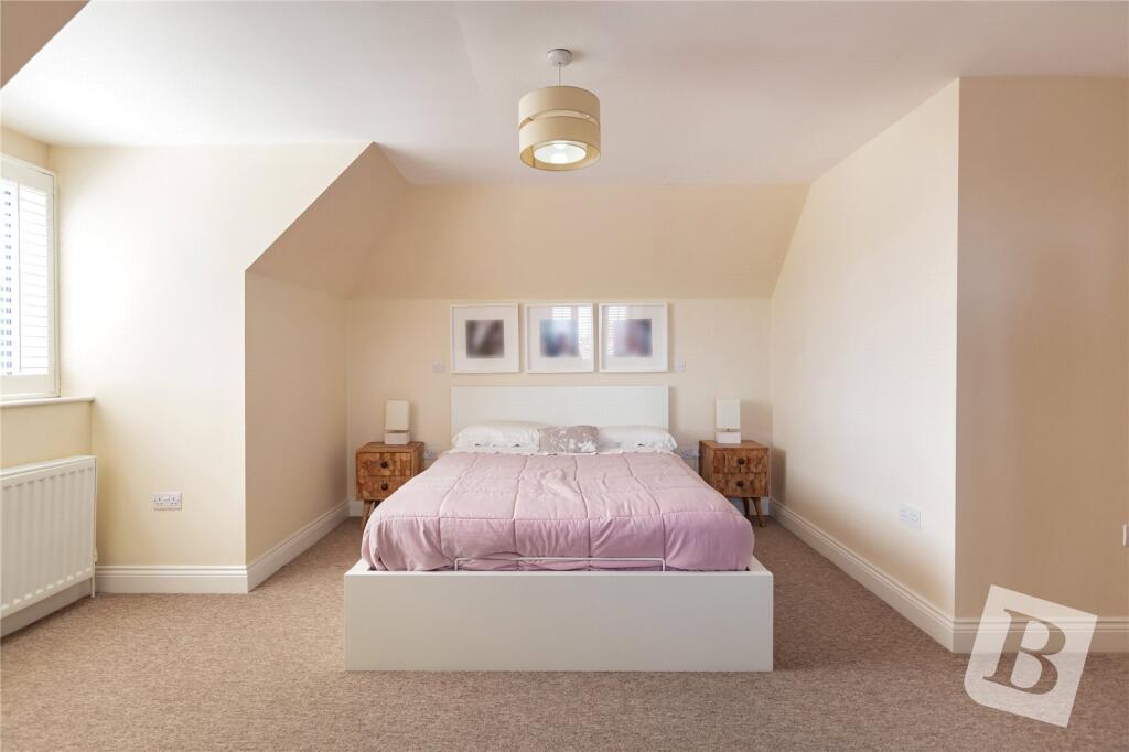
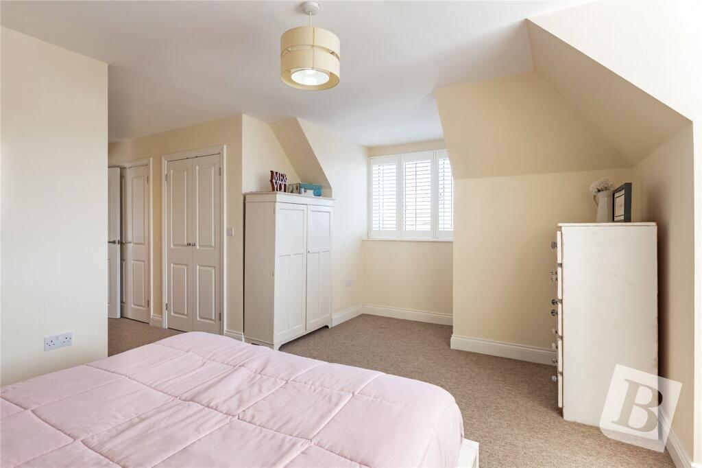
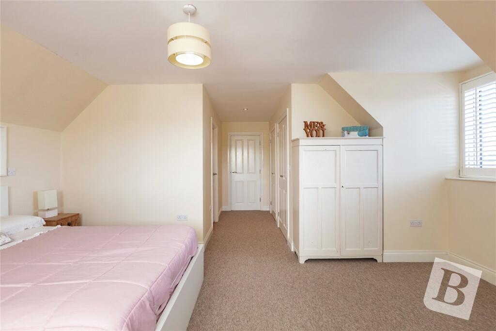
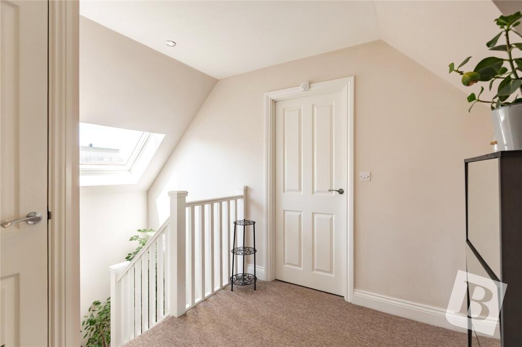
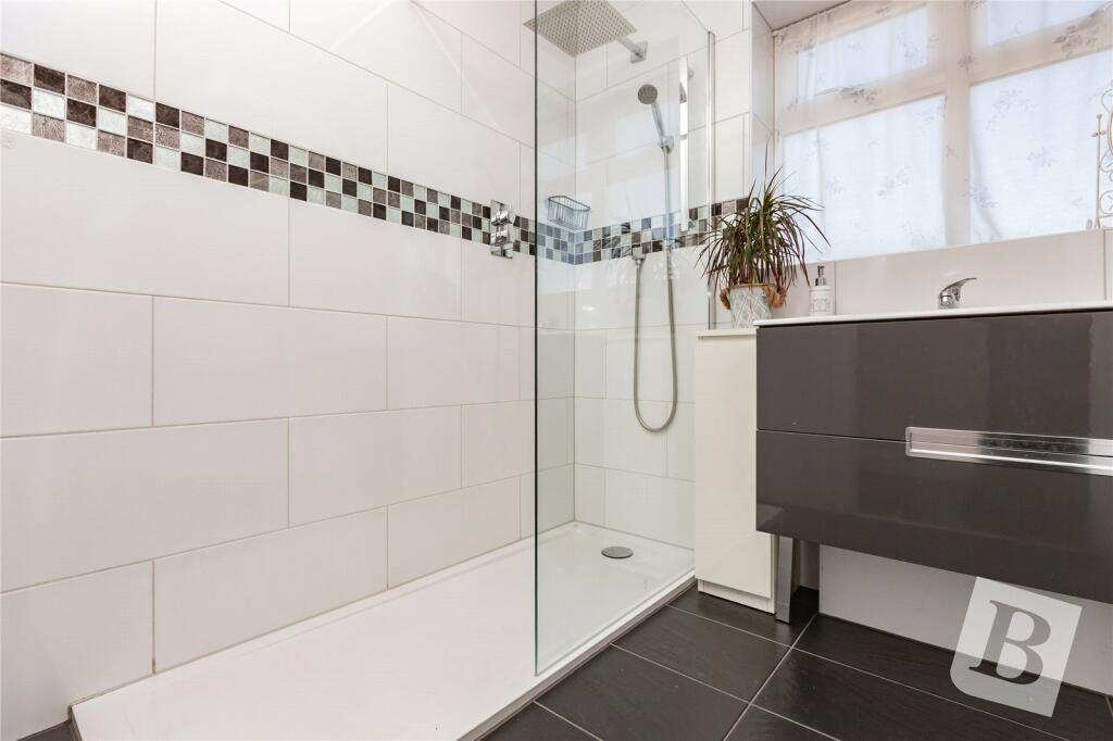
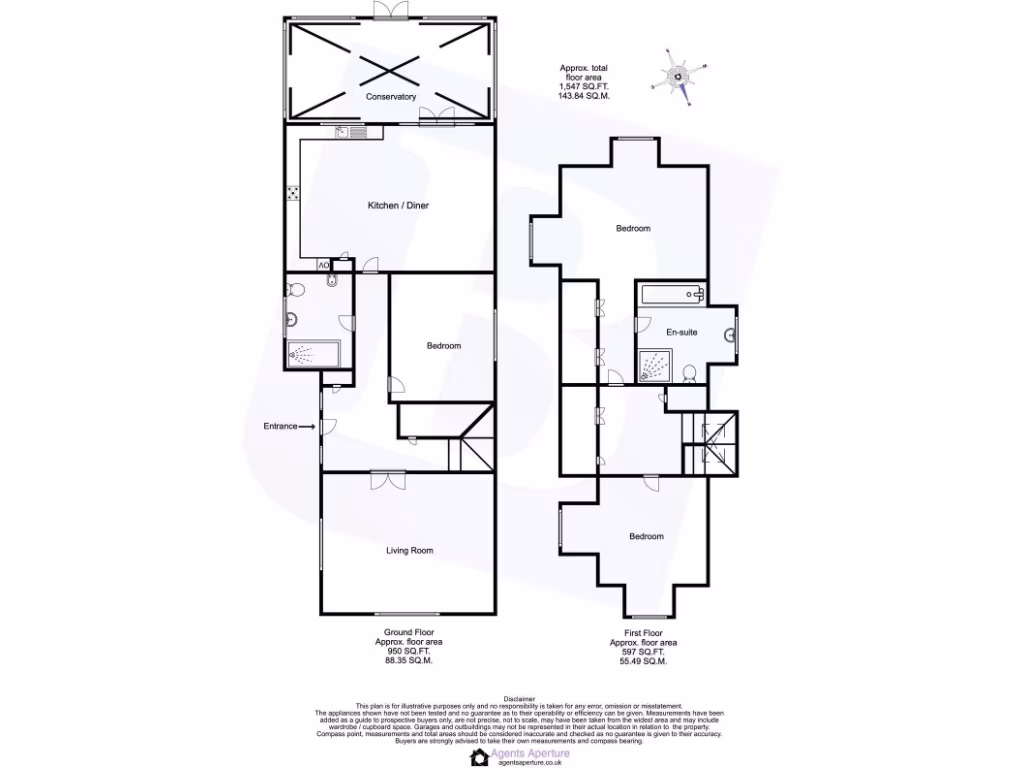
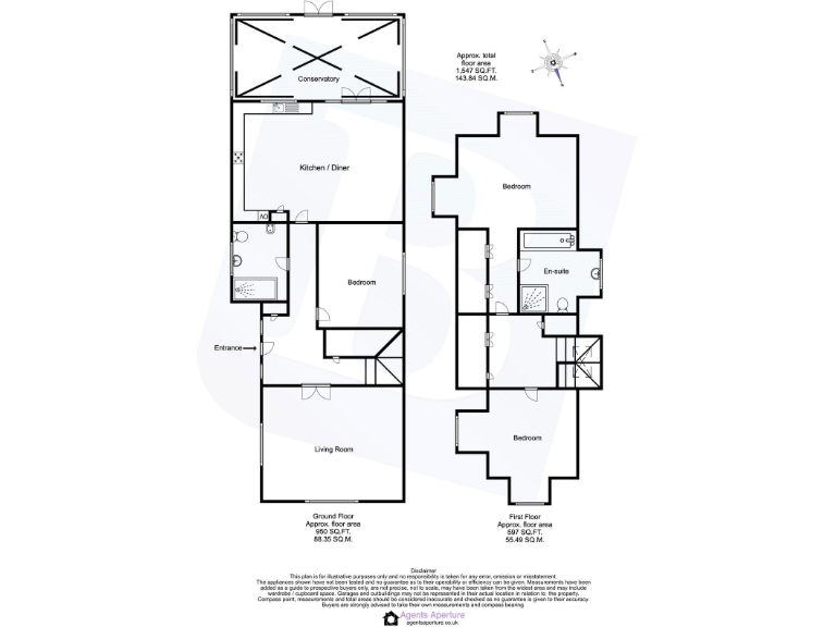
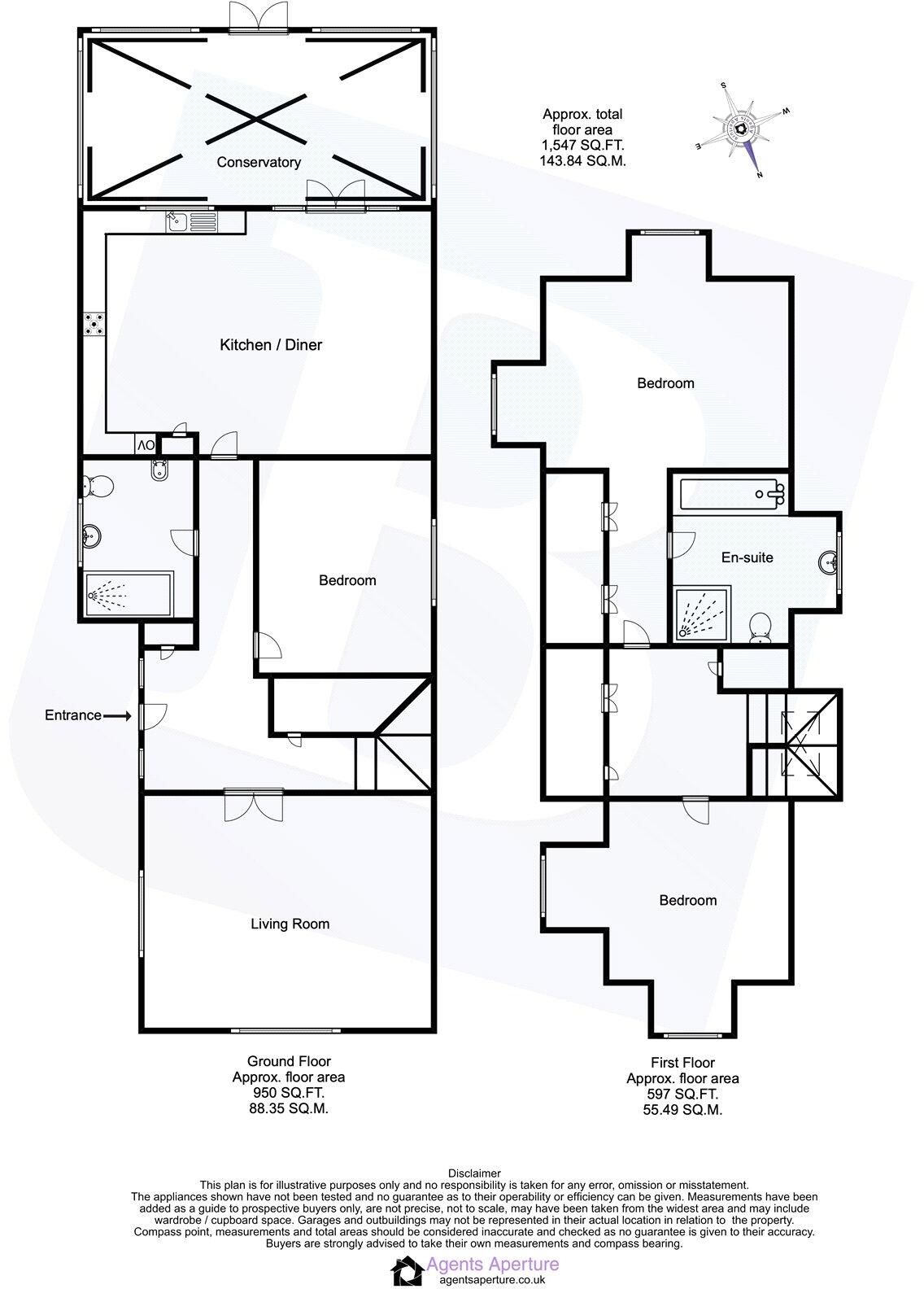
- This charming two-story home offers a thoughtfully arranged living space with a total area of approximately 1043 square feet. On the ground floor, the property features a spacious, open-plan kitchen and dining area that leads into a conservatory, providing abundant natural light and views of the surrounding area. The living room is of average size, with direct access to the two downstairs bedrooms, creating a seamless living experience. The upstairs includes two additional bedrooms, one with an en-suite bathroom, offering convenience and privacy for residents. The property does not include a view beyond the internal layout described. While the sizes of the individual rooms are mainly average, the total size of the property suggests a comfortable living environment, suitable for family living.
Image Descriptions
- residential house modern suburban
- living room contemporary
Rooms
- Conservatory:
- Kitchen / Diner:
- Living Room:
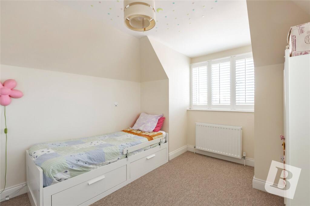
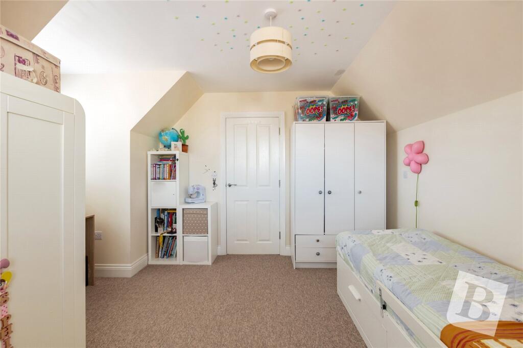
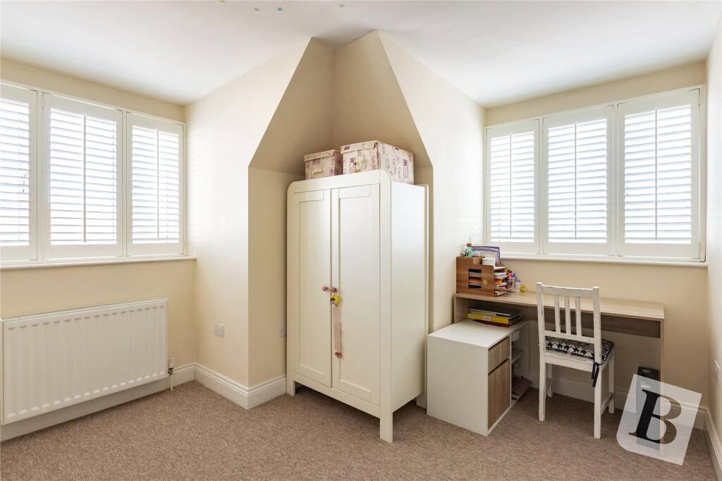
- Bedroom:
- Bedroom:
- Bedroom:
- En-suite:
Textual Property Features
Detected Visual Features
- modern
- suburban
- detached
- semi-detached
- two-story
- dormer windows
- driveway
- residential area
- contemporary
- living room
- bright
- standard ceiling
- radiator heating
- multiple windows
Nearby Schools
- La Salette Catholic Primary School
- Newtons Primary School
- The Leys Primary School
- Thomas Arnold Primary School, Rowdowns Road
- Village Infants' School
- Scargill Junior School
- Scargill Infant School
- Hunters Hall Primary School
- Five Elms Primary School
- William Bellamy Primary School
- Rush Green Primary School
- Marsh Green Primary School
- St Joseph's Catholic Primary School
- Whybridge Junior School
- The Brittons Academy
- Godwin Primary School
- William Ford CofE Junior School
- John Perry Primary School
- Brook Sixth Form and Academy
- Richard Alibon Primary School with ARP for Cognitive and Learning Difficulties : SEN Base
- Eastbrook School
- Robert Clack School
- Beam Primary School
- St Peter's Catholic Primary School
- Whybridge Infant School
- Dagenham Park CofE School
- Parsloes Primary School
- All Saints Catholic School and Technology College
Nearest General Shops
- Id: 122865222
- Tags:
- Building: yes
- Name: West & Coe Funeral Home
- Shop: funeral_directors
- TagsNormalized:
- funeral
- funeral directors
- shop
- Lat: 51.5419835
- Lon: 0.1658985
- FullGeoHash: u10j5ybvcdng
- PartitionGeoHash: u10j
- Images:
- FoodStandards: null
- Distance: 229.9
,- Id: 1127808816
- Tags:
- Addr:
- City: Dagenham
- Housenumber: 628
- Street: Rainham Road South
- Building: yes
- Name: Bespoke Flowers
- Shop: florist
- TagsNormalized:
- Lat: 51.5417891
- Lon: 0.1657205
- FullGeoHash: u10j5ybsttfh
- PartitionGeoHash: u10j
- Images:
- FoodStandards: null
- Distance: 213.4
,- Id: 870880179
- Tags:
- Building: yes
- Name: Peter James Group
- Shop: car_repair
- TagsNormalized:
- Lat: 51.539303
- Lon: 0.166078
- FullGeoHash: u10j5y2yjykt
- PartitionGeoHash: u10j
- Images:
- FoodStandards: null
- Distance: 93.8
}
Nearest Grocery shops
- Id: 122867216
- Tags:
- Addr:
- Housenumber: 627
- Street: Rainham Road South
- Brand: Londis
- Brand:wikidata: Q21008564
- Brand:wikipedia: en:Londis (United Kingdom)
- Building: retail
- Building:levels: 3
- Landuse: retail
- Name: Londis
- Shop: convenience
- TagsNormalized:
- londis
- retail
- convenience
- shop
- Lat: 51.5428995
- Lon: 0.1653364
- FullGeoHash: u10j5z07hsgg
- PartitionGeoHash: u10j
- Images:
- FoodStandards: null
- Distance: 338.7
,- Id: 122865223
- Tags:
- Addr:
- Housenumber: 5
- Street: Beadles Parade, Rainham Road South
- Building: retail
- Building:levels: 2
- Building:material: brick
- Name: Teenas Food Store
- Phone: +44 7903 718429;+44 7553 836498
- Shop: convenience
- Source: Bing;photograph
- TagsNormalized:
- retail
- food
- convenience
- shop
- Lat: 51.5427087
- Lon: 0.1659589
- FullGeoHash: u10j5z0f517c
- PartitionGeoHash: u10j
- Images:
- FoodStandards: null
- Distance: 307.2
,- Id: 870880185
- Tags:
- Brand: Londis
- Brand:wikidata: Q21008564
- Brand:wikipedia: en:Londis (United Kingdom)
- Building: retail
- Building:levels: 1
- Diet:
- Name: Londis
- Nohousenumber: yes
- Opening_hours: 24/7
- Roof:
- Shop: convenience
- Wheelchair: yes
- TagsNormalized:
- londis
- retail
- convenience
- shop
- Lat: 51.539017
- Lon: 0.1661207
- FullGeoHash: u10j5y2uwche
- PartitionGeoHash: u10j
- Images:
- FoodStandards: null
- Distance: 120.2
}
Nearest Religious buildings
- Id: 46875888
- Tags:
- Alt_name: St Peter and St Paul's Churchyard
- Amenity: grave_yard
- Leisure: nature_reserve
- Name: Dagenham Village Churchyard
- Wikidata: Q15212532
- Wikipedia: en:Dagenham Village Churchyard
- TagsNormalized:
- grave yard
- nature reserve
- leisure
- church
- Lat: 51.5392088
- Lon: 0.1625059
- FullGeoHash: u10j5wqmdsv5
- PartitionGeoHash: u10j
- Images:
- FoodStandards: null
- Distance: 312.5
,- Id: 9396545
- Tags:
- Name: Church Lane
- Network: London Buses
- Operator: Transport for London
- Public_transport: stop_area
- Public_transport:version: 2
- Type: public_transport
- TagsNormalized:
- Lat: 51.5381625
- Lon: 0.1649832
- FullGeoHash: u10j5y0ps3u6
- PartitionGeoHash: u10j
- Images:
- FoodStandards: null
- Distance: 241.4
,- Id: 122862041
- Tags:
- Amenity: place_of_worship
- Building: yes
- Denomination: methodist
- Name: Old Dagenham Methodist Church
- Religion: christian
- TagsNormalized:
- place of worship
- methodist
- church
- christian
- Lat: 51.5400016
- Lon: 0.1657686
- FullGeoHash: u10j5y8dq8wj
- PartitionGeoHash: u10j
- Images:
- FoodStandards: null
- Distance: 74.1
}
Nearest Medical buildings
- Id: 598513119
- Tags:
- TagsNormalized:
- Lat: 51.5399544
- Lon: 0.1573507
- FullGeoHash: u10j5wd9fxc5
- PartitionGeoHash: u10j
- Images:
- FoodStandards: null
- Distance: 656.3
,- Id: 120192812
- Tags:
- Addr:
- Housenumber: 2, 2A
- Street: Royal Parade, Church Street
- Amenity: pharmacy
- Building: yes
- Landuse: retail
- TagsNormalized:
- Lat: 51.5399837
- Lon: 0.1577772
- FullGeoHash: u10j5wdfhmr4
- PartitionGeoHash: u10j
- Images:
- FoodStandards: null
- Distance: 626.8
,- Id: 120359076
- Tags:
- Addr:
- City: Dagenham
- Postcode: RM10 9SR
- Street: John Parker Close
- Amenity: hospital
- Building: yes
- Emergency: no
- Fhrs:
- Id: 129890
- Local_authority_id: 60868
- Name: Grays Court Community Hospital
- TagsNormalized:
- Lat: 51.5392785
- Lon: 0.1580578
- FullGeoHash: u10j5w7n51b7
- PartitionGeoHash: u10j
- Images:
- FoodStandards:
- Id: 129890
- FHRSID: 129890
- LocalAuthorityBusinessID: 60868
- BusinessName: Grays Court Community Hospital
- BusinessType: Hospitals/Childcare/Caring Premises
- BusinessTypeID: 5
- AddressLine1: null
- AddressLine2: John Parker Close
- AddressLine3: null
- AddressLine4: Dagenham
- PostCode: RM10 9SR
- RatingValue: 5
- RatingKey: fhrs_5_en-GB
- RatingDate: 2017-03-02
- LocalAuthorityCode: 501
- LocalAuthorityName: Barking and Dagenham
- LocalAuthorityWebSite: http://www.lbbd.gov.uk/Pages/Home.aspx
- LocalAuthorityEmailAddress: foodsafety@lbbd.gov.uk
- Scores:
- Hygiene: 0
- Structural: 0
- ConfidenceInManagement: 0
- NewRatingPending: false
- Geocode:
- Longitude: 0.15729600000000
- Latitude: 51.53897700000000
- Distance: 612.7
,- Id: 122865212
- Tags:
- Addr:
- Housenumber: 7
- Street: Beadles Parade, Rainham Road South
- Amenity: pharmacy
- Brand: Day Lewis Pharmacy
- Brand:wikidata: Q62563772
- Building: retail
- Building:levels: 2
- Building:material: brick
- Healthcare: pharmacy
- Name: Day Lewis Pharmacy
- Source: Bing;photograph
- TagsNormalized:
- pharmacy
- day lewis pharmacy
- retail
- health
- healthcare
- Lat: 51.5426047
- Lon: 0.1659402
- FullGeoHash: u10j5z0c6tvv
- PartitionGeoHash: u10j
- Images:
- FoodStandards: null
- Distance: 296.1
}
Nearest Airports
- Id: 103894219
- Tags:
- Aerodrome: international
- Aeroway: aerodrome
- Iata: SEN
- Icao: EGMC
- Name: London Southend Airport
- Old_name: Southend Municipal Airport
- Ref: SEN
- Wikidata: Q1415441
- TagsNormalized:
- airport
- international airport
- Lat: 51.5701749
- Lon: 0.6924624
- FullGeoHash: u10mru04p937
- PartitionGeoHash: u10m
- Images:
- FoodStandards: null
- Distance: 36494.3
,- Id: 121158889
- Tags:
- Aerodrome: continental
- Aeroway: aerodrome
- Fhrs:
- Authority: City of London Corporation
- Iata: LCY
- Icao: EGLC
- Name: London City Airport
- Operator: London City Airport Limited
- Ref: LCY
- Website: https://www.londoncityairport.com/
- Wikidata: Q8982
- Wikipedia: en:London City Airport
- TagsNormalized:
- airport
- continental airport
- Lat: 51.5042658
- Lon: 0.0539987
- FullGeoHash: u10j10p64702
- PartitionGeoHash: u10j
- Images:
- FoodStandards: null
- Distance: 8760.2
}
Nearest Leisure Facilities
- Id: 119005936
- Tags:
- TagsNormalized:
- Lat: 51.5384454
- Lon: 0.1615184
- FullGeoHash: u10j5wm95wsf
- PartitionGeoHash: u10j
- Images:
- FoodStandards: null
- Distance: 406.7
,- Id: 359450403
- Tags:
- Access: no
- Leisure: swimming_pool
- Sport: swimming
- TagsNormalized:
- swimming
- swimming pool
- pool
- leisure
- sports
- Lat: 51.5422267
- Lon: 0.1714127
- FullGeoHash: u10j5yuz4pqw
- PartitionGeoHash: u10j
- Images:
- FoodStandards: null
- Distance: 401.5
,- Id: 359450398
- Tags:
- TagsNormalized:
- Lat: 51.5419926
- Lon: 0.171423
- FullGeoHash: u10j5yuvf7y3
- PartitionGeoHash: u10j
- Images:
- FoodStandards: null
- Distance: 386.6
,- Id: 1150206889
- Tags:
- Leisure: garden
- Name: Stoneford Cottage Garden
- TagsNormalized:
- Lat: 51.5370293
- Lon: 0.1692455
- FullGeoHash: u10j5y50zwwd
- PartitionGeoHash: u10j
- Images:
- FoodStandards: null
- Distance: 369.9
,- Id: 870880160
- Tags:
- Access: yes
- Leisure: playground
- Name: Baynes Crescent Playground
- TagsNormalized:
- Lat: 51.538061
- Lon: 0.1665336
- FullGeoHash: u10j5y1qbwbm
- PartitionGeoHash: u10j
- Images:
- FoodStandards: null
- Distance: 216.8
}
Nearest Tourist attractions
- Id: 865382603
- Tags:
- Building: yes
- Name: Ford Heritage Centre
- Tourism: museum
- TagsNormalized:
- Lat: 51.5209131
- Lon: 0.1508832
- FullGeoHash: u10j57jg5f69
- PartitionGeoHash: u10j
- Images:
- FoodStandards: null
- Distance: 2392.4
,- Id: 424227055
- Tags:
- Building: yes
- Name: Will Perrin Court
- Operator: Havering Council
- Smoking: isolated
- Tourism: hostel
- TagsNormalized:
- Lat: 51.5323954
- Lon: 0.1922057
- FullGeoHash: u10jhm5vywyb
- PartitionGeoHash: u10j
- Images:
- FoodStandards: null
- Distance: 1947.6
,- Id: 6239276386
- Tags:
- Name: Igor
- Tourism: apartment
- TagsNormalized:
- Lat: 51.5434984
- Lon: 0.1468202
- FullGeoHash: u10j5r4ytht0
- PartitionGeoHash: u10j
- Images:
- FoodStandards: null
- Distance: 1438.1
}
Nearest Hotels
- Id: 1118341939
- Tags:
- Addr:
- City: Dagenham
- Housename: hotel
- Housenumber: 8
- Postcode: RM9 6UQ
- Street: Cook Road
- Description: um lugar grande
- Smoking: no
- Tourism: hotel
- TagsNormalized:
- Lat: 51.5322197
- Lon: 0.1338612
- FullGeoHash: u10j5j1kznn0
- PartitionGeoHash: u10j
- Images:
- FoodStandards: null
- Distance: 2439.6
,- Id: 676486619
- Tags:
- Addr:
- City: Dagenham
- Postcode: RM9 6YS
- Street: Chequers Lane
- Brand: Premier Inn
- Brand:wikidata: Q2108626
- Brand:wikipedia: en:Premier Inn
- Building: hotel
- Internet_access: wlan
- Internet_access:fee: customers
- Internet_access:operator: Virgin Media
- Internet_access:ssid: Premier Inn Free Wi-Fi
- Name: Premier Inn
- Source:
- Tourism: hotel
- TagsNormalized:
- Lat: 51.5311711
- Lon: 0.1489535
- FullGeoHash: u10j5kuqyfec
- PartitionGeoHash: u10j
- Images:
- FoodStandards: null
- Distance: 1579.4
,- Id: 860397933
- Tags:
- Addr:
- City: Dagenham
- Postcode: RM10 7FN
- Street: Yew Tree Avenue
- Alt_name: Travelodge London Dagenham East
- Branch: London Dagenham East
- Brand: Travelodge
- Brand:wikidata: Q9361374
- Brand:wikipedia: en:Travelodge UK
- Building: yes
- Internet_access: wlan
- Internet_access:fee: customers
- Internet_access:ssid: Travelodge WiFi
- Name: Travelodge
- Tourism: hotel
- Wheelchair: yes
- TagsNormalized:
- Lat: 51.5459415
- Lon: 0.1665858
- FullGeoHash: u10j5z9kcezq
- PartitionGeoHash: u10j
- Images:
- FoodStandards: null
- Distance: 660.8
}
Tags
- modern
- suburban
- detached
- semi-detached
- two-story
- dormer windows
- driveway
- residential area
- contemporary
- living room
- bright
- standard ceiling
- radiator heating
- multiple windows
Local Market Stats
- Average Price/sqft: £425
- Avg Income: £42300
- Rental Yield: 6.5%
- Social Housing: 28%
- Planning Success Rate: 72%
AirBnB Data
- 1km average: £86/night
- Listings in 1km: 2
Similar Properties
 3 bedroom house for sale in Gainsborough Road, Dagenham, RM8 — £490,000 • 3 bed • 1 bath • 802 ft²
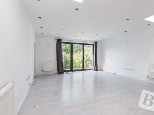 4 bedroom semi-detached house for sale in Purland Close, Dagenham, RM8 — £550,000 • 4 bed • 2 bath • 1138 ft²
 2 bedroom detached bungalow for sale in Dagmar Road, Dagenham, RM10 — £500,000 • 2 bed • 2 bath • 3620 ft²
 5 bedroom end of terrace house for sale in Second Avenue, Dagenham, RM10 — £550,000 • 5 bed • 2 bath • 1465 ft²
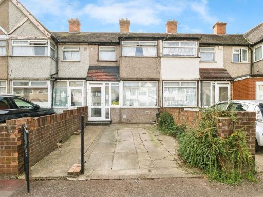 3 bedroom terraced house for sale in Oval Road North, Dagenham, RM10 — £365,000 • 3 bed • 1 bath • 755 ft²
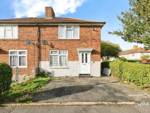 3 bedroom semi-detached house for sale in Alibon Road, DAGENHAM, Essex, RM10 — £435,000 • 3 bed • 1 bath • 710 ft²
Meta
- {
"@context": "https://schema.org",
"@type": "Residence",
"name": "3 bedroom detached bungalow for sale in Cadiz Road, Dagenha…",
"description": "",
"url": "https://propertypiper.co.uk/property/1d736838-8939-45c1-aebf-d370c1ea2041",
"image": "https://image-a.propertypiper.co.uk/1f7b139b-0881-4f8b-89b9-81ae86cf7916-1024.jpeg",
"address": {
"@type": "PostalAddress",
"streetAddress": "Cadiz Road, Dagenham, RM10",
"postalCode": "RM10 8XL",
"addressLocality": "Barking and Dagenham",
"addressRegion": "Dagenham and Rainham",
"addressCountry": "England"
},
"geo": {
"@type": "GeoCoordinates",
"latitude": 51.540001,
"longitude": 0.1668407
},
"numberOfRooms": 3,
"numberOfBathroomsTotal": 2,
"floorSize": {
"@type": "QuantitativeValue",
"value": 1547,
"unitCode": "FTK"
},
"offers": {
"@type": "Offer",
"price": 550000,
"priceCurrency": "GBP",
"availability": "https://schema.org/InStock"
},
"additionalProperty": [
{
"@type": "PropertyValue",
"name": "Feature",
"value": "modern"
},
{
"@type": "PropertyValue",
"name": "Feature",
"value": "suburban"
},
{
"@type": "PropertyValue",
"name": "Feature",
"value": "detached"
},
{
"@type": "PropertyValue",
"name": "Feature",
"value": "semi-detached"
},
{
"@type": "PropertyValue",
"name": "Feature",
"value": "two-story"
},
{
"@type": "PropertyValue",
"name": "Feature",
"value": "dormer windows"
},
{
"@type": "PropertyValue",
"name": "Feature",
"value": "driveway"
},
{
"@type": "PropertyValue",
"name": "Feature",
"value": "residential area"
},
{
"@type": "PropertyValue",
"name": "Feature",
"value": "contemporary"
},
{
"@type": "PropertyValue",
"name": "Feature",
"value": "living room"
},
{
"@type": "PropertyValue",
"name": "Feature",
"value": "bright"
},
{
"@type": "PropertyValue",
"name": "Feature",
"value": "standard ceiling"
},
{
"@type": "PropertyValue",
"name": "Feature",
"value": "radiator heating"
},
{
"@type": "PropertyValue",
"name": "Feature",
"value": "multiple windows"
}
]
}
High Res Floorplan Images
Compatible Floorplan Images
FloorplanImages Thumbnail