M6 8NW - 3 bedroom semidetached house for sale in Margrove Road, Sal…
View on Property Piper
3 bedroom semi-detached house for sale in Margrove Road, Salford, M6
Property Details
- Price: £280000
- Bedrooms: 3
- Bathrooms: 2
- Property Type: undefined
- Property SubType: undefined
Brochure Descriptions
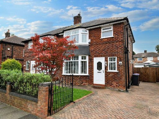
- Semi‑detached two‑storey red brick house located on Margrove Road, Salford. The property presents a traditional bay window to the front, white PVCu front door, and a paved driveway providing off‑street parking and pedestrian access to the side. Small, neatly maintained front lawn and low brick boundary with wrought‑iron gate. Likely offers 2–3 bedrooms with living accommodation over two floors (inferred from external proportions). Rear garden not visible but there is side vehicular access suggesting a private rear space. Overall plot appears average for an urban/suburban semi, front garden small and driveway offering useful parking provision. The property would suit owner‑occupiers or buy‑to‑let purchasers seeking a straightforward family house in a residential area.
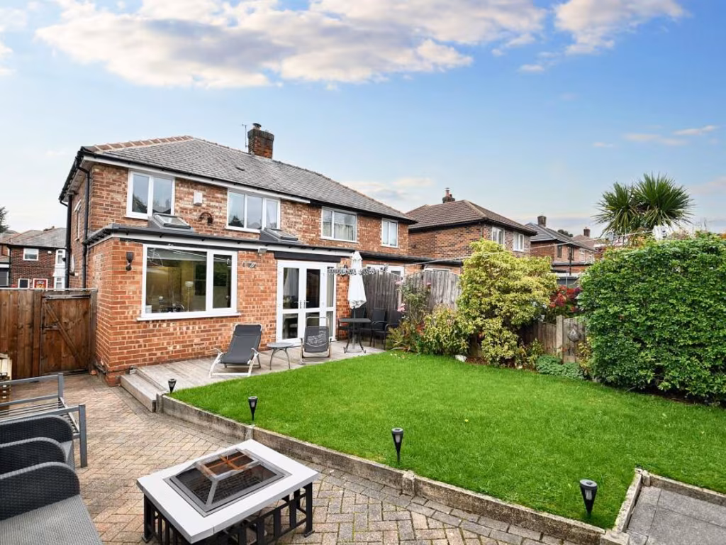
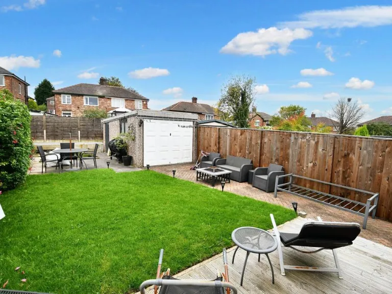
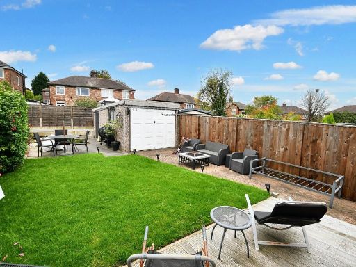
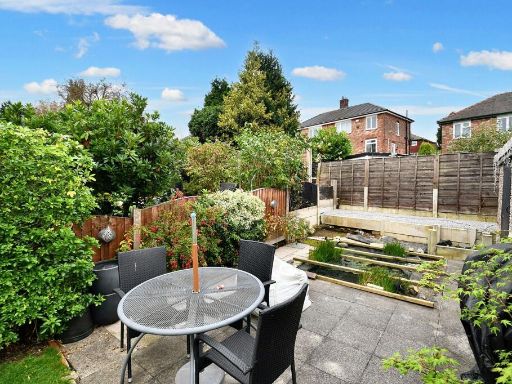
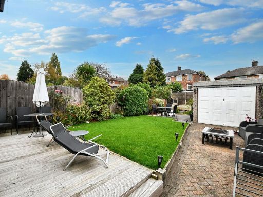
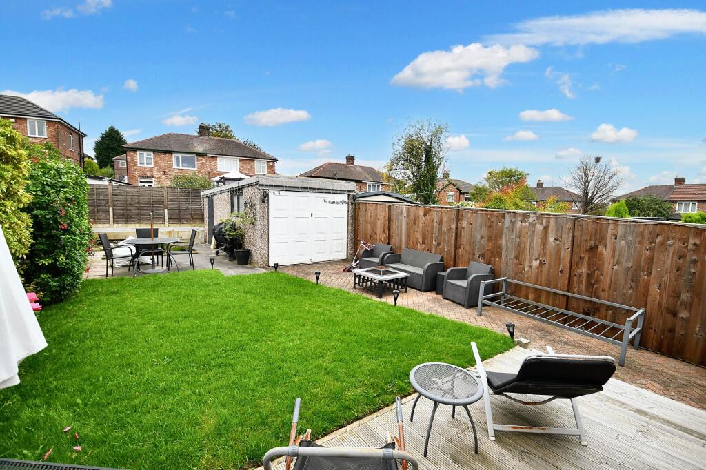
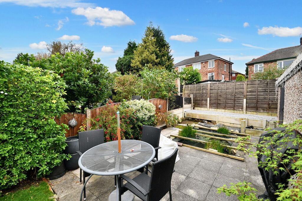
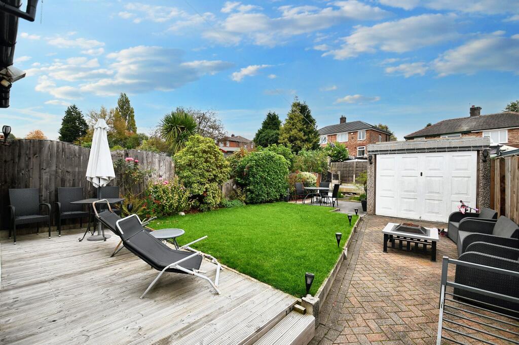
- Two-storey semi-detached brick house with a single-storey rear extension. The photo shows a well-maintained rear garden of average size with a paved patio area, raised lawn and mature boundary shrubs/hedging providing good privacy. Property appears to be in good decorative order externally with double-glazed windows and a tiled roof. Likely to be a typical mid-20th-century suburban family house (probable 2–4 bedrooms) offering a private rear garden and outdoor entertaining space. Overall plot size: average for a suburban semi-detached property. Views: local suburban neighbourhood, no notable long-distance vistas.
Image Descriptions
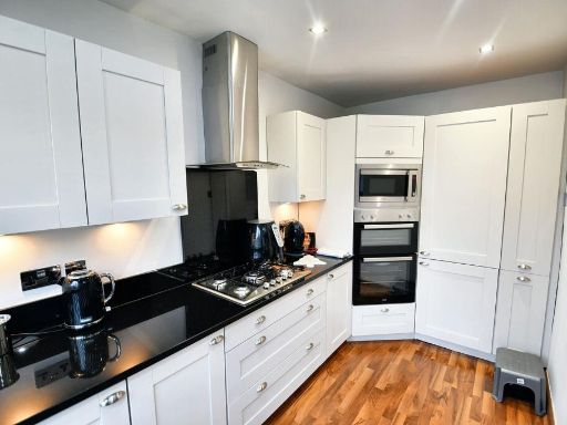
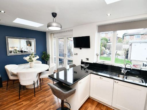
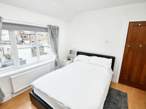
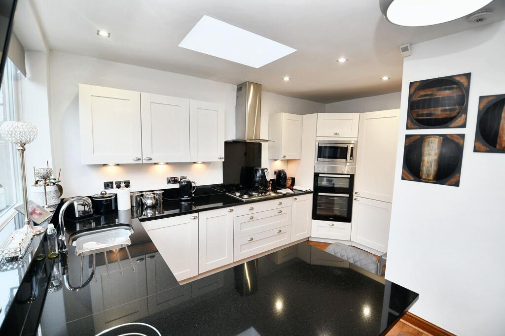
- exterior of a semidetached house Mid-20th Century Suburban
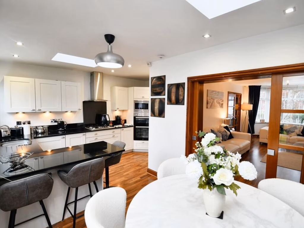
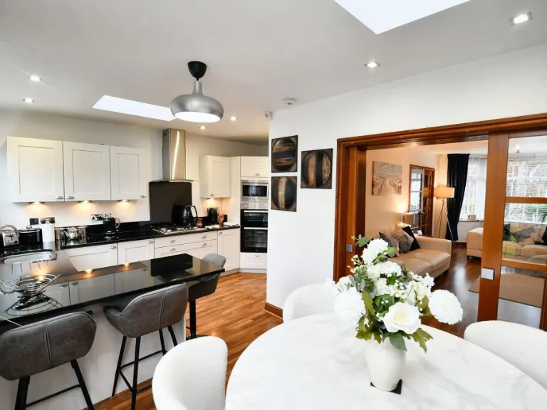
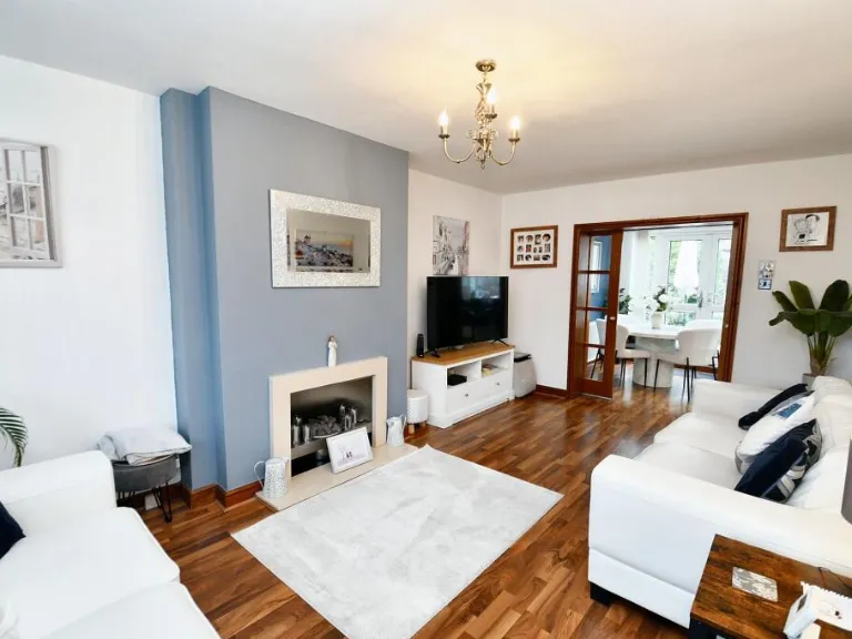
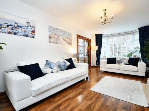
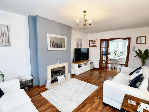
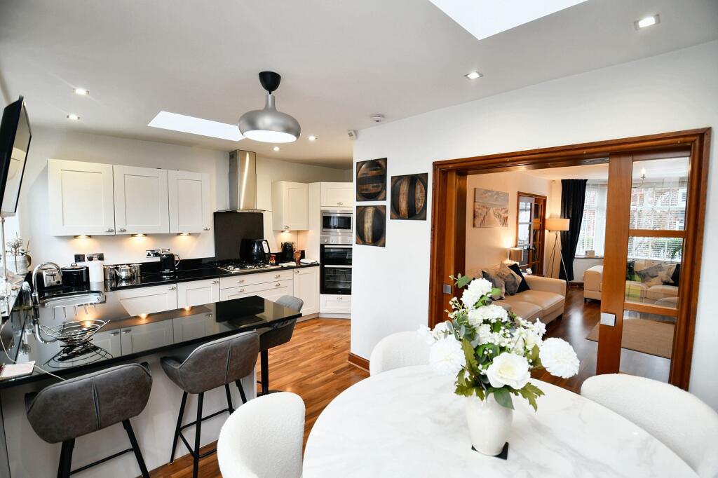
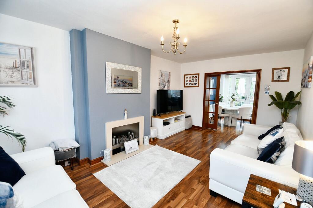
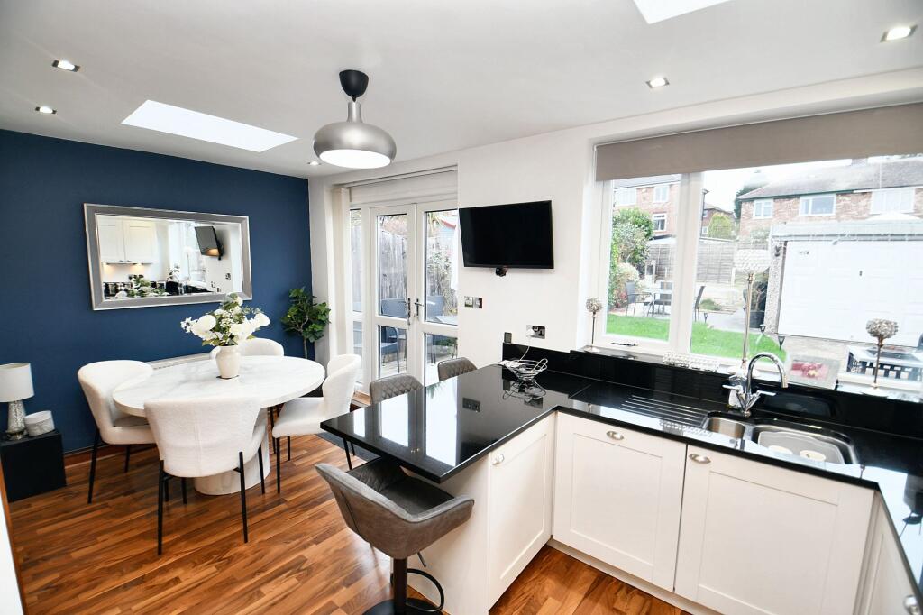
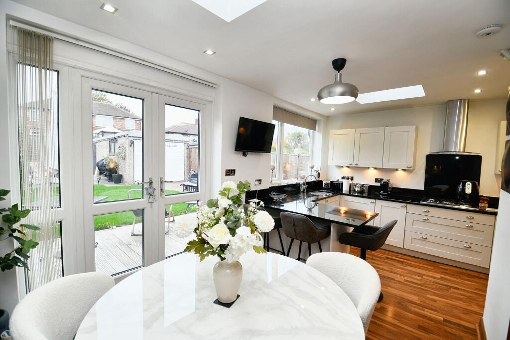
- living room contemporary
Textual Property Features
Detected Visual Features
- semidetached
- brick
- suburban
- 20th Century
- exterior
- driveway
- garden
- UK architecture
- residential
- contemporary
- living room
- wood flooring
- bay window
- white walls
- chandelier
- glazed wood doors
Nearby Schools
- St Augustine's CofE Primary School
- St Mary's RC Primary School
- King of Kings
- Branwood Preparatory School
- Light Oaks Junior School
- Summerville Primary School
- Grosvenor Road Primary School
- St Andrew's CofE Primary School
- St Luke's CofE Primary School
- All Hallows RC High School
- Ellesmere Park High School
- St John's CofE Primary School
- The Deans Primary School
- St Mary's RC Primary School
- St Mark's RC Primary School
- Holy Family VA RC Primary School
- Monton Green Primary School
- Light Oaks Infant School
- St Luke's RC Primary School
- AldridgeUTC@MediaCityUK
- Willow Tree Primary School
- Clarendon Road Community Primary School
- Clarendon Cottage Preparatory School
Nearest General Shops
- Id: 10696465867
- Tags:
- TagsNormalized:
- Lat: 53.488847
- Lon: -2.3262188
- FullGeoHash: gcw2716555v8
- PartitionGeoHash: gcw2
- Images:
- FoodStandards: null
- Distance: 995.6
,- Id: 10696465866
- Tags:
- Name: Hair Line
- Shop: hairdresser
- TagsNormalized:
- Lat: 53.488853
- Lon: -2.3261394
- FullGeoHash: gcw27165jhbs
- PartitionGeoHash: gcw2
- Images:
- FoodStandards: null
- Distance: 991.7
,- Id: 10691381710
- Tags:
- Name: Martins
- Shop: bakery
- TagsNormalized:
- Lat: 53.4888883
- Lon: -2.3256572
- FullGeoHash: gcw2716e272r
- PartitionGeoHash: gcw2
- Images:
- FoodStandards: null
- Distance: 968.8
}
Nearest Religious buildings
- Id: 480946881
- Tags:
- Amenity: place_of_worship
- TagsNormalized:
- Lat: 53.4999007
- Lon: -2.308744
- FullGeoHash: gcw277qgd27d
- PartitionGeoHash: gcw2
- Images:
- FoodStandards: null
- Distance: 697.2
,- Id: 836774555
- Tags:
- Amenity: place_of_worship
- Building: church
- Denomination: anglican
- Name: Holy Angels
- Religion: christian
- Wikidata: Q105100536
- TagsNormalized:
- place of worship
- church
- anglican
- christian
- Lat: 53.4971464
- Lon: -2.3069582
- FullGeoHash: gcw27db57yzk
- PartitionGeoHash: gcw2
- Images:
- FoodStandards: null
- Distance: 660.6
,- Id: 480733775
- Tags:
- Amenity: place_of_worship
- TagsNormalized:
- Lat: 53.5009424
- Lon: -2.3123758
- FullGeoHash: gcw277s1tdx8
- PartitionGeoHash: gcw2
- Images:
- FoodStandards: null
- Distance: 641.7
}
Nearest Medical buildings
- Id: 9032789350
- Tags:
- Amenity: pharmacy
- Brand: Lloyds Pharmacy
- Brand:wikidata: Q6662870
- Brand:wikipedia: en:LloydsPharmacy
- Dispensing: yes
- Healthcare: pharmacy
- Name: Lloyds Pharmacy
- TagsNormalized:
- pharmacy
- lloyds pharmacy
- health
- healthcare
- Lat: 53.488433
- Lon: -2.3238853
- FullGeoHash: gcw2717b9w9e
- PartitionGeoHash: gcw2
- Images:
- FoodStandards: null
- Distance: 945
,- Id: 1002421465
- Tags:
- Addr:
- City: Salford
- Housenumber: 19
- Postcode: M6 8AQ
- Street: Lancaster Road
- Amenity: hospital
- Emergency: no
- Healthcare: hospital
- Healthcare:speciality: general
- Website: https://www.oaklands-hospital.co.uk/
- TagsNormalized:
- hospital
- health
- healthcare
- general
- Lat: 53.4917518
- Lon: -2.3211111
- FullGeoHash: gcw271vu41q0
- PartitionGeoHash: gcw2
- Images:
- FoodStandards: null
- Distance: 534.5
,- Id: 10696535889
- Tags:
- Amenity: hospital
- Healthcare: hospital
- Name: Oaklands Hospital
- Operator: Ramsey Health
- Operator:type: private
- TagsNormalized:
- Lat: 53.4917453
- Lon: -2.3210717
- FullGeoHash: gcw271vu5053
- PartitionGeoHash: gcw2
- Images:
- FoodStandards: null
- Distance: 533.7
,- Id: 9382000543
- Tags:
- Addr:
- City: Salford
- Housenumber: 146
- Postcode: M6 8QQ
- Street: Eccles Old Road
- Amenity: dentist
- Healthcare: dentist
- Name: Bupa Dental Care Salford
- Not:
- TagsNormalized:
- dentist
- health
- healthcare
- bupa
- dental
- Lat: 53.4922061
- Lon: -2.311925
- FullGeoHash: gcw273uw8jzy
- PartitionGeoHash: gcw2
- Images:
- FoodStandards: null
- Distance: 505.5
}
Nearest Airports
- Id: 1224469
- Tags:
- Addr:
- City: Manchester
- Country: GB
- Postcode: M90 1QX
- Aerodrome: international
- Aeroway: aerodrome
- Arp: yes
- Atis: 128.175
- Iata: MAN
- Icao: EGCC
- Name: Manchester Airport
- Note: rough sketched outline referring to Yahoo imagery - true boundary is where?
- Old_name: Ringway
- Operator: Manchester Airport PLC
- Size: 18720000
- Source:
- Tower_frequency: 118.625,119.400
- Type: multipolygon
- Website: https://www.manchesterairport.co.uk/
- Wikidata: Q8694
- Wikipedia: en:Manchester Airport
- TagsNormalized:
- airport
- international airport
- Lat: 53.3503197
- Lon: -2.2798822
- FullGeoHash: gcqrs05u4ukt
- PartitionGeoHash: gcqr
- Images:
- FoodStandards: null
- Distance: 16355.8
}
Nearest Leisure Facilities
- Id: 419934417
- Tags:
- Leisure: pitch
- Sport: soccer
- Surface: grass
- TagsNormalized:
- Lat: 53.4988471
- Lon: -2.3153605
- FullGeoHash: gcw2774j25yj
- PartitionGeoHash: gcw2
- Images:
- FoodStandards: null
- Distance: 353.2
,- Id: 419884797
- Tags:
- Leisure: pitch
- Sport: tennis
- TagsNormalized:
- Lat: 53.4971881
- Lon: -2.3120717
- FullGeoHash: gcw276u7sydm
- PartitionGeoHash: gcw2
- Images:
- FoodStandards: null
- Distance: 342.8
,- Id: 82257940
- Tags:
- Leisure: park
- Name: Lightoaks Park
- TagsNormalized:
- Lat: 53.4981812
- Lon: -2.3137112
- FullGeoHash: gcw27751qxgc
- PartitionGeoHash: gcw2
- Images:
- FoodStandards: null
- Distance: 332.2
,- Id: 419934414
- Tags:
- Leisure: pitch
- Sport: soccer
- Surface: grass
- TagsNormalized:
- Lat: 53.4985983
- Lon: -2.3159395
- FullGeoHash: gcw2771eftw3
- PartitionGeoHash: gcw2
- Images:
- FoodStandards: null
- Distance: 318.4
,- Id: 419936918
- Tags:
- Leisure: fitness_station
- Surface: asphalt
- TagsNormalized:
- fitness
- fitness station
- station
- leisure
- Lat: 53.4982288
- Lon: -2.3145
- FullGeoHash: gcw27749u0xt
- PartitionGeoHash: gcw2
- Images:
- FoodStandards: null
- Distance: 309
}
Nearest Tourist attractions
- Id: 961697213
- Tags:
- Addr:
- City: Manchester
- Postcode: M17 1TZ
- Street: Trafford Wharf Road
- Alt_name: IWM North
- Fee: no
- Landuse: commercial
- Name: Imperial War Museum North
- Opening_hours: Mo-Su 10:00-17:00
- Tourism: museum
- Website: https://www.iwm.org.uk/visits/iwm-north
- Wheelchair: yes
- Wikipedia: en:Imperial War Museum North
- TagsNormalized:
- Lat: 53.4697469
- Lon: -2.2990841
- FullGeoHash: gcw25tvgg7q8
- PartitionGeoHash: gcw2
- Images:
- FoodStandards: null
- Distance: 3118.7
,- Id: 286457355
- Tags:
- Addr:
- City: Salford
- Housename: The Lowry
- Housenumber: Pier 8
- Postcode: M50 3AZ
- Street: The Quays
- Amenity: theatre
- Building: yes
- Building:material: glass
- Email: info@thelowry.com
- Fhrs:
- Name: The Lowry
- Phone: +44 843 208 6000
- Source: Bing
- Tourism: gallery
- Website: https://www.thelowry.com/
- Wheelchair: yes
- Wikidata: Q3521692
- Wikipedia: en:The Lowry
- TagsNormalized:
- Lat: 53.4708234
- Lon: -2.2960949
- FullGeoHash: gcw25y0415gt
- PartitionGeoHash: gcw2
- Images:
- FoodStandards:
- Id: 86914
- FHRSID: 86914
- LocalAuthorityBusinessID: 22276
- BusinessName: THE LOWRY
- BusinessType: Restaurant/Cafe/Canteen
- BusinessTypeID: 1
- AddressLine1: The Lowry Centre
- AddressLine2: The Quays
- AddressLine3: Salford
- AddressLine4: null
- PostCode: M50 3AZ
- RatingValue: 5
- RatingKey: fhrs_5_en-GB
- RatingDate: 2018-03-28
- LocalAuthorityCode: 422
- LocalAuthorityName: Salford
- LocalAuthorityWebSite: http://www.salford.gov.uk/envhealth.htm
- LocalAuthorityEmailAddress: environmentalhealth@salford.gov.uk
- Scores:
- Hygiene: 0
- Structural: 0
- ConfidenceInManagement: 5
- NewRatingPending: false
- Geocode:
- Longitude: -2.29545700000000
- Latitude: 53.47079900000000
- Distance: 3089.9
,- Id: 168883287
- Tags:
- Name: The B Hive
- Tourism: guest_house
- TagsNormalized:
- Lat: 53.4972944
- Lon: -2.2873041
- FullGeoHash: gcw27fykmfqr
- PartitionGeoHash: gcw2
- Images:
- FoodStandards: null
- Distance: 1950
}
Nearest Hotels
- Id: 193476815
- Tags:
- Addr:
- City: Salford
- Housename: The Gray Mare
- Postcode: M5 5ED
- Street: Eccles New Road
- Building: yes
- Name: Trivelles Eccles
- Phone: +441617377089
- Tourism: hotel
- Website: http://www.trivelleshotels.com/eccles
- TagsNormalized:
- Lat: 53.4821113
- Lon: -2.3053826
- FullGeoHash: gcw27817bsnh
- PartitionGeoHash: gcw2
- Images:
- FoodStandards: null
- Distance: 1692.3
,- Id: 369415436
- Tags:
- Brand: Premier Inn
- Brand:wikidata: Q2108626
- Brand:wikipedia: en:Premier Inn
- Internet_access: wlan
- Internet_access:fee: customers
- Internet_access:operator: Virgin Media
- Internet_access:ssid: Premier Inn Free Wi-Fi
- Name: Premier Inn Swinton
- Tourism: hotel
- TagsNormalized:
- Lat: 53.5081985
- Lon: -2.312266
- FullGeoHash: gcw27ku7b71s
- PartitionGeoHash: gcw2
- Images:
- FoodStandards: null
- Distance: 1412.6
,- Id: 696536590
- Tags:
- Addr:
- City: Salford
- Housenumber: 345
- Postcode: M6 7NJ
- Street: Bolton Road
- Amenity: pub
- Fhrs:
- Name: The Wellington Hotel
- Source:
- TagsNormalized:
- Lat: 53.499847
- Lon: -2.307276
- FullGeoHash: gcw277rghw66
- PartitionGeoHash: gcw2
- Images:
- FoodStandards: null
- Distance: 769.4
}
Tags
- semidetached
- brick
- suburban
- 20th Century
- exterior
- driveway
- garden
- UK architecture
- residential
- contemporary
- living room
- wood flooring
- bay window
- white walls
- chandelier
- glazed wood doors
Local Market Stats
- Average Price/sqft: £235
- Avg Income: £37000
- Rental Yield: 5.8%
- Social Housing: 28%
- Planning Success Rate: 75%
Similar Properties
 3 bedroom semi-detached house for sale in Hallwood Avenue, Salford, M6 — £280,000 • 3 bed • 1 bath
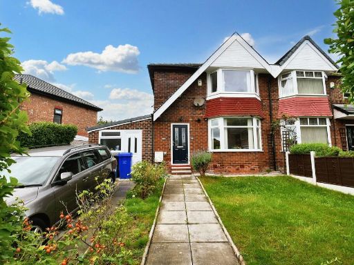 3 bedroom semi-detached house for sale in Moorville Road, Salford, M6 — £300,000 • 3 bed • 2 bath • 1023 ft²
 4 bedroom semi-detached house for sale in Radcliffe Park Road, Salford, M6 — £340,000 • 4 bed • 2 bath
 3 bedroom semi-detached house for sale in Doveleys Road, Salford, M6 — £500,000 • 3 bed • 2 bath
 3 bedroom semi-detached house for sale in Chandos Grove, Salford, M5 — £280,000 • 3 bed • 2 bath
 3 bedroom semi-detached house for sale in Manor Road, Salford, Greater Manchester, M6 — £350,000 • 3 bed • 2 bath • 1131 ft²
Meta
- {
"@context": "https://schema.org",
"@type": "Residence",
"name": "3 bedroom semidetached house for sale in Margrove Road, Sal…",
"description": "",
"url": "https://propertypiper.co.uk/property/18f11c2d-b8bb-456b-9458-314bfe3f2e8b",
"image": "https://image-a.propertypiper.co.uk/2a50fc5f-a629-4868-bca7-9298749a174f-1024.jpeg",
"address": {
"@type": "PostalAddress",
"streetAddress": "35 MARGROVE ROAD SALFORD ",
"postalCode": "M6 8NW",
"addressLocality": "Salford",
"addressRegion": "Salford and Eccles",
"addressCountry": "England"
},
"geo": {
"@type": "GeoCoordinates",
"latitude": 53.4957684,
"longitude": -2.3166725
},
"numberOfRooms": 3,
"numberOfBathroomsTotal": 2,
"offers": {
"@type": "Offer",
"price": 280000,
"priceCurrency": "GBP",
"availability": "https://schema.org/InStock"
},
"additionalProperty": [
{
"@type": "PropertyValue",
"name": "Feature",
"value": "semidetached"
},
{
"@type": "PropertyValue",
"name": "Feature",
"value": "brick"
},
{
"@type": "PropertyValue",
"name": "Feature",
"value": "suburban"
},
{
"@type": "PropertyValue",
"name": "Feature",
"value": "20th Century"
},
{
"@type": "PropertyValue",
"name": "Feature",
"value": "exterior"
},
{
"@type": "PropertyValue",
"name": "Feature",
"value": "driveway"
},
{
"@type": "PropertyValue",
"name": "Feature",
"value": "garden"
},
{
"@type": "PropertyValue",
"name": "Feature",
"value": "UK architecture"
},
{
"@type": "PropertyValue",
"name": "Feature",
"value": "residential"
},
{
"@type": "PropertyValue",
"name": "Feature",
"value": "contemporary"
},
{
"@type": "PropertyValue",
"name": "Feature",
"value": "living room"
},
{
"@type": "PropertyValue",
"name": "Feature",
"value": "wood flooring"
},
{
"@type": "PropertyValue",
"name": "Feature",
"value": "bay window"
},
{
"@type": "PropertyValue",
"name": "Feature",
"value": "white walls"
},
{
"@type": "PropertyValue",
"name": "Feature",
"value": "chandelier"
},
{
"@type": "PropertyValue",
"name": "Feature",
"value": "glazed wood doors"
}
]
}
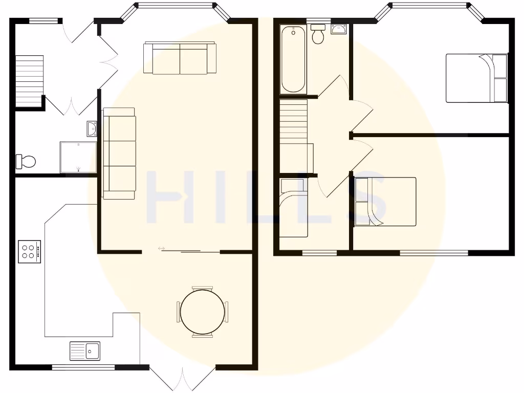
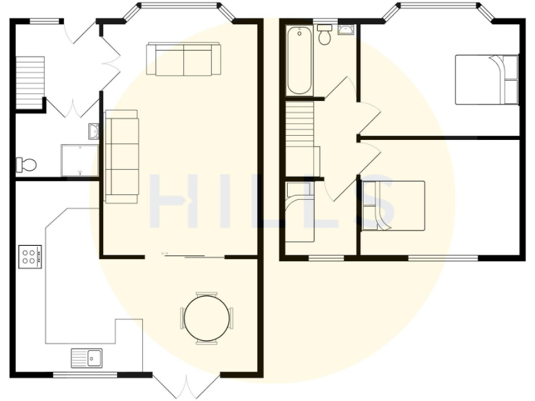
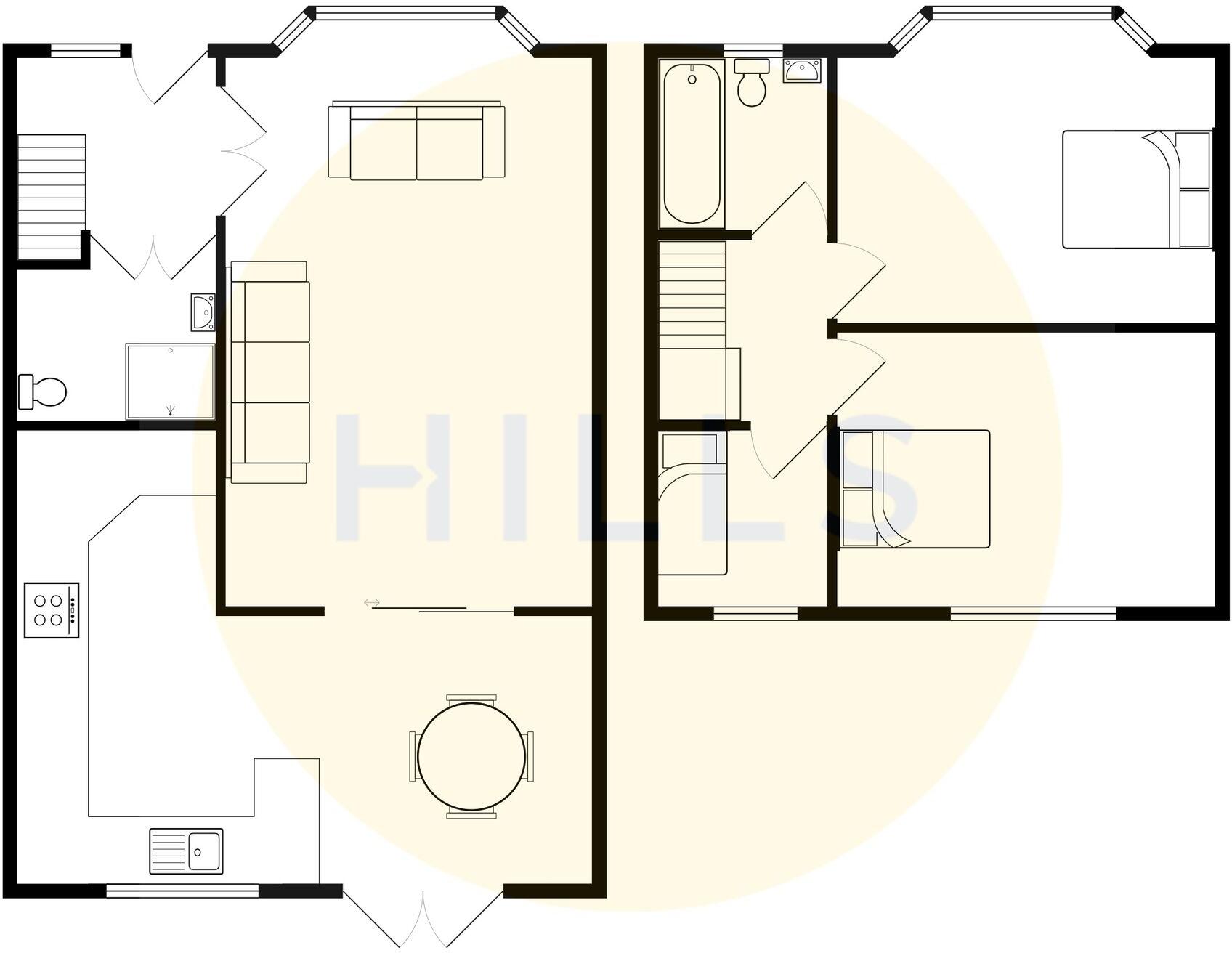
High Res Floorplan Images
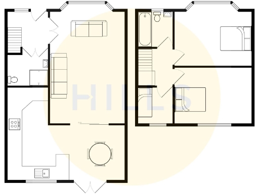
Compatible Floorplan Images
FloorplanImages Thumbnail