EH48 2TA - 4 bedroom detached house for sale in Old Golf Course Road,…
View on Property Piper
4 bedroom detached house for sale in Old Golf Course Road, Armadale, EH48
Property Details
- Price: £295000
- Bedrooms: 4
- Bathrooms: 3
- Property Type: undefined
- Property SubType: undefined
Brochure Descriptions
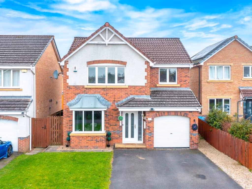
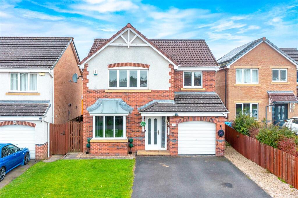
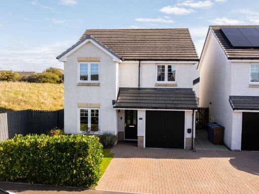
- Detached two-storey residence with integral single garage and paved driveway. Brick and rendered façade with bay window to the ground floor and pitched tiled roof; likely a 3–4 bedroom family home. Small front lawn and narrow side access gate; rear garden not visible. Situated on a suburban street in Armadale — standard residential view, no notable landscape vistas. Overall plot and garden size appear small to average; the property footprint and accommodation are consistent with a mid-sized family house.
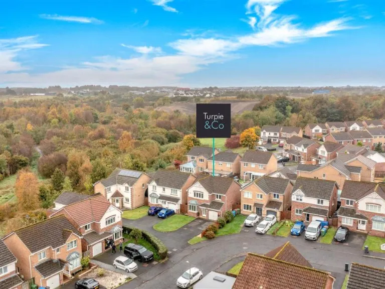
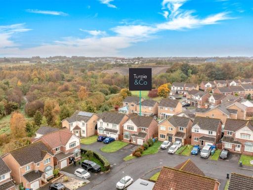
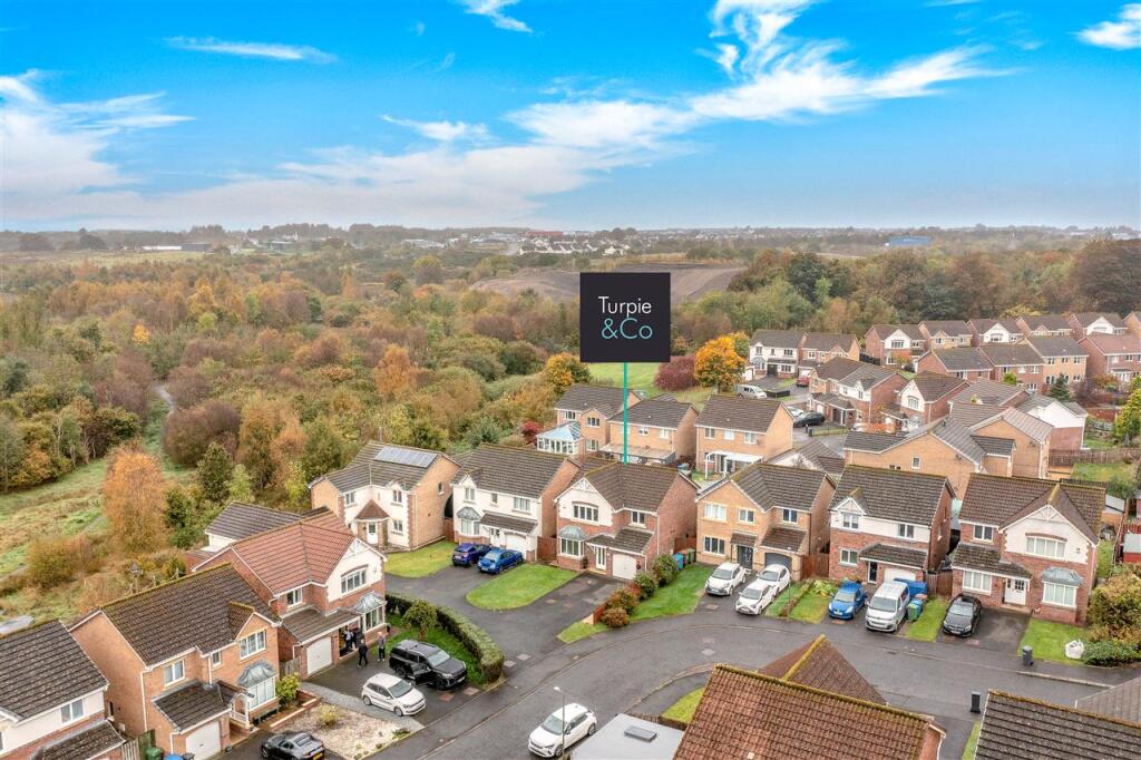
- Suburban two-storey detached and semi‑detached family homes arranged around a small cul‑de‑sac. Properties appear to have single garages and private driveways, small to average front gardens and modest rear gardens. Construction is modern brick with pitched roofs; likely 3–4 bedroom family houses. The site benefits from a pleasant outlook across mature woodland/greenbelt to the rear, offering an elevated, semi‑rural aspect and good privacy. Overall plot sizes are modest; the development footprint is medium‑sized within a residential estate. Suitable for family purchasers seeking a quiet estate location with woodland views.
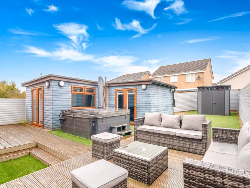
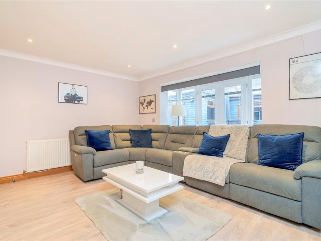
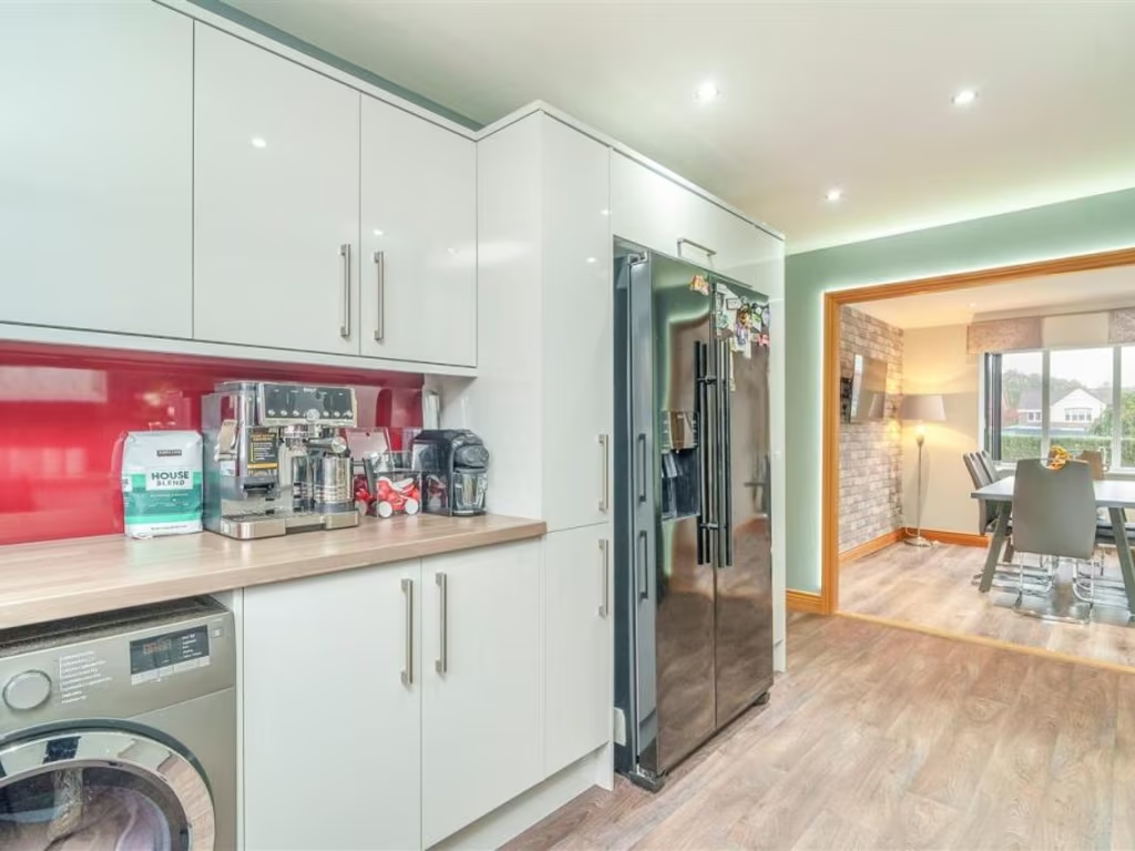
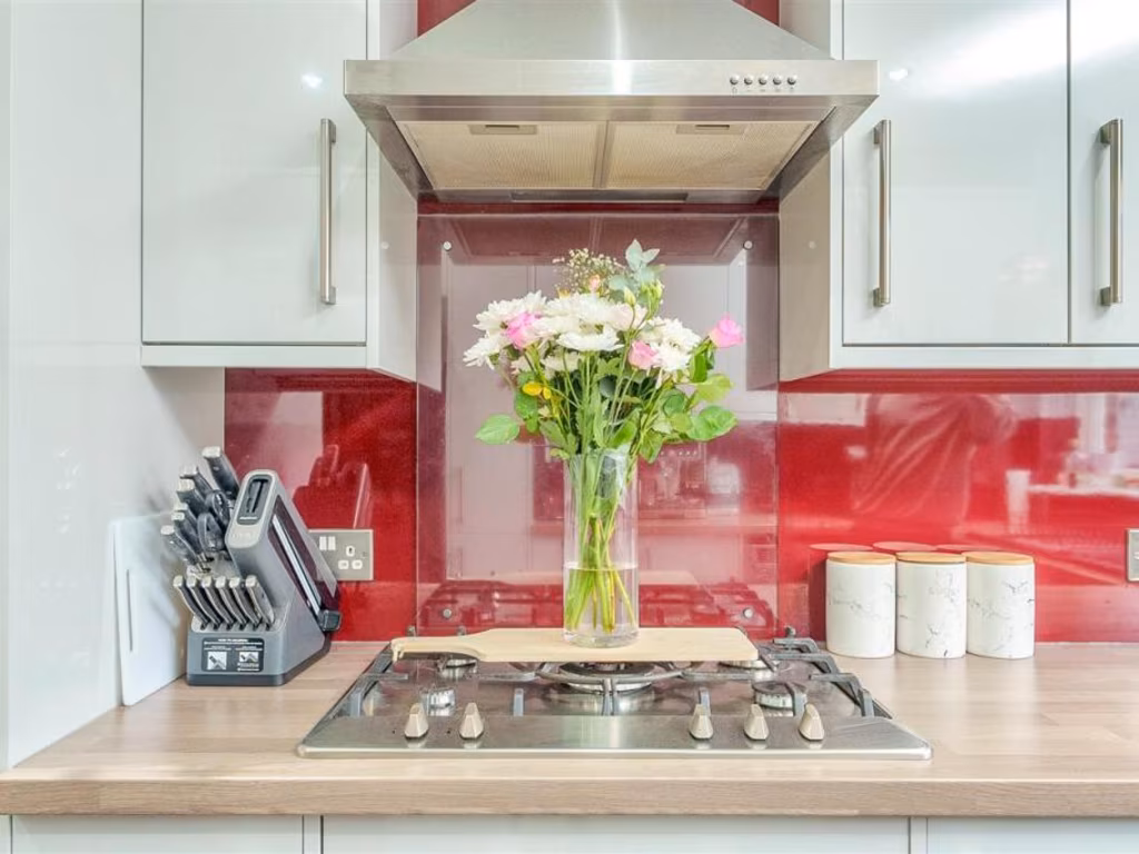
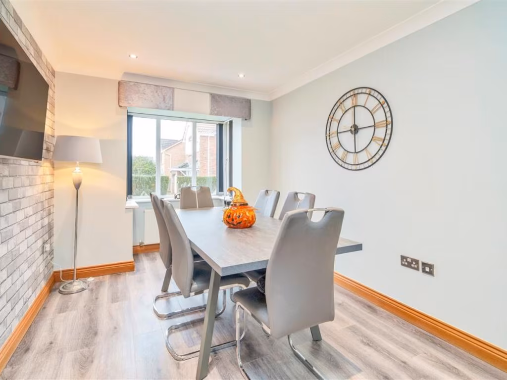
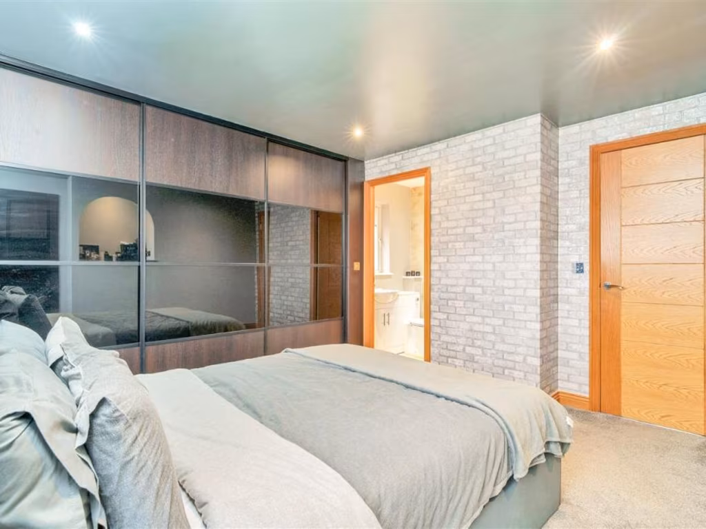
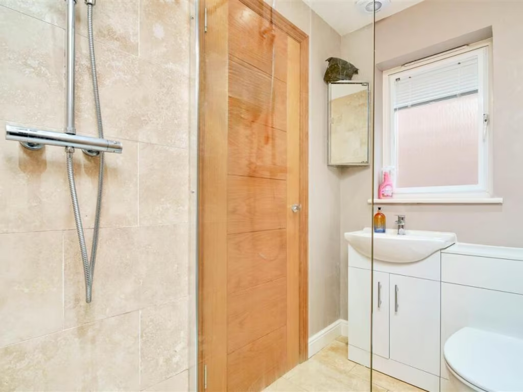
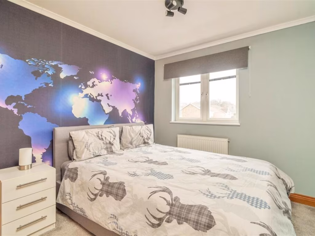
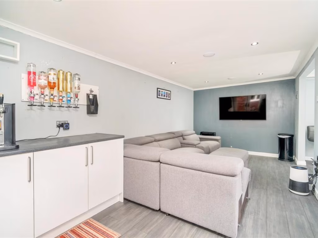
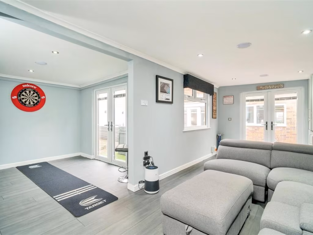
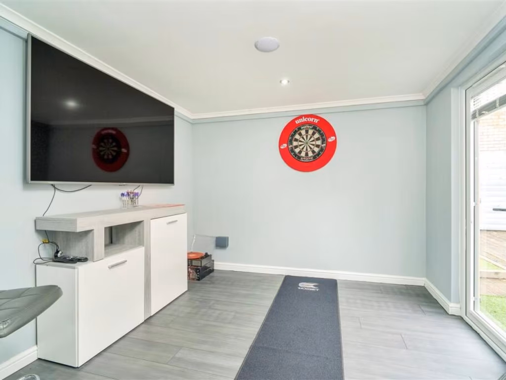
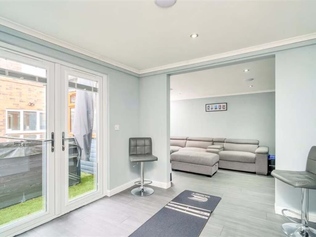
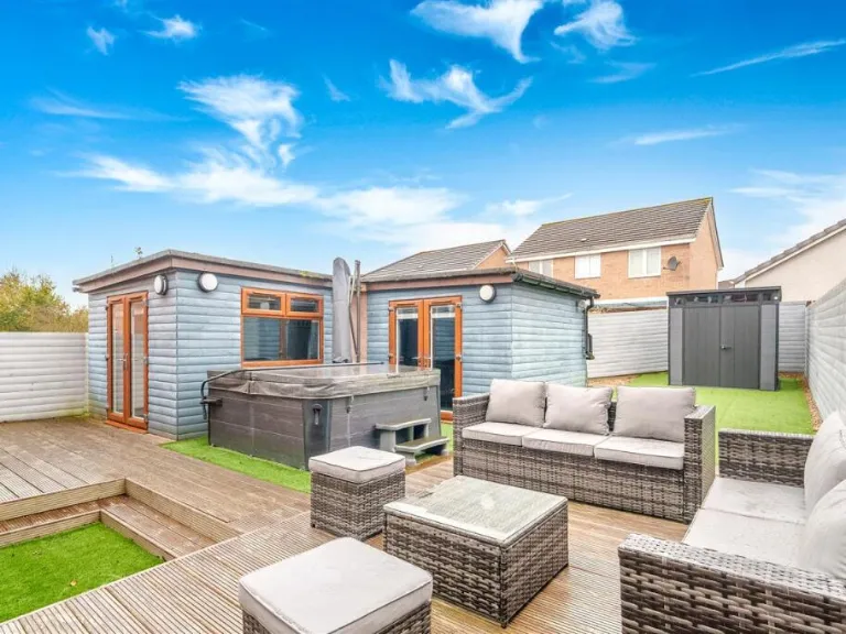
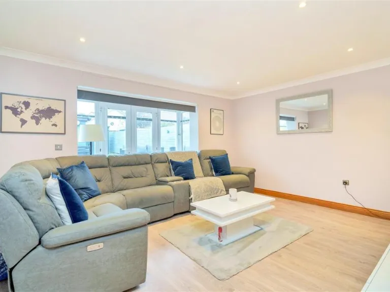
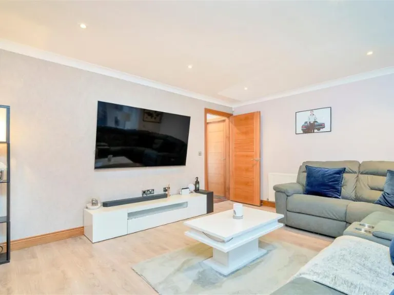
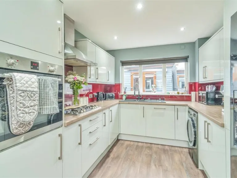
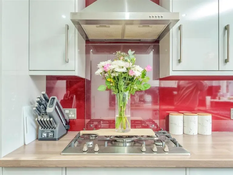
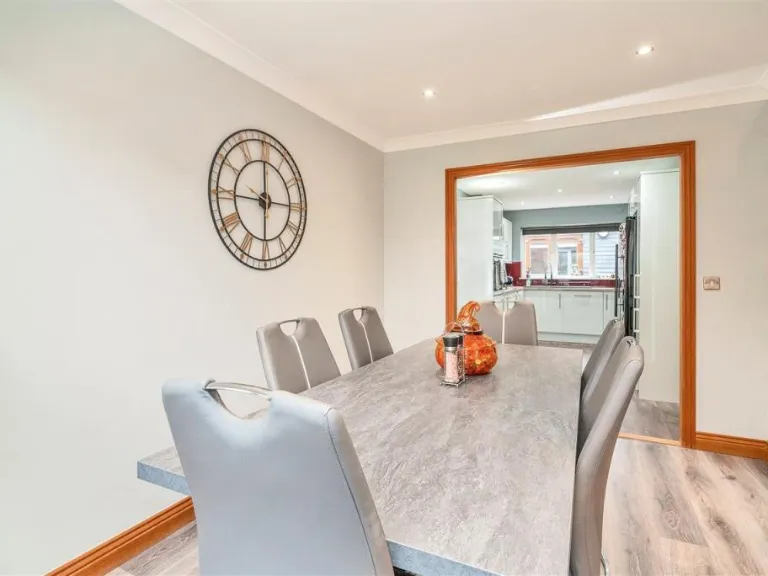
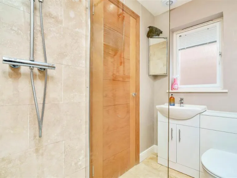
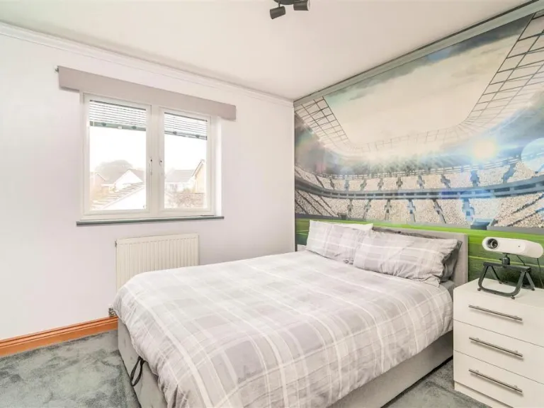
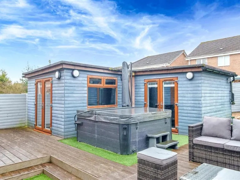
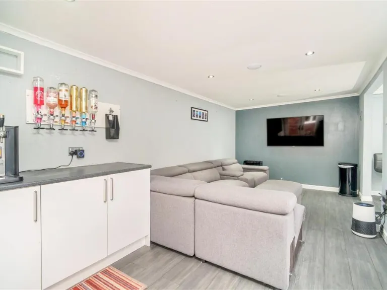
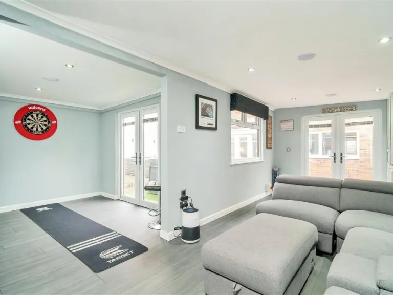
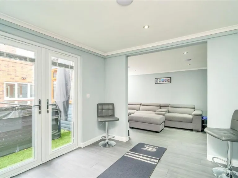
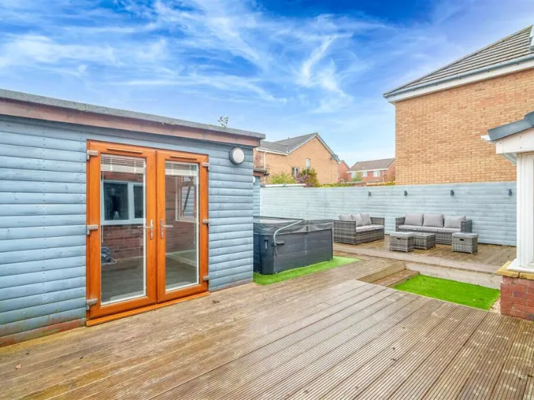
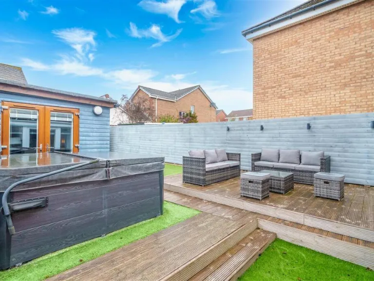
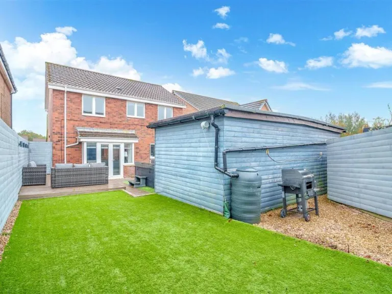
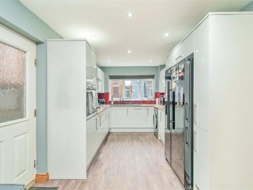
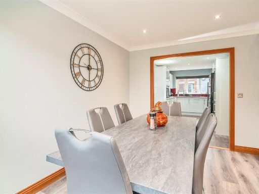
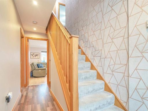
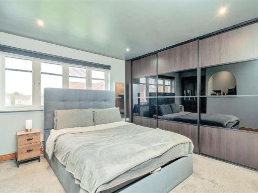
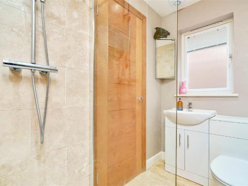
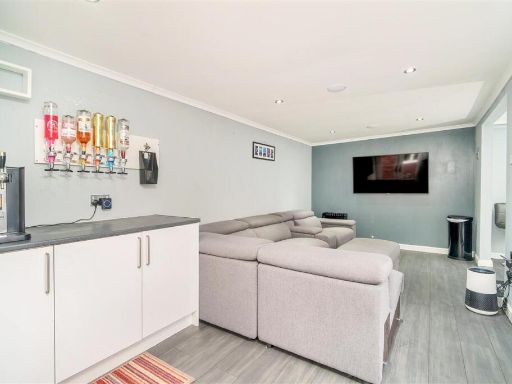
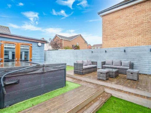
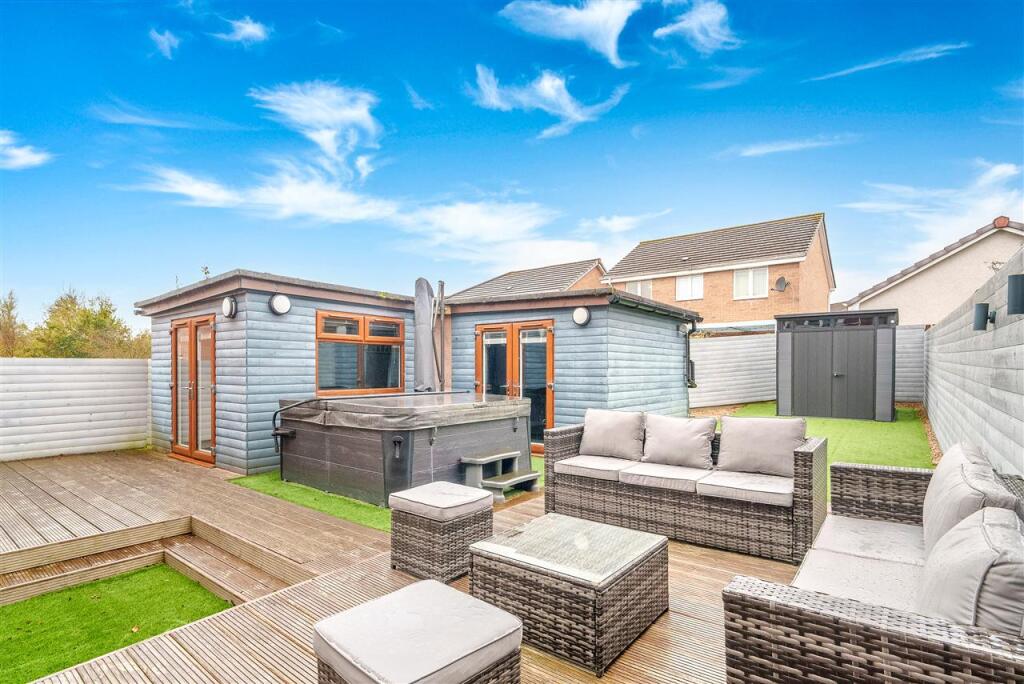
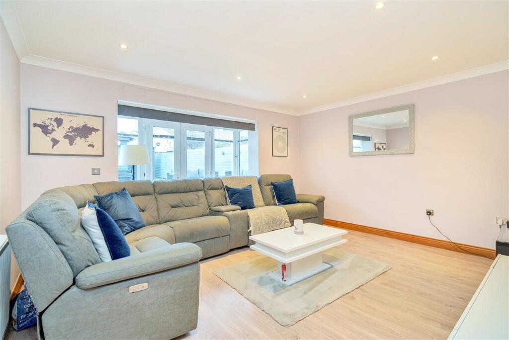
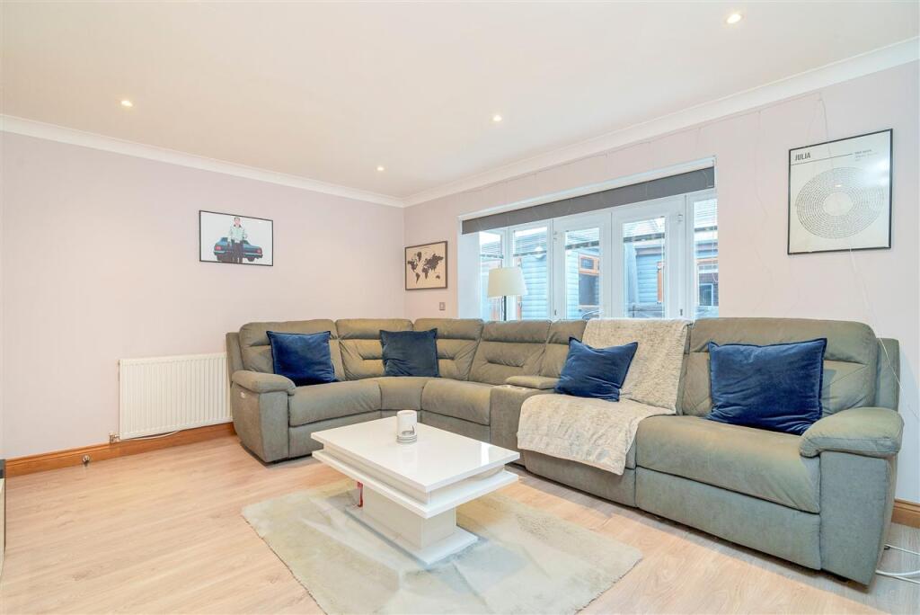
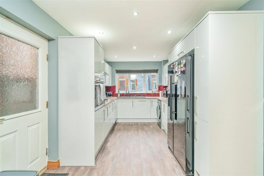
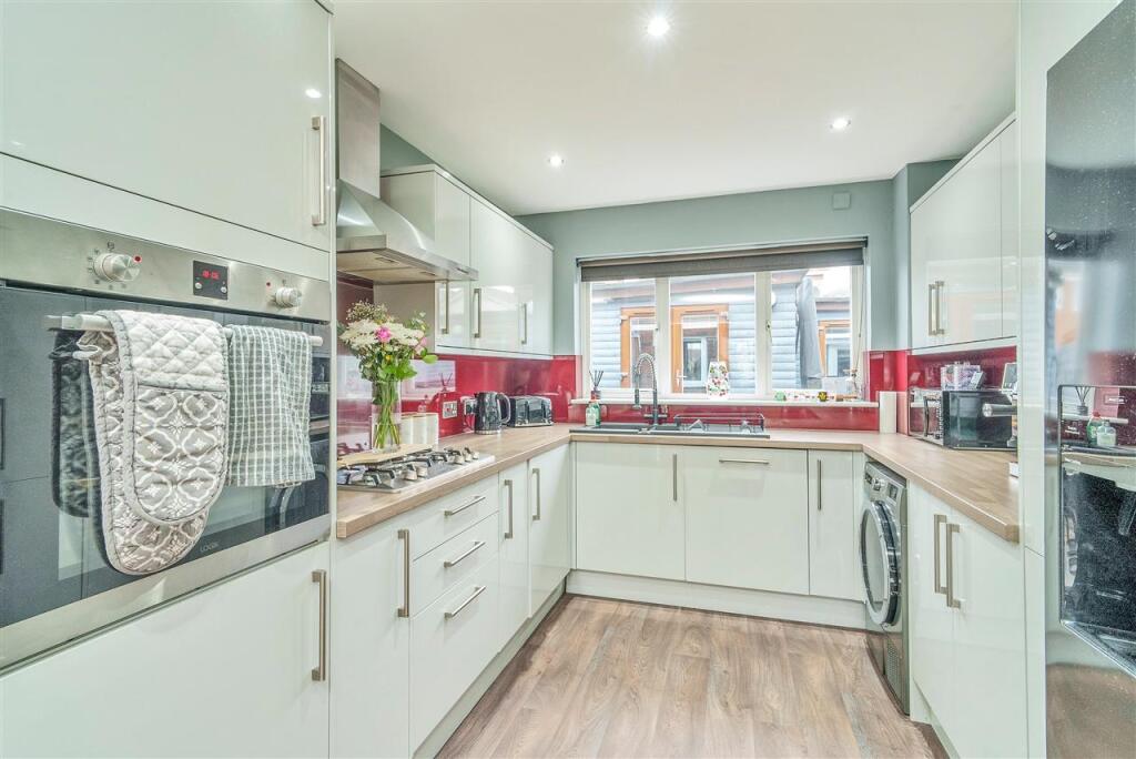
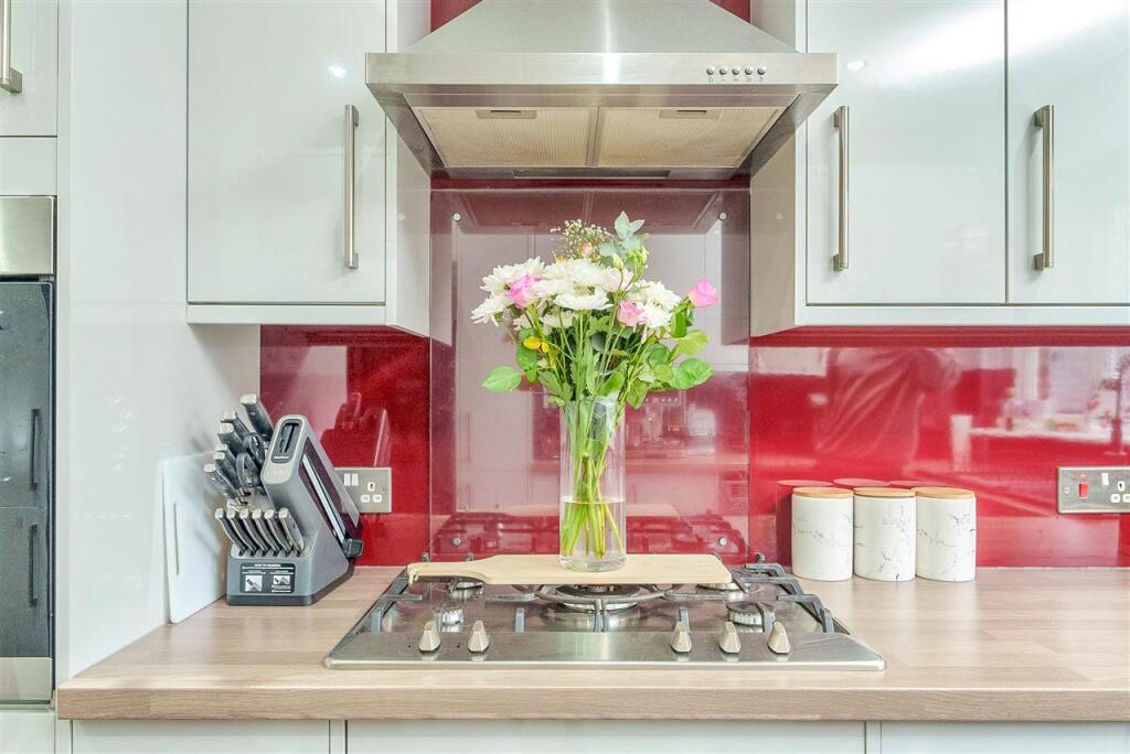
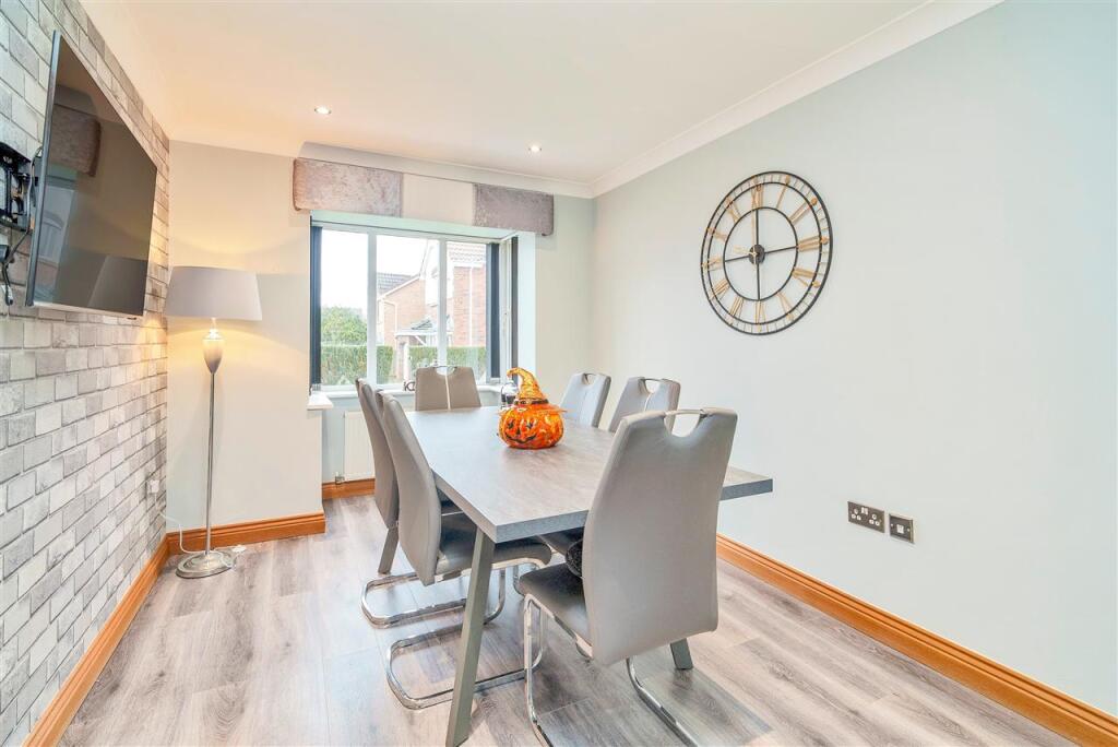
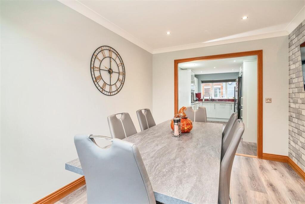
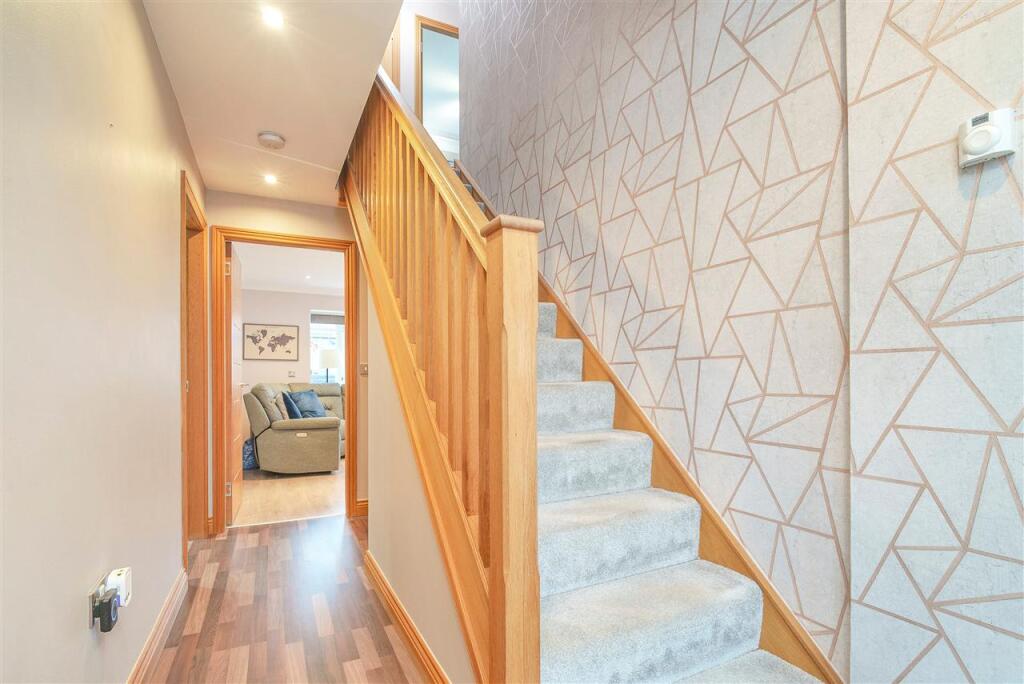
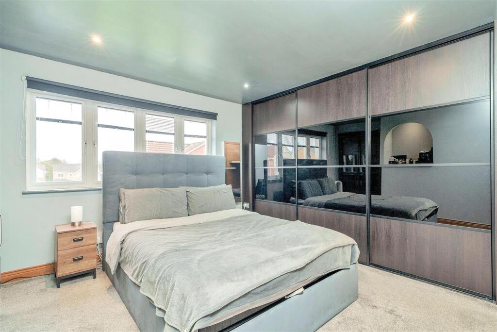
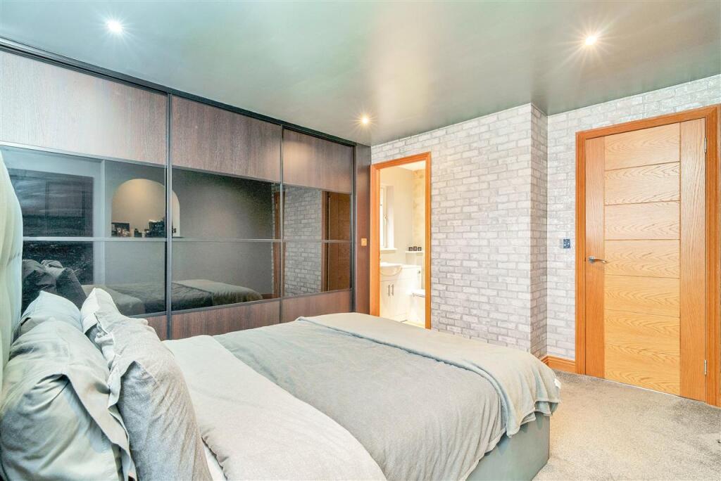
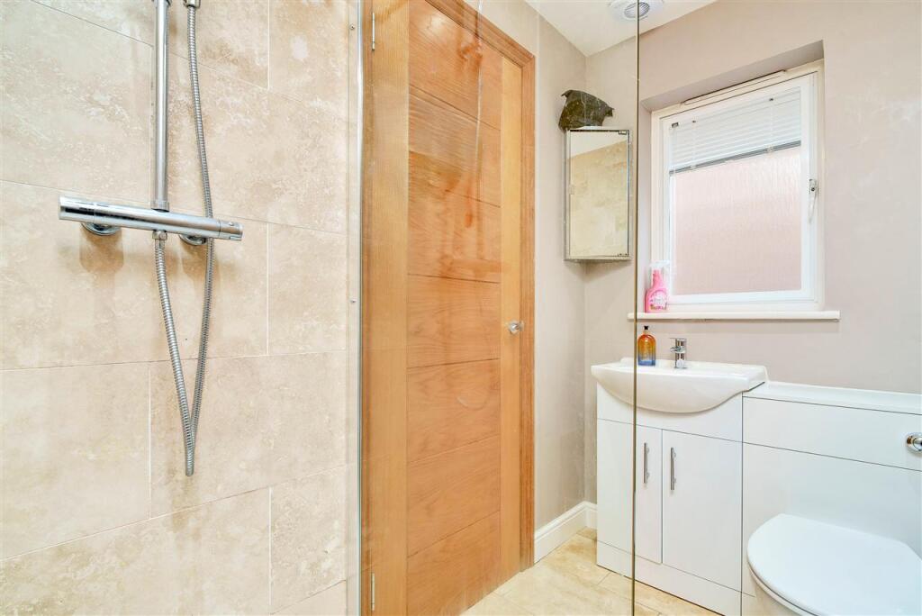
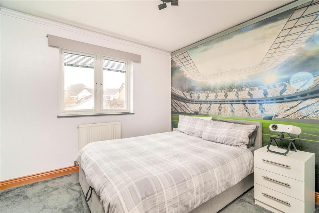
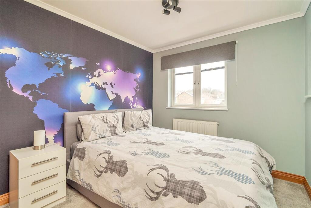
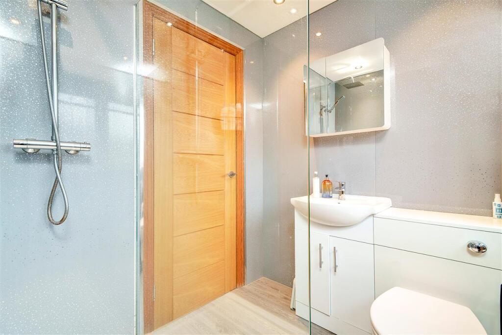
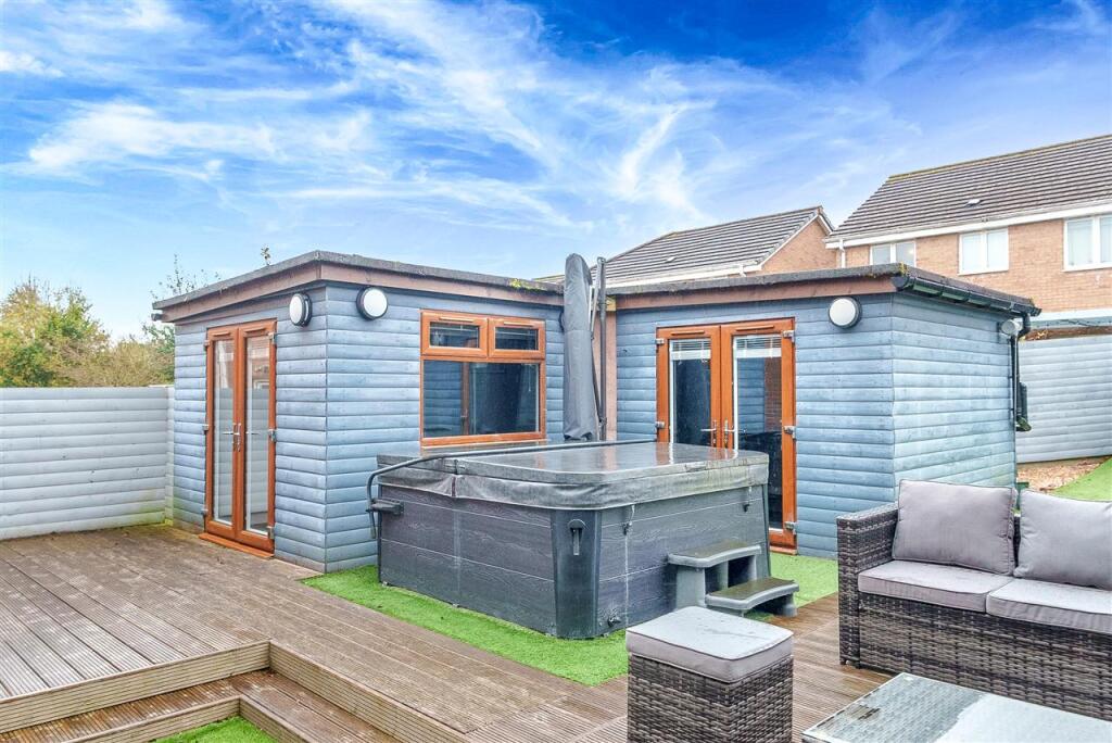
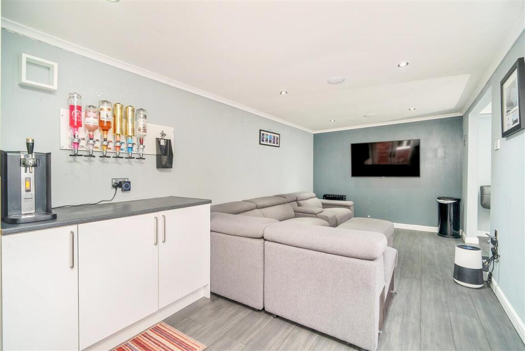
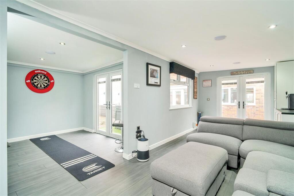
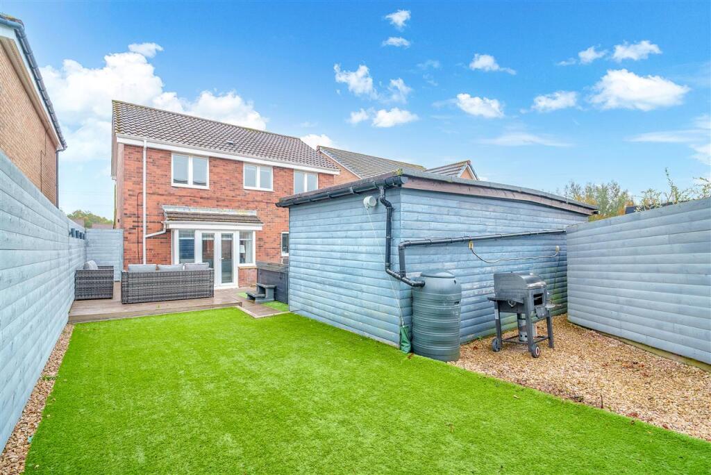
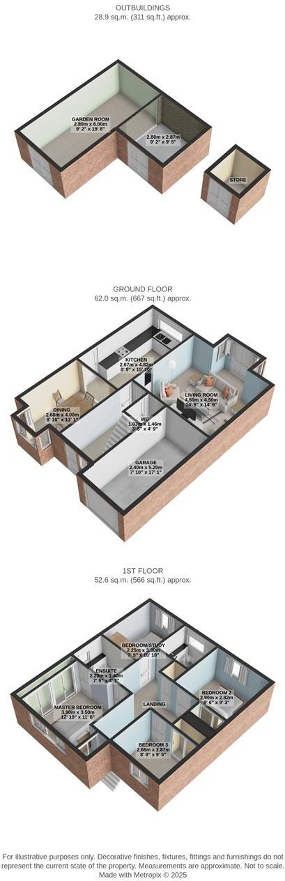
- A well-presented modern four-bedroom detached family home arranged over two floors. The property offers a large bright living room with west-facing French doors opening onto the garden, a sleek contemporary kitchen with adjoining dining room, and a versatile separate garden room (stated as 311 sq ft) ideal for entertaining or as a year-round leisure space. Accommodation includes four well-proportioned double bedrooms (one with an en-suite shower room), a luxurious family shower room and a guest WC. Externally the house sits in a popular residential development with a neat front lawn and a landscaped rear garden featuring raised decking, artificial lawn and outdoor storage. Practical benefits include a private driveway, integral garage and EV charging point. Overall plot and garden are average-to-large for the area; the house presents as a turnkey family home in a sought-after, well-connected neighbourhood close to schools, amenities and transport links.
Image Descriptions
- property exterior contemporary suburban
- outdoor leisure area modern
Floorplan Description
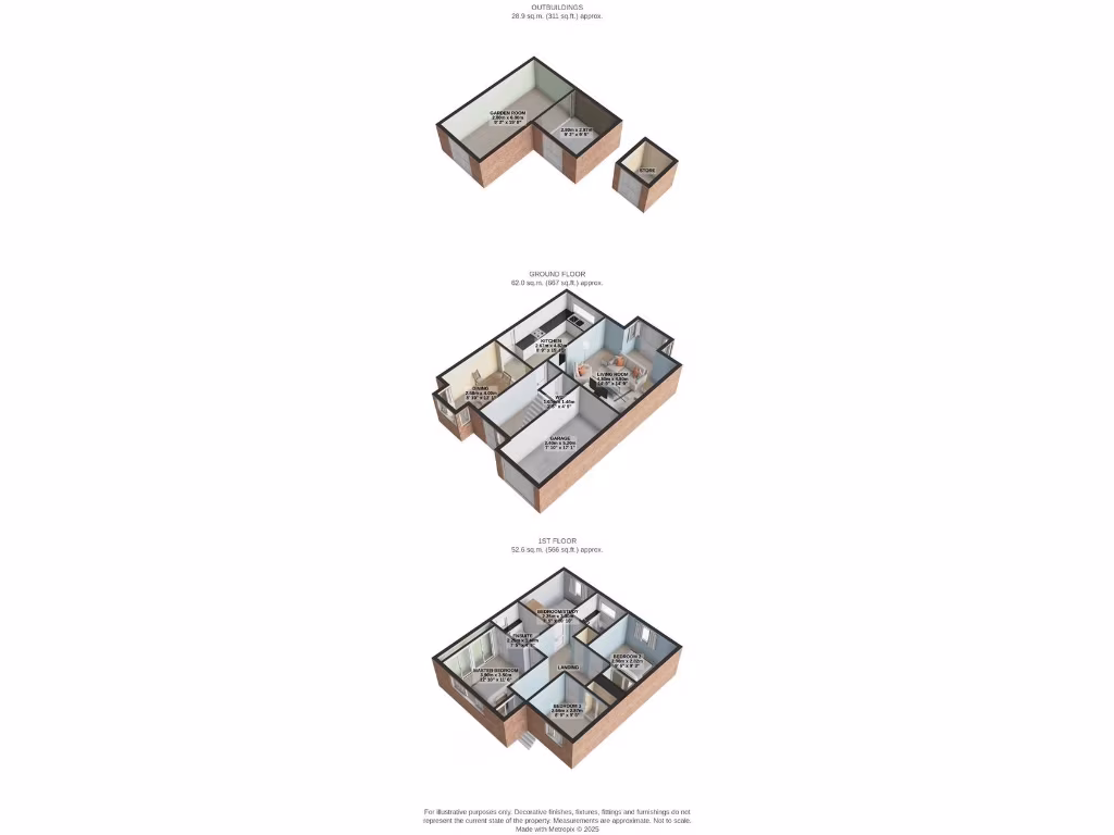
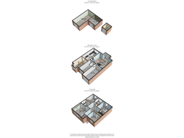
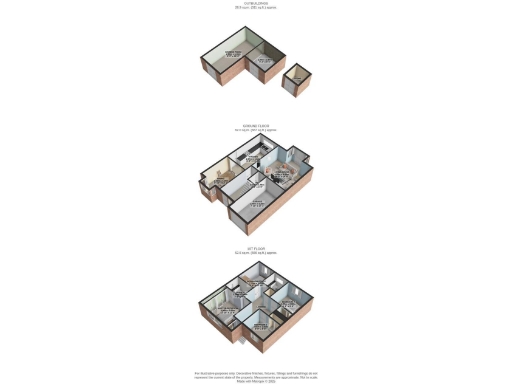
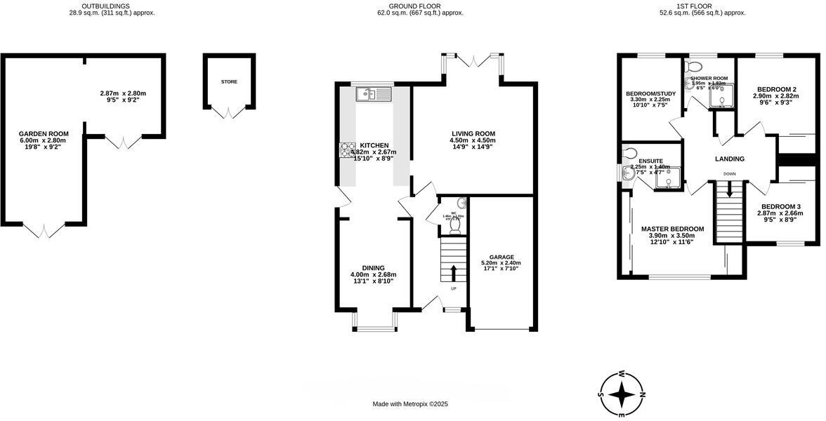
- Two-storey house with living room, kitchen, dining room, garage and four bedrooms (one used as study)
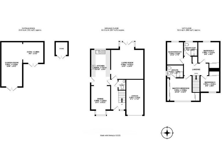
- Two-storey house with separate outbuildings
Rooms
- KITCHEN:
- LIVING ROOM:
- DINING:
- GARAGE:
- MASTER BEDROOM:
- ENSUITE:
- SHOWER ROOM:
- BEDROOM 2:
- BEDROOM 3:
- BEDROOM/STUDY:
- GARDEN ROOM:
- STORE:
- KITCHEN:
- DINING:
- LIVING ROOM:
- GARAGE:
- WC:
- MASTER BEDROOM:
- ENSUITE:
- BEDROOM 2:
- BEDROOM 3:
- BEDROOM/STUDY:
Textual Property Features
Detected Visual Features
- contemporary
- suburban
- semi-detached
- garage
- garden
- modern design
- well maintained
- curb appeal
- modern
- outdoor space
- decking
- leisure area
- hot tub
- wooden cladding
- seating area
Nearest General Shops
- Id: 481573505
- Tags:
- Building: yes
- Name: Livelines Tackle & Guns
- Opening_hours: We-Fr 10:00-17:00; Sa 09:00-13:30
- Shop: weapons
- Website: https://www.airgundealerscotland.co.uk/
- TagsNormalized:
- Lat: 55.8973937
- Lon: -3.7004326
- FullGeoHash: gcvmgzc3vtmm
- PartitionGeoHash: gcvm
- Images:
- FoodStandards: null
- Distance: 1276.4
,- Id: 4205813589
- Tags:
- Name: Armadale MOT Test Centre
- Shop: car_repair
- TagsNormalized:
- Lat: 55.8947332
- Lon: -3.7011514
- FullGeoHash: gcvmgz2fkvmq
- PartitionGeoHash: gcvm
- Images:
- FoodStandards: null
- Distance: 1226.7
,- Id: 390902566
- Tags:
- Brand: Citroën
- Landuse: retail
- Name: Arnold Clark
- Shop: car
- TagsNormalized:
- Lat: 55.8867501
- Lon: -3.6967608
- FullGeoHash: gcvmgvu5gjr3
- PartitionGeoHash: gcvm
- Images:
- FoodStandards: null
- Distance: 1131.7
}
Nearest Grocery shops
- Id: 376534689
- Tags:
- Building: yes
- Name: Day-Today
- Shop: convenience
- TagsNormalized:
- Lat: 55.8979926
- Lon: -3.7072676
- FullGeoHash: gcvmgxumqmhf
- PartitionGeoHash: gcvm
- Images:
- FoodStandards: null
- Distance: 1695.1
,- Id: 1130851346
- Tags:
- Building: retail
- Name: best-one
- Shop: convenience
- Source: Bing
- TagsNormalized:
- retail
- best-one
- convenience
- shop
- Lat: 55.8917201
- Lon: -3.7011607
- FullGeoHash: gcvmgybbuey9
- PartitionGeoHash: gcvm
- Images:
- FoodStandards: null
- Distance: 1206.9
,- Id: 452898061
- Tags:
- Addr:
- City: Armadale
- Housenumber: 1-3
- Postcode: EH48 2LX
- Street: St Paul's Drive
- Suburb: Bathville
- Building: yes
- Fhrs:
- Name: Stop n Shop
- Shop: convenience
- Source:
- TagsNormalized:
- Lat: 55.8974501
- Lon: -3.6911558
- FullGeoHash: gcvmupb4jzft
- PartitionGeoHash: gcvm
- Images:
- FoodStandards: null
- Distance: 794.4
}
Nearest Religious buildings
- Id: 363818705
- Tags:
- Addr:
- City: Whitburn
- Country: GB
- Housenumber: 62
- Postcode: EH47 0RD
- Street: East Main Street
- Amenity: place_of_worship
- Building: yes
- Denomination: church_of_scotland
- Name: Brucefield Church
- Religion: christian
- Wikidata: Q15789988
- TagsNormalized:
- place of worship
- church
- church of scotland
- christian
- Lat: 55.8668157
- Lon: -3.681646
- FullGeoHash: gcvmu4ppg3mb
- PartitionGeoHash: gcvm
- Images:
- FoodStandards: null
- Distance: 2862.9
,- Id: 460358427
- Tags:
- Amenity: place_of_worship
- Building: church
- Denomination: catholic
- Name: St Mary's and St Columba's Parish
- Religion: christian
- TagsNormalized:
- place of worship
- church
- catholic
- parish
- christian
- Lat: 55.9032246
- Lon: -3.6418921
- FullGeoHash: gcvqj0u5cu2k
- PartitionGeoHash: gcvq
- Images:
- FoodStandards: null
- Distance: 2759.6
,- Id: 722514457
- Tags:
- Addr:
- City: Bathgate
- Housenumber: 5
- Street: Whitburn Road
- Amenity: place_of_worship
- Name: Sarajia Islamic Center
- Phone: +44 1506 635380
- Postal_code: EH48 1HE
- Religion: muslim
- TagsNormalized:
- place of worship
- islamic
- muslim
- mosque
- Lat: 55.9006658
- Lon: -3.6421959
- FullGeoHash: gcvqj07ufxmu
- PartitionGeoHash: gcvq
- Images:
- FoodStandards: null
- Distance: 2632.1
}
Nearest Airports
- Id: 403150963
- Tags:
- Aerodrome: international
- Aerodrome:type: public
- Aeroway: aerodrome
- Iata: EDI
- Icao: EGPH
- Is_in: Edinburgh,Scotland,UK
- Name: Edinburgh Airport
- Old_name: Turnhouse
- Source: Gagravarr_Airports
- Wikidata: Q8716
- Wikipedia: en:Edinburgh Airport
- TagsNormalized:
- airport
- international airport
- Lat: 55.9500825
- Lon: -3.3614651
- FullGeoHash: gcvw792kb5mf
- PartitionGeoHash: gcvw
- Images:
- FoodStandards: null
- Distance: 20962.3
}
Nearest Leisure Facilities
- Id: 394887002
- Tags:
- Area: no
- Leisure: track
- Oneway: yes
- Source: Bing
- Sport: grehound_racing
- TagsNormalized:
- Lat: 55.8982632
- Lon: -3.6829949
- FullGeoHash: gcvmupyngzxb
- PartitionGeoHash: gcvm
- Images:
- FoodStandards: null
- Distance: 637.9
,- Id: 266695360
- Tags:
- Leisure: stadium
- Name: Armadale Stadium
- Wikidata: Q4792527
- Wikipedia: en:Armadale Stadium
- TagsNormalized:
- Lat: 55.8982039
- Lon: -3.68304
- FullGeoHash: gcvmupynduqq
- PartitionGeoHash: gcvm
- Images:
- FoodStandards: null
- Distance: 631.6
,- Id: 1011483109
- Tags:
- TagsNormalized:
- Lat: 55.8966896
- Lon: -3.6873508
- FullGeoHash: gcvmupdvy6pv
- PartitionGeoHash: gcvm
- Images:
- FoodStandards: null
- Distance: 572.5
,- Id: 1011480713
- Tags:
- Leisure: playground
- Surface: asphalt
- TagsNormalized:
- Lat: 55.8948843
- Lon: -3.687261
- FullGeoHash: gcvmup7529du
- PartitionGeoHash: gcvm
- Images:
- FoodStandards: null
- Distance: 424.2
,- Id: 1011479851
- Tags:
- TagsNormalized:
- Lat: 55.8935944
- Lon: -3.6811783
- FullGeoHash: gcvmupp7y34t
- PartitionGeoHash: gcvm
- Images:
- FoodStandards: null
- Distance: 122.5
}
Nearest Tourist attractions
- Id: 969241432
- Tags:
- Surface: gravel
- Tourism: picnic_site
- TagsNormalized:
- Lat: 55.8665385
- Lon: -3.71863
- FullGeoHash: gcvmg6hnjtse
- PartitionGeoHash: gcvm
- Images:
- FoodStandards: null
- Distance: 3692.2
,- Id: 7028426014
- Tags:
- Name: Whitburn Community Museum
- Operator: West Lothian Council
- Tourism: museum
- Website: https://www.westlothian.gov.uk/article/44864/Whitburn-Community-Museum
- TagsNormalized:
- Lat: 55.8657986
- Lon: -3.6885832
- FullGeoHash: gcvmu441cg9j
- PartitionGeoHash: gcvm
- Images:
- FoodStandards: null
- Distance: 3005.3
,- Id: 361177184
- Tags:
- Addr:
- City: Bathgate
- Housenumber: 9-11
- Postcode: EH48 4HU
- Street: Mansefield Street
- Building: yes
- Name: Bennie Museum
- Tourism: museum
- Wikidata: Q17122436
- TagsNormalized:
- Lat: 55.9027708
- Lon: -3.642933
- FullGeoHash: gcvqj0g31xb3
- PartitionGeoHash: gcvq
- Images:
- FoodStandards: null
- Distance: 2679.4
}
Nearest Train stations
- Id: 7556744219
- Tags:
- Name: Livingston Mill
- Platforms: 1
- Public_transport: station
- Railway: station
- Train: yes
- Usage: tourism
- TagsNormalized:
- Lat: 55.8852617
- Lon: -3.5485017
- FullGeoHash: gcvmzm851zv7
- PartitionGeoHash: gcvm
- Images:
- FoodStandards: null
- Distance: 8355.7
,- Id: 7556744224
- Tags:
- Name: Almondhaugh Halt
- Operator: Almond Valley Heritage Centre
- Platforms: 1
- Public_transport: station
- Railway: station
- Train: yes
- Usage: tourism
- TagsNormalized:
- Lat: 55.8847771
- Lon: -3.5553551
- FullGeoHash: gcvmzje06jx0
- PartitionGeoHash: gcvm
- Images:
- FoodStandards: null
- Distance: 7936.2
,- Id: 30745503
- Tags:
- Name: Addiewell
- Naptan:
- Network: National Rail
- Operator: ScotRail
- Public_transport: station
- Railway: station
- Ref:
- Source: npe/landsat
- Wikidata: Q2135613
- Wikipedia: en:Addiewell railway station
- TagsNormalized:
- Lat: 55.8434492
- Lon: -3.6063049
- FullGeoHash: gcvmtvvzxj2n
- PartitionGeoHash: gcvm
- Images:
- FoodStandards: null
- Distance: 7214.4
,- Id: 7209309360
- Tags:
- Name: Bathgate
- Naptan:
- Network: National Rail
- Note: position guessed from wikipedia track outline
- Operator: ScotRail
- Public_transport: station
- Railway: station
- Ref:
- Source: guessed (validated against building)
- Wheelchair: yes
- Wikidata: Q4869021
- Wikipedia: en:Bathgate railway station
- TagsNormalized:
- Lat: 55.8971052
- Lon: -3.6362736
- FullGeoHash: gcvmvrb0hxtu
- PartitionGeoHash: gcvm
- Images:
- FoodStandards: null
- Distance: 2887
,- Id: 7209346141
- Tags:
- Name: Armadale
- Name:gd: Armadal
- Naptan:
- Network: National Rail
- Operator: ScotRail
- Public_transport: station
- Railway: station
- Ref:
- Wikidata: Q4792532
- Wikipedia: en:Armadale railway station (Scotland)
- TagsNormalized:
- Lat: 55.8865302
- Lon: -3.6929618
- FullGeoHash: gcvmgvyfeu24
- PartitionGeoHash: gcvm
- Images:
- FoodStandards: null
- Distance: 963.8
}
Nearest Bus stations and stops
- Id: 3261456830
- Tags:
- Bench: no
- Bin: no
- Bus: yes
- Covered: no
- Highway: bus_stop
- Public_transport: platform
- Shelter: no
- Tactile_paving: yes
- TagsNormalized:
- Lat: 55.8900453
- Lon: -3.6465756
- FullGeoHash: gcvmvn2xhes4
- PartitionGeoHash: gcvm
- Images:
- FoodStandards: null
- Distance: 2218
,- Id: 7476962295
- Tags:
- Bus: yes
- Highway: bus_stop
- Public_transport: platform
- TagsNormalized:
- Lat: 55.9006873
- Lon: -3.6986195
- FullGeoHash: gcvq5b6tpgmk
- PartitionGeoHash: gcvq
- Images:
- FoodStandards: null
- Distance: 1381.2
,- Id: 7578409928
- Tags:
- Bus: yes
- Highway: bus_stop
- Public_transport: platform
- TagsNormalized:
- Lat: 55.8982175
- Lon: -3.6628621
- FullGeoHash: gcvmuxuy9nup
- PartitionGeoHash: gcvm
- Images:
- FoodStandards: null
- Distance: 1341.2
,- Id: 7476962433
- Tags:
- Bus: yes
- Highway: bus_stop
- Public_transport: platform
- TagsNormalized:
- Lat: 55.8981379
- Lon: -3.7001604
- FullGeoHash: gcvmgzcwk00k
- PartitionGeoHash: gcvm
- Images:
- FoodStandards: null
- Distance: 1298.4
,- Id: 7476962432
- Tags:
- Bus: yes
- Highway: bus_stop
- Public_transport: platform
- TagsNormalized:
- Lat: 55.8982655
- Lon: -3.6999856
- FullGeoHash: gcvmgzcybpfv
- PartitionGeoHash: gcvm
- Images:
- FoodStandards: null
- Distance: 1295.7
}
Nearest Hotels
- Id: 461176926
- Tags:
- Building: yes
- Name: Hilcroft Hotel
- Operator: Best Western
- Tourism: hotel
- TagsNormalized:
- Lat: 55.8674123
- Lon: -3.6718286
- FullGeoHash: gcvmu6q720qp
- PartitionGeoHash: gcvm
- Images:
- FoodStandards: null
- Distance: 2865.7
,- Id: 3372202819
- Tags:
- Addr:
- Amenity: restaurant
- Name: Balbairdie Hotel
- Operator: Belhaven Inns
- TagsNormalized:
- Lat: 55.9012439
- Lon: -3.6406527
- FullGeoHash: gcvqj0sbqehs
- PartitionGeoHash: gcvq
- Images:
- FoodStandards: null
- Distance: 2744.6
,- Id: 419545607
- Tags:
- Amenity: restaurant
- Building: hotel
- Cuisine: chinese
- Name: The Royal Regent
- TagsNormalized:
- Lat: 55.8723258
- Lon: -3.6862164
- FullGeoHash: gcvmu55zbumv
- PartitionGeoHash: gcvm
- Images:
- FoodStandards: null
- Distance: 2266.5
}
Tags
- contemporary
- suburban
- semi-detached
- garage
- garden
- modern design
- well maintained
- curb appeal
- modern
- outdoor space
- decking
- leisure area
- hot tub
- garden
- wooden cladding
- seating area
Local Market Stats
- Average Price/sqft: £188
- Rental Yield: 5%
- Planning Success Rate: 90%
AirBnB Data
- 1km average: £80/night
- Listings in 1km: 1
Similar Properties
 4 bedroom detached house for sale in Kerr's Way, Armadale, EH48 — £300,000 • 4 bed • 3 bath • 1109 ft²
 4 bedroom detached house for sale in Station Road, Armadale, EH48 — £325,000 • 4 bed • 2 bath • 3080 ft²
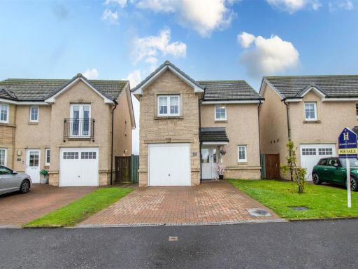 3 bedroom detached house for sale in Kerr's Way, Armadale, Bathgate, EH48 — £270,000 • 3 bed • 3 bath • 1012 ft²
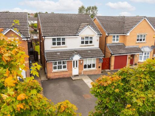 4 bedroom detached house for sale in Mallace Avenue, Armadale, EH48 — £280,000 • 4 bed • 3 bath • 1227 ft²
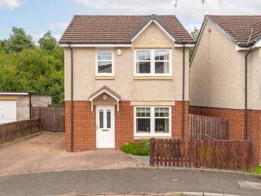 3 bedroom detached house for sale in Forrest Place, Armadale, EH48 — £240,000 • 3 bed • 3 bath • 872 ft²
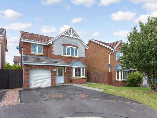 4 bedroom detached house for sale in Mallace Avenue, Armadale, Bathgate, West Lothian, EH48 — £220,000 • 4 bed • 3 bath
Meta
- {
"@context": "https://schema.org",
"@type": "Residence",
"name": "4 bedroom detached house for sale in Old Golf Course Road,…",
"description": "",
"url": "https://propertypiper.co.uk/property/11d73908-fb2a-4f39-bcdb-78b8fec0c03d",
"image": "https://image-a.propertypiper.co.uk/3c732adf-73ac-4d50-94f1-a387a769c4bd-1024.jpeg",
"address": {
"@type": "PostalAddress",
"streetAddress": "58, OLD GOLF COURSE ROAD",
"postalCode": "EH48 2TA",
"addressLocality": "West Lothian",
"addressRegion": "Linlithgow and East Falkirk",
"addressCountry": "Scotland"
},
"geo": {
"@type": "GeoCoordinates",
"latitude": 55.892562000868224,
"longitude": -3.6818626904975074
},
"numberOfRooms": 4,
"numberOfBathroomsTotal": 3,
"floorSize": {
"@type": "QuantitativeValue",
"value": 311,
"unitCode": "FTK"
},
"offers": {
"@type": "Offer",
"price": 295000,
"priceCurrency": "GBP",
"availability": "https://schema.org/InStock"
},
"additionalProperty": [
{
"@type": "PropertyValue",
"name": "Feature",
"value": "contemporary"
},
{
"@type": "PropertyValue",
"name": "Feature",
"value": "suburban"
},
{
"@type": "PropertyValue",
"name": "Feature",
"value": "semi-detached"
},
{
"@type": "PropertyValue",
"name": "Feature",
"value": "garage"
},
{
"@type": "PropertyValue",
"name": "Feature",
"value": "garden"
},
{
"@type": "PropertyValue",
"name": "Feature",
"value": "modern design"
},
{
"@type": "PropertyValue",
"name": "Feature",
"value": "well maintained"
},
{
"@type": "PropertyValue",
"name": "Feature",
"value": "curb appeal"
},
{
"@type": "PropertyValue",
"name": "Feature",
"value": "modern"
},
{
"@type": "PropertyValue",
"name": "Feature",
"value": "outdoor space"
},
{
"@type": "PropertyValue",
"name": "Feature",
"value": "decking"
},
{
"@type": "PropertyValue",
"name": "Feature",
"value": "leisure area"
},
{
"@type": "PropertyValue",
"name": "Feature",
"value": "hot tub"
},
{
"@type": "PropertyValue",
"name": "Feature",
"value": "garden"
},
{
"@type": "PropertyValue",
"name": "Feature",
"value": "wooden cladding"
},
{
"@type": "PropertyValue",
"name": "Feature",
"value": "seating area"
}
]
}
High Res Floorplan Images
Compatible Floorplan Images
FloorplanImages Thumbnail