SL0 0SE - 3 bedroom end of terrace house for sale in Oak End Drive, I…
View on Property Piper
3 bedroom end of terrace house for sale in Oak End Drive, Iver Heath, SL0
Property Details
- Price: £550000
- Bedrooms: 3
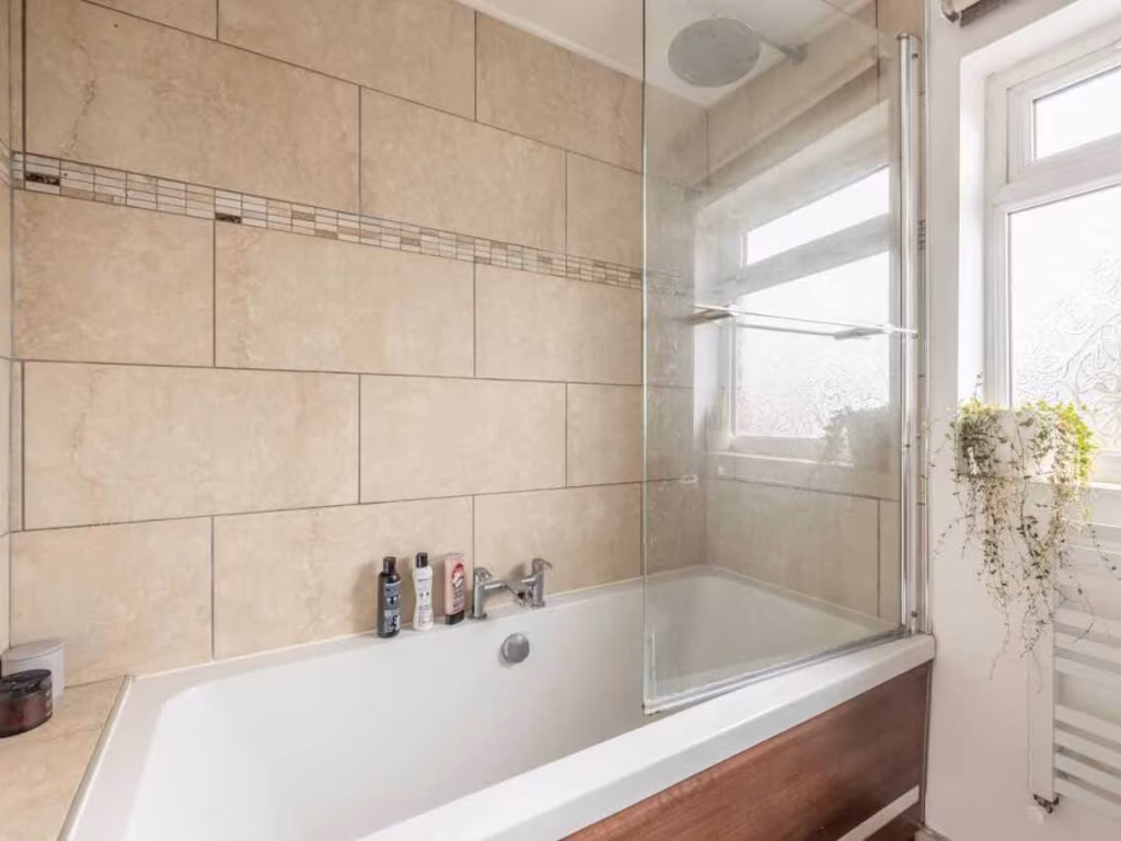
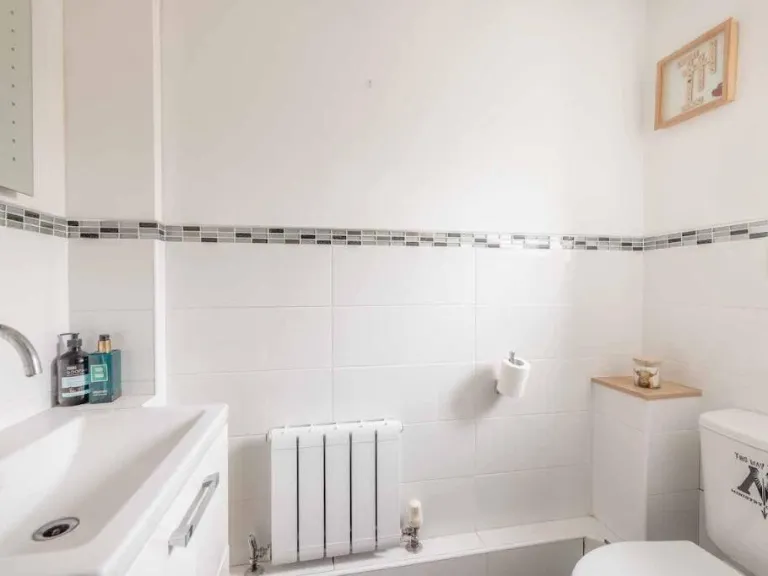
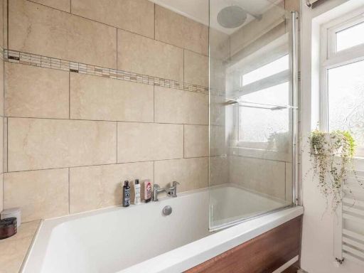
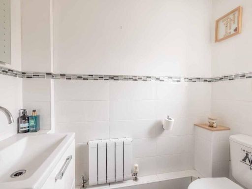
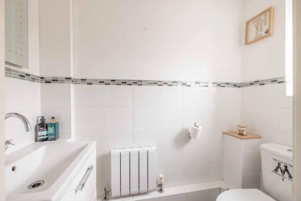
- Bathrooms: 2
- Property Type: undefined
- Property SubType: undefined
Brochure Descriptions
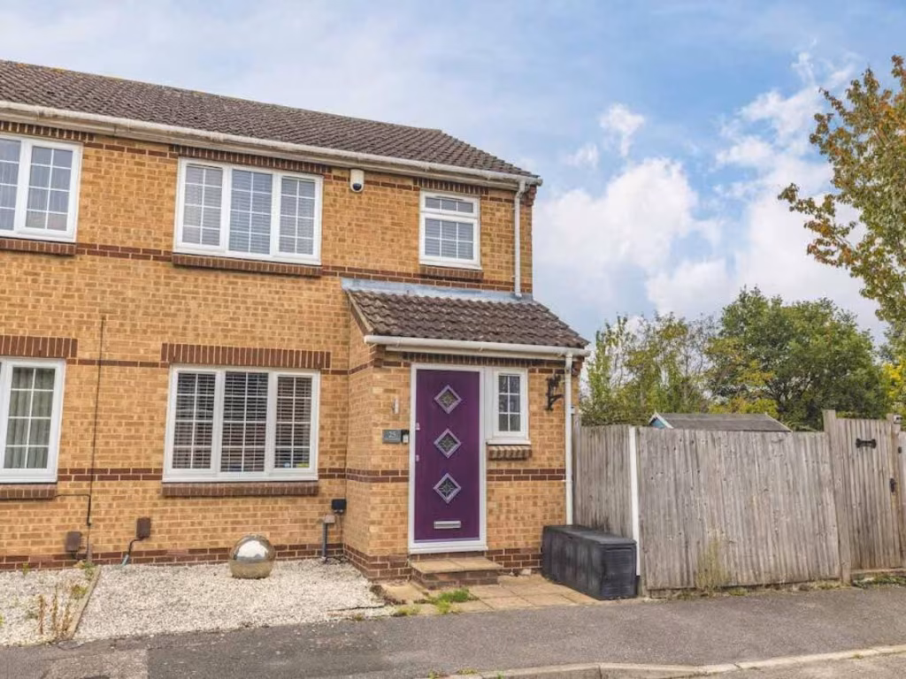
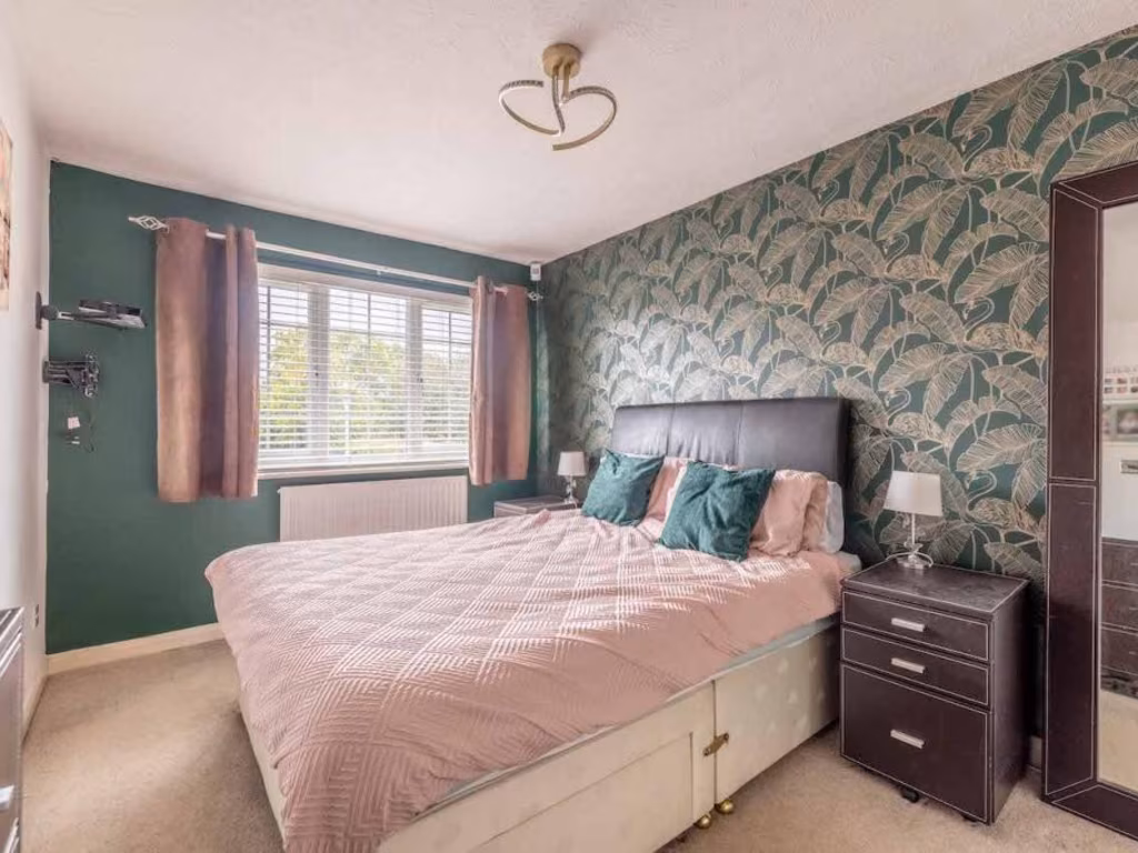
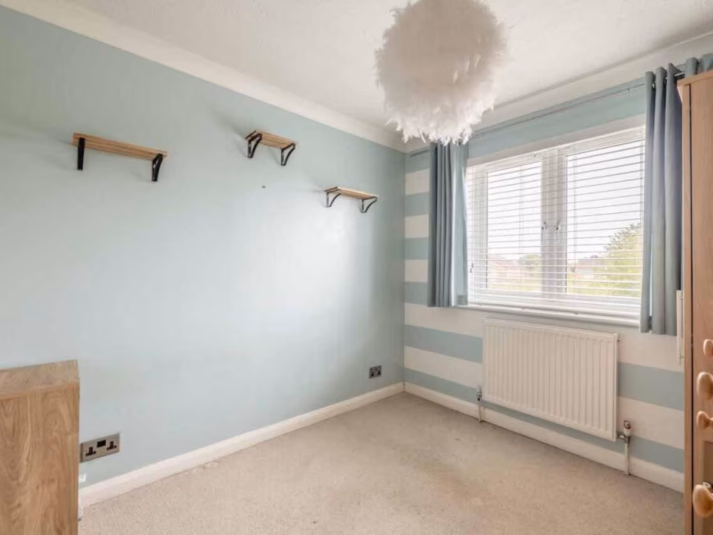
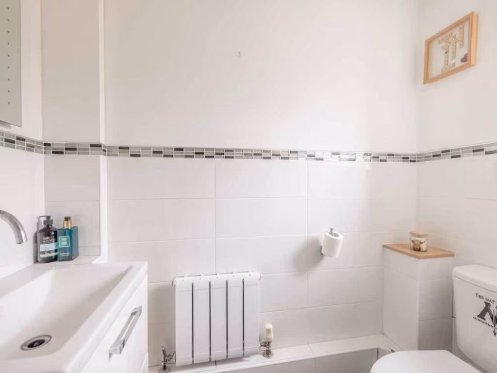
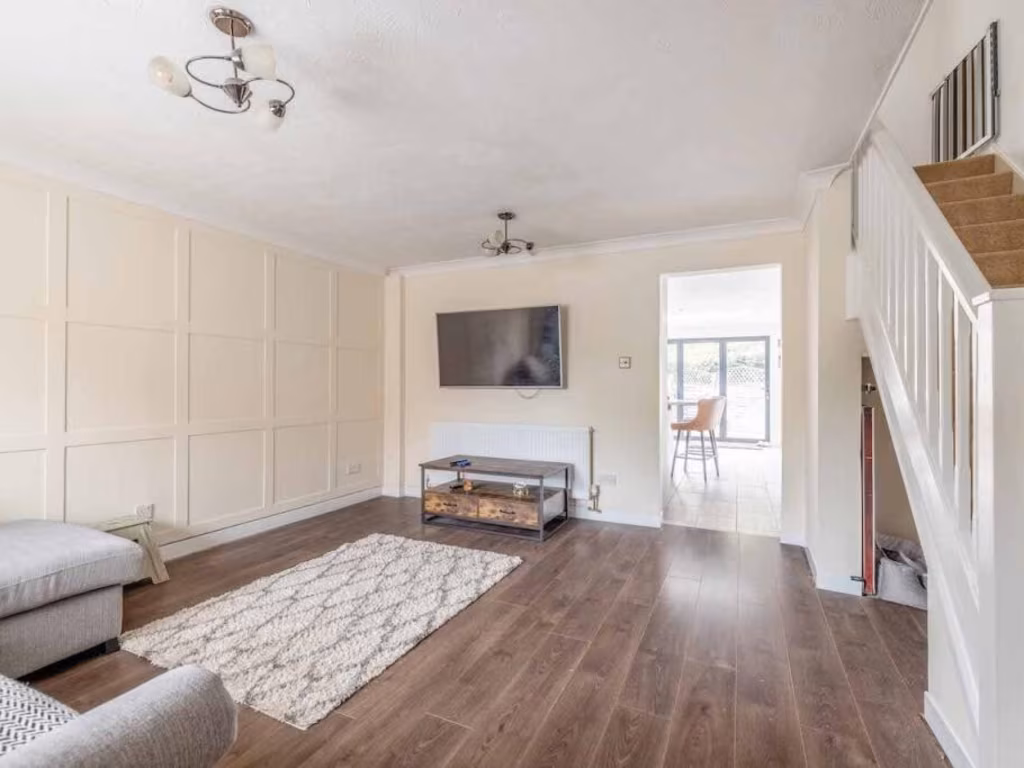
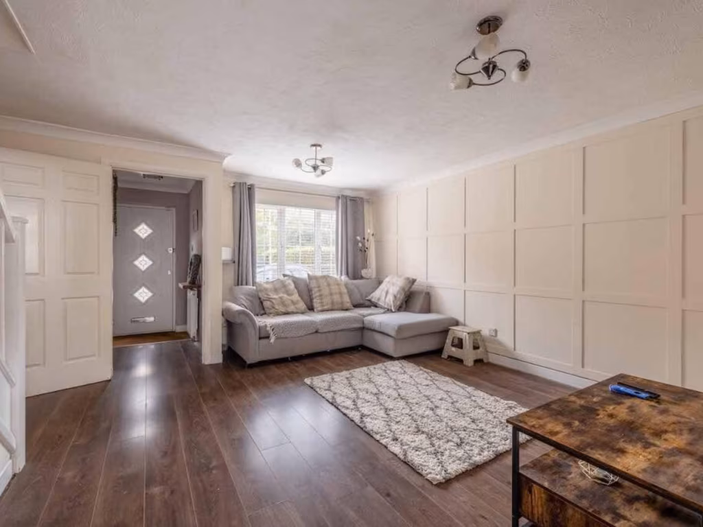
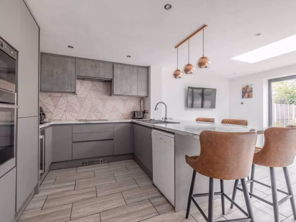
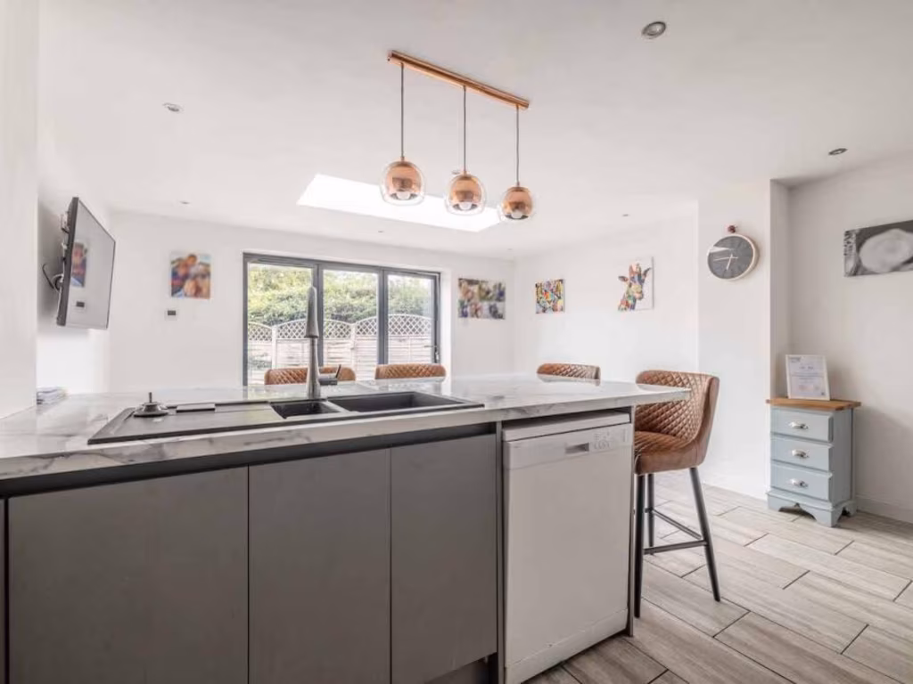
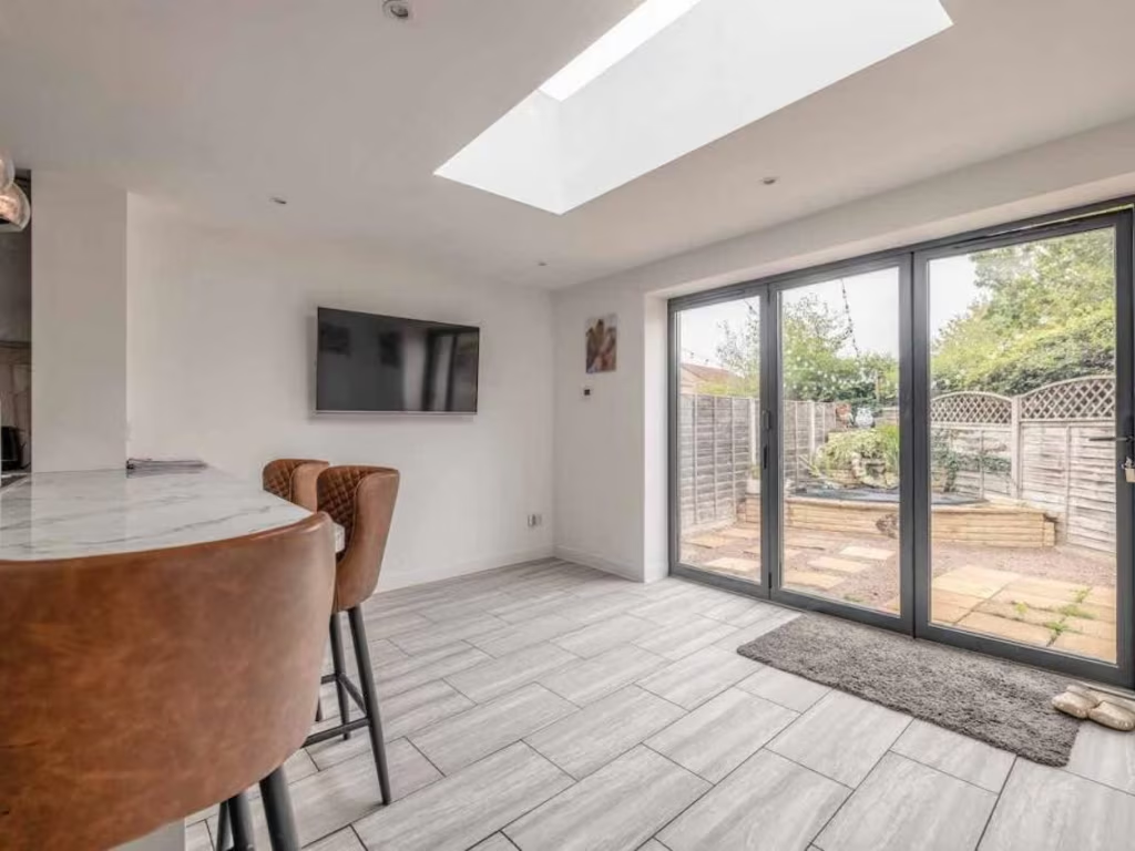
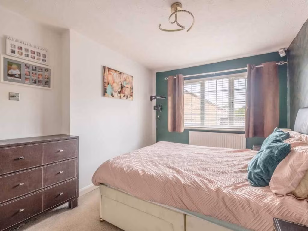
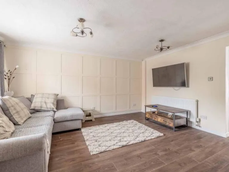
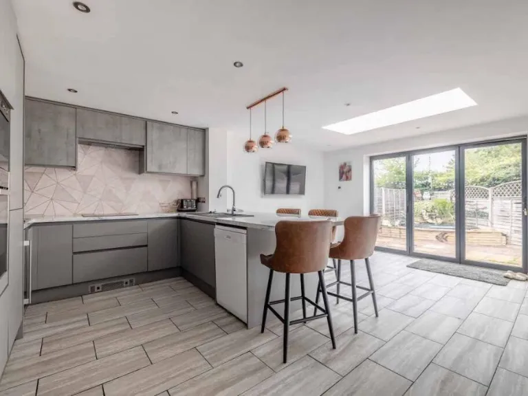
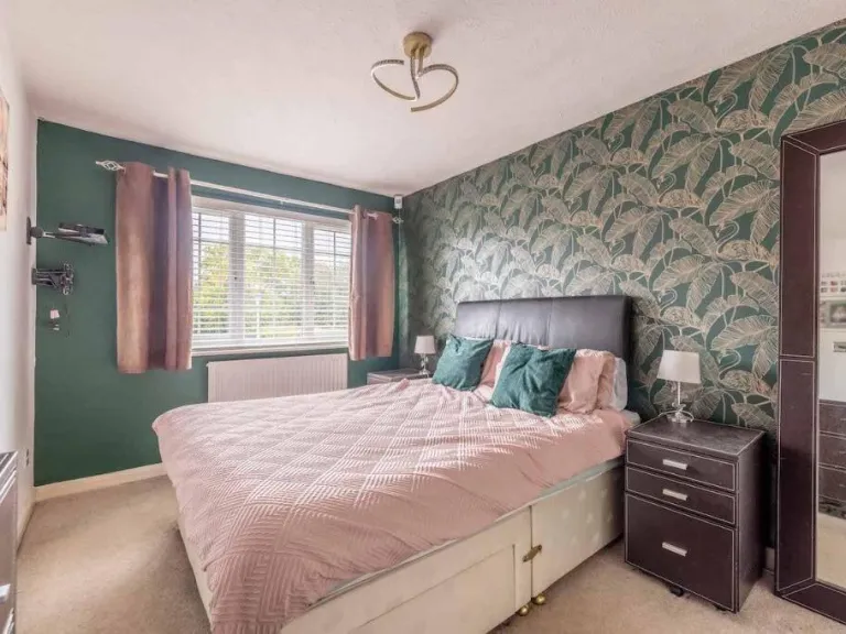
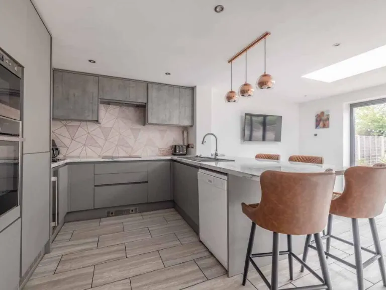
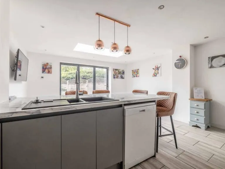
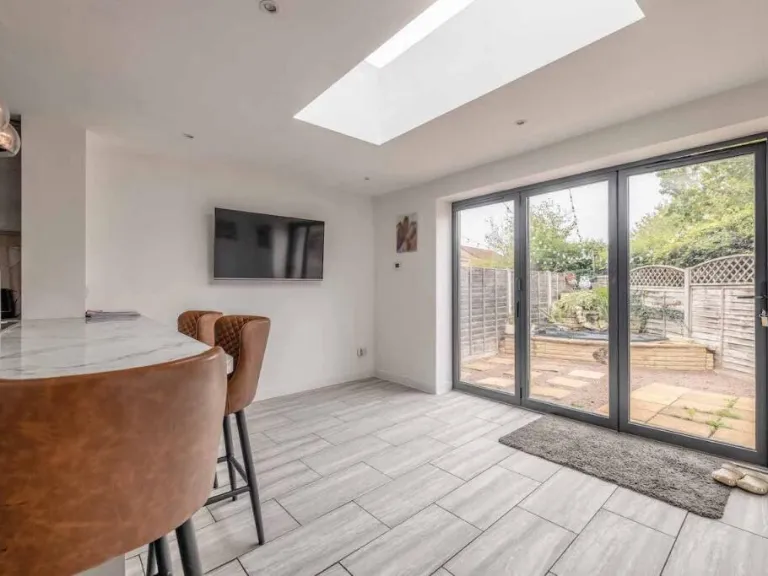
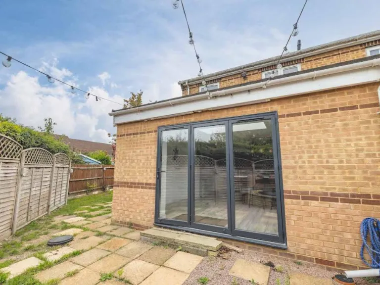
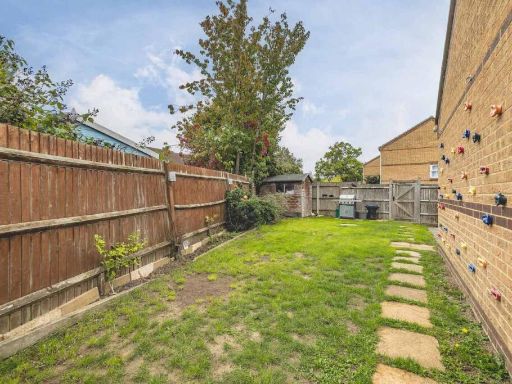
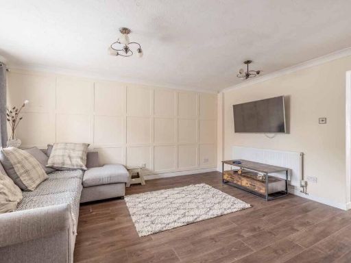
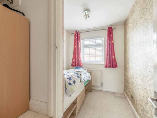
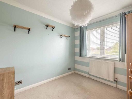
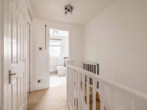
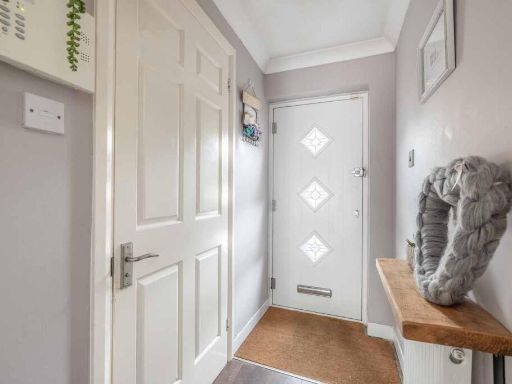
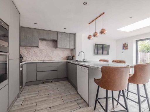
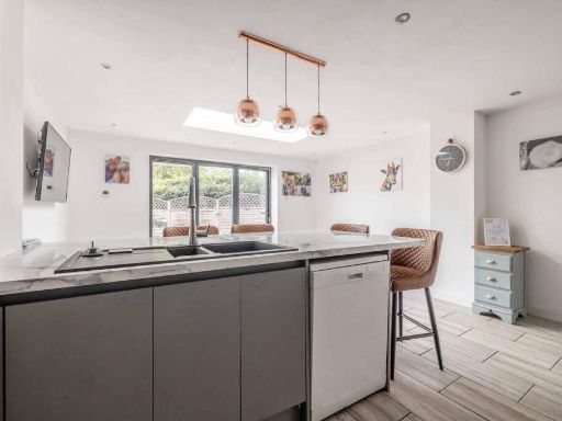
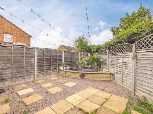
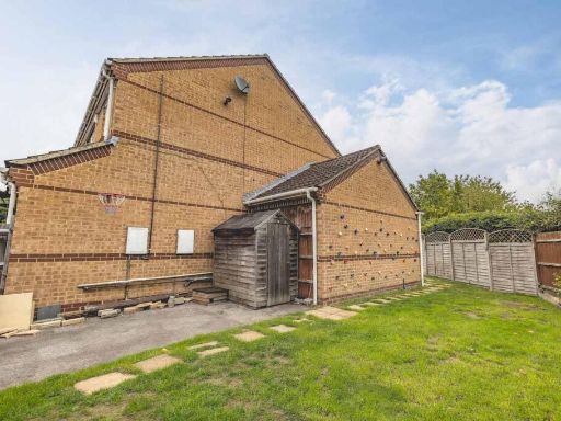
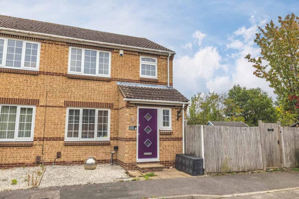
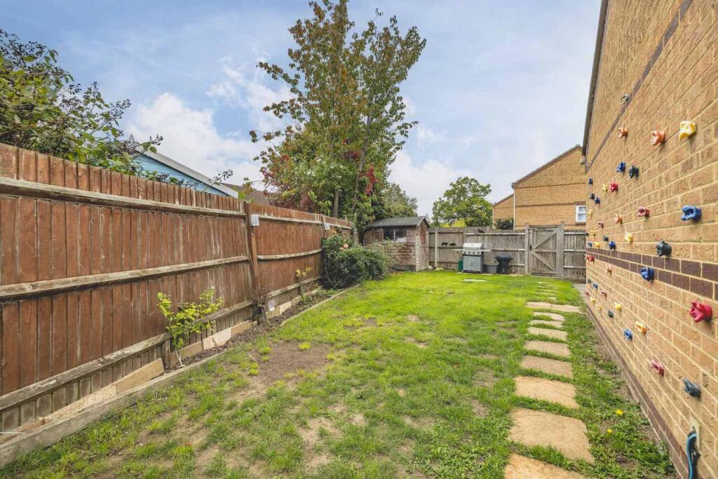
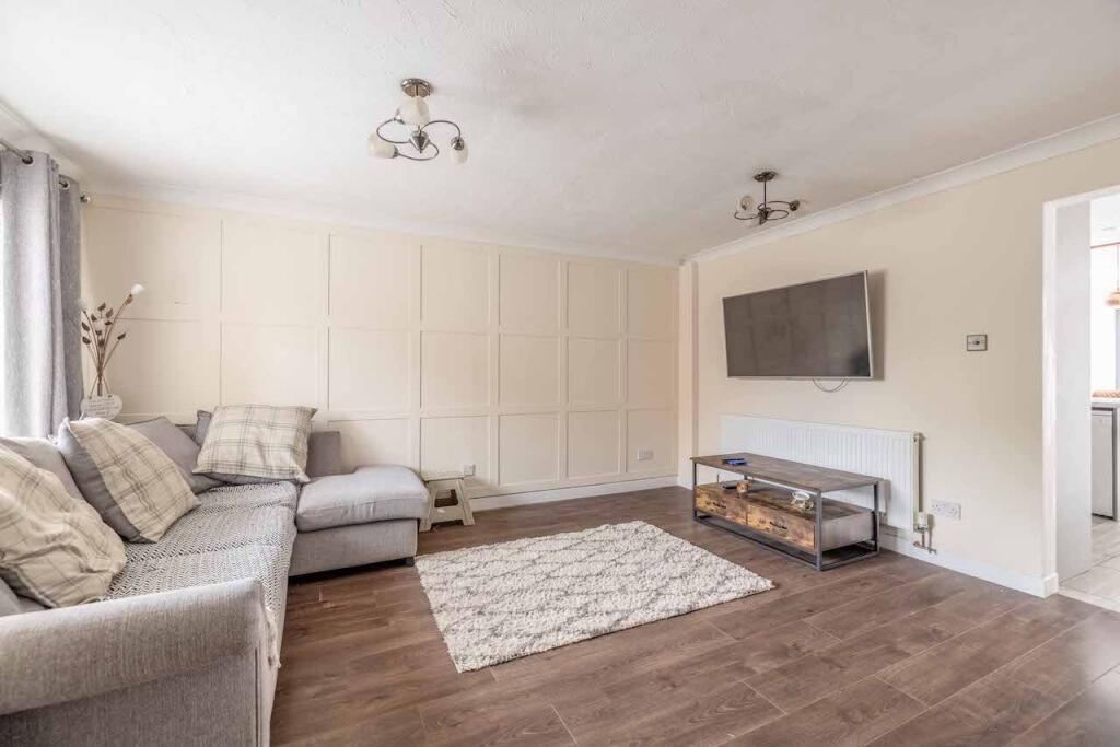
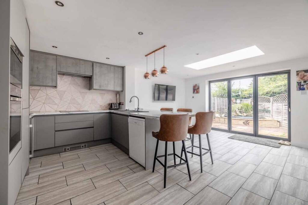
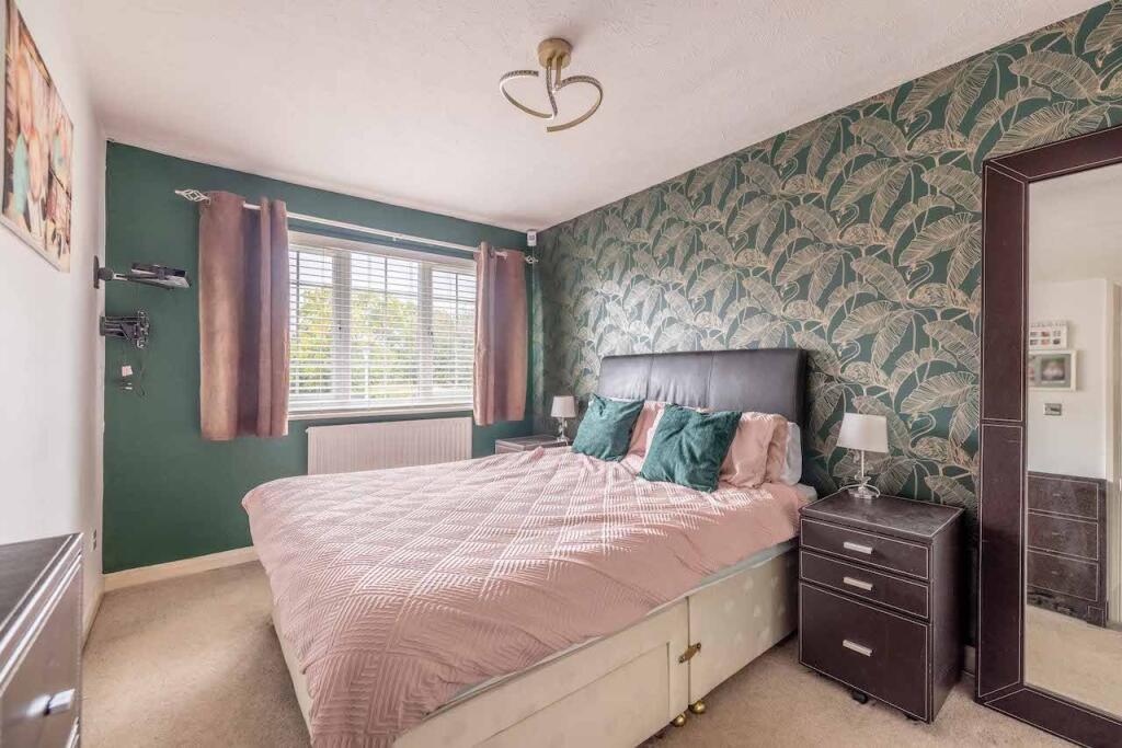
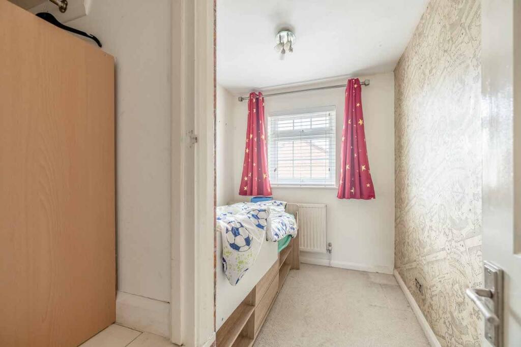
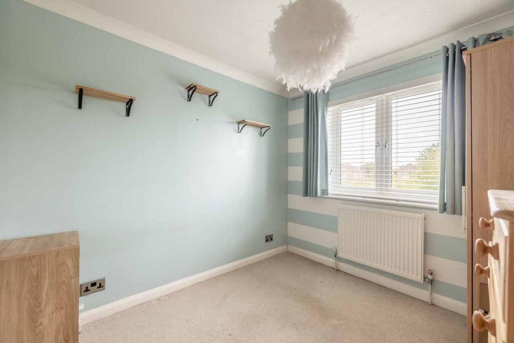
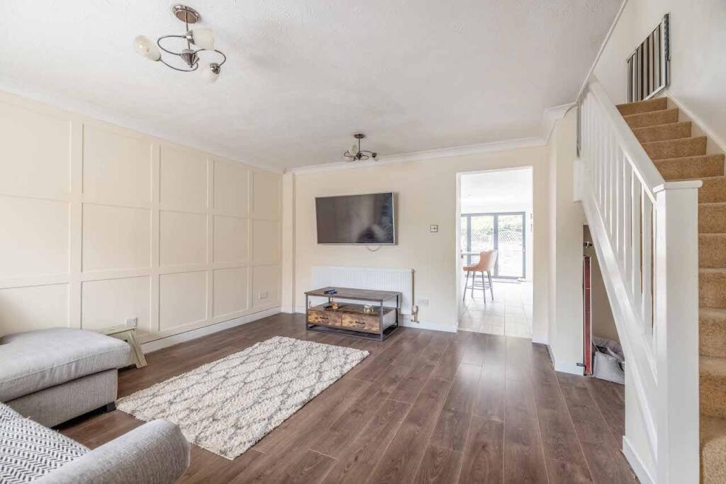
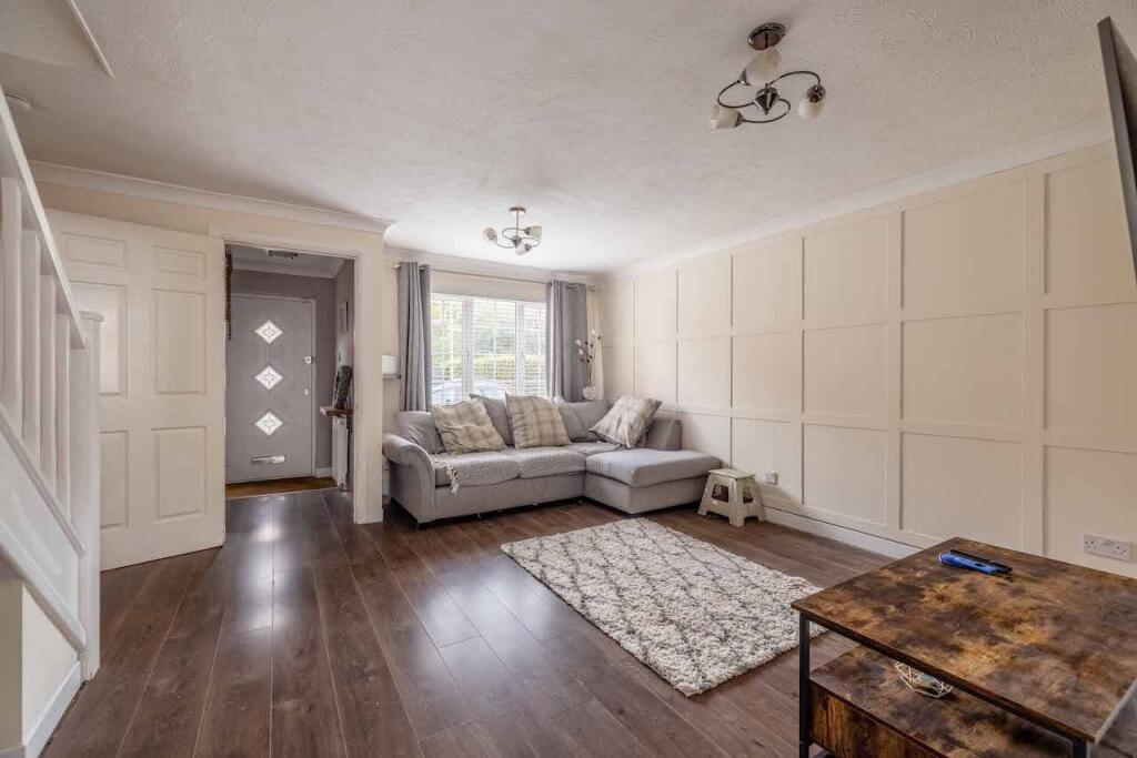
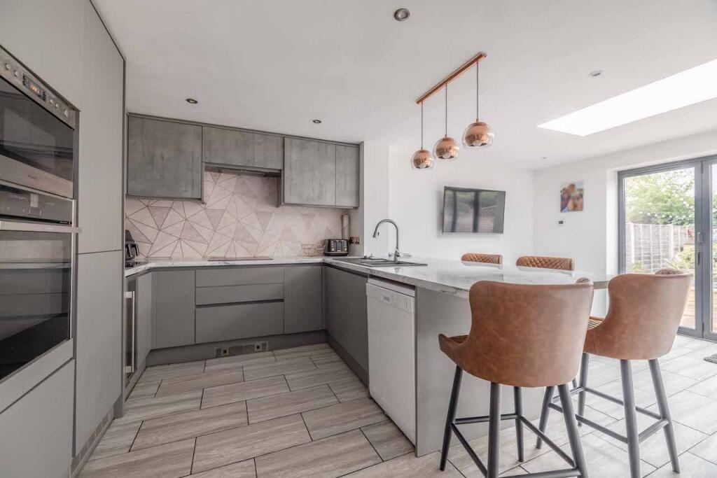
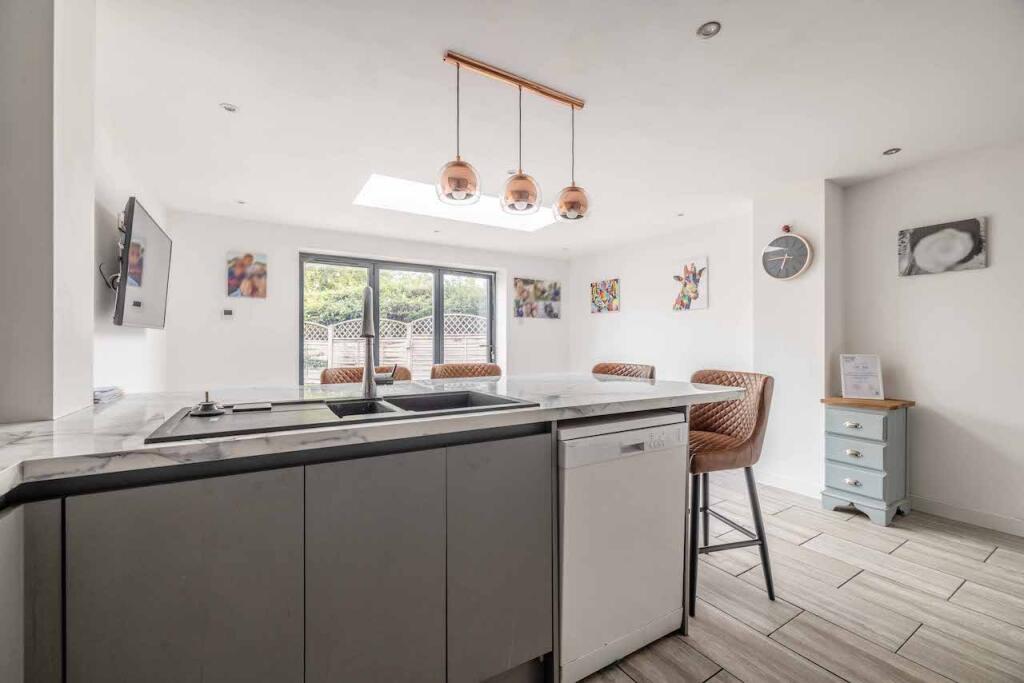
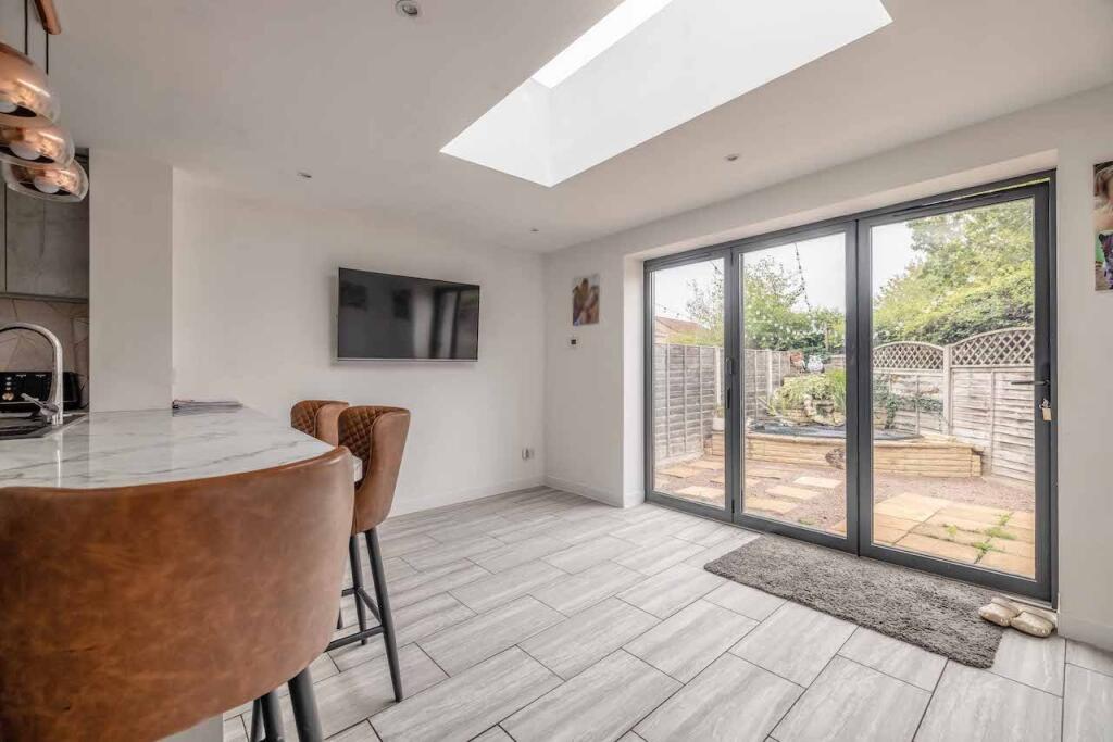
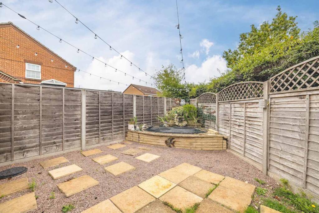
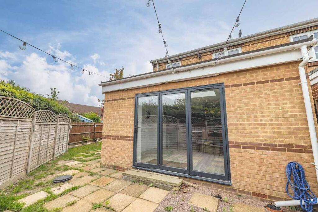
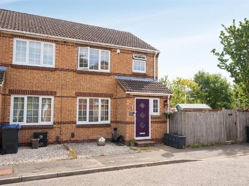
- A three-bedroom, semi-detached brick family home located at 25 Oak End Drive, Iver. The property sits on a modest/average corner plot with a gravelled frontage and off-street parking and a fenced rear garden of average size (lawned with paved/stepped access). The exterior is traditional brickwork with a modern-coloured entrance door. Internally the accommodation presents as well-maintained and tastefully updated: an average-sized front living room, a contemporary open-plan kitchen/dining area with an island/breakfast-bar and modern fittings, a main double bedroom with fitted storage and decorative finishes, plus two further bedrooms that appear suitable as children’s bedrooms or a study. Fixtures and finishes are modern and neutral, with laminate or engineered wood flooring in principal reception spaces and carpet in bedrooms. Overall the property is consistent with a mid-market family home offering practical living space and good rental/owner-occupier appeal; the plot and accommodation suggest suitability for a young family seeking a well-presented house in a residential neighbourhood with scope for further internal reconfiguration or modest extension subject to planning.
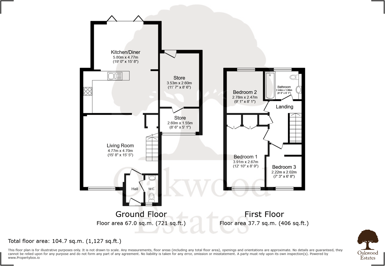
- Freehold three-bedroom detached residence located in Iver Heath (Buckinghamshire) presented on a substantial plot of approximately 0.5 acres. The property offers two reception rooms, two bathrooms, and a kitchen/diner with ground- and first-floor accommodation (total floor area given as c. 104.7 sq.m / 1,127 sq.ft). Features noted include a cul-de-sac location, good access to Heathrow and major motorways (M4/M25/M40), no onward chain and potential to extend subject to planning (S.T.P.P.). Garden size: large (plot 0.5 acres). Overall property footprint: medium house on a large plot, suitable for extension or redevelopment. No exceptional views (suburban/residential setting).
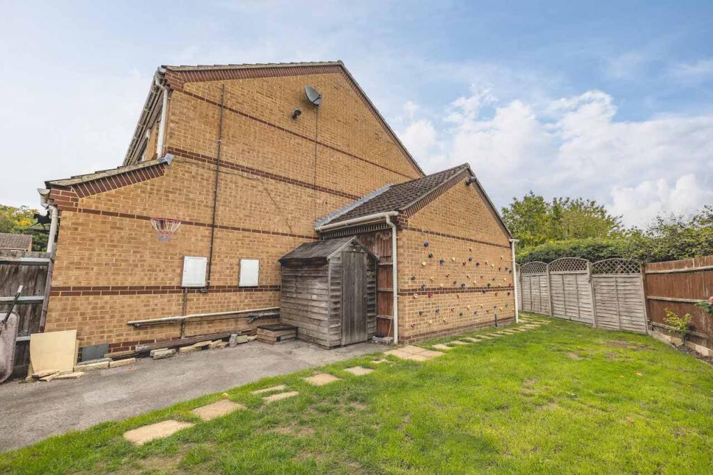
- End-of-terrace / end-of-row two-storey brick house in a cul-de-sac setting. Presented as a three-bedroom, two-reception-room freehold property with a modest frontage parking/gravel area and a gated side access to a long, narrow rear garden. Interior shows a well-proportioned living room with neutral décor and wood-effect flooring. The garden is small-to-average in width but reasonably long; overall plot appears modest for suburban standards despite a stated plot note. Property benefits listed include no upper chain, council tax band E, and potential to extend subject to planning permission. Location is suburban with good access to Heathrow and major motorways and is described as within a desirable school catchment. No notable views (urban/residential setting). Overall property size: small-to-medium.
Image Descriptions
- semi-detached house contemporary
- garden
Floorplan Description
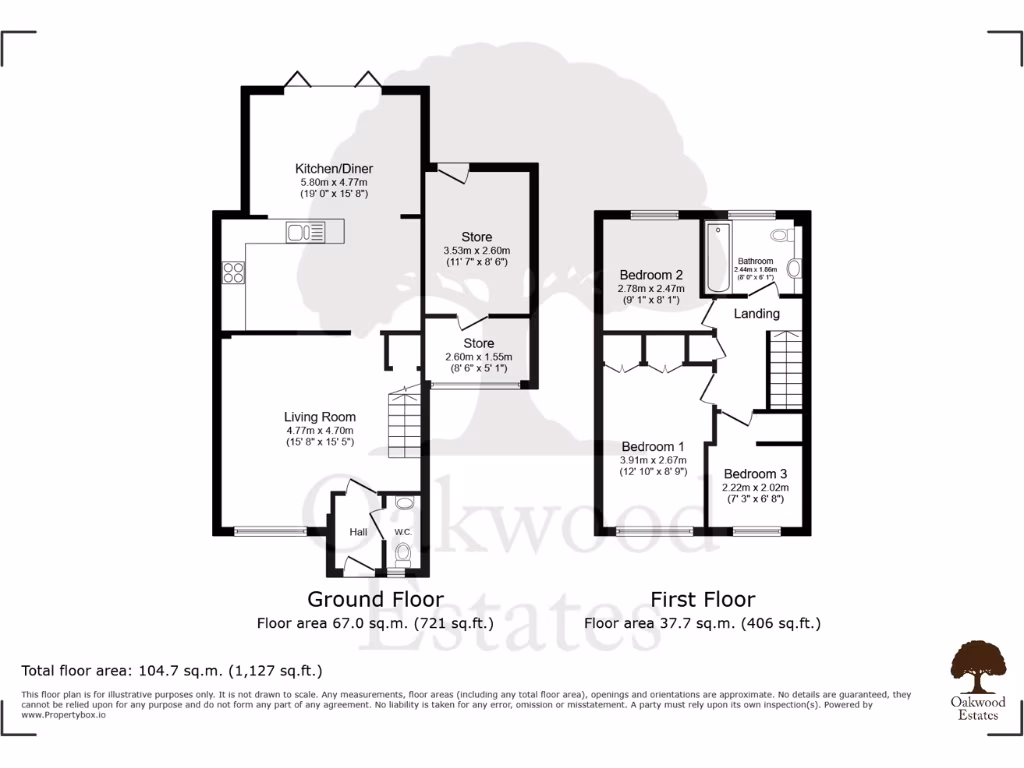
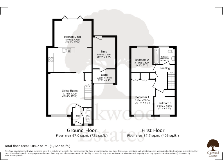
- Two-storey residential property with kitchen/diner, living room, stores and three bedrooms.
Rooms
- Kitchen/Diner:
- Living Room:
- Store:
- Store:
- Bedroom 2:
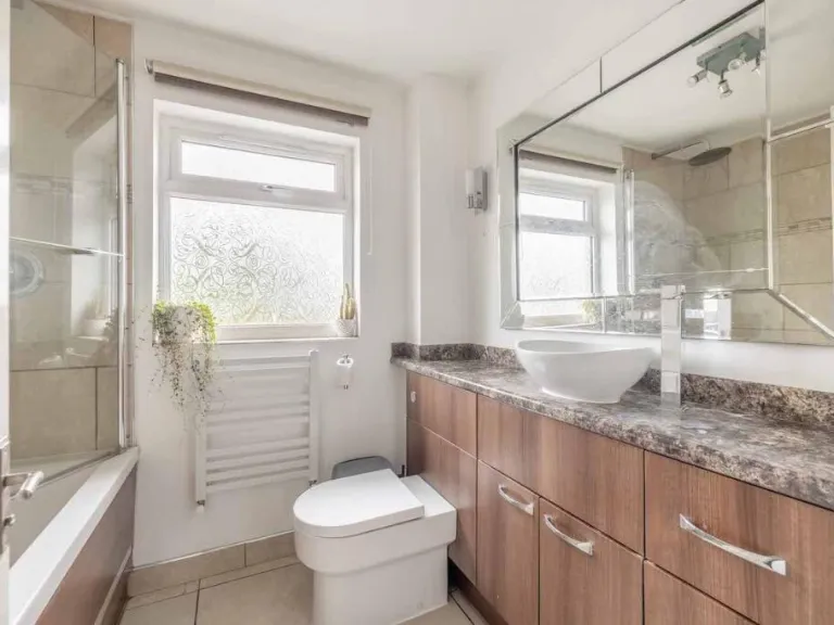
- Bathroom:
- Bedroom 1:
- Bedroom 3:
Textual Property Features
- Has Garden
- Chain Free
- Success
Detected Visual Features
- semi-detached
- contemporary
- two-story
- brick exterior
- modern windows
- residential
- driveway
- suburban
- garden
- grassy
- urban
- fenced
- backyard
- outdoor
- greenery
- yard
- pathway
EPC Details
- Fully double glazed
- Cavity wall, as built, insulated (assumed)
- Boiler and radiators, mains gas
- Low energy lighting in all fixed outlets
- Solid, no insulation (assumed)
Nearby Schools
- Cowley St Laurence CofE Primary School
- St Andrew's C of E Primary School
- Marish Primary School
- The Langley Heritage Primary
- Wexham Court Primary School
- International School of Creative Arts
- Fulmer Infant School
- The Gerrards Cross CofE School
- Whitehall Junior School
- Ryvers School
- Iver Village Infant Academy
- Iver Heath Infant School and Nursery
- Foxborough Primary School
- Uxbridge High School
- Whitehall Infant School
- St Mary's Catholic Primary School
- Hermitage Primary School
- Langley Grammar School
- The Langley Academy
- Wexham School
- Iver Heath Junior School
- Denham Village School
- Denham Green E-ACT Primary Academy
- The Langley Academy Primary
- Langley Hall Primary Academy
- Langley Hall Arts Academy
- The Iver Village Junior School
- Teikyo School UK
Nearest Bars And Restaurants
- Id: 926122022
- Tags:
- Amenity: cafe
- Building: yes
- TagsNormalized:
- Lat: 51.5299548
- Lon: -0.5366289
- FullGeoHash: gcpt5u9pxxu3
- PartitionGeoHash: gcpt
- Images:
- FoodStandards: null
- Distance: 1211.1
,- Id: 1044798532
- Tags:
- Amenity: pub
- Building: yes
- Name: The Stag and Hounds
- TagsNormalized:
- Lat: 51.5429855
- Lon: -0.520233
- FullGeoHash: gcpthpj5tsyh
- PartitionGeoHash: gcpt
- Images:
- FoodStandards: null
- Distance: 682.9
,- Id: 48990722
- Tags:
- Amenity: pub
- Building: yes
- Ele: 10
- Name: Crooked Billet
- Toilets: yes
- Toilets:access: customers
- TagsNormalized:
- Lat: 51.5347898
- Lon: -0.5305693
- FullGeoHash: gcpt5vteuv4g
- PartitionGeoHash: gcpt
- Images:
- FoodStandards: null
- Distance: 554.1
,- Id: 619541260
- Tags:
- Amenity: restaurant
- Contact:
- Name: The Palm Suite
- TagsNormalized:
- Lat: 51.5419472
- Lon: -0.5211622
- FullGeoHash: gcpthnut8537
- PartitionGeoHash: gcpt
- Images:
- FoodStandards: null
- Distance: 553
,- Id: 106563988
- Tags:
- Addr:
- Amenity: pub
- Brand: Hall & Woodhouse
- Brand:wikidata: Q5642555
- Brand:wikipedia: en:Hall & Woodhouse
- Building: yes
- Contact:
- Name: The Black Horse
- TagsNormalized:
- bar
- pub
- hall & woodhouse
- horses
- Lat: 51.537267
- Lon: -0.5157612
- FullGeoHash: gcpthq06mfus
- PartitionGeoHash: gcpt
- Images:
- FoodStandards: null
- Distance: 539.4
}
Nearest General Shops
- Id: 48748862
- Tags:
- Landuse: commercial
- Name: Iver Flowerland
- Shop: garden_centre
- TagsNormalized:
- Lat: 51.5279099
- Lon: -0.516972
- FullGeoHash: gcpthhrecdte
- PartitionGeoHash: gcpt
- Images:
- FoodStandards: null
- Distance: 1129.4
,- Id: 1412493872
- Tags:
- Addr:
- Housename: Woodland Nursery
- Street: Wood Lane
- Name: Wood Lane Nursery
- Shop: garden_centre
- Source: Local Knowledge
- TagsNormalized:
- nursery
- wood
- garden centre
- shop
- Lat: 51.5293921
- Lon: -0.5293305
- FullGeoHash: gcpt5uws3wyt
- PartitionGeoHash: gcpt
- Images:
- FoodStandards: null
- Distance: 955.9
,- Id: 1044309152
- Tags:
- Building: yes
- Name: KEW Motors
- Shop: car_repair
- TagsNormalized:
- Lat: 51.5393349
- Lon: -0.5161324
- FullGeoHash: gcpthq2nmhru
- PartitionGeoHash: gcpt
- Images:
- FoodStandards: null
- Distance: 565.8
}
Nearest Grocery shops
- Id: 238244182
- Tags:
- Addr:
- City: Iver
- Country: GB
- Postcode: SL0 0LU
- Street: Billet Lane
- Building: yes
- Email: copasfarms@copasfarms.co.uk
- Name: Copas Farms PYO
- Opening_hours: Tu-Su 10:00-17:00
- Phone: +44 1753 652727
- Shop: greengrocer
- Website: http://www.copasfarms.co.uk
- TagsNormalized:
- Lat: 51.5217306
- Lon: -0.535665
- FullGeoHash: gcpt5g1zy4en
- PartitionGeoHash: gcpt
- Images:
- FoodStandards: null
- Distance: 1913.4
,- Id: 619395968
- Tags:
- Name: The Co-op
- Shop: convenience
- TagsNormalized:
- Lat: 51.5429135
- Lon: -0.5210072
- FullGeoHash: gcpthphe5xkz
- PartitionGeoHash: gcpt
- Images:
- FoodStandards: null
- Distance: 659
,- Id: 619395961
- Tags:
- TagsNormalized:
- Lat: 51.536843
- Lon: -0.5191447
- FullGeoHash: gcpthjvzz5ce
- PartitionGeoHash: gcpt
- Images:
- FoodStandards: null
- Distance: 308
}
Nearest Religious buildings
- Id: 360910346
- Tags:
- Amenity: place_of_worship
- Building: church
- Denomination: anglican
- Name: St Peter
- Religion: christian
- Source: Local Knowledge
- Wikidata: Q17524672
- TagsNormalized:
- place of worship
- church
- anglican
- christian
- Lat: 51.5199114
- Lon: -0.5027807
- FullGeoHash: gcpthdcvhred
- PartitionGeoHash: gcpt
- Images:
- FoodStandards: null
- Distance: 2400.7
,- Id: 1412549004
- Tags:
- Addr:
- City: Iver
- Housename: Kings Church
- Postcode: SL0 9NW
- Street: High Street
- Amenity: place_of_worship
- Denomination: independent_baptist
- Email: office@kingschurchiver.org
- Name: Kings Church Iver
- Phone: +44 1753 651178
- Religion: christian
- Service_times: Sunday: 10:30
- Website: https://kingschurchiver.org/
- TagsNormalized:
- place of worship
- baptist
- church
- christian
- Lat: 51.520454
- Lon: -0.5084308
- FullGeoHash: gcpth7jb2swx
- PartitionGeoHash: gcpt
- Images:
- FoodStandards: null
- Distance: 2136.3
,- Id: 860039583
- Tags:
- Amenity: place_of_worship
- Building: church
- Denomination: anglican
- Name: St Margaret's Church
- Religion: christian
- Wikidata: Q26617508
- TagsNormalized:
- place of worship
- church
- anglican
- christian
- Lat: 51.538546
- Lon: -0.5251541
- FullGeoHash: gcpthn39g12d
- PartitionGeoHash: gcpt
- Images:
- FoodStandards: null
- Distance: 185.6
}
Nearest Airports
- Id: 14001268
- Tags:
- Access: yes
- Aerodrome: international
- Aerodrome:type: public
- Aeroway: aerodrome
- Alt_name: London Heathrow
- Alt_name_2: London Heathrow Airport
- Ele: 25
- Iata: LHR
- Icao: EGLL
- Int_name: Heathrow Airport
- Name: London Heathrow Airport
- Note: area still approx
- Old_name: London Airport
- Operator: Heathrow Airport Limited
- Rank_aci:
- Ref: LHR
- Short_name: Heathrow
- Type: multipolygon
- Website: https://www.heathrow.com/
- Wikidata: Q8691
- Wikipedia: en:Heathrow Airport
- TagsNormalized:
- airport
- international airport
- Lat: 51.4677522
- Lon: -0.4547736
- FullGeoHash: gcpsv9kv7h2h
- PartitionGeoHash: gcps
- Images:
- FoodStandards: null
- Distance: 9072.3
}
Nearest Leisure Facilities
- Id: 1044456786
- Tags:
- Leisure: pitch
- Sport: basketball
- TagsNormalized:
- pitch
- leisure
- basketball
- sports
- Lat: 51.540533
- Lon: -0.5208815
- FullGeoHash: gcpthnstqedx
- PartitionGeoHash: gcpt
- Images:
- FoodStandards: null
- Distance: 414
,- Id: 48836757
- Tags:
- Leisure: pitch
- Sport: tennis
- TagsNormalized:
- Lat: 51.5403258
- Lon: -0.5220636
- FullGeoHash: gcpthneu5j15
- PartitionGeoHash: gcpt
- Images:
- FoodStandards: null
- Distance: 362.3
,- Id: 911570465
- Tags:
- Leisure: pitch
- Sport: bowls
- TagsNormalized:
- Lat: 51.5398886
- Lon: -0.5216648
- FullGeoHash: gcpthns1s7de
- PartitionGeoHash: gcpt
- Images:
- FoodStandards: null
- Distance: 326.1
,- Id: 619541248
- Tags:
- TagsNormalized:
- Lat: 51.5379616
- Lon: -0.5223161
- FullGeoHash: gcpthn5wmhku
- PartitionGeoHash: gcpt
- Images:
- FoodStandards: null
- Distance: 120.5
,- Id: 48826195
- Tags:
- Leisure: pitch
- Name: School Playing Field
- Sport: multi
- Surface: grass
- TagsNormalized:
- Lat: 51.5373616
- Lon: -0.5223334
- FullGeoHash: gcpthn5dusxb
- PartitionGeoHash: gcpt
- Images:
- FoodStandards: null
- Distance: 86.6
}
Nearest Tourist attractions
- Id: 2460874583
- Tags:
- TagsNormalized:
- Lat: 51.5218003
- Lon: -0.5355831
- FullGeoHash: gcpt5g600p8q
- PartitionGeoHash: gcpt
- Images:
- FoodStandards: null
- Distance: 1904
,- Id: 10207819272
- Tags:
- Name: Treehouse
- Tourism: attraction
- TagsNormalized:
- Lat: 51.541036
- Lon: -0.5497513
- FullGeoHash: gcpt5qz8mc7x
- PartitionGeoHash: gcpt
- Images:
- FoodStandards: null
- Distance: 1860.9
,- Id: 127677288
- Tags:
- Addr:
- Housename: Iver Environment Centre
- Postcode: SL0 0EB
- Street: Slough Road
- Name: Iver Environment Centre
- Old_name: Iver Nature Study Centre
- Tourism: attraction
- TagsNormalized:
- Lat: 51.543256
- Lon: -0.5006236
- FullGeoHash: gcpthx5mnx7f
- PartitionGeoHash: gcpt
- Images:
- FoodStandards: null
- Distance: 1723.1
}
Nearest Bus stations and stops
- Id: 766069431
- Tags:
- Bench: no
- Highway: bus_stop
- Name: Slough Road
- Public_transport: platform
- Shelter: no
- Tactile_paving: no
- TagsNormalized:
- Lat: 51.5400779
- Lon: -0.498197
- FullGeoHash: gcpthwt4xnvk
- PartitionGeoHash: gcpt
- Images:
- FoodStandards: null
- Distance: 1783
,- Id: 766069435
- Tags:
- Bench: no
- Highway: bus_stop
- Name: Slough Road
- Public_transport: platform
- Shelter: no
- Tactile_paving: no
- TagsNormalized:
- Lat: 51.5400187
- Lon: -0.4992341
- FullGeoHash: gcpthws6r5b5
- PartitionGeoHash: gcpt
- Images:
- FoodStandards: null
- Distance: 1711.3
,- Id: 6681775708
- Tags:
- Bench: yes
- Bin: yes
- Bus: yes
- Highway: bus_stop
- Name: Pinewood Studios (pickup)
- Network: Pinewood Studios Shuttle Bus
- Operator: Passenger Plus Ltd
- Public_transport: platform
- Shelter: yes
- TagsNormalized:
- Lat: 51.5478149
- Lon: -0.5315999
- FullGeoHash: gcpt5zuzuc4m
- PartitionGeoHash: gcpt
- Images:
- FoodStandards: null
- Distance: 1304.4
,- Id: 619395970
- Tags:
- Highway: bus_stop
- Name: The Black Horse
- Public_transport: platform
- Shelter: yes
- TagsNormalized:
- Lat: 51.5373058
- Lon: -0.5153943
- FullGeoHash: gcpthq0dw6nh
- PartitionGeoHash: gcpt
- Images:
- FoodStandards: null
- Distance: 564.9
,- Id: 619395972
- Tags:
- Highway: bus_stop
- Name: The Black Horse
- Public_transport: platform
- TagsNormalized:
- Lat: 51.5377571
- Lon: -0.5159128
- FullGeoHash: gcpthq0m4q78
- PartitionGeoHash: gcpt
- Images:
- FoodStandards: null
- Distance: 532.5
}
Nearest Hotels
- Id: 925744820
- Tags:
- Addr:
- City: Uxbridge
- Postcode: UB8 1SS
- Street: Baker's Road
- Alt_name: Travelodge Uxbridge
- Branch: Uxbridge
- Brand: Travelodge
- Brand:wikidata: Q9361374
- Brand:wikipedia: en:Travelodge UK
- Building: yes
- Description: In this hotel, the entrance leads into a small area with a settee & a vending machine. The reception is on the 2nd floor. To access it, take the lift. The 2nd floor also has a café. The rooms are on floors 1 & 3-8. There are 2 Kone lifts in this hotel.
- Internet_access: wlan
- Internet_access:fee: customers
- Internet_access:ssid: Travelodge WiFi
- Level: 0;1;2;3;4;5;6;7;8
- Name: Travelodge
- Tourism: hotel
- TagsNormalized:
- Lat: 51.5470134
- Lon: -0.4782777
- FullGeoHash: gcptjpgep7f2
- PartitionGeoHash: gcpt
- Images:
- FoodStandards: null
- Distance: 3316.1
,- Id: 190082066
- Tags:
- Building: yes
- Name: Pinewood
- Tourism: hotel
- TagsNormalized:
- Lat: 51.5266838
- Lon: -0.5565385
- FullGeoHash: gcpt5k4sxwnc
- PartitionGeoHash: gcpt
- Images:
- FoodStandards: null
- Distance: 2563.6
,- Id: 407503595
- Tags:
- Addr:
- City: Uxbridge
- Postcode: UB8 2YF
- Street: Riverside Way
- Brand: Premier Inn
- Brand:wikidata: Q2108626
- Brand:wikipedia: en:Premier Inn
- Building: hotel
- Internet_access: wlan
- Internet_access:fee: customers
- Internet_access:operator: Virgin Media
- Internet_access:ssid: Premier Inn Free Wi-Fi
- Name: Premier Inn
- Tourism: hotel
- TagsNormalized:
- Lat: 51.5423498
- Lon: -0.4902893
- FullGeoHash: gcpthyfzzqmu
- PartitionGeoHash: gcpt
- Images:
- FoodStandards: null
- Distance: 2371.1
}
Tags
- semi-detached
- contemporary
- two-story
- brick exterior
- modern windows
- residential
- driveway
- suburban
- garden
- grassy
- urban
- fenced
- backyard
- outdoor
- greenery
- yard
- pathway
Local Market Stats
- Average Price/sqft: £509
- Avg Income: £62000
- Rental Yield: 3.6%
- Social Housing: 7%
- Planning Success Rate: 82%
AirBnB Data
- 1km average: £89/night
- Listings in 1km: 1
Similar Properties
 3 bedroom semi-detached house for sale in Oak End Drive, Iver, SL0 — £550,000 • 3 bed • 1 bath • 931 ft²
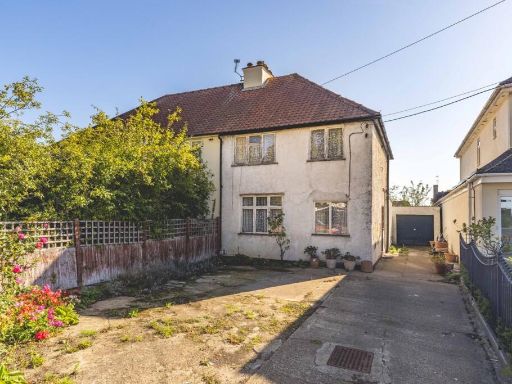 3 bedroom semi-detached house for sale in Church Road, Iver, SL0 — £625,000 • 3 bed • 1 bath • 1227 ft²
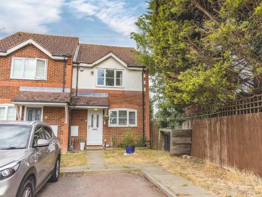 3 bedroom semi-detached house for sale in Martindale, Iver Heath, SL0 — £475,000 • 3 bed • 2 bath • 888 ft²
 4 bedroom semi-detached house for sale in Whitehouse Way, Iver, SL0 — £635,000 • 4 bed • 2 bath • 1388 ft²
 3 bedroom town house for sale in Copse Wood, Iver Heath, SL0 — £525,000 • 3 bed • 2 bath • 1408 ft²
 4 bedroom semi-detached house for sale in St Margarets Court, St Margarets Close, Iver Heath, SL0 — £550,000 • 4 bed • 2 bath • 1133 ft²
Meta
- {
"@context": "https://schema.org",
"@type": "Residence",
"name": "3 bedroom end of terrace house for sale in Oak End Drive, I…",
"description": "",
"url": "https://propertypiper.co.uk/property/1062f2c5-c114-4b54-b1df-06c6302e6e1c",
"image": "https://image-a.propertypiper.co.uk/4e70d570-3507-4469-9496-ea7e52b73910-1024.jpeg",
"address": {
"@type": "PostalAddress",
"streetAddress": "25, OAK END DRIVE, IVER",
"postalCode": "SL0 0SE",
"addressLocality": "Buckinghamshire",
"addressRegion": "Beaconsfield",
"addressCountry": "England"
},
"geo": {
"@type": "GeoCoordinates",
"latitude": 51.5372032,
"longitude": -0.5235599
},
"numberOfRooms": 3,
"numberOfBathroomsTotal": 2,
"floorSize": {
"@type": "QuantitativeValue",
"value": 1112,
"unitCode": "FTK"
},
"offers": {
"@type": "Offer",
"price": 550000,
"priceCurrency": "GBP",
"availability": "https://schema.org/InStock"
},
"additionalProperty": [
{
"@type": "PropertyValue",
"name": "Feature",
"value": "semi-detached"
},
{
"@type": "PropertyValue",
"name": "Feature",
"value": "contemporary"
},
{
"@type": "PropertyValue",
"name": "Feature",
"value": "two-story"
},
{
"@type": "PropertyValue",
"name": "Feature",
"value": "brick exterior"
},
{
"@type": "PropertyValue",
"name": "Feature",
"value": "modern windows"
},
{
"@type": "PropertyValue",
"name": "Feature",
"value": "residential"
},
{
"@type": "PropertyValue",
"name": "Feature",
"value": "driveway"
},
{
"@type": "PropertyValue",
"name": "Feature",
"value": "suburban"
},
{
"@type": "PropertyValue",
"name": "Feature",
"value": "garden"
},
{
"@type": "PropertyValue",
"name": "Feature",
"value": "grassy"
},
{
"@type": "PropertyValue",
"name": "Feature",
"value": "urban"
},
{
"@type": "PropertyValue",
"name": "Feature",
"value": "fenced"
},
{
"@type": "PropertyValue",
"name": "Feature",
"value": "backyard"
},
{
"@type": "PropertyValue",
"name": "Feature",
"value": "outdoor"
},
{
"@type": "PropertyValue",
"name": "Feature",
"value": "greenery"
},
{
"@type": "PropertyValue",
"name": "Feature",
"value": "yard"
},
{
"@type": "PropertyValue",
"name": "Feature",
"value": "pathway"
}
]
}
High Res Floorplan Images
Compatible Floorplan Images
FloorplanImages Thumbnail