BN3 8EE - 2 bedroom detached bungalow for sale in Meads Avenue, Hove,…
View on Property Piper
2 bedroom detached bungalow for sale in Meads Avenue, Hove, BN3
Property Details
- Price: £525000
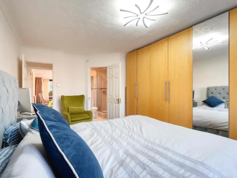
- Bedrooms: 2
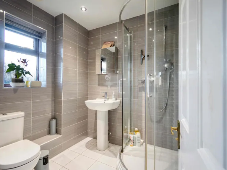
- Bathrooms: 2
- Property Type: undefined
- Property SubType: undefined
Image Descriptions
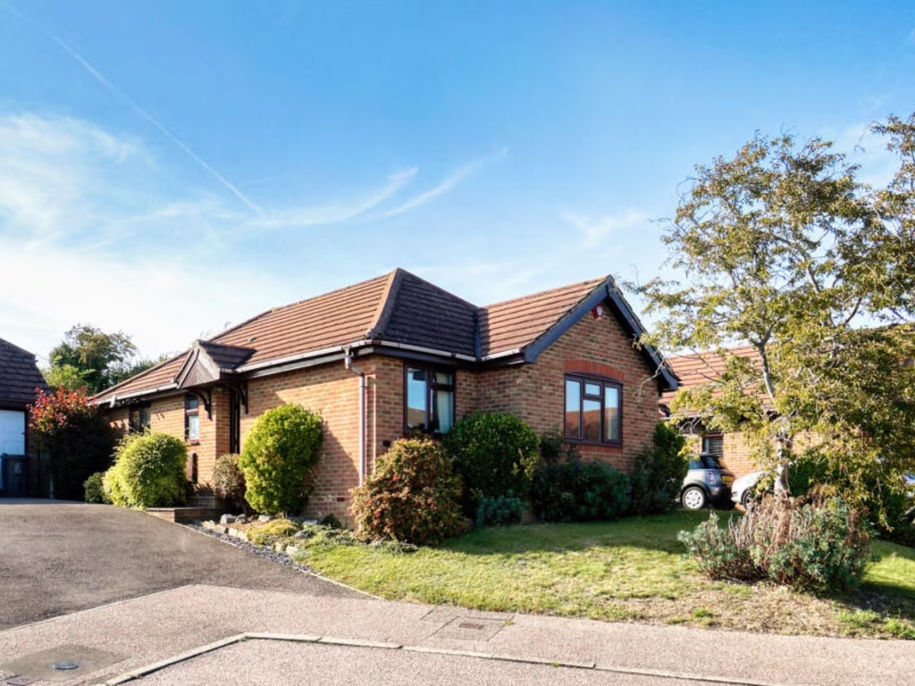
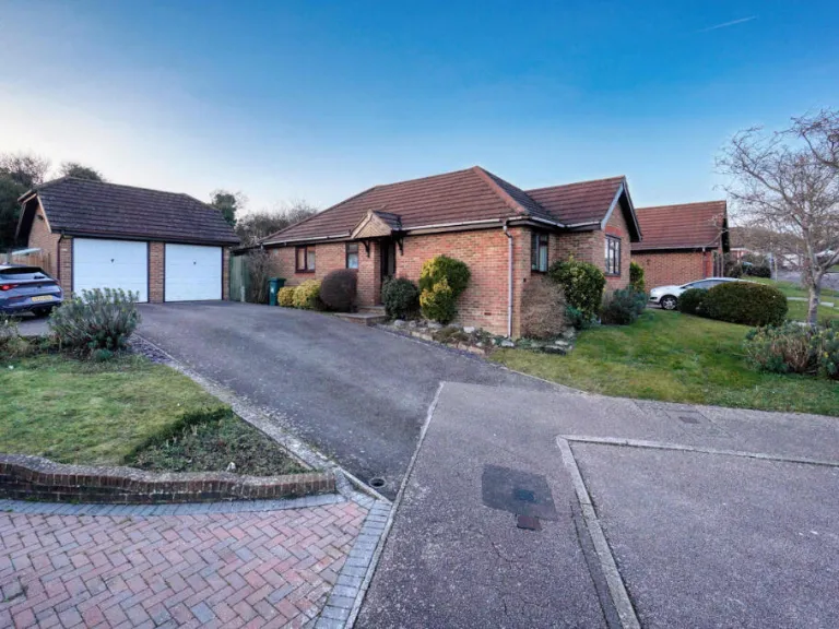
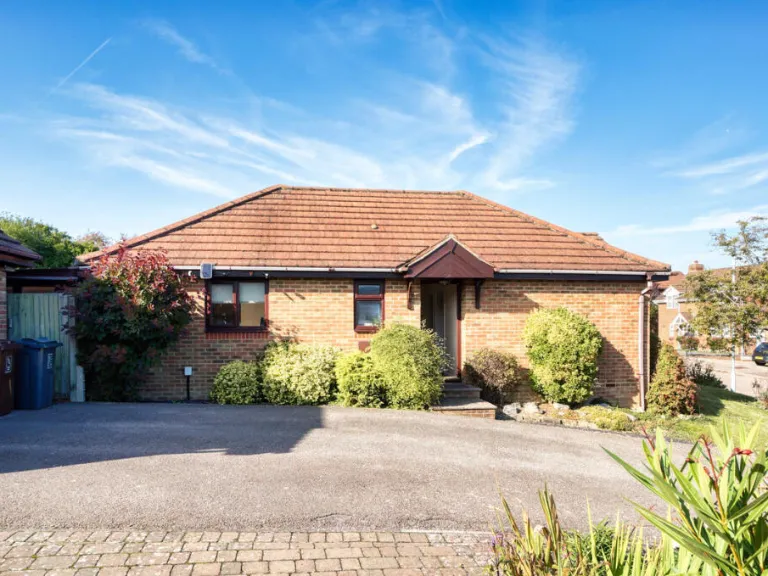
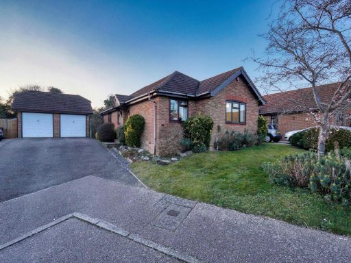
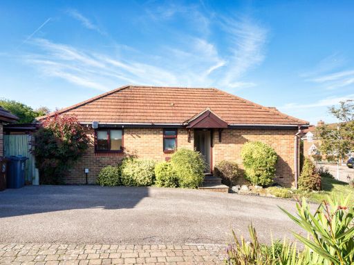
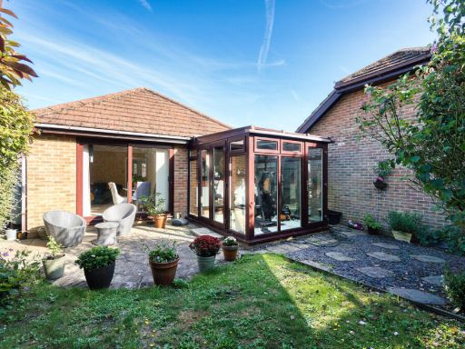
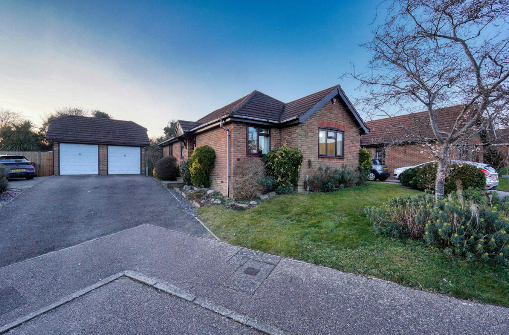
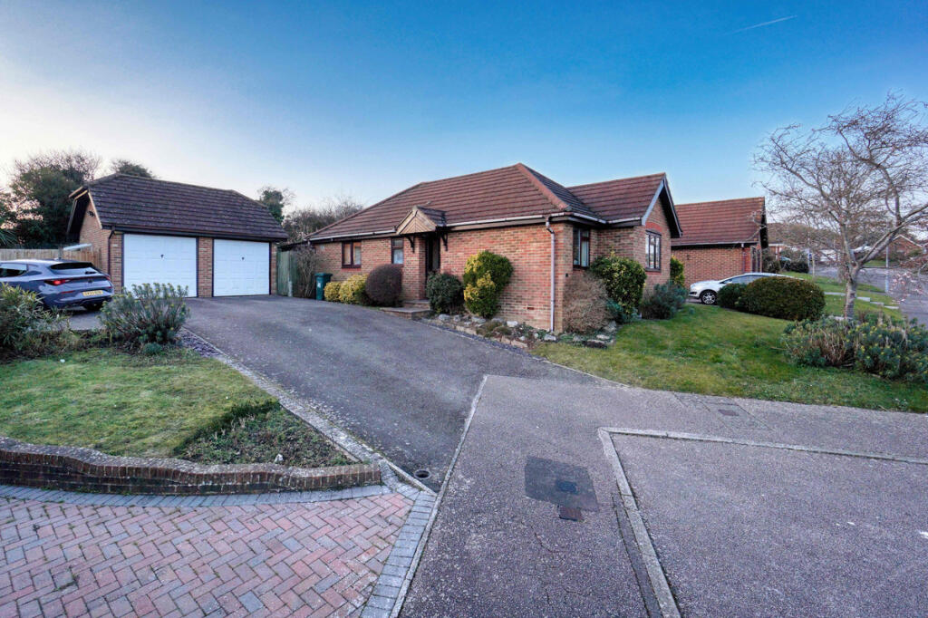
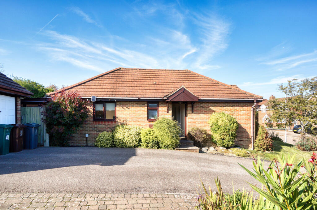
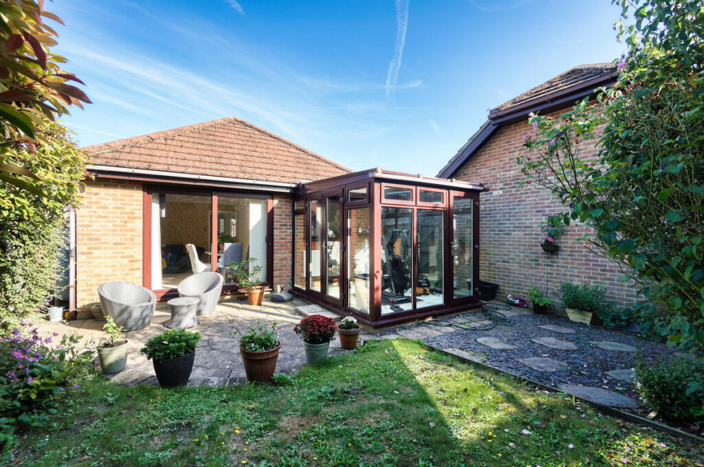
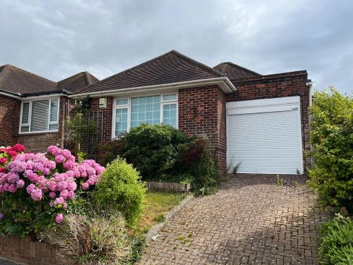
- house modern bungalow
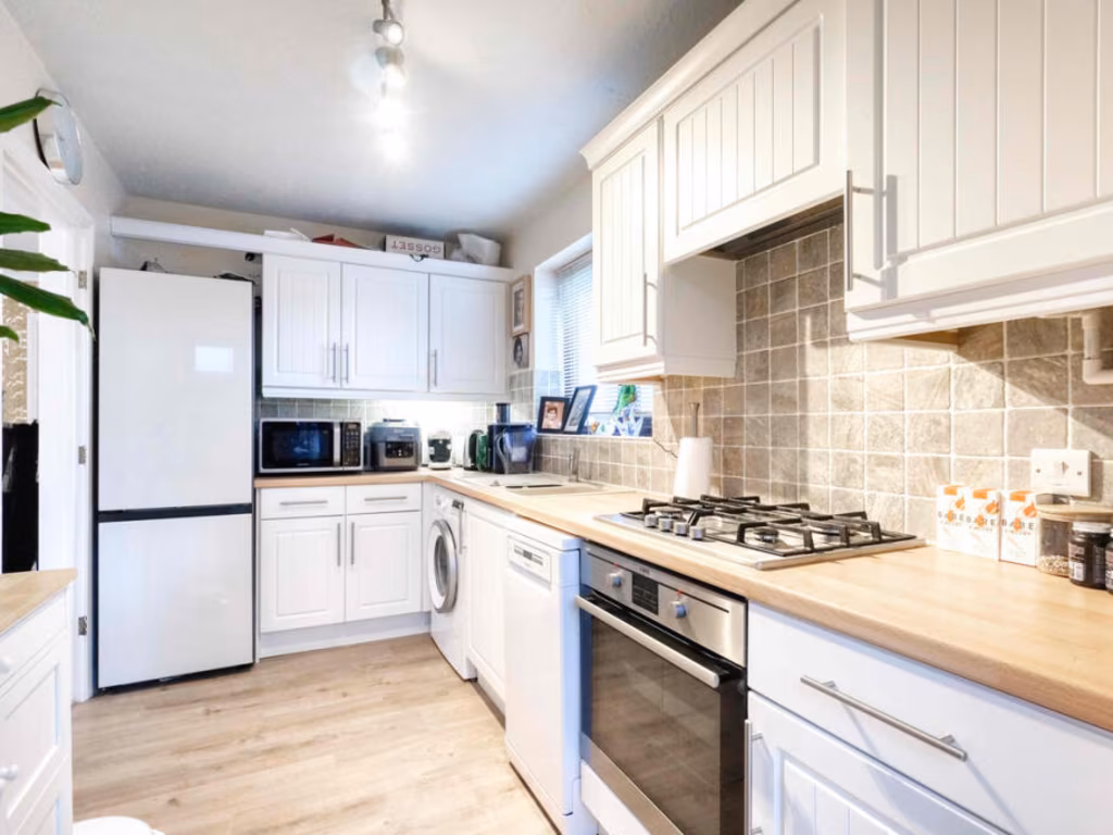
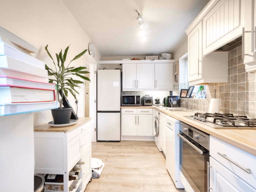
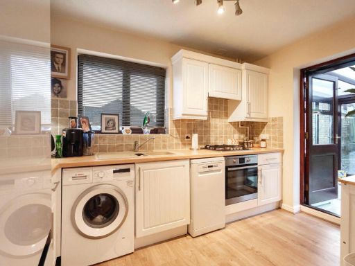
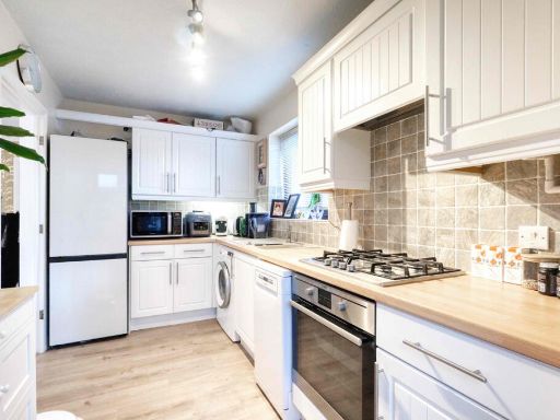
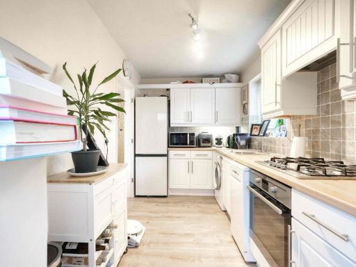
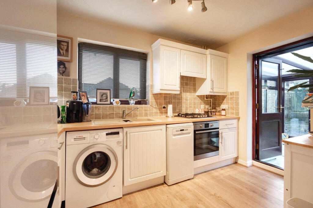
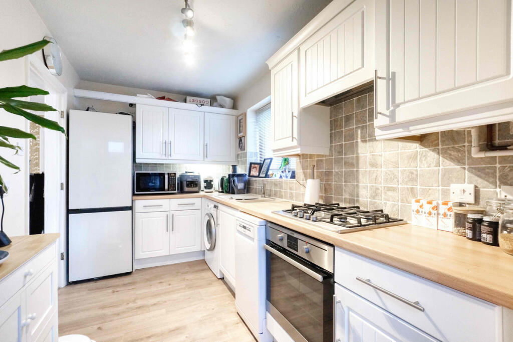
- kitchen modern
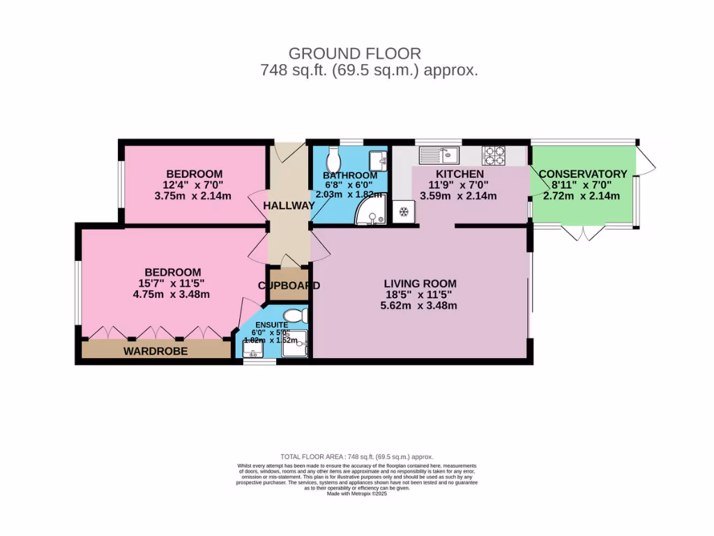
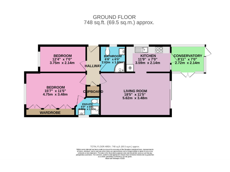
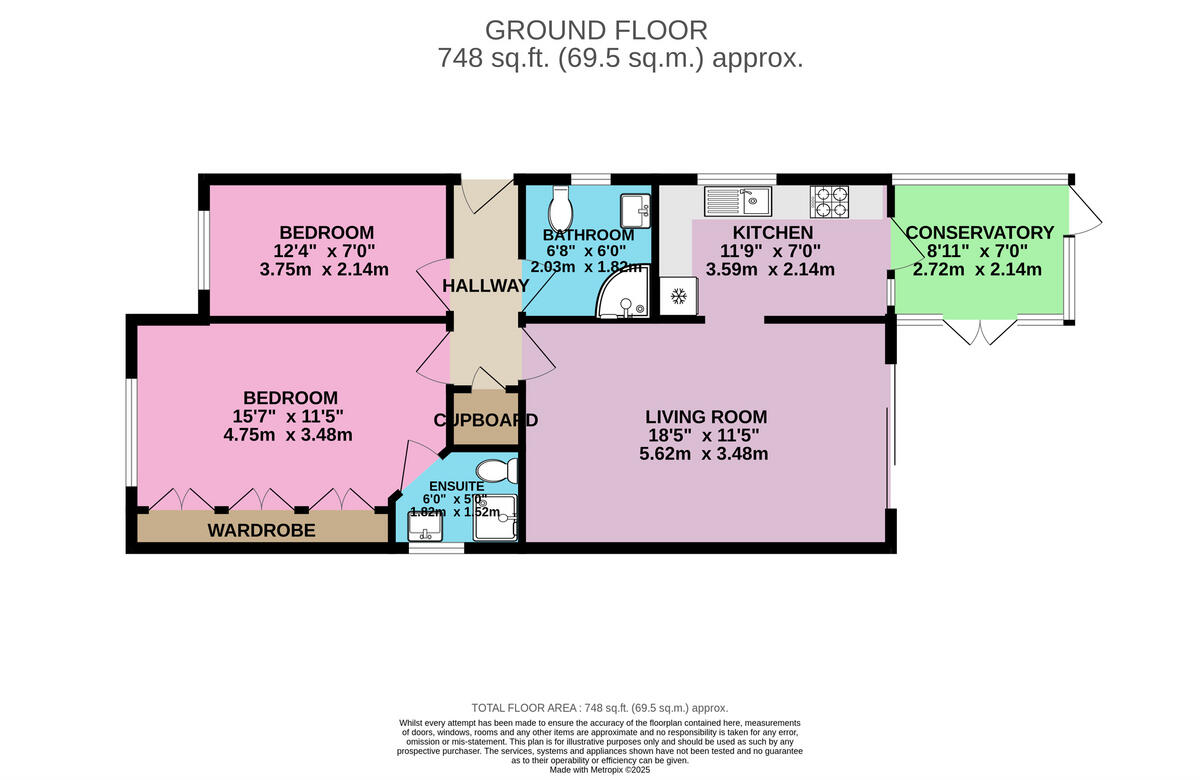
Floorplan Description
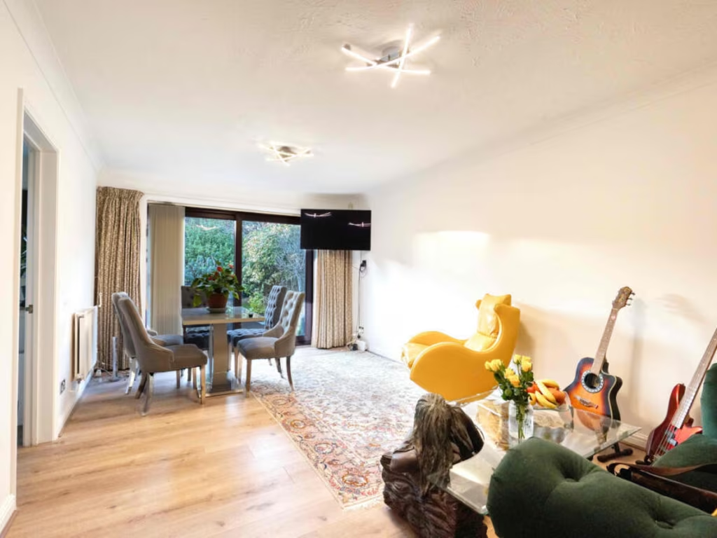
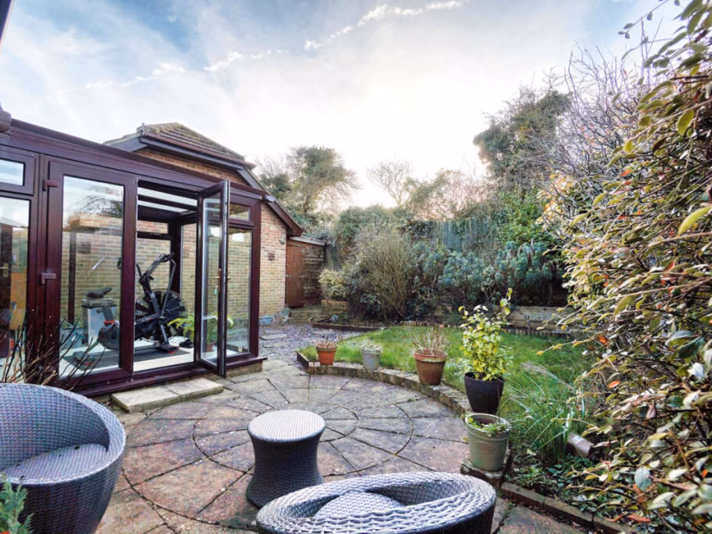
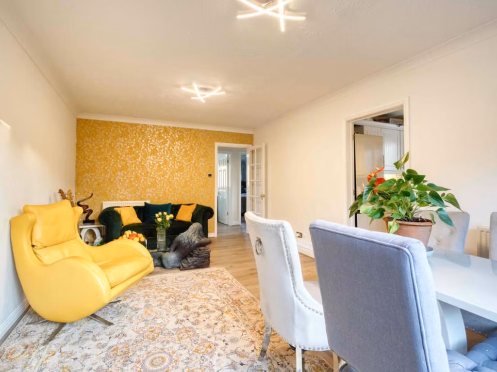
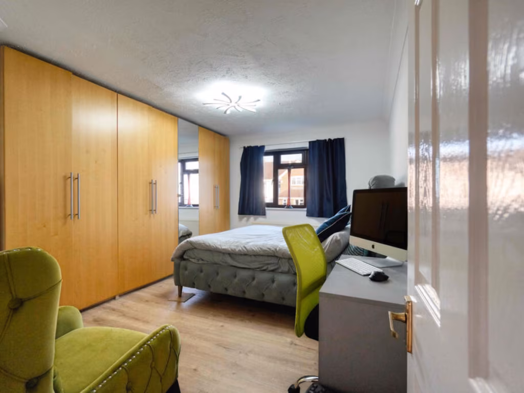
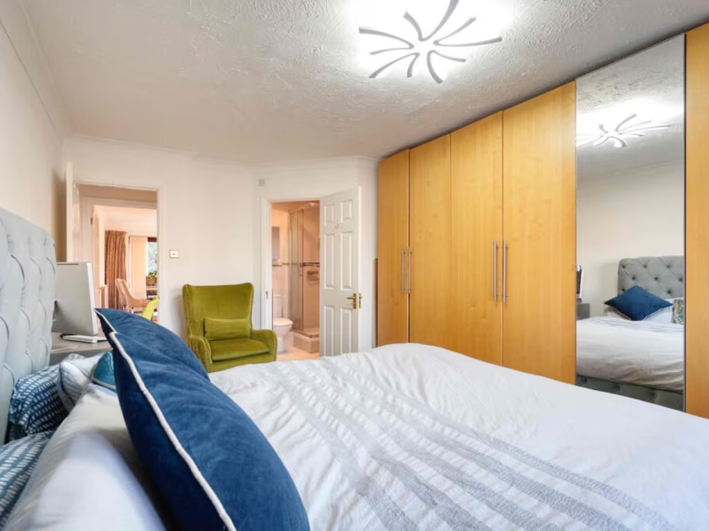
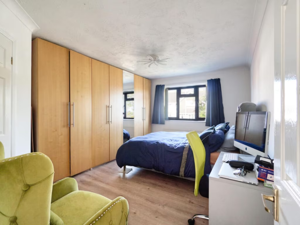
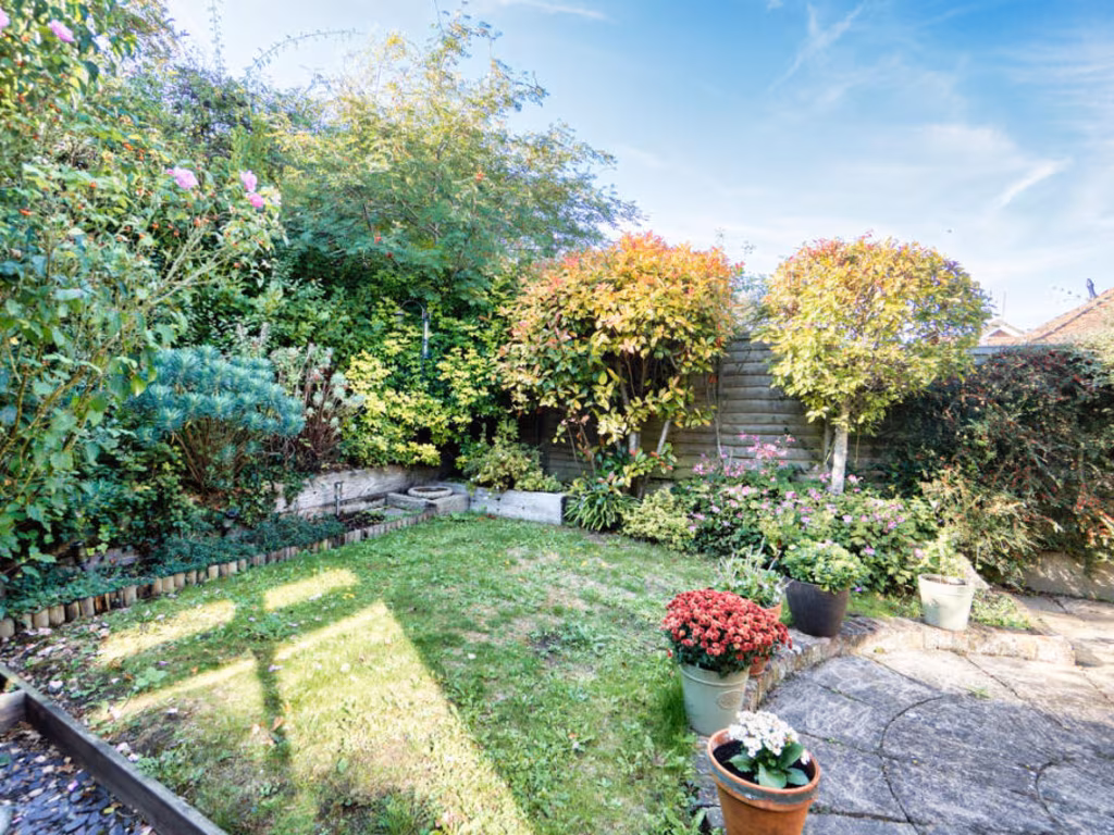
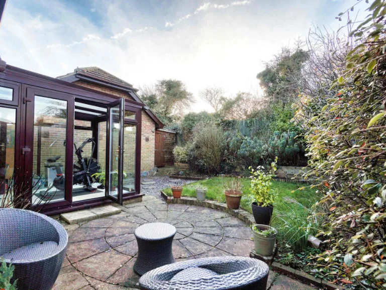
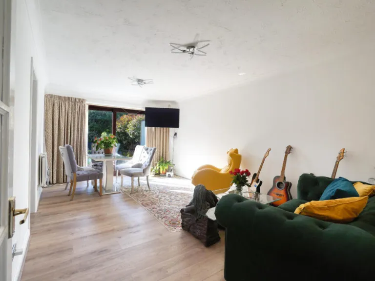
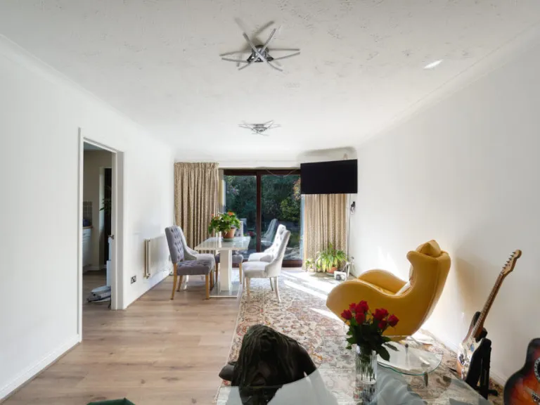
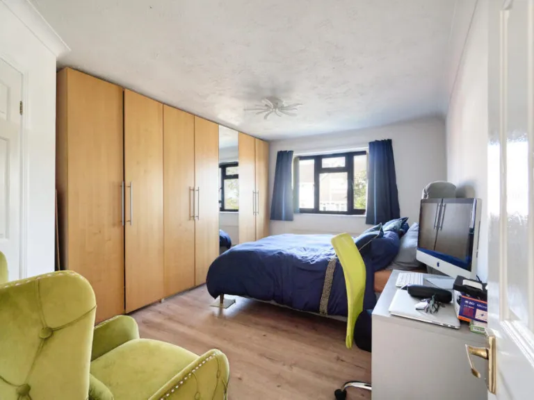
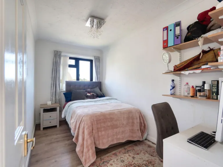
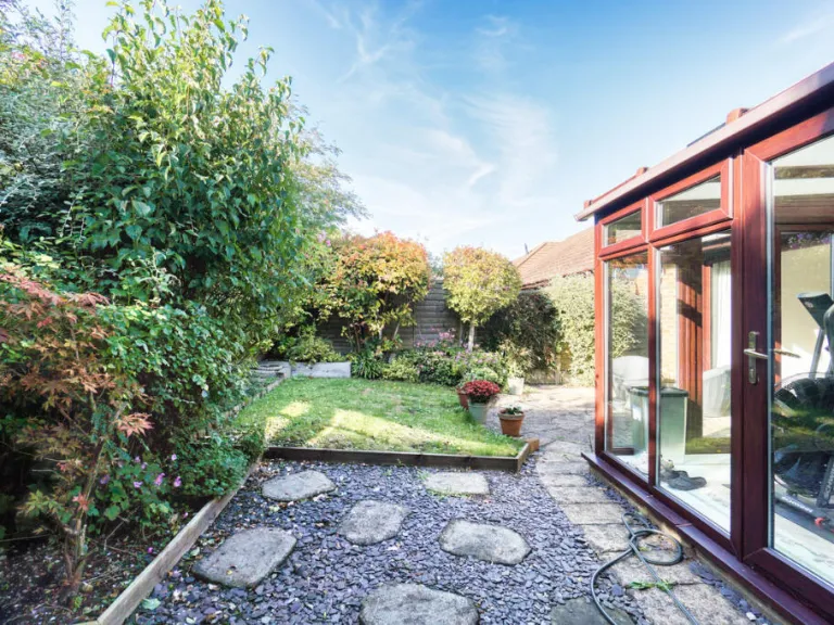
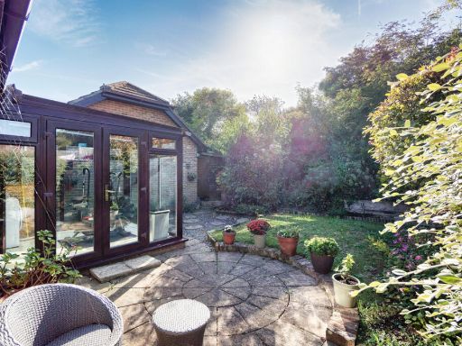
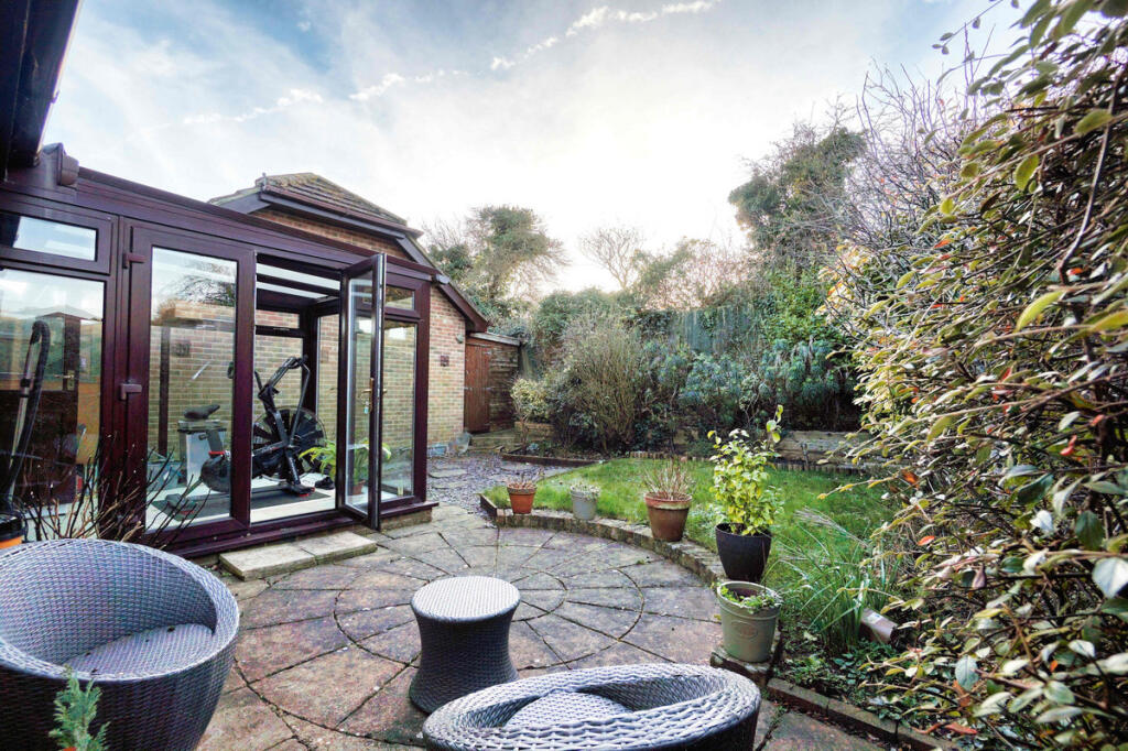
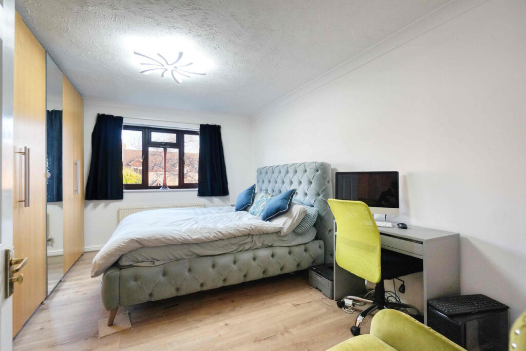
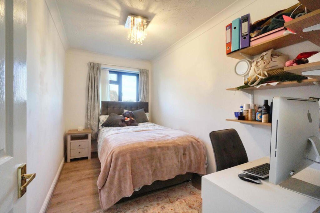
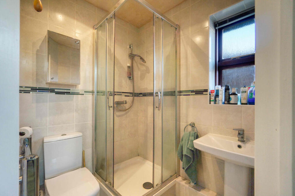
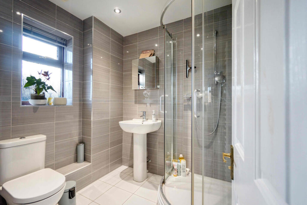
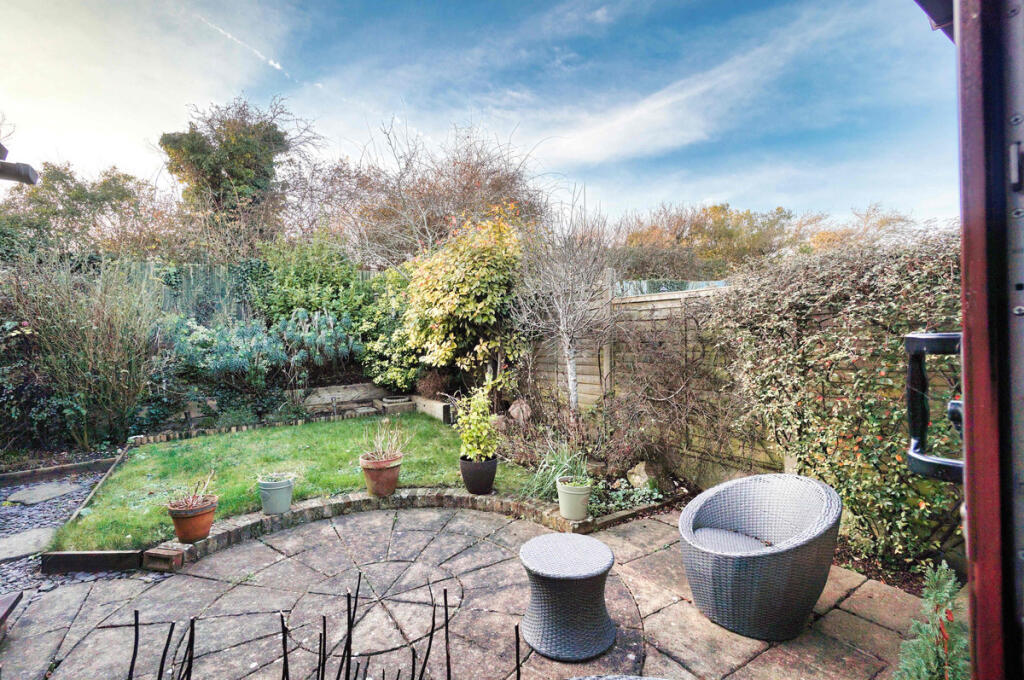
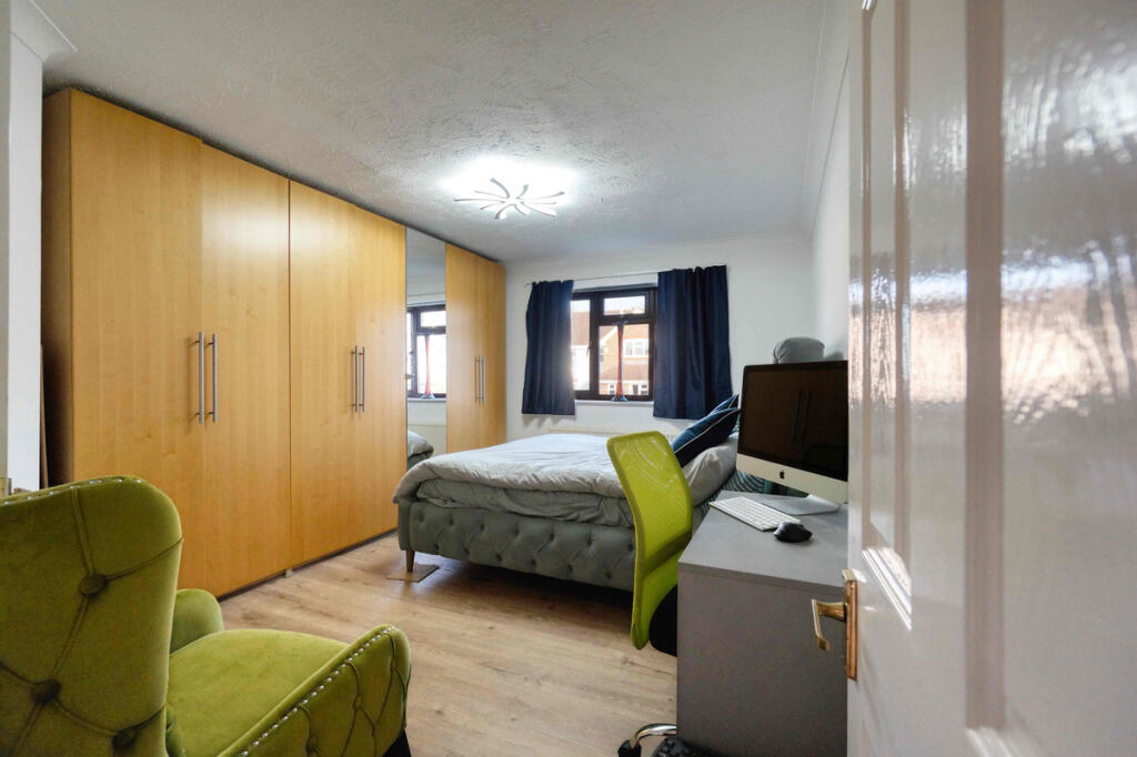
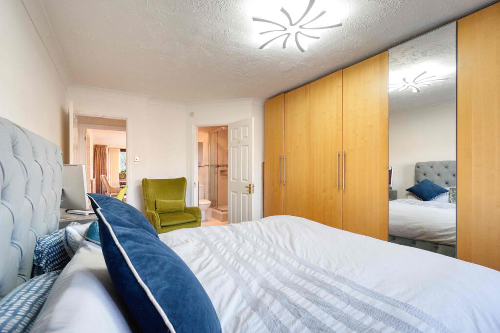
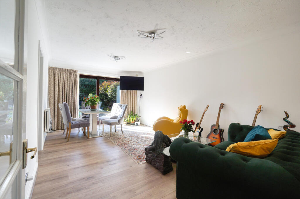
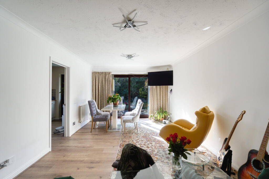
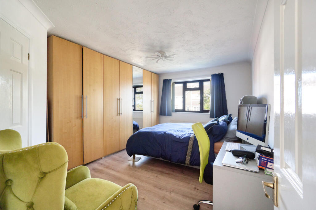
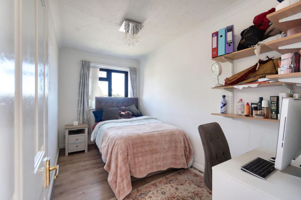
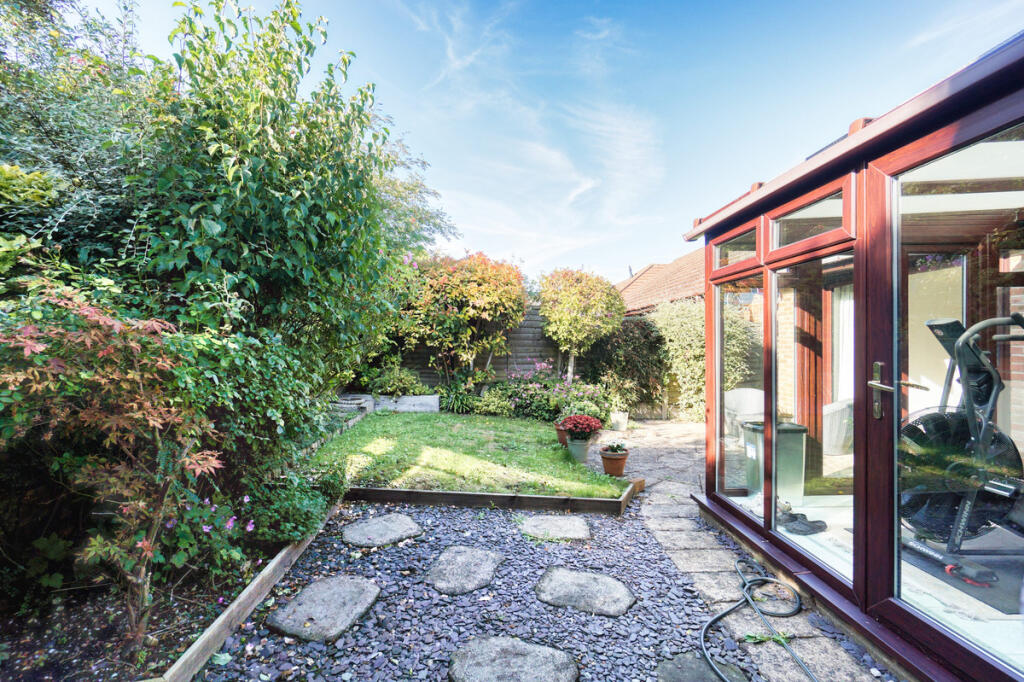
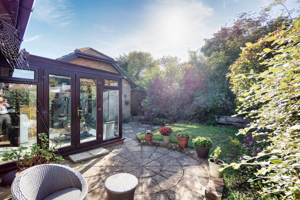
- A ground floor flat with two bedrooms, a bathroom, en-suite, kitchen, living room, conservatory, cupboard and wardrobe.
Rooms
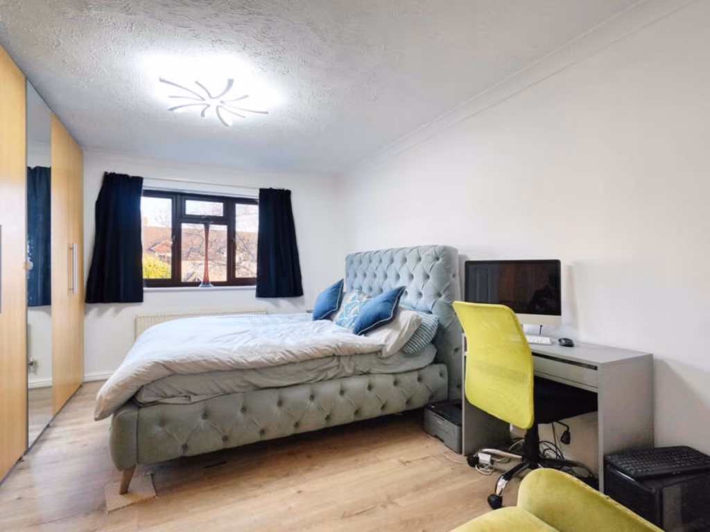
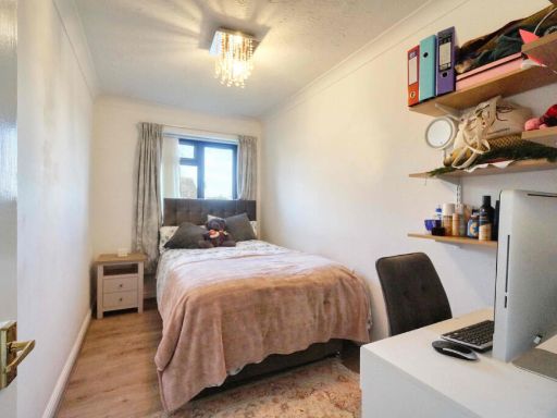
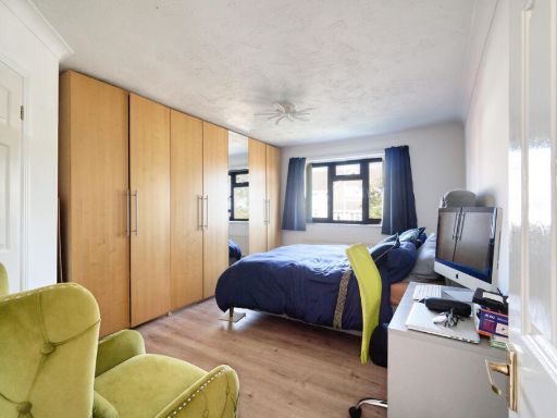
- Bedroom: Small
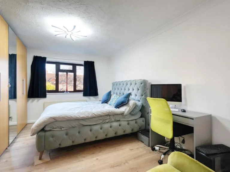
- Bedroom: Average
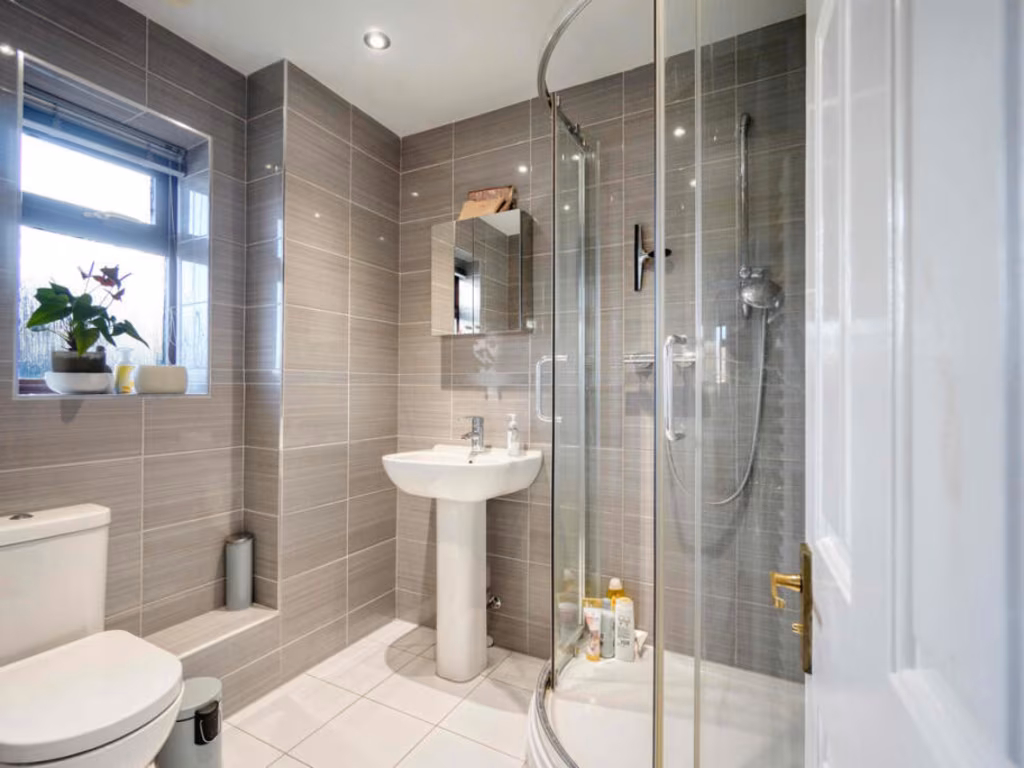
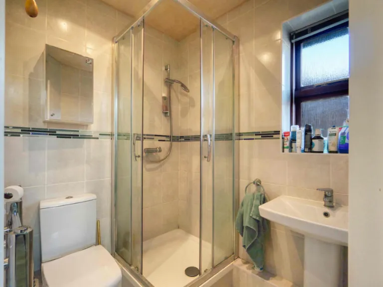
- Bathroom: Small
- En-suite: Small
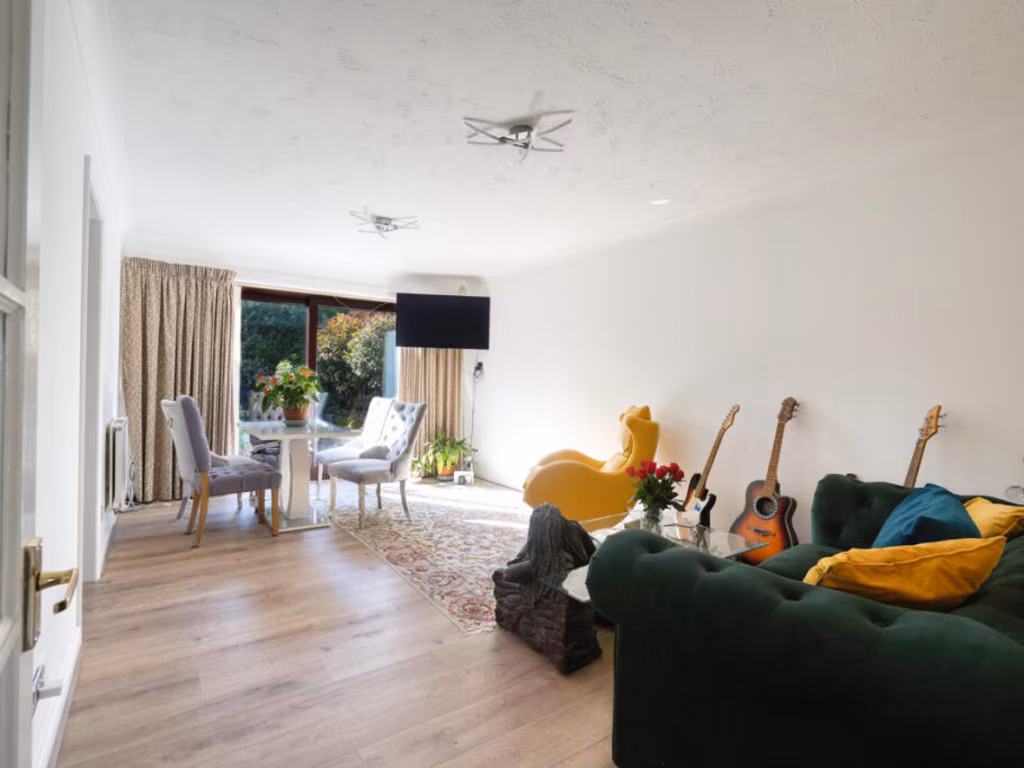
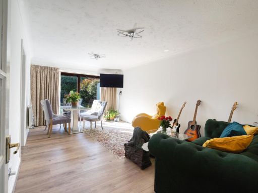
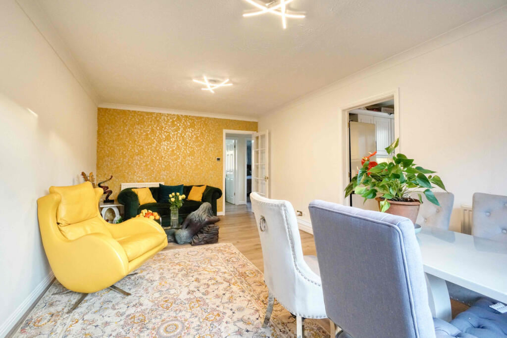
- Living Room: Large
- Kitchen: Average
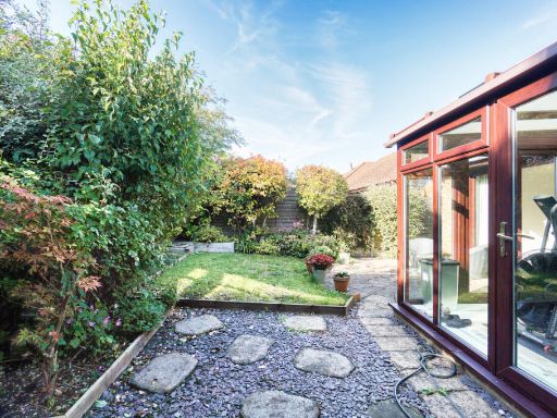
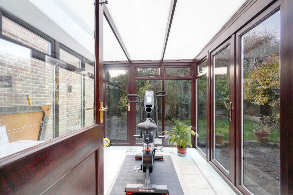
- Conservatory: Small
- Cupboard:
Textual Property Features
Detected Visual Features
- modern
- bungalow
- brick
- single-story
- driveway
- garage
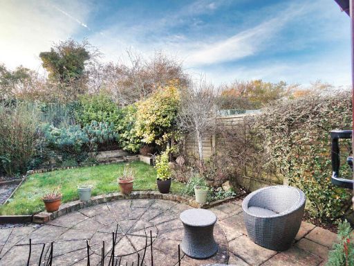
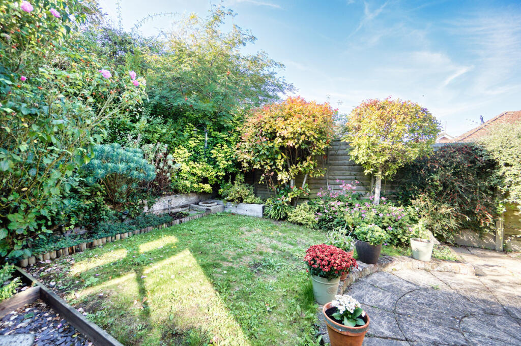
- garden
- landscaped
- suburban
- compact
- private
- modern kitchen
- standard ceiling
- integrated appliances
- tile backsplash
- laminate flooring
- updated kitchen
EPC Details
- Fully double glazed
- Cavity wall, as built, insulated (assumed)
- Boiler and radiators, mains gas
- Low energy lighting in all fixed outlets
- Solid, limited insulation (assumed)
Nearby Schools
- Hove Park School and Sixth Form Centre
- Goldstone Primary School
- West Hove Infant School
- Brackenbury Primary School
- Bilingual Primary School - Brighton & Hove
- Holmbush Primary Academy
- Mile Oak Primary School
- West Blatchington Primary and Nursery School
- St Christopher's School
- Glebe Primary School
- Eastbrook Primary Academy
- Aldrington CofE Primary School
- Peter Gladwin Primary School
- Portslade Aldridge Community Academy
- King's School
- St Andrew's CofE (Aided) Primary School
- St Mary's Catholic Primary School
- Hove Junior School
- Drive Preparatory School
- Shoreham Academy
- St Nicolas CofE Primary School
- Blatchington Mill School
- Westdene Primary School
Nearest General Shops
- Id: 6426407402
- Tags:
- Addr:
- Housenumber: 89
- Postcode: BN41 2DF
- Street: Mill Lane
- Fhrs:
- Name: Ye Olde Bakers Shop
- Shop: bakery
- TagsNormalized:
- Lat: 50.8433205
- Lon: -0.21058
- FullGeoHash: gcpc5pwxv1uh
- PartitionGeoHash: gcpc
- Images:
- FoodStandards: null
- Distance: 832.5
,- Id: 6414711029
- Tags:
- TagsNormalized:
- Lat: 50.852654
- Lon: -0.1980198
- FullGeoHash: gcpc73ry1vc9
- PartitionGeoHash: gcpc
- Images:
- FoodStandards: null
- Distance: 690
,- Id: 6414711030
- Tags:
- TagsNormalized:
- Lat: 50.8526066
- Lon: -0.1981513
- FullGeoHash: gcpc73rtyszw
- PartitionGeoHash: gcpc
- Images:
- FoodStandards: null
- Distance: 679.5
}
Nearest Grocery shops
- Id: 237116028
- Tags:
- Addr:
- Housenumber: 3
- Postcode: BN3 8LD
- Street: West Way
- Brand: Tesco Express
- Brand:wikidata: Q98456772
- Brand:wikipedia: en:Tesco
- Building: yes
- Contact:
- Website: https://www.tesco.com/store-locator/the-city-of-brighton-and-hove/3-5-w-way
- Fhrs:
- Name: Tesco Express
- Shop: convenience
- TagsNormalized:
- tesco
- tesco express
- convenience
- shop
- Lat: 50.8451832
- Lon: -0.1941756
- FullGeoHash: gcpc784demh5
- PartitionGeoHash: gcpc
- Images:
- FoodStandards:
- Id: 269637
- FHRSID: 269637
- LocalAuthorityBusinessID: 2012/00039/COMM
- BusinessName: Tesco
- BusinessType: Retailers - supermarkets/hypermarkets
- BusinessTypeID: 7840
- AddressLine1: 3 West Way
- AddressLine2: Hove
- AddressLine3: null
- AddressLine4: null
- PostCode: BN3 8LD
- RatingValue: 5
- RatingKey: fhrs_5_en-GB
- RatingDate: 2015-02-13
- LocalAuthorityCode: 875
- LocalAuthorityName: Brighton and Hove
- LocalAuthorityWebSite: http://www.brighton-hove.gov.uk/foodsafety
- LocalAuthorityEmailAddress: ehl.food@brighton-hove.gov.uk
- Scores:
- Hygiene: 0
- Structural: 0
- ConfidenceInManagement: 0
- NewRatingPending: false
- Geocode:
- Longitude: -0.19540100000000
- Latitude: 50.84503500000000
- Distance: 1091.5
,- Id: 6426407403
- Tags:
- Addr:
- Housenumber: 91
- Postcode: BN41 2DF
- Street: Mill Lane
- Fhrs:
- Shop: convenience
- TagsNormalized:
- Lat: 50.8433899
- Lon: -0.2106256
- FullGeoHash: gcpc5py8hnf4
- PartitionGeoHash: gcpc
- Images:
- FoodStandards: null
- Distance: 826
,- Id: 6373062259
- Tags:
- Addr:
- City: Hove
- Housenumber: 165
- Postcode: BN3 8EY
- Street: Hangleton Way
- Name: Sweetielicious
- Shop: convenience
- TagsNormalized:
- Lat: 50.8525882
- Lon: -0.1982097
- FullGeoHash: gcpc73rtv3s0
- PartitionGeoHash: gcpc
- Images:
- FoodStandards: null
- Distance: 674.9
}
Nearest Religious buildings
- Id: 238207940
- Tags:
- Amenity: place_of_worship
- Building: church
- Denomination: anglican
- Name: St Nicholas'
- Religion: christian
- Wikidata: Q7594970
- Wikipedia: en:St Nicolas Church, Portslade
- TagsNormalized:
- place of worship
- church
- anglican
- christian
- Lat: 50.8430309
- Lon: -0.2181958
- FullGeoHash: gcpc5p9n5evk
- PartitionGeoHash: gcpc
- Images:
- FoodStandards: null
- Distance: 1132.4
,- Id: 238181465
- Tags:
- Amenity: place_of_worship
- Building: church
- Denomination: baptist
- Name: Oasis Christian Fellowship
- Religion: christian
- TagsNormalized:
- place of worship
- church
- baptist
- christian
- Lat: 50.8480325
- Lon: -0.2009144
- FullGeoHash: gcpc72teq272
- PartitionGeoHash: gcpc
- Images:
- FoodStandards: null
- Distance: 522.2
,- Id: 677488359
- Tags:
- Addr:
- City: Hove
- Postcode: BN3 8ER
- Street: Hangleton Way
- Amenity: place_of_worship
- Denomination: anglican
- Fhrs:
- Name: St Helen's
- Religion: christian
- Source:
- Wikidata: Q7593313
- Wikipedia: en:St Helen's Church, Hangleton
- TagsNormalized:
- place of worship
- anglican
- christian
- church
- Lat: 50.8511083
- Lon: -0.200851
- FullGeoHash: gcpc73jtpvds
- PartitionGeoHash: gcpc
- Images:
- FoodStandards:
- Id: 206114
- FHRSID: 206114
- LocalAuthorityBusinessID: 1992/00662/COMM
- BusinessName: St Helen's Church Hall
- BusinessType: Other catering premises
- BusinessTypeID: 7841
- AddressLine1: St Helens Church Hall
- AddressLine2: Hangleton Way
- AddressLine3: Hove
- AddressLine4: null
- PostCode: BN3 8ER
- RatingValue: Exempt
- RatingKey: fhrs_exempt_en-GB
- RatingDate: 2015-08-21
- LocalAuthorityCode: 875
- LocalAuthorityName: Brighton and Hove
- LocalAuthorityWebSite: http://www.brighton-hove.gov.uk/foodsafety
- LocalAuthorityEmailAddress: ehl.food@brighton-hove.gov.uk
- Scores:
- Hygiene: null
- Structural: null
- ConfidenceInManagement: null
- NewRatingPending: false
- Geocode:
- Longitude: -0.19896900000000
- Latitude: 50.85197000000000
- Distance: 453.5
}
Nearest Medical buildings
- Id: 3232538
- Tags:
- Amenity: hospital
- Building: yes
- Name: Mill View Hospital
- Type: multipolygon
- TagsNormalized:
- Lat: 50.8428094
- Lon: -0.1909407
- FullGeoHash: gcpc5xsuyf87
- PartitionGeoHash: gcpc
- Images:
- FoodStandards: null
- Distance: 1428.8
,- Id: 427800490
- Tags:
- Amenity: doctors
- Name: Portslade County Clinic
- TagsNormalized:
- Lat: 50.8381968
- Lon: -0.2110701
- FullGeoHash: gcpc5ny3cwy8
- PartitionGeoHash: gcpc
- Images:
- FoodStandards: null
- Distance: 1394.7
,- Id: 5754467917
- Tags:
- Addr:
- Housename: The Parade
- Housenumber: 4
- Postcode: BN3 7LU
- Street: Hangleton Road
- Amenity: pharmacy
- Brand:
- Fhrs:
- Name: Boots Pharmacy
- TagsNormalized:
- Lat: 50.8445517
- Lon: -0.1951493
- FullGeoHash: gcpc5xcyuxqh
- PartitionGeoHash: gcpc
- Images:
- FoodStandards:
- Id: 207568
- FHRSID: 207568
- LocalAuthorityBusinessID: 2002/00001/COMM
- BusinessName: Boots UK Ltd
- BusinessType: Retailers - other
- BusinessTypeID: 4613
- AddressLine1: 4 The Parade
- AddressLine2: Hangleton Road
- AddressLine3: Hove
- AddressLine4: null
- PostCode: BN3 7LU
- RatingValue: Exempt
- RatingKey: fhrs_exempt_en-GB
- RatingDate: 2014-09-05
- LocalAuthorityCode: 875
- LocalAuthorityName: Brighton and Hove
- LocalAuthorityWebSite: http://www.brighton-hove.gov.uk/foodsafety
- LocalAuthorityEmailAddress: ehl.food@brighton-hove.gov.uk
- Scores:
- Hygiene: null
- Structural: null
- ConfidenceInManagement: null
- NewRatingPending: false
- Geocode:
- Longitude: -0.19516000000000
- Latitude: 50.84465300000000
- Distance: 1076.4
,- Id: 27274575
- Tags:
- Amenity: doctors
- Name: Hangleton Medical Centre
- TagsNormalized:
- Lat: 50.8453288
- Lon: -0.1960535
- FullGeoHash: gcpc7815x87b
- PartitionGeoHash: gcpc
- Images:
- FoodStandards: null
- Distance: 973.6
}
Nearest Leisure Facilities
- Id: 4442267
- Tags:
- Created_by: JOSM
- Leisure: park
- TagsNormalized:
- Lat: 50.8493093
- Lon: -0.2023726
- FullGeoHash: gcpc72udsqk1
- PartitionGeoHash: gcpc
- Images:
- FoodStandards: null
- Distance: 366.6
,- Id: 1074319978
- Tags:
- TagsNormalized:
- Lat: 50.8484247
- Lon: -0.2107941
- FullGeoHash: gcpc70wt81ks
- PartitionGeoHash: gcpc
- Images:
- FoodStandards: null
- Distance: 340.2
,- Id: 1074319961
- Tags:
- TagsNormalized:
- Lat: 50.8497111
- Lon: -0.2113694
- FullGeoHash: gcpc70yj49pt
- PartitionGeoHash: gcpc
- Images:
- FoodStandards: null
- Distance: 303
,- Id: 1074319957
- Tags:
- TagsNormalized:
- Lat: 50.8495741
- Lon: -0.2110449
- FullGeoHash: gcpc70yk4r9s
- PartitionGeoHash: gcpc
- Images:
- FoodStandards: null
- Distance: 286.5
,- Id: 4442270
- Tags:
- Leisure: golf_course
- Name: Benfield Valley Golf Course
- TagsNormalized:
- Lat: 50.850813
- Lon: -0.208065
- FullGeoHash: gcpc7307rwx7
- PartitionGeoHash: gcpc
- Images:
- FoodStandards: null
- Distance: 67.4
}
Nearest Tourist attractions
- Id: 235905061
- Tags:
- Building: yes
- Name: Palm Court B&B
- Tourism: guest_house
- TagsNormalized:
- Lat: 50.8291449
- Lon: -0.2042501
- FullGeoHash: gcpc5m5m0xk5
- PartitionGeoHash: gcpc
- Images:
- FoodStandards: null
- Distance: 2384.3
,- Id: 111607316
- Tags:
- Addr:
- City: Hove
- Postcode: BN3 7QA
- Street: The Droveway
- Historic: heritage
- Name: British Engineerium
- Tourism: museum
- Website: http://www.britishengineerium.org/
- Wikidata: Q4969933
- Wikipedia: en:British Engineerium
- TagsNormalized:
- Lat: 50.8443353
- Lon: -0.1755557
- FullGeoHash: gcpchpbjtr04
- PartitionGeoHash: gcpc
- Images:
- FoodStandards: null
- Distance: 2327.8
,- Id: 671692452
- Tags:
- Amenity: camera_obscura
- Building: water_tower
- Historic: yes
- Man_made: water_tower
- Name: Foredown Tower
- Tourism: museum
- Wikidata: Q5468179
- Wikipedia: en:Foredown Tower
- TagsNormalized:
- Lat: 50.8503817
- Lon: -0.2158462
- FullGeoHash: gcpc714bfqjq
- PartitionGeoHash: gcpc
- Images:
- FoodStandards: null
- Distance: 604.4
}
Nearest Bus stations and stops
- Id: 8925313030
- Tags:
- Highway: bus_stop
- Name: Bottom of Downsview
- Public_transport: platform
- TagsNormalized:
- Lat: 50.8522066
- Lon: -0.2036
- FullGeoHash: gcpc737exf2u
- PartitionGeoHash: gcpc
- Images:
- FoodStandards: null
- Distance: 318
,- Id: 2474968272
- Tags:
- Highway: bus_stop
- Name: Sycamore Close
- Public_transport: platform
- TagsNormalized:
- Lat: 50.8493819
- Lon: -0.2113352
- FullGeoHash: gcpc70y55ec4
- PartitionGeoHash: gcpc
- Images:
- FoodStandards: null
- Distance: 313.4
,- Id: 8919971414
- Tags:
- Highway: bus_stop
- Name: Valley Drive South
- Public_transport: platform
- TagsNormalized:
- Lat: 50.8485901
- Lon: -0.2053082
- FullGeoHash: gcpc72dqxbpn
- PartitionGeoHash: gcpc
- Images:
- FoodStandards: null
- Distance: 252.4
,- Id: 8915195353
- Tags:
- Highway: bus_stop
- Name: Valley Drive South
- Public_transport: platform
- TagsNormalized:
- Lat: 50.8486847
- Lon: -0.205381
- FullGeoHash: gcpc72drn3bg
- PartitionGeoHash: gcpc
- Images:
- FoodStandards: null
- Distance: 240.7
,- Id: 8925312941
- Tags:
- Highway: bus_stop
- Name: Bottom of Hangleton Valley Drive
- Public_transport: platform
- TagsNormalized:
- Lat: 50.8489983
- Lon: -0.2055308
- FullGeoHash: gcpc72f2fu31
- PartitionGeoHash: gcpc
- Images:
- FoodStandards: null
- Distance: 206
}
Nearest Hotels
- Id: 1508756250
- Tags:
- Name: Cinderella Hotel
- Tourism: hotel
- TagsNormalized:
- Lat: 50.8275476
- Lon: -0.1762548
- FullGeoHash: gcpc5uzeuvwg
- PartitionGeoHash: gcpc
- Images:
- FoodStandards: null
- Distance: 3354.1
,- Id: 236761964
- Tags:
- Addr:
- City: Hove
- Country: GB
- Housename: Best Western Princes Marine Hotel
- Housenumber: 153
- Postcode: BN3 4GR
- Street: Kingsway
- Brand: Best Western
- Brand:wikidata: Q830334
- Brand:wikipedia: en:Best Western
- Building: commercial
- Building:levels: 5
- Fhrs:
- Name: Princes Marine Hotel
- Roof:
- Tourism: hotel
- Website: https://www.bestwestern.co.uk/hotels/best-western-princes-marine-hotel-83740
- TagsNormalized:
- Lat: 50.8260386
- Lon: -0.181904
- FullGeoHash: gcpc5uee1k69
- PartitionGeoHash: gcpc
- Images:
- FoodStandards: null
- Distance: 3250.5
,- Id: 9093919465
- Tags:
- Addr:
- City: Hove
- Country: GB
- Housenumber: 324
- Postcode: BN3 5LF
- Street: Portland Road
- Fhrs:
- Name: The Garden Bar
- Survey:
- Tourism: hotel
- TagsNormalized:
- Lat: 50.8344295
- Lon: -0.1963002
- FullGeoHash: gcpc5w1h1b7z
- PartitionGeoHash: gcpc
- Images:
- FoodStandards: null
- Distance: 1945.5
}
Tags
- modern
- bungalow
- brick
- single-story
- driveway
- garage
- garden
- landscaped
- suburban
- compact
- private
- modern kitchen
- standard ceiling
- integrated appliances
- tile backsplash
- laminate flooring
- updated kitchen
Local Market Stats
- Average Price/sqft: £523
- Avg Income: £54300
- Rental Yield: 4.3%
- Social Housing: 23%
- Planning Success Rate: 88%
AirBnB Data
- 1km average: £90/night
- Listings in 1km: 6
Similar Properties
 2 bedroom detached bungalow for sale in Charles Close, BN3 , BN3 — £535,000 • 2 bed • 1 bath • 1077 ft²
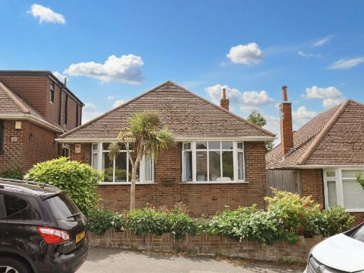 2 bedroom detached bungalow for sale in Northease Drive, Hove, East Sussex, BN3 — £500,000 • 2 bed • 1 bath • 977 ft²
 2 bedroom detached bungalow for sale in Pipers Close, Hove, East Sussex, BN3 — £475,000 • 2 bed • 1 bath • 830 ft²
 3 bedroom detached bungalow for sale in Malines Avenue, Peacehaven, BN10 — £365,000 • 3 bed • 1 bath • 976 ft²
 4 bedroom detached house for sale in Queen Victoria Avenue, Hove, East Sussex, BN3 — £1,175,000 • 4 bed • 2 bath • 1767 ft²
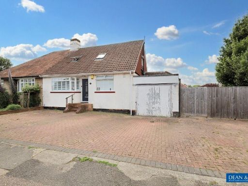 4 bedroom semi-detached bungalow for sale in Holmes Avenue, Hove, East Sussex, BN3 — £730,000 • 4 bed • 2 bath • 1731 ft²
Meta
- {
"@context": "https://schema.org",
"@type": "Residence",
"name": "2 bedroom detached bungalow for sale in Meads Avenue, Hove,…",
"description": "",
"url": "https://propertypiper.co.uk/property/0fb7bc21-f2c3-463e-899d-e4439fa985ea",
"image": "https://image-a.propertypiper.co.uk/c34a24b4-4a1c-44c5-992c-df7480d24613-1024.jpeg",
"address": {
"@type": "PostalAddress",
"streetAddress": "41 MEADS AVENUE HOVE",
"postalCode": "BN3 8EE",
"addressLocality": "Brighton and Hove",
"addressRegion": "Hove",
"addressCountry": "England"
},
"geo": {
"@type": "GeoCoordinates",
"latitude": 50.85050413431759,
"longitude": -0.20723960336384079
},
"numberOfRooms": 2,
"numberOfBathroomsTotal": 2,
"floorSize": {
"@type": "QuantitativeValue",
"value": 748,
"unitCode": "FTK"
},
"offers": {
"@type": "Offer",
"price": 525000,
"priceCurrency": "GBP",
"availability": "https://schema.org/InStock"
},
"additionalProperty": [
{
"@type": "PropertyValue",
"name": "Feature",
"value": "modern"
},
{
"@type": "PropertyValue",
"name": "Feature",
"value": "bungalow"
},
{
"@type": "PropertyValue",
"name": "Feature",
"value": "brick"
},
{
"@type": "PropertyValue",
"name": "Feature",
"value": "single-story"
},
{
"@type": "PropertyValue",
"name": "Feature",
"value": "driveway"
},
{
"@type": "PropertyValue",
"name": "Feature",
"value": "garage"
},
{
"@type": "PropertyValue",
"name": "Feature",
"value": "garden"
},
{
"@type": "PropertyValue",
"name": "Feature",
"value": "landscaped"
},
{
"@type": "PropertyValue",
"name": "Feature",
"value": "suburban"
},
{
"@type": "PropertyValue",
"name": "Feature",
"value": "compact"
},
{
"@type": "PropertyValue",
"name": "Feature",
"value": "private"
},
{
"@type": "PropertyValue",
"name": "Feature",
"value": "modern kitchen"
},
{
"@type": "PropertyValue",
"name": "Feature",
"value": "standard ceiling"
},
{
"@type": "PropertyValue",
"name": "Feature",
"value": "integrated appliances"
},
{
"@type": "PropertyValue",
"name": "Feature",
"value": "tile backsplash"
},
{
"@type": "PropertyValue",
"name": "Feature",
"value": "laminate flooring"
},
{
"@type": "PropertyValue",
"name": "Feature",
"value": "updated kitchen"
}
]
}
High Res Floorplan Images
Compatible Floorplan Images
FloorplanImages Thumbnail