EX34 0HY - 3 bedroom link detached house for sale in Castle Street, Co…
View on Property Piper
3 bedroom link detached house for sale in Castle Street, Combe Martin, Ilfracombe, EX34
Property Details
- Price: £227750
- Bedrooms: 3
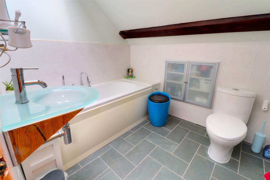
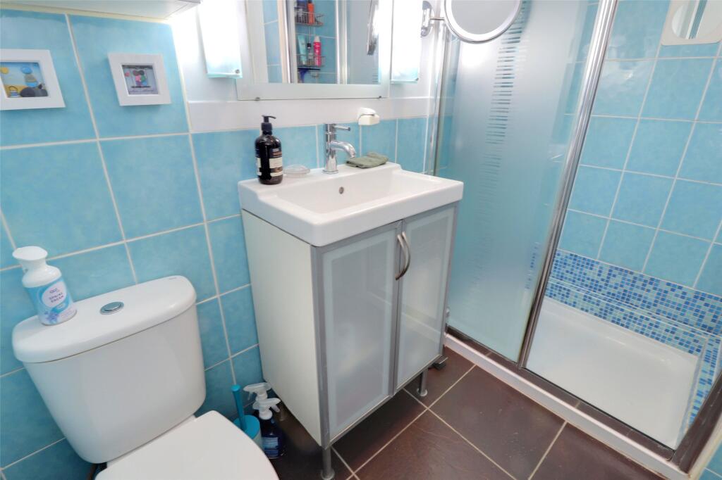
- Bathrooms: 2
- Property Type: undefined
- Property SubType: undefined
Image Descriptions
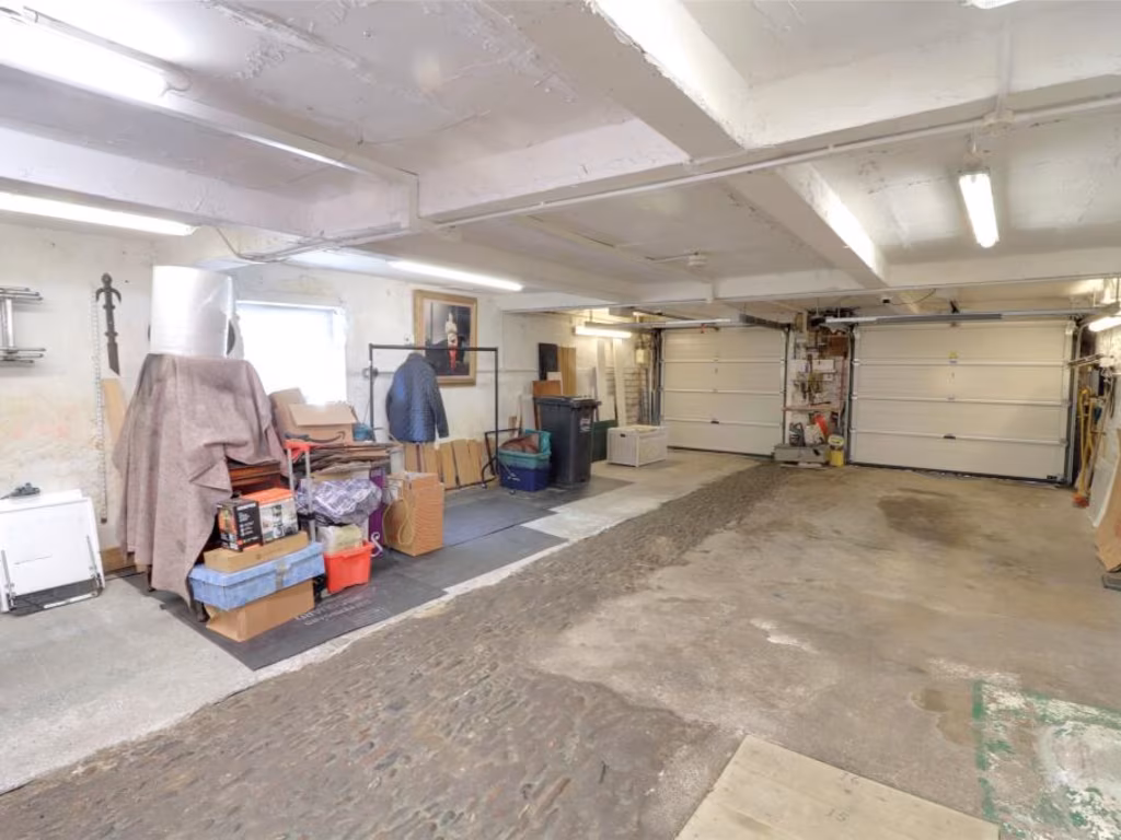
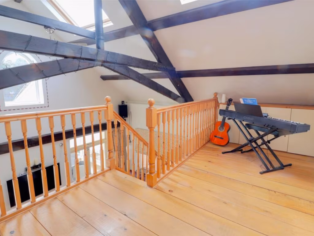
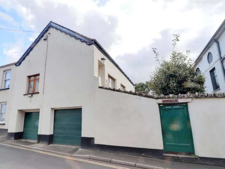
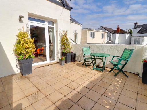
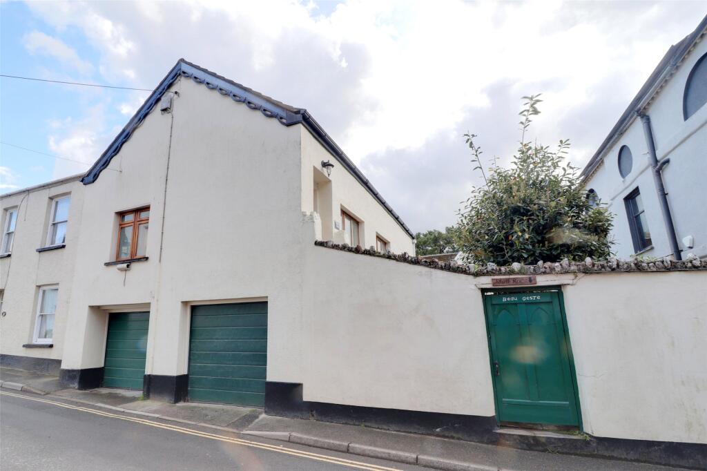
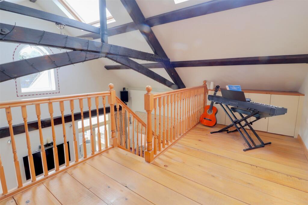
- garage and exterior wall mid-20th century
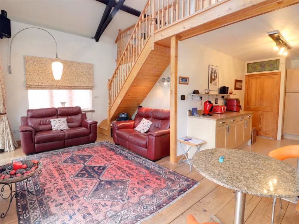
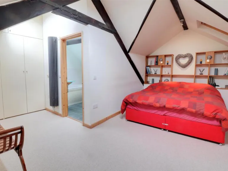
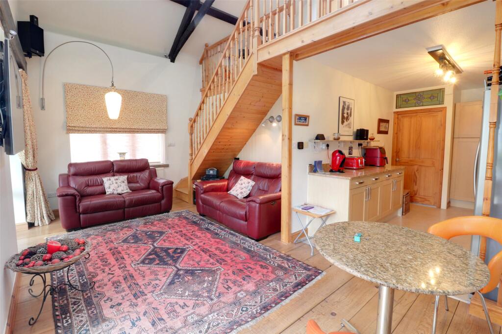
- interior living room with mezzanine rustic
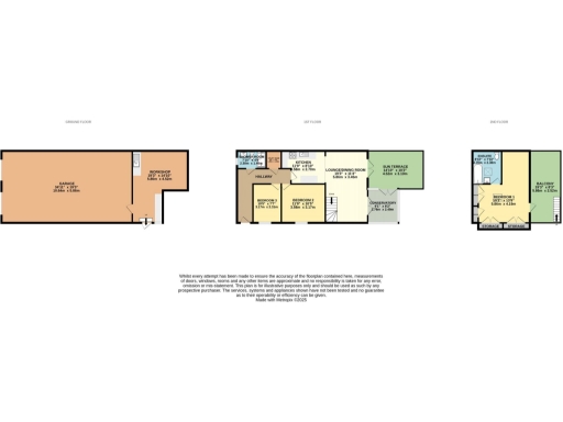
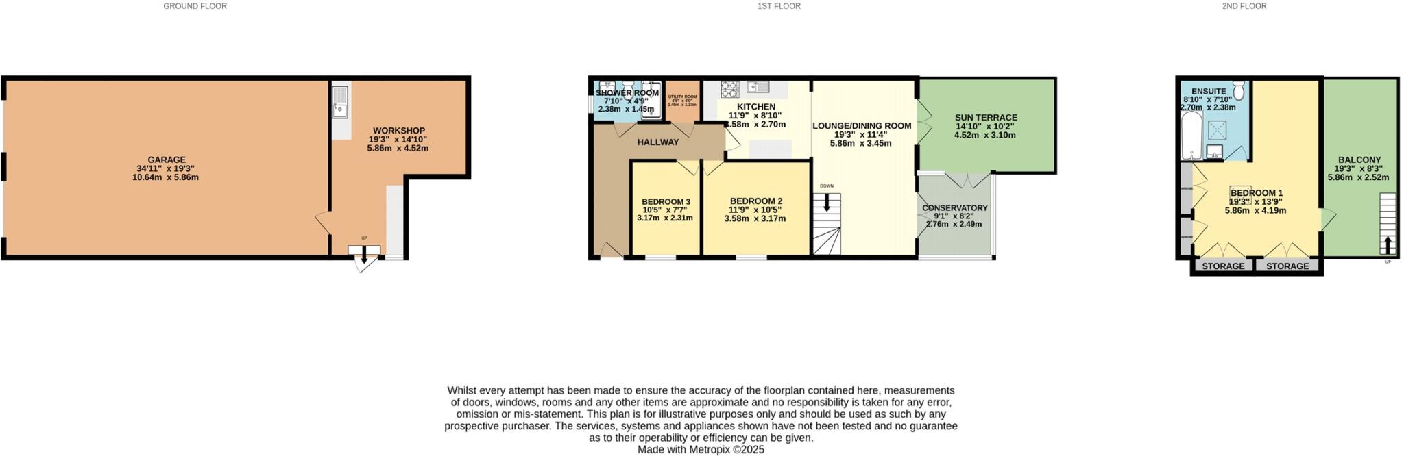
Rooms
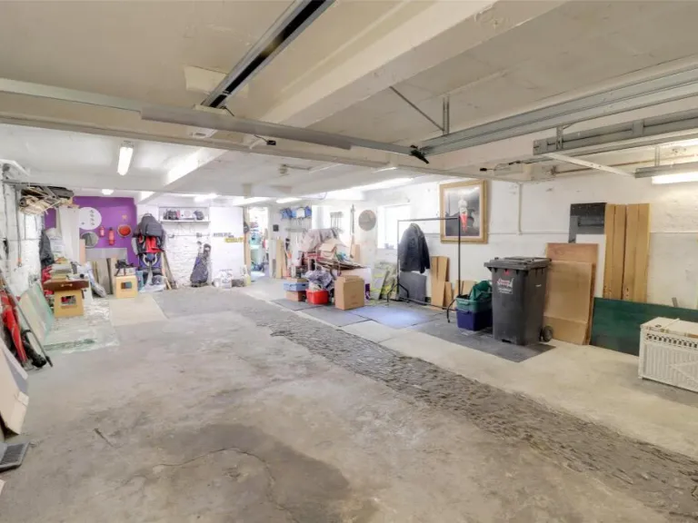
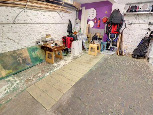
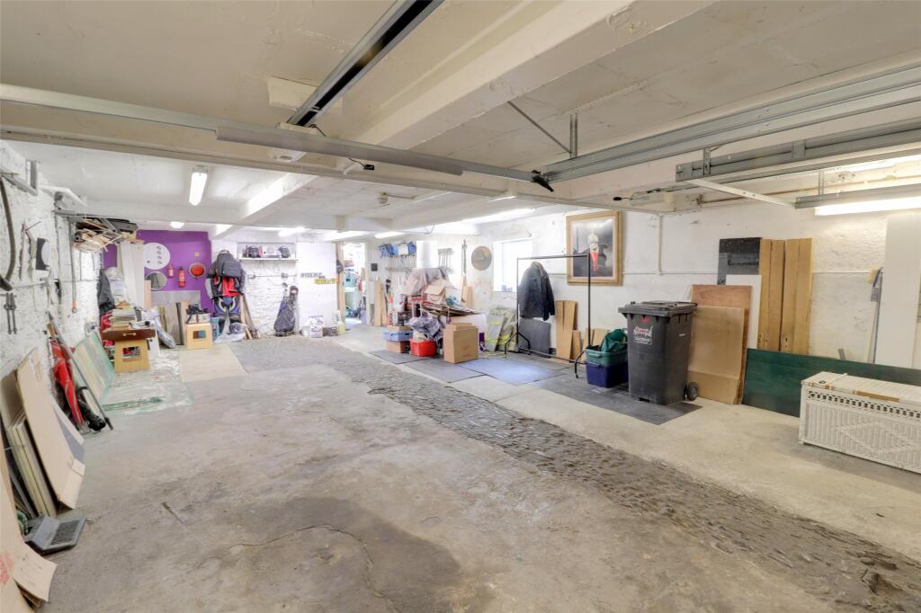
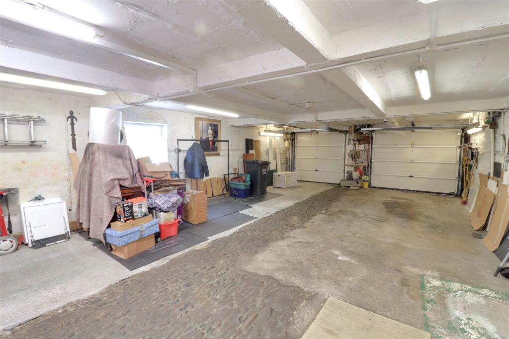
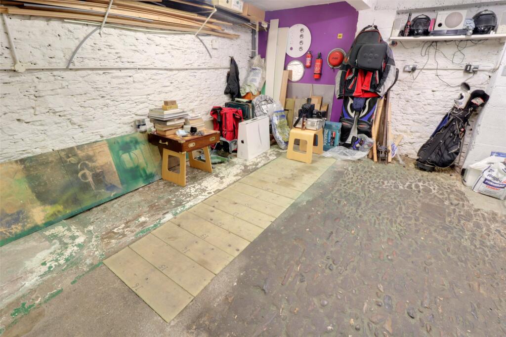
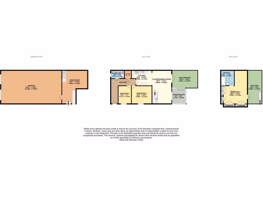
- Garage: large
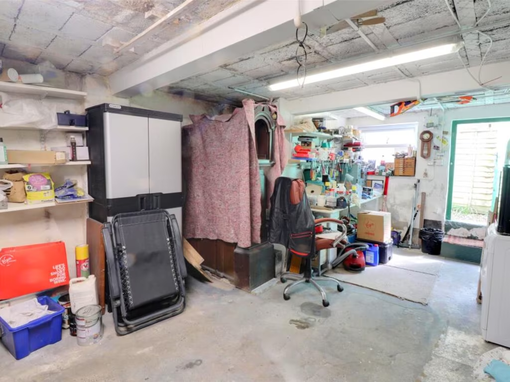
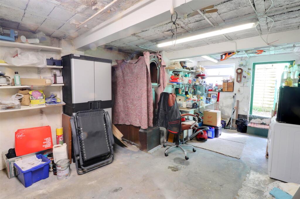
- Workshop: average
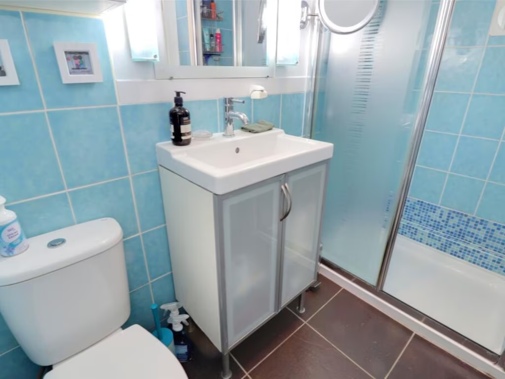
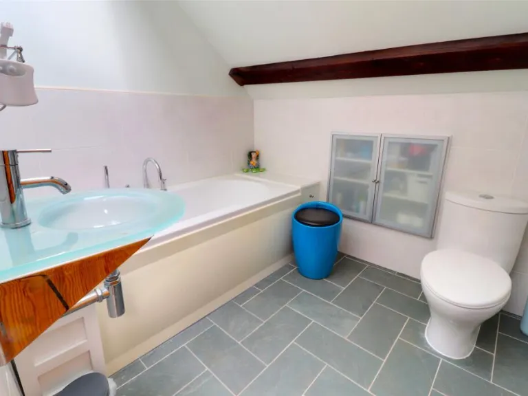
- Shower Room: small
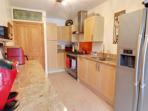
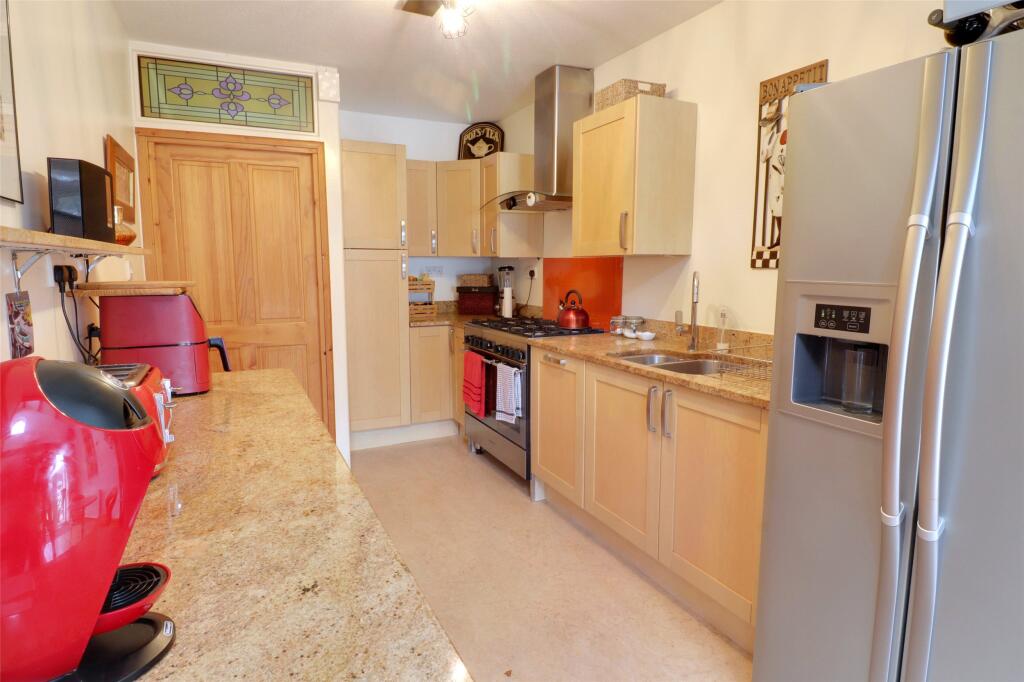
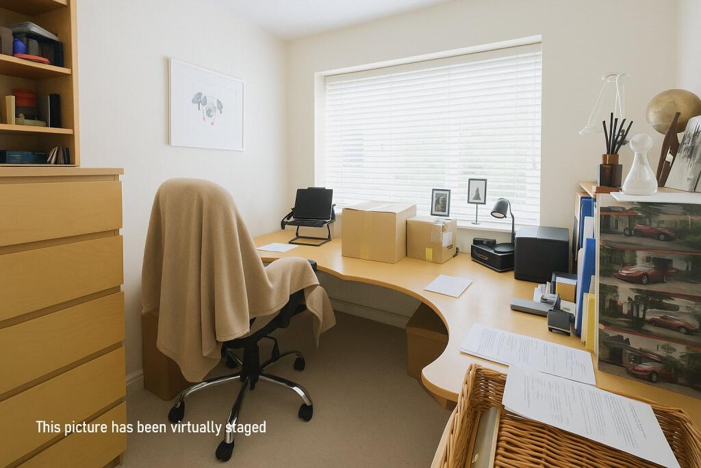
- Kitchen: average
- Lounge/Dining Room: average
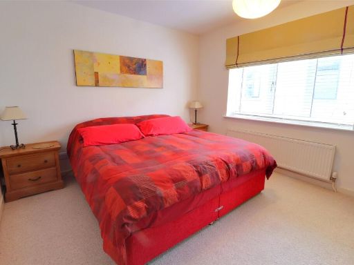
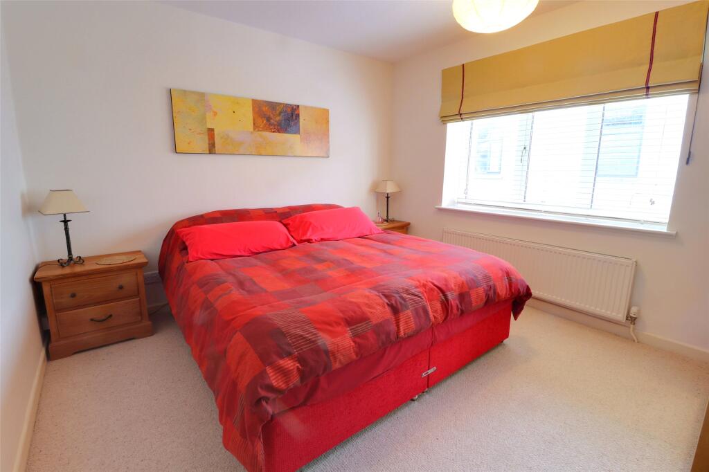
- Bedroom 3: small
- Bedroom 2: average
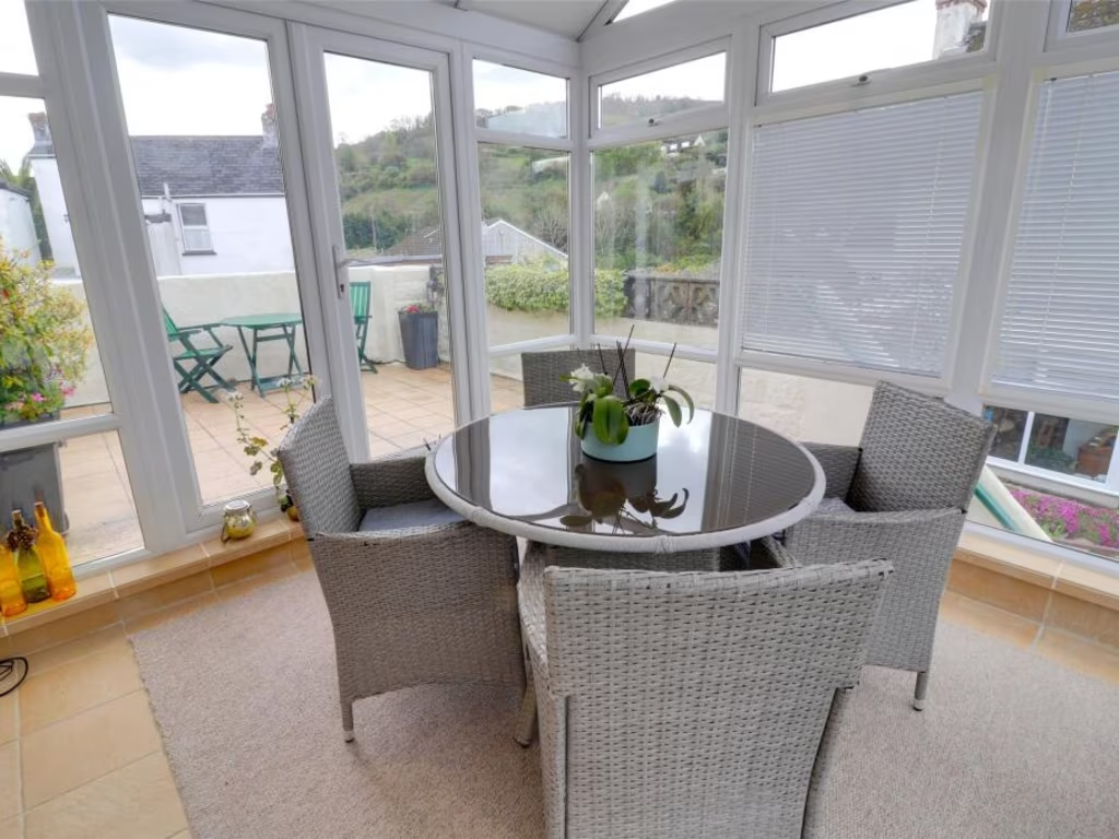
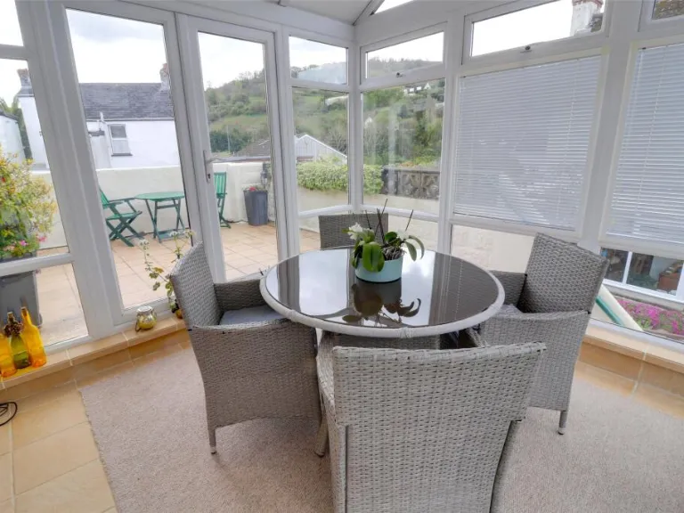
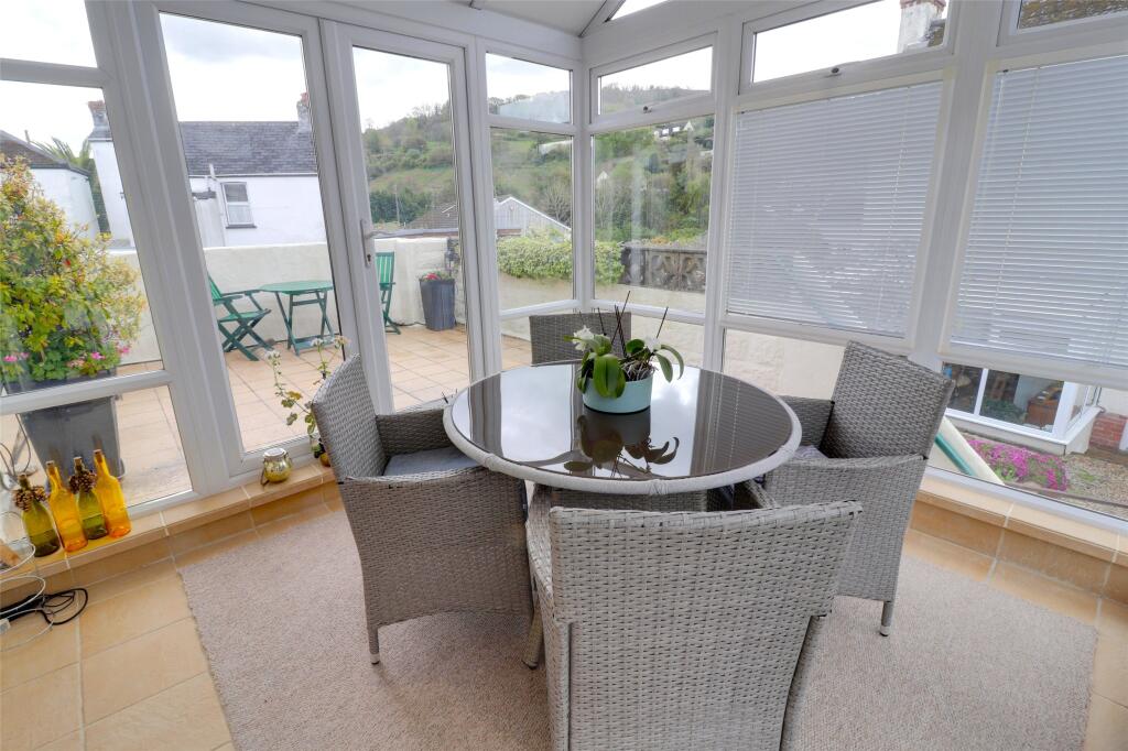
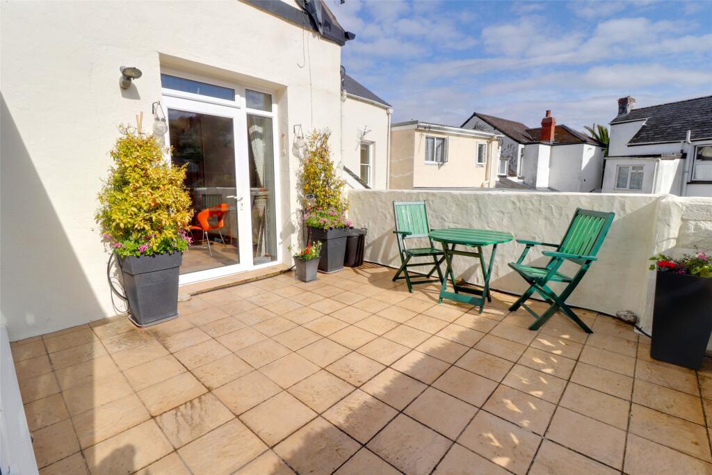
- Sun Terrace: average
- Conservatory: small
- Ensuite: small
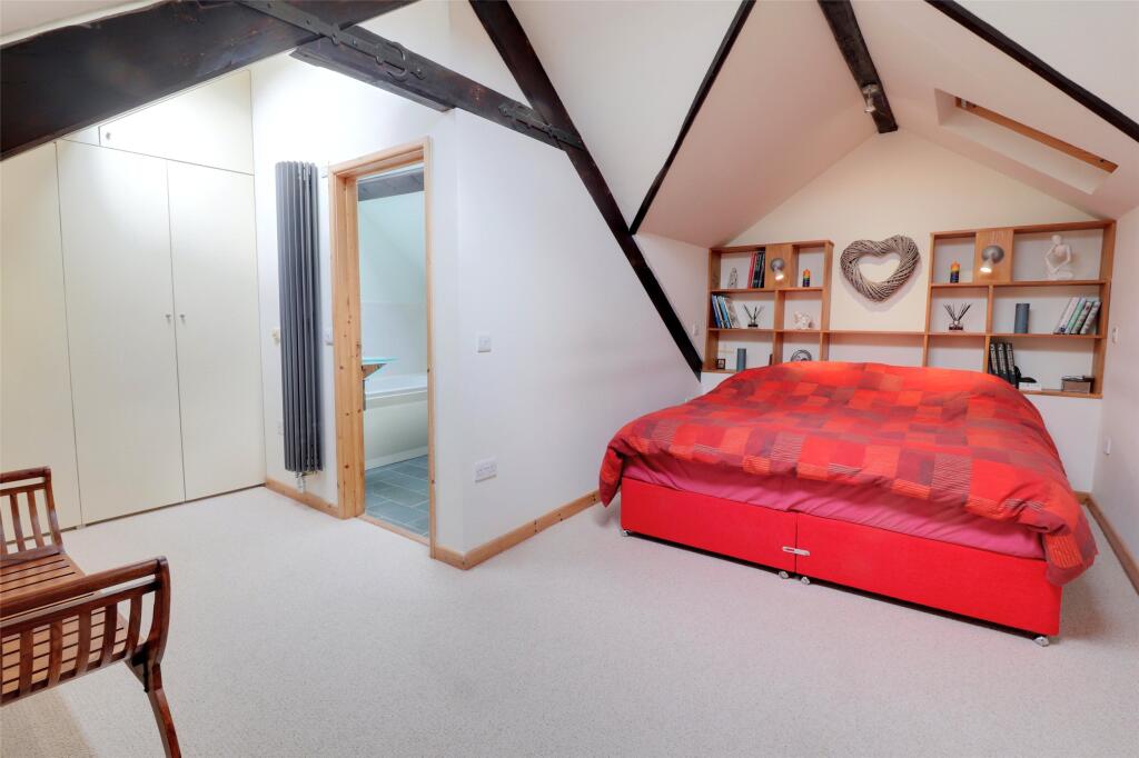
- Bedroom 1: large
- Balcony: average
- Storage: small
- Storage: small
Textual Property Features
Detected Visual Features
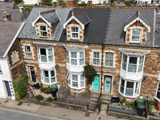
- mid-20th century
- garage
- corner property
- external view
- potent encroachment
- rustic
- mezzanine
- open-plan
- exposed beams
- wood flooring
- high ceiling
Nearby Schools
- Marwood School
- Kentisbury Primary School
- Berrynarbor Church of England Primary School
- The Ilfracombe Church of England Academy
- West Down School
- Combe Martin Primary School
- Ilfracombe Infant and Nursery School
- Ilfracombe Church of England Junior School
Nearest Bars And Restaurants
- Id: 10678483463
- Tags:
- Alt_name: Tides in & out
- Amenity: cafe
- Name: Tides in
- Note: Business 'Tides in & out' is divided into two adjacent shops - 'Tides in' (seated café) and 'Tides out' (takeaway)
- Outdoor_seating: sidewalk
- Takeaway: no
- TagsNormalized:
- Lat: 51.2062852
- Lon: -4.0378893
- FullGeoHash: gcj5k1gdnr7t
- PartitionGeoHash: gcj5
- Images:
- FoodStandards: null
- Distance: 1381.9
,- Id: 828094164
- Tags:
- Amenity: cafe
- Building: yes
- Name: Galleon Tea Rooms
- TagsNormalized:
- Lat: 51.2060671
- Lon: -4.0379449
- FullGeoHash: gcj5k1g8vnf0
- PartitionGeoHash: gcj5
- Images:
- FoodStandards: null
- Distance: 1369.4
,- Id: 974374821
- Tags:
- Amenity: pub
- Building: yes
- Name: Pack O'Cards
- TagsNormalized:
- Lat: 51.202057
- Lon: -4.0291418
- FullGeoHash: gcj5k341d5np
- PartitionGeoHash: gcj5
- Images:
- FoodStandards: null
- Distance: 613.9
,- Id: 1017321143
- Tags:
- Amenity: pub
- Building: yes
- Building:colour: beige
- Name: The Castle Inn
- Roof:
- TagsNormalized:
- Lat: 51.1994827
- Lon: -4.0247188
- FullGeoHash: gcj5k2t69724
- PartitionGeoHash: gcj5
- Images:
- FoodStandards: null
- Distance: 193.4
,- Id: 1017315687
- Tags:
- Amenity: pub
- Building: yes
- Building:colour: grey
- Building:levels: 2
- Building:material: stone
- Name: George and Dragon
- Roof:
- Sports_tv: Sky Sports
- TagsNormalized:
- Lat: 51.1984511
- Lon: -4.0232551
- FullGeoHash: gcj5k2qke759
- PartitionGeoHash: gcj5
- Images:
- FoodStandards: null
- Distance: 41.7
}
Nearest General Shops
- Id: 827380890
- Tags:
- Addr:
- Building: yes
- Name: Hair of the Dog Groomers
- Old_name: Sherbrook Selectables
- Shop: pet_grooming
- TagsNormalized:
- Lat: 51.2058133
- Lon: -4.0361085
- FullGeoHash: gcj5k1szrz7q
- PartitionGeoHash: gcj5
- Images:
- FoodStandards: null
- Distance: 1253.9
,- Id: 7724417354
- Tags:
- Addr:
- Fhrs:
- Name: The Village Bakery
- Shop: bakery
- TagsNormalized:
- Lat: 51.2054656
- Lon: -4.0354325
- FullGeoHash: gcj5k1tmrwek
- PartitionGeoHash: gcj5
- Images:
- FoodStandards:
- Id: 1112162
- FHRSID: 1112162
- LocalAuthorityBusinessID: PI/000082967
- BusinessName: Village Bakery
- BusinessType: Restaurant/Cafe/Canteen
- BusinessTypeID: 1
- AddressLine1: King Street
- AddressLine2: Combe Martin
- AddressLine3: Ilfracombe
- AddressLine4: Devon
- PostCode: EX34 0AL
- RatingValue: 3
- RatingKey: fhrs_3_en-GB
- RatingDate: 2022-02-02
- LocalAuthorityCode: 075
- LocalAuthorityName: North Devon
- LocalAuthorityWebSite: http://www.northdevon.gov.uk
- LocalAuthorityEmailAddress: customerservices@northdevon.gov.uk
- Scores:
- Hygiene: 10
- Structural: 10
- ConfidenceInManagement: 10
- NewRatingPending: false
- Geocode:
- Longitude: -4.03536605834961
- Latitude: 51.20542144775390
- Distance: 1193.1
,- Id: 10678483239
- Tags:
- Old_name: Creeks Traditional Sweets
- Shop: vacant
- TagsNormalized:
- Lat: 51.2016481
- Lon: -4.0277714
- FullGeoHash: gcj5k2gp4ngz
- PartitionGeoHash: gcj5
- Images:
- FoodStandards: null
- Distance: 514.3
}
Nearest Grocery shops
- Id: 2397426786
- Tags:
- Amenity: fast_food
- Cuisine: fish_and_chips
- Name: The Black & White Fish and Chip Shop
- TagsNormalized:
- fast food
- food
- fish
- chip
- shop
- Lat: 51.2060804
- Lon: -4.0374147
- FullGeoHash: gcj5k1u113jr
- PartitionGeoHash: gcj5
- Images:
- FoodStandards: null
- Distance: 1342
,- Id: 827359199
- Tags:
- Addr:
- City: Ilfracombe
- Postcode: EX34 0DD
- Street: Cross Street
- Suburb: Coombe Martin
- Brand: Central Convenience Store
- Brand:wikidata: Q97104475
- Building: yes
- Building:colour: grey
- Building:levels: 2
- Building:material: stone
- Name: Central
- Official_name: Central Convenience Store
- Operator: Bestway Retail Ltd
- Payzone: yes
- Phone: +44 1271 882214
- Roof:
- Shop: convenience
- TagsNormalized:
- Lat: 51.2058962
- Lon: -4.0363466
- FullGeoHash: gcj5k1szfqcu
- PartitionGeoHash: gcj5
- Images:
- FoodStandards: null
- Distance: 1272.4
,- Id: 828114970
- Tags:
- Addr:
- Building: yes
- Name: King Street Stores
- Phone: +44 1271 882124
- Shop: convenience
- TagsNormalized:
- Lat: 51.2028533
- Lon: -4.0303824
- FullGeoHash: gcj5k31njr9j
- PartitionGeoHash: gcj5
- Images:
- FoodStandards: null
- Distance: 737.6
}
Nearest Supermarkets
- Id: 172086580
- Tags:
- Building: yes
- Name: Co-op
- Shop: supermarket
- TagsNormalized:
- Lat: 51.0857576
- Lon: -4.0516558
- FullGeoHash: gcj4egcsje6q
- PartitionGeoHash: gcj4
- Images:
- FoodStandards: null
- Distance: 12672.2
,- Id: 237497896
- Tags:
- Addr:
- City: Ilfracombe
- Country: GB
- Postcode: EX34 8BS
- Street: Wilder Road
- Alt_name: LIDL Ilfracombe
- Brand: Lidl
- Brand:wikidata: Q151954
- Brand:wikipedia: en:Lidl
- Building: yes
- Fhrs:
- Image: https://archive.org/details/ilfracombe-2021-09-05/DSCN3865.JPG
- Name: Lidl
- Opening_hours: Mo-Sa 08:00-21:00;Su 11:00-17:00
- Shop: supermarket
- Source: OS_OpenData_StreetView
- TagsNormalized:
- Lat: 51.2084138
- Lon: -4.1275843
- FullGeoHash: gcj5644qsk4n
- PartitionGeoHash: gcj5
- Images:
- FoodStandards:
- Id: 180857
- FHRSID: 180857
- LocalAuthorityBusinessID: PI/000067550
- BusinessName: Lidl
- BusinessType: Retailers - supermarkets/hypermarkets
- BusinessTypeID: 7840
- AddressLine1: Wilder Road
- AddressLine2: Ilfracombe
- AddressLine3: Devon
- AddressLine4: null
- PostCode: EX34 8BS
- RatingValue: 5
- RatingKey: fhrs_5_en-GB
- RatingDate: 2010-02-17
- LocalAuthorityCode: 075
- LocalAuthorityName: North Devon
- LocalAuthorityWebSite: http://www.northdevon.gov.uk
- LocalAuthorityEmailAddress: customerservices@northdevon.gov.uk
- Scores:
- Hygiene: 0
- Structural: 0
- ConfidenceInManagement: 5
- NewRatingPending: false
- Geocode:
- Longitude: -4.12692022323608
- Latitude: 51.20817947387700
- Distance: 7391.6
,- Id: 28071004
- Tags:
- Addr:
- City: Ilfracombe
- Postcode: EX34 8PQ
- Street: Old Barnstaple Road
- Alt_name: Tesco Ilfracombe Superstore
- Brand: Tesco
- Brand:wikidata: Q487494
- Brand:wikipedia: en:Tesco
- Building: retail
- Building:levels: 1
- Contact:
- Website: https://www.tesco.com/store-locator/ilfracombe/old-barnstaple-rd
- Name: Tesco
- Opening_hours: Mo-Sa 07:00-23:00; Su 10:00-16:00
- Roof:
- Shop: supermarket
- Source: bing
- TagsNormalized:
- tesco
- retail
- supermarket
- shop
- Lat: 51.1986107
- Lon: -4.1076223
- FullGeoHash: gcj5682vt2yc
- PartitionGeoHash: gcj5
- Images:
- FoodStandards: null
- Distance: 5914.9
}
Nearest Religious buildings
- Id: 826141422
- Tags:
- Addr:
- Amenity: place_of_worship
- Building: yes
- Building:colour: grey
- Denomination: baptist
- Name: Baptist Church
- Religion: christian
- Roof:
- TagsNormalized:
- place of worship
- baptist
- church
- christian
- Lat: 51.2016278
- Lon: -4.0274924
- FullGeoHash: gcj5k2gr0ehn
- PartitionGeoHash: gcj5
- Images:
- FoodStandards: null
- Distance: 499.5
,- Id: 826517834
- Tags:
- Amenity: place_of_worship
- Building: church
- Denomination: anglican
- Name: St Peter ad Vincula
- Religion: christian
- Wikidata: Q17526560
- TagsNormalized:
- place of worship
- church
- anglican
- christian
- Lat: 51.1984217
- Lon: -4.0248257
- FullGeoHash: gcj5k2mhqv83
- PartitionGeoHash: gcj5
- Images:
- FoodStandards: null
- Distance: 146.8
,- Id: 1016654009
- Tags:
- Amenity: place_of_worship
- Building: church
- Denomination: methodist
- Religion: christian
- TagsNormalized:
- place of worship
- church
- methodist
- christian
- Lat: 51.1983269
- Lon: -4.0224295
- FullGeoHash: gcj5k2qgyegh
- PartitionGeoHash: gcj5
- Images:
- FoodStandards: null
- Distance: 22.2
}
Nearest Leisure Facilities
- Id: 826153564
- Tags:
- Leisure: pitch
- Sport: soccer
- TagsNormalized:
- Lat: 51.2024739
- Lon: -4.0259647
- FullGeoHash: gcj5k3hkh0zj
- PartitionGeoHash: gcj5
- Images:
- FoodStandards: null
- Distance: 519.1
,- Id: 983169250
- Tags:
- TagsNormalized:
- outdoor
- outdoor seating
- leisure
- Lat: 51.1948462
- Lon: -4.0208452
- FullGeoHash: gcj5hx8pee08
- PartitionGeoHash: gcj5
- Images:
- FoodStandards: null
- Distance: 402.6
,- Id: 983169194
- Tags:
- TagsNormalized:
- Lat: 51.2001257
- Lon: -4.026871
- FullGeoHash: gcj5k2ewr55q
- PartitionGeoHash: gcj5
- Images:
- FoodStandards: null
- Distance: 354.7
,- Id: 983169242
- Tags:
- TagsNormalized:
- Lat: 51.1952136
- Lon: -4.0215563
- FullGeoHash: gcj5hrz9dzw2
- PartitionGeoHash: gcj5
- Images:
- FoodStandards: null
- Distance: 349.4
,- Id: 10709344481
- Tags:
- TagsNormalized:
- picnic
- picnic table
- leisure
- Lat: 51.1989633
- Lon: -4.0238862
- FullGeoHash: gcj5k2mzsdsb
- PartitionGeoHash: gcj5
- Images:
- FoodStandards: null
- Distance: 111.5
}
Nearest Tourist attractions
- Id: 983169246
- Tags:
- Building: yes
- Tourism: chalet
- TagsNormalized:
- Lat: 51.1950859
- Lon: -4.0215616
- FullGeoHash: gcj5hrz8fzdq
- PartitionGeoHash: gcj5
- Images:
- FoodStandards: null
- Distance: 363.1
,- Id: 983169245
- Tags:
- Building: yes
- Tourism: chalet
- TagsNormalized:
- Lat: 51.195107
- Lon: -4.0217115
- FullGeoHash: gcj5hrz3p7ds
- PartitionGeoHash: gcj5
- Images:
- FoodStandards: null
- Distance: 358.6
,- Id: 1017315685
- Tags:
- Building: detached
- Building:levels: 1
- Capacity: 10
- Email: rentthecabin@hotmail.com
- Name: The Cabin
- Phone: +44 7413 540354
- Roof:
- Tourism: chalet
- TagsNormalized:
- Lat: 51.1988278
- Lon: -4.0238659
- FullGeoHash: gcj5k2myv1k0
- PartitionGeoHash: gcj5
- Images:
- FoodStandards: null
- Distance: 100.5
}
Nearest Train stations
- Id: 40988130
- Tags:
- Addr:
- Name: Lynmouth Bay Railway Station
- Public_transport: station
- Railway: station
- Usage: tourism
- Wheelchair: yes
- Wikidata: Q18619254
- Wikipedia: en:Lynmouth Bay railway station
- TagsNormalized:
- Lat: 51.2316264
- Lon: -3.8323694
- FullGeoHash: gcj72y3mg767
- PartitionGeoHash: gcj7
- Images:
- FoodStandards: null
- Distance: 13768.4
,- Id: 708036547
- Tags:
- Addr:
- City: Lynton
- Postcode: EX35 6EQ
- Suburb: Lynmouth
- Name: Lynton Village Railway Station
- Public_transport: station
- Railway: station
- Usage: tourism
- Website: https://www.cliffrailwaylynton.co.uk
- Wheelchair: yes
- Wikidata: Q18619256
- Wikipedia: en:Lynton Village railway station
- TagsNormalized:
- Lat: 51.2313042
- Lon: -3.8354722
- FullGeoHash: gcj72wr5gp29
- PartitionGeoHash: gcj7
- Images:
- FoodStandards: null
- Distance: 13550.7
,- Id: 7989362427
- Tags:
- Name: Woody Bay
- Public_transport: station
- Railway: station
- Usage: tourism
- TagsNormalized:
- Lat: 51.2017482
- Lon: -3.8874256
- FullGeoHash: gcj5r8crb3tm
- PartitionGeoHash: gcj5
- Images:
- FoodStandards: null
- Distance: 9435.6
,- Id: 7985809804
- Tags:
- Name: Killington Lane
- Public_transport: station
- Railway: station
- Train: yes
- Usage: tourism
- TagsNormalized:
- Lat: 51.1967627
- Lon: -3.9036851
- FullGeoHash: gcj5r0j6v833
- PartitionGeoHash: gcj5
- Images:
- FoodStandards: null
- Distance: 8296.9
,- Id: 9079211824
- Tags:
- Public_transport: station
- Railway: station
- Usage: tourism
- TagsNormalized:
- Lat: 51.1886258
- Lon: -4.0042878
- FullGeoHash: gcj5hys5m76w
- PartitionGeoHash: gcj5
- Images:
- FoodStandards: null
- Distance: 1673.8
}
Nearest Bus stations and stops
- Id: 281720360
- Tags:
- Bus: yes
- Highway: bus_stop
- Public_transport: platform
- TagsNormalized:
- Lat: 51.1990737
- Lon: -4.1070812
- FullGeoHash: gcj568924p47
- PartitionGeoHash: gcj5
- Images:
- FoodStandards: null
- Distance: 5877.8
,- Id: 8995363145
- Tags:
- Bus: yes
- Highway: bus_stop
- Public_transport: platform
- Shelter: no
- TagsNormalized:
- Lat: 51.2090306
- Lon: -4.0646576
- FullGeoHash: gcj57d24nx5w
- PartitionGeoHash: gcj5
- Images:
- FoodStandards: null
- Distance: 3156.5
,- Id: 8975313484
- Tags:
- Bus: yes
- Highway: bus_stop
- Public_transport: platform
- Shelter: yes
- TagsNormalized:
- Lat: 51.2086137
- Lon: -4.0648546
- FullGeoHash: gcj57d0pf12x
- PartitionGeoHash: gcj5
- Images:
- FoodStandards: null
- Distance: 3152
,- Id: 8995363144
- Tags:
- Bus: yes
- Highway: bus_stop
- Public_transport: platform
- Shelter: yes
- TagsNormalized:
- Lat: 51.2059149
- Lon: -4.0540755
- FullGeoHash: gcj579zbj4qh
- PartitionGeoHash: gcj5
- Images:
- FoodStandards: null
- Distance: 2343.4
,- Id: 7713855603
- Tags:
- Bus: yes
- Highway: bus_stop
- Public_transport: platform
- TagsNormalized:
- Lat: 51.2049229
- Lon: -4.0416323
- FullGeoHash: gcj5k18fr1kw
- PartitionGeoHash: gcj5
- Images:
- FoodStandards: null
- Distance: 1510.4
}
Nearest Hotels
- Id: 826172489
- Tags:
- Building: yes
- Building:colour: grey
- Roof:
- Tourism: hotel
- TagsNormalized:
- Lat: 51.2054332
- Lon: -4.0413469
- FullGeoHash: gcj5k19jmb96
- PartitionGeoHash: gcj5
- Images:
- FoodStandards: null
- Distance: 1522
,- Id: 5696048281
- Tags:
- Name: Poplars Hotel
- Tourism: hotel
- TagsNormalized:
- Lat: 51.2054029
- Lon: -4.0413165
- FullGeoHash: gcj5k19jndbn
- PartitionGeoHash: gcj5
- Images:
- FoodStandards: null
- Distance: 1518.5
,- Id: 827355630
- Tags:
- Building: yes
- Tourism: hotel
- TagsNormalized:
- Lat: 51.2068398
- Lon: -4.0379639
- FullGeoHash: gcj5k1gtkwgc
- PartitionGeoHash: gcj5
- Images:
- FoodStandards: null
- Distance: 1426.4
}
Tags
- mid-20th century
- garage
- corner property
- external view
- potent encroachment
- rustic
- mezzanine
- open-plan
- exposed beams
- wood flooring
- high ceiling
Local Market Stats
- Average Price/sqft: £268
- Avg Income: £38200
- Rental Yield: 3.1%
- Social Housing: 2%
- Planning Success Rate: 88%
AirBnB Data
- 1km average: £73/night
- Listings in 1km: 7
Similar Properties
 4 bedroom terraced house for sale in Kingsley Terrace, Combe Martin, Ilfracombe, Devon, EX34 — £214,500 • 4 bed • 2 bath • 1125 ft²
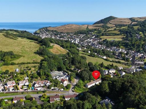 3 bedroom semi-detached house for sale in Park Villas, Rectory Road, Combe Martin, Devon, EX34 — £184,250 • 3 bed • 2 bath • 856 ft²
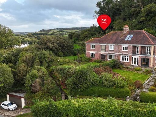 4 bedroom semi-detached house for sale in Newberry Hill, Berrynarbor, Ilfracombe, Devon, EX34 — £368,500 • 4 bed • 2 bath • 1613 ft²
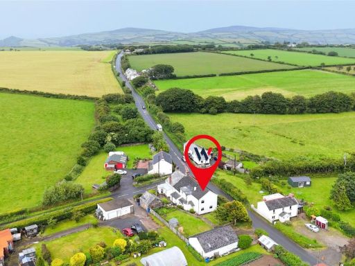 4 bedroom semi-detached house for sale in Berry Down, Combe Martin, Ilfracombe, EX34 — £244,500 • 4 bed • 1 bath • 1174 ft²
 3 bedroom house for sale in Kingston Avenue, Combe Martin, Ilfracombe, Devon, EX34 — £234,500 • 3 bed • 1 bath • 1349 ft²
 3 bedroom property for sale in Highfield Gardens, Combe Martin, Ilfracombe, Devon, EX34 — £159,000 • 3 bed • 2 bath
Meta
- {
"@context": "https://schema.org",
"@type": "Residence",
"name": "3 bedroom link detached house for sale in Castle Street, Co…",
"description": "",
"url": "https://propertypiper.co.uk/property/07784d0c-2ad3-4e73-b469-fd1504826413",
"image": "https://image-a.propertypiper.co.uk/4bc1538f-f6d0-4543-8cd1-2e3389eae853-1024.jpeg",
"address": {
"@type": "PostalAddress",
"streetAddress": "Tevyes Fiddle, Castle Street, Combe Martin, ILFRACOMBE",
"postalCode": "EX34 0HY",
"addressLocality": "North Devon",
"addressRegion": "North Devon",
"addressCountry": "England"
},
"geo": {
"@type": "GeoCoordinates",
"latitude": 51.19826761989595,
"longitude": -4.022733715916933
},
"numberOfRooms": 3,
"numberOfBathroomsTotal": 2,
"floorSize": {
"@type": "QuantitativeValue",
"value": 1557,
"unitCode": "FTK"
},
"offers": {
"@type": "Offer",
"price": 227750,
"priceCurrency": "GBP",
"availability": "https://schema.org/InStock"
},
"additionalProperty": [
{
"@type": "PropertyValue",
"name": "Feature",
"value": "mid-20th century"
},
{
"@type": "PropertyValue",
"name": "Feature",
"value": "garage"
},
{
"@type": "PropertyValue",
"name": "Feature",
"value": "corner property"
},
{
"@type": "PropertyValue",
"name": "Feature",
"value": "external view"
},
{
"@type": "PropertyValue",
"name": "Feature",
"value": "potent encroachment"
},
{
"@type": "PropertyValue",
"name": "Feature",
"value": "rustic"
},
{
"@type": "PropertyValue",
"name": "Feature",
"value": "mezzanine"
},
{
"@type": "PropertyValue",
"name": "Feature",
"value": "open-plan"
},
{
"@type": "PropertyValue",
"name": "Feature",
"value": "exposed beams"
},
{
"@type": "PropertyValue",
"name": "Feature",
"value": "wood flooring"
},
{
"@type": "PropertyValue",
"name": "Feature",
"value": "high ceiling"
}
]
}
High Res Floorplan Images
Compatible Floorplan Images
FloorplanImages Thumbnail